Launch List
AN API endpoint that returns all Launch objects or a single launch.
EXAMPLE - /launch/[id]/ or /launch/?mode=list&search=SpaceX
GET Return a list of all Launch objects.
FILTERS Fields - 'name', 'id(s)', 'lsp__id', 'lsp__name', 'serial_number', 'launcher_config__id', 'rocket__spacecraftflight__spacecraft__name', 'is_crewed', 'include_suborbital', 'spacecraft_config__ids', 'related', 'location__ids', 'lsp__ids', 'pad__ids', 'status__ids'
MODE 'normal', 'list', 'detailed'
EXAMPLE ?mode=list
SEARCH Searches through the launch name, rocket name, launch agency, mission name & spacecraft name.
EXAMPLE - ?search=SpaceX
GET /2.2.0/launch/?format=api&offset=4270&ordering=net
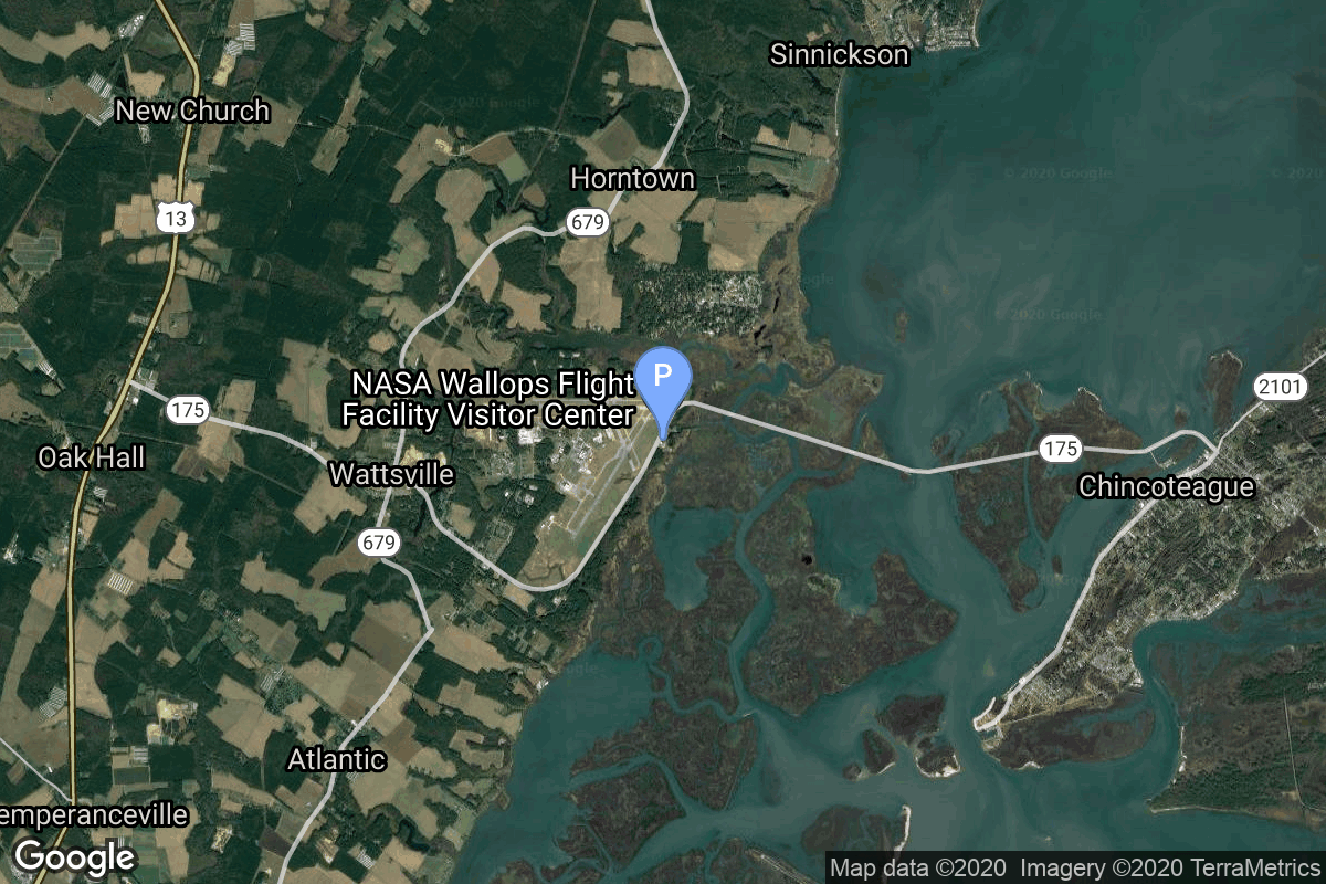
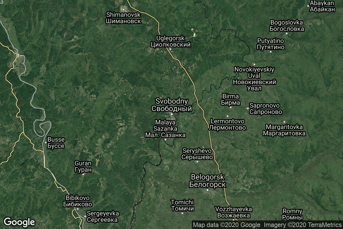
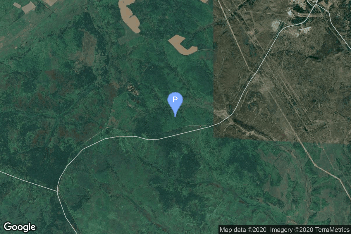
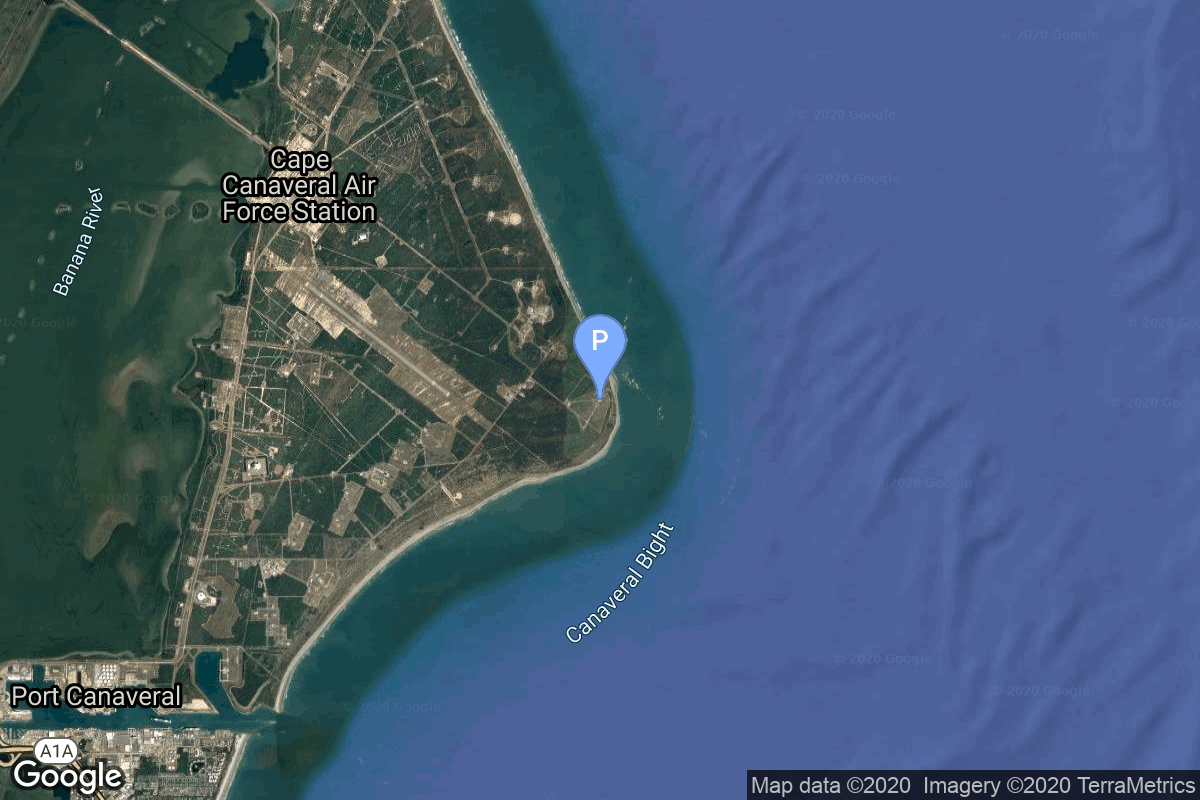
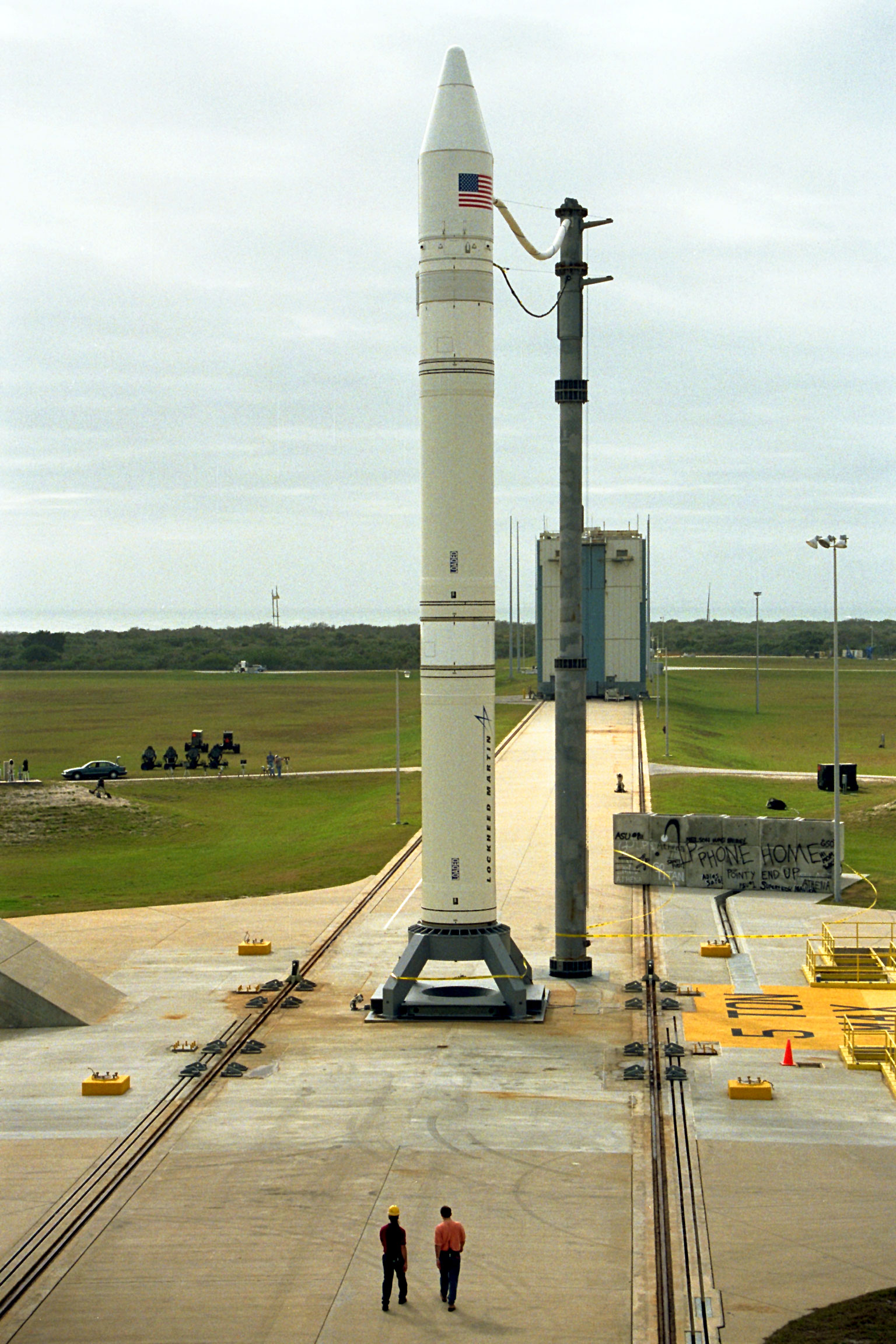
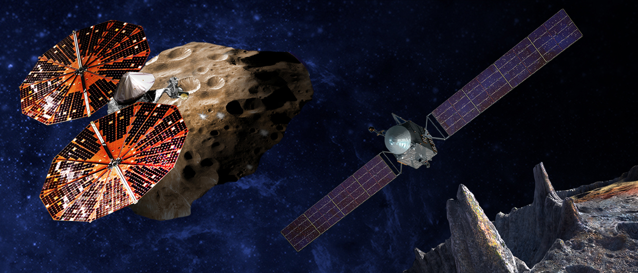
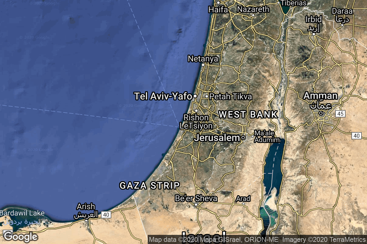
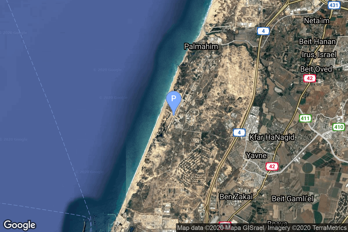
{ "count": 7608, "next": "https://ll.thespacedevs.com/2.2.0/launch/?format=api&limit=10&offset=4280&ordering=net", "previous": "https://ll.thespacedevs.com/2.2.0/launch/?format=api&limit=10&offset=4260&ordering=net", "results": [ { "id": "0acafdb8-f363-4caf-8fc2-572def9a33fc", "url": "https://ll.thespacedevs.com/2.2.0/launch/0acafdb8-f363-4caf-8fc2-572def9a33fc/?format=api", "slug": "pegasus-xl-haps-orbcomm-a1-a8", "name": "Pegasus XL HAPS | Orbcomm-A1 - A8", "status": { "id": 3, "name": "Launch Successful", "abbrev": "Success", "description": "The launch vehicle successfully inserted its payload(s) into the target orbit(s)." }, "last_updated": "2024-06-15T13:21:09Z", "net": "1997-12-23T19:11:42Z", "window_end": "1997-12-23T19:11:42Z", "window_start": "1997-12-23T19:11:42Z", "net_precision": { "id": 0, "name": "Second", "abbrev": "SEC", "description": "The T-0 is accurate to the second." }, "probability": null, "weather_concerns": null, "holdreason": "", "failreason": "", "hashtag": null, "launch_service_provider": { "id": 100, "url": "https://ll.thespacedevs.com/2.2.0/agencies/100/?format=api", "name": "Orbital Sciences Corporation", "type": "Commercial" }, "rocket": { "id": 426, "configuration": { "id": 118, "url": "https://ll.thespacedevs.com/2.2.0/config/launcher/118/?format=api", "name": "Pegasus XL HAPS", "family": "Pegasus", "full_name": "Pegasus XL HAPS", "variant": "HAPS" } }, "mission": null, "pad": { "id": 52, "url": "https://ll.thespacedevs.com/2.2.0/pad/52/?format=api", "agency_id": null, "name": "Wallops Flight Facility", "description": null, "info_url": null, "wiki_url": "https://en.wikipedia.org/wiki/Wallops_Flight_Facility", "map_url": "https://www.google.com/maps?q=37.938611,-75.457222", "latitude": "37.938611", "longitude": "-75.457222", "location": { "id": 20, "url": "https://ll.thespacedevs.com/2.2.0/location/20/?format=api", "name": "Air launch to orbit", "country_code": "???", "description": "", "map_image": "https://thespacedevs-prod.nyc3.digitaloceanspaces.com/media/map_images/location_20_20200803142433.jpg", "timezone_name": "", "total_launch_count": 51, "total_landing_count": 0 }, "country_code": "USA", "map_image": "https://thespacedevs-prod.nyc3.digitaloceanspaces.com/media/map_images/pad_52_20200803143305.jpg", "total_launch_count": 6, "orbital_launch_attempt_count": 6 }, "webcast_live": false, "image": "https://thespacedevs-prod.nyc3.digitaloceanspaces.com/media/images/pegasus_xl_moun_image_20240307124328.jpeg", "infographic": null, "program": [], "orbital_launch_attempt_count": 4205, "location_launch_attempt_count": 18, "pad_launch_attempt_count": 3, "agency_launch_attempt_count": 20, "orbital_launch_attempt_count_year": 4205, "location_launch_attempt_count_year": 4, "pad_launch_attempt_count_year": 2, "agency_launch_attempt_count_year": 5, "type": "normal" }, { "id": "abf8dac7-d3f3-45f4-8904-2f798d5047c6", "url": "https://ll.thespacedevs.com/2.2.0/launch/abf8dac7-d3f3-45f4-8904-2f798d5047c6/?format=api", "slug": "start-1-earlybird", "name": "Start-1 | EarlyBird", "status": { "id": 3, "name": "Launch Successful", "abbrev": "Success", "description": "The launch vehicle successfully inserted its payload(s) into the target orbit(s)." }, "last_updated": "2023-06-14T04:23:09Z", "net": "1997-12-24T13:32:52Z", "window_end": "1997-12-24T13:32:52Z", "window_start": "1997-12-24T13:32:52Z", "net_precision": null, "probability": null, "weather_concerns": null, "holdreason": "", "failreason": "", "hashtag": null, "launch_service_provider": { "id": 270, "url": "https://ll.thespacedevs.com/2.2.0/agencies/270/?format=api", "name": "Strategic Rocket Forces", "type": "Government" }, "rocket": { "id": 6830, "configuration": { "id": 381, "url": "https://ll.thespacedevs.com/2.2.0/config/launcher/381/?format=api", "name": "Start-1", "family": "Start", "full_name": "Start-1", "variant": "1" } }, "mission": { "id": 5220, "name": "EarlyBird", "description": "EarlyBird 1, a remote sensing satellite built by CTA Space Systems (now part of Orbital Sciences Corporation (OSC)) for EarthWatch, Inc., was to provide high resolution commercial imagery. EarthWatch planed to offer black-and-white images with a resolution as high as 3 meters per pixel, and color images with a resolution of 15 meters per pixel. The imaging sensor was derived from NASA's cancelled Clark satellite.", "launch_designator": null, "type": "Earth Science", "orbit": { "id": 8, "name": "Low Earth Orbit", "abbrev": "LEO" }, "agencies": [], "info_urls": [], "vid_urls": [] }, "pad": { "id": 128, "url": "https://ll.thespacedevs.com/2.2.0/pad/128/?format=api", "agency_id": 163, "name": "5", "description": null, "info_url": null, "wiki_url": "https://en.wikipedia.org/wiki/Svobodny_Cosmodrome", "map_url": "https://www.google.com/maps?q=51.7,127.997806", "latitude": "51.7", "longitude": "127.997806", "location": { "id": 146, "url": "https://ll.thespacedevs.com/2.2.0/location/146/?format=api", "name": "Svobodny Cosmodrome, Russian Federation", "country_code": "RUS", "description": "Svobodny was a Russian rocket launch site located approximately 15 km north of Svobodny, Amur Oblast. The cosmodrome was originally constructed as a launch site for intercontinental ballistic missiles called Svobodny-18. It was initially selected as a replacement for Baikonur Cosmodrome in the Kazakh Soviet Socialist Republic, which became independent as Kazakhstan after the dissolution of the Soviet Union. However the development of Svobodny was subsequently ended in 2007 in favour of a totally new space port, the Vostochny Cosmodrome.", "map_image": "https://thespacedevs-prod.nyc3.digitaloceanspaces.com/media/map_images/location_146_20200803142450.jpg", "timezone_name": "Asia/Yakutsk", "total_launch_count": 5, "total_landing_count": 0 }, "country_code": "RUS", "map_image": "https://thespacedevs-prod.nyc3.digitaloceanspaces.com/media/map_images/pad_128_20200803143250.jpg", "total_launch_count": 5, "orbital_launch_attempt_count": 5 }, "webcast_live": false, "image": null, "infographic": null, "program": [], "orbital_launch_attempt_count": 4206, "location_launch_attempt_count": 2, "pad_launch_attempt_count": 2, "agency_launch_attempt_count": 7, "orbital_launch_attempt_count_year": 88, "location_launch_attempt_count_year": 2, "pad_launch_attempt_count_year": 2, "agency_launch_attempt_count_year": 5, "type": "normal" }, { "id": "f816a831-232f-4f39-addb-52c3bfc52133", "url": "https://ll.thespacedevs.com/2.2.0/launch/f816a831-232f-4f39-addb-52c3bfc52133/?format=api", "slug": "proton-kdm-2m-asiasat-3", "name": "Proton-K/DM-2M | Asiasat 3", "status": { "id": 4, "name": "Launch Failure", "abbrev": "Failure", "description": "Either the launch vehicle did not reach orbit, or the payload(s) failed to separate." }, "last_updated": "2023-06-14T03:46:16Z", "net": "1997-12-24T23:19:00Z", "window_end": "1997-12-24T23:19:00Z", "window_start": "1997-12-24T23:19:00Z", "net_precision": null, "probability": null, "weather_concerns": null, "holdreason": "", "failreason": null, "hashtag": null, "launch_service_provider": { "id": 96, "url": "https://ll.thespacedevs.com/2.2.0/agencies/96/?format=api", "name": "Khrunichev State Research and Production Space Center", "type": "Government" }, "rocket": { "id": 6831, "configuration": { "id": 350, "url": "https://ll.thespacedevs.com/2.2.0/config/launcher/350/?format=api", "name": "Proton-K/DM-2M", "family": "Proton / UR-500", "full_name": "Proton-K/DM-2M", "variant": "DM-2M" } }, "mission": { "id": 5221, "name": "Asiasat 3", "description": "Chinese communications satellite", "launch_designator": null, "type": "Communications", "orbit": { "id": 1, "name": "Geostationary Orbit", "abbrev": "Direct-GEO" }, "agencies": [], "info_urls": [], "vid_urls": [] }, "pad": { "id": 31, "url": "https://ll.thespacedevs.com/2.2.0/pad/31/?format=api", "agency_id": null, "name": "81/23 (81L)", "description": null, "info_url": null, "wiki_url": "", "map_url": "https://www.google.com/maps?q=46.073997,62.977999", "latitude": "46.073997", "longitude": "62.977999", "location": { "id": 15, "url": "https://ll.thespacedevs.com/2.2.0/location/15/?format=api", "name": "Baikonur Cosmodrome, Republic of Kazakhstan", "country_code": "KAZ", "description": "The Baikonur Cosmodrome is a spaceport operated by Russia within Kazakhstan. Located in the Kazakh city of Baikonur, it is the largest operational space launch facility in terms of area. All Russian crewed spaceflights are launched from Baikonur.", "map_image": "https://thespacedevs-prod.nyc3.digitaloceanspaces.com/media/map_images/location_15_20200803142517.jpg", "timezone_name": "Asia/Qyzylorda", "total_launch_count": 1558, "total_landing_count": 0 }, "country_code": "KAZ", "map_image": "https://thespacedevs-prod.nyc3.digitaloceanspaces.com/media/map_images/pad_31_20200803143402.jpg", "total_launch_count": 104, "orbital_launch_attempt_count": 104 }, "webcast_live": false, "image": "https://thespacedevs-prod.nyc3.digitaloceanspaces.com/media/images/proton_image_20231231095535.jpg", "infographic": null, "program": [], "orbital_launch_attempt_count": 4207, "location_launch_attempt_count": 1102, "pad_launch_attempt_count": 77, "agency_launch_attempt_count": 51, "orbital_launch_attempt_count_year": 89, "location_launch_attempt_count_year": 18, "pad_launch_attempt_count_year": 6, "agency_launch_attempt_count_year": 9, "type": "normal" }, { "id": "0fdacb6a-4e02-436f-898b-d74115cd911d", "url": "https://ll.thespacedevs.com/2.2.0/launch/0fdacb6a-4e02-436f-898b-d74115cd911d/?format=api", "slug": "athena-ii-lunar-prospector", "name": "Athena II | Lunar Prospector", "status": { "id": 3, "name": "Launch Successful", "abbrev": "Success", "description": "The launch vehicle successfully inserted its payload(s) into the target orbit(s)." }, "last_updated": "2023-12-31T12:25:32Z", "net": "1998-01-07T02:28:44Z", "window_end": "1998-01-07T02:28:44Z", "window_start": "1998-01-07T02:28:44Z", "net_precision": null, "probability": null, "weather_concerns": null, "holdreason": "", "failreason": "", "hashtag": null, "launch_service_provider": { "id": 82, "url": "https://ll.thespacedevs.com/2.2.0/agencies/82/?format=api", "name": "Lockheed Martin", "type": "Commercial" }, "rocket": { "id": 6832, "configuration": { "id": 229, "url": "https://ll.thespacedevs.com/2.2.0/config/launcher/229/?format=api", "name": "Athena II", "family": "Athena", "full_name": "Athena II", "variant": "II" } }, "mission": { "id": 5222, "name": "Lunar Prospector", "description": "Lunar Prospector was a small spin stabilized lunar orbiter. Using its Gamma Ray Spectrometer (GRS), it collected a large amount of scientific data that helps researchers understand the chemical composition of the lunar surface.", "launch_designator": null, "type": "Robotic Exploration", "orbit": { "id": 11, "name": "Lunar Orbit", "abbrev": "LO" }, "agencies": [], "info_urls": [], "vid_urls": [] }, "pad": { "id": 27, "url": "https://ll.thespacedevs.com/2.2.0/pad/27/?format=api", "agency_id": null, "name": "Space Launch Complex 46", "description": null, "info_url": null, "wiki_url": "https://en.wikipedia.org/wiki/Spaceport_Florida_Launch_Complex_46", "map_url": "https://www.google.com/maps?q=28.4584,-80.5284", "latitude": "28.4584", "longitude": "-80.5284", "location": { "id": 12, "url": "https://ll.thespacedevs.com/2.2.0/location/12/?format=api", "name": "Cape Canaveral SFS, FL, USA", "country_code": "USA", "description": "Cape Canaveral Space Force Station (CCSFS) is an installation of the United States Space Force's Space Launch Delta 45, located on Cape Canaveral in Brevard County, Florida.", "map_image": "https://thespacedevs-prod.nyc3.digitaloceanspaces.com/media/map_images/location_12_20200803142519.jpg", "timezone_name": "America/New_York", "total_launch_count": 1054, "total_landing_count": 68 }, "country_code": "USA", "map_image": "https://thespacedevs-prod.nyc3.digitaloceanspaces.com/media/map_images/pad_27_20200803143319.jpg", "total_launch_count": 6, "orbital_launch_attempt_count": 5 }, "webcast_live": false, "image": "https://thespacedevs-prod.nyc3.digitaloceanspaces.com/media/images/athena_2_with_l_image_20240411091736.jpeg", "infographic": null, "program": [ { "id": 33, "url": "https://ll.thespacedevs.com/2.2.0/program/33/?format=api", "name": "Discovery Program", "description": "The Discovery Program is a series of Solar System exploration missions funded by the U.S. National Aeronautics and Space Administration (NASA) through its Planetary Missions Program Office. The cost of each mission is capped at a lower level than missions from NASA's New Frontiers or Flagship Programs. As a result, Discovery missions tend to be more focused on a specific scientific goal rather than serving a general purpose.", "agencies": [ { "id": 44, "url": "https://ll.thespacedevs.com/2.2.0/agencies/44/?format=api", "name": "National Aeronautics and Space Administration", "type": "Government" } ], "image_url": "https://thespacedevs-prod.nyc3.digitaloceanspaces.com/media/images/discovery2520p_program_20231231122246.jpeg", "start_date": "1990-01-01T00:00:00Z", "end_date": null, "info_url": "https://www.nasa.gov/planetarymissions/discovery-program/", "wiki_url": "https://en.wikipedia.org/wiki/Discovery_Program", "mission_patches": [], "type": { "id": 5, "name": "Exploration" } } ], "orbital_launch_attempt_count": 4208, "location_launch_attempt_count": 540, "pad_launch_attempt_count": 1, "agency_launch_attempt_count": 32, "orbital_launch_attempt_count_year": 1, "location_launch_attempt_count_year": 1, "pad_launch_attempt_count_year": 1, "agency_launch_attempt_count_year": 1, "type": "normal" }, { "id": "4011fc4e-61af-4d99-a03b-f375345ef80a", "url": "https://ll.thespacedevs.com/2.2.0/launch/4011fc4e-61af-4d99-a03b-f375345ef80a/?format=api", "slug": "delta-ii-skynet-4d", "name": "Delta II | Skynet 4D", "status": { "id": 3, "name": "Launch Successful", "abbrev": "Success", "description": "The launch vehicle successfully inserted its payload(s) into the target orbit(s)." }, "last_updated": "2023-06-14T17:42:53Z", "net": "1998-01-10T00:32:01Z", "window_end": "1998-01-10T00:32:01Z", "window_start": "1998-01-10T00:32:01Z", "net_precision": null, "probability": null, "weather_concerns": null, "holdreason": "", "failreason": null, "hashtag": null, "launch_service_provider": { "id": 161, "url": "https://ll.thespacedevs.com/2.2.0/agencies/161/?format=api", "name": "United States Air Force", "type": "Government" }, "rocket": { "id": 6833, "configuration": { "id": 140, "url": "https://ll.thespacedevs.com/2.2.0/config/launcher/140/?format=api", "name": "Delta II", "family": "Delta", "full_name": "Delta II 7925-9.5", "variant": "7925-9.5" } }, "mission": { "id": 5223, "name": "Skynet 4D", "description": "Skynet 4 was the third generation of UK Ministry of Defense communications satellites. They provided jam-proof communications service between fixed and mobile land and sea-based ground stations.", "launch_designator": null, "type": "Communications", "orbit": { "id": 1, "name": "Geostationary Orbit", "abbrev": "Direct-GEO" }, "agencies": [], "info_urls": [], "vid_urls": [] }, "pad": { "id": 1, "url": "https://ll.thespacedevs.com/2.2.0/pad/1/?format=api", "agency_id": null, "name": "Space Launch Complex 17B", "description": "", "info_url": null, "wiki_url": "https://en.wikipedia.org/wiki/Cape_Canaveral_Space_Launch_Complex_17", "map_url": "https://www.google.com/maps?q=28.4458,-80.5657", "latitude": "28.4458", "longitude": "-80.5657", "location": { "id": 12, "url": "https://ll.thespacedevs.com/2.2.0/location/12/?format=api", "name": "Cape Canaveral SFS, FL, USA", "country_code": "USA", "description": "Cape Canaveral Space Force Station (CCSFS) is an installation of the United States Space Force's Space Launch Delta 45, located on Cape Canaveral in Brevard County, Florida.", "map_image": "https://thespacedevs-prod.nyc3.digitaloceanspaces.com/media/map_images/location_12_20200803142519.jpg", "timezone_name": "America/New_York", "total_launch_count": 1054, "total_landing_count": 68 }, "country_code": "USA", "map_image": "https://thespacedevs-prod.nyc3.digitaloceanspaces.com/media/map_images/pad_1_20200803143208.jpg", "total_launch_count": 132, "orbital_launch_attempt_count": 132 }, "webcast_live": false, "image": "https://thespacedevs-prod.nyc3.digitaloceanspaces.com/media/images/delta_ii_7925-9_image_20240312090356.jpeg", "infographic": null, "program": [], "orbital_launch_attempt_count": 4209, "location_launch_attempt_count": 541, "pad_launch_attempt_count": 106, "agency_launch_attempt_count": 988, "orbital_launch_attempt_count_year": 2, "location_launch_attempt_count_year": 2, "pad_launch_attempt_count_year": 1, "agency_launch_attempt_count_year": 1, "type": "normal" }, { "id": "02c372d4-3bb2-4de3-a676-4cd6cfec9728", "url": "https://ll.thespacedevs.com/2.2.0/launch/02c372d4-3bb2-4de3-a676-4cd6cfec9728/?format=api", "slug": "shavit-2-ofeq-4", "name": "Shavit-2 | Ofeq-4", "status": { "id": 4, "name": "Launch Failure", "abbrev": "Failure", "description": "Either the launch vehicle did not reach orbit, or the payload(s) failed to separate." }, "last_updated": "2023-06-14T03:58:14Z", "net": "1998-01-22T12:56:00Z", "window_end": "1998-01-22T12:56:00Z", "window_start": "1998-01-22T12:56:00Z", "net_precision": null, "probability": null, "weather_concerns": null, "holdreason": "", "failreason": null, "hashtag": null, "launch_service_provider": { "id": 35, "url": "https://ll.thespacedevs.com/2.2.0/agencies/35/?format=api", "name": "Israeli Space Agency", "type": "Government" }, "rocket": { "id": 6834, "configuration": { "id": 110, "url": "https://ll.thespacedevs.com/2.2.0/config/launcher/110/?format=api", "name": "Shavit-2", "family": "Shavit", "full_name": "Shavit-2", "variant": "2" } }, "mission": { "id": 5224, "name": "Ofeq-4", "description": "Intended for surveillance of Israel's neighbours, the Ofeq series is unusual in having a retrograde orbit. This is due to the geographical location of Israel, which gives only an unobstructed launch path over the mediterranean sea. It is similar to the EROS-A civilian Earth observation satellite. Ofeq 4 (which was possibly the prototype EROS-A satellite) was lost in an launch failure in early 1998.", "launch_designator": null, "type": "Government/Top Secret", "orbit": { "id": 8, "name": "Low Earth Orbit", "abbrev": "LEO" }, "agencies": [], "info_urls": [], "vid_urls": [] }, "pad": { "id": 75, "url": "https://ll.thespacedevs.com/2.2.0/pad/75/?format=api", "agency_id": 95, "name": "Shavit Launch Pad", "description": "", "info_url": null, "wiki_url": "https://en.wikipedia.org/wiki/Palmachim_Airbase", "map_url": "https://www.google.com/maps?q=31.884444,34.680278", "latitude": "31.884444", "longitude": "34.680278", "location": { "id": 4, "url": "https://ll.thespacedevs.com/2.2.0/location/4/?format=api", "name": "Palmachim Airbase, State of Israel", "country_code": "ISR", "description": "Palmachim Airbase is an Israeli Air Force (IAF) base and spaceport, which the IAF and the Israel Space Agency (ISA) operate jointly. It is located west of the city of Yavne on the Mediterranean coast, 12 km south of the Gush Dan metropolitan area with Tel Aviv, named after the Kibbutz Palmachim north of it.", "map_image": "https://thespacedevs-prod.nyc3.digitaloceanspaces.com/media/map_images/location_4_20200803142418.jpg", "timezone_name": "Asia/Jerusalem", "total_launch_count": 13, "total_landing_count": 0 }, "country_code": "ISR", "map_image": "https://thespacedevs-prod.nyc3.digitaloceanspaces.com/media/map_images/pad_75_20200803143316.jpg", "total_launch_count": 13, "orbital_launch_attempt_count": 13 }, "webcast_live": false, "image": "https://thespacedevs-prod.nyc3.digitaloceanspaces.com/media/images/shavit-2_liftof_image_20240918164729.jpeg", "infographic": null, "program": [], "orbital_launch_attempt_count": 4210, "location_launch_attempt_count": 4, "pad_launch_attempt_count": 4, "agency_launch_attempt_count": 4, "orbital_launch_attempt_count_year": 3, "location_launch_attempt_count_year": 1, "pad_launch_attempt_count_year": 1, "agency_launch_attempt_count_year": 1, "type": "normal" }, { "id": "836daae0-6a72-4d44-9a7a-f6392e6c305c", "url": "https://ll.thespacedevs.com/2.2.0/launch/836daae0-6a72-4d44-9a7a-f6392e6c305c/?format=api", "slug": "space-shuttle-endeavour-ov-105-sts-89", "name": "Space Shuttle Endeavour / OV-105 | STS-89", "status": { "id": 3, "name": "Launch Successful", "abbrev": "Success", "description": "The launch vehicle successfully inserted its payload(s) into the target orbit(s)." }, "last_updated": "2023-06-14T08:50:40Z", "net": "1998-01-23T02:48:15Z", "window_end": "1998-01-23T02:48:15Z", "window_start": "1998-01-23T02:48:15Z", "net_precision": null, "probability": -1, "weather_concerns": null, "holdreason": "", "failreason": "", "hashtag": null, "launch_service_provider": { "id": 191, "url": "https://ll.thespacedevs.com/2.2.0/agencies/191/?format=api", "name": "United Space Alliance", "type": "Commercial" }, "rocket": { "id": 427, "configuration": { "id": 493, "url": "https://ll.thespacedevs.com/2.2.0/config/launcher/493/?format=api", "name": "Space Shuttle", "family": "", "full_name": "Space Shuttle", "variant": "" } }, "mission": { "id": 840, "name": "STS-89", "description": "STS-89 was a space shuttle mission to the Mir space station flown by Space Shuttle Endeavour, and launched from Kennedy Space Center, Florida on 22 January 1998.", "launch_designator": null, "type": "Human Exploration", "orbit": { "id": 8, "name": "Low Earth Orbit", "abbrev": "LEO" }, "agencies": [], "info_urls": [], "vid_urls": [] }, "pad": { "id": 87, "url": "https://ll.thespacedevs.com/2.2.0/pad/87/?format=api", "agency_id": 121, "name": "Launch Complex 39A", "description": "", "info_url": null, "wiki_url": "https://en.wikipedia.org/wiki/Kennedy_Space_Center_Launch_Complex_39#Launch_Pad_39A", "map_url": "https://www.google.com/maps?q=28.60822681,-80.60428186", "latitude": "28.60822681", "longitude": "-80.60428186", "location": { "id": 27, "url": "https://ll.thespacedevs.com/2.2.0/location/27/?format=api", "name": "Kennedy Space Center, FL, USA", "country_code": "USA", "description": "The John F. Kennedy Space Center, located on Merritt Island, Florida, is one of NASA's ten field centers. Since 1968, KSC has been NASA's primary launch center of American spaceflight, research, and technology. Launch operations for the Apollo, Skylab and Space Shuttle programs were carried out from Kennedy Space Center Launch Complex 39 and managed by KSC. Located on the east coast of Florida, KSC is adjacent to Cape Canaveral Space Force Station (CCSFS).", "map_image": "https://thespacedevs-prod.nyc3.digitaloceanspaces.com/media/map_images/location_27_20200803142447.jpg", "timezone_name": "America/New_York", "total_launch_count": 273, "total_landing_count": 0 }, "country_code": "USA", "map_image": "https://thespacedevs-prod.nyc3.digitaloceanspaces.com/media/map_images/pad_87_20200803143537.jpg", "total_launch_count": 215, "orbital_launch_attempt_count": 214 }, "webcast_live": false, "image": "https://thespacedevs-prod.nyc3.digitaloceanspaces.com/media/images/space_shuttle_image_20230422074810.jpeg", "infographic": null, "program": [ { "id": 16, "url": "https://ll.thespacedevs.com/2.2.0/program/16/?format=api", "name": "Mir", "description": "Mir was a space station that operated in low Earth orbit from 1986 to 2001, operated by the Soviet Union and later by Russia. Mir was the first modular space station and was assembled in orbit from 1986 to 1996.", "agencies": [ { "id": 63, "url": "https://ll.thespacedevs.com/2.2.0/agencies/63/?format=api", "name": "Russian Federal Space Agency (ROSCOSMOS)", "type": "Government" }, { "id": 66, "url": "https://ll.thespacedevs.com/2.2.0/agencies/66/?format=api", "name": "Soviet Space Program", "type": "Government" } ], "image_url": "https://thespacedevs-prod.nyc3.digitaloceanspaces.com/media/images/mir_program_20200821092345.jpeg", "start_date": "1986-02-20T21:28:23Z", "end_date": "2001-03-23T05:59:00Z", "info_url": null, "wiki_url": "https://en.wikipedia.org/wiki/Mir", "mission_patches": [], "type": { "id": 2, "name": "Human Spaceflight" } }, { "id": 6, "url": "https://ll.thespacedevs.com/2.2.0/program/6/?format=api", "name": "Space Shuttle", "description": "The Space Shuttle program was the fourth human spaceflight program carried out by the National Aeronautics and Space Administration (NASA), which accomplished routine transportation for Earth-to-orbit crew and cargo from 1981 to 2011.", "agencies": [ { "id": 44, "url": "https://ll.thespacedevs.com/2.2.0/agencies/44/?format=api", "name": "National Aeronautics and Space Administration", "type": "Government" } ], "image_url": "https://thespacedevs-prod.nyc3.digitaloceanspaces.com/media/images/space2520shutt_program_20200820202237.png", "start_date": "1981-04-12T12:00:03Z", "end_date": "2011-07-08T15:29:00Z", "info_url": "https://www.nasa.gov/mission_pages/shuttle/main/index.html", "wiki_url": "https://en.wikipedia.org/wiki/Space_Shuttle_program", "mission_patches": [], "type": { "id": 2, "name": "Human Spaceflight" } }, { "id": 12, "url": "https://ll.thespacedevs.com/2.2.0/program/12/?format=api", "name": "Shuttle–Mir", "description": "The Shuttle–Mir program was a collaborative 11-mission space program between Russia and the United States that involved American Space Shuttles visiting the Russian space station Mir, Russian cosmonauts flying on the Shuttle, and an American astronaut flying aboard a Soyuz spacecraft to engage in long-duration expeditions aboard Mir.", "agencies": [ { "id": 44, "url": "https://ll.thespacedevs.com/2.2.0/agencies/44/?format=api", "name": "National Aeronautics and Space Administration", "type": "Government" }, { "id": 63, "url": "https://ll.thespacedevs.com/2.2.0/agencies/63/?format=api", "name": "Russian Federal Space Agency (ROSCOSMOS)", "type": "Government" } ], "image_url": "https://thespacedevs-prod.nyc3.digitaloceanspaces.com/media/images/shuttle25e225_program_20200821090507.png", "start_date": "1993-09-01T00:00:00Z", "end_date": "1998-06-12T18:00:18Z", "info_url": "https://www.nasa.gov/audience/formedia/factsheet/shuttle_mir_factsheet.html", "wiki_url": "https://en.wikipedia.org/wiki/Shuttle–Mir_program", "mission_patches": [], "type": { "id": 2, "name": "Human Spaceflight" } } ], "orbital_launch_attempt_count": 4211, "location_launch_attempt_count": 106, "pad_launch_attempt_count": 65, "agency_launch_attempt_count": 10, "orbital_launch_attempt_count_year": 4, "location_launch_attempt_count_year": 1, "pad_launch_attempt_count_year": 1, "agency_launch_attempt_count_year": 1, "type": "normal" }, { "id": "33f96681-487e-4b8f-9d59-c355458cacd7", "url": "https://ll.thespacedevs.com/2.2.0/launch/33f96681-487e-4b8f-9d59-c355458cacd7/?format=api", "slug": "soyuz-u-soyuz-tm-27", "name": "Soyuz U | Soyuz TM-27", "status": { "id": 3, "name": "Launch Successful", "abbrev": "Success", "description": "The launch vehicle successfully inserted its payload(s) into the target orbit(s)." }, "last_updated": "2023-06-14T08:41:44Z", "net": "1998-01-29T16:33:42Z", "window_end": "1998-01-29T16:33:42Z", "window_start": "1998-01-29T16:33:42Z", "net_precision": null, "probability": -1, "weather_concerns": null, "holdreason": "", "failreason": "", "hashtag": null, "launch_service_provider": { "id": 63, "url": "https://ll.thespacedevs.com/2.2.0/agencies/63/?format=api", "name": "Russian Federal Space Agency (ROSCOSMOS)", "type": "Government" }, "rocket": { "id": 434, "configuration": { "id": 37, "url": "https://ll.thespacedevs.com/2.2.0/config/launcher/37/?format=api", "name": "Soyuz U", "family": "Soyuz", "full_name": "Soyuz U", "variant": "" } }, "mission": { "id": 366, "name": "Soyuz TM-27", "description": "Soyuz TM-27 was the 35th mission and the 25th long-duration expedition to Mir space station. It was also a part of the US/Russian Shuttle-Mir Program.\nThe mission began on January 29, 1998, 16:33:42 UTC, launching Commander Talgat Musabayev, Flight Engineer Nikolai Budarin and Research Cosmonaut Léopold Eyharts into orbit. They docked with Mir two days later. During their stay there, cosmonauts performed several EVAs and various scientific experiments in medicine, biotechnology, Earth sciences etc. Station crew was visited by several Progress resupply spacecrafts, STS-91, and welcomed aboard Soyuz TM-28 with the next expedition crew. \nThe mission concluded with a safe landing back on Earth on August 25, 1998, 05:24:44 UTC.", "launch_designator": null, "type": "Human Exploration", "orbit": { "id": 8, "name": "Low Earth Orbit", "abbrev": "LEO" }, "agencies": [], "info_urls": [], "vid_urls": [] }, "pad": { "id": 32, "url": "https://ll.thespacedevs.com/2.2.0/pad/32/?format=api", "agency_id": null, "name": "1/5", "description": null, "info_url": null, "wiki_url": "", "map_url": "https://www.google.com/maps?q=45.92,63.342", "latitude": "45.92", "longitude": "63.342", "location": { "id": 15, "url": "https://ll.thespacedevs.com/2.2.0/location/15/?format=api", "name": "Baikonur Cosmodrome, Republic of Kazakhstan", "country_code": "KAZ", "description": "The Baikonur Cosmodrome is a spaceport operated by Russia within Kazakhstan. Located in the Kazakh city of Baikonur, it is the largest operational space launch facility in terms of area. All Russian crewed spaceflights are launched from Baikonur.", "map_image": "https://thespacedevs-prod.nyc3.digitaloceanspaces.com/media/map_images/location_15_20200803142517.jpg", "timezone_name": "Asia/Qyzylorda", "total_launch_count": 1558, "total_landing_count": 0 }, "country_code": "KAZ", "map_image": "https://thespacedevs-prod.nyc3.digitaloceanspaces.com/media/map_images/pad_32_20200803143513.jpg", "total_launch_count": 487, "orbital_launch_attempt_count": 487 }, "webcast_live": false, "image": "https://thespacedevs-prod.nyc3.digitaloceanspaces.com/media/images/soyuz2520u_image_20190222031023.jpeg", "infographic": null, "program": [ { "id": 16, "url": "https://ll.thespacedevs.com/2.2.0/program/16/?format=api", "name": "Mir", "description": "Mir was a space station that operated in low Earth orbit from 1986 to 2001, operated by the Soviet Union and later by Russia. Mir was the first modular space station and was assembled in orbit from 1986 to 1996.", "agencies": [ { "id": 63, "url": "https://ll.thespacedevs.com/2.2.0/agencies/63/?format=api", "name": "Russian Federal Space Agency (ROSCOSMOS)", "type": "Government" }, { "id": 66, "url": "https://ll.thespacedevs.com/2.2.0/agencies/66/?format=api", "name": "Soviet Space Program", "type": "Government" } ], "image_url": "https://thespacedevs-prod.nyc3.digitaloceanspaces.com/media/images/mir_program_20200821092345.jpeg", "start_date": "1986-02-20T21:28:23Z", "end_date": "2001-03-23T05:59:00Z", "info_url": null, "wiki_url": "https://en.wikipedia.org/wiki/Mir", "mission_patches": [], "type": { "id": 2, "name": "Human Spaceflight" } }, { "id": 8, "url": "https://ll.thespacedevs.com/2.2.0/program/8/?format=api", "name": "Soyuz", "description": "The Soyuz programme is a human spaceflight programme initiated by the Soviet Union in the early 1960s. The Soyuz spacecraft was originally part of a Moon landing project intended to put a Soviet cosmonaut on the Moon. It was the third Soviet human spaceflight programme after the Vostok and Voskhod programmes.", "agencies": [ { "id": 63, "url": "https://ll.thespacedevs.com/2.2.0/agencies/63/?format=api", "name": "Russian Federal Space Agency (ROSCOSMOS)", "type": "Government" }, { "id": 66, "url": "https://ll.thespacedevs.com/2.2.0/agencies/66/?format=api", "name": "Soviet Space Program", "type": "Government" } ], "image_url": "https://thespacedevs-prod.nyc3.digitaloceanspaces.com/media/images/soyuz_program_20201129185543.png", "start_date": "1966-11-28T11:02:00Z", "end_date": null, "info_url": null, "wiki_url": "https://en.wikipedia.org/wiki/Soyuz_programme", "mission_patches": [], "type": { "id": 2, "name": "Human Spaceflight" } } ], "orbital_launch_attempt_count": 4212, "location_launch_attempt_count": 1103, "pad_launch_attempt_count": 347, "agency_launch_attempt_count": 75, "orbital_launch_attempt_count_year": 5, "location_launch_attempt_count_year": 1, "pad_launch_attempt_count_year": 1, "agency_launch_attempt_count_year": 1, "type": "normal" }, { "id": "a5478ff3-2e23-46fe-92f1-2f122a05a90e", "url": "https://ll.thespacedevs.com/2.2.0/launch/a5478ff3-2e23-46fe-92f1-2f122a05a90e/?format=api", "slug": "atlas-iia-nrol-5", "name": "Atlas IIA | NROL-5", "status": { "id": 3, "name": "Launch Successful", "abbrev": "Success", "description": "The launch vehicle successfully inserted its payload(s) into the target orbit(s)." }, "last_updated": "2023-06-14T17:40:00Z", "net": "1998-01-29T18:37:00Z", "window_end": "1998-01-29T18:37:00Z", "window_start": "1998-01-29T18:37:00Z", "net_precision": null, "probability": null, "weather_concerns": null, "holdreason": "", "failreason": "", "hashtag": null, "launch_service_provider": { "id": 82, "url": "https://ll.thespacedevs.com/2.2.0/agencies/82/?format=api", "name": "Lockheed Martin", "type": "Commercial" }, "rocket": { "id": 6835, "configuration": { "id": 254, "url": "https://ll.thespacedevs.com/2.2.0/config/launcher/254/?format=api", "name": "Atlas IIA", "family": "Atlas", "full_name": "Atlas IIA", "variant": "IIA" } }, "mission": { "id": 5225, "name": "NROL-5 (Quasar 12)", "description": "Satellite Data System (SDS) spacecraft are communication relay satellites for transmitting real-time data from US reconnaissance satellites (e.g. KH-11, Onyx, Topaz) in polar areas. They are also used for communications to USAF aircraft on polar routes and connect the various ground stations of the Air Force Satellite Control Network (AFSCN). The spacecraft relay the downlinked data to a ground station at Fort Belvoir, Virginia.", "launch_designator": null, "type": "Communications", "orbit": { "id": 0, "name": "Elliptical Orbit", "abbrev": "Elliptical" }, "agencies": [], "info_urls": [], "vid_urls": [] }, "pad": { "id": 121, "url": "https://ll.thespacedevs.com/2.2.0/pad/121/?format=api", "agency_id": 161, "name": "Launch Complex 36A", "description": null, "info_url": null, "wiki_url": "https://en.wikipedia.org/wiki/Cape_Canaveral_Launch_Complex_36", "map_url": "https://www.google.com/maps?q=28.4705556,-80.542194", "latitude": "28.4705556", "longitude": "-80.542194", "location": { "id": 12, "url": "https://ll.thespacedevs.com/2.2.0/location/12/?format=api", "name": "Cape Canaveral SFS, FL, USA", "country_code": "USA", "description": "Cape Canaveral Space Force Station (CCSFS) is an installation of the United States Space Force's Space Launch Delta 45, located on Cape Canaveral in Brevard County, Florida.", "map_image": "https://thespacedevs-prod.nyc3.digitaloceanspaces.com/media/map_images/location_12_20200803142519.jpg", "timezone_name": "America/New_York", "total_launch_count": 1054, "total_landing_count": 68 }, "country_code": "USA", "map_image": "https://thespacedevs-prod.nyc3.digitaloceanspaces.com/media/map_images/pad_121_20200803143231.jpg", "total_launch_count": 69, "orbital_launch_attempt_count": 69 }, "webcast_live": false, "image": null, "infographic": null, "program": [], "orbital_launch_attempt_count": 4213, "location_launch_attempt_count": 542, "pad_launch_attempt_count": 50, "agency_launch_attempt_count": 33, "orbital_launch_attempt_count_year": 6, "location_launch_attempt_count_year": 3, "pad_launch_attempt_count_year": 1, "agency_launch_attempt_count_year": 2, "type": "normal" }, { "id": "d3d2875b-ca3f-47b7-9944-fd207687e0b6", "url": "https://ll.thespacedevs.com/2.2.0/launch/d3d2875b-ca3f-47b7-9944-fd207687e0b6/?format=api", "slug": "ariane-44lp-inmarsat-3-f5-brasilsat-b3", "name": "Ariane 44LP | Inmarsat-3 F5 & Brasilsat B3", "status": { "id": 3, "name": "Launch Successful", "abbrev": "Success", "description": "The launch vehicle successfully inserted its payload(s) into the target orbit(s)." }, "last_updated": "2023-06-14T04:22:21Z", "net": "1998-02-04T23:29:00Z", "window_end": "1998-02-04T23:29:00Z", "window_start": "1998-02-04T23:29:00Z", "net_precision": null, "probability": null, "weather_concerns": null, "holdreason": "", "failreason": null, "hashtag": null, "launch_service_provider": { "id": 115, "url": "https://ll.thespacedevs.com/2.2.0/agencies/115/?format=api", "name": "Arianespace", "type": "Commercial" }, "rocket": { "id": 6836, "configuration": { "id": 226, "url": "https://ll.thespacedevs.com/2.2.0/config/launcher/226/?format=api", "name": "Ariane 44LP", "family": "Ariane", "full_name": "Ariane 44LP", "variant": "44LP" } }, "mission": { "id": 5226, "name": "Inmarsat-3 F5 & Brasilsat B3", "description": "Launched in 1996-8, the Inmarsat-3s were built by Lockheed Martin Astro Space (now Lockheed Martin Missiles & Space) of the USA, responsible for the basic spacecraft, and the European Matra Marconi Space (now Astrium), which developed the communications payload. Brazil's second generation of communications satellites are the result of joint engineering and manufacturing efforts in the United States and Brazil. The new spacecraft are called the Brasilsat B series, and are widebody, more powerful versions of Hughes Space and Communications Company's popular HS-376 model. EMBRATEL, Brazil's telecommunications company, signed a contract in August 1990 for two spacecraft. In December 1995, with those new satellites in orbit and rapidly filling with customers, EMBRATEL exercised an option for a third spacecraft. A fourth was ordered in June 1998.", "launch_designator": null, "type": "Communications", "orbit": { "id": 1, "name": "Geostationary Orbit", "abbrev": "Direct-GEO" }, "agencies": [], "info_urls": [], "vid_urls": [] }, "pad": { "id": 124, "url": "https://ll.thespacedevs.com/2.2.0/pad/124/?format=api", "agency_id": 115, "name": "Ariane Launch Area 2", "description": "The ELA-2 pad, built in 1986, had been used for Ariane 4 launches from 1988 until 2003. Before 1988, although purpose-built for Ariane 4, the pad hosted an Ariane-2 and two Ariane-3 launches.", "info_url": null, "wiki_url": "https://en.wikipedia.org/wiki/ELA-2", "map_url": "https://www.google.com/maps?q=5.232,-52.778194", "latitude": "5.232", "longitude": "-52.778194", "location": { "id": 13, "url": "https://ll.thespacedevs.com/2.2.0/location/13/?format=api", "name": "Guiana Space Centre, French Guiana", "country_code": "GUF", "description": "The Guiana Space Centre is a European spaceport to the northwest of Kourou in French Guiana, a region of France in South America. Kourou is located at a latitude of 5°. In operation since 1968, it is a suitable location for a spaceport because of its equatorial location and open sea to the east.", "map_image": "https://thespacedevs-prod.nyc3.digitaloceanspaces.com/media/map_images/location_13_20200803142412.jpg", "timezone_name": "America/Cayenne", "total_launch_count": 327, "total_landing_count": 0 }, "country_code": "GUF", "map_image": "https://thespacedevs-prod.nyc3.digitaloceanspaces.com/media/map_images/pad_124_20200803143241.jpg", "total_launch_count": 119, "orbital_launch_attempt_count": 119 }, "webcast_live": false, "image": "https://thespacedevs-prod.nyc3.digitaloceanspaces.com/media/images/ariane_44lp_at__image_20240401083402.png", "infographic": null, "program": [], "orbital_launch_attempt_count": 4214, "location_launch_attempt_count": 114, "pad_launch_attempt_count": 78, "agency_launch_attempt_count": 103, "orbital_launch_attempt_count_year": 7, "location_launch_attempt_count_year": 1, "pad_launch_attempt_count_year": 1, "agency_launch_attempt_count_year": 1, "type": "normal" } ] }