Launch List
AN API endpoint that returns all Launch objects or a single launch.
EXAMPLE - /launch/[id]/ or /launch/?mode=list&search=SpaceX
GET Return a list of all Launch objects.
FILTERS Fields - 'name', 'id(s)', 'lsp__id', 'lsp__name', 'serial_number', 'launcher_config__id', 'rocket__spacecraftflight__spacecraft__name', 'is_crewed', 'include_suborbital', 'spacecraft_config__ids', 'related', 'location__ids', 'lsp__ids', 'pad__ids', 'status__ids'
MODE 'normal', 'list', 'detailed'
EXAMPLE ?mode=list
SEARCH Searches through the launch name, rocket name, launch agency, mission name & spacecraft name.
EXAMPLE - ?search=SpaceX
GET /2.2.0/launch/?format=api&offset=2930&ordering=-net
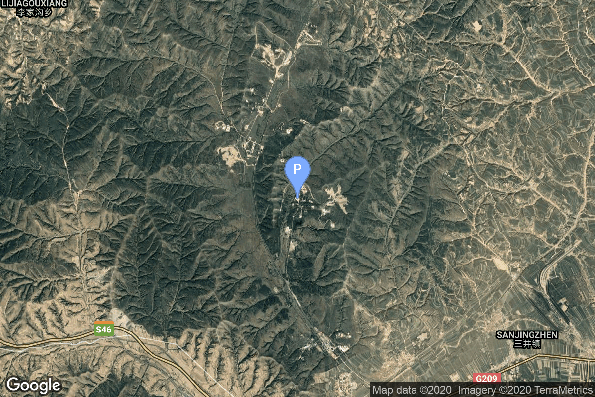
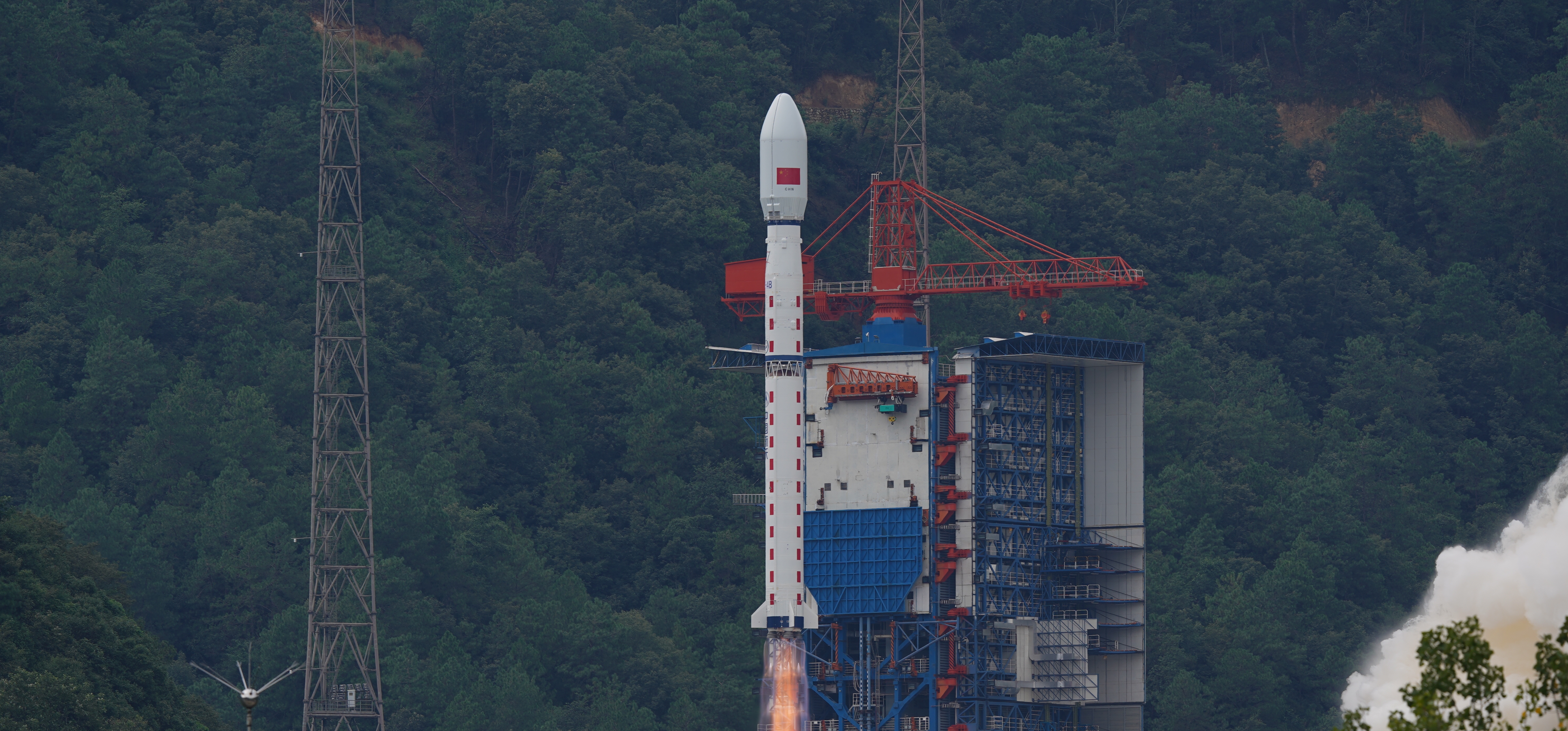
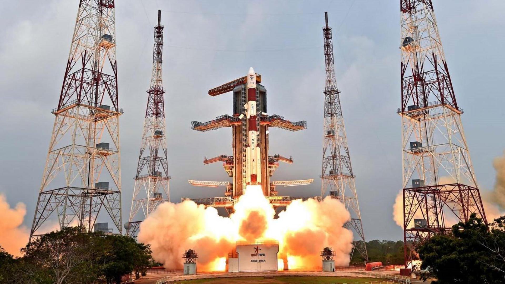
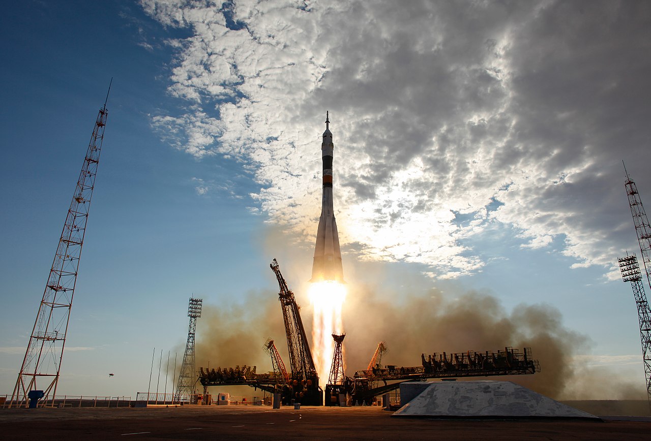
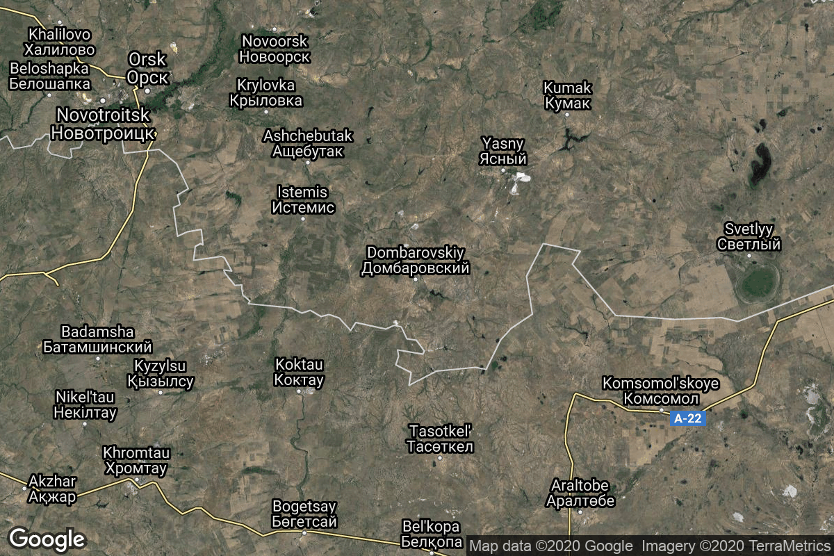
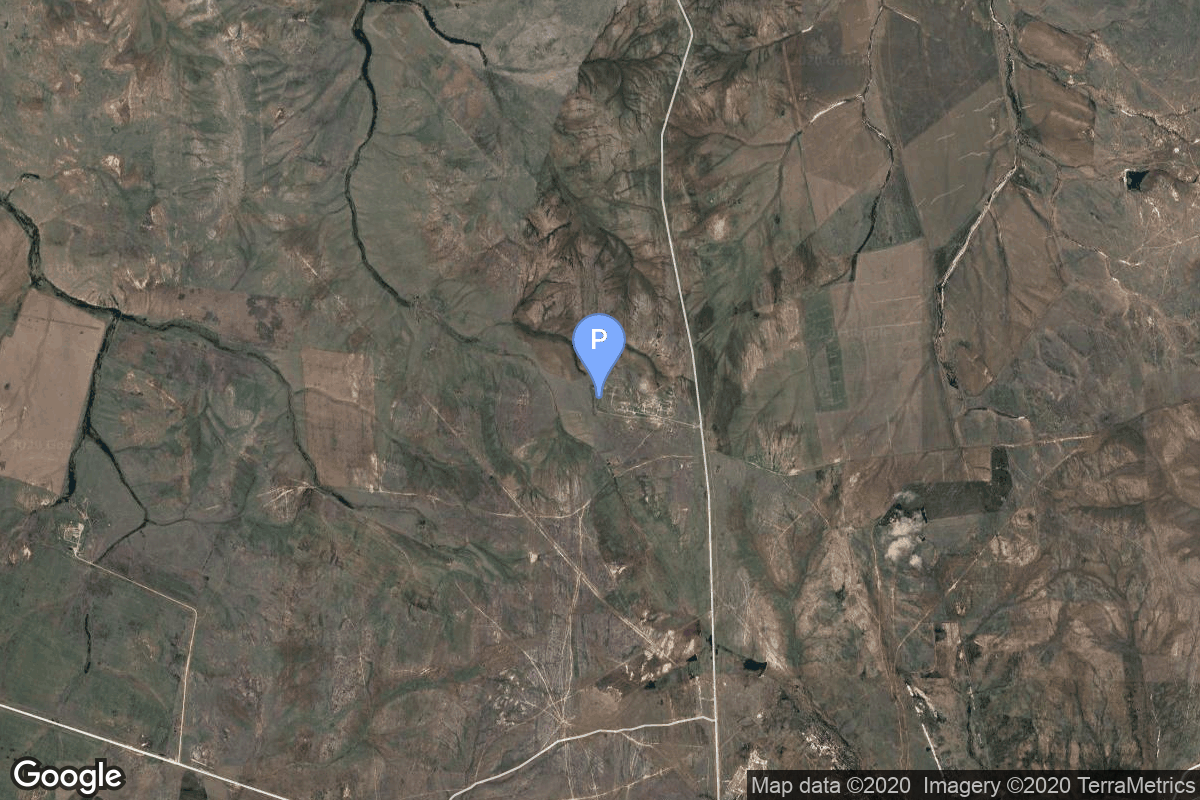
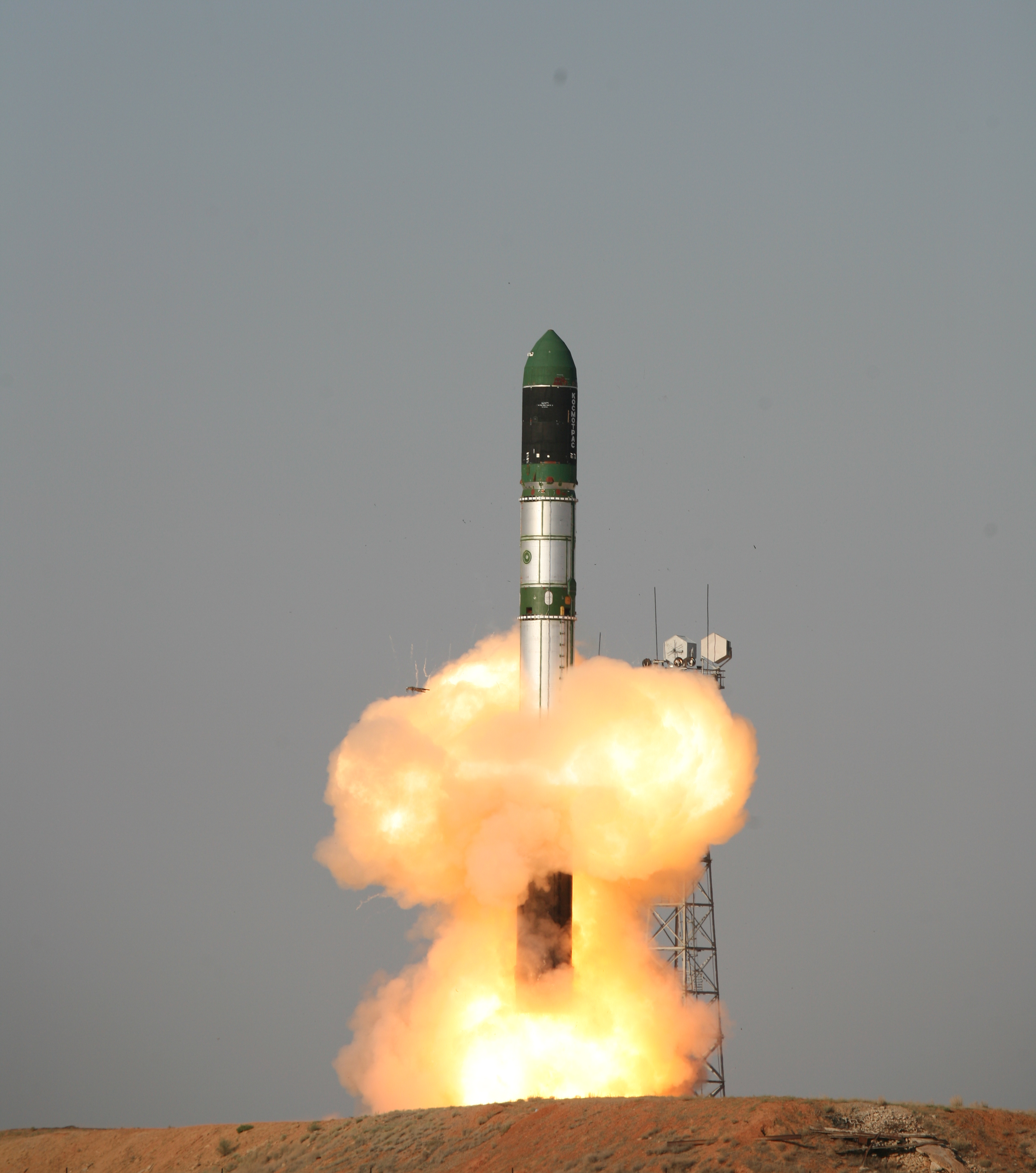
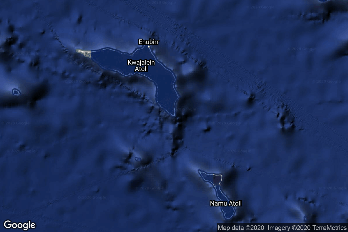
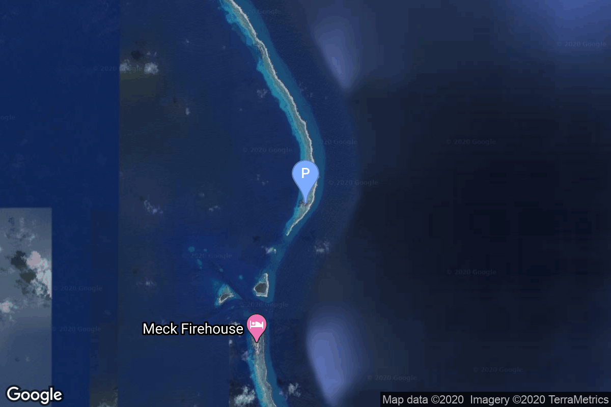
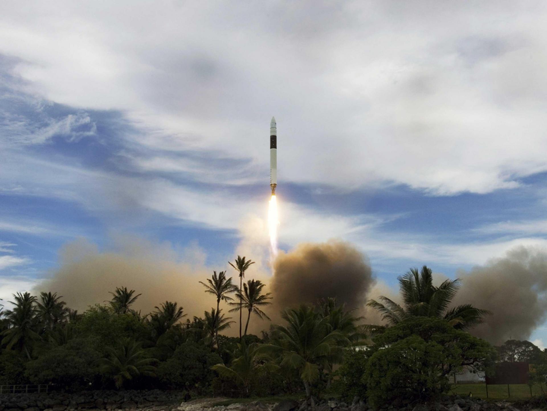
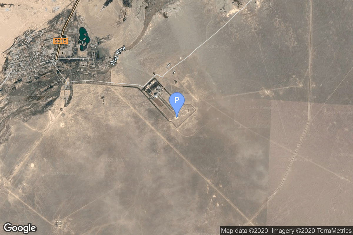
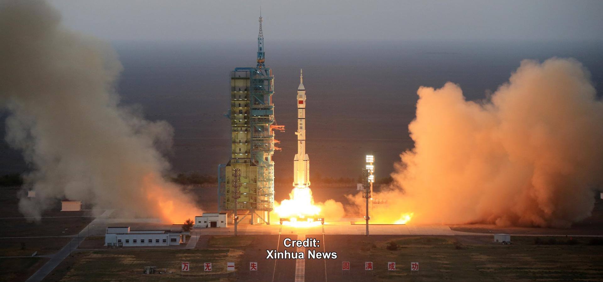
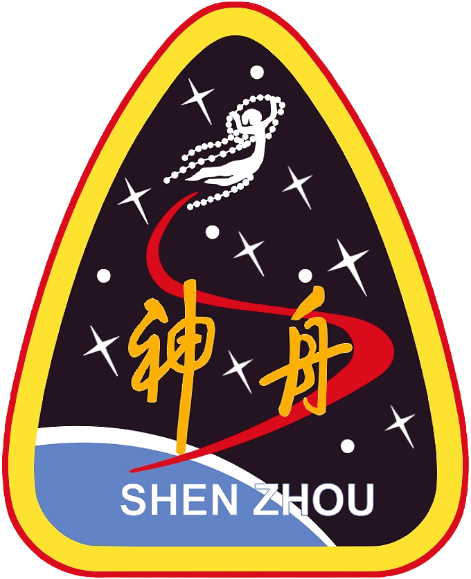
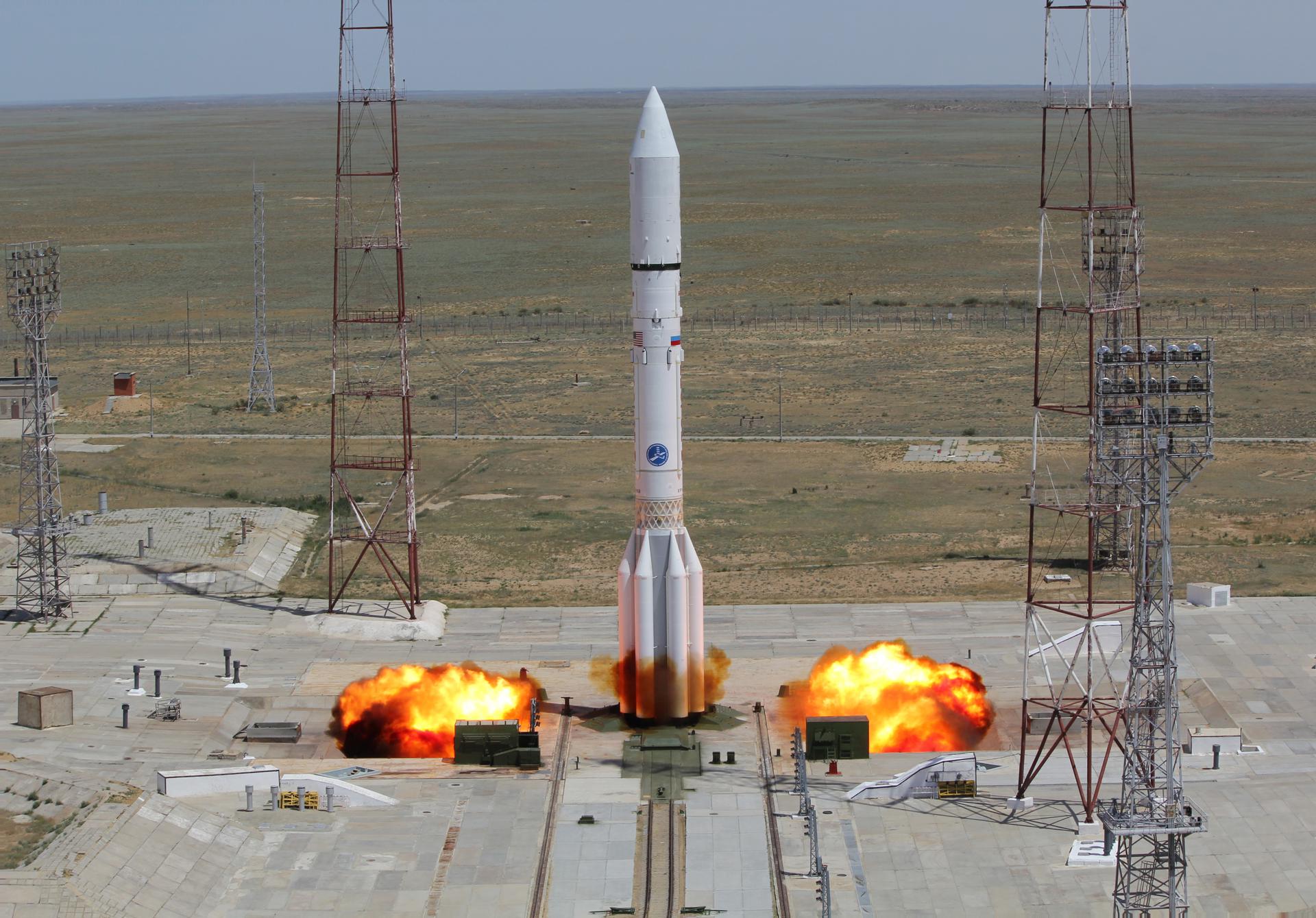
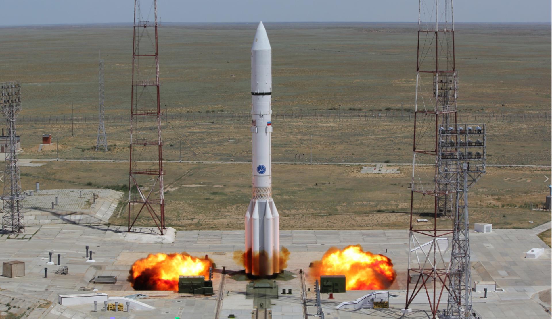
{ "count": 7936, "next": "https://ll.thespacedevs.com/2.2.0/launch/?format=api&limit=10&offset=2940&ordering=-net", "previous": "https://ll.thespacedevs.com/2.2.0/launch/?format=api&limit=10&offset=2920&ordering=-net", "results": [ { "id": "8dc0e528-eeef-48ab-8f56-45fa42f40f7a", "url": "https://ll.thespacedevs.com/2.2.0/launch/8dc0e528-eeef-48ab-8f56-45fa42f40f7a/?format=api", "slug": "long-march-4b-shi-jian-6e-6f", "name": "Long March 4B | Shi Jian 6E & 6F", "status": { "id": 3, "name": "Launch Successful", "abbrev": "Success", "description": "The launch vehicle successfully inserted its payload(s) into the target orbit(s)." }, "last_updated": "2024-06-15T14:24:47Z", "net": "2008-10-25T01:15:04Z", "window_end": "2008-10-25T01:15:04Z", "window_start": "2008-10-25T01:15:04Z", "net_precision": { "id": 0, "name": "Second", "abbrev": "SEC", "description": "The T-0 is accurate to the second." }, "probability": null, "weather_concerns": null, "holdreason": "", "failreason": "", "hashtag": null, "launch_service_provider": { "id": 88, "url": "https://ll.thespacedevs.com/2.2.0/agencies/88/?format=api", "name": "China Aerospace Science and Technology Corporation", "type": "Government" }, "rocket": { "id": 7369, "configuration": { "id": 10, "url": "https://ll.thespacedevs.com/2.2.0/config/launcher/10/?format=api", "name": "Long March 4B", "family": "Long March", "full_name": "Long March 4B", "variant": "B" } }, "mission": { "id": 5758, "name": "Shi Jian 6E & 6F", "description": "It was announced that the two satellites had a design life of at least two years, and would be used to probe the space environment, radiation and its effects, record space physical environment parameters, and conduct other related space experiments.", "launch_designator": null, "type": "Navigation", "orbit": { "id": 8, "name": "Low Earth Orbit", "abbrev": "LEO" }, "agencies": [], "info_urls": [], "vid_urls": [] }, "pad": { "id": 25, "url": "https://ll.thespacedevs.com/2.2.0/pad/25/?format=api", "agency_id": null, "name": "Launch Complex 9", "description": "", "info_url": null, "wiki_url": null, "map_url": "https://www.google.com/maps?q=38.863128,111.589567", "latitude": "38.863128", "longitude": "111.589567", "location": { "id": 19, "url": "https://ll.thespacedevs.com/2.2.0/location/19/?format=api", "name": "Taiyuan Satellite Launch Center, People's Republic of China", "country_code": "CHN", "description": "The Taiyuan Satellite Launch Center is a People's Republic of China space and defense launch facility. It is situated in Kelan County, Xinzhou, Shanxi Province and is the second of four launch sites having been founded in March 1966 and coming into full operation in 1968.", "map_image": "https://thespacedevs-prod.nyc3.digitaloceanspaces.com/media/map_images/location_19_20200803142421.jpg", "timezone_name": "Asia/Shanghai", "total_launch_count": 157, "total_landing_count": 0 }, "country_code": "CHN", "map_image": "https://thespacedevs-prod.nyc3.digitaloceanspaces.com/media/map_images/pad_25_20200803143501.jpg", "total_launch_count": 78, "orbital_launch_attempt_count": 78 }, "webcast_live": false, "image": "https://thespacedevs-prod.nyc3.digitaloceanspaces.com/media/images/long_march_4b_l_image_20251209044050.jpeg", "infographic": null, "program": [], "orbital_launch_attempt_count": 4940, "location_launch_attempt_count": 29, "pad_launch_attempt_count": 1, "agency_launch_attempt_count": 56, "orbital_launch_attempt_count_year": 55, "location_launch_attempt_count_year": 3, "pad_launch_attempt_count_year": 1, "agency_launch_attempt_count_year": 6, "type": "normal" }, { "id": "c8ce6c7f-86a8-474e-812f-312b38ac14c0", "url": "https://ll.thespacedevs.com/2.2.0/launch/c8ce6c7f-86a8-474e-812f-312b38ac14c0/?format=api", "slug": "pslv-xl-chandrayaan-1", "name": "PSLV XL | Chandrayaan-1", "status": { "id": 3, "name": "Launch Successful", "abbrev": "Success", "description": "The launch vehicle successfully inserted its payload(s) into the target orbit(s)." }, "last_updated": "2024-10-13T18:04:42Z", "net": "2008-10-22T00:52:11Z", "window_end": "2008-10-22T00:52:11Z", "window_start": "2008-10-22T00:52:11Z", "net_precision": { "id": 0, "name": "Second", "abbrev": "SEC", "description": "The T-0 is accurate to the second." }, "probability": null, "weather_concerns": null, "holdreason": "", "failreason": "", "hashtag": null, "launch_service_provider": { "id": 31, "url": "https://ll.thespacedevs.com/2.2.0/agencies/31/?format=api", "name": "Indian Space Research Organization", "type": "Government" }, "rocket": { "id": 1404, "configuration": { "id": 38, "url": "https://ll.thespacedevs.com/2.2.0/config/launcher/38/?format=api", "name": "PSLV-XL", "family": "PSLV", "full_name": "PSLV XL", "variant": "XL" } }, "mission": null, "pad": { "id": 50, "url": "https://ll.thespacedevs.com/2.2.0/pad/50/?format=api", "agency_id": 31, "name": "Satish Dhawan Space Centre First Launch Pad", "description": "India has two launch pads at the site. The First Launch Pad, operational since 1993, is used for Polar Satellite Launch Vehicle, Small Satellite Launch Vehicle and formerly used by Geosynchronous Satellite Launch Vehicle.", "info_url": null, "wiki_url": "https://en.wikipedia.org/wiki/Satish_Dhawan_Space_Centre_First_Launch_Pad", "map_url": "https://www.google.com/maps?q=13.733,80.235", "latitude": "13.733", "longitude": "80.235", "location": { "id": 14, "url": "https://ll.thespacedevs.com/2.2.0/location/14/?format=api", "name": "Satish Dhawan Space Centre, India", "country_code": "IND", "description": "Satish Dhawan Space Centre – SDSC (formerly Sriharikota Range – SHAR),[1] is the primary spaceport of the Indian Space Research Organisation (ISRO), located in Sriharikota, Andhra Pradesh.", "map_image": "https://thespacedevs-prod.nyc3.digitaloceanspaces.com/media/map_images/location_14_20200803142403.jpg", "timezone_name": "Asia/Kolkata", "total_launch_count": 104, "total_landing_count": 0 }, "country_code": "IND", "map_image": "https://thespacedevs-prod.nyc3.digitaloceanspaces.com/media/map_images/pad_50_20200803143457.jpg", "total_launch_count": 64, "orbital_launch_attempt_count": 63 }, "webcast_live": false, "image": "https://thespacedevs-prod.nyc3.digitaloceanspaces.com/media/images/pslv_image_20190224012254.jpeg", "infographic": null, "program": [], "orbital_launch_attempt_count": 4939, "location_launch_attempt_count": 27, "pad_launch_attempt_count": 14, "agency_launch_attempt_count": 27, "orbital_launch_attempt_count_year": 54, "location_launch_attempt_count_year": 3, "pad_launch_attempt_count_year": 2, "agency_launch_attempt_count_year": 3, "type": "normal" }, { "id": "0b7d44c4-ac5e-4daa-bba4-a22a545351ca", "url": "https://ll.thespacedevs.com/2.2.0/launch/0b7d44c4-ac5e-4daa-bba4-a22a545351ca/?format=api", "slug": "pegasus-xl-interstellar-boundary-explorer-ibex", "name": "Pegasus XL | Interstellar Boundary Explorer (IBEX)", "status": { "id": 3, "name": "Launch Successful", "abbrev": "Success", "description": "The launch vehicle successfully inserted its payload(s) into the target orbit(s)." }, "last_updated": "2023-06-14T03:54:55Z", "net": "2008-10-19T17:47:23Z", "window_end": "2008-10-19T17:47:23Z", "window_start": "2008-10-19T17:47:23Z", "net_precision": null, "probability": null, "weather_concerns": null, "holdreason": "", "failreason": null, "hashtag": null, "launch_service_provider": { "id": 100, "url": "https://ll.thespacedevs.com/2.2.0/agencies/100/?format=api", "name": "Orbital Sciences Corporation", "type": "Commercial" }, "rocket": { "id": 1403, "configuration": { "id": 173, "url": "https://ll.thespacedevs.com/2.2.0/config/launcher/173/?format=api", "name": "Pegasus XL", "family": "Pegasus", "full_name": "Pegasus XL", "variant": "" } }, "mission": null, "pad": { "id": 59, "url": "https://ll.thespacedevs.com/2.2.0/pad/59/?format=api", "agency_id": null, "name": "Kwajalein Atoll", "description": null, "info_url": null, "wiki_url": "https://en.wikipedia.org/wiki/Kwajalein_Atoll", "map_url": "https://www.google.com/maps?q=8.716667,167.733333", "latitude": "8.716667", "longitude": "167.733333", "location": { "id": 20, "url": "https://ll.thespacedevs.com/2.2.0/location/20/?format=api", "name": "Air launch to orbit", "country_code": "???", "description": "", "map_image": "https://thespacedevs-prod.nyc3.digitaloceanspaces.com/media/map_images/location_20_20200803142433.jpg", "timezone_name": "", "total_launch_count": 52, "total_landing_count": 0 }, "country_code": "MHL", "map_image": "https://thespacedevs-prod.nyc3.digitaloceanspaces.com/media/map_images/pad_59_20200803143427.jpg", "total_launch_count": 5, "orbital_launch_attempt_count": 5 }, "webcast_live": false, "image": "https://thespacedevs-prod.nyc3.digitaloceanspaces.com/media/images/pegasus_xl_moun_image_20240307124328.jpeg", "infographic": null, "program": [], "orbital_launch_attempt_count": 4938, "location_launch_attempt_count": 40, "pad_launch_attempt_count": 3, "agency_launch_attempt_count": 55, "orbital_launch_attempt_count_year": 53, "location_launch_attempt_count_year": 2, "pad_launch_attempt_count_year": 2, "agency_launch_attempt_count_year": 2, "type": "normal" }, { "id": "424c6223-ab74-4401-9eb7-b4ca20b97ae0", "url": "https://ll.thespacedevs.com/2.2.0/launch/424c6223-ab74-4401-9eb7-b4ca20b97ae0/?format=api", "slug": "soyuz-fg-soyuz-tma-13", "name": "Soyuz-FG | Soyuz TMA-13", "status": { "id": 3, "name": "Launch Successful", "abbrev": "Success", "description": "The launch vehicle successfully inserted its payload(s) into the target orbit(s)." }, "last_updated": "2024-06-15T13:29:08Z", "net": "2008-10-12T07:01:33Z", "window_end": "2008-10-12T07:01:33Z", "window_start": "2008-10-12T07:01:33Z", "net_precision": { "id": 0, "name": "Second", "abbrev": "SEC", "description": "The T-0 is accurate to the second." }, "probability": null, "weather_concerns": null, "holdreason": "", "failreason": "", "hashtag": null, "launch_service_provider": { "id": 63, "url": "https://ll.thespacedevs.com/2.2.0/agencies/63/?format=api", "name": "Russian Federal Space Agency (ROSCOSMOS)", "type": "Government" }, "rocket": { "id": 1402, "configuration": { "id": 34, "url": "https://ll.thespacedevs.com/2.2.0/config/launcher/34/?format=api", "name": "Soyuz", "family": "", "full_name": "Soyuz FG", "variant": "FG" } }, "mission": { "id": 207, "name": "Soyuz TMA-13", "description": "Soyuz TMA-13 begins Expedition 18 by carrying 3 astronauts and cosmonauts to the International Space Station. \nRussian Commander, cosmonaut Yuri Lonchakov alongside Flight Engineer, Michael Fincke (NASA) & spaceflight participant Richard Garriott (Space Adventures) will launch aboard the Soyuz spacecraft from the Baikonur Cosmodrome in Kazakhstan and then rendezvous with the station. \nIt landed on 8 April 2009, 07:16 UTC", "launch_designator": null, "type": "Human Exploration", "orbit": { "id": 8, "name": "Low Earth Orbit", "abbrev": "LEO" }, "agencies": [], "info_urls": [], "vid_urls": [] }, "pad": { "id": 32, "url": "https://ll.thespacedevs.com/2.2.0/pad/32/?format=api", "agency_id": null, "name": "1/5", "description": null, "info_url": null, "wiki_url": "", "map_url": "https://www.google.com/maps?q=45.92,63.342", "latitude": "45.92", "longitude": "63.342", "location": { "id": 15, "url": "https://ll.thespacedevs.com/2.2.0/location/15/?format=api", "name": "Baikonur Cosmodrome, Republic of Kazakhstan", "country_code": "KAZ", "description": "The Baikonur Cosmodrome is a spaceport operated by Russia within Kazakhstan. Located in the Kazakh city of Baikonur, it is the largest operational space launch facility in terms of area. All Russian crewed spaceflights are launched from Baikonur.", "map_image": "https://thespacedevs-prod.nyc3.digitaloceanspaces.com/media/map_images/location_15_20200803142517.jpg", "timezone_name": "Asia/Qyzylorda", "total_launch_count": 1564, "total_landing_count": 0 }, "country_code": "KAZ", "map_image": "https://thespacedevs-prod.nyc3.digitaloceanspaces.com/media/map_images/pad_32_20200803143513.jpg", "total_launch_count": 487, "orbital_launch_attempt_count": 487 }, "webcast_live": false, "image": "https://thespacedevs-prod.nyc3.digitaloceanspaces.com/media/images/soyuz_image_20190717035537.jpg", "infographic": null, "program": [ { "id": 17, "url": "https://ll.thespacedevs.com/2.2.0/program/17/?format=api", "name": "International Space Station", "description": "The International Space Station programme is tied together by a complex set of legal, political and financial agreements between the sixteen nations involved in the project, governing ownership of the various components, rights to crewing and utilization, and responsibilities for crew rotation and resupply of the International Space Station. It was conceived in 1984 by President Ronald Reagan, during the Space Station Freedom project as it was originally called.", "agencies": [ { "id": 16, "url": "https://ll.thespacedevs.com/2.2.0/agencies/16/?format=api", "name": "Canadian Space Agency", "type": "Government" }, { "id": 27, "url": "https://ll.thespacedevs.com/2.2.0/agencies/27/?format=api", "name": "European Space Agency", "type": "Multinational" }, { "id": 37, "url": "https://ll.thespacedevs.com/2.2.0/agencies/37/?format=api", "name": "Japan Aerospace Exploration Agency", "type": "Government" }, { "id": 44, "url": "https://ll.thespacedevs.com/2.2.0/agencies/44/?format=api", "name": "National Aeronautics and Space Administration", "type": "Government" }, { "id": 63, "url": "https://ll.thespacedevs.com/2.2.0/agencies/63/?format=api", "name": "Russian Federal Space Agency (ROSCOSMOS)", "type": "Government" } ], "image_url": "https://thespacedevs-prod.nyc3.digitaloceanspaces.com/media/images/international2_program_20201129184745.png", "start_date": "1998-11-20T06:40:00Z", "end_date": null, "info_url": "https://www.nasa.gov/mission_pages/station/main/index.html", "wiki_url": "https://en.wikipedia.org/wiki/International_Space_Station_programme", "mission_patches": [], "type": { "id": 2, "name": "Human Spaceflight" } }, { "id": 8, "url": "https://ll.thespacedevs.com/2.2.0/program/8/?format=api", "name": "Soyuz", "description": "The Soyuz programme is a human spaceflight programme initiated by the Soviet Union in the early 1960s. The Soyuz spacecraft was originally part of a Moon landing project intended to put a Soviet cosmonaut on the Moon. It was the third Soviet human spaceflight programme after the Vostok and Voskhod programmes.", "agencies": [ { "id": 63, "url": "https://ll.thespacedevs.com/2.2.0/agencies/63/?format=api", "name": "Russian Federal Space Agency (ROSCOSMOS)", "type": "Government" }, { "id": 66, "url": "https://ll.thespacedevs.com/2.2.0/agencies/66/?format=api", "name": "Soviet Space Program", "type": "Government" } ], "image_url": "https://thespacedevs-prod.nyc3.digitaloceanspaces.com/media/images/soyuz_program_20201129185543.png", "start_date": "1966-11-28T11:02:00Z", "end_date": null, "info_url": null, "wiki_url": "https://en.wikipedia.org/wiki/Soyuz_programme", "mission_patches": [], "type": { "id": 2, "name": "Human Spaceflight" } } ], "orbital_launch_attempt_count": 4937, "location_launch_attempt_count": 1303, "pad_launch_attempt_count": 417, "agency_launch_attempt_count": 179, "orbital_launch_attempt_count_year": 52, "location_launch_attempt_count_year": 15, "pad_launch_attempt_count_year": 5, "agency_launch_attempt_count_year": 6, "type": "normal" }, { "id": "63f1b8c6-8dfb-4956-a760-5777ac1ce10c", "url": "https://ll.thespacedevs.com/2.2.0/launch/63f1b8c6-8dfb-4956-a760-5777ac1ce10c/?format=api", "slug": "dnepr-thaichote", "name": "Dnepr | Thaichote", "status": { "id": 3, "name": "Launch Successful", "abbrev": "Success", "description": "The launch vehicle successfully inserted its payload(s) into the target orbit(s)." }, "last_updated": "2023-06-14T04:30:01Z", "net": "2008-10-01T06:37:21Z", "window_end": "2008-10-01T06:37:21Z", "window_start": "2008-10-01T06:37:21Z", "net_precision": null, "probability": null, "weather_concerns": null, "holdreason": "", "failreason": null, "hashtag": null, "launch_service_provider": { "id": 119, "url": "https://ll.thespacedevs.com/2.2.0/agencies/119/?format=api", "name": "ISC Kosmotras", "type": "Commercial" }, "rocket": { "id": 7368, "configuration": { "id": 31, "url": "https://ll.thespacedevs.com/2.2.0/config/launcher/31/?format=api", "name": "Dnepr", "family": "", "full_name": "Dnepr 1", "variant": "1" } }, "mission": { "id": 5757, "name": "Thaichote", "description": "Thai Earth observation satellite", "launch_designator": null, "type": "Earth Science", "orbit": { "id": 17, "name": "Sun-Synchronous Orbit", "abbrev": "SSO" }, "agencies": [], "info_urls": [], "vid_urls": [] }, "pad": { "id": 183, "url": "https://ll.thespacedevs.com/2.2.0/pad/183/?format=api", "agency_id": null, "name": "370/13", "description": null, "info_url": null, "wiki_url": "https://en.wikipedia.org/wiki/Dombarovsky_Air_Base", "map_url": "https://www.google.com/maps?q=51.0938889,59.8400282", "latitude": "51.0938889", "longitude": "59.8400282", "location": { "id": 5, "url": "https://ll.thespacedevs.com/2.2.0/location/5/?format=api", "name": "Dombarovskiy, Russian Federation", "country_code": "RUS", "description": "Dombarovsky is a military airbase near Yasny in Russia's Orenburg Oblast. Operated by the Soviet Air Defence Forces and later by the Russian Air Force, it hosted fighter interceptor squadrons and hosts an ICBM base (which has been adapted for commercial satellite launches) with a supporting helicopter base.", "map_image": "https://thespacedevs-prod.nyc3.digitaloceanspaces.com/media/map_images/location_5_20200803142425.jpg", "timezone_name": "Asia/Yekaterinburg", "total_launch_count": 10, "total_landing_count": 0 }, "country_code": "RUS", "map_image": "https://thespacedevs-prod.nyc3.digitaloceanspaces.com/media/map_images/pad_183_20200803143512.jpg", "total_launch_count": 8, "orbital_launch_attempt_count": 8 }, "webcast_live": false, "image": "https://thespacedevs-prod.nyc3.digitaloceanspaces.com/media/images/dnepr-1_liftoff_image_20240411092543.jpeg", "infographic": null, "program": [], "orbital_launch_attempt_count": 4936, "location_launch_attempt_count": 3, "pad_launch_attempt_count": 1, "agency_launch_attempt_count": 12, "orbital_launch_attempt_count_year": 51, "location_launch_attempt_count_year": 1, "pad_launch_attempt_count_year": 1, "agency_launch_attempt_count_year": 2, "type": "normal" }, { "id": "0560cfb0-ed19-4e8b-9fe9-728feb0f817c", "url": "https://ll.thespacedevs.com/2.2.0/launch/0560cfb0-ed19-4e8b-9fe9-728feb0f817c/?format=api", "slug": "falcon-1-ratsat", "name": "Falcon 1 | RatSat", "status": { "id": 3, "name": "Launch Successful", "abbrev": "Success", "description": "The launch vehicle successfully inserted its payload(s) into the target orbit(s)." }, "last_updated": "2023-07-08T08:51:15Z", "net": "2008-09-28T23:15:00Z", "window_end": "2008-09-28T23:15:00Z", "window_start": "2008-09-28T23:15:00Z", "net_precision": null, "probability": null, "weather_concerns": null, "holdreason": "", "failreason": "", "hashtag": null, "launch_service_provider": { "id": 121, "url": "https://ll.thespacedevs.com/2.2.0/agencies/121/?format=api", "name": "SpaceX", "type": "Commercial" }, "rocket": { "id": 1400, "configuration": { "id": 133, "url": "https://ll.thespacedevs.com/2.2.0/config/launcher/133/?format=api", "name": "Falcon 1", "family": "Falcon", "full_name": "Falcon 1", "variant": "1" } }, "mission": { "id": 6461, "name": "RatSat", "description": "RatSat was an aluminum mass simulator on the fourth flight of the Falcon 1 rocket.", "launch_designator": null, "type": "Test Flight", "orbit": { "id": 8, "name": "Low Earth Orbit", "abbrev": "LEO" }, "agencies": [], "info_urls": [], "vid_urls": [] }, "pad": { "id": 107, "url": "https://ll.thespacedevs.com/2.2.0/pad/107/?format=api", "agency_id": null, "name": "Omelek Island", "description": null, "info_url": null, "wiki_url": "https://en.wikipedia.org/wiki/Omelek_Island", "map_url": "https://www.google.com/maps?q=9.047861,167.743", "latitude": "9.047861", "longitude": "167.743", "location": { "id": 142, "url": "https://ll.thespacedevs.com/2.2.0/location/142/?format=api", "name": "Ronald Reagan Ballistic Missile Defense Test Site, Kwajalein Atoll, Marshall Islands", "country_code": "MHL", "description": "The Ronald Reagan Ballistic Missile Defense Test Site is a missile test range in Marshall Islands. It covers about 750,000 square miles (1,900,000 km2) and includes rocket launch sites at the Kwajalein Atoll (on multiple islands), Wake Island, and Aur Atoll. It primarily functions as a test facility for U.S. missile defense and space research programs.", "map_image": "https://thespacedevs-prod.nyc3.digitaloceanspaces.com/media/map_images/location_142_20200803142511.jpg", "timezone_name": "Pacific/Tarawa", "total_launch_count": 5, "total_landing_count": 0 }, "country_code": "MHL", "map_image": "https://thespacedevs-prod.nyc3.digitaloceanspaces.com/media/map_images/pad_107_20200803143450.jpg", "total_launch_count": 5, "orbital_launch_attempt_count": 5 }, "webcast_live": false, "image": "https://thespacedevs-prod.nyc3.digitaloceanspaces.com/media/images/falcon_image_20190222030438.jpeg", "infographic": null, "program": [], "orbital_launch_attempt_count": 4935, "location_launch_attempt_count": 4, "pad_launch_attempt_count": 4, "agency_launch_attempt_count": 4, "orbital_launch_attempt_count_year": 50, "location_launch_attempt_count_year": 2, "pad_launch_attempt_count_year": 2, "agency_launch_attempt_count_year": 2, "type": "normal" }, { "id": "916e50f7-22ee-429c-9c67-fc3610f09553", "url": "https://ll.thespacedevs.com/2.2.0/launch/916e50f7-22ee-429c-9c67-fc3610f09553/?format=api", "slug": "long-march-2f-shenzhou-7", "name": "Long March 2F | Shenzhou-7", "status": { "id": 3, "name": "Launch Successful", "abbrev": "Success", "description": "The launch vehicle successfully inserted its payload(s) into the target orbit(s)." }, "last_updated": "2023-10-25T10:59:15Z", "net": "2008-09-25T13:10:04Z", "window_end": "2008-09-25T13:10:04Z", "window_start": "2008-09-25T13:10:04Z", "net_precision": null, "probability": null, "weather_concerns": null, "holdreason": "", "failreason": "", "hashtag": null, "launch_service_provider": { "id": 88, "url": "https://ll.thespacedevs.com/2.2.0/agencies/88/?format=api", "name": "China Aerospace Science and Technology Corporation", "type": "Government" }, "rocket": { "id": 1401, "configuration": { "id": 79, "url": "https://ll.thespacedevs.com/2.2.0/config/launcher/79/?format=api", "name": "Long March 2F", "family": "Long March", "full_name": "Long March 2F", "variant": "F" } }, "mission": { "id": 305, "name": "Shenzhou-7", "description": "This is the third crewed mission for China's Shenzhou program. Shenzhou-7 began its mission by bringing Zhai Zhigang, Liu Boming and Jing Haipeng into low Earth orbit. It was the first Chinese mission to have a three-person crew. During their 3 days in orbit, astronauts performed a number of tasks, including the first Chinese EVA carried out by Zhai Zhingang and Liu Boming. Shenzhou-7 deorbited and landed safely back on Earth on 28 September.", "launch_designator": null, "type": "Human Exploration", "orbit": { "id": 8, "name": "Low Earth Orbit", "abbrev": "LEO" }, "agencies": [], "info_urls": [], "vid_urls": [] }, "pad": { "id": 37, "url": "https://ll.thespacedevs.com/2.2.0/pad/37/?format=api", "agency_id": null, "name": "Launch Area 91 (SLS-1 / 921)", "description": "", "info_url": null, "wiki_url": "https://en.wikipedia.org/wiki/Jiuquan_Launch_Area_4", "map_url": "https://www.google.com/maps?q=40.957893,100.290944", "latitude": "40.957893", "longitude": "100.290944", "location": { "id": 17, "url": "https://ll.thespacedevs.com/2.2.0/location/17/?format=api", "name": "Jiuquan Satellite Launch Center, People's Republic of China", "country_code": "CHN", "description": "Jiuquan Satellite Launch Center is a Chinese spaceport located between the Ejin, Alxa, Inner Mongolia and Hangtian Town, Jinta County, Jiuquan, Gansu Province. It is part of the Dongfeng Aerospace City (Base 10).", "map_image": "https://thespacedevs-prod.nyc3.digitaloceanspaces.com/media/map_images/location_17_20200803142429.jpg", "timezone_name": "Asia/Shanghai", "total_launch_count": 292, "total_landing_count": 2 }, "country_code": "CHN", "map_image": "https://thespacedevs-prod.nyc3.digitaloceanspaces.com/media/map_images/pad_37_20200803143603.jpg", "total_launch_count": 29, "orbital_launch_attempt_count": 29 }, "webcast_live": false, "image": "https://thespacedevs-prod.nyc3.digitaloceanspaces.com/media/images/long_march_2_image_20210908195835.jpeg", "infographic": null, "program": [ { "id": 7, "url": "https://ll.thespacedevs.com/2.2.0/program/7/?format=api", "name": "Shenzhou", "description": "The Shenzhou program is a crewed spaceflight initiative by China. The program put the first Chinese citizen, Yang Liwei, into orbit on 15 October 2003.", "agencies": [ { "id": 17, "url": "https://ll.thespacedevs.com/2.2.0/agencies/17/?format=api", "name": "China National Space Administration", "type": "Government" } ], "image_url": "https://thespacedevs-prod.nyc3.digitaloceanspaces.com/media/images/shenzhou_program_20200820204745.PNG", "start_date": "1993-01-01T00:00:00Z", "end_date": null, "info_url": null, "wiki_url": "https://en.wikipedia.org/wiki/Shenzhou_program", "mission_patches": [], "type": { "id": 2, "name": "Human Spaceflight" } } ], "orbital_launch_attempt_count": 4934, "location_launch_attempt_count": 43, "pad_launch_attempt_count": 7, "agency_launch_attempt_count": 55, "orbital_launch_attempt_count_year": 49, "location_launch_attempt_count_year": 1, "pad_launch_attempt_count_year": 1, "agency_launch_attempt_count_year": 5, "type": "normal" }, { "id": "acf2a8a5-801b-4123-a171-4894871005f8", "url": "https://ll.thespacedevs.com/2.2.0/launch/acf2a8a5-801b-4123-a171-4894871005f8/?format=api", "slug": "proton-m-uragan-m-15-to-17", "name": "Proton-M | Uragan-M 15 to 17", "status": { "id": 3, "name": "Launch Successful", "abbrev": "Success", "description": "The launch vehicle successfully inserted its payload(s) into the target orbit(s)." }, "last_updated": "2023-06-14T03:46:19Z", "net": "2008-09-25T08:49:37Z", "window_end": "2008-09-25T08:49:37Z", "window_start": "2008-09-25T08:49:37Z", "net_precision": null, "probability": null, "weather_concerns": null, "holdreason": "", "failreason": null, "hashtag": null, "launch_service_provider": { "id": 96, "url": "https://ll.thespacedevs.com/2.2.0/agencies/96/?format=api", "name": "Khrunichev State Research and Production Space Center", "type": "Government" }, "rocket": { "id": 7367, "configuration": { "id": 94, "url": "https://ll.thespacedevs.com/2.2.0/config/launcher/94/?format=api", "name": "Proton-M", "family": "Proton / UR-500", "full_name": "Proton-M DM-2 Enhanced", "variant": "DM-2 Enhanced" } }, "mission": { "id": 5756, "name": "Uragan-M 15 to 17", "description": "GLONASS navigation satellites", "launch_designator": null, "type": "Navigation", "orbit": { "id": 12, "name": "Medium Earth Orbit", "abbrev": "MEO" }, "agencies": [], "info_urls": [], "vid_urls": [] }, "pad": { "id": 31, "url": "https://ll.thespacedevs.com/2.2.0/pad/31/?format=api", "agency_id": null, "name": "81/23 (81L)", "description": null, "info_url": null, "wiki_url": "", "map_url": "https://www.google.com/maps?q=46.073997,62.977999", "latitude": "46.073997", "longitude": "62.977999", "location": { "id": 15, "url": "https://ll.thespacedevs.com/2.2.0/location/15/?format=api", "name": "Baikonur Cosmodrome, Republic of Kazakhstan", "country_code": "KAZ", "description": "The Baikonur Cosmodrome is a spaceport operated by Russia within Kazakhstan. Located in the Kazakh city of Baikonur, it is the largest operational space launch facility in terms of area. All Russian crewed spaceflights are launched from Baikonur.", "map_image": "https://thespacedevs-prod.nyc3.digitaloceanspaces.com/media/map_images/location_15_20200803142517.jpg", "timezone_name": "Asia/Qyzylorda", "total_launch_count": 1564, "total_landing_count": 0 }, "country_code": "KAZ", "map_image": "https://thespacedevs-prod.nyc3.digitaloceanspaces.com/media/map_images/pad_31_20200803143402.jpg", "total_launch_count": 104, "orbital_launch_attempt_count": 104 }, "webcast_live": false, "image": "https://thespacedevs-prod.nyc3.digitaloceanspaces.com/media/images/proton-m_image_20191211081456.jpeg", "infographic": null, "program": [ { "id": 34, "url": "https://ll.thespacedevs.com/2.2.0/program/34/?format=api", "name": "GLONASS", "description": "GLONASS (ГЛОНАСС, IPA: [ɡɫɐˈnas]; Russian: Глобальная навигационная спутниковая система, tr. Global'naya Navigatsionnaya Sputnikovaya Sistema, lit. 'Global Navigation Satellite System') is a Russian satellite navigation system operating as part of a radionavigation-satellite service. It provides an alternative to Global Positioning System (GPS) and is the second navigational system in operation with global coverage and of comparable precision.", "agencies": [ { "id": 63, "url": "https://ll.thespacedevs.com/2.2.0/agencies/63/?format=api", "name": "Russian Federal Space Agency (ROSCOSMOS)", "type": "Government" } ], "image_url": "https://thespacedevs-prod.nyc3.digitaloceanspaces.com/media/images/glonass_program_20240102170258.png", "start_date": "1982-10-12T00:00:00Z", "end_date": null, "info_url": "https://www.glonass-iac.ru/en/", "wiki_url": "https://en.wikipedia.org/wiki/GLONASS", "mission_patches": [], "type": { "id": 4, "name": "Navigation Constellation" } } ], "orbital_launch_attempt_count": 4933, "location_launch_attempt_count": 1302, "pad_launch_attempt_count": 104, "agency_launch_attempt_count": 137, "orbital_launch_attempt_count_year": 48, "location_launch_attempt_count_year": 14, "pad_launch_attempt_count_year": 1, "agency_launch_attempt_count_year": 7, "type": "normal" }, { "id": "5fc81128-c6da-4977-ae8f-24548a95b7de", "url": "https://ll.thespacedevs.com/2.2.0/launch/5fc81128-c6da-4977-ae8f-24548a95b7de/?format=api", "slug": "zenit-galaxy-19", "name": "Zenit | Galaxy 19", "status": { "id": 3, "name": "Launch Successful", "abbrev": "Success", "description": "The launch vehicle successfully inserted its payload(s) into the target orbit(s)." }, "last_updated": "2023-06-14T03:33:18Z", "net": "2008-09-24T09:27:59Z", "window_end": "2008-09-24T09:27:59Z", "window_start": "2008-09-24T09:27:59Z", "net_precision": null, "probability": null, "weather_concerns": null, "holdreason": "", "failreason": null, "hashtag": null, "launch_service_provider": { "id": 122, "url": "https://ll.thespacedevs.com/2.2.0/agencies/122/?format=api", "name": "Sea Launch", "type": "Commercial" }, "rocket": { "id": 7366, "configuration": { "id": 11, "url": "https://ll.thespacedevs.com/2.2.0/config/launcher/11/?format=api", "name": "Zenit", "family": "Zenith", "full_name": "Zenit 3SL", "variant": "3SL" } }, "mission": { "id": 5755, "name": "Galaxy 19", "description": "American geostationary communications satellite", "launch_designator": null, "type": "Communications", "orbit": { "id": 1, "name": "Geostationary Orbit", "abbrev": "Direct-GEO" }, "agencies": [], "info_urls": [], "vid_urls": [] }, "pad": { "id": 13, "url": "https://ll.thespacedevs.com/2.2.0/pad/13/?format=api", "agency_id": 80, "name": "Launch Platform Odyssey", "description": "", "info_url": null, "wiki_url": "https://en.wikipedia.org/wiki/Odyssey_(launch_platform)", "map_url": "https://www.google.com/maps?q=0.0,-154", "latitude": "0.0", "longitude": "-154.0", "location": { "id": 3, "url": "https://ll.thespacedevs.com/2.2.0/location/3/?format=api", "name": "Sea Launch", "country_code": "???", "description": "", "map_image": "https://thespacedevs-prod.nyc3.digitaloceanspaces.com/media/map_images/location_3_20200803142448.jpg", "timezone_name": "", "total_launch_count": 40, "total_landing_count": 0 }, "country_code": "", "map_image": "https://thespacedevs-prod.nyc3.digitaloceanspaces.com/media/map_images/pad_13_20200803143257.jpg", "total_launch_count": 36, "orbital_launch_attempt_count": 36 }, "webcast_live": false, "image": null, "infographic": null, "program": [], "orbital_launch_attempt_count": 4932, "location_launch_attempt_count": 32, "pad_launch_attempt_count": 29, "agency_launch_attempt_count": 30, "orbital_launch_attempt_count_year": 47, "location_launch_attempt_count_year": 5, "pad_launch_attempt_count_year": 5, "agency_launch_attempt_count_year": 6, "type": "normal" }, { "id": "679f8f74-73fc-4f3b-a856-8d75a238d331", "url": "https://ll.thespacedevs.com/2.2.0/launch/679f8f74-73fc-4f3b-a856-8d75a238d331/?format=api", "slug": "proton-m-briz-m-nimiq-4", "name": "Proton-M Briz-M | Nimiq 4", "status": { "id": 3, "name": "Launch Successful", "abbrev": "Success", "description": "The launch vehicle successfully inserted its payload(s) into the target orbit(s)." }, "last_updated": "2023-06-14T03:35:08Z", "net": "2008-09-19T21:48:00Z", "window_end": "2008-09-19T21:48:00Z", "window_start": "2008-09-19T21:48:00Z", "net_precision": null, "probability": null, "weather_concerns": null, "holdreason": "", "failreason": null, "hashtag": null, "launch_service_provider": { "id": 96, "url": "https://ll.thespacedevs.com/2.2.0/agencies/96/?format=api", "name": "Khrunichev State Research and Production Space Center", "type": "Government" }, "rocket": { "id": 7365, "configuration": { "id": 22, "url": "https://ll.thespacedevs.com/2.2.0/config/launcher/22/?format=api", "name": "Proton-M Briz-M", "family": "Proton / UR-500", "full_name": "Proton-M Briz-M", "variant": "Briz-M" } }, "mission": { "id": 5754, "name": "Nimiq 4", "description": "Canadian geostationary communications satellite", "launch_designator": null, "type": "Communications", "orbit": { "id": 1, "name": "Geostationary Orbit", "abbrev": "Direct-GEO" }, "agencies": [], "info_urls": [], "vid_urls": [] }, "pad": { "id": 15, "url": "https://ll.thespacedevs.com/2.2.0/pad/15/?format=api", "agency_id": null, "name": "200/39 (200L)", "description": null, "info_url": null, "wiki_url": "", "map_url": "https://www.google.com/maps?q=46.039984,63.032093", "latitude": "46.039984", "longitude": "63.032093", "location": { "id": 15, "url": "https://ll.thespacedevs.com/2.2.0/location/15/?format=api", "name": "Baikonur Cosmodrome, Republic of Kazakhstan", "country_code": "KAZ", "description": "The Baikonur Cosmodrome is a spaceport operated by Russia within Kazakhstan. Located in the Kazakh city of Baikonur, it is the largest operational space launch facility in terms of area. All Russian crewed spaceflights are launched from Baikonur.", "map_image": "https://thespacedevs-prod.nyc3.digitaloceanspaces.com/media/map_images/location_15_20200803142517.jpg", "timezone_name": "Asia/Qyzylorda", "total_launch_count": 1564, "total_landing_count": 0 }, "country_code": "KAZ", "map_image": "https://thespacedevs-prod.nyc3.digitaloceanspaces.com/media/map_images/pad_15_20200803143530.jpg", "total_launch_count": 167, "orbital_launch_attempt_count": 167 }, "webcast_live": false, "image": "https://thespacedevs-prod.nyc3.digitaloceanspaces.com/media/images/proton-m2520briz-m_image_20190224012317.jpeg", "infographic": null, "program": [], "orbital_launch_attempt_count": 4931, "location_launch_attempt_count": 1301, "pad_launch_attempt_count": 116, "agency_launch_attempt_count": 136, "orbital_launch_attempt_count_year": 46, "location_launch_attempt_count_year": 13, "pad_launch_attempt_count_year": 5, "agency_launch_attempt_count_year": 6, "type": "normal" } ] }