Launch List
API endpoint that returns all Launch objects or a single launch.
EXAMPLE - /launch/
GET: Return a list of all Launch objects.
FILTERS: Fields - 'name', 'id(s)', 'lsp_id', 'lsp_name', 'serial_number', 'launcher_config__id', 'rocket__spacecraftflight__spacecraft__name'
MODE: 'normal', 'list', 'detailed' EXAMPLE: ?mode=list
SEARCH: Searches through the launch name, rocket name, launch agency, mission name & spacecraft name. EXAMPLE - ?search=SpaceX
GET /2.0.0/launch/?format=api&offset=10
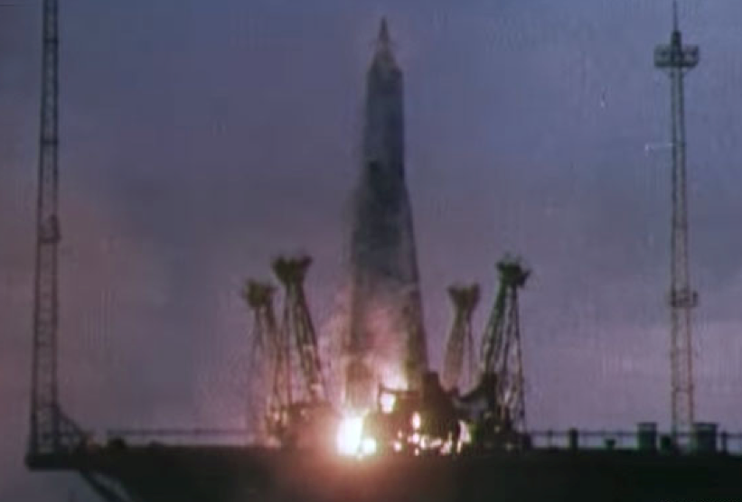
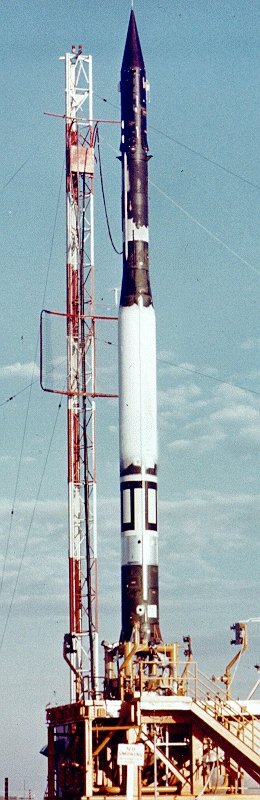
{ "count": 7843, "next": "https://ll.thespacedevs.com/2.0.0/launch/?format=api&limit=10&offset=20", "previous": "https://ll.thespacedevs.com/2.0.0/launch/?format=api&limit=10", "results": [ { "id": "6a7f56f9-2565-4b6c-b0c5-23e9c74a2368", "url": "https://ll.thespacedevs.com/2.0.0/launch/6a7f56f9-2565-4b6c-b0c5-23e9c74a2368/?format=api", "launch_library_id": null, "slug": "sputnik-8a91-d1-2", "name": "Sputnik 8A91 | D1- 2", "status": { "id": 3, "name": "Success" }, "net": "1958-05-15T07:00:35Z", "window_end": "1958-05-15T07:00:35Z", "window_start": "1958-05-15T07:00:35Z", "inhold": false, "tbdtime": false, "tbddate": false, "probability": null, "holdreason": "", "failreason": "", "hashtag": null, "launch_service_provider": { "id": 66, "url": "https://ll.thespacedevs.com/2.0.0/agencies/66/?format=api", "name": "Soviet Space Program", "type": "Government" }, "rocket": { "id": 3013, "configuration": { "id": 469, "launch_library_id": null, "url": "https://ll.thespacedevs.com/2.0.0/config/launcher/469/?format=api", "name": "Sputnik 8A91", "family": "Sputnik", "full_name": "Sputnik 8A91", "variant": "8A91" } }, "mission": { "id": 1437, "launch_library_id": null, "name": "D1- 2", "description": "First complex scientific satellite to reach orbit.", "launch_designator": null, "type": "Earth Science", "orbit": { "id": 8, "name": "Low Earth Orbit", "abbrev": "LEO" } }, "pad": { "id": 32, "url": "https://ll.thespacedevs.com/2.0.0/pad/32/?format=api", "agency_id": null, "name": "1/5", "info_url": null, "wiki_url": "", "map_url": "https://www.google.com/maps?q=45.92,63.342", "latitude": "45.92", "longitude": "63.342", "location": { "id": 15, "url": "https://ll.thespacedevs.com/2.0.0/location/15/?format=api", "name": "Baikonur Cosmodrome, Republic of Kazakhstan", "country_code": "KAZ", "map_image": "https://thespacedevs-prod.nyc3.digitaloceanspaces.com/media/map_images/location_15_20200803142517.jpg", "total_launch_count": 1561, "total_landing_count": 0 }, "map_image": "https://thespacedevs-prod.nyc3.digitaloceanspaces.com/media/map_images/pad_32_20200803143513.jpg", "total_launch_count": 487 }, "webcast_live": false, "image": "https://thespacedevs-prod.nyc3.digitaloceanspaces.com/media/images/sputnik_8a91_image_20210830171943.png", "infographic": null, "program": [] }, { "id": "a861fb4d-8988-468b-abd1-a6e8abe5f2c7", "url": "https://ll.thespacedevs.com/2.0.0/launch/a861fb4d-8988-468b-abd1-a6e8abe5f2c7/?format=api", "launch_library_id": null, "slug": "vanguard-vanguard-5", "name": "Vanguard | Vanguard", "status": { "id": 4, "name": "Failure" }, "net": "1958-05-28T03:46:20Z", "window_end": "1958-05-28T03:46:20Z", "window_start": "1958-05-28T03:46:20Z", "inhold": false, "tbdtime": false, "tbddate": false, "probability": null, "holdreason": "", "failreason": null, "hashtag": null, "launch_service_provider": { "id": 166, "url": "https://ll.thespacedevs.com/2.0.0/agencies/166/?format=api", "name": "US Navy", "type": "Government" }, "rocket": { "id": 3014, "configuration": { "id": 449, "launch_library_id": null, "url": "https://ll.thespacedevs.com/2.0.0/config/launcher/449/?format=api", "name": "Vanguard", "family": "", "full_name": "Vanguard", "variant": "" } }, "mission": { "id": 1432, "launch_library_id": null, "name": "Vanguard", "description": "Small satellite used to test the Vanguard three-stage launch vehicle.", "launch_designator": null, "type": "Test Flight", "orbit": { "id": 8, "name": "Low Earth Orbit", "abbrev": "LEO" } }, "pad": { "id": 118, "url": "https://ll.thespacedevs.com/2.0.0/pad/118/?format=api", "agency_id": 166, "name": "Launch Complex 18A", "info_url": null, "wiki_url": "https://en.wikipedia.org/wiki/Cape_Canaveral_Launch_Complex_18", "map_url": "https://www.google.com/maps?q=28.4493,-80.564494", "latitude": "28.4493", "longitude": "-80.564494", "location": { "id": 12, "url": "https://ll.thespacedevs.com/2.0.0/location/12/?format=api", "name": "Cape Canaveral SFS, FL, USA", "country_code": "USA", "map_image": "https://thespacedevs-prod.nyc3.digitaloceanspaces.com/media/map_images/location_12_20200803142519.jpg", "total_launch_count": 1101, "total_landing_count": 72 }, "map_image": "https://thespacedevs-prod.nyc3.digitaloceanspaces.com/media/map_images/pad_118_20200803143338.jpg", "total_launch_count": 18 }, "webcast_live": false, "image": "https://thespacedevs-prod.nyc3.digitaloceanspaces.com/media/images/vanguard_1_on_p_image_20240411114304.jpeg", "infographic": null, "program": [] }, { "id": "57e64adf-5c20-4c81-b17a-587b44d574b0", "url": "https://ll.thespacedevs.com/2.0.0/launch/57e64adf-5c20-4c81-b17a-587b44d574b0/?format=api", "launch_library_id": null, "slug": "vanguard-vanguard-6", "name": "Vanguard | Vanguard", "status": { "id": 4, "name": "Failure" }, "net": "1958-06-26T05:00:52Z", "window_end": "1958-06-26T05:00:52Z", "window_start": "1958-06-26T05:00:52Z", "inhold": false, "tbdtime": false, "tbddate": false, "probability": null, "holdreason": "", "failreason": null, "hashtag": null, "launch_service_provider": { "id": 166, "url": "https://ll.thespacedevs.com/2.0.0/agencies/166/?format=api", "name": "US Navy", "type": "Government" }, "rocket": { "id": 3015, "configuration": { "id": 449, "launch_library_id": null, "url": "https://ll.thespacedevs.com/2.0.0/config/launcher/449/?format=api", "name": "Vanguard", "family": "", "full_name": "Vanguard", "variant": "" } }, "mission": { "id": 1432, "launch_library_id": null, "name": "Vanguard", "description": "Small satellite used to test the Vanguard three-stage launch vehicle.", "launch_designator": null, "type": "Test Flight", "orbit": { "id": 8, "name": "Low Earth Orbit", "abbrev": "LEO" } }, "pad": { "id": 118, "url": "https://ll.thespacedevs.com/2.0.0/pad/118/?format=api", "agency_id": 166, "name": "Launch Complex 18A", "info_url": null, "wiki_url": "https://en.wikipedia.org/wiki/Cape_Canaveral_Launch_Complex_18", "map_url": "https://www.google.com/maps?q=28.4493,-80.564494", "latitude": "28.4493", "longitude": "-80.564494", "location": { "id": 12, "url": "https://ll.thespacedevs.com/2.0.0/location/12/?format=api", "name": "Cape Canaveral SFS, FL, USA", "country_code": "USA", "map_image": "https://thespacedevs-prod.nyc3.digitaloceanspaces.com/media/map_images/location_12_20200803142519.jpg", "total_launch_count": 1101, "total_landing_count": 72 }, "map_image": "https://thespacedevs-prod.nyc3.digitaloceanspaces.com/media/map_images/pad_118_20200803143338.jpg", "total_launch_count": 18 }, "webcast_live": false, "image": "https://thespacedevs-prod.nyc3.digitaloceanspaces.com/media/images/vanguard_1_on_p_image_20240411114304.jpeg", "infographic": null, "program": [] }, { "id": "64da1836-0c00-4074-ab0a-f9d0ee6b1221", "url": "https://ll.thespacedevs.com/2.0.0/launch/64da1836-0c00-4074-ab0a-f9d0ee6b1221/?format=api", "launch_library_id": null, "slug": "project-pilot-nots-1", "name": "Project Pilot | NOTS 1", "status": { "id": 4, "name": "Failure" }, "net": "1958-07-25T00:00:00Z", "window_end": "1958-07-25T00:00:00Z", "window_start": "1958-07-25T00:00:00Z", "inhold": false, "tbdtime": false, "tbddate": false, "probability": null, "holdreason": "", "failreason": null, "hashtag": null, "launch_service_provider": { "id": 166, "url": "https://ll.thespacedevs.com/2.0.0/agencies/166/?format=api", "name": "US Navy", "type": "Government" }, "rocket": { "id": 3016, "configuration": { "id": 344, "launch_library_id": null, "url": "https://ll.thespacedevs.com/2.0.0/config/launcher/344/?format=api", "name": "Project Pilot", "family": "", "full_name": "Project Pilot", "variant": "" } }, "mission": { "id": 1438, "launch_library_id": null, "name": "NOTS 1", "description": "The project pilot payloads were small cylindrical satellites. These missions intended to be the first to launch a satellite from an aircraft. They had only a single instrument, a very primitive infrared line scanning device to make IR images of the ground.", "launch_designator": null, "type": "Government/Top Secret", "orbit": { "id": 8, "name": "Low Earth Orbit", "abbrev": "LEO" } }, "pad": { "id": 145, "url": "https://ll.thespacedevs.com/2.0.0/pad/145/?format=api", "agency_id": null, "name": "Naval Air Weapons Station China Lake", "info_url": null, "wiki_url": "https://en.wikipedia.org/wiki/Naval_Air_Weapons_Station_China_Lake", "map_url": "https://www.google.com/maps?q=35.6855556,-117.6941384", "latitude": "35.6855556", "longitude": "-117.6941384", "location": { "id": 144, "url": "https://ll.thespacedevs.com/2.0.0/location/144/?format=api", "name": "Air launch to Suborbital flight", "country_code": "???", "map_image": "https://thespacedevs-prod.nyc3.digitaloceanspaces.com/media/map_images/location_144_20200803142439.jpg", "total_launch_count": 86, "total_landing_count": 0 }, "map_image": "https://thespacedevs-prod.nyc3.digitaloceanspaces.com/media/map_images/pad_145_20200803143330.jpg", "total_launch_count": 6 }, "webcast_live": false, "image": null, "infographic": null, "program": [] }, { "id": "e0975cef-e8c6-4f35-bbf7-1b55963e06a5", "url": "https://ll.thespacedevs.com/2.0.0/launch/e0975cef-e8c6-4f35-bbf7-1b55963e06a5/?format=api", "launch_library_id": null, "slug": "juno-i-explorer-4", "name": "Juno-I | Explorer 4", "status": { "id": 3, "name": "Success" }, "net": "1958-07-26T15:00:57Z", "window_end": "1958-07-26T15:00:57Z", "window_start": "1958-07-26T15:00:57Z", "inhold": false, "tbdtime": false, "tbddate": false, "probability": null, "holdreason": "", "failreason": null, "hashtag": null, "launch_service_provider": { "id": 271, "url": "https://ll.thespacedevs.com/2.0.0/agencies/271/?format=api", "name": "Army Ballistic Missile Agency", "type": "Government" }, "rocket": { "id": 3017, "configuration": { "id": 324, "launch_library_id": null, "url": "https://ll.thespacedevs.com/2.0.0/config/launcher/324/?format=api", "name": "Juno-I", "family": "Redstone", "full_name": "Juno-I", "variant": "Juno I" } }, "mission": { "id": 1439, "launch_library_id": null, "name": "Explorer 4", "description": "An American satellite in order to study the Van Allen radiation belts and the effects of nuclear explosions upon these belts.", "launch_designator": null, "type": "Earth Science", "orbit": { "id": 12, "name": "Medium Earth Orbit", "abbrev": "MEO" } }, "pad": { "id": 123, "url": "https://ll.thespacedevs.com/2.0.0/pad/123/?format=api", "agency_id": 161, "name": "Launch Complex 5", "info_url": null, "wiki_url": "https://en.wikipedia.org/wiki/Cape_Canaveral_Launch_Complex_5", "map_url": "https://www.google.com/maps?q=28.43942,-80.573301", "latitude": "28.43942", "longitude": "-80.573301", "location": { "id": 12, "url": "https://ll.thespacedevs.com/2.0.0/location/12/?format=api", "name": "Cape Canaveral SFS, FL, USA", "country_code": "USA", "map_image": "https://thespacedevs-prod.nyc3.digitaloceanspaces.com/media/map_images/location_12_20200803142519.jpg", "total_launch_count": 1101, "total_landing_count": 72 }, "map_image": "https://thespacedevs-prod.nyc3.digitaloceanspaces.com/media/map_images/pad_123_20200803143235.jpg", "total_launch_count": 13 }, "webcast_live": false, "image": "https://thespacedevs-prod.nyc3.digitaloceanspaces.com/media/images/juno_i_on_the_p_image_20240411120216.jpeg", "infographic": null, "program": [] }, { "id": "ac4c0c44-1925-4636-99b5-8c3b33d6c62a", "url": "https://ll.thespacedevs.com/2.0.0/launch/ac4c0c44-1925-4636-99b5-8c3b33d6c62a/?format=api", "launch_library_id": null, "slug": "project-pilot-nots-2", "name": "Project Pilot | NOTS 2", "status": { "id": 4, "name": "Failure" }, "net": "1958-08-12T00:00:00Z", "window_end": "1958-08-12T00:00:00Z", "window_start": "1958-08-12T00:00:00Z", "inhold": false, "tbdtime": false, "tbddate": false, "probability": null, "holdreason": "", "failreason": null, "hashtag": null, "launch_service_provider": { "id": 166, "url": "https://ll.thespacedevs.com/2.0.0/agencies/166/?format=api", "name": "US Navy", "type": "Government" }, "rocket": { "id": 3018, "configuration": { "id": 344, "launch_library_id": null, "url": "https://ll.thespacedevs.com/2.0.0/config/launcher/344/?format=api", "name": "Project Pilot", "family": "", "full_name": "Project Pilot", "variant": "" } }, "mission": { "id": 1440, "launch_library_id": null, "name": "NOTS 2", "description": "The project pilot payloads were small cylindrical satellites. These missions intended to be the first to launch a satellite from an aircraft. They had only a single instrument, a very primitive infrared line scanning device to make IR images of the ground.", "launch_designator": null, "type": "Government/Top Secret", "orbit": { "id": 8, "name": "Low Earth Orbit", "abbrev": "LEO" } }, "pad": { "id": 145, "url": "https://ll.thespacedevs.com/2.0.0/pad/145/?format=api", "agency_id": null, "name": "Naval Air Weapons Station China Lake", "info_url": null, "wiki_url": "https://en.wikipedia.org/wiki/Naval_Air_Weapons_Station_China_Lake", "map_url": "https://www.google.com/maps?q=35.6855556,-117.6941384", "latitude": "35.6855556", "longitude": "-117.6941384", "location": { "id": 144, "url": "https://ll.thespacedevs.com/2.0.0/location/144/?format=api", "name": "Air launch to Suborbital flight", "country_code": "???", "map_image": "https://thespacedevs-prod.nyc3.digitaloceanspaces.com/media/map_images/location_144_20200803142439.jpg", "total_launch_count": 86, "total_landing_count": 0 }, "map_image": "https://thespacedevs-prod.nyc3.digitaloceanspaces.com/media/map_images/pad_145_20200803143330.jpg", "total_launch_count": 6 }, "webcast_live": false, "image": null, "infographic": null, "program": [] }, { "id": "5408eda7-a3cc-48d2-9a62-e77a3cf86bc1", "url": "https://ll.thespacedevs.com/2.0.0/launch/5408eda7-a3cc-48d2-9a62-e77a3cf86bc1/?format=api", "launch_library_id": null, "slug": "thor-able-i-able-i-pioneer", "name": "Thor Able I | Able I (Pioneer)", "status": { "id": 4, "name": "Failure" }, "net": "1958-08-17T12:18:00Z", "window_end": "1958-08-17T12:18:00Z", "window_start": "1958-08-17T12:18:00Z", "inhold": false, "tbdtime": false, "tbddate": false, "probability": null, "holdreason": "", "failreason": null, "hashtag": null, "launch_service_provider": { "id": 271, "url": "https://ll.thespacedevs.com/2.0.0/agencies/271/?format=api", "name": "Army Ballistic Missile Agency", "type": "Government" }, "rocket": { "id": 3019, "configuration": { "id": 388, "launch_library_id": null, "url": "https://ll.thespacedevs.com/2.0.0/config/launcher/388/?format=api", "name": "Thor Able I", "family": "Thor", "full_name": "Thor Able I", "variant": "Able I" } }, "mission": { "id": 1441, "launch_library_id": null, "name": "Able I (Pioneer)", "description": "The first pioneer orbiter, pioneer 0 was a lunar orbiter intended to enter a lunar orbit for observation. However, the mission failed 77 seconds into launch.", "launch_designator": null, "type": "Lunar Exploration", "orbit": { "id": 11, "name": "Lunar Orbit", "abbrev": "LO" } }, "pad": { "id": 14, "url": "https://ll.thespacedevs.com/2.0.0/pad/14/?format=api", "agency_id": null, "name": "Space Launch Complex 17A", "info_url": null, "wiki_url": "https://en.wikipedia.org/wiki/Cape_Canaveral_Space_Launch_Complex_17", "map_url": "https://www.google.com/maps?q=28.4472,-80.565", "latitude": "28.4472", "longitude": "-80.565", "location": { "id": 12, "url": "https://ll.thespacedevs.com/2.0.0/location/12/?format=api", "name": "Cape Canaveral SFS, FL, USA", "country_code": "USA", "map_image": "https://thespacedevs-prod.nyc3.digitaloceanspaces.com/media/map_images/location_12_20200803142519.jpg", "total_launch_count": 1101, "total_landing_count": 72 }, "map_image": "https://thespacedevs-prod.nyc3.digitaloceanspaces.com/media/map_images/pad_14_20200803143451.jpg", "total_launch_count": 145 }, "webcast_live": false, "image": null, "infographic": null, "program": [] }, { "id": "ee6958bf-155d-4400-9d9a-9d3e27c56d6d", "url": "https://ll.thespacedevs.com/2.0.0/launch/ee6958bf-155d-4400-9d9a-9d3e27c56d6d/?format=api", "launch_library_id": null, "slug": "project-pilot-nots-3", "name": "Project Pilot | NOTS 3", "status": { "id": 4, "name": "Failure" }, "net": "1958-08-22T00:00:00Z", "window_end": "1958-08-22T00:00:00Z", "window_start": "1958-08-22T00:00:00Z", "inhold": false, "tbdtime": false, "tbddate": false, "probability": null, "holdreason": "", "failreason": null, "hashtag": null, "launch_service_provider": { "id": 166, "url": "https://ll.thespacedevs.com/2.0.0/agencies/166/?format=api", "name": "US Navy", "type": "Government" }, "rocket": { "id": 3020, "configuration": { "id": 344, "launch_library_id": null, "url": "https://ll.thespacedevs.com/2.0.0/config/launcher/344/?format=api", "name": "Project Pilot", "family": "", "full_name": "Project Pilot", "variant": "" } }, "mission": { "id": 1442, "launch_library_id": null, "name": "NOTS 3", "description": "The project pilot payloads were small cylindrical satellites. These missions intended to be the first to launch a satellite from an aircraft. They had only a single instrument, a very primitive infrared line scanning device to make IR images of the ground.", "launch_designator": null, "type": "Government/Top Secret", "orbit": { "id": 8, "name": "Low Earth Orbit", "abbrev": "LEO" } }, "pad": { "id": 145, "url": "https://ll.thespacedevs.com/2.0.0/pad/145/?format=api", "agency_id": null, "name": "Naval Air Weapons Station China Lake", "info_url": null, "wiki_url": "https://en.wikipedia.org/wiki/Naval_Air_Weapons_Station_China_Lake", "map_url": "https://www.google.com/maps?q=35.6855556,-117.6941384", "latitude": "35.6855556", "longitude": "-117.6941384", "location": { "id": 144, "url": "https://ll.thespacedevs.com/2.0.0/location/144/?format=api", "name": "Air launch to Suborbital flight", "country_code": "???", "map_image": "https://thespacedevs-prod.nyc3.digitaloceanspaces.com/media/map_images/location_144_20200803142439.jpg", "total_launch_count": 86, "total_landing_count": 0 }, "map_image": "https://thespacedevs-prod.nyc3.digitaloceanspaces.com/media/map_images/pad_145_20200803143330.jpg", "total_launch_count": 6 }, "webcast_live": false, "image": null, "infographic": null, "program": [] }, { "id": "a17719ee-5a39-452d-afc6-770d3c6deb1b", "url": "https://ll.thespacedevs.com/2.0.0/launch/a17719ee-5a39-452d-afc6-770d3c6deb1b/?format=api", "launch_library_id": null, "slug": "juno-i-explorer-5", "name": "Juno-I | Explorer 5", "status": { "id": 4, "name": "Failure" }, "net": "1958-08-24T06:17:22Z", "window_end": "1958-08-24T06:17:22Z", "window_start": "1958-08-24T06:17:22Z", "inhold": false, "tbdtime": false, "tbddate": false, "probability": null, "holdreason": "", "failreason": null, "hashtag": null, "launch_service_provider": { "id": 271, "url": "https://ll.thespacedevs.com/2.0.0/agencies/271/?format=api", "name": "Army Ballistic Missile Agency", "type": "Government" }, "rocket": { "id": 3021, "configuration": { "id": 324, "launch_library_id": null, "url": "https://ll.thespacedevs.com/2.0.0/config/launcher/324/?format=api", "name": "Juno-I", "family": "Redstone", "full_name": "Juno-I", "variant": "Juno I" } }, "mission": { "id": 1443, "launch_library_id": null, "name": "Explorer 5", "description": "Explorer 5 was a US satellite designed to study the van allen radiation belts, however, the launch failed after the first stage collided with the second stage.", "launch_designator": null, "type": "Earth Science", "orbit": { "id": 12, "name": "Medium Earth Orbit", "abbrev": "MEO" } }, "pad": { "id": 123, "url": "https://ll.thespacedevs.com/2.0.0/pad/123/?format=api", "agency_id": 161, "name": "Launch Complex 5", "info_url": null, "wiki_url": "https://en.wikipedia.org/wiki/Cape_Canaveral_Launch_Complex_5", "map_url": "https://www.google.com/maps?q=28.43942,-80.573301", "latitude": "28.43942", "longitude": "-80.573301", "location": { "id": 12, "url": "https://ll.thespacedevs.com/2.0.0/location/12/?format=api", "name": "Cape Canaveral SFS, FL, USA", "country_code": "USA", "map_image": "https://thespacedevs-prod.nyc3.digitaloceanspaces.com/media/map_images/location_12_20200803142519.jpg", "total_launch_count": 1101, "total_landing_count": 72 }, "map_image": "https://thespacedevs-prod.nyc3.digitaloceanspaces.com/media/map_images/pad_123_20200803143235.jpg", "total_launch_count": 13 }, "webcast_live": false, "image": "https://thespacedevs-prod.nyc3.digitaloceanspaces.com/media/images/juno_i_on_the_p_image_20240411120216.jpeg", "infographic": null, "program": [] }, { "id": "31bcb852-0c9f-4f1f-a201-a108c88e77f8", "url": "https://ll.thespacedevs.com/2.0.0/launch/31bcb852-0c9f-4f1f-a201-a108c88e77f8/?format=api", "launch_library_id": null, "slug": "project-pilot-nots-4", "name": "Project Pilot | NOTS 4", "status": { "id": 4, "name": "Failure" }, "net": "1958-08-25T00:00:00Z", "window_end": "1958-08-25T00:00:00Z", "window_start": "1958-08-25T00:00:00Z", "inhold": false, "tbdtime": false, "tbddate": false, "probability": null, "holdreason": "", "failreason": null, "hashtag": null, "launch_service_provider": { "id": 166, "url": "https://ll.thespacedevs.com/2.0.0/agencies/166/?format=api", "name": "US Navy", "type": "Government" }, "rocket": { "id": 3022, "configuration": { "id": 344, "launch_library_id": null, "url": "https://ll.thespacedevs.com/2.0.0/config/launcher/344/?format=api", "name": "Project Pilot", "family": "", "full_name": "Project Pilot", "variant": "" } }, "mission": { "id": 1444, "launch_library_id": null, "name": "NOTS 4", "description": "The project pilot payloads were small cylindrical satellites. These missions intended to be the first to launch a satellite from an aircraft. They had only a single instrument, a very primitive infrared line scanning device to make IR images of the ground.", "launch_designator": null, "type": "Government/Top Secret", "orbit": { "id": 8, "name": "Low Earth Orbit", "abbrev": "LEO" } }, "pad": { "id": 145, "url": "https://ll.thespacedevs.com/2.0.0/pad/145/?format=api", "agency_id": null, "name": "Naval Air Weapons Station China Lake", "info_url": null, "wiki_url": "https://en.wikipedia.org/wiki/Naval_Air_Weapons_Station_China_Lake", "map_url": "https://www.google.com/maps?q=35.6855556,-117.6941384", "latitude": "35.6855556", "longitude": "-117.6941384", "location": { "id": 144, "url": "https://ll.thespacedevs.com/2.0.0/location/144/?format=api", "name": "Air launch to Suborbital flight", "country_code": "???", "map_image": "https://thespacedevs-prod.nyc3.digitaloceanspaces.com/media/map_images/location_144_20200803142439.jpg", "total_launch_count": 86, "total_landing_count": 0 }, "map_image": "https://thespacedevs-prod.nyc3.digitaloceanspaces.com/media/map_images/pad_145_20200803143330.jpg", "total_launch_count": 6 }, "webcast_live": false, "image": null, "infographic": null, "program": [] } ] }