Pad List
Filters
Parameters - active, agencies_ids, id, id__contains, latitude__gt, latitude__gte, latitude__lt, latitude__lte, location__id, location__name, location__name__contains, longitude__gt, longitude__gte, longitude__lt, longitude__lte, name, name__contains, orbital_launch_attempt_count, orbital_launch_attempt_count__gt, orbital_launch_attempt_count__gte, orbital_launch_attempt_count__lt, orbital_launch_attempt_count__lte, total_launch_count, total_launch_count__gt, total_launch_count__gte, total_launch_count__lt, total_launch_count__lte
Example - /pads/?location__id=11
Search
Fields searched - location__name, name, orbital_launch_attempt_count, total_launch_count
Example - /pads/?search=39A
Ordering
Fields - id, location__id, location__name, name, orbital_launch_attempt_count, total_launch_count
Example - /pads/?ordering=-orbital_launch_attempt_count
Number of results
Use limit to control the number of objects in the response (max 100)
Example - /pads/?limit=2
Format
Switch to JSON output - /pads/?format=json
Help
Find all the FAQs and support links on the documentation homepage - ll.thespacedevs.com/docs
GET /2.3.0/pads/?format=api&offset=200&ordering=location__id
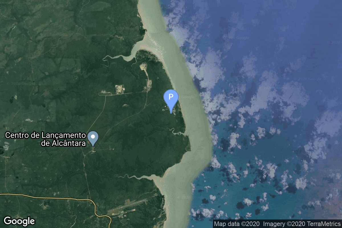
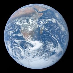
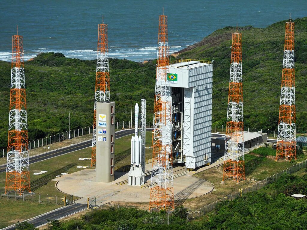
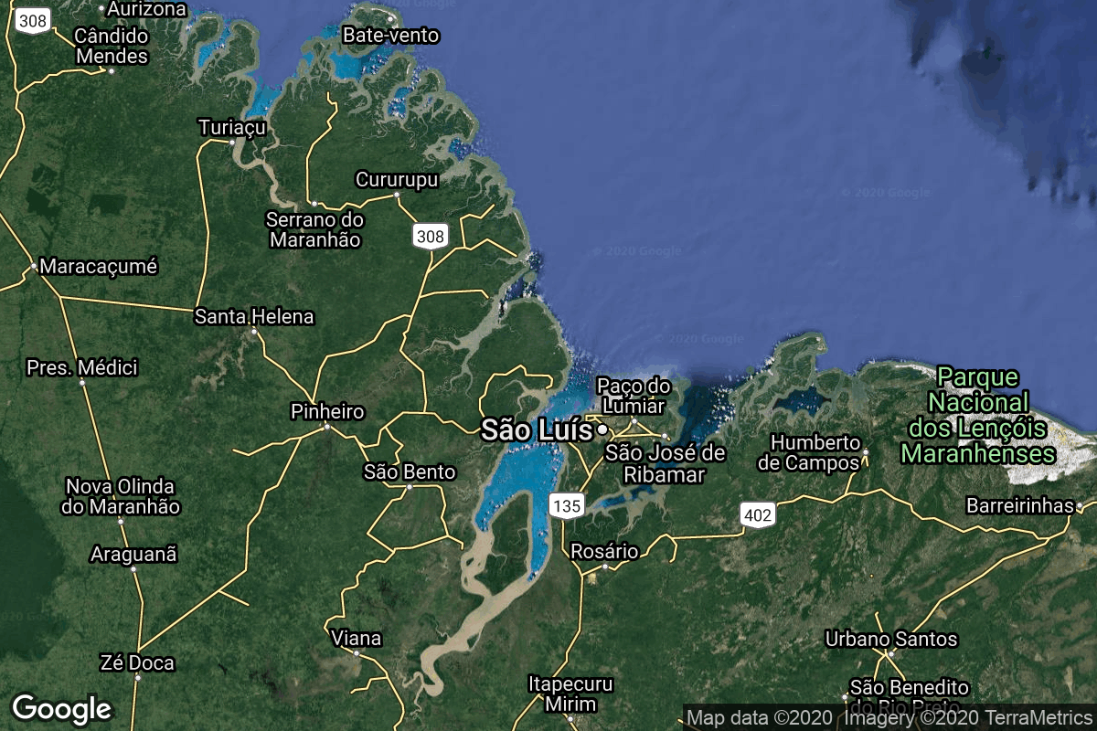
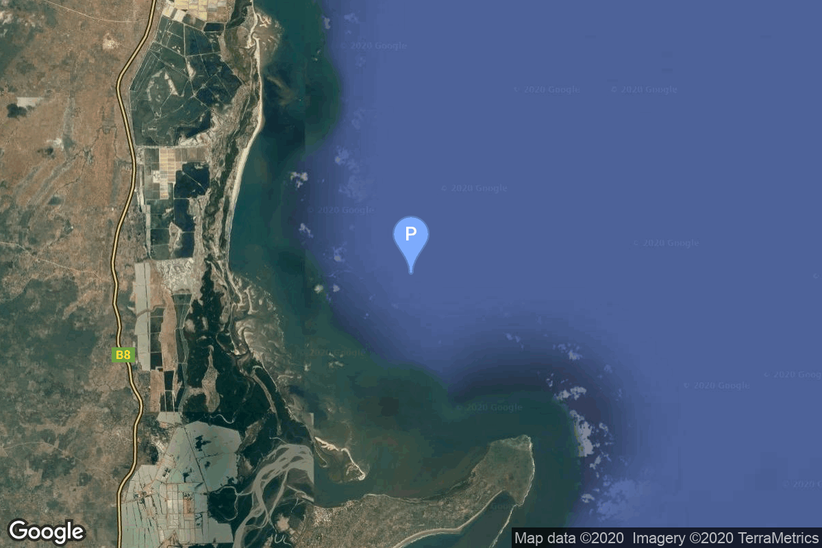
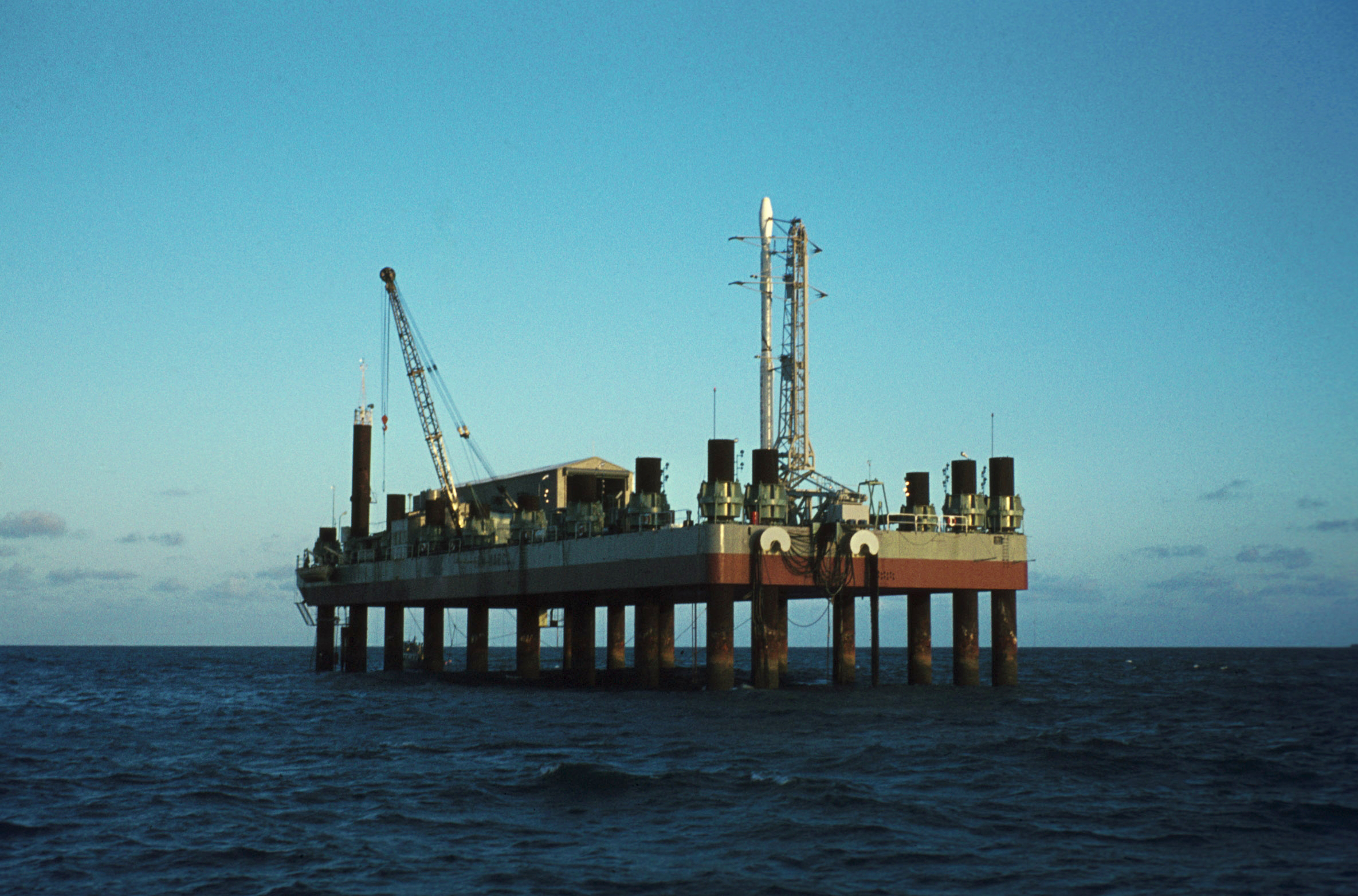
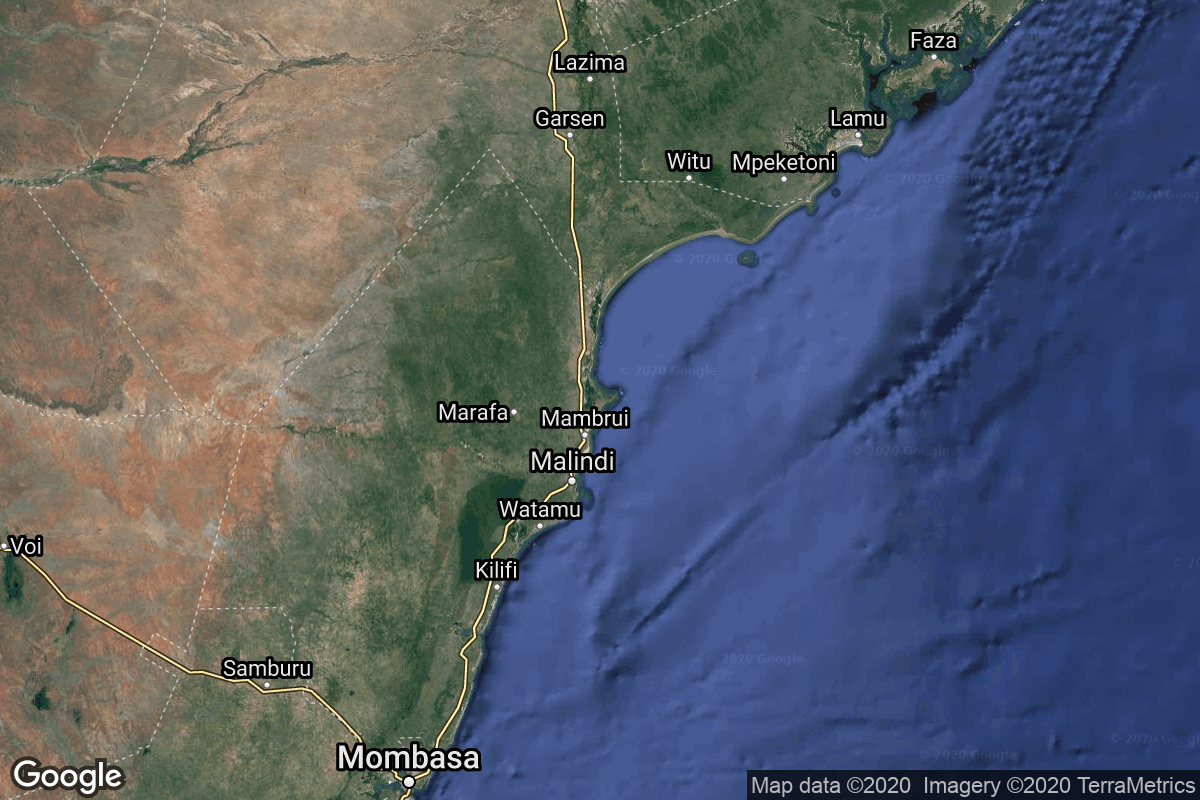
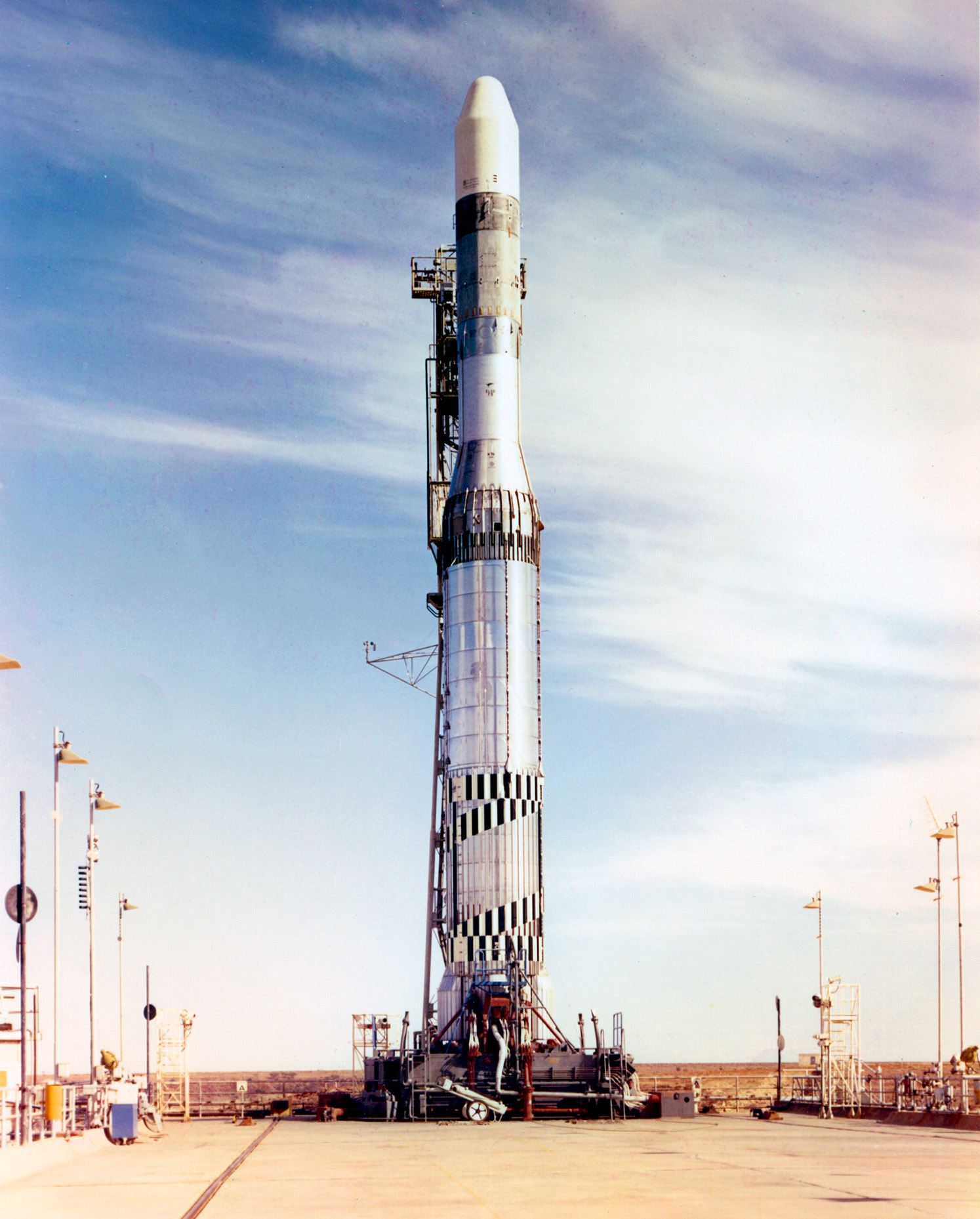
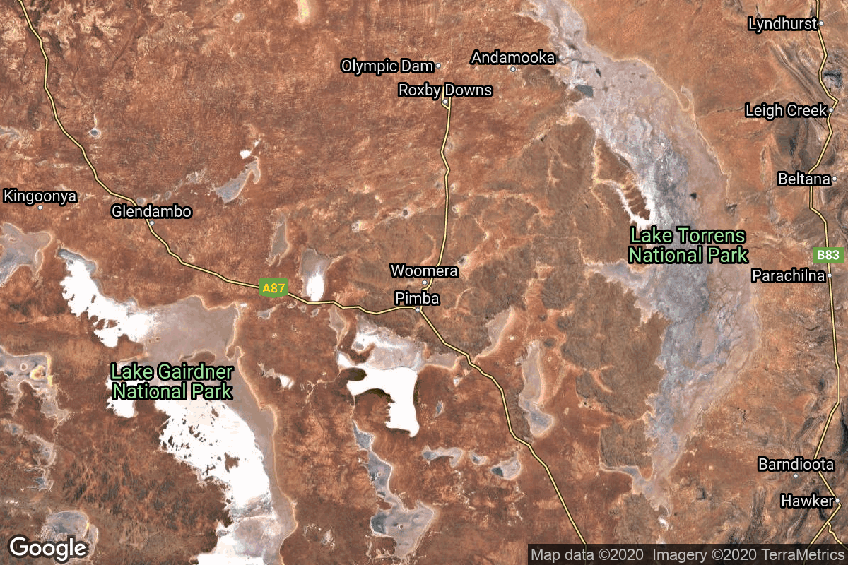
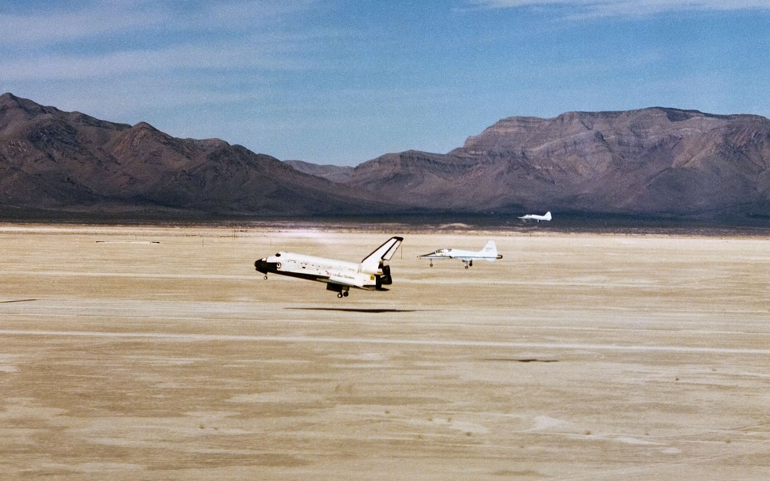
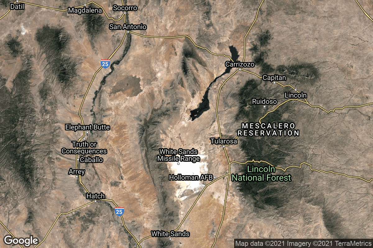
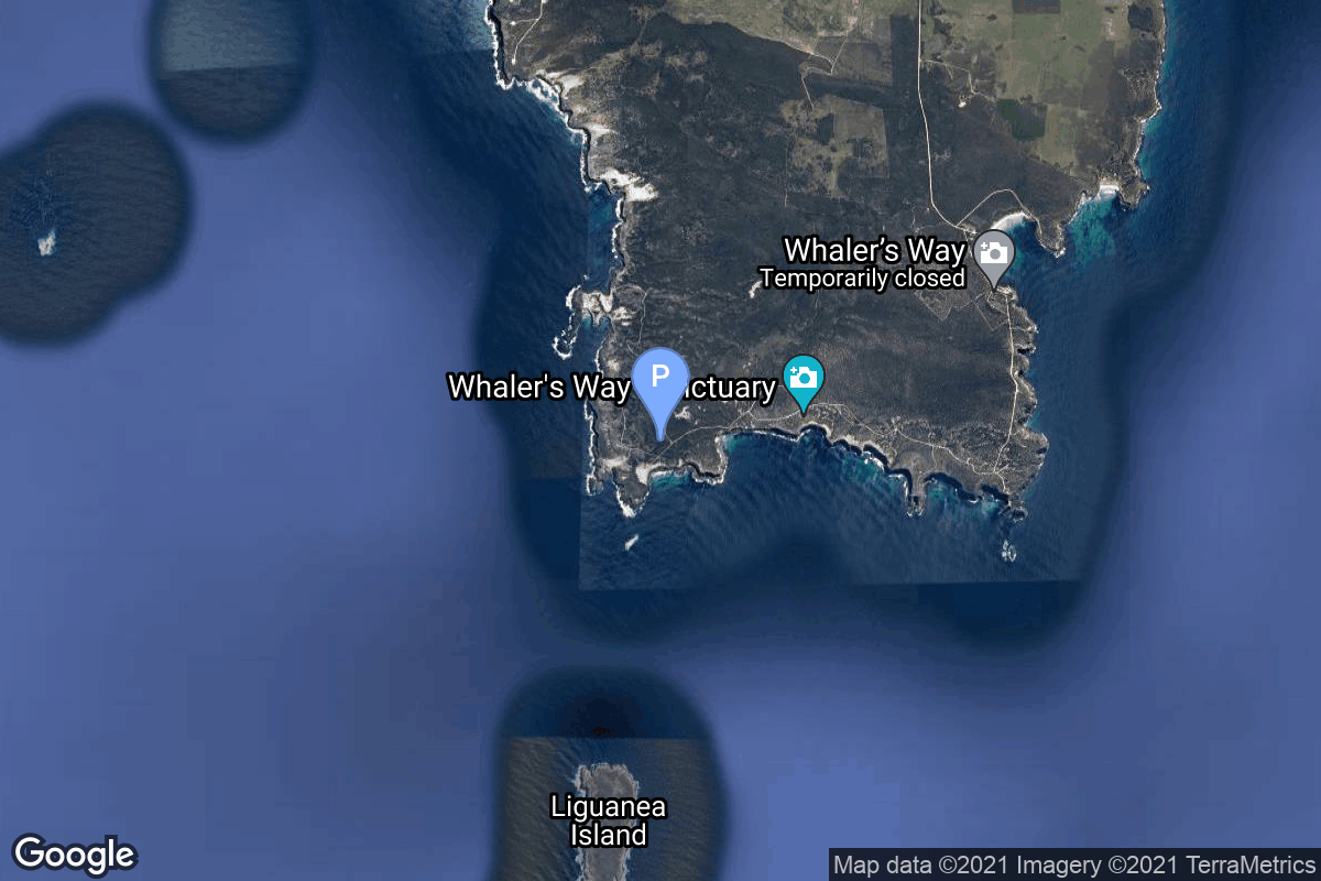
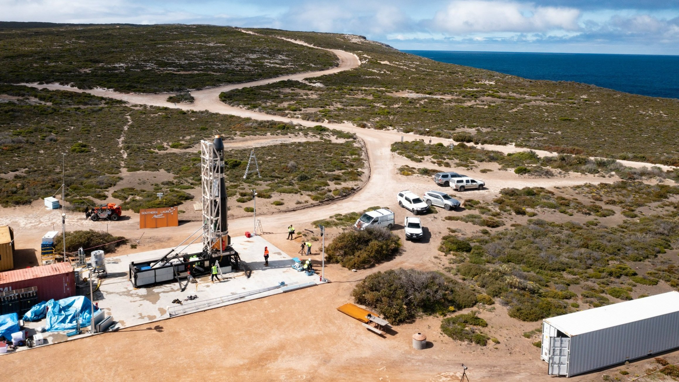
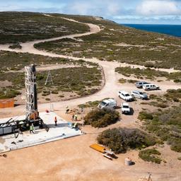
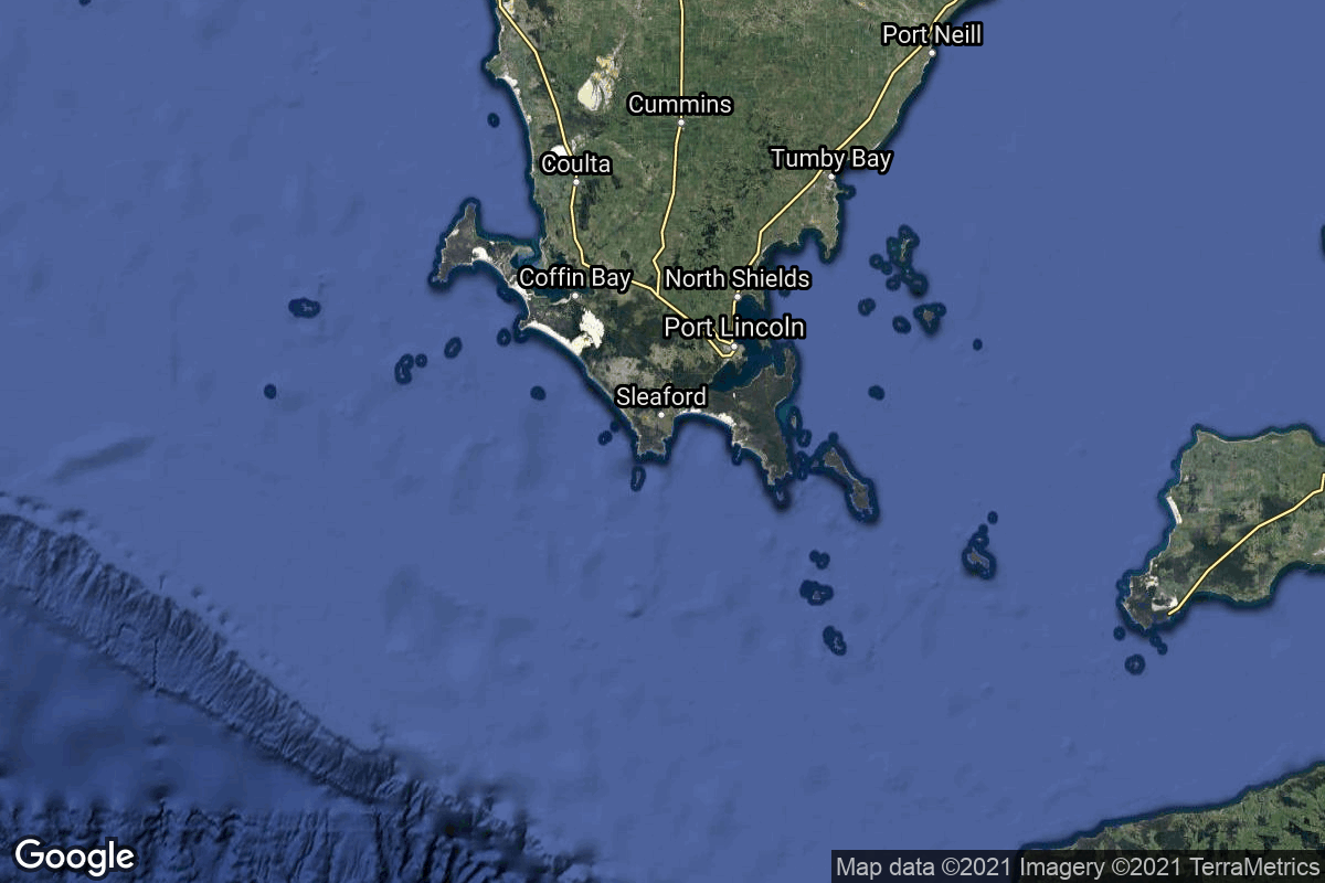
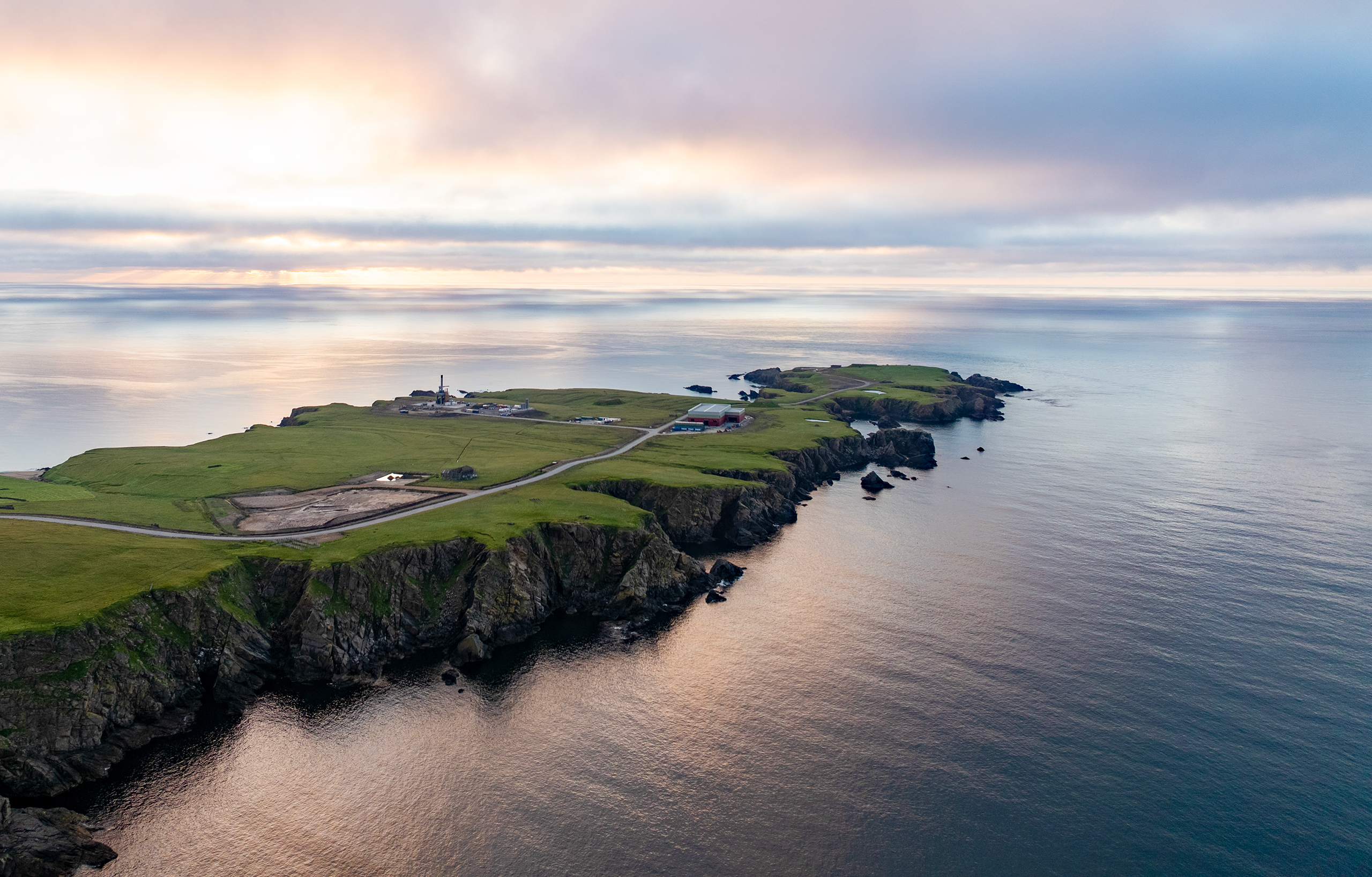
{ "count": 231, "next": "https://ll.thespacedevs.com/2.3.0/pads/?format=api&limit=10&offset=210&ordering=location__id", "previous": "https://ll.thespacedevs.com/2.3.0/pads/?format=api&limit=10&offset=190&ordering=location__id", "results": [ { "id": 146, "url": "https://ll.thespacedevs.com/2.3.0/pads/146/?format=api", "active": true, "agencies": [], "name": "VLS Pad", "image": null, "description": null, "info_url": null, "wiki_url": "https://en.wikipedia.org/wiki/Alc%C3%A2ntara_Launch_Center", "map_url": "https://www.google.com/maps?q=-2.3177,-44.369984", "latitude": -2.3177, "longitude": -44.369984, "country": { "id": 24, "name": "Brazil", "alpha_2_code": "BR", "alpha_3_code": "BRA", "nationality_name": "Brazilian", "nationality_name_composed": "Brazilian" }, "map_image": "https://thespacedevs-prod.nyc3.digitaloceanspaces.com/media/map_images/pad_146_20200803143337.jpg", "total_launch_count": 2, "orbital_launch_attempt_count": 2, "fastest_turnaround": "P769DT6H", "location": { "response_mode": "normal", "id": 150, "url": "https://ll.thespacedevs.com/2.3.0/locations/150/?format=api", "name": "Alcântara Space Center, Federative Republic of Brazil", "celestial_body": { "response_mode": "normal", "id": 1, "name": "Earth", "type": { "id": 1, "name": "Planet" }, "diameter": 12742000.0, "mass": 5.972168e+24, "gravity": 9.80655, "length_of_day": "1 00:00:00", "atmosphere": true, "image": { "id": 2040, "name": "Earth (Apollo 17)", "image_url": "https://thespacedevs-prod.nyc3.digitaloceanspaces.com/media/images/earth_2528apol_image_20240402194304.jpeg", "thumbnail_url": "https://thespacedevs-prod.nyc3.digitaloceanspaces.com/media/images/earth_2528apol_image_thumbnail_20240402194305.jpeg", "credit": "NASA", "license": { "id": 4, "name": "NASA Image and Media Guidelines", "priority": 0, "link": "https://www.nasa.gov/nasa-brand-center/images-and-media/" }, "single_use": true, "variants": [] }, "description": "Earth is the third planet from the Sun and the only astronomical object known to harbor life.", "wiki_url": "https://en.wikipedia.org/wiki/Earth", "total_attempted_launches": 7147, "successful_launches": 6604, "failed_launches": 543, "total_attempted_landings": 1101, "successful_landings": 1058, "failed_landings": 43 }, "active": true, "country": { "id": 24, "name": "Brazil", "alpha_2_code": "BR", "alpha_3_code": "BRA", "nationality_name": "Brazilian", "nationality_name_composed": "Brazilian" }, "description": "The Alcântara Space Center, formerly known as Alcântara Launch Center is a space center and launching facility of the Brazilian Space Agency in the city of Alcântara, located on Brazil's northern Atlantic coast, in the state of Maranhão.", "image": { "id": 2136, "name": "VLS Pad at the Alcântara Space Center", "image_url": "https://thespacedevs-prod.nyc3.digitaloceanspaces.com/media/images/vls_pad_at_the__image_20240808093113.jpeg", "thumbnail_url": "https://thespacedevs-prod.nyc3.digitaloceanspaces.com/media/images/vls_pad_at_the__image_thumbnail_20240808093114.jpeg", "credit": "AEB", "license": { "id": 27, "name": "CC BY-ND 3.0", "priority": 0, "link": "https://creativecommons.org/licenses/by-nd/3.0/deed.en" }, "single_use": true, "variants": [] }, "map_image": "https://thespacedevs-prod.nyc3.digitaloceanspaces.com/media/map_images/location_150_20200803142405.jpg", "longitude": -44.4175, "latitude": -2.339444, "timezone_name": "America/Fortaleza", "total_launch_count": 2, "total_landing_count": 0 } }, { "id": 155, "url": "https://ll.thespacedevs.com/2.3.0/pads/155/?format=api", "active": true, "agencies": [], "name": "San Marco platform", "image": null, "description": null, "info_url": null, "wiki_url": "https://en.wikipedia.org/wiki/Broglio_Space_Center", "map_url": "https://www.google.com/maps?q=-2.9383333,40.210306", "latitude": -2.9383333, "longitude": 40.210306, "country": { "id": 3, "name": "Italy", "alpha_2_code": "IT", "alpha_3_code": "ITA", "nationality_name": "Italian", "nationality_name_composed": "Italo" }, "map_image": "https://thespacedevs-prod.nyc3.digitaloceanspaces.com/media/map_images/pad_155_20200803143349.jpg", "total_launch_count": 9, "orbital_launch_attempt_count": 9, "fastest_turnaround": "P132DT20H38M39S", "location": { "response_mode": "normal", "id": 151, "url": "https://ll.thespacedevs.com/2.3.0/locations/151/?format=api", "name": "Broglio Space Center, Kenya", "celestial_body": { "response_mode": "normal", "id": 1, "name": "Earth", "type": { "id": 1, "name": "Planet" }, "diameter": 12742000.0, "mass": 5.972168e+24, "gravity": 9.80655, "length_of_day": "1 00:00:00", "atmosphere": true, "image": { "id": 2040, "name": "Earth (Apollo 17)", "image_url": "https://thespacedevs-prod.nyc3.digitaloceanspaces.com/media/images/earth_2528apol_image_20240402194304.jpeg", "thumbnail_url": "https://thespacedevs-prod.nyc3.digitaloceanspaces.com/media/images/earth_2528apol_image_thumbnail_20240402194305.jpeg", "credit": "NASA", "license": { "id": 4, "name": "NASA Image and Media Guidelines", "priority": 0, "link": "https://www.nasa.gov/nasa-brand-center/images-and-media/" }, "single_use": true, "variants": [] }, "description": "Earth is the third planet from the Sun and the only astronomical object known to harbor life.", "wiki_url": "https://en.wikipedia.org/wiki/Earth", "total_attempted_launches": 7147, "successful_launches": 6604, "failed_launches": 543, "total_attempted_landings": 1101, "successful_landings": 1058, "failed_landings": 43 }, "active": false, "country": { "id": 3, "name": "Italy", "alpha_2_code": "IT", "alpha_3_code": "ITA", "nationality_name": "Italian", "nationality_name_composed": "Italo" }, "description": "The Luigi Broglio Space Center (BSC) located near Malindi, Kenya, is an Italian Space Agency (ASI) Spaceport. It served as a spaceport for the launch of both Italian and international satellites, but is currently only used for satellite communications.", "image": { "id": 2199, "name": "Scout-B1 on the San Marco platform (Ariel 5)", "image_url": "https://thespacedevs-prod.nyc3.digitaloceanspaces.com/media/images/scout-b1_on_the_image_20240918151220.jpg", "thumbnail_url": "https://thespacedevs-prod.nyc3.digitaloceanspaces.com/media/images/scout-b1_on_the_image_thumbnail_20240918151221.jpeg", "credit": "NASA", "license": { "id": 4, "name": "NASA Image and Media Guidelines", "priority": 0, "link": "https://www.nasa.gov/nasa-brand-center/images-and-media/" }, "single_use": true, "variants": [] }, "map_image": "https://thespacedevs-prod.nyc3.digitaloceanspaces.com/media/map_images/location_151_20200803142409.jpg", "longitude": 40.2125, "latitude": -2.938333, "timezone_name": "Africa/Nairobi", "total_launch_count": 9, "total_landing_count": 0 } }, { "id": 180, "url": "https://ll.thespacedevs.com/2.3.0/pads/180/?format=api", "active": true, "agencies": [], "name": "Launch Area 6A", "image": null, "description": null, "info_url": null, "wiki_url": "https://en.wikipedia.org/wiki/RAAF_Woomera_Range_Complex", "map_url": "https://www.google.com/maps?q=-30.9552778,136.5300282", "latitude": -30.9552778, "longitude": 136.5300282, "country": { "id": 34, "name": "Australia", "alpha_2_code": "AU", "alpha_3_code": "AUS", "nationality_name": "Australian", "nationality_name_composed": "Australo" }, "map_image": "https://thespacedevs-prod.nyc3.digitaloceanspaces.com/media/map_images/pad_180_20200803143508.jpg", "total_launch_count": 3, "orbital_launch_attempt_count": 3, "fastest_turnaround": "P214DT23H42M58S", "location": { "response_mode": "normal", "id": 152, "url": "https://ll.thespacedevs.com/2.3.0/locations/152/?format=api", "name": "RAAF Woomera Range Complex", "celestial_body": { "response_mode": "normal", "id": 1, "name": "Earth", "type": { "id": 1, "name": "Planet" }, "diameter": 12742000.0, "mass": 5.972168e+24, "gravity": 9.80655, "length_of_day": "1 00:00:00", "atmosphere": true, "image": { "id": 2040, "name": "Earth (Apollo 17)", "image_url": "https://thespacedevs-prod.nyc3.digitaloceanspaces.com/media/images/earth_2528apol_image_20240402194304.jpeg", "thumbnail_url": "https://thespacedevs-prod.nyc3.digitaloceanspaces.com/media/images/earth_2528apol_image_thumbnail_20240402194305.jpeg", "credit": "NASA", "license": { "id": 4, "name": "NASA Image and Media Guidelines", "priority": 0, "link": "https://www.nasa.gov/nasa-brand-center/images-and-media/" }, "single_use": true, "variants": [] }, "description": "Earth is the third planet from the Sun and the only astronomical object known to harbor life.", "wiki_url": "https://en.wikipedia.org/wiki/Earth", "total_attempted_launches": 7147, "successful_launches": 6604, "failed_launches": 543, "total_attempted_landings": 1101, "successful_landings": 1058, "failed_landings": 43 }, "active": true, "country": { "id": 34, "name": "Australia", "alpha_2_code": "AU", "alpha_3_code": "AUS", "nationality_name": "Australian", "nationality_name_composed": "Australo" }, "description": "The RAAF Woomera Range Complex (WRC) is a major Australian military and civil aerospace facility and operation located in South Australia, approximately 450 km (280 mi) north-west of Adelaide. The WRC is operated by the Royal Australian Air Force (RAAF), a Service of the Australian Defence Force (ADF). The complex has a land area of 122,188 km2 (47,177 sq mi) or roughly the size of North Korea or Pennsylvania. The airspace above the area is restricted and controlled by the RAAF for safety and security. The WRC is a highly specialised ADF test and evaluation capability operated by the RAAF for the purposes of testing defence materiel.", "image": { "id": 2208, "name": "Europa I on Launch Area 6A", "image_url": "https://thespacedevs-prod.nyc3.digitaloceanspaces.com/media/images/europa_i_on_lau_image_20240918171901.jpg", "thumbnail_url": "https://thespacedevs-prod.nyc3.digitaloceanspaces.com/media/images/europa_i_on_lau_image_thumbnail_20240918171901.jpeg", "credit": "ELDO", "license": { "id": 2, "name": "ESA Standard Licence", "priority": 2, "link": "https://www.esa.int/ESA_Multimedia/Terms_and_conditions_of_use_of_images_and_videos_available_on_the_esa_website" }, "single_use": true, "variants": [] }, "map_image": "https://thespacedevs-prod.nyc3.digitaloceanspaces.com/media/map_images/location_152_20200803142502.jpg", "longitude": 136.5322, "latitude": -30.9553, "timezone_name": "Australia/Adelaide", "total_launch_count": 6, "total_landing_count": 0 } }, { "id": 179, "url": "https://ll.thespacedevs.com/2.3.0/pads/179/?format=api", "active": true, "agencies": [], "name": "Launch Area 5B", "image": null, "description": null, "info_url": null, "wiki_url": "https://en.wikipedia.org/wiki/RAAF_Woomera_Range_Complex", "map_url": "https://www.google.com/maps?q=-30.9552778,136.5300282", "latitude": -30.9552778, "longitude": 136.5300282, "country": { "id": 34, "name": "Australia", "alpha_2_code": "AU", "alpha_3_code": "AUS", "nationality_name": "Australian", "nationality_name_composed": "Australo" }, "map_image": "https://thespacedevs-prod.nyc3.digitaloceanspaces.com/media/map_images/pad_179_20200803143455.jpg", "total_launch_count": 2, "orbital_launch_attempt_count": 2, "fastest_turnaround": "P421DT3H35M24S", "location": { "response_mode": "normal", "id": 152, "url": "https://ll.thespacedevs.com/2.3.0/locations/152/?format=api", "name": "RAAF Woomera Range Complex", "celestial_body": { "response_mode": "normal", "id": 1, "name": "Earth", "type": { "id": 1, "name": "Planet" }, "diameter": 12742000.0, "mass": 5.972168e+24, "gravity": 9.80655, "length_of_day": "1 00:00:00", "atmosphere": true, "image": { "id": 2040, "name": "Earth (Apollo 17)", "image_url": "https://thespacedevs-prod.nyc3.digitaloceanspaces.com/media/images/earth_2528apol_image_20240402194304.jpeg", "thumbnail_url": "https://thespacedevs-prod.nyc3.digitaloceanspaces.com/media/images/earth_2528apol_image_thumbnail_20240402194305.jpeg", "credit": "NASA", "license": { "id": 4, "name": "NASA Image and Media Guidelines", "priority": 0, "link": "https://www.nasa.gov/nasa-brand-center/images-and-media/" }, "single_use": true, "variants": [] }, "description": "Earth is the third planet from the Sun and the only astronomical object known to harbor life.", "wiki_url": "https://en.wikipedia.org/wiki/Earth", "total_attempted_launches": 7147, "successful_launches": 6604, "failed_launches": 543, "total_attempted_landings": 1101, "successful_landings": 1058, "failed_landings": 43 }, "active": true, "country": { "id": 34, "name": "Australia", "alpha_2_code": "AU", "alpha_3_code": "AUS", "nationality_name": "Australian", "nationality_name_composed": "Australo" }, "description": "The RAAF Woomera Range Complex (WRC) is a major Australian military and civil aerospace facility and operation located in South Australia, approximately 450 km (280 mi) north-west of Adelaide. The WRC is operated by the Royal Australian Air Force (RAAF), a Service of the Australian Defence Force (ADF). The complex has a land area of 122,188 km2 (47,177 sq mi) or roughly the size of North Korea or Pennsylvania. The airspace above the area is restricted and controlled by the RAAF for safety and security. The WRC is a highly specialised ADF test and evaluation capability operated by the RAAF for the purposes of testing defence materiel.", "image": { "id": 2208, "name": "Europa I on Launch Area 6A", "image_url": "https://thespacedevs-prod.nyc3.digitaloceanspaces.com/media/images/europa_i_on_lau_image_20240918171901.jpg", "thumbnail_url": "https://thespacedevs-prod.nyc3.digitaloceanspaces.com/media/images/europa_i_on_lau_image_thumbnail_20240918171901.jpeg", "credit": "ELDO", "license": { "id": 2, "name": "ESA Standard Licence", "priority": 2, "link": "https://www.esa.int/ESA_Multimedia/Terms_and_conditions_of_use_of_images_and_videos_available_on_the_esa_website" }, "single_use": true, "variants": [] }, "map_image": "https://thespacedevs-prod.nyc3.digitaloceanspaces.com/media/map_images/location_152_20200803142502.jpg", "longitude": 136.5322, "latitude": -30.9553, "timezone_name": "Australia/Adelaide", "total_launch_count": 6, "total_landing_count": 0 } }, { "id": 181, "url": "https://ll.thespacedevs.com/2.3.0/pads/181/?format=api", "active": true, "agencies": [], "name": "Launch Area 8", "image": null, "description": null, "info_url": null, "wiki_url": "https://en.wikipedia.org/wiki/RAAF_Woomera_Range_Complex", "map_url": "https://www.google.com/maps?q=-30.9552778,136.5300282", "latitude": -30.9552778, "longitude": 136.5300282, "country": { "id": 34, "name": "Australia", "alpha_2_code": "AU", "alpha_3_code": "AUS", "nationality_name": "Australian", "nationality_name_composed": "Australo" }, "map_image": "https://thespacedevs-prod.nyc3.digitaloceanspaces.com/media/map_images/pad_181_20200803143447.jpg", "total_launch_count": 1, "orbital_launch_attempt_count": 1, "fastest_turnaround": null, "location": { "response_mode": "normal", "id": 152, "url": "https://ll.thespacedevs.com/2.3.0/locations/152/?format=api", "name": "RAAF Woomera Range Complex", "celestial_body": { "response_mode": "normal", "id": 1, "name": "Earth", "type": { "id": 1, "name": "Planet" }, "diameter": 12742000.0, "mass": 5.972168e+24, "gravity": 9.80655, "length_of_day": "1 00:00:00", "atmosphere": true, "image": { "id": 2040, "name": "Earth (Apollo 17)", "image_url": "https://thespacedevs-prod.nyc3.digitaloceanspaces.com/media/images/earth_2528apol_image_20240402194304.jpeg", "thumbnail_url": "https://thespacedevs-prod.nyc3.digitaloceanspaces.com/media/images/earth_2528apol_image_thumbnail_20240402194305.jpeg", "credit": "NASA", "license": { "id": 4, "name": "NASA Image and Media Guidelines", "priority": 0, "link": "https://www.nasa.gov/nasa-brand-center/images-and-media/" }, "single_use": true, "variants": [] }, "description": "Earth is the third planet from the Sun and the only astronomical object known to harbor life.", "wiki_url": "https://en.wikipedia.org/wiki/Earth", "total_attempted_launches": 7147, "successful_launches": 6604, "failed_launches": 543, "total_attempted_landings": 1101, "successful_landings": 1058, "failed_landings": 43 }, "active": true, "country": { "id": 34, "name": "Australia", "alpha_2_code": "AU", "alpha_3_code": "AUS", "nationality_name": "Australian", "nationality_name_composed": "Australo" }, "description": "The RAAF Woomera Range Complex (WRC) is a major Australian military and civil aerospace facility and operation located in South Australia, approximately 450 km (280 mi) north-west of Adelaide. The WRC is operated by the Royal Australian Air Force (RAAF), a Service of the Australian Defence Force (ADF). The complex has a land area of 122,188 km2 (47,177 sq mi) or roughly the size of North Korea or Pennsylvania. The airspace above the area is restricted and controlled by the RAAF for safety and security. The WRC is a highly specialised ADF test and evaluation capability operated by the RAAF for the purposes of testing defence materiel.", "image": { "id": 2208, "name": "Europa I on Launch Area 6A", "image_url": "https://thespacedevs-prod.nyc3.digitaloceanspaces.com/media/images/europa_i_on_lau_image_20240918171901.jpg", "thumbnail_url": "https://thespacedevs-prod.nyc3.digitaloceanspaces.com/media/images/europa_i_on_lau_image_thumbnail_20240918171901.jpeg", "credit": "ELDO", "license": { "id": 2, "name": "ESA Standard Licence", "priority": 2, "link": "https://www.esa.int/ESA_Multimedia/Terms_and_conditions_of_use_of_images_and_videos_available_on_the_esa_website" }, "single_use": true, "variants": [] }, "map_image": "https://thespacedevs-prod.nyc3.digitaloceanspaces.com/media/map_images/location_152_20200803142502.jpg", "longitude": 136.5322, "latitude": -30.9553, "timezone_name": "Australia/Adelaide", "total_launch_count": 6, "total_landing_count": 0 } }, { "id": 184, "url": "https://ll.thespacedevs.com/2.3.0/pads/184/?format=api", "active": true, "agencies": [], "name": "Satellite Launch Pad", "image": null, "description": null, "info_url": null, "wiki_url": "https://en.wikipedia.org/wiki/Tonghae_Satellite_Launching_Ground", "map_url": "https://www.google.com/maps?q=40.855799,129.665895", "latitude": 40.855799, "longitude": 129.665895, "country": { "id": 53, "name": "North Korea", "alpha_2_code": "KP", "alpha_3_code": "PRK", "nationality_name": "North Korean", "nationality_name_composed": "North Korean" }, "map_image": "https://thespacedevs-prod.nyc3.digitaloceanspaces.com/media/map_images/pad_184_20200803143423.jpg", "total_launch_count": 2, "orbital_launch_attempt_count": 2, "fastest_turnaround": "P3869DT23H23M", "location": { "response_mode": "normal", "id": 153, "url": "https://ll.thespacedevs.com/2.3.0/locations/153/?format=api", "name": "Tonghae Satellite Launching Ground", "celestial_body": { "response_mode": "normal", "id": 1, "name": "Earth", "type": { "id": 1, "name": "Planet" }, "diameter": 12742000.0, "mass": 5.972168e+24, "gravity": 9.80655, "length_of_day": "1 00:00:00", "atmosphere": true, "image": { "id": 2040, "name": "Earth (Apollo 17)", "image_url": "https://thespacedevs-prod.nyc3.digitaloceanspaces.com/media/images/earth_2528apol_image_20240402194304.jpeg", "thumbnail_url": "https://thespacedevs-prod.nyc3.digitaloceanspaces.com/media/images/earth_2528apol_image_thumbnail_20240402194305.jpeg", "credit": "NASA", "license": { "id": 4, "name": "NASA Image and Media Guidelines", "priority": 0, "link": "https://www.nasa.gov/nasa-brand-center/images-and-media/" }, "single_use": true, "variants": [] }, "description": "Earth is the third planet from the Sun and the only astronomical object known to harbor life.", "wiki_url": "https://en.wikipedia.org/wiki/Earth", "total_attempted_launches": 7147, "successful_launches": 6604, "failed_launches": 543, "total_attempted_landings": 1101, "successful_landings": 1058, "failed_landings": 43 }, "active": false, "country": { "id": 53, "name": "North Korea", "alpha_2_code": "KP", "alpha_3_code": "PRK", "nationality_name": "North Korean", "nationality_name_composed": "North Korean" }, "description": "The Tonghae Satellite Launching Ground is a rocket launching site in North Korea.", "image": { "id": 2224, "name": "Tonghae Satellite Launching Ground from space", "image_url": "https://thespacedevs-prod.nyc3.digitaloceanspaces.com/media/images/tonghae_satelli_image_20240920082229.png", "thumbnail_url": "https://thespacedevs-prod.nyc3.digitaloceanspaces.com/media/images/tonghae_satelli_image_thumbnail_20240920082229.png", "credit": "Airbus", "license": { "id": 1, "name": "Unknown", "priority": 9, "link": null }, "single_use": true, "variants": [] }, "map_image": "https://thespacedevs-prod.nyc3.digitaloceanspaces.com/media/map_images/location_153_20200803142503.jpg", "longitude": 129.686389, "latitude": 40.858333, "timezone_name": "Asia/Pyongyang", "total_launch_count": 2, "total_landing_count": 0 } }, { "id": 194, "url": "https://ll.thespacedevs.com/2.3.0/pads/194/?format=api", "active": true, "agencies": [ { "response_mode": "normal", "id": 165, "url": "https://ll.thespacedevs.com/2.3.0/agencies/165/?format=api", "name": "US Army", "abbrev": "USA", "type": { "id": 1, "name": "Government" }, "featured": false, "country": [ { "id": 2, "name": "United States of America", "alpha_2_code": "US", "alpha_3_code": "USA", "nationality_name": "American", "nationality_name_composed": "Americano" } ], "description": null, "administrator": null, "founding_year": null, "launchers": "", "spacecraft": "", "parent": null, "image": null, "logo": null, "social_logo": null } ], "name": "Launch Complex 36", "image": null, "description": null, "info_url": null, "wiki_url": "https://en.wikipedia.org/wiki/White_Sands_Launch_Complex_36", "map_url": "https://www.google.com/maps?q=32.416944,-106.321944", "latitude": 32.416944, "longitude": -106.321944, "country": { "id": 2, "name": "United States of America", "alpha_2_code": "US", "alpha_3_code": "USA", "nationality_name": "American", "nationality_name_composed": "Americano" }, "map_image": "https://thespacedevs-prod.nyc3.digitaloceanspaces.com/media/map_images/pad_launch_complex_36_20210901072730.jpg", "total_launch_count": 5, "orbital_launch_attempt_count": 0, "fastest_turnaround": "P161DT22H1M4S", "location": { "response_mode": "normal", "id": 155, "url": "https://ll.thespacedevs.com/2.3.0/locations/155/?format=api", "name": "White Sands Missile Range", "celestial_body": { "response_mode": "normal", "id": 1, "name": "Earth", "type": { "id": 1, "name": "Planet" }, "diameter": 12742000.0, "mass": 5.972168e+24, "gravity": 9.80655, "length_of_day": "1 00:00:00", "atmosphere": true, "image": { "id": 2040, "name": "Earth (Apollo 17)", "image_url": "https://thespacedevs-prod.nyc3.digitaloceanspaces.com/media/images/earth_2528apol_image_20240402194304.jpeg", "thumbnail_url": "https://thespacedevs-prod.nyc3.digitaloceanspaces.com/media/images/earth_2528apol_image_thumbnail_20240402194305.jpeg", "credit": "NASA", "license": { "id": 4, "name": "NASA Image and Media Guidelines", "priority": 0, "link": "https://www.nasa.gov/nasa-brand-center/images-and-media/" }, "single_use": true, "variants": [] }, "description": "Earth is the third planet from the Sun and the only astronomical object known to harbor life.", "wiki_url": "https://en.wikipedia.org/wiki/Earth", "total_attempted_launches": 7147, "successful_launches": 6604, "failed_launches": 543, "total_attempted_landings": 1101, "successful_landings": 1058, "failed_landings": 43 }, "active": true, "country": { "id": 2, "name": "United States of America", "alpha_2_code": "US", "alpha_3_code": "USA", "nationality_name": "American", "nationality_name_composed": "Americano" }, "description": "White Sands Missile Range is a United States Army military testing area and firing range located in the US state of New Mexico. The range was originally established in 1941 as the Alamogordo Bombing and Gunnery Range, where the Trinity test site lay at the northern end of the Range, in Socorro County near the towns of Carrizozo and San Antonio. It then became the White Sands Proving Ground on 9 July 1945.", "image": { "id": 2229, "name": "Space Shuttle Columbia landing at White Sands (STS-3)", "image_url": "https://thespacedevs-prod.nyc3.digitaloceanspaces.com/media/images/space_shuttle_c_image_20240920084425.jpg", "thumbnail_url": "https://thespacedevs-prod.nyc3.digitaloceanspaces.com/media/images/space_shuttle_c_image_thumbnail_20240920084425.jpeg", "credit": "NASA", "license": { "id": 4, "name": "NASA Image and Media Guidelines", "priority": 0, "link": "https://www.nasa.gov/nasa-brand-center/images-and-media/" }, "single_use": false, "variants": [] }, "map_image": "https://thespacedevs-prod.nyc3.digitaloceanspaces.com/media/map_images/location_white_sands_missile_range_20210901072636.jpg", "longitude": -106.405833, "latitude": 32.335556, "timezone_name": "America/Denver", "total_launch_count": 5, "total_landing_count": 0 } }, { "id": 197, "url": "https://ll.thespacedevs.com/2.3.0/pads/197/?format=api", "active": true, "agencies": [ { "response_mode": "normal", "id": 1028, "url": "https://ll.thespacedevs.com/2.3.0/agencies/1028/?format=api", "name": "Southern Launch", "abbrev": "", "type": { "id": 5, "name": "Private" }, "featured": false, "country": [ { "id": 34, "name": "Australia", "alpha_2_code": "AU", "alpha_3_code": "AUS", "nationality_name": "Australian", "nationality_name_composed": "Australo" } ], "description": "Southern Launch is a South Australian launch company specializing in infrastructure and logistics for sub-orbital and orbital launches from Australian launch sites.", "administrator": "CEO: Lloyd Damp", "founding_year": 2017, "launchers": "", "spacecraft": "", "parent": null, "image": null, "logo": { "id": 181, "name": "Southern Launch logo", "image_url": "https://thespacedevs-prod.nyc3.digitaloceanspaces.com/media/images/southern_launch_image_20240820182546.png", "thumbnail_url": "https://thespacedevs-prod.nyc3.digitaloceanspaces.com/media/images/southern_launch_image_thumbnail_20240820182546.png", "credit": "Southern Launch", "license": { "id": 1, "name": "Unknown", "priority": 9, "link": null }, "single_use": true, "variants": [] }, "social_logo": { "id": 2182, "name": "Southern Launch social logo", "image_url": "https://thespacedevs-prod.nyc3.digitaloceanspaces.com/media/images/southern_launch_image_20240820182607.jpg", "thumbnail_url": "https://thespacedevs-prod.nyc3.digitaloceanspaces.com/media/images/southern_launch_image_thumbnail_20240820182607.jpeg", "credit": "Southern Launch", "license": { "id": 1, "name": "Unknown", "priority": 9, "link": null }, "single_use": true, "variants": [] } } ], "name": "Pad 1", "image": null, "description": null, "info_url": "https://www.southernlaunch.space/whalers-way-orbital-launch-complex", "wiki_url": "https://en.wikipedia.org/wiki/Whalers_Way_Orbital_Launch_Complex", "map_url": "https://www.google.com/maps?q=-34.937822,135.630035", "latitude": -34.937822, "longitude": 135.630035, "country": { "id": 34, "name": "Australia", "alpha_2_code": "AU", "alpha_3_code": "AUS", "nationality_name": "Australian", "nationality_name_composed": "Australo" }, "map_image": "https://thespacedevs-prod.nyc3.digitaloceanspaces.com/media/map_images/pad_whalers_way_orbital_launch_complex_20210910042853.jpg", "total_launch_count": 1, "orbital_launch_attempt_count": 0, "fastest_turnaround": null, "location": { "response_mode": "normal", "id": 156, "url": "https://ll.thespacedevs.com/2.3.0/locations/156/?format=api", "name": "Whalers Way Orbital Launch Complex, South Australia", "celestial_body": { "response_mode": "normal", "id": 1, "name": "Earth", "type": { "id": 1, "name": "Planet" }, "diameter": 12742000.0, "mass": 5.972168e+24, "gravity": 9.80655, "length_of_day": "1 00:00:00", "atmosphere": true, "image": { "id": 2040, "name": "Earth (Apollo 17)", "image_url": "https://thespacedevs-prod.nyc3.digitaloceanspaces.com/media/images/earth_2528apol_image_20240402194304.jpeg", "thumbnail_url": "https://thespacedevs-prod.nyc3.digitaloceanspaces.com/media/images/earth_2528apol_image_thumbnail_20240402194305.jpeg", "credit": "NASA", "license": { "id": 4, "name": "NASA Image and Media Guidelines", "priority": 0, "link": "https://www.nasa.gov/nasa-brand-center/images-and-media/" }, "single_use": true, "variants": [] }, "description": "Earth is the third planet from the Sun and the only astronomical object known to harbor life.", "wiki_url": "https://en.wikipedia.org/wiki/Earth", "total_attempted_launches": 7147, "successful_launches": 6604, "failed_launches": 543, "total_attempted_landings": 1101, "successful_landings": 1058, "failed_landings": 43 }, "active": true, "country": { "id": 34, "name": "Australia", "alpha_2_code": "AU", "alpha_3_code": "AUS", "nationality_name": "Australian", "nationality_name_composed": "Australo" }, "description": "Whalers Way Orbital Launch Complex is a rocket-launching facility operated by Southern Launch at Whalers Way, in the locality of Sleaford near Port Lincoln on South Australia's Eyre Peninsula.", "image": { "id": 2228, "name": "Whalers Way Orbital Launch Complex", "image_url": "https://thespacedevs-prod.nyc3.digitaloceanspaces.com/media/images/whalers_way_orb_image_20240920084054.jpg", "thumbnail_url": "https://thespacedevs-prod.nyc3.digitaloceanspaces.com/media/images/whalers_way_orb_image_thumbnail_20240920084054.jpeg", "credit": "Southern Launch", "license": { "id": 1, "name": "Unknown", "priority": 9, "link": null }, "single_use": true, "variants": [] }, "map_image": "https://thespacedevs-prod.nyc3.digitaloceanspaces.com/media/map_images/location_whalers_way_orbital_launch_complex_20210910042508.jpg", "longitude": 135.65, "latitude": -34.91, "timezone_name": "Australia/Adelaide", "total_launch_count": 1, "total_landing_count": 0 } }, { "id": 214, "url": "https://ll.thespacedevs.com/2.3.0/pads/214/?format=api", "active": true, "agencies": [], "name": "Launch Pad Elizabeth", "image": null, "description": "Named after the late Queen Elizabeth II, the pad will support launch operations of US-based launchers.\r\n\r\nIt is located at the most northern tip of the UK, allowing for extra security control to meet ITAR regulations.", "info_url": null, "wiki_url": null, "map_url": null, "latitude": null, "longitude": null, "country": { "id": 10, "name": "United Kingdom", "alpha_2_code": "GB", "alpha_3_code": "GBR", "nationality_name": "British", "nationality_name_composed": "Brito" }, "map_image": "https://thespacedevs-prod.nyc3.digitaloceanspaces.com/media/map_images/pad_launch_pad_elizabeth_20231013025957.jpg", "total_launch_count": 0, "orbital_launch_attempt_count": 0, "fastest_turnaround": null, "location": { "response_mode": "normal", "id": 157, "url": "https://ll.thespacedevs.com/2.3.0/locations/157/?format=api", "name": "SaxaVord Spaceport", "celestial_body": { "response_mode": "normal", "id": 1, "name": "Earth", "type": { "id": 1, "name": "Planet" }, "diameter": 12742000.0, "mass": 5.972168e+24, "gravity": 9.80655, "length_of_day": "1 00:00:00", "atmosphere": true, "image": { "id": 2040, "name": "Earth (Apollo 17)", "image_url": "https://thespacedevs-prod.nyc3.digitaloceanspaces.com/media/images/earth_2528apol_image_20240402194304.jpeg", "thumbnail_url": "https://thespacedevs-prod.nyc3.digitaloceanspaces.com/media/images/earth_2528apol_image_thumbnail_20240402194305.jpeg", "credit": "NASA", "license": { "id": 4, "name": "NASA Image and Media Guidelines", "priority": 0, "link": "https://www.nasa.gov/nasa-brand-center/images-and-media/" }, "single_use": true, "variants": [] }, "description": "Earth is the third planet from the Sun and the only astronomical object known to harbor life.", "wiki_url": "https://en.wikipedia.org/wiki/Earth", "total_attempted_launches": 7147, "successful_launches": 6604, "failed_launches": 543, "total_attempted_landings": 1101, "successful_landings": 1058, "failed_landings": 43 }, "active": true, "country": { "id": 10, "name": "United Kingdom", "alpha_2_code": "GB", "alpha_3_code": "GBR", "nationality_name": "British", "nationality_name_composed": "Brito" }, "description": "SaxaVord Spaceport is a UK spaceport located on the Lamba Ness peninsula on Unst, the most northerly of the inhabited Shetland Islands off the coast of Scotland. The site is near the RAF Saxa Vord radar station and the settlement of Skaw, adjacent to the Saxa Vord distillery.", "image": { "id": 2213, "name": "SaxaVord Spaceport", "image_url": "https://thespacedevs-prod.nyc3.digitaloceanspaces.com/media/images/saxavord_spacep_image_20240919164412.jpg", "thumbnail_url": "https://thespacedevs-prod.nyc3.digitaloceanspaces.com/media/images/saxavord_spacep_image_thumbnail_20240919164413.jpeg", "credit": "SaxaVord", "license": { "id": 1, "name": "Unknown", "priority": 9, "link": null }, "single_use": true, "variants": [] }, "map_image": "https://thespacedevs-prod.nyc3.digitaloceanspaces.com/media/map_images/location_saxavord_spaceport_20211102161146.jpg", "longitude": -0.7692, "latitude": 60.8184, "timezone_name": "Europe/London", "total_launch_count": 0, "total_landing_count": 0 } }, { "id": 237, "url": "https://ll.thespacedevs.com/2.3.0/pads/237/?format=api", "active": false, "agencies": [], "name": "Unknown Pad", "image": { "id": 2213, "name": "SaxaVord Spaceport", "image_url": "https://thespacedevs-prod.nyc3.digitaloceanspaces.com/media/images/saxavord_spacep_image_20240919164412.jpg", "thumbnail_url": "https://thespacedevs-prod.nyc3.digitaloceanspaces.com/media/images/saxavord_spacep_image_thumbnail_20240919164413.jpeg", "credit": "SaxaVord", "license": { "id": 1, "name": "Unknown", "priority": 9, "link": null }, "single_use": true, "variants": [] }, "description": "", "info_url": null, "wiki_url": "https://en.wikipedia.org/wiki/SaxaVord_Spaceport", "map_url": "https://www.google.com/maps?q=60.8184,-0.7692", "latitude": 60.8184, "longitude": -0.7692, "country": { "id": 10, "name": "United Kingdom", "alpha_2_code": "GB", "alpha_3_code": "GBR", "nationality_name": "British", "nationality_name_composed": "Brito" }, "map_image": "https://thespacedevs-prod.nyc3.digitaloceanspaces.com/media/map_images/pad_unknown_pad_20241227075133.jpg", "total_launch_count": 0, "orbital_launch_attempt_count": 0, "fastest_turnaround": null, "location": { "response_mode": "normal", "id": 157, "url": "https://ll.thespacedevs.com/2.3.0/locations/157/?format=api", "name": "SaxaVord Spaceport", "celestial_body": { "response_mode": "normal", "id": 1, "name": "Earth", "type": { "id": 1, "name": "Planet" }, "diameter": 12742000.0, "mass": 5.972168e+24, "gravity": 9.80655, "length_of_day": "1 00:00:00", "atmosphere": true, "image": { "id": 2040, "name": "Earth (Apollo 17)", "image_url": "https://thespacedevs-prod.nyc3.digitaloceanspaces.com/media/images/earth_2528apol_image_20240402194304.jpeg", "thumbnail_url": "https://thespacedevs-prod.nyc3.digitaloceanspaces.com/media/images/earth_2528apol_image_thumbnail_20240402194305.jpeg", "credit": "NASA", "license": { "id": 4, "name": "NASA Image and Media Guidelines", "priority": 0, "link": "https://www.nasa.gov/nasa-brand-center/images-and-media/" }, "single_use": true, "variants": [] }, "description": "Earth is the third planet from the Sun and the only astronomical object known to harbor life.", "wiki_url": "https://en.wikipedia.org/wiki/Earth", "total_attempted_launches": 7147, "successful_launches": 6604, "failed_launches": 543, "total_attempted_landings": 1101, "successful_landings": 1058, "failed_landings": 43 }, "active": true, "country": { "id": 10, "name": "United Kingdom", "alpha_2_code": "GB", "alpha_3_code": "GBR", "nationality_name": "British", "nationality_name_composed": "Brito" }, "description": "SaxaVord Spaceport is a UK spaceport located on the Lamba Ness peninsula on Unst, the most northerly of the inhabited Shetland Islands off the coast of Scotland. The site is near the RAF Saxa Vord radar station and the settlement of Skaw, adjacent to the Saxa Vord distillery.", "image": { "id": 2213, "name": "SaxaVord Spaceport", "image_url": "https://thespacedevs-prod.nyc3.digitaloceanspaces.com/media/images/saxavord_spacep_image_20240919164412.jpg", "thumbnail_url": "https://thespacedevs-prod.nyc3.digitaloceanspaces.com/media/images/saxavord_spacep_image_thumbnail_20240919164413.jpeg", "credit": "SaxaVord", "license": { "id": 1, "name": "Unknown", "priority": 9, "link": null }, "single_use": true, "variants": [] }, "map_image": "https://thespacedevs-prod.nyc3.digitaloceanspaces.com/media/map_images/location_saxavord_spaceport_20211102161146.jpg", "longitude": -0.7692, "latitude": 60.8184, "timezone_name": "Europe/London", "total_launch_count": 0, "total_landing_count": 0 } } ] }