Pad List
Filters
Parameters - active, agencies_ids, id, id__contains, latitude__gt, latitude__gte, latitude__lt, latitude__lte, location__id, location__name, location__name__contains, longitude__gt, longitude__gte, longitude__lt, longitude__lte, name, name__contains, orbital_launch_attempt_count, orbital_launch_attempt_count__gt, orbital_launch_attempt_count__gte, orbital_launch_attempt_count__lt, orbital_launch_attempt_count__lte, total_launch_count, total_launch_count__gt, total_launch_count__gte, total_launch_count__lt, total_launch_count__lte
Example - /pads/?location__id=11
Search
Fields searched - location__name, name, orbital_launch_attempt_count, total_launch_count
Example - /pads/?search=39A
Ordering
Fields - id, location__id, location__name, name, orbital_launch_attempt_count, total_launch_count
Example - /pads/?ordering=-orbital_launch_attempt_count
Number of results
Use limit to control the number of objects in the response (max 100)
Example - /pads/?limit=2
Format
Switch to JSON output - /pads/?format=json
Help
Find all the FAQs and support links on the documentation homepage - ll.thespacedevs.com/docs
GET /2.3.0/pads/?format=api&offset=190&ordering=-location__id
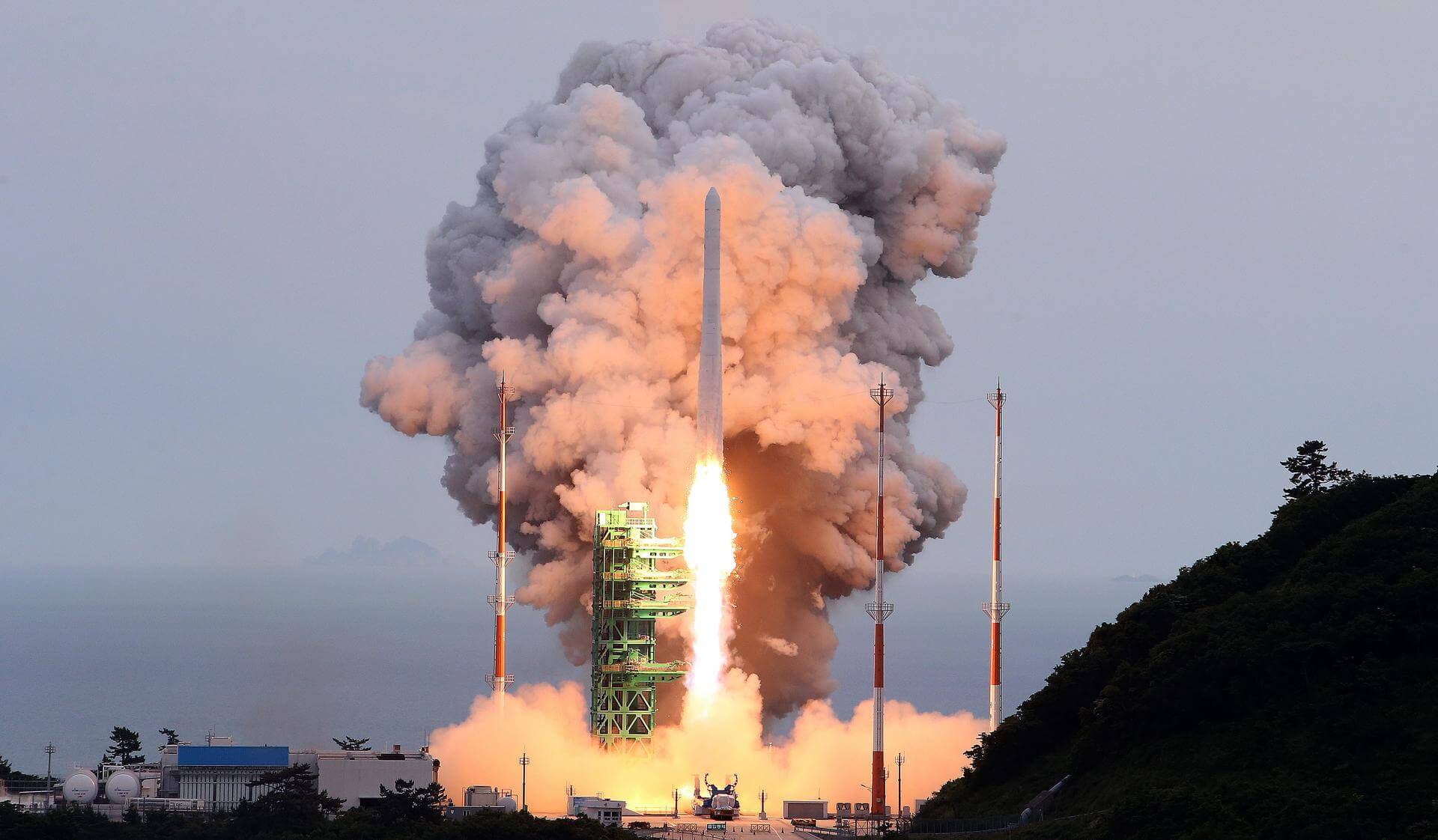
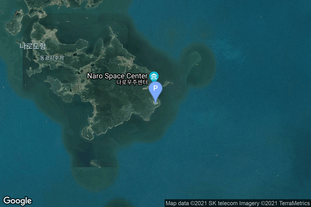
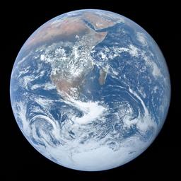
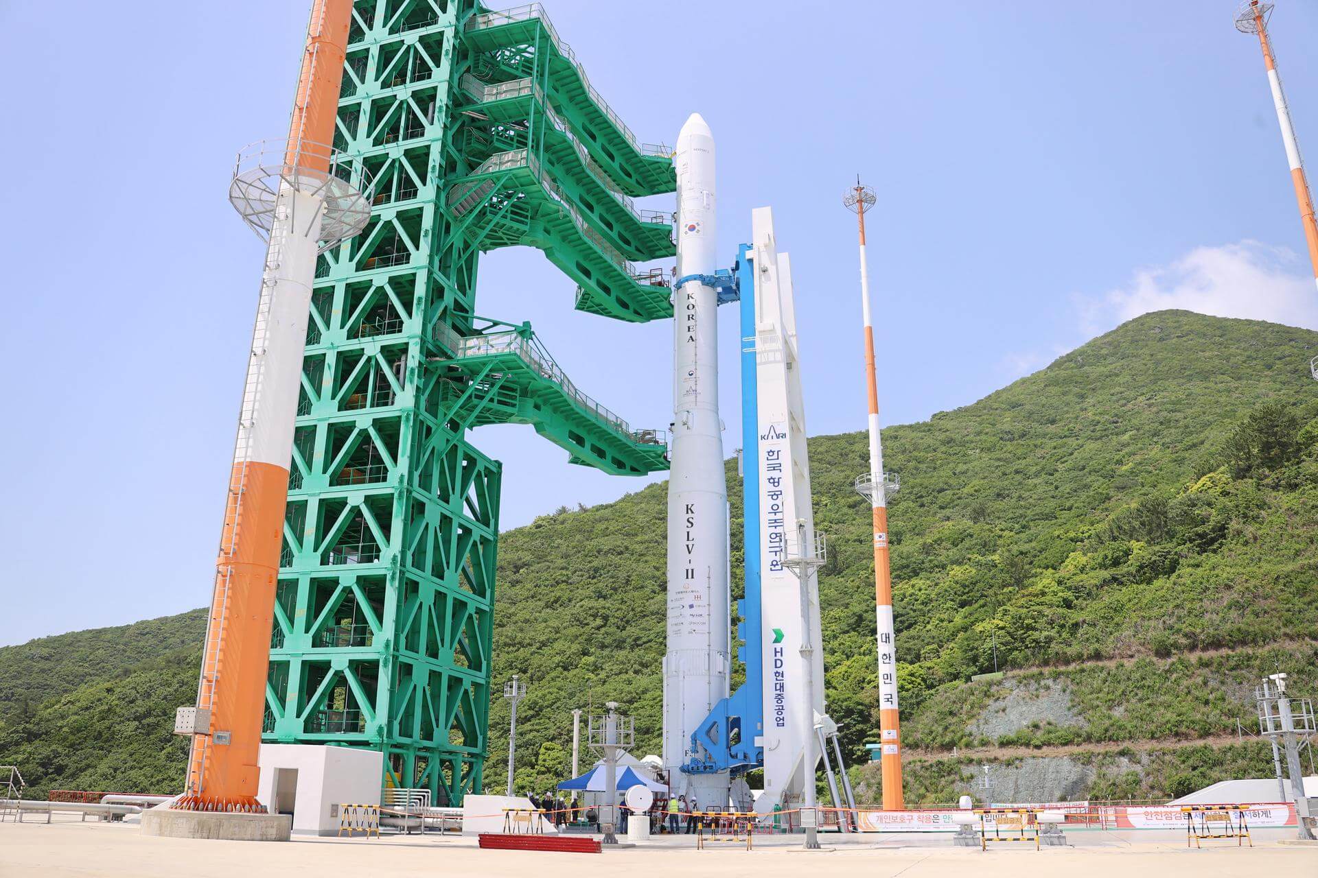
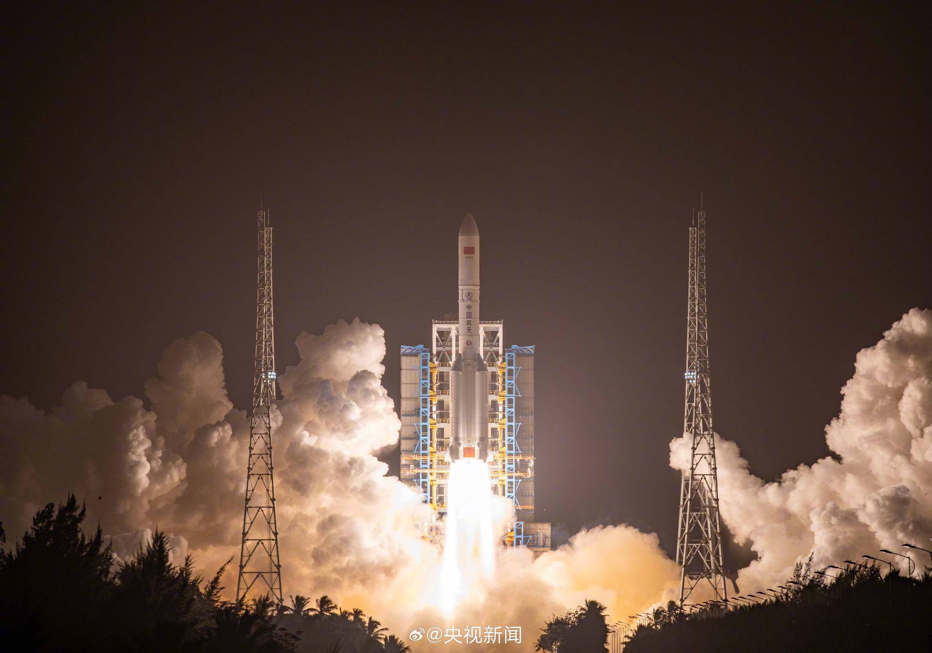
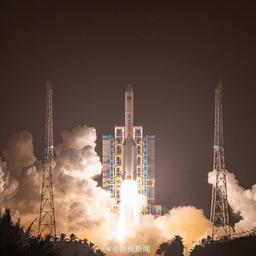
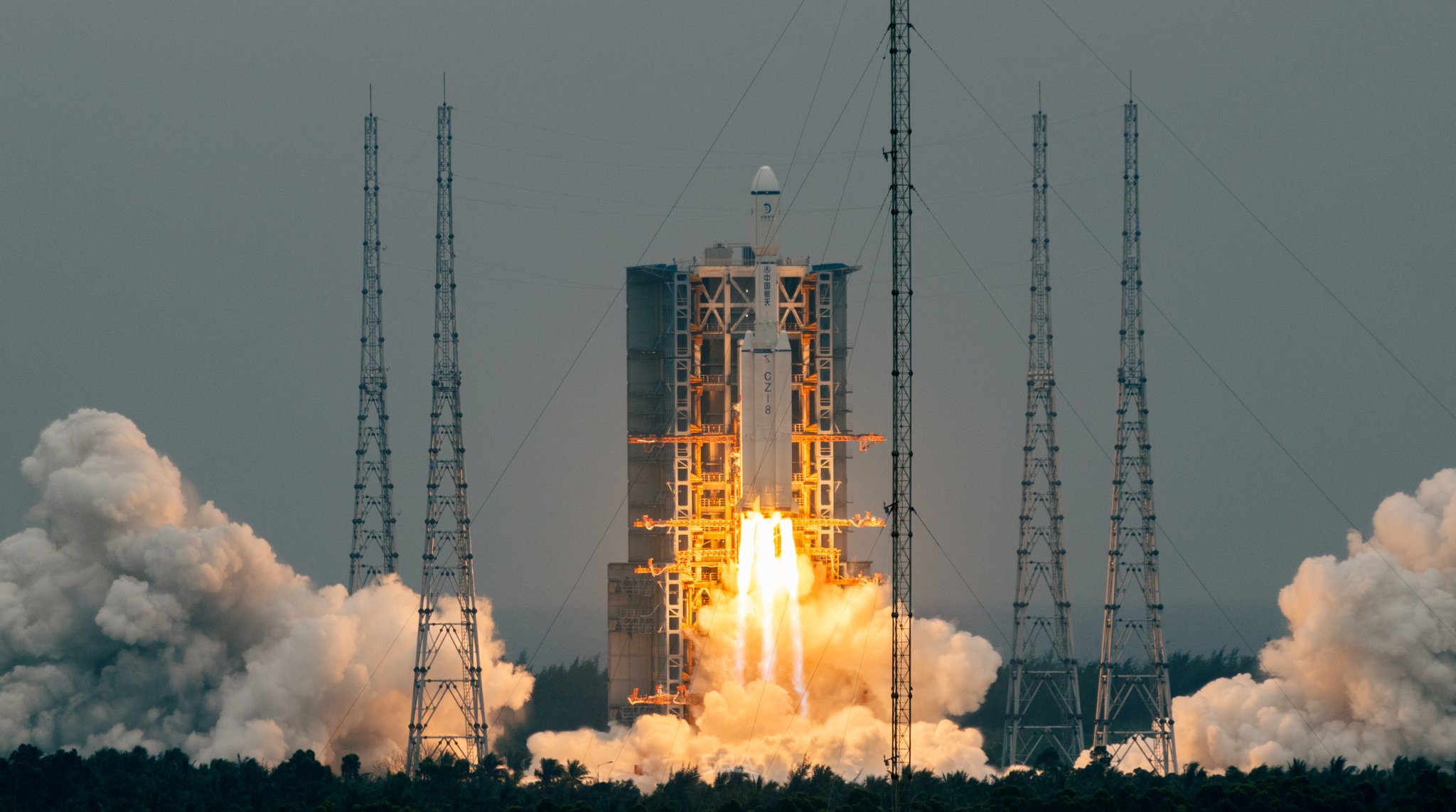
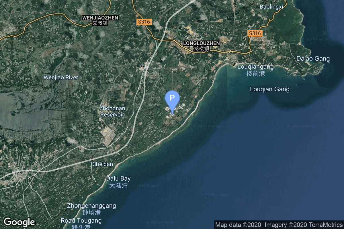
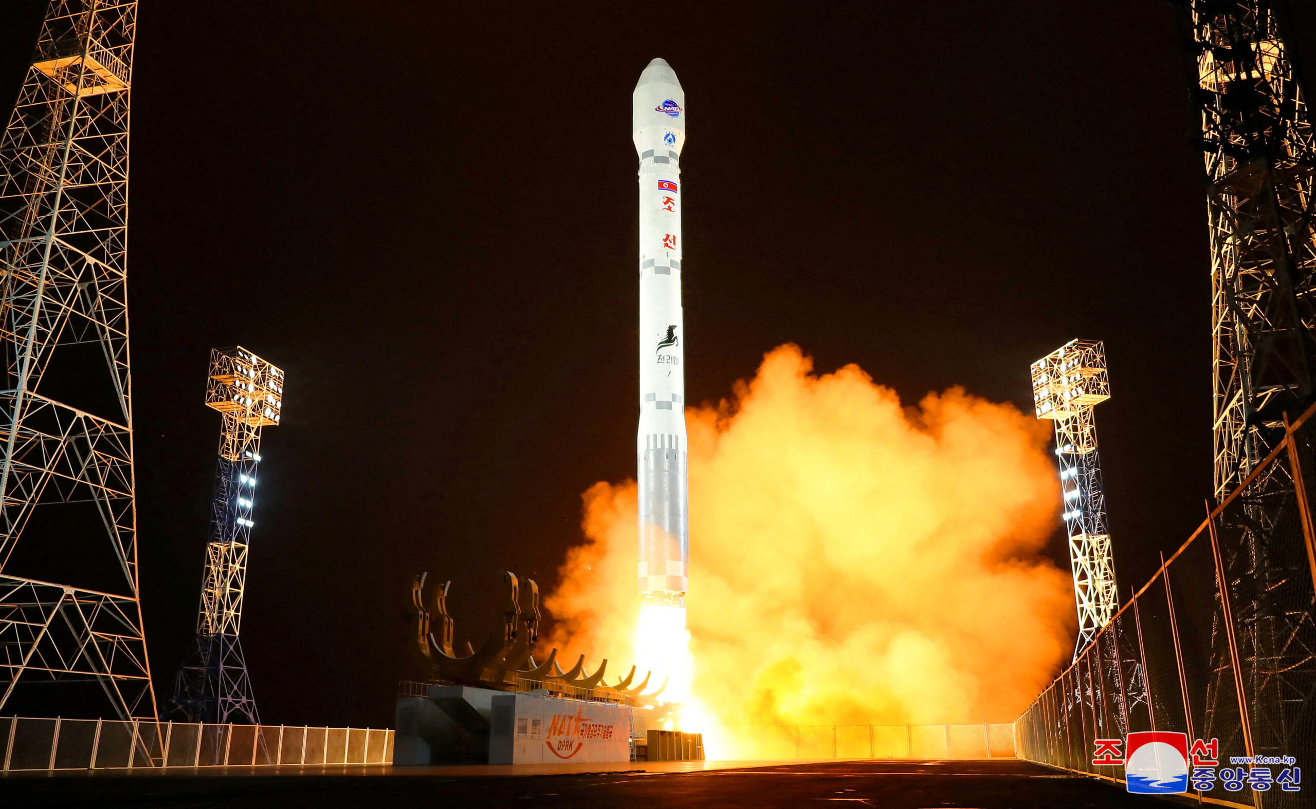
{ "count": 231, "next": "https://ll.thespacedevs.com/2.3.0/pads/?format=api&limit=10&offset=200&ordering=-location__id", "previous": "https://ll.thespacedevs.com/2.3.0/pads/?format=api&limit=10&offset=180&ordering=-location__id", "results": [ { "id": 192, "url": "https://ll.thespacedevs.com/2.3.0/pads/192/?format=api", "active": true, "agencies": [ { "response_mode": "normal", "id": 41, "url": "https://ll.thespacedevs.com/2.3.0/agencies/41/?format=api", "name": "Korea Aerospace Research Institute", "abbrev": "KARI", "type": { "id": 1, "name": "Government" }, "featured": false, "country": [ { "id": 35, "name": "South Korea", "alpha_2_code": "KR", "alpha_3_code": "KOR", "nationality_name": "South Korean", "nationality_name_composed": "South Korean" } ], "description": "The Korea Aerospace Research Institute (KARI) established in 1989, is the aeronautics and space agency of Republic of Korea. Its main laboratories are located in Daejeon, in the Daedeok Science Town.", "administrator": "Administrator: Lee Sang-Ryool", "founding_year": 1989, "launchers": "Nuri", "spacecraft": "", "parent": "Korea AeroSpace Administration", "image": null, "logo": { "id": 154, "name": "[AUTO] Korea Aerospace Research Institute - logo", "image_url": "https://thespacedevs-prod.nyc3.digitaloceanspaces.com/media/images/korea2520aerospace2520research2520institute_logo_20200806032236.png", "thumbnail_url": "https://thespacedevs-prod.nyc3.digitaloceanspaces.com/media/images/255bauto255d__image_thumbnail_20240305185029.png", "credit": null, "license": { "id": 1, "name": "Unknown", "priority": 9, "link": null }, "single_use": true, "variants": [] }, "social_logo": { "id": 72, "name": "[AUTO] Korea Aerospace Research Institute - social_logo", "image_url": "https://thespacedevs-prod.nyc3.digitaloceanspaces.com/media/images/korea2520aerospace2520research2520institute_nation_20230604194037.jpg", "thumbnail_url": "https://thespacedevs-prod.nyc3.digitaloceanspaces.com/media/images/255bauto255d__image_thumbnail_20240305184817.jpeg", "credit": null, "license": { "id": 1, "name": "Unknown", "priority": 9, "link": null }, "single_use": true, "variants": [] } } ], "name": "LC-2", "image": { "id": 1283, "name": "Nuri liftoff from LC-2 (NEXTSat-2 & SNIPE)", "image_url": "https://thespacedevs-prod.nyc3.digitaloceanspaces.com/media/images/nuri_liftoff_2_image_20240820080542.jpeg", "thumbnail_url": "https://thespacedevs-prod.nyc3.digitaloceanspaces.com/media/images/nuri_liftoff_2_image_thumbnail_20240820080542.jpeg", "credit": "KARI/VNA/CVN", "license": { "id": 1, "name": "Unknown", "priority": 9, "link": null }, "single_use": false, "variants": [] }, "description": "", "info_url": null, "wiki_url": "https://en.wikipedia.org/wiki/Naro_Space_Center", "map_url": "https://www.google.com/maps?q=34.431867,127.535069", "latitude": 34.431867, "longitude": 127.535069, "country": { "id": 35, "name": "South Korea", "alpha_2_code": "KR", "alpha_3_code": "KOR", "nationality_name": "South Korean", "nationality_name_composed": "South Korean" }, "map_image": "https://thespacedevs-prod.nyc3.digitaloceanspaces.com/media/map_images/pad_lc-2_20210812070305.jpg", "total_launch_count": 4, "orbital_launch_attempt_count": 3, "fastest_turnaround": "P242DT23H", "location": { "response_mode": "normal", "id": 9, "url": "https://ll.thespacedevs.com/2.3.0/locations/9/?format=api", "name": "Naro Space Center, South Korea", "celestial_body": { "response_mode": "normal", "id": 1, "name": "Earth", "type": { "id": 1, "name": "Planet" }, "diameter": 12742000.0, "mass": 5.972168e+24, "gravity": 9.80655, "length_of_day": "1 00:00:00", "atmosphere": true, "image": { "id": 2040, "name": "Earth (Apollo 17)", "image_url": "https://thespacedevs-prod.nyc3.digitaloceanspaces.com/media/images/earth_2528apol_image_20240402194304.jpeg", "thumbnail_url": "https://thespacedevs-prod.nyc3.digitaloceanspaces.com/media/images/earth_2528apol_image_thumbnail_20240402194305.jpeg", "credit": "NASA", "license": { "id": 4, "name": "NASA Image and Media Guidelines", "priority": 0, "link": "https://www.nasa.gov/nasa-brand-center/images-and-media/" }, "single_use": true, "variants": [] }, "description": "Earth is the third planet from the Sun and the only astronomical object known to harbor life.", "wiki_url": "https://en.wikipedia.org/wiki/Earth", "total_attempted_launches": 7147, "successful_launches": 6604, "failed_launches": 543, "total_attempted_landings": 1101, "successful_landings": 1058, "failed_landings": 43 }, "active": true, "country": { "id": 35, "name": "South Korea", "alpha_2_code": "KR", "alpha_3_code": "KOR", "nationality_name": "South Korean", "nationality_name_composed": "South Korean" }, "description": "The Naro Space Center is a South Korean spaceport in South Jeolla's Goheung County, operated by the state-run Korea Aerospace Research Institute.", "image": { "id": 1797, "name": "Nuri on the launch pad", "image_url": "https://thespacedevs-prod.nyc3.digitaloceanspaces.com/media/images/nuri_on_the_lau_image_20240307163812.jpeg", "thumbnail_url": "https://thespacedevs-prod.nyc3.digitaloceanspaces.com/media/images/nuri_on_the_lau_image_thumbnail_20240307163813.jpeg", "credit": "Korea Aerospace Research Institute", "license": { "id": 15, "name": "Korea Open Government License Type I: Attribution", "priority": 6, "link": "https://www.kogl.or.kr/edu/eduDataFileDown.do?dataIdx=97&dataFileIdx=1" }, "single_use": true, "variants": [] }, "map_image": "https://thespacedevs-prod.nyc3.digitaloceanspaces.com/media/map_images/location_9_20200803142441.jpg", "longitude": 127.535, "latitude": 34.431944, "timezone_name": "Asia/Seoul", "total_launch_count": 7, "total_landing_count": 0 } }, { "id": 64, "url": "https://ll.thespacedevs.com/2.3.0/pads/64/?format=api", "active": true, "agencies": [ { "response_mode": "normal", "id": 41, "url": "https://ll.thespacedevs.com/2.3.0/agencies/41/?format=api", "name": "Korea Aerospace Research Institute", "abbrev": "KARI", "type": { "id": 1, "name": "Government" }, "featured": false, "country": [ { "id": 35, "name": "South Korea", "alpha_2_code": "KR", "alpha_3_code": "KOR", "nationality_name": "South Korean", "nationality_name_composed": "South Korean" } ], "description": "The Korea Aerospace Research Institute (KARI) established in 1989, is the aeronautics and space agency of Republic of Korea. Its main laboratories are located in Daejeon, in the Daedeok Science Town.", "administrator": "Administrator: Lee Sang-Ryool", "founding_year": 1989, "launchers": "Nuri", "spacecraft": "", "parent": "Korea AeroSpace Administration", "image": null, "logo": { "id": 154, "name": "[AUTO] Korea Aerospace Research Institute - logo", "image_url": "https://thespacedevs-prod.nyc3.digitaloceanspaces.com/media/images/korea2520aerospace2520research2520institute_logo_20200806032236.png", "thumbnail_url": "https://thespacedevs-prod.nyc3.digitaloceanspaces.com/media/images/255bauto255d__image_thumbnail_20240305185029.png", "credit": null, "license": { "id": 1, "name": "Unknown", "priority": 9, "link": null }, "single_use": true, "variants": [] }, "social_logo": { "id": 72, "name": "[AUTO] Korea Aerospace Research Institute - social_logo", "image_url": "https://thespacedevs-prod.nyc3.digitaloceanspaces.com/media/images/korea2520aerospace2520research2520institute_nation_20230604194037.jpg", "thumbnail_url": "https://thespacedevs-prod.nyc3.digitaloceanspaces.com/media/images/255bauto255d__image_thumbnail_20240305184817.jpeg", "credit": null, "license": { "id": 1, "name": "Unknown", "priority": 9, "link": null }, "single_use": true, "variants": [] } } ], "name": "LC-1", "image": null, "description": null, "info_url": null, "wiki_url": "https://en.wikipedia.org/wiki/Naro_Space_Center", "map_url": "https://www.google.com/maps?q=34.431867,127.535069", "latitude": 34.431867, "longitude": 127.535069, "country": { "id": 35, "name": "South Korea", "alpha_2_code": "KR", "alpha_3_code": "KOR", "nationality_name": "South Korean", "nationality_name_composed": "South Korean" }, "map_image": "https://thespacedevs-prod.nyc3.digitaloceanspaces.com/media/map_images/pad_64_20200803143347.jpg", "total_launch_count": 3, "orbital_launch_attempt_count": 3, "fastest_turnaround": "P289DT27S", "location": { "response_mode": "normal", "id": 9, "url": "https://ll.thespacedevs.com/2.3.0/locations/9/?format=api", "name": "Naro Space Center, South Korea", "celestial_body": { "response_mode": "normal", "id": 1, "name": "Earth", "type": { "id": 1, "name": "Planet" }, "diameter": 12742000.0, "mass": 5.972168e+24, "gravity": 9.80655, "length_of_day": "1 00:00:00", "atmosphere": true, "image": { "id": 2040, "name": "Earth (Apollo 17)", "image_url": "https://thespacedevs-prod.nyc3.digitaloceanspaces.com/media/images/earth_2528apol_image_20240402194304.jpeg", "thumbnail_url": "https://thespacedevs-prod.nyc3.digitaloceanspaces.com/media/images/earth_2528apol_image_thumbnail_20240402194305.jpeg", "credit": "NASA", "license": { "id": 4, "name": "NASA Image and Media Guidelines", "priority": 0, "link": "https://www.nasa.gov/nasa-brand-center/images-and-media/" }, "single_use": true, "variants": [] }, "description": "Earth is the third planet from the Sun and the only astronomical object known to harbor life.", "wiki_url": "https://en.wikipedia.org/wiki/Earth", "total_attempted_launches": 7147, "successful_launches": 6604, "failed_launches": 543, "total_attempted_landings": 1101, "successful_landings": 1058, "failed_landings": 43 }, "active": true, "country": { "id": 35, "name": "South Korea", "alpha_2_code": "KR", "alpha_3_code": "KOR", "nationality_name": "South Korean", "nationality_name_composed": "South Korean" }, "description": "The Naro Space Center is a South Korean spaceport in South Jeolla's Goheung County, operated by the state-run Korea Aerospace Research Institute.", "image": { "id": 1797, "name": "Nuri on the launch pad", "image_url": "https://thespacedevs-prod.nyc3.digitaloceanspaces.com/media/images/nuri_on_the_lau_image_20240307163812.jpeg", "thumbnail_url": "https://thespacedevs-prod.nyc3.digitaloceanspaces.com/media/images/nuri_on_the_lau_image_thumbnail_20240307163813.jpeg", "credit": "Korea Aerospace Research Institute", "license": { "id": 15, "name": "Korea Open Government License Type I: Attribution", "priority": 6, "link": "https://www.kogl.or.kr/edu/eduDataFileDown.do?dataIdx=97&dataFileIdx=1" }, "single_use": true, "variants": [] }, "map_image": "https://thespacedevs-prod.nyc3.digitaloceanspaces.com/media/map_images/location_9_20200803142441.jpg", "longitude": 127.535, "latitude": 34.431944, "timezone_name": "Asia/Seoul", "total_launch_count": 7, "total_landing_count": 0 } }, { "id": 175, "url": "https://ll.thespacedevs.com/2.3.0/pads/175/?format=api", "active": true, "agencies": [], "name": "101", "image": { "id": 1340, "name": "Long March 5 liftoff from pad 101 (Yaogan 41)", "image_url": "https://thespacedevs-prod.nyc3.digitaloceanspaces.com/media/images/long2520march_image_20231216085127.jpeg", "thumbnail_url": "https://thespacedevs-prod.nyc3.digitaloceanspaces.com/media/images/255bauto255d__image_thumbnail_20240305192444.jpeg", "credit": "央视新闻", "license": { "id": 1, "name": "Unknown", "priority": 9, "link": null }, "single_use": false, "variants": [] }, "description": "", "info_url": null, "wiki_url": "https://en.wikipedia.org/wiki/Wenchang_Spacecraft_Launch_Site", "map_url": "https://www.google.com/maps?q=19.614334,110.951011", "latitude": 19.614334, "longitude": 110.951011, "country": { "id": 6, "name": "China", "alpha_2_code": "CN", "alpha_3_code": "CHN", "nationality_name": "Chinese", "nationality_name_composed": "Sino" }, "map_image": "https://thespacedevs-prod.nyc3.digitaloceanspaces.com/media/map_images/pad_175_20200803143424.jpg", "total_launch_count": 14, "orbital_launch_attempt_count": 14, "fastest_turnaround": "P69DT21H49M", "location": { "response_mode": "normal", "id": 8, "url": "https://ll.thespacedevs.com/2.3.0/locations/8/?format=api", "name": "Wenchang Space Launch Site, People's Republic of China", "celestial_body": { "response_mode": "normal", "id": 1, "name": "Earth", "type": { "id": 1, "name": "Planet" }, "diameter": 12742000.0, "mass": 5.972168e+24, "gravity": 9.80655, "length_of_day": "1 00:00:00", "atmosphere": true, "image": { "id": 2040, "name": "Earth (Apollo 17)", "image_url": "https://thespacedevs-prod.nyc3.digitaloceanspaces.com/media/images/earth_2528apol_image_20240402194304.jpeg", "thumbnail_url": "https://thespacedevs-prod.nyc3.digitaloceanspaces.com/media/images/earth_2528apol_image_thumbnail_20240402194305.jpeg", "credit": "NASA", "license": { "id": 4, "name": "NASA Image and Media Guidelines", "priority": 0, "link": "https://www.nasa.gov/nasa-brand-center/images-and-media/" }, "single_use": true, "variants": [] }, "description": "Earth is the third planet from the Sun and the only astronomical object known to harbor life.", "wiki_url": "https://en.wikipedia.org/wiki/Earth", "total_attempted_launches": 7147, "successful_launches": 6604, "failed_launches": 543, "total_attempted_landings": 1101, "successful_landings": 1058, "failed_landings": 43 }, "active": true, "country": { "id": 6, "name": "China", "alpha_2_code": "CN", "alpha_3_code": "CHN", "nationality_name": "Chinese", "nationality_name_composed": "Sino" }, "description": "The Wenchang Space Launch Site is a rocket launch site located in Wenchang on the island of Hainan, in China.\r\n\r\nFormally a suborbital test center, it currently serves as China's southernmost spaceport. The site was selected for its low latitude, 19° north of the equator, allowing for larger payloads to be launched. It is capable of launching the Long March 5, the heaviest Chinese rocket. Unlike launch facilities on the mainland, Wenchang uses its seaport for deliveries.", "image": { "id": 2019, "name": "CZ-8 liftoff from pad 201 (Queqiao-2)", "image_url": "https://thespacedevs-prod.nyc3.digitaloceanspaces.com/media/images/cz-8_liftoff_2_image_20240320175819.jpeg", "thumbnail_url": "https://thespacedevs-prod.nyc3.digitaloceanspaces.com/media/images/cz-8_liftoff_2_image_thumbnail_20240320175820.jpeg", "credit": "秦英健/Qin Yingjian", "license": { "id": 1, "name": "Unknown", "priority": 9, "link": null }, "single_use": false, "variants": [] }, "map_image": "https://thespacedevs-prod.nyc3.digitaloceanspaces.com/media/map_images/location_8_20200803142445.jpg", "longitude": 110.951133, "latitude": 19.614492, "timezone_name": "Asia/Shanghai", "total_launch_count": 38, "total_landing_count": 0 } }, { "id": 78, "url": "https://ll.thespacedevs.com/2.3.0/pads/78/?format=api", "active": true, "agencies": [], "name": "Unknown Pad", "image": null, "description": null, "info_url": null, "wiki_url": "https://en.wikipedia.org/wiki/Wenchang_Satellite_Launch_Center", "map_url": "https://www.google.com/maps?q=19.614354,110.951057", "latitude": 19.614354, "longitude": 110.951057, "country": { "id": 6, "name": "China", "alpha_2_code": "CN", "alpha_3_code": "CHN", "nationality_name": "Chinese", "nationality_name_composed": "Sino" }, "map_image": "https://thespacedevs-prod.nyc3.digitaloceanspaces.com/media/map_images/pad_78_20200803143548.jpg", "total_launch_count": 0, "orbital_launch_attempt_count": 0, "fastest_turnaround": null, "location": { "response_mode": "normal", "id": 8, "url": "https://ll.thespacedevs.com/2.3.0/locations/8/?format=api", "name": "Wenchang Space Launch Site, People's Republic of China", "celestial_body": { "response_mode": "normal", "id": 1, "name": "Earth", "type": { "id": 1, "name": "Planet" }, "diameter": 12742000.0, "mass": 5.972168e+24, "gravity": 9.80655, "length_of_day": "1 00:00:00", "atmosphere": true, "image": { "id": 2040, "name": "Earth (Apollo 17)", "image_url": "https://thespacedevs-prod.nyc3.digitaloceanspaces.com/media/images/earth_2528apol_image_20240402194304.jpeg", "thumbnail_url": "https://thespacedevs-prod.nyc3.digitaloceanspaces.com/media/images/earth_2528apol_image_thumbnail_20240402194305.jpeg", "credit": "NASA", "license": { "id": 4, "name": "NASA Image and Media Guidelines", "priority": 0, "link": "https://www.nasa.gov/nasa-brand-center/images-and-media/" }, "single_use": true, "variants": [] }, "description": "Earth is the third planet from the Sun and the only astronomical object known to harbor life.", "wiki_url": "https://en.wikipedia.org/wiki/Earth", "total_attempted_launches": 7147, "successful_launches": 6604, "failed_launches": 543, "total_attempted_landings": 1101, "successful_landings": 1058, "failed_landings": 43 }, "active": true, "country": { "id": 6, "name": "China", "alpha_2_code": "CN", "alpha_3_code": "CHN", "nationality_name": "Chinese", "nationality_name_composed": "Sino" }, "description": "The Wenchang Space Launch Site is a rocket launch site located in Wenchang on the island of Hainan, in China.\r\n\r\nFormally a suborbital test center, it currently serves as China's southernmost spaceport. The site was selected for its low latitude, 19° north of the equator, allowing for larger payloads to be launched. It is capable of launching the Long March 5, the heaviest Chinese rocket. Unlike launch facilities on the mainland, Wenchang uses its seaport for deliveries.", "image": { "id": 2019, "name": "CZ-8 liftoff from pad 201 (Queqiao-2)", "image_url": "https://thespacedevs-prod.nyc3.digitaloceanspaces.com/media/images/cz-8_liftoff_2_image_20240320175819.jpeg", "thumbnail_url": "https://thespacedevs-prod.nyc3.digitaloceanspaces.com/media/images/cz-8_liftoff_2_image_thumbnail_20240320175820.jpeg", "credit": "秦英健/Qin Yingjian", "license": { "id": 1, "name": "Unknown", "priority": 9, "link": null }, "single_use": false, "variants": [] }, "map_image": "https://thespacedevs-prod.nyc3.digitaloceanspaces.com/media/map_images/location_8_20200803142445.jpg", "longitude": 110.951133, "latitude": 19.614492, "timezone_name": "Asia/Shanghai", "total_launch_count": 38, "total_landing_count": 0 } }, { "id": 218, "url": "https://ll.thespacedevs.com/2.3.0/pads/218/?format=api", "active": true, "agencies": [], "name": "Commercial LC-1", "image": null, "description": "", "info_url": null, "wiki_url": "https://en.wikipedia.org/wiki/Wenchang_Commercial_Space_Launch_Site", "map_url": "https://www.google.com/maps?q=19.597275,110.930753", "latitude": 19.597275, "longitude": 110.930753, "country": { "id": 6, "name": "China", "alpha_2_code": "CN", "alpha_3_code": "CHN", "nationality_name": "Chinese", "nationality_name_composed": "Sino" }, "map_image": "https://thespacedevs-prod.nyc3.digitaloceanspaces.com/media/map_images/pad_commercial_lc-1_20231225074041.jpg", "total_launch_count": 1, "orbital_launch_attempt_count": 1, "fastest_turnaround": null, "location": { "response_mode": "normal", "id": 8, "url": "https://ll.thespacedevs.com/2.3.0/locations/8/?format=api", "name": "Wenchang Space Launch Site, People's Republic of China", "celestial_body": { "response_mode": "normal", "id": 1, "name": "Earth", "type": { "id": 1, "name": "Planet" }, "diameter": 12742000.0, "mass": 5.972168e+24, "gravity": 9.80655, "length_of_day": "1 00:00:00", "atmosphere": true, "image": { "id": 2040, "name": "Earth (Apollo 17)", "image_url": "https://thespacedevs-prod.nyc3.digitaloceanspaces.com/media/images/earth_2528apol_image_20240402194304.jpeg", "thumbnail_url": "https://thespacedevs-prod.nyc3.digitaloceanspaces.com/media/images/earth_2528apol_image_thumbnail_20240402194305.jpeg", "credit": "NASA", "license": { "id": 4, "name": "NASA Image and Media Guidelines", "priority": 0, "link": "https://www.nasa.gov/nasa-brand-center/images-and-media/" }, "single_use": true, "variants": [] }, "description": "Earth is the third planet from the Sun and the only astronomical object known to harbor life.", "wiki_url": "https://en.wikipedia.org/wiki/Earth", "total_attempted_launches": 7147, "successful_launches": 6604, "failed_launches": 543, "total_attempted_landings": 1101, "successful_landings": 1058, "failed_landings": 43 }, "active": true, "country": { "id": 6, "name": "China", "alpha_2_code": "CN", "alpha_3_code": "CHN", "nationality_name": "Chinese", "nationality_name_composed": "Sino" }, "description": "The Wenchang Space Launch Site is a rocket launch site located in Wenchang on the island of Hainan, in China.\r\n\r\nFormally a suborbital test center, it currently serves as China's southernmost spaceport. The site was selected for its low latitude, 19° north of the equator, allowing for larger payloads to be launched. It is capable of launching the Long March 5, the heaviest Chinese rocket. Unlike launch facilities on the mainland, Wenchang uses its seaport for deliveries.", "image": { "id": 2019, "name": "CZ-8 liftoff from pad 201 (Queqiao-2)", "image_url": "https://thespacedevs-prod.nyc3.digitaloceanspaces.com/media/images/cz-8_liftoff_2_image_20240320175819.jpeg", "thumbnail_url": "https://thespacedevs-prod.nyc3.digitaloceanspaces.com/media/images/cz-8_liftoff_2_image_thumbnail_20240320175820.jpeg", "credit": "秦英健/Qin Yingjian", "license": { "id": 1, "name": "Unknown", "priority": 9, "link": null }, "single_use": false, "variants": [] }, "map_image": "https://thespacedevs-prod.nyc3.digitaloceanspaces.com/media/map_images/location_8_20200803142445.jpg", "longitude": 110.951133, "latitude": 19.614492, "timezone_name": "Asia/Shanghai", "total_launch_count": 38, "total_landing_count": 0 } }, { "id": 222, "url": "https://ll.thespacedevs.com/2.3.0/pads/222/?format=api", "active": true, "agencies": [], "name": "Commercial LC-3", "image": null, "description": "", "info_url": null, "wiki_url": "https://en.wikipedia.org/wiki/Wenchang_Commercial_Space_Launch_Site", "map_url": "https://www.google.com/maps?q=19.5945793,110.9260013", "latitude": 19.5945793, "longitude": 110.9260013, "country": { "id": 6, "name": "China", "alpha_2_code": "CN", "alpha_3_code": "CHN", "nationality_name": "Chinese", "nationality_name_composed": "Sino" }, "map_image": "https://thespacedevs-prod.nyc3.digitaloceanspaces.com/media/map_images/pad_commercial_lc-3_20240627115237.jpg", "total_launch_count": 0, "orbital_launch_attempt_count": 0, "fastest_turnaround": null, "location": { "response_mode": "normal", "id": 8, "url": "https://ll.thespacedevs.com/2.3.0/locations/8/?format=api", "name": "Wenchang Space Launch Site, People's Republic of China", "celestial_body": { "response_mode": "normal", "id": 1, "name": "Earth", "type": { "id": 1, "name": "Planet" }, "diameter": 12742000.0, "mass": 5.972168e+24, "gravity": 9.80655, "length_of_day": "1 00:00:00", "atmosphere": true, "image": { "id": 2040, "name": "Earth (Apollo 17)", "image_url": "https://thespacedevs-prod.nyc3.digitaloceanspaces.com/media/images/earth_2528apol_image_20240402194304.jpeg", "thumbnail_url": "https://thespacedevs-prod.nyc3.digitaloceanspaces.com/media/images/earth_2528apol_image_thumbnail_20240402194305.jpeg", "credit": "NASA", "license": { "id": 4, "name": "NASA Image and Media Guidelines", "priority": 0, "link": "https://www.nasa.gov/nasa-brand-center/images-and-media/" }, "single_use": true, "variants": [] }, "description": "Earth is the third planet from the Sun and the only astronomical object known to harbor life.", "wiki_url": "https://en.wikipedia.org/wiki/Earth", "total_attempted_launches": 7147, "successful_launches": 6604, "failed_launches": 543, "total_attempted_landings": 1101, "successful_landings": 1058, "failed_landings": 43 }, "active": true, "country": { "id": 6, "name": "China", "alpha_2_code": "CN", "alpha_3_code": "CHN", "nationality_name": "Chinese", "nationality_name_composed": "Sino" }, "description": "The Wenchang Space Launch Site is a rocket launch site located in Wenchang on the island of Hainan, in China.\r\n\r\nFormally a suborbital test center, it currently serves as China's southernmost spaceport. The site was selected for its low latitude, 19° north of the equator, allowing for larger payloads to be launched. It is capable of launching the Long March 5, the heaviest Chinese rocket. Unlike launch facilities on the mainland, Wenchang uses its seaport for deliveries.", "image": { "id": 2019, "name": "CZ-8 liftoff from pad 201 (Queqiao-2)", "image_url": "https://thespacedevs-prod.nyc3.digitaloceanspaces.com/media/images/cz-8_liftoff_2_image_20240320175819.jpeg", "thumbnail_url": "https://thespacedevs-prod.nyc3.digitaloceanspaces.com/media/images/cz-8_liftoff_2_image_thumbnail_20240320175820.jpeg", "credit": "秦英健/Qin Yingjian", "license": { "id": 1, "name": "Unknown", "priority": 9, "link": null }, "single_use": false, "variants": [] }, "map_image": "https://thespacedevs-prod.nyc3.digitaloceanspaces.com/media/map_images/location_8_20200803142445.jpg", "longitude": 110.951133, "latitude": 19.614492, "timezone_name": "Asia/Shanghai", "total_launch_count": 38, "total_landing_count": 0 } }, { "id": 219, "url": "https://ll.thespacedevs.com/2.3.0/pads/219/?format=api", "active": true, "agencies": [], "name": "Commercial LC-2", "image": null, "description": "", "info_url": null, "wiki_url": "https://en.wikipedia.org/wiki/Wenchang_Commercial_Space_Launch_Site", "map_url": "https://www.google.com/maps?q=19.59755,110.936481", "latitude": 19.59755, "longitude": 110.936481, "country": { "id": 6, "name": "China", "alpha_2_code": "CN", "alpha_3_code": "CHN", "nationality_name": "Chinese", "nationality_name_composed": "Sino" }, "map_image": "https://thespacedevs-prod.nyc3.digitaloceanspaces.com/media/map_images/pad_commercial_lc-2_20231225074048.jpg", "total_launch_count": 1, "orbital_launch_attempt_count": 1, "fastest_turnaround": null, "location": { "response_mode": "normal", "id": 8, "url": "https://ll.thespacedevs.com/2.3.0/locations/8/?format=api", "name": "Wenchang Space Launch Site, People's Republic of China", "celestial_body": { "response_mode": "normal", "id": 1, "name": "Earth", "type": { "id": 1, "name": "Planet" }, "diameter": 12742000.0, "mass": 5.972168e+24, "gravity": 9.80655, "length_of_day": "1 00:00:00", "atmosphere": true, "image": { "id": 2040, "name": "Earth (Apollo 17)", "image_url": "https://thespacedevs-prod.nyc3.digitaloceanspaces.com/media/images/earth_2528apol_image_20240402194304.jpeg", "thumbnail_url": "https://thespacedevs-prod.nyc3.digitaloceanspaces.com/media/images/earth_2528apol_image_thumbnail_20240402194305.jpeg", "credit": "NASA", "license": { "id": 4, "name": "NASA Image and Media Guidelines", "priority": 0, "link": "https://www.nasa.gov/nasa-brand-center/images-and-media/" }, "single_use": true, "variants": [] }, "description": "Earth is the third planet from the Sun and the only astronomical object known to harbor life.", "wiki_url": "https://en.wikipedia.org/wiki/Earth", "total_attempted_launches": 7147, "successful_launches": 6604, "failed_launches": 543, "total_attempted_landings": 1101, "successful_landings": 1058, "failed_landings": 43 }, "active": true, "country": { "id": 6, "name": "China", "alpha_2_code": "CN", "alpha_3_code": "CHN", "nationality_name": "Chinese", "nationality_name_composed": "Sino" }, "description": "The Wenchang Space Launch Site is a rocket launch site located in Wenchang on the island of Hainan, in China.\r\n\r\nFormally a suborbital test center, it currently serves as China's southernmost spaceport. The site was selected for its low latitude, 19° north of the equator, allowing for larger payloads to be launched. It is capable of launching the Long March 5, the heaviest Chinese rocket. Unlike launch facilities on the mainland, Wenchang uses its seaport for deliveries.", "image": { "id": 2019, "name": "CZ-8 liftoff from pad 201 (Queqiao-2)", "image_url": "https://thespacedevs-prod.nyc3.digitaloceanspaces.com/media/images/cz-8_liftoff_2_image_20240320175819.jpeg", "thumbnail_url": "https://thespacedevs-prod.nyc3.digitaloceanspaces.com/media/images/cz-8_liftoff_2_image_thumbnail_20240320175820.jpeg", "credit": "秦英健/Qin Yingjian", "license": { "id": 1, "name": "Unknown", "priority": 9, "link": null }, "single_use": false, "variants": [] }, "map_image": "https://thespacedevs-prod.nyc3.digitaloceanspaces.com/media/map_images/location_8_20200803142445.jpg", "longitude": 110.951133, "latitude": 19.614492, "timezone_name": "Asia/Shanghai", "total_launch_count": 38, "total_landing_count": 0 } }, { "id": 176, "url": "https://ll.thespacedevs.com/2.3.0/pads/176/?format=api", "active": true, "agencies": [], "name": "201", "image": { "id": 2019, "name": "CZ-8 liftoff from pad 201 (Queqiao-2)", "image_url": "https://thespacedevs-prod.nyc3.digitaloceanspaces.com/media/images/cz-8_liftoff_2_image_20240320175819.jpeg", "thumbnail_url": "https://thespacedevs-prod.nyc3.digitaloceanspaces.com/media/images/cz-8_liftoff_2_image_thumbnail_20240320175820.jpeg", "credit": "秦英健/Qin Yingjian", "license": { "id": 1, "name": "Unknown", "priority": 9, "link": null }, "single_use": false, "variants": [] }, "description": "", "info_url": null, "wiki_url": "https://en.wikipedia.org/wiki/Wenchang_Spacecraft_Launch_Site", "map_url": "https://www.google.com/maps?q=19.618452,110.955356", "latitude": 19.618452, "longitude": 110.955356, "country": { "id": 6, "name": "China", "alpha_2_code": "CN", "alpha_3_code": "CHN", "nationality_name": "Chinese", "nationality_name_composed": "Sino" }, "map_image": "https://thespacedevs-prod.nyc3.digitaloceanspaces.com/media/map_images/pad_176_20200803143412.jpg", "total_launch_count": 22, "orbital_launch_attempt_count": 22, "fastest_turnaround": "P46DT6H35M", "location": { "response_mode": "normal", "id": 8, "url": "https://ll.thespacedevs.com/2.3.0/locations/8/?format=api", "name": "Wenchang Space Launch Site, People's Republic of China", "celestial_body": { "response_mode": "normal", "id": 1, "name": "Earth", "type": { "id": 1, "name": "Planet" }, "diameter": 12742000.0, "mass": 5.972168e+24, "gravity": 9.80655, "length_of_day": "1 00:00:00", "atmosphere": true, "image": { "id": 2040, "name": "Earth (Apollo 17)", "image_url": "https://thespacedevs-prod.nyc3.digitaloceanspaces.com/media/images/earth_2528apol_image_20240402194304.jpeg", "thumbnail_url": "https://thespacedevs-prod.nyc3.digitaloceanspaces.com/media/images/earth_2528apol_image_thumbnail_20240402194305.jpeg", "credit": "NASA", "license": { "id": 4, "name": "NASA Image and Media Guidelines", "priority": 0, "link": "https://www.nasa.gov/nasa-brand-center/images-and-media/" }, "single_use": true, "variants": [] }, "description": "Earth is the third planet from the Sun and the only astronomical object known to harbor life.", "wiki_url": "https://en.wikipedia.org/wiki/Earth", "total_attempted_launches": 7147, "successful_launches": 6604, "failed_launches": 543, "total_attempted_landings": 1101, "successful_landings": 1058, "failed_landings": 43 }, "active": true, "country": { "id": 6, "name": "China", "alpha_2_code": "CN", "alpha_3_code": "CHN", "nationality_name": "Chinese", "nationality_name_composed": "Sino" }, "description": "The Wenchang Space Launch Site is a rocket launch site located in Wenchang on the island of Hainan, in China.\r\n\r\nFormally a suborbital test center, it currently serves as China's southernmost spaceport. The site was selected for its low latitude, 19° north of the equator, allowing for larger payloads to be launched. It is capable of launching the Long March 5, the heaviest Chinese rocket. Unlike launch facilities on the mainland, Wenchang uses its seaport for deliveries.", "image": { "id": 2019, "name": "CZ-8 liftoff from pad 201 (Queqiao-2)", "image_url": "https://thespacedevs-prod.nyc3.digitaloceanspaces.com/media/images/cz-8_liftoff_2_image_20240320175819.jpeg", "thumbnail_url": "https://thespacedevs-prod.nyc3.digitaloceanspaces.com/media/images/cz-8_liftoff_2_image_thumbnail_20240320175820.jpeg", "credit": "秦英健/Qin Yingjian", "license": { "id": 1, "name": "Unknown", "priority": 9, "link": null }, "single_use": false, "variants": [] }, "map_image": "https://thespacedevs-prod.nyc3.digitaloceanspaces.com/media/map_images/location_8_20200803142445.jpg", "longitude": 110.951133, "latitude": 19.614492, "timezone_name": "Asia/Shanghai", "total_launch_count": 38, "total_landing_count": 0 } }, { "id": 208, "url": "https://ll.thespacedevs.com/2.3.0/pads/208/?format=api", "active": true, "agencies": [], "name": "Malligyong-1 Pad", "image": { "id": 2216, "name": "Chollima-1 liftoff (Malligyong-1c)", "image_url": "https://thespacedevs-prod.nyc3.digitaloceanspaces.com/media/images/chollima-1_lift_image_20240919165247.jpeg", "thumbnail_url": "https://thespacedevs-prod.nyc3.digitaloceanspaces.com/media/images/chollima-1_lift_image_thumbnail_20240919165248.jpeg", "credit": "KCNA", "license": { "id": 1, "name": "Unknown", "priority": 9, "link": null }, "single_use": false, "variants": [] }, "description": "", "info_url": null, "wiki_url": null, "map_url": "https://goo.gl/maps/DgkrTCHCsAcw1CWR7", "latitude": 39.652861, "longitude": 124.736639, "country": { "id": 53, "name": "North Korea", "alpha_2_code": "KP", "alpha_3_code": "PRK", "nationality_name": "North Korean", "nationality_name_composed": "North Korean" }, "map_image": "https://thespacedevs-prod.nyc3.digitaloceanspaces.com/media/map_images/pad_unknown_pad_prk_2023_20230601125308.jpg", "total_launch_count": 4, "orbital_launch_attempt_count": 4, "fastest_turnaround": "P84DT21H27M", "location": { "response_mode": "normal", "id": 7, "url": "https://ll.thespacedevs.com/2.3.0/locations/7/?format=api", "name": "Sohae Satellite Launching Station, Cholsan County, North Pyongan Province, Democratic People's Republic of Korea", "celestial_body": { "response_mode": "normal", "id": 1, "name": "Earth", "type": { "id": 1, "name": "Planet" }, "diameter": 12742000.0, "mass": 5.972168e+24, "gravity": 9.80655, "length_of_day": "1 00:00:00", "atmosphere": true, "image": { "id": 2040, "name": "Earth (Apollo 17)", "image_url": "https://thespacedevs-prod.nyc3.digitaloceanspaces.com/media/images/earth_2528apol_image_20240402194304.jpeg", "thumbnail_url": "https://thespacedevs-prod.nyc3.digitaloceanspaces.com/media/images/earth_2528apol_image_thumbnail_20240402194305.jpeg", "credit": "NASA", "license": { "id": 4, "name": "NASA Image and Media Guidelines", "priority": 0, "link": "https://www.nasa.gov/nasa-brand-center/images-and-media/" }, "single_use": true, "variants": [] }, "description": "Earth is the third planet from the Sun and the only astronomical object known to harbor life.", "wiki_url": "https://en.wikipedia.org/wiki/Earth", "total_attempted_launches": 7147, "successful_launches": 6604, "failed_launches": 543, "total_attempted_landings": 1101, "successful_landings": 1058, "failed_landings": 43 }, "active": true, "country": { "id": 53, "name": "North Korea", "alpha_2_code": "KP", "alpha_3_code": "PRK", "nationality_name": "North Korean", "nationality_name_composed": "North Korean" }, "description": "Sohae Satellite Launching Station is a rocket launching site in Tongch'ang-ri, Cholsan County, North Pyongan Province, North Korea. The base is located among hills close to the northern border with China. The spaceport was built on the site of the village Pongdong-ri which was displaced during construction.", "image": { "id": 2216, "name": "Chollima-1 liftoff (Malligyong-1c)", "image_url": "https://thespacedevs-prod.nyc3.digitaloceanspaces.com/media/images/chollima-1_lift_image_20240919165247.jpeg", "thumbnail_url": "https://thespacedevs-prod.nyc3.digitaloceanspaces.com/media/images/chollima-1_lift_image_thumbnail_20240919165248.jpeg", "credit": "KCNA", "license": { "id": 1, "name": "Unknown", "priority": 9, "link": null }, "single_use": false, "variants": [] }, "map_image": "https://thespacedevs-prod.nyc3.digitaloceanspaces.com/media/map_images/location_7_20200803142414.jpg", "longitude": 124.705, "latitude": 39.66, "timezone_name": "Asia/Pyongyang", "total_launch_count": 7, "total_landing_count": 0 } }, { "id": 74, "url": "https://ll.thespacedevs.com/2.3.0/pads/74/?format=api", "active": true, "agencies": [ { "response_mode": "normal", "id": 40, "url": "https://ll.thespacedevs.com/2.3.0/agencies/40/?format=api", "name": "Korean Committee of Space Technology", "abbrev": "KCST", "type": { "id": 1, "name": "Government" }, "featured": false, "country": [ { "id": 53, "name": "North Korea", "alpha_2_code": "KP", "alpha_3_code": "PRK", "nationality_name": "North Korean", "nationality_name_composed": "North Korean" } ], "description": "The Korean Committee of Space Technology was the agency of the government of the Democratic People's Republic of Korea (North Korea) responsible for the country's space program. The agency was terminated and succeeded by the National Aerospace Development Administration in 2013 after the Law on Space Development was passed in the 7th session of the 12th Supreme People's Assembly.", "administrator": null, "founding_year": null, "launchers": "Paektusan | Unha", "spacecraft": "", "parent": null, "image": null, "logo": null, "social_logo": null } ], "name": "Unha Launch Pad", "image": null, "description": null, "info_url": null, "wiki_url": "https://en.wikipedia.org/wiki/Sohae_Satellite_Launching_Station", "map_url": "https://www.google.com/maps?q=39.660065,124.705366", "latitude": 39.660065, "longitude": 124.705366, "country": { "id": 53, "name": "North Korea", "alpha_2_code": "KP", "alpha_3_code": "PRK", "nationality_name": "North Korean", "nationality_name_composed": "North Korean" }, "map_image": "https://thespacedevs-prod.nyc3.digitaloceanspaces.com/media/map_images/pad_74_20200803143358.jpg", "total_launch_count": 3, "orbital_launch_attempt_count": 3, "fastest_turnaround": "P243DT2H10M51S", "location": { "response_mode": "normal", "id": 7, "url": "https://ll.thespacedevs.com/2.3.0/locations/7/?format=api", "name": "Sohae Satellite Launching Station, Cholsan County, North Pyongan Province, Democratic People's Republic of Korea", "celestial_body": { "response_mode": "normal", "id": 1, "name": "Earth", "type": { "id": 1, "name": "Planet" }, "diameter": 12742000.0, "mass": 5.972168e+24, "gravity": 9.80655, "length_of_day": "1 00:00:00", "atmosphere": true, "image": { "id": 2040, "name": "Earth (Apollo 17)", "image_url": "https://thespacedevs-prod.nyc3.digitaloceanspaces.com/media/images/earth_2528apol_image_20240402194304.jpeg", "thumbnail_url": "https://thespacedevs-prod.nyc3.digitaloceanspaces.com/media/images/earth_2528apol_image_thumbnail_20240402194305.jpeg", "credit": "NASA", "license": { "id": 4, "name": "NASA Image and Media Guidelines", "priority": 0, "link": "https://www.nasa.gov/nasa-brand-center/images-and-media/" }, "single_use": true, "variants": [] }, "description": "Earth is the third planet from the Sun and the only astronomical object known to harbor life.", "wiki_url": "https://en.wikipedia.org/wiki/Earth", "total_attempted_launches": 7147, "successful_launches": 6604, "failed_launches": 543, "total_attempted_landings": 1101, "successful_landings": 1058, "failed_landings": 43 }, "active": true, "country": { "id": 53, "name": "North Korea", "alpha_2_code": "KP", "alpha_3_code": "PRK", "nationality_name": "North Korean", "nationality_name_composed": "North Korean" }, "description": "Sohae Satellite Launching Station is a rocket launching site in Tongch'ang-ri, Cholsan County, North Pyongan Province, North Korea. The base is located among hills close to the northern border with China. The spaceport was built on the site of the village Pongdong-ri which was displaced during construction.", "image": { "id": 2216, "name": "Chollima-1 liftoff (Malligyong-1c)", "image_url": "https://thespacedevs-prod.nyc3.digitaloceanspaces.com/media/images/chollima-1_lift_image_20240919165247.jpeg", "thumbnail_url": "https://thespacedevs-prod.nyc3.digitaloceanspaces.com/media/images/chollima-1_lift_image_thumbnail_20240919165248.jpeg", "credit": "KCNA", "license": { "id": 1, "name": "Unknown", "priority": 9, "link": null }, "single_use": false, "variants": [] }, "map_image": "https://thespacedevs-prod.nyc3.digitaloceanspaces.com/media/map_images/location_7_20200803142414.jpg", "longitude": 124.705, "latitude": 39.66, "timezone_name": "Asia/Pyongyang", "total_launch_count": 7, "total_landing_count": 0 } } ] }