Upcoming Launch List
Modes
Levels of detail in the response - list, normal, detailed
Example - /launches/upcoming/?mode=list
Filters
Parameters - agency_launch_attempt_count, agency_launch_attempt_count__gt, agency_launch_attempt_count__gte, agency_launch_attempt_count__lt, agency_launch_attempt_count__lte, agency_launch_attempt_count_year, agency_launch_attempt_count_year__gt, agency_launch_attempt_count_year__gte, agency_launch_attempt_count_year__lt, agency_launch_attempt_count_year__lte, day, hide_recent_previous, id, include_suborbital, is_crewed, last_updated__gte, last_updated__lte, launch_designator, launcher_config__id, location__ids, location_launch_attempt_count, location_launch_attempt_count__gt, location_launch_attempt_count__gte, location_launch_attempt_count__lt, location_launch_attempt_count__lte, location_launch_attempt_count_year, location_launch_attempt_count_year__gt, location_launch_attempt_count_year__gte, location_launch_attempt_count_year__lt, location_launch_attempt_count_year__lte, lsp__id, lsp__name, mission__orbit__celestial_body__id, mission__orbit__name, mission__orbit__name__icontains, month, name, net__gt, net__gte, net__lt, net__lte, orbital_launch_attempt_count, orbital_launch_attempt_count__gt, orbital_launch_attempt_count__gte, orbital_launch_attempt_count__lt, orbital_launch_attempt_count__lte, orbital_launch_attempt_count_year, orbital_launch_attempt_count_year__gt, orbital_launch_attempt_count_year__gte, orbital_launch_attempt_count_year__lt, orbital_launch_attempt_count_year__lte, pad, pad__location, pad__location__celestial_body__id, pad_launch_attempt_count, pad_launch_attempt_count__gt, pad_launch_attempt_count__gte, pad_launch_attempt_count__lt, pad_launch_attempt_count__lte, pad_launch_attempt_count_year, pad_launch_attempt_count_year__gt, pad_launch_attempt_count_year__gte, pad_launch_attempt_count_year__lt, pad_launch_attempt_count_year__lte, program, related_lsp__id, related_lsp__name, rocket__configuration__full_name, rocket__configuration__full_name__icontains, rocket__configuration__id, rocket__configuration__manufacturer__name, rocket__configuration__manufacturer__name__icontains, rocket__configuration__name, rocket__spacecraftflight__spacecraft__id, rocket__spacecraftflight__spacecraft__name, rocket__spacecraftflight__spacecraft__name__icontains, serial_number, slug, spacecraft_config__ids, status, status__ids, video_url, window_end__gt, window_end__gte, window_end__lt, window_end__lte, window_start__gt, window_start__gte, window_start__lt, window_start__lte, year
Example - /launches/upcoming/?hide_recent_previous=True
Search
Fields searched - launch_service_provider__name, mission__name, name, pad__location__name, pad__name, rocket__configuration__manufacturer__abbrev, rocket__configuration__manufacturer__name, rocket__configuration__name, rocket__spacecraftflight__spacecraft__name
Example - /launches/upcoming/?search=Starlink
Ordering
Fields - id, last_updated, name, net
Example - /launches/upcoming/?ordering=-last_updated
Number of results
Use limit to control the number of objects in the response (max 100)
Example - /launches/upcoming/?limit=2
Format
Switch to JSON output - /launches/upcoming/?format=json
Help
Find all the FAQs and support links on the documentation homepage - ll.thespacedevs.com/docs
GET /2.3.0/launches/upcoming/?format=api&offset=170&ordering=-net
{ "count": 338, "next": "https://ll.thespacedevs.com/2.3.0/launches/upcoming/?format=api&limit=10&offset=180&ordering=-net", "previous": "https://ll.thespacedevs.com/2.3.0/launches/upcoming/?format=api&limit=10&offset=160&ordering=-net", "results": [ { "id": "ca3d56b7-2175-48e4-9a6a-2ecc9996d96b", "url": "https://ll.thespacedevs.com/2.3.0/launches/ca3d56b7-2175-48e4-9a6a-2ecc9996d96b/?format=api", "name": "New Glenn | Project Kuiper (New Glenn #1)", "response_mode": "normal", "slug": "new-glenn-project-kuiper-new-glenn-1", "launch_designator": null, "status": { "id": 2, "name": "To Be Determined", "abbrev": "TBD", "description": "Current date is a placeholder or rough estimation based on unreliable or interpreted sources." }, "last_updated": "2024-09-06T19:06:47Z", "net": "2025-12-31T00:00:00Z", "net_precision": null, "window_end": "2025-12-31T00:00:00Z", "window_start": "2025-12-31T00:00:00Z", "image": { "id": 1794, "name": "New Glenn on LC-36", "image_url": "https://thespacedevs-prod.nyc3.digitaloceanspaces.com/media/images/new_glenn_on_lc_image_20240313170026.jpeg", "thumbnail_url": "https://thespacedevs-prod.nyc3.digitaloceanspaces.com/media/images/new_glenn_on_lc_image_thumbnail_20240313170027.jpeg", "credit": "Blue Origin", "license": { "id": 1, "name": "Unknown", "priority": 9, "link": null }, "single_use": true, "variants": [] }, "infographic": null, "probability": null, "weather_concerns": null, "failreason": "", "hashtag": null, "launch_service_provider": { "response_mode": "list", "id": 141, "url": "https://ll.thespacedevs.com/2.3.0/agencies/141/?format=api", "name": "Blue Origin", "abbrev": "BO", "type": { "id": 3, "name": "Commercial" } }, "rocket": { "id": 2581, "configuration": { "response_mode": "list", "id": 138, "url": "https://ll.thespacedevs.com/2.3.0/launcher_configurations/138/?format=api", "name": "New Glenn", "families": [], "full_name": "New Glenn", "variant": "" } }, "mission": { "id": 6001, "name": "Project Kuiper (New Glenn #1)", "type": "Communications", "description": "Project Kuiper is a mega constellation of satellites in Low Earth Orbit that will offer broadband internet access, this constellation will be managed by Kuiper Systems LLC, a subsidiary of Amazon. This constellation is planned to be composed of 3,276 satellites. The satellites are projected to be placed in 98 orbital planes in three orbital layers, one at 590 km, 610 km and 630 km altitude.\r\n\r\n61 satellites will be carried on each New Glenn launch.", "image": null, "orbit": { "id": 8, "name": "Low Earth Orbit", "abbrev": "LEO", "celestial_body": { "response_mode": "list", "id": 1, "name": "Earth" } }, "agencies": [], "info_urls": [], "vid_urls": [] }, "pad": { "id": 121, "url": "https://ll.thespacedevs.com/2.3.0/pads/121/?format=api", "active": true, "agencies": [ { "response_mode": "normal", "id": 161, "url": "https://ll.thespacedevs.com/2.3.0/agencies/161/?format=api", "name": "United States Air Force", "abbrev": "USAF", "type": { "id": 1, "name": "Government" }, "featured": false, "country": [ { "id": 2, "name": "United States of America", "alpha_2_code": "US", "alpha_3_code": "USA", "nationality_name": "American", "nationality_name_composed": "Americano" } ], "description": "The United States Air Force (USAF) is the air service branch of the United States Armed Forces, and is one of the eight uniformed services of the United States. Originally created on 1 August 1907, as a part of the United States Army Signal Corps, the USAF was established as a separate branch of the United States Armed Forces in 1947 with the enactment of the National Security Act of 1947.", "administrator": "Commander-in-Chief: President of the US", "founding_year": 1947, "launchers": "", "spacecraft": "", "parent": null, "image": null, "logo": { "id": 193, "name": "[AUTO] United States Air Force - logo", "image_url": "https://thespacedevs-prod.nyc3.digitaloceanspaces.com/media/images/united2520states2520air2520force_logo_20230804084626.png", "thumbnail_url": "https://thespacedevs-prod.nyc3.digitaloceanspaces.com/media/images/255bauto255d__image_thumbnail_20240305185152.png", "credit": null, "license": { "id": 1, "name": "Unknown", "priority": 9, "link": null }, "single_use": true, "variants": [] }, "social_logo": { "id": 99, "name": "[AUTO] United States Air Force - social_logo", "image_url": "https://thespacedevs-prod.nyc3.digitaloceanspaces.com/media/images/united2520states2520air2520force_nation_20230804085132.jpg", "thumbnail_url": "https://thespacedevs-prod.nyc3.digitaloceanspaces.com/media/images/255bauto255d__image_thumbnail_20240305184855.jpeg", "credit": null, "license": { "id": 1, "name": "Unknown", "priority": 9, "link": null }, "single_use": true, "variants": [] } } ], "name": "Launch Complex 36A", "image": null, "description": null, "info_url": null, "wiki_url": "https://en.wikipedia.org/wiki/Cape_Canaveral_Launch_Complex_36", "map_url": "https://www.google.com/maps?q=28.4705556,-80.542194", "latitude": 28.4705556, "longitude": -80.542194, "country": { "id": 2, "name": "United States of America", "alpha_2_code": "US", "alpha_3_code": "USA", "nationality_name": "American", "nationality_name_composed": "Americano" }, "map_image": "https://thespacedevs-prod.nyc3.digitaloceanspaces.com/media/map_images/pad_121_20200803143231.jpg", "total_launch_count": 69, "orbital_launch_attempt_count": 69, "fastest_turnaround": "P46DT2H55M", "location": { "response_mode": "normal", "id": 12, "url": "https://ll.thespacedevs.com/2.3.0/locations/12/?format=api", "name": "Cape Canaveral SFS, FL, USA", "celestial_body": { "response_mode": "normal", "id": 1, "name": "Earth", "type": { "id": 1, "name": "Planet" }, "diameter": 12742000.0, "mass": 5.972168e+24, "gravity": 9.80655, "length_of_day": "1 00:00:00", "atmosphere": true, "image": { "id": 2040, "name": "Earth (Apollo 17)", "image_url": "https://thespacedevs-prod.nyc3.digitaloceanspaces.com/media/images/earth_2528apol_image_20240402194304.jpeg", "thumbnail_url": "https://thespacedevs-prod.nyc3.digitaloceanspaces.com/media/images/earth_2528apol_image_thumbnail_20240402194305.jpeg", "credit": "NASA", "license": { "id": 4, "name": "NASA Image and Media Guidelines", "priority": 0, "link": "https://www.nasa.gov/nasa-brand-center/images-and-media/" }, "single_use": true, "variants": [] }, "description": "Earth is the third planet from the Sun and the only astronomical object known to harbor life.", "wiki_url": "https://en.wikipedia.org/wiki/Earth", "total_attempted_launches": 7148, "successful_launches": 6605, "failed_launches": 543, "total_attempted_landings": 1102, "successful_landings": 1059, "failed_landings": 43 }, "active": true, "country": { "id": 2, "name": "United States of America", "alpha_2_code": "US", "alpha_3_code": "USA", "nationality_name": "American", "nationality_name_composed": "Americano" }, "description": "Cape Canaveral Space Force Station (CCSFS) is an installation of the United States Space Force's Space Launch Delta 45, located on Cape Canaveral in Brevard County, Florida.", "image": { "id": 2200, "name": "Cape Canaveral & KSC seen from orbit (STS-43)", "image_url": "https://thespacedevs-prod.nyc3.digitaloceanspaces.com/media/images/cape_canaveral__image_20240918151615.jpg", "thumbnail_url": "https://thespacedevs-prod.nyc3.digitaloceanspaces.com/media/images/cape_canaveral__image_thumbnail_20240918151616.jpeg", "credit": "NASA", "license": { "id": 4, "name": "NASA Image and Media Guidelines", "priority": 0, "link": "https://www.nasa.gov/nasa-brand-center/images-and-media/" }, "single_use": true, "variants": [] }, "map_image": "https://thespacedevs-prod.nyc3.digitaloceanspaces.com/media/map_images/location_12_20200803142519.jpg", "longitude": -80.577778, "latitude": 28.488889, "timezone_name": "America/New_York", "total_launch_count": 1020, "total_landing_count": 64 } }, "webcast_live": false, "program": [ { "response_mode": "normal", "id": 27, "url": "https://ll.thespacedevs.com/2.3.0/programs/27/?format=api", "name": "Project Kuiper", "image": { "id": 1898, "name": "Amazon Kuiper dish", "image_url": "https://thespacedevs-prod.nyc3.digitaloceanspaces.com/media/images/project2520kui_program_20231228165031.jpeg", "thumbnail_url": "https://thespacedevs-prod.nyc3.digitaloceanspaces.com/media/images/255bauto255d__image_thumbnail_20240305194059.jpeg", "credit": "Amazon", "license": { "id": 1, "name": "Unknown", "priority": 9, "link": null }, "single_use": true, "variants": [] }, "info_url": "https://en.wikipedia.org/wiki/Kuiper_Systems", "wiki_url": "http://aboutamazon.com/what-we-do/devices-services/project-kuiper", "description": "Amazon's Kuiper Project is a satellite internet initiative aimed at providing high-speed, low-latency broadband connectivity to underserved and remote areas globally. The project involves deploying a constellation of low Earth orbit (LEO) satellites to create a satellite internet network capable of delivering reliable internet access.", "agencies": [ { "response_mode": "list", "id": 1058, "url": "https://ll.thespacedevs.com/2.3.0/agencies/1058/?format=api", "name": "Kuiper Systems LLC", "abbrev": "Amazon", "type": { "id": 5, "name": "Private" } } ], "start_date": "2023-10-16T18:06:00Z", "end_date": null, "mission_patches": [], "type": { "id": 3, "name": "Communication Constellation" } } ], "orbital_launch_attempt_count": 7112, "location_launch_attempt_count": 1074, "pad_launch_attempt_count": 73, "agency_launch_attempt_count": 36, "orbital_launch_attempt_count_year": 263, "location_launch_attempt_count_year": 80, "pad_launch_attempt_count_year": 5, "agency_launch_attempt_count_year": 8 }, { "id": "7e89e423-6f47-40a0-b075-c6fc1d9cf228", "url": "https://ll.thespacedevs.com/2.3.0/launches/7e89e423-6f47-40a0-b075-c6fc1d9cf228/?format=api", "name": "Atlas V 551 | Project Kuiper (KA-06)", "response_mode": "normal", "slug": "atlas-v-551-project-kuiper-ka-06", "launch_designator": null, "status": { "id": 2, "name": "To Be Determined", "abbrev": "TBD", "description": "Current date is a placeholder or rough estimation based on unreliable or interpreted sources." }, "last_updated": "2025-04-02T17:43:43Z", "net": "2025-12-31T00:00:00Z", "net_precision": { "id": 14, "name": "Year", "abbrev": "Y", "description": "The T-0 is expected in the given year." }, "window_end": "2025-12-31T00:00:00Z", "window_start": "2025-12-31T00:00:00Z", "image": { "id": 1705, "name": "[AUTO] Atlas V 551 - image", "image_url": "https://thespacedevs-prod.nyc3.digitaloceanspaces.com/media/images/atlas2520v2520551_image_20190224012316.jpeg", "thumbnail_url": "https://thespacedevs-prod.nyc3.digitaloceanspaces.com/media/images/255bauto255d__image_thumbnail_20240305193536.jpeg", "credit": null, "license": { "id": 1, "name": "Unknown", "priority": 9, "link": null }, "single_use": true, "variants": [] }, "infographic": null, "probability": null, "weather_concerns": null, "failreason": "", "hashtag": null, "launch_service_provider": { "response_mode": "list", "id": 124, "url": "https://ll.thespacedevs.com/2.3.0/agencies/124/?format=api", "name": "United Launch Alliance", "abbrev": "ULA", "type": { "id": 3, "name": "Commercial" } }, "rocket": { "id": 178, "configuration": { "response_mode": "list", "id": 27, "url": "https://ll.thespacedevs.com/2.3.0/launcher_configurations/27/?format=api", "name": "Atlas V 551", "families": [ { "response_mode": "list", "id": 66, "name": "Atlas" }, { "response_mode": "list", "id": 174, "name": "Atlas V" } ], "full_name": "Atlas V 551", "variant": "551" } }, "mission": { "id": 5998, "name": "Project Kuiper (KA-06)", "type": "Communications", "description": "Project Kuiper is a mega constellation of satellites in Low Earth Orbit that will offer broadband internet access, this constellation will be managed by Kuiper Systems LLC, a subsidiary of Amazon. This constellation is planned to be composed of 3,276 satellites. The satellites are projected to be placed in 98 orbital planes in three orbital layers, one at 590 km, 610 km and 630 km altitude.", "image": null, "orbit": { "id": 8, "name": "Low Earth Orbit", "abbrev": "LEO", "celestial_body": { "response_mode": "list", "id": 1, "name": "Earth" } }, "agencies": [], "info_urls": [], "vid_urls": [] }, "pad": { "id": 29, "url": "https://ll.thespacedevs.com/2.3.0/pads/29/?format=api", "active": true, "agencies": [], "name": "Space Launch Complex 41", "image": { "id": 1394, "name": "Atlas V 541 on the pad (Mars 2020/Perseverance rover & Ingenuity helicopter)", "image_url": "https://thespacedevs-prod.nyc3.digitaloceanspaces.com/media/images/atlas2520v252_image_20200729144937.jpg", "thumbnail_url": "https://thespacedevs-prod.nyc3.digitaloceanspaces.com/media/images/255bauto255d__image_thumbnail_20240305192627.jpeg", "credit": "United Launch Alliance", "license": { "id": 10, "name": "ULA Image Use Policy", "priority": 3, "link": "https://www.ulalaunch.com/terms-and-conditions" }, "single_use": false, "variants": [] }, "description": "", "info_url": null, "wiki_url": "https://en.wikipedia.org/wiki/Cape_Canaveral_Air_Force_Station_Space_Launch_Complex_41", "map_url": "https://www.google.com/maps?q=28.58341025,-80.58303644", "latitude": 28.58341025, "longitude": -80.58303644, "country": { "id": 2, "name": "United States of America", "alpha_2_code": "US", "alpha_3_code": "USA", "nationality_name": "American", "nationality_name_composed": "Americano" }, "map_image": "https://thespacedevs-prod.nyc3.digitaloceanspaces.com/media/map_images/pad_29_20200803143528.jpg", "total_launch_count": 115, "orbital_launch_attempt_count": 115, "fastest_turnaround": "P15DT22H26M17S", "location": { "response_mode": "normal", "id": 12, "url": "https://ll.thespacedevs.com/2.3.0/locations/12/?format=api", "name": "Cape Canaveral SFS, FL, USA", "celestial_body": { "response_mode": "normal", "id": 1, "name": "Earth", "type": { "id": 1, "name": "Planet" }, "diameter": 12742000.0, "mass": 5.972168e+24, "gravity": 9.80655, "length_of_day": "1 00:00:00", "atmosphere": true, "image": { "id": 2040, "name": "Earth (Apollo 17)", "image_url": "https://thespacedevs-prod.nyc3.digitaloceanspaces.com/media/images/earth_2528apol_image_20240402194304.jpeg", "thumbnail_url": "https://thespacedevs-prod.nyc3.digitaloceanspaces.com/media/images/earth_2528apol_image_thumbnail_20240402194305.jpeg", "credit": "NASA", "license": { "id": 4, "name": "NASA Image and Media Guidelines", "priority": 0, "link": "https://www.nasa.gov/nasa-brand-center/images-and-media/" }, "single_use": true, "variants": [] }, "description": "Earth is the third planet from the Sun and the only astronomical object known to harbor life.", "wiki_url": "https://en.wikipedia.org/wiki/Earth", "total_attempted_launches": 7148, "successful_launches": 6605, "failed_launches": 543, "total_attempted_landings": 1102, "successful_landings": 1059, "failed_landings": 43 }, "active": true, "country": { "id": 2, "name": "United States of America", "alpha_2_code": "US", "alpha_3_code": "USA", "nationality_name": "American", "nationality_name_composed": "Americano" }, "description": "Cape Canaveral Space Force Station (CCSFS) is an installation of the United States Space Force's Space Launch Delta 45, located on Cape Canaveral in Brevard County, Florida.", "image": { "id": 2200, "name": "Cape Canaveral & KSC seen from orbit (STS-43)", "image_url": "https://thespacedevs-prod.nyc3.digitaloceanspaces.com/media/images/cape_canaveral__image_20240918151615.jpg", "thumbnail_url": "https://thespacedevs-prod.nyc3.digitaloceanspaces.com/media/images/cape_canaveral__image_thumbnail_20240918151616.jpeg", "credit": "NASA", "license": { "id": 4, "name": "NASA Image and Media Guidelines", "priority": 0, "link": "https://www.nasa.gov/nasa-brand-center/images-and-media/" }, "single_use": true, "variants": [] }, "map_image": "https://thespacedevs-prod.nyc3.digitaloceanspaces.com/media/map_images/location_12_20200803142519.jpg", "longitude": -80.577778, "latitude": 28.488889, "timezone_name": "America/New_York", "total_launch_count": 1020, "total_landing_count": 64 } }, "webcast_live": false, "program": [ { "response_mode": "normal", "id": 27, "url": "https://ll.thespacedevs.com/2.3.0/programs/27/?format=api", "name": "Project Kuiper", "image": { "id": 1898, "name": "Amazon Kuiper dish", "image_url": "https://thespacedevs-prod.nyc3.digitaloceanspaces.com/media/images/project2520kui_program_20231228165031.jpeg", "thumbnail_url": "https://thespacedevs-prod.nyc3.digitaloceanspaces.com/media/images/255bauto255d__image_thumbnail_20240305194059.jpeg", "credit": "Amazon", "license": { "id": 1, "name": "Unknown", "priority": 9, "link": null }, "single_use": true, "variants": [] }, "info_url": "https://en.wikipedia.org/wiki/Kuiper_Systems", "wiki_url": "http://aboutamazon.com/what-we-do/devices-services/project-kuiper", "description": "Amazon's Kuiper Project is a satellite internet initiative aimed at providing high-speed, low-latency broadband connectivity to underserved and remote areas globally. The project involves deploying a constellation of low Earth orbit (LEO) satellites to create a satellite internet network capable of delivering reliable internet access.", "agencies": [ { "response_mode": "list", "id": 1058, "url": "https://ll.thespacedevs.com/2.3.0/agencies/1058/?format=api", "name": "Kuiper Systems LLC", "abbrev": "Amazon", "type": { "id": 5, "name": "Private" } } ], "start_date": "2023-10-16T18:06:00Z", "end_date": null, "mission_patches": [], "type": { "id": 3, "name": "Communication Constellation" } } ], "orbital_launch_attempt_count": 7112, "location_launch_attempt_count": 1074, "pad_launch_attempt_count": 138, "agency_launch_attempt_count": 191, "orbital_launch_attempt_count_year": 263, "location_launch_attempt_count_year": 80, "pad_launch_attempt_count_year": 24, "agency_launch_attempt_count_year": 27 }, { "id": "9d69b85a-940d-4c1a-be75-6449d3b2a836", "url": "https://ll.thespacedevs.com/2.3.0/launches/9d69b85a-940d-4c1a-be75-6449d3b2a836/?format=api", "name": "Long March 3B/E | Fengyun-4C", "response_mode": "normal", "slug": "long-march-3be-fengyun-4c", "launch_designator": null, "status": { "id": 2, "name": "To Be Determined", "abbrev": "TBD", "description": "Current date is a placeholder or rough estimation based on unreliable or interpreted sources." }, "last_updated": "2023-12-19T04:32:04Z", "net": "2025-12-31T00:00:00Z", "net_precision": { "id": 14, "name": "Year", "abbrev": "Y", "description": "The T-0 is expected in the given year." }, "window_end": "2025-12-31T00:00:00Z", "window_start": "2025-12-31T00:00:00Z", "image": { "id": 1770, "name": "[AUTO] Long March 3 - image", "image_url": "https://thespacedevs-prod.nyc3.digitaloceanspaces.com/media/images/long2520march25203_image_20190222031215.jpeg", "thumbnail_url": "https://thespacedevs-prod.nyc3.digitaloceanspaces.com/media/images/255bauto255d__image_thumbnail_20240305193722.jpeg", "credit": null, "license": { "id": 1, "name": "Unknown", "priority": 9, "link": null }, "single_use": false, "variants": [] }, "infographic": null, "probability": null, "weather_concerns": null, "failreason": "", "hashtag": null, "launch_service_provider": { "response_mode": "list", "id": 88, "url": "https://ll.thespacedevs.com/2.3.0/agencies/88/?format=api", "name": "China Aerospace Science and Technology Corporation", "abbrev": "CASC", "type": { "id": 1, "name": "Government" } }, "rocket": { "id": 138, "configuration": { "response_mode": "list", "id": 50, "url": "https://ll.thespacedevs.com/2.3.0/launcher_configurations/50/?format=api", "name": "Long March 3", "families": [ { "response_mode": "list", "id": 106, "name": "Long March" }, { "response_mode": "list", "id": 110, "name": "Long March 3" } ], "full_name": "Long March 3B/E", "variant": "B/E" } }, "mission": { "id": 6709, "name": "Fengyun-4C", "type": "Earth Science", "description": "China's geostationary meteorological satellite program FY-4 (Feng Yun 4) is the second generation of chinese geostationary meteorological satellites.", "image": null, "orbit": { "id": 2, "name": "Geostationary Transfer Orbit", "abbrev": "GTO", "celestial_body": { "response_mode": "list", "id": 1, "name": "Earth" } }, "agencies": [], "info_urls": [], "vid_urls": [] }, "pad": { "id": 86, "url": "https://ll.thespacedevs.com/2.3.0/pads/86/?format=api", "active": true, "agencies": [ { "response_mode": "normal", "id": 17, "url": "https://ll.thespacedevs.com/2.3.0/agencies/17/?format=api", "name": "China National Space Administration", "abbrev": "CNSA", "type": { "id": 1, "name": "Government" }, "featured": true, "country": [ { "id": 6, "name": "China", "alpha_2_code": "CN", "alpha_3_code": "CHN", "nationality_name": "Chinese", "nationality_name_composed": "Sino" } ], "description": "The China National Space Administration (CNSA) is the national space agency of the People's Republic of China. It is responsible for the national space program and for planning and development of space activities. CNSA and China Aerospace Corporation (CASC) assumed the authority over space development efforts previously held by the Ministry of Aerospace Industry. The CNSA has many launch sites around China with their orbital sites located in Jiuquan, Xichang, Taiyuan and Wenchang.", "administrator": "Administrator: Tang Dengjie", "founding_year": 1993, "launchers": "", "spacecraft": "Shenzhou", "parent": null, "image": { "id": 9, "name": "[AUTO] China National Space Administration - image", "image_url": "https://thespacedevs-prod.nyc3.digitaloceanspaces.com/media/images/china2520national2520space2520administration_image_20190207032431.jpeg", "thumbnail_url": "https://thespacedevs-prod.nyc3.digitaloceanspaces.com/media/images/255bauto255d__image_thumbnail_20240305184601.jpeg", "credit": null, "license": { "id": 1, "name": "Unknown", "priority": 9, "link": null }, "single_use": true, "variants": [] }, "logo": { "id": 125, "name": "[AUTO] China National Space Administration - logo", "image_url": "https://thespacedevs-prod.nyc3.digitaloceanspaces.com/media/images/china2520national2520space2520administration_logo_20190207032431.png", "thumbnail_url": "https://thespacedevs-prod.nyc3.digitaloceanspaces.com/media/images/255bauto255d__image_thumbnail_20240305184936.png", "credit": null, "license": { "id": 1, "name": "Unknown", "priority": 9, "link": null }, "single_use": true, "variants": [] }, "social_logo": { "id": 51, "name": "[AUTO] China National Space Administration - social_logo", "image_url": "https://thespacedevs-prod.nyc3.digitaloceanspaces.com/media/images/china2520national2520space2520administration_nation_20190602114400.png", "thumbnail_url": "https://thespacedevs-prod.nyc3.digitaloceanspaces.com/media/images/255bauto255d__image_thumbnail_20240305184747.png", "credit": null, "license": { "id": 1, "name": "Unknown", "priority": 9, "link": null }, "single_use": true, "variants": [] } } ], "name": "Unknown Pad", "image": null, "description": null, "info_url": null, "wiki_url": "https://en.wikipedia.org/wiki/Xichang_Satellite_Launch_Center", "map_url": "https://www.google.com/maps?q=28.246017,102.026556", "latitude": 28.246017, "longitude": 102.026556, "country": { "id": 6, "name": "China", "alpha_2_code": "CN", "alpha_3_code": "CHN", "nationality_name": "Chinese", "nationality_name_composed": "Sino" }, "map_image": "https://thespacedevs-prod.nyc3.digitaloceanspaces.com/media/map_images/pad_86_20200803143555.jpg", "total_launch_count": 0, "orbital_launch_attempt_count": 0, "fastest_turnaround": null, "location": { "response_mode": "normal", "id": 16, "url": "https://ll.thespacedevs.com/2.3.0/locations/16/?format=api", "name": "Xichang Satellite Launch Center, People's Republic of China", "celestial_body": { "response_mode": "normal", "id": 1, "name": "Earth", "type": { "id": 1, "name": "Planet" }, "diameter": 12742000.0, "mass": 5.972168e+24, "gravity": 9.80655, "length_of_day": "1 00:00:00", "atmosphere": true, "image": { "id": 2040, "name": "Earth (Apollo 17)", "image_url": "https://thespacedevs-prod.nyc3.digitaloceanspaces.com/media/images/earth_2528apol_image_20240402194304.jpeg", "thumbnail_url": "https://thespacedevs-prod.nyc3.digitaloceanspaces.com/media/images/earth_2528apol_image_thumbnail_20240402194305.jpeg", "credit": "NASA", "license": { "id": 4, "name": "NASA Image and Media Guidelines", "priority": 0, "link": "https://www.nasa.gov/nasa-brand-center/images-and-media/" }, "single_use": true, "variants": [] }, "description": "Earth is the third planet from the Sun and the only astronomical object known to harbor life.", "wiki_url": "https://en.wikipedia.org/wiki/Earth", "total_attempted_launches": 7148, "successful_launches": 6605, "failed_launches": 543, "total_attempted_landings": 1102, "successful_landings": 1059, "failed_landings": 43 }, "active": true, "country": { "id": 6, "name": "China", "alpha_2_code": "CN", "alpha_3_code": "CHN", "nationality_name": "Chinese", "nationality_name_composed": "Sino" }, "description": "The Xichang Satellite Launch Center is a spaceport in China. It is located in Zeyuan Town, northwest of Xichang, Liangshan Yi Autonomous Prefecture in Sichuan.", "image": { "id": 1421, "name": "Long March 3B/E liftoff from LC-2 (Beidou-3 G4)", "image_url": "https://thespacedevs-prod.nyc3.digitaloceanspaces.com/media/images/long2520march_image_20230728061656.jpeg", "thumbnail_url": "https://thespacedevs-prod.nyc3.digitaloceanspaces.com/media/images/255bauto255d__image_thumbnail_20240305192718.jpeg", "credit": "China Pictorial/Wanquan", "license": { "id": 1, "name": "Unknown", "priority": 9, "link": null }, "single_use": false, "variants": [] }, "map_image": "https://thespacedevs-prod.nyc3.digitaloceanspaces.com/media/map_images/location_16_20200803142513.jpg", "longitude": 102.026556, "latitude": 28.246017, "timezone_name": "Asia/Shanghai", "total_launch_count": 224, "total_landing_count": 0 } }, "webcast_live": false, "program": [], "orbital_launch_attempt_count": 7112, "location_launch_attempt_count": 226, "pad_launch_attempt_count": 2, "agency_launch_attempt_count": 526, "orbital_launch_attempt_count_year": 263, "location_launch_attempt_count_year": 9, "pad_launch_attempt_count_year": 2, "agency_launch_attempt_count_year": 25 }, { "id": "01ca3653-126a-4c01-94fb-a9467b39cdac", "url": "https://ll.thespacedevs.com/2.3.0/launches/01ca3653-126a-4c01-94fb-a9467b39cdac/?format=api", "name": "H3 | Inmarsat satellite", "response_mode": "normal", "slug": "h3-inmarsat-satellite", "launch_designator": null, "status": { "id": 2, "name": "To Be Determined", "abbrev": "TBD", "description": "Current date is a placeholder or rough estimation based on unreliable or interpreted sources." }, "last_updated": "2024-08-02T17:17:10Z", "net": "2025-12-31T00:00:00Z", "net_precision": { "id": 14, "name": "Year", "abbrev": "Y", "description": "The T-0 is expected in the given year." }, "window_end": "2025-12-31T00:00:00Z", "window_start": "2025-12-31T00:00:00Z", "image": { "id": 1746, "name": "H3 render", "image_url": "https://thespacedevs-prod.nyc3.digitaloceanspaces.com/media/images/h-iii_image_20221104084531.jpeg", "thumbnail_url": "https://thespacedevs-prod.nyc3.digitaloceanspaces.com/media/images/255bauto255d__image_thumbnail_20240305193643.jpeg", "credit": "JAXA", "license": { "id": 9, "name": "JAXA Image Usage Policy", "priority": 8, "link": "https://global.jaxa.jp/policy.html" }, "single_use": false, "variants": [] }, "infographic": null, "probability": null, "weather_concerns": null, "failreason": "", "hashtag": null, "launch_service_provider": { "response_mode": "list", "id": 98, "url": "https://ll.thespacedevs.com/2.3.0/agencies/98/?format=api", "name": "Mitsubishi Heavy Industries", "abbrev": "MHI", "type": { "id": 3, "name": "Commercial" } }, "rocket": { "id": 2163, "configuration": { "response_mode": "list", "id": 30, "url": "https://ll.thespacedevs.com/2.3.0/launcher_configurations/30/?format=api", "name": "H3", "families": [ { "response_mode": "list", "id": 86, "name": "H3" } ], "full_name": "H3", "variant": "" } }, "mission": null, "pad": { "id": 209, "url": "https://ll.thespacedevs.com/2.3.0/pads/209/?format=api", "active": true, "agencies": [ { "response_mode": "normal", "id": 37, "url": "https://ll.thespacedevs.com/2.3.0/agencies/37/?format=api", "name": "Japan Aerospace Exploration Agency", "abbrev": "JAXA", "type": { "id": 1, "name": "Government" }, "featured": true, "country": [ { "id": 28, "name": "Japan", "alpha_2_code": "JP", "alpha_3_code": "JPN", "nationality_name": "Japanese", "nationality_name_composed": "Nippo" } ], "description": "The Japan Aerospace Exploration Agency (JAXA) is Japan's national aero-space agency. Through the merger of three previously independent organizations, JAXA was formed on 1 October 2003. JAXA is responsible for research, technology development and the launch of satellites into orbit, and is involved in many more advanced missions, such as asteroid exploration and possible manned exploration of the Moon. JAXA launch their Epsilon vehicle from the Uchinoura Space Center and their H-II vehicles from the Tanegashima Space Center.", "administrator": "Administrator: Hiroshi Yamakawa", "founding_year": 2003, "launchers": "H-II", "spacecraft": "", "parent": null, "image": { "id": 16, "name": "[AUTO] Japan Aerospace Exploration Agency - image", "image_url": "https://thespacedevs-prod.nyc3.digitaloceanspaces.com/media/images/japan2520aerospace2520exploration2520agency_image_20190207032440.jpeg", "thumbnail_url": "https://thespacedevs-prod.nyc3.digitaloceanspaces.com/media/images/255bauto255d__image_thumbnail_20240305184621.jpeg", "credit": null, "license": { "id": 1, "name": "Unknown", "priority": 9, "link": null }, "single_use": true, "variants": [] }, "logo": { "id": 151, "name": "[AUTO] Japan Aerospace Exploration Agency - logo", "image_url": "https://thespacedevs-prod.nyc3.digitaloceanspaces.com/media/images/japan2520aerospace2520exploration2520agency_logo_20190207032440.png", "thumbnail_url": "https://thespacedevs-prod.nyc3.digitaloceanspaces.com/media/images/255bauto255d__image_thumbnail_20240305185023.png", "credit": null, "license": { "id": 1, "name": "Unknown", "priority": 9, "link": null }, "single_use": true, "variants": [] }, "social_logo": { "id": 69, "name": "[AUTO] Japan Aerospace Exploration Agency - social_logo", "image_url": "https://thespacedevs-prod.nyc3.digitaloceanspaces.com/media/images/japan2520aerospace2520exploration2520agency_nation_20230531052930.png", "thumbnail_url": "https://thespacedevs-prod.nyc3.digitaloceanspaces.com/media/images/255bauto255d__image_thumbnail_20240305184813.png", "credit": null, "license": { "id": 1, "name": "Unknown", "priority": 9, "link": null }, "single_use": true, "variants": [] } } ], "name": "Yoshinobu Launch Complex LP-2", "image": { "id": 1751, "name": "H-IIB 304 liftoff from LP-2 (HTV-3)", "image_url": "https://thespacedevs-prod.nyc3.digitaloceanspaces.com/media/images/h-iib_304_lifto_image_20240325125154.jpg", "thumbnail_url": "https://thespacedevs-prod.nyc3.digitaloceanspaces.com/media/images/h-iib_304_lifto_image_thumbnail_20240325125154.jpeg", "credit": "JAXA", "license": { "id": 9, "name": "JAXA Image Usage Policy", "priority": 8, "link": "https://global.jaxa.jp/policy.html" }, "single_use": false, "variants": [] }, "description": "", "info_url": null, "wiki_url": "https://en.wikipedia.org/wiki/Yoshinobu_Launch_Complex", "map_url": "https://www.google.com/maps?q=30.400938,130.97564", "latitude": 30.400938, "longitude": 130.97564, "country": { "id": 28, "name": "Japan", "alpha_2_code": "JP", "alpha_3_code": "JPN", "nationality_name": "Japanese", "nationality_name_composed": "Nippo" }, "map_image": "https://thespacedevs-prod.nyc3.digitaloceanspaces.com/media/map_images/pad_yoshinobu_launch_complex_lp-2_20230707124715.jpg", "total_launch_count": 14, "orbital_launch_attempt_count": 14, "fastest_turnaround": "P90DT1H42M", "location": { "response_mode": "normal", "id": 26, "url": "https://ll.thespacedevs.com/2.3.0/locations/26/?format=api", "name": "Tanegashima Space Center, Japan", "celestial_body": { "response_mode": "normal", "id": 1, "name": "Earth", "type": { "id": 1, "name": "Planet" }, "diameter": 12742000.0, "mass": 5.972168e+24, "gravity": 9.80655, "length_of_day": "1 00:00:00", "atmosphere": true, "image": { "id": 2040, "name": "Earth (Apollo 17)", "image_url": "https://thespacedevs-prod.nyc3.digitaloceanspaces.com/media/images/earth_2528apol_image_20240402194304.jpeg", "thumbnail_url": "https://thespacedevs-prod.nyc3.digitaloceanspaces.com/media/images/earth_2528apol_image_thumbnail_20240402194305.jpeg", "credit": "NASA", "license": { "id": 4, "name": "NASA Image and Media Guidelines", "priority": 0, "link": "https://www.nasa.gov/nasa-brand-center/images-and-media/" }, "single_use": true, "variants": [] }, "description": "Earth is the third planet from the Sun and the only astronomical object known to harbor life.", "wiki_url": "https://en.wikipedia.org/wiki/Earth", "total_attempted_launches": 7148, "successful_launches": 6605, "failed_launches": 543, "total_attempted_landings": 1102, "successful_landings": 1059, "failed_landings": 43 }, "active": true, "country": { "id": 28, "name": "Japan", "alpha_2_code": "JP", "alpha_3_code": "JPN", "nationality_name": "Japanese", "nationality_name_composed": "Nippo" }, "description": "The Tanegashima Space Center is the largest rocket-launch complex in Japan. It is located on the southeastern tip of Tanegashima, an island located south of Kyushu, an island and region and Japan. It was established in 1969 when the National Space Development Agency of Japan (NASDA) was formed, and is now run by JAXA. The activities that take place at TNSC include assembly, testing, launching, and tracking satellites, as well as rocket engine firing tests.", "image": { "id": 2223, "name": "Tanegashima Space Center", "image_url": "https://thespacedevs-prod.nyc3.digitaloceanspaces.com/media/images/tanegashima_spa_image_20240920081514.jpg", "thumbnail_url": "https://thespacedevs-prod.nyc3.digitaloceanspaces.com/media/images/tanegashima_spa_image_thumbnail_20240920081514.jpeg", "credit": "JAXA", "license": { "id": 9, "name": "JAXA Image Usage Policy", "priority": 8, "link": "https://global.jaxa.jp/policy.html" }, "single_use": true, "variants": [] }, "map_image": "https://thespacedevs-prod.nyc3.digitaloceanspaces.com/media/map_images/location_26_20200803142507.jpg", "longitude": 130.97, "latitude": 30.4, "timezone_name": "Asia/Tokyo", "total_launch_count": 94, "total_landing_count": 0 } }, "webcast_live": false, "program": [], "orbital_launch_attempt_count": 7112, "location_launch_attempt_count": 100, "pad_launch_attempt_count": 19, "agency_launch_attempt_count": 59, "orbital_launch_attempt_count_year": 7112, "location_launch_attempt_count_year": 7, "pad_launch_attempt_count_year": 6, "agency_launch_attempt_count_year": 6 }, { "id": "f7a003eb-6eab-48e0-8c53-4ee9b1252696", "url": "https://ll.thespacedevs.com/2.3.0/launches/f7a003eb-6eab-48e0-8c53-4ee9b1252696/?format=api", "name": "Proton-M/Blok DM-03 | Elektro-L No.5", "response_mode": "normal", "slug": "proton-mblok-dm-03-elektro-l-no5", "launch_designator": null, "status": { "id": 2, "name": "To Be Determined", "abbrev": "TBD", "description": "Current date is a placeholder or rough estimation based on unreliable or interpreted sources." }, "last_updated": "2023-12-18T23:59:00Z", "net": "2025-12-31T00:00:00Z", "net_precision": { "id": 14, "name": "Year", "abbrev": "Y", "description": "The T-0 is expected in the given year." }, "window_end": "2025-12-31T00:00:00Z", "window_start": "2025-12-31T00:00:00Z", "image": { "id": 1804, "name": "[AUTO] Proton-M - image", "image_url": "https://thespacedevs-prod.nyc3.digitaloceanspaces.com/media/images/proton-m_image_20191211081456.jpeg", "thumbnail_url": "https://thespacedevs-prod.nyc3.digitaloceanspaces.com/media/images/255bauto255d__image_thumbnail_20240305193819.jpeg", "credit": null, "license": { "id": 1, "name": "Unknown", "priority": 9, "link": null }, "single_use": true, "variants": [] }, "infographic": null, "probability": null, "weather_concerns": null, "failreason": "", "hashtag": null, "launch_service_provider": { "response_mode": "list", "id": 96, "url": "https://ll.thespacedevs.com/2.3.0/agencies/96/?format=api", "name": "Khrunichev State Research and Production Space Center", "abbrev": "KhSC", "type": { "id": 1, "name": "Government" } }, "rocket": { "id": 181, "configuration": { "response_mode": "list", "id": 46, "url": "https://ll.thespacedevs.com/2.3.0/launcher_configurations/46/?format=api", "name": "Proton-M", "families": [ { "response_mode": "list", "id": 130, "name": "Proton / UR-500" } ], "full_name": "Proton-M Blok DM-03", "variant": "M Blok DM-03" } }, "mission": { "id": 6708, "name": "Elektro-L No.5", "type": "Earth Science", "description": "Elektro-L is a series of meteorological satellites developed for the Russian Federal Space Agency by NPO Lavochkin. They are designed to capture real-time images of clouds and the Earth's underlying surface, heliogeophysical measurements, collection and translating hydrometeorological and service data.", "image": null, "orbit": { "id": 1, "name": "Geostationary Orbit", "abbrev": "Direct-GEO", "celestial_body": { "response_mode": "list", "id": 1, "name": "Earth" } }, "agencies": [], "info_urls": [], "vid_urls": [] }, "pad": { "id": 68, "url": "https://ll.thespacedevs.com/2.3.0/pads/68/?format=api", "active": true, "agencies": [], "name": "Unknown Pad", "image": null, "description": null, "info_url": null, "wiki_url": "", "map_url": "https://www.google.com/maps?q=45.92,63.342", "latitude": 45.92, "longitude": 63.342, "country": { "id": 44, "name": "Kazakhstan", "alpha_2_code": "KZ", "alpha_3_code": "KAZ", "nationality_name": "Kazakh", "nationality_name_composed": "Kazakhstani" }, "map_image": "https://thespacedevs-prod.nyc3.digitaloceanspaces.com/media/map_images/pad_68_20200803143521.jpg", "total_launch_count": 0, "orbital_launch_attempt_count": 0, "fastest_turnaround": null, "location": { "response_mode": "normal", "id": 15, "url": "https://ll.thespacedevs.com/2.3.0/locations/15/?format=api", "name": "Baikonur Cosmodrome, Republic of Kazakhstan", "celestial_body": { "response_mode": "normal", "id": 1, "name": "Earth", "type": { "id": 1, "name": "Planet" }, "diameter": 12742000.0, "mass": 5.972168e+24, "gravity": 9.80655, "length_of_day": "1 00:00:00", "atmosphere": true, "image": { "id": 2040, "name": "Earth (Apollo 17)", "image_url": "https://thespacedevs-prod.nyc3.digitaloceanspaces.com/media/images/earth_2528apol_image_20240402194304.jpeg", "thumbnail_url": "https://thespacedevs-prod.nyc3.digitaloceanspaces.com/media/images/earth_2528apol_image_thumbnail_20240402194305.jpeg", "credit": "NASA", "license": { "id": 4, "name": "NASA Image and Media Guidelines", "priority": 0, "link": "https://www.nasa.gov/nasa-brand-center/images-and-media/" }, "single_use": true, "variants": [] }, "description": "Earth is the third planet from the Sun and the only astronomical object known to harbor life.", "wiki_url": "https://en.wikipedia.org/wiki/Earth", "total_attempted_launches": 7148, "successful_launches": 6605, "failed_launches": 543, "total_attempted_landings": 1102, "successful_landings": 1059, "failed_landings": 43 }, "active": true, "country": { "id": 44, "name": "Kazakhstan", "alpha_2_code": "KZ", "alpha_3_code": "KAZ", "nationality_name": "Kazakh", "nationality_name_composed": "Kazakhstani" }, "description": "The Baikonur Cosmodrome is a spaceport operated by Russia within Kazakhstan. Located in the Kazakh city of Baikonur, it is the largest operational space launch facility in terms of area. All Russian crewed spaceflights are launched from Baikonur.", "image": { "id": 2198, "name": "Soyuz launch pad at the Baikonur Cosmodrome", "image_url": "https://thespacedevs-prod.nyc3.digitaloceanspaces.com/media/images/soyuz_launch_pa_image_20240918150530.jpg", "thumbnail_url": "https://thespacedevs-prod.nyc3.digitaloceanspaces.com/media/images/soyuz_launch_pa_image_thumbnail_20240918150530.jpeg", "credit": "NASA/Bill Ingalls", "license": { "id": 4, "name": "NASA Image and Media Guidelines", "priority": 0, "link": "https://www.nasa.gov/nasa-brand-center/images-and-media/" }, "single_use": true, "variants": [] }, "map_image": "https://thespacedevs-prod.nyc3.digitaloceanspaces.com/media/map_images/location_15_20200803142517.jpg", "longitude": 63.305, "latitude": 45.965, "timezone_name": "Asia/Qyzylorda", "total_launch_count": 1555, "total_landing_count": 0 } }, "webcast_live": false, "program": [], "orbital_launch_attempt_count": 7112, "location_launch_attempt_count": 1561, "pad_launch_attempt_count": 1, "agency_launch_attempt_count": 197, "orbital_launch_attempt_count_year": 263, "location_launch_attempt_count_year": 8, "pad_launch_attempt_count_year": 1, "agency_launch_attempt_count_year": 2 }, { "id": "9d90b9bc-9c62-4618-8514-6f835b4a2030", "url": "https://ll.thespacedevs.com/2.3.0/launches/9d90b9bc-9c62-4618-8514-6f835b4a2030/?format=api", "name": "Atlas V 551 | Project Kuiper (KA-02)", "response_mode": "normal", "slug": "atlas-v-551-project-kuiper-ka-02", "launch_designator": null, "status": { "id": 2, "name": "To Be Determined", "abbrev": "TBD", "description": "Current date is a placeholder or rough estimation based on unreliable or interpreted sources." }, "last_updated": "2025-04-02T17:42:08Z", "net": "2025-12-31T00:00:00Z", "net_precision": { "id": 14, "name": "Year", "abbrev": "Y", "description": "The T-0 is expected in the given year." }, "window_end": "2025-12-31T00:00:00Z", "window_start": "2025-12-31T00:00:00Z", "image": { "id": 1705, "name": "[AUTO] Atlas V 551 - image", "image_url": "https://thespacedevs-prod.nyc3.digitaloceanspaces.com/media/images/atlas2520v2520551_image_20190224012316.jpeg", "thumbnail_url": "https://thespacedevs-prod.nyc3.digitaloceanspaces.com/media/images/255bauto255d__image_thumbnail_20240305193536.jpeg", "credit": null, "license": { "id": 1, "name": "Unknown", "priority": 9, "link": null }, "single_use": true, "variants": [] }, "infographic": null, "probability": null, "weather_concerns": null, "failreason": "", "hashtag": null, "launch_service_provider": { "response_mode": "list", "id": 124, "url": "https://ll.thespacedevs.com/2.3.0/agencies/124/?format=api", "name": "United Launch Alliance", "abbrev": "ULA", "type": { "id": 3, "name": "Commercial" } }, "rocket": { "id": 143, "configuration": { "response_mode": "list", "id": 27, "url": "https://ll.thespacedevs.com/2.3.0/launcher_configurations/27/?format=api", "name": "Atlas V 551", "families": [ { "response_mode": "list", "id": 66, "name": "Atlas" }, { "response_mode": "list", "id": 174, "name": "Atlas V" } ], "full_name": "Atlas V 551", "variant": "551" } }, "mission": { "id": 5994, "name": "Project Kuiper (KA-02)", "type": "Communications", "description": "Project Kuiper is a mega constellation of satellites in Low Earth Orbit that will offer broadband internet access, this constellation will be managed by Kuiper Systems LLC, a subsidiary of Amazon. This constellation is planned to be composed of 3,276 satellites. The satellites are projected to be placed in 98 orbital planes in three orbital layers, one at 590 km, 610 km and 630 km altitude.", "image": null, "orbit": { "id": 8, "name": "Low Earth Orbit", "abbrev": "LEO", "celestial_body": { "response_mode": "list", "id": 1, "name": "Earth" } }, "agencies": [], "info_urls": [], "vid_urls": [] }, "pad": { "id": 29, "url": "https://ll.thespacedevs.com/2.3.0/pads/29/?format=api", "active": true, "agencies": [], "name": "Space Launch Complex 41", "image": { "id": 1394, "name": "Atlas V 541 on the pad (Mars 2020/Perseverance rover & Ingenuity helicopter)", "image_url": "https://thespacedevs-prod.nyc3.digitaloceanspaces.com/media/images/atlas2520v252_image_20200729144937.jpg", "thumbnail_url": "https://thespacedevs-prod.nyc3.digitaloceanspaces.com/media/images/255bauto255d__image_thumbnail_20240305192627.jpeg", "credit": "United Launch Alliance", "license": { "id": 10, "name": "ULA Image Use Policy", "priority": 3, "link": "https://www.ulalaunch.com/terms-and-conditions" }, "single_use": false, "variants": [] }, "description": "", "info_url": null, "wiki_url": "https://en.wikipedia.org/wiki/Cape_Canaveral_Air_Force_Station_Space_Launch_Complex_41", "map_url": "https://www.google.com/maps?q=28.58341025,-80.58303644", "latitude": 28.58341025, "longitude": -80.58303644, "country": { "id": 2, "name": "United States of America", "alpha_2_code": "US", "alpha_3_code": "USA", "nationality_name": "American", "nationality_name_composed": "Americano" }, "map_image": "https://thespacedevs-prod.nyc3.digitaloceanspaces.com/media/map_images/pad_29_20200803143528.jpg", "total_launch_count": 115, "orbital_launch_attempt_count": 115, "fastest_turnaround": "P15DT22H26M17S", "location": { "response_mode": "normal", "id": 12, "url": "https://ll.thespacedevs.com/2.3.0/locations/12/?format=api", "name": "Cape Canaveral SFS, FL, USA", "celestial_body": { "response_mode": "normal", "id": 1, "name": "Earth", "type": { "id": 1, "name": "Planet" }, "diameter": 12742000.0, "mass": 5.972168e+24, "gravity": 9.80655, "length_of_day": "1 00:00:00", "atmosphere": true, "image": { "id": 2040, "name": "Earth (Apollo 17)", "image_url": "https://thespacedevs-prod.nyc3.digitaloceanspaces.com/media/images/earth_2528apol_image_20240402194304.jpeg", "thumbnail_url": "https://thespacedevs-prod.nyc3.digitaloceanspaces.com/media/images/earth_2528apol_image_thumbnail_20240402194305.jpeg", "credit": "NASA", "license": { "id": 4, "name": "NASA Image and Media Guidelines", "priority": 0, "link": "https://www.nasa.gov/nasa-brand-center/images-and-media/" }, "single_use": true, "variants": [] }, "description": "Earth is the third planet from the Sun and the only astronomical object known to harbor life.", "wiki_url": "https://en.wikipedia.org/wiki/Earth", "total_attempted_launches": 7148, "successful_launches": 6605, "failed_launches": 543, "total_attempted_landings": 1102, "successful_landings": 1059, "failed_landings": 43 }, "active": true, "country": { "id": 2, "name": "United States of America", "alpha_2_code": "US", "alpha_3_code": "USA", "nationality_name": "American", "nationality_name_composed": "Americano" }, "description": "Cape Canaveral Space Force Station (CCSFS) is an installation of the United States Space Force's Space Launch Delta 45, located on Cape Canaveral in Brevard County, Florida.", "image": { "id": 2200, "name": "Cape Canaveral & KSC seen from orbit (STS-43)", "image_url": "https://thespacedevs-prod.nyc3.digitaloceanspaces.com/media/images/cape_canaveral__image_20240918151615.jpg", "thumbnail_url": "https://thespacedevs-prod.nyc3.digitaloceanspaces.com/media/images/cape_canaveral__image_thumbnail_20240918151616.jpeg", "credit": "NASA", "license": { "id": 4, "name": "NASA Image and Media Guidelines", "priority": 0, "link": "https://www.nasa.gov/nasa-brand-center/images-and-media/" }, "single_use": true, "variants": [] }, "map_image": "https://thespacedevs-prod.nyc3.digitaloceanspaces.com/media/map_images/location_12_20200803142519.jpg", "longitude": -80.577778, "latitude": 28.488889, "timezone_name": "America/New_York", "total_launch_count": 1020, "total_landing_count": 64 } }, "webcast_live": false, "program": [ { "response_mode": "normal", "id": 27, "url": "https://ll.thespacedevs.com/2.3.0/programs/27/?format=api", "name": "Project Kuiper", "image": { "id": 1898, "name": "Amazon Kuiper dish", "image_url": "https://thespacedevs-prod.nyc3.digitaloceanspaces.com/media/images/project2520kui_program_20231228165031.jpeg", "thumbnail_url": "https://thespacedevs-prod.nyc3.digitaloceanspaces.com/media/images/255bauto255d__image_thumbnail_20240305194059.jpeg", "credit": "Amazon", "license": { "id": 1, "name": "Unknown", "priority": 9, "link": null }, "single_use": true, "variants": [] }, "info_url": "https://en.wikipedia.org/wiki/Kuiper_Systems", "wiki_url": "http://aboutamazon.com/what-we-do/devices-services/project-kuiper", "description": "Amazon's Kuiper Project is a satellite internet initiative aimed at providing high-speed, low-latency broadband connectivity to underserved and remote areas globally. The project involves deploying a constellation of low Earth orbit (LEO) satellites to create a satellite internet network capable of delivering reliable internet access.", "agencies": [ { "response_mode": "list", "id": 1058, "url": "https://ll.thespacedevs.com/2.3.0/agencies/1058/?format=api", "name": "Kuiper Systems LLC", "abbrev": "Amazon", "type": { "id": 5, "name": "Private" } } ], "start_date": "2023-10-16T18:06:00Z", "end_date": null, "mission_patches": [], "type": { "id": 3, "name": "Communication Constellation" } } ], "orbital_launch_attempt_count": 7112, "location_launch_attempt_count": 1074, "pad_launch_attempt_count": 138, "agency_launch_attempt_count": 191, "orbital_launch_attempt_count_year": 263, "location_launch_attempt_count_year": 80, "pad_launch_attempt_count_year": 24, "agency_launch_attempt_count_year": 27 }, { "id": "0dcbd5ee-2728-4c79-8dc5-051ea11b888f", "url": "https://ll.thespacedevs.com/2.3.0/launches/0dcbd5ee-2728-4c79-8dc5-051ea11b888f/?format=api", "name": "Atlas V 551 | Project Kuiper (KA-04)", "response_mode": "normal", "slug": "atlas-v-551-project-kuiper-ka-04", "launch_designator": null, "status": { "id": 2, "name": "To Be Determined", "abbrev": "TBD", "description": "Current date is a placeholder or rough estimation based on unreliable or interpreted sources." }, "last_updated": "2025-04-02T17:42:55Z", "net": "2025-12-31T00:00:00Z", "net_precision": { "id": 14, "name": "Year", "abbrev": "Y", "description": "The T-0 is expected in the given year." }, "window_end": "2025-12-31T00:00:00Z", "window_start": "2025-12-31T00:00:00Z", "image": { "id": 1705, "name": "[AUTO] Atlas V 551 - image", "image_url": "https://thespacedevs-prod.nyc3.digitaloceanspaces.com/media/images/atlas2520v2520551_image_20190224012316.jpeg", "thumbnail_url": "https://thespacedevs-prod.nyc3.digitaloceanspaces.com/media/images/255bauto255d__image_thumbnail_20240305193536.jpeg", "credit": null, "license": { "id": 1, "name": "Unknown", "priority": 9, "link": null }, "single_use": true, "variants": [] }, "infographic": null, "probability": null, "weather_concerns": null, "failreason": "", "hashtag": null, "launch_service_provider": { "response_mode": "list", "id": 124, "url": "https://ll.thespacedevs.com/2.3.0/agencies/124/?format=api", "name": "United Launch Alliance", "abbrev": "ULA", "type": { "id": 3, "name": "Commercial" } }, "rocket": { "id": 171, "configuration": { "response_mode": "list", "id": 27, "url": "https://ll.thespacedevs.com/2.3.0/launcher_configurations/27/?format=api", "name": "Atlas V 551", "families": [ { "response_mode": "list", "id": 66, "name": "Atlas" }, { "response_mode": "list", "id": 174, "name": "Atlas V" } ], "full_name": "Atlas V 551", "variant": "551" } }, "mission": { "id": 5996, "name": "Project Kuiper (KA-04)", "type": "Communications", "description": "Project Kuiper is a mega constellation of satellites in Low Earth Orbit that will offer broadband internet access, this constellation will be managed by Kuiper Systems LLC, a subsidiary of Amazon. This constellation is planned to be composed of 3,276 satellites. The satellites are projected to be placed in 98 orbital planes in three orbital layers, one at 590 km, 610 km and 630 km altitude.", "image": null, "orbit": { "id": 8, "name": "Low Earth Orbit", "abbrev": "LEO", "celestial_body": { "response_mode": "list", "id": 1, "name": "Earth" } }, "agencies": [], "info_urls": [], "vid_urls": [] }, "pad": { "id": 29, "url": "https://ll.thespacedevs.com/2.3.0/pads/29/?format=api", "active": true, "agencies": [], "name": "Space Launch Complex 41", "image": { "id": 1394, "name": "Atlas V 541 on the pad (Mars 2020/Perseverance rover & Ingenuity helicopter)", "image_url": "https://thespacedevs-prod.nyc3.digitaloceanspaces.com/media/images/atlas2520v252_image_20200729144937.jpg", "thumbnail_url": "https://thespacedevs-prod.nyc3.digitaloceanspaces.com/media/images/255bauto255d__image_thumbnail_20240305192627.jpeg", "credit": "United Launch Alliance", "license": { "id": 10, "name": "ULA Image Use Policy", "priority": 3, "link": "https://www.ulalaunch.com/terms-and-conditions" }, "single_use": false, "variants": [] }, "description": "", "info_url": null, "wiki_url": "https://en.wikipedia.org/wiki/Cape_Canaveral_Air_Force_Station_Space_Launch_Complex_41", "map_url": "https://www.google.com/maps?q=28.58341025,-80.58303644", "latitude": 28.58341025, "longitude": -80.58303644, "country": { "id": 2, "name": "United States of America", "alpha_2_code": "US", "alpha_3_code": "USA", "nationality_name": "American", "nationality_name_composed": "Americano" }, "map_image": "https://thespacedevs-prod.nyc3.digitaloceanspaces.com/media/map_images/pad_29_20200803143528.jpg", "total_launch_count": 115, "orbital_launch_attempt_count": 115, "fastest_turnaround": "P15DT22H26M17S", "location": { "response_mode": "normal", "id": 12, "url": "https://ll.thespacedevs.com/2.3.0/locations/12/?format=api", "name": "Cape Canaveral SFS, FL, USA", "celestial_body": { "response_mode": "normal", "id": 1, "name": "Earth", "type": { "id": 1, "name": "Planet" }, "diameter": 12742000.0, "mass": 5.972168e+24, "gravity": 9.80655, "length_of_day": "1 00:00:00", "atmosphere": true, "image": { "id": 2040, "name": "Earth (Apollo 17)", "image_url": "https://thespacedevs-prod.nyc3.digitaloceanspaces.com/media/images/earth_2528apol_image_20240402194304.jpeg", "thumbnail_url": "https://thespacedevs-prod.nyc3.digitaloceanspaces.com/media/images/earth_2528apol_image_thumbnail_20240402194305.jpeg", "credit": "NASA", "license": { "id": 4, "name": "NASA Image and Media Guidelines", "priority": 0, "link": "https://www.nasa.gov/nasa-brand-center/images-and-media/" }, "single_use": true, "variants": [] }, "description": "Earth is the third planet from the Sun and the only astronomical object known to harbor life.", "wiki_url": "https://en.wikipedia.org/wiki/Earth", "total_attempted_launches": 7148, "successful_launches": 6605, "failed_launches": 543, "total_attempted_landings": 1102, "successful_landings": 1059, "failed_landings": 43 }, "active": true, "country": { "id": 2, "name": "United States of America", "alpha_2_code": "US", "alpha_3_code": "USA", "nationality_name": "American", "nationality_name_composed": "Americano" }, "description": "Cape Canaveral Space Force Station (CCSFS) is an installation of the United States Space Force's Space Launch Delta 45, located on Cape Canaveral in Brevard County, Florida.", "image": { "id": 2200, "name": "Cape Canaveral & KSC seen from orbit (STS-43)", "image_url": "https://thespacedevs-prod.nyc3.digitaloceanspaces.com/media/images/cape_canaveral__image_20240918151615.jpg", "thumbnail_url": "https://thespacedevs-prod.nyc3.digitaloceanspaces.com/media/images/cape_canaveral__image_thumbnail_20240918151616.jpeg", "credit": "NASA", "license": { "id": 4, "name": "NASA Image and Media Guidelines", "priority": 0, "link": "https://www.nasa.gov/nasa-brand-center/images-and-media/" }, "single_use": true, "variants": [] }, "map_image": "https://thespacedevs-prod.nyc3.digitaloceanspaces.com/media/map_images/location_12_20200803142519.jpg", "longitude": -80.577778, "latitude": 28.488889, "timezone_name": "America/New_York", "total_launch_count": 1020, "total_landing_count": 64 } }, "webcast_live": false, "program": [ { "response_mode": "normal", "id": 27, "url": "https://ll.thespacedevs.com/2.3.0/programs/27/?format=api", "name": "Project Kuiper", "image": { "id": 1898, "name": "Amazon Kuiper dish", "image_url": "https://thespacedevs-prod.nyc3.digitaloceanspaces.com/media/images/project2520kui_program_20231228165031.jpeg", "thumbnail_url": "https://thespacedevs-prod.nyc3.digitaloceanspaces.com/media/images/255bauto255d__image_thumbnail_20240305194059.jpeg", "credit": "Amazon", "license": { "id": 1, "name": "Unknown", "priority": 9, "link": null }, "single_use": true, "variants": [] }, "info_url": "https://en.wikipedia.org/wiki/Kuiper_Systems", "wiki_url": "http://aboutamazon.com/what-we-do/devices-services/project-kuiper", "description": "Amazon's Kuiper Project is a satellite internet initiative aimed at providing high-speed, low-latency broadband connectivity to underserved and remote areas globally. The project involves deploying a constellation of low Earth orbit (LEO) satellites to create a satellite internet network capable of delivering reliable internet access.", "agencies": [ { "response_mode": "list", "id": 1058, "url": "https://ll.thespacedevs.com/2.3.0/agencies/1058/?format=api", "name": "Kuiper Systems LLC", "abbrev": "Amazon", "type": { "id": 5, "name": "Private" } } ], "start_date": "2023-10-16T18:06:00Z", "end_date": null, "mission_patches": [], "type": { "id": 3, "name": "Communication Constellation" } } ], "orbital_launch_attempt_count": 7112, "location_launch_attempt_count": 1074, "pad_launch_attempt_count": 138, "agency_launch_attempt_count": 191, "orbital_launch_attempt_count_year": 263, "location_launch_attempt_count_year": 80, "pad_launch_attempt_count_year": 24, "agency_launch_attempt_count_year": 27 }, { "id": "d55d90ff-c6e0-48b6-9d05-97d086677997", "url": "https://ll.thespacedevs.com/2.3.0/launches/d55d90ff-c6e0-48b6-9d05-97d086677997/?format=api", "name": "Vulcan VC4L | Dream Chaser CRS 2 Flight 2", "response_mode": "normal", "slug": "vulcan-vc4l-dream-chaser-crs-2-flight-2", "launch_designator": null, "status": { "id": 2, "name": "To Be Determined", "abbrev": "TBD", "description": "Current date is a placeholder or rough estimation based on unreliable or interpreted sources." }, "last_updated": "2024-10-03T01:27:14Z", "net": "2025-12-31T00:00:00Z", "net_precision": { "id": 14, "name": "Year", "abbrev": "Y", "description": "The T-0 is expected in the given year." }, "window_end": "2025-12-31T00:00:00Z", "window_start": "2025-12-31T00:00:00Z", "image": null, "infographic": null, "probability": null, "weather_concerns": null, "failreason": "", "hashtag": null, "launch_service_provider": { "response_mode": "list", "id": 124, "url": "https://ll.thespacedevs.com/2.3.0/agencies/124/?format=api", "name": "United Launch Alliance", "abbrev": "ULA", "type": { "id": 3, "name": "Commercial" } }, "rocket": { "id": 2530, "configuration": { "response_mode": "list", "id": 202, "url": "https://ll.thespacedevs.com/2.3.0/launcher_configurations/202/?format=api", "name": "Vulcan VC4L", "families": [ { "response_mode": "list", "id": 170, "name": "Vulcan" } ], "full_name": "Vulcan VC4L", "variant": "VC4L" } }, "mission": { "id": 6592, "name": "Dream Chaser CRS 2 Flight 2", "type": "Resupply", "description": "Second flight of the Dream Chaser Spaceplane to the ISS.", "image": null, "orbit": { "id": 8, "name": "Low Earth Orbit", "abbrev": "LEO", "celestial_body": { "response_mode": "list", "id": 1, "name": "Earth" } }, "agencies": [ { "response_mode": "normal", "id": 44, "url": "https://ll.thespacedevs.com/2.3.0/agencies/44/?format=api", "name": "National Aeronautics and Space Administration", "abbrev": "NASA", "type": { "id": 1, "name": "Government" }, "featured": true, "country": [ { "id": 2, "name": "United States of America", "alpha_2_code": "US", "alpha_3_code": "USA", "nationality_name": "American", "nationality_name_composed": "Americano" } ], "description": "The National Aeronautics and Space Administration is an independent agency of the executive branch of the United States federal government responsible for the civilian space program, as well as aeronautics and aerospace research. NASA have many launch facilities but most are inactive. The most commonly used pad will be LC-39B at Kennedy Space Center in Florida.", "administrator": "Acting Administrator: James Free", "founding_year": 1958, "launchers": "Space Shuttle | SLS", "spacecraft": "Orion", "parent": null, "image": { "id": 19, "name": "[AUTO] National Aeronautics and Space Administration - image", "image_url": "https://thespacedevs-prod.nyc3.digitaloceanspaces.com/media/images/national2520aeronautics2520and2520space2520administration_image_20190207032448.jpeg", "thumbnail_url": "https://thespacedevs-prod.nyc3.digitaloceanspaces.com/media/images/255bauto255d__image_thumbnail_20240305184631.jpeg", "credit": null, "license": { "id": 1, "name": "Unknown", "priority": 9, "link": null }, "single_use": true, "variants": [] }, "logo": { "id": 161, "name": "[AUTO] National Aeronautics and Space Administration - logo", "image_url": "https://thespacedevs-prod.nyc3.digitaloceanspaces.com/media/images/national2520aeronautics2520and2520space2520administration_logo_20190207032448.png", "thumbnail_url": "https://thespacedevs-prod.nyc3.digitaloceanspaces.com/media/images/255bauto255d__image_thumbnail_20240305185043.png", "credit": null, "license": { "id": 1, "name": "Unknown", "priority": 9, "link": null }, "single_use": true, "variants": [] }, "social_logo": { "id": 76, "name": "[AUTO] National Aeronautics and Space Administration - social_logo", "image_url": "https://thespacedevs-prod.nyc3.digitaloceanspaces.com/media/images/national2520aeronautics2520and2520space2520administration_nation_20230803040809.jpg", "thumbnail_url": "https://thespacedevs-prod.nyc3.digitaloceanspaces.com/media/images/255bauto255d__image_thumbnail_20240305184823.jpeg", "credit": null, "license": { "id": 1, "name": "Unknown", "priority": 9, "link": null }, "single_use": true, "variants": [] }, "total_launch_count": 141, "consecutive_successful_launches": 11, "successful_launches": 121, "failed_launches": 20, "pending_launches": 6, "consecutive_successful_landings": 0, "successful_landings": 0, "failed_landings": 0, "attempted_landings": 0, "successful_landings_spacecraft": 178, "failed_landings_spacecraft": 2, "attempted_landings_spacecraft": 180, "successful_landings_payload": 0, "failed_landings_payload": 0, "attempted_landings_payload": 0, "info_url": "http://www.nasa.gov", "wiki_url": "http://en.wikipedia.org/wiki/National_Aeronautics_and_Space_Administration", "social_media_links": [] }, { "response_mode": "normal", "id": 1020, "url": "https://ll.thespacedevs.com/2.3.0/agencies/1020/?format=api", "name": "Sierra Nevada Corporation", "abbrev": "SNC", "type": { "id": 3, "name": "Commercial" }, "featured": false, "country": [ { "id": 2, "name": "United States of America", "alpha_2_code": "US", "alpha_3_code": "USA", "nationality_name": "American", "nationality_name_composed": "Americano" } ], "description": "Sierra Nevada Corporation (SNC) is an American, privately held aerospace and national security contractor specializing in aircraft modification and integration, high performance space components and systems, and commercial solutions. The company contracts with the United States Armed Forces, NASA and private spaceflight companies.", "administrator": "CEO: Fatih Ozmen", "founding_year": 1963, "launchers": "", "spacecraft": "", "parent": null, "image": { "id": 27, "name": "[AUTO] Sierra Nevada Corporation - image", "image_url": "https://thespacedevs-prod.nyc3.digitaloceanspaces.com/media/images/sierra_nevada_c_image_20200821083933.jpeg", "thumbnail_url": "https://thespacedevs-prod.nyc3.digitaloceanspaces.com/media/images/255bauto255d__image_thumbnail_20240305184659.jpeg", "credit": null, "license": { "id": 1, "name": "Unknown", "priority": 9, "link": null }, "single_use": true, "variants": [] }, "logo": { "id": 180, "name": "[AUTO] Sierra Nevada Corporation - logo", "image_url": "https://thespacedevs-prod.nyc3.digitaloceanspaces.com/media/images/sierra2520nevada2520corporation_logo_20200821083933.png", "thumbnail_url": "https://thespacedevs-prod.nyc3.digitaloceanspaces.com/media/images/255bauto255d__image_thumbnail_20240305185125.png", "credit": null, "license": { "id": 1, "name": "Unknown", "priority": 9, "link": null }, "single_use": true, "variants": [] }, "social_logo": null, "total_launch_count": 0, "consecutive_successful_launches": 0, "successful_launches": 0, "failed_launches": 0, "pending_launches": 0, "consecutive_successful_landings": 0, "successful_landings": 0, "failed_landings": 0, "attempted_landings": 0, "successful_landings_spacecraft": 0, "failed_landings_spacecraft": 0, "attempted_landings_spacecraft": 0, "successful_landings_payload": 0, "failed_landings_payload": 0, "attempted_landings_payload": 0, "info_url": null, "wiki_url": "https://en.wikipedia.org/wiki/Sierra_Nevada_Corporation", "social_media_links": [] } ], "info_urls": [], "vid_urls": [] }, "pad": { "id": 29, "url": "https://ll.thespacedevs.com/2.3.0/pads/29/?format=api", "active": true, "agencies": [], "name": "Space Launch Complex 41", "image": { "id": 1394, "name": "Atlas V 541 on the pad (Mars 2020/Perseverance rover & Ingenuity helicopter)", "image_url": "https://thespacedevs-prod.nyc3.digitaloceanspaces.com/media/images/atlas2520v252_image_20200729144937.jpg", "thumbnail_url": "https://thespacedevs-prod.nyc3.digitaloceanspaces.com/media/images/255bauto255d__image_thumbnail_20240305192627.jpeg", "credit": "United Launch Alliance", "license": { "id": 10, "name": "ULA Image Use Policy", "priority": 3, "link": "https://www.ulalaunch.com/terms-and-conditions" }, "single_use": false, "variants": [] }, "description": "", "info_url": null, "wiki_url": "https://en.wikipedia.org/wiki/Cape_Canaveral_Air_Force_Station_Space_Launch_Complex_41", "map_url": "https://www.google.com/maps?q=28.58341025,-80.58303644", "latitude": 28.58341025, "longitude": -80.58303644, "country": { "id": 2, "name": "United States of America", "alpha_2_code": "US", "alpha_3_code": "USA", "nationality_name": "American", "nationality_name_composed": "Americano" }, "map_image": "https://thespacedevs-prod.nyc3.digitaloceanspaces.com/media/map_images/pad_29_20200803143528.jpg", "total_launch_count": 115, "orbital_launch_attempt_count": 115, "fastest_turnaround": "P15DT22H26M17S", "location": { "response_mode": "normal", "id": 12, "url": "https://ll.thespacedevs.com/2.3.0/locations/12/?format=api", "name": "Cape Canaveral SFS, FL, USA", "celestial_body": { "response_mode": "normal", "id": 1, "name": "Earth", "type": { "id": 1, "name": "Planet" }, "diameter": 12742000.0, "mass": 5.972168e+24, "gravity": 9.80655, "length_of_day": "1 00:00:00", "atmosphere": true, "image": { "id": 2040, "name": "Earth (Apollo 17)", "image_url": "https://thespacedevs-prod.nyc3.digitaloceanspaces.com/media/images/earth_2528apol_image_20240402194304.jpeg", "thumbnail_url": "https://thespacedevs-prod.nyc3.digitaloceanspaces.com/media/images/earth_2528apol_image_thumbnail_20240402194305.jpeg", "credit": "NASA", "license": { "id": 4, "name": "NASA Image and Media Guidelines", "priority": 0, "link": "https://www.nasa.gov/nasa-brand-center/images-and-media/" }, "single_use": true, "variants": [] }, "description": "Earth is the third planet from the Sun and the only astronomical object known to harbor life.", "wiki_url": "https://en.wikipedia.org/wiki/Earth", "total_attempted_launches": 7148, "successful_launches": 6605, "failed_launches": 543, "total_attempted_landings": 1102, "successful_landings": 1059, "failed_landings": 43 }, "active": true, "country": { "id": 2, "name": "United States of America", "alpha_2_code": "US", "alpha_3_code": "USA", "nationality_name": "American", "nationality_name_composed": "Americano" }, "description": "Cape Canaveral Space Force Station (CCSFS) is an installation of the United States Space Force's Space Launch Delta 45, located on Cape Canaveral in Brevard County, Florida.", "image": { "id": 2200, "name": "Cape Canaveral & KSC seen from orbit (STS-43)", "image_url": "https://thespacedevs-prod.nyc3.digitaloceanspaces.com/media/images/cape_canaveral__image_20240918151615.jpg", "thumbnail_url": "https://thespacedevs-prod.nyc3.digitaloceanspaces.com/media/images/cape_canaveral__image_thumbnail_20240918151616.jpeg", "credit": "NASA", "license": { "id": 4, "name": "NASA Image and Media Guidelines", "priority": 0, "link": "https://www.nasa.gov/nasa-brand-center/images-and-media/" }, "single_use": true, "variants": [] }, "map_image": "https://thespacedevs-prod.nyc3.digitaloceanspaces.com/media/map_images/location_12_20200803142519.jpg", "longitude": -80.577778, "latitude": 28.488889, "timezone_name": "America/New_York", "total_launch_count": 1020, "total_landing_count": 64 } }, "webcast_live": false, "program": [ { "response_mode": "normal", "id": 11, "url": "https://ll.thespacedevs.com/2.3.0/programs/11/?format=api", "name": "Commercial Resupply Services", "image": { "id": 1878, "name": "[AUTO] Commercial Resupply Services - image", "image_url": "https://thespacedevs-prod.nyc3.digitaloceanspaces.com/media/images/commercial2520_program_20201129212219.png", "thumbnail_url": "https://thespacedevs-prod.nyc3.digitaloceanspaces.com/media/images/255bauto255d__image_thumbnail_20240305194021.png", "credit": null, "license": { "id": 1, "name": "Unknown", "priority": 9, "link": null }, "single_use": true, "variants": [] }, "info_url": null, "wiki_url": "https://en.wikipedia.org/wiki/Commercial_Resupply_Services#Commercial_Resupply_Services", "description": "Commercial Resupply Services (CRS) are a series of flights awarded by NASA for the delivery of cargo and supplies to the International Space Station.The first CRS contracts were signed in 2008 and awarded $1.6 billion to SpaceX for twelve cargo Dragon and $1.9 billion to Orbital Sciences for eight Cygnus flights, covering deliveries to 2016. The Falcon 9 and Antares rockets were also developed under the CRS program to deliver cargo spacecraft to the ISS.", "agencies": [ { "response_mode": "list", "id": 44, "url": "https://ll.thespacedevs.com/2.3.0/agencies/44/?format=api", "name": "National Aeronautics and Space Administration", "abbrev": "NASA", "type": { "id": 1, "name": "Government" } }, { "response_mode": "list", "id": 257, "url": "https://ll.thespacedevs.com/2.3.0/agencies/257/?format=api", "name": "Northrop Grumman Space Systems", "abbrev": "NGSS", "type": { "id": 3, "name": "Commercial" } }, { "response_mode": "list", "id": 1020, "url": "https://ll.thespacedevs.com/2.3.0/agencies/1020/?format=api", "name": "Sierra Nevada Corporation", "abbrev": "SNC", "type": { "id": 3, "name": "Commercial" } }, { "response_mode": "list", "id": 121, "url": "https://ll.thespacedevs.com/2.3.0/agencies/121/?format=api", "name": "SpaceX", "abbrev": "SpX", "type": { "id": 3, "name": "Commercial" } } ], "start_date": "2008-12-23T00:00:00Z", "end_date": null, "mission_patches": [], "type": { "id": 2, "name": "Human Spaceflight" } } ], "orbital_launch_attempt_count": 7112, "location_launch_attempt_count": 1074, "pad_launch_attempt_count": 138, "agency_launch_attempt_count": 191, "orbital_launch_attempt_count_year": 263, "location_launch_attempt_count_year": 80, "pad_launch_attempt_count_year": 24, "agency_launch_attempt_count_year": 27 }, { "id": "c101b9da-2165-4d7b-aa9e-12a965ef8cd2", "url": "https://ll.thespacedevs.com/2.3.0/launches/c101b9da-2165-4d7b-aa9e-12a965ef8cd2/?format=api", "name": "GSLV | IDRSS-1", "response_mode": "normal", "slug": "gslv-idrss-1", "launch_designator": null, "status": { "id": 2, "name": "To Be Determined", "abbrev": "TBD", "description": "Current date is a placeholder or rough estimation based on unreliable or interpreted sources." }, "last_updated": "2024-10-14T06:39:05Z", "net": "2025-12-31T00:00:00Z", "net_precision": { "id": 14, "name": "Year", "abbrev": "Y", "description": "The T-0 is expected in the given year." }, "window_end": "2025-12-31T00:00:00Z", "window_start": "2025-12-31T00:00:00Z", "image": { "id": 1744, "name": "[AUTO] GSLV Mk II - image", "image_url": "https://thespacedevs-prod.nyc3.digitaloceanspaces.com/media/images/gslv2520mk2520ii_image_20190825171642.jpg", "thumbnail_url": "https://thespacedevs-prod.nyc3.digitaloceanspaces.com/media/images/255bauto255d__image_thumbnail_20240305193640.jpeg", "credit": null, "license": { "id": 1, "name": "Unknown", "priority": 9, "link": null }, "single_use": true, "variants": [] }, "infographic": null, "probability": null, "weather_concerns": null, "failreason": "", "hashtag": null, "launch_service_provider": { "response_mode": "list", "id": 31, "url": "https://ll.thespacedevs.com/2.3.0/agencies/31/?format=api", "name": "Indian Space Research Organization", "abbrev": "ISRO", "type": { "id": 1, "name": "Government" } }, "rocket": { "id": 2616, "configuration": { "response_mode": "list", "id": 168, "url": "https://ll.thespacedevs.com/2.3.0/launcher_configurations/168/?format=api", "name": "GSLV Mk II", "families": [ { "response_mode": "list", "id": 84, "name": "GSLV" } ], "full_name": "GSLV Mk. II", "variant": "" } }, "mission": null, "pad": { "id": 82, "url": "https://ll.thespacedevs.com/2.3.0/pads/82/?format=api", "active": true, "agencies": [ { "response_mode": "normal", "id": 31, "url": "https://ll.thespacedevs.com/2.3.0/agencies/31/?format=api", "name": "Indian Space Research Organization", "abbrev": "ISRO", "type": { "id": 1, "name": "Government" }, "featured": true, "country": [ { "id": 9, "name": "India", "alpha_2_code": "IN", "alpha_3_code": "IND", "nationality_name": "Indian", "nationality_name_composed": "Indo" } ], "description": "The Indian Space Research Organisation (ISRO) is the space agency of the Government of India headquartered in the city of Bangalore. Its vision is to \"harness space technology for national development while pursuing space science research and planetary exploration.\"", "administrator": "Chairman: V. Narayanan", "founding_year": 1969, "launchers": "PSLV | GSLV", "spacecraft": "Gaganyaan", "parent": null, "image": { "id": 14, "name": "[AUTO] Indian Space Research Organization - image", "image_url": "https://thespacedevs-prod.nyc3.digitaloceanspaces.com/media/images/indian2520space2520research2520organization_image_20190215225409.jpeg", "thumbnail_url": "https://thespacedevs-prod.nyc3.digitaloceanspaces.com/media/images/255bauto255d__image_thumbnail_20240305184615.jpeg", "credit": null, "license": { "id": 1, "name": "Unknown", "priority": 9, "link": null }, "single_use": true, "variants": [] }, "logo": { "id": 141, "name": "[AUTO] Indian Space Research Organization - logo", "image_url": "https://thespacedevs-prod.nyc3.digitaloceanspaces.com/media/images/indian2520space2520research2520organization_logo_20190215225409.png", "thumbnail_url": "https://thespacedevs-prod.nyc3.digitaloceanspaces.com/media/images/255bauto255d__image_thumbnail_20240305185007.png", "credit": null, "license": { "id": 1, "name": "Unknown", "priority": 9, "link": null }, "single_use": true, "variants": [] }, "social_logo": { "id": 63, "name": "[AUTO] Indian Space Research Organization - social_logo", "image_url": "https://thespacedevs-prod.nyc3.digitaloceanspaces.com/media/images/indian2520space2520research2520organization_nation_20230624125733.jpg", "thumbnail_url": "https://thespacedevs-prod.nyc3.digitaloceanspaces.com/media/images/255bauto255d__image_thumbnail_20240305184805.jpeg", "credit": null, "license": { "id": 1, "name": "Unknown", "priority": 9, "link": null }, "single_use": true, "variants": [] } } ], "name": "Satish Dhawan Space Centre Second Launch Pad", "image": { "id": 1992, "name": "Second Launch Pad", "image_url": "https://thespacedevs-prod.nyc3.digitaloceanspaces.com/media/images/second_launch_p_image_20240311093204.jpeg", "thumbnail_url": "https://thespacedevs-prod.nyc3.digitaloceanspaces.com/media/images/second_launch_p_image_thumbnail_20240311093204.jpeg", "credit": "Indian Space Research Organisation", "license": { "id": 11, "name": "Government Open Data License - India (GODL)", "priority": 3, "link": "https://data.gov.in/sites/default/files/Gazette_Notification_OGDL.pdf" }, "single_use": true, "variants": [] }, "description": "The second launch pad was built between 1999 and 2003. It became functional in 2005 and has since been used for various rockets. This launch pad supports missions by PSLV, GSLV, LVM3 rockets and is even envisioned for India's future crewed spaceflight.", "info_url": null, "wiki_url": "https://en.wikipedia.org/wiki/Satish_Dhawan_Space_Centre_Second_Launch_Pad", "map_url": "https://www.google.com/maps?q=13.7199,80.2304", "latitude": 13.7199, "longitude": 80.2304, "country": { "id": 9, "name": "India", "alpha_2_code": "IN", "alpha_3_code": "IND", "nationality_name": "Indian", "nationality_name_composed": "Indo" }, "map_image": "https://thespacedevs-prod.nyc3.digitaloceanspaces.com/media/map_images/pad_82_20200803143602.jpg", "total_launch_count": 29, "orbital_launch_attempt_count": 28, "fastest_turnaround": "P31DT31M", "location": { "response_mode": "normal", "id": 14, "url": "https://ll.thespacedevs.com/2.3.0/locations/14/?format=api", "name": "Satish Dhawan Space Centre, India", "celestial_body": { "response_mode": "normal", "id": 1, "name": "Earth", "type": { "id": 1, "name": "Planet" }, "diameter": 12742000.0, "mass": 5.972168e+24, "gravity": 9.80655, "length_of_day": "1 00:00:00", "atmosphere": true, "image": { "id": 2040, "name": "Earth (Apollo 17)", "image_url": "https://thespacedevs-prod.nyc3.digitaloceanspaces.com/media/images/earth_2528apol_image_20240402194304.jpeg", "thumbnail_url": "https://thespacedevs-prod.nyc3.digitaloceanspaces.com/media/images/earth_2528apol_image_thumbnail_20240402194305.jpeg", "credit": "NASA", "license": { "id": 4, "name": "NASA Image and Media Guidelines", "priority": 0, "link": "https://www.nasa.gov/nasa-brand-center/images-and-media/" }, "single_use": true, "variants": [] }, "description": "Earth is the third planet from the Sun and the only astronomical object known to harbor life.", "wiki_url": "https://en.wikipedia.org/wiki/Earth", "total_attempted_launches": 7148, "successful_launches": 6605, "failed_launches": 543, "total_attempted_landings": 1102, "successful_landings": 1059, "failed_landings": 43 }, "active": true, "country": { "id": 9, "name": "India", "alpha_2_code": "IN", "alpha_3_code": "IND", "nationality_name": "Indian", "nationality_name_composed": "Indo" }, "description": "Satish Dhawan Space Centre – SDSC (formerly Sriharikota Range – SHAR),[1] is the primary spaceport of the Indian Space Research Organisation (ISRO), located in Sriharikota, Andhra Pradesh.", "image": { "id": 2212, "name": "Satish Dhawan Space Centre", "image_url": "https://thespacedevs-prod.nyc3.digitaloceanspaces.com/media/images/satish_dhawan_s_image_20240919164153.png", "thumbnail_url": "https://thespacedevs-prod.nyc3.digitaloceanspaces.com/media/images/satish_dhawan_s_image_thumbnail_20240919164154.png", "credit": "ISRO", "license": { "id": 11, "name": "Government Open Data License - India (GODL)", "priority": 3, "link": "https://data.gov.in/sites/default/files/Gazette_Notification_OGDL.pdf" }, "single_use": true, "variants": [] }, "map_image": "https://thespacedevs-prod.nyc3.digitaloceanspaces.com/media/map_images/location_14_20200803142403.jpg", "longitude": 80.23, "latitude": 13.72, "timezone_name": "Asia/Kolkata", "total_launch_count": 98, "total_landing_count": 0 } }, "webcast_live": false, "program": [], "orbital_launch_attempt_count": 7112, "location_launch_attempt_count": 112, "pad_launch_attempt_count": 38, "agency_launch_attempt_count": 108, "orbital_launch_attempt_count_year": 7112, "location_launch_attempt_count_year": 15, "pad_launch_attempt_count_year": 10, "agency_launch_attempt_count_year": 15 }, { "id": "cb0c27fd-496c-4f74-aa04-9c0e5af33e3c", "url": "https://ll.thespacedevs.com/2.3.0/launches/cb0c27fd-496c-4f74-aa04-9c0e5af33e3c/?format=api", "name": "Epsilon S | JV-LOTUSat-1", "response_mode": "normal", "slug": "epsilon-s-jv-lotusat-1", "launch_designator": null, "status": { "id": 2, "name": "To Be Determined", "abbrev": "TBD", "description": "Current date is a placeholder or rough estimation based on unreliable or interpreted sources." }, "last_updated": "2024-11-26T02:56:47Z", "net": "2025-12-31T00:00:00Z", "net_precision": { "id": 14, "name": "Year", "abbrev": "Y", "description": "The T-0 is expected in the given year." }, "window_end": "2025-12-31T00:00:00Z", "window_start": "2025-12-31T00:00:00Z", "image": { "id": 1731, "name": "[AUTO] Epsilon - image", "image_url": "https://thespacedevs-prod.nyc3.digitaloceanspaces.com/media/images/epsilon_image_20190207032600.jpeg", "thumbnail_url": "https://thespacedevs-prod.nyc3.digitaloceanspaces.com/media/images/255bauto255d__image_thumbnail_20240305193620.jpeg", "credit": null, "license": { "id": 1, "name": "Unknown", "priority": 9, "link": null }, "single_use": true, "variants": [] }, "infographic": null, "probability": null, "weather_concerns": null, "failreason": "", "hashtag": null, "launch_service_provider": { "response_mode": "list", "id": 37, "url": "https://ll.thespacedevs.com/2.3.0/agencies/37/?format=api", "name": "Japan Aerospace Exploration Agency", "abbrev": "JAXA", "type": { "id": 1, "name": "Government" } }, "rocket": { "id": 63, "configuration": { "response_mode": "list", "id": 115, "url": "https://ll.thespacedevs.com/2.3.0/launcher_configurations/115/?format=api", "name": "Epsilon S", "families": [ { "response_mode": "list", "id": 78, "name": "Epsilon" } ], "full_name": "Epsilon S", "variant": "S" } }, "mission": { "id": 6983, "name": "JV-LOTUSat-1", "type": "Earth Science", "description": "Vietnamese Synthetic Aperture Radar Earth observation satellite build by NEC Corporation of Japan, based on Japan's ASNARO 2 satellite and the NEXTAR NX-300L satellite bus. The satellite will contribute to measures against natural disasters and climate change in Vietnam.", "image": null, "orbit": { "id": 17, "name": "Sun-Synchronous Orbit", "abbrev": "SSO", "celestial_body": { "response_mode": "list", "id": 1, "name": "Earth" } }, "agencies": [], "info_urls": [], "vid_urls": [] }, "pad": { "id": 47, "url": "https://ll.thespacedevs.com/2.3.0/pads/47/?format=api", "active": true, "agencies": [ { "response_mode": "normal", "id": 37, "url": "https://ll.thespacedevs.com/2.3.0/agencies/37/?format=api", "name": "Japan Aerospace Exploration Agency", "abbrev": "JAXA", "type": { "id": 1, "name": "Government" }, "featured": true, "country": [ { "id": 28, "name": "Japan", "alpha_2_code": "JP", "alpha_3_code": "JPN", "nationality_name": "Japanese", "nationality_name_composed": "Nippo" } ], "description": "The Japan Aerospace Exploration Agency (JAXA) is Japan's national aero-space agency. Through the merger of three previously independent organizations, JAXA was formed on 1 October 2003. JAXA is responsible for research, technology development and the launch of satellites into orbit, and is involved in many more advanced missions, such as asteroid exploration and possible manned exploration of the Moon. JAXA launch their Epsilon vehicle from the Uchinoura Space Center and their H-II vehicles from the Tanegashima Space Center.", "administrator": "Administrator: Hiroshi Yamakawa", "founding_year": 2003, "launchers": "H-II", "spacecraft": "", "parent": null, "image": { "id": 16, "name": "[AUTO] Japan Aerospace Exploration Agency - image", "image_url": "https://thespacedevs-prod.nyc3.digitaloceanspaces.com/media/images/japan2520aerospace2520exploration2520agency_image_20190207032440.jpeg", "thumbnail_url": "https://thespacedevs-prod.nyc3.digitaloceanspaces.com/media/images/255bauto255d__image_thumbnail_20240305184621.jpeg", "credit": null, "license": { "id": 1, "name": "Unknown", "priority": 9, "link": null }, "single_use": true, "variants": [] }, "logo": { "id": 151, "name": "[AUTO] Japan Aerospace Exploration Agency - logo", "image_url": "https://thespacedevs-prod.nyc3.digitaloceanspaces.com/media/images/japan2520aerospace2520exploration2520agency_logo_20190207032440.png", "thumbnail_url": "https://thespacedevs-prod.nyc3.digitaloceanspaces.com/media/images/255bauto255d__image_thumbnail_20240305185023.png", "credit": null, "license": { "id": 1, "name": "Unknown", "priority": 9, "link": null }, "single_use": true, "variants": [] }, "social_logo": { "id": 69, "name": "[AUTO] Japan Aerospace Exploration Agency - social_logo", "image_url": "https://thespacedevs-prod.nyc3.digitaloceanspaces.com/media/images/japan2520aerospace2520exploration2520agency_nation_20230531052930.png", "thumbnail_url": "https://thespacedevs-prod.nyc3.digitaloceanspaces.com/media/images/255bauto255d__image_thumbnail_20240305184813.png", "credit": null, "license": { "id": 1, "name": "Unknown", "priority": 9, "link": null }, "single_use": true, "variants": [] } } ], "name": "Mu Center", "image": null, "description": null, "info_url": null, "wiki_url": "https://en.wikipedia.org/wiki/Uchinoura_Space_Center", "map_url": "https://www.google.com/maps?q=31.2509794,131.0821319", "latitude": 31.2509794, "longitude": 131.0821319, "country": { "id": 28, "name": "Japan", "alpha_2_code": "JP", "alpha_3_code": "JPN", "nationality_name": "Japanese", "nationality_name_composed": "Nippo" }, "map_image": "https://thespacedevs-prod.nyc3.digitaloceanspaces.com/media/map_images/pad_47_20200803143524.jpg", "total_launch_count": 36, "orbital_launch_attempt_count": 36, "fastest_turnaround": "P143DT23H", "location": { "response_mode": "normal", "id": 24, "url": "https://ll.thespacedevs.com/2.3.0/locations/24/?format=api", "name": "Uchinoura Space Center, Japan", "celestial_body": { "response_mode": "normal", "id": 1, "name": "Earth", "type": { "id": 1, "name": "Planet" }, "diameter": 12742000.0, "mass": 5.972168e+24, "gravity": 9.80655, "length_of_day": "1 00:00:00", "atmosphere": true, "image": { "id": 2040, "name": "Earth (Apollo 17)", "image_url": "https://thespacedevs-prod.nyc3.digitaloceanspaces.com/media/images/earth_2528apol_image_20240402194304.jpeg", "thumbnail_url": "https://thespacedevs-prod.nyc3.digitaloceanspaces.com/media/images/earth_2528apol_image_thumbnail_20240402194305.jpeg", "credit": "NASA", "license": { "id": 4, "name": "NASA Image and Media Guidelines", "priority": 0, "link": "https://www.nasa.gov/nasa-brand-center/images-and-media/" }, "single_use": true, "variants": [] }, "description": "Earth is the third planet from the Sun and the only astronomical object known to harbor life.", "wiki_url": "https://en.wikipedia.org/wiki/Earth", "total_attempted_launches": 7148, "successful_launches": 6605, "failed_launches": 543, "total_attempted_landings": 1102, "successful_landings": 1059, "failed_landings": 43 }, "active": true, "country": { "id": 28, "name": "Japan", "alpha_2_code": "JP", "alpha_3_code": "JPN", "nationality_name": "Japanese", "nationality_name_composed": "Nippo" }, "description": "The Uchinoura Space Center is a space launch facility in the Japanese town of Kimotsuki, Kagoshima Prefecture. All of Japan's scientific satellites were launched from Uchinoura prior to the M-V launch vehicles being decommissioned in 2006. It continues to be used for suborbital launches, stratospheric balloons and has also been used for the Epsilon orbital launch vehicle. Additionally, the center has antennas for communication with interplanetary space probes.", "image": { "id": 2225, "name": "Uchinoura Space Center, Japan", "image_url": "https://thespacedevs-prod.nyc3.digitaloceanspaces.com/media/images/uchinoura_space_image_20240920082429.JPG", "thumbnail_url": "https://thespacedevs-prod.nyc3.digitaloceanspaces.com/media/images/uchinoura_space_image_thumbnail_20240920082429.jpeg", "credit": "Ippukucho", "license": { "id": 19, "name": "CC BY 3.0", "priority": 4, "link": "https://creativecommons.org/licenses/by/3.0/" }, "single_use": true, "variants": [] }, "map_image": "https://thespacedevs-prod.nyc3.digitaloceanspaces.com/media/map_images/location_24_20200803142411.jpg", "longitude": 131.081944, "latitude": 31.251944, "timezone_name": "Asia/Tokyo", "total_launch_count": 43, "total_landing_count": 0 } }, "webcast_live": false, "program": [], "orbital_launch_attempt_count": 7112, "location_launch_attempt_count": 45, "pad_launch_attempt_count": 38, "agency_launch_attempt_count": 39, "orbital_launch_attempt_count_year": 263, "location_launch_attempt_count_year": 2, "pad_launch_attempt_count_year": 2, "agency_launch_attempt_count_year": 3 } ] }
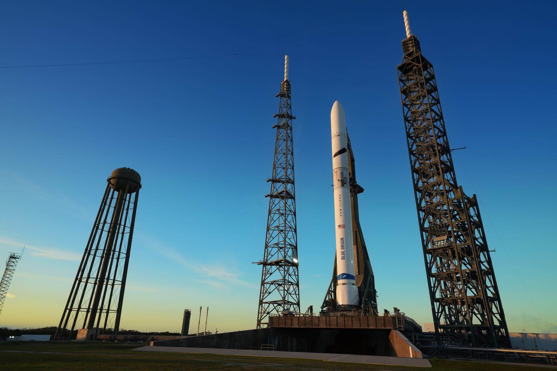
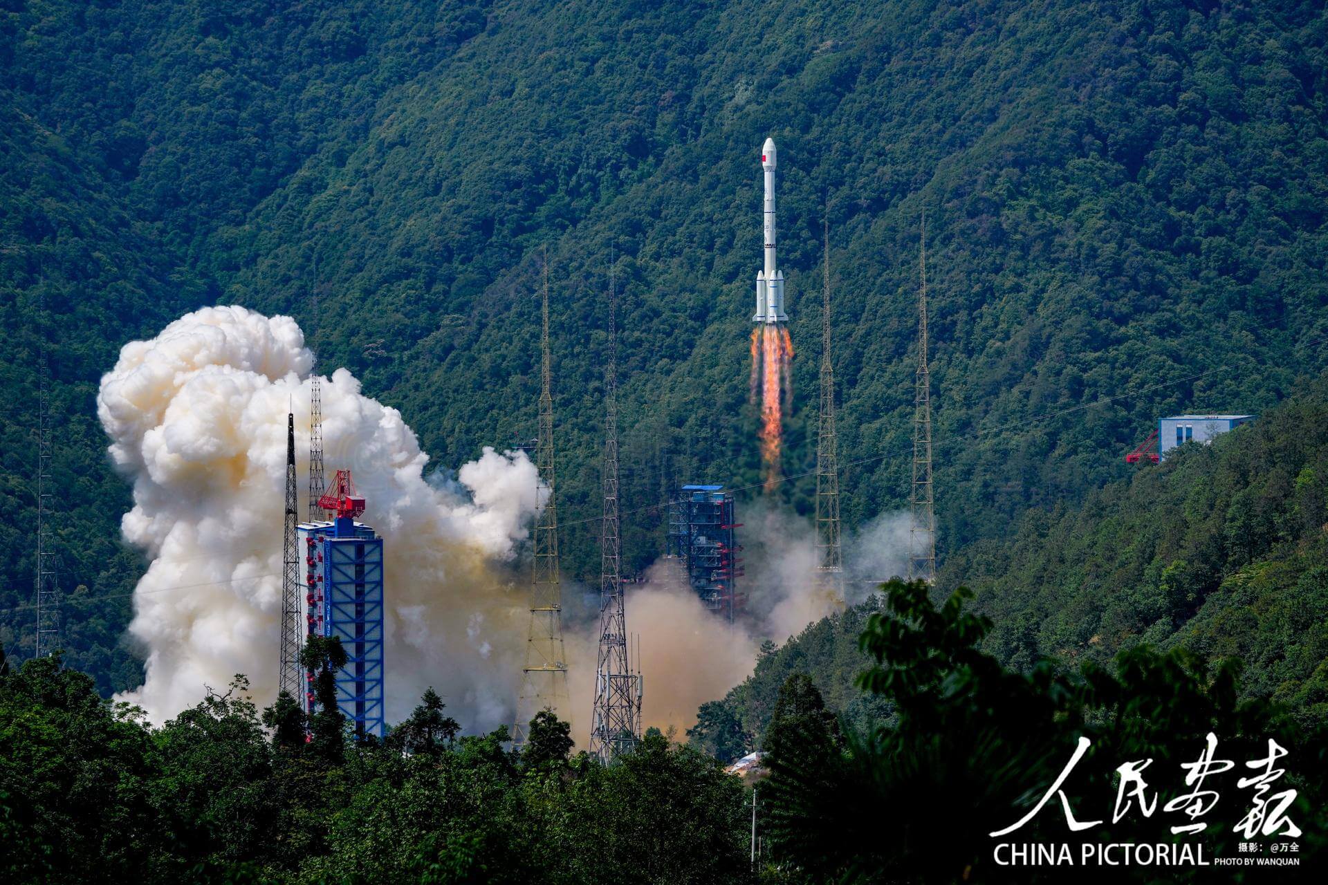
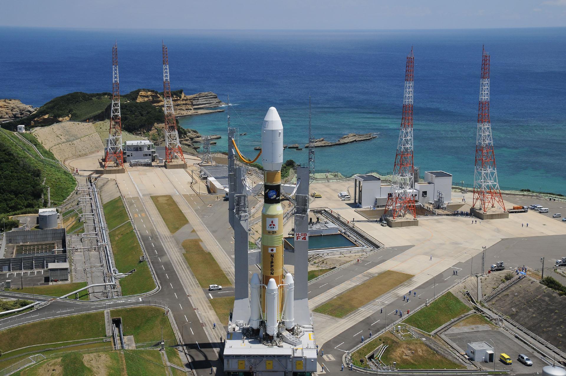
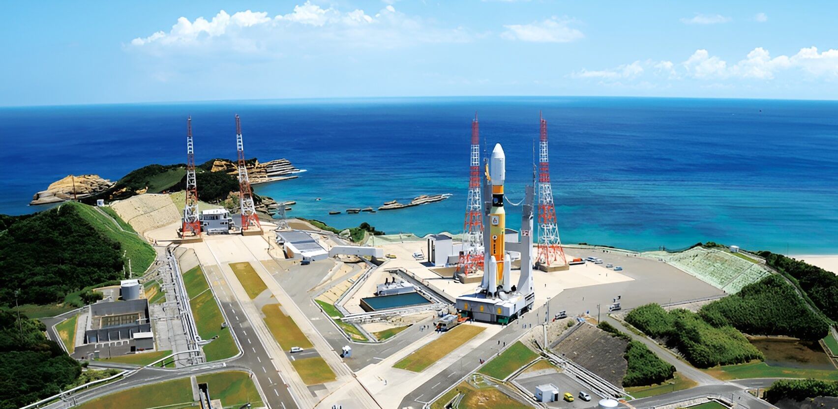
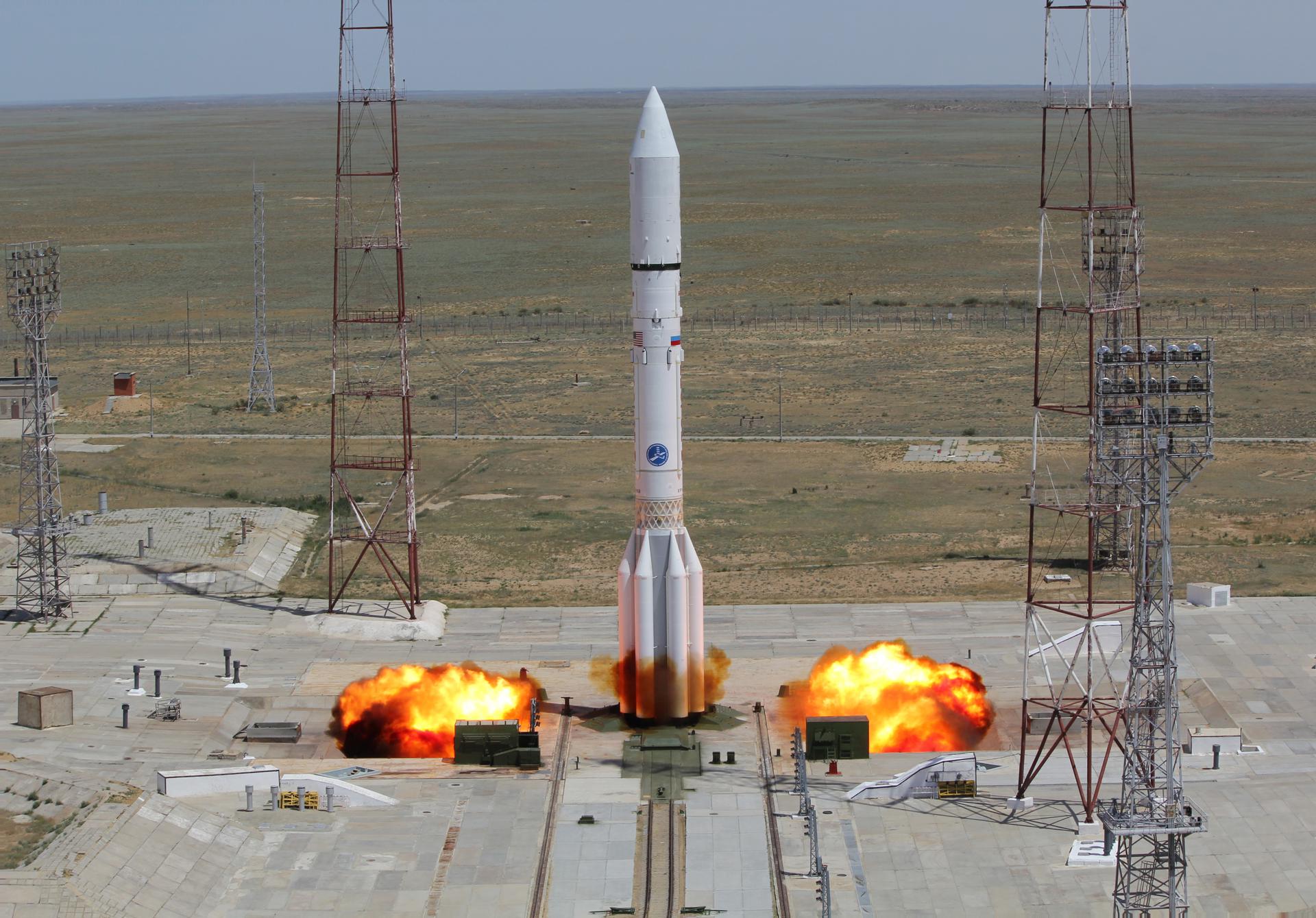
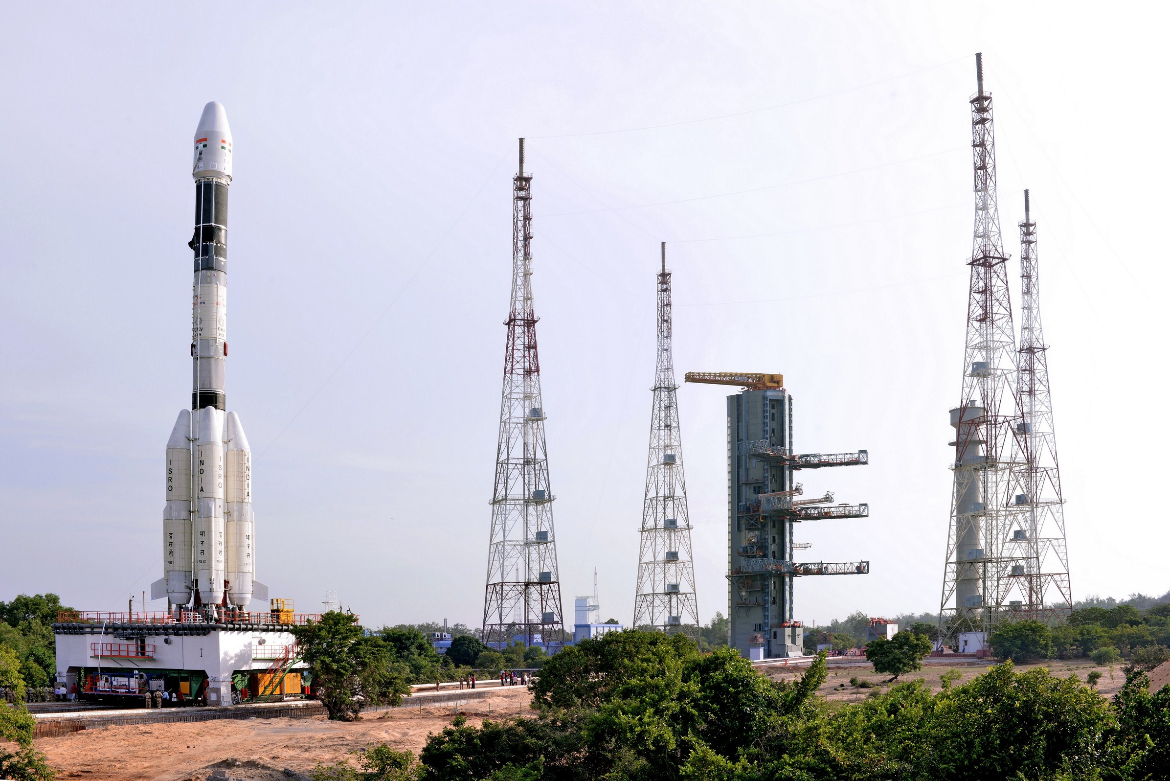
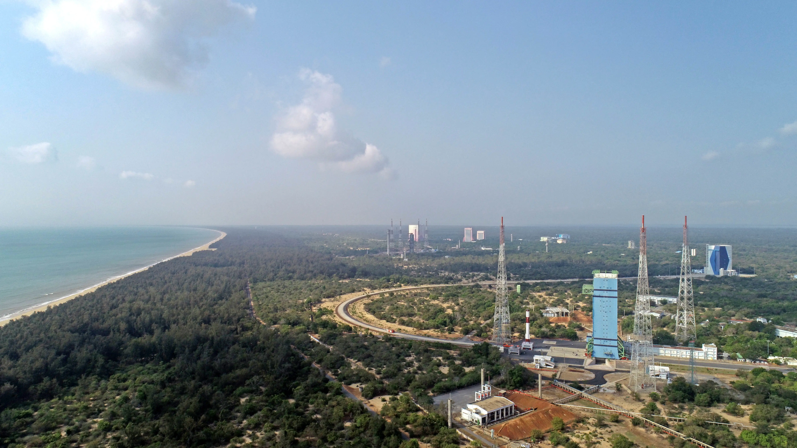
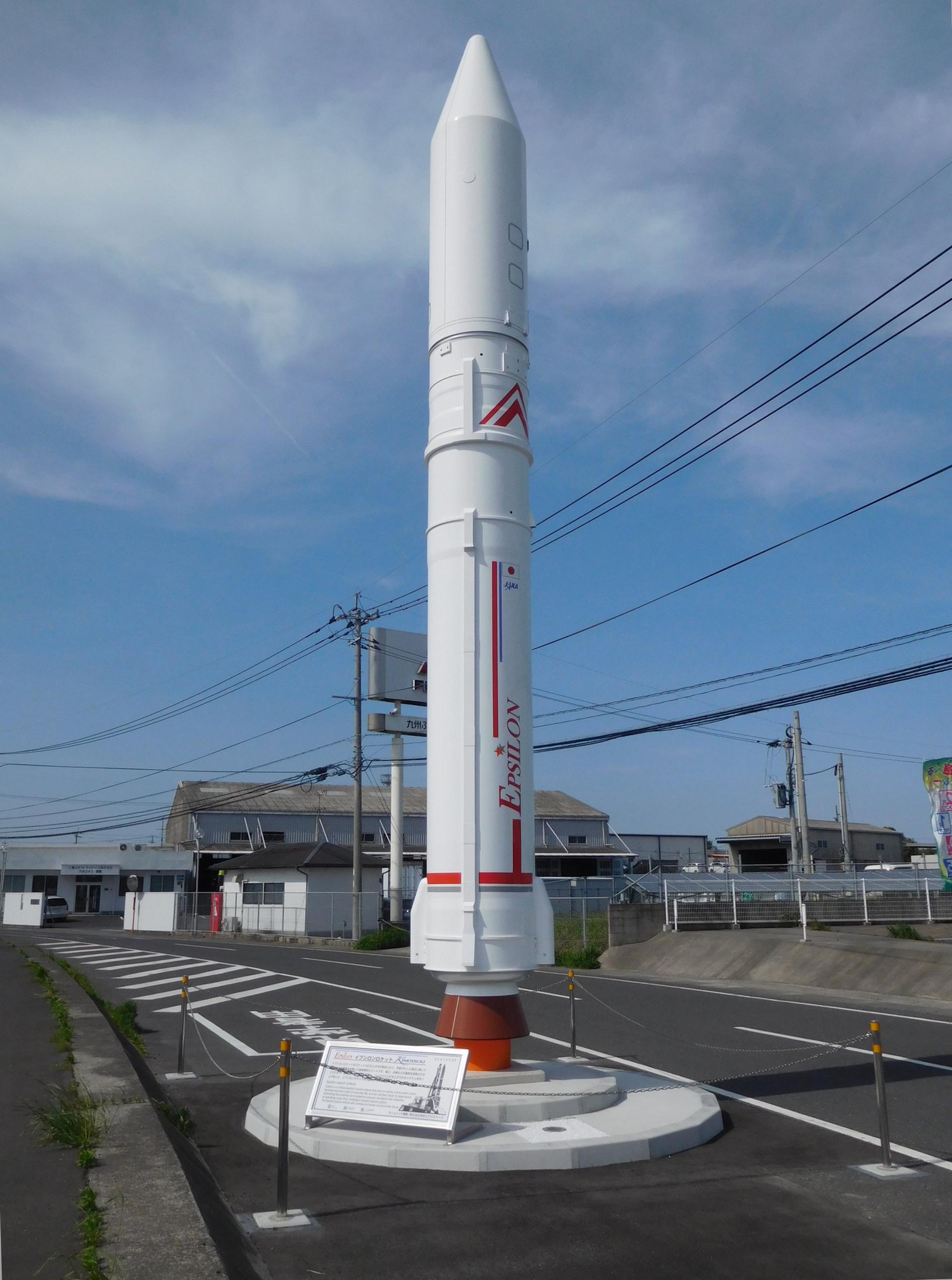
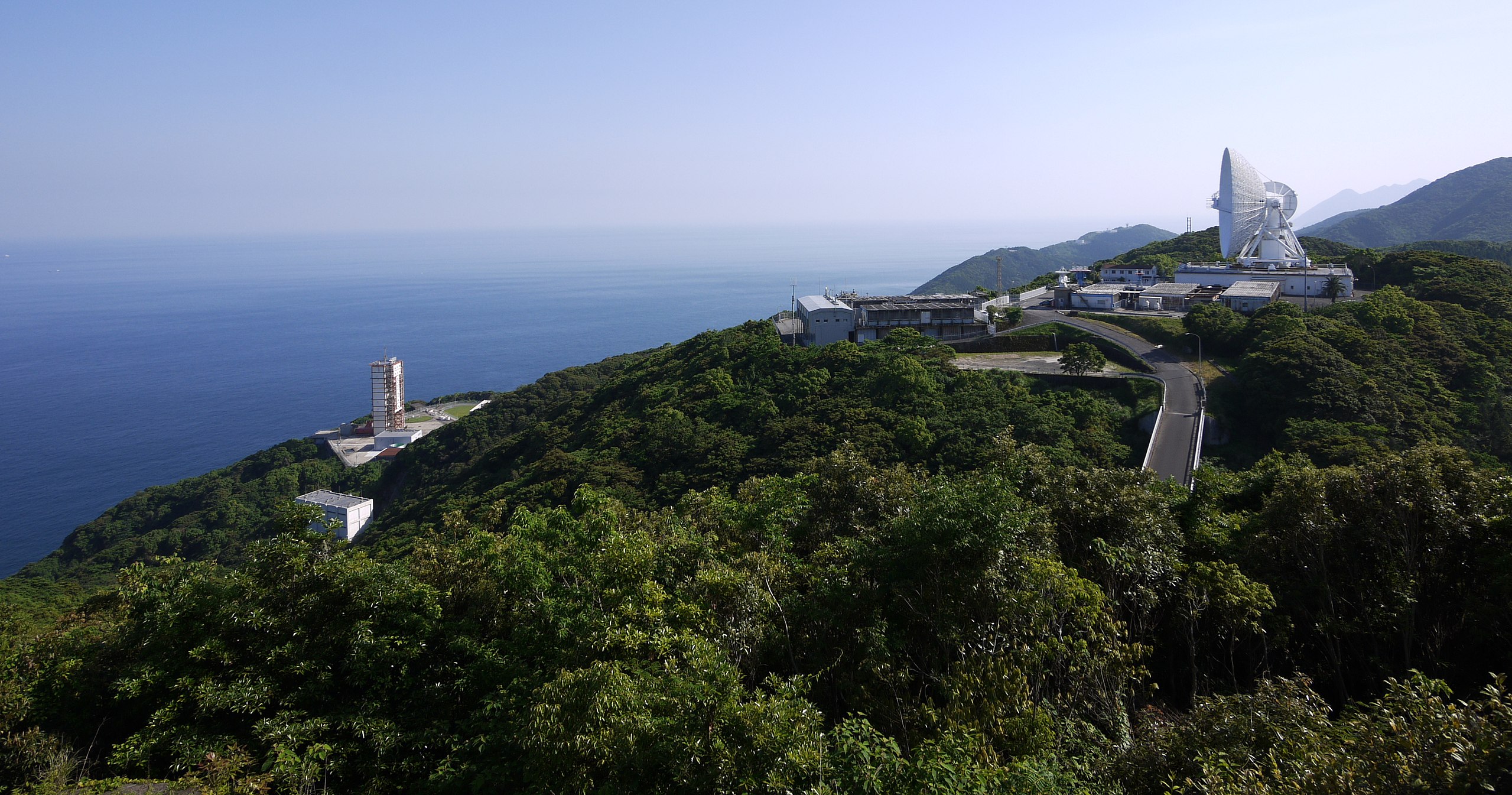