Previous Launch List
Modes
Levels of detail in the response - list, normal, detailed
Example - /launches/previous/?mode=list
Filters
Parameters - agency_launch_attempt_count, agency_launch_attempt_count__gt, agency_launch_attempt_count__gte, agency_launch_attempt_count__lt, agency_launch_attempt_count__lte, agency_launch_attempt_count_year, agency_launch_attempt_count_year__gt, agency_launch_attempt_count_year__gte, agency_launch_attempt_count_year__lt, agency_launch_attempt_count_year__lte, day, id, include_suborbital, is_crewed, last_updated__gte, last_updated__lte, launch_designator, launcher_config__id, location__ids, location_launch_attempt_count, location_launch_attempt_count__gt, location_launch_attempt_count__gte, location_launch_attempt_count__lt, location_launch_attempt_count__lte, location_launch_attempt_count_year, location_launch_attempt_count_year__gt, location_launch_attempt_count_year__gte, location_launch_attempt_count_year__lt, location_launch_attempt_count_year__lte, lsp__id, lsp__name, mission__orbit__celestial_body__id, mission__orbit__name, mission__orbit__name__icontains, month, name, net__gt, net__gte, net__lt, net__lte, orbital_launch_attempt_count, orbital_launch_attempt_count__gt, orbital_launch_attempt_count__gte, orbital_launch_attempt_count__lt, orbital_launch_attempt_count__lte, orbital_launch_attempt_count_year, orbital_launch_attempt_count_year__gt, orbital_launch_attempt_count_year__gte, orbital_launch_attempt_count_year__lt, orbital_launch_attempt_count_year__lte, pad, pad__location, pad__location__celestial_body__id, pad_launch_attempt_count, pad_launch_attempt_count__gt, pad_launch_attempt_count__gte, pad_launch_attempt_count__lt, pad_launch_attempt_count__lte, pad_launch_attempt_count_year, pad_launch_attempt_count_year__gt, pad_launch_attempt_count_year__gte, pad_launch_attempt_count_year__lt, pad_launch_attempt_count_year__lte, program, related_lsp__id, related_lsp__name, rocket__configuration__full_name, rocket__configuration__full_name__icontains, rocket__configuration__id, rocket__configuration__manufacturer__name, rocket__configuration__manufacturer__name__icontains, rocket__configuration__name, rocket__spacecraftflight__spacecraft__id, rocket__spacecraftflight__spacecraft__name, rocket__spacecraftflight__spacecraft__name__icontains, serial_number, slug, spacecraft_config__ids, status, status__ids, video_url, window_end__gt, window_end__gte, window_end__lt, window_end__lte, window_start__gt, window_start__gte, window_start__lt, window_start__lte, year
Example - /launches/previous/?pad__location=13
Search
Fields searched - launch_designator, launch_service_provider__name, mission__name, name, pad__location__name, pad__name, rocket__configuration__manufacturer__abbrev, rocket__configuration__manufacturer__name, rocket__configuration__name, rocket__spacecraftflight__spacecraft__name
Example - /launches/previous/?search=Starlink
Ordering
Fields - id, last_updated, name, net
Example - /launches/previous/?ordering=-last_updated
Number of results
Use limit to control the number of objects in the response (max 100)
Example - /launches/previous/?limit=2
Format
Switch to JSON output - /launches/previous/?format=json
Help
Find all the FAQs and support links on the documentation homepage - ll.thespacedevs.com/docs
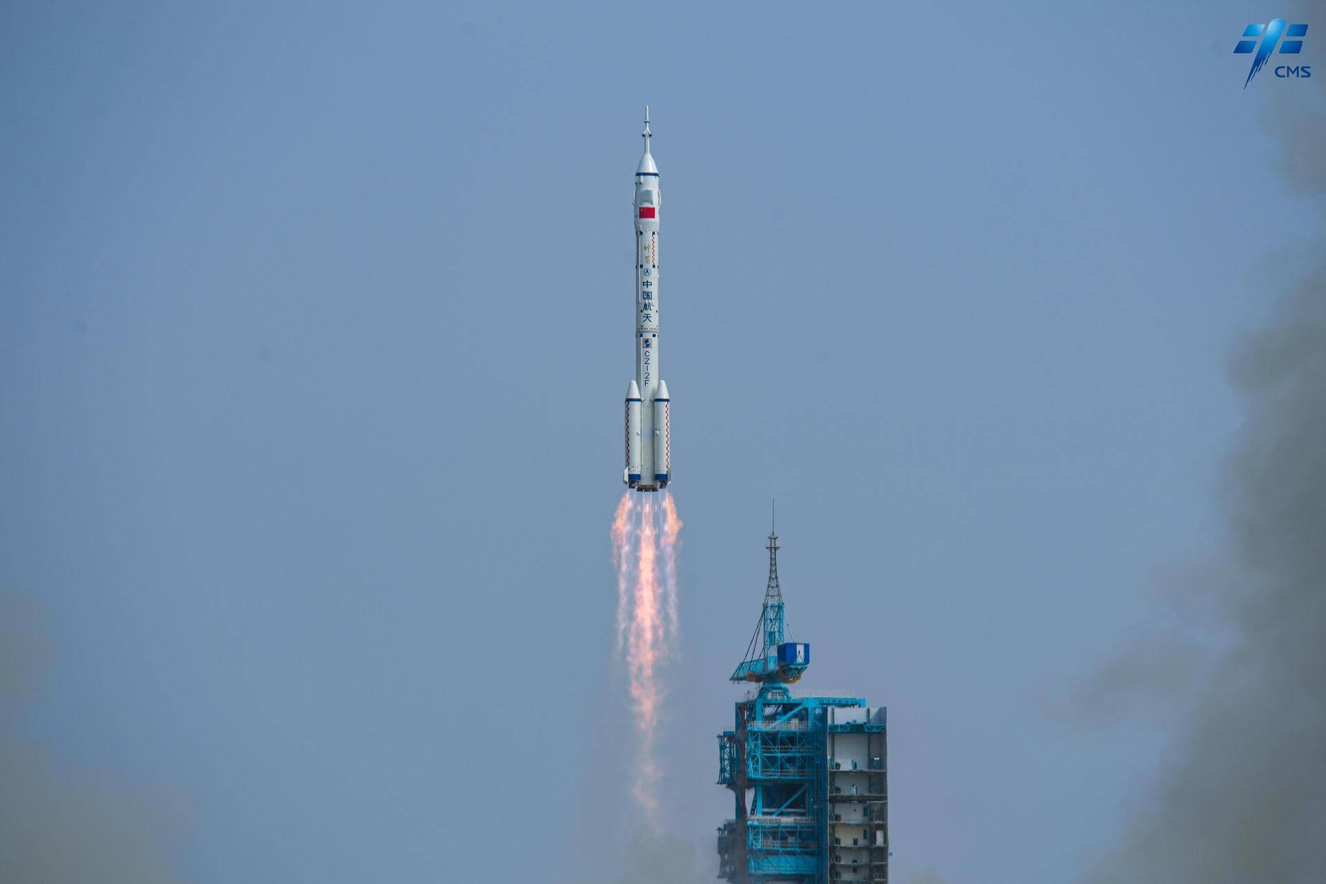
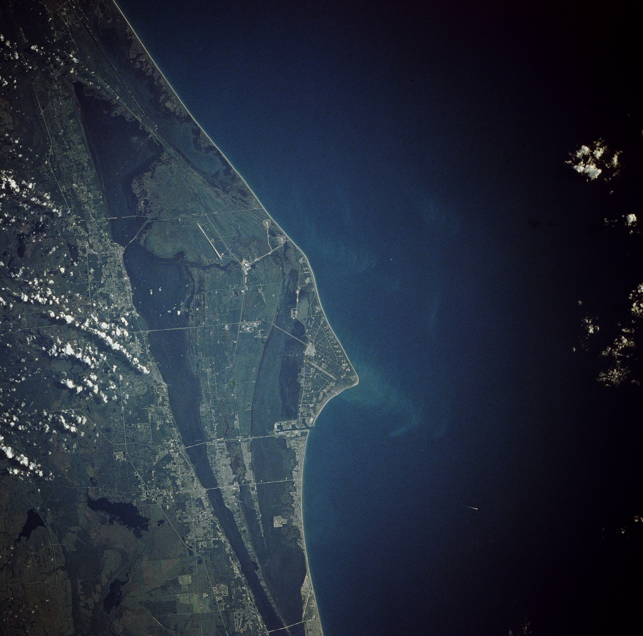
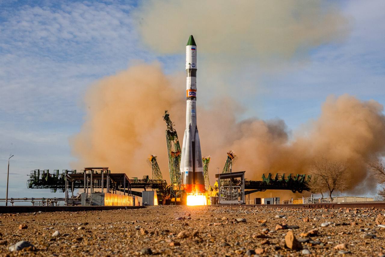
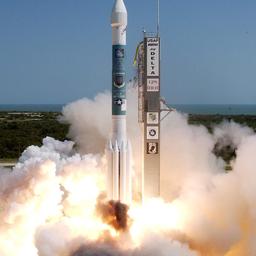
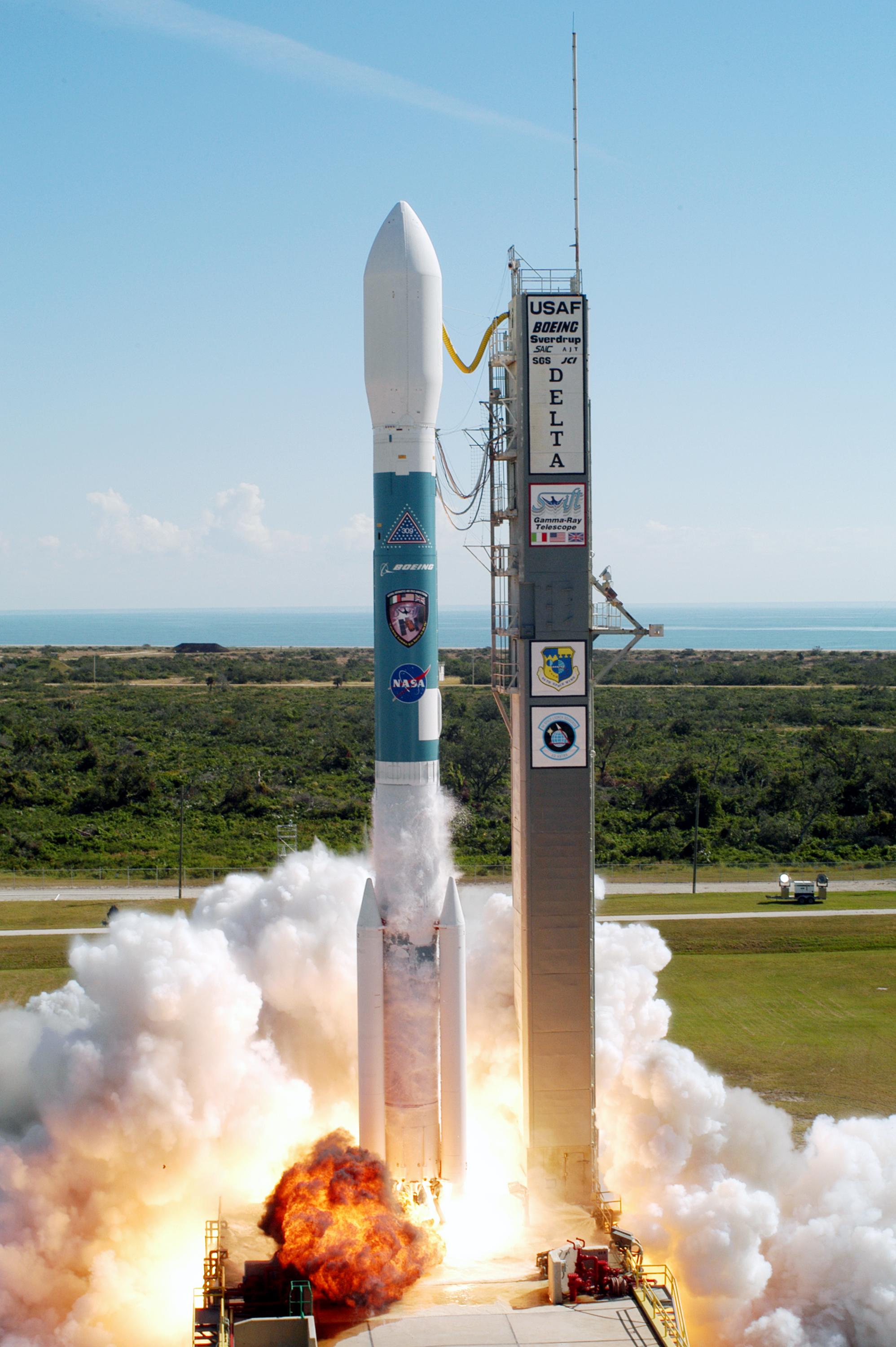
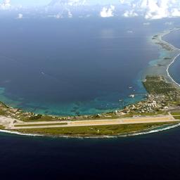
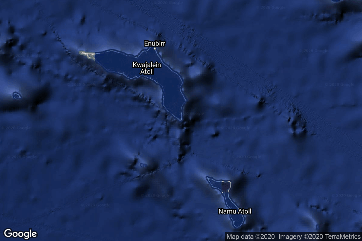
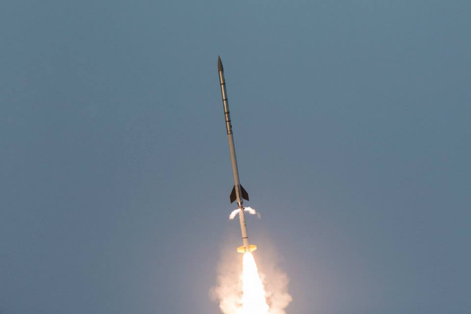
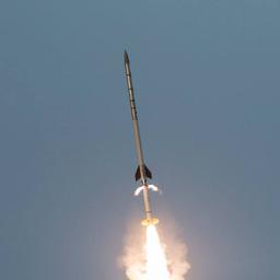
GET /2.3.0/launches/previous/?format=api&offset=7000&ordering=-id
{ "count": 7158, "next": "https://ll.thespacedevs.com/2.3.0/launches/previous/?format=api&limit=10&offset=7010&ordering=-id", "previous": "https://ll.thespacedevs.com/2.3.0/launches/previous/?format=api&limit=10&offset=6990&ordering=-id", "results": [ { "id": "0591b46e-9a74-40b8-9822-30984fe51276", "url": "https://ll.thespacedevs.com/2.3.0/launches/0591b46e-9a74-40b8-9822-30984fe51276/?format=api", "name": "Soyuz U | Yantar-4K2 50", "response_mode": "normal", "slug": "soyuz-u-yantar-4k2-50", "launch_designator": "1990-009", "status": { "id": 3, "name": "Launch Successful", "abbrev": "Success", "description": "The launch vehicle successfully inserted its payload(s) into the target orbit(s)." }, "last_updated": "2023-06-14T03:50:16Z", "net": "1990-01-25T17:15:00Z", "net_precision": null, "window_end": "1990-01-25T17:15:00Z", "window_start": "1990-01-25T17:15:00Z", "image": { "id": 1835, "name": "[AUTO] Soyuz U - image", "image_url": "https://thespacedevs-prod.nyc3.digitaloceanspaces.com/media/images/soyuz2520u_image_20190222031023.jpeg", "thumbnail_url": "https://thespacedevs-prod.nyc3.digitaloceanspaces.com/media/images/255bauto255d__image_thumbnail_20240305193909.jpeg", "credit": null, "license": { "id": 1, "name": "Unknown", "priority": 9, "link": null }, "single_use": true, "variants": [] }, "infographic": null, "probability": null, "weather_concerns": null, "failreason": null, "hashtag": null, "launch_service_provider": { "response_mode": "list", "id": 66, "url": "https://ll.thespacedevs.com/2.3.0/agencies/66/?format=api", "name": "Soviet Space Program", "abbrev": "CCCP", "type": { "id": 1, "name": "Government" } }, "rocket": { "id": 6239, "configuration": { "response_mode": "list", "id": 37, "url": "https://ll.thespacedevs.com/2.3.0/launcher_configurations/37/?format=api", "name": "Soyuz U", "families": [ { "response_mode": "list", "id": 147, "name": "Soyuz" } ], "full_name": "Soyuz U", "variant": "" } }, "mission": { "id": 4629, "name": "Yantar-4K2 50", "type": "Government/Top Secret", "description": "Film-return reconnaissance satellite", "image": null, "orbit": { "id": 8, "name": "Low Earth Orbit", "abbrev": "LEO", "celestial_body": { "response_mode": "list", "id": 1, "name": "Earth" } }, "agencies": [], "info_urls": [], "vid_urls": [] }, "pad": { "id": 35, "url": "https://ll.thespacedevs.com/2.3.0/pads/35/?format=api", "active": true, "agencies": [ { "response_mode": "normal", "id": 163, "url": "https://ll.thespacedevs.com/2.3.0/agencies/163/?format=api", "name": "Russian Aerospace Defence Forces", "abbrev": "VKO", "type": { "id": 1, "name": "Government" }, "featured": false, "country": [ { "id": 5, "name": "Russia", "alpha_2_code": "RU", "alpha_3_code": "RUS", "nationality_name": "Russian", "nationality_name_composed": "Russo" } ], "description": null, "administrator": null, "founding_year": null, "launchers": "", "spacecraft": "", "parent": "Russian Federal Space Agency (ROSCOSMOS)", "image": null, "logo": null, "social_logo": null } ], "name": "16/2", "image": null, "description": null, "info_url": null, "wiki_url": "", "map_url": "https://www.google.com/maps?q=62.960091,40.682983", "latitude": 62.960091, "longitude": 40.682983, "country": { "id": 5, "name": "Russia", "alpha_2_code": "RU", "alpha_3_code": "RUS", "nationality_name": "Russian", "nationality_name_composed": "Russo" }, "map_image": "https://thespacedevs-prod.nyc3.digitaloceanspaces.com/media/map_images/pad_35_20200803143306.jpg", "total_launch_count": 136, "orbital_launch_attempt_count": 136, "fastest_turnaround": "P3DT8H52M58S", "location": { "response_mode": "normal", "id": 6, "url": "https://ll.thespacedevs.com/2.3.0/locations/6/?format=api", "name": "Plesetsk Cosmodrome, Russian Federation", "celestial_body": { "response_mode": "normal", "id": 1, "name": "Earth", "type": { "id": 1, "name": "Planet" }, "diameter": 12742000.0, "mass": 5.972168e+24, "gravity": 9.80655, "length_of_day": "1 00:00:00", "atmosphere": true, "image": { "id": 2040, "name": "Earth (Apollo 17)", "image_url": "https://thespacedevs-prod.nyc3.digitaloceanspaces.com/media/images/earth_2528apol_image_20240402194304.jpeg", "thumbnail_url": "https://thespacedevs-prod.nyc3.digitaloceanspaces.com/media/images/earth_2528apol_image_thumbnail_20240402194305.jpeg", "credit": "NASA", "license": { "id": 4, "name": "NASA Image and Media Guidelines", "priority": 0, "link": "https://www.nasa.gov/nasa-brand-center/images-and-media/" }, "single_use": true, "variants": [] }, "description": "Earth is the third planet from the Sun and the only astronomical object known to harbor life.", "wiki_url": "https://en.wikipedia.org/wiki/Earth", "total_attempted_launches": 7147, "successful_launches": 6604, "failed_launches": 543, "total_attempted_landings": 1101, "successful_landings": 1058, "failed_landings": 43 }, "active": true, "country": { "id": 5, "name": "Russia", "alpha_2_code": "RU", "alpha_3_code": "RUS", "nationality_name": "Russian", "nationality_name_composed": "Russo" }, "description": "Plesetsk Cosmodrome is a Russian spaceport located in Mirny, Arkhangelsk Oblast, about 800 km north of Moscow and approximately 200 km south of Arkhangelsk. Originally developed as an ICBM site for the R-7 missile, it also served for numerous satellite launches using the R-7 and other rockets. Its high latitude makes it useful only for certain types of launches, especially the Molniya orbits, so for much of the site's history it functioned as a secondary location, with most orbital launches taking place from Baikonur, in the Kazakh SSR. With the end of the Soviet Union, Baikonur became a foreign territory, and Kazakhstan charged $115 million usage fees annually. Consequently, Plesetsk has seen considerably more activity since the 2000s.", "image": { "id": 1461, "name": "Soyuz 2.1b/Fregat-M liftoff from pad 43/3 (Glonass-K2 No. 13, Kosmos 2569)", "image_url": "https://thespacedevs-prod.nyc3.digitaloceanspaces.com/media/images/soyuz25202.1b_image_20230807181912.jpg", "thumbnail_url": "https://thespacedevs-prod.nyc3.digitaloceanspaces.com/media/images/255bauto255d__image_thumbnail_20240305192834.jpeg", "credit": "Mil.ru", "license": { "id": 30, "name": "CC BY 4.0", "priority": 4, "link": "https://creativecommons.org/licenses/by/4.0/" }, "single_use": false, "variants": [] }, "map_image": "https://thespacedevs-prod.nyc3.digitaloceanspaces.com/media/map_images/location_6_20200803142434.jpg", "longitude": 40.577778, "latitude": 62.925556, "timezone_name": "Europe/Moscow", "total_launch_count": 1674, "total_landing_count": 0 } }, "webcast_live": false, "program": [], "orbital_launch_attempt_count": 3485, "location_launch_attempt_count": 1297, "pad_launch_attempt_count": 83, "agency_launch_attempt_count": 2320, "orbital_launch_attempt_count_year": 9, "location_launch_attempt_count_year": 4, "pad_launch_attempt_count_year": 1, "agency_launch_attempt_count_year": 4 }, { "id": "0590c900-a351-416f-b18b-d2a212ea1b61", "url": "https://ll.thespacedevs.com/2.3.0/launches/0590c900-a351-416f-b18b-d2a212ea1b61/?format=api", "name": "Ceres-1 | Taijing-1-01 & 02", "response_mode": "normal", "slug": "ceres-1-taijing-1-01-02", "launch_designator": "2022-095", "status": { "id": 3, "name": "Launch Successful", "abbrev": "Success", "description": "The launch vehicle successfully inserted its payload(s) into the target orbit(s)." }, "last_updated": "2023-07-08T08:42:23Z", "net": "2022-08-09T04:11:00Z", "net_precision": null, "window_end": "2022-08-09T04:51:00Z", "window_start": "2022-08-09T03:56:00Z", "image": { "id": 1708, "name": "[AUTO] Ceres-1 - image", "image_url": "https://thespacedevs-prod.nyc3.digitaloceanspaces.com/media/images/ceres-1_image_20230722081939.jpeg", "thumbnail_url": "https://thespacedevs-prod.nyc3.digitaloceanspaces.com/media/images/255bauto255d__image_thumbnail_20240305193541.jpeg", "credit": null, "license": { "id": 1, "name": "Unknown", "priority": 9, "link": null }, "single_use": true, "variants": [] }, "infographic": null, "probability": null, "weather_concerns": null, "failreason": "", "hashtag": null, "launch_service_provider": { "response_mode": "list", "id": 1021, "url": "https://ll.thespacedevs.com/2.3.0/agencies/1021/?format=api", "name": "Galactic Energy", "abbrev": "GE", "type": { "id": 3, "name": "Commercial" } }, "rocket": { "id": 7622, "configuration": { "response_mode": "list", "id": 461, "url": "https://ll.thespacedevs.com/2.3.0/launcher_configurations/461/?format=api", "name": "Ceres-1", "families": [ { "response_mode": "list", "id": 2, "name": "Ceres-1" } ], "full_name": "Ceres-1", "variant": "Ceres-1" } }, "mission": { "id": 6122, "name": "Taijing-1-01 & 02", "type": "Earth Science", "description": "Two commercial Earth observation satellites built by Minospace.", "image": null, "orbit": { "id": 17, "name": "Sun-Synchronous Orbit", "abbrev": "SSO", "celestial_body": { "response_mode": "list", "id": 1, "name": "Earth" } }, "agencies": [], "info_urls": [], "vid_urls": [] }, "pad": { "id": 21, "url": "https://ll.thespacedevs.com/2.3.0/pads/21/?format=api", "active": true, "agencies": [], "name": "Launch Area 95A", "image": { "id": 1329, "name": "Ceres-1 liftoff from LA-95A (Jilin-1 High Resolution 03D-08, 51 to 54)", "image_url": "https://thespacedevs-prod.nyc3.digitaloceanspaces.com/media/images/ceres-1252025_image_20230703100031.jpeg", "thumbnail_url": "https://thespacedevs-prod.nyc3.digitaloceanspaces.com/media/images/255bauto255d__image_thumbnail_20240305192423.jpeg", "credit": "Galactic Energy", "license": { "id": 1, "name": "Unknown", "priority": 9, "link": null }, "single_use": false, "variants": [] }, "description": "", "info_url": null, "wiki_url": "https://en.wikipedia.org/wiki/Jiuquan_Satellite_Launch_Center", "map_url": "https://www.google.com/maps?q=40.969117,100.343333", "latitude": 40.969117, "longitude": 100.343333, "country": { "id": 6, "name": "China", "alpha_2_code": "CN", "alpha_3_code": "CHN", "nationality_name": "Chinese", "nationality_name_composed": "Sino" }, "map_image": "https://thespacedevs-prod.nyc3.digitaloceanspaces.com/media/map_images/pad_21_20200803143253.jpg", "total_launch_count": 59, "orbital_launch_attempt_count": 59, "fastest_turnaround": "P2DT1H47M", "location": { "response_mode": "normal", "id": 17, "url": "https://ll.thespacedevs.com/2.3.0/locations/17/?format=api", "name": "Jiuquan Satellite Launch Center, People's Republic of China", "celestial_body": { "response_mode": "normal", "id": 1, "name": "Earth", "type": { "id": 1, "name": "Planet" }, "diameter": 12742000.0, "mass": 5.972168e+24, "gravity": 9.80655, "length_of_day": "1 00:00:00", "atmosphere": true, "image": { "id": 2040, "name": "Earth (Apollo 17)", "image_url": "https://thespacedevs-prod.nyc3.digitaloceanspaces.com/media/images/earth_2528apol_image_20240402194304.jpeg", "thumbnail_url": "https://thespacedevs-prod.nyc3.digitaloceanspaces.com/media/images/earth_2528apol_image_thumbnail_20240402194305.jpeg", "credit": "NASA", "license": { "id": 4, "name": "NASA Image and Media Guidelines", "priority": 0, "link": "https://www.nasa.gov/nasa-brand-center/images-and-media/" }, "single_use": true, "variants": [] }, "description": "Earth is the third planet from the Sun and the only astronomical object known to harbor life.", "wiki_url": "https://en.wikipedia.org/wiki/Earth", "total_attempted_launches": 7147, "successful_launches": 6604, "failed_launches": 543, "total_attempted_landings": 1101, "successful_landings": 1058, "failed_landings": 43 }, "active": true, "country": { "id": 6, "name": "China", "alpha_2_code": "CN", "alpha_3_code": "CHN", "nationality_name": "Chinese", "nationality_name_composed": "Sino" }, "description": "Jiuquan Satellite Launch Center is a Chinese spaceport located between the Ejin, Alxa, Inner Mongolia and Hangtian Town, Jinta County, Jiuquan, Gansu Province. It is part of the Dongfeng Aerospace City (Base 10).", "image": { "id": 1374, "name": "Long March 2F/G liftoff (Shenzhou 16)", "image_url": "https://thespacedevs-prod.nyc3.digitaloceanspaces.com/media/images/long2520march_image_20240101085213.jpeg", "thumbnail_url": "https://thespacedevs-prod.nyc3.digitaloceanspaces.com/media/images/255bauto255d__image_thumbnail_20240305192548.jpeg", "credit": "CMS", "license": { "id": 1, "name": "Unknown", "priority": 9, "link": null }, "single_use": false, "variants": [] }, "map_image": "https://thespacedevs-prod.nyc3.digitaloceanspaces.com/media/map_images/location_17_20200803142429.jpg", "longitude": 100.291111, "latitude": 40.958056, "timezone_name": "Asia/Shanghai", "total_launch_count": 248, "total_landing_count": 0 } }, "webcast_live": false, "program": [], "orbital_launch_attempt_count": 6281, "location_launch_attempt_count": 171, "pad_launch_attempt_count": 32, "agency_launch_attempt_count": 3, "orbital_launch_attempt_count_year": 99, "location_launch_attempt_count_year": 14, "pad_launch_attempt_count_year": 4, "agency_launch_attempt_count_year": 1 }, { "id": "0590523c-4b00-445a-bdb7-2970f04c24ce", "url": "https://ll.thespacedevs.com/2.3.0/launches/0590523c-4b00-445a-bdb7-2970f04c24ce/?format=api", "name": "Atlas LV-3A | Ranger 1", "response_mode": "normal", "slug": "atlas-lv-3a-ranger-1", "launch_designator": "1961-021", "status": { "id": 7, "name": "Launch was a Partial Failure", "abbrev": "Partial Failure", "description": "Either the launch vehicle reached orbit but did not deliver its payload in the targeted orbit, or an exceptional event made it impossible to consider the mission a success." }, "last_updated": "2023-06-14T17:40:09Z", "net": "1961-08-23T10:04:10Z", "net_precision": null, "window_end": "1961-08-23T10:04:10Z", "window_start": "1961-08-23T10:04:10Z", "image": null, "infographic": null, "probability": 0, "weather_concerns": null, "failreason": "", "hashtag": "", "launch_service_provider": { "response_mode": "list", "id": 161, "url": "https://ll.thespacedevs.com/2.3.0/agencies/161/?format=api", "name": "United States Air Force", "abbrev": "USAF", "type": { "id": 1, "name": "Government" } }, "rocket": { "id": 2388, "configuration": { "response_mode": "list", "id": 183, "url": "https://ll.thespacedevs.com/2.3.0/launcher_configurations/183/?format=api", "name": "Atlas Agena B", "families": [ { "response_mode": "list", "id": 66, "name": "Atlas" } ], "full_name": "Atlas LV-3 Agena B", "variant": "LV-3 Agena B" } }, "mission": null, "pad": { "id": 99, "url": "https://ll.thespacedevs.com/2.3.0/pads/99/?format=api", "active": true, "agencies": [ { "response_mode": "normal", "id": 161, "url": "https://ll.thespacedevs.com/2.3.0/agencies/161/?format=api", "name": "United States Air Force", "abbrev": "USAF", "type": { "id": 1, "name": "Government" }, "featured": false, "country": [ { "id": 2, "name": "United States of America", "alpha_2_code": "US", "alpha_3_code": "USA", "nationality_name": "American", "nationality_name_composed": "Americano" } ], "description": "The United States Air Force (USAF) is the air service branch of the United States Armed Forces, and is one of the eight uniformed services of the United States. Originally created on 1 August 1907, as a part of the United States Army Signal Corps, the USAF was established as a separate branch of the United States Armed Forces in 1947 with the enactment of the National Security Act of 1947.", "administrator": "Commander-in-Chief: President of the US", "founding_year": 1947, "launchers": "", "spacecraft": "", "parent": null, "image": null, "logo": { "id": 193, "name": "[AUTO] United States Air Force - logo", "image_url": "https://thespacedevs-prod.nyc3.digitaloceanspaces.com/media/images/united2520states2520air2520force_logo_20230804084626.png", "thumbnail_url": "https://thespacedevs-prod.nyc3.digitaloceanspaces.com/media/images/255bauto255d__image_thumbnail_20240305185152.png", "credit": null, "license": { "id": 1, "name": "Unknown", "priority": 9, "link": null }, "single_use": true, "variants": [] }, "social_logo": { "id": 99, "name": "[AUTO] United States Air Force - social_logo", "image_url": "https://thespacedevs-prod.nyc3.digitaloceanspaces.com/media/images/united2520states2520air2520force_nation_20230804085132.jpg", "thumbnail_url": "https://thespacedevs-prod.nyc3.digitaloceanspaces.com/media/images/255bauto255d__image_thumbnail_20240305184855.jpeg", "credit": null, "license": { "id": 1, "name": "Unknown", "priority": 9, "link": null }, "single_use": true, "variants": [] } } ], "name": "Launch Complex 12", "image": null, "description": null, "info_url": null, "wiki_url": "https://en.wikipedia.org/wiki/Cape_Canaveral_Air_Force_Station_Launch_Complex_12", "map_url": "https://www.google.com/maps?q=28.480607,-80.541938", "latitude": 28.480607, "longitude": -80.541938, "country": { "id": 2, "name": "United States of America", "alpha_2_code": "US", "alpha_3_code": "USA", "nationality_name": "American", "nationality_name_composed": "Americano" }, "map_image": "https://thespacedevs-prod.nyc3.digitaloceanspaces.com/media/map_images/pad_99_20200803143435.jpg", "total_launch_count": 23, "orbital_launch_attempt_count": 21, "fastest_turnaround": "P32DT4H32M2S", "location": { "response_mode": "normal", "id": 12, "url": "https://ll.thespacedevs.com/2.3.0/locations/12/?format=api", "name": "Cape Canaveral SFS, FL, USA", "celestial_body": { "response_mode": "normal", "id": 1, "name": "Earth", "type": { "id": 1, "name": "Planet" }, "diameter": 12742000.0, "mass": 5.972168e+24, "gravity": 9.80655, "length_of_day": "1 00:00:00", "atmosphere": true, "image": { "id": 2040, "name": "Earth (Apollo 17)", "image_url": "https://thespacedevs-prod.nyc3.digitaloceanspaces.com/media/images/earth_2528apol_image_20240402194304.jpeg", "thumbnail_url": "https://thespacedevs-prod.nyc3.digitaloceanspaces.com/media/images/earth_2528apol_image_thumbnail_20240402194305.jpeg", "credit": "NASA", "license": { "id": 4, "name": "NASA Image and Media Guidelines", "priority": 0, "link": "https://www.nasa.gov/nasa-brand-center/images-and-media/" }, "single_use": true, "variants": [] }, "description": "Earth is the third planet from the Sun and the only astronomical object known to harbor life.", "wiki_url": "https://en.wikipedia.org/wiki/Earth", "total_attempted_launches": 7147, "successful_launches": 6604, "failed_launches": 543, "total_attempted_landings": 1101, "successful_landings": 1058, "failed_landings": 43 }, "active": true, "country": { "id": 2, "name": "United States of America", "alpha_2_code": "US", "alpha_3_code": "USA", "nationality_name": "American", "nationality_name_composed": "Americano" }, "description": "Cape Canaveral Space Force Station (CCSFS) is an installation of the United States Space Force's Space Launch Delta 45, located on Cape Canaveral in Brevard County, Florida.", "image": { "id": 2200, "name": "Cape Canaveral & KSC seen from orbit (STS-43)", "image_url": "https://thespacedevs-prod.nyc3.digitaloceanspaces.com/media/images/cape_canaveral__image_20240918151615.jpg", "thumbnail_url": "https://thespacedevs-prod.nyc3.digitaloceanspaces.com/media/images/cape_canaveral__image_thumbnail_20240918151616.jpeg", "credit": "NASA", "license": { "id": 4, "name": "NASA Image and Media Guidelines", "priority": 0, "link": "https://www.nasa.gov/nasa-brand-center/images-and-media/" }, "single_use": true, "variants": [] }, "map_image": "https://thespacedevs-prod.nyc3.digitaloceanspaces.com/media/map_images/location_12_20200803142519.jpg", "longitude": -80.577778, "latitude": 28.488889, "timezone_name": "America/New_York", "total_launch_count": 1019, "total_landing_count": 64 } }, "webcast_live": false, "program": [], "orbital_launch_attempt_count": 121, "location_launch_attempt_count": 66, "pad_launch_attempt_count": 3, "agency_launch_attempt_count": 56, "orbital_launch_attempt_count_year": 121, "location_launch_attempt_count_year": 16, "pad_launch_attempt_count_year": 1, "agency_launch_attempt_count_year": 18 }, { "id": "057d67df-fdee-4a69-9980-f07950ffda87", "url": "https://ll.thespacedevs.com/2.3.0/launches/057d67df-fdee-4a69-9980-f07950ffda87/?format=api", "name": "Voskhod | Zenit-2M 54", "response_mode": "normal", "slug": "voskhod-zenit-2m-54", "launch_designator": "1975-002", "status": { "id": 3, "name": "Launch Successful", "abbrev": "Success", "description": "The launch vehicle successfully inserted its payload(s) into the target orbit(s)." }, "last_updated": "2023-06-14T03:41:32Z", "net": "1975-01-17T09:00:00Z", "net_precision": null, "window_end": "1975-01-17T09:00:00Z", "window_start": "1975-01-17T09:00:00Z", "image": null, "infographic": null, "probability": null, "weather_concerns": null, "failreason": null, "hashtag": null, "launch_service_provider": { "response_mode": "list", "id": 66, "url": "https://ll.thespacedevs.com/2.3.0/agencies/66/?format=api", "name": "Soviet Space Program", "abbrev": "CCCP", "type": { "id": 1, "name": "Government" } }, "rocket": { "id": 4541, "configuration": { "response_mode": "list", "id": 104, "url": "https://ll.thespacedevs.com/2.3.0/launcher_configurations/104/?format=api", "name": "Voskhod", "families": [ { "response_mode": "list", "id": 122, "name": "R-7" } ], "full_name": "Voskhod", "variant": "Voskhod" } }, "mission": { "id": 2959, "name": "Zenit-2M 54", "type": "Government/Top Secret", "description": "The soviet Zenit-2M (Gektor, 11F690) was an improved version of the Zenit-2 area surveillance reconnaissance satellite. It was part of the Vostok-based Zenit-family.", "image": null, "orbit": { "id": 8, "name": "Low Earth Orbit", "abbrev": "LEO", "celestial_body": { "response_mode": "list", "id": 1, "name": "Earth" } }, "agencies": [], "info_urls": [], "vid_urls": [] }, "pad": { "id": 20, "url": "https://ll.thespacedevs.com/2.3.0/pads/20/?format=api", "active": true, "agencies": [], "name": "31/6", "image": { "id": 1467, "name": "Soyuz 2.1a liftoff from pad 31/6 (Progress MS-25)", "image_url": "https://thespacedevs-prod.nyc3.digitaloceanspaces.com/media/images/soyuz25202.1a_image_20231231162517.jpg", "thumbnail_url": "https://thespacedevs-prod.nyc3.digitaloceanspaces.com/media/images/255bauto255d__image_thumbnail_20240305192846.jpeg", "credit": "Roscosmos", "license": { "id": 14, "name": "Roscosmos Image Use Policy", "priority": 3, "link": "https://www.roscosmos.ru/22650/" }, "single_use": true, "variants": [] }, "description": "", "info_url": null, "wiki_url": "https://en.wikipedia.org/wiki/Baikonur_Cosmodrome_Site_31", "map_url": "https://www.google.com/maps?q=45.996034,63.564003", "latitude": 45.996034, "longitude": 63.564003, "country": { "id": 44, "name": "Kazakhstan", "alpha_2_code": "KZ", "alpha_3_code": "KAZ", "nationality_name": "Kazakh", "nationality_name_composed": "Kazakhstani" }, "map_image": "https://thespacedevs-prod.nyc3.digitaloceanspaces.com/media/map_images/pad_20_20200803143516.jpg", "total_launch_count": 422, "orbital_launch_attempt_count": 422, "fastest_turnaround": "P1DT23H9M9S", "location": { "response_mode": "normal", "id": 15, "url": "https://ll.thespacedevs.com/2.3.0/locations/15/?format=api", "name": "Baikonur Cosmodrome, Republic of Kazakhstan", "celestial_body": { "response_mode": "normal", "id": 1, "name": "Earth", "type": { "id": 1, "name": "Planet" }, "diameter": 12742000.0, "mass": 5.972168e+24, "gravity": 9.80655, "length_of_day": "1 00:00:00", "atmosphere": true, "image": { "id": 2040, "name": "Earth (Apollo 17)", "image_url": "https://thespacedevs-prod.nyc3.digitaloceanspaces.com/media/images/earth_2528apol_image_20240402194304.jpeg", "thumbnail_url": "https://thespacedevs-prod.nyc3.digitaloceanspaces.com/media/images/earth_2528apol_image_thumbnail_20240402194305.jpeg", "credit": "NASA", "license": { "id": 4, "name": "NASA Image and Media Guidelines", "priority": 0, "link": "https://www.nasa.gov/nasa-brand-center/images-and-media/" }, "single_use": true, "variants": [] }, "description": "Earth is the third planet from the Sun and the only astronomical object known to harbor life.", "wiki_url": "https://en.wikipedia.org/wiki/Earth", "total_attempted_launches": 7147, "successful_launches": 6604, "failed_launches": 543, "total_attempted_landings": 1101, "successful_landings": 1058, "failed_landings": 43 }, "active": true, "country": { "id": 44, "name": "Kazakhstan", "alpha_2_code": "KZ", "alpha_3_code": "KAZ", "nationality_name": "Kazakh", "nationality_name_composed": "Kazakhstani" }, "description": "The Baikonur Cosmodrome is a spaceport operated by Russia within Kazakhstan. Located in the Kazakh city of Baikonur, it is the largest operational space launch facility in terms of area. All Russian crewed spaceflights are launched from Baikonur.", "image": { "id": 2198, "name": "Soyuz launch pad at the Baikonur Cosmodrome", "image_url": "https://thespacedevs-prod.nyc3.digitaloceanspaces.com/media/images/soyuz_launch_pa_image_20240918150530.jpg", "thumbnail_url": "https://thespacedevs-prod.nyc3.digitaloceanspaces.com/media/images/soyuz_launch_pa_image_thumbnail_20240918150530.jpeg", "credit": "NASA/Bill Ingalls", "license": { "id": 4, "name": "NASA Image and Media Guidelines", "priority": 0, "link": "https://www.nasa.gov/nasa-brand-center/images-and-media/" }, "single_use": true, "variants": [] }, "map_image": "https://thespacedevs-prod.nyc3.digitaloceanspaces.com/media/map_images/location_15_20200803142517.jpg", "longitude": 63.305, "latitude": 45.965, "timezone_name": "Asia/Qyzylorda", "total_launch_count": 1555, "total_landing_count": 0 } }, "webcast_live": false, "program": [], "orbital_launch_attempt_count": 1653, "location_launch_attempt_count": 417, "pad_launch_attempt_count": 157, "agency_launch_attempt_count": 888, "orbital_launch_attempt_count_year": 2, "location_launch_attempt_count_year": 2, "pad_launch_attempt_count_year": 1, "agency_launch_attempt_count_year": 2 }, { "id": "05785a92-a310-49c5-abb2-d254834dc44e", "url": "https://ll.thespacedevs.com/2.3.0/launches/05785a92-a310-49c5-abb2-d254834dc44e/?format=api", "name": "Thor Agena D | KH-4 18", "response_mode": "normal", "slug": "thor-agena-d-kh-4-18", "launch_designator": "1963-002", "status": { "id": 3, "name": "Launch Successful", "abbrev": "Success", "description": "The launch vehicle successfully inserted its payload(s) into the target orbit(s)." }, "last_updated": "2023-06-14T04:18:59Z", "net": "1963-01-07T21:09:49Z", "net_precision": null, "window_end": "1963-01-07T21:09:49Z", "window_start": "1963-01-07T21:09:49Z", "image": null, "infographic": null, "probability": null, "weather_concerns": null, "failreason": null, "hashtag": null, "launch_service_provider": { "response_mode": "list", "id": 161, "url": "https://ll.thespacedevs.com/2.3.0/agencies/161/?format=api", "name": "United States Air Force", "abbrev": "USAF", "type": { "id": 1, "name": "Government" } }, "rocket": { "id": 3182, "configuration": { "response_mode": "list", "id": 393, "url": "https://ll.thespacedevs.com/2.3.0/launcher_configurations/393/?format=api", "name": "Thor Agena D", "families": [ { "response_mode": "list", "id": 73, "name": "Thor" }, { "response_mode": "list", "id": 193, "name": "Thor-Agena" } ], "full_name": "Thor Agena D", "variant": "Agena D" } }, "mission": { "id": 1604, "name": "KH-4 18", "type": "Government/Top Secret", "description": "The KH-4 (Keyhole-4) was fourth version in the Corona-program to build an optical reconnaissance satellite.", "image": null, "orbit": { "id": 8, "name": "Low Earth Orbit", "abbrev": "LEO", "celestial_body": { "response_mode": "list", "id": 1, "name": "Earth" } }, "agencies": [], "info_urls": [], "vid_urls": [] }, "pad": { "id": 98, "url": "https://ll.thespacedevs.com/2.3.0/pads/98/?format=api", "active": false, "agencies": [ { "response_mode": "normal", "id": 161, "url": "https://ll.thespacedevs.com/2.3.0/agencies/161/?format=api", "name": "United States Air Force", "abbrev": "USAF", "type": { "id": 1, "name": "Government" }, "featured": false, "country": [ { "id": 2, "name": "United States of America", "alpha_2_code": "US", "alpha_3_code": "USA", "nationality_name": "American", "nationality_name_composed": "Americano" } ], "description": "The United States Air Force (USAF) is the air service branch of the United States Armed Forces, and is one of the eight uniformed services of the United States. Originally created on 1 August 1907, as a part of the United States Army Signal Corps, the USAF was established as a separate branch of the United States Armed Forces in 1947 with the enactment of the National Security Act of 1947.", "administrator": "Commander-in-Chief: President of the US", "founding_year": 1947, "launchers": "", "spacecraft": "", "parent": null, "image": null, "logo": { "id": 193, "name": "[AUTO] United States Air Force - logo", "image_url": "https://thespacedevs-prod.nyc3.digitaloceanspaces.com/media/images/united2520states2520air2520force_logo_20230804084626.png", "thumbnail_url": "https://thespacedevs-prod.nyc3.digitaloceanspaces.com/media/images/255bauto255d__image_thumbnail_20240305185152.png", "credit": null, "license": { "id": 1, "name": "Unknown", "priority": 9, "link": null }, "single_use": true, "variants": [] }, "social_logo": { "id": 99, "name": "[AUTO] United States Air Force - social_logo", "image_url": "https://thespacedevs-prod.nyc3.digitaloceanspaces.com/media/images/united2520states2520air2520force_nation_20230804085132.jpg", "thumbnail_url": "https://thespacedevs-prod.nyc3.digitaloceanspaces.com/media/images/255bauto255d__image_thumbnail_20240305184855.jpeg", "credit": null, "license": { "id": 1, "name": "Unknown", "priority": 9, "link": null }, "single_use": true, "variants": [] } } ], "name": "Space Launch Complex 2E", "image": null, "description": "SLC-2E, was used for Delta, Thor-Agena and Thorad launches between 1966 and 1972 and has been demolished", "info_url": null, "wiki_url": "https://en.wikipedia.org/wiki/Vandenberg_Space_Launch_Complex_2", "map_url": "https://www.google.com/maps?q=34.7516,-120.6192", "latitude": 34.7516, "longitude": -120.6192, "country": { "id": 2, "name": "United States of America", "alpha_2_code": "US", "alpha_3_code": "USA", "nationality_name": "American", "nationality_name_composed": "Americano" }, "map_image": "https://thespacedevs-prod.nyc3.digitaloceanspaces.com/media/map_images/pad_98_20200803143228.jpg", "total_launch_count": 47, "orbital_launch_attempt_count": 47, "fastest_turnaround": "P25DT17H2M49S", "location": { "response_mode": "normal", "id": 11, "url": "https://ll.thespacedevs.com/2.3.0/locations/11/?format=api", "name": "Vandenberg SFB, CA, USA", "celestial_body": { "response_mode": "normal", "id": 1, "name": "Earth", "type": { "id": 1, "name": "Planet" }, "diameter": 12742000.0, "mass": 5.972168e+24, "gravity": 9.80655, "length_of_day": "1 00:00:00", "atmosphere": true, "image": { "id": 2040, "name": "Earth (Apollo 17)", "image_url": "https://thespacedevs-prod.nyc3.digitaloceanspaces.com/media/images/earth_2528apol_image_20240402194304.jpeg", "thumbnail_url": "https://thespacedevs-prod.nyc3.digitaloceanspaces.com/media/images/earth_2528apol_image_thumbnail_20240402194305.jpeg", "credit": "NASA", "license": { "id": 4, "name": "NASA Image and Media Guidelines", "priority": 0, "link": "https://www.nasa.gov/nasa-brand-center/images-and-media/" }, "single_use": true, "variants": [] }, "description": "Earth is the third planet from the Sun and the only astronomical object known to harbor life.", "wiki_url": "https://en.wikipedia.org/wiki/Earth", "total_attempted_launches": 7147, "successful_launches": 6604, "failed_launches": 543, "total_attempted_landings": 1101, "successful_landings": 1058, "failed_landings": 43 }, "active": true, "country": { "id": 2, "name": "United States of America", "alpha_2_code": "US", "alpha_3_code": "USA", "nationality_name": "American", "nationality_name_composed": "Americano" }, "description": "Vandenberg Space Force Base is a United States Space Force Base in Santa Barbara County, California. Established in 1941, Vandenberg Space Force Base is a space launch base, launching spacecraft from the Western Range, and also performs missile testing. The United States Space Force's Space Launch Delta 30 serves as the host delta for the base, equivalent to an Air Force air base wing. In addition to its military space launch mission, Vandenberg Space Force Base also hosts space launches for civil and commercial space entities, such as NASA and SpaceX.", "image": { "id": 2226, "name": "Vandenberg SFB imaged by Sentinel-2", "image_url": "https://thespacedevs-prod.nyc3.digitaloceanspaces.com/media/images/vandenberg_sfb__image_20240920082910.jpeg", "thumbnail_url": "https://thespacedevs-prod.nyc3.digitaloceanspaces.com/media/images/vandenberg_sfb__image_thumbnail_20240920082910.jpeg", "credit": "Contains modified Copernicus Sentinel data 2020", "license": { "id": 33, "name": "Copernicus Image Use Policy", "priority": 0, "link": "https://eur-lex.europa.eu/legal-content/EN/TXT/?uri=CELEX:32013R1159" }, "single_use": true, "variants": [] }, "map_image": "https://thespacedevs-prod.nyc3.digitaloceanspaces.com/media/map_images/location_11_20200803142416.jpg", "longitude": -120.52023, "latitude": 34.75133, "timezone_name": "America/Los_Angeles", "total_launch_count": 804, "total_landing_count": 26 } }, "webcast_live": false, "program": [], "orbital_launch_attempt_count": 226, "location_launch_attempt_count": 83, "pad_launch_attempt_count": 9, "agency_launch_attempt_count": 127, "orbital_launch_attempt_count_year": 2, "location_launch_attempt_count_year": 1, "pad_launch_attempt_count_year": 1, "agency_launch_attempt_count_year": 1 }, { "id": "05674dc7-017b-42ea-9446-df615cd00361", "url": "https://ll.thespacedevs.com/2.3.0/launches/05674dc7-017b-42ea-9446-df615cd00361/?format=api", "name": "Zenit-2 | Tselina-2 9", "response_mode": "normal", "slug": "zenit-2-tselina-2-9", "launch_designator": null, "status": { "id": 4, "name": "Launch Failure", "abbrev": "Failure", "description": "Either the launch vehicle did not reach orbit, or the payload(s) failed to separate." }, "last_updated": "2023-06-14T03:31:00Z", "net": "1991-08-30T08:58:01Z", "net_precision": null, "window_end": "1991-08-30T08:58:01Z", "window_start": "1991-08-30T08:58:01Z", "image": null, "infographic": null, "probability": null, "weather_concerns": null, "failreason": null, "hashtag": null, "launch_service_provider": { "response_mode": "list", "id": 66, "url": "https://ll.thespacedevs.com/2.3.0/agencies/66/?format=api", "name": "Soviet Space Program", "abbrev": "CCCP", "type": { "id": 1, "name": "Government" } }, "rocket": { "id": 6393, "configuration": { "response_mode": "list", "id": 455, "url": "https://ll.thespacedevs.com/2.3.0/launcher_configurations/455/?format=api", "name": "Zenit-2", "families": [ { "response_mode": "list", "id": 171, "name": "Zenith" } ], "full_name": "Zenit-2", "variant": "2" } }, "mission": { "id": 4783, "name": "Tselina-2 9", "type": "Government/Top Secret", "description": "Second generation ELING satellite", "image": null, "orbit": { "id": 8, "name": "Low Earth Orbit", "abbrev": "LEO", "celestial_body": { "response_mode": "list", "id": 1, "name": "Earth" } }, "agencies": [], "info_urls": [], "vid_urls": [] }, "pad": { "id": 2, "url": "https://ll.thespacedevs.com/2.3.0/pads/2/?format=api", "active": true, "agencies": [], "name": "45/1", "image": null, "description": null, "info_url": null, "wiki_url": "", "map_url": "https://www.google.com/maps?q=45.943492,63.653014", "latitude": 45.943492, "longitude": 63.653014, "country": { "id": 44, "name": "Kazakhstan", "alpha_2_code": "KZ", "alpha_3_code": "KAZ", "nationality_name": "Kazakh", "nationality_name_composed": "Kazakhstani" }, "map_image": "https://thespacedevs-prod.nyc3.digitaloceanspaces.com/media/map_images/pad_2_20200803143256.jpg", "total_launch_count": 46, "orbital_launch_attempt_count": 46, "fastest_turnaround": "P18DT2H45M", "location": { "response_mode": "normal", "id": 15, "url": "https://ll.thespacedevs.com/2.3.0/locations/15/?format=api", "name": "Baikonur Cosmodrome, Republic of Kazakhstan", "celestial_body": { "response_mode": "normal", "id": 1, "name": "Earth", "type": { "id": 1, "name": "Planet" }, "diameter": 12742000.0, "mass": 5.972168e+24, "gravity": 9.80655, "length_of_day": "1 00:00:00", "atmosphere": true, "image": { "id": 2040, "name": "Earth (Apollo 17)", "image_url": "https://thespacedevs-prod.nyc3.digitaloceanspaces.com/media/images/earth_2528apol_image_20240402194304.jpeg", "thumbnail_url": "https://thespacedevs-prod.nyc3.digitaloceanspaces.com/media/images/earth_2528apol_image_thumbnail_20240402194305.jpeg", "credit": "NASA", "license": { "id": 4, "name": "NASA Image and Media Guidelines", "priority": 0, "link": "https://www.nasa.gov/nasa-brand-center/images-and-media/" }, "single_use": true, "variants": [] }, "description": "Earth is the third planet from the Sun and the only astronomical object known to harbor life.", "wiki_url": "https://en.wikipedia.org/wiki/Earth", "total_attempted_launches": 7147, "successful_launches": 6604, "failed_launches": 543, "total_attempted_landings": 1101, "successful_landings": 1058, "failed_landings": 43 }, "active": true, "country": { "id": 44, "name": "Kazakhstan", "alpha_2_code": "KZ", "alpha_3_code": "KAZ", "nationality_name": "Kazakh", "nationality_name_composed": "Kazakhstani" }, "description": "The Baikonur Cosmodrome is a spaceport operated by Russia within Kazakhstan. Located in the Kazakh city of Baikonur, it is the largest operational space launch facility in terms of area. All Russian crewed spaceflights are launched from Baikonur.", "image": { "id": 2198, "name": "Soyuz launch pad at the Baikonur Cosmodrome", "image_url": "https://thespacedevs-prod.nyc3.digitaloceanspaces.com/media/images/soyuz_launch_pa_image_20240918150530.jpg", "thumbnail_url": "https://thespacedevs-prod.nyc3.digitaloceanspaces.com/media/images/soyuz_launch_pa_image_thumbnail_20240918150530.jpeg", "credit": "NASA/Bill Ingalls", "license": { "id": 4, "name": "NASA Image and Media Guidelines", "priority": 0, "link": "https://www.nasa.gov/nasa-brand-center/images-and-media/" }, "single_use": true, "variants": [] }, "map_image": "https://thespacedevs-prod.nyc3.digitaloceanspaces.com/media/map_images/location_15_20200803142517.jpg", "longitude": 63.305, "latitude": 45.965, "timezone_name": "Asia/Qyzylorda", "total_launch_count": 1555, "total_landing_count": 0 } }, "webcast_live": false, "program": [], "orbital_launch_attempt_count": 3662, "location_launch_attempt_count": 967, "pad_launch_attempt_count": 14, "agency_launch_attempt_count": 2439, "orbital_launch_attempt_count_year": 65, "location_launch_attempt_count_year": 15, "pad_launch_attempt_count_year": 1, "agency_launch_attempt_count_year": 44 }, { "id": "0563b3f2-f676-4d3b-a765-9e8f602a8f34", "url": "https://ll.thespacedevs.com/2.3.0/launches/0563b3f2-f676-4d3b-a765-9e8f602a8f34/?format=api", "name": "Delta 2914 | NATO 3C", "response_mode": "normal", "slug": "delta-2914-nato-3c", "launch_designator": "1978-106", "status": { "id": 3, "name": "Launch Successful", "abbrev": "Success", "description": "The launch vehicle successfully inserted its payload(s) into the target orbit(s)." }, "last_updated": "2023-06-14T17:42:57Z", "net": "1978-11-19T00:46:00Z", "net_precision": null, "window_end": "1978-11-19T00:46:00Z", "window_start": "1978-11-19T00:46:00Z", "image": { "id": 1712, "name": "Delta 2914 liftoff (IUE)", "image_url": "https://thespacedevs-prod.nyc3.digitaloceanspaces.com/media/images/delta_2910_image_20231231105214.jpeg", "thumbnail_url": "https://thespacedevs-prod.nyc3.digitaloceanspaces.com/media/images/255bauto255d__image_thumbnail_20240305193547.jpeg", "credit": "NASA Kennedy Space Center", "license": { "id": 4, "name": "NASA Image and Media Guidelines", "priority": 0, "link": "https://www.nasa.gov/nasa-brand-center/images-and-media/" }, "single_use": false, "variants": [] }, "infographic": null, "probability": null, "weather_concerns": null, "failreason": null, "hashtag": null, "launch_service_provider": { "response_mode": "list", "id": 161, "url": "https://ll.thespacedevs.com/2.3.0/agencies/161/?format=api", "name": "United States Air Force", "abbrev": "USAF", "type": { "id": 1, "name": "Government" } }, "rocket": { "id": 5015, "configuration": { "response_mode": "list", "id": 287, "url": "https://ll.thespacedevs.com/2.3.0/launcher_configurations/287/?format=api", "name": "Delta 2914", "families": [ { "response_mode": "list", "id": 72, "name": "Delta" }, { "response_mode": "list", "id": 178, "name": "Delta I" } ], "full_name": "Delta 2914", "variant": "2914" } }, "mission": { "id": 3428, "name": "NATO 3C", "type": "Communications", "description": "Military communications satellite providing links between officials of the various NATO nations.", "image": null, "orbit": { "id": 1, "name": "Geostationary Orbit", "abbrev": "Direct-GEO", "celestial_body": { "response_mode": "list", "id": 1, "name": "Earth" } }, "agencies": [], "info_urls": [], "vid_urls": [] }, "pad": { "id": 1, "url": "https://ll.thespacedevs.com/2.3.0/pads/1/?format=api", "active": true, "agencies": [], "name": "Space Launch Complex 17B", "image": { "id": 2247, "name": "Delta II 7925H-9.5 from SLC-17B (Dawn)", "image_url": "https://thespacedevs-prod.nyc3.digitaloceanspaces.com/media/images/delta_ii_7925h-_image_20240922115412.jpg", "thumbnail_url": "https://thespacedevs-prod.nyc3.digitaloceanspaces.com/media/images/delta_ii_7925h-_image_thumbnail_20240922115412.jpeg", "credit": "NASA/Regina Mitchell-Ryall & Jerry Cannon", "license": { "id": 4, "name": "NASA Image and Media Guidelines", "priority": 0, "link": "https://www.nasa.gov/nasa-brand-center/images-and-media/" }, "single_use": false, "variants": [] }, "description": "", "info_url": null, "wiki_url": "https://en.wikipedia.org/wiki/Cape_Canaveral_Space_Launch_Complex_17", "map_url": "https://www.google.com/maps?q=28.4458,-80.5657", "latitude": 28.4458, "longitude": -80.5657, "country": { "id": 2, "name": "United States of America", "alpha_2_code": "US", "alpha_3_code": "USA", "nationality_name": "American", "nationality_name_composed": "Americano" }, "map_image": "https://thespacedevs-prod.nyc3.digitaloceanspaces.com/media/map_images/pad_1_20200803143208.jpg", "total_launch_count": 132, "orbital_launch_attempt_count": 132, "fastest_turnaround": "P20DT2H40M34S", "location": { "response_mode": "normal", "id": 12, "url": "https://ll.thespacedevs.com/2.3.0/locations/12/?format=api", "name": "Cape Canaveral SFS, FL, USA", "celestial_body": { "response_mode": "normal", "id": 1, "name": "Earth", "type": { "id": 1, "name": "Planet" }, "diameter": 12742000.0, "mass": 5.972168e+24, "gravity": 9.80655, "length_of_day": "1 00:00:00", "atmosphere": true, "image": { "id": 2040, "name": "Earth (Apollo 17)", "image_url": "https://thespacedevs-prod.nyc3.digitaloceanspaces.com/media/images/earth_2528apol_image_20240402194304.jpeg", "thumbnail_url": "https://thespacedevs-prod.nyc3.digitaloceanspaces.com/media/images/earth_2528apol_image_thumbnail_20240402194305.jpeg", "credit": "NASA", "license": { "id": 4, "name": "NASA Image and Media Guidelines", "priority": 0, "link": "https://www.nasa.gov/nasa-brand-center/images-and-media/" }, "single_use": true, "variants": [] }, "description": "Earth is the third planet from the Sun and the only astronomical object known to harbor life.", "wiki_url": "https://en.wikipedia.org/wiki/Earth", "total_attempted_launches": 7147, "successful_launches": 6604, "failed_launches": 543, "total_attempted_landings": 1101, "successful_landings": 1058, "failed_landings": 43 }, "active": true, "country": { "id": 2, "name": "United States of America", "alpha_2_code": "US", "alpha_3_code": "USA", "nationality_name": "American", "nationality_name_composed": "Americano" }, "description": "Cape Canaveral Space Force Station (CCSFS) is an installation of the United States Space Force's Space Launch Delta 45, located on Cape Canaveral in Brevard County, Florida.", "image": { "id": 2200, "name": "Cape Canaveral & KSC seen from orbit (STS-43)", "image_url": "https://thespacedevs-prod.nyc3.digitaloceanspaces.com/media/images/cape_canaveral__image_20240918151615.jpg", "thumbnail_url": "https://thespacedevs-prod.nyc3.digitaloceanspaces.com/media/images/cape_canaveral__image_thumbnail_20240918151616.jpeg", "credit": "NASA", "license": { "id": 4, "name": "NASA Image and Media Guidelines", "priority": 0, "link": "https://www.nasa.gov/nasa-brand-center/images-and-media/" }, "single_use": true, "variants": [] }, "map_image": "https://thespacedevs-prod.nyc3.digitaloceanspaces.com/media/map_images/location_12_20200803142519.jpg", "longitude": -80.577778, "latitude": 28.488889, "timezone_name": "America/New_York", "total_launch_count": 1019, "total_landing_count": 64 } }, "webcast_live": false, "program": [], "orbital_launch_attempt_count": 2155, "location_launch_attempt_count": 353, "pad_launch_attempt_count": 66, "agency_launch_attempt_count": 733, "orbital_launch_attempt_count_year": 110, "location_launch_attempt_count_year": 17, "pad_launch_attempt_count_year": 4, "agency_launch_attempt_count_year": 29 }, { "id": "05615e0e-55e6-4820-90d3-84d8103eb12a", "url": "https://ll.thespacedevs.com/2.3.0/launches/05615e0e-55e6-4820-90d3-84d8103eb12a/?format=api", "name": "Delta II | GPS IIR-3", "response_mode": "normal", "slug": "delta-ii-gps-iir-3", "launch_designator": "1999-055", "status": { "id": 3, "name": "Launch Successful", "abbrev": "Success", "description": "The launch vehicle successfully inserted its payload(s) into the target orbit(s)." }, "last_updated": "2024-01-02T15:00:49Z", "net": "1999-10-07T12:51:01Z", "net_precision": null, "window_end": "1999-10-07T12:51:01Z", "window_start": "1999-10-07T12:51:01Z", "image": { "id": 1718, "name": "Delta II 7925-9.5 liftoff (GPS IIR-15)", "image_url": "https://thespacedevs-prod.nyc3.digitaloceanspaces.com/media/images/delta_ii_7925-9_image_20240312090356.jpeg", "thumbnail_url": "https://thespacedevs-prod.nyc3.digitaloceanspaces.com/media/images/delta_ii_7925-9_image_thumbnail_20240312090356.jpeg", "credit": "USAF", "license": { "id": 17, "name": "Department of Defense Image Use Policy", "priority": 6, "link": "https://www.dimoc.mil/resources/limitations/" }, "single_use": false, "variants": [] }, "infographic": null, "probability": null, "weather_concerns": null, "failreason": "", "hashtag": null, "launch_service_provider": { "response_mode": "list", "id": 161, "url": "https://ll.thespacedevs.com/2.3.0/agencies/161/?format=api", "name": "United States Air Force", "abbrev": "USAF", "type": { "id": 1, "name": "Government" } }, "rocket": { "id": 6946, "configuration": { "response_mode": "list", "id": 140, "url": "https://ll.thespacedevs.com/2.3.0/launcher_configurations/140/?format=api", "name": "Delta II", "families": [ { "response_mode": "list", "id": 72, "name": "Delta" }, { "response_mode": "list", "id": 177, "name": "Delta II" } ], "full_name": "Delta II 7925-9.5", "variant": "7925-9.5" } }, "mission": { "id": 5335, "name": "GPS IIR-3", "type": "Navigation", "description": "GPS-2R (Global Positioning System) or Navstar-2R (Navigation System using Timing And Ranging) are the third evolution stage of the second generation of the GPS satellites.", "image": null, "orbit": { "id": 12, "name": "Medium Earth Orbit", "abbrev": "MEO", "celestial_body": { "response_mode": "list", "id": 1, "name": "Earth" } }, "agencies": [], "info_urls": [], "vid_urls": [] }, "pad": { "id": 14, "url": "https://ll.thespacedevs.com/2.3.0/pads/14/?format=api", "active": true, "agencies": [], "name": "Space Launch Complex 17A", "image": { "id": 2246, "name": "Delta II liftoff from SLC-17A (Swift)", "image_url": "https://thespacedevs-prod.nyc3.digitaloceanspaces.com/media/images/delta_ii_liftof_image_20240922114900.jpg", "thumbnail_url": "https://thespacedevs-prod.nyc3.digitaloceanspaces.com/media/images/delta_ii_liftof_image_thumbnail_20240922114900.jpeg", "credit": "NASA/KSC", "license": { "id": 4, "name": "NASA Image and Media Guidelines", "priority": 0, "link": "https://www.nasa.gov/nasa-brand-center/images-and-media/" }, "single_use": false, "variants": [] }, "description": "", "info_url": null, "wiki_url": "https://en.wikipedia.org/wiki/Cape_Canaveral_Space_Launch_Complex_17", "map_url": "https://www.google.com/maps?q=28.4472,-80.565", "latitude": 28.4472, "longitude": -80.565, "country": { "id": 2, "name": "United States of America", "alpha_2_code": "US", "alpha_3_code": "USA", "nationality_name": "American", "nationality_name_composed": "Americano" }, "map_image": "https://thespacedevs-prod.nyc3.digitaloceanspaces.com/media/map_images/pad_14_20200803143451.jpg", "total_launch_count": 145, "orbital_launch_attempt_count": 145, "fastest_turnaround": "P14DT5H46M", "location": { "response_mode": "normal", "id": 12, "url": "https://ll.thespacedevs.com/2.3.0/locations/12/?format=api", "name": "Cape Canaveral SFS, FL, USA", "celestial_body": { "response_mode": "normal", "id": 1, "name": "Earth", "type": { "id": 1, "name": "Planet" }, "diameter": 12742000.0, "mass": 5.972168e+24, "gravity": 9.80655, "length_of_day": "1 00:00:00", "atmosphere": true, "image": { "id": 2040, "name": "Earth (Apollo 17)", "image_url": "https://thespacedevs-prod.nyc3.digitaloceanspaces.com/media/images/earth_2528apol_image_20240402194304.jpeg", "thumbnail_url": "https://thespacedevs-prod.nyc3.digitaloceanspaces.com/media/images/earth_2528apol_image_thumbnail_20240402194305.jpeg", "credit": "NASA", "license": { "id": 4, "name": "NASA Image and Media Guidelines", "priority": 0, "link": "https://www.nasa.gov/nasa-brand-center/images-and-media/" }, "single_use": true, "variants": [] }, "description": "Earth is the third planet from the Sun and the only astronomical object known to harbor life.", "wiki_url": "https://en.wikipedia.org/wiki/Earth", "total_attempted_launches": 7147, "successful_launches": 6604, "failed_launches": 543, "total_attempted_landings": 1101, "successful_landings": 1058, "failed_landings": 43 }, "active": true, "country": { "id": 2, "name": "United States of America", "alpha_2_code": "US", "alpha_3_code": "USA", "nationality_name": "American", "nationality_name_composed": "Americano" }, "description": "Cape Canaveral Space Force Station (CCSFS) is an installation of the United States Space Force's Space Launch Delta 45, located on Cape Canaveral in Brevard County, Florida.", "image": { "id": 2200, "name": "Cape Canaveral & KSC seen from orbit (STS-43)", "image_url": "https://thespacedevs-prod.nyc3.digitaloceanspaces.com/media/images/cape_canaveral__image_20240918151615.jpg", "thumbnail_url": "https://thespacedevs-prod.nyc3.digitaloceanspaces.com/media/images/cape_canaveral__image_thumbnail_20240918151616.jpeg", "credit": "NASA", "license": { "id": 4, "name": "NASA Image and Media Guidelines", "priority": 0, "link": "https://www.nasa.gov/nasa-brand-center/images-and-media/" }, "single_use": true, "variants": [] }, "map_image": "https://thespacedevs-prod.nyc3.digitaloceanspaces.com/media/map_images/location_12_20200803142519.jpg", "longitude": -80.577778, "latitude": 28.488889, "timezone_name": "America/New_York", "total_launch_count": 1019, "total_landing_count": 64 } }, "webcast_live": false, "program": [ { "response_mode": "normal", "id": 29, "url": "https://ll.thespacedevs.com/2.3.0/programs/29/?format=api", "name": "Global Positioning System", "image": { "id": 1883, "name": "[AUTO] Global Positioning System - image", "image_url": "https://thespacedevs-prod.nyc3.digitaloceanspaces.com/media/images/global2520posi_program_20231229182501.png", "thumbnail_url": "https://thespacedevs-prod.nyc3.digitaloceanspaces.com/media/images/255bauto255d__image_thumbnail_20240305194031.png", "credit": null, "license": { "id": 1, "name": "Unknown", "priority": 9, "link": null }, "single_use": true, "variants": [] }, "info_url": "https://www.gps.gov/", "wiki_url": "https://en.wikipedia.org/wiki/Global_Positioning_System", "description": "The Global Positioning System (GPS), originally Navstar GPS, is a satellite-based radio navigation system owned by the United States government and operated by the United States Space Force. It is one of the global navigation satellite systems (GNSS) that provide geolocation and time information to a GPS receiver anywhere on or near the Earth where there is an unobstructed line of sight to four or more GPS satellites.", "agencies": [ { "response_mode": "list", "id": 1041, "url": "https://ll.thespacedevs.com/2.3.0/agencies/1041/?format=api", "name": "United States Space Force", "abbrev": "USSF", "type": { "id": 1, "name": "Government" } } ], "start_date": "1978-02-22T00:00:00Z", "end_date": null, "mission_patches": [], "type": { "id": 4, "name": "Navigation Constellation" } } ], "orbital_launch_attempt_count": 4346, "location_launch_attempt_count": 571, "pad_launch_attempt_count": 124, "agency_launch_attempt_count": 1018, "orbital_launch_attempt_count_year": 57, "location_launch_attempt_count_year": 15, "pad_launch_attempt_count_year": 4, "agency_launch_attempt_count_year": 15 }, { "id": "0560cfb0-ed19-4e8b-9fe9-728feb0f817c", "url": "https://ll.thespacedevs.com/2.3.0/launches/0560cfb0-ed19-4e8b-9fe9-728feb0f817c/?format=api", "name": "Falcon 1 | RatSat", "response_mode": "normal", "slug": "falcon-1-ratsat", "launch_designator": "2008-048", "status": { "id": 3, "name": "Launch Successful", "abbrev": "Success", "description": "The launch vehicle successfully inserted its payload(s) into the target orbit(s)." }, "last_updated": "2023-07-08T08:51:15Z", "net": "2008-09-28T23:15:00Z", "net_precision": null, "window_end": "2008-09-28T23:15:00Z", "window_start": "2008-09-28T23:15:00Z", "image": { "id": 1733, "name": "[AUTO] Falcon 1 - image", "image_url": "https://thespacedevs-prod.nyc3.digitaloceanspaces.com/media/images/falcon_image_20190222030438.jpeg", "thumbnail_url": "https://thespacedevs-prod.nyc3.digitaloceanspaces.com/media/images/255bauto255d__image_thumbnail_20240305193623.jpeg", "credit": null, "license": { "id": 1, "name": "Unknown", "priority": 9, "link": null }, "single_use": true, "variants": [] }, "infographic": null, "probability": -1, "weather_concerns": null, "failreason": "", "hashtag": null, "launch_service_provider": { "response_mode": "list", "id": 121, "url": "https://ll.thespacedevs.com/2.3.0/agencies/121/?format=api", "name": "SpaceX", "abbrev": "SpX", "type": { "id": 3, "name": "Commercial" } }, "rocket": { "id": 1400, "configuration": { "response_mode": "list", "id": 133, "url": "https://ll.thespacedevs.com/2.3.0/launcher_configurations/133/?format=api", "name": "Falcon 1", "families": [ { "response_mode": "list", "id": 1, "name": "Falcon" } ], "full_name": "Falcon 1", "variant": "1" } }, "mission": { "id": 6461, "name": "RatSat", "type": "Test Flight", "description": "RatSat was an aluminum mass simulator on the fourth flight of the Falcon 1 rocket.", "image": null, "orbit": { "id": 8, "name": "Low Earth Orbit", "abbrev": "LEO", "celestial_body": { "response_mode": "list", "id": 1, "name": "Earth" } }, "agencies": [], "info_urls": [], "vid_urls": [] }, "pad": { "id": 107, "url": "https://ll.thespacedevs.com/2.3.0/pads/107/?format=api", "active": true, "agencies": [], "name": "Omelek Island", "image": null, "description": null, "info_url": null, "wiki_url": "https://en.wikipedia.org/wiki/Omelek_Island", "map_url": "https://www.google.com/maps?q=9.047861,167.743", "latitude": 9.047861, "longitude": 167.743, "country": { "id": 52, "name": "Marshall Islands", "alpha_2_code": "MH", "alpha_3_code": "MHL", "nationality_name": "Marshallese", "nationality_name_composed": "Marshallese" }, "map_image": "https://thespacedevs-prod.nyc3.digitaloceanspaces.com/media/map_images/pad_107_20200803143450.jpg", "total_launch_count": 5, "orbital_launch_attempt_count": 5, "fastest_turnaround": "P56DT19H41M", "location": { "response_mode": "normal", "id": 142, "url": "https://ll.thespacedevs.com/2.3.0/locations/142/?format=api", "name": "Ronald Reagan Ballistic Missile Defense Test Site, Kwajalein Atoll, Marshall Islands", "celestial_body": { "response_mode": "normal", "id": 1, "name": "Earth", "type": { "id": 1, "name": "Planet" }, "diameter": 12742000.0, "mass": 5.972168e+24, "gravity": 9.80655, "length_of_day": "1 00:00:00", "atmosphere": true, "image": { "id": 2040, "name": "Earth (Apollo 17)", "image_url": "https://thespacedevs-prod.nyc3.digitaloceanspaces.com/media/images/earth_2528apol_image_20240402194304.jpeg", "thumbnail_url": "https://thespacedevs-prod.nyc3.digitaloceanspaces.com/media/images/earth_2528apol_image_thumbnail_20240402194305.jpeg", "credit": "NASA", "license": { "id": 4, "name": "NASA Image and Media Guidelines", "priority": 0, "link": "https://www.nasa.gov/nasa-brand-center/images-and-media/" }, "single_use": true, "variants": [] }, "description": "Earth is the third planet from the Sun and the only astronomical object known to harbor life.", "wiki_url": "https://en.wikipedia.org/wiki/Earth", "total_attempted_launches": 7147, "successful_launches": 6604, "failed_launches": 543, "total_attempted_landings": 1101, "successful_landings": 1058, "failed_landings": 43 }, "active": true, "country": { "id": 52, "name": "Marshall Islands", "alpha_2_code": "MH", "alpha_3_code": "MHL", "nationality_name": "Marshallese", "nationality_name_composed": "Marshallese" }, "description": "The Ronald Reagan Ballistic Missile Defense Test Site is a missile test range in Marshall Islands. It covers about 750,000 square miles (1,900,000 km2) and includes rocket launch sites at the Kwajalein Atoll (on multiple islands), Wake Island, and Aur Atoll. It primarily functions as a test facility for U.S. missile defense and space research programs.", "image": { "id": 2211, "name": "Ronald Reagan Ballistic Missile Defense Test Site", "image_url": "https://thespacedevs-prod.nyc3.digitaloceanspaces.com/media/images/ronald_reagan_b_image_20240919163927.jpg", "thumbnail_url": "https://thespacedevs-prod.nyc3.digitaloceanspaces.com/media/images/ronald_reagan_b_image_thumbnail_20240919163927.jpeg", "credit": "US Army Space and Missile Defense Command", "license": { "id": 17, "name": "Department of Defense Image Use Policy", "priority": 6, "link": "https://www.dimoc.mil/resources/limitations/" }, "single_use": true, "variants": [] }, "map_image": "https://thespacedevs-prod.nyc3.digitaloceanspaces.com/media/map_images/location_142_20200803142511.jpg", "longitude": 167.733333, "latitude": 8.716667, "timezone_name": "Pacific/Tarawa", "total_launch_count": 5, "total_landing_count": 0 } }, "webcast_live": false, "program": [], "orbital_launch_attempt_count": 4935, "location_launch_attempt_count": 4, "pad_launch_attempt_count": 4, "agency_launch_attempt_count": 4, "orbital_launch_attempt_count_year": 50, "location_launch_attempt_count_year": 2, "pad_launch_attempt_count_year": 2, "agency_launch_attempt_count_year": 2 }, { "id": "055fa36b-74c4-4fc5-809e-d123f7781df8", "url": "https://ll.thespacedevs.com/2.3.0/launches/055fa36b-74c4-4fc5-809e-d123f7781df8/?format=api", "name": "Black Brant IX | SISTINE", "response_mode": "normal", "slug": "black-brant-ix-sistine", "launch_designator": null, "status": { "id": 3, "name": "Launch Successful", "abbrev": "Success", "description": "The launch vehicle successfully inserted its payload(s) into the target orbit(s)." }, "last_updated": "2023-06-14T04:31:05Z", "net": "2022-07-06T13:54:00Z", "net_precision": null, "window_end": "2022-07-06T13:54:00Z", "window_start": "2022-07-06T13:54:00Z", "image": { "id": 1707, "name": "[AUTO] Black Brant IX - image", "image_url": "https://thespacedevs-prod.nyc3.digitaloceanspaces.com/media/images/black_brant_ix_image_20220625190201.jpg", "thumbnail_url": "https://thespacedevs-prod.nyc3.digitaloceanspaces.com/media/images/255bauto255d__image_thumbnail_20240305193539.jpeg", "credit": null, "license": { "id": 1, "name": "Unknown", "priority": 9, "link": null }, "single_use": true, "variants": [] }, "infographic": null, "probability": null, "weather_concerns": null, "failreason": "", "hashtag": null, "launch_service_provider": { "response_mode": "list", "id": 1038, "url": "https://ll.thespacedevs.com/2.3.0/agencies/1038/?format=api", "name": "Equatorial Launch Australia", "abbrev": "ELA", "type": { "id": 3, "name": "Commercial" } }, "rocket": { "id": 7611, "configuration": { "response_mode": "list", "id": 481, "url": "https://ll.thespacedevs.com/2.3.0/launcher_configurations/481/?format=api", "name": "Black Brant IX", "families": [], "full_name": "Black Brant IX", "variant": "IX" } }, "mission": { "id": 6097, "name": "SISTINE", "type": "Astrophysics", "description": "The Suborbital Imaging Spectrograph for Transition region Irradiance from Nearby Exoplanet host stars (SISTINE) is a payload from the University of Colorado. Its objective is to study how light from stars affects the atmospheres of the planets around them, including the gases thought to be signs of life. For this flight, it will measure the ultraviolet light output from α Centauri A and B, two stars of the three-star α Centauri system that are the closest stars to our Sun.", "image": null, "orbit": { "id": 15, "name": "Suborbital", "abbrev": "Sub", "celestial_body": { "response_mode": "list", "id": 1, "name": "Earth" } }, "agencies": [], "info_urls": [], "vid_urls": [] }, "pad": { "id": 202, "url": "https://ll.thespacedevs.com/2.3.0/pads/202/?format=api", "active": true, "agencies": [ { "response_mode": "normal", "id": 1038, "url": "https://ll.thespacedevs.com/2.3.0/agencies/1038/?format=api", "name": "Equatorial Launch Australia", "abbrev": "ELA", "type": { "id": 3, "name": "Commercial" }, "featured": false, "country": [ { "id": 34, "name": "Australia", "alpha_2_code": "AU", "alpha_3_code": "AUS", "nationality_name": "Australian", "nationality_name_composed": "Australo" } ], "description": "Equatorial Launch Australia (ELA) is an Australian startup founded in 2015 to provide commercial space launches from the Arnhem Land spaceport.", "administrator": "CEO: Michael Jones", "founding_year": 2015, "launchers": "", "spacecraft": "", "parent": null, "image": null, "logo": { "id": 129, "name": "[AUTO] Equatorial Launch Australia - logo", "image_url": "https://thespacedevs-prod.nyc3.digitaloceanspaces.com/media/images/equatorial2520launch2520australia_logo_20220912001304.png", "thumbnail_url": "https://thespacedevs-prod.nyc3.digitaloceanspaces.com/media/images/255bauto255d__image_thumbnail_20240305184945.png", "credit": null, "license": { "id": 1, "name": "Unknown", "priority": 9, "link": null }, "single_use": true, "variants": [] }, "social_logo": { "id": 54, "name": "[AUTO] Equatorial Launch Australia - social_logo", "image_url": "https://thespacedevs-prod.nyc3.digitaloceanspaces.com/media/images/equatorial2520launch2520australia_nation_20220622154855.png", "thumbnail_url": "https://thespacedevs-prod.nyc3.digitaloceanspaces.com/media/images/255bauto255d__image_thumbnail_20240305184752.png", "credit": null, "license": { "id": 1, "name": "Unknown", "priority": 9, "link": null }, "single_use": true, "variants": [] } } ], "name": "Suborbital Launch Ramp", "image": null, "description": null, "info_url": "https://ela.space/arnhem-space-centre/", "wiki_url": "https://en.wikipedia.org/wiki/Arnhem_Land#Economy", "map_url": "https://www.google.com/maps?q=-12.3892948,136.7903215", "latitude": -12.3892948, "longitude": 136.7903215, "country": { "id": 34, "name": "Australia", "alpha_2_code": "AU", "alpha_3_code": "AUS", "nationality_name": "Australian", "nationality_name_composed": "Australo" }, "map_image": "https://thespacedevs-prod.nyc3.digitaloceanspaces.com/media/map_images/pad_suborbital_launch_ramp_20220625184504.jpg", "total_launch_count": 3, "orbital_launch_attempt_count": 0, "fastest_turnaround": "P4DT21H7M", "location": { "response_mode": "normal", "id": 160, "url": "https://ll.thespacedevs.com/2.3.0/locations/160/?format=api", "name": "Arnhem Space Centre", "celestial_body": { "response_mode": "normal", "id": 1, "name": "Earth", "type": { "id": 1, "name": "Planet" }, "diameter": 12742000.0, "mass": 5.972168e+24, "gravity": 9.80655, "length_of_day": "1 00:00:00", "atmosphere": true, "image": { "id": 2040, "name": "Earth (Apollo 17)", "image_url": "https://thespacedevs-prod.nyc3.digitaloceanspaces.com/media/images/earth_2528apol_image_20240402194304.jpeg", "thumbnail_url": "https://thespacedevs-prod.nyc3.digitaloceanspaces.com/media/images/earth_2528apol_image_thumbnail_20240402194305.jpeg", "credit": "NASA", "license": { "id": 4, "name": "NASA Image and Media Guidelines", "priority": 0, "link": "https://www.nasa.gov/nasa-brand-center/images-and-media/" }, "single_use": true, "variants": [] }, "description": "Earth is the third planet from the Sun and the only astronomical object known to harbor life.", "wiki_url": "https://en.wikipedia.org/wiki/Earth", "total_attempted_launches": 7147, "successful_launches": 6604, "failed_launches": 543, "total_attempted_landings": 1101, "successful_landings": 1058, "failed_landings": 43 }, "active": false, "country": { "id": 34, "name": "Australia", "alpha_2_code": "AU", "alpha_3_code": "AUS", "nationality_name": "Australian", "nationality_name_composed": "Australo" }, "description": "The Arnhem Space Centre was Australia's first commercial spaceport, located near Nhulunbuy, in Arnhem Land, Australia. It was owned and operated by Equatorial Launch Australia (ELA), and was the site of NASA's first non-orbital sounding rocket launch from a commercial port outside the United States on 27 June 2022.", "image": { "id": 2197, "name": "Arnhem Space Centre", "image_url": "https://thespacedevs-prod.nyc3.digitaloceanspaces.com/media/images/arnhem_space_ce_image_20240918150330.jpg", "thumbnail_url": "https://thespacedevs-prod.nyc3.digitaloceanspaces.com/media/images/arnhem_space_ce_image_thumbnail_20240918150331.jpeg", "credit": "Equatorial Launch Australia", "license": { "id": 29, "name": "ELA Image Use Policy", "priority": 8, "link": "https://ela.space/website-disclaimer" }, "single_use": false, "variants": [] }, "map_image": "https://thespacedevs-prod.nyc3.digitaloceanspaces.com/media/map_images/location_arnhem_space_centre_20220622160552.jpg", "longitude": 136.813889, "latitude": -12.381389, "timezone_name": "Australia/Darwin", "total_launch_count": 3, "total_landing_count": 0 } }, "webcast_live": false, "program": [], "orbital_launch_attempt_count": null, "location_launch_attempt_count": 2, "pad_launch_attempt_count": 2, "agency_launch_attempt_count": 2, "orbital_launch_attempt_count_year": 0, "location_launch_attempt_count_year": 2, "pad_launch_attempt_count_year": 2, "agency_launch_attempt_count_year": 2 } ] }