Previous Launch List
Modes
Levels of detail in the response - list, normal, detailed
Example - /launches/previous/?mode=list
Filters
Parameters - agency_launch_attempt_count, agency_launch_attempt_count__gt, agency_launch_attempt_count__gte, agency_launch_attempt_count__lt, agency_launch_attempt_count__lte, agency_launch_attempt_count_year, agency_launch_attempt_count_year__gt, agency_launch_attempt_count_year__gte, agency_launch_attempt_count_year__lt, agency_launch_attempt_count_year__lte, day, id, include_suborbital, is_crewed, last_updated__gte, last_updated__lte, launch_designator, launcher_config__id, location__ids, location_launch_attempt_count, location_launch_attempt_count__gt, location_launch_attempt_count__gte, location_launch_attempt_count__lt, location_launch_attempt_count__lte, location_launch_attempt_count_year, location_launch_attempt_count_year__gt, location_launch_attempt_count_year__gte, location_launch_attempt_count_year__lt, location_launch_attempt_count_year__lte, lsp__id, lsp__name, mission__orbit__celestial_body__id, mission__orbit__name, mission__orbit__name__icontains, month, name, net__gt, net__gte, net__lt, net__lte, orbital_launch_attempt_count, orbital_launch_attempt_count__gt, orbital_launch_attempt_count__gte, orbital_launch_attempt_count__lt, orbital_launch_attempt_count__lte, orbital_launch_attempt_count_year, orbital_launch_attempt_count_year__gt, orbital_launch_attempt_count_year__gte, orbital_launch_attempt_count_year__lt, orbital_launch_attempt_count_year__lte, pad, pad__location, pad__location__celestial_body__id, pad_launch_attempt_count, pad_launch_attempt_count__gt, pad_launch_attempt_count__gte, pad_launch_attempt_count__lt, pad_launch_attempt_count__lte, pad_launch_attempt_count_year, pad_launch_attempt_count_year__gt, pad_launch_attempt_count_year__gte, pad_launch_attempt_count_year__lt, pad_launch_attempt_count_year__lte, program, related_lsp__id, related_lsp__name, rocket__configuration__full_name, rocket__configuration__full_name__icontains, rocket__configuration__id, rocket__configuration__manufacturer__name, rocket__configuration__manufacturer__name__icontains, rocket__configuration__name, rocket__spacecraftflight__spacecraft__id, rocket__spacecraftflight__spacecraft__name, rocket__spacecraftflight__spacecraft__name__icontains, serial_number, slug, spacecraft_config__ids, status, status__ids, video_url, window_end__gt, window_end__gte, window_end__lt, window_end__lte, window_start__gt, window_start__gte, window_start__lt, window_start__lte, year
Example - /launches/previous/?pad__location=13
Search
Fields searched - launch_designator, launch_service_provider__name, mission__name, name, pad__location__name, pad__name, rocket__configuration__manufacturer__abbrev, rocket__configuration__manufacturer__name, rocket__configuration__name, rocket__spacecraftflight__spacecraft__name
Example - /launches/previous/?search=Starlink
Ordering
Fields - id, last_updated, name, net
Example - /launches/previous/?ordering=-last_updated
Number of results
Use limit to control the number of objects in the response (max 100)
Example - /launches/previous/?limit=2
Format
Switch to JSON output - /launches/previous/?format=json
Help
Find all the FAQs and support links on the documentation homepage - ll.thespacedevs.com/docs
GET /2.3.0/launches/previous/?format=api&offset=6100&ordering=-name
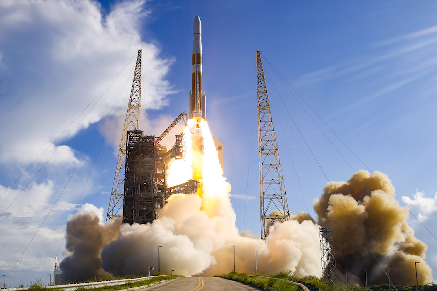
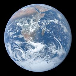
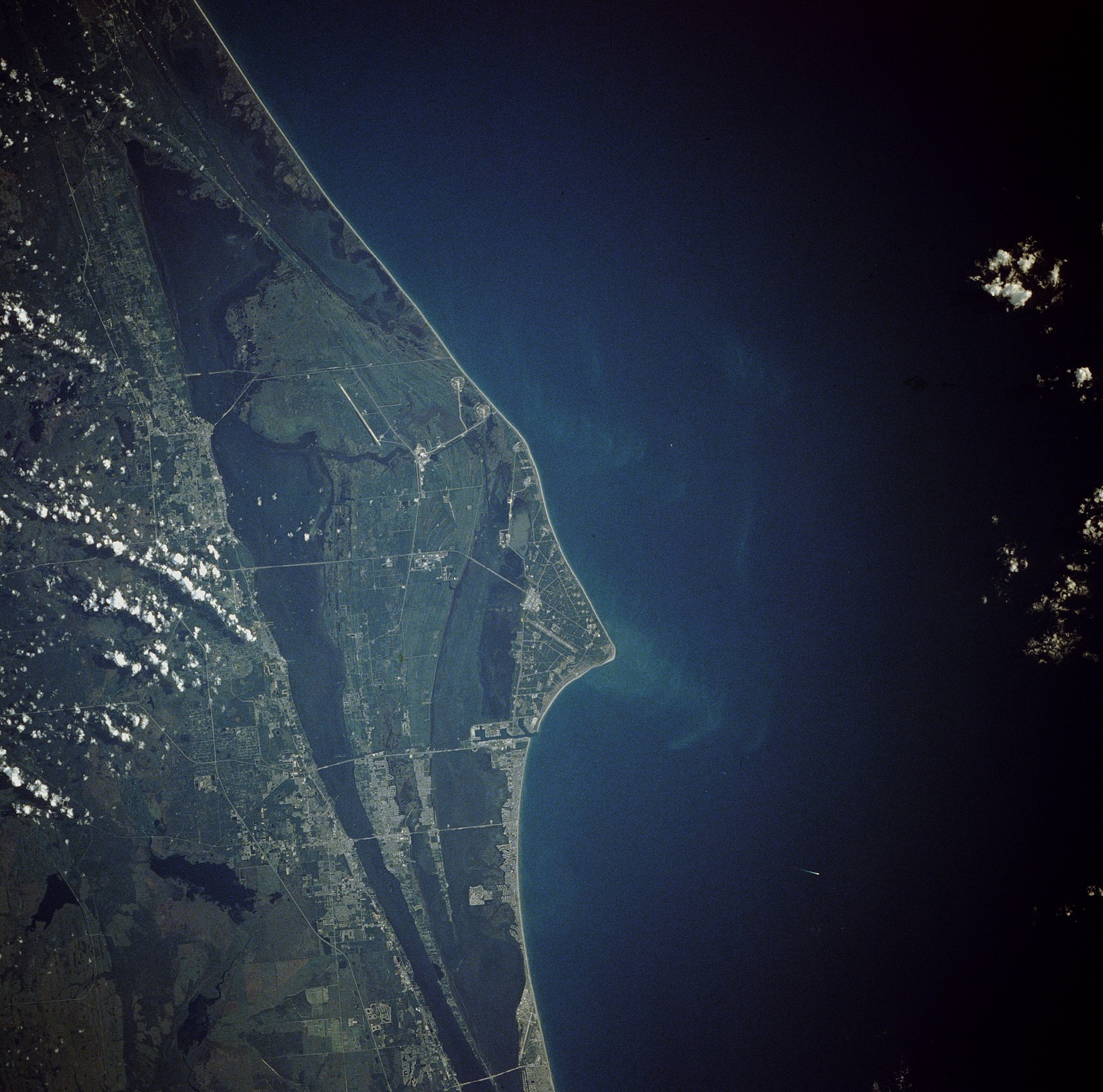
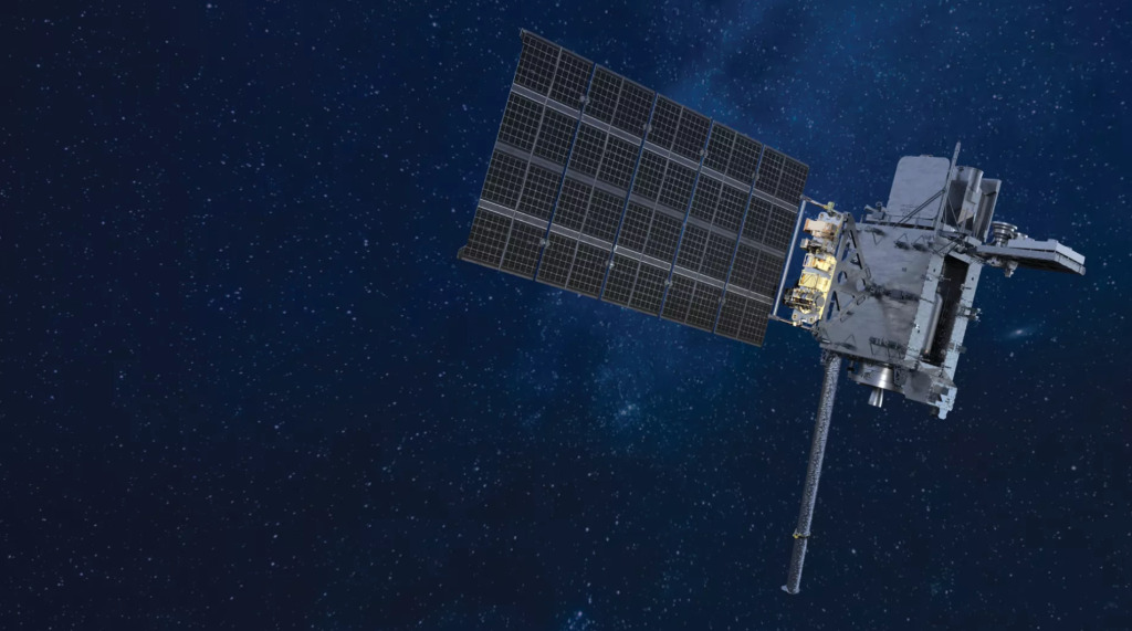
{ "count": 7180, "next": "https://ll.thespacedevs.com/2.3.0/launches/previous/?format=api&limit=10&offset=6110&ordering=-name", "previous": "https://ll.thespacedevs.com/2.3.0/launches/previous/?format=api&limit=10&offset=6090&ordering=-name", "results": [ { "id": "08ccc857-69bc-4e74-9ed5-218a1ac47884", "url": "https://ll.thespacedevs.com/2.3.0/launches/08ccc857-69bc-4e74-9ed5-218a1ac47884/?format=api", "name": "Delta IV M+(4,2) | GPS IIF-5 (USA-248)", "response_mode": "normal", "slug": "delta-iv-m42-gps-iif-5-usa-248", "launch_designator": "2014-008", "status": { "id": 3, "name": "Launch Successful", "abbrev": "Success", "description": "The launch vehicle successfully inserted its payload(s) into the target orbit(s)." }, "last_updated": "2024-10-30T08:29:26Z", "net": "2014-02-21T01:59:00Z", "net_precision": null, "window_end": "2014-02-21T01:59:00Z", "window_start": "2014-02-21T01:59:00Z", "image": { "id": 1724, "name": "Delta IV M+(4,2) launching from SLC-37", "image_url": "https://thespacedevs-prod.nyc3.digitaloceanspaces.com/media/images/delta_iv_m252b_image_20220302002926.jpeg", "thumbnail_url": "https://thespacedevs-prod.nyc3.digitaloceanspaces.com/media/images/255bauto255d__image_thumbnail_20240305193607.jpeg", "credit": "United Launch Alliance", "license": { "id": 10, "name": "ULA Image Use Policy", "priority": 3, "link": "https://www.ulalaunch.com/terms-and-conditions" }, "single_use": true, "variants": [] }, "infographic": null, "probability": -1, "weather_concerns": null, "failreason": "", "hashtag": null, "launch_service_provider": { "response_mode": "list", "id": 124, "url": "https://ll.thespacedevs.com/2.3.0/agencies/124/?format=api", "name": "United Launch Alliance", "abbrev": "ULA", "type": { "id": 3, "name": "Commercial" } }, "rocket": { "id": 1739, "configuration": { "response_mode": "list", "id": 33, "url": "https://ll.thespacedevs.com/2.3.0/launcher_configurations/33/?format=api", "name": "Delta IV M+(4,2)", "families": [ { "response_mode": "list", "id": 72, "name": "Delta" }, { "response_mode": "list", "id": 175, "name": "Delta IV" } ], "full_name": "Delta IV M+(4,2)", "variant": "M+(4,2)" } }, "mission": { "id": 28, "name": "GPS IIF-5", "type": "Navigation", "description": "GPS Block IIF, or GPS IIF is an interim class of GPS satellite, which will be used to keep the Navstar Global Positioning System operational until the GPS Block IIIA satellites become operational. They are being built by Boeing, and will be operated by the United States Air Force following their launch by United Launch Alliance, using Evolved Expendable Launch Vehicles.", "image": null, "orbit": { "id": 12, "name": "Medium Earth Orbit", "abbrev": "MEO", "celestial_body": { "response_mode": "list", "id": 1, "name": "Earth" } }, "agencies": [], "info_urls": [], "vid_urls": [] }, "pad": { "id": 38, "url": "https://ll.thespacedevs.com/2.3.0/pads/38/?format=api", "active": true, "agencies": [], "name": "Space Launch Complex 37B", "image": { "id": 2032, "name": "SLC-37B", "image_url": "https://thespacedevs-prod.nyc3.digitaloceanspaces.com/media/images/slc-37b_image_20240329083424.jpeg", "thumbnail_url": "https://thespacedevs-prod.nyc3.digitaloceanspaces.com/media/images/slc-37b_image_thumbnail_20240329083424.jpeg", "credit": "United Launch Alliance", "license": { "id": 10, "name": "ULA Image Use Policy", "priority": 3, "link": "https://www.ulalaunch.com/terms-and-conditions" }, "single_use": true, "variants": [] }, "description": "", "info_url": null, "wiki_url": "https://en.wikipedia.org/wiki/Cape_Canaveral_Air_Force_Station_Space_Launch_Complex_37", "map_url": "https://www.google.com/maps?q=28.5317,-80.56495", "latitude": 28.5317, "longitude": -80.56495, "country": { "id": 2, "name": "United States of America", "alpha_2_code": "US", "alpha_3_code": "USA", "nationality_name": "American", "nationality_name_composed": "Americano" }, "map_image": "https://thespacedevs-prod.nyc3.digitaloceanspaces.com/media/map_images/pad_38_20200803143515.jpg", "total_launch_count": 40, "orbital_launch_attempt_count": 40, "fastest_turnaround": "P66DT5H24M59S", "location": { "response_mode": "normal", "id": 12, "url": "https://ll.thespacedevs.com/2.3.0/locations/12/?format=api", "name": "Cape Canaveral SFS, FL, USA", "celestial_body": { "response_mode": "normal", "id": 1, "name": "Earth", "type": { "id": 1, "name": "Planet" }, "diameter": 12742000.0, "mass": 5.972168e+24, "gravity": 9.80655, "length_of_day": "1 00:00:00", "atmosphere": true, "image": { "id": 2040, "name": "Earth (Apollo 17)", "image_url": "https://thespacedevs-prod.nyc3.digitaloceanspaces.com/media/images/earth_2528apol_image_20240402194304.jpeg", "thumbnail_url": "https://thespacedevs-prod.nyc3.digitaloceanspaces.com/media/images/earth_2528apol_image_thumbnail_20240402194305.jpeg", "credit": "NASA", "license": { "id": 4, "name": "NASA Image and Media Guidelines", "priority": 0, "link": "https://www.nasa.gov/nasa-brand-center/images-and-media/" }, "single_use": true, "variants": [] }, "description": "Earth is the third planet from the Sun and the only astronomical object known to harbor life.", "wiki_url": "https://en.wikipedia.org/wiki/Earth", "total_attempted_launches": 7169, "successful_launches": 6625, "failed_launches": 544, "total_attempted_landings": 1113, "successful_landings": 1070, "failed_landings": 43 }, "active": true, "country": { "id": 2, "name": "United States of America", "alpha_2_code": "US", "alpha_3_code": "USA", "nationality_name": "American", "nationality_name_composed": "Americano" }, "description": "Cape Canaveral Space Force Station (CCSFS) is an installation of the United States Space Force's Space Launch Delta 45, located on Cape Canaveral in Brevard County, Florida.", "image": { "id": 2200, "name": "Cape Canaveral & KSC seen from orbit (STS-43)", "image_url": "https://thespacedevs-prod.nyc3.digitaloceanspaces.com/media/images/cape_canaveral__image_20240918151615.jpg", "thumbnail_url": "https://thespacedevs-prod.nyc3.digitaloceanspaces.com/media/images/cape_canaveral__image_thumbnail_20240918151616.jpeg", "credit": "NASA", "license": { "id": 4, "name": "NASA Image and Media Guidelines", "priority": 0, "link": "https://www.nasa.gov/nasa-brand-center/images-and-media/" }, "single_use": true, "variants": [] }, "map_image": "https://thespacedevs-prod.nyc3.digitaloceanspaces.com/media/map_images/location_12_20200803142519.jpg", "longitude": -80.577778, "latitude": 28.488889, "timezone_name": "America/New_York", "total_launch_count": 1025, "total_landing_count": 64 } }, "webcast_live": false, "program": [ { "response_mode": "normal", "id": 29, "url": "https://ll.thespacedevs.com/2.3.0/programs/29/?format=api", "name": "Global Positioning System", "image": { "id": 1883, "name": "[AUTO] Global Positioning System - image", "image_url": "https://thespacedevs-prod.nyc3.digitaloceanspaces.com/media/images/global2520posi_program_20231229182501.png", "thumbnail_url": "https://thespacedevs-prod.nyc3.digitaloceanspaces.com/media/images/255bauto255d__image_thumbnail_20240305194031.png", "credit": null, "license": { "id": 1, "name": "Unknown", "priority": 9, "link": null }, "single_use": true, "variants": [] }, "info_url": "https://www.gps.gov/", "wiki_url": "https://en.wikipedia.org/wiki/Global_Positioning_System", "description": "The Global Positioning System (GPS), originally Navstar GPS, is a satellite-based radio navigation system owned by the United States government and operated by the United States Space Force. It is one of the global navigation satellite systems (GNSS) that provide geolocation and time information to a GPS receiver anywhere on or near the Earth where there is an unobstructed line of sight to four or more GPS satellites.", "agencies": [ { "response_mode": "list", "id": 1041, "url": "https://ll.thespacedevs.com/2.3.0/agencies/1041/?format=api", "name": "United States Space Force", "abbrev": "USSF", "type": { "id": 1, "name": "Government" } } ], "start_date": "1978-02-22T00:00:00Z", "end_date": null, "mission_patches": [], "type": { "id": 4, "name": "Navigation Constellation" } } ], "orbital_launch_attempt_count": 5357, "location_launch_attempt_count": 706, "pad_launch_attempt_count": 27, "agency_launch_attempt_count": 80, "orbital_launch_attempt_count_year": 8, "location_launch_attempt_count_year": 3, "pad_launch_attempt_count_year": 1, "agency_launch_attempt_count_year": 2 }, { "id": "aaf40c14-a1c0-489e-ae40-2320d0f4af56", "url": "https://ll.thespacedevs.com/2.3.0/launches/aaf40c14-a1c0-489e-ae40-2320d0f4af56/?format=api", "name": "Delta IV M+(4,2) | GPS IIF-3 (USA-239)", "response_mode": "normal", "slug": "delta-iv-m42-gps-iif-3-usa-239", "launch_designator": "2012-053", "status": { "id": 3, "name": "Launch Successful", "abbrev": "Success", "description": "The launch vehicle successfully inserted its payload(s) into the target orbit(s)." }, "last_updated": "2024-01-02T15:26:16Z", "net": "2012-10-04T12:10:00Z", "net_precision": null, "window_end": "2012-10-04T12:10:00Z", "window_start": "2012-10-04T12:10:00Z", "image": { "id": 1724, "name": "Delta IV M+(4,2) launching from SLC-37", "image_url": "https://thespacedevs-prod.nyc3.digitaloceanspaces.com/media/images/delta_iv_m252b_image_20220302002926.jpeg", "thumbnail_url": "https://thespacedevs-prod.nyc3.digitaloceanspaces.com/media/images/255bauto255d__image_thumbnail_20240305193607.jpeg", "credit": "United Launch Alliance", "license": { "id": 10, "name": "ULA Image Use Policy", "priority": 3, "link": "https://www.ulalaunch.com/terms-and-conditions" }, "single_use": true, "variants": [] }, "infographic": null, "probability": -1, "weather_concerns": null, "failreason": "", "hashtag": null, "launch_service_provider": { "response_mode": "list", "id": 124, "url": "https://ll.thespacedevs.com/2.3.0/agencies/124/?format=api", "name": "United Launch Alliance", "abbrev": "ULA", "type": { "id": 3, "name": "Commercial" } }, "rocket": { "id": 1634, "configuration": { "response_mode": "list", "id": 33, "url": "https://ll.thespacedevs.com/2.3.0/launcher_configurations/33/?format=api", "name": "Delta IV M+(4,2)", "families": [ { "response_mode": "list", "id": 72, "name": "Delta" }, { "response_mode": "list", "id": 175, "name": "Delta IV" } ], "full_name": "Delta IV M+(4,2)", "variant": "M+(4,2)" } }, "mission": { "id": 221, "name": "GPS IIF-3 (USA-239)", "type": "Navigation", "description": "GPS IIF-3 is a next-generation GPS satellite which provides navigational assistance for U.S. military operations on land, at sea, and in the air.", "image": null, "orbit": { "id": 12, "name": "Medium Earth Orbit", "abbrev": "MEO", "celestial_body": { "response_mode": "list", "id": 1, "name": "Earth" } }, "agencies": [], "info_urls": [], "vid_urls": [] }, "pad": { "id": 38, "url": "https://ll.thespacedevs.com/2.3.0/pads/38/?format=api", "active": true, "agencies": [], "name": "Space Launch Complex 37B", "image": { "id": 2032, "name": "SLC-37B", "image_url": "https://thespacedevs-prod.nyc3.digitaloceanspaces.com/media/images/slc-37b_image_20240329083424.jpeg", "thumbnail_url": "https://thespacedevs-prod.nyc3.digitaloceanspaces.com/media/images/slc-37b_image_thumbnail_20240329083424.jpeg", "credit": "United Launch Alliance", "license": { "id": 10, "name": "ULA Image Use Policy", "priority": 3, "link": "https://www.ulalaunch.com/terms-and-conditions" }, "single_use": true, "variants": [] }, "description": "", "info_url": null, "wiki_url": "https://en.wikipedia.org/wiki/Cape_Canaveral_Air_Force_Station_Space_Launch_Complex_37", "map_url": "https://www.google.com/maps?q=28.5317,-80.56495", "latitude": 28.5317, "longitude": -80.56495, "country": { "id": 2, "name": "United States of America", "alpha_2_code": "US", "alpha_3_code": "USA", "nationality_name": "American", "nationality_name_composed": "Americano" }, "map_image": "https://thespacedevs-prod.nyc3.digitaloceanspaces.com/media/map_images/pad_38_20200803143515.jpg", "total_launch_count": 40, "orbital_launch_attempt_count": 40, "fastest_turnaround": "P66DT5H24M59S", "location": { "response_mode": "normal", "id": 12, "url": "https://ll.thespacedevs.com/2.3.0/locations/12/?format=api", "name": "Cape Canaveral SFS, FL, USA", "celestial_body": { "response_mode": "normal", "id": 1, "name": "Earth", "type": { "id": 1, "name": "Planet" }, "diameter": 12742000.0, "mass": 5.972168e+24, "gravity": 9.80655, "length_of_day": "1 00:00:00", "atmosphere": true, "image": { "id": 2040, "name": "Earth (Apollo 17)", "image_url": "https://thespacedevs-prod.nyc3.digitaloceanspaces.com/media/images/earth_2528apol_image_20240402194304.jpeg", "thumbnail_url": "https://thespacedevs-prod.nyc3.digitaloceanspaces.com/media/images/earth_2528apol_image_thumbnail_20240402194305.jpeg", "credit": "NASA", "license": { "id": 4, "name": "NASA Image and Media Guidelines", "priority": 0, "link": "https://www.nasa.gov/nasa-brand-center/images-and-media/" }, "single_use": true, "variants": [] }, "description": "Earth is the third planet from the Sun and the only astronomical object known to harbor life.", "wiki_url": "https://en.wikipedia.org/wiki/Earth", "total_attempted_launches": 7169, "successful_launches": 6625, "failed_launches": 544, "total_attempted_landings": 1113, "successful_landings": 1070, "failed_landings": 43 }, "active": true, "country": { "id": 2, "name": "United States of America", "alpha_2_code": "US", "alpha_3_code": "USA", "nationality_name": "American", "nationality_name_composed": "Americano" }, "description": "Cape Canaveral Space Force Station (CCSFS) is an installation of the United States Space Force's Space Launch Delta 45, located on Cape Canaveral in Brevard County, Florida.", "image": { "id": 2200, "name": "Cape Canaveral & KSC seen from orbit (STS-43)", "image_url": "https://thespacedevs-prod.nyc3.digitaloceanspaces.com/media/images/cape_canaveral__image_20240918151615.jpg", "thumbnail_url": "https://thespacedevs-prod.nyc3.digitaloceanspaces.com/media/images/cape_canaveral__image_thumbnail_20240918151616.jpeg", "credit": "NASA", "license": { "id": 4, "name": "NASA Image and Media Guidelines", "priority": 0, "link": "https://www.nasa.gov/nasa-brand-center/images-and-media/" }, "single_use": true, "variants": [] }, "map_image": "https://thespacedevs-prod.nyc3.digitaloceanspaces.com/media/map_images/location_12_20200803142519.jpg", "longitude": -80.577778, "latitude": 28.488889, "timezone_name": "America/New_York", "total_launch_count": 1025, "total_landing_count": 64 } }, "webcast_live": false, "program": [ { "response_mode": "normal", "id": 29, "url": "https://ll.thespacedevs.com/2.3.0/programs/29/?format=api", "name": "Global Positioning System", "image": { "id": 1883, "name": "[AUTO] Global Positioning System - image", "image_url": "https://thespacedevs-prod.nyc3.digitaloceanspaces.com/media/images/global2520posi_program_20231229182501.png", "thumbnail_url": "https://thespacedevs-prod.nyc3.digitaloceanspaces.com/media/images/255bauto255d__image_thumbnail_20240305194031.png", "credit": null, "license": { "id": 1, "name": "Unknown", "priority": 9, "link": null }, "single_use": true, "variants": [] }, "info_url": "https://www.gps.gov/", "wiki_url": "https://en.wikipedia.org/wiki/Global_Positioning_System", "description": "The Global Positioning System (GPS), originally Navstar GPS, is a satellite-based radio navigation system owned by the United States government and operated by the United States Space Force. It is one of the global navigation satellite systems (GNSS) that provide geolocation and time information to a GPS receiver anywhere on or near the Earth where there is an unobstructed line of sight to four or more GPS satellites.", "agencies": [ { "response_mode": "list", "id": 1041, "url": "https://ll.thespacedevs.com/2.3.0/agencies/1041/?format=api", "name": "United States Space Force", "abbrev": "USSF", "type": { "id": 1, "name": "Government" } } ], "start_date": "1978-02-22T00:00:00Z", "end_date": null, "mission_patches": [], "type": { "id": 4, "name": "Navigation Constellation" } } ], "orbital_launch_attempt_count": 5246, "location_launch_attempt_count": 691, "pad_launch_attempt_count": 24, "agency_launch_attempt_count": 66, "orbital_launch_attempt_count_year": 56, "location_launch_attempt_count_year": 8, "pad_launch_attempt_count_year": 3, "agency_launch_attempt_count_year": 9 }, { "id": "11594e65-8177-4a02-8246-4e530483aefa", "url": "https://ll.thespacedevs.com/2.3.0/launches/11594e65-8177-4a02-8246-4e530483aefa/?format=api", "name": "Delta IV M+(4,2) | GPS IIF-2 (USA-232)", "response_mode": "normal", "slug": "delta-iv-m42-gps-iif-2-usa-232", "launch_designator": "2011-036", "status": { "id": 3, "name": "Launch Successful", "abbrev": "Success", "description": "The launch vehicle successfully inserted its payload(s) into the target orbit(s)." }, "last_updated": "2024-01-02T15:26:10Z", "net": "2011-07-16T06:41:00Z", "net_precision": null, "window_end": "2011-07-16T06:41:00Z", "window_start": "2011-07-16T06:41:00Z", "image": { "id": 1724, "name": "Delta IV M+(4,2) launching from SLC-37", "image_url": "https://thespacedevs-prod.nyc3.digitaloceanspaces.com/media/images/delta_iv_m252b_image_20220302002926.jpeg", "thumbnail_url": "https://thespacedevs-prod.nyc3.digitaloceanspaces.com/media/images/255bauto255d__image_thumbnail_20240305193607.jpeg", "credit": "United Launch Alliance", "license": { "id": 10, "name": "ULA Image Use Policy", "priority": 3, "link": "https://www.ulalaunch.com/terms-and-conditions" }, "single_use": true, "variants": [] }, "infographic": null, "probability": -1, "weather_concerns": null, "failreason": "", "hashtag": null, "launch_service_provider": { "response_mode": "list", "id": 124, "url": "https://ll.thespacedevs.com/2.3.0/agencies/124/?format=api", "name": "United Launch Alliance", "abbrev": "ULA", "type": { "id": 3, "name": "Commercial" } }, "rocket": { "id": 1539, "configuration": { "response_mode": "list", "id": 33, "url": "https://ll.thespacedevs.com/2.3.0/launcher_configurations/33/?format=api", "name": "Delta IV M+(4,2)", "families": [ { "response_mode": "list", "id": 72, "name": "Delta" }, { "response_mode": "list", "id": 175, "name": "Delta IV" } ], "full_name": "Delta IV M+(4,2)", "variant": "M+(4,2)" } }, "mission": { "id": 228, "name": "GPS IIF-2 (USA-232)", "type": "Navigation", "description": "GPS IIF-8 is a next-generation GPS satellite which provides navigational assistance for U.S. military operations on land, at sea, and in the air.", "image": null, "orbit": { "id": 12, "name": "Medium Earth Orbit", "abbrev": "MEO", "celestial_body": { "response_mode": "list", "id": 1, "name": "Earth" } }, "agencies": [], "info_urls": [], "vid_urls": [] }, "pad": { "id": 38, "url": "https://ll.thespacedevs.com/2.3.0/pads/38/?format=api", "active": true, "agencies": [], "name": "Space Launch Complex 37B", "image": { "id": 2032, "name": "SLC-37B", "image_url": "https://thespacedevs-prod.nyc3.digitaloceanspaces.com/media/images/slc-37b_image_20240329083424.jpeg", "thumbnail_url": "https://thespacedevs-prod.nyc3.digitaloceanspaces.com/media/images/slc-37b_image_thumbnail_20240329083424.jpeg", "credit": "United Launch Alliance", "license": { "id": 10, "name": "ULA Image Use Policy", "priority": 3, "link": "https://www.ulalaunch.com/terms-and-conditions" }, "single_use": true, "variants": [] }, "description": "", "info_url": null, "wiki_url": "https://en.wikipedia.org/wiki/Cape_Canaveral_Air_Force_Station_Space_Launch_Complex_37", "map_url": "https://www.google.com/maps?q=28.5317,-80.56495", "latitude": 28.5317, "longitude": -80.56495, "country": { "id": 2, "name": "United States of America", "alpha_2_code": "US", "alpha_3_code": "USA", "nationality_name": "American", "nationality_name_composed": "Americano" }, "map_image": "https://thespacedevs-prod.nyc3.digitaloceanspaces.com/media/map_images/pad_38_20200803143515.jpg", "total_launch_count": 40, "orbital_launch_attempt_count": 40, "fastest_turnaround": "P66DT5H24M59S", "location": { "response_mode": "normal", "id": 12, "url": "https://ll.thespacedevs.com/2.3.0/locations/12/?format=api", "name": "Cape Canaveral SFS, FL, USA", "celestial_body": { "response_mode": "normal", "id": 1, "name": "Earth", "type": { "id": 1, "name": "Planet" }, "diameter": 12742000.0, "mass": 5.972168e+24, "gravity": 9.80655, "length_of_day": "1 00:00:00", "atmosphere": true, "image": { "id": 2040, "name": "Earth (Apollo 17)", "image_url": "https://thespacedevs-prod.nyc3.digitaloceanspaces.com/media/images/earth_2528apol_image_20240402194304.jpeg", "thumbnail_url": "https://thespacedevs-prod.nyc3.digitaloceanspaces.com/media/images/earth_2528apol_image_thumbnail_20240402194305.jpeg", "credit": "NASA", "license": { "id": 4, "name": "NASA Image and Media Guidelines", "priority": 0, "link": "https://www.nasa.gov/nasa-brand-center/images-and-media/" }, "single_use": true, "variants": [] }, "description": "Earth is the third planet from the Sun and the only astronomical object known to harbor life.", "wiki_url": "https://en.wikipedia.org/wiki/Earth", "total_attempted_launches": 7169, "successful_launches": 6625, "failed_launches": 544, "total_attempted_landings": 1113, "successful_landings": 1070, "failed_landings": 43 }, "active": true, "country": { "id": 2, "name": "United States of America", "alpha_2_code": "US", "alpha_3_code": "USA", "nationality_name": "American", "nationality_name_composed": "Americano" }, "description": "Cape Canaveral Space Force Station (CCSFS) is an installation of the United States Space Force's Space Launch Delta 45, located on Cape Canaveral in Brevard County, Florida.", "image": { "id": 2200, "name": "Cape Canaveral & KSC seen from orbit (STS-43)", "image_url": "https://thespacedevs-prod.nyc3.digitaloceanspaces.com/media/images/cape_canaveral__image_20240918151615.jpg", "thumbnail_url": "https://thespacedevs-prod.nyc3.digitaloceanspaces.com/media/images/cape_canaveral__image_thumbnail_20240918151616.jpeg", "credit": "NASA", "license": { "id": 4, "name": "NASA Image and Media Guidelines", "priority": 0, "link": "https://www.nasa.gov/nasa-brand-center/images-and-media/" }, "single_use": true, "variants": [] }, "map_image": "https://thespacedevs-prod.nyc3.digitaloceanspaces.com/media/map_images/location_12_20200803142519.jpg", "longitude": -80.577778, "latitude": 28.488889, "timezone_name": "America/New_York", "total_launch_count": 1025, "total_landing_count": 64 } }, "webcast_live": false, "program": [ { "response_mode": "normal", "id": 29, "url": "https://ll.thespacedevs.com/2.3.0/programs/29/?format=api", "name": "Global Positioning System", "image": { "id": 1883, "name": "[AUTO] Global Positioning System - image", "image_url": "https://thespacedevs-prod.nyc3.digitaloceanspaces.com/media/images/global2520posi_program_20231229182501.png", "thumbnail_url": "https://thespacedevs-prod.nyc3.digitaloceanspaces.com/media/images/255bauto255d__image_thumbnail_20240305194031.png", "credit": null, "license": { "id": 1, "name": "Unknown", "priority": 9, "link": null }, "single_use": true, "variants": [] }, "info_url": "https://www.gps.gov/", "wiki_url": "https://en.wikipedia.org/wiki/Global_Positioning_System", "description": "The Global Positioning System (GPS), originally Navstar GPS, is a satellite-based radio navigation system owned by the United States government and operated by the United States Space Force. It is one of the global navigation satellite systems (GNSS) that provide geolocation and time information to a GPS receiver anywhere on or near the Earth where there is an unobstructed line of sight to four or more GPS satellites.", "agencies": [ { "response_mode": "list", "id": 1041, "url": "https://ll.thespacedevs.com/2.3.0/agencies/1041/?format=api", "name": "United States Space Force", "abbrev": "USSF", "type": { "id": 1, "name": "Government" } } ], "start_date": "1978-02-22T00:00:00Z", "end_date": null, "mission_patches": [], "type": { "id": 4, "name": "Navigation Constellation" } } ], "orbital_launch_attempt_count": 5143, "location_launch_attempt_count": 680, "pad_launch_attempt_count": 21, "agency_launch_attempt_count": 53, "orbital_launch_attempt_count_year": 37, "location_launch_attempt_count_year": 4, "pad_launch_attempt_count_year": 2, "agency_launch_attempt_count_year": 7 }, { "id": "54add5a6-de47-48bb-9486-982181cf2766", "url": "https://ll.thespacedevs.com/2.3.0/launches/54add5a6-de47-48bb-9486-982181cf2766/?format=api", "name": "Delta IV M+(4,2) | GOES-P (GOES 15)", "response_mode": "normal", "slug": "delta-iv-m42-goes-p-goes-15", "launch_designator": "2010-008", "status": { "id": 3, "name": "Launch Successful", "abbrev": "Success", "description": "The launch vehicle successfully inserted its payload(s) into the target orbit(s)." }, "last_updated": "2023-06-14T17:43:26Z", "net": "2010-03-04T23:57:00Z", "net_precision": null, "window_end": "2010-03-04T23:57:00Z", "window_start": "2010-03-04T23:57:00Z", "image": { "id": 1724, "name": "Delta IV M+(4,2) launching from SLC-37", "image_url": "https://thespacedevs-prod.nyc3.digitaloceanspaces.com/media/images/delta_iv_m252b_image_20220302002926.jpeg", "thumbnail_url": "https://thespacedevs-prod.nyc3.digitaloceanspaces.com/media/images/255bauto255d__image_thumbnail_20240305193607.jpeg", "credit": "United Launch Alliance", "license": { "id": 10, "name": "ULA Image Use Policy", "priority": 3, "link": "https://www.ulalaunch.com/terms-and-conditions" }, "single_use": true, "variants": [] }, "infographic": null, "probability": -1, "weather_concerns": null, "failreason": null, "hashtag": null, "launch_service_provider": { "response_mode": "list", "id": 124, "url": "https://ll.thespacedevs.com/2.3.0/agencies/124/?format=api", "name": "United Launch Alliance", "abbrev": "ULA", "type": { "id": 3, "name": "Commercial" } }, "rocket": { "id": 1445, "configuration": { "response_mode": "list", "id": 33, "url": "https://ll.thespacedevs.com/2.3.0/launcher_configurations/33/?format=api", "name": "Delta IV M+(4,2)", "families": [ { "response_mode": "list", "id": 72, "name": "Delta" }, { "response_mode": "list", "id": 175, "name": "Delta IV" } ], "full_name": "Delta IV M+(4,2)", "variant": "M+(4,2)" } }, "mission": null, "pad": { "id": 38, "url": "https://ll.thespacedevs.com/2.3.0/pads/38/?format=api", "active": true, "agencies": [], "name": "Space Launch Complex 37B", "image": { "id": 2032, "name": "SLC-37B", "image_url": "https://thespacedevs-prod.nyc3.digitaloceanspaces.com/media/images/slc-37b_image_20240329083424.jpeg", "thumbnail_url": "https://thespacedevs-prod.nyc3.digitaloceanspaces.com/media/images/slc-37b_image_thumbnail_20240329083424.jpeg", "credit": "United Launch Alliance", "license": { "id": 10, "name": "ULA Image Use Policy", "priority": 3, "link": "https://www.ulalaunch.com/terms-and-conditions" }, "single_use": true, "variants": [] }, "description": "", "info_url": null, "wiki_url": "https://en.wikipedia.org/wiki/Cape_Canaveral_Air_Force_Station_Space_Launch_Complex_37", "map_url": "https://www.google.com/maps?q=28.5317,-80.56495", "latitude": 28.5317, "longitude": -80.56495, "country": { "id": 2, "name": "United States of America", "alpha_2_code": "US", "alpha_3_code": "USA", "nationality_name": "American", "nationality_name_composed": "Americano" }, "map_image": "https://thespacedevs-prod.nyc3.digitaloceanspaces.com/media/map_images/pad_38_20200803143515.jpg", "total_launch_count": 40, "orbital_launch_attempt_count": 40, "fastest_turnaround": "P66DT5H24M59S", "location": { "response_mode": "normal", "id": 12, "url": "https://ll.thespacedevs.com/2.3.0/locations/12/?format=api", "name": "Cape Canaveral SFS, FL, USA", "celestial_body": { "response_mode": "normal", "id": 1, "name": "Earth", "type": { "id": 1, "name": "Planet" }, "diameter": 12742000.0, "mass": 5.972168e+24, "gravity": 9.80655, "length_of_day": "1 00:00:00", "atmosphere": true, "image": { "id": 2040, "name": "Earth (Apollo 17)", "image_url": "https://thespacedevs-prod.nyc3.digitaloceanspaces.com/media/images/earth_2528apol_image_20240402194304.jpeg", "thumbnail_url": "https://thespacedevs-prod.nyc3.digitaloceanspaces.com/media/images/earth_2528apol_image_thumbnail_20240402194305.jpeg", "credit": "NASA", "license": { "id": 4, "name": "NASA Image and Media Guidelines", "priority": 0, "link": "https://www.nasa.gov/nasa-brand-center/images-and-media/" }, "single_use": true, "variants": [] }, "description": "Earth is the third planet from the Sun and the only astronomical object known to harbor life.", "wiki_url": "https://en.wikipedia.org/wiki/Earth", "total_attempted_launches": 7169, "successful_launches": 6625, "failed_launches": 544, "total_attempted_landings": 1113, "successful_landings": 1070, "failed_landings": 43 }, "active": true, "country": { "id": 2, "name": "United States of America", "alpha_2_code": "US", "alpha_3_code": "USA", "nationality_name": "American", "nationality_name_composed": "Americano" }, "description": "Cape Canaveral Space Force Station (CCSFS) is an installation of the United States Space Force's Space Launch Delta 45, located on Cape Canaveral in Brevard County, Florida.", "image": { "id": 2200, "name": "Cape Canaveral & KSC seen from orbit (STS-43)", "image_url": "https://thespacedevs-prod.nyc3.digitaloceanspaces.com/media/images/cape_canaveral__image_20240918151615.jpg", "thumbnail_url": "https://thespacedevs-prod.nyc3.digitaloceanspaces.com/media/images/cape_canaveral__image_thumbnail_20240918151616.jpeg", "credit": "NASA", "license": { "id": 4, "name": "NASA Image and Media Guidelines", "priority": 0, "link": "https://www.nasa.gov/nasa-brand-center/images-and-media/" }, "single_use": true, "variants": [] }, "map_image": "https://thespacedevs-prod.nyc3.digitaloceanspaces.com/media/map_images/location_12_20200803142519.jpg", "longitude": -80.577778, "latitude": 28.488889, "timezone_name": "America/New_York", "total_launch_count": 1025, "total_landing_count": 64 } }, "webcast_live": false, "program": [ { "response_mode": "normal", "id": 37, "url": "https://ll.thespacedevs.com/2.3.0/programs/37/?format=api", "name": "Geostationary Operational Environmental Satellite", "image": { "id": 2118, "name": "GOES-U render", "image_url": "https://thespacedevs-prod.nyc3.digitaloceanspaces.com/media/images/goes-u_render_image_20240623151909.jpg", "thumbnail_url": "https://thespacedevs-prod.nyc3.digitaloceanspaces.com/media/images/goes-u_render_image_thumbnail_20240623151910.png", "credit": "NASA", "license": { "id": 4, "name": "NASA Image and Media Guidelines", "priority": 0, "link": "https://www.nasa.gov/nasa-brand-center/images-and-media/" }, "single_use": true, "variants": [] }, "info_url": null, "wiki_url": "https://en.wikipedia.org/wiki/Geostationary_Operational_Environmental_Satellite", "description": "The Geostationary Operational Environmental Satellite (GOES), operated by the United States' National Oceanic and Atmospheric Administration (NOAA)'s National Environmental Satellite, Data, and Information Service division, supports weather forecasting, severe storm tracking, and meteorology research", "agencies": [ { "response_mode": "list", "id": 44, "url": "https://ll.thespacedevs.com/2.3.0/agencies/44/?format=api", "name": "National Aeronautics and Space Administration", "abbrev": "NASA", "type": { "id": 1, "name": "Government" } }, { "response_mode": "list", "id": 210, "url": "https://ll.thespacedevs.com/2.3.0/agencies/210/?format=api", "name": "National Oceanic and Atmospheric Administration", "abbrev": "NOAA", "type": { "id": 1, "name": "Government" } } ], "start_date": "1975-10-16T22:40:00Z", "end_date": null, "mission_patches": [], "type": { "id": 8, "name": "Earth Observation" } } ], "orbital_launch_attempt_count": 5040, "location_launch_attempt_count": 670, "pad_launch_attempt_count": 17, "agency_launch_attempt_count": 40, "orbital_launch_attempt_count_year": 5040, "location_launch_attempt_count_year": 2, "pad_launch_attempt_count_year": 1, "agency_launch_attempt_count_year": 2 }, { "id": "ed79a690-b9d3-45b8-836b-84ed212f90ac", "url": "https://ll.thespacedevs.com/2.3.0/launches/ed79a690-b9d3-45b8-836b-84ed212f90ac/?format=api", "name": "Delta IV M+(4,2) | GOES-14", "response_mode": "normal", "slug": "delta-iv-m42-goes-14", "launch_designator": "2009-033", "status": { "id": 3, "name": "Launch Successful", "abbrev": "Success", "description": "The launch vehicle successfully inserted its payload(s) into the target orbit(s)." }, "last_updated": "2023-06-14T17:43:29Z", "net": "2009-06-27T22:51:00Z", "net_precision": null, "window_end": "2009-06-27T22:51:00Z", "window_start": "2009-06-27T22:51:00Z", "image": { "id": 1724, "name": "Delta IV M+(4,2) launching from SLC-37", "image_url": "https://thespacedevs-prod.nyc3.digitaloceanspaces.com/media/images/delta_iv_m252b_image_20220302002926.jpeg", "thumbnail_url": "https://thespacedevs-prod.nyc3.digitaloceanspaces.com/media/images/255bauto255d__image_thumbnail_20240305193607.jpeg", "credit": "United Launch Alliance", "license": { "id": 10, "name": "ULA Image Use Policy", "priority": 3, "link": "https://www.ulalaunch.com/terms-and-conditions" }, "single_use": true, "variants": [] }, "infographic": null, "probability": 0, "weather_concerns": null, "failreason": "", "hashtag": "", "launch_service_provider": { "response_mode": "list", "id": 124, "url": "https://ll.thespacedevs.com/2.3.0/agencies/124/?format=api", "name": "United Launch Alliance", "abbrev": "ULA", "type": { "id": 3, "name": "Commercial" } }, "rocket": { "id": 1420, "configuration": { "response_mode": "list", "id": 33, "url": "https://ll.thespacedevs.com/2.3.0/launcher_configurations/33/?format=api", "name": "Delta IV M+(4,2)", "families": [ { "response_mode": "list", "id": 72, "name": "Delta" }, { "response_mode": "list", "id": 175, "name": "Delta IV" } ], "full_name": "Delta IV M+(4,2)", "variant": "M+(4,2)" } }, "mission": { "id": 547, "name": "GOES-14", "type": "Earth Science", "description": "A US weather satellite for NOAA. Adds to the Geostationary (GOES) constellation", "image": null, "orbit": { "id": 2, "name": "Geostationary Transfer Orbit", "abbrev": "GTO", "celestial_body": { "response_mode": "list", "id": 1, "name": "Earth" } }, "agencies": [], "info_urls": [], "vid_urls": [] }, "pad": { "id": 38, "url": "https://ll.thespacedevs.com/2.3.0/pads/38/?format=api", "active": true, "agencies": [], "name": "Space Launch Complex 37B", "image": { "id": 2032, "name": "SLC-37B", "image_url": "https://thespacedevs-prod.nyc3.digitaloceanspaces.com/media/images/slc-37b_image_20240329083424.jpeg", "thumbnail_url": "https://thespacedevs-prod.nyc3.digitaloceanspaces.com/media/images/slc-37b_image_thumbnail_20240329083424.jpeg", "credit": "United Launch Alliance", "license": { "id": 10, "name": "ULA Image Use Policy", "priority": 3, "link": "https://www.ulalaunch.com/terms-and-conditions" }, "single_use": true, "variants": [] }, "description": "", "info_url": null, "wiki_url": "https://en.wikipedia.org/wiki/Cape_Canaveral_Air_Force_Station_Space_Launch_Complex_37", "map_url": "https://www.google.com/maps?q=28.5317,-80.56495", "latitude": 28.5317, "longitude": -80.56495, "country": { "id": 2, "name": "United States of America", "alpha_2_code": "US", "alpha_3_code": "USA", "nationality_name": "American", "nationality_name_composed": "Americano" }, "map_image": "https://thespacedevs-prod.nyc3.digitaloceanspaces.com/media/map_images/pad_38_20200803143515.jpg", "total_launch_count": 40, "orbital_launch_attempt_count": 40, "fastest_turnaround": "P66DT5H24M59S", "location": { "response_mode": "normal", "id": 12, "url": "https://ll.thespacedevs.com/2.3.0/locations/12/?format=api", "name": "Cape Canaveral SFS, FL, USA", "celestial_body": { "response_mode": "normal", "id": 1, "name": "Earth", "type": { "id": 1, "name": "Planet" }, "diameter": 12742000.0, "mass": 5.972168e+24, "gravity": 9.80655, "length_of_day": "1 00:00:00", "atmosphere": true, "image": { "id": 2040, "name": "Earth (Apollo 17)", "image_url": "https://thespacedevs-prod.nyc3.digitaloceanspaces.com/media/images/earth_2528apol_image_20240402194304.jpeg", "thumbnail_url": "https://thespacedevs-prod.nyc3.digitaloceanspaces.com/media/images/earth_2528apol_image_thumbnail_20240402194305.jpeg", "credit": "NASA", "license": { "id": 4, "name": "NASA Image and Media Guidelines", "priority": 0, "link": "https://www.nasa.gov/nasa-brand-center/images-and-media/" }, "single_use": true, "variants": [] }, "description": "Earth is the third planet from the Sun and the only astronomical object known to harbor life.", "wiki_url": "https://en.wikipedia.org/wiki/Earth", "total_attempted_launches": 7169, "successful_launches": 6625, "failed_launches": 544, "total_attempted_landings": 1113, "successful_landings": 1070, "failed_landings": 43 }, "active": true, "country": { "id": 2, "name": "United States of America", "alpha_2_code": "US", "alpha_3_code": "USA", "nationality_name": "American", "nationality_name_composed": "Americano" }, "description": "Cape Canaveral Space Force Station (CCSFS) is an installation of the United States Space Force's Space Launch Delta 45, located on Cape Canaveral in Brevard County, Florida.", "image": { "id": 2200, "name": "Cape Canaveral & KSC seen from orbit (STS-43)", "image_url": "https://thespacedevs-prod.nyc3.digitaloceanspaces.com/media/images/cape_canaveral__image_20240918151615.jpg", "thumbnail_url": "https://thespacedevs-prod.nyc3.digitaloceanspaces.com/media/images/cape_canaveral__image_thumbnail_20240918151616.jpeg", "credit": "NASA", "license": { "id": 4, "name": "NASA Image and Media Guidelines", "priority": 0, "link": "https://www.nasa.gov/nasa-brand-center/images-and-media/" }, "single_use": true, "variants": [] }, "map_image": "https://thespacedevs-prod.nyc3.digitaloceanspaces.com/media/map_images/location_12_20200803142519.jpg", "longitude": -80.577778, "latitude": 28.488889, "timezone_name": "America/New_York", "total_launch_count": 1025, "total_landing_count": 64 } }, "webcast_live": false, "program": [ { "response_mode": "normal", "id": 37, "url": "https://ll.thespacedevs.com/2.3.0/programs/37/?format=api", "name": "Geostationary Operational Environmental Satellite", "image": { "id": 2118, "name": "GOES-U render", "image_url": "https://thespacedevs-prod.nyc3.digitaloceanspaces.com/media/images/goes-u_render_image_20240623151909.jpg", "thumbnail_url": "https://thespacedevs-prod.nyc3.digitaloceanspaces.com/media/images/goes-u_render_image_thumbnail_20240623151910.png", "credit": "NASA", "license": { "id": 4, "name": "NASA Image and Media Guidelines", "priority": 0, "link": "https://www.nasa.gov/nasa-brand-center/images-and-media/" }, "single_use": true, "variants": [] }, "info_url": null, "wiki_url": "https://en.wikipedia.org/wiki/Geostationary_Operational_Environmental_Satellite", "description": "The Geostationary Operational Environmental Satellite (GOES), operated by the United States' National Oceanic and Atmospheric Administration (NOAA)'s National Environmental Satellite, Data, and Information Service division, supports weather forecasting, severe storm tracking, and meteorology research", "agencies": [ { "response_mode": "list", "id": 44, "url": "https://ll.thespacedevs.com/2.3.0/agencies/44/?format=api", "name": "National Aeronautics and Space Administration", "abbrev": "NASA", "type": { "id": 1, "name": "Government" } }, { "response_mode": "list", "id": 210, "url": "https://ll.thespacedevs.com/2.3.0/agencies/210/?format=api", "name": "National Oceanic and Atmospheric Administration", "abbrev": "NOAA", "type": { "id": 1, "name": "Government" } } ], "start_date": "1975-10-16T22:40:00Z", "end_date": null, "mission_patches": [], "type": { "id": 8, "name": "Earth Observation" } } ], "orbital_launch_attempt_count": 4989, "location_launch_attempt_count": 663, "pad_launch_attempt_count": 15, "agency_launch_attempt_count": 30, "orbital_launch_attempt_count_year": 35, "location_launch_attempt_count_year": 6, "pad_launch_attempt_count_year": 2, "agency_launch_attempt_count_year": 8 }, { "id": "8d9fc85a-07a2-43f4-9ef7-02f4e3cb833e", "url": "https://ll.thespacedevs.com/2.3.0/launches/8d9fc85a-07a2-43f4-9ef7-02f4e3cb833e/?format=api", "name": "Delta IV M+(4,2) | GOES 13", "response_mode": "normal", "slug": "delta-iv-m42-goes-13", "launch_designator": "2006-018", "status": { "id": 3, "name": "Launch Successful", "abbrev": "Success", "description": "The launch vehicle successfully inserted its payload(s) into the target orbit(s)." }, "last_updated": "2023-06-14T17:43:27Z", "net": "2006-05-24T22:11:00Z", "net_precision": null, "window_end": "2006-05-24T22:11:00Z", "window_start": "2006-05-24T22:11:00Z", "image": { "id": 1724, "name": "Delta IV M+(4,2) launching from SLC-37", "image_url": "https://thespacedevs-prod.nyc3.digitaloceanspaces.com/media/images/delta_iv_m252b_image_20220302002926.jpeg", "thumbnail_url": "https://thespacedevs-prod.nyc3.digitaloceanspaces.com/media/images/255bauto255d__image_thumbnail_20240305193607.jpeg", "credit": "United Launch Alliance", "license": { "id": 10, "name": "ULA Image Use Policy", "priority": 3, "link": "https://www.ulalaunch.com/terms-and-conditions" }, "single_use": true, "variants": [] }, "infographic": null, "probability": null, "weather_concerns": null, "failreason": null, "hashtag": null, "launch_service_provider": { "response_mode": "list", "id": 161, "url": "https://ll.thespacedevs.com/2.3.0/agencies/161/?format=api", "name": "United States Air Force", "abbrev": "USAF", "type": { "id": 1, "name": "Government" } }, "rocket": { "id": 7267, "configuration": { "response_mode": "list", "id": 33, "url": "https://ll.thespacedevs.com/2.3.0/launcher_configurations/33/?format=api", "name": "Delta IV M+(4,2)", "families": [ { "response_mode": "list", "id": 72, "name": "Delta" }, { "response_mode": "list", "id": 175, "name": "Delta IV" } ], "full_name": "Delta IV M+(4,2)", "variant": "M+(4,2)" } }, "mission": { "id": 5656, "name": "GOES 13", "type": "Earth Science", "description": "In January 1998, Boeing Satellite Systems, Inc.(BSS), of El Segundo, Calif., was awarded a contract from NASA's Goddard Space Flight Center in Greenbelt, Md. The contract includes the design, manufacture, integration and launch of two Geostationary Operational Environmental Satellites, GOES N and GOES O, with options for GOES P and GOES Q. The GOES program is funded and operated by the National Oceanic and Atmospheric Administration (NOAA).", "image": null, "orbit": { "id": 1, "name": "Geostationary Orbit", "abbrev": "Direct-GEO", "celestial_body": { "response_mode": "list", "id": 1, "name": "Earth" } }, "agencies": [], "info_urls": [], "vid_urls": [] }, "pad": { "id": 38, "url": "https://ll.thespacedevs.com/2.3.0/pads/38/?format=api", "active": true, "agencies": [], "name": "Space Launch Complex 37B", "image": { "id": 2032, "name": "SLC-37B", "image_url": "https://thespacedevs-prod.nyc3.digitaloceanspaces.com/media/images/slc-37b_image_20240329083424.jpeg", "thumbnail_url": "https://thespacedevs-prod.nyc3.digitaloceanspaces.com/media/images/slc-37b_image_thumbnail_20240329083424.jpeg", "credit": "United Launch Alliance", "license": { "id": 10, "name": "ULA Image Use Policy", "priority": 3, "link": "https://www.ulalaunch.com/terms-and-conditions" }, "single_use": true, "variants": [] }, "description": "", "info_url": null, "wiki_url": "https://en.wikipedia.org/wiki/Cape_Canaveral_Air_Force_Station_Space_Launch_Complex_37", "map_url": "https://www.google.com/maps?q=28.5317,-80.56495", "latitude": 28.5317, "longitude": -80.56495, "country": { "id": 2, "name": "United States of America", "alpha_2_code": "US", "alpha_3_code": "USA", "nationality_name": "American", "nationality_name_composed": "Americano" }, "map_image": "https://thespacedevs-prod.nyc3.digitaloceanspaces.com/media/map_images/pad_38_20200803143515.jpg", "total_launch_count": 40, "orbital_launch_attempt_count": 40, "fastest_turnaround": "P66DT5H24M59S", "location": { "response_mode": "normal", "id": 12, "url": "https://ll.thespacedevs.com/2.3.0/locations/12/?format=api", "name": "Cape Canaveral SFS, FL, USA", "celestial_body": { "response_mode": "normal", "id": 1, "name": "Earth", "type": { "id": 1, "name": "Planet" }, "diameter": 12742000.0, "mass": 5.972168e+24, "gravity": 9.80655, "length_of_day": "1 00:00:00", "atmosphere": true, "image": { "id": 2040, "name": "Earth (Apollo 17)", "image_url": "https://thespacedevs-prod.nyc3.digitaloceanspaces.com/media/images/earth_2528apol_image_20240402194304.jpeg", "thumbnail_url": "https://thespacedevs-prod.nyc3.digitaloceanspaces.com/media/images/earth_2528apol_image_thumbnail_20240402194305.jpeg", "credit": "NASA", "license": { "id": 4, "name": "NASA Image and Media Guidelines", "priority": 0, "link": "https://www.nasa.gov/nasa-brand-center/images-and-media/" }, "single_use": true, "variants": [] }, "description": "Earth is the third planet from the Sun and the only astronomical object known to harbor life.", "wiki_url": "https://en.wikipedia.org/wiki/Earth", "total_attempted_launches": 7169, "successful_launches": 6625, "failed_launches": 544, "total_attempted_landings": 1113, "successful_landings": 1070, "failed_landings": 43 }, "active": true, "country": { "id": 2, "name": "United States of America", "alpha_2_code": "US", "alpha_3_code": "USA", "nationality_name": "American", "nationality_name_composed": "Americano" }, "description": "Cape Canaveral Space Force Station (CCSFS) is an installation of the United States Space Force's Space Launch Delta 45, located on Cape Canaveral in Brevard County, Florida.", "image": { "id": 2200, "name": "Cape Canaveral & KSC seen from orbit (STS-43)", "image_url": "https://thespacedevs-prod.nyc3.digitaloceanspaces.com/media/images/cape_canaveral__image_20240918151615.jpg", "thumbnail_url": "https://thespacedevs-prod.nyc3.digitaloceanspaces.com/media/images/cape_canaveral__image_thumbnail_20240918151616.jpeg", "credit": "NASA", "license": { "id": 4, "name": "NASA Image and Media Guidelines", "priority": 0, "link": "https://www.nasa.gov/nasa-brand-center/images-and-media/" }, "single_use": true, "variants": [] }, "map_image": "https://thespacedevs-prod.nyc3.digitaloceanspaces.com/media/map_images/location_12_20200803142519.jpg", "longitude": -80.577778, "latitude": 28.488889, "timezone_name": "America/New_York", "total_launch_count": 1025, "total_landing_count": 64 } }, "webcast_live": false, "program": [ { "response_mode": "normal", "id": 37, "url": "https://ll.thespacedevs.com/2.3.0/programs/37/?format=api", "name": "Geostationary Operational Environmental Satellite", "image": { "id": 2118, "name": "GOES-U render", "image_url": "https://thespacedevs-prod.nyc3.digitaloceanspaces.com/media/images/goes-u_render_image_20240623151909.jpg", "thumbnail_url": "https://thespacedevs-prod.nyc3.digitaloceanspaces.com/media/images/goes-u_render_image_thumbnail_20240623151910.png", "credit": "NASA", "license": { "id": 4, "name": "NASA Image and Media Guidelines", "priority": 0, "link": "https://www.nasa.gov/nasa-brand-center/images-and-media/" }, "single_use": true, "variants": [] }, "info_url": null, "wiki_url": "https://en.wikipedia.org/wiki/Geostationary_Operational_Environmental_Satellite", "description": "The Geostationary Operational Environmental Satellite (GOES), operated by the United States' National Oceanic and Atmospheric Administration (NOAA)'s National Environmental Satellite, Data, and Information Service division, supports weather forecasting, severe storm tracking, and meteorology research", "agencies": [ { "response_mode": "list", "id": 44, "url": "https://ll.thespacedevs.com/2.3.0/agencies/44/?format=api", "name": "National Aeronautics and Space Administration", "abbrev": "NASA", "type": { "id": 1, "name": "Government" } }, { "response_mode": "list", "id": 210, "url": "https://ll.thespacedevs.com/2.3.0/agencies/210/?format=api", "name": "National Oceanic and Atmospheric Administration", "abbrev": "NOAA", "type": { "id": 1, "name": "Government" } } ], "start_date": "1975-10-16T22:40:00Z", "end_date": null, "mission_patches": [], "type": { "id": 8, "name": "Earth Observation" } } ], "orbital_launch_attempt_count": 4770, "location_launch_attempt_count": 640, "pad_launch_attempt_count": 12, "agency_launch_attempt_count": 1072, "orbital_launch_attempt_count_year": 20, "location_launch_attempt_count_year": 3, "pad_launch_attempt_count_year": 1, "agency_launch_attempt_count_year": 2 }, { "id": "14672c4c-bbd6-4bb3-9e5b-c14ca8284285", "url": "https://ll.thespacedevs.com/2.3.0/launches/14672c4c-bbd6-4bb3-9e5b-c14ca8284285/?format=api", "name": "Delta IV M+(4,2) | Eutelsat W5", "response_mode": "normal", "slug": "delta-iv-m42-eutelsat-w5", "launch_designator": "2002-051", "status": { "id": 3, "name": "Launch Successful", "abbrev": "Success", "description": "The launch vehicle successfully inserted its payload(s) into the target orbit(s)." }, "last_updated": "2023-06-14T17:43:27Z", "net": "2002-11-20T22:39:00Z", "net_precision": null, "window_end": "2002-11-20T22:39:00Z", "window_start": "2002-11-20T22:39:00Z", "image": { "id": 1724, "name": "Delta IV M+(4,2) launching from SLC-37", "image_url": "https://thespacedevs-prod.nyc3.digitaloceanspaces.com/media/images/delta_iv_m252b_image_20220302002926.jpeg", "thumbnail_url": "https://thespacedevs-prod.nyc3.digitaloceanspaces.com/media/images/255bauto255d__image_thumbnail_20240305193607.jpeg", "credit": "United Launch Alliance", "license": { "id": 10, "name": "ULA Image Use Policy", "priority": 3, "link": "https://www.ulalaunch.com/terms-and-conditions" }, "single_use": true, "variants": [] }, "infographic": null, "probability": null, "weather_concerns": null, "failreason": null, "hashtag": null, "launch_service_provider": { "response_mode": "list", "id": 80, "url": "https://ll.thespacedevs.com/2.3.0/agencies/80/?format=api", "name": "Boeing", "abbrev": "BA", "type": { "id": 3, "name": "Commercial" } }, "rocket": { "id": 7110, "configuration": { "response_mode": "list", "id": 33, "url": "https://ll.thespacedevs.com/2.3.0/launcher_configurations/33/?format=api", "name": "Delta IV M+(4,2)", "families": [ { "response_mode": "list", "id": 72, "name": "Delta" }, { "response_mode": "list", "id": 175, "name": "Delta IV" } ], "full_name": "Delta IV M+(4,2)", "variant": "M+(4,2)" } }, "mission": { "id": 5499, "name": "Eutelsat W5", "type": "Communications", "description": "EUTELSAT W5 was a European (EUTELSAT Consortium) geostationary communication spacecraft. EUTELSAT W5 was to provide voice, video, and Internet services to all countries in western Europe, central Asia, and the Indian subcontinent", "image": null, "orbit": { "id": 3, "name": "Geosynchronous Orbit", "abbrev": "GSO", "celestial_body": { "response_mode": "list", "id": 1, "name": "Earth" } }, "agencies": [], "info_urls": [], "vid_urls": [] }, "pad": { "id": 38, "url": "https://ll.thespacedevs.com/2.3.0/pads/38/?format=api", "active": true, "agencies": [], "name": "Space Launch Complex 37B", "image": { "id": 2032, "name": "SLC-37B", "image_url": "https://thespacedevs-prod.nyc3.digitaloceanspaces.com/media/images/slc-37b_image_20240329083424.jpeg", "thumbnail_url": "https://thespacedevs-prod.nyc3.digitaloceanspaces.com/media/images/slc-37b_image_thumbnail_20240329083424.jpeg", "credit": "United Launch Alliance", "license": { "id": 10, "name": "ULA Image Use Policy", "priority": 3, "link": "https://www.ulalaunch.com/terms-and-conditions" }, "single_use": true, "variants": [] }, "description": "", "info_url": null, "wiki_url": "https://en.wikipedia.org/wiki/Cape_Canaveral_Air_Force_Station_Space_Launch_Complex_37", "map_url": "https://www.google.com/maps?q=28.5317,-80.56495", "latitude": 28.5317, "longitude": -80.56495, "country": { "id": 2, "name": "United States of America", "alpha_2_code": "US", "alpha_3_code": "USA", "nationality_name": "American", "nationality_name_composed": "Americano" }, "map_image": "https://thespacedevs-prod.nyc3.digitaloceanspaces.com/media/map_images/pad_38_20200803143515.jpg", "total_launch_count": 40, "orbital_launch_attempt_count": 40, "fastest_turnaround": "P66DT5H24M59S", "location": { "response_mode": "normal", "id": 12, "url": "https://ll.thespacedevs.com/2.3.0/locations/12/?format=api", "name": "Cape Canaveral SFS, FL, USA", "celestial_body": { "response_mode": "normal", "id": 1, "name": "Earth", "type": { "id": 1, "name": "Planet" }, "diameter": 12742000.0, "mass": 5.972168e+24, "gravity": 9.80655, "length_of_day": "1 00:00:00", "atmosphere": true, "image": { "id": 2040, "name": "Earth (Apollo 17)", "image_url": "https://thespacedevs-prod.nyc3.digitaloceanspaces.com/media/images/earth_2528apol_image_20240402194304.jpeg", "thumbnail_url": "https://thespacedevs-prod.nyc3.digitaloceanspaces.com/media/images/earth_2528apol_image_thumbnail_20240402194305.jpeg", "credit": "NASA", "license": { "id": 4, "name": "NASA Image and Media Guidelines", "priority": 0, "link": "https://www.nasa.gov/nasa-brand-center/images-and-media/" }, "single_use": true, "variants": [] }, "description": "Earth is the third planet from the Sun and the only astronomical object known to harbor life.", "wiki_url": "https://en.wikipedia.org/wiki/Earth", "total_attempted_launches": 7169, "successful_launches": 6625, "failed_launches": 544, "total_attempted_landings": 1113, "successful_landings": 1070, "failed_landings": 43 }, "active": true, "country": { "id": 2, "name": "United States of America", "alpha_2_code": "US", "alpha_3_code": "USA", "nationality_name": "American", "nationality_name_composed": "Americano" }, "description": "Cape Canaveral Space Force Station (CCSFS) is an installation of the United States Space Force's Space Launch Delta 45, located on Cape Canaveral in Brevard County, Florida.", "image": { "id": 2200, "name": "Cape Canaveral & KSC seen from orbit (STS-43)", "image_url": "https://thespacedevs-prod.nyc3.digitaloceanspaces.com/media/images/cape_canaveral__image_20240918151615.jpg", "thumbnail_url": "https://thespacedevs-prod.nyc3.digitaloceanspaces.com/media/images/cape_canaveral__image_thumbnail_20240918151616.jpeg", "credit": "NASA", "license": { "id": 4, "name": "NASA Image and Media Guidelines", "priority": 0, "link": "https://www.nasa.gov/nasa-brand-center/images-and-media/" }, "single_use": true, "variants": [] }, "map_image": "https://thespacedevs-prod.nyc3.digitaloceanspaces.com/media/map_images/location_12_20200803142519.jpg", "longitude": -80.577778, "latitude": 28.488889, "timezone_name": "America/New_York", "total_launch_count": 1025, "total_landing_count": 64 } }, "webcast_live": false, "program": [], "orbital_launch_attempt_count": 4564, "location_launch_attempt_count": 603, "pad_launch_attempt_count": 8, "agency_launch_attempt_count": 1, "orbital_launch_attempt_count_year": 53, "location_launch_attempt_count_year": 7, "pad_launch_attempt_count_year": 1, "agency_launch_attempt_count_year": 1 }, { "id": "b874f013-5a64-407d-8ca4-c35835c4dde2", "url": "https://ll.thespacedevs.com/2.3.0/launches/b874f013-5a64-407d-8ca4-c35835c4dde2/?format=api", "name": "Delta IV M+(4,2) | AFSPC-6", "response_mode": "normal", "slug": "delta-iv-m42-afspc-6", "launch_designator": "2016-052", "status": { "id": 3, "name": "Launch Successful", "abbrev": "Success", "description": "The launch vehicle successfully inserted its payload(s) into the target orbit(s)." }, "last_updated": "2023-06-14T17:42:24Z", "net": "2016-08-19T04:52:00Z", "net_precision": null, "window_end": "2016-08-19T05:52:00Z", "window_start": "2016-08-19T04:47:00Z", "image": { "id": 1724, "name": "Delta IV M+(4,2) launching from SLC-37", "image_url": "https://thespacedevs-prod.nyc3.digitaloceanspaces.com/media/images/delta_iv_m252b_image_20220302002926.jpeg", "thumbnail_url": "https://thespacedevs-prod.nyc3.digitaloceanspaces.com/media/images/255bauto255d__image_thumbnail_20240305193607.jpeg", "credit": "United Launch Alliance", "license": { "id": 10, "name": "ULA Image Use Policy", "priority": 3, "link": "https://www.ulalaunch.com/terms-and-conditions" }, "single_use": true, "variants": [] }, "infographic": null, "probability": 80, "weather_concerns": null, "failreason": null, "hashtag": null, "launch_service_provider": { "response_mode": "list", "id": 124, "url": "https://ll.thespacedevs.com/2.3.0/agencies/124/?format=api", "name": "United Launch Alliance", "abbrev": "ULA", "type": { "id": 3, "name": "Commercial" } }, "rocket": { "id": 1948, "configuration": { "response_mode": "list", "id": 33, "url": "https://ll.thespacedevs.com/2.3.0/launcher_configurations/33/?format=api", "name": "Delta IV M+(4,2)", "families": [ { "response_mode": "list", "id": 72, "name": "Delta" }, { "response_mode": "list", "id": 175, "name": "Delta IV" } ], "full_name": "Delta IV M+(4,2)", "variant": "M+(4,2)" } }, "mission": { "id": 122, "name": "AFSPC-6", "type": "Government/Top Secret", "description": "The third and fourth satellites in the Geosynchronous Space Situational Awareness Program (GSSAP) will be launched for the US Air Force.", "image": null, "orbit": { "id": 2, "name": "Geostationary Transfer Orbit", "abbrev": "GTO", "celestial_body": { "response_mode": "list", "id": 1, "name": "Earth" } }, "agencies": [], "info_urls": [], "vid_urls": [] }, "pad": { "id": 29, "url": "https://ll.thespacedevs.com/2.3.0/pads/29/?format=api", "active": true, "agencies": [], "name": "Space Launch Complex 41", "image": { "id": 1394, "name": "Atlas V 541 on the pad (Mars 2020/Perseverance rover & Ingenuity helicopter)", "image_url": "https://thespacedevs-prod.nyc3.digitaloceanspaces.com/media/images/atlas2520v252_image_20200729144937.jpg", "thumbnail_url": "https://thespacedevs-prod.nyc3.digitaloceanspaces.com/media/images/255bauto255d__image_thumbnail_20240305192627.jpeg", "credit": "United Launch Alliance", "license": { "id": 10, "name": "ULA Image Use Policy", "priority": 3, "link": "https://www.ulalaunch.com/terms-and-conditions" }, "single_use": false, "variants": [] }, "description": "", "info_url": null, "wiki_url": "https://en.wikipedia.org/wiki/Cape_Canaveral_Air_Force_Station_Space_Launch_Complex_41", "map_url": "https://www.google.com/maps?q=28.58341025,-80.58303644", "latitude": 28.58341025, "longitude": -80.58303644, "country": { "id": 2, "name": "United States of America", "alpha_2_code": "US", "alpha_3_code": "USA", "nationality_name": "American", "nationality_name_composed": "Americano" }, "map_image": "https://thespacedevs-prod.nyc3.digitaloceanspaces.com/media/map_images/pad_29_20200803143528.jpg", "total_launch_count": 115, "orbital_launch_attempt_count": 115, "fastest_turnaround": "P15DT22H26M17S", "location": { "response_mode": "normal", "id": 12, "url": "https://ll.thespacedevs.com/2.3.0/locations/12/?format=api", "name": "Cape Canaveral SFS, FL, USA", "celestial_body": { "response_mode": "normal", "id": 1, "name": "Earth", "type": { "id": 1, "name": "Planet" }, "diameter": 12742000.0, "mass": 5.972168e+24, "gravity": 9.80655, "length_of_day": "1 00:00:00", "atmosphere": true, "image": { "id": 2040, "name": "Earth (Apollo 17)", "image_url": "https://thespacedevs-prod.nyc3.digitaloceanspaces.com/media/images/earth_2528apol_image_20240402194304.jpeg", "thumbnail_url": "https://thespacedevs-prod.nyc3.digitaloceanspaces.com/media/images/earth_2528apol_image_thumbnail_20240402194305.jpeg", "credit": "NASA", "license": { "id": 4, "name": "NASA Image and Media Guidelines", "priority": 0, "link": "https://www.nasa.gov/nasa-brand-center/images-and-media/" }, "single_use": true, "variants": [] }, "description": "Earth is the third planet from the Sun and the only astronomical object known to harbor life.", "wiki_url": "https://en.wikipedia.org/wiki/Earth", "total_attempted_launches": 7169, "successful_launches": 6625, "failed_launches": 544, "total_attempted_landings": 1113, "successful_landings": 1070, "failed_landings": 43 }, "active": true, "country": { "id": 2, "name": "United States of America", "alpha_2_code": "US", "alpha_3_code": "USA", "nationality_name": "American", "nationality_name_composed": "Americano" }, "description": "Cape Canaveral Space Force Station (CCSFS) is an installation of the United States Space Force's Space Launch Delta 45, located on Cape Canaveral in Brevard County, Florida.", "image": { "id": 2200, "name": "Cape Canaveral & KSC seen from orbit (STS-43)", "image_url": "https://thespacedevs-prod.nyc3.digitaloceanspaces.com/media/images/cape_canaveral__image_20240918151615.jpg", "thumbnail_url": "https://thespacedevs-prod.nyc3.digitaloceanspaces.com/media/images/cape_canaveral__image_thumbnail_20240918151616.jpeg", "credit": "NASA", "license": { "id": 4, "name": "NASA Image and Media Guidelines", "priority": 0, "link": "https://www.nasa.gov/nasa-brand-center/images-and-media/" }, "single_use": true, "variants": [] }, "map_image": "https://thespacedevs-prod.nyc3.digitaloceanspaces.com/media/map_images/location_12_20200803142519.jpg", "longitude": -80.577778, "latitude": 28.488889, "timezone_name": "America/New_York", "total_launch_count": 1025, "total_landing_count": 64 } }, "webcast_live": false, "program": [], "orbital_launch_attempt_count": 5581, "location_launch_attempt_count": 749, "pad_launch_attempt_count": 81, "agency_launch_attempt_count": 111, "orbital_launch_attempt_count_year": 52, "location_launch_attempt_count_year": 13, "pad_launch_attempt_count_year": 5, "agency_launch_attempt_count_year": 7 }, { "id": "ae2a0738-43cf-4e0e-a7e4-9804e6082477", "url": "https://ll.thespacedevs.com/2.3.0/launches/ae2a0738-43cf-4e0e-a7e4-9804e6082477/?format=api", "name": "Delta IV M+(4,2) | AFSPC-4", "response_mode": "normal", "slug": "delta-iv-m42-afspc-4", "launch_designator": "2014-043", "status": { "id": 3, "name": "Launch Successful", "abbrev": "Success", "description": "The launch vehicle successfully inserted its payload(s) into the target orbit(s)." }, "last_updated": "2023-06-14T17:43:28Z", "net": "2014-07-28T23:28:00Z", "net_precision": null, "window_end": "2014-07-28T23:28:00Z", "window_start": "2014-07-28T23:28:00Z", "image": { "id": 1724, "name": "Delta IV M+(4,2) launching from SLC-37", "image_url": "https://thespacedevs-prod.nyc3.digitaloceanspaces.com/media/images/delta_iv_m252b_image_20220302002926.jpeg", "thumbnail_url": "https://thespacedevs-prod.nyc3.digitaloceanspaces.com/media/images/255bauto255d__image_thumbnail_20240305193607.jpeg", "credit": "United Launch Alliance", "license": { "id": 10, "name": "ULA Image Use Policy", "priority": 3, "link": "https://www.ulalaunch.com/terms-and-conditions" }, "single_use": true, "variants": [] }, "infographic": null, "probability": -1, "weather_concerns": null, "failreason": null, "hashtag": null, "launch_service_provider": { "response_mode": "list", "id": 124, "url": "https://ll.thespacedevs.com/2.3.0/agencies/124/?format=api", "name": "United Launch Alliance", "abbrev": "ULA", "type": { "id": 3, "name": "Commercial" } }, "rocket": { "id": 1774, "configuration": { "response_mode": "list", "id": 33, "url": "https://ll.thespacedevs.com/2.3.0/launcher_configurations/33/?format=api", "name": "Delta IV M+(4,2)", "families": [ { "response_mode": "list", "id": 72, "name": "Delta" }, { "response_mode": "list", "id": 175, "name": "Delta IV" } ], "full_name": "Delta IV M+(4,2)", "variant": "M+(4,2)" } }, "mission": null, "pad": { "id": 38, "url": "https://ll.thespacedevs.com/2.3.0/pads/38/?format=api", "active": true, "agencies": [], "name": "Space Launch Complex 37B", "image": { "id": 2032, "name": "SLC-37B", "image_url": "https://thespacedevs-prod.nyc3.digitaloceanspaces.com/media/images/slc-37b_image_20240329083424.jpeg", "thumbnail_url": "https://thespacedevs-prod.nyc3.digitaloceanspaces.com/media/images/slc-37b_image_thumbnail_20240329083424.jpeg", "credit": "United Launch Alliance", "license": { "id": 10, "name": "ULA Image Use Policy", "priority": 3, "link": "https://www.ulalaunch.com/terms-and-conditions" }, "single_use": true, "variants": [] }, "description": "", "info_url": null, "wiki_url": "https://en.wikipedia.org/wiki/Cape_Canaveral_Air_Force_Station_Space_Launch_Complex_37", "map_url": "https://www.google.com/maps?q=28.5317,-80.56495", "latitude": 28.5317, "longitude": -80.56495, "country": { "id": 2, "name": "United States of America", "alpha_2_code": "US", "alpha_3_code": "USA", "nationality_name": "American", "nationality_name_composed": "Americano" }, "map_image": "https://thespacedevs-prod.nyc3.digitaloceanspaces.com/media/map_images/pad_38_20200803143515.jpg", "total_launch_count": 40, "orbital_launch_attempt_count": 40, "fastest_turnaround": "P66DT5H24M59S", "location": { "response_mode": "normal", "id": 12, "url": "https://ll.thespacedevs.com/2.3.0/locations/12/?format=api", "name": "Cape Canaveral SFS, FL, USA", "celestial_body": { "response_mode": "normal", "id": 1, "name": "Earth", "type": { "id": 1, "name": "Planet" }, "diameter": 12742000.0, "mass": 5.972168e+24, "gravity": 9.80655, "length_of_day": "1 00:00:00", "atmosphere": true, "image": { "id": 2040, "name": "Earth (Apollo 17)", "image_url": "https://thespacedevs-prod.nyc3.digitaloceanspaces.com/media/images/earth_2528apol_image_20240402194304.jpeg", "thumbnail_url": "https://thespacedevs-prod.nyc3.digitaloceanspaces.com/media/images/earth_2528apol_image_thumbnail_20240402194305.jpeg", "credit": "NASA", "license": { "id": 4, "name": "NASA Image and Media Guidelines", "priority": 0, "link": "https://www.nasa.gov/nasa-brand-center/images-and-media/" }, "single_use": true, "variants": [] }, "description": "Earth is the third planet from the Sun and the only astronomical object known to harbor life.", "wiki_url": "https://en.wikipedia.org/wiki/Earth", "total_attempted_launches": 7169, "successful_launches": 6625, "failed_launches": 544, "total_attempted_landings": 1113, "successful_landings": 1070, "failed_landings": 43 }, "active": true, "country": { "id": 2, "name": "United States of America", "alpha_2_code": "US", "alpha_3_code": "USA", "nationality_name": "American", "nationality_name_composed": "Americano" }, "description": "Cape Canaveral Space Force Station (CCSFS) is an installation of the United States Space Force's Space Launch Delta 45, located on Cape Canaveral in Brevard County, Florida.", "image": { "id": 2200, "name": "Cape Canaveral & KSC seen from orbit (STS-43)", "image_url": "https://thespacedevs-prod.nyc3.digitaloceanspaces.com/media/images/cape_canaveral__image_20240918151615.jpg", "thumbnail_url": "https://thespacedevs-prod.nyc3.digitaloceanspaces.com/media/images/cape_canaveral__image_thumbnail_20240918151616.jpeg", "credit": "NASA", "license": { "id": 4, "name": "NASA Image and Media Guidelines", "priority": 0, "link": "https://www.nasa.gov/nasa-brand-center/images-and-media/" }, "single_use": true, "variants": [] }, "map_image": "https://thespacedevs-prod.nyc3.digitaloceanspaces.com/media/map_images/location_12_20200803142519.jpg", "longitude": -80.577778, "latitude": 28.488889, "timezone_name": "America/New_York", "total_launch_count": 1025, "total_landing_count": 64 } }, "webcast_live": false, "program": [], "orbital_launch_attempt_count": 5394, "location_launch_attempt_count": 712, "pad_launch_attempt_count": 29, "agency_launch_attempt_count": 86, "orbital_launch_attempt_count_year": 5394, "location_launch_attempt_count_year": 9, "pad_launch_attempt_count_year": 3, "agency_launch_attempt_count_year": 8 }, { "id": "59be6437-262c-4976-b0cd-c2ed27454d44", "url": "https://ll.thespacedevs.com/2.3.0/launches/59be6437-262c-4976-b0cd-c2ed27454d44/?format=api", "name": "Delta IV Heavy | Parker Solar Probe", "response_mode": "normal", "slug": "delta-iv-heavy-parker-solar-probe", "launch_designator": "2018-065", "status": { "id": 3, "name": "Launch Successful", "abbrev": "Success", "description": "The launch vehicle successfully inserted its payload(s) into the target orbit(s)." }, "last_updated": "2024-03-13T09:37:48Z", "net": "2018-08-12T07:31:00Z", "net_precision": null, "window_end": "2018-08-12T08:36:00Z", "window_start": "2018-08-12T07:31:00Z", "image": { "id": 2000, "name": "Delta IV Heavy liftoff from LC-37 (PSP)", "image_url": "https://thespacedevs-prod.nyc3.digitaloceanspaces.com/media/images/delta_iv_heavy__image_20240313093740.jpg", "thumbnail_url": "https://thespacedevs-prod.nyc3.digitaloceanspaces.com/media/images/delta_iv_heavy__image_thumbnail_20240313093740.jpeg", "credit": "United Launch Alliance", "license": { "id": 10, "name": "ULA Image Use Policy", "priority": 3, "link": "https://www.ulalaunch.com/terms-and-conditions" }, "single_use": true, "variants": [] }, "infographic": null, "probability": 95, "weather_concerns": null, "failreason": "", "hashtag": "#SolarProbe", "launch_service_provider": { "response_mode": "list", "id": 124, "url": "https://ll.thespacedevs.com/2.3.0/agencies/124/?format=api", "name": "United Launch Alliance", "abbrev": "ULA", "type": { "id": 3, "name": "Commercial" } }, "rocket": { "id": 2123, "configuration": { "response_mode": "list", "id": 21, "url": "https://ll.thespacedevs.com/2.3.0/launcher_configurations/21/?format=api", "name": "Delta IV Heavy", "families": [ { "response_mode": "list", "id": 72, "name": "Delta" }, { "response_mode": "list", "id": 175, "name": "Delta IV" } ], "full_name": "Delta IV Heavy", "variant": "Heavy" } }, "mission": { "id": 262, "name": "Parker Solar Probe", "type": "Heliophysics", "description": "Flying into the Sun’s atmosphere (or corona) for the first time. Coming closer to the Sun than any previous spacecraft, Parker Solar Probe will employ a combination of in situ measurements and imaging to achieve the mission’s primary\nscientific goal: to understand how the Sun’s corona is heated and how the solar wind is accelerated.", "image": null, "orbit": { "id": 6, "name": "Heliocentric N/A", "abbrev": "Helio-N/A", "celestial_body": { "response_mode": "list", "id": 1, "name": "Earth" } }, "agencies": [], "info_urls": [], "vid_urls": [] }, "pad": { "id": 38, "url": "https://ll.thespacedevs.com/2.3.0/pads/38/?format=api", "active": true, "agencies": [], "name": "Space Launch Complex 37B", "image": { "id": 2032, "name": "SLC-37B", "image_url": "https://thespacedevs-prod.nyc3.digitaloceanspaces.com/media/images/slc-37b_image_20240329083424.jpeg", "thumbnail_url": "https://thespacedevs-prod.nyc3.digitaloceanspaces.com/media/images/slc-37b_image_thumbnail_20240329083424.jpeg", "credit": "United Launch Alliance", "license": { "id": 10, "name": "ULA Image Use Policy", "priority": 3, "link": "https://www.ulalaunch.com/terms-and-conditions" }, "single_use": true, "variants": [] }, "description": "", "info_url": null, "wiki_url": "https://en.wikipedia.org/wiki/Cape_Canaveral_Air_Force_Station_Space_Launch_Complex_37", "map_url": "https://www.google.com/maps?q=28.5317,-80.56495", "latitude": 28.5317, "longitude": -80.56495, "country": { "id": 2, "name": "United States of America", "alpha_2_code": "US", "alpha_3_code": "USA", "nationality_name": "American", "nationality_name_composed": "Americano" }, "map_image": "https://thespacedevs-prod.nyc3.digitaloceanspaces.com/media/map_images/pad_38_20200803143515.jpg", "total_launch_count": 40, "orbital_launch_attempt_count": 40, "fastest_turnaround": "P66DT5H24M59S", "location": { "response_mode": "normal", "id": 12, "url": "https://ll.thespacedevs.com/2.3.0/locations/12/?format=api", "name": "Cape Canaveral SFS, FL, USA", "celestial_body": { "response_mode": "normal", "id": 1, "name": "Earth", "type": { "id": 1, "name": "Planet" }, "diameter": 12742000.0, "mass": 5.972168e+24, "gravity": 9.80655, "length_of_day": "1 00:00:00", "atmosphere": true, "image": { "id": 2040, "name": "Earth (Apollo 17)", "image_url": "https://thespacedevs-prod.nyc3.digitaloceanspaces.com/media/images/earth_2528apol_image_20240402194304.jpeg", "thumbnail_url": "https://thespacedevs-prod.nyc3.digitaloceanspaces.com/media/images/earth_2528apol_image_thumbnail_20240402194305.jpeg", "credit": "NASA", "license": { "id": 4, "name": "NASA Image and Media Guidelines", "priority": 0, "link": "https://www.nasa.gov/nasa-brand-center/images-and-media/" }, "single_use": true, "variants": [] }, "description": "Earth is the third planet from the Sun and the only astronomical object known to harbor life.", "wiki_url": "https://en.wikipedia.org/wiki/Earth", "total_attempted_launches": 7169, "successful_launches": 6625, "failed_launches": 544, "total_attempted_landings": 1113, "successful_landings": 1070, "failed_landings": 43 }, "active": true, "country": { "id": 2, "name": "United States of America", "alpha_2_code": "US", "alpha_3_code": "USA", "nationality_name": "American", "nationality_name_composed": "Americano" }, "description": "Cape Canaveral Space Force Station (CCSFS) is an installation of the United States Space Force's Space Launch Delta 45, located on Cape Canaveral in Brevard County, Florida.", "image": { "id": 2200, "name": "Cape Canaveral & KSC seen from orbit (STS-43)", "image_url": "https://thespacedevs-prod.nyc3.digitaloceanspaces.com/media/images/cape_canaveral__image_20240918151615.jpg", "thumbnail_url": "https://thespacedevs-prod.nyc3.digitaloceanspaces.com/media/images/cape_canaveral__image_thumbnail_20240918151616.jpeg", "credit": "NASA", "license": { "id": 4, "name": "NASA Image and Media Guidelines", "priority": 0, "link": "https://www.nasa.gov/nasa-brand-center/images-and-media/" }, "single_use": true, "variants": [] }, "map_image": "https://thespacedevs-prod.nyc3.digitaloceanspaces.com/media/map_images/location_12_20200803142519.jpg", "longitude": -80.577778, "latitude": 28.488889, "timezone_name": "America/New_York", "total_launch_count": 1025, "total_landing_count": 64 } }, "webcast_live": false, "program": [ { "response_mode": "normal", "id": 36, "url": "https://ll.thespacedevs.com/2.3.0/programs/36/?format=api", "name": "NASA Large Strategic Science Missions", "image": { "id": 1871, "name": "[AUTO] NASA Large Strategic Science Missions - image", "image_url": "https://thespacedevs-prod.nyc3.digitaloceanspaces.com/media/images/nasa2520large_program_20240205122003.jpeg", "thumbnail_url": "https://thespacedevs-prod.nyc3.digitaloceanspaces.com/media/images/255bauto255d__image_thumbnail_20240305194008.jpeg", "credit": null, "license": { "id": 1, "name": "Unknown", "priority": 9, "link": null }, "single_use": true, "variants": [] }, "info_url": null, "wiki_url": "https://en.wikipedia.org/wiki/Large_strategic_science_missions", "description": "NASA's large strategic science missions or large strategic missions, formerly known as Flagship missions or Flagship-class missions, are the costliest and most capable NASA science spacecraft. Flagship missions exist within all four divisions of NASA's Science Mission Directorate (SMD): the astrophysics, Earth science, heliophysics and planetary science divisions.", "agencies": [ { "response_mode": "list", "id": 44, "url": "https://ll.thespacedevs.com/2.3.0/agencies/44/?format=api", "name": "National Aeronautics and Space Administration", "abbrev": "NASA", "type": { "id": 1, "name": "Government" } } ], "start_date": "1975-08-22T00:00:00Z", "end_date": null, "mission_patches": [], "type": { "id": 5, "name": "Exploration" } } ], "orbital_launch_attempt_count": 5771, "location_launch_attempt_count": 774, "pad_launch_attempt_count": 35, "agency_launch_attempt_count": 130, "orbital_launch_attempt_count_year": 65, "location_launch_attempt_count_year": 13, "pad_launch_attempt_count_year": 1, "agency_launch_attempt_count_year": 6 } ] }