Launch List
Modes
Levels of detail in the response - list, normal, detailed
Example - /launches/?mode=list
Filters
Parameters - agency_launch_attempt_count, agency_launch_attempt_count__gt, agency_launch_attempt_count__gte, agency_launch_attempt_count__lt, agency_launch_attempt_count__lte, agency_launch_attempt_count_year, agency_launch_attempt_count_year__gt, agency_launch_attempt_count_year__gte, agency_launch_attempt_count_year__lt, agency_launch_attempt_count_year__lte, day, id, include_suborbital, is_crewed, last_updated__gte, last_updated__lte, launch_designator, launcher_config__id, location__ids, location_launch_attempt_count, location_launch_attempt_count__gt, location_launch_attempt_count__gte, location_launch_attempt_count__lt, location_launch_attempt_count__lte, location_launch_attempt_count_year, location_launch_attempt_count_year__gt, location_launch_attempt_count_year__gte, location_launch_attempt_count_year__lt, location_launch_attempt_count_year__lte, lsp__id, lsp__name, mission__orbit__celestial_body__id, mission__orbit__name, mission__orbit__name__icontains, month, name, net__gt, net__gte, net__lt, net__lte, orbital_launch_attempt_count, orbital_launch_attempt_count__gt, orbital_launch_attempt_count__gte, orbital_launch_attempt_count__lt, orbital_launch_attempt_count__lte, orbital_launch_attempt_count_year, orbital_launch_attempt_count_year__gt, orbital_launch_attempt_count_year__gte, orbital_launch_attempt_count_year__lt, orbital_launch_attempt_count_year__lte, pad, pad__location, pad__location__celestial_body__id, pad_launch_attempt_count, pad_launch_attempt_count__gt, pad_launch_attempt_count__gte, pad_launch_attempt_count__lt, pad_launch_attempt_count__lte, pad_launch_attempt_count_year, pad_launch_attempt_count_year__gt, pad_launch_attempt_count_year__gte, pad_launch_attempt_count_year__lt, pad_launch_attempt_count_year__lte, program, related_lsp__id, related_lsp__name, rocket__configuration__full_name, rocket__configuration__full_name__icontains, rocket__configuration__id, rocket__configuration__manufacturer__name, rocket__configuration__manufacturer__name__icontains, rocket__configuration__name, rocket__spacecraftflight__spacecraft__id, rocket__spacecraftflight__spacecraft__name, rocket__spacecraftflight__spacecraft__name__icontains, serial_number, slug, spacecraft_config__ids, status, status__ids, video_url, window_end__gt, window_end__gte, window_end__lt, window_end__lte, window_start__gt, window_start__gte, window_start__lt, window_start__lte, year
Example - /launches/?pad__location=13
Search
Fields searched - launch_designator, launch_service_provider__name, mission__name, name, pad__location__name, pad__name, rocket__configuration__manufacturer__abbrev, rocket__configuration__manufacturer__name, rocket__configuration__name, rocket__spacecraftflight__spacecraft__name
Example - /launches/?search=Starlink
Ordering
Fields - id, last_updated, name, net
Example - /launches/?ordering=-last_updated
Number of results
Use limit to control the number of objects in the response (max 100)
Example - /launches/?limit=2
Format
Switch to JSON output - /launches/?format=json
Help
Find all the FAQs and support links on the documentation homepage - ll.thespacedevs.com/docs
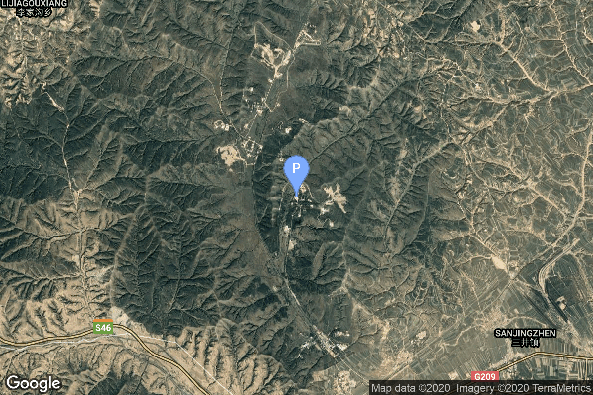
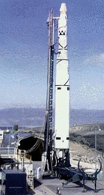
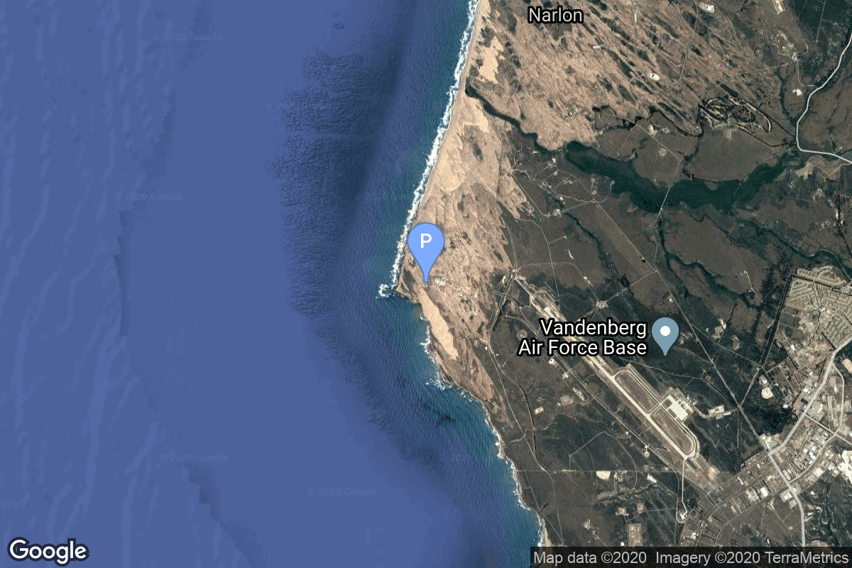
GET /2.3.0/launches/?format=api&offset=6320&ordering=id
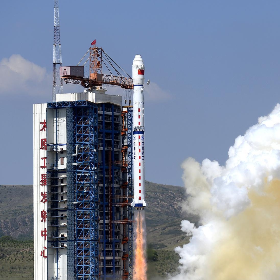
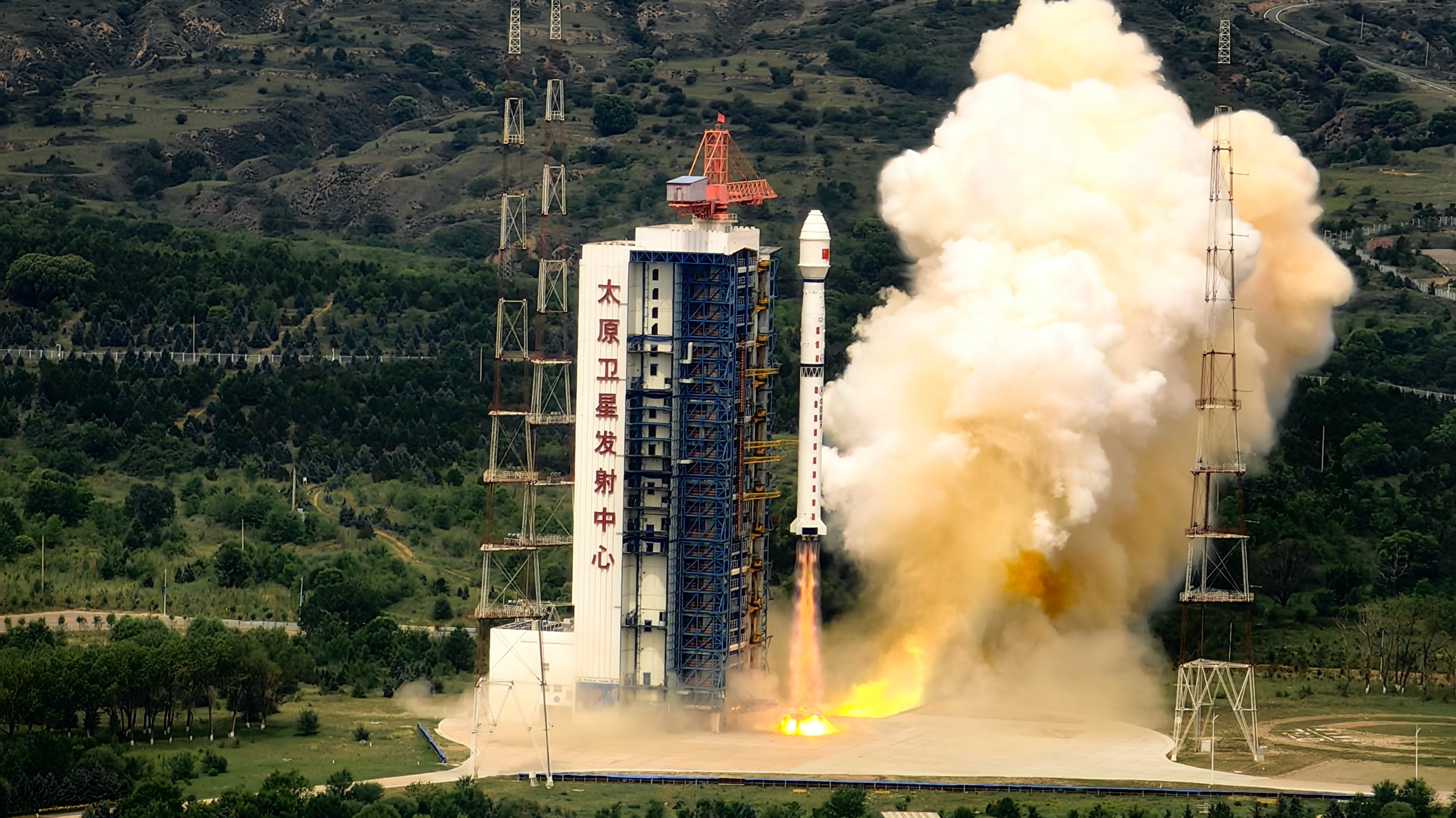
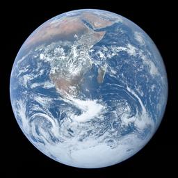
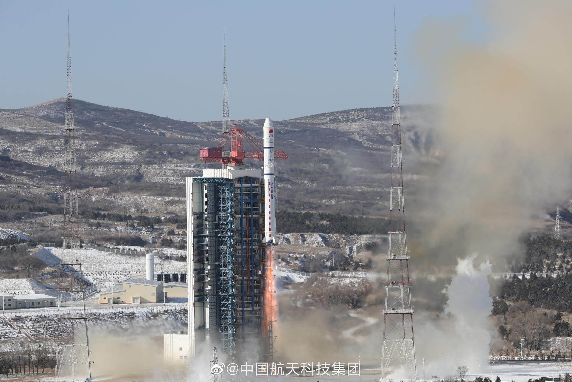
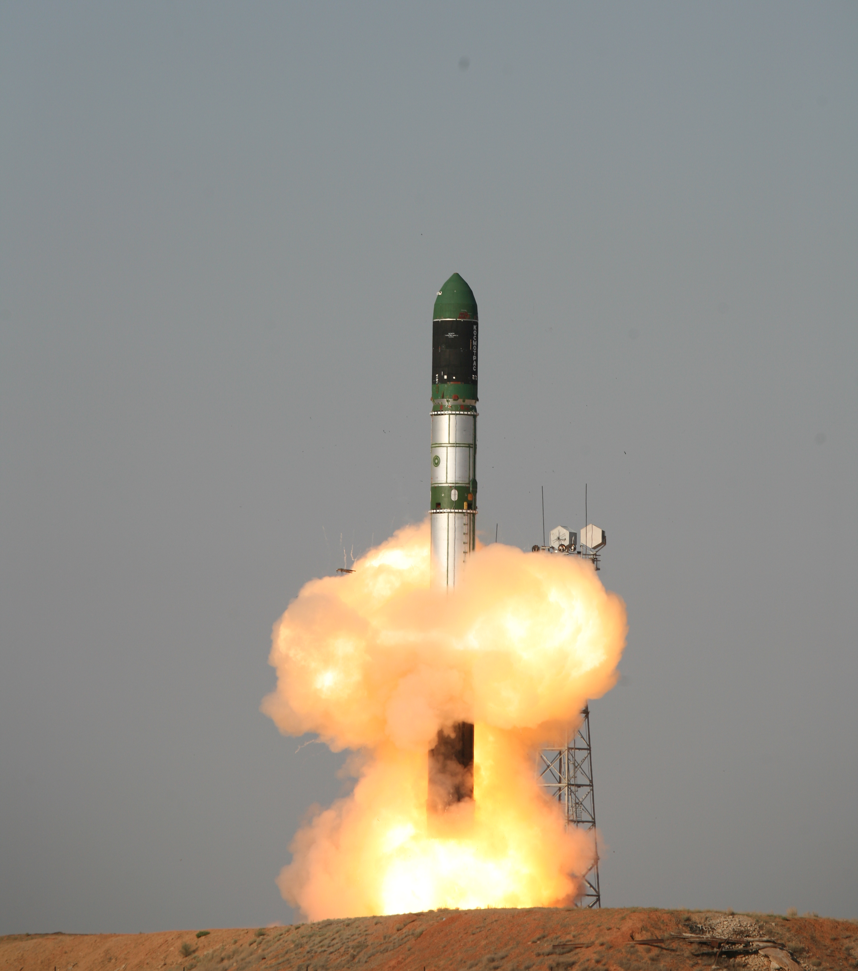
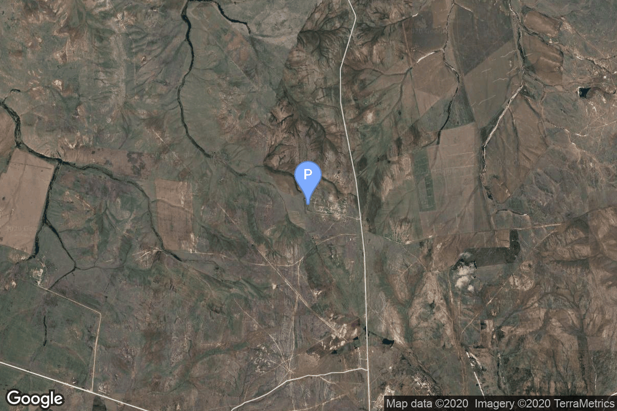
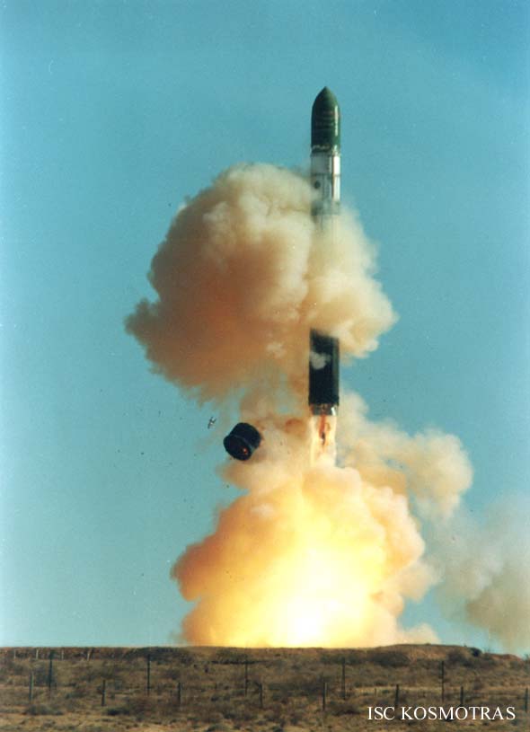
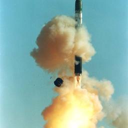
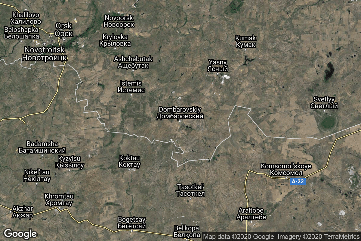
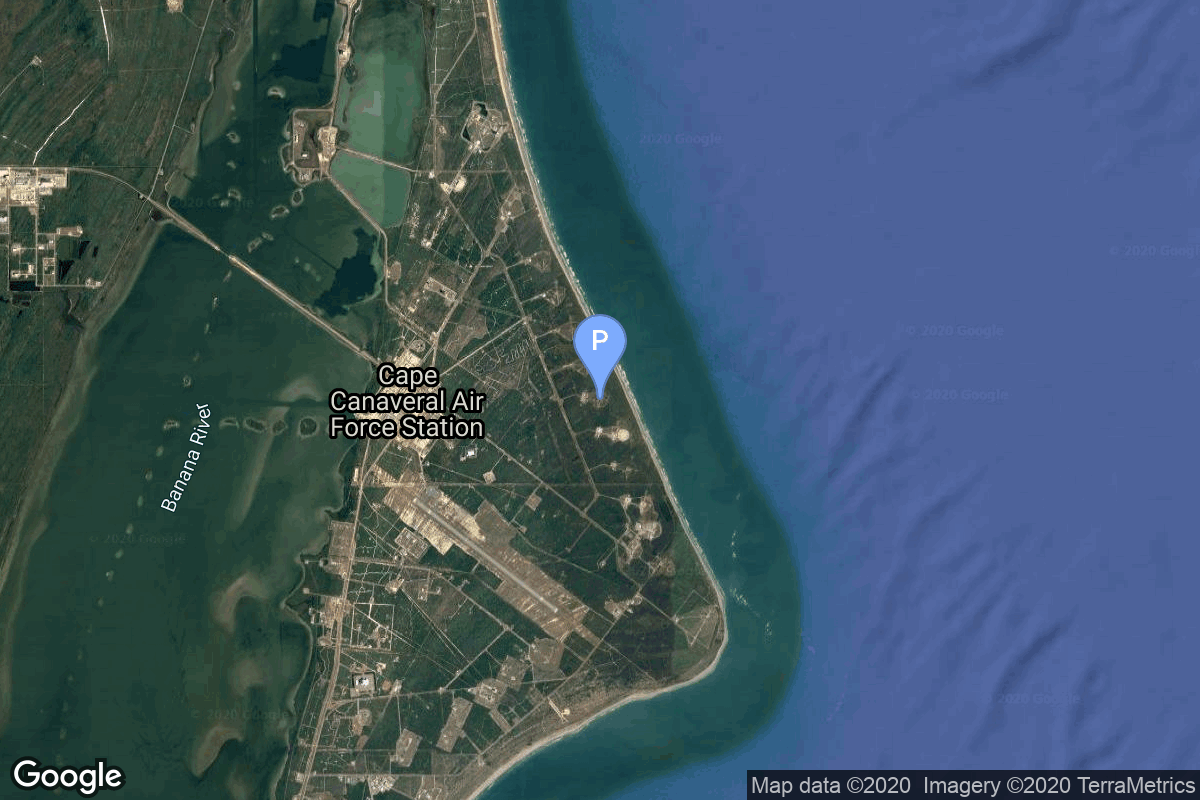
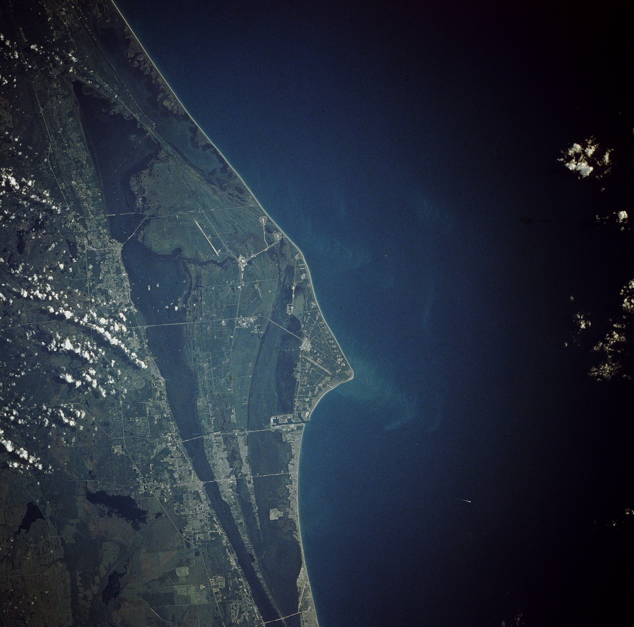
{ "count": 7530, "next": "https://ll.thespacedevs.com/2.3.0/launches/?format=api&limit=10&offset=6330&ordering=id", "previous": "https://ll.thespacedevs.com/2.3.0/launches/?format=api&limit=10&offset=6310&ordering=id", "results": [ { "id": "d6649b8e-e425-414b-8c07-1490404b8fb4", "url": "https://ll.thespacedevs.com/2.3.0/launches/d6649b8e-e425-414b-8c07-1490404b8fb4/?format=api", "name": "Long March 4B | Shiyan-6-03", "response_mode": "normal", "slug": "long-march-4b-shiyan-6-03", "launch_designator": "2021-028", "status": { "id": 3, "name": "Launch Successful", "abbrev": "Success", "description": "The launch vehicle successfully inserted its payload(s) into the target orbit(s)." }, "last_updated": "2023-06-14T03:42:38Z", "net": "2021-04-08T23:01:00Z", "net_precision": null, "window_end": "2021-04-08T23:47:00Z", "window_start": "2021-04-08T22:54:00Z", "image": { "id": 1775, "name": "[AUTO] Long March 4B - image", "image_url": "https://thespacedevs-prod.nyc3.digitaloceanspaces.com/media/images/long2520march25204_image_20190430065008.jpg", "thumbnail_url": "https://thespacedevs-prod.nyc3.digitaloceanspaces.com/media/images/255bauto255d__image_thumbnail_20240305193731.jpeg", "credit": null, "license": { "id": 1, "name": "Unknown", "priority": 9, "link": null }, "single_use": true, "variants": [] }, "infographic": null, "probability": null, "weather_concerns": null, "failreason": "", "hashtag": null, "launch_service_provider": { "response_mode": "list", "id": 88, "url": "https://ll.thespacedevs.com/2.3.0/agencies/88/?format=api", "name": "China Aerospace Science and Technology Corporation", "abbrev": "CASC", "type": { "id": 1, "name": "Government" } }, "rocket": { "id": 2849, "configuration": { "response_mode": "list", "id": 10, "url": "https://ll.thespacedevs.com/2.3.0/launcher_configurations/10/?format=api", "name": "Long March 4B", "families": [ { "response_mode": "list", "id": 106, "name": "Long March" }, { "response_mode": "list", "id": 111, "name": "Long March 4" } ], "full_name": "Long March 4B", "variant": "B" } }, "mission": null, "pad": { "id": 25, "url": "https://ll.thespacedevs.com/2.3.0/pads/25/?format=api", "active": true, "agencies": [], "name": "Launch Complex 9", "image": { "id": 2125, "name": "CZ-4B liftoff from LC-9 (Gaofen-11-05)", "image_url": "https://thespacedevs-prod.nyc3.digitaloceanspaces.com/media/images/cz-4b_liftoff__image_20240719064703.jpeg", "thumbnail_url": "https://thespacedevs-prod.nyc3.digitaloceanspaces.com/media/images/cz-4b_liftoff__image_thumbnail_20240719064704.jpeg", "credit": "中国航天科技集团", "license": { "id": 1, "name": "Unknown", "priority": 9, "link": null }, "single_use": false, "variants": [] }, "description": "", "info_url": null, "wiki_url": null, "map_url": "https://www.google.com/maps?q=38.863128,111.589567", "latitude": 38.863128, "longitude": 111.589567, "country": { "id": 6, "name": "China", "alpha_2_code": "CN", "alpha_3_code": "CHN", "nationality_name": "Chinese", "nationality_name_composed": "Sino" }, "map_image": "https://thespacedevs-prod.nyc3.digitaloceanspaces.com/media/map_images/pad_25_20200803143501.jpg", "total_launch_count": 76, "orbital_launch_attempt_count": 76, "fastest_turnaround": "P16DT20H3M", "location": { "response_mode": "normal", "id": 19, "url": "https://ll.thespacedevs.com/2.3.0/locations/19/?format=api", "name": "Taiyuan Satellite Launch Center, People's Republic of China", "celestial_body": { "response_mode": "normal", "id": 1, "name": "Earth", "type": { "id": 1, "name": "Planet" }, "diameter": 12742000.0, "mass": 5.972168e+24, "gravity": 9.80655, "length_of_day": "1 00:00:00", "atmosphere": true, "image": { "id": 2040, "name": "Earth (Apollo 17)", "image_url": "https://thespacedevs-prod.nyc3.digitaloceanspaces.com/media/images/earth_2528apol_image_20240402194304.jpeg", "thumbnail_url": "https://thespacedevs-prod.nyc3.digitaloceanspaces.com/media/images/earth_2528apol_image_thumbnail_20240402194305.jpeg", "credit": "NASA", "license": { "id": 4, "name": "NASA Image and Media Guidelines", "priority": 0, "link": "https://www.nasa.gov/nasa-brand-center/images-and-media/" }, "single_use": true, "variants": [] }, "description": "Earth is the third planet from the Sun and the only astronomical object known to harbor life.", "wiki_url": "https://en.wikipedia.org/wiki/Earth", "total_attempted_launches": 7182, "successful_launches": 6636, "failed_launches": 546, "total_attempted_landings": 1125, "successful_landings": 1080, "failed_landings": 45 }, "active": true, "country": { "id": 6, "name": "China", "alpha_2_code": "CN", "alpha_3_code": "CHN", "nationality_name": "Chinese", "nationality_name_composed": "Sino" }, "description": "The Taiyuan Satellite Launch Center is a People's Republic of China space and defense launch facility. It is situated in Kelan County, Xinzhou, Shanxi Province and is the second of four launch sites having been founded in March 1966 and coming into full operation in 1968.", "image": { "id": 1369, "name": "[AUTO] Long March 2D | 6 x Jilin-1, Qilu-2/3 & others - image", "image_url": "https://thespacedevs-prod.nyc3.digitaloceanspaces.com/media/images/long2520march_image_20230907134308.jpeg", "thumbnail_url": "https://thespacedevs-prod.nyc3.digitaloceanspaces.com/media/images/255bauto255d__image_thumbnail_20240305192538.jpeg", "credit": null, "license": { "id": 1, "name": "Unknown", "priority": 9, "link": null }, "single_use": true, "variants": [] }, "map_image": "https://thespacedevs-prod.nyc3.digitaloceanspaces.com/media/map_images/location_19_20200803142421.jpg", "longitude": 111.608, "latitude": 38.8491, "timezone_name": "Asia/Shanghai", "total_launch_count": 142, "total_landing_count": 0 } }, "webcast_live": false, "program": [], "orbital_launch_attempt_count": 6066, "location_launch_attempt_count": 90, "pad_launch_attempt_count": 49, "agency_launch_attempt_count": 312, "orbital_launch_attempt_count_year": 6066, "location_launch_attempt_count_year": 1, "pad_launch_attempt_count_year": 1, "agency_launch_attempt_count_year": 8 }, { "id": "d66cda59-131e-4d51-a3cd-df42b9b703d4", "url": "https://ll.thespacedevs.com/2.3.0/launches/d66cda59-131e-4d51-a3cd-df42b9b703d4/?format=api", "name": "Dnepr 1 | KOMPSat-5 (Arirang-5)", "response_mode": "normal", "slug": "dnepr-1-kompsat-5-arirang-5", "launch_designator": "2013-042", "status": { "id": 3, "name": "Launch Successful", "abbrev": "Success", "description": "The launch vehicle successfully inserted its payload(s) into the target orbit(s)." }, "last_updated": "2023-07-07T13:35:44Z", "net": "2013-08-22T14:39:13Z", "net_precision": null, "window_end": "2013-08-22T14:39:13Z", "window_start": "2013-08-22T14:39:13Z", "image": { "id": 2059, "name": "Dnepr-1 liftoff (TanDEM-X)", "image_url": "https://thespacedevs-prod.nyc3.digitaloceanspaces.com/media/images/dnepr-1_liftoff_image_20240411092543.jpeg", "thumbnail_url": "https://thespacedevs-prod.nyc3.digitaloceanspaces.com/media/images/dnepr-1_liftoff_image_thumbnail_20240411092543.jpeg", "credit": "DLR", "license": { "id": 19, "name": "CC BY 3.0", "priority": 4, "link": "https://creativecommons.org/licenses/by/3.0/" }, "single_use": true, "variants": [] }, "infographic": null, "probability": -1, "weather_concerns": null, "failreason": "", "hashtag": null, "launch_service_provider": { "response_mode": "list", "id": 119, "url": "https://ll.thespacedevs.com/2.3.0/agencies/119/?format=api", "name": "ISC Kosmotras", "abbrev": "ISCK", "type": { "id": 3, "name": "Commercial" } }, "rocket": { "id": 1695, "configuration": { "response_mode": "list", "id": 31, "url": "https://ll.thespacedevs.com/2.3.0/launcher_configurations/31/?format=api", "name": "Dnepr", "families": [], "full_name": "Dnepr 1", "variant": "1" } }, "mission": null, "pad": { "id": 183, "url": "https://ll.thespacedevs.com/2.3.0/pads/183/?format=api", "active": true, "agencies": [], "name": "370/13", "image": null, "description": null, "info_url": null, "wiki_url": "https://en.wikipedia.org/wiki/Dombarovsky_Air_Base", "map_url": "https://www.google.com/maps?q=51.0938889,59.8400282", "latitude": 51.0938889, "longitude": 59.8400282, "country": { "id": 5, "name": "Russia", "alpha_2_code": "RU", "alpha_3_code": "RUS", "nationality_name": "Russian", "nationality_name_composed": "Russo" }, "map_image": "https://thespacedevs-prod.nyc3.digitaloceanspaces.com/media/map_images/pad_183_20200803143512.jpg", "total_launch_count": 8, "orbital_launch_attempt_count": 8, "fastest_turnaround": "P90DT16H30M58S", "location": { "response_mode": "normal", "id": 5, "url": "https://ll.thespacedevs.com/2.3.0/locations/5/?format=api", "name": "Dombarovskiy, Russian Federation", "celestial_body": { "response_mode": "normal", "id": 1, "name": "Earth", "type": { "id": 1, "name": "Planet" }, "diameter": 12742000.0, "mass": 5.972168e+24, "gravity": 9.80655, "length_of_day": "1 00:00:00", "atmosphere": true, "image": { "id": 2040, "name": "Earth (Apollo 17)", "image_url": "https://thespacedevs-prod.nyc3.digitaloceanspaces.com/media/images/earth_2528apol_image_20240402194304.jpeg", "thumbnail_url": "https://thespacedevs-prod.nyc3.digitaloceanspaces.com/media/images/earth_2528apol_image_thumbnail_20240402194305.jpeg", "credit": "NASA", "license": { "id": 4, "name": "NASA Image and Media Guidelines", "priority": 0, "link": "https://www.nasa.gov/nasa-brand-center/images-and-media/" }, "single_use": true, "variants": [] }, "description": "Earth is the third planet from the Sun and the only astronomical object known to harbor life.", "wiki_url": "https://en.wikipedia.org/wiki/Earth", "total_attempted_launches": 7182, "successful_launches": 6636, "failed_launches": 546, "total_attempted_landings": 1125, "successful_landings": 1080, "failed_landings": 45 }, "active": true, "country": { "id": 5, "name": "Russia", "alpha_2_code": "RU", "alpha_3_code": "RUS", "nationality_name": "Russian", "nationality_name_composed": "Russo" }, "description": "Dombarovsky is a military airbase near Yasny in Russia's Orenburg Oblast. Operated by the Soviet Air Defence Forces and later by the Russian Air Force, it hosted fighter interceptor squadrons and hosts an ICBM base (which has been adapted for commercial satellite launches) with a supporting helicopter base.", "image": { "id": 2201, "name": "Dnepr 1 liftoff (Prisma)", "image_url": "https://thespacedevs-prod.nyc3.digitaloceanspaces.com/media/images/dnepr_1_liftoff_image_20240918152530.jpg", "thumbnail_url": "https://thespacedevs-prod.nyc3.digitaloceanspaces.com/media/images/dnepr_1_liftoff_image_thumbnail_20240918152530.jpeg", "credit": "ISC Kosmotras", "license": { "id": 2, "name": "ESA Standard Licence", "priority": 2, "link": "https://www.esa.int/ESA_Multimedia/Terms_and_conditions_of_use_of_images_and_videos_available_on_the_esa_website" }, "single_use": true, "variants": [] }, "map_image": "https://thespacedevs-prod.nyc3.digitaloceanspaces.com/media/map_images/location_5_20200803142425.jpg", "longitude": 59.853333, "latitude": 51.048889, "timezone_name": "Asia/Yekaterinburg", "total_launch_count": 10, "total_landing_count": 0 } }, "webcast_live": false, "program": [], "orbital_launch_attempt_count": 5312, "location_launch_attempt_count": 6, "pad_launch_attempt_count": 4, "agency_launch_attempt_count": 18, "orbital_launch_attempt_count_year": 5312, "location_launch_attempt_count_year": 1, "pad_launch_attempt_count_year": 1, "agency_launch_attempt_count_year": 1 }, { "id": "d675fb92-f9a8-4a5e-bd88-19f0f37c0355", "url": "https://ll.thespacedevs.com/2.3.0/launches/d675fb92-f9a8-4a5e-bd88-19f0f37c0355/?format=api", "name": "Atlas SLV-3 Agena D | GATV 10", "response_mode": "normal", "slug": "atlas-slv-3-agena-d-gatv-10", "launch_designator": "1966-065", "status": { "id": 3, "name": "Launch Successful", "abbrev": "Success", "description": "The launch vehicle successfully inserted its payload(s) into the target orbit(s)." }, "last_updated": "2023-06-14T17:42:42Z", "net": "1966-07-18T20:39:46Z", "net_precision": null, "window_end": "1966-07-18T20:39:46Z", "window_start": "1966-07-18T20:39:46Z", "image": null, "infographic": null, "probability": null, "weather_concerns": null, "failreason": "", "hashtag": null, "launch_service_provider": { "response_mode": "list", "id": 161, "url": "https://ll.thespacedevs.com/2.3.0/agencies/161/?format=api", "name": "United States Air Force", "abbrev": "USAF", "type": { "id": 1, "name": "Government" } }, "rocket": { "id": 3551, "configuration": { "response_mode": "list", "id": 258, "url": "https://ll.thespacedevs.com/2.3.0/launcher_configurations/258/?format=api", "name": "Atlas SLV-3 Agena D", "families": [ { "response_mode": "list", "id": 66, "name": "Atlas" }, { "response_mode": "list", "id": 188, "name": "Atlas D" } ], "full_name": "Atlas SLV-3 Agena D", "variant": "SLV-3 Agena D" } }, "mission": { "id": 1971, "name": "GATV 10", "type": "Test Target", "description": "The GATV (Gemini Agena Target Vehicle) was designed to be launched into Earth orbit prior to a Gemini mission and used for rendezvous and docking practice.", "image": null, "orbit": { "id": 8, "name": "Low Earth Orbit", "abbrev": "LEO", "celestial_body": { "response_mode": "list", "id": 1, "name": "Earth" } }, "agencies": [], "info_urls": [], "vid_urls": [] }, "pad": { "id": 17, "url": "https://ll.thespacedevs.com/2.3.0/pads/17/?format=api", "active": true, "agencies": [ { "response_mode": "normal", "id": 1048, "url": "https://ll.thespacedevs.com/2.3.0/agencies/1048/?format=api", "name": "Stoke Space", "abbrev": "Stoke", "type": { "id": 5, "name": "Private" }, "featured": false, "country": [ { "id": 2, "name": "United States of America", "alpha_2_code": "US", "alpha_3_code": "USA", "nationality_name": "American", "nationality_name_composed": "Americano" } ], "description": "Stoke Space Technologies is an American space launch company based in the Seattle suburb of Kent, Washington.", "administrator": "CEO: Andy Lapsa", "founding_year": null, "launchers": "", "spacecraft": "", "parent": null, "image": null, "logo": { "id": 187, "name": "[AUTO] Stoke Space - logo", "image_url": "https://thespacedevs-prod.nyc3.digitaloceanspaces.com/media/images/stoke2520space_logo_20230308081301.png", "thumbnail_url": "https://thespacedevs-prod.nyc3.digitaloceanspaces.com/media/images/255bauto255d__image_thumbnail_20240305185139.png", "credit": null, "license": { "id": 1, "name": "Unknown", "priority": 9, "link": null }, "single_use": true, "variants": [] }, "social_logo": null } ], "name": "Space Launch Complex 14", "image": null, "description": null, "info_url": null, "wiki_url": "https://en.wikipedia.org/wiki/Cape_Canaveral_Air_Force_Station_Launch_Complex_14", "map_url": "https://www.google.com/maps?q=28.49103,-80.54687", "latitude": 28.49103, "longitude": -80.54687, "country": { "id": 2, "name": "United States of America", "alpha_2_code": "US", "alpha_3_code": "USA", "nationality_name": "American", "nationality_name_composed": "Americano" }, "map_image": "https://thespacedevs-prod.nyc3.digitaloceanspaces.com/media/map_images/pad_17_20200803143405.jpg", "total_launch_count": 20, "orbital_launch_attempt_count": 16, "fastest_turnaround": "P14DT23H44M59S", "location": { "response_mode": "normal", "id": 12, "url": "https://ll.thespacedevs.com/2.3.0/locations/12/?format=api", "name": "Cape Canaveral SFS, FL, USA", "celestial_body": { "response_mode": "normal", "id": 1, "name": "Earth", "type": { "id": 1, "name": "Planet" }, "diameter": 12742000.0, "mass": 5.972168e+24, "gravity": 9.80655, "length_of_day": "1 00:00:00", "atmosphere": true, "image": { "id": 2040, "name": "Earth (Apollo 17)", "image_url": "https://thespacedevs-prod.nyc3.digitaloceanspaces.com/media/images/earth_2528apol_image_20240402194304.jpeg", "thumbnail_url": "https://thespacedevs-prod.nyc3.digitaloceanspaces.com/media/images/earth_2528apol_image_thumbnail_20240402194305.jpeg", "credit": "NASA", "license": { "id": 4, "name": "NASA Image and Media Guidelines", "priority": 0, "link": "https://www.nasa.gov/nasa-brand-center/images-and-media/" }, "single_use": true, "variants": [] }, "description": "Earth is the third planet from the Sun and the only astronomical object known to harbor life.", "wiki_url": "https://en.wikipedia.org/wiki/Earth", "total_attempted_launches": 7182, "successful_launches": 6636, "failed_launches": 546, "total_attempted_landings": 1125, "successful_landings": 1080, "failed_landings": 45 }, "active": true, "country": { "id": 2, "name": "United States of America", "alpha_2_code": "US", "alpha_3_code": "USA", "nationality_name": "American", "nationality_name_composed": "Americano" }, "description": "Cape Canaveral Space Force Station (CCSFS) is an installation of the United States Space Force's Space Launch Delta 45, located on Cape Canaveral in Brevard County, Florida.", "image": { "id": 2200, "name": "Cape Canaveral & KSC seen from orbit (STS-43)", "image_url": "https://thespacedevs-prod.nyc3.digitaloceanspaces.com/media/images/cape_canaveral__image_20240918151615.jpg", "thumbnail_url": "https://thespacedevs-prod.nyc3.digitaloceanspaces.com/media/images/cape_canaveral__image_thumbnail_20240918151616.jpeg", "credit": "NASA", "license": { "id": 4, "name": "NASA Image and Media Guidelines", "priority": 0, "link": "https://www.nasa.gov/nasa-brand-center/images-and-media/" }, "single_use": true, "variants": [] }, "map_image": "https://thespacedevs-prod.nyc3.digitaloceanspaces.com/media/map_images/location_12_20200803142519.jpg", "longitude": -80.577778, "latitude": 28.488889, "timezone_name": "America/New_York", "total_launch_count": 1028, "total_landing_count": 64 } }, "webcast_live": false, "program": [ { "response_mode": "normal", "id": 3, "url": "https://ll.thespacedevs.com/2.3.0/programs/3/?format=api", "name": "Gemini", "image": { "id": 1895, "name": "[AUTO] Gemini - image", "image_url": "https://thespacedevs-prod.nyc3.digitaloceanspaces.com/media/images/project2520gem_program_20200820195350.png", "thumbnail_url": "https://thespacedevs-prod.nyc3.digitaloceanspaces.com/media/images/255bauto255d__image_thumbnail_20240305194053.png", "credit": null, "license": { "id": 1, "name": "Unknown", "priority": 9, "link": null }, "single_use": true, "variants": [] }, "info_url": "https://www.nasa.gov/mission_pages/gemini/index.html", "wiki_url": "https://en.wikipedia.org/wiki/Project_Gemini", "description": "Project Gemini was NASA's second human spaceflight program. Conducted between projects Mercury and Apollo, Gemini started in 1961 and concluded in 1966.", "agencies": [ { "response_mode": "list", "id": 44, "url": "https://ll.thespacedevs.com/2.3.0/agencies/44/?format=api", "name": "National Aeronautics and Space Administration", "abbrev": "NASA", "type": { "id": 1, "name": "Government" } } ], "start_date": "1961-12-07T00:00:00Z", "end_date": "1966-11-15T19:21:04Z", "mission_patches": [], "type": { "id": 2, "name": "Human Spaceflight" } } ], "orbital_launch_attempt_count": 589, "location_launch_attempt_count": 176, "pad_launch_attempt_count": 18, "agency_launch_attempt_count": 338, "orbital_launch_attempt_count_year": 72, "location_launch_attempt_count_year": 17, "pad_launch_attempt_count_year": 4, "agency_launch_attempt_count_year": 39 }, { "id": "d6772a56-b47e-425c-a445-206613749e26", "url": "https://ll.thespacedevs.com/2.3.0/launches/d6772a56-b47e-425c-a445-206613749e26/?format=api", "name": "Thor DM-21 Agena-B | KH-4 1", "response_mode": "normal", "slug": "thor-dm-21-agena-b-kh-4-1", "launch_designator": "1962-005", "status": { "id": 3, "name": "Launch Successful", "abbrev": "Success", "description": "The launch vehicle successfully inserted its payload(s) into the target orbit(s)." }, "last_updated": "2023-06-14T04:18:28Z", "net": "1962-02-27T19:39:20Z", "net_precision": null, "window_end": "1962-02-27T19:39:20Z", "window_start": "1962-02-27T19:39:20Z", "image": { "id": 1853, "name": "[AUTO] Thor DM-21 Agena-B - image", "image_url": "https://thespacedevs-prod.nyc3.digitaloceanspaces.com/media/images/thor2520dm-212520agena-b_image_20190414123658.jpg", "thumbnail_url": "https://thespacedevs-prod.nyc3.digitaloceanspaces.com/media/images/255bauto255d__image_thumbnail_20240305193937.jpeg", "credit": null, "license": { "id": 1, "name": "Unknown", "priority": 9, "link": null }, "single_use": true, "variants": [] }, "infographic": null, "probability": null, "weather_concerns": null, "failreason": null, "hashtag": null, "launch_service_provider": { "response_mode": "list", "id": 161, "url": "https://ll.thespacedevs.com/2.3.0/agencies/161/?format=api", "name": "United States Air Force", "abbrev": "USAF", "type": { "id": 1, "name": "Government" } }, "rocket": { "id": 3107, "configuration": { "response_mode": "list", "id": 186, "url": "https://ll.thespacedevs.com/2.3.0/launcher_configurations/186/?format=api", "name": "Thor DM-21 Agena-B", "families": [ { "response_mode": "list", "id": 73, "name": "Thor" }, { "response_mode": "list", "id": 193, "name": "Thor-Agena" } ], "full_name": "Thor DM-21 Agena-B", "variant": "" } }, "mission": { "id": 1529, "name": "KH-4 1", "type": "Government/Top Secret", "description": "The KH-4 (Keyhole-4) was fourth version in the Corona-program to build an optical reconnaissance satellite.", "image": null, "orbit": { "id": 8, "name": "Low Earth Orbit", "abbrev": "LEO", "celestial_body": { "response_mode": "list", "id": 1, "name": "Earth" } }, "agencies": [], "info_urls": [], "vid_urls": [] }, "pad": { "id": 95, "url": "https://ll.thespacedevs.com/2.3.0/pads/95/?format=api", "active": false, "agencies": [ { "response_mode": "normal", "id": 161, "url": "https://ll.thespacedevs.com/2.3.0/agencies/161/?format=api", "name": "United States Air Force", "abbrev": "USAF", "type": { "id": 1, "name": "Government" }, "featured": false, "country": [ { "id": 2, "name": "United States of America", "alpha_2_code": "US", "alpha_3_code": "USA", "nationality_name": "American", "nationality_name_composed": "Americano" } ], "description": "The United States Air Force (USAF) is the air service branch of the United States Armed Forces, and is one of the eight uniformed services of the United States. Originally created on 1 August 1907, as a part of the United States Army Signal Corps, the USAF was established as a separate branch of the United States Armed Forces in 1947 with the enactment of the National Security Act of 1947.", "administrator": "Commander-in-Chief: President of the US", "founding_year": 1947, "launchers": "", "spacecraft": "", "parent": null, "image": null, "logo": { "id": 193, "name": "[AUTO] United States Air Force - logo", "image_url": "https://thespacedevs-prod.nyc3.digitaloceanspaces.com/media/images/united2520states2520air2520force_logo_20230804084626.png", "thumbnail_url": "https://thespacedevs-prod.nyc3.digitaloceanspaces.com/media/images/255bauto255d__image_thumbnail_20240305185152.png", "credit": null, "license": { "id": 1, "name": "Unknown", "priority": 9, "link": null }, "single_use": true, "variants": [] }, "social_logo": { "id": 99, "name": "[AUTO] United States Air Force - social_logo", "image_url": "https://thespacedevs-prod.nyc3.digitaloceanspaces.com/media/images/united2520states2520air2520force_nation_20230804085132.jpg", "thumbnail_url": "https://thespacedevs-prod.nyc3.digitaloceanspaces.com/media/images/255bauto255d__image_thumbnail_20240305184855.jpeg", "credit": null, "license": { "id": 1, "name": "Unknown", "priority": 9, "link": null }, "single_use": true, "variants": [] } } ], "name": "Space Launch Complex 1W", "image": null, "description": "Space Launch Complex 1 West (SLC-1W) was a launch pad at Vandenberg Space Force Base in California, United States. It was built in 1958 for the never activated 75th Strategic Missile Squadron for Thor Agena A launches.", "info_url": null, "wiki_url": "https://en.wikipedia.org/wiki/Vandenberg_Space_Launch_Complex_1", "map_url": "https://www.google.com/maps?q=34.7572,-120.6303", "latitude": 34.7572, "longitude": -120.6303, "country": { "id": 2, "name": "United States of America", "alpha_2_code": "US", "alpha_3_code": "USA", "nationality_name": "American", "nationality_name_composed": "Americano" }, "map_image": "https://thespacedevs-prod.nyc3.digitaloceanspaces.com/media/map_images/pad_95_20200803143209.jpg", "total_launch_count": 56, "orbital_launch_attempt_count": 56, "fastest_turnaround": "P13DT1H26M", "location": { "response_mode": "normal", "id": 11, "url": "https://ll.thespacedevs.com/2.3.0/locations/11/?format=api", "name": "Vandenberg SFB, CA, USA", "celestial_body": { "response_mode": "normal", "id": 1, "name": "Earth", "type": { "id": 1, "name": "Planet" }, "diameter": 12742000.0, "mass": 5.972168e+24, "gravity": 9.80655, "length_of_day": "1 00:00:00", "atmosphere": true, "image": { "id": 2040, "name": "Earth (Apollo 17)", "image_url": "https://thespacedevs-prod.nyc3.digitaloceanspaces.com/media/images/earth_2528apol_image_20240402194304.jpeg", "thumbnail_url": "https://thespacedevs-prod.nyc3.digitaloceanspaces.com/media/images/earth_2528apol_image_thumbnail_20240402194305.jpeg", "credit": "NASA", "license": { "id": 4, "name": "NASA Image and Media Guidelines", "priority": 0, "link": "https://www.nasa.gov/nasa-brand-center/images-and-media/" }, "single_use": true, "variants": [] }, "description": "Earth is the third planet from the Sun and the only astronomical object known to harbor life.", "wiki_url": "https://en.wikipedia.org/wiki/Earth", "total_attempted_launches": 7182, "successful_launches": 6636, "failed_launches": 546, "total_attempted_landings": 1125, "successful_landings": 1080, "failed_landings": 45 }, "active": true, "country": { "id": 2, "name": "United States of America", "alpha_2_code": "US", "alpha_3_code": "USA", "nationality_name": "American", "nationality_name_composed": "Americano" }, "description": "Vandenberg Space Force Base is a United States Space Force Base in Santa Barbara County, California. Established in 1941, Vandenberg Space Force Base is a space launch base, launching spacecraft from the Western Range, and also performs missile testing. The United States Space Force's Space Launch Delta 30 serves as the host delta for the base, equivalent to an Air Force air base wing. In addition to its military space launch mission, Vandenberg Space Force Base also hosts space launches for civil and commercial space entities, such as NASA and SpaceX.", "image": { "id": 2226, "name": "Vandenberg SFB imaged by Sentinel-2", "image_url": "https://thespacedevs-prod.nyc3.digitaloceanspaces.com/media/images/vandenberg_sfb__image_20240920082910.jpeg", "thumbnail_url": "https://thespacedevs-prod.nyc3.digitaloceanspaces.com/media/images/vandenberg_sfb__image_thumbnail_20240920082910.jpeg", "credit": "Contains modified Copernicus Sentinel data 2020", "license": { "id": 33, "name": "Copernicus Image Use Policy", "priority": 0, "link": "https://eur-lex.europa.eu/legal-content/EN/TXT/?uri=CELEX:32013R1159" }, "single_use": true, "variants": [] }, "map_image": "https://thespacedevs-prod.nyc3.digitaloceanspaces.com/media/map_images/location_11_20200803142416.jpg", "longitude": -120.52023, "latitude": 34.75133, "timezone_name": "America/Los_Angeles", "total_launch_count": 811, "total_landing_count": 26 } }, "webcast_live": false, "program": [], "orbital_launch_attempt_count": 149, "location_launch_attempt_count": 47, "pad_launch_attempt_count": 21, "agency_launch_attempt_count": 77, "orbital_launch_attempt_count_year": 7, "location_launch_attempt_count_year": 3, "pad_launch_attempt_count_year": 2, "agency_launch_attempt_count_year": 6 }, { "id": "d68320e6-6584-4d0b-8da0-71e978d5b8cf", "url": "https://ll.thespacedevs.com/2.3.0/launches/d68320e6-6584-4d0b-8da0-71e978d5b8cf/?format=api", "name": "H-IIA 202 | Michibiki 2 (QZS-2)", "response_mode": "normal", "slug": "h-iia-202-michibiki-2-qzs-2", "launch_designator": "2017-028", "status": { "id": 3, "name": "Launch Successful", "abbrev": "Success", "description": "The launch vehicle successfully inserted its payload(s) into the target orbit(s)." }, "last_updated": "2023-06-14T03:53:07Z", "net": "2017-06-01T00:17:46Z", "net_precision": null, "window_end": "2017-06-01T00:17:46Z", "window_start": "2017-06-01T00:17:46Z", "image": { "id": 1482, "name": "H-IIA 202 liftoff (XRISM & SLIM)", "image_url": "https://thespacedevs-prod.nyc3.digitaloceanspaces.com/media/images/h-iia_202_lifto_image_20240325123250.jpg", "thumbnail_url": "https://thespacedevs-prod.nyc3.digitaloceanspaces.com/media/images/h-iia_202_lifto_image_thumbnail_20240325123250.jpeg", "credit": "Mitsubishi Heavy Industries", "license": { "id": 1, "name": "Unknown", "priority": 9, "link": null }, "single_use": false, "variants": [] }, "infographic": null, "probability": -1, "weather_concerns": null, "failreason": null, "hashtag": null, "launch_service_provider": { "response_mode": "list", "id": 98, "url": "https://ll.thespacedevs.com/2.3.0/agencies/98/?format=api", "name": "Mitsubishi Heavy Industries", "abbrev": "MHI", "type": { "id": 3, "name": "Commercial" } }, "rocket": { "id": 2004, "configuration": { "response_mode": "list", "id": 32, "url": "https://ll.thespacedevs.com/2.3.0/launcher_configurations/32/?format=api", "name": "H-IIA", "families": [ { "response_mode": "list", "id": 88, "name": "H-II" } ], "full_name": "H-IIA 202", "variant": "202" } }, "mission": { "id": 614, "name": "Michibiki 2 (QZS-2)", "type": "Navigation", "description": "The Quasi-Zenith Satellite System (QZSS) is a three-satellite regional time transfer system and the satellite-based augmentation system for the GPS that would be receivable within Japan. The primary purpose of QZSS is to increase the availability of GPS in Japan's numerous urban canyons, where only satellites at very high elevation can be seen. A secondary function is performance enhancement, increasing the accuracy and reliability of GPS derived navigation solutions. A single satellite weighs about 4000 kg, has an expected lifetime of 15 years and is put in a elliptical, highly inclined geosynchronous orbit.", "image": null, "orbit": { "id": 4, "name": "Geosynchronous Transfer Orbit", "abbrev": "GSTO", "celestial_body": { "response_mode": "list", "id": 1, "name": "Earth" } }, "agencies": [], "info_urls": [], "vid_urls": [] }, "pad": { "id": 41, "url": "https://ll.thespacedevs.com/2.3.0/pads/41/?format=api", "active": true, "agencies": [ { "response_mode": "normal", "id": 37, "url": "https://ll.thespacedevs.com/2.3.0/agencies/37/?format=api", "name": "Japan Aerospace Exploration Agency", "abbrev": "JAXA", "type": { "id": 1, "name": "Government" }, "featured": true, "country": [ { "id": 28, "name": "Japan", "alpha_2_code": "JP", "alpha_3_code": "JPN", "nationality_name": "Japanese", "nationality_name_composed": "Nippo" } ], "description": "The Japan Aerospace Exploration Agency (JAXA) is Japan's national aero-space agency. Through the merger of three previously independent organizations, JAXA was formed on 1 October 2003. JAXA is responsible for research, technology development and the launch of satellites into orbit, and is involved in many more advanced missions, such as asteroid exploration and possible manned exploration of the Moon. JAXA launch their Epsilon vehicle from the Uchinoura Space Center and their H-II vehicles from the Tanegashima Space Center.", "administrator": "Administrator: Hiroshi Yamakawa", "founding_year": 2003, "launchers": "H-II", "spacecraft": "", "parent": null, "image": { "id": 16, "name": "[AUTO] Japan Aerospace Exploration Agency - image", "image_url": "https://thespacedevs-prod.nyc3.digitaloceanspaces.com/media/images/japan2520aerospace2520exploration2520agency_image_20190207032440.jpeg", "thumbnail_url": "https://thespacedevs-prod.nyc3.digitaloceanspaces.com/media/images/255bauto255d__image_thumbnail_20240305184621.jpeg", "credit": null, "license": { "id": 1, "name": "Unknown", "priority": 9, "link": null }, "single_use": true, "variants": [] }, "logo": { "id": 151, "name": "[AUTO] Japan Aerospace Exploration Agency - logo", "image_url": "https://thespacedevs-prod.nyc3.digitaloceanspaces.com/media/images/japan2520aerospace2520exploration2520agency_logo_20190207032440.png", "thumbnail_url": "https://thespacedevs-prod.nyc3.digitaloceanspaces.com/media/images/255bauto255d__image_thumbnail_20240305185023.png", "credit": null, "license": { "id": 1, "name": "Unknown", "priority": 9, "link": null }, "single_use": true, "variants": [] }, "social_logo": { "id": 69, "name": "[AUTO] Japan Aerospace Exploration Agency - social_logo", "image_url": "https://thespacedevs-prod.nyc3.digitaloceanspaces.com/media/images/japan2520aerospace2520exploration2520agency_nation_20230531052930.png", "thumbnail_url": "https://thespacedevs-prod.nyc3.digitaloceanspaces.com/media/images/255bauto255d__image_thumbnail_20240305184813.png", "credit": null, "license": { "id": 1, "name": "Unknown", "priority": 9, "link": null }, "single_use": true, "variants": [] } } ], "name": "Yoshinobu Launch Complex LP-1", "image": { "id": 1520, "name": "H-IIA 202 liftoff from LP-1 (IGS Radar 7)", "image_url": "https://thespacedevs-prod.nyc3.digitaloceanspaces.com/media/images/h-iia25202022_image_20240101101918.jpeg", "thumbnail_url": "https://thespacedevs-prod.nyc3.digitaloceanspaces.com/media/images/255bauto255d__image_thumbnail_20240305193026.jpeg", "credit": "Mitsubishi Heavy Industries", "license": { "id": 1, "name": "Unknown", "priority": 9, "link": null }, "single_use": false, "variants": [] }, "description": "", "info_url": null, "wiki_url": "https://en.wikipedia.org/wiki/Yoshinobu_Launch_Complex", "map_url": "https://www.google.com/maps?q=30.400813,130.977748", "latitude": 30.400813, "longitude": 130.977748, "country": { "id": 28, "name": "Japan", "alpha_2_code": "JP", "alpha_3_code": "JPN", "nationality_name": "Japanese", "nationality_name_composed": "Nippo" }, "map_image": "https://thespacedevs-prod.nyc3.digitaloceanspaces.com/media/map_images/pad_41_20200803143551.jpg", "total_launch_count": 56, "orbital_launch_attempt_count": 56, "fastest_turnaround": "P25DT4H54M", "location": { "response_mode": "normal", "id": 26, "url": "https://ll.thespacedevs.com/2.3.0/locations/26/?format=api", "name": "Tanegashima Space Center, Japan", "celestial_body": { "response_mode": "normal", "id": 1, "name": "Earth", "type": { "id": 1, "name": "Planet" }, "diameter": 12742000.0, "mass": 5.972168e+24, "gravity": 9.80655, "length_of_day": "1 00:00:00", "atmosphere": true, "image": { "id": 2040, "name": "Earth (Apollo 17)", "image_url": "https://thespacedevs-prod.nyc3.digitaloceanspaces.com/media/images/earth_2528apol_image_20240402194304.jpeg", "thumbnail_url": "https://thespacedevs-prod.nyc3.digitaloceanspaces.com/media/images/earth_2528apol_image_thumbnail_20240402194305.jpeg", "credit": "NASA", "license": { "id": 4, "name": "NASA Image and Media Guidelines", "priority": 0, "link": "https://www.nasa.gov/nasa-brand-center/images-and-media/" }, "single_use": true, "variants": [] }, "description": "Earth is the third planet from the Sun and the only astronomical object known to harbor life.", "wiki_url": "https://en.wikipedia.org/wiki/Earth", "total_attempted_launches": 7182, "successful_launches": 6636, "failed_launches": 546, "total_attempted_landings": 1125, "successful_landings": 1080, "failed_landings": 45 }, "active": true, "country": { "id": 28, "name": "Japan", "alpha_2_code": "JP", "alpha_3_code": "JPN", "nationality_name": "Japanese", "nationality_name_composed": "Nippo" }, "description": "The Tanegashima Space Center is the largest rocket-launch complex in Japan. It is located on the southeastern tip of Tanegashima, an island located south of Kyushu, an island and region and Japan. It was established in 1969 when the National Space Development Agency of Japan (NASDA) was formed, and is now run by JAXA. The activities that take place at TNSC include assembly, testing, launching, and tracking satellites, as well as rocket engine firing tests.", "image": { "id": 2223, "name": "Tanegashima Space Center", "image_url": "https://thespacedevs-prod.nyc3.digitaloceanspaces.com/media/images/tanegashima_spa_image_20240920081514.jpg", "thumbnail_url": "https://thespacedevs-prod.nyc3.digitaloceanspaces.com/media/images/tanegashima_spa_image_thumbnail_20240920081514.jpeg", "credit": "JAXA", "license": { "id": 9, "name": "JAXA Image Usage Policy", "priority": 8, "link": "https://global.jaxa.jp/policy.html" }, "single_use": true, "variants": [] }, "map_image": "https://thespacedevs-prod.nyc3.digitaloceanspaces.com/media/map_images/location_26_20200803142507.jpg", "longitude": 130.97, "latitude": 30.4, "timezone_name": "Asia/Tokyo", "total_launch_count": 94, "total_landing_count": 0 } }, "webcast_live": false, "program": [], "orbital_launch_attempt_count": 5645, "location_launch_attempt_count": 71, "pad_launch_attempt_count": 41, "agency_launch_attempt_count": 33, "orbital_launch_attempt_count_year": 30, "location_launch_attempt_count_year": 3, "pad_launch_attempt_count_year": 3, "agency_launch_attempt_count_year": 3 }, { "id": "d68ba788-f668-4ee0-a88c-a8f6c4c0ebf1", "url": "https://ll.thespacedevs.com/2.3.0/launches/d68ba788-f668-4ee0-a88c-a8f6c4c0ebf1/?format=api", "name": "Delta IV M+(5,4) | WGS-9 (USA-275)", "response_mode": "normal", "slug": "delta-iv-m54-wgs-9-usa-275", "launch_designator": "2017-016", "status": { "id": 3, "name": "Launch Successful", "abbrev": "Success", "description": "The launch vehicle successfully inserted its payload(s) into the target orbit(s)." }, "last_updated": "2024-08-02T16:57:01Z", "net": "2017-03-19T00:18:00Z", "net_precision": null, "window_end": "2017-03-19T00:59:00Z", "window_start": "2017-03-18T23:44:00Z", "image": { "id": 1726, "name": "Delta IV M+(5,4) launching WGS-10", "image_url": "https://thespacedevs-prod.nyc3.digitaloceanspaces.com/media/images/delta_iv_m252b_image_20240308073027.jpeg", "thumbnail_url": "https://thespacedevs-prod.nyc3.digitaloceanspaces.com/media/images/delta_iv_m252b_image_thumbnail_20240308073027.jpeg", "credit": "United Launch Alliance", "license": { "id": 10, "name": "ULA Image Use Policy", "priority": 3, "link": "https://www.ulalaunch.com/terms-and-conditions" }, "single_use": true, "variants": [] }, "infographic": null, "probability": 100, "weather_concerns": null, "failreason": "", "hashtag": null, "launch_service_provider": { "response_mode": "list", "id": 124, "url": "https://ll.thespacedevs.com/2.3.0/agencies/124/?format=api", "name": "United Launch Alliance", "abbrev": "ULA", "type": { "id": 3, "name": "Commercial" } }, "rocket": { "id": 1992, "configuration": { "response_mode": "list", "id": 23, "url": "https://ll.thespacedevs.com/2.3.0/launcher_configurations/23/?format=api", "name": "Delta IV M+(5,4)", "families": [ { "response_mode": "list", "id": 72, "name": "Delta" }, { "response_mode": "list", "id": 175, "name": "Delta IV" } ], "full_name": "Delta IV M+(5,4)", "variant": "M+(5,4)" } }, "mission": { "id": 392, "name": "WGS-9 (USA-275)", "type": "Communications", "description": "WGS-9 is the ninth of 10 high-capacity military communications satellites providing vital service for tactical forces who rely on WGS for connectivity to the Defence Information Systems Network (DISN).", "image": null, "orbit": { "id": 2, "name": "Geostationary Transfer Orbit", "abbrev": "GTO", "celestial_body": { "response_mode": "list", "id": 1, "name": "Earth" } }, "agencies": [], "info_urls": [], "vid_urls": [] }, "pad": { "id": 38, "url": "https://ll.thespacedevs.com/2.3.0/pads/38/?format=api", "active": true, "agencies": [], "name": "Space Launch Complex 37B", "image": { "id": 2032, "name": "SLC-37B", "image_url": "https://thespacedevs-prod.nyc3.digitaloceanspaces.com/media/images/slc-37b_image_20240329083424.jpeg", "thumbnail_url": "https://thespacedevs-prod.nyc3.digitaloceanspaces.com/media/images/slc-37b_image_thumbnail_20240329083424.jpeg", "credit": "United Launch Alliance", "license": { "id": 10, "name": "ULA Image Use Policy", "priority": 3, "link": "https://www.ulalaunch.com/terms-and-conditions" }, "single_use": true, "variants": [] }, "description": "", "info_url": null, "wiki_url": "https://en.wikipedia.org/wiki/Cape_Canaveral_Air_Force_Station_Space_Launch_Complex_37", "map_url": "https://www.google.com/maps?q=28.5317,-80.56495", "latitude": 28.5317, "longitude": -80.56495, "country": { "id": 2, "name": "United States of America", "alpha_2_code": "US", "alpha_3_code": "USA", "nationality_name": "American", "nationality_name_composed": "Americano" }, "map_image": "https://thespacedevs-prod.nyc3.digitaloceanspaces.com/media/map_images/pad_38_20200803143515.jpg", "total_launch_count": 40, "orbital_launch_attempt_count": 40, "fastest_turnaround": "P66DT5H24M59S", "location": { "response_mode": "normal", "id": 12, "url": "https://ll.thespacedevs.com/2.3.0/locations/12/?format=api", "name": "Cape Canaveral SFS, FL, USA", "celestial_body": { "response_mode": "normal", "id": 1, "name": "Earth", "type": { "id": 1, "name": "Planet" }, "diameter": 12742000.0, "mass": 5.972168e+24, "gravity": 9.80655, "length_of_day": "1 00:00:00", "atmosphere": true, "image": { "id": 2040, "name": "Earth (Apollo 17)", "image_url": "https://thespacedevs-prod.nyc3.digitaloceanspaces.com/media/images/earth_2528apol_image_20240402194304.jpeg", "thumbnail_url": "https://thespacedevs-prod.nyc3.digitaloceanspaces.com/media/images/earth_2528apol_image_thumbnail_20240402194305.jpeg", "credit": "NASA", "license": { "id": 4, "name": "NASA Image and Media Guidelines", "priority": 0, "link": "https://www.nasa.gov/nasa-brand-center/images-and-media/" }, "single_use": true, "variants": [] }, "description": "Earth is the third planet from the Sun and the only astronomical object known to harbor life.", "wiki_url": "https://en.wikipedia.org/wiki/Earth", "total_attempted_launches": 7182, "successful_launches": 6636, "failed_launches": 546, "total_attempted_landings": 1125, "successful_landings": 1080, "failed_landings": 45 }, "active": true, "country": { "id": 2, "name": "United States of America", "alpha_2_code": "US", "alpha_3_code": "USA", "nationality_name": "American", "nationality_name_composed": "Americano" }, "description": "Cape Canaveral Space Force Station (CCSFS) is an installation of the United States Space Force's Space Launch Delta 45, located on Cape Canaveral in Brevard County, Florida.", "image": { "id": 2200, "name": "Cape Canaveral & KSC seen from orbit (STS-43)", "image_url": "https://thespacedevs-prod.nyc3.digitaloceanspaces.com/media/images/cape_canaveral__image_20240918151615.jpg", "thumbnail_url": "https://thespacedevs-prod.nyc3.digitaloceanspaces.com/media/images/cape_canaveral__image_thumbnail_20240918151616.jpeg", "credit": "NASA", "license": { "id": 4, "name": "NASA Image and Media Guidelines", "priority": 0, "link": "https://www.nasa.gov/nasa-brand-center/images-and-media/" }, "single_use": true, "variants": [] }, "map_image": "https://thespacedevs-prod.nyc3.digitaloceanspaces.com/media/map_images/location_12_20200803142519.jpg", "longitude": -80.577778, "latitude": 28.488889, "timezone_name": "America/New_York", "total_launch_count": 1028, "total_landing_count": 64 } }, "webcast_live": false, "program": [], "orbital_launch_attempt_count": 5632, "location_launch_attempt_count": 756, "pad_launch_attempt_count": 34, "agency_launch_attempt_count": 119, "orbital_launch_attempt_count_year": 17, "location_launch_attempt_count_year": 2, "pad_launch_attempt_count_year": 1, "agency_launch_attempt_count_year": 3 }, { "id": "d6914604-67ae-453f-b191-65963994b6a3", "url": "https://ll.thespacedevs.com/2.3.0/launches/d6914604-67ae-453f-b191-65963994b6a3/?format=api", "name": "Proton | Gorizont 21", "response_mode": "normal", "slug": "proton-gorizont-21", "launch_designator": "1990-094", "status": { "id": 3, "name": "Launch Successful", "abbrev": "Success", "description": "The launch vehicle successfully inserted its payload(s) into the target orbit(s)." }, "last_updated": "2023-06-14T03:46:15Z", "net": "1990-11-03T14:40:00Z", "net_precision": null, "window_end": "1990-11-03T14:40:00Z", "window_start": "1990-11-03T14:40:00Z", "image": { "id": 1803, "name": "[AUTO] Proton - image", "image_url": "https://thespacedevs-prod.nyc3.digitaloceanspaces.com/media/images/proton_image_20231231095535.jpg", "thumbnail_url": "https://thespacedevs-prod.nyc3.digitaloceanspaces.com/media/images/255bauto255d__image_thumbnail_20240305193817.jpeg", "credit": null, "license": { "id": 1, "name": "Unknown", "priority": 9, "link": null }, "single_use": false, "variants": [] }, "infographic": null, "probability": null, "weather_concerns": null, "failreason": null, "hashtag": null, "launch_service_provider": { "response_mode": "list", "id": 66, "url": "https://ll.thespacedevs.com/2.3.0/agencies/66/?format=api", "name": "Soviet Space Program", "abbrev": "CCCP", "type": { "id": 1, "name": "Government" } }, "rocket": { "id": 6319, "configuration": { "response_mode": "list", "id": 80, "url": "https://ll.thespacedevs.com/2.3.0/launcher_configurations/80/?format=api", "name": "Proton", "families": [ { "response_mode": "list", "id": 130, "name": "Proton / UR-500" } ], "full_name": "Proton K/DM-2", "variant": "K/DM-2" } }, "mission": { "id": 4709, "name": "Gorizont 21", "type": "Communications", "description": "Geostationary communications satellite", "image": null, "orbit": { "id": 1, "name": "Geostationary Orbit", "abbrev": "Direct-GEO", "celestial_body": { "response_mode": "list", "id": 1, "name": "Earth" } }, "agencies": [], "info_urls": [], "vid_urls": [] }, "pad": { "id": 31, "url": "https://ll.thespacedevs.com/2.3.0/pads/31/?format=api", "active": true, "agencies": [], "name": "81/23 (81L)", "image": null, "description": null, "info_url": null, "wiki_url": "", "map_url": "https://www.google.com/maps?q=46.073997,62.977999", "latitude": 46.073997, "longitude": 62.977999, "country": { "id": 44, "name": "Kazakhstan", "alpha_2_code": "KZ", "alpha_3_code": "KAZ", "nationality_name": "Kazakh", "nationality_name_composed": "Kazakhstani" }, "map_image": "https://thespacedevs-prod.nyc3.digitaloceanspaces.com/media/map_images/pad_31_20200803143402.jpg", "total_launch_count": 104, "orbital_launch_attempt_count": 104, "fastest_turnaround": "P8DT3H34M56S", "location": { "response_mode": "normal", "id": 15, "url": "https://ll.thespacedevs.com/2.3.0/locations/15/?format=api", "name": "Baikonur Cosmodrome, Republic of Kazakhstan", "celestial_body": { "response_mode": "normal", "id": 1, "name": "Earth", "type": { "id": 1, "name": "Planet" }, "diameter": 12742000.0, "mass": 5.972168e+24, "gravity": 9.80655, "length_of_day": "1 00:00:00", "atmosphere": true, "image": { "id": 2040, "name": "Earth (Apollo 17)", "image_url": "https://thespacedevs-prod.nyc3.digitaloceanspaces.com/media/images/earth_2528apol_image_20240402194304.jpeg", "thumbnail_url": "https://thespacedevs-prod.nyc3.digitaloceanspaces.com/media/images/earth_2528apol_image_thumbnail_20240402194305.jpeg", "credit": "NASA", "license": { "id": 4, "name": "NASA Image and Media Guidelines", "priority": 0, "link": "https://www.nasa.gov/nasa-brand-center/images-and-media/" }, "single_use": true, "variants": [] }, "description": "Earth is the third planet from the Sun and the only astronomical object known to harbor life.", "wiki_url": "https://en.wikipedia.org/wiki/Earth", "total_attempted_launches": 7182, "successful_launches": 6636, "failed_launches": 546, "total_attempted_landings": 1125, "successful_landings": 1080, "failed_landings": 45 }, "active": true, "country": { "id": 44, "name": "Kazakhstan", "alpha_2_code": "KZ", "alpha_3_code": "KAZ", "nationality_name": "Kazakh", "nationality_name_composed": "Kazakhstani" }, "description": "The Baikonur Cosmodrome is a spaceport operated by Russia within Kazakhstan. Located in the Kazakh city of Baikonur, it is the largest operational space launch facility in terms of area. All Russian crewed spaceflights are launched from Baikonur.", "image": { "id": 2198, "name": "Soyuz launch pad at the Baikonur Cosmodrome", "image_url": "https://thespacedevs-prod.nyc3.digitaloceanspaces.com/media/images/soyuz_launch_pa_image_20240918150530.jpg", "thumbnail_url": "https://thespacedevs-prod.nyc3.digitaloceanspaces.com/media/images/soyuz_launch_pa_image_thumbnail_20240918150530.jpeg", "credit": "NASA/Bill Ingalls", "license": { "id": 4, "name": "NASA Image and Media Guidelines", "priority": 0, "link": "https://www.nasa.gov/nasa-brand-center/images-and-media/" }, "single_use": true, "variants": [] }, "map_image": "https://thespacedevs-prod.nyc3.digitaloceanspaces.com/media/map_images/location_15_20200803142517.jpg", "longitude": 63.305, "latitude": 45.965, "timezone_name": "Asia/Qyzylorda", "total_launch_count": 1555, "total_landing_count": 0 } }, "webcast_live": false, "program": [], "orbital_launch_attempt_count": 3575, "location_launch_attempt_count": 944, "pad_launch_attempt_count": 38, "agency_launch_attempt_count": 2379, "orbital_launch_attempt_count_year": 99, "location_launch_attempt_count_year": 21, "pad_launch_attempt_count_year": 2, "agency_launch_attempt_count_year": 63 }, { "id": "d695a4e6-3283-4d51-85d8-786021e8ece2", "url": "https://ll.thespacedevs.com/2.3.0/launches/d695a4e6-3283-4d51-85d8-786021e8ece2/?format=api", "name": "Voskhod | Zenit-4M 31", "response_mode": "normal", "slug": "voskhod-zenit-4m-31", "launch_designator": "1972-008", "status": { "id": 3, "name": "Launch Successful", "abbrev": "Success", "description": "The launch vehicle successfully inserted its payload(s) into the target orbit(s)." }, "last_updated": "2023-06-14T03:41:21Z", "net": "1972-02-16T09:30:00Z", "net_precision": null, "window_end": "1972-02-16T09:30:00Z", "window_start": "1972-02-16T09:30:00Z", "image": null, "infographic": null, "probability": null, "weather_concerns": null, "failreason": null, "hashtag": null, "launch_service_provider": { "response_mode": "list", "id": 66, "url": "https://ll.thespacedevs.com/2.3.0/agencies/66/?format=api", "name": "Soviet Space Program", "abbrev": "CCCP", "type": { "id": 1, "name": "Government" } }, "rocket": { "id": 4227, "configuration": { "response_mode": "list", "id": 104, "url": "https://ll.thespacedevs.com/2.3.0/launcher_configurations/104/?format=api", "name": "Voskhod", "families": [ { "response_mode": "list", "id": 122, "name": "R-7" } ], "full_name": "Voskhod", "variant": "Voskhod" } }, "mission": { "id": 2645, "name": "Zenit-4M 31", "type": "Government/Top Secret", "description": "The soviet Zenit-4M (Rotor, 11F691) was an improved version of the Zenit-4 high resolution reconnaissance satellite and was part of the Vostok-based Zenit-family.", "image": null, "orbit": { "id": 8, "name": "Low Earth Orbit", "abbrev": "LEO", "celestial_body": { "response_mode": "list", "id": 1, "name": "Earth" } }, "agencies": [], "info_urls": [], "vid_urls": [] }, "pad": { "id": 20, "url": "https://ll.thespacedevs.com/2.3.0/pads/20/?format=api", "active": true, "agencies": [], "name": "31/6", "image": { "id": 1467, "name": "Soyuz 2.1a liftoff from pad 31/6 (Progress MS-25)", "image_url": "https://thespacedevs-prod.nyc3.digitaloceanspaces.com/media/images/soyuz25202.1a_image_20231231162517.jpg", "thumbnail_url": "https://thespacedevs-prod.nyc3.digitaloceanspaces.com/media/images/255bauto255d__image_thumbnail_20240305192846.jpeg", "credit": "Roscosmos", "license": { "id": 14, "name": "Roscosmos Image Use Policy", "priority": 3, "link": "https://www.roscosmos.ru/22650/" }, "single_use": true, "variants": [] }, "description": "", "info_url": null, "wiki_url": "https://en.wikipedia.org/wiki/Baikonur_Cosmodrome_Site_31", "map_url": "https://www.google.com/maps?q=45.996034,63.564003", "latitude": 45.996034, "longitude": 63.564003, "country": { "id": 44, "name": "Kazakhstan", "alpha_2_code": "KZ", "alpha_3_code": "KAZ", "nationality_name": "Kazakh", "nationality_name_composed": "Kazakhstani" }, "map_image": "https://thespacedevs-prod.nyc3.digitaloceanspaces.com/media/map_images/pad_20_20200803143516.jpg", "total_launch_count": 422, "orbital_launch_attempt_count": 422, "fastest_turnaround": "P1DT23H9M9S", "location": { "response_mode": "normal", "id": 15, "url": "https://ll.thespacedevs.com/2.3.0/locations/15/?format=api", "name": "Baikonur Cosmodrome, Republic of Kazakhstan", "celestial_body": { "response_mode": "normal", "id": 1, "name": "Earth", "type": { "id": 1, "name": "Planet" }, "diameter": 12742000.0, "mass": 5.972168e+24, "gravity": 9.80655, "length_of_day": "1 00:00:00", "atmosphere": true, "image": { "id": 2040, "name": "Earth (Apollo 17)", "image_url": "https://thespacedevs-prod.nyc3.digitaloceanspaces.com/media/images/earth_2528apol_image_20240402194304.jpeg", "thumbnail_url": "https://thespacedevs-prod.nyc3.digitaloceanspaces.com/media/images/earth_2528apol_image_thumbnail_20240402194305.jpeg", "credit": "NASA", "license": { "id": 4, "name": "NASA Image and Media Guidelines", "priority": 0, "link": "https://www.nasa.gov/nasa-brand-center/images-and-media/" }, "single_use": true, "variants": [] }, "description": "Earth is the third planet from the Sun and the only astronomical object known to harbor life.", "wiki_url": "https://en.wikipedia.org/wiki/Earth", "total_attempted_launches": 7182, "successful_launches": 6636, "failed_launches": 546, "total_attempted_landings": 1125, "successful_landings": 1080, "failed_landings": 45 }, "active": true, "country": { "id": 44, "name": "Kazakhstan", "alpha_2_code": "KZ", "alpha_3_code": "KAZ", "nationality_name": "Kazakh", "nationality_name_composed": "Kazakhstani" }, "description": "The Baikonur Cosmodrome is a spaceport operated by Russia within Kazakhstan. Located in the Kazakh city of Baikonur, it is the largest operational space launch facility in terms of area. All Russian crewed spaceflights are launched from Baikonur.", "image": { "id": 2198, "name": "Soyuz launch pad at the Baikonur Cosmodrome", "image_url": "https://thespacedevs-prod.nyc3.digitaloceanspaces.com/media/images/soyuz_launch_pa_image_20240918150530.jpg", "thumbnail_url": "https://thespacedevs-prod.nyc3.digitaloceanspaces.com/media/images/soyuz_launch_pa_image_thumbnail_20240918150530.jpeg", "credit": "NASA/Bill Ingalls", "license": { "id": 4, "name": "NASA Image and Media Guidelines", "priority": 0, "link": "https://www.nasa.gov/nasa-brand-center/images-and-media/" }, "single_use": true, "variants": [] }, "map_image": "https://thespacedevs-prod.nyc3.digitaloceanspaces.com/media/map_images/location_15_20200803142517.jpg", "longitude": 63.305, "latitude": 45.965, "timezone_name": "Asia/Qyzylorda", "total_launch_count": 1555, "total_landing_count": 0 } }, "webcast_live": false, "program": [], "orbital_launch_attempt_count": 1314, "location_launch_attempt_count": 347, "pad_launch_attempt_count": 127, "agency_launch_attempt_count": 637, "orbital_launch_attempt_count_year": 8, "location_launch_attempt_count_year": 4, "pad_launch_attempt_count_year": 3, "agency_launch_attempt_count_year": 5 }, { "id": "d6971568-1e61-4722-aa04-b7ccac2c1306", "url": "https://ll.thespacedevs.com/2.3.0/launches/d6971568-1e61-4722-aa04-b7ccac2c1306/?format=api", "name": "Kosmos-3M | Strela-1M 169-176", "response_mode": "normal", "slug": "kosmos-3m-strela-1m-169-176", "launch_designator": "1979-024", "status": { "id": 3, "name": "Launch Successful", "abbrev": "Success", "description": "The launch vehicle successfully inserted its payload(s) into the target orbit(s)." }, "last_updated": "2023-06-14T04:27:29Z", "net": "1979-03-15T02:58:00Z", "net_precision": null, "window_end": "1979-03-15T02:58:00Z", "window_start": "1979-03-15T02:58:00Z", "image": null, "infographic": null, "probability": null, "weather_concerns": null, "failreason": null, "hashtag": null, "launch_service_provider": { "response_mode": "list", "id": 66, "url": "https://ll.thespacedevs.com/2.3.0/agencies/66/?format=api", "name": "Soviet Space Program", "abbrev": "CCCP", "type": { "id": 1, "name": "Government" } }, "rocket": { "id": 5055, "configuration": { "response_mode": "list", "id": 102, "url": "https://ll.thespacedevs.com/2.3.0/launcher_configurations/102/?format=api", "name": "Kosmos-3M", "families": [ { "response_mode": "list", "id": 97, "name": "Kosmos" } ], "full_name": "Kosmos-3M (11K65M)", "variant": "-3M" } }, "mission": { "id": 3467, "name": "Strela-1M 169-176", "type": "Government/Top Secret", "description": "Military communications satellites", "image": null, "orbit": { "id": 8, "name": "Low Earth Orbit", "abbrev": "LEO", "celestial_body": { "response_mode": "list", "id": 1, "name": "Earth" } }, "agencies": [], "info_urls": [], "vid_urls": [] }, "pad": { "id": 167, "url": "https://ll.thespacedevs.com/2.3.0/pads/167/?format=api", "active": true, "agencies": [], "name": "132/2", "image": null, "description": null, "info_url": null, "wiki_url": "https://en.wikipedia.org/wiki/Plesetsk_Cosmodrome", "map_url": "https://www.google.com/maps?q=62.883,40.869806", "latitude": 62.883, "longitude": 40.869806, "country": { "id": 5, "name": "Russia", "alpha_2_code": "RU", "alpha_3_code": "RUS", "nationality_name": "Russian", "nationality_name_composed": "Russo" }, "map_image": "https://thespacedevs-prod.nyc3.digitaloceanspaces.com/media/map_images/pad_167_20200803143417.jpg", "total_launch_count": 172, "orbital_launch_attempt_count": 172, "fastest_turnaround": "P2DT5H49M1S", "location": { "response_mode": "normal", "id": 6, "url": "https://ll.thespacedevs.com/2.3.0/locations/6/?format=api", "name": "Plesetsk Cosmodrome, Russian Federation", "celestial_body": { "response_mode": "normal", "id": 1, "name": "Earth", "type": { "id": 1, "name": "Planet" }, "diameter": 12742000.0, "mass": 5.972168e+24, "gravity": 9.80655, "length_of_day": "1 00:00:00", "atmosphere": true, "image": { "id": 2040, "name": "Earth (Apollo 17)", "image_url": "https://thespacedevs-prod.nyc3.digitaloceanspaces.com/media/images/earth_2528apol_image_20240402194304.jpeg", "thumbnail_url": "https://thespacedevs-prod.nyc3.digitaloceanspaces.com/media/images/earth_2528apol_image_thumbnail_20240402194305.jpeg", "credit": "NASA", "license": { "id": 4, "name": "NASA Image and Media Guidelines", "priority": 0, "link": "https://www.nasa.gov/nasa-brand-center/images-and-media/" }, "single_use": true, "variants": [] }, "description": "Earth is the third planet from the Sun and the only astronomical object known to harbor life.", "wiki_url": "https://en.wikipedia.org/wiki/Earth", "total_attempted_launches": 7182, "successful_launches": 6636, "failed_launches": 546, "total_attempted_landings": 1125, "successful_landings": 1080, "failed_landings": 45 }, "active": true, "country": { "id": 5, "name": "Russia", "alpha_2_code": "RU", "alpha_3_code": "RUS", "nationality_name": "Russian", "nationality_name_composed": "Russo" }, "description": "Plesetsk Cosmodrome is a Russian spaceport located in Mirny, Arkhangelsk Oblast, about 800 km north of Moscow and approximately 200 km south of Arkhangelsk. Originally developed as an ICBM site for the R-7 missile, it also served for numerous satellite launches using the R-7 and other rockets. Its high latitude makes it useful only for certain types of launches, especially the Molniya orbits, so for much of the site's history it functioned as a secondary location, with most orbital launches taking place from Baikonur, in the Kazakh SSR. With the end of the Soviet Union, Baikonur became a foreign territory, and Kazakhstan charged $115 million usage fees annually. Consequently, Plesetsk has seen considerably more activity since the 2000s.", "image": { "id": 1461, "name": "Soyuz 2.1b/Fregat-M liftoff from pad 43/3 (Glonass-K2 No. 13, Kosmos 2569)", "image_url": "https://thespacedevs-prod.nyc3.digitaloceanspaces.com/media/images/soyuz25202.1b_image_20230807181912.jpg", "thumbnail_url": "https://thespacedevs-prod.nyc3.digitaloceanspaces.com/media/images/255bauto255d__image_thumbnail_20240305192834.jpeg", "credit": "Mil.ru", "license": { "id": 30, "name": "CC BY 4.0", "priority": 4, "link": "https://creativecommons.org/licenses/by/4.0/" }, "single_use": false, "variants": [] }, "map_image": "https://thespacedevs-prod.nyc3.digitaloceanspaces.com/media/map_images/location_6_20200803142434.jpg", "longitude": 40.577778, "latitude": 62.925556, "timezone_name": "Europe/Moscow", "total_launch_count": 1675, "total_landing_count": 0 } }, "webcast_live": false, "program": [], "orbital_launch_attempt_count": 2198, "location_launch_attempt_count": 670, "pad_launch_attempt_count": 98, "agency_launch_attempt_count": 1293, "orbital_launch_attempt_count_year": 25, "location_launch_attempt_count_year": 15, "pad_launch_attempt_count_year": 3, "agency_launch_attempt_count_year": 20 }, { "id": "d6a2cba0-b205-4c5f-b860-902b7b8f389b", "url": "https://ll.thespacedevs.com/2.3.0/launches/d6a2cba0-b205-4c5f-b860-902b7b8f389b/?format=api", "name": "Scout D-1 | Aeros 1", "response_mode": "normal", "slug": "scout-d-1-aeros-1", "launch_designator": "1972-100", "status": { "id": 3, "name": "Launch Successful", "abbrev": "Success", "description": "The launch vehicle successfully inserted its payload(s) into the target orbit(s)." }, "last_updated": "2023-06-14T04:25:50Z", "net": "1972-12-16T11:24:56Z", "net_precision": null, "window_end": "1972-12-16T11:24:56Z", "window_start": "1972-12-16T11:24:56Z", "image": null, "infographic": null, "probability": null, "weather_concerns": null, "failreason": null, "hashtag": null, "launch_service_provider": { "response_mode": "list", "id": 44, "url": "https://ll.thespacedevs.com/2.3.0/agencies/44/?format=api", "name": "National Aeronautics and Space Administration", "abbrev": "NASA", "type": { "id": 1, "name": "Government" } }, "rocket": { "id": 4322, "configuration": { "response_mode": "list", "id": 360, "url": "https://ll.thespacedevs.com/2.3.0/launcher_configurations/360/?format=api", "name": "Scout D-1", "families": [ { "response_mode": "list", "id": 139, "name": "Scout" } ], "full_name": "Scout D-1", "variant": "D-1" } }, "mission": { "id": 2740, "name": "Aeros 1", "type": "Earth Science", "description": "Joint NASA-German ministry for science and education satellite to study the upper atmosphere.", "image": null, "orbit": { "id": 8, "name": "Low Earth Orbit", "abbrev": "LEO", "celestial_body": { "response_mode": "list", "id": 1, "name": "Earth" } }, "agencies": [], "info_urls": [], "vid_urls": [] }, "pad": { "id": 154, "url": "https://ll.thespacedevs.com/2.3.0/pads/154/?format=api", "active": false, "agencies": [], "name": "Space Launch Complex 5", "image": { "id": 1984, "name": "Scout X-4 S122 rocket launch from Vandenberg Launch Complex 5", "image_url": "https://thespacedevs-prod.nyc3.digitaloceanspaces.com/media/images/scout_x-4_s122__image_20240311075016.jpeg", "thumbnail_url": "https://thespacedevs-prod.nyc3.digitaloceanspaces.com/media/images/scout_x-4_s122__image_thumbnail_20240311075016.jpeg", "credit": "U.S. Air Force", "license": { "id": 17, "name": "Department of Defense Image Use Policy", "priority": 6, "link": "https://www.dimoc.mil/resources/limitations/" }, "single_use": true, "variants": [] }, "description": "Space Launch Complex 5 (SLC-5) was a launch pad at Vandenberg Space Force Base in California, United States. It was previously part of the Point Arguello Naval Air Station, during which time it was designated Launch Complex D or LC-D. Constructed in 1961, it was used by 69 Scout launch vehicles between 1962 and 1994.", "info_url": "https://www.astronautix.com/v/vandenbergslc5.html", "wiki_url": "https://en.wikipedia.org/wiki/Vandenberg_Air_Force_Base_Space_Launch_Complex_5", "map_url": "https://www.google.com/maps?q=34.6080,-120.6247", "latitude": 34.608, "longitude": -120.6247, "country": { "id": 2, "name": "United States of America", "alpha_2_code": "US", "alpha_3_code": "USA", "nationality_name": "American", "nationality_name_composed": "Americano" }, "map_image": "https://thespacedevs-prod.nyc3.digitaloceanspaces.com/media/map_images/pad_154_20200803143408.jpg", "total_launch_count": 69, "orbital_launch_attempt_count": 69, "fastest_turnaround": "P11DT17H59S", "location": { "response_mode": "normal", "id": 11, "url": "https://ll.thespacedevs.com/2.3.0/locations/11/?format=api", "name": "Vandenberg SFB, CA, USA", "celestial_body": { "response_mode": "normal", "id": 1, "name": "Earth", "type": { "id": 1, "name": "Planet" }, "diameter": 12742000.0, "mass": 5.972168e+24, "gravity": 9.80655, "length_of_day": "1 00:00:00", "atmosphere": true, "image": { "id": 2040, "name": "Earth (Apollo 17)", "image_url": "https://thespacedevs-prod.nyc3.digitaloceanspaces.com/media/images/earth_2528apol_image_20240402194304.jpeg", "thumbnail_url": "https://thespacedevs-prod.nyc3.digitaloceanspaces.com/media/images/earth_2528apol_image_thumbnail_20240402194305.jpeg", "credit": "NASA", "license": { "id": 4, "name": "NASA Image and Media Guidelines", "priority": 0, "link": "https://www.nasa.gov/nasa-brand-center/images-and-media/" }, "single_use": true, "variants": [] }, "description": "Earth is the third planet from the Sun and the only astronomical object known to harbor life.", "wiki_url": "https://en.wikipedia.org/wiki/Earth", "total_attempted_launches": 7182, "successful_launches": 6636, "failed_launches": 546, "total_attempted_landings": 1125, "successful_landings": 1080, "failed_landings": 45 }, "active": true, "country": { "id": 2, "name": "United States of America", "alpha_2_code": "US", "alpha_3_code": "USA", "nationality_name": "American", "nationality_name_composed": "Americano" }, "description": "Vandenberg Space Force Base is a United States Space Force Base in Santa Barbara County, California. Established in 1941, Vandenberg Space Force Base is a space launch base, launching spacecraft from the Western Range, and also performs missile testing. The United States Space Force's Space Launch Delta 30 serves as the host delta for the base, equivalent to an Air Force air base wing. In addition to its military space launch mission, Vandenberg Space Force Base also hosts space launches for civil and commercial space entities, such as NASA and SpaceX.", "image": { "id": 2226, "name": "Vandenberg SFB imaged by Sentinel-2", "image_url": "https://thespacedevs-prod.nyc3.digitaloceanspaces.com/media/images/vandenberg_sfb__image_20240920082910.jpeg", "thumbnail_url": "https://thespacedevs-prod.nyc3.digitaloceanspaces.com/media/images/vandenberg_sfb__image_thumbnail_20240920082910.jpeg", "credit": "Contains modified Copernicus Sentinel data 2020", "license": { "id": 33, "name": "Copernicus Image Use Policy", "priority": 0, "link": "https://eur-lex.europa.eu/legal-content/EN/TXT/?uri=CELEX:32013R1159" }, "single_use": true, "variants": [] }, "map_image": "https://thespacedevs-prod.nyc3.digitaloceanspaces.com/media/map_images/location_11_20200803142416.jpg", "longitude": -120.52023, "latitude": 34.75133, "timezone_name": "America/Los_Angeles", "total_launch_count": 811, "total_landing_count": 26 } }, "webcast_live": false, "program": [], "orbital_launch_attempt_count": 1416, "location_launch_attempt_count": 395, "pad_launch_attempt_count": 42, "agency_launch_attempt_count": 120, "orbital_launch_attempt_count_year": 110, "location_launch_attempt_count_year": 20, "pad_launch_attempt_count_year": 3, "agency_launch_attempt_count_year": 7 } ] }