Pad List
API endpoint that allows Location instances to be viewed.
GET: Return a list of all the existing location instances.
FILTERS: Parameters - 'id', 'agency_id', 'name', 'name__contains', 'latitude', 'latitude__contains', 'longitude', 'longitude__contains', 'location__name', 'location__name__contains', 'location__id', 'orbital_launch_attempt_count', 'total_launch_count'
ORDERING: Fields - 'id', 'name', 'location__id', 'location__name', 'orbital_launch_attempt_count', 'total_launch_count'
Example - /2.2.0/pad/?ordering=location__name
GET /2.2.0/pad/?format=api&offset=40&ordering=-id
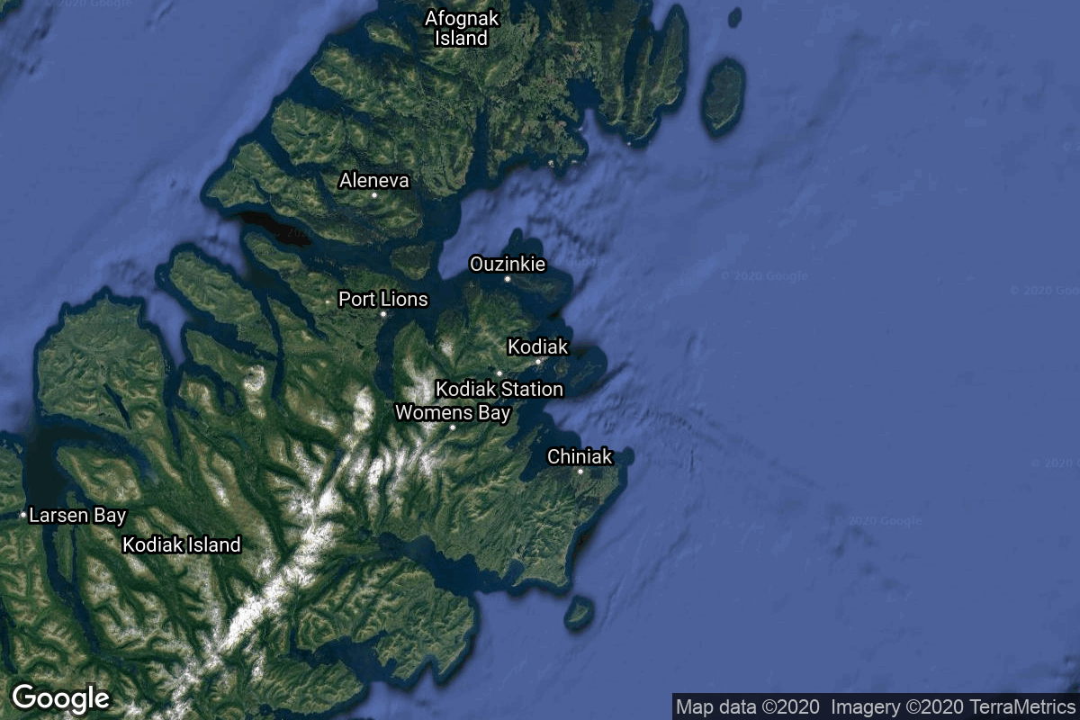
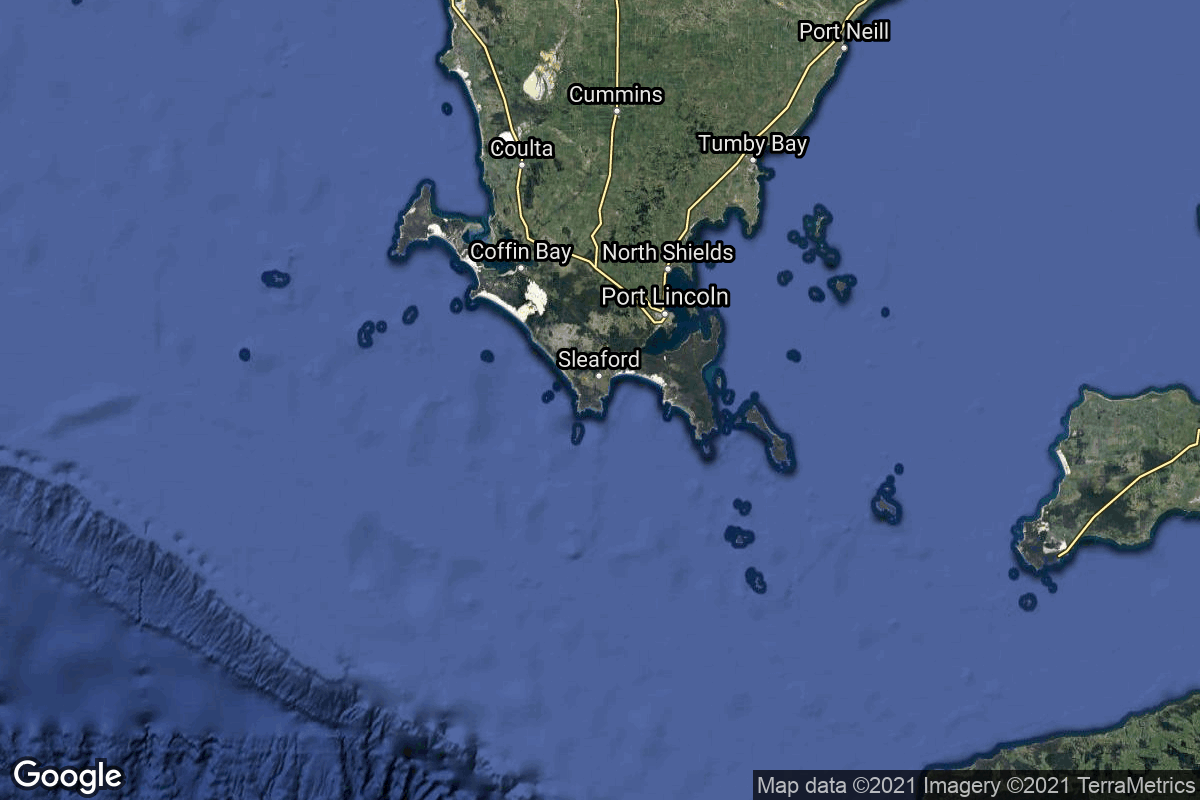
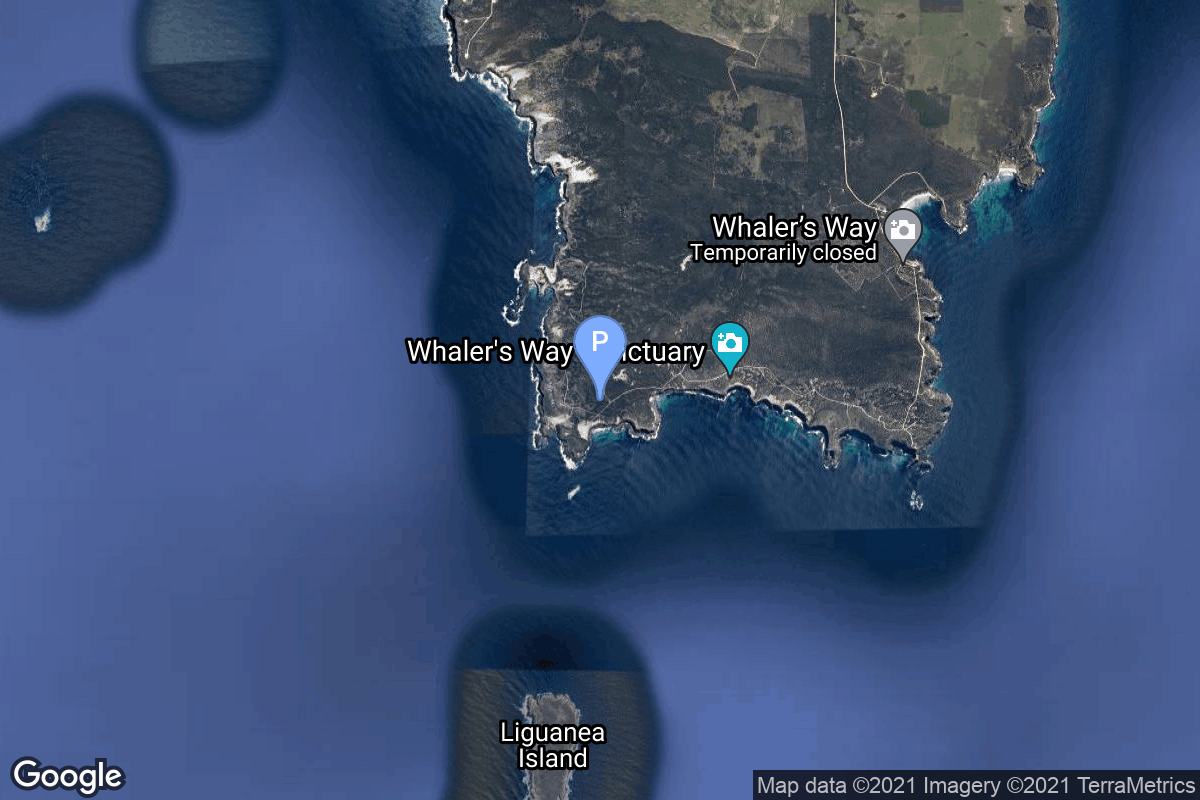
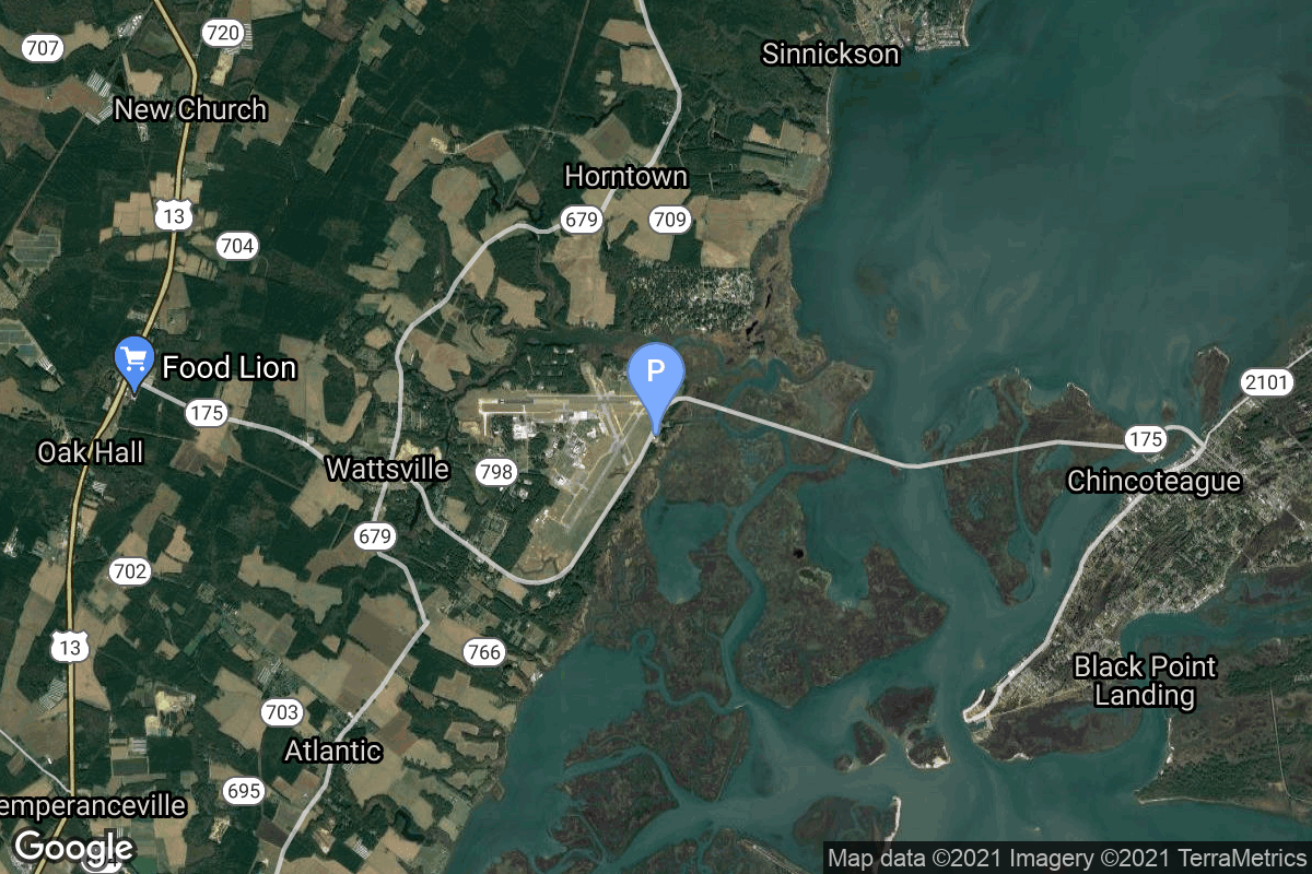
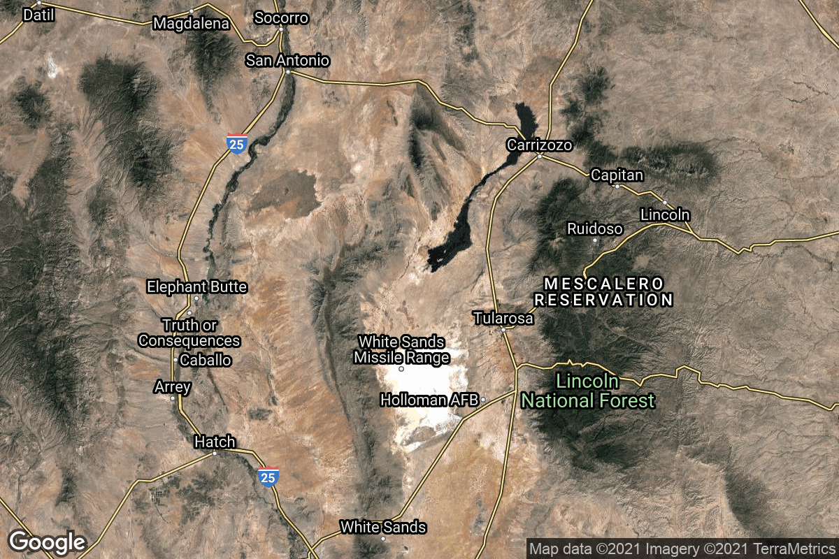
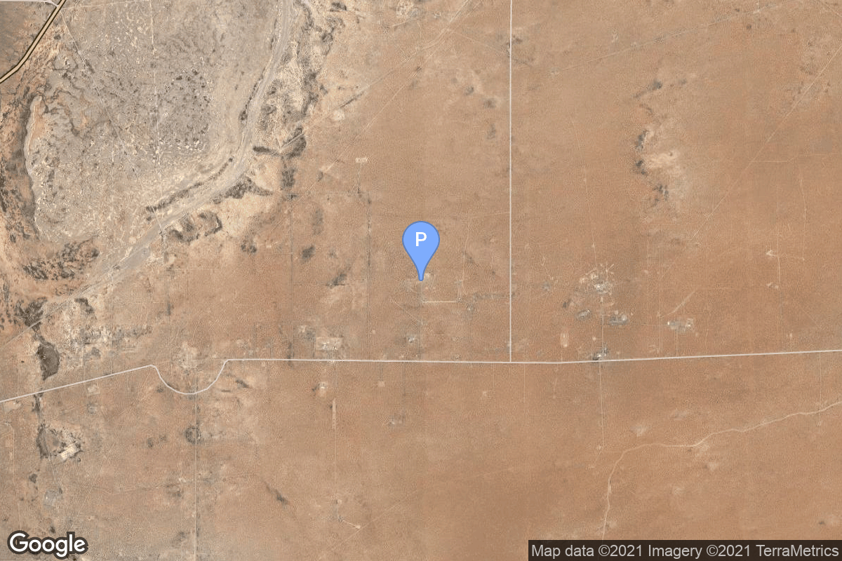
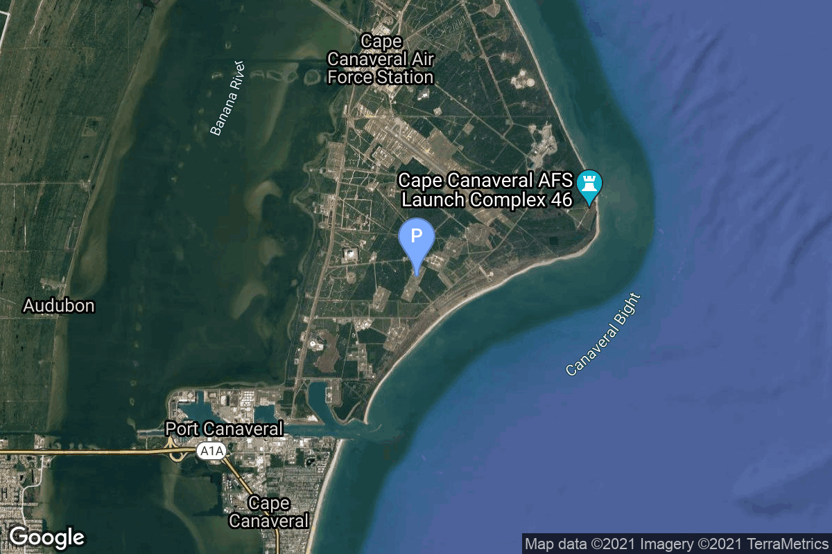
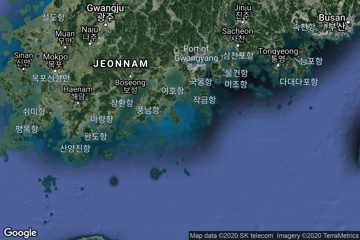
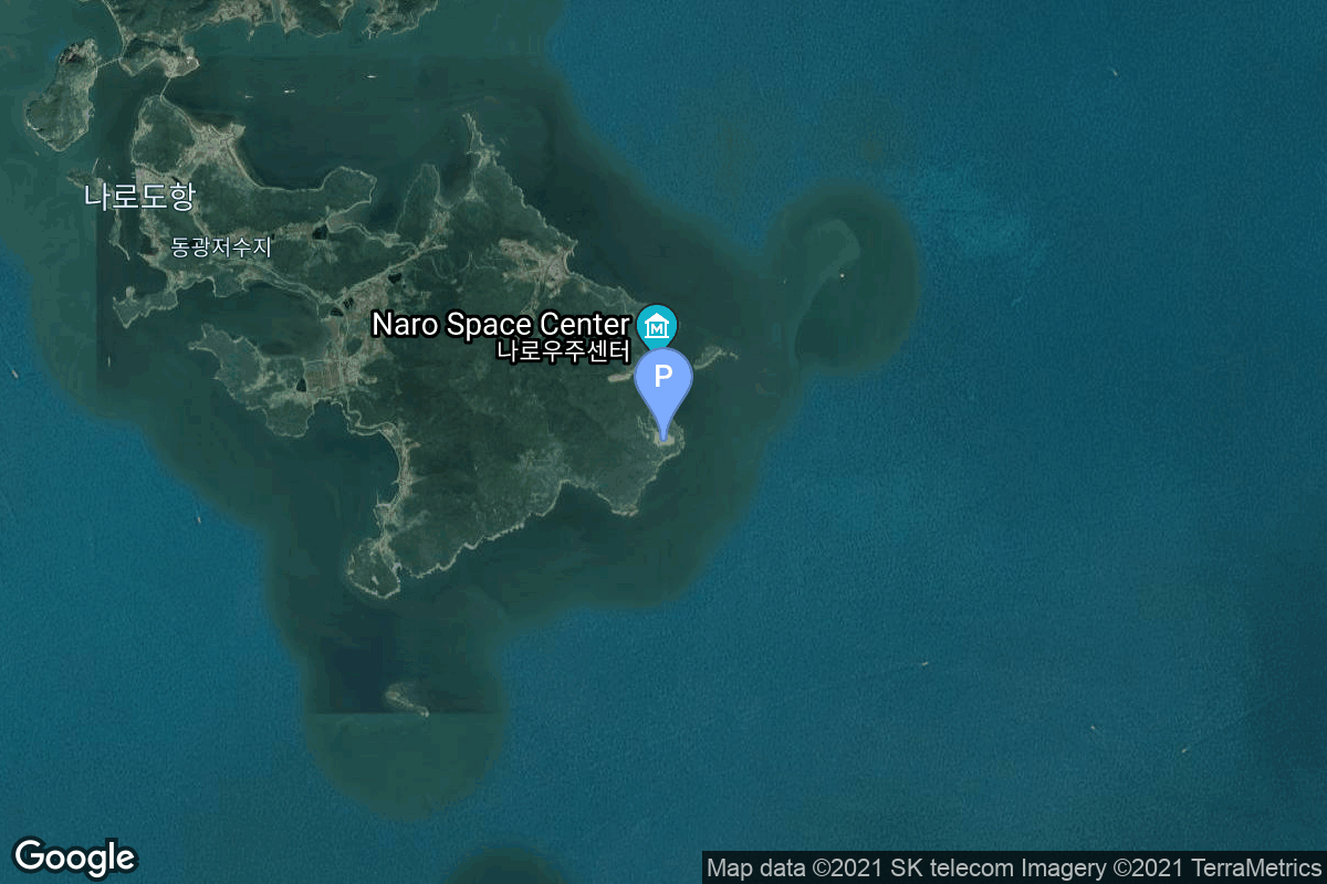
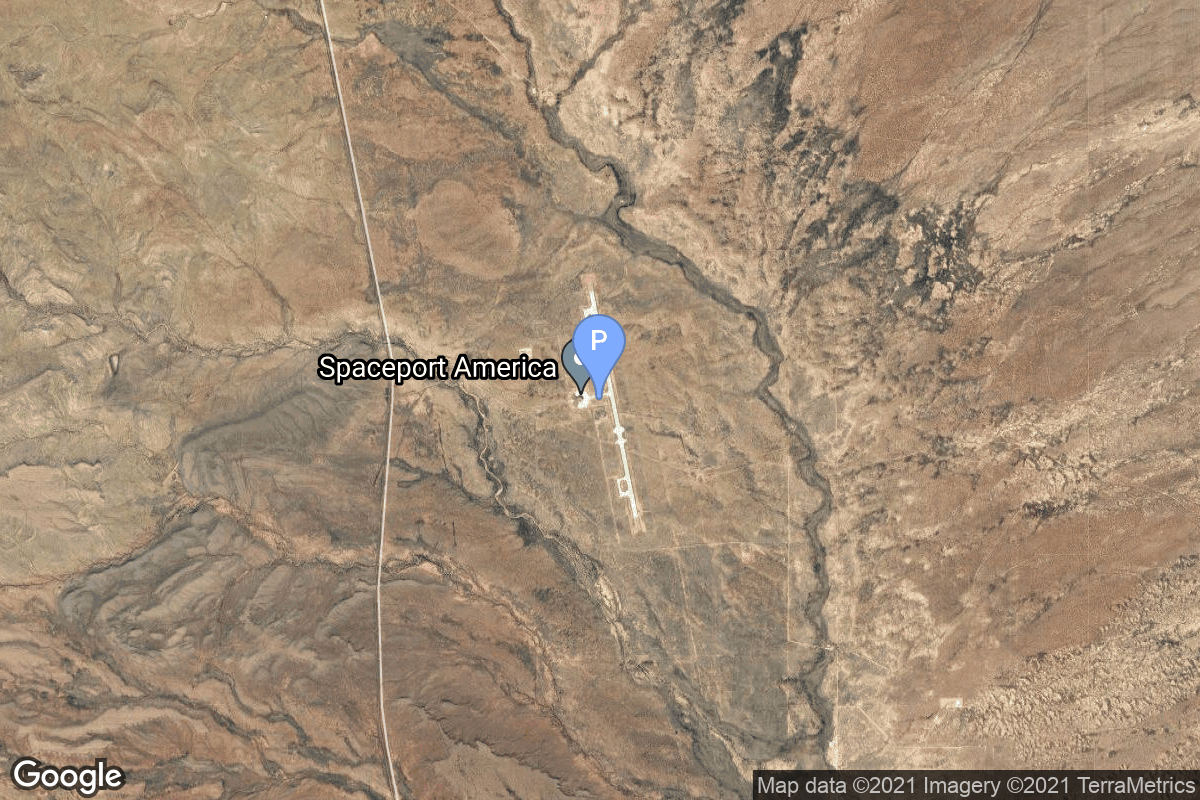
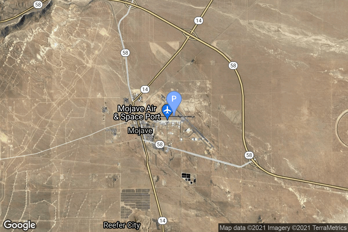
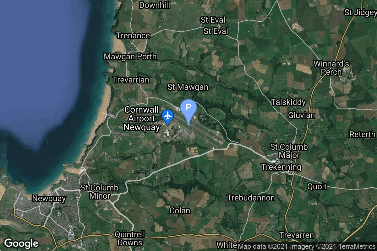
{ "count": 233, "next": "https://ll.thespacedevs.com/2.2.0/pad/?format=api&limit=10&offset=50&ordering=-id", "previous": "https://ll.thespacedevs.com/2.2.0/pad/?format=api&limit=10&offset=30&ordering=-id", "results": [ { "id": 199, "url": "https://ll.thespacedevs.com/2.2.0/pad/199/?format=api", "agency_id": null, "name": "Launch Pad 3C", "description": "", "info_url": null, "wiki_url": "https://en.wikipedia.org/wiki/Pacific_Spaceport_Complex_%E2%80%93_Alaska", "map_url": "https://www.google.com/maps?q=57.431239,-152.350749", "latitude": "57.431239", "longitude": "-152.350749", "location": { "id": 25, "url": "https://ll.thespacedevs.com/2.2.0/location/25/?format=api", "name": "Pacific Spaceport Complex, Alaska, USA", "country_code": "USA", "description": "The Pacific Spaceport Complex – Alaska (PSCA), formerly known as the Kodiak Launch Complex (KLC), is a dual-use commercial and military spaceport for sub-orbital and orbital launch vehicles. The facility is owned and operated by the Alaska Aerospace Corporation, a corporation owned by the Government of Alaska, and is located on Kodiak Island in Alaska.", "map_image": "https://thespacedevs-prod.nyc3.digitaloceanspaces.com/media/map_images/location_25_20200803142500.jpg", "timezone_name": "America/Anchorage", "total_launch_count": 9, "total_landing_count": 0 }, "country_code": "USA", "map_image": "https://thespacedevs-prod.nyc3.digitaloceanspaces.com/media/map_images/pad_199_20220904142623.jpg", "total_launch_count": 1, "orbital_launch_attempt_count": 1 }, { "id": 197, "url": "https://ll.thespacedevs.com/2.2.0/pad/197/?format=api", "agency_id": 1028, "name": "Pad 1", "description": null, "info_url": "https://www.southernlaunch.space/whalers-way-orbital-launch-complex", "wiki_url": "https://en.wikipedia.org/wiki/Whalers_Way_Orbital_Launch_Complex", "map_url": "https://www.google.com/maps?q=-34.937822,135.630035", "latitude": "-34.937822", "longitude": "135.630035", "location": { "id": 156, "url": "https://ll.thespacedevs.com/2.2.0/location/156/?format=api", "name": "Whalers Way Orbital Launch Complex, South Australia", "country_code": "AUS", "description": "Whalers Way Orbital Launch Complex is a rocket-launching facility operated by Southern Launch at Whalers Way, in the locality of Sleaford near Port Lincoln on South Australia's Eyre Peninsula.", "map_image": "https://thespacedevs-prod.nyc3.digitaloceanspaces.com/media/map_images/location_whalers_way_orbital_launch_complex_20210910042508.jpg", "timezone_name": "Australia/Adelaide", "total_launch_count": 1, "total_landing_count": 0 }, "country_code": "AUS", "map_image": "https://thespacedevs-prod.nyc3.digitaloceanspaces.com/media/map_images/pad_whalers_way_orbital_launch_complex_20210910042853.jpg", "total_launch_count": 1, "orbital_launch_attempt_count": 0 }, { "id": 196, "url": "https://ll.thespacedevs.com/2.2.0/pad/196/?format=api", "agency_id": 44, "name": "Launch Area 4", "description": null, "info_url": null, "wiki_url": "https://en.wikipedia.org/wiki/Wallops_Flight_Facility", "map_url": "https://www.google.com/maps?q=37.938611,-75.457222", "latitude": "37.938611", "longitude": "-75.457222", "location": { "id": 21, "url": "https://ll.thespacedevs.com/2.2.0/location/21/?format=api", "name": "Wallops Flight Facility, Virginia, USA", "country_code": "USA", "description": "Wallops Flight Facility is a rocket launch site on Wallops Island on the Eastern Shore of Virginia, United States, just east of the Delmarva Peninsula and north-northeast of Norfolk. The facility is operated by the Goddard Space Flight Center in Greenbelt, Maryland, and primarily serves to support science and exploration missions for NASA and other federal agencies. WFF includes an extensively instrumented range to support launches of more than a dozen types of sounding rockets; small expendable suborbital and orbital rockets; high-altitude balloon flights carrying scientific instruments for atmospheric and astronomical research; and, using its Research Airport, flight tests of aeronautical research aircraft, including uncrewed aerial vehicles.", "map_image": "https://thespacedevs-prod.nyc3.digitaloceanspaces.com/media/map_images/location_21_20200803142423.jpg", "timezone_name": "America/New_York", "total_launch_count": 85, "total_landing_count": 0 }, "country_code": "USA", "map_image": "https://thespacedevs-prod.nyc3.digitaloceanspaces.com/media/map_images/pad_launch_area_4_20210901092808.jpg", "total_launch_count": 1, "orbital_launch_attempt_count": 0 }, { "id": 195, "url": "https://ll.thespacedevs.com/2.2.0/pad/195/?format=api", "agency_id": 44, "name": "Launch Area 1", "description": null, "info_url": null, "wiki_url": "https://en.wikipedia.org/wiki/Wallops_Flight_Facility", "map_url": "https://www.google.com/maps?q=37.938611,-75.457222", "latitude": "37.938611", "longitude": "-75.457222", "location": { "id": 21, "url": "https://ll.thespacedevs.com/2.2.0/location/21/?format=api", "name": "Wallops Flight Facility, Virginia, USA", "country_code": "USA", "description": "Wallops Flight Facility is a rocket launch site on Wallops Island on the Eastern Shore of Virginia, United States, just east of the Delmarva Peninsula and north-northeast of Norfolk. The facility is operated by the Goddard Space Flight Center in Greenbelt, Maryland, and primarily serves to support science and exploration missions for NASA and other federal agencies. WFF includes an extensively instrumented range to support launches of more than a dozen types of sounding rockets; small expendable suborbital and orbital rockets; high-altitude balloon flights carrying scientific instruments for atmospheric and astronomical research; and, using its Research Airport, flight tests of aeronautical research aircraft, including uncrewed aerial vehicles.", "map_image": "https://thespacedevs-prod.nyc3.digitaloceanspaces.com/media/map_images/location_21_20200803142423.jpg", "timezone_name": "America/New_York", "total_launch_count": 85, "total_landing_count": 0 }, "country_code": "USA", "map_image": "https://thespacedevs-prod.nyc3.digitaloceanspaces.com/media/map_images/pad_launch_area_1_20210901085625.jpg", "total_launch_count": 7, "orbital_launch_attempt_count": 0 }, { "id": 194, "url": "https://ll.thespacedevs.com/2.2.0/pad/194/?format=api", "agency_id": 165, "name": "Launch Complex 36", "description": null, "info_url": null, "wiki_url": "https://en.wikipedia.org/wiki/White_Sands_Launch_Complex_36", "map_url": "https://www.google.com/maps?q=32.416944,-106.321944", "latitude": "32.416944", "longitude": "-106.321944", "location": { "id": 155, "url": "https://ll.thespacedevs.com/2.2.0/location/155/?format=api", "name": "White Sands Missile Range", "country_code": "USA", "description": "White Sands Missile Range is a United States Army military testing area and firing range located in the US state of New Mexico. The range was originally established in 1941 as the Alamogordo Bombing and Gunnery Range, where the Trinity test site lay at the northern end of the Range, in Socorro County near the towns of Carrizozo and San Antonio. It then became the White Sands Proving Ground on 9 July 1945.", "map_image": "https://thespacedevs-prod.nyc3.digitaloceanspaces.com/media/map_images/location_white_sands_missile_range_20210901072636.jpg", "timezone_name": "America/Denver", "total_launch_count": 5, "total_landing_count": 0 }, "country_code": "USA", "map_image": "https://thespacedevs-prod.nyc3.digitaloceanspaces.com/media/map_images/pad_launch_complex_36_20210901072730.jpg", "total_launch_count": 5, "orbital_launch_attempt_count": 0 }, { "id": 193, "url": "https://ll.thespacedevs.com/2.2.0/pad/193/?format=api", "agency_id": 161, "name": "Launch Complex 26A", "description": null, "info_url": null, "wiki_url": "https://en.wikipedia.org/wiki/Cape_Canaveral_Air_Force_Station_Launch_Complex_26", "map_url": "https://www.google.com/maps?q=28.4433,-80.5712", "latitude": "28.4433", "longitude": "-80.5712", "location": { "id": 12, "url": "https://ll.thespacedevs.com/2.2.0/location/12/?format=api", "name": "Cape Canaveral SFS, FL, USA", "country_code": "USA", "description": "Cape Canaveral Space Force Station (CCSFS) is an installation of the United States Space Force's Space Launch Delta 45, located on Cape Canaveral in Brevard County, Florida.", "map_image": "https://thespacedevs-prod.nyc3.digitaloceanspaces.com/media/map_images/location_12_20200803142519.jpg", "timezone_name": "America/New_York", "total_launch_count": 1100, "total_landing_count": 71 }, "country_code": "USA", "map_image": "https://thespacedevs-prod.nyc3.digitaloceanspaces.com/media/map_images/pad_space_launch_complex_26a_20210830170946.jpg", "total_launch_count": 3, "orbital_launch_attempt_count": 3 }, { "id": 192, "url": "https://ll.thespacedevs.com/2.2.0/pad/192/?format=api", "agency_id": 41, "name": "LC-2", "description": "", "info_url": null, "wiki_url": "https://en.wikipedia.org/wiki/Naro_Space_Center", "map_url": "https://www.google.com/maps?q=34.431867,127.535069", "latitude": "34.431867", "longitude": "127.535069", "location": { "id": 9, "url": "https://ll.thespacedevs.com/2.2.0/location/9/?format=api", "name": "Naro Space Center, South Korea", "country_code": "KOR", "description": "The Naro Space Center is a South Korean spaceport in South Jeolla's Goheung County, operated by the state-run Korea Aerospace Research Institute.", "map_image": "https://thespacedevs-prod.nyc3.digitaloceanspaces.com/media/map_images/location_9_20200803142441.jpg", "timezone_name": "Asia/Seoul", "total_launch_count": 8, "total_landing_count": 0 }, "country_code": "KOR", "map_image": "https://thespacedevs-prod.nyc3.digitaloceanspaces.com/media/map_images/pad_lc-2_20210812070305.jpg", "total_launch_count": 5, "orbital_launch_attempt_count": 4 }, { "id": 191, "url": "https://ll.thespacedevs.com/2.2.0/pad/191/?format=api", "agency_id": 1024, "name": "Spaceport America", "description": null, "info_url": "https://www.spaceportamerica.com/", "wiki_url": "https://en.wikipedia.org/wiki/Spaceport_America", "map_url": "https://www.google.com/maps?q=32.9902778,-106.9719162", "latitude": "32.9902778", "longitude": "-106.9719162", "location": { "id": 144, "url": "https://ll.thespacedevs.com/2.2.0/location/144/?format=api", "name": "Air launch to Suborbital flight", "country_code": "???", "description": "", "map_image": "https://thespacedevs-prod.nyc3.digitaloceanspaces.com/media/map_images/location_144_20200803142439.jpg", "timezone_name": "", "total_launch_count": 86, "total_landing_count": 0 }, "country_code": "USA", "map_image": "https://thespacedevs-prod.nyc3.digitaloceanspaces.com/media/map_images/pad_spaceport_america_20210522162030.jpg", "total_launch_count": 14, "orbital_launch_attempt_count": 0 }, { "id": 190, "url": "https://ll.thespacedevs.com/2.2.0/pad/190/?format=api", "agency_id": 1024, "name": "Mojave Air and Space Port", "description": null, "info_url": "https://www.mojaveairport.com/", "wiki_url": "https://en.wikipedia.org/wiki/Mojave_Air_and_Space_Port", "map_url": "https://www.google.com/maps?q=35.0594444,-118.1538607", "latitude": "35.0594444", "longitude": "-118.1538607", "location": { "id": 144, "url": "https://ll.thespacedevs.com/2.2.0/location/144/?format=api", "name": "Air launch to Suborbital flight", "country_code": "???", "description": "", "map_image": "https://thespacedevs-prod.nyc3.digitaloceanspaces.com/media/map_images/location_144_20200803142439.jpg", "timezone_name": "", "total_launch_count": 86, "total_landing_count": 0 }, "country_code": "USA", "map_image": "https://thespacedevs-prod.nyc3.digitaloceanspaces.com/media/map_images/pad_190_20210522160913.jpg", "total_launch_count": 53, "orbital_launch_attempt_count": 0 }, { "id": 189, "url": "https://ll.thespacedevs.com/2.2.0/pad/189/?format=api", "agency_id": 199, "name": "Spaceport Cornwall", "description": null, "info_url": "https://spaceportcornwall.com/", "wiki_url": "https://en.wikipedia.org/wiki/Newquay_Airport", "map_url": "https://www.google.com/maps?q=50.4408333,-4.9974718", "latitude": "50.4408333", "longitude": "-4.9974718", "location": { "id": 20, "url": "https://ll.thespacedevs.com/2.2.0/location/20/?format=api", "name": "Air launch to orbit", "country_code": "???", "description": "", "map_image": "https://thespacedevs-prod.nyc3.digitaloceanspaces.com/media/map_images/location_20_20200803142433.jpg", "timezone_name": "", "total_launch_count": 51, "total_landing_count": 0 }, "country_code": "GBR", "map_image": "https://thespacedevs-prod.nyc3.digitaloceanspaces.com/media/map_images/pad_spaceport_cornwall_20210514102058.jpg", "total_launch_count": 1, "orbital_launch_attempt_count": 1 } ] }