Launch List
AN API endpoint that returns all Launch objects or a single launch.
EXAMPLE - /launch/[id]/ or /launch/?mode=list&search=SpaceX
GET Return a list of all Launch objects.
FILTERS Fields - 'name', 'id(s)', 'lsp__id', 'lsp__name', 'serial_number', 'launcher_config__id', 'rocket__spacecraftflight__spacecraft__name', 'is_crewed', 'include_suborbital', 'spacecraft_config__ids', 'related', 'location__ids', 'lsp__ids', 'pad__ids', 'status__ids'
MODE 'normal', 'list', 'detailed'
EXAMPLE ?mode=list
SEARCH Searches through the launch name, rocket name, launch agency, mission name & spacecraft name.
EXAMPLE - ?search=SpaceX
GET /2.2.0/launch/?format=api&offset=7380&ordering=net
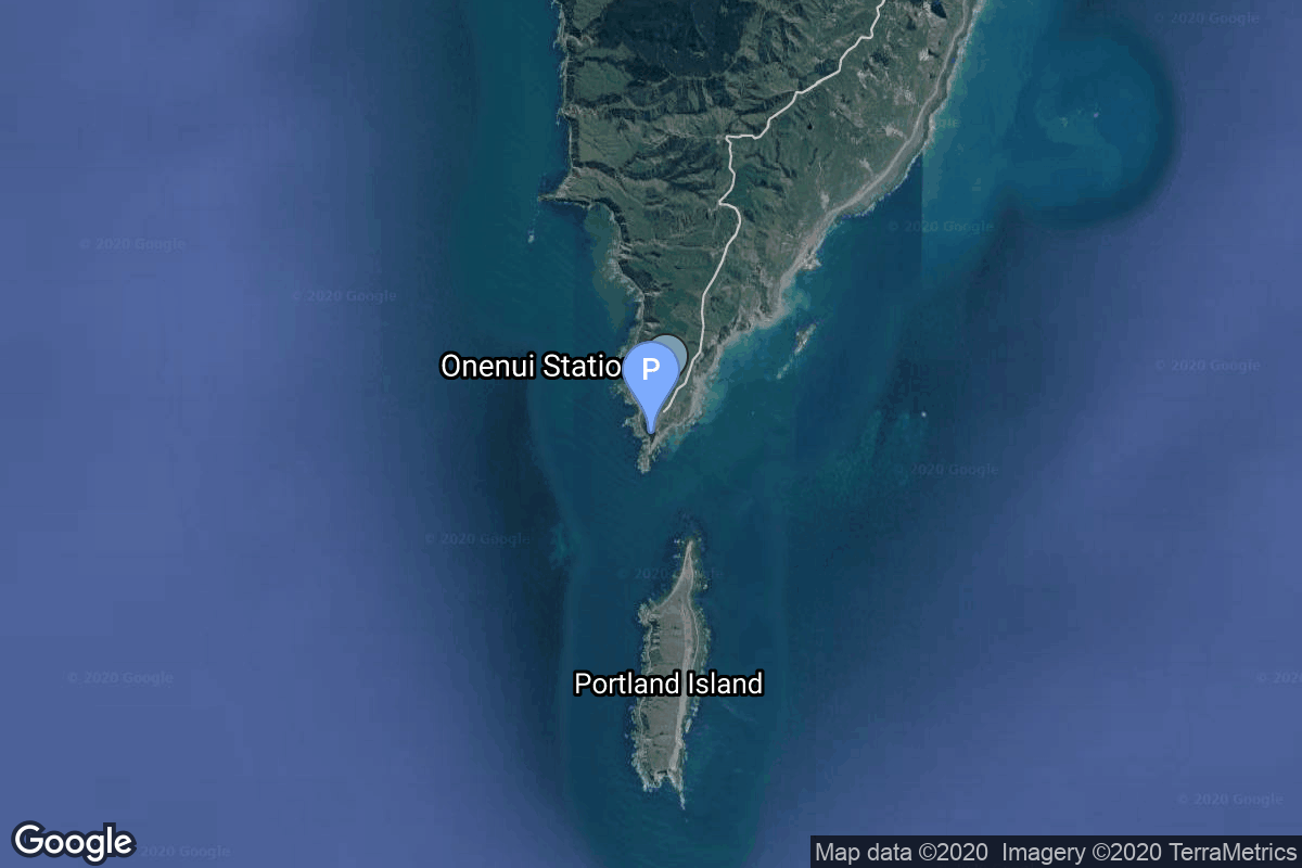
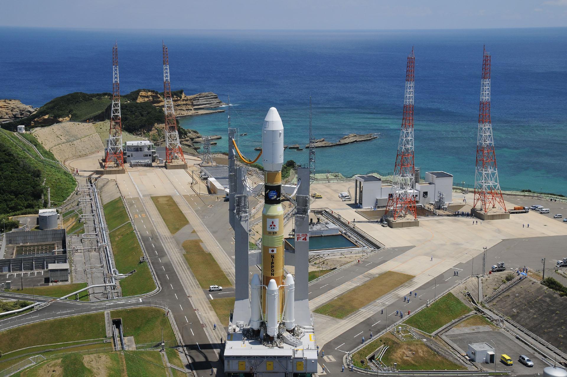
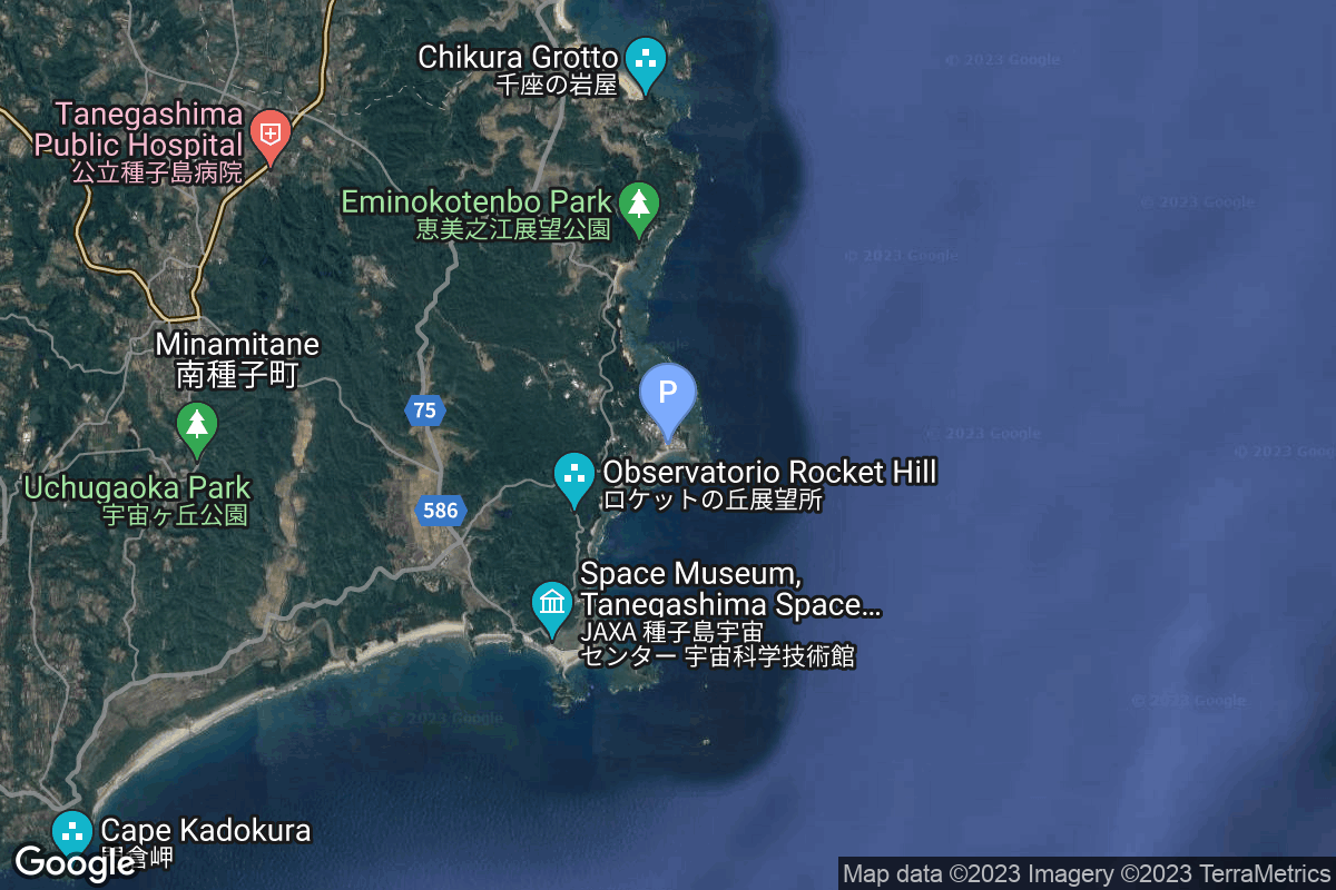
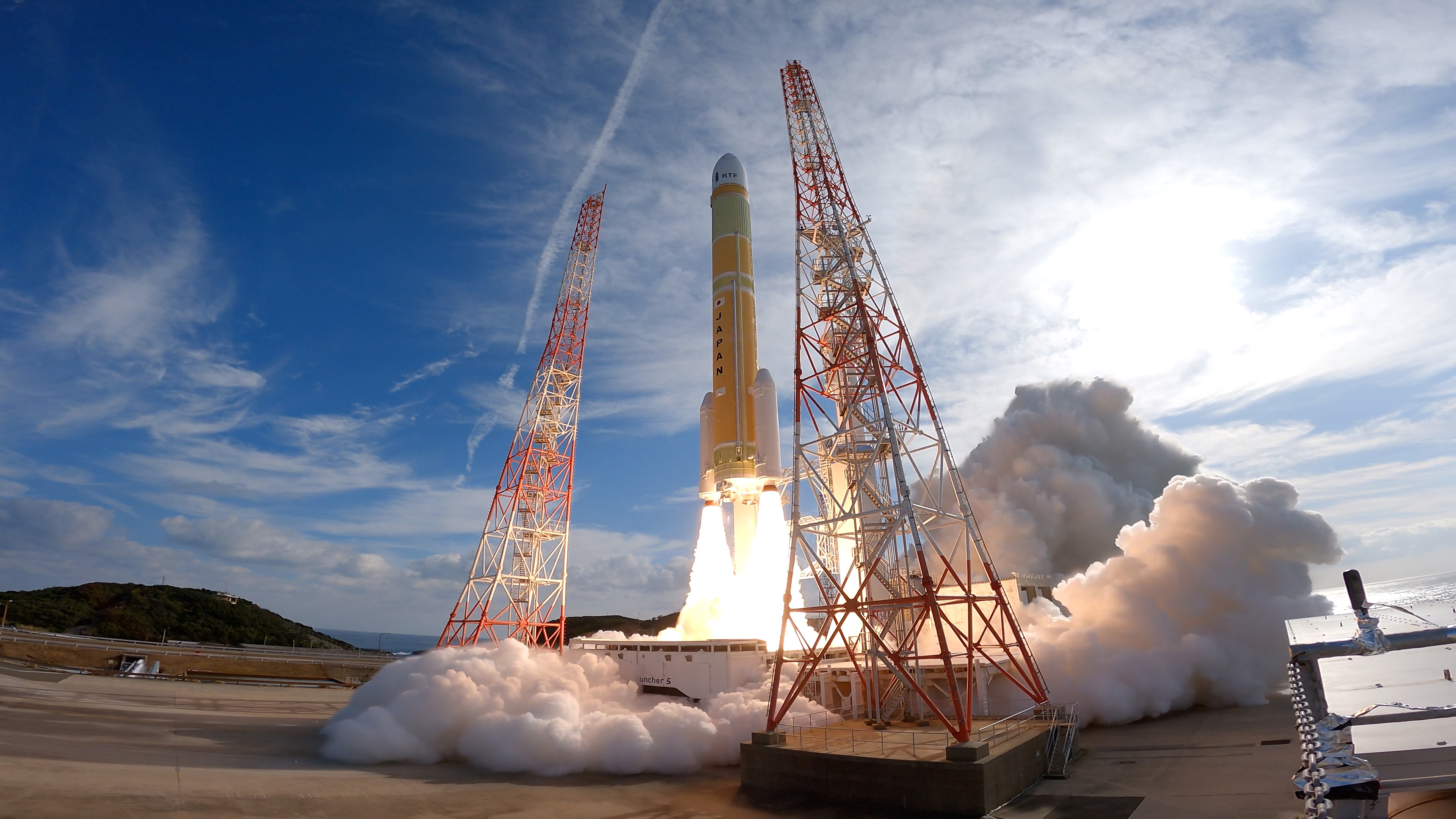
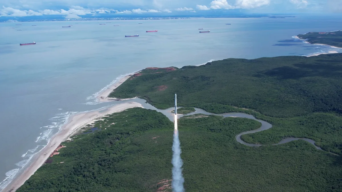
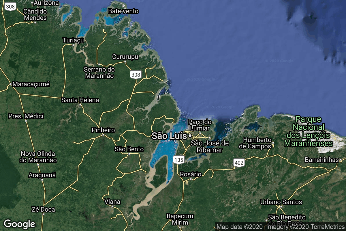
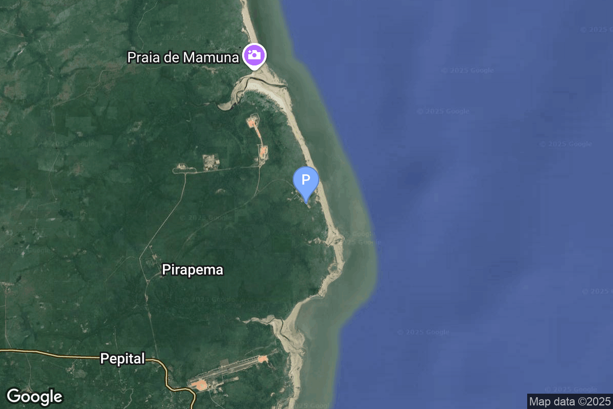
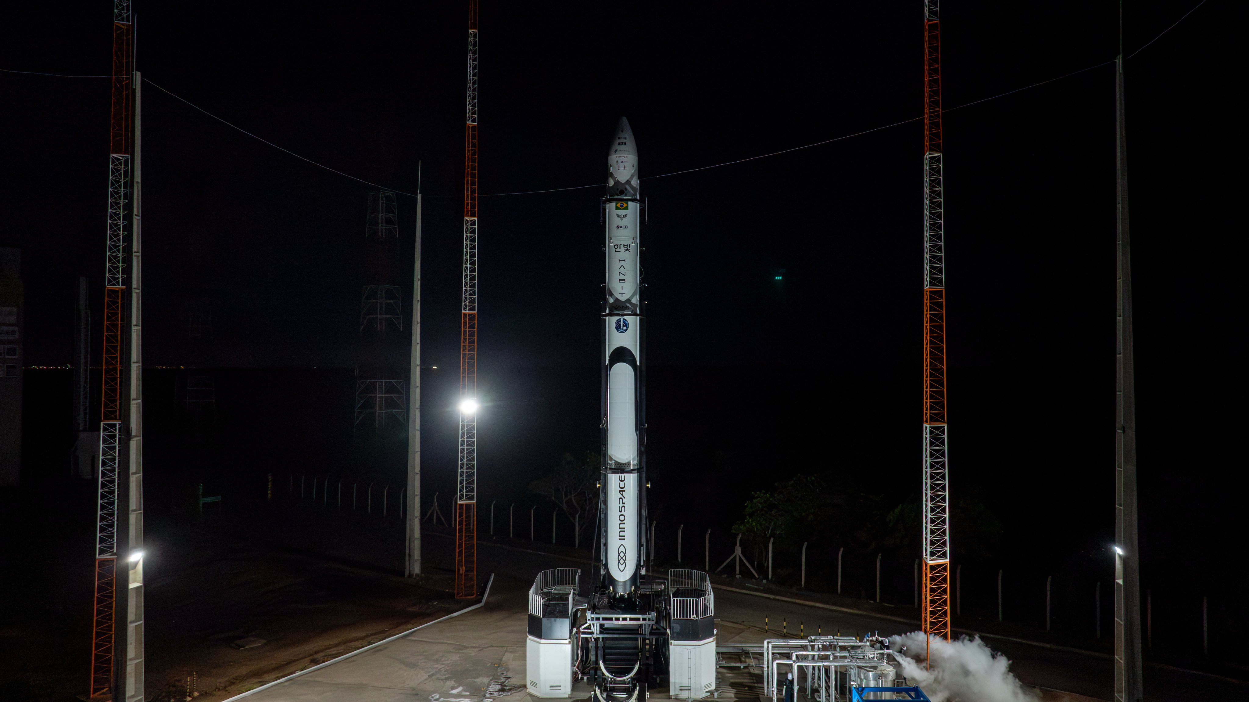
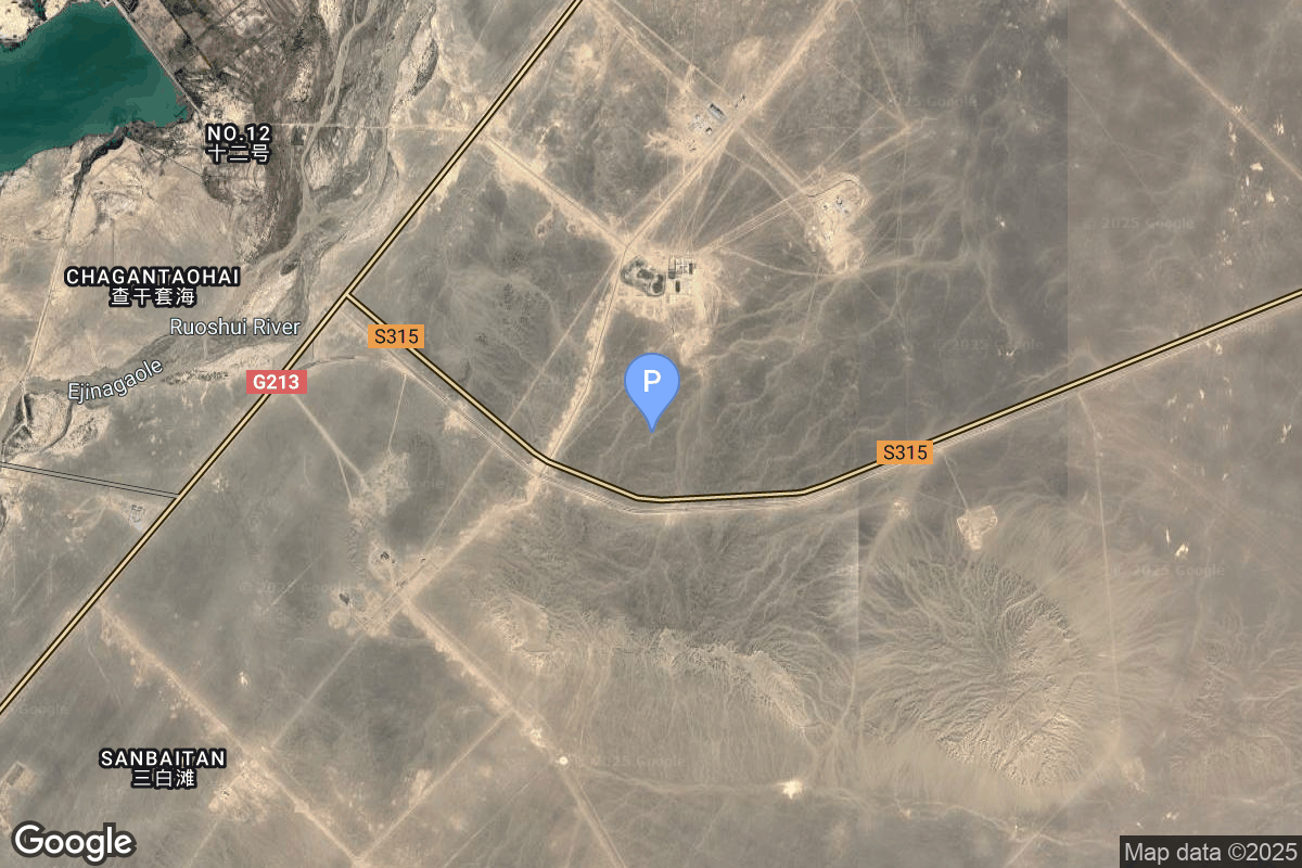
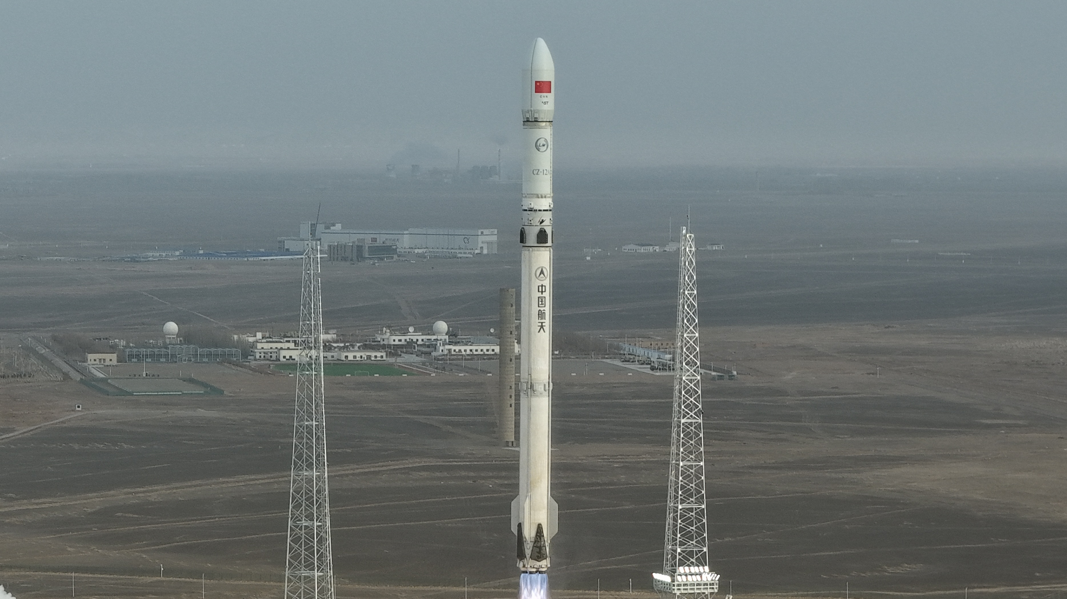
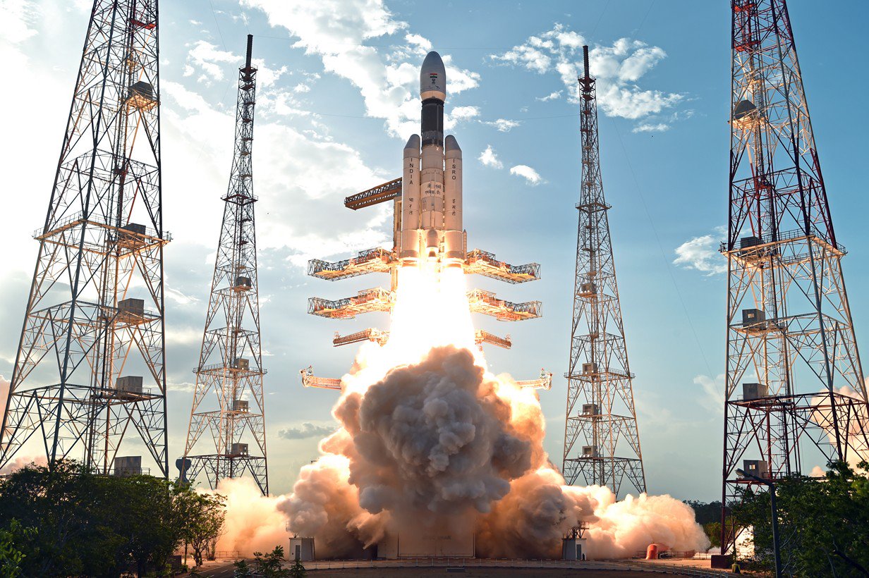
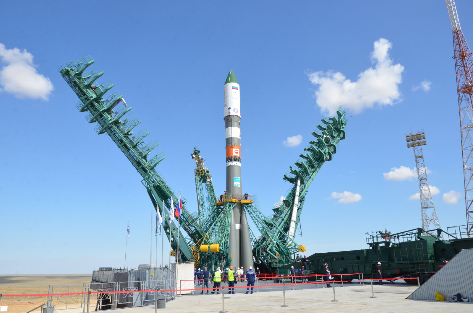
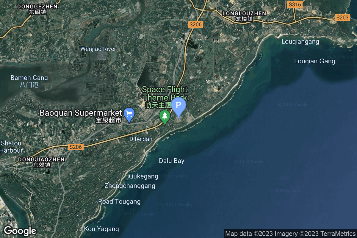
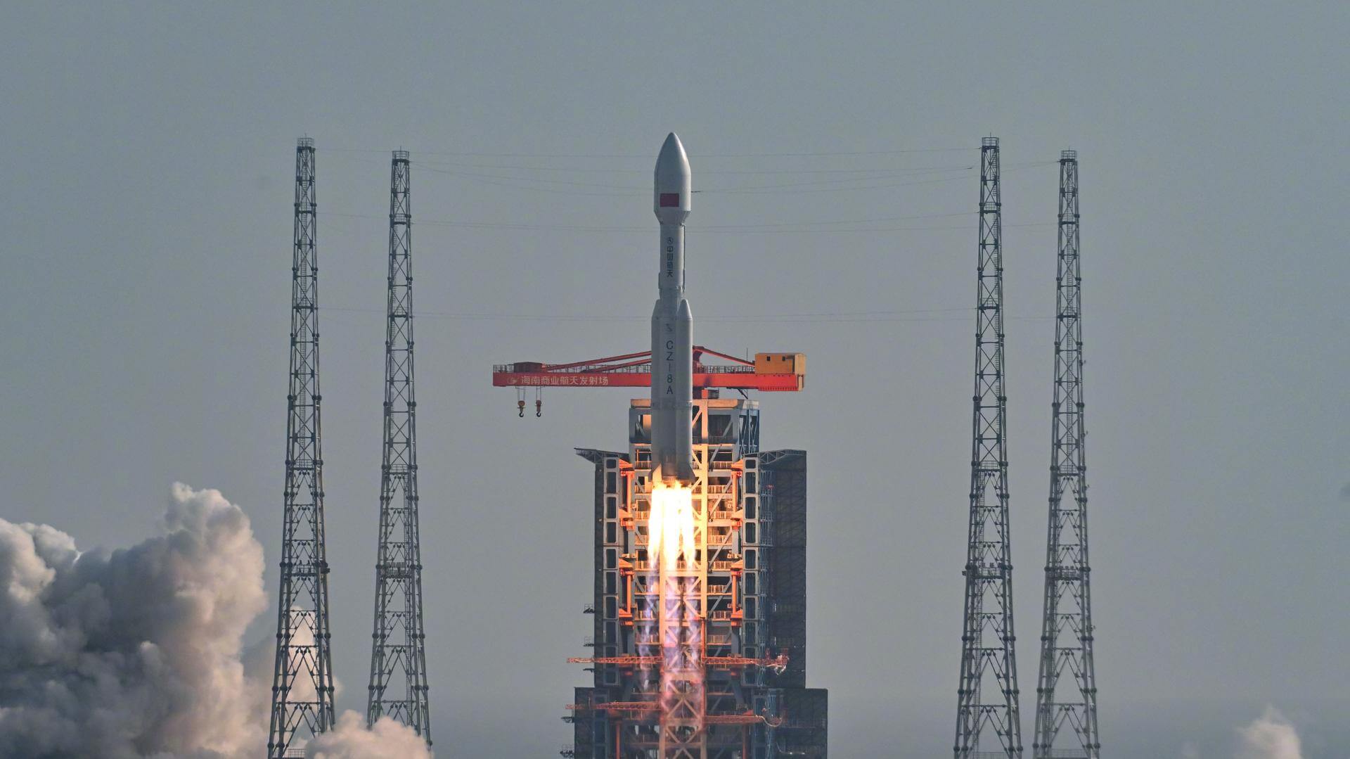
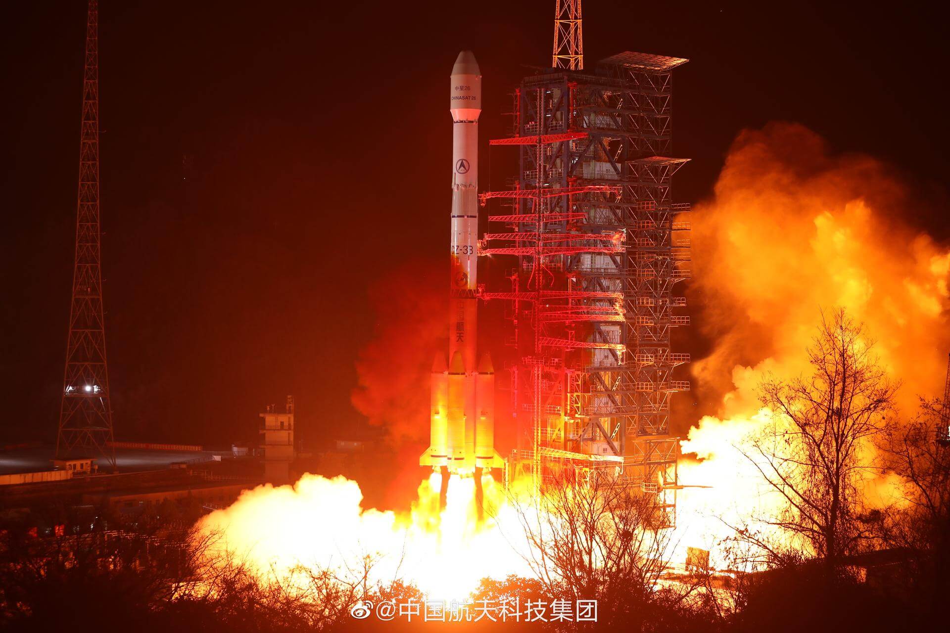
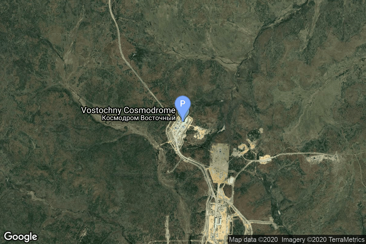
{ "count": 7895, "next": "https://ll.thespacedevs.com/2.2.0/launch/?format=api&limit=10&offset=7390&ordering=net", "previous": "https://ll.thespacedevs.com/2.2.0/launch/?format=api&limit=10&offset=7370&ordering=net", "results": [ { "id": "1e562a6b-f1eb-4c9c-a074-4172c831ed70", "url": "https://ll.thespacedevs.com/2.2.0/launch/1e562a6b-f1eb-4c9c-a074-4172c831ed70/?format=api", "slug": "electron-the-wisdom-god-guides-iqps-launch-6", "name": "Electron | The Wisdom God Guides (iQPS Launch 6)", "status": { "id": 3, "name": "Launch Successful", "abbrev": "Success", "description": "The launch vehicle successfully inserted its payload(s) into the target orbit(s)." }, "last_updated": "2025-12-21T18:25:55Z", "net": "2025-12-21T06:36:00Z", "window_end": "2025-12-21T06:36:00Z", "window_start": "2025-12-21T06:36:00Z", "net_precision": { "id": 1, "name": "Minute", "abbrev": "MIN", "description": "The T-0 is accurate to the minute." }, "probability": 85, "weather_concerns": null, "holdreason": "", "failreason": "", "hashtag": null, "launch_service_provider": { "id": 147, "url": "https://ll.thespacedevs.com/2.2.0/agencies/147/?format=api", "name": "Rocket Lab", "type": "Commercial" }, "rocket": { "id": 8545, "configuration": { "id": 26, "url": "https://ll.thespacedevs.com/2.2.0/config/launcher/26/?format=api", "name": "Electron", "family": "", "full_name": "Electron", "variant": "" } }, "mission": { "id": 7136, "name": "The Wisdom God Guides (iQPS Launch 6)", "description": "Synthetic aperture radar Earth observation satellite for Japanese Earth imaging company iQPS.", "launch_designator": null, "type": "Earth Science", "orbit": { "id": 8, "name": "Low Earth Orbit", "abbrev": "LEO" }, "agencies": [], "info_urls": [], "vid_urls": [] }, "pad": { "id": 185, "url": "https://ll.thespacedevs.com/2.2.0/pad/185/?format=api", "agency_id": 147, "name": "Rocket Lab Launch Complex 1B", "description": "", "info_url": null, "wiki_url": "https://en.wikipedia.org/wiki/Rocket_Lab_Launch_Complex_1", "map_url": "https://www.google.com/maps?q=-39.262833,177.864469", "latitude": "-39.262833", "longitude": "177.864469", "location": { "id": 10, "url": "https://ll.thespacedevs.com/2.2.0/location/10/?format=api", "name": "Rocket Lab Launch Complex 1, Mahia Peninsula, New Zealand", "country_code": "NZL", "description": "Rocket Lab Launch Complex 1 is a commercial spaceport located close to Ahuriri Point at the southern tip of Māhia Peninsula, on the east coast of New Zealand's North Island. It is owned and operated by private spaceflight company Rocket Lab and supports launches of the company's Electron rocket for small satellites. With the launch of Electron on 25 May 2017, it became the first private spaceport to host an orbital launch attempt, and the first site in New Zealand to host an orbital launch attempt. With the Electron launch of 21 January 2018, it became the first private spaceport to host a successful orbital launch.", "map_image": "https://thespacedevs-prod.nyc3.digitaloceanspaces.com/media/map_images/location_10_20200803142509.jpg", "timezone_name": "Pacific/Auckland", "total_launch_count": 76, "total_landing_count": 17 }, "country_code": "NZL", "map_image": "https://thespacedevs-prod.nyc3.digitaloceanspaces.com/media/map_images/pad_185_20200803143540.jpg", "total_launch_count": 36, "orbital_launch_attempt_count": 36 }, "webcast_live": false, "image": "https://thespacedevs-prod.nyc3.digitaloceanspaces.com/media/images/electron_image_20190705175640.jpeg", "infographic": null, "program": [], "orbital_launch_attempt_count": 7163, "location_launch_attempt_count": 69, "pad_launch_attempt_count": 34, "agency_launch_attempt_count": 79, "orbital_launch_attempt_count_year": 314, "location_launch_attempt_count_year": 17, "pad_launch_attempt_count_year": 9, "agency_launch_attempt_count_year": 21, "type": "normal" }, { "id": "dc1b1aea-7a5f-4b39-9df5-1fd38dd670cf", "url": "https://ll.thespacedevs.com/2.2.0/launch/dc1b1aea-7a5f-4b39-9df5-1fd38dd670cf/?format=api", "slug": "h3-22-michibiki-5-qzs-5", "name": "H3-22 | Michibiki 5 (QZS-5)", "status": { "id": 4, "name": "Launch Failure", "abbrev": "Failure", "description": "Either the launch vehicle did not reach orbit, or the payload(s) failed to separate." }, "last_updated": "2025-12-23T05:54:19Z", "net": "2025-12-22T01:51:30Z", "window_end": "2025-12-22T02:04:33Z", "window_start": "2025-12-22T01:51:30Z", "net_precision": { "id": 0, "name": "Second", "abbrev": "SEC", "description": "The T-0 is accurate to the second." }, "probability": null, "weather_concerns": null, "holdreason": "", "failreason": "2nd stage liquid hydrogen tank pressure abnormally start decreasing after fairing separation, leading up to 2nd stage 1st burn 27 seconds longer than planned & engine shutting down 1 second into 2nd burn. Payload stranded in LEO and re-entered shortly after.", "hashtag": null, "launch_service_provider": { "id": 98, "url": "https://ll.thespacedevs.com/2.2.0/agencies/98/?format=api", "name": "Mitsubishi Heavy Industries", "type": "Commercial" }, "rocket": { "id": 7766, "configuration": { "id": 486, "url": "https://ll.thespacedevs.com/2.2.0/config/launcher/486/?format=api", "name": "H3-22", "family": "H3", "full_name": "H3-22", "variant": "22" } }, "mission": { "id": 6284, "name": "Michibiki 5 (QZS-5)", "description": "QZSS (Quasi Zenith Satellite System) is a Japanese satellite navigation system operating from inclined, elliptical geosynchronous orbits to achieve optimal high-elevation visibility in urban canyons and mountainous areas. The navigation system objective is to broadcast GPS-interoperable and augmentation signals as well as original Japanese (QZSS) signals from a three-spacecraft constellation.\r\n\r\nThe navigation system objective is to broadcast GPS-interoperable and augmentation signals as well as original Japanese (QZSS) signals from a three-spacecraft constellation in inclined, elliptical geosynchronous orbits.", "launch_designator": null, "type": "Navigation", "orbit": { "id": 4, "name": "Geosynchronous Transfer Orbit", "abbrev": "GSTO" }, "agencies": [ { "id": 37, "url": "https://ll.thespacedevs.com/2.2.0/agencies/37/?format=api", "name": "Japan Aerospace Exploration Agency", "featured": true, "type": "Government", "country_code": "JPN", "abbrev": "JAXA", "description": "The Japan Aerospace Exploration Agency (JAXA) is Japan's national aero-space agency. Through the merger of three previously independent organizations, JAXA was formed on 1 October 2003. JAXA is responsible for research, technology development and the launch of satellites into orbit, and is involved in many more advanced missions, such as asteroid exploration and possible manned exploration of the Moon. JAXA launch their Epsilon vehicle from the Uchinoura Space Center and their H-II vehicles from the Tanegashima Space Center.", "administrator": "Administrator: Hiroshi Yamakawa", "founding_year": "2003", "launchers": "H-II", "spacecraft": "", "launch_library_url": null, "total_launch_count": 37, "consecutive_successful_launches": 2, "successful_launches": 33, "failed_launches": 4, "pending_launches": 2, "consecutive_successful_landings": 0, "successful_landings": 0, "failed_landings": 0, "attempted_landings": 0, "info_url": "https://www.jaxa.jp/", "wiki_url": "https://en.wikipedia.org/wiki/Japan_Aerospace_Exploration_Agency", "logo_url": "https://thespacedevs-prod.nyc3.digitaloceanspaces.com/media/images/japan2520aerospace2520exploration2520agency_logo_20190207032440.png", "image_url": "https://thespacedevs-prod.nyc3.digitaloceanspaces.com/media/images/japan2520aerospace2520exploration2520agency_image_20190207032440.jpeg", "nation_url": "https://thespacedevs-prod.nyc3.digitaloceanspaces.com/media/images/japan2520aerospace2520exploration2520agency_nation_20230531052930.png" } ], "info_urls": [], "vid_urls": [] }, "pad": { "id": 209, "url": "https://ll.thespacedevs.com/2.2.0/pad/209/?format=api", "agency_id": 37, "name": "Yoshinobu Launch Complex LP-2", "description": "", "info_url": null, "wiki_url": "https://en.wikipedia.org/wiki/Yoshinobu_Launch_Complex", "map_url": "https://www.google.com/maps?q=30.400938,130.97564", "latitude": "30.400938", "longitude": "130.97564", "location": { "id": 26, "url": "https://ll.thespacedevs.com/2.2.0/location/26/?format=api", "name": "Tanegashima Space Center, Japan", "country_code": "JPN", "description": "The Tanegashima Space Center is the largest rocket-launch complex in Japan. It is located on the southeastern tip of Tanegashima, an island located south of Kyushu, an island and region and Japan. It was established in 1969 when the National Space Development Agency of Japan (NASDA) was formed, and is now run by JAXA. The activities that take place at TNSC include assembly, testing, launching, and tracking satellites, as well as rocket engine firing tests.", "map_image": "https://thespacedevs-prod.nyc3.digitaloceanspaces.com/media/map_images/location_26_20200803142507.jpg", "timezone_name": "Asia/Tokyo", "total_launch_count": 97, "total_landing_count": 0 }, "country_code": "JPN", "map_image": "https://thespacedevs-prod.nyc3.digitaloceanspaces.com/media/map_images/pad_yoshinobu_launch_complex_lp-2_20230707124715.jpg", "total_launch_count": 16, "orbital_launch_attempt_count": 16 }, "webcast_live": false, "image": "https://thespacedevs-prod.nyc3.digitaloceanspaces.com/media/images/h3-22_liftoff__image_20251028183835.jpg", "infographic": null, "program": [], "orbital_launch_attempt_count": 7164, "location_launch_attempt_count": 97, "pad_launch_attempt_count": 16, "agency_launch_attempt_count": 56, "orbital_launch_attempt_count_year": 315, "location_launch_attempt_count_year": 4, "pad_launch_attempt_count_year": 3, "agency_launch_attempt_count_year": 3, "type": "normal" }, { "id": "a81fcb21-ed57-47ef-ab57-33ddd9c6ffcd", "url": "https://ll.thespacedevs.com/2.2.0/launch/a81fcb21-ed57-47ef-ab57-33ddd9c6ffcd/?format=api", "slug": "hanbit-nano-spaceward", "name": "HANBIT-Nano | Spaceward", "status": { "id": 4, "name": "Launch Failure", "abbrev": "Failure", "description": "Either the launch vehicle did not reach orbit, or the payload(s) failed to separate." }, "last_updated": "2025-12-23T01:49:54Z", "net": "2025-12-23T01:13:00Z", "window_end": "2025-12-23T02:59:00Z", "window_start": "2025-12-22T15:00:00Z", "net_precision": { "id": 1, "name": "Minute", "abbrev": "MIN", "description": "The T-0 is accurate to the minute." }, "probability": null, "weather_concerns": null, "holdreason": "", "failreason": "Apparently loss of control and crashed back on ground about 1 minute after launch.", "hashtag": null, "launch_service_provider": { "id": 1098, "url": "https://ll.thespacedevs.com/2.2.0/agencies/1098/?format=api", "name": "Innospace", "type": "Private" }, "rocket": { "id": 8777, "configuration": { "id": 530, "url": "https://ll.thespacedevs.com/2.2.0/config/launcher/530/?format=api", "name": "HANBIT-Nano", "family": "HANBIT", "full_name": "HANBIT-Nano", "variant": "Nano" } }, "mission": { "id": 7368, "name": "Spaceward", "description": "Maiden orbital launch attempt for the South Korean start-up Innospace and its HANBIT-Nano small launch vehicle. Onboard this flight are five small satellites from the Brazilian space agency AEB, Brazilian university Universidade Federal do Maranhão and Indian startup Grahaa Space, as well as three payloads from AEB and Brazilian company Castro Leite Consultoria that will remain attached to the rocket, and an empty aluminium can from the South Korean beverage company Brewguru.", "launch_designator": null, "type": "Test Flight", "orbit": { "id": 17, "name": "Sun-Synchronous Orbit", "abbrev": "SSO" }, "agencies": [ { "id": 12, "url": "https://ll.thespacedevs.com/2.2.0/agencies/12/?format=api", "name": "Brazilian Space Agency", "featured": false, "type": "Government", "country_code": "BRA", "abbrev": "AEB", "description": "The Brazilian Space Agency is a space agency in South America. They work in partnership with the US and Russia aboard the ISS. It was previously operated by the military until 1994. They now operate largely in tandem with other nations. They run a spaceport and rocket launch site both in Brazil. They built the VLM small satellite launch system in tandem with Germany. The VLS-1 was intended to be a primary launch vehicle for the BSA, but it failed 3 times and was canceled. They have restarted work on the system in tandem with the Russian Space Agency.", "administrator": "Administrator: Marco Antonio Chamon", "founding_year": "1961", "launchers": "VLM | VLS", "spacecraft": "None", "launch_library_url": null, "total_launch_count": 2, "consecutive_successful_launches": 0, "successful_launches": 0, "failed_launches": 2, "pending_launches": 0, "consecutive_successful_landings": 0, "successful_landings": 0, "failed_landings": 0, "attempted_landings": 0, "info_url": "https://www.gov.br/aeb/pt-br", "wiki_url": "https://en.wikipedia.org/wiki/Brazilian_Space_Agency", "logo_url": null, "image_url": null, "nation_url": null }, { "id": 1098, "url": "https://ll.thespacedevs.com/2.2.0/agencies/1098/?format=api", "name": "Innospace", "featured": false, "type": "Private", "country_code": "KOR", "abbrev": "IS", "description": "Innospace is a South Korean startup company specializing in developing hybrid space rocket.", "administrator": "CEO: Kim Soo-jong", "founding_year": "2017", "launchers": "HANBIT", "spacecraft": "", "launch_library_url": null, "total_launch_count": 2, "consecutive_successful_launches": 0, "successful_launches": 1, "failed_launches": 1, "pending_launches": 2, "consecutive_successful_landings": 0, "successful_landings": 0, "failed_landings": 0, "attempted_landings": 0, "info_url": "https://www.innospc.com/main", "wiki_url": "https://en.wikipedia.org/wiki/Innospace", "logo_url": "https://thespacedevs-prod.nyc3.digitaloceanspaces.com/media/images/innospace_socia_image_20251021112531.png", "image_url": "https://thespacedevs-prod.nyc3.digitaloceanspaces.com/media/images/hanbit-tlv_laun_image_20251021112914.jpg", "nation_url": "https://thespacedevs-prod.nyc3.digitaloceanspaces.com/media/images/innospace_socia_image_20251021112531.png" } ], "info_urls": [], "vid_urls": [] }, "pad": { "id": 240, "url": "https://ll.thespacedevs.com/2.2.0/pad/240/?format=api", "agency_id": 1098, "name": "HANBIT Pad", "description": "Launchpad of the HANBIT rockets developed by South Korean company Innospace.", "info_url": null, "wiki_url": "https://en.wikipedia.org/wiki/Alc%C3%A2ntara_Space_Center", "map_url": "https://www.google.com/maps?q=-2.31698,-44.36873", "latitude": "-2.31698", "longitude": "-44.36873", "location": { "id": 150, "url": "https://ll.thespacedevs.com/2.2.0/location/150/?format=api", "name": "Alcântara Space Center, Federative Republic of Brazil", "country_code": "BRA", "description": "The Alcântara Space Center, formerly known as Alcântara Launch Center is a space center and launching facility of the Brazilian Space Agency in the city of Alcântara, located on Brazil's northern Atlantic coast, in the state of Maranhão.", "map_image": "https://thespacedevs-prod.nyc3.digitaloceanspaces.com/media/map_images/location_150_20200803142405.jpg", "timezone_name": "America/Fortaleza", "total_launch_count": 4, "total_landing_count": 0 }, "country_code": "BRA", "map_image": "https://thespacedevs-prod.nyc3.digitaloceanspaces.com/media/map_images/pad_hanbit_pad_20251021114902.jpg", "total_launch_count": 2, "orbital_launch_attempt_count": 1 }, "webcast_live": false, "image": "https://thespacedevs-prod.nyc3.digitaloceanspaces.com/media/images/hanbit-nano_spa_image_20251224011159.jpg", "infographic": null, "program": [], "orbital_launch_attempt_count": 7165, "location_launch_attempt_count": 4, "pad_launch_attempt_count": 2, "agency_launch_attempt_count": 2, "orbital_launch_attempt_count_year": 316, "location_launch_attempt_count_year": 1, "pad_launch_attempt_count_year": 1, "agency_launch_attempt_count_year": 1, "type": "normal" }, { "id": "c7ae20f6-347c-4039-a933-0ed9b28ad4b9", "url": "https://ll.thespacedevs.com/2.2.0/launch/c7ae20f6-347c-4039-a933-0ed9b28ad4b9/?format=api", "slug": "long-march-12a-demo-flight", "name": "Long March 12A | Demo Flight", "status": { "id": 3, "name": "Launch Successful", "abbrev": "Success", "description": "The launch vehicle successfully inserted its payload(s) into the target orbit(s)." }, "last_updated": "2025-12-23T04:18:05Z", "net": "2025-12-23T02:00:00Z", "window_end": "2025-12-23T04:14:00Z", "window_start": "2025-12-23T01:54:00Z", "net_precision": { "id": 1, "name": "Minute", "abbrev": "MIN", "description": "The T-0 is accurate to the minute." }, "probability": null, "weather_concerns": null, "holdreason": "", "failreason": "", "hashtag": null, "launch_service_provider": { "id": 88, "url": "https://ll.thespacedevs.com/2.2.0/agencies/88/?format=api", "name": "China Aerospace Science and Technology Corporation", "type": "Government" }, "rocket": { "id": 8820, "configuration": { "id": 538, "url": "https://ll.thespacedevs.com/2.2.0/config/launcher/538/?format=api", "name": "Long March 12A", "family": "Long March", "full_name": "Long March 12A", "variant": "" } }, "mission": { "id": 7411, "name": "Demo Flight", "description": "First test launch of CASC/SAST’s Long March 12A rocket, with a dummy payload. The rocket’s 1st stage attempted to land on a landing pad about 300 km downrange of the launch site.", "launch_designator": null, "type": "Test Flight", "orbit": { "id": 8, "name": "Low Earth Orbit", "abbrev": "LEO" }, "agencies": [], "info_urls": [], "vid_urls": [] }, "pad": { "id": 247, "url": "https://ll.thespacedevs.com/2.2.0/pad/247/?format=api", "agency_id": 88, "name": "Long March 12 series Pad", "description": "", "info_url": null, "wiki_url": "https://en.wikipedia.org/wiki/Long_March_12A", "map_url": "https://www.google.com/maps?q=40.891596,100.217289", "latitude": "40.891596", "longitude": "100.217289", "location": { "id": 17, "url": "https://ll.thespacedevs.com/2.2.0/location/17/?format=api", "name": "Jiuquan Satellite Launch Center, People's Republic of China", "country_code": "CHN", "description": "Jiuquan Satellite Launch Center is a Chinese spaceport located between the Ejin, Alxa, Inner Mongolia and Hangtian Town, Jinta County, Jiuquan, Gansu Province. It is part of the Dongfeng Aerospace City (Base 10).", "map_image": "https://thespacedevs-prod.nyc3.digitaloceanspaces.com/media/map_images/location_17_20200803142429.jpg", "timezone_name": "Asia/Shanghai", "total_launch_count": 287, "total_landing_count": 2 }, "country_code": "CHN", "map_image": "https://thespacedevs-prod.nyc3.digitaloceanspaces.com/media/map_images/pad_long_march_12a_pad_20251128223939.jpg", "total_launch_count": 2, "orbital_launch_attempt_count": 2 }, "webcast_live": false, "image": "https://thespacedevs-prod.nyc3.digitaloceanspaces.com/media/images/long_march_12a__image_20251224005749.jpg", "infographic": null, "program": [], "orbital_launch_attempt_count": 7166, "location_launch_attempt_count": 272, "pad_launch_attempt_count": 1, "agency_launch_attempt_count": 566, "orbital_launch_attempt_count_year": 317, "location_launch_attempt_count_year": 33, "pad_launch_attempt_count_year": 1, "agency_launch_attempt_count_year": 65, "type": "normal" }, { "id": "1c040590-5157-4850-86e2-f878dd7d49d4", "url": "https://ll.thespacedevs.com/2.2.0/launch/1c040590-5157-4850-86e2-f878dd7d49d4/?format=api", "slug": "lvm-3-bluebird-block-2-1", "name": "LVM-3 | BlueBird Block 2 #1", "status": { "id": 3, "name": "Launch Successful", "abbrev": "Success", "description": "The launch vehicle successfully inserted its payload(s) into the target orbit(s)." }, "last_updated": "2025-12-24T12:54:02Z", "net": "2025-12-24T03:25:30Z", "window_end": "2025-12-24T06:50:00Z", "window_start": "2025-12-24T02:50:00Z", "net_precision": { "id": 0, "name": "Second", "abbrev": "SEC", "description": "The T-0 is accurate to the second." }, "probability": null, "weather_concerns": null, "holdreason": "", "failreason": "", "hashtag": null, "launch_service_provider": { "id": 31, "url": "https://ll.thespacedevs.com/2.2.0/agencies/31/?format=api", "name": "Indian Space Research Organization", "type": "Government" }, "rocket": { "id": 8407, "configuration": { "id": 172, "url": "https://ll.thespacedevs.com/2.2.0/config/launcher/172/?format=api", "name": "LVM-3 (GSLV Mk III)", "family": "GSLV", "full_name": "Launch Vehicle Mark-3 (GSLV Mk III)", "variant": "" } }, "mission": { "id": 6995, "name": "BlueBird Block 2 #1", "description": "AST SpaceMobile’s Block 2 BlueBird satellites are designed to deliver up to 10 times the bandwidth capacity of the BlueBird Block 1 satellites, required to achieve 24/7 continuous cellular broadband service coverage in the United States, with beams designed to support a capacity of up to 40 MHz, enabling peak data transmission speeds up to 120 Mbps, supporting voice, full data and video applications. The Block 2 BlueBirds, featuring as large as 2400 square foot communications arrays, will be the largest satellites ever commercially deployed in Low Earth orbit once launched.\r\n\r\nThis launch will feature a single satellite.", "launch_designator": null, "type": "Communications", "orbit": { "id": 8, "name": "Low Earth Orbit", "abbrev": "LEO" }, "agencies": [], "info_urls": [], "vid_urls": [] }, "pad": { "id": 82, "url": "https://ll.thespacedevs.com/2.2.0/pad/82/?format=api", "agency_id": 31, "name": "Satish Dhawan Space Centre Second Launch Pad", "description": "The second launch pad was built between 1999 and 2003. It became functional in 2005 and has since been used for various rockets. This launch pad supports missions by PSLV, GSLV, LVM3 rockets and is even envisioned for India's future crewed spaceflight.", "info_url": null, "wiki_url": "https://en.wikipedia.org/wiki/Satish_Dhawan_Space_Centre_Second_Launch_Pad", "map_url": "https://www.google.com/maps?q=13.7199,80.2304", "latitude": "13.7199", "longitude": "80.2304", "location": { "id": 14, "url": "https://ll.thespacedevs.com/2.2.0/location/14/?format=api", "name": "Satish Dhawan Space Centre, India", "country_code": "IND", "description": "Satish Dhawan Space Centre – SDSC (formerly Sriharikota Range – SHAR),[1] is the primary spaceport of the Indian Space Research Organisation (ISRO), located in Sriharikota, Andhra Pradesh.", "map_image": "https://thespacedevs-prod.nyc3.digitaloceanspaces.com/media/map_images/location_14_20200803142403.jpg", "timezone_name": "Asia/Kolkata", "total_launch_count": 103, "total_landing_count": 0 }, "country_code": "IND", "map_image": "https://thespacedevs-prod.nyc3.digitaloceanspaces.com/media/map_images/pad_82_20200803143602.jpg", "total_launch_count": 32, "orbital_launch_attempt_count": 31 }, "webcast_live": false, "image": "https://thespacedevs-prod.nyc3.digitaloceanspaces.com/media/images/gslv2520mk2520iii_image_20190604000938.jpg", "infographic": null, "program": [], "orbital_launch_attempt_count": 7167, "location_launch_attempt_count": 102, "pad_launch_attempt_count": 32, "agency_launch_attempt_count": 98, "orbital_launch_attempt_count_year": 318, "location_launch_attempt_count_year": 5, "pad_launch_attempt_count_year": 4, "agency_launch_attempt_count_year": 5, "type": "normal" }, { "id": "7b60de1e-7d8a-4213-a2f5-44a01ae21e28", "url": "https://ll.thespacedevs.com/2.2.0/launch/7b60de1e-7d8a-4213-a2f5-44a01ae21e28/?format=api", "slug": "soyuz-21a-obzor-r-no1", "name": "Soyuz 2.1a | Obzor-R No.1", "status": { "id": 3, "name": "Launch Successful", "abbrev": "Success", "description": "The launch vehicle successfully inserted its payload(s) into the target orbit(s)." }, "last_updated": "2025-12-26T15:54:25Z", "net": "2025-12-25T14:11:00Z", "window_end": "2025-12-25T15:00:00Z", "window_start": "2025-12-25T14:00:00Z", "net_precision": { "id": 1, "name": "Minute", "abbrev": "MIN", "description": "The T-0 is accurate to the minute." }, "probability": null, "weather_concerns": null, "holdreason": "", "failreason": "", "hashtag": null, "launch_service_provider": { "id": 63, "url": "https://ll.thespacedevs.com/2.2.0/agencies/63/?format=api", "name": "Russian Federal Space Agency (ROSCOSMOS)", "type": "Government" }, "rocket": { "id": 2509, "configuration": { "id": 24, "url": "https://ll.thespacedevs.com/2.2.0/config/launcher/24/?format=api", "name": "Soyuz 2.1a", "family": "Soyuz", "full_name": "Soyuz 2.1a", "variant": "" } }, "mission": { "id": 6636, "name": "Obzor-R No.1", "description": "The Russian Obzor-R satellite is a planned X-band radar earth observation satellite designed by TsSKB-Progress.\r\n\r\nIn 2012, the development of the Arkon-2M radar satellite was stopped and instead the development of the Obzor-R was initiated.\r\n\r\nThe satellite features the BRLK X-band Synthetic Aperture Radar as the imaging instrument with a ground resolution of 500 m.", "launch_designator": null, "type": "Earth Science", "orbit": { "id": 17, "name": "Sun-Synchronous Orbit", "abbrev": "SSO" }, "agencies": [], "info_urls": [], "vid_urls": [] }, "pad": { "id": 85, "url": "https://ll.thespacedevs.com/2.2.0/pad/85/?format=api", "agency_id": 163, "name": "43/4 (43R)", "description": "", "info_url": null, "wiki_url": null, "map_url": "https://www.google.com/maps?q=62.92883,40.457098", "latitude": "62.92883", "longitude": "40.457098", "location": { "id": 6, "url": "https://ll.thespacedevs.com/2.2.0/location/6/?format=api", "name": "Plesetsk Cosmodrome, Russian Federation", "country_code": "RUS", "description": "Plesetsk Cosmodrome is a Russian spaceport located in Mirny, Arkhangelsk Oblast, about 800 km north of Moscow and approximately 200 km south of Arkhangelsk. Originally developed as an ICBM site for the R-7 missile, it also served for numerous satellite launches using the R-7 and other rockets. Its high latitude makes it useful only for certain types of launches, especially the Molniya orbits, so for much of the site's history it functioned as a secondary location, with most orbital launches taking place from Baikonur, in the Kazakh SSR. With the end of the Soviet Union, Baikonur became a foreign territory, and Kazakhstan charged $115 million usage fees annually. Consequently, Plesetsk has seen considerably more activity since the 2000s.", "map_image": "https://thespacedevs-prod.nyc3.digitaloceanspaces.com/media/map_images/location_6_20200803142434.jpg", "timezone_name": "Europe/Moscow", "total_launch_count": 1685, "total_landing_count": 0 }, "country_code": "RUS", "map_image": "https://thespacedevs-prod.nyc3.digitaloceanspaces.com/media/map_images/pad_85_20200803143554.jpg", "total_launch_count": 328, "orbital_launch_attempt_count": 328 }, "webcast_live": false, "image": "https://thespacedevs-prod.nyc3.digitaloceanspaces.com/media/images/soyuz_2.1a_image_20230805184309.jpg", "infographic": null, "program": [], "orbital_launch_attempt_count": 7168, "location_launch_attempt_count": 1680, "pad_launch_attempt_count": 325, "agency_launch_attempt_count": 337, "orbital_launch_attempt_count_year": 319, "location_launch_attempt_count_year": 9, "pad_launch_attempt_count_year": 3, "agency_launch_attempt_count_year": 8, "type": "normal" }, { "id": "f4909efe-4764-43fa-9e4a-07e479af1ba7", "url": "https://ll.thespacedevs.com/2.2.0/launch/f4909efe-4764-43fa-9e4a-07e479af1ba7/?format=api", "slug": "long-march-8a-satnet-leo-group-17", "name": "Long March 8A | SatNet LEO Group 17", "status": { "id": 3, "name": "Launch Successful", "abbrev": "Success", "description": "The launch vehicle successfully inserted its payload(s) into the target orbit(s)." }, "last_updated": "2025-12-26T17:25:23Z", "net": "2025-12-25T23:26:00Z", "window_end": "2025-12-25T23:43:00Z", "window_start": "2025-12-25T23:18:00Z", "net_precision": { "id": 1, "name": "Minute", "abbrev": "MIN", "description": "The T-0 is accurate to the minute." }, "probability": null, "weather_concerns": null, "holdreason": "", "failreason": "", "hashtag": null, "launch_service_provider": { "id": 88, "url": "https://ll.thespacedevs.com/2.2.0/agencies/88/?format=api", "name": "China Aerospace Science and Technology Corporation", "type": "Government" }, "rocket": { "id": 8856, "configuration": { "id": 518, "url": "https://ll.thespacedevs.com/2.2.0/config/launcher/518/?format=api", "name": "Long March 8A", "family": "Long March", "full_name": "Long March 8A", "variant": "A" } }, "mission": { "id": 7447, "name": "SatNet LEO Group 17", "description": "A batch of 9 Low Earth Orbit communication satellites for the Chinese state owned SatNet constellation operated by the China Satellite Network Group.\r\n\r\nThe constellation will eventually consists of 13000 satellites.", "launch_designator": null, "type": "Communications", "orbit": { "id": 8, "name": "Low Earth Orbit", "abbrev": "LEO" }, "agencies": [], "info_urls": [], "vid_urls": [] }, "pad": { "id": 218, "url": "https://ll.thespacedevs.com/2.2.0/pad/218/?format=api", "agency_id": null, "name": "Commercial LC-1", "description": "", "info_url": null, "wiki_url": "https://en.wikipedia.org/wiki/Wenchang_Commercial_Space_Launch_Site", "map_url": "https://www.google.com/maps?q=19.597275,110.930753", "latitude": "19.597275", "longitude": "110.930753", "location": { "id": 8, "url": "https://ll.thespacedevs.com/2.2.0/location/8/?format=api", "name": "Wenchang Space Launch Site, People's Republic of China", "country_code": "CHN", "description": "The Wenchang Space Launch Site is a rocket launch site located in Wenchang on the island of Hainan, in China.\r\n\r\nFormally a suborbital test center, it currently serves as China's southernmost spaceport. The site was selected for its low latitude, 19° north of the equator, allowing for larger payloads to be launched. It is capable of launching the Long March 5, the heaviest Chinese rocket. Unlike launch facilities on the mainland, Wenchang uses its seaport for deliveries.", "map_image": "https://thespacedevs-prod.nyc3.digitaloceanspaces.com/media/map_images/location_8_20200803142445.jpg", "timezone_name": "Asia/Shanghai", "total_launch_count": 63, "total_landing_count": 0 }, "country_code": "CHN", "map_image": "https://thespacedevs-prod.nyc3.digitaloceanspaces.com/media/map_images/pad_commercial_lc-1_20231225074041.jpg", "total_launch_count": 11, "orbital_launch_attempt_count": 11 }, "webcast_live": false, "image": "https://thespacedevs-prod.nyc3.digitaloceanspaces.com/media/images/cz-8a_launch_2_image_20251206093107.jpeg", "infographic": null, "program": [], "orbital_launch_attempt_count": 7169, "location_launch_attempt_count": 54, "pad_launch_attempt_count": 6, "agency_launch_attempt_count": 567, "orbital_launch_attempt_count_year": 320, "location_launch_attempt_count_year": 20, "pad_launch_attempt_count_year": 6, "agency_launch_attempt_count_year": 66, "type": "normal" }, { "id": "9d69b85a-940d-4c1a-be75-6449d3b2a836", "url": "https://ll.thespacedevs.com/2.2.0/launch/9d69b85a-940d-4c1a-be75-6449d3b2a836/?format=api", "slug": "long-march-3be-fengyun-4c", "name": "Long March 3B/E | Fengyun-4C", "status": { "id": 3, "name": "Launch Successful", "abbrev": "Success", "description": "The launch vehicle successfully inserted its payload(s) into the target orbit(s)." }, "last_updated": "2025-12-27T09:51:52Z", "net": "2025-12-26T16:07:00Z", "window_end": "2025-12-26T16:56:00Z", "window_start": "2025-12-26T16:00:00Z", "net_precision": { "id": 1, "name": "Minute", "abbrev": "MIN", "description": "The T-0 is accurate to the minute." }, "probability": null, "weather_concerns": null, "holdreason": "", "failreason": "", "hashtag": null, "launch_service_provider": { "id": 88, "url": "https://ll.thespacedevs.com/2.2.0/agencies/88/?format=api", "name": "China Aerospace Science and Technology Corporation", "type": "Government" }, "rocket": { "id": 138, "configuration": { "id": 50, "url": "https://ll.thespacedevs.com/2.2.0/config/launcher/50/?format=api", "name": "Long March 3B/E", "family": "Long March", "full_name": "Long March 3B/E", "variant": "B/E" } }, "mission": { "id": 6709, "name": "Fengyun-4C", "description": "China's geostationary meteorological satellite program FY-4 (Feng Yun 4) is the second generation of chinese geostationary meteorological satellites.", "launch_designator": null, "type": "Earth Science", "orbit": { "id": 2, "name": "Geostationary Transfer Orbit", "abbrev": "GTO" }, "agencies": [], "info_urls": [], "vid_urls": [] }, "pad": { "id": 45, "url": "https://ll.thespacedevs.com/2.2.0/pad/45/?format=api", "agency_id": null, "name": "Launch Complex 2 (LC-2)", "description": "", "info_url": null, "wiki_url": "https://en.wikipedia.org/wiki/Xichang_Satellite_Launch_Center", "map_url": "https://www.google.com/maps?q=28.245504,102.026768", "latitude": "28.245504", "longitude": "102.026768", "location": { "id": 16, "url": "https://ll.thespacedevs.com/2.2.0/location/16/?format=api", "name": "Xichang Satellite Launch Center, People's Republic of China", "country_code": "CHN", "description": "The Xichang Satellite Launch Center is a spaceport in China. It is located in Zeyuan Town, northwest of Xichang, Liangshan Yi Autonomous Prefecture in Sichuan.", "map_image": "https://thespacedevs-prod.nyc3.digitaloceanspaces.com/media/map_images/location_16_20200803142513.jpg", "timezone_name": "Asia/Shanghai", "total_launch_count": 240, "total_landing_count": 0 }, "country_code": "CHN", "map_image": "https://thespacedevs-prod.nyc3.digitaloceanspaces.com/media/map_images/pad_45_20200803143520.jpg", "total_launch_count": 124, "orbital_launch_attempt_count": 124 }, "webcast_live": false, "image": "https://thespacedevs-prod.nyc3.digitaloceanspaces.com/media/images/long2520march_image_20230907120240.jpeg", "infographic": null, "program": [], "orbital_launch_attempt_count": 7170, "location_launch_attempt_count": 236, "pad_launch_attempt_count": 123, "agency_launch_attempt_count": 568, "orbital_launch_attempt_count_year": 321, "location_launch_attempt_count_year": 19, "pad_launch_attempt_count_year": 9, "agency_launch_attempt_count_year": 67, "type": "normal" }, { "id": "43cfdc96-8481-446f-ace5-ddc5ed60fb14", "url": "https://ll.thespacedevs.com/2.2.0/launch/43cfdc96-8481-446f-ace5-ddc5ed60fb14/?format=api", "slug": "soyuz-21bfregat-m-aist-2t-01-02", "name": "Soyuz 2.1b/Fregat-M | AIST-2T 01 & 02", "status": { "id": 3, "name": "Launch Successful", "abbrev": "Success", "description": "The launch vehicle successfully inserted its payload(s) into the target orbit(s)." }, "last_updated": "2025-12-29T00:35:41Z", "net": "2025-12-28T13:18:05Z", "window_end": "2025-12-28T13:18:05Z", "window_start": "2025-12-28T13:18:05Z", "net_precision": { "id": 0, "name": "Second", "abbrev": "SEC", "description": "The T-0 is accurate to the second." }, "probability": null, "weather_concerns": null, "holdreason": "", "failreason": "", "hashtag": null, "launch_service_provider": { "id": 63, "url": "https://ll.thespacedevs.com/2.2.0/agencies/63/?format=api", "name": "Russian Federal Space Agency (ROSCOSMOS)", "type": "Government" }, "rocket": { "id": 8364, "configuration": { "id": 134, "url": "https://ll.thespacedevs.com/2.2.0/config/launcher/134/?format=api", "name": "Soyuz 2.1b/Fregat-M", "family": "Soyuz", "full_name": "Soyuz 2.1b Fregat-M", "variant": "Fregat-M" } }, "mission": { "id": 6945, "name": "AIST-2T 01 & 02", "description": "A pair of Russian optical Earth observation satellites built by the Progress Rocket Space Centre for obtaining stereo images of the Earth's surface, with maximum resolution of 1.2 m in panchromatic mode and a swath width of 32 km.\r\n\r\n50 small satellites will also be launched as ride-share payloads, including 3 from Iran.", "launch_designator": null, "type": "Earth Science", "orbit": { "id": 17, "name": "Sun-Synchronous Orbit", "abbrev": "SSO" }, "agencies": [], "info_urls": [], "vid_urls": [] }, "pad": { "id": 83, "url": "https://ll.thespacedevs.com/2.2.0/pad/83/?format=api", "agency_id": 63, "name": "Cosmodrome Site 1S", "description": "", "info_url": null, "wiki_url": "https://en.wikipedia.org/wiki/Vostochny_Cosmodrome", "map_url": "https://www.google.com/maps?q=51.884395,128.333932", "latitude": "51.884395", "longitude": "128.333932", "location": { "id": 18, "url": "https://ll.thespacedevs.com/2.2.0/location/18/?format=api", "name": "Vostochny Cosmodrome, Siberia, Russian Federation", "country_code": "RUS", "description": "The Vostochny Cosmodrome is a Russian spaceport above the 51st parallel north in the Amur Oblast, in the Russian Far East. It is intended to reduce Russia's dependency on the Baikonur Cosmodrome in Kazakhstan. The first launch took place on 28 April 2016 at 02:01 UTC.", "map_image": "https://thespacedevs-prod.nyc3.digitaloceanspaces.com/media/map_images/location_18_20200803142401.jpg", "timezone_name": "Asia/Yakutsk", "total_launch_count": 21, "total_landing_count": 0 }, "country_code": "RUS", "map_image": "https://thespacedevs-prod.nyc3.digitaloceanspaces.com/media/map_images/pad_83_20200803143544.jpg", "total_launch_count": 20, "orbital_launch_attempt_count": 20 }, "webcast_live": false, "image": "https://thespacedevs-prod.nyc3.digitaloceanspaces.com/media/images/soyuz_2.1b_image_20230802085331.jpg", "infographic": null, "program": [], "orbital_launch_attempt_count": 7171, "location_launch_attempt_count": 21, "pad_launch_attempt_count": 20, "agency_launch_attempt_count": 338, "orbital_launch_attempt_count_year": 322, "location_launch_attempt_count_year": 2, "pad_launch_attempt_count_year": 2, "agency_launch_attempt_count_year": 9, "type": "normal" }, { "id": "53aad862-af92-44b5-91ef-70e92a079ba4", "url": "https://ll.thespacedevs.com/2.2.0/launch/53aad862-af92-44b5-91ef-70e92a079ba4/?format=api", "slug": "long-march-4b-tianhui-7", "name": "Long March 4B | Tianhui 7", "status": { "id": 3, "name": "Launch Successful", "abbrev": "Success", "description": "The launch vehicle successfully inserted its payload(s) into the target orbit(s)." }, "last_updated": "2025-12-31T02:56:35Z", "net": "2025-12-30T04:12:00Z", "window_end": "2025-12-30T04:32:00Z", "window_start": "2025-12-30T04:04:00Z", "net_precision": { "id": 1, "name": "Minute", "abbrev": "MIN", "description": "The T-0 is accurate to the minute." }, "probability": null, "weather_concerns": null, "holdreason": "", "failreason": "", "hashtag": null, "launch_service_provider": { "id": 88, "url": "https://ll.thespacedevs.com/2.2.0/agencies/88/?format=api", "name": "China Aerospace Science and Technology Corporation", "type": "Government" }, "rocket": { "id": 8868, "configuration": { "id": 10, "url": "https://ll.thespacedevs.com/2.2.0/config/launcher/10/?format=api", "name": "Long March 4B", "family": "Long March", "full_name": "Long March 4B", "variant": "B" } }, "mission": { "id": 7459, "name": "Tianhui 7", "description": "A satellite officially described as for cartography purposes, details TBD.", "launch_designator": null, "type": "Earth Science", "orbit": { "id": 17, "name": "Sun-Synchronous Orbit", "abbrev": "SSO" }, "agencies": [], "info_urls": [], "vid_urls": [] }, "pad": { "id": 22, "url": "https://ll.thespacedevs.com/2.2.0/pad/22/?format=api", "agency_id": null, "name": "Launch Area 94 (SLS-2 / 603)", "description": "", "info_url": null, "wiki_url": "https://en.wikipedia.org/wiki/Jiuquan_Launch_Area_4", "map_url": "https://www.google.com/maps?q=40.960482,100.298059", "latitude": "40.960482", "longitude": "100.298059", "location": { "id": 17, "url": "https://ll.thespacedevs.com/2.2.0/location/17/?format=api", "name": "Jiuquan Satellite Launch Center, People's Republic of China", "country_code": "CHN", "description": "Jiuquan Satellite Launch Center is a Chinese spaceport located between the Ejin, Alxa, Inner Mongolia and Hangtian Town, Jinta County, Jiuquan, Gansu Province. It is part of the Dongfeng Aerospace City (Base 10).", "map_image": "https://thespacedevs-prod.nyc3.digitaloceanspaces.com/media/map_images/location_17_20200803142429.jpg", "timezone_name": "Asia/Shanghai", "total_launch_count": 287, "total_landing_count": 2 }, "country_code": "CHN", "map_image": "https://thespacedevs-prod.nyc3.digitaloceanspaces.com/media/map_images/pad_22_20200803143437.jpg", "total_launch_count": 136, "orbital_launch_attempt_count": 136 }, "webcast_live": false, "image": "https://thespacedevs-prod.nyc3.digitaloceanspaces.com/media/images/long_march_4b_l_image_20251209044050.jpeg", "infographic": null, "program": [], "orbital_launch_attempt_count": 7172, "location_launch_attempt_count": 273, "pad_launch_attempt_count": 132, "agency_launch_attempt_count": 569, "orbital_launch_attempt_count_year": 323, "location_launch_attempt_count_year": 34, "pad_launch_attempt_count_year": 13, "agency_launch_attempt_count_year": 68, "type": "normal" } ] }