Launch List
AN API endpoint that returns all Launch objects or a single launch.
EXAMPLE - /launch/[id]/ or /launch/?mode=list&search=SpaceX
GET Return a list of all Launch objects.
FILTERS Fields - 'name', 'id(s)', 'lsp__id', 'lsp__name', 'serial_number', 'launcher_config__id', 'rocket__spacecraftflight__spacecraft__name', 'is_crewed', 'include_suborbital', 'spacecraft_config__ids', 'related', 'location__ids', 'lsp__ids', 'pad__ids', 'status__ids'
MODE 'normal', 'list', 'detailed'
EXAMPLE ?mode=list
SEARCH Searches through the launch name, rocket name, launch agency, mission name & spacecraft name.
EXAMPLE - ?search=SpaceX
GET /2.2.0/launch/?format=api&offset=6800&ordering=-id
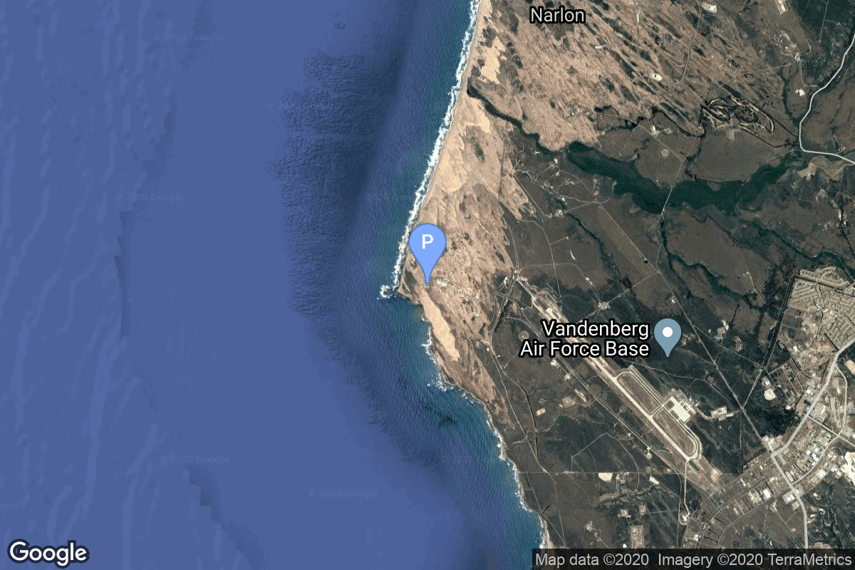
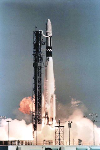
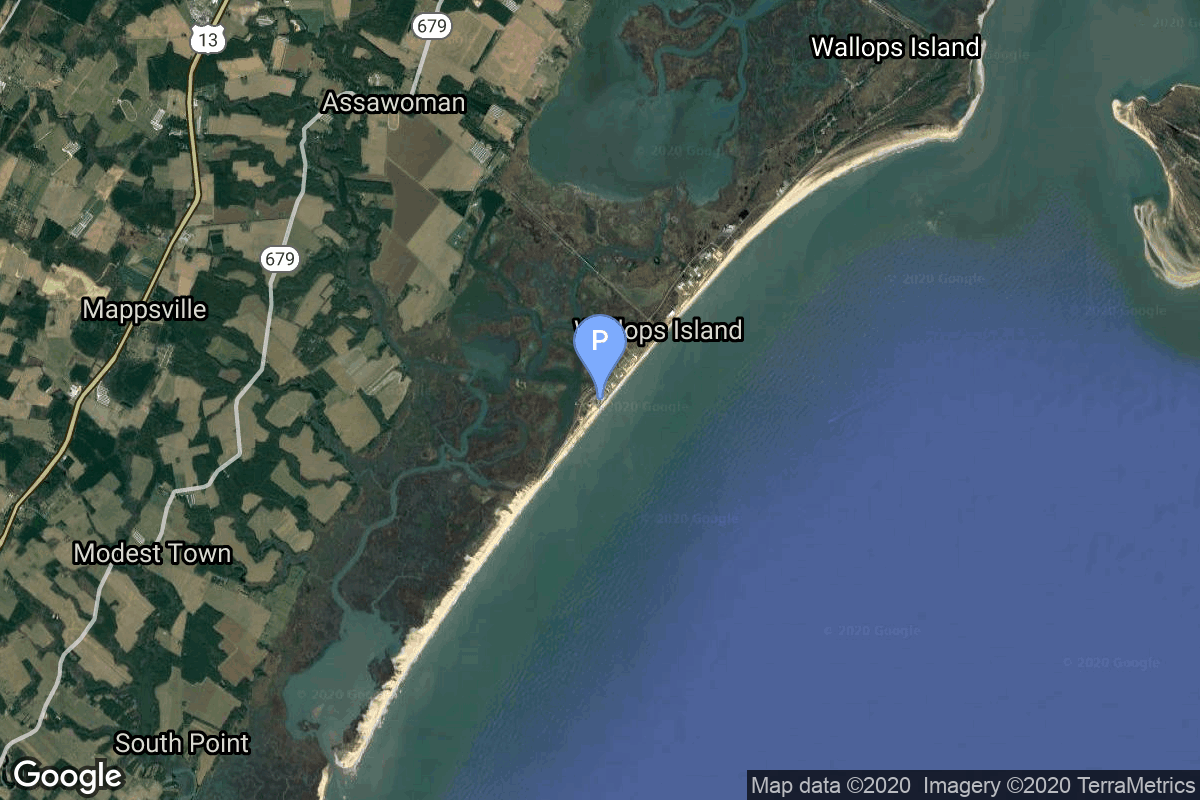
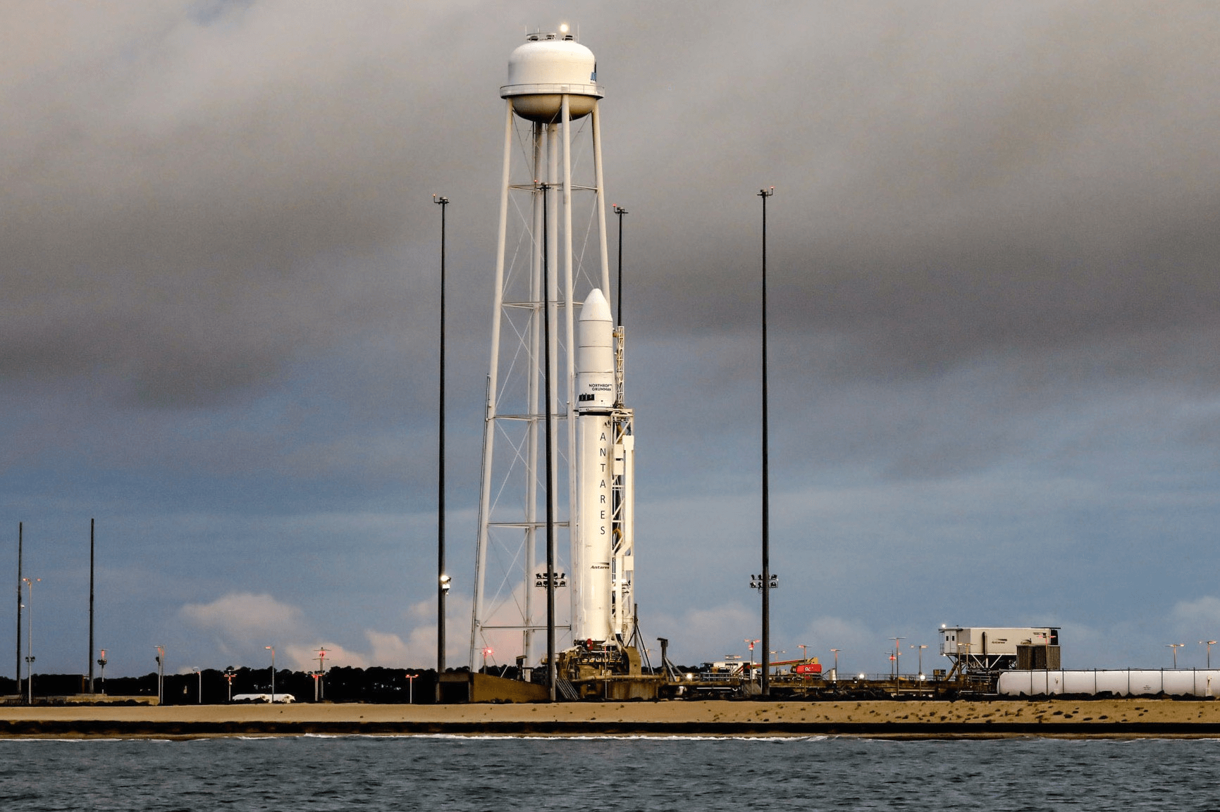
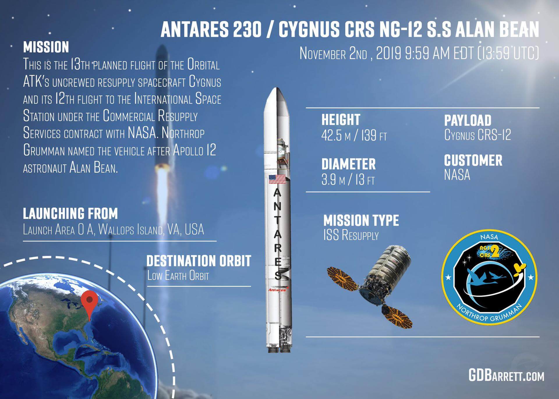
{ "count": 7895, "next": "https://ll.thespacedevs.com/2.2.0/launch/?format=api&limit=10&offset=6810&ordering=-id", "previous": "https://ll.thespacedevs.com/2.2.0/launch/?format=api&limit=10&offset=6790&ordering=-id", "results": [ { "id": "24723fad-aeec-43c7-bedd-a463013d70ae", "url": "https://ll.thespacedevs.com/2.2.0/launch/24723fad-aeec-43c7-bedd-a463013d70ae/?format=api", "slug": "atlas-iias-nrol-1", "name": "Atlas IIAS | NROL-1", "status": { "id": 3, "name": "Launch Successful", "abbrev": "Success", "description": "The launch vehicle successfully inserted its payload(s) into the target orbit(s)." }, "last_updated": "2023-06-14T17:40:00Z", "net": "2004-08-31T23:17:00Z", "window_end": "2004-08-31T23:17:00Z", "window_start": "2004-08-31T23:17:00Z", "net_precision": null, "probability": null, "weather_concerns": null, "holdreason": "", "failreason": "", "hashtag": null, "launch_service_provider": { "id": 82, "url": "https://ll.thespacedevs.com/2.2.0/agencies/82/?format=api", "name": "Lockheed Martin", "type": "Commercial" }, "rocket": { "id": 7195, "configuration": { "id": 255, "url": "https://ll.thespacedevs.com/2.2.0/config/launcher/255/?format=api", "name": "Atlas IIAS", "family": "Atlas", "full_name": "Atlas IIAS", "variant": "IIAS" } }, "mission": { "id": 5584, "name": "NROL-1 (Quasar 15)", "description": "63rd and last flight of Atlas IIAS. 576th and final launch of Rocketdyne-powered Atlas rockets. Final launch from LC36A after 42 years of use. Launch delayed from June 24 and 25, July 1 and 27, August 27, 28, 29 and 30. The payload was probably a communications satellite used to relay data from imaging spy satellites.", "launch_designator": null, "type": "Communications", "orbit": { "id": 1, "name": "Geostationary Orbit", "abbrev": "Direct-GEO" }, "agencies": [], "info_urls": [], "vid_urls": [] }, "pad": { "id": 121, "url": "https://ll.thespacedevs.com/2.2.0/pad/121/?format=api", "agency_id": 161, "name": "Launch Complex 36A", "description": null, "info_url": null, "wiki_url": "https://en.wikipedia.org/wiki/Cape_Canaveral_Launch_Complex_36", "map_url": "https://www.google.com/maps?q=28.4705556,-80.542194", "latitude": "28.4705556", "longitude": "-80.542194", "location": { "id": 12, "url": "https://ll.thespacedevs.com/2.2.0/location/12/?format=api", "name": "Cape Canaveral SFS, FL, USA", "country_code": "USA", "description": "Cape Canaveral Space Force Station (CCSFS) is an installation of the United States Space Force's Space Launch Delta 45, located on Cape Canaveral in Brevard County, Florida.", "map_image": "https://thespacedevs-prod.nyc3.digitaloceanspaces.com/media/map_images/location_12_20200803142519.jpg", "timezone_name": "America/New_York", "total_launch_count": 1113, "total_landing_count": 75 }, "country_code": "USA", "map_image": "https://thespacedevs-prod.nyc3.digitaloceanspaces.com/media/map_images/pad_121_20200803143231.jpg", "total_launch_count": 71, "orbital_launch_attempt_count": 71 }, "webcast_live": false, "image": null, "infographic": null, "program": [], "orbital_launch_attempt_count": 4673, "location_launch_attempt_count": 627, "pad_launch_attempt_count": 68, "agency_launch_attempt_count": 75, "orbital_launch_attempt_count_year": 34, "location_launch_attempt_count_year": 9, "pad_launch_attempt_count_year": 3, "agency_launch_attempt_count_year": 5, "type": "normal" }, { "id": "24698542-9dda-4271-9ce0-1cc6f3ef0839", "url": "https://ll.thespacedevs.com/2.2.0/launch/24698542-9dda-4271-9ce0-1cc6f3ef0839/?format=api", "slug": "thor-slv-2a-agena-d-kh-4a-11", "name": "Thor SLV-2A Agena D | KH-4A 11", "status": { "id": 3, "name": "Launch Successful", "abbrev": "Success", "description": "The launch vehicle successfully inserted its payload(s) into the target orbit(s)." }, "last_updated": "2023-06-14T04:18:26Z", "net": "1964-10-05T21:50:14Z", "window_end": "1964-10-05T21:50:14Z", "window_start": "1964-10-05T21:50:14Z", "net_precision": null, "probability": null, "weather_concerns": null, "holdreason": "", "failreason": null, "hashtag": null, "launch_service_provider": { "id": 161, "url": "https://ll.thespacedevs.com/2.2.0/agencies/161/?format=api", "name": "United States Air Force", "type": "Government" }, "rocket": { "id": 3321, "configuration": { "id": 417, "url": "https://ll.thespacedevs.com/2.2.0/config/launcher/417/?format=api", "name": "Thor SLV-2A Agena D", "family": "Thor", "full_name": "Thor SLV-2A Agena D", "variant": "SLV-2A Agena D" } }, "mission": { "id": 1743, "name": "KH-4A 11", "description": "The KH-4A (Keyhole-4A) was the fifth optical reconnaissance satellite version in the Corona-program.", "launch_designator": null, "type": "Government/Top Secret", "orbit": { "id": 8, "name": "Low Earth Orbit", "abbrev": "LEO" }, "agencies": [], "info_urls": [], "vid_urls": [] }, "pad": { "id": 95, "url": "https://ll.thespacedevs.com/2.2.0/pad/95/?format=api", "agency_id": 161, "name": "Space Launch Complex 1W", "description": "Space Launch Complex 1 West (SLC-1W) was a launch pad at Vandenberg Space Force Base in California, United States. It was built in 1958 for the never activated 75th Strategic Missile Squadron for Thor Agena A launches.", "info_url": null, "wiki_url": "https://en.wikipedia.org/wiki/Vandenberg_Space_Launch_Complex_1", "map_url": "https://www.google.com/maps?q=34.7572,-120.6303", "latitude": "34.7572", "longitude": "-120.6303", "location": { "id": 11, "url": "https://ll.thespacedevs.com/2.2.0/location/11/?format=api", "name": "Vandenberg SFB, CA, USA", "country_code": "USA", "description": "Vandenberg Space Force Base is a United States Space Force Base in Santa Barbara County, California. Established in 1941, Vandenberg Space Force Base is a space launch base, launching spacecraft from the Western Range, and also performs missile testing. The United States Space Force's Space Launch Delta 30 serves as the host delta for the base, equivalent to an Air Force air base wing. In addition to its military space launch mission, Vandenberg Space Force Base also hosts space launches for civil and commercial space entities, such as NASA and SpaceX.", "map_image": "https://thespacedevs-prod.nyc3.digitaloceanspaces.com/media/map_images/location_11_20200803142416.jpg", "timezone_name": "America/Los_Angeles", "total_launch_count": 888, "total_landing_count": 34 }, "country_code": "USA", "map_image": "https://thespacedevs-prod.nyc3.digitaloceanspaces.com/media/map_images/pad_95_20200803143209.jpg", "total_launch_count": 56, "orbital_launch_attempt_count": 56 }, "webcast_live": false, "image": "https://thespacedevs-prod.nyc3.digitaloceanspaces.com/media/images/thor_slv-2a_age_image_20251102055131.jpg", "infographic": null, "program": [], "orbital_launch_attempt_count": 364, "location_launch_attempt_count": 146, "pad_launch_attempt_count": 38, "agency_launch_attempt_count": 215, "orbital_launch_attempt_count_year": 71, "location_launch_attempt_count_year": 29, "pad_launch_attempt_count_year": 5, "agency_launch_attempt_count_year": 40, "type": "normal" }, { "id": "244f6809-7aba-41d8-ad7b-ba3623afcecd", "url": "https://ll.thespacedevs.com/2.2.0/launch/244f6809-7aba-41d8-ad7b-ba3623afcecd/?format=api", "slug": "antares-230-cygnus-crs-2-ng-12-ss-alan-bean", "name": "Antares 230+ | Cygnus CRS-2 NG-12 (S.S. Alan Bean)", "status": { "id": 3, "name": "Launch Successful", "abbrev": "Success", "description": "The launch vehicle successfully inserted its payload(s) into the target orbit(s)." }, "last_updated": "2023-06-14T03:58:45Z", "net": "2019-11-02T13:59:47Z", "window_end": "2019-11-02T13:59:47Z", "window_start": "2019-11-02T13:59:47Z", "net_precision": null, "probability": 100, "weather_concerns": null, "holdreason": "", "failreason": null, "hashtag": "#NG12", "launch_service_provider": { "id": 257, "url": "https://ll.thespacedevs.com/2.2.0/agencies/257/?format=api", "name": "Northrop Grumman Space Systems", "type": "Commercial" }, "rocket": { "id": 2572, "configuration": { "id": 210, "url": "https://ll.thespacedevs.com/2.2.0/config/launcher/210/?format=api", "name": "Antares 230+", "family": "Antares", "full_name": "Antares 230+", "variant": "230+" } }, "mission": { "id": 25, "name": "Cygnus CRS-2 NG-12 (S.S. Alan Bean)", "description": "This is the 13th planned flight of the Orbital ATK's uncrewed resupply spacecraft Cygnus and its 12th flight to the International Space Station under the Commercial Resupply Services contract with NASA.", "launch_designator": null, "type": "Resupply", "orbit": { "id": 8, "name": "Low Earth Orbit", "abbrev": "LEO" }, "agencies": [], "info_urls": [], "vid_urls": [] }, "pad": { "id": 76, "url": "https://ll.thespacedevs.com/2.2.0/pad/76/?format=api", "agency_id": 44, "name": "Launch Area 0 A", "description": "LP-0A was first built for the failed Conestoga rocket program. The original launch tower was subsequently demolished in September 2008. A new pad facility was built from 2009 to 2011 for Orbital Sciences Taurus II, now renamed Antares.", "info_url": null, "wiki_url": "https://en.wikipedia.org/wiki/Mid-Atlantic_Regional_Spaceport_Launch_Pad_0#Pad_0A", "map_url": "https://www.google.com/maps?q=37.8337,-75.4881", "latitude": "37.8337", "longitude": "-75.4881", "location": { "id": 21, "url": "https://ll.thespacedevs.com/2.2.0/location/21/?format=api", "name": "Wallops Flight Facility, Virginia, USA", "country_code": "USA", "description": "Wallops Flight Facility is a rocket launch site on Wallops Island on the Eastern Shore of Virginia, United States, just east of the Delmarva Peninsula and north-northeast of Norfolk. The facility is operated by the Goddard Space Flight Center in Greenbelt, Maryland, and primarily serves to support science and exploration missions for NASA and other federal agencies. WFF includes an extensively instrumented range to support launches of more than a dozen types of sounding rockets; small expendable suborbital and orbital rockets; high-altitude balloon flights carrying scientific instruments for atmospheric and astronomical research; and, using its Research Airport, flight tests of aeronautical research aircraft, including uncrewed aerial vehicles.", "map_image": "https://thespacedevs-prod.nyc3.digitaloceanspaces.com/media/map_images/location_21_20200803142423.jpg", "timezone_name": "America/New_York", "total_launch_count": 86, "total_landing_count": 0 }, "country_code": "USA", "map_image": "https://thespacedevs-prod.nyc3.digitaloceanspaces.com/media/map_images/pad_76_20200803143538.jpg", "total_launch_count": 19, "orbital_launch_attempt_count": 19 }, "webcast_live": false, "image": "https://thespacedevs-prod.nyc3.digitaloceanspaces.com/media/images/antares_230252_image_20230801170759.png", "infographic": "https://thespacedevs-prod.nyc3.digitaloceanspaces.com/media/infographic_images/antares2520230_infographic_20200806035737.jpeg", "program": [ { "id": 17, "url": "https://ll.thespacedevs.com/2.2.0/program/17/?format=api", "name": "International Space Station", "description": "The International Space Station programme is tied together by a complex set of legal, political and financial agreements between the sixteen nations involved in the project, governing ownership of the various components, rights to crewing and utilization, and responsibilities for crew rotation and resupply of the International Space Station. It was conceived in 1984 by President Ronald Reagan, during the Space Station Freedom project as it was originally called.", "agencies": [ { "id": 16, "url": "https://ll.thespacedevs.com/2.2.0/agencies/16/?format=api", "name": "Canadian Space Agency", "type": "Government" }, { "id": 27, "url": "https://ll.thespacedevs.com/2.2.0/agencies/27/?format=api", "name": "European Space Agency", "type": "Multinational" }, { "id": 37, "url": "https://ll.thespacedevs.com/2.2.0/agencies/37/?format=api", "name": "Japan Aerospace Exploration Agency", "type": "Government" }, { "id": 44, "url": "https://ll.thespacedevs.com/2.2.0/agencies/44/?format=api", "name": "National Aeronautics and Space Administration", "type": "Government" }, { "id": 63, "url": "https://ll.thespacedevs.com/2.2.0/agencies/63/?format=api", "name": "Russian Federal Space Agency (ROSCOSMOS)", "type": "Government" } ], "image_url": "https://thespacedevs-prod.nyc3.digitaloceanspaces.com/media/images/international2_program_20201129184745.png", "start_date": "1998-11-20T06:40:00Z", "end_date": null, "info_url": "https://www.nasa.gov/mission_pages/station/main/index.html", "wiki_url": "https://en.wikipedia.org/wiki/International_Space_Station_programme", "mission_patches": [], "type": { "id": 2, "name": "Human Spaceflight" } }, { "id": 11, "url": "https://ll.thespacedevs.com/2.2.0/program/11/?format=api", "name": "Commercial Resupply Services", "description": "Commercial Resupply Services (CRS) are a series of flights awarded by NASA for the delivery of cargo and supplies to the International Space Station.The first CRS contracts were signed in 2008 and awarded $1.6 billion to SpaceX for twelve cargo Dragon and $1.9 billion to Orbital Sciences for eight Cygnus flights, covering deliveries to 2016. The Falcon 9 and Antares rockets were also developed under the CRS program to deliver cargo spacecraft to the ISS.", "agencies": [ { "id": 44, "url": "https://ll.thespacedevs.com/2.2.0/agencies/44/?format=api", "name": "National Aeronautics and Space Administration", "type": "Government" }, { "id": 257, "url": "https://ll.thespacedevs.com/2.2.0/agencies/257/?format=api", "name": "Northrop Grumman Space Systems", "type": "Commercial" }, { "id": 1020, "url": "https://ll.thespacedevs.com/2.2.0/agencies/1020/?format=api", "name": "Sierra Nevada Corporation", "type": "Commercial" }, { "id": 121, "url": "https://ll.thespacedevs.com/2.2.0/agencies/121/?format=api", "name": "SpaceX", "type": "Commercial" } ], "image_url": "https://thespacedevs-prod.nyc3.digitaloceanspaces.com/media/images/commercial2520_program_20201129212219.png", "start_date": "2008-12-23T00:00:00Z", "end_date": null, "info_url": null, "wiki_url": "https://en.wikipedia.org/wiki/Commercial_Resupply_Services#Commercial_Resupply_Services", "mission_patches": [], "type": { "id": 2, "name": "Human Spaceflight" } } ], "orbital_launch_attempt_count": 5896, "location_launch_attempt_count": 65, "pad_launch_attempt_count": 12, "agency_launch_attempt_count": 4, "orbital_launch_attempt_count_year": 76, "location_launch_attempt_count_year": 2, "pad_launch_attempt_count_year": 2, "agency_launch_attempt_count_year": 3, "type": "normal" }, { "id": "244d7ce9-3958-4d51-affc-292c21a44f5c", "url": "https://ll.thespacedevs.com/2.2.0/launch/244d7ce9-3958-4d51-affc-292c21a44f5c/?format=api", "slug": "titan-iiic-transtage-5", "name": "Titan IIIC | Transtage 5", "status": { "id": 3, "name": "Launch Successful", "abbrev": "Success", "description": "The launch vehicle successfully inserted its payload(s) into the target orbit(s)." }, "last_updated": "2023-06-14T17:41:24Z", "net": "1965-06-18T14:00:04Z", "window_end": "1965-06-18T14:00:04Z", "window_start": "1965-06-18T14:00:04Z", "net_precision": null, "probability": null, "weather_concerns": null, "holdreason": "", "failreason": null, "hashtag": null, "launch_service_provider": { "id": 161, "url": "https://ll.thespacedevs.com/2.2.0/agencies/161/?format=api", "name": "United States Air Force", "type": "Government" }, "rocket": { "id": 3407, "configuration": { "id": 439, "url": "https://ll.thespacedevs.com/2.2.0/config/launcher/439/?format=api", "name": "Titan IIIC", "family": "Titan", "full_name": "Titan IIIC", "variant": "IIIC" } }, "mission": { "id": 1827, "name": "Transtage 5", "description": "Test flights of the cryogenic Transtage stage.", "launch_designator": null, "type": "Test Flight", "orbit": { "id": 8, "name": "Low Earth Orbit", "abbrev": "LEO" }, "agencies": [], "info_urls": [], "vid_urls": [] }, "pad": { "id": 80, "url": "https://ll.thespacedevs.com/2.2.0/pad/80/?format=api", "agency_id": 121, "name": "Space Launch Complex 40", "description": "", "info_url": null, "wiki_url": "https://en.wikipedia.org/wiki/Cape_Canaveral_Air_Force_Station_Space_Launch_Complex_40", "map_url": "https://www.google.com/maps?q=28.56194122,-80.57735736", "latitude": "28.56194122", "longitude": "-80.57735736", "location": { "id": 12, "url": "https://ll.thespacedevs.com/2.2.0/location/12/?format=api", "name": "Cape Canaveral SFS, FL, USA", "country_code": "USA", "description": "Cape Canaveral Space Force Station (CCSFS) is an installation of the United States Space Force's Space Launch Delta 45, located on Cape Canaveral in Brevard County, Florida.", "map_image": "https://thespacedevs-prod.nyc3.digitaloceanspaces.com/media/map_images/location_12_20200803142519.jpg", "timezone_name": "America/New_York", "total_launch_count": 1113, "total_landing_count": 75 }, "country_code": "USA", "map_image": "https://thespacedevs-prod.nyc3.digitaloceanspaces.com/media/map_images/pad_80_20200803143323.jpg", "total_launch_count": 386, "orbital_launch_attempt_count": 386 }, "webcast_live": false, "image": "https://thespacedevs-prod.nyc3.digitaloceanspaces.com/media/images/titan_iii-c_lau_image_20251103140641.jpeg", "infographic": null, "program": [], "orbital_launch_attempt_count": 446, "location_launch_attempt_count": 146, "pad_launch_attempt_count": 1, "agency_launch_attempt_count": 265, "orbital_launch_attempt_count_year": 53, "location_launch_attempt_count_year": 20, "pad_launch_attempt_count_year": 1, "agency_launch_attempt_count_year": 34, "type": "normal" }, { "id": "242b9778-c094-482a-96b3-2a0b67988f88", "url": "https://ll.thespacedevs.com/2.2.0/launch/242b9778-c094-482a-96b3-2a0b67988f88/?format=api", "slug": "proton-kdm-raduga-9", "name": "Proton-K/DM | Raduga 9", "status": { "id": 3, "name": "Launch Successful", "abbrev": "Success", "description": "The launch vehicle successfully inserted its payload(s) into the target orbit(s)." }, "last_updated": "2023-06-14T03:35:02Z", "net": "1981-07-30T21:38:00Z", "window_end": "1981-07-30T21:38:00Z", "window_start": "1981-07-30T21:38:00Z", "net_precision": null, "probability": null, "weather_concerns": null, "holdreason": "", "failreason": null, "hashtag": null, "launch_service_provider": { "id": 66, "url": "https://ll.thespacedevs.com/2.2.0/agencies/66/?format=api", "name": "Soviet Space Program", "type": "Government" }, "rocket": { "id": 5300, "configuration": { "id": 349, "url": "https://ll.thespacedevs.com/2.2.0/config/launcher/349/?format=api", "name": "Proton-K/DM", "family": "Proton / UR-500", "full_name": "Proton-K/DM", "variant": "DM" } }, "mission": { "id": 3708, "name": "Raduga 9", "description": "Geostationary communications satellite for military and governmental puposes", "launch_designator": null, "type": "Communications", "orbit": { "id": 1, "name": "Geostationary Orbit", "abbrev": "Direct-GEO" }, "agencies": [], "info_urls": [], "vid_urls": [] }, "pad": { "id": 15, "url": "https://ll.thespacedevs.com/2.2.0/pad/15/?format=api", "agency_id": null, "name": "200/39 (200L)", "description": null, "info_url": null, "wiki_url": "", "map_url": "https://www.google.com/maps?q=46.039984,63.032093", "latitude": "46.039984", "longitude": "63.032093", "location": { "id": 15, "url": "https://ll.thespacedevs.com/2.2.0/location/15/?format=api", "name": "Baikonur Cosmodrome, Republic of Kazakhstan", "country_code": "KAZ", "description": "The Baikonur Cosmodrome is a spaceport operated by Russia within Kazakhstan. Located in the Kazakh city of Baikonur, it is the largest operational space launch facility in terms of area. All Russian crewed spaceflights are launched from Baikonur.", "map_image": "https://thespacedevs-prod.nyc3.digitaloceanspaces.com/media/map_images/location_15_20200803142517.jpg", "timezone_name": "Asia/Qyzylorda", "total_launch_count": 1563, "total_landing_count": 0 }, "country_code": "KAZ", "map_image": "https://thespacedevs-prod.nyc3.digitaloceanspaces.com/media/map_images/pad_15_20200803143530.jpg", "total_launch_count": 167, "orbital_launch_attempt_count": 167 }, "webcast_live": false, "image": "https://thespacedevs-prod.nyc3.digitaloceanspaces.com/media/images/proton_image_20231231095535.jpg", "infographic": null, "program": [], "orbital_launch_attempt_count": 2462, "location_launch_attempt_count": 603, "pad_launch_attempt_count": 5, "agency_launch_attempt_count": 1509, "orbital_launch_attempt_count_year": 71, "location_launch_attempt_count_year": 25, "pad_launch_attempt_count_year": 2, "agency_launch_attempt_count_year": 58, "type": "normal" }, { "id": "242a5669-7d52-4cab-8a03-72af4aa08f12", "url": "https://ll.thespacedevs.com/2.2.0/launch/242a5669-7d52-4cab-8a03-72af4aa08f12/?format=api", "slug": "falcon-9-block-5-starlink-group-6-54", "name": "Falcon 9 Block 5 | Starlink Group 6-54", "status": { "id": 3, "name": "Launch Successful", "abbrev": "Success", "description": "The launch vehicle successfully inserted its payload(s) into the target orbit(s)." }, "last_updated": "2024-04-28T23:17:44Z", "net": "2024-04-28T22:08:00Z", "window_end": "2024-04-29T01:48:00Z", "window_start": "2024-04-28T22:08:00Z", "net_precision": { "id": 0, "name": "Second", "abbrev": "SEC", "description": "The T-0 is accurate to the second." }, "probability": 80, "weather_concerns": "Thick Cloud Layers Rule, Cumulus Cloud Rule", "holdreason": "", "failreason": "", "hashtag": null, "launch_service_provider": { "id": 121, "url": "https://ll.thespacedevs.com/2.2.0/agencies/121/?format=api", "name": "SpaceX", "type": "Commercial" }, "rocket": { "id": 8233, "configuration": { "id": 164, "url": "https://ll.thespacedevs.com/2.2.0/config/launcher/164/?format=api", "name": "Falcon 9", "family": "Falcon", "full_name": "Falcon 9 Block 5", "variant": "Block 5" } }, "mission": { "id": 6810, "name": "Starlink Group 6-54", "description": "A batch of 23 satellites for the Starlink mega-constellation - SpaceX's project for space-based Internet communication system.", "launch_designator": null, "type": "Communications", "orbit": { "id": 8, "name": "Low Earth Orbit", "abbrev": "LEO" }, "agencies": [ { "id": 121, "url": "https://ll.thespacedevs.com/2.2.0/agencies/121/?format=api", "name": "SpaceX", "featured": true, "type": "Commercial", "country_code": "USA", "abbrev": "SpX", "description": "Space Exploration Technologies Corp., known as SpaceX, is an American aerospace manufacturer and space transport services company headquartered in Hawthorne, California. It was founded in 2002 by entrepreneur Elon Musk with the goal of reducing space transportation costs and enabling the colonization of Mars. SpaceX operates from many pads, on the East Coast of the US they operate from SLC-40 at Cape Canaveral Space Force Station and historic LC-39A at Kennedy Space Center. They also operate from SLC-4E at Vandenberg Space Force Base, California, usually for polar launches. Another launch site is being developed at Boca Chica, Texas.", "administrator": "CEO: Elon Musk", "founding_year": "2002", "launchers": "Falcon | Starship", "spacecraft": "Dragon", "launch_library_url": null, "total_launch_count": 687, "consecutive_successful_launches": 172, "successful_launches": 672, "failed_launches": 15, "pending_launches": 132, "consecutive_successful_landings": 8, "successful_landings": 632, "failed_landings": 28, "attempted_landings": 659, "info_url": "https://www.spacex.com/", "wiki_url": "https://en.wikipedia.org/wiki/SpaceX", "logo_url": "https://thespacedevs-prod.nyc3.digitaloceanspaces.com/media/images/spacex_logo_20220826094919.png", "image_url": "https://thespacedevs-prod.nyc3.digitaloceanspaces.com/media/images/falcon_9_image_20230807133459.jpeg", "nation_url": "https://thespacedevs-prod.nyc3.digitaloceanspaces.com/media/images/spacex_social_l_image_20260407054626.jpg" } ], "info_urls": [], "vid_urls": [] }, "pad": { "id": 80, "url": "https://ll.thespacedevs.com/2.2.0/pad/80/?format=api", "agency_id": 121, "name": "Space Launch Complex 40", "description": "", "info_url": null, "wiki_url": "https://en.wikipedia.org/wiki/Cape_Canaveral_Air_Force_Station_Space_Launch_Complex_40", "map_url": "https://www.google.com/maps?q=28.56194122,-80.57735736", "latitude": "28.56194122", "longitude": "-80.57735736", "location": { "id": 12, "url": "https://ll.thespacedevs.com/2.2.0/location/12/?format=api", "name": "Cape Canaveral SFS, FL, USA", "country_code": "USA", "description": "Cape Canaveral Space Force Station (CCSFS) is an installation of the United States Space Force's Space Launch Delta 45, located on Cape Canaveral in Brevard County, Florida.", "map_image": "https://thespacedevs-prod.nyc3.digitaloceanspaces.com/media/map_images/location_12_20200803142519.jpg", "timezone_name": "America/New_York", "total_launch_count": 1113, "total_landing_count": 75 }, "country_code": "USA", "map_image": "https://thespacedevs-prod.nyc3.digitaloceanspaces.com/media/map_images/pad_80_20200803143323.jpg", "total_launch_count": 386, "orbital_launch_attempt_count": 386 }, "webcast_live": false, "image": "https://thespacedevs-prod.nyc3.digitaloceanspaces.com/media/images/falcon2520925_image_20221009234147.png", "infographic": null, "program": [ { "id": 25, "url": "https://ll.thespacedevs.com/2.2.0/program/25/?format=api", "name": "Starlink", "description": "Starlink is a satellite internet constellation operated by American aerospace company SpaceX", "agencies": [ { "id": 121, "url": "https://ll.thespacedevs.com/2.2.0/agencies/121/?format=api", "name": "SpaceX", "type": "Commercial" } ], "image_url": "https://thespacedevs-prod.nyc3.digitaloceanspaces.com/media/images/starlink_program_20231228154508.jpeg", "start_date": "2018-02-22T14:17:00Z", "end_date": null, "info_url": "https://starlink.com", "wiki_url": "https://en.wikipedia.org/wiki/Starlink", "mission_patches": [ { "id": 7, "name": "Space X Starlink Mission Patch", "priority": 10, "image_url": "https://thespacedevs-prod.nyc3.digitaloceanspaces.com/media/mission_patch_images/space2520x252_mission_patch_20221011205756.png", "agency": { "id": 121, "url": "https://ll.thespacedevs.com/2.2.0/agencies/121/?format=api", "name": "SpaceX", "type": "Commercial" } } ], "type": { "id": 3, "name": "Communication Constellation" } } ], "orbital_launch_attempt_count": 6670, "location_launch_attempt_count": 949, "pad_launch_attempt_count": 238, "agency_launch_attempt_count": 355, "orbital_launch_attempt_count_year": 81, "location_launch_attempt_count_year": 22, "pad_launch_attempt_count_year": 20, "agency_launch_attempt_count_year": 44, "type": "normal" }, { "id": "24218f72-ec9c-45d7-ba78-be1ee363b2e4", "url": "https://ll.thespacedevs.com/2.2.0/launch/24218f72-ec9c-45d7-ba78-be1ee363b2e4/?format=api", "slug": "molniya-m-us-k-26", "name": "Molniya-M | US-K 26", "status": { "id": 3, "name": "Launch Successful", "abbrev": "Success", "description": "The launch vehicle successfully inserted its payload(s) into the target orbit(s)." }, "last_updated": "2023-06-14T04:29:04Z", "net": "1982-05-20T13:08:31Z", "window_end": "1982-05-20T13:08:31Z", "window_start": "1982-05-20T13:08:31Z", "net_precision": null, "probability": null, "weather_concerns": null, "holdreason": "", "failreason": null, "hashtag": null, "launch_service_provider": { "id": 66, "url": "https://ll.thespacedevs.com/2.2.0/agencies/66/?format=api", "name": "Soviet Space Program", "type": "Government" }, "rocket": { "id": 5399, "configuration": { "id": 106, "url": "https://ll.thespacedevs.com/2.2.0/config/launcher/106/?format=api", "name": "Molniya-M", "family": "R-7", "full_name": "Molniya-M 2BL", "variant": "2BL" } }, "mission": { "id": 3806, "name": "US-K 26", "description": "Early warning satellite", "launch_designator": null, "type": "Government/Top Secret", "orbit": { "id": 0, "name": "Elliptical Orbit", "abbrev": "Elliptical" }, "agencies": [], "info_urls": [], "vid_urls": [] }, "pad": { "id": 168, "url": "https://ll.thespacedevs.com/2.2.0/pad/168/?format=api", "agency_id": null, "name": "41/1", "description": null, "info_url": null, "wiki_url": "https://en.wikipedia.org/wiki/Plesetsk_Cosmodrome", "map_url": "https://www.google.com/maps?q=62.941,40.526806", "latitude": "62.941", "longitude": "40.526806", "location": { "id": 6, "url": "https://ll.thespacedevs.com/2.2.0/location/6/?format=api", "name": "Plesetsk Cosmodrome, Russian Federation", "country_code": "RUS", "description": "Plesetsk Cosmodrome is a Russian spaceport located in Mirny, Arkhangelsk Oblast, about 800 km north of Moscow and approximately 200 km south of Arkhangelsk. Originally developed as an ICBM site for the R-7 missile, it also served for numerous satellite launches using the R-7 and other rockets. Its high latitude makes it useful only for certain types of launches, especially the Molniya orbits, so for much of the site's history it functioned as a secondary location, with most orbital launches taking place from Baikonur, in the Kazakh SSR. With the end of the Soviet Union, Baikonur became a foreign territory, and Kazakhstan charged $115 million usage fees annually. Consequently, Plesetsk has seen considerably more activity since the 2000s.", "map_image": "https://thespacedevs-prod.nyc3.digitaloceanspaces.com/media/map_images/location_6_20200803142434.jpg", "timezone_name": "Europe/Moscow", "total_launch_count": 1685, "total_landing_count": 0 }, "country_code": "RUS", "map_image": "https://thespacedevs-prod.nyc3.digitaloceanspaces.com/media/map_images/pad_168_20200803143446.jpg", "total_launch_count": 310, "orbital_launch_attempt_count": 310 }, "webcast_live": false, "image": "https://thespacedevs-prod.nyc3.digitaloceanspaces.com/media/images/molniya_m_image_20251102061752.jpg", "infographic": null, "program": [], "orbital_launch_attempt_count": 2564, "location_launch_attempt_count": 873, "pad_launch_attempt_count": 223, "agency_launch_attempt_count": 1590, "orbital_launch_attempt_count_year": 47, "location_launch_attempt_count_year": 26, "pad_launch_attempt_count_year": 10, "agency_launch_attempt_count_year": 39, "type": "normal" }, { "id": "241e01b2-c9ff-4185-ad78-f48d441ff919", "url": "https://ll.thespacedevs.com/2.2.0/launch/241e01b2-c9ff-4185-ad78-f48d441ff919/?format=api", "slug": "callisto-flight-1", "name": "Callisto | Flight 1", "status": { "id": 2, "name": "To Be Determined", "abbrev": "TBD", "description": "Current date is a placeholder or rough estimation based on unreliable or interpreted sources." }, "last_updated": "2025-09-16T11:24:15Z", "net": "2027-12-31T00:00:00Z", "window_end": "2027-12-31T00:00:00Z", "window_start": "2027-12-31T00:00:00Z", "net_precision": { "id": 14, "name": "Year", "abbrev": "Y", "description": "The T-0 is expected in the given year." }, "probability": null, "weather_concerns": null, "holdreason": "", "failreason": "", "hashtag": null, "launch_service_provider": { "id": 46, "url": "https://ll.thespacedevs.com/2.2.0/agencies/46/?format=api", "name": "National Center of Space Research", "type": "Government" }, "rocket": { "id": 8718, "configuration": { "id": 524, "url": "https://ll.thespacedevs.com/2.2.0/config/launcher/524/?format=api", "name": "Callisto", "family": "", "full_name": "Callisto", "variant": "" } }, "mission": { "id": 7311, "name": "Flight 1", "description": "First test flight of the Callisto VTVL demonstrator.", "launch_designator": null, "type": "Test Flight", "orbit": { "id": 15, "name": "Suborbital", "abbrev": "Sub" }, "agencies": [ { "id": 29, "url": "https://ll.thespacedevs.com/2.2.0/agencies/29/?format=api", "name": "German Aerospace Center", "featured": false, "type": "Government", "country_code": "DEU", "abbrev": "DLR", "description": "The German Aerospace Center is Germany's Center for aerospace, energy, and transportation research. Their main work is as a contributor to the ESA. They have done work both in tandem with the US on Space Shuttle and the ISS, and also with other European Nations on missions like Space Lab and Mars Express.", "administrator": "Administrator: Anke Kaysser-Pyzalla", "founding_year": "1969", "launchers": "", "spacecraft": "Mars Express | Rosetta | Dawn", "launch_library_url": null, "total_launch_count": 1, "consecutive_successful_launches": 1, "successful_launches": 1, "failed_launches": 0, "pending_launches": 0, "consecutive_successful_landings": 0, "successful_landings": 0, "failed_landings": 0, "attempted_landings": 0, "info_url": "https://www.dlr.de/", "wiki_url": "https://en.wikipedia.org/wiki/German_Aerospace_Center", "logo_url": "https://thespacedevs-prod.nyc3.digitaloceanspaces.com/media/images/german2520aerospace2520center_logo_20230806164738.png", "image_url": null, "nation_url": "https://thespacedevs-prod.nyc3.digitaloceanspaces.com/media/images/dlr_social_logo_image_20250916112302.jpg" }, { "id": 37, "url": "https://ll.thespacedevs.com/2.2.0/agencies/37/?format=api", "name": "Japan Aerospace Exploration Agency", "featured": true, "type": "Government", "country_code": "JPN", "abbrev": "JAXA", "description": "The Japan Aerospace Exploration Agency (JAXA) is Japan's national aero-space agency. Through the merger of three previously independent organizations, JAXA was formed on 1 October 2003. JAXA is responsible for research, technology development and the launch of satellites into orbit, and is involved in many more advanced missions, such as asteroid exploration and possible manned exploration of the Moon. JAXA launch their Epsilon vehicle from the Uchinoura Space Center and their H-II vehicles from the Tanegashima Space Center.", "administrator": "Administrator: Hiroshi Yamakawa", "founding_year": "2003", "launchers": "H-II", "spacecraft": "", "launch_library_url": null, "total_launch_count": 37, "consecutive_successful_launches": 2, "successful_launches": 33, "failed_launches": 4, "pending_launches": 2, "consecutive_successful_landings": 0, "successful_landings": 0, "failed_landings": 0, "attempted_landings": 0, "info_url": "https://www.jaxa.jp/", "wiki_url": "https://en.wikipedia.org/wiki/Japan_Aerospace_Exploration_Agency", "logo_url": "https://thespacedevs-prod.nyc3.digitaloceanspaces.com/media/images/japan2520aerospace2520exploration2520agency_logo_20190207032440.png", "image_url": "https://thespacedevs-prod.nyc3.digitaloceanspaces.com/media/images/japan2520aerospace2520exploration2520agency_image_20190207032440.jpeg", "nation_url": "https://thespacedevs-prod.nyc3.digitaloceanspaces.com/media/images/japan2520aerospace2520exploration2520agency_nation_20230531052930.png" }, { "id": 46, "url": "https://ll.thespacedevs.com/2.2.0/agencies/46/?format=api", "name": "National Center of Space Research", "featured": false, "type": "Government", "country_code": "FRA", "abbrev": "CNES", "description": "The National Center of Space Research, or CNES, is a French National Agency in charge of France's space program. In partnership with the US and Russia, they have put 10 people in space. CNES works in tandem with the larger ESA to develop the Ariane 5 and work on other probes and satellites. They are working with Germany to develop a cheaper and more efficient reusable rocket, which hopefully will be ready to fly by 2026.", "administrator": "CEO: François Jacq", "founding_year": "1961", "launchers": "Ariane 5", "spacecraft": "Mars/Venus Express | Rosetta", "launch_library_url": null, "total_launch_count": 14, "consecutive_successful_launches": 3, "successful_launches": 12, "failed_launches": 2, "pending_launches": 1, "consecutive_successful_landings": 0, "successful_landings": 0, "failed_landings": 0, "attempted_landings": 0, "info_url": "https://www.cnes.fr/", "wiki_url": "https://en.wikipedia.org/wiki/CNES", "logo_url": "https://thespacedevs-prod.nyc3.digitaloceanspaces.com/media/images/cnes_logo_image_20250722090832.png", "image_url": "https://thespacedevs-prod.nyc3.digitaloceanspaces.com/media/images/cnes_toulouse_e_image_20250722090314.jpg", "nation_url": "https://thespacedevs-prod.nyc3.digitaloceanspaces.com/media/images/cnes_social_log_image_20250722090952.jpg" } ], "info_urls": [], "vid_urls": [] }, "pad": { "id": 125, "url": "https://ll.thespacedevs.com/2.2.0/pad/125/?format=api", "agency_id": 46, "name": "Diamant Launch Area", "description": "", "info_url": null, "wiki_url": null, "map_url": "https://www.google.com/maps?q=5.2222222,-52.7758051", "latitude": "5.2222222", "longitude": "-52.7758051", "location": { "id": 13, "url": "https://ll.thespacedevs.com/2.2.0/location/13/?format=api", "name": "Guiana Space Centre, French Guiana", "country_code": "GUF", "description": "The Guiana Space Centre is a European spaceport to the northwest of Kourou in French Guiana, a region of France in South America. Kourou is located at a latitude of 5°. In operation since 1968, it is a suitable location for a spaceport because of its equatorial location and open sea to the east.", "map_image": "https://thespacedevs-prod.nyc3.digitaloceanspaces.com/media/map_images/location_13_20200803142412.jpg", "timezone_name": "America/Cayenne", "total_launch_count": 333, "total_landing_count": 0 }, "country_code": "GUF", "map_image": "https://thespacedevs-prod.nyc3.digitaloceanspaces.com/media/map_images/pad_125_20200803143236.jpg", "total_launch_count": 8, "orbital_launch_attempt_count": 8 }, "webcast_live": false, "image": "https://thespacedevs-prod.nyc3.digitaloceanspaces.com/media/images/callisto_render_image_20250916093902.webp", "infographic": null, "program": [], "orbital_launch_attempt_count": null, "location_launch_attempt_count": 363, "pad_launch_attempt_count": 12, "agency_launch_attempt_count": 15, "orbital_launch_attempt_count_year": null, "location_launch_attempt_count_year": 18, "pad_launch_attempt_count_year": 2, "agency_launch_attempt_count_year": 1, "type": "normal" }, { "id": "241daa97-b6ac-4afe-97bf-e05091bf3ac2", "url": "https://ll.thespacedevs.com/2.2.0/launch/241daa97-b6ac-4afe-97bf-e05091bf3ac2/?format=api", "slug": "kosmos-3m-zaliv-6", "name": "Kosmos-3M | Zaliv 6", "status": { "id": 3, "name": "Launch Successful", "abbrev": "Success", "description": "The launch vehicle successfully inserted its payload(s) into the target orbit(s)." }, "last_updated": "2023-06-14T03:43:45Z", "net": "1970-10-12T13:57:00Z", "window_end": "1970-10-12T13:57:00Z", "window_start": "1970-10-12T13:57:00Z", "net_precision": null, "probability": null, "weather_concerns": null, "holdreason": "", "failreason": null, "hashtag": null, "launch_service_provider": { "id": 66, "url": "https://ll.thespacedevs.com/2.2.0/agencies/66/?format=api", "name": "Soviet Space Program", "type": "Government" }, "rocket": { "id": 4059, "configuration": { "id": 102, "url": "https://ll.thespacedevs.com/2.2.0/config/launcher/102/?format=api", "name": "Kosmos-3M", "family": "Kosmos", "full_name": "Kosmos-3M (11K65M)", "variant": "-3M" } }, "mission": { "id": 2477, "name": "Zaliv 6", "description": "The first soviet navigation system called Tsiklon consisted of Zaliv satellites in low earth orbit.", "launch_designator": null, "type": "Navigation", "orbit": { "id": 8, "name": "Low Earth Orbit", "abbrev": "LEO" }, "agencies": [], "info_urls": [], "vid_urls": [] }, "pad": { "id": 28, "url": "https://ll.thespacedevs.com/2.2.0/pad/28/?format=api", "agency_id": 163, "name": "132/1 (132L)", "description": null, "info_url": null, "wiki_url": "", "map_url": "https://www.google.com/maps?q=62.883229,40.868549", "latitude": "62.883229", "longitude": "40.868549", "location": { "id": 6, "url": "https://ll.thespacedevs.com/2.2.0/location/6/?format=api", "name": "Plesetsk Cosmodrome, Russian Federation", "country_code": "RUS", "description": "Plesetsk Cosmodrome is a Russian spaceport located in Mirny, Arkhangelsk Oblast, about 800 km north of Moscow and approximately 200 km south of Arkhangelsk. Originally developed as an ICBM site for the R-7 missile, it also served for numerous satellite launches using the R-7 and other rockets. Its high latitude makes it useful only for certain types of launches, especially the Molniya orbits, so for much of the site's history it functioned as a secondary location, with most orbital launches taking place from Baikonur, in the Kazakh SSR. With the end of the Soviet Union, Baikonur became a foreign territory, and Kazakhstan charged $115 million usage fees annually. Consequently, Plesetsk has seen considerably more activity since the 2000s.", "map_image": "https://thespacedevs-prod.nyc3.digitaloceanspaces.com/media/map_images/location_6_20200803142434.jpg", "timezone_name": "Europe/Moscow", "total_launch_count": 1685, "total_landing_count": 0 }, "country_code": "RUS", "map_image": "https://thespacedevs-prod.nyc3.digitaloceanspaces.com/media/map_images/pad_28_20200803143254.jpg", "total_launch_count": 212, "orbital_launch_attempt_count": 212 }, "webcast_live": false, "image": "https://thespacedevs-prod.nyc3.digitaloceanspaces.com/media/images/kosmos-3m_durin_image_20251101171325.jpg", "infographic": null, "program": [], "orbital_launch_attempt_count": 1138, "location_launch_attempt_count": 147, "pad_launch_attempt_count": 7, "agency_launch_attempt_count": 516, "orbital_launch_attempt_count_year": 92, "location_launch_attempt_count_year": 39, "pad_launch_attempt_count_year": 3, "agency_launch_attempt_count_year": 63, "type": "normal" }, { "id": "241d73d1-148f-4a9d-a9a1-6bf098c79e80", "url": "https://ll.thespacedevs.com/2.2.0/launch/241d73d1-148f-4a9d-a9a1-6bf098c79e80/?format=api", "slug": "soyuz-fg-soyuz-tma-5", "name": "Soyuz-FG | Soyuz TMA-5", "status": { "id": 3, "name": "Launch Successful", "abbrev": "Success", "description": "The launch vehicle successfully inserted its payload(s) into the target orbit(s)." }, "last_updated": "2024-06-15T13:35:10Z", "net": "2004-10-14T03:06:26Z", "window_end": "2004-10-14T03:06:26Z", "window_start": "2004-10-14T03:06:26Z", "net_precision": { "id": 0, "name": "Second", "abbrev": "SEC", "description": "The T-0 is accurate to the second." }, "probability": null, "weather_concerns": null, "holdreason": "", "failreason": "", "hashtag": null, "launch_service_provider": { "id": 63, "url": "https://ll.thespacedevs.com/2.2.0/agencies/63/?format=api", "name": "Russian Federal Space Agency (ROSCOSMOS)", "type": "Government" }, "rocket": { "id": 505, "configuration": { "id": 34, "url": "https://ll.thespacedevs.com/2.2.0/config/launcher/34/?format=api", "name": "Soyuz", "family": "", "full_name": "Soyuz FG", "variant": "FG" } }, "mission": { "id": 198, "name": "Soyuz TMA-5", "description": "Soyuz TMA-5 begins Expedition 10 by carrying 3 astronauts and cosmonauts to the International Space Station. \nRussian Commander, cosmonaut Salizhan Sharipov alongside Flight Engineers, Leroy Chiao (NASA) & Yuri Shargin (RSA) will launch aboard the Soyuz spacecraft from the Baikonur Cosmodrome in Kazakhstan and then rendezvous with the station. \nIt landed on April 24, 2005, 22:08 UTC", "launch_designator": null, "type": "Human Exploration", "orbit": { "id": 8, "name": "Low Earth Orbit", "abbrev": "LEO" }, "agencies": [], "info_urls": [], "vid_urls": [] }, "pad": { "id": 32, "url": "https://ll.thespacedevs.com/2.2.0/pad/32/?format=api", "agency_id": null, "name": "1/5", "description": null, "info_url": null, "wiki_url": "", "map_url": "https://www.google.com/maps?q=45.92,63.342", "latitude": "45.92", "longitude": "63.342", "location": { "id": 15, "url": "https://ll.thespacedevs.com/2.2.0/location/15/?format=api", "name": "Baikonur Cosmodrome, Republic of Kazakhstan", "country_code": "KAZ", "description": "The Baikonur Cosmodrome is a spaceport operated by Russia within Kazakhstan. Located in the Kazakh city of Baikonur, it is the largest operational space launch facility in terms of area. All Russian crewed spaceflights are launched from Baikonur.", "map_image": "https://thespacedevs-prod.nyc3.digitaloceanspaces.com/media/map_images/location_15_20200803142517.jpg", "timezone_name": "Asia/Qyzylorda", "total_launch_count": 1563, "total_landing_count": 0 }, "country_code": "KAZ", "map_image": "https://thespacedevs-prod.nyc3.digitaloceanspaces.com/media/map_images/pad_32_20200803143513.jpg", "total_launch_count": 487, "orbital_launch_attempt_count": 487 }, "webcast_live": false, "image": "https://thespacedevs-prod.nyc3.digitaloceanspaces.com/media/images/soyuz_image_20190717035537.jpg", "infographic": null, "program": [ { "id": 17, "url": "https://ll.thespacedevs.com/2.2.0/program/17/?format=api", "name": "International Space Station", "description": "The International Space Station programme is tied together by a complex set of legal, political and financial agreements between the sixteen nations involved in the project, governing ownership of the various components, rights to crewing and utilization, and responsibilities for crew rotation and resupply of the International Space Station. It was conceived in 1984 by President Ronald Reagan, during the Space Station Freedom project as it was originally called.", "agencies": [ { "id": 16, "url": "https://ll.thespacedevs.com/2.2.0/agencies/16/?format=api", "name": "Canadian Space Agency", "type": "Government" }, { "id": 27, "url": "https://ll.thespacedevs.com/2.2.0/agencies/27/?format=api", "name": "European Space Agency", "type": "Multinational" }, { "id": 37, "url": "https://ll.thespacedevs.com/2.2.0/agencies/37/?format=api", "name": "Japan Aerospace Exploration Agency", "type": "Government" }, { "id": 44, "url": "https://ll.thespacedevs.com/2.2.0/agencies/44/?format=api", "name": "National Aeronautics and Space Administration", "type": "Government" }, { "id": 63, "url": "https://ll.thespacedevs.com/2.2.0/agencies/63/?format=api", "name": "Russian Federal Space Agency (ROSCOSMOS)", "type": "Government" } ], "image_url": "https://thespacedevs-prod.nyc3.digitaloceanspaces.com/media/images/international2_program_20201129184745.png", "start_date": "1998-11-20T06:40:00Z", "end_date": null, "info_url": "https://www.nasa.gov/mission_pages/station/main/index.html", "wiki_url": "https://en.wikipedia.org/wiki/International_Space_Station_programme", "mission_patches": [], "type": { "id": 2, "name": "Human Spaceflight" } }, { "id": 8, "url": "https://ll.thespacedevs.com/2.2.0/program/8/?format=api", "name": "Soyuz", "description": "The Soyuz programme is a human spaceflight programme initiated by the Soviet Union in the early 1960s. The Soyuz spacecraft was originally part of a Moon landing project intended to put a Soviet cosmonaut on the Moon. It was the third Soviet human spaceflight programme after the Vostok and Voskhod programmes.", "agencies": [ { "id": 63, "url": "https://ll.thespacedevs.com/2.2.0/agencies/63/?format=api", "name": "Russian Federal Space Agency (ROSCOSMOS)", "type": "Government" }, { "id": 66, "url": "https://ll.thespacedevs.com/2.2.0/agencies/66/?format=api", "name": "Soviet Space Program", "type": "Government" } ], "image_url": "https://thespacedevs-prod.nyc3.digitaloceanspaces.com/media/images/soyuz_program_20201129185543.png", "start_date": "1966-11-28T11:02:00Z", "end_date": null, "info_url": null, "wiki_url": "https://en.wikipedia.org/wiki/Soyuz_programme", "mission_patches": [], "type": { "id": 2, "name": "Human Spaceflight" } } ], "orbital_launch_attempt_count": 4680, "location_launch_attempt_count": 1228, "pad_launch_attempt_count": 391, "agency_launch_attempt_count": 140, "orbital_launch_attempt_count_year": 41, "location_launch_attempt_count_year": 13, "pad_launch_attempt_count_year": 5, "agency_launch_attempt_count_year": 7, "type": "normal" } ] }