Launch List
AN API endpoint that returns all Launch objects or a single launch.
EXAMPLE - /launch/[id]/ or /launch/?mode=list&search=SpaceX
GET Return a list of all Launch objects.
FILTERS Fields - 'name', 'id(s)', 'lsp__id', 'lsp__name', 'serial_number', 'launcher_config__id', 'rocket__spacecraftflight__spacecraft__name', 'is_crewed', 'include_suborbital', 'spacecraft_config__ids', 'related', 'location__ids', 'lsp__ids', 'pad__ids', 'status__ids'
MODE 'normal', 'list', 'detailed'
EXAMPLE ?mode=list
SEARCH Searches through the launch name, rocket name, launch agency, mission name & spacecraft name.
EXAMPLE - ?search=SpaceX
GET /2.2.0/launch/?format=api&offset=6630&ordering=-name
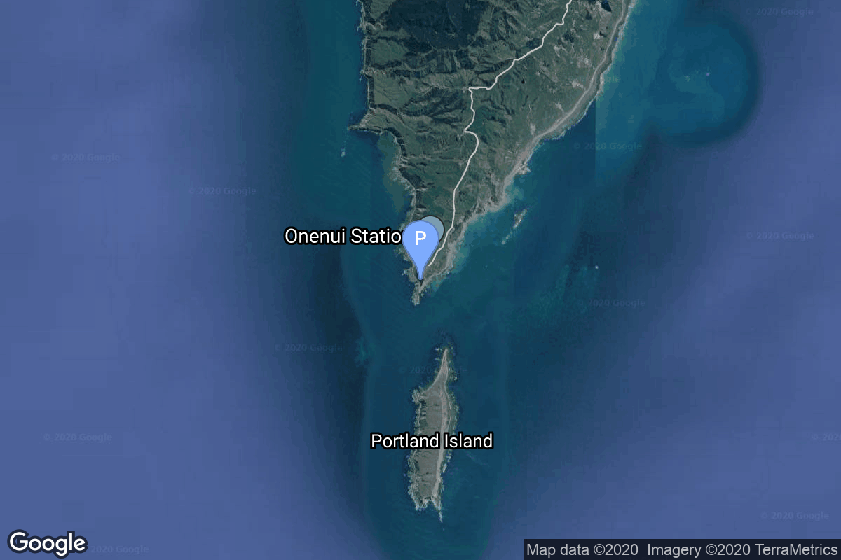
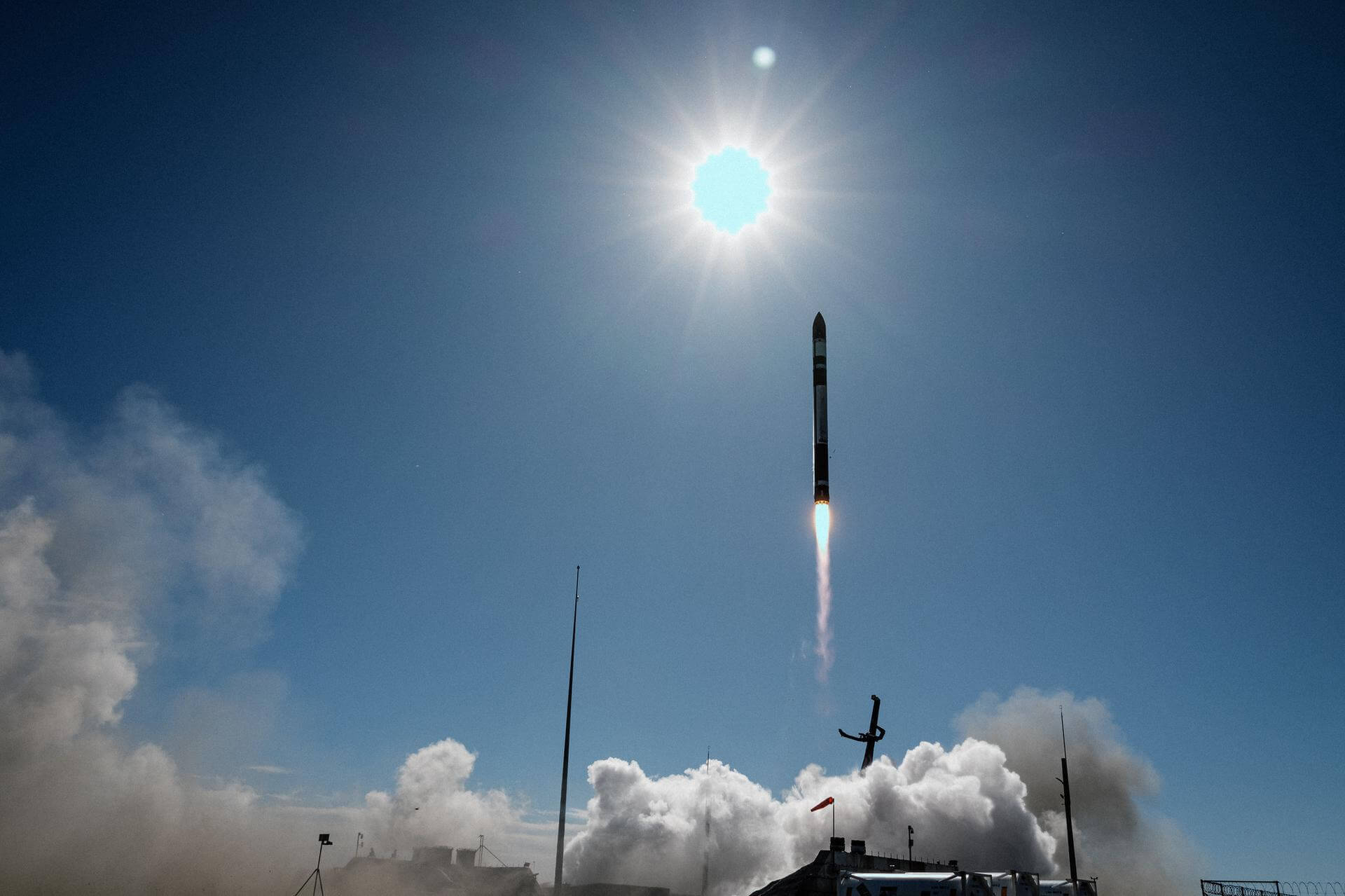
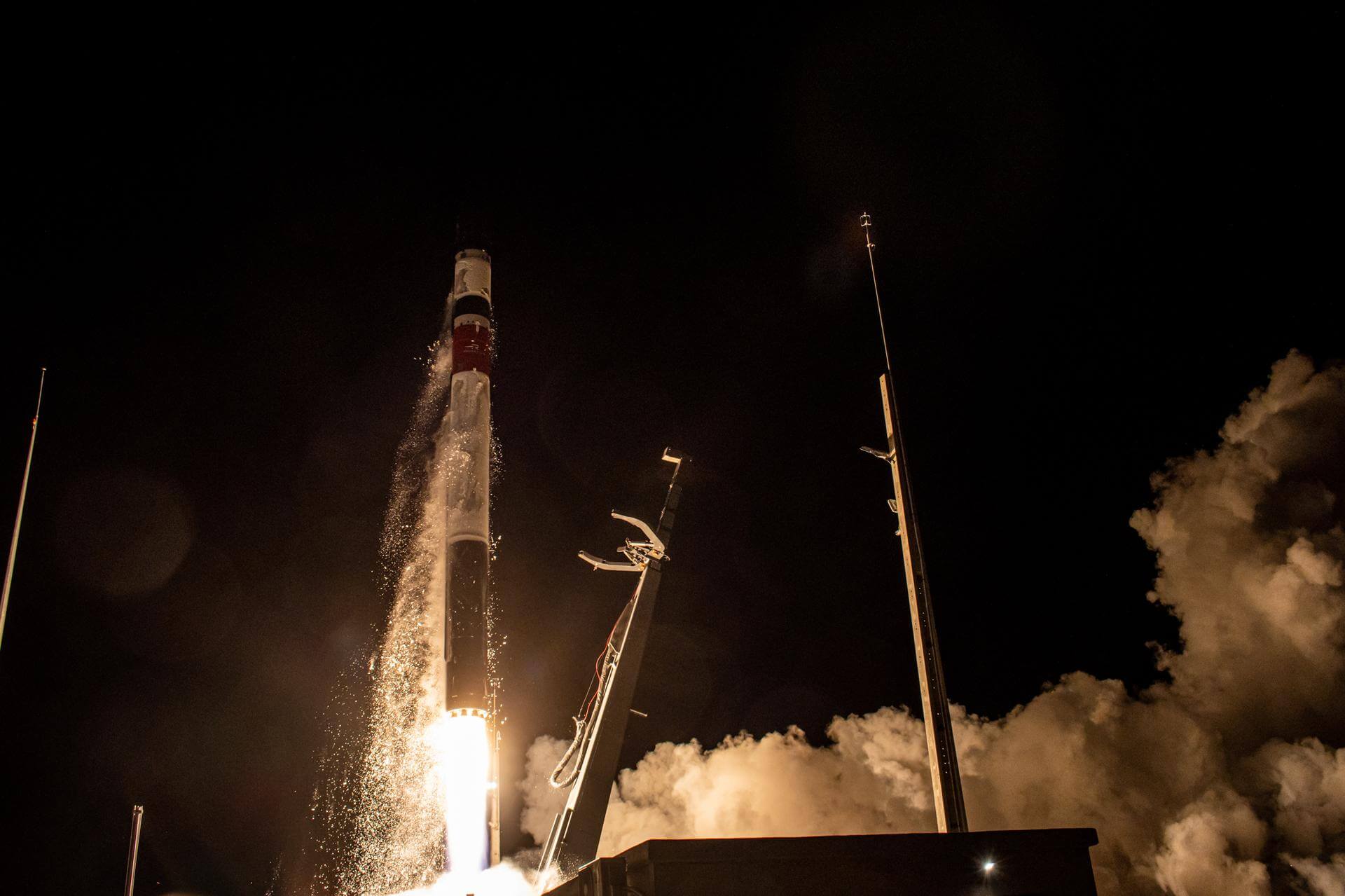
{ "count": 7916, "next": "https://ll.thespacedevs.com/2.2.0/launch/?format=api&limit=10&offset=6640&ordering=-name", "previous": "https://ll.thespacedevs.com/2.2.0/launch/?format=api&limit=10&offset=6620&ordering=-name", "results": [ { "id": "0a4ae6ce-07ef-4e48-9b4d-0bf4e1182134", "url": "https://ll.thespacedevs.com/2.2.0/launch/0a4ae6ce-07ef-4e48-9b4d-0bf4e1182134/?format=api", "slug": "electron-the-mountain-god-guards-iqps-launch-3", "name": "Electron | The Mountain God Guards (iQPS Launch 3)", "status": { "id": 3, "name": "Launch Successful", "abbrev": "Success", "description": "The launch vehicle successfully inserted its payload(s) into the target orbit(s)." }, "last_updated": "2025-08-04T07:05:06Z", "net": "2025-06-11T15:31:00Z", "window_end": "2025-06-11T16:05:00Z", "window_start": "2025-06-11T15:15:00Z", "net_precision": { "id": 1, "name": "Minute", "abbrev": "MIN", "description": "The T-0 is accurate to the minute." }, "probability": 70, "weather_concerns": null, "holdreason": "", "failreason": "", "hashtag": null, "launch_service_provider": { "id": 147, "url": "https://ll.thespacedevs.com/2.2.0/agencies/147/?format=api", "name": "Rocket Lab", "type": "Commercial" }, "rocket": { "id": 8520, "configuration": { "id": 26, "url": "https://ll.thespacedevs.com/2.2.0/config/launcher/26/?format=api", "name": "Electron", "family": "", "full_name": "Electron", "variant": "" } }, "mission": { "id": 7110, "name": "The Mountain God Guards (iQPS Launch 3)", "description": "Synthetic aperture radar Earth observation satellite for Japanese Earth imaging company iQPS.", "launch_designator": null, "type": "Earth Science", "orbit": { "id": 8, "name": "Low Earth Orbit", "abbrev": "LEO" }, "agencies": [ { "id": 1092, "url": "https://ll.thespacedevs.com/2.2.0/agencies/1092/?format=api", "name": "Institute for Q-shu Pioneers of Space", "featured": false, "type": "Private", "country_code": "JPN", "abbrev": "iQPS", "description": "iQPS (Institute for Q-shu Pioneers of Space, Inc.) is a Japanese satellite manufacturer and operator. The company was founded as a spin-off company of Kyushu University in 2005.", "administrator": "CEO: Shunsuke Onishi", "founding_year": "2005", "launchers": "", "spacecraft": "", "launch_library_url": null, "total_launch_count": 0, "consecutive_successful_launches": 0, "successful_launches": 0, "failed_launches": 0, "pending_launches": 0, "consecutive_successful_landings": 0, "successful_landings": 0, "failed_landings": 0, "attempted_landings": 0, "info_url": "https://i-qps.net/en/", "wiki_url": "https://en.wikipedia.org/wiki/IQPS", "logo_url": "https://thespacedevs-prod.nyc3.digitaloceanspaces.com/media/images/iqps_logo_image_20250303221951.jpg", "image_url": null, "nation_url": "https://thespacedevs-prod.nyc3.digitaloceanspaces.com/media/images/iqps_social_log_image_20250303221924.jpg" } ], "info_urls": [], "vid_urls": [] }, "pad": { "id": 65, "url": "https://ll.thespacedevs.com/2.2.0/pad/65/?format=api", "agency_id": 147, "name": "Rocket Lab Launch Complex 1A", "description": "", "info_url": null, "wiki_url": "https://en.wikipedia.org/wiki/Rocket_Lab_Launch_Complex_1", "map_url": "https://www.google.com/maps?q=-39.262833,177.864469", "latitude": "-39.262833", "longitude": "177.864469", "location": { "id": 10, "url": "https://ll.thespacedevs.com/2.2.0/location/10/?format=api", "name": "Rocket Lab Launch Complex 1, Mahia Peninsula, New Zealand", "country_code": "NZL", "description": "Rocket Lab Launch Complex 1 is a commercial spaceport located close to Ahuriri Point at the southern tip of Māhia Peninsula, on the east coast of New Zealand's North Island. It is owned and operated by private spaceflight company Rocket Lab and supports launches of the company's Electron rocket for small satellites. With the launch of Electron on 25 May 2017, it became the first private spaceport to host an orbital launch attempt, and the first site in New Zealand to host an orbital launch attempt. With the Electron launch of 21 January 2018, it became the first private spaceport to host a successful orbital launch.", "map_image": "https://thespacedevs-prod.nyc3.digitaloceanspaces.com/media/map_images/location_10_20200803142509.jpg", "timezone_name": "Pacific/Auckland", "total_launch_count": 78, "total_landing_count": 17 }, "country_code": "NZL", "map_image": "https://thespacedevs-prod.nyc3.digitaloceanspaces.com/media/map_images/pad_65_20200803143549.jpg", "total_launch_count": 41, "orbital_launch_attempt_count": 41 }, "webcast_live": false, "image": "https://thespacedevs-prod.nyc3.digitaloceanspaces.com/media/images/electron_image_20190705175640.jpeg", "infographic": null, "program": [], "orbital_launch_attempt_count": 6978, "location_launch_attempt_count": 60, "pad_launch_attempt_count": 31, "agency_launch_attempt_count": 66, "orbital_launch_attempt_count_year": 129, "location_launch_attempt_count_year": 8, "pad_launch_attempt_count_year": 4, "agency_launch_attempt_count_year": 8, "type": "normal" }, { "id": "2918b5f6-1340-4c73-bb75-4f9b5e16999f", "url": "https://ll.thespacedevs.com/2.2.0/launch/2918b5f6-1340-4c73-bb75-4f9b5e16999f/?format=api", "slug": "electron-the-moon-god-awakens-qps-sar-5", "name": "Electron | The Moon God Awakens (QPS-SAR-5)", "status": { "id": 3, "name": "Launch Successful", "abbrev": "Success", "description": "The launch vehicle successfully inserted its payload(s) into the target orbit(s)." }, "last_updated": "2024-06-15T13:15:57Z", "net": "2023-12-15T04:05:54Z", "window_end": "2023-12-15T06:00:00Z", "window_start": "2023-12-15T04:00:00Z", "net_precision": { "id": 0, "name": "Second", "abbrev": "SEC", "description": "The T-0 is accurate to the second." }, "probability": null, "weather_concerns": null, "holdreason": "", "failreason": "", "hashtag": null, "launch_service_provider": { "id": 147, "url": "https://ll.thespacedevs.com/2.2.0/agencies/147/?format=api", "name": "Rocket Lab", "type": "Commercial" }, "rocket": { "id": 7990, "configuration": { "id": 26, "url": "https://ll.thespacedevs.com/2.2.0/config/launcher/26/?format=api", "name": "Electron", "family": "", "full_name": "Electron", "variant": "" } }, "mission": { "id": 6516, "name": "The Moon God Awakens (QPS-SAR-5)", "description": "QPS-SAR-5 is a synthetic-aperture radar (SAR) satellite that will join a constellation after QPS-SAR-6 already in orbit. iQPS’s satellites are small, high-performance SAR satellites that use a lightweight, large, stowable antenna to collect high resolution images of Earth, even through clouds and adverse weather conditions.", "launch_designator": null, "type": "Earth Science", "orbit": { "id": 8, "name": "Low Earth Orbit", "abbrev": "LEO" }, "agencies": [ { "id": 1065, "url": "https://ll.thespacedevs.com/2.2.0/agencies/1065/?format=api", "name": "QPS Research Institute", "featured": false, "type": "Commercial", "country_code": "JPN", "abbrev": "iQPS", "description": "iQPS has developed “QPS-SAR”,a high-resolution small radar satellite and provides high-resolution and high-quality SAR images that enable observations of designated targets, even at night and/or in bad weather.", "administrator": "President: Shunsuke Onishi", "founding_year": "2005", "launchers": "", "spacecraft": "", "launch_library_url": null, "total_launch_count": 0, "consecutive_successful_launches": 0, "successful_launches": 0, "failed_launches": 0, "pending_launches": 0, "consecutive_successful_landings": 0, "successful_landings": 0, "failed_landings": 0, "attempted_landings": 0, "info_url": "https://i-qps.net/", "wiki_url": null, "logo_url": null, "image_url": null, "nation_url": null } ], "info_urls": [], "vid_urls": [] }, "pad": { "id": 185, "url": "https://ll.thespacedevs.com/2.2.0/pad/185/?format=api", "agency_id": 147, "name": "Rocket Lab Launch Complex 1B", "description": "", "info_url": null, "wiki_url": "https://en.wikipedia.org/wiki/Rocket_Lab_Launch_Complex_1", "map_url": "https://www.google.com/maps?q=-39.262833,177.864469", "latitude": "-39.262833", "longitude": "177.864469", "location": { "id": 10, "url": "https://ll.thespacedevs.com/2.2.0/location/10/?format=api", "name": "Rocket Lab Launch Complex 1, Mahia Peninsula, New Zealand", "country_code": "NZL", "description": "Rocket Lab Launch Complex 1 is a commercial spaceport located close to Ahuriri Point at the southern tip of Māhia Peninsula, on the east coast of New Zealand's North Island. It is owned and operated by private spaceflight company Rocket Lab and supports launches of the company's Electron rocket for small satellites. With the launch of Electron on 25 May 2017, it became the first private spaceport to host an orbital launch attempt, and the first site in New Zealand to host an orbital launch attempt. With the Electron launch of 21 January 2018, it became the first private spaceport to host a successful orbital launch.", "map_image": "https://thespacedevs-prod.nyc3.digitaloceanspaces.com/media/map_images/location_10_20200803142509.jpg", "timezone_name": "Pacific/Auckland", "total_launch_count": 78, "total_landing_count": 17 }, "country_code": "NZL", "map_image": "https://thespacedevs-prod.nyc3.digitaloceanspaces.com/media/map_images/pad_185_20200803143540.jpg", "total_launch_count": 37, "orbital_launch_attempt_count": 37 }, "webcast_live": false, "image": "https://thespacedevs-prod.nyc3.digitaloceanspaces.com/media/images/electron25202_image_20231216124337.jpeg", "infographic": null, "program": [], "orbital_launch_attempt_count": 6573, "location_launch_attempt_count": 39, "pad_launch_attempt_count": 13, "agency_launch_attempt_count": 42, "orbital_launch_attempt_count_year": 205, "location_launch_attempt_count_year": 7, "pad_launch_attempt_count_year": 7, "agency_launch_attempt_count_year": 10, "type": "normal" }, { "id": "113a85d7-2f1c-4302-a1d5-9b8837ab6a33", "url": "https://ll.thespacedevs.com/2.2.0/launch/113a85d7-2f1c-4302-a1d5-9b8837ab6a33/?format=api", "slug": "electron-the-lightning-god-reigns-iqps-launch-1", "name": "Electron | The Lightning God Reigns (iQPS Launch 1)", "status": { "id": 3, "name": "Launch Successful", "abbrev": "Success", "description": "The launch vehicle successfully inserted its payload(s) into the target orbit(s)." }, "last_updated": "2025-03-16T03:13:24Z", "net": "2025-03-15T00:00:00Z", "window_end": "2025-03-15T02:00:00Z", "window_start": "2025-03-15T00:00:00Z", "net_precision": { "id": 1, "name": "Minute", "abbrev": "MIN", "description": "The T-0 is accurate to the minute." }, "probability": null, "weather_concerns": null, "holdreason": "", "failreason": "", "hashtag": null, "launch_service_provider": { "id": 147, "url": "https://ll.thespacedevs.com/2.2.0/agencies/147/?format=api", "name": "Rocket Lab", "type": "Commercial" }, "rocket": { "id": 8518, "configuration": { "id": 26, "url": "https://ll.thespacedevs.com/2.2.0/config/launcher/26/?format=api", "name": "Electron", "family": "", "full_name": "Electron", "variant": "" } }, "mission": { "id": 7108, "name": "The Lightning God Reigns (iQPS Launch 1)", "description": "Synthetic aperture radar Earth observation satellite for Japanese Earth imaging company iQPS.", "launch_designator": null, "type": "Earth Science", "orbit": { "id": 8, "name": "Low Earth Orbit", "abbrev": "LEO" }, "agencies": [ { "id": 1092, "url": "https://ll.thespacedevs.com/2.2.0/agencies/1092/?format=api", "name": "Institute for Q-shu Pioneers of Space", "featured": false, "type": "Private", "country_code": "JPN", "abbrev": "iQPS", "description": "iQPS (Institute for Q-shu Pioneers of Space, Inc.) is a Japanese satellite manufacturer and operator. The company was founded as a spin-off company of Kyushu University in 2005.", "administrator": "CEO: Shunsuke Onishi", "founding_year": "2005", "launchers": "", "spacecraft": "", "launch_library_url": null, "total_launch_count": 0, "consecutive_successful_launches": 0, "successful_launches": 0, "failed_launches": 0, "pending_launches": 0, "consecutive_successful_landings": 0, "successful_landings": 0, "failed_landings": 0, "attempted_landings": 0, "info_url": "https://i-qps.net/en/", "wiki_url": "https://en.wikipedia.org/wiki/IQPS", "logo_url": "https://thespacedevs-prod.nyc3.digitaloceanspaces.com/media/images/iqps_logo_image_20250303221951.jpg", "image_url": null, "nation_url": "https://thespacedevs-prod.nyc3.digitaloceanspaces.com/media/images/iqps_social_log_image_20250303221924.jpg" } ], "info_urls": [], "vid_urls": [] }, "pad": { "id": 185, "url": "https://ll.thespacedevs.com/2.2.0/pad/185/?format=api", "agency_id": 147, "name": "Rocket Lab Launch Complex 1B", "description": "", "info_url": null, "wiki_url": "https://en.wikipedia.org/wiki/Rocket_Lab_Launch_Complex_1", "map_url": "https://www.google.com/maps?q=-39.262833,177.864469", "latitude": "-39.262833", "longitude": "177.864469", "location": { "id": 10, "url": "https://ll.thespacedevs.com/2.2.0/location/10/?format=api", "name": "Rocket Lab Launch Complex 1, Mahia Peninsula, New Zealand", "country_code": "NZL", "description": "Rocket Lab Launch Complex 1 is a commercial spaceport located close to Ahuriri Point at the southern tip of Māhia Peninsula, on the east coast of New Zealand's North Island. It is owned and operated by private spaceflight company Rocket Lab and supports launches of the company's Electron rocket for small satellites. With the launch of Electron on 25 May 2017, it became the first private spaceport to host an orbital launch attempt, and the first site in New Zealand to host an orbital launch attempt. With the Electron launch of 21 January 2018, it became the first private spaceport to host a successful orbital launch.", "map_image": "https://thespacedevs-prod.nyc3.digitaloceanspaces.com/media/map_images/location_10_20200803142509.jpg", "timezone_name": "Pacific/Auckland", "total_launch_count": 78, "total_landing_count": 17 }, "country_code": "NZL", "map_image": "https://thespacedevs-prod.nyc3.digitaloceanspaces.com/media/map_images/pad_185_20200803143540.jpg", "total_launch_count": 37, "orbital_launch_attempt_count": 37 }, "webcast_live": false, "image": "https://thespacedevs-prod.nyc3.digitaloceanspaces.com/media/images/electron_image_20190705175640.jpeg", "infographic": null, "program": [], "orbital_launch_attempt_count": 6900, "location_launch_attempt_count": 55, "pad_launch_attempt_count": 27, "agency_launch_attempt_count": 61, "orbital_launch_attempt_count_year": 51, "location_launch_attempt_count_year": 3, "pad_launch_attempt_count_year": 2, "agency_launch_attempt_count_year": 3, "type": "normal" }, { "id": "fc69c107-b0ad-47e9-8973-9de75a7c6b6d", "url": "https://ll.thespacedevs.com/2.2.0/launch/fc69c107-b0ad-47e9-8973-9de75a7c6b6d/?format=api", "slug": "electron-the-harvest-goddess-thrives-iqps-launch-4", "name": "Electron | The Harvest Goddess Thrives (iQPS Launch 4)", "status": { "id": 3, "name": "Launch Successful", "abbrev": "Success", "description": "The launch vehicle successfully inserted its payload(s) into the target orbit(s)." }, "last_updated": "2025-08-26T11:24:16Z", "net": "2025-08-05T04:10:00Z", "window_end": "2025-08-05T05:15:00Z", "window_start": "2025-08-05T03:45:00Z", "net_precision": { "id": 1, "name": "Minute", "abbrev": "MIN", "description": "The T-0 is accurate to the minute." }, "probability": null, "weather_concerns": null, "holdreason": "", "failreason": "", "hashtag": null, "launch_service_provider": { "id": 147, "url": "https://ll.thespacedevs.com/2.2.0/agencies/147/?format=api", "name": "Rocket Lab", "type": "Commercial" }, "rocket": { "id": 8521, "configuration": { "id": 26, "url": "https://ll.thespacedevs.com/2.2.0/config/launcher/26/?format=api", "name": "Electron", "family": "", "full_name": "Electron", "variant": "" } }, "mission": { "id": 7111, "name": "The Harvest Goddess Thrives (iQPS Launch 4)", "description": "Synthetic aperture radar Earth observation satellite for Japanese Earth imaging company iQPS.", "launch_designator": null, "type": "Earth Science", "orbit": { "id": 8, "name": "Low Earth Orbit", "abbrev": "LEO" }, "agencies": [], "info_urls": [], "vid_urls": [] }, "pad": { "id": 185, "url": "https://ll.thespacedevs.com/2.2.0/pad/185/?format=api", "agency_id": 147, "name": "Rocket Lab Launch Complex 1B", "description": "", "info_url": null, "wiki_url": "https://en.wikipedia.org/wiki/Rocket_Lab_Launch_Complex_1", "map_url": "https://www.google.com/maps?q=-39.262833,177.864469", "latitude": "-39.262833", "longitude": "177.864469", "location": { "id": 10, "url": "https://ll.thespacedevs.com/2.2.0/location/10/?format=api", "name": "Rocket Lab Launch Complex 1, Mahia Peninsula, New Zealand", "country_code": "NZL", "description": "Rocket Lab Launch Complex 1 is a commercial spaceport located close to Ahuriri Point at the southern tip of Māhia Peninsula, on the east coast of New Zealand's North Island. It is owned and operated by private spaceflight company Rocket Lab and supports launches of the company's Electron rocket for small satellites. With the launch of Electron on 25 May 2017, it became the first private spaceport to host an orbital launch attempt, and the first site in New Zealand to host an orbital launch attempt. With the Electron launch of 21 January 2018, it became the first private spaceport to host a successful orbital launch.", "map_image": "https://thespacedevs-prod.nyc3.digitaloceanspaces.com/media/map_images/location_10_20200803142509.jpg", "timezone_name": "Pacific/Auckland", "total_launch_count": 78, "total_landing_count": 17 }, "country_code": "NZL", "map_image": "https://thespacedevs-prod.nyc3.digitaloceanspaces.com/media/map_images/pad_185_20200803143540.jpg", "total_launch_count": 37, "orbital_launch_attempt_count": 37 }, "webcast_live": false, "image": "https://thespacedevs-prod.nyc3.digitaloceanspaces.com/media/images/electron_image_20190705175640.jpeg", "infographic": null, "program": [], "orbital_launch_attempt_count": 7023, "location_launch_attempt_count": 63, "pad_launch_attempt_count": 31, "agency_launch_attempt_count": 69, "orbital_launch_attempt_count_year": 174, "location_launch_attempt_count_year": 11, "pad_launch_attempt_count_year": 6, "agency_launch_attempt_count_year": 11, "type": "normal" }, { "id": "8b7e748c-6ed5-4681-a898-827b4a23b8d7", "url": "https://ll.thespacedevs.com/2.2.0/launch/8b7e748c-6ed5-4681-a898-827b4a23b8d7/?format=api", "slug": "electron-the-grain-goddess-provides-iqps-launch-7", "name": "Electron | The Grain Goddess Provides (iQPS Launch 7)", "status": { "id": 2, "name": "To Be Determined", "abbrev": "TBD", "description": "Current date is a placeholder or rough estimation based on unreliable or interpreted sources." }, "last_updated": "2026-05-07T13:57:20Z", "net": "2026-06-30T00:00:00Z", "window_end": "2026-06-30T00:00:00Z", "window_start": "2026-06-30T00:00:00Z", "net_precision": { "id": 7, "name": "Month", "abbrev": "M", "description": "The T-0 is expected in the given month." }, "probability": null, "weather_concerns": null, "holdreason": "", "failreason": "", "hashtag": null, "launch_service_provider": { "id": 147, "url": "https://ll.thespacedevs.com/2.2.0/agencies/147/?format=api", "name": "Rocket Lab", "type": "Commercial" }, "rocket": { "id": 8546, "configuration": { "id": 26, "url": "https://ll.thespacedevs.com/2.2.0/config/launcher/26/?format=api", "name": "Electron", "family": "", "full_name": "Electron", "variant": "" } }, "mission": { "id": 7137, "name": "The Grain Goddess Provides (iQPS Launch 7)", "description": "Synthetic aperture radar Earth observation satellite for Japanese Earth imaging company iQPS.", "launch_designator": null, "type": "Earth Science", "orbit": { "id": 8, "name": "Low Earth Orbit", "abbrev": "LEO" }, "agencies": [], "info_urls": [], "vid_urls": [] }, "pad": { "id": 210, "url": "https://ll.thespacedevs.com/2.2.0/pad/210/?format=api", "agency_id": null, "name": "Unknown Pad", "description": null, "info_url": null, "wiki_url": null, "map_url": null, "latitude": "-39.260881", "longitude": "177.865826", "location": { "id": 10, "url": "https://ll.thespacedevs.com/2.2.0/location/10/?format=api", "name": "Rocket Lab Launch Complex 1, Mahia Peninsula, New Zealand", "country_code": "NZL", "description": "Rocket Lab Launch Complex 1 is a commercial spaceport located close to Ahuriri Point at the southern tip of Māhia Peninsula, on the east coast of New Zealand's North Island. It is owned and operated by private spaceflight company Rocket Lab and supports launches of the company's Electron rocket for small satellites. With the launch of Electron on 25 May 2017, it became the first private spaceport to host an orbital launch attempt, and the first site in New Zealand to host an orbital launch attempt. With the Electron launch of 21 January 2018, it became the first private spaceport to host a successful orbital launch.", "map_image": "https://thespacedevs-prod.nyc3.digitaloceanspaces.com/media/map_images/location_10_20200803142509.jpg", "timezone_name": "Pacific/Auckland", "total_launch_count": 78, "total_landing_count": 17 }, "country_code": "NZL", "map_image": "https://thespacedevs-prod.nyc3.digitaloceanspaces.com/media/map_images/pad_210_20230819165718.jpg", "total_launch_count": 0, "orbital_launch_attempt_count": 0 }, "webcast_live": false, "image": "https://thespacedevs-prod.nyc3.digitaloceanspaces.com/media/images/electron_image_20190705175640.jpeg", "infographic": null, "program": [], "orbital_launch_attempt_count": 7329, "location_launch_attempt_count": 79, "pad_launch_attempt_count": 1, "agency_launch_attempt_count": 92, "orbital_launch_attempt_count_year": 156, "location_launch_attempt_count_year": 10, "pad_launch_attempt_count_year": 1, "agency_launch_attempt_count_year": 13, "type": "normal" }, { "id": "50a682c6-1da0-4859-a163-4182c7619178", "url": "https://ll.thespacedevs.com/2.2.0/launch/50a682c6-1da0-4859-a163-4182c7619178/?format=api", "slug": "electron-the-cosmos-will-see-you-now-open-cosmos-c", "name": "Electron | The Cosmos Will See You Now (Open Cosmos Constellation Launch 1)", "status": { "id": 3, "name": "Launch Successful", "abbrev": "Success", "description": "The launch vehicle successfully inserted its payload(s) into the target orbit(s)." }, "last_updated": "2026-01-22T19:56:43Z", "net": "2026-01-22T10:52:00Z", "window_end": "2026-01-22T13:20:00Z", "window_start": "2026-01-22T10:15:00Z", "net_precision": { "id": 1, "name": "Minute", "abbrev": "MIN", "description": "The T-0 is accurate to the minute." }, "probability": 80, "weather_concerns": null, "holdreason": "", "failreason": "", "hashtag": null, "launch_service_provider": { "id": 147, "url": "https://ll.thespacedevs.com/2.2.0/agencies/147/?format=api", "name": "Rocket Lab", "type": "Commercial" }, "rocket": { "id": 8890, "configuration": { "id": 26, "url": "https://ll.thespacedevs.com/2.2.0/config/launcher/26/?format=api", "name": "Electron", "family": "", "full_name": "Electron", "variant": "" } }, "mission": { "id": 7481, "name": "The Cosmos Will See You Now (Open Cosmos Constellation Launch 1)", "description": "First 2 satellites (named MR-1 and MR-2) of UK-based Open Cosmos' secure LEO broadband constellation designed to provide independent and resilient connectivity infrastructure for Europe and the world, using high-priority Ka-band spectrum filings by the Principality of Liechtenstein.", "launch_designator": null, "type": "Communications", "orbit": { "id": 13, "name": "Polar Orbit", "abbrev": "PO" }, "agencies": [], "info_urls": [], "vid_urls": [] }, "pad": { "id": 65, "url": "https://ll.thespacedevs.com/2.2.0/pad/65/?format=api", "agency_id": 147, "name": "Rocket Lab Launch Complex 1A", "description": "", "info_url": null, "wiki_url": "https://en.wikipedia.org/wiki/Rocket_Lab_Launch_Complex_1", "map_url": "https://www.google.com/maps?q=-39.262833,177.864469", "latitude": "-39.262833", "longitude": "177.864469", "location": { "id": 10, "url": "https://ll.thespacedevs.com/2.2.0/location/10/?format=api", "name": "Rocket Lab Launch Complex 1, Mahia Peninsula, New Zealand", "country_code": "NZL", "description": "Rocket Lab Launch Complex 1 is a commercial spaceport located close to Ahuriri Point at the southern tip of Māhia Peninsula, on the east coast of New Zealand's North Island. It is owned and operated by private spaceflight company Rocket Lab and supports launches of the company's Electron rocket for small satellites. With the launch of Electron on 25 May 2017, it became the first private spaceport to host an orbital launch attempt, and the first site in New Zealand to host an orbital launch attempt. With the Electron launch of 21 January 2018, it became the first private spaceport to host a successful orbital launch.", "map_image": "https://thespacedevs-prod.nyc3.digitaloceanspaces.com/media/map_images/location_10_20200803142509.jpg", "timezone_name": "Pacific/Auckland", "total_launch_count": 78, "total_landing_count": 17 }, "country_code": "NZL", "map_image": "https://thespacedevs-prod.nyc3.digitaloceanspaces.com/media/map_images/pad_65_20200803143549.jpg", "total_launch_count": 41, "orbital_launch_attempt_count": 41 }, "webcast_live": false, "image": "https://thespacedevs-prod.nyc3.digitaloceanspaces.com/media/images/electron_image_20190705175640.jpeg", "infographic": null, "program": [], "orbital_launch_attempt_count": 7191, "location_launch_attempt_count": 70, "pad_launch_attempt_count": 36, "agency_launch_attempt_count": 80, "orbital_launch_attempt_count_year": 18, "location_launch_attempt_count_year": 1, "pad_launch_attempt_count_year": 1, "agency_launch_attempt_count_year": 1, "type": "normal" }, { "id": "8089a091-9b40-45d4-b68d-322b49a2bcba", "url": "https://ll.thespacedevs.com/2.2.0/launch/8089a091-9b40-45d4-b68d-322b49a2bcba/?format=api", "slug": "electron-the-beat-goes-on-blacksky-18-19", "name": "Electron | The Beat Goes On (BlackSky 18-19)", "status": { "id": 3, "name": "Launch Successful", "abbrev": "Success", "description": "The launch vehicle successfully inserted its payload(s) into the target orbit(s)." }, "last_updated": "2024-08-01T16:30:11Z", "net": "2023-03-24T09:14:56Z", "window_end": "2023-03-24T09:14:56Z", "window_start": "2023-03-24T09:14:56Z", "net_precision": { "id": 0, "name": "Second", "abbrev": "SEC", "description": "The T-0 is accurate to the second." }, "probability": null, "weather_concerns": null, "holdreason": "", "failreason": "", "hashtag": null, "launch_service_provider": { "id": 147, "url": "https://ll.thespacedevs.com/2.2.0/agencies/147/?format=api", "name": "Rocket Lab", "type": "Commercial" }, "rocket": { "id": 7793, "configuration": { "id": 26, "url": "https://ll.thespacedevs.com/2.2.0/config/launcher/26/?format=api", "name": "Electron", "family": "", "full_name": "Electron", "variant": "" } }, "mission": { "id": 6311, "name": "The Beat Goes On (BlackSky 18-19)", "description": "Payload consists of 2 second generation Earth-imaging satellites for BlackSky.\r\n\r\nThey are part of a constellation of 60 Low Earth Orbit Earth imaging satellites adding capacity to the company’s real-time geospatial intelligence and monitoring capabilities.", "launch_designator": null, "type": "Earth Science", "orbit": { "id": 8, "name": "Low Earth Orbit", "abbrev": "LEO" }, "agencies": [], "info_urls": [], "vid_urls": [] }, "pad": { "id": 185, "url": "https://ll.thespacedevs.com/2.2.0/pad/185/?format=api", "agency_id": 147, "name": "Rocket Lab Launch Complex 1B", "description": "", "info_url": null, "wiki_url": "https://en.wikipedia.org/wiki/Rocket_Lab_Launch_Complex_1", "map_url": "https://www.google.com/maps?q=-39.262833,177.864469", "latitude": "-39.262833", "longitude": "177.864469", "location": { "id": 10, "url": "https://ll.thespacedevs.com/2.2.0/location/10/?format=api", "name": "Rocket Lab Launch Complex 1, Mahia Peninsula, New Zealand", "country_code": "NZL", "description": "Rocket Lab Launch Complex 1 is a commercial spaceport located close to Ahuriri Point at the southern tip of Māhia Peninsula, on the east coast of New Zealand's North Island. It is owned and operated by private spaceflight company Rocket Lab and supports launches of the company's Electron rocket for small satellites. With the launch of Electron on 25 May 2017, it became the first private spaceport to host an orbital launch attempt, and the first site in New Zealand to host an orbital launch attempt. With the Electron launch of 21 January 2018, it became the first private spaceport to host a successful orbital launch.", "map_image": "https://thespacedevs-prod.nyc3.digitaloceanspaces.com/media/map_images/location_10_20200803142509.jpg", "timezone_name": "Pacific/Auckland", "total_launch_count": 78, "total_landing_count": 17 }, "country_code": "NZL", "map_image": "https://thespacedevs-prod.nyc3.digitaloceanspaces.com/media/map_images/pad_185_20200803143540.jpg", "total_launch_count": 37, "orbital_launch_attempt_count": 37 }, "webcast_live": false, "image": "https://thespacedevs-prod.nyc3.digitaloceanspaces.com/media/images/electron25202_image_20230824185117.jpeg", "infographic": null, "program": [], "orbital_launch_attempt_count": 6414, "location_launch_attempt_count": 33, "pad_launch_attempt_count": 7, "agency_launch_attempt_count": 35, "orbital_launch_attempt_count_year": 46, "location_launch_attempt_count_year": 1, "pad_launch_attempt_count_year": 1, "agency_launch_attempt_count_year": 3, "type": "normal" }, { "id": "498c278b-7c41-4591-ac43-f8edb97a968d", "url": "https://ll.thespacedevs.com/2.2.0/launch/498c278b-7c41-4591-ac43-f8edb97a968d/?format=api", "slug": "electron-thats-a-funny-looking-cactus-stp-27rd", "name": "Electron | That's a Funny Looking Cactus (STP-27RD)", "status": { "id": 3, "name": "Launch Successful", "abbrev": "Success", "description": "The launch vehicle successfully inserted its payload(s) into the target orbit(s)." }, "last_updated": "2024-08-02T12:10:18Z", "net": "2019-05-05T06:00:00Z", "window_end": "2019-05-05T10:00:00Z", "window_start": "2019-05-05T06:00:00Z", "net_precision": null, "probability": null, "weather_concerns": null, "holdreason": "", "failreason": "", "hashtag": null, "launch_service_provider": { "id": 147, "url": "https://ll.thespacedevs.com/2.2.0/agencies/147/?format=api", "name": "Rocket Lab", "type": "Commercial" }, "rocket": { "id": 2416, "configuration": { "id": 26, "url": "https://ll.thespacedevs.com/2.2.0/config/launcher/26/?format=api", "name": "Electron", "family": "", "full_name": "Electron", "variant": "" } }, "mission": { "id": 985, "name": "That's a Funny Looking Cactus (STP-27RD)", "description": "The mission has been procured by the DoD Space Test Program in partnership with Defense Innovation Unit (DIU) as part of its Rapid Agile Launch Initiative .The payload consists of three satellites, SPARC-1, Falcon ODE and Harbinger, that will deployed in a precise sequence. The Space Plug and Play Architecture Research CubeSat-1 (SPARC-1) mission, sponsored by the Air Force Research Laboratory Space Vehicles Directorate (AFRL/RV), is a joint Swedish-United States experiment to explore technology developments in avionics miniaturization, software defined radio systems, and space situational awareness (SSA). The Falcon Orbital Debris Experiment (Falcon ODE), sponsored by the United States Air Force Academy, will evaluate ground-based tracking of space objects. Harbinger, a commercial small satellite built by York Space Systems and sponsored by the U.S Army, will demonstrate the ability of an experimental commercial system to meet DoD space capability requirements.", "launch_designator": null, "type": "Dedicated Rideshare", "orbit": { "id": 8, "name": "Low Earth Orbit", "abbrev": "LEO" }, "agencies": [], "info_urls": [], "vid_urls": [] }, "pad": { "id": 65, "url": "https://ll.thespacedevs.com/2.2.0/pad/65/?format=api", "agency_id": 147, "name": "Rocket Lab Launch Complex 1A", "description": "", "info_url": null, "wiki_url": "https://en.wikipedia.org/wiki/Rocket_Lab_Launch_Complex_1", "map_url": "https://www.google.com/maps?q=-39.262833,177.864469", "latitude": "-39.262833", "longitude": "177.864469", "location": { "id": 10, "url": "https://ll.thespacedevs.com/2.2.0/location/10/?format=api", "name": "Rocket Lab Launch Complex 1, Mahia Peninsula, New Zealand", "country_code": "NZL", "description": "Rocket Lab Launch Complex 1 is a commercial spaceport located close to Ahuriri Point at the southern tip of Māhia Peninsula, on the east coast of New Zealand's North Island. It is owned and operated by private spaceflight company Rocket Lab and supports launches of the company's Electron rocket for small satellites. With the launch of Electron on 25 May 2017, it became the first private spaceport to host an orbital launch attempt, and the first site in New Zealand to host an orbital launch attempt. With the Electron launch of 21 January 2018, it became the first private spaceport to host a successful orbital launch.", "map_image": "https://thespacedevs-prod.nyc3.digitaloceanspaces.com/media/map_images/location_10_20200803142509.jpg", "timezone_name": "Pacific/Auckland", "total_launch_count": 78, "total_landing_count": 17 }, "country_code": "NZL", "map_image": "https://thespacedevs-prod.nyc3.digitaloceanspaces.com/media/map_images/pad_65_20200803143549.jpg", "total_launch_count": 41, "orbital_launch_attempt_count": 41 }, "webcast_live": false, "image": "https://thespacedevs-prod.nyc3.digitaloceanspaces.com/media/images/electron_image_20190705175640.jpeg", "infographic": null, "program": [], "orbital_launch_attempt_count": 5849, "location_launch_attempt_count": 6, "pad_launch_attempt_count": 6, "agency_launch_attempt_count": 6, "orbital_launch_attempt_count_year": 29, "location_launch_attempt_count_year": 2, "pad_launch_attempt_count_year": 2, "agency_launch_attempt_count_year": 2, "type": "normal" }, { "id": "add0a5be-1cf0-49cb-975a-e8c8e18d37ec", "url": "https://ll.thespacedevs.com/2.2.0/launch/add0a5be-1cf0-49cb-975a-e8c8e18d37ec/?format=api", "slug": "electron-ten-owl-of-ten-strix-launch-10", "name": "Electron | Ten Owl Of Ten (StriX Launch 10)", "status": { "id": 3, "name": "Launch Successful", "abbrev": "Success", "description": "The launch vehicle successfully inserted its payload(s) into the target orbit(s)." }, "last_updated": "2026-06-26T19:52:26Z", "net": "2026-06-26T17:43:00Z", "window_end": "2026-06-26T17:43:00Z", "window_start": "2026-06-26T16:45:00Z", "net_precision": { "id": 1, "name": "Minute", "abbrev": "MIN", "description": "The T-0 is accurate to the minute." }, "probability": null, "weather_concerns": null, "holdreason": "", "failreason": "", "hashtag": null, "launch_service_provider": { "id": 147, "url": "https://ll.thespacedevs.com/2.2.0/agencies/147/?format=api", "name": "Rocket Lab", "type": "Commercial" }, "rocket": { "id": 8266, "configuration": { "id": 26, "url": "https://ll.thespacedevs.com/2.2.0/config/launcher/26/?format=api", "name": "Electron", "family": "", "full_name": "Electron", "variant": "" } }, "mission": { "id": 6847, "name": "Ten Owl Of Ten (StriX Launch 10)", "description": "Synthetic aperture radar satellite for Japanese Earth imaging company Synspective.", "launch_designator": null, "type": "Earth Science", "orbit": { "id": 8, "name": "Low Earth Orbit", "abbrev": "LEO" }, "agencies": [ { "id": 1071, "url": "https://ll.thespacedevs.com/2.2.0/agencies/1071/?format=api", "name": "Synspective", "featured": false, "type": "Private", "country_code": "JPN", "abbrev": "", "description": "Synspective was established with the aim to integrate SAR satellite technology in society through the agility of a start-up company. Synspective derives its name from the company concept of “Synthetic Data for Perspective on Sustainable Development.", "administrator": "CEO: Dr. Motoyuki Arai", "founding_year": "2018", "launchers": "", "spacecraft": "", "launch_library_url": null, "total_launch_count": 0, "consecutive_successful_launches": 0, "successful_launches": 0, "failed_launches": 0, "pending_launches": 0, "consecutive_successful_landings": 0, "successful_landings": 0, "failed_landings": 0, "attempted_landings": 0, "info_url": "https://synspective.com/", "wiki_url": null, "logo_url": "https://thespacedevs-prod.nyc3.digitaloceanspaces.com/media/images/synspective_log_image_20240325082018.png", "image_url": null, "nation_url": "https://thespacedevs-prod.nyc3.digitaloceanspaces.com/media/images/synspective_nation_20240228091738.jpg" } ], "info_urls": [], "vid_urls": [] }, "pad": { "id": 185, "url": "https://ll.thespacedevs.com/2.2.0/pad/185/?format=api", "agency_id": 147, "name": "Rocket Lab Launch Complex 1B", "description": "", "info_url": null, "wiki_url": "https://en.wikipedia.org/wiki/Rocket_Lab_Launch_Complex_1", "map_url": "https://www.google.com/maps?q=-39.262833,177.864469", "latitude": "-39.262833", "longitude": "177.864469", "location": { "id": 10, "url": "https://ll.thespacedevs.com/2.2.0/location/10/?format=api", "name": "Rocket Lab Launch Complex 1, Mahia Peninsula, New Zealand", "country_code": "NZL", "description": "Rocket Lab Launch Complex 1 is a commercial spaceport located close to Ahuriri Point at the southern tip of Māhia Peninsula, on the east coast of New Zealand's North Island. It is owned and operated by private spaceflight company Rocket Lab and supports launches of the company's Electron rocket for small satellites. With the launch of Electron on 25 May 2017, it became the first private spaceport to host an orbital launch attempt, and the first site in New Zealand to host an orbital launch attempt. With the Electron launch of 21 January 2018, it became the first private spaceport to host a successful orbital launch.", "map_image": "https://thespacedevs-prod.nyc3.digitaloceanspaces.com/media/map_images/location_10_20200803142509.jpg", "timezone_name": "Pacific/Auckland", "total_launch_count": 78, "total_landing_count": 17 }, "country_code": "NZL", "map_image": "https://thespacedevs-prod.nyc3.digitaloceanspaces.com/media/map_images/pad_185_20200803143540.jpg", "total_launch_count": 37, "orbital_launch_attempt_count": 37 }, "webcast_live": false, "image": "https://thespacedevs-prod.nyc3.digitaloceanspaces.com/media/images/electron_image_20190705175640.jpeg", "infographic": null, "program": [], "orbital_launch_attempt_count": 7325, "location_launch_attempt_count": 78, "pad_launch_attempt_count": 37, "agency_launch_attempt_count": 91, "orbital_launch_attempt_count_year": 152, "location_launch_attempt_count_year": 9, "pad_launch_attempt_count_year": 3, "agency_launch_attempt_count_year": 12, "type": "normal" }, { "id": "0f16b696-d248-4096-9be7-953802c569b2", "url": "https://ll.thespacedevs.com/2.2.0/launch/0f16b696-d248-4096-9be7-953802c569b2/?format=api", "slug": "electron-symphony-in-the-stars-echostar-lyra-4", "name": "Electron | Symphony In The Stars (EchoStar Lyra-4)", "status": { "id": 3, "name": "Launch Successful", "abbrev": "Success", "description": "The launch vehicle successfully inserted its payload(s) into the target orbit(s)." }, "last_updated": "2025-07-31T23:27:53Z", "net": "2025-06-28T07:08:00Z", "window_end": "2025-06-28T07:08:00Z", "window_start": "2025-06-28T07:08:00Z", "net_precision": { "id": 1, "name": "Minute", "abbrev": "MIN", "description": "The T-0 is accurate to the minute." }, "probability": null, "weather_concerns": null, "holdreason": "", "failreason": "", "hashtag": null, "launch_service_provider": { "id": 147, "url": "https://ll.thespacedevs.com/2.2.0/agencies/147/?format=api", "name": "Rocket Lab", "type": "Commercial" }, "rocket": { "id": 8642, "configuration": { "id": 26, "url": "https://ll.thespacedevs.com/2.2.0/config/launcher/26/?format=api", "name": "Electron", "family": "", "full_name": "Electron", "variant": "" } }, "mission": { "id": 7234, "name": "Symphony In The Stars (EchoStar Lyra-4)", "description": "'Symphony In The Stars' is the first of two dedicated missions on Electron to deploy a single spacecraft to a 650km circular Earth orbit for a confidential commercial customer.\r\n\r\nA second dedicated launch on Electron to meet those same mission requirements is scheduled for launch before the end of 2025.\r\n\r\nThe payload has since been identified by USSF as EchoStar's Lyra-4, an EchoStar Lyra Block 1 satellite. It is a 4-satellite constellation that will deliver global Internet of Things (IoT), machine-to-machine (M2M) and other data services through S-band. EchoStar will operate the constellation from its Australian subsidiary, EchoStar Global.", "launch_designator": null, "type": "Communications", "orbit": { "id": 17, "name": "Sun-Synchronous Orbit", "abbrev": "SSO" }, "agencies": [], "info_urls": [], "vid_urls": [] }, "pad": { "id": 185, "url": "https://ll.thespacedevs.com/2.2.0/pad/185/?format=api", "agency_id": 147, "name": "Rocket Lab Launch Complex 1B", "description": "", "info_url": null, "wiki_url": "https://en.wikipedia.org/wiki/Rocket_Lab_Launch_Complex_1", "map_url": "https://www.google.com/maps?q=-39.262833,177.864469", "latitude": "-39.262833", "longitude": "177.864469", "location": { "id": 10, "url": "https://ll.thespacedevs.com/2.2.0/location/10/?format=api", "name": "Rocket Lab Launch Complex 1, Mahia Peninsula, New Zealand", "country_code": "NZL", "description": "Rocket Lab Launch Complex 1 is a commercial spaceport located close to Ahuriri Point at the southern tip of Māhia Peninsula, on the east coast of New Zealand's North Island. It is owned and operated by private spaceflight company Rocket Lab and supports launches of the company's Electron rocket for small satellites. With the launch of Electron on 25 May 2017, it became the first private spaceport to host an orbital launch attempt, and the first site in New Zealand to host an orbital launch attempt. With the Electron launch of 21 January 2018, it became the first private spaceport to host a successful orbital launch.", "map_image": "https://thespacedevs-prod.nyc3.digitaloceanspaces.com/media/map_images/location_10_20200803142509.jpg", "timezone_name": "Pacific/Auckland", "total_launch_count": 78, "total_landing_count": 17 }, "country_code": "NZL", "map_image": "https://thespacedevs-prod.nyc3.digitaloceanspaces.com/media/map_images/pad_185_20200803143540.jpg", "total_launch_count": 37, "orbital_launch_attempt_count": 37 }, "webcast_live": false, "image": "https://thespacedevs-prod.nyc3.digitaloceanspaces.com/media/images/electron_image_20190705175640.jpeg", "infographic": null, "program": [], "orbital_launch_attempt_count": 6993, "location_launch_attempt_count": 62, "pad_launch_attempt_count": 30, "agency_launch_attempt_count": 68, "orbital_launch_attempt_count_year": 144, "location_launch_attempt_count_year": 10, "pad_launch_attempt_count_year": 5, "agency_launch_attempt_count_year": 10, "type": "normal" } ] }