Launch List
AN API endpoint that returns all Launch objects or a single launch.
EXAMPLE - /launch/[id]/ or /launch/?mode=list&search=SpaceX
GET Return a list of all Launch objects.
FILTERS Fields - 'name', 'id(s)', 'lsp__id', 'lsp__name', 'serial_number', 'launcher_config__id', 'rocket__spacecraftflight__spacecraft__name', 'is_crewed', 'include_suborbital', 'spacecraft_config__ids', 'related', 'location__ids', 'lsp__ids', 'pad__ids', 'status__ids'
MODE 'normal', 'list', 'detailed'
EXAMPLE ?mode=list
SEARCH Searches through the launch name, rocket name, launch agency, mission name & spacecraft name.
EXAMPLE - ?search=SpaceX
GET /2.2.0/launch/?format=api&offset=4370&ordering=-id
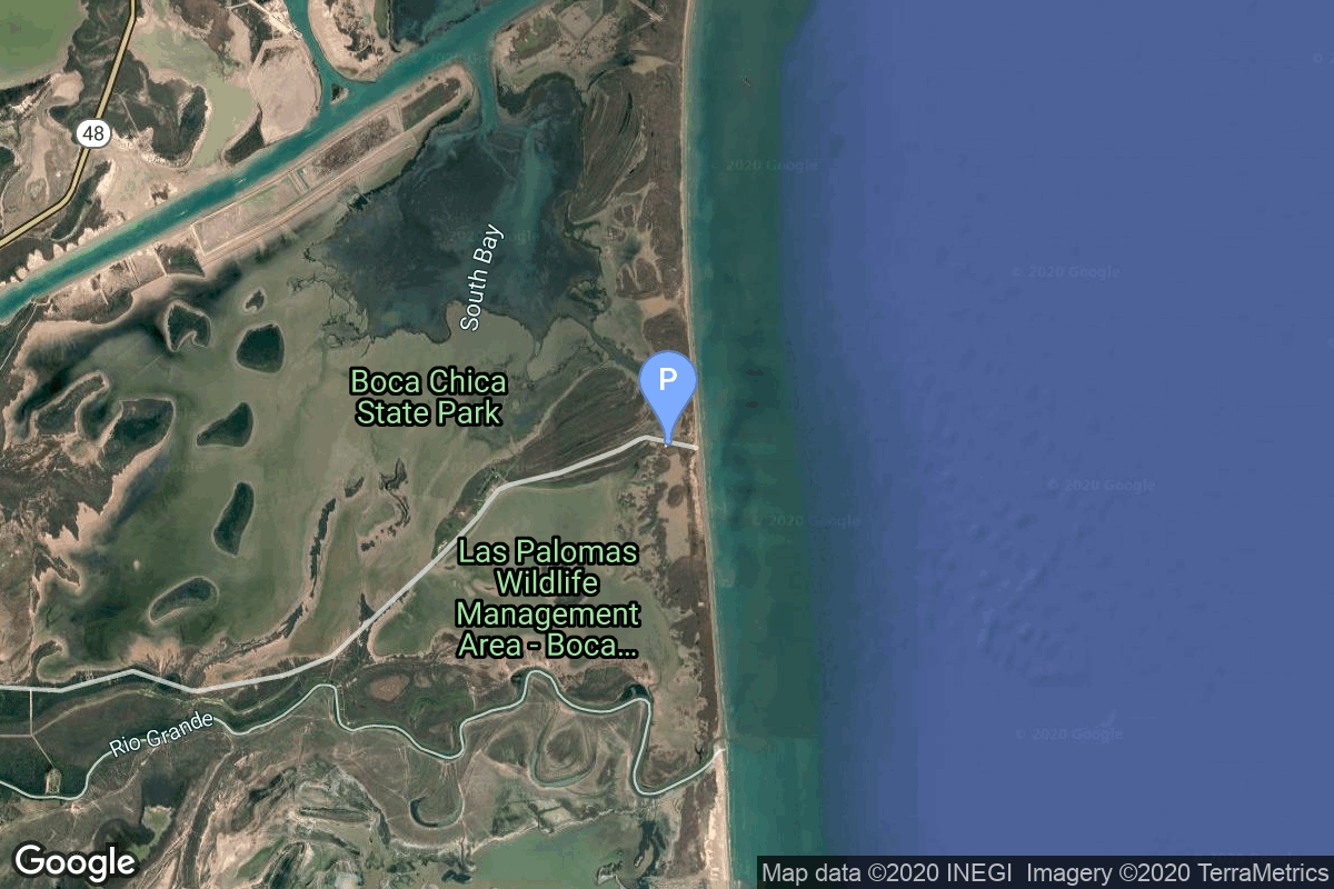
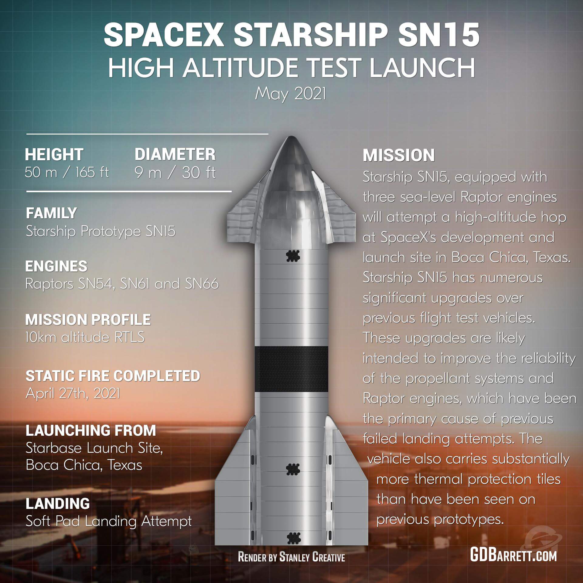
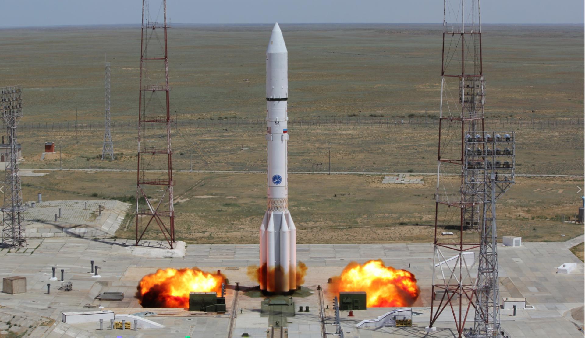
{ "count": 7924, "next": "https://ll.thespacedevs.com/2.2.0/launch/?format=api&limit=10&offset=4380&ordering=-id", "previous": "https://ll.thespacedevs.com/2.2.0/launch/?format=api&limit=10&offset=4360&ordering=-id", "results": [ { "id": "73e676bb-3f80-4909-b3d7-026f9f1ee5d8", "url": "https://ll.thespacedevs.com/2.2.0/launch/73e676bb-3f80-4909-b3d7-026f9f1ee5d8/?format=api", "slug": "long-march-3be-apstar-6d", "name": "Long March 3B/E | APStar-6D", "status": { "id": 3, "name": "Launch Successful", "abbrev": "Success", "description": "The launch vehicle successfully inserted its payload(s) into the target orbit(s)." }, "last_updated": "2024-06-15T14:30:37Z", "net": "2020-07-09T12:11:04Z", "window_end": "2020-07-09T12:39:00Z", "window_start": "2020-07-09T12:03:00Z", "net_precision": { "id": 0, "name": "Second", "abbrev": "SEC", "description": "The T-0 is accurate to the second." }, "probability": null, "weather_concerns": null, "holdreason": "", "failreason": "", "hashtag": null, "launch_service_provider": { "id": 88, "url": "https://ll.thespacedevs.com/2.2.0/agencies/88/?format=api", "name": "China Aerospace Science and Technology Corporation", "type": "Government" }, "rocket": { "id": 58, "configuration": { "id": 50, "url": "https://ll.thespacedevs.com/2.2.0/config/launcher/50/?format=api", "name": "Long March 3B/E", "family": "Long March", "full_name": "Long March 3B/E", "variant": "B/E" } }, "mission": { "id": 528, "name": "APStar-6D", "description": "APStar-6D is a commercial communications satellite for APT Satellite Company Ltd under an end-to-end contract signed with China Great Wall Industry Corp. (CGWIC) for satellite production and launch services. It will deliver VSAT, video distribution, Direct-to-home television and cellular backhaul to the Asia-Pacific Region.", "launch_designator": null, "type": "Communications", "orbit": { "id": 2, "name": "Geostationary Transfer Orbit", "abbrev": "GTO" }, "agencies": [], "info_urls": [], "vid_urls": [] }, "pad": { "id": 66, "url": "https://ll.thespacedevs.com/2.2.0/pad/66/?format=api", "agency_id": 17, "name": "Launch Complex 3 (LC-3/LA-1)", "description": "", "info_url": null, "wiki_url": "https://en.wikipedia.org/wiki/Xichang_Satellite_Launch_Center", "map_url": "https://www.google.com/maps?q=28.247059,102.029008", "latitude": "28.247059", "longitude": "102.029008", "location": { "id": 16, "url": "https://ll.thespacedevs.com/2.2.0/location/16/?format=api", "name": "Xichang Satellite Launch Center, People's Republic of China", "country_code": "CHN", "description": "The Xichang Satellite Launch Center is a spaceport in China. It is located in Zeyuan Town, northwest of Xichang, Liangshan Yi Autonomous Prefecture in Sichuan.", "map_image": "https://thespacedevs-prod.nyc3.digitaloceanspaces.com/media/map_images/location_16_20200803142513.jpg", "timezone_name": "Asia/Shanghai", "total_launch_count": 241, "total_landing_count": 0 }, "country_code": "CHN", "map_image": "https://thespacedevs-prod.nyc3.digitaloceanspaces.com/media/map_images/pad_66_20200803143611.jpg", "total_launch_count": 108, "orbital_launch_attempt_count": 108 }, "webcast_live": false, "image": "https://thespacedevs-prod.nyc3.digitaloceanspaces.com/media/images/long2520march_image_20230907120240.jpeg", "infographic": null, "program": [], "orbital_launch_attempt_count": 5972, "location_launch_attempt_count": 146, "pad_launch_attempt_count": 58, "agency_launch_attempt_count": 286, "orbital_launch_attempt_count_year": 50, "location_launch_attempt_count_year": 8, "pad_launch_attempt_count_year": 3, "agency_launch_attempt_count_year": 16, "type": "normal" }, { "id": "73e30362-059c-4f0f-95d9-0d96cfc5f5fd", "url": "https://ll.thespacedevs.com/2.2.0/launch/73e30362-059c-4f0f-95d9-0d96cfc5f5fd/?format=api", "slug": "titan-34b-quasar-4", "name": "Titan 34B | Quasar 4", "status": { "id": 3, "name": "Launch Successful", "abbrev": "Success", "description": "The launch vehicle successfully inserted its payload(s) into the target orbit(s)." }, "last_updated": "2023-06-14T04:26:23Z", "net": "1980-12-13T16:04:00Z", "window_end": "1980-12-13T16:04:00Z", "window_start": "1980-12-13T16:04:00Z", "net_precision": null, "probability": null, "weather_concerns": null, "holdreason": "", "failreason": null, "hashtag": null, "launch_service_provider": { "id": 161, "url": "https://ll.thespacedevs.com/2.2.0/agencies/161/?format=api", "name": "United States Air Force", "type": "Government" }, "rocket": { "id": 5229, "configuration": { "id": 423, "url": "https://ll.thespacedevs.com/2.2.0/config/launcher/423/?format=api", "name": "Titan 34B", "family": "Titan", "full_name": "Titan 34B", "variant": "34B" } }, "mission": { "id": 3639, "name": "Quasar 4", "description": "Communication relay satellite for US reconnaissance satellites", "launch_designator": null, "type": "Government/Top Secret", "orbit": { "id": 0, "name": "Elliptical Orbit", "abbrev": "Elliptical" }, "agencies": [], "info_urls": [], "vid_urls": [] }, "pad": { "id": 156, "url": "https://ll.thespacedevs.com/2.2.0/pad/156/?format=api", "agency_id": null, "name": "Space Launch Complex 4W", "description": "SLC-4W started operations in 1963 as Space Launch Complex 4W, and continued as an operational launch site through 2003. In 2015, SpaceX started conversion of the launch site into Landing Zone LZ-4. Landing operations commenced in 2018 at LZ-4.", "info_url": "https://www.astronautix.com/v/vandenbergslc4w.html", "wiki_url": "https://en.wikipedia.org/wiki/Vandenberg_Air_Force_Base_Space_Launch_Complex_4#SLC-4W", "map_url": "https://www.google.com/maps?q=34.63312,-120.61584", "latitude": "34.63312", "longitude": "-120.61584", "location": { "id": 11, "url": "https://ll.thespacedevs.com/2.2.0/location/11/?format=api", "name": "Vandenberg SFB, CA, USA", "country_code": "USA", "description": "Vandenberg Space Force Base is a United States Space Force Base in Santa Barbara County, California. Established in 1941, Vandenberg Space Force Base is a space launch base, launching spacecraft from the Western Range, and also performs missile testing. The United States Space Force's Space Launch Delta 30 serves as the host delta for the base, equivalent to an Air Force air base wing. In addition to its military space launch mission, Vandenberg Space Force Base also hosts space launches for civil and commercial space entities, such as NASA and SpaceX.", "map_image": "https://thespacedevs-prod.nyc3.digitaloceanspaces.com/media/map_images/location_11_20200803142416.jpg", "timezone_name": "America/Los_Angeles", "total_launch_count": 897, "total_landing_count": 35 }, "country_code": "USA", "map_image": "https://thespacedevs-prod.nyc3.digitaloceanspaces.com/media/map_images/pad_156_20200803143351.jpg", "total_launch_count": 93, "orbital_launch_attempt_count": 93 }, "webcast_live": false, "image": null, "infographic": null, "program": [], "orbital_launch_attempt_count": 2386, "location_launch_attempt_count": 484, "pad_launch_attempt_count": 71, "agency_launch_attempt_count": 764, "orbital_launch_attempt_count_year": 103, "location_launch_attempt_count_year": 9, "pad_launch_attempt_count_year": 1, "agency_launch_attempt_count_year": 15, "type": "normal" }, { "id": "73e1c86e-296d-4a4d-b074-9698006df9e9", "url": "https://ll.thespacedevs.com/2.2.0/launch/73e1c86e-296d-4a4d-b074-9698006df9e9/?format=api", "slug": "soyuz-u-progress-m-24", "name": "Soyuz U | Progress M-24", "status": { "id": 3, "name": "Launch Successful", "abbrev": "Success", "description": "The launch vehicle successfully inserted its payload(s) into the target orbit(s)." }, "last_updated": "2023-06-14T03:48:25Z", "net": "1994-08-25T14:25:12Z", "window_end": "1994-08-25T14:25:12Z", "window_start": "1994-08-25T14:25:12Z", "net_precision": null, "probability": 0, "weather_concerns": null, "holdreason": "", "failreason": "", "hashtag": "", "launch_service_provider": { "id": 63, "url": "https://ll.thespacedevs.com/2.2.0/agencies/63/?format=api", "name": "Russian Federal Space Agency (ROSCOSMOS)", "type": "Government" }, "rocket": { "id": 2297, "configuration": { "id": 37, "url": "https://ll.thespacedevs.com/2.2.0/config/launcher/37/?format=api", "name": "Soyuz U", "family": "Soyuz", "full_name": "Soyuz U", "variant": "" } }, "mission": null, "pad": { "id": 32, "url": "https://ll.thespacedevs.com/2.2.0/pad/32/?format=api", "agency_id": null, "name": "1/5", "description": null, "info_url": null, "wiki_url": "", "map_url": "https://www.google.com/maps?q=45.92,63.342", "latitude": "45.92", "longitude": "63.342", "location": { "id": 15, "url": "https://ll.thespacedevs.com/2.2.0/location/15/?format=api", "name": "Baikonur Cosmodrome, Republic of Kazakhstan", "country_code": "KAZ", "description": "The Baikonur Cosmodrome is a spaceport operated by Russia within Kazakhstan. Located in the Kazakh city of Baikonur, it is the largest operational space launch facility in terms of area. All Russian crewed spaceflights are launched from Baikonur.", "map_image": "https://thespacedevs-prod.nyc3.digitaloceanspaces.com/media/map_images/location_15_20200803142517.jpg", "timezone_name": "Asia/Qyzylorda", "total_launch_count": 1563, "total_landing_count": 0 }, "country_code": "KAZ", "map_image": "https://thespacedevs-prod.nyc3.digitaloceanspaces.com/media/map_images/pad_32_20200803143513.jpg", "total_launch_count": 487, "orbital_launch_attempt_count": 487 }, "webcast_live": false, "image": "https://thespacedevs-prod.nyc3.digitaloceanspaces.com/media/images/soyuz2520u_image_20190222031023.jpeg", "infographic": null, "program": [ { "id": 16, "url": "https://ll.thespacedevs.com/2.2.0/program/16/?format=api", "name": "Mir", "description": "Mir was a space station that operated in low Earth orbit from 1986 to 2001, operated by the Soviet Union and later by Russia. Mir was the first modular space station and was assembled in orbit from 1986 to 1996.", "agencies": [ { "id": 63, "url": "https://ll.thespacedevs.com/2.2.0/agencies/63/?format=api", "name": "Russian Federal Space Agency (ROSCOSMOS)", "type": "Government" }, { "id": 66, "url": "https://ll.thespacedevs.com/2.2.0/agencies/66/?format=api", "name": "Soviet Space Program", "type": "Government" } ], "image_url": "https://thespacedevs-prod.nyc3.digitaloceanspaces.com/media/images/mir_program_20200821092345.jpeg", "start_date": "1986-02-20T21:28:23Z", "end_date": "2001-03-23T05:59:00Z", "info_url": null, "wiki_url": "https://en.wikipedia.org/wiki/Mir", "mission_patches": [], "type": { "id": 2, "name": "Human Spaceflight" } } ], "orbital_launch_attempt_count": 3923, "location_launch_attempt_count": 1035, "pad_launch_attempt_count": 326, "agency_launch_attempt_count": 39, "orbital_launch_attempt_count_year": 55, "location_launch_attempt_count_year": 16, "pad_launch_attempt_count_year": 6, "agency_launch_attempt_count_year": 9, "type": "normal" }, { "id": "73c9b06c-ee02-4320-a3a8-198fba2b2271", "url": "https://ll.thespacedevs.com/2.2.0/launch/73c9b06c-ee02-4320-a3a8-198fba2b2271/?format=api", "slug": "soyuz-fg-venus-express", "name": "Soyuz-FG | Venus Express", "status": { "id": 3, "name": "Launch Successful", "abbrev": "Success", "description": "The launch vehicle successfully inserted its payload(s) into the target orbit(s)." }, "last_updated": "2023-06-14T03:41:08Z", "net": "2005-11-09T03:33:34Z", "window_end": "2005-11-09T03:33:34Z", "window_start": "2005-11-09T03:33:34Z", "net_precision": null, "probability": null, "weather_concerns": null, "holdreason": "", "failreason": null, "hashtag": null, "launch_service_provider": { "id": 63, "url": "https://ll.thespacedevs.com/2.2.0/agencies/63/?format=api", "name": "Russian Federal Space Agency (ROSCOSMOS)", "type": "Government" }, "rocket": { "id": 7249, "configuration": { "id": 70, "url": "https://ll.thespacedevs.com/2.2.0/config/launcher/70/?format=api", "name": "Soyuz-FG", "family": "", "full_name": "Soyuz-FG Fregat", "variant": "Fregat" } }, "mission": { "id": 5638, "name": "Venus Express", "description": "Venus Express (VEX) was the first Venus exploration mission of the European Space Agency (ESA). Launched in November 2005, it arrived at Venus in April 2006 and began continuously sending back science data from its polar orbit around Venus. Equipped with seven scientific instruments, the main objective of the mission was the long term observation of the Venusian atmosphere.", "launch_designator": null, "type": "Planetary Science", "orbit": { "id": 20, "name": "Venus Orbit", "abbrev": "Venus" }, "agencies": [], "info_urls": [], "vid_urls": [] }, "pad": { "id": 20, "url": "https://ll.thespacedevs.com/2.2.0/pad/20/?format=api", "agency_id": null, "name": "31/6", "description": "", "info_url": null, "wiki_url": "https://en.wikipedia.org/wiki/Baikonur_Cosmodrome_Site_31", "map_url": "https://www.google.com/maps?q=45.996034,63.564003", "latitude": "45.996034", "longitude": "63.564003", "location": { "id": 15, "url": "https://ll.thespacedevs.com/2.2.0/location/15/?format=api", "name": "Baikonur Cosmodrome, Republic of Kazakhstan", "country_code": "KAZ", "description": "The Baikonur Cosmodrome is a spaceport operated by Russia within Kazakhstan. Located in the Kazakh city of Baikonur, it is the largest operational space launch facility in terms of area. All Russian crewed spaceflights are launched from Baikonur.", "map_image": "https://thespacedevs-prod.nyc3.digitaloceanspaces.com/media/map_images/location_15_20200803142517.jpg", "timezone_name": "Asia/Qyzylorda", "total_launch_count": 1563, "total_landing_count": 0 }, "country_code": "KAZ", "map_image": "https://thespacedevs-prod.nyc3.digitaloceanspaces.com/media/map_images/pad_20_20200803143516.jpg", "total_launch_count": 428, "orbital_launch_attempt_count": 428 }, "webcast_live": false, "image": "https://thespacedevs-prod.nyc3.digitaloceanspaces.com/media/images/soyuz_image_20190717035842.jpeg", "infographic": null, "program": [], "orbital_launch_attempt_count": 4743, "location_launch_attempt_count": 1247, "pad_launch_attempt_count": 336, "agency_launch_attempt_count": 150, "orbital_launch_attempt_count_year": 49, "location_launch_attempt_count_year": 15, "pad_launch_attempt_count_year": 3, "agency_launch_attempt_count_year": 9, "type": "normal" }, { "id": "73c7b701-2bb7-49af-b69f-f9f7c7f6968f", "url": "https://ll.thespacedevs.com/2.2.0/launch/73c7b701-2bb7-49af-b69f-f9f7c7f6968f/?format=api", "slug": "soyuz-u-yantar-4k2-39", "name": "Soyuz U | Yantar-4K2 39", "status": { "id": 3, "name": "Launch Successful", "abbrev": "Success", "description": "The launch vehicle successfully inserted its payload(s) into the target orbit(s)." }, "last_updated": "2023-06-14T03:48:24Z", "net": "1988-06-22T13:00:00Z", "window_end": "1988-06-22T13:00:00Z", "window_start": "1988-06-22T13:00:00Z", "net_precision": null, "probability": null, "weather_concerns": null, "holdreason": "", "failreason": null, "hashtag": null, "launch_service_provider": { "id": 66, "url": "https://ll.thespacedevs.com/2.2.0/agencies/66/?format=api", "name": "Soviet Space Program", "type": "Government" }, "rocket": { "id": 6080, "configuration": { "id": 37, "url": "https://ll.thespacedevs.com/2.2.0/config/launcher/37/?format=api", "name": "Soyuz U", "family": "Soyuz", "full_name": "Soyuz U", "variant": "" } }, "mission": { "id": 4470, "name": "Yantar-4K2 39", "description": "Film-return reconnaissance satellite", "launch_designator": null, "type": "Government/Top Secret", "orbit": { "id": 8, "name": "Low Earth Orbit", "abbrev": "LEO" }, "agencies": [], "info_urls": [], "vid_urls": [] }, "pad": { "id": 32, "url": "https://ll.thespacedevs.com/2.2.0/pad/32/?format=api", "agency_id": null, "name": "1/5", "description": null, "info_url": null, "wiki_url": "", "map_url": "https://www.google.com/maps?q=45.92,63.342", "latitude": "45.92", "longitude": "63.342", "location": { "id": 15, "url": "https://ll.thespacedevs.com/2.2.0/location/15/?format=api", "name": "Baikonur Cosmodrome, Republic of Kazakhstan", "country_code": "KAZ", "description": "The Baikonur Cosmodrome is a spaceport operated by Russia within Kazakhstan. Located in the Kazakh city of Baikonur, it is the largest operational space launch facility in terms of area. All Russian crewed spaceflights are launched from Baikonur.", "map_image": "https://thespacedevs-prod.nyc3.digitaloceanspaces.com/media/map_images/location_15_20200803142517.jpg", "timezone_name": "Asia/Qyzylorda", "total_launch_count": 1563, "total_landing_count": 0 }, "country_code": "KAZ", "map_image": "https://thespacedevs-prod.nyc3.digitaloceanspaces.com/media/map_images/pad_32_20200803143513.jpg", "total_launch_count": 487, "orbital_launch_attempt_count": 487 }, "webcast_live": false, "image": "https://thespacedevs-prod.nyc3.digitaloceanspaces.com/media/images/soyuz2520u_image_20190222031023.jpeg", "infographic": null, "program": [], "orbital_launch_attempt_count": 3308, "location_launch_attempt_count": 872, "pad_launch_attempt_count": 258, "agency_launch_attempt_count": 2192, "orbital_launch_attempt_count_year": 55, "location_launch_attempt_count_year": 24, "pad_launch_attempt_count_year": 10, "agency_launch_attempt_count_year": 45, "type": "normal" }, { "id": "73c17f58-0aad-4a3a-9660-9253525860ec", "url": "https://ll.thespacedevs.com/2.2.0/launch/73c17f58-0aad-4a3a-9660-9253525860ec/?format=api", "slug": "little-joe-lj-5a", "name": "Little Joe | LJ-5A", "status": { "id": 7, "name": "Launch was a Partial Failure", "abbrev": "Partial Failure", "description": "Either the launch vehicle reached orbit but did not deliver its payload in the targeted orbit, or an exceptional event made it impossible to consider the mission a success." }, "last_updated": "2023-06-14T04:31:01Z", "net": "1961-03-18T16:49:00Z", "window_end": "1961-03-18T16:49:00Z", "window_start": "1961-03-18T16:49:00Z", "net_precision": null, "probability": null, "weather_concerns": null, "holdreason": "", "failreason": "", "hashtag": null, "launch_service_provider": { "id": 44, "url": "https://ll.thespacedevs.com/2.2.0/agencies/44/?format=api", "name": "National Aeronautics and Space Administration", "type": "Government" }, "rocket": { "id": 7440, "configuration": { "id": 473, "url": "https://ll.thespacedevs.com/2.2.0/config/launcher/473/?format=api", "name": "Little Joe", "family": "Little Joe", "full_name": "Little Joe", "variant": "" } }, "mission": { "id": 5829, "name": "LJ-5A", "description": "Uncrewed launch escape system test of the Mercury spacecraft, conducted as part of the U.S. Mercury program. It was an attempted re-test of the failed Little Joe 5 flight.", "launch_designator": null, "type": "Test Flight", "orbit": { "id": 15, "name": "Suborbital", "abbrev": "Sub" }, "agencies": [], "info_urls": [], "vid_urls": [] }, "pad": { "id": 195, "url": "https://ll.thespacedevs.com/2.2.0/pad/195/?format=api", "agency_id": 44, "name": "Launch Area 1", "description": null, "info_url": null, "wiki_url": "https://en.wikipedia.org/wiki/Wallops_Flight_Facility", "map_url": "https://www.google.com/maps?q=37.938611,-75.457222", "latitude": "37.938611", "longitude": "-75.457222", "location": { "id": 21, "url": "https://ll.thespacedevs.com/2.2.0/location/21/?format=api", "name": "Wallops Flight Facility, Virginia, USA", "country_code": "USA", "description": "Wallops Flight Facility is a rocket launch site on Wallops Island on the Eastern Shore of Virginia, United States, just east of the Delmarva Peninsula and north-northeast of Norfolk. The facility is operated by the Goddard Space Flight Center in Greenbelt, Maryland, and primarily serves to support science and exploration missions for NASA and other federal agencies. WFF includes an extensively instrumented range to support launches of more than a dozen types of sounding rockets; small expendable suborbital and orbital rockets; high-altitude balloon flights carrying scientific instruments for atmospheric and astronomical research; and, using its Research Airport, flight tests of aeronautical research aircraft, including uncrewed aerial vehicles.", "map_image": "https://thespacedevs-prod.nyc3.digitaloceanspaces.com/media/map_images/location_21_20200803142423.jpg", "timezone_name": "America/New_York", "total_launch_count": 87, "total_landing_count": 0 }, "country_code": "USA", "map_image": "https://thespacedevs-prod.nyc3.digitaloceanspaces.com/media/map_images/pad_launch_area_1_20210901085625.jpg", "total_launch_count": 7, "orbital_launch_attempt_count": 0 }, "webcast_live": false, "image": "https://thespacedevs-prod.nyc3.digitaloceanspaces.com/media/images/little_joe_image_20210901081353.jpeg", "infographic": null, "program": [ { "id": 2, "url": "https://ll.thespacedevs.com/2.2.0/program/2/?format=api", "name": "Mercury", "description": "Project Mercury was the first human spaceflight program of the United States, running from 1958 through 1963.", "agencies": [ { "id": 44, "url": "https://ll.thespacedevs.com/2.2.0/agencies/44/?format=api", "name": "National Aeronautics and Space Administration", "type": "Government" } ], "image_url": "https://thespacedevs-prod.nyc3.digitaloceanspaces.com/media/images/project2520mer_program_20200820194755.png", "start_date": "1958-10-07T00:00:00Z", "end_date": "1963-05-16T23:24:02Z", "info_url": "https://www.nasa.gov/mission_pages/mercury/missions/program-toc.html", "wiki_url": "https://en.wikipedia.org/wiki/Project_Mercury", "mission_patches": [], "type": { "id": 2, "name": "Human Spaceflight" } } ], "orbital_launch_attempt_count": null, "location_launch_attempt_count": 10, "pad_launch_attempt_count": 7, "agency_launch_attempt_count": 23, "orbital_launch_attempt_count_year": null, "location_launch_attempt_count_year": 2, "pad_launch_attempt_count_year": 1, "agency_launch_attempt_count_year": 4, "type": "normal" }, { "id": "73ae8553-cc90-46e9-9a01-70a712493856", "url": "https://ll.thespacedevs.com/2.2.0/launch/73ae8553-cc90-46e9-9a01-70a712493856/?format=api", "slug": "starship-sn15-10-km-flight", "name": "Starship SN15 | 10 km Flight", "status": { "id": 3, "name": "Launch Successful", "abbrev": "Success", "description": "The launch vehicle successfully inserted its payload(s) into the target orbit(s)." }, "last_updated": "2024-03-05T18:17:54Z", "net": "2021-05-05T22:24:00Z", "window_end": "2021-05-06T01:00:00Z", "window_start": "2021-05-05T17:00:00Z", "net_precision": null, "probability": null, "weather_concerns": null, "holdreason": "", "failreason": "", "hashtag": null, "launch_service_provider": { "id": 121, "url": "https://ll.thespacedevs.com/2.2.0/agencies/121/?format=api", "name": "SpaceX", "type": "Commercial" }, "rocket": { "id": 2852, "configuration": { "id": 207, "url": "https://ll.thespacedevs.com/2.2.0/config/launcher/207/?format=api", "name": "Starship Prototype", "family": "Starship", "full_name": "Starship Prototype", "variant": "Prototype" } }, "mission": { "id": 1266, "name": "10 km Flight", "description": "The SN15 Starship prototype will perform a test flight similar to SN8 to SN11. It will launch up to an altitude of 10 km or 33,000 ft and do a belly flop maneuver followed by a controlled descent to the landing pad.", "launch_designator": null, "type": "Test Flight", "orbit": { "id": 15, "name": "Suborbital", "abbrev": "Sub" }, "agencies": [], "info_urls": [], "vid_urls": [] }, "pad": { "id": 111, "url": "https://ll.thespacedevs.com/2.2.0/pad/111/?format=api", "agency_id": 121, "name": "Suborbital Pad A", "description": "Suborbital Pad A was used for Starhopper flights, the SN5 and SN6 hops, as well as multiple Starship high altitude flight tests. It was demolished at the end of 2023, to make room for a second orbital pad.", "info_url": null, "wiki_url": "https://en.wikipedia.org/wiki/SpaceX_South_Texas_Launch_Site", "map_url": "https://www.google.com/maps?q=25.997116,-97.15503099856647", "latitude": "25.997116", "longitude": "-97.15503099856647", "location": { "id": 143, "url": "https://ll.thespacedevs.com/2.2.0/location/143/?format=api", "name": "SpaceX Starbase, TX, USA", "country_code": "USA", "description": "Starbase is an industrial complex for Starship rockets and the headquarters of the American aerospace manufacturer company SpaceX. Located near Brownsville, Texas, United States, it has been under construction since the late 2010s by SpaceX. Starbase is composed of a spaceport near the Gulf of Mexico, a production facility at the Boca Chica village, and a small structure test site along the Texas State Highway 4.", "map_image": "https://thespacedevs-prod.nyc3.digitaloceanspaces.com/media/map_images/location_143_20200803142438.jpg", "timezone_name": "America/Chicago", "total_launch_count": 21, "total_landing_count": 13 }, "country_code": "USA", "map_image": "https://thespacedevs-prod.nyc3.digitaloceanspaces.com/media/map_images/pad_111_20200803143229.jpg", "total_launch_count": 7, "orbital_launch_attempt_count": 0 }, "webcast_live": false, "image": "https://thespacedevs-prod.nyc3.digitaloceanspaces.com/media/images/starship2520sn_image_20210413205503.jpeg", "infographic": "https://thespacedevs-prod.nyc3.digitaloceanspaces.com/media/infographic_images/starship2520sn_infographic_20210504025610.jpeg", "program": [ { "id": 1, "url": "https://ll.thespacedevs.com/2.2.0/program/1/?format=api", "name": "SpaceX Starship", "description": "The SpaceX Starship is a fully reusable super heavy-lift launch vehicle under development by SpaceX since 2012, as a self-funded private spaceflight project. The second stage of the Starship — is designed as a long-duration cargo and passenger-carrying spacecraft. It is expected to be initially used without any booster stage at all, as part of an extensive development program to prove out launch-and-landing and iterate on a variety of design details, particularly with respect to the vehicle's atmospheric reentry.", "agencies": [ { "id": 121, "url": "https://ll.thespacedevs.com/2.2.0/agencies/121/?format=api", "name": "SpaceX", "type": "Commercial" } ], "image_url": "https://thespacedevs-prod.nyc3.digitaloceanspaces.com/media/images/starship_on_the_image_20250111100520.jpg", "start_date": "2019-03-01T05:00:00Z", "end_date": null, "info_url": "https://www.spacex.com/vehicles/starship/", "wiki_url": "https://en.wikipedia.org/wiki/SpaceX_Starship", "mission_patches": [], "type": { "id": 7, "name": "Technology" } } ], "orbital_launch_attempt_count": null, "location_launch_attempt_count": 9, "pad_launch_attempt_count": 7, "agency_launch_attempt_count": 134, "orbital_launch_attempt_count_year": null, "location_launch_attempt_count_year": 4, "pad_launch_attempt_count_year": 2, "agency_launch_attempt_count_year": 17, "type": "normal" }, { "id": "73a63803-5d7b-4deb-aaa9-2c34fe9ba34e", "url": "https://ll.thespacedevs.com/2.2.0/launch/73a63803-5d7b-4deb-aaa9-2c34fe9ba34e/?format=api", "slug": "soyuz-u-zenit-2m-94", "name": "Soyuz U | Zenit-2M 94", "status": { "id": 3, "name": "Launch Successful", "abbrev": "Success", "description": "The launch vehicle successfully inserted its payload(s) into the target orbit(s)." }, "last_updated": "2023-06-14T03:51:33Z", "net": "1979-01-11T15:00:00Z", "window_end": "1979-01-11T15:00:00Z", "window_start": "1979-01-11T15:00:00Z", "net_precision": null, "probability": null, "weather_concerns": null, "holdreason": "", "failreason": null, "hashtag": null, "launch_service_provider": { "id": 66, "url": "https://ll.thespacedevs.com/2.2.0/agencies/66/?format=api", "name": "Soviet Space Program", "type": "Government" }, "rocket": { "id": 5034, "configuration": { "id": 37, "url": "https://ll.thespacedevs.com/2.2.0/config/launcher/37/?format=api", "name": "Soyuz U", "family": "Soyuz", "full_name": "Soyuz U", "variant": "" } }, "mission": { "id": 3447, "name": "Zenit-2M 94", "description": "The soviet Zenit-2M (Gektor, 11F690) was an improved version of the Zenit-2 area surveillance reconnaissance satellite. It was part of the Vostok-based Zenit-family.", "launch_designator": null, "type": "Government/Top Secret", "orbit": { "id": 8, "name": "Low Earth Orbit", "abbrev": "LEO" }, "agencies": [], "info_urls": [], "vid_urls": [] }, "pad": { "id": 36, "url": "https://ll.thespacedevs.com/2.2.0/pad/36/?format=api", "agency_id": 163, "name": "43/3 (43L)", "description": "", "info_url": null, "wiki_url": null, "map_url": "https://www.google.com/maps?q=62.9273,40.45", "latitude": "62.9273", "longitude": "40.45", "location": { "id": 6, "url": "https://ll.thespacedevs.com/2.2.0/location/6/?format=api", "name": "Plesetsk Cosmodrome, Russian Federation", "country_code": "RUS", "description": "Plesetsk Cosmodrome is a Russian spaceport located in Mirny, Arkhangelsk Oblast, about 800 km north of Moscow and approximately 200 km south of Arkhangelsk. Originally developed as an ICBM site for the R-7 missile, it also served for numerous satellite launches using the R-7 and other rockets. Its high latitude makes it useful only for certain types of launches, especially the Molniya orbits, so for much of the site's history it functioned as a secondary location, with most orbital launches taking place from Baikonur, in the Kazakh SSR. With the end of the Soviet Union, Baikonur became a foreign territory, and Kazakhstan charged $115 million usage fees annually. Consequently, Plesetsk has seen considerably more activity since the 2000s.", "map_image": "https://thespacedevs-prod.nyc3.digitaloceanspaces.com/media/map_images/location_6_20200803142434.jpg", "timezone_name": "Europe/Moscow", "total_launch_count": 1685, "total_landing_count": 0 }, "country_code": "RUS", "map_image": "https://thespacedevs-prod.nyc3.digitaloceanspaces.com/media/map_images/pad_36_20200803143534.jpg", "total_launch_count": 232, "orbital_launch_attempt_count": 232 }, "webcast_live": false, "image": "https://thespacedevs-prod.nyc3.digitaloceanspaces.com/media/images/soyuz2520u_image_20190222031023.jpeg", "infographic": null, "program": [], "orbital_launch_attempt_count": 2174, "location_launch_attempt_count": 656, "pad_launch_attempt_count": 90, "agency_launch_attempt_count": 1274, "orbital_launch_attempt_count_year": 1, "location_launch_attempt_count_year": 1, "pad_launch_attempt_count_year": 1, "agency_launch_attempt_count_year": 1, "type": "normal" }, { "id": "73a3c33c-5679-4f64-aa03-67167cb0a7e1", "url": "https://ll.thespacedevs.com/2.2.0/launch/73a3c33c-5679-4f64-aa03-67167cb0a7e1/?format=api", "slug": "proton-mbriz-m-yamal-601", "name": "Proton-M/Briz-M | Yamal-601", "status": { "id": 3, "name": "Launch Successful", "abbrev": "Success", "description": "The launch vehicle successfully inserted its payload(s) into the target orbit(s)." }, "last_updated": "2024-10-11T17:17:35Z", "net": "2019-05-30T17:42:00Z", "window_end": "2019-05-30T17:42:00Z", "window_start": "2019-05-30T17:42:00Z", "net_precision": { "id": 0, "name": "Second", "abbrev": "SEC", "description": "The T-0 is accurate to the second." }, "probability": null, "weather_concerns": null, "holdreason": "", "failreason": "", "hashtag": null, "launch_service_provider": { "id": 96, "url": "https://ll.thespacedevs.com/2.2.0/agencies/96/?format=api", "name": "Khrunichev State Research and Production Space Center", "type": "Government" }, "rocket": { "id": 2151, "configuration": { "id": 22, "url": "https://ll.thespacedevs.com/2.2.0/config/launcher/22/?format=api", "name": "Proton-M Briz-M", "family": "Proton / UR-500", "full_name": "Proton-M Briz-M", "variant": "Briz-M" } }, "mission": { "id": 775, "name": "Yamal-601", "description": "Yamal-601 is a geostationary communications satellite for Gazprom Space Systems.", "launch_designator": null, "type": "Communications", "orbit": { "id": 2, "name": "Geostationary Transfer Orbit", "abbrev": "GTO" }, "agencies": [], "info_urls": [], "vid_urls": [] }, "pad": { "id": 15, "url": "https://ll.thespacedevs.com/2.2.0/pad/15/?format=api", "agency_id": null, "name": "200/39 (200L)", "description": null, "info_url": null, "wiki_url": "", "map_url": "https://www.google.com/maps?q=46.039984,63.032093", "latitude": "46.039984", "longitude": "63.032093", "location": { "id": 15, "url": "https://ll.thespacedevs.com/2.2.0/location/15/?format=api", "name": "Baikonur Cosmodrome, Republic of Kazakhstan", "country_code": "KAZ", "description": "The Baikonur Cosmodrome is a spaceport operated by Russia within Kazakhstan. Located in the Kazakh city of Baikonur, it is the largest operational space launch facility in terms of area. All Russian crewed spaceflights are launched from Baikonur.", "map_image": "https://thespacedevs-prod.nyc3.digitaloceanspaces.com/media/map_images/location_15_20200803142517.jpg", "timezone_name": "Asia/Qyzylorda", "total_launch_count": 1563, "total_landing_count": 0 }, "country_code": "KAZ", "map_image": "https://thespacedevs-prod.nyc3.digitaloceanspaces.com/media/map_images/pad_15_20200803143530.jpg", "total_launch_count": 167, "orbital_launch_attempt_count": 167 }, "webcast_live": false, "image": "https://thespacedevs-prod.nyc3.digitaloceanspaces.com/media/images/proton-m2520briz-m_image_20190224012317.jpeg", "infographic": null, "program": [], "orbital_launch_attempt_count": 5855, "location_launch_attempt_count": 1499, "pad_launch_attempt_count": 162, "agency_launch_attempt_count": 181, "orbital_launch_attempt_count_year": 35, "location_launch_attempt_count_year": 4, "pad_launch_attempt_count_year": 1, "agency_launch_attempt_count_year": 1, "type": "normal" }, { "id": "739d1744-7924-4988-b9e4-8759308d243c", "url": "https://ll.thespacedevs.com/2.2.0/launch/739d1744-7924-4988-b9e4-8759308d243c/?format=api", "slug": "electron-strix-launch-21", "name": "Electron | StriX Launch 21", "status": { "id": 2, "name": "To Be Determined", "abbrev": "TBD", "description": "Current date is a placeholder or rough estimation based on unreliable or interpreted sources." }, "last_updated": "2025-10-01T06:53:32Z", "net": "2029-12-31T00:00:00Z", "window_end": "2029-12-31T00:00:00Z", "window_start": "2029-12-31T00:00:00Z", "net_precision": { "id": 16, "name": "Decade", "abbrev": "DEC", "description": "The T-0 is expected in the given decade." }, "probability": null, "weather_concerns": null, "holdreason": "", "failreason": "", "hashtag": null, "launch_service_provider": { "id": 147, "url": "https://ll.thespacedevs.com/2.2.0/agencies/147/?format=api", "name": "Rocket Lab", "type": "Commercial" }, "rocket": { "id": 8739, "configuration": { "id": 26, "url": "https://ll.thespacedevs.com/2.2.0/config/launcher/26/?format=api", "name": "Electron", "family": "", "full_name": "Electron", "variant": "" } }, "mission": { "id": 7330, "name": "StriX Launch 21", "description": "Synthetic aperture radar satellite for Japanese Earth imaging company Synspective.", "launch_designator": null, "type": "Earth Science", "orbit": { "id": 17, "name": "Sun-Synchronous Orbit", "abbrev": "SSO" }, "agencies": [ { "id": 1071, "url": "https://ll.thespacedevs.com/2.2.0/agencies/1071/?format=api", "name": "Synspective", "featured": false, "type": "Private", "country_code": "JPN", "abbrev": "", "description": "Synspective was established with the aim to integrate SAR satellite technology in society through the agility of a start-up company. Synspective derives its name from the company concept of “Synthetic Data for Perspective on Sustainable Development.", "administrator": "CEO: Dr. Motoyuki Arai", "founding_year": "2018", "launchers": "", "spacecraft": "", "launch_library_url": null, "total_launch_count": 0, "consecutive_successful_launches": 0, "successful_launches": 0, "failed_launches": 0, "pending_launches": 0, "consecutive_successful_landings": 0, "successful_landings": 0, "failed_landings": 0, "attempted_landings": 0, "info_url": "https://synspective.com/", "wiki_url": null, "logo_url": "https://thespacedevs-prod.nyc3.digitaloceanspaces.com/media/images/synspective_log_image_20240325082018.png", "image_url": null, "nation_url": "https://thespacedevs-prod.nyc3.digitaloceanspaces.com/media/images/synspective_nation_20240228091738.jpg" } ], "info_urls": [], "vid_urls": [] }, "pad": { "id": 210, "url": "https://ll.thespacedevs.com/2.2.0/pad/210/?format=api", "agency_id": null, "name": "Unknown Pad", "description": null, "info_url": null, "wiki_url": null, "map_url": null, "latitude": "-39.260881", "longitude": "177.865826", "location": { "id": 10, "url": "https://ll.thespacedevs.com/2.2.0/location/10/?format=api", "name": "Rocket Lab Launch Complex 1, Mahia Peninsula, New Zealand", "country_code": "NZL", "description": "Rocket Lab Launch Complex 1 is a commercial spaceport located close to Ahuriri Point at the southern tip of Māhia Peninsula, on the east coast of New Zealand's North Island. It is owned and operated by private spaceflight company Rocket Lab and supports launches of the company's Electron rocket for small satellites. With the launch of Electron on 25 May 2017, it became the first private spaceport to host an orbital launch attempt, and the first site in New Zealand to host an orbital launch attempt. With the Electron launch of 21 January 2018, it became the first private spaceport to host a successful orbital launch.", "map_image": "https://thespacedevs-prod.nyc3.digitaloceanspaces.com/media/map_images/location_10_20200803142509.jpg", "timezone_name": "Pacific/Auckland", "total_launch_count": 78, "total_landing_count": 17 }, "country_code": "NZL", "map_image": "https://thespacedevs-prod.nyc3.digitaloceanspaces.com/media/map_images/pad_210_20230819165718.jpg", "total_launch_count": 0, "orbital_launch_attempt_count": 0 }, "webcast_live": false, "image": "https://thespacedevs-prod.nyc3.digitaloceanspaces.com/media/images/electron_image_20190705175640.jpeg", "infographic": null, "program": [], "orbital_launch_attempt_count": 7678, "location_launch_attempt_count": 115, "pad_launch_attempt_count": 36, "agency_launch_attempt_count": 134, "orbital_launch_attempt_count_year": 44, "location_launch_attempt_count_year": 12, "pad_launch_attempt_count_year": 12, "agency_launch_attempt_count_year": 12, "type": "normal" } ] }