Launch List
AN API endpoint that returns all Launch objects or a single launch.
EXAMPLE - /launch/[id]/ or /launch/?mode=list&search=SpaceX
GET Return a list of all Launch objects.
FILTERS Fields - 'name', 'id(s)', 'lsp__id', 'lsp__name', 'serial_number', 'launcher_config__id', 'rocket__spacecraftflight__spacecraft__name', 'is_crewed', 'include_suborbital', 'spacecraft_config__ids', 'related', 'location__ids', 'lsp__ids', 'pad__ids', 'status__ids'
MODE 'normal', 'list', 'detailed'
EXAMPLE ?mode=list
SEARCH Searches through the launch name, rocket name, launch agency, mission name & spacecraft name.
EXAMPLE - ?search=SpaceX
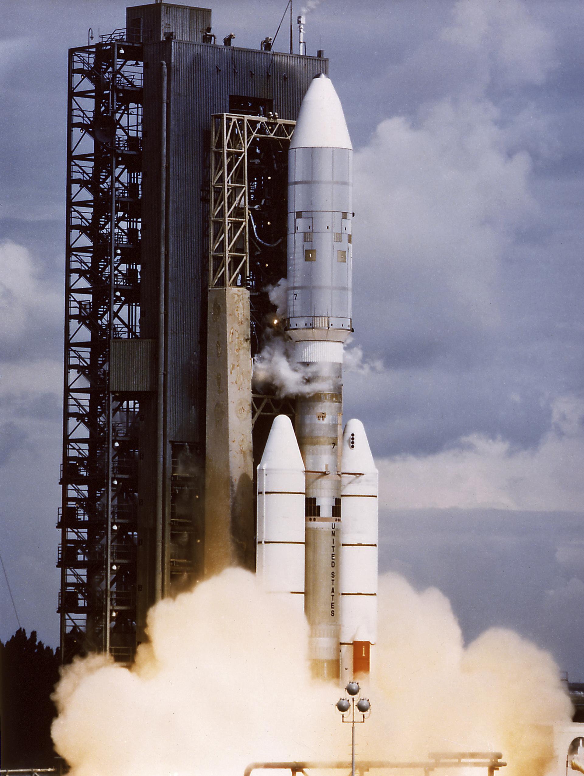
GET /2.2.0/launch/?format=api&offset=4330&ordering=-id
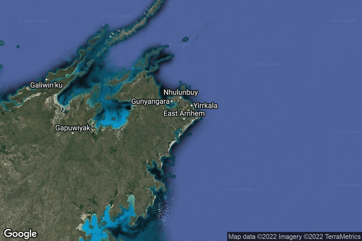
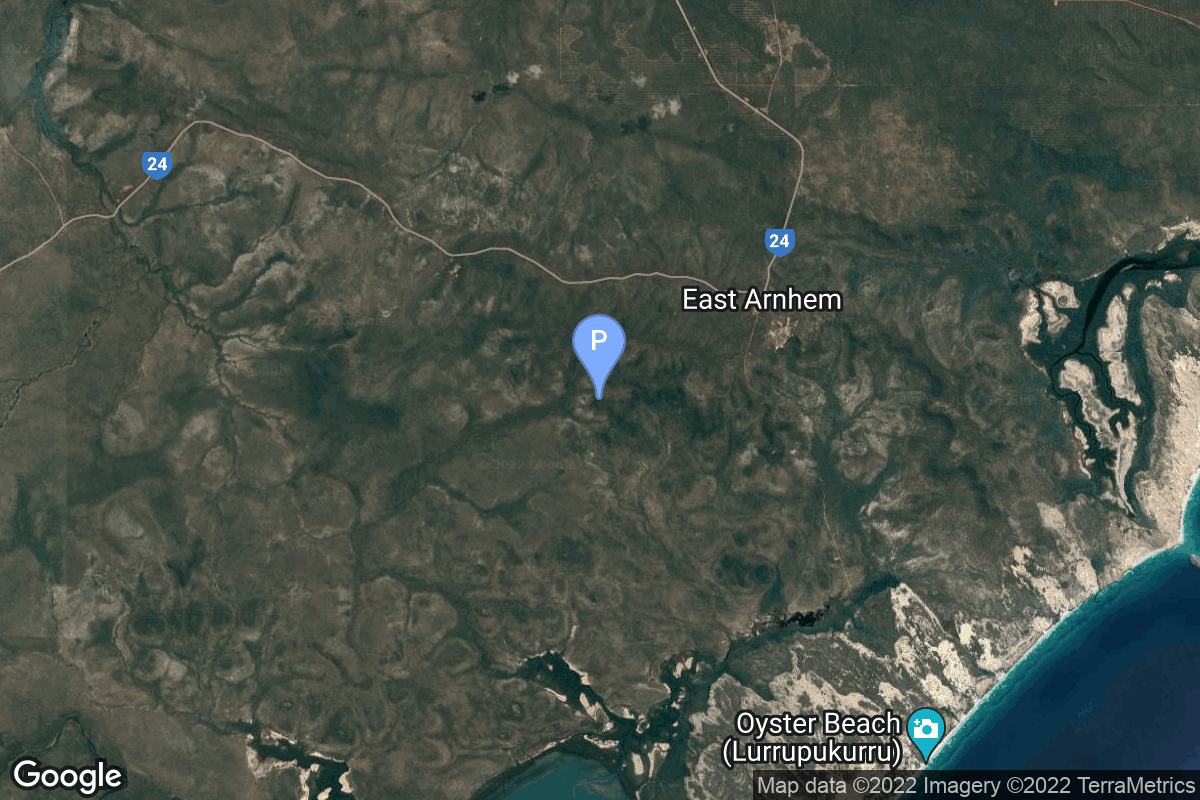
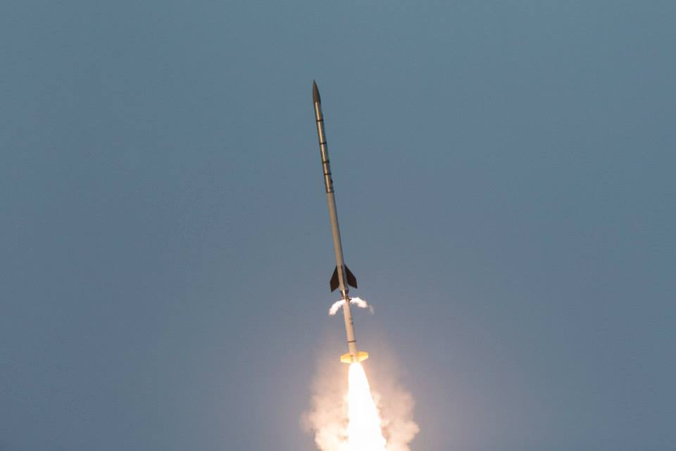
{ "count": 7924, "next": "https://ll.thespacedevs.com/2.2.0/launch/?format=api&limit=10&offset=4340&ordering=-id", "previous": "https://ll.thespacedevs.com/2.2.0/launch/?format=api&limit=10&offset=4320&ordering=-id", "results": [ { "id": "755498a3-909b-46e7-ae55-9ea303ab3f7b", "url": "https://ll.thespacedevs.com/2.2.0/launch/755498a3-909b-46e7-ae55-9ea303ab3f7b/?format=api", "slug": "voskhod-zenit-4-18", "name": "Voskhod | Zenit-4 18", "status": { "id": 4, "name": "Launch Failure", "abbrev": "Failure", "description": "Either the launch vehicle did not reach orbit, or the payload(s) failed to separate." }, "last_updated": "2023-06-14T04:29:08Z", "net": "1966-05-17T11:00:00Z", "window_end": "1966-05-17T11:00:00Z", "window_start": "1966-05-17T11:00:00Z", "net_precision": null, "probability": null, "weather_concerns": null, "holdreason": "", "failreason": null, "hashtag": null, "launch_service_provider": { "id": 66, "url": "https://ll.thespacedevs.com/2.2.0/agencies/66/?format=api", "name": "Soviet Space Program", "type": "Government" }, "rocket": { "id": 3525, "configuration": { "id": 104, "url": "https://ll.thespacedevs.com/2.2.0/config/launcher/104/?format=api", "name": "Voskhod", "family": "R-7", "full_name": "Voskhod", "variant": "Voskhod" } }, "mission": { "id": 1945, "name": "Zenit-4 18", "description": "Zenit-4 film-return reconnaissance satellite.", "launch_designator": null, "type": "Government/Top Secret", "orbit": { "id": 8, "name": "Low Earth Orbit", "abbrev": "LEO" }, "agencies": [], "info_urls": [], "vid_urls": [] }, "pad": { "id": 168, "url": "https://ll.thespacedevs.com/2.2.0/pad/168/?format=api", "agency_id": null, "name": "41/1", "description": null, "info_url": null, "wiki_url": "https://en.wikipedia.org/wiki/Plesetsk_Cosmodrome", "map_url": "https://www.google.com/maps?q=62.941,40.526806", "latitude": "62.941", "longitude": "40.526806", "location": { "id": 6, "url": "https://ll.thespacedevs.com/2.2.0/location/6/?format=api", "name": "Plesetsk Cosmodrome, Russian Federation", "country_code": "RUS", "description": "Plesetsk Cosmodrome is a Russian spaceport located in Mirny, Arkhangelsk Oblast, about 800 km north of Moscow and approximately 200 km south of Arkhangelsk. Originally developed as an ICBM site for the R-7 missile, it also served for numerous satellite launches using the R-7 and other rockets. Its high latitude makes it useful only for certain types of launches, especially the Molniya orbits, so for much of the site's history it functioned as a secondary location, with most orbital launches taking place from Baikonur, in the Kazakh SSR. With the end of the Soviet Union, Baikonur became a foreign territory, and Kazakhstan charged $115 million usage fees annually. Consequently, Plesetsk has seen considerably more activity since the 2000s.", "map_image": "https://thespacedevs-prod.nyc3.digitaloceanspaces.com/media/map_images/location_6_20200803142434.jpg", "timezone_name": "Europe/Moscow", "total_launch_count": 1685, "total_landing_count": 0 }, "country_code": "RUS", "map_image": "https://thespacedevs-prod.nyc3.digitaloceanspaces.com/media/map_images/pad_168_20200803143446.jpg", "total_launch_count": 310, "orbital_launch_attempt_count": 310 }, "webcast_live": false, "image": "https://thespacedevs-prod.nyc3.digitaloceanspaces.com/media/images/voskhod_during__image_20251102062248.jpg", "infographic": null, "program": [], "orbital_launch_attempt_count": 563, "location_launch_attempt_count": 3, "pad_launch_attempt_count": 3, "agency_launch_attempt_count": 185, "orbital_launch_attempt_count_year": 46, "location_launch_attempt_count_year": 3, "pad_launch_attempt_count_year": 3, "agency_launch_attempt_count_year": 23, "type": "normal" }, { "id": "754ba4ef-751f-4aed-8eac-2da25c8bc53a", "url": "https://ll.thespacedevs.com/2.2.0/launch/754ba4ef-751f-4aed-8eac-2da25c8bc53a/?format=api", "slug": "soyuz-u-yantar-4k2-9", "name": "Soyuz U | Yantar-4K2 9", "status": { "id": 3, "name": "Launch Successful", "abbrev": "Success", "description": "The launch vehicle successfully inserted its payload(s) into the target orbit(s)." }, "last_updated": "2023-06-14T03:48:23Z", "net": "1984-07-31T12:29:54Z", "window_end": "1984-07-31T12:29:54Z", "window_start": "1984-07-31T12:29:54Z", "net_precision": null, "probability": null, "weather_concerns": null, "holdreason": "", "failreason": null, "hashtag": null, "launch_service_provider": { "id": 66, "url": "https://ll.thespacedevs.com/2.2.0/agencies/66/?format=api", "name": "Soviet Space Program", "type": "Government" }, "rocket": { "id": 5661, "configuration": { "id": 37, "url": "https://ll.thespacedevs.com/2.2.0/config/launcher/37/?format=api", "name": "Soyuz U", "family": "Soyuz", "full_name": "Soyuz U", "variant": "" } }, "mission": { "id": 4063, "name": "Yantar-4K2 9", "description": "Film-return reconnaissance satellite", "launch_designator": null, "type": "Government/Top Secret", "orbit": { "id": 8, "name": "Low Earth Orbit", "abbrev": "LEO" }, "agencies": [], "info_urls": [], "vid_urls": [] }, "pad": { "id": 32, "url": "https://ll.thespacedevs.com/2.2.0/pad/32/?format=api", "agency_id": null, "name": "1/5", "description": null, "info_url": null, "wiki_url": "", "map_url": "https://www.google.com/maps?q=45.92,63.342", "latitude": "45.92", "longitude": "63.342", "location": { "id": 15, "url": "https://ll.thespacedevs.com/2.2.0/location/15/?format=api", "name": "Baikonur Cosmodrome, Republic of Kazakhstan", "country_code": "KAZ", "description": "The Baikonur Cosmodrome is a spaceport operated by Russia within Kazakhstan. Located in the Kazakh city of Baikonur, it is the largest operational space launch facility in terms of area. All Russian crewed spaceflights are launched from Baikonur.", "map_image": "https://thespacedevs-prod.nyc3.digitaloceanspaces.com/media/map_images/location_15_20200803142517.jpg", "timezone_name": "Asia/Qyzylorda", "total_launch_count": 1563, "total_landing_count": 0 }, "country_code": "KAZ", "map_image": "https://thespacedevs-prod.nyc3.digitaloceanspaces.com/media/map_images/pad_32_20200803143513.jpg", "total_launch_count": 487, "orbital_launch_attempt_count": 487 }, "webcast_live": false, "image": "https://thespacedevs-prod.nyc3.digitaloceanspaces.com/media/images/soyuz2520u_image_20190222031023.jpeg", "infographic": null, "program": [], "orbital_launch_attempt_count": 2852, "location_launch_attempt_count": 715, "pad_launch_attempt_count": 208, "agency_launch_attempt_count": 1820, "orbital_launch_attempt_count_year": 77, "location_launch_attempt_count_year": 21, "pad_launch_attempt_count_year": 2, "agency_launch_attempt_count_year": 61, "type": "normal" }, { "id": "75414835-ec0a-43f4-b624-1636502312f3", "url": "https://ll.thespacedevs.com/2.2.0/launch/75414835-ec0a-43f4-b624-1636502312f3/?format=api", "slug": "titan-iiie-voyager-2", "name": "Titan IIIE | Voyager 2", "status": { "id": 3, "name": "Launch Successful", "abbrev": "Success", "description": "The launch vehicle successfully inserted its payload(s) into the target orbit(s)." }, "last_updated": "2024-06-15T13:19:22Z", "net": "1977-08-20T14:29:44Z", "window_end": "1977-08-20T14:29:44Z", "window_start": "1977-08-20T14:29:44Z", "net_precision": { "id": 0, "name": "Second", "abbrev": "SEC", "description": "The T-0 is accurate to the second." }, "probability": null, "weather_concerns": null, "holdreason": "", "failreason": "", "hashtag": null, "launch_service_provider": { "id": 82, "url": "https://ll.thespacedevs.com/2.2.0/agencies/82/?format=api", "name": "Lockheed Martin", "type": "Commercial" }, "rocket": { "id": 260, "configuration": { "id": 148, "url": "https://ll.thespacedevs.com/2.2.0/config/launcher/148/?format=api", "name": "Titan III", "family": "Titan", "full_name": "Titan IIIE", "variant": "E" } }, "mission": { "id": 503, "name": "Voyager 2", "description": "Voyager 2 is a space probe launched by NASA on August 20, 1977, to study the outer planets. Part of the Voyager program, it was launched 16 days before its twin, Voyager 1, on a trajectory that took longer to reach Jupiter and Saturn but enabled further encounters with Uranus and Neptune. It is the only spacecraft to have visited either of the ice giants.", "launch_designator": null, "type": "Robotic Exploration", "orbit": { "id": 14, "name": "Solar Escape Trajectory", "abbrev": "Solar Esc." }, "agencies": [], "info_urls": [], "vid_urls": [] }, "pad": { "id": 29, "url": "https://ll.thespacedevs.com/2.2.0/pad/29/?format=api", "agency_id": null, "name": "Space Launch Complex 41", "description": "", "info_url": null, "wiki_url": "https://en.wikipedia.org/wiki/Cape_Canaveral_Air_Force_Station_Space_Launch_Complex_41", "map_url": "https://www.google.com/maps?q=28.58341025,-80.58303644", "latitude": "28.58341025", "longitude": "-80.58303644", "location": { "id": 12, "url": "https://ll.thespacedevs.com/2.2.0/location/12/?format=api", "name": "Cape Canaveral SFS, FL, USA", "country_code": "USA", "description": "Cape Canaveral Space Force Station (CCSFS) is an installation of the United States Space Force's Space Launch Delta 45, located on Cape Canaveral in Brevard County, Florida.", "map_image": "https://thespacedevs-prod.nyc3.digitaloceanspaces.com/media/map_images/location_12_20200803142519.jpg", "timezone_name": "America/New_York", "total_launch_count": 1120, "total_landing_count": 75 }, "country_code": "USA", "map_image": "https://thespacedevs-prod.nyc3.digitaloceanspaces.com/media/map_images/pad_29_20200803143528.jpg", "total_launch_count": 125, "orbital_launch_attempt_count": 125 }, "webcast_live": false, "image": "https://thespacedevs-prod.nyc3.digitaloceanspaces.com/media/images/titan2520iii_image_20190222030055.jpeg", "infographic": null, "program": [ { "id": 36, "url": "https://ll.thespacedevs.com/2.2.0/program/36/?format=api", "name": "NASA Large Strategic Science Missions", "description": "NASA's large strategic science missions or large strategic missions, formerly known as Flagship missions or Flagship-class missions, are the costliest and most capable NASA science spacecraft. Flagship missions exist within all four divisions of NASA's Science Mission Directorate (SMD): the astrophysics, Earth science, heliophysics and planetary science divisions.", "agencies": [ { "id": 44, "url": "https://ll.thespacedevs.com/2.2.0/agencies/44/?format=api", "name": "National Aeronautics and Space Administration", "type": "Government" } ], "image_url": "https://thespacedevs-prod.nyc3.digitaloceanspaces.com/media/images/nasa2520large_program_20240205122003.jpeg", "start_date": "1975-08-22T00:00:00Z", "end_date": null, "info_url": null, "wiki_url": "https://en.wikipedia.org/wiki/Large_strategic_science_missions", "mission_patches": [], "type": { "id": 5, "name": "Exploration" } } ], "orbital_launch_attempt_count": 1994, "location_launch_attempt_count": 328, "pad_launch_attempt_count": 16, "agency_launch_attempt_count": 6, "orbital_launch_attempt_count_year": 79, "location_launch_attempt_count_year": 11, "pad_launch_attempt_count_year": 1, "agency_launch_attempt_count_year": 1, "type": "normal" }, { "id": "753edd58-6b33-448c-997d-04b0ac8f8cc8", "url": "https://ll.thespacedevs.com/2.2.0/launch/753edd58-6b33-448c-997d-04b0ac8f8cc8/?format=api", "slug": "delta-2310-noaa-5", "name": "Delta 2310 | NOAA 5", "status": { "id": 3, "name": "Launch Successful", "abbrev": "Success", "description": "The launch vehicle successfully inserted its payload(s) into the target orbit(s)." }, "last_updated": "2023-06-14T03:52:44Z", "net": "1976-07-29T17:07:00Z", "window_end": "1976-07-29T17:07:00Z", "window_start": "1976-07-29T17:07:00Z", "net_precision": null, "probability": null, "weather_concerns": null, "holdreason": "", "failreason": null, "hashtag": null, "launch_service_provider": { "id": 161, "url": "https://ll.thespacedevs.com/2.2.0/agencies/161/?format=api", "name": "United States Air Force", "type": "Government" }, "rocket": { "id": 4740, "configuration": { "id": 283, "url": "https://ll.thespacedevs.com/2.2.0/config/launcher/283/?format=api", "name": "Delta 2310", "family": "Delta", "full_name": "Delta 2310", "variant": "2310" } }, "mission": { "id": 3158, "name": "NOAA 5", "description": "Meteorological satellite using radiometric imaging", "launch_designator": null, "type": "Earth Science", "orbit": { "id": 17, "name": "Sun-Synchronous Orbit", "abbrev": "SSO" }, "agencies": [], "info_urls": [], "vid_urls": [] }, "pad": { "id": 39, "url": "https://ll.thespacedevs.com/2.2.0/pad/39/?format=api", "agency_id": null, "name": "Space Launch Complex 2W", "description": "SLC-2W was originally used for Delta, Thor-Agena and Delta II launches. After the last Delta II flight in 2018, SLC-2W was repurposed to launch Firefly Alpha rockets.", "info_url": null, "wiki_url": "https://en.wikipedia.org/wiki/Vandenberg_Space_Launch_Complex_2", "map_url": "https://www.google.com/maps?q=34.7556,-120.6224", "latitude": "34.7556", "longitude": "-120.6224", "location": { "id": 11, "url": "https://ll.thespacedevs.com/2.2.0/location/11/?format=api", "name": "Vandenberg SFB, CA, USA", "country_code": "USA", "description": "Vandenberg Space Force Base is a United States Space Force Base in Santa Barbara County, California. Established in 1941, Vandenberg Space Force Base is a space launch base, launching spacecraft from the Western Range, and also performs missile testing. The United States Space Force's Space Launch Delta 30 serves as the host delta for the base, equivalent to an Air Force air base wing. In addition to its military space launch mission, Vandenberg Space Force Base also hosts space launches for civil and commercial space entities, such as NASA and SpaceX.", "map_image": "https://thespacedevs-prod.nyc3.digitaloceanspaces.com/media/map_images/location_11_20200803142416.jpg", "timezone_name": "America/Los_Angeles", "total_launch_count": 897, "total_landing_count": 35 }, "country_code": "USA", "map_image": "https://thespacedevs-prod.nyc3.digitaloceanspaces.com/media/map_images/pad_39_20200803143542.jpg", "total_launch_count": 99, "orbital_launch_attempt_count": 99 }, "webcast_live": false, "image": "https://thespacedevs-prod.nyc3.digitaloceanspaces.com/media/images/delta-2310_252_image_20251115100123.png", "infographic": null, "program": [], "orbital_launch_attempt_count": 1861, "location_launch_attempt_count": 443, "pad_launch_attempt_count": 38, "agency_launch_attempt_count": 674, "orbital_launch_attempt_count_year": 78, "location_launch_attempt_count_year": 8, "pad_launch_attempt_count_year": 2, "agency_launch_attempt_count_year": 19, "type": "normal" }, { "id": "7537ebb1-068f-49d5-bf15-e91cdffe10f6", "url": "https://ll.thespacedevs.com/2.2.0/launch/7537ebb1-068f-49d5-bf15-e91cdffe10f6/?format=api", "slug": "kosmos-3m-strela-1m-89-96", "name": "Kosmos-3M | Strela-1M 89-96", "status": { "id": 3, "name": "Launch Successful", "abbrev": "Success", "description": "The launch vehicle successfully inserted its payload(s) into the target orbit(s)." }, "last_updated": "2023-06-14T03:43:48Z", "net": "1975-05-28T00:25:01Z", "window_end": "1975-05-28T00:25:01Z", "window_start": "1975-05-28T00:25:01Z", "net_precision": null, "probability": null, "weather_concerns": null, "holdreason": "", "failreason": null, "hashtag": null, "launch_service_provider": { "id": 66, "url": "https://ll.thespacedevs.com/2.2.0/agencies/66/?format=api", "name": "Soviet Space Program", "type": "Government" }, "rocket": { "id": 4585, "configuration": { "id": 102, "url": "https://ll.thespacedevs.com/2.2.0/config/launcher/102/?format=api", "name": "Kosmos-3M", "family": "Kosmos", "full_name": "Kosmos-3M (11K65M)", "variant": "-3M" } }, "mission": { "id": 3003, "name": "Strela-1M 89-96", "description": "Military communications satellites", "launch_designator": null, "type": "Government/Top Secret", "orbit": { "id": 8, "name": "Low Earth Orbit", "abbrev": "LEO" }, "agencies": [], "info_urls": [], "vid_urls": [] }, "pad": { "id": 28, "url": "https://ll.thespacedevs.com/2.2.0/pad/28/?format=api", "agency_id": 163, "name": "132/1 (132L)", "description": null, "info_url": null, "wiki_url": "", "map_url": "https://www.google.com/maps?q=62.883229,40.868549", "latitude": "62.883229", "longitude": "40.868549", "location": { "id": 6, "url": "https://ll.thespacedevs.com/2.2.0/location/6/?format=api", "name": "Plesetsk Cosmodrome, Russian Federation", "country_code": "RUS", "description": "Plesetsk Cosmodrome is a Russian spaceport located in Mirny, Arkhangelsk Oblast, about 800 km north of Moscow and approximately 200 km south of Arkhangelsk. Originally developed as an ICBM site for the R-7 missile, it also served for numerous satellite launches using the R-7 and other rockets. Its high latitude makes it useful only for certain types of launches, especially the Molniya orbits, so for much of the site's history it functioned as a secondary location, with most orbital launches taking place from Baikonur, in the Kazakh SSR. With the end of the Soviet Union, Baikonur became a foreign territory, and Kazakhstan charged $115 million usage fees annually. Consequently, Plesetsk has seen considerably more activity since the 2000s.", "map_image": "https://thespacedevs-prod.nyc3.digitaloceanspaces.com/media/map_images/location_6_20200803142434.jpg", "timezone_name": "Europe/Moscow", "total_launch_count": 1685, "total_landing_count": 0 }, "country_code": "RUS", "map_image": "https://thespacedevs-prod.nyc3.digitaloceanspaces.com/media/map_images/pad_28_20200803143254.jpg", "total_launch_count": 212, "orbital_launch_attempt_count": 212 }, "webcast_live": false, "image": "https://thespacedevs-prod.nyc3.digitaloceanspaces.com/media/images/kosmos-3m_durin_image_20251101171325.jpg", "infographic": null, "program": [], "orbital_launch_attempt_count": 1699, "location_launch_attempt_count": 416, "pad_launch_attempt_count": 35, "agency_launch_attempt_count": 919, "orbital_launch_attempt_count_year": 48, "location_launch_attempt_count_year": 21, "pad_launch_attempt_count_year": 6, "agency_launch_attempt_count_year": 33, "type": "normal" }, { "id": "7533059e-732d-4ee5-9f5d-2974f85b9e88", "url": "https://ll.thespacedevs.com/2.2.0/launch/7533059e-732d-4ee5-9f5d-2974f85b9e88/?format=api", "slug": "black-brant-ix-xqc", "name": "Black Brant IX | XQC", "status": { "id": 3, "name": "Launch Successful", "abbrev": "Success", "description": "The launch vehicle successfully inserted its payload(s) into the target orbit(s)." }, "last_updated": "2023-06-14T04:31:06Z", "net": "2022-06-26T14:30:00Z", "window_end": "2022-06-26T16:14:00Z", "window_start": "2022-06-26T13:14:00Z", "net_precision": null, "probability": null, "weather_concerns": null, "holdreason": "", "failreason": "", "hashtag": null, "launch_service_provider": { "id": 1038, "url": "https://ll.thespacedevs.com/2.2.0/agencies/1038/?format=api", "name": "Equatorial Launch Australia", "type": "Commercial" }, "rocket": { "id": 7610, "configuration": { "id": 481, "url": "https://ll.thespacedevs.com/2.2.0/config/launcher/481/?format=api", "name": "Black Brant IX", "family": "", "full_name": "Black Brant IX", "variant": "IX" } }, "mission": { "id": 6096, "name": "XQC", "description": "The X-ray Quantum Calorimeter Experiment (XQC) is a payload from the University of Wisconsin. Its objective is to measure X-rays with unprecedented precision to better understand the interstellar medium and its influence on the structure and evolution of galaxies and stars.", "launch_designator": null, "type": "Astrophysics", "orbit": { "id": 15, "name": "Suborbital", "abbrev": "Sub" }, "agencies": [], "info_urls": [], "vid_urls": [] }, "pad": { "id": 202, "url": "https://ll.thespacedevs.com/2.2.0/pad/202/?format=api", "agency_id": 1038, "name": "Suborbital Launch Ramp", "description": null, "info_url": "https://ela.space/arnhem-space-centre/", "wiki_url": "https://en.wikipedia.org/wiki/Arnhem_Land#Economy", "map_url": "https://www.google.com/maps?q=-12.3892948,136.7903215", "latitude": "-12.3892948", "longitude": "136.7903215", "location": { "id": 160, "url": "https://ll.thespacedevs.com/2.2.0/location/160/?format=api", "name": "Arnhem Space Centre", "country_code": "AUS", "description": "The Arnhem Space Centre was Australia's first commercial spaceport, located near Nhulunbuy, in Arnhem Land, Australia. It was owned and operated by Equatorial Launch Australia (ELA), and was the site of NASA's first non-orbital sounding rocket launch from a commercial port outside the United States on 27 June 2022.", "map_image": "https://thespacedevs-prod.nyc3.digitaloceanspaces.com/media/map_images/location_arnhem_space_centre_20220622160552.jpg", "timezone_name": "Australia/Darwin", "total_launch_count": 3, "total_landing_count": 0 }, "country_code": "AUS", "map_image": "https://thespacedevs-prod.nyc3.digitaloceanspaces.com/media/map_images/pad_suborbital_launch_ramp_20220625184504.jpg", "total_launch_count": 3, "orbital_launch_attempt_count": 0 }, "webcast_live": false, "image": "https://thespacedevs-prod.nyc3.digitaloceanspaces.com/media/images/black_brant_ix_image_20220625190201.jpg", "infographic": null, "program": [], "orbital_launch_attempt_count": null, "location_launch_attempt_count": 1, "pad_launch_attempt_count": 1, "agency_launch_attempt_count": 1, "orbital_launch_attempt_count_year": null, "location_launch_attempt_count_year": 1, "pad_launch_attempt_count_year": 1, "agency_launch_attempt_count_year": 1, "type": "normal" }, { "id": "75323c10-7ef7-4739-9604-593e3d68da6f", "url": "https://ll.thespacedevs.com/2.2.0/launch/75323c10-7ef7-4739-9604-593e3d68da6f/?format=api", "slug": "molniya-m-molniya-3-12l", "name": "Molniya-M | Molniya-3 12L", "status": { "id": 3, "name": "Launch Successful", "abbrev": "Success", "description": "The launch vehicle successfully inserted its payload(s) into the target orbit(s)." }, "last_updated": "2023-06-14T04:29:08Z", "net": "1975-04-14T17:52:59Z", "window_end": "1975-04-14T17:52:59Z", "window_start": "1975-04-14T17:52:59Z", "net_precision": null, "probability": null, "weather_concerns": null, "holdreason": "", "failreason": null, "hashtag": null, "launch_service_provider": { "id": 66, "url": "https://ll.thespacedevs.com/2.2.0/agencies/66/?format=api", "name": "Soviet Space Program", "type": "Government" }, "rocket": { "id": 4570, "configuration": { "id": 106, "url": "https://ll.thespacedevs.com/2.2.0/config/launcher/106/?format=api", "name": "Molniya-M", "family": "R-7", "full_name": "Molniya-M 2BL", "variant": "2BL" } }, "mission": { "id": 2988, "name": "Molniya-3 12L", "description": "Molniya communication satellites operating from a highly elliptical orbit", "launch_designator": null, "type": "Communications", "orbit": { "id": 0, "name": "Elliptical Orbit", "abbrev": "Elliptical" }, "agencies": [], "info_urls": [], "vid_urls": [] }, "pad": { "id": 168, "url": "https://ll.thespacedevs.com/2.2.0/pad/168/?format=api", "agency_id": null, "name": "41/1", "description": null, "info_url": null, "wiki_url": "https://en.wikipedia.org/wiki/Plesetsk_Cosmodrome", "map_url": "https://www.google.com/maps?q=62.941,40.526806", "latitude": "62.941", "longitude": "40.526806", "location": { "id": 6, "url": "https://ll.thespacedevs.com/2.2.0/location/6/?format=api", "name": "Plesetsk Cosmodrome, Russian Federation", "country_code": "RUS", "description": "Plesetsk Cosmodrome is a Russian spaceport located in Mirny, Arkhangelsk Oblast, about 800 km north of Moscow and approximately 200 km south of Arkhangelsk. Originally developed as an ICBM site for the R-7 missile, it also served for numerous satellite launches using the R-7 and other rockets. Its high latitude makes it useful only for certain types of launches, especially the Molniya orbits, so for much of the site's history it functioned as a secondary location, with most orbital launches taking place from Baikonur, in the Kazakh SSR. With the end of the Soviet Union, Baikonur became a foreign territory, and Kazakhstan charged $115 million usage fees annually. Consequently, Plesetsk has seen considerably more activity since the 2000s.", "map_image": "https://thespacedevs-prod.nyc3.digitaloceanspaces.com/media/map_images/location_6_20200803142434.jpg", "timezone_name": "Europe/Moscow", "total_launch_count": 1685, "total_landing_count": 0 }, "country_code": "RUS", "map_image": "https://thespacedevs-prod.nyc3.digitaloceanspaces.com/media/map_images/pad_168_20200803143446.jpg", "total_launch_count": 310, "orbital_launch_attempt_count": 310 }, "webcast_live": false, "image": "https://thespacedevs-prod.nyc3.digitaloceanspaces.com/media/images/molniya_m_image_20251102061752.jpg", "infographic": null, "program": [], "orbital_launch_attempt_count": 1683, "location_launch_attempt_count": 411, "pad_launch_attempt_count": 128, "agency_launch_attempt_count": 910, "orbital_launch_attempt_count_year": 32, "location_launch_attempt_count_year": 16, "pad_launch_attempt_count_year": 7, "agency_launch_attempt_count_year": 24, "type": "normal" }, { "id": "752d5262-5a49-45ed-8f57-6dfcbb8866d6", "url": "https://ll.thespacedevs.com/2.2.0/launch/752d5262-5a49-45ed-8f57-6dfcbb8866d6/?format=api", "slug": "proton-uragan-42-to-44", "name": "Proton | Uragan 42 to 44", "status": { "id": 3, "name": "Launch Successful", "abbrev": "Success", "description": "The launch vehicle successfully inserted its payload(s) into the target orbit(s)." }, "last_updated": "2023-06-14T03:35:03Z", "net": "1991-04-04T10:47:12Z", "window_end": "1991-04-04T10:47:12Z", "window_start": "1991-04-04T10:47:12Z", "net_precision": null, "probability": null, "weather_concerns": null, "holdreason": "", "failreason": null, "hashtag": null, "launch_service_provider": { "id": 66, "url": "https://ll.thespacedevs.com/2.2.0/agencies/66/?format=api", "name": "Soviet Space Program", "type": "Government" }, "rocket": { "id": 6361, "configuration": { "id": 80, "url": "https://ll.thespacedevs.com/2.2.0/config/launcher/80/?format=api", "name": "Proton", "family": "Proton / UR-500", "full_name": "Proton K/DM-2", "variant": "K/DM-2" } }, "mission": { "id": 4751, "name": "Uragan 42 to 44", "description": "GLONASS navigation satellites", "launch_designator": null, "type": "Navigation", "orbit": { "id": 12, "name": "Medium Earth Orbit", "abbrev": "MEO" }, "agencies": [], "info_urls": [], "vid_urls": [] }, "pad": { "id": 15, "url": "https://ll.thespacedevs.com/2.2.0/pad/15/?format=api", "agency_id": null, "name": "200/39 (200L)", "description": null, "info_url": null, "wiki_url": "", "map_url": "https://www.google.com/maps?q=46.039984,63.032093", "latitude": "46.039984", "longitude": "63.032093", "location": { "id": 15, "url": "https://ll.thespacedevs.com/2.2.0/location/15/?format=api", "name": "Baikonur Cosmodrome, Republic of Kazakhstan", "country_code": "KAZ", "description": "The Baikonur Cosmodrome is a spaceport operated by Russia within Kazakhstan. Located in the Kazakh city of Baikonur, it is the largest operational space launch facility in terms of area. All Russian crewed spaceflights are launched from Baikonur.", "map_image": "https://thespacedevs-prod.nyc3.digitaloceanspaces.com/media/map_images/location_15_20200803142517.jpg", "timezone_name": "Asia/Qyzylorda", "total_launch_count": 1563, "total_landing_count": 0 }, "country_code": "KAZ", "map_image": "https://thespacedevs-prod.nyc3.digitaloceanspaces.com/media/map_images/pad_15_20200803143530.jpg", "total_launch_count": 167, "orbital_launch_attempt_count": 167 }, "webcast_live": false, "image": "https://thespacedevs-prod.nyc3.digitaloceanspaces.com/media/images/proton_image_20231231095535.jpg", "infographic": null, "program": [ { "id": 34, "url": "https://ll.thespacedevs.com/2.2.0/program/34/?format=api", "name": "GLONASS", "description": "GLONASS (ГЛОНАСС, IPA: [ɡɫɐˈnas]; Russian: Глобальная навигационная спутниковая система, tr. Global'naya Navigatsionnaya Sputnikovaya Sistema, lit. 'Global Navigation Satellite System') is a Russian satellite navigation system operating as part of a radionavigation-satellite service. It provides an alternative to Global Positioning System (GPS) and is the second navigational system in operation with global coverage and of comparable precision.", "agencies": [ { "id": 63, "url": "https://ll.thespacedevs.com/2.2.0/agencies/63/?format=api", "name": "Russian Federal Space Agency (ROSCOSMOS)", "type": "Government" } ], "image_url": "https://thespacedevs-prod.nyc3.digitaloceanspaces.com/media/images/glonass_program_20240102170258.png", "start_date": "1982-10-12T00:00:00Z", "end_date": null, "info_url": "https://www.glonass-iac.ru/en/", "wiki_url": "https://en.wikipedia.org/wiki/GLONASS", "mission_patches": [], "type": { "id": 4, "name": "Navigation Constellation" } } ], "orbital_launch_attempt_count": 3622, "location_launch_attempt_count": 960, "pad_launch_attempt_count": 61, "agency_launch_attempt_count": 2415, "orbital_launch_attempt_count_year": 25, "location_launch_attempt_count_year": 8, "pad_launch_attempt_count_year": 2, "agency_launch_attempt_count_year": 20, "type": "normal" }, { "id": "7527bd62-050d-4665-9d7b-056a99840b00", "url": "https://ll.thespacedevs.com/2.2.0/launch/7527bd62-050d-4665-9d7b-056a99840b00/?format=api", "slug": "kosmos-3m-strela-1m-217-224", "name": "Kosmos-3M | Strela-1M 217-224", "status": { "id": 3, "name": "Launch Successful", "abbrev": "Success", "description": "The launch vehicle successfully inserted its payload(s) into the target orbit(s)." }, "last_updated": "2023-06-14T04:27:38Z", "net": "1981-08-06T11:49:00Z", "window_end": "1981-08-06T11:49:00Z", "window_start": "1981-08-06T11:49:00Z", "net_precision": null, "probability": null, "weather_concerns": null, "holdreason": "", "failreason": null, "hashtag": null, "launch_service_provider": { "id": 66, "url": "https://ll.thespacedevs.com/2.2.0/agencies/66/?format=api", "name": "Soviet Space Program", "type": "Government" }, "rocket": { "id": 5305, "configuration": { "id": 102, "url": "https://ll.thespacedevs.com/2.2.0/config/launcher/102/?format=api", "name": "Kosmos-3M", "family": "Kosmos", "full_name": "Kosmos-3M (11K65M)", "variant": "-3M" } }, "mission": { "id": 3713, "name": "Strela-1M 217-224", "description": "Military communications satellites", "launch_designator": null, "type": "Government/Top Secret", "orbit": { "id": 8, "name": "Low Earth Orbit", "abbrev": "LEO" }, "agencies": [], "info_urls": [], "vid_urls": [] }, "pad": { "id": 167, "url": "https://ll.thespacedevs.com/2.2.0/pad/167/?format=api", "agency_id": null, "name": "132/2", "description": null, "info_url": null, "wiki_url": "https://en.wikipedia.org/wiki/Plesetsk_Cosmodrome", "map_url": "https://www.google.com/maps?q=62.883,40.869806", "latitude": "62.883", "longitude": "40.869806", "location": { "id": 6, "url": "https://ll.thespacedevs.com/2.2.0/location/6/?format=api", "name": "Plesetsk Cosmodrome, Russian Federation", "country_code": "RUS", "description": "Plesetsk Cosmodrome is a Russian spaceport located in Mirny, Arkhangelsk Oblast, about 800 km north of Moscow and approximately 200 km south of Arkhangelsk. Originally developed as an ICBM site for the R-7 missile, it also served for numerous satellite launches using the R-7 and other rockets. Its high latitude makes it useful only for certain types of launches, especially the Molniya orbits, so for much of the site's history it functioned as a secondary location, with most orbital launches taking place from Baikonur, in the Kazakh SSR. With the end of the Soviet Union, Baikonur became a foreign territory, and Kazakhstan charged $115 million usage fees annually. Consequently, Plesetsk has seen considerably more activity since the 2000s.", "map_image": "https://thespacedevs-prod.nyc3.digitaloceanspaces.com/media/map_images/location_6_20200803142434.jpg", "timezone_name": "Europe/Moscow", "total_launch_count": 1685, "total_landing_count": 0 }, "country_code": "RUS", "map_image": "https://thespacedevs-prod.nyc3.digitaloceanspaces.com/media/map_images/pad_167_20200803143417.jpg", "total_launch_count": 172, "orbital_launch_attempt_count": 172 }, "webcast_live": false, "image": "https://thespacedevs-prod.nyc3.digitaloceanspaces.com/media/images/kosmos-3m_durin_image_20251101171325.jpg", "infographic": null, "program": [], "orbital_launch_attempt_count": 2467, "location_launch_attempt_count": 822, "pad_launch_attempt_count": 114, "agency_launch_attempt_count": 1512, "orbital_launch_attempt_count_year": 76, "location_launch_attempt_count_year": 35, "pad_launch_attempt_count_year": 3, "agency_launch_attempt_count_year": 61, "type": "normal" }, { "id": "7521857f-9117-4de2-a3d6-9c451caf8c46", "url": "https://ll.thespacedevs.com/2.2.0/launch/7521857f-9117-4de2-a3d6-9c451caf8c46/?format=api", "slug": "kosmos-3m-tselina-o-8", "name": "Kosmos-3M | Tselina-O 8", "status": { "id": 3, "name": "Launch Successful", "abbrev": "Success", "description": "The launch vehicle successfully inserted its payload(s) into the target orbit(s)." }, "last_updated": "2023-06-14T03:43:47Z", "net": "1971-02-17T21:09:59Z", "window_end": "1971-02-17T21:09:59Z", "window_start": "1971-02-17T21:09:59Z", "net_precision": null, "probability": null, "weather_concerns": null, "holdreason": "", "failreason": null, "hashtag": null, "launch_service_provider": { "id": 66, "url": "https://ll.thespacedevs.com/2.2.0/agencies/66/?format=api", "name": "Soviet Space Program", "type": "Government" }, "rocket": { "id": 4104, "configuration": { "id": 102, "url": "https://ll.thespacedevs.com/2.2.0/config/launcher/102/?format=api", "name": "Kosmos-3M", "family": "Kosmos", "full_name": "Kosmos-3M (11K65M)", "variant": "-3M" } }, "mission": { "id": 2522, "name": "Tselina-O 8", "description": "The Tselina-O (11F616) was one component of two-satellite Tselina ELINT satellite system. Tselina-O provided general ELINT surveillance to be examined in detail by the larger Tselina-D satellites.", "launch_designator": null, "type": "Government/Top Secret", "orbit": { "id": 8, "name": "Low Earth Orbit", "abbrev": "LEO" }, "agencies": [], "info_urls": [], "vid_urls": [] }, "pad": { "id": 28, "url": "https://ll.thespacedevs.com/2.2.0/pad/28/?format=api", "agency_id": 163, "name": "132/1 (132L)", "description": null, "info_url": null, "wiki_url": "", "map_url": "https://www.google.com/maps?q=62.883229,40.868549", "latitude": "62.883229", "longitude": "40.868549", "location": { "id": 6, "url": "https://ll.thespacedevs.com/2.2.0/location/6/?format=api", "name": "Plesetsk Cosmodrome, Russian Federation", "country_code": "RUS", "description": "Plesetsk Cosmodrome is a Russian spaceport located in Mirny, Arkhangelsk Oblast, about 800 km north of Moscow and approximately 200 km south of Arkhangelsk. Originally developed as an ICBM site for the R-7 missile, it also served for numerous satellite launches using the R-7 and other rockets. Its high latitude makes it useful only for certain types of launches, especially the Molniya orbits, so for much of the site's history it functioned as a secondary location, with most orbital launches taking place from Baikonur, in the Kazakh SSR. With the end of the Soviet Union, Baikonur became a foreign territory, and Kazakhstan charged $115 million usage fees annually. Consequently, Plesetsk has seen considerably more activity since the 2000s.", "map_image": "https://thespacedevs-prod.nyc3.digitaloceanspaces.com/media/map_images/location_6_20200803142434.jpg", "timezone_name": "Europe/Moscow", "total_launch_count": 1685, "total_landing_count": 0 }, "country_code": "RUS", "map_image": "https://thespacedevs-prod.nyc3.digitaloceanspaces.com/media/map_images/pad_28_20200803143254.jpg", "total_launch_count": 212, "orbital_launch_attempt_count": 212 }, "webcast_live": false, "image": "https://thespacedevs-prod.nyc3.digitaloceanspaces.com/media/images/kosmos-3m_durin_image_20251101171325.jpg", "infographic": null, "program": [], "orbital_launch_attempt_count": 1186, "location_launch_attempt_count": 166, "pad_launch_attempt_count": 10, "agency_launch_attempt_count": 548, "orbital_launch_attempt_count_year": 15, "location_launch_attempt_count_year": 5, "pad_launch_attempt_count_year": 2, "agency_launch_attempt_count_year": 7, "type": "normal" } ] }