Launch List
AN API endpoint that returns all Launch objects or a single launch.
EXAMPLE - /launch/[id]/ or /launch/?mode=list&search=SpaceX
GET Return a list of all Launch objects.
FILTERS Fields - 'name', 'id(s)', 'lsp__id', 'lsp__name', 'serial_number', 'launcher_config__id', 'rocket__spacecraftflight__spacecraft__name', 'is_crewed', 'include_suborbital', 'spacecraft_config__ids', 'related', 'location__ids', 'lsp__ids', 'pad__ids', 'status__ids'
MODE 'normal', 'list', 'detailed'
EXAMPLE ?mode=list
SEARCH Searches through the launch name, rocket name, launch agency, mission name & spacecraft name.
EXAMPLE - ?search=SpaceX
GET /2.2.0/launch/?format=api&offset=4260&ordering=net
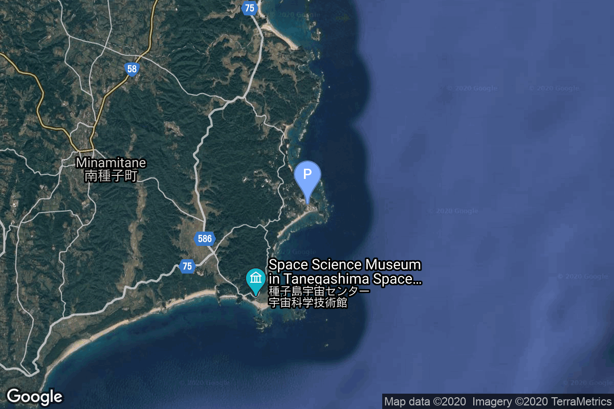
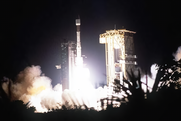
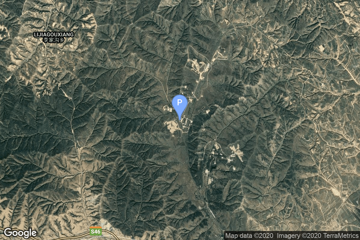
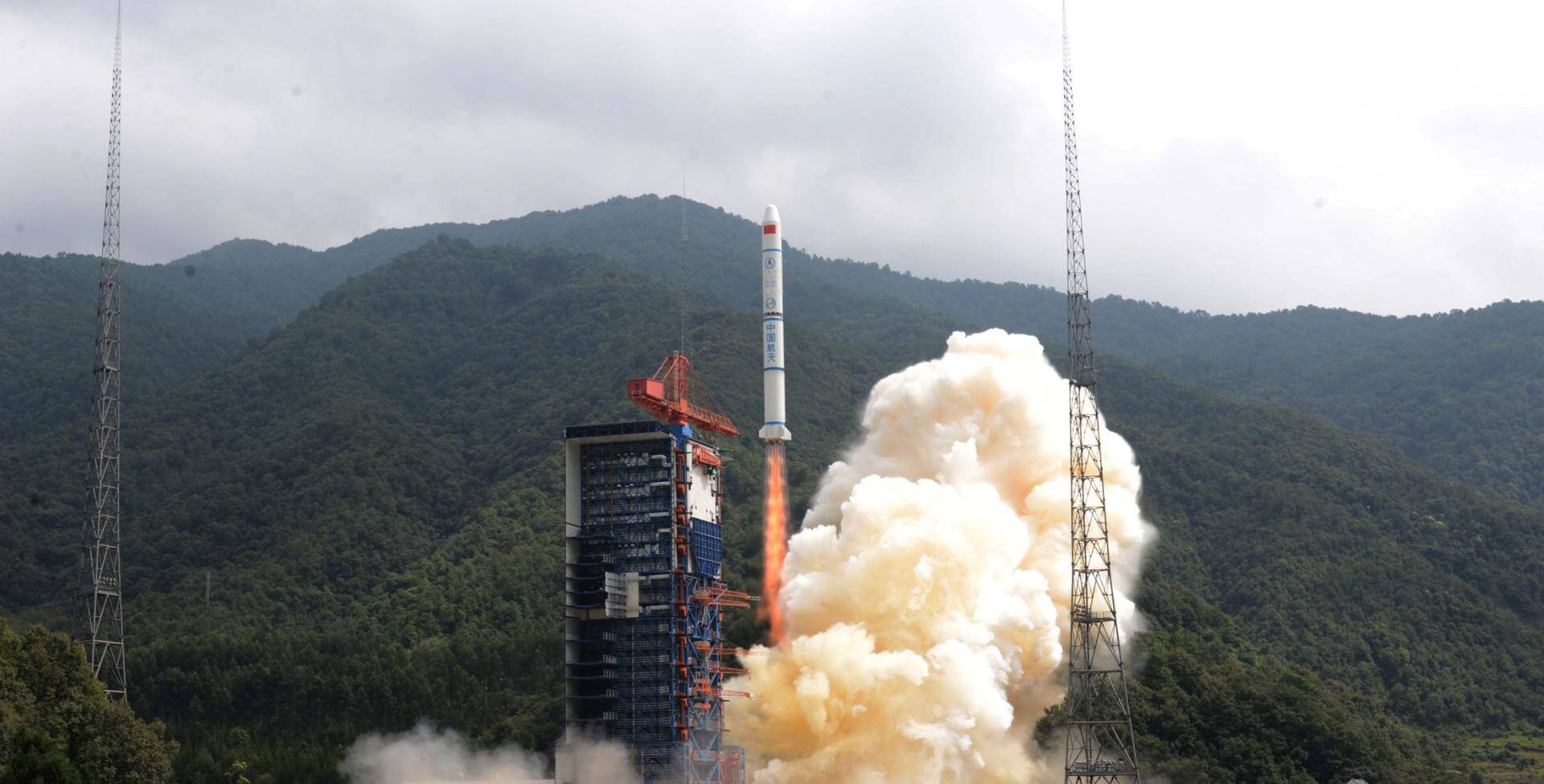
{ "count": 7608, "next": "https://ll.thespacedevs.com/2.2.0/launch/?format=api&limit=10&offset=4270&ordering=net", "previous": "https://ll.thespacedevs.com/2.2.0/launch/?format=api&limit=10&offset=4250&ordering=net", "results": [ { "id": "6f099bbb-0101-4eb6-b721-541a6f6bc6a3", "url": "https://ll.thespacedevs.com/2.2.0/launch/6f099bbb-0101-4eb6-b721-541a6f6bc6a3/?format=api", "slug": "h-ii-trmm-ets-7", "name": "H-II | TRMM & ETS 7", "status": { "id": 3, "name": "Launch Successful", "abbrev": "Success", "description": "The launch vehicle successfully inserted its payload(s) into the target orbit(s)." }, "last_updated": "2023-06-14T03:53:08Z", "net": "1997-11-27T21:27:00Z", "window_end": "1997-11-27T21:27:00Z", "window_start": "1997-11-27T21:27:00Z", "net_precision": null, "probability": null, "weather_concerns": null, "holdreason": "", "failreason": null, "hashtag": null, "launch_service_provider": { "id": 37, "url": "https://ll.thespacedevs.com/2.2.0/agencies/37/?format=api", "name": "Japan Aerospace Exploration Agency", "type": "Government" }, "rocket": { "id": 6821, "configuration": { "id": 320, "url": "https://ll.thespacedevs.com/2.2.0/config/launcher/320/?format=api", "name": "H-II", "family": "H-II", "full_name": "H-II", "variant": "" } }, "mission": { "id": 5211, "name": "TRMM & ETS 7", "description": "TRMM (Tropical Rainfall Measuring Mission) is the first space mission dedicated to quantitatively measuring tropical and subtropical rainfall which is one of the most important and least-known parameters affecting the global climate system. ETS-VII (Engineering Test Satellite, \"Kiku 7\") was launched aboard the H-2 No. 6 rocket from Tanegashima Space Center in November 1997.mETS-VII itself comprises two satellites: \"Orihime\" and \"Hikoboshi\". \"Orihime\" is a target satellite weighing approximately 400 kilograms. It is placed in a fixed circular orbit at an altitude of roughly 550 kilometers. \"Hikoboshi\" is a chaser satellite, weighing some 2.5 tons. It moves in a variable orbit to rendezvous and dock with \"Orihime\". \"Hikoboshi\" is equipped with a six-jointed, three-clawed robot arm two meters long.", "launch_designator": null, "type": "Earth Science", "orbit": { "id": 8, "name": "Low Earth Orbit", "abbrev": "LEO" }, "agencies": [], "info_urls": [], "vid_urls": [] }, "pad": { "id": 41, "url": "https://ll.thespacedevs.com/2.2.0/pad/41/?format=api", "agency_id": 37, "name": "Yoshinobu Launch Complex LP-1", "description": "", "info_url": null, "wiki_url": "https://en.wikipedia.org/wiki/Yoshinobu_Launch_Complex", "map_url": "https://www.google.com/maps?q=30.400813,130.977748", "latitude": "30.400813", "longitude": "130.977748", "location": { "id": 26, "url": "https://ll.thespacedevs.com/2.2.0/location/26/?format=api", "name": "Tanegashima Space Center, Japan", "country_code": "JPN", "description": "The Tanegashima Space Center is the largest rocket-launch complex in Japan. It is located on the southeastern tip of Tanegashima, an island located south of Kyushu, an island and region and Japan. It was established in 1969 when the National Space Development Agency of Japan (NASDA) was formed, and is now run by JAXA. The activities that take place at TNSC include assembly, testing, launching, and tracking satellites, as well as rocket engine firing tests.", "map_image": "https://thespacedevs-prod.nyc3.digitaloceanspaces.com/media/map_images/location_26_20200803142507.jpg", "timezone_name": "Asia/Tokyo", "total_launch_count": 95, "total_landing_count": 0 }, "country_code": "JPN", "map_image": "https://thespacedevs-prod.nyc3.digitaloceanspaces.com/media/map_images/pad_41_20200803143551.jpg", "total_launch_count": 57, "orbital_launch_attempt_count": 57 }, "webcast_live": false, "image": null, "infographic": null, "program": [], "orbital_launch_attempt_count": 4195, "location_launch_attempt_count": 29, "pad_launch_attempt_count": 5, "agency_launch_attempt_count": 5, "orbital_launch_attempt_count_year": 77, "location_launch_attempt_count_year": 1, "pad_launch_attempt_count_year": 1, "agency_launch_attempt_count_year": 1, "type": "normal" }, { "id": "4eac4e07-d46f-44f5-a98f-a96c6a77d15c", "url": "https://ll.thespacedevs.com/2.2.0/launch/4eac4e07-d46f-44f5-a98f-a96c6a77d15c/?format=api", "slug": "ariane-44p-jcsat-1b-equator-s", "name": "Ariane 44P | JCSAT 1B & Equator-S", "status": { "id": 3, "name": "Launch Successful", "abbrev": "Success", "description": "The launch vehicle successfully inserted its payload(s) into the target orbit(s)." }, "last_updated": "2023-06-14T04:22:17Z", "net": "1997-12-02T22:52:00Z", "window_end": "1997-12-02T22:52:00Z", "window_start": "1997-12-02T22:52:00Z", "net_precision": null, "probability": null, "weather_concerns": null, "holdreason": "", "failreason": null, "hashtag": null, "launch_service_provider": { "id": 115, "url": "https://ll.thespacedevs.com/2.2.0/agencies/115/?format=api", "name": "Arianespace", "type": "Commercial" }, "rocket": { "id": 6822, "configuration": { "id": 227, "url": "https://ll.thespacedevs.com/2.2.0/config/launcher/227/?format=api", "name": "Ariane 44P", "family": "Ariane", "full_name": "Ariane 44P", "variant": "44P" } }, "mission": { "id": 5212, "name": "JCSAT 1B & Equator-S", "description": "Japanese communications satellite", "launch_designator": null, "type": "Communications", "orbit": { "id": 1, "name": "Geostationary Orbit", "abbrev": "Direct-GEO" }, "agencies": [], "info_urls": [], "vid_urls": [] }, "pad": { "id": 124, "url": "https://ll.thespacedevs.com/2.2.0/pad/124/?format=api", "agency_id": 115, "name": "Ariane Launch Area 2", "description": "The ELA-2 pad, built in 1986, had been used for Ariane 4 launches from 1988 until 2003. Before 1988, although purpose-built for Ariane 4, the pad hosted an Ariane-2 and two Ariane-3 launches.", "info_url": null, "wiki_url": "https://en.wikipedia.org/wiki/ELA-2", "map_url": "https://www.google.com/maps?q=5.232,-52.778194", "latitude": "5.232", "longitude": "-52.778194", "location": { "id": 13, "url": "https://ll.thespacedevs.com/2.2.0/location/13/?format=api", "name": "Guiana Space Centre, French Guiana", "country_code": "GUF", "description": "The Guiana Space Centre is a European spaceport to the northwest of Kourou in French Guiana, a region of France in South America. Kourou is located at a latitude of 5°. In operation since 1968, it is a suitable location for a spaceport because of its equatorial location and open sea to the east.", "map_image": "https://thespacedevs-prod.nyc3.digitaloceanspaces.com/media/map_images/location_13_20200803142412.jpg", "timezone_name": "America/Cayenne", "total_launch_count": 327, "total_landing_count": 0 }, "country_code": "GUF", "map_image": "https://thespacedevs-prod.nyc3.digitaloceanspaces.com/media/map_images/pad_124_20200803143241.jpg", "total_launch_count": 119, "orbital_launch_attempt_count": 119 }, "webcast_live": false, "image": "https://thespacedevs-prod.nyc3.digitaloceanspaces.com/media/images/ariane_44p_at_e_image_20240401083030.png", "infographic": null, "program": [], "orbital_launch_attempt_count": 4196, "location_launch_attempt_count": 112, "pad_launch_attempt_count": 76, "agency_launch_attempt_count": 101, "orbital_launch_attempt_count_year": 78, "location_launch_attempt_count_year": 11, "pad_launch_attempt_count_year": 10, "agency_launch_attempt_count_year": 10, "type": "normal" }, { "id": "8ba623d1-294b-4734-b412-23fc6d202e5b", "url": "https://ll.thespacedevs.com/2.2.0/launch/8ba623d1-294b-4734-b412-23fc6d202e5b/?format=api", "slug": "proton-kdm-2m-astra-1g", "name": "Proton-K/DM-2M | Astra 1G", "status": { "id": 3, "name": "Launch Successful", "abbrev": "Success", "description": "The launch vehicle successfully inserted its payload(s) into the target orbit(s)." }, "last_updated": "2023-06-14T03:46:16Z", "net": "1997-12-02T23:10:37Z", "window_end": "1997-12-02T23:10:37Z", "window_start": "1997-12-02T23:10:37Z", "net_precision": null, "probability": null, "weather_concerns": null, "holdreason": "", "failreason": null, "hashtag": null, "launch_service_provider": { "id": 96, "url": "https://ll.thespacedevs.com/2.2.0/agencies/96/?format=api", "name": "Khrunichev State Research and Production Space Center", "type": "Government" }, "rocket": { "id": 6823, "configuration": { "id": 350, "url": "https://ll.thespacedevs.com/2.2.0/config/launcher/350/?format=api", "name": "Proton-K/DM-2M", "family": "Proton / UR-500", "full_name": "Proton-K/DM-2M", "variant": "DM-2M" } }, "mission": { "id": 5213, "name": "Astra 1G", "description": "SES ordered its Hughes 601 satellites, in 1994 for Astra 1G; in 1995 for Astra 1H; and in 1996 for Astra 2A. In August 1999, SES ordered Astra 2C, another Hughes 601HP", "launch_designator": null, "type": "Communications", "orbit": { "id": 1, "name": "Geostationary Orbit", "abbrev": "Direct-GEO" }, "agencies": [], "info_urls": [], "vid_urls": [] }, "pad": { "id": 31, "url": "https://ll.thespacedevs.com/2.2.0/pad/31/?format=api", "agency_id": null, "name": "81/23 (81L)", "description": null, "info_url": null, "wiki_url": "", "map_url": "https://www.google.com/maps?q=46.073997,62.977999", "latitude": "46.073997", "longitude": "62.977999", "location": { "id": 15, "url": "https://ll.thespacedevs.com/2.2.0/location/15/?format=api", "name": "Baikonur Cosmodrome, Republic of Kazakhstan", "country_code": "KAZ", "description": "The Baikonur Cosmodrome is a spaceport operated by Russia within Kazakhstan. Located in the Kazakh city of Baikonur, it is the largest operational space launch facility in terms of area. All Russian crewed spaceflights are launched from Baikonur.", "map_image": "https://thespacedevs-prod.nyc3.digitaloceanspaces.com/media/map_images/location_15_20200803142517.jpg", "timezone_name": "Asia/Qyzylorda", "total_launch_count": 1558, "total_landing_count": 0 }, "country_code": "KAZ", "map_image": "https://thespacedevs-prod.nyc3.digitaloceanspaces.com/media/map_images/pad_31_20200803143402.jpg", "total_launch_count": 104, "orbital_launch_attempt_count": 104 }, "webcast_live": false, "image": "https://thespacedevs-prod.nyc3.digitaloceanspaces.com/media/images/proton_image_20231231095535.jpg", "infographic": null, "program": [], "orbital_launch_attempt_count": 4197, "location_launch_attempt_count": 1099, "pad_launch_attempt_count": 76, "agency_launch_attempt_count": 50, "orbital_launch_attempt_count_year": 79, "location_launch_attempt_count_year": 15, "pad_launch_attempt_count_year": 5, "agency_launch_attempt_count_year": 8, "type": "normal" }, { "id": "cb9e5cea-8826-4908-bdc5-77d1aa153334", "url": "https://ll.thespacedevs.com/2.2.0/launch/cb9e5cea-8826-4908-bdc5-77d1aa153334/?format=api", "slug": "long-march-2csd-iridium-42-44", "name": "Long March 2C/SD | Iridium 42 & 44", "status": { "id": 3, "name": "Launch Successful", "abbrev": "Success", "description": "The launch vehicle successfully inserted its payload(s) into the target orbit(s)." }, "last_updated": "2023-12-30T10:34:01Z", "net": "1997-12-08T07:16:49Z", "window_end": "1997-12-08T07:16:49Z", "window_start": "1997-12-08T07:16:49Z", "net_precision": null, "probability": null, "weather_concerns": null, "holdreason": "", "failreason": "", "hashtag": null, "launch_service_provider": { "id": 189, "url": "https://ll.thespacedevs.com/2.2.0/agencies/189/?format=api", "name": "China Aerospace Corporation", "type": "Government" }, "rocket": { "id": 6824, "configuration": { "id": 267, "url": "https://ll.thespacedevs.com/2.2.0/config/launcher/267/?format=api", "name": "Long March 2C/SD", "family": "Long March", "full_name": "Long March 2C/SD", "variant": "C/SD" } }, "mission": { "id": 5214, "name": "Iridium 42 & 44", "description": "Iridium provides global mobile telecommunications services using a constellation of 66 low earth orbit satellites in a 86.4° inclined orbit. Although 77 satellites were originally envisioned for the system and spawned the name based on the 77th element in the periodic table, the system has been scaled back. Motorola's Satellite Communications Group designed and manufactured the Iridium satellites with Lockheed Martin providing the LM-700A spacecraft buses.", "launch_designator": null, "type": "Communications", "orbit": { "id": 8, "name": "Low Earth Orbit", "abbrev": "LEO" }, "agencies": [], "info_urls": [], "vid_urls": [] }, "pad": { "id": 33, "url": "https://ll.thespacedevs.com/2.2.0/pad/33/?format=api", "agency_id": null, "name": "Launch Complex 7", "description": null, "info_url": null, "wiki_url": null, "map_url": "https://www.google.com/maps?q=38.8489311,111.6079339", "latitude": "38.8489311", "longitude": "111.6079339", "location": { "id": 19, "url": "https://ll.thespacedevs.com/2.2.0/location/19/?format=api", "name": "Taiyuan Satellite Launch Center, People's Republic of China", "country_code": "CHN", "description": "The Taiyuan Satellite Launch Center is a People's Republic of China space and defense launch facility. It is situated in Kelan County, Xinzhou, Shanxi Province and is the second of four launch sites having been founded in March 1966 and coming into full operation in 1968.", "map_image": "https://thespacedevs-prod.nyc3.digitaloceanspaces.com/media/map_images/location_19_20200803142421.jpg", "timezone_name": "Asia/Shanghai", "total_launch_count": 145, "total_landing_count": 0 }, "country_code": "CHN", "map_image": "https://thespacedevs-prod.nyc3.digitaloceanspaces.com/media/map_images/pad_33_20200803143335.jpg", "total_launch_count": 32, "orbital_launch_attempt_count": 32 }, "webcast_live": false, "image": "https://thespacedevs-prod.nyc3.digitaloceanspaces.com/media/images/long_march_2c-i_image_20210908194304.jpeg", "infographic": null, "program": [ { "id": 28, "url": "https://ll.thespacedevs.com/2.2.0/program/28/?format=api", "name": "Iridium Constellation", "description": "The Iridium satellite constellation provides L band voice and data information coverage to satellite phones, satellite messenger communication devices and integrated transceivers.", "agencies": [ { "id": 202, "url": "https://ll.thespacedevs.com/2.2.0/agencies/202/?format=api", "name": "Iridium Communications", "type": "Commercial" } ], "image_url": "https://thespacedevs-prod.nyc3.digitaloceanspaces.com/media/images/iridium2520con_program_20231228184831.jpeg", "start_date": "1997-05-05T00:00:00Z", "end_date": null, "info_url": "https://iridium.com/", "wiki_url": "https://en.wikipedia.org/wiki/Iridium_satellite_constellation", "mission_patches": [], "type": { "id": 3, "name": "Communication Constellation" } } ], "orbital_launch_attempt_count": 4198, "location_launch_attempt_count": 4, "pad_launch_attempt_count": 4, "agency_launch_attempt_count": 19, "orbital_launch_attempt_count_year": 80, "location_launch_attempt_count_year": 2, "pad_launch_attempt_count_year": 2, "agency_launch_attempt_count_year": 6, "type": "normal" }, { "id": "cb3f88b6-1750-4213-8b63-85fb49040425", "url": "https://ll.thespacedevs.com/2.2.0/launch/cb3f88b6-1750-4213-8b63-85fb49040425/?format=api", "slug": "atlas-iias-galaxy-8i", "name": "Atlas IIAS | Galaxy 8i", "status": { "id": 3, "name": "Launch Successful", "abbrev": "Success", "description": "The launch vehicle successfully inserted its payload(s) into the target orbit(s)." }, "last_updated": "2023-06-14T17:39:57Z", "net": "1997-12-08T23:52:01Z", "window_end": "1997-12-08T23:52:01Z", "window_start": "1997-12-08T23:52:01Z", "net_precision": null, "probability": null, "weather_concerns": null, "holdreason": "", "failreason": null, "hashtag": null, "launch_service_provider": { "id": 82, "url": "https://ll.thespacedevs.com/2.2.0/agencies/82/?format=api", "name": "Lockheed Martin", "type": "Commercial" }, "rocket": { "id": 6825, "configuration": { "id": 255, "url": "https://ll.thespacedevs.com/2.2.0/config/launcher/255/?format=api", "name": "Atlas IIAS", "family": "Atlas", "full_name": "Atlas IIAS", "variant": "IIAS" } }, "mission": { "id": 5215, "name": "Galaxy 8i", "description": "Galaxy 8-i is one of the most powerful satellites to join PanAmSat Corporation's fleet of spacecraft, with nearly 10 kilowatts of power at beginning of life. It is a Hughes HS-601HP body-stabilized model built by Hughes Space and Communications Company in El Segundo, Calif.", "launch_designator": null, "type": "Communications", "orbit": { "id": 1, "name": "Geostationary Orbit", "abbrev": "Direct-GEO" }, "agencies": [], "info_urls": [], "vid_urls": [] }, "pad": { "id": 122, "url": "https://ll.thespacedevs.com/2.2.0/pad/122/?format=api", "agency_id": 161, "name": "Launch Complex 36B", "description": null, "info_url": null, "wiki_url": "https://en.wikipedia.org/wiki/Cape_Canaveral_Launch_Complex_36", "map_url": "https://www.google.com/maps?q=28.4705556,-80.542194", "latitude": "28.4705556", "longitude": "-80.542194", "location": { "id": 12, "url": "https://ll.thespacedevs.com/2.2.0/location/12/?format=api", "name": "Cape Canaveral SFS, FL, USA", "country_code": "USA", "description": "Cape Canaveral Space Force Station (CCSFS) is an installation of the United States Space Force's Space Launch Delta 45, located on Cape Canaveral in Brevard County, Florida.", "map_image": "https://thespacedevs-prod.nyc3.digitaloceanspaces.com/media/map_images/location_12_20200803142519.jpg", "timezone_name": "America/New_York", "total_launch_count": 1054, "total_landing_count": 68 }, "country_code": "USA", "map_image": "https://thespacedevs-prod.nyc3.digitaloceanspaces.com/media/map_images/pad_122_20200803143232.jpg", "total_launch_count": 76, "orbital_launch_attempt_count": 76 }, "webcast_live": false, "image": null, "infographic": null, "program": [], "orbital_launch_attempt_count": 4199, "location_launch_attempt_count": 539, "pad_launch_attempt_count": 62, "agency_launch_attempt_count": 31, "orbital_launch_attempt_count_year": 81, "location_launch_attempt_count_year": 16, "pad_launch_attempt_count_year": 5, "agency_launch_attempt_count_year": 9, "type": "normal" }, { "id": "e44e30a8-a349-441d-a21e-0bbcb8ce5559", "url": "https://ll.thespacedevs.com/2.2.0/launch/e44e30a8-a349-441d-a21e-0bbcb8ce5559/?format=api", "slug": "tsiklon-2-us-pm-9", "name": "Tsiklon-2 | US-PM 9", "status": { "id": 3, "name": "Launch Successful", "abbrev": "Success", "description": "The launch vehicle successfully inserted its payload(s) into the target orbit(s)." }, "last_updated": "2023-06-14T04:24:24Z", "net": "1997-12-09T07:17:20Z", "window_end": "1997-12-09T07:17:20Z", "window_start": "1997-12-09T07:17:20Z", "net_precision": null, "probability": null, "weather_concerns": null, "holdreason": "", "failreason": null, "hashtag": null, "launch_service_provider": { "id": 63, "url": "https://ll.thespacedevs.com/2.2.0/agencies/63/?format=api", "name": "Russian Federal Space Agency (ROSCOSMOS)", "type": "Government" }, "rocket": { "id": 6826, "configuration": { "id": 443, "url": "https://ll.thespacedevs.com/2.2.0/config/launcher/443/?format=api", "name": "Tsiklon-2", "family": "Tsiklon", "full_name": "Tsiklon-2", "variant": "2" } }, "mission": { "id": 5216, "name": "US-PM 9", "description": "US-PM (Upravlenniye Sputnik Passivny Modifikirovanny) (also reported as US-PU) was a solar powered improved EORSAT (Electronic Ocean Reconnaissance Satellite). It used an passive ELINT devices to track naval vessels from space by registering their electronic emmissions.", "launch_designator": null, "type": "Government/Top Secret", "orbit": { "id": 8, "name": "Low Earth Orbit", "abbrev": "LEO" }, "agencies": [], "info_urls": [], "vid_urls": [] }, "pad": { "id": 133, "url": "https://ll.thespacedevs.com/2.2.0/pad/133/?format=api", "agency_id": null, "name": "90/19", "description": null, "info_url": null, "wiki_url": "https://en.wikipedia.org/wiki/Baikonur_Cosmodrome_Site_90", "map_url": "https://www.google.com/maps?q=46.081,62.929806", "latitude": "46.081", "longitude": "62.929806", "location": { "id": 15, "url": "https://ll.thespacedevs.com/2.2.0/location/15/?format=api", "name": "Baikonur Cosmodrome, Republic of Kazakhstan", "country_code": "KAZ", "description": "The Baikonur Cosmodrome is a spaceport operated by Russia within Kazakhstan. Located in the Kazakh city of Baikonur, it is the largest operational space launch facility in terms of area. All Russian crewed spaceflights are launched from Baikonur.", "map_image": "https://thespacedevs-prod.nyc3.digitaloceanspaces.com/media/map_images/location_15_20200803142517.jpg", "timezone_name": "Asia/Qyzylorda", "total_launch_count": 1558, "total_landing_count": 0 }, "country_code": "KAZ", "map_image": "https://thespacedevs-prod.nyc3.digitaloceanspaces.com/media/map_images/pad_133_20200803143315.jpg", "total_launch_count": 16, "orbital_launch_attempt_count": 16 }, "webcast_live": false, "image": "https://thespacedevs-prod.nyc3.digitaloceanspaces.com/media/images/tsyklon-2_lifto_image_20240411113159.jpg", "infographic": null, "program": [], "orbital_launch_attempt_count": 4200, "location_launch_attempt_count": 1100, "pad_launch_attempt_count": 16, "agency_launch_attempt_count": 73, "orbital_launch_attempt_count_year": 82, "location_launch_attempt_count_year": 16, "pad_launch_attempt_count_year": 1, "agency_launch_attempt_count_year": 8, "type": "normal" }, { "id": "01cfd91d-fab5-4842-abc0-c87f512f50ca", "url": "https://ll.thespacedevs.com/2.2.0/launch/01cfd91d-fab5-4842-abc0-c87f512f50ca/?format=api", "slug": "soyuz-u-pvb-yantar-4k2-77", "name": "Soyuz-U-PVB | Yantar-4K2 77", "status": { "id": 3, "name": "Launch Successful", "abbrev": "Success", "description": "The launch vehicle successfully inserted its payload(s) into the target orbit(s)." }, "last_updated": "2023-06-14T03:50:24Z", "net": "1997-12-15T15:40:00Z", "window_end": "1997-12-15T15:40:00Z", "window_start": "1997-12-15T15:40:00Z", "net_precision": null, "probability": null, "weather_concerns": null, "holdreason": "", "failreason": "", "hashtag": null, "launch_service_provider": { "id": 270, "url": "https://ll.thespacedevs.com/2.2.0/agencies/270/?format=api", "name": "Strategic Rocket Forces", "type": "Government" }, "rocket": { "id": 6827, "configuration": { "id": 378, "url": "https://ll.thespacedevs.com/2.2.0/config/launcher/378/?format=api", "name": "Soyuz-U-PVB", "family": "Soyuz", "full_name": "Soyuz-U-PVB", "variant": "U-PVB" } }, "mission": { "id": 5217, "name": "Yantar-4K2 77", "description": "Film-return reconnaissance satellite", "launch_designator": null, "type": "Government/Top Secret", "orbit": { "id": 8, "name": "Low Earth Orbit", "abbrev": "LEO" }, "agencies": [], "info_urls": [], "vid_urls": [] }, "pad": { "id": 35, "url": "https://ll.thespacedevs.com/2.2.0/pad/35/?format=api", "agency_id": 163, "name": "16/2", "description": null, "info_url": null, "wiki_url": "", "map_url": "https://www.google.com/maps?q=62.960091,40.682983", "latitude": "62.960091", "longitude": "40.682983", "location": { "id": 6, "url": "https://ll.thespacedevs.com/2.2.0/location/6/?format=api", "name": "Plesetsk Cosmodrome, Russian Federation", "country_code": "RUS", "description": "Plesetsk Cosmodrome is a Russian spaceport located in Mirny, Arkhangelsk Oblast, about 800 km north of Moscow and approximately 200 km south of Arkhangelsk. Originally developed as an ICBM site for the R-7 missile, it also served for numerous satellite launches using the R-7 and other rockets. Its high latitude makes it useful only for certain types of launches, especially the Molniya orbits, so for much of the site's history it functioned as a secondary location, with most orbital launches taking place from Baikonur, in the Kazakh SSR. With the end of the Soviet Union, Baikonur became a foreign territory, and Kazakhstan charged $115 million usage fees annually. Consequently, Plesetsk has seen considerably more activity since the 2000s.", "map_image": "https://thespacedevs-prod.nyc3.digitaloceanspaces.com/media/map_images/location_6_20200803142434.jpg", "timezone_name": "Europe/Moscow", "total_launch_count": 1678, "total_landing_count": 0 }, "country_code": "RUS", "map_image": "https://thespacedevs-prod.nyc3.digitaloceanspaces.com/media/map_images/pad_35_20200803143306.jpg", "total_launch_count": 136, "orbital_launch_attempt_count": 136 }, "webcast_live": false, "image": null, "infographic": null, "program": [], "orbital_launch_attempt_count": 4201, "location_launch_attempt_count": 1493, "pad_launch_attempt_count": 115, "agency_launch_attempt_count": 6, "orbital_launch_attempt_count_year": 83, "location_launch_attempt_count_year": 9, "pad_launch_attempt_count_year": 2, "agency_launch_attempt_count_year": 4, "type": "normal" }, { "id": "6dff9d5b-ff2d-46a0-92fd-ab03f9e244d4", "url": "https://ll.thespacedevs.com/2.2.0/launch/6dff9d5b-ff2d-46a0-92fd-ab03f9e244d4/?format=api", "slug": "soyuz-u-progress-m-37", "name": "Soyuz U | Progress M-37", "status": { "id": 3, "name": "Launch Successful", "abbrev": "Success", "description": "The launch vehicle successfully inserted its payload(s) into the target orbit(s)." }, "last_updated": "2023-06-14T03:48:41Z", "net": "1997-12-20T08:45:02Z", "window_end": "1997-12-20T08:45:02Z", "window_start": "1997-12-20T08:45:02Z", "net_precision": null, "probability": 0, "weather_concerns": null, "holdreason": "", "failreason": "", "hashtag": "", "launch_service_provider": { "id": 63, "url": "https://ll.thespacedevs.com/2.2.0/agencies/63/?format=api", "name": "Russian Federal Space Agency (ROSCOSMOS)", "type": "Government" }, "rocket": { "id": 2310, "configuration": { "id": 37, "url": "https://ll.thespacedevs.com/2.2.0/config/launcher/37/?format=api", "name": "Soyuz U", "family": "Soyuz", "full_name": "Soyuz U", "variant": "" } }, "mission": null, "pad": { "id": 32, "url": "https://ll.thespacedevs.com/2.2.0/pad/32/?format=api", "agency_id": null, "name": "1/5", "description": null, "info_url": null, "wiki_url": "", "map_url": "https://www.google.com/maps?q=45.92,63.342", "latitude": "45.92", "longitude": "63.342", "location": { "id": 15, "url": "https://ll.thespacedevs.com/2.2.0/location/15/?format=api", "name": "Baikonur Cosmodrome, Republic of Kazakhstan", "country_code": "KAZ", "description": "The Baikonur Cosmodrome is a spaceport operated by Russia within Kazakhstan. Located in the Kazakh city of Baikonur, it is the largest operational space launch facility in terms of area. All Russian crewed spaceflights are launched from Baikonur.", "map_image": "https://thespacedevs-prod.nyc3.digitaloceanspaces.com/media/map_images/location_15_20200803142517.jpg", "timezone_name": "Asia/Qyzylorda", "total_launch_count": 1558, "total_landing_count": 0 }, "country_code": "KAZ", "map_image": "https://thespacedevs-prod.nyc3.digitaloceanspaces.com/media/map_images/pad_32_20200803143513.jpg", "total_launch_count": 487, "orbital_launch_attempt_count": 487 }, "webcast_live": false, "image": "https://thespacedevs-prod.nyc3.digitaloceanspaces.com/media/images/soyuz2520u_image_20190222031023.jpeg", "infographic": null, "program": [ { "id": 16, "url": "https://ll.thespacedevs.com/2.2.0/program/16/?format=api", "name": "Mir", "description": "Mir was a space station that operated in low Earth orbit from 1986 to 2001, operated by the Soviet Union and later by Russia. Mir was the first modular space station and was assembled in orbit from 1986 to 1996.", "agencies": [ { "id": 63, "url": "https://ll.thespacedevs.com/2.2.0/agencies/63/?format=api", "name": "Russian Federal Space Agency (ROSCOSMOS)", "type": "Government" }, { "id": 66, "url": "https://ll.thespacedevs.com/2.2.0/agencies/66/?format=api", "name": "Soviet Space Program", "type": "Government" } ], "image_url": "https://thespacedevs-prod.nyc3.digitaloceanspaces.com/media/images/mir_program_20200821092345.jpeg", "start_date": "1986-02-20T21:28:23Z", "end_date": "2001-03-23T05:59:00Z", "info_url": null, "wiki_url": "https://en.wikipedia.org/wiki/Mir", "mission_patches": [], "type": { "id": 2, "name": "Human Spaceflight" } } ], "orbital_launch_attempt_count": 4202, "location_launch_attempt_count": 1101, "pad_launch_attempt_count": 346, "agency_launch_attempt_count": 74, "orbital_launch_attempt_count_year": 4202, "location_launch_attempt_count_year": 17, "pad_launch_attempt_count_year": 6, "agency_launch_attempt_count_year": 9, "type": "normal" }, { "id": "c5bcad5a-2d5b-44e9-bcd9-ab76e510f96b", "url": "https://ll.thespacedevs.com/2.2.0/launch/c5bcad5a-2d5b-44e9-bcd9-ab76e510f96b/?format=api", "slug": "delta-ii-iridium-45-to-49", "name": "Delta II | Iridium 45 to 49", "status": { "id": 3, "name": "Launch Successful", "abbrev": "Success", "description": "The launch vehicle successfully inserted its payload(s) into the target orbit(s)." }, "last_updated": "2023-12-30T10:33:44Z", "net": "1997-12-20T13:16:00Z", "window_end": "1997-12-20T13:16:00Z", "window_start": "1997-12-20T13:16:00Z", "net_precision": null, "probability": null, "weather_concerns": null, "holdreason": "", "failreason": "", "hashtag": null, "launch_service_provider": { "id": 161, "url": "https://ll.thespacedevs.com/2.2.0/agencies/161/?format=api", "name": "United States Air Force", "type": "Government" }, "rocket": { "id": 6828, "configuration": { "id": 99, "url": "https://ll.thespacedevs.com/2.2.0/config/launcher/99/?format=api", "name": "Delta II", "family": "Delta", "full_name": "Delta II 7920-10C", "variant": "7920-10C" } }, "mission": { "id": 5218, "name": "Iridium 45 to 49", "description": "Iridium provides global mobile telecommunications services using a constellation of 66 low earth orbit satellites in a 86.4° inclined orbit. Although 77 satellites were originally envisioned for the system and spawned the name based on the 77th element in the periodic table, the system has been scaled back. Motorola's Satellite Communications Group designed and manufactured the Iridium satellites with Lockheed Martin providing the LM-700A spacecraft buses.", "launch_designator": null, "type": "Communications", "orbit": { "id": 8, "name": "Low Earth Orbit", "abbrev": "LEO" }, "agencies": [], "info_urls": [], "vid_urls": [] }, "pad": { "id": 39, "url": "https://ll.thespacedevs.com/2.2.0/pad/39/?format=api", "agency_id": null, "name": "Space Launch Complex 2W", "description": "SLC-2W was originally used for Delta, Thor-Agena and Delta II launches. After the last Delta II flight in 2018, SLC-2W was repurposed to launch Firefly Alpha rockets.", "info_url": null, "wiki_url": "https://en.wikipedia.org/wiki/Vandenberg_Space_Launch_Complex_2", "map_url": "https://www.google.com/maps?q=34.7556,-120.6224", "latitude": "34.7556", "longitude": "-120.6224", "location": { "id": 11, "url": "https://ll.thespacedevs.com/2.2.0/location/11/?format=api", "name": "Vandenberg SFB, CA, USA", "country_code": "USA", "description": "Vandenberg Space Force Base is a United States Space Force Base in Santa Barbara County, California. Established in 1941, Vandenberg Space Force Base is a space launch base, launching spacecraft from the Western Range, and also performs missile testing. The United States Space Force's Space Launch Delta 30 serves as the host delta for the base, equivalent to an Air Force air base wing. In addition to its military space launch mission, Vandenberg Space Force Base also hosts space launches for civil and commercial space entities, such as NASA and SpaceX.", "map_image": "https://thespacedevs-prod.nyc3.digitaloceanspaces.com/media/map_images/location_11_20200803142416.jpg", "timezone_name": "America/Los_Angeles", "total_launch_count": 832, "total_landing_count": 29 }, "country_code": "USA", "map_image": "https://thespacedevs-prod.nyc3.digitaloceanspaces.com/media/map_images/pad_39_20200803143542.jpg", "total_launch_count": 98, "orbital_launch_attempt_count": 98 }, "webcast_live": false, "image": "https://thespacedevs-prod.nyc3.digitaloceanspaces.com/media/images/delta2520ii_image_20190222030612.jpeg", "infographic": null, "program": [ { "id": 28, "url": "https://ll.thespacedevs.com/2.2.0/program/28/?format=api", "name": "Iridium Constellation", "description": "The Iridium satellite constellation provides L band voice and data information coverage to satellite phones, satellite messenger communication devices and integrated transceivers.", "agencies": [ { "id": 202, "url": "https://ll.thespacedevs.com/2.2.0/agencies/202/?format=api", "name": "Iridium Communications", "type": "Commercial" } ], "image_url": "https://thespacedevs-prod.nyc3.digitaloceanspaces.com/media/images/iridium2520con_program_20231228184831.jpeg", "start_date": "1997-05-05T00:00:00Z", "end_date": null, "info_url": "https://iridium.com/", "wiki_url": "https://en.wikipedia.org/wiki/Iridium_satellite_constellation", "mission_patches": [], "type": { "id": 3, "name": "Communication Constellation" } } ], "orbital_launch_attempt_count": 4203, "location_launch_attempt_count": 580, "pad_launch_attempt_count": 56, "agency_launch_attempt_count": 987, "orbital_launch_attempt_count_year": 85, "location_launch_attempt_count_year": 10, "pad_launch_attempt_count_year": 6, "agency_launch_attempt_count_year": 15, "type": "normal" }, { "id": "c95c068e-07dc-49c2-8ff9-58d01ca982f8", "url": "https://ll.thespacedevs.com/2.2.0/launch/c95c068e-07dc-49c2-8ff9-58d01ca982f8/?format=api", "slug": "ariane-42l-intelsat-804", "name": "Ariane 42L | INTELSAT 804", "status": { "id": 3, "name": "Launch Successful", "abbrev": "Success", "description": "The launch vehicle successfully inserted its payload(s) into the target orbit(s)." }, "last_updated": "2024-06-13T18:16:09Z", "net": "1997-12-22T00:16:00Z", "window_end": "1997-12-22T00:16:00Z", "window_start": "1997-12-22T00:16:00Z", "net_precision": { "id": 1, "name": "Minute", "abbrev": "MIN", "description": "The T-0 is accurate to the minute." }, "probability": null, "weather_concerns": null, "holdreason": "", "failreason": "", "hashtag": null, "launch_service_provider": { "id": 115, "url": "https://ll.thespacedevs.com/2.2.0/agencies/115/?format=api", "name": "Arianespace", "type": "Commercial" }, "rocket": { "id": 6829, "configuration": { "id": 223, "url": "https://ll.thespacedevs.com/2.2.0/config/launcher/223/?format=api", "name": "Ariane 42L", "family": "Ariane", "full_name": "Ariane 42L", "variant": "42L" } }, "mission": { "id": 5219, "name": "INTELSAT 804", "description": "The Intelsat VIII-VIII/A series has been designed to meet the needs of Intelsat users throughout the system for improved C-band coverage and service. These spacecraft will incorporate six-fold C-band frequency reuse, two-fold frequency reuse of expanded C-band capacity, and the highest C-band power level ever for an Intelsat satellite. Consequently, Intelsat VIII will provide significantly more C-band capacity for public switched telephony and Intelsat Business Service, better quality for video services, and encourage new international VSAT applications.", "launch_designator": null, "type": "Communications", "orbit": { "id": 1, "name": "Geostationary Orbit", "abbrev": "Direct-GEO" }, "agencies": [], "info_urls": [], "vid_urls": [] }, "pad": { "id": 124, "url": "https://ll.thespacedevs.com/2.2.0/pad/124/?format=api", "agency_id": 115, "name": "Ariane Launch Area 2", "description": "The ELA-2 pad, built in 1986, had been used for Ariane 4 launches from 1988 until 2003. Before 1988, although purpose-built for Ariane 4, the pad hosted an Ariane-2 and two Ariane-3 launches.", "info_url": null, "wiki_url": "https://en.wikipedia.org/wiki/ELA-2", "map_url": "https://www.google.com/maps?q=5.232,-52.778194", "latitude": "5.232", "longitude": "-52.778194", "location": { "id": 13, "url": "https://ll.thespacedevs.com/2.2.0/location/13/?format=api", "name": "Guiana Space Centre, French Guiana", "country_code": "GUF", "description": "The Guiana Space Centre is a European spaceport to the northwest of Kourou in French Guiana, a region of France in South America. Kourou is located at a latitude of 5°. In operation since 1968, it is a suitable location for a spaceport because of its equatorial location and open sea to the east.", "map_image": "https://thespacedevs-prod.nyc3.digitaloceanspaces.com/media/map_images/location_13_20200803142412.jpg", "timezone_name": "America/Cayenne", "total_launch_count": 327, "total_landing_count": 0 }, "country_code": "GUF", "map_image": "https://thespacedevs-prod.nyc3.digitaloceanspaces.com/media/map_images/pad_124_20200803143241.jpg", "total_launch_count": 119, "orbital_launch_attempt_count": 119 }, "webcast_live": false, "image": "https://thespacedevs-prod.nyc3.digitaloceanspaces.com/media/images/ariane_42l_at_e_image_20240401083718.png", "infographic": null, "program": [], "orbital_launch_attempt_count": 4204, "location_launch_attempt_count": 113, "pad_launch_attempt_count": 77, "agency_launch_attempt_count": 102, "orbital_launch_attempt_count_year": 86, "location_launch_attempt_count_year": 12, "pad_launch_attempt_count_year": 11, "agency_launch_attempt_count_year": 11, "type": "normal" } ] }