Launch List
AN API endpoint that returns all Launch objects or a single launch.
EXAMPLE - /launch/[id]/ or /launch/?mode=list&search=SpaceX
GET Return a list of all Launch objects.
FILTERS Fields - 'name', 'id(s)', 'lsp__id', 'lsp__name', 'serial_number', 'launcher_config__id', 'rocket__spacecraftflight__spacecraft__name', 'is_crewed', 'include_suborbital', 'spacecraft_config__ids', 'related', 'location__ids', 'lsp__ids', 'pad__ids', 'status__ids'
MODE 'normal', 'list', 'detailed'
EXAMPLE ?mode=list
SEARCH Searches through the launch name, rocket name, launch agency, mission name & spacecraft name.
EXAMPLE - ?search=SpaceX
GET /2.2.0/launch/?format=api&offset=4150&ordering=id
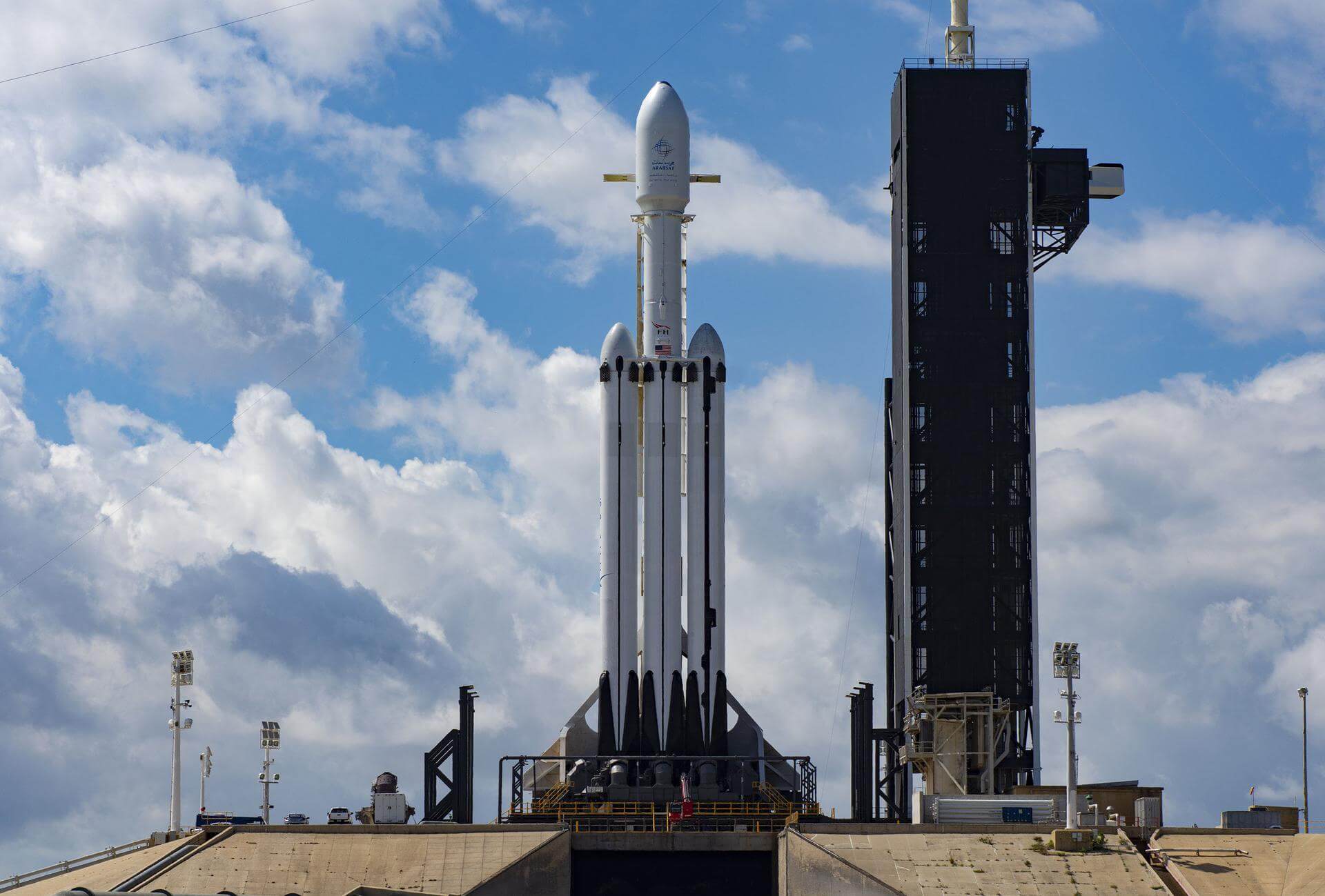
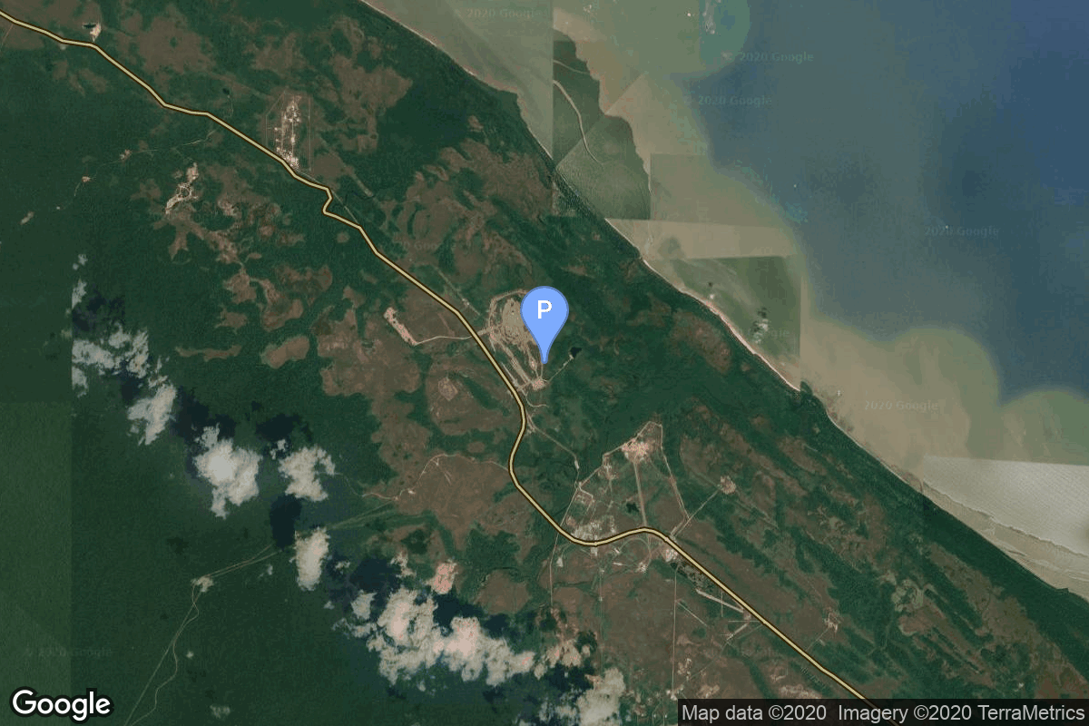
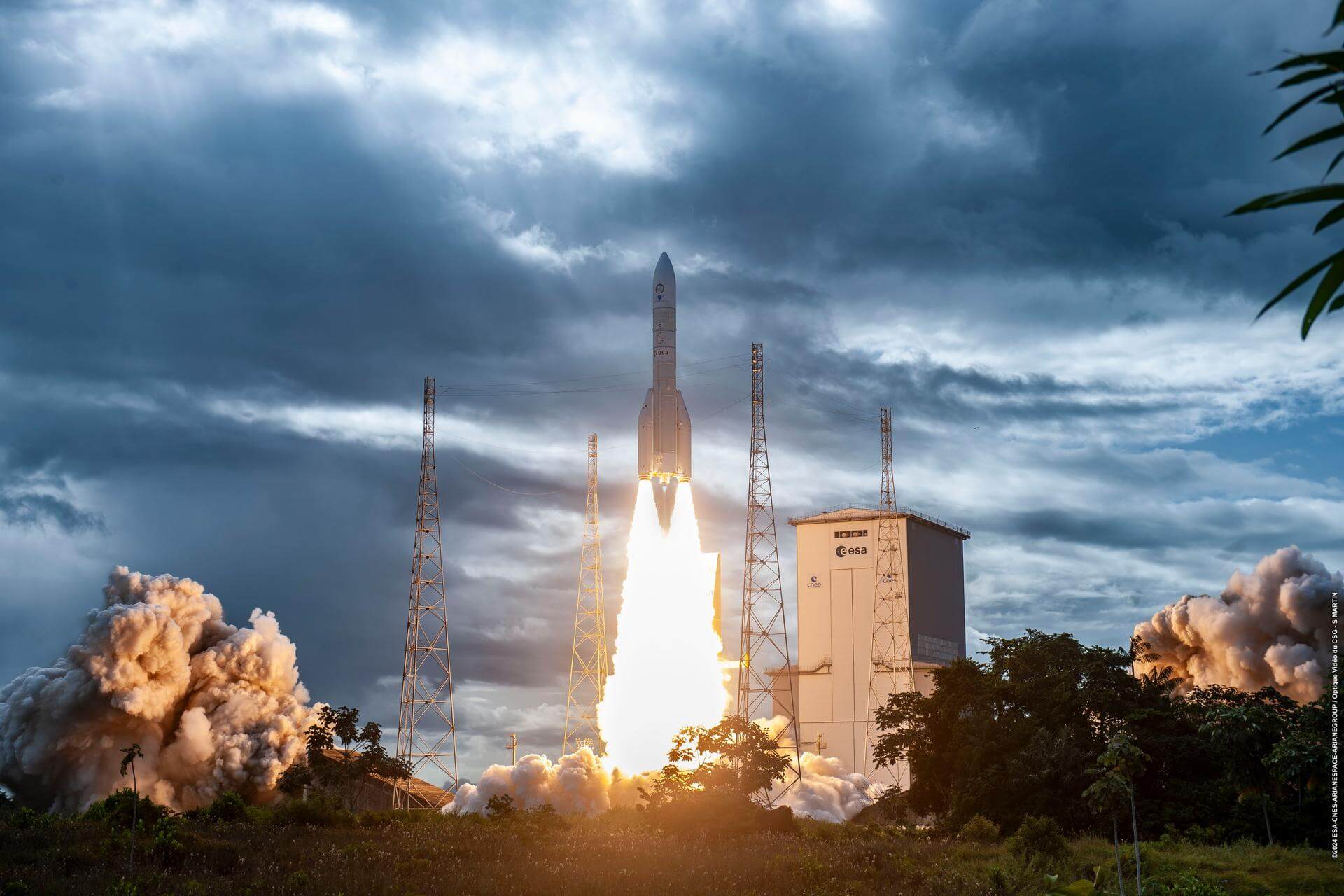
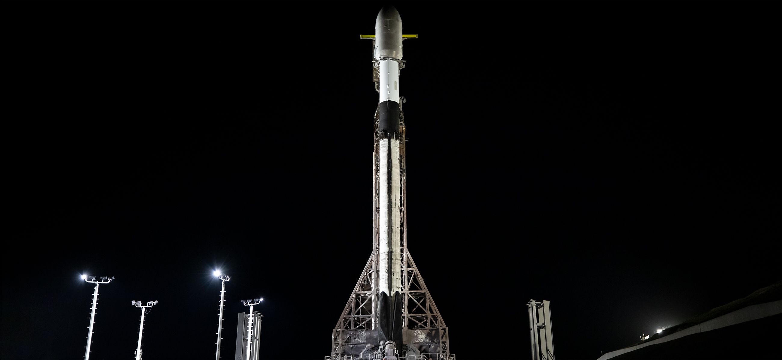
{ "count": 7917, "next": "https://ll.thespacedevs.com/2.2.0/launch/?format=api&limit=10&offset=4160&ordering=id", "previous": "https://ll.thespacedevs.com/2.2.0/launch/?format=api&limit=10&offset=4140&ordering=id", "results": [ { "id": "86d12414-1e9e-46f4-865a-0398f162cf28", "url": "https://ll.thespacedevs.com/2.2.0/launch/86d12414-1e9e-46f4-865a-0398f162cf28/?format=api", "slug": "falcon-heavy-ussf-63", "name": "Falcon Heavy | USSF-63", "status": { "id": 2, "name": "To Be Determined", "abbrev": "TBD", "description": "Current date is a placeholder or rough estimation based on unreliable or interpreted sources." }, "last_updated": "2025-10-04T17:43:44Z", "net": "2027-06-30T00:00:00Z", "window_end": "2027-06-30T00:00:00Z", "window_start": "2027-06-30T00:00:00Z", "net_precision": { "id": 15, "name": "Fiscal Year", "abbrev": "FY", "description": "The T-0 is expected in the given fiscal year of the launch country." }, "probability": null, "weather_concerns": null, "holdreason": "", "failreason": "", "hashtag": null, "launch_service_provider": { "id": 121, "url": "https://ll.thespacedevs.com/2.2.0/agencies/121/?format=api", "name": "SpaceX", "type": "Commercial" }, "rocket": { "id": 8752, "configuration": { "id": 161, "url": "https://ll.thespacedevs.com/2.2.0/config/launcher/161/?format=api", "name": "Falcon Heavy", "family": "Falcon", "full_name": "Falcon Heavy", "variant": "Heavy" } }, "mission": { "id": 7343, "name": "USSF-63", "description": "Classified payload for the US Space Force.", "launch_designator": null, "type": "Government/Top Secret", "orbit": { "id": 25, "name": "Unknown", "abbrev": "N/A" }, "agencies": [ { "id": 1041, "url": "https://ll.thespacedevs.com/2.2.0/agencies/1041/?format=api", "name": "United States Space Force", "featured": false, "type": "Government", "country_code": "USA", "abbrev": "USSF", "description": "The United States Space Force (USSF) is the space service branch of the U.S. Armed Forces, one of the eight U.S. uniformed services.", "administrator": null, "founding_year": "2019", "launchers": "", "spacecraft": "", "launch_library_url": null, "total_launch_count": 0, "consecutive_successful_launches": 0, "successful_launches": 0, "failed_launches": 0, "pending_launches": 0, "consecutive_successful_landings": 0, "successful_landings": 0, "failed_landings": 0, "attempted_landings": 0, "info_url": "https://www.spaceforce.mil/", "wiki_url": "https://en.wikipedia.org/wiki/United_States_Space_Force", "logo_url": "https://thespacedevs-prod.nyc3.digitaloceanspaces.com/media/images/united2520states2520space2520force_logo_20221102113048.png", "image_url": null, "nation_url": "https://thespacedevs-prod.nyc3.digitaloceanspaces.com/media/images/united_states_s_image_20250916065613.jpg" } ], "info_urls": [], "vid_urls": [] }, "pad": { "id": 87, "url": "https://ll.thespacedevs.com/2.2.0/pad/87/?format=api", "agency_id": 121, "name": "Launch Complex 39A", "description": "", "info_url": null, "wiki_url": "https://en.wikipedia.org/wiki/Kennedy_Space_Center_Launch_Complex_39#Launch_Pad_39A", "map_url": "https://www.google.com/maps?q=28.60822681,-80.60428186", "latitude": "28.60822681", "longitude": "-80.60428186", "location": { "id": 27, "url": "https://ll.thespacedevs.com/2.2.0/location/27/?format=api", "name": "Kennedy Space Center, FL, USA", "country_code": "USA", "description": "The John F. Kennedy Space Center, located on Merritt Island, Florida, is one of NASA's ten field centers. Since 1968, KSC has been NASA's primary launch center of American spaceflight, research, and technology. Launch operations for the Apollo, Skylab and Space Shuttle programs were carried out from Kennedy Space Center Launch Complex 39 and managed by KSC. Located on the east coast of Florida, KSC is adjacent to Cape Canaveral Space Force Station (CCSFS).", "map_image": "https://thespacedevs-prod.nyc3.digitaloceanspaces.com/media/map_images/location_27_20200803142447.jpg", "timezone_name": "America/New_York", "total_launch_count": 281, "total_landing_count": 0 }, "country_code": "USA", "map_image": "https://thespacedevs-prod.nyc3.digitaloceanspaces.com/media/map_images/pad_87_20200803143537.jpg", "total_launch_count": 222, "orbital_launch_attempt_count": 221 }, "webcast_live": false, "image": "https://thespacedevs-prod.nyc3.digitaloceanspaces.com/media/images/falcon_heavy_image_20220129192819.jpeg", "infographic": null, "program": [], "orbital_launch_attempt_count": 7535, "location_launch_attempt_count": 290, "pad_launch_attempt_count": 229, "agency_launch_attempt_count": 774, "orbital_launch_attempt_count_year": 38, "location_launch_attempt_count_year": 6, "pad_launch_attempt_count_year": 4, "agency_launch_attempt_count_year": 18, "type": "normal" }, { "id": "86d2e053-fb3d-4884-8f47-62527e104d4c", "url": "https://ll.thespacedevs.com/2.2.0/launch/86d2e053-fb3d-4884-8f47-62527e104d4c/?format=api", "slug": "ariane-6-nexus-1", "name": "Ariane 6 | NEXUS-1", "status": { "id": 2, "name": "To Be Determined", "abbrev": "TBD", "description": "Current date is a placeholder or rough estimation based on unreliable or interpreted sources." }, "last_updated": "2026-03-23T17:23:01Z", "net": "2027-12-31T00:00:00Z", "window_end": "2027-12-31T00:00:00Z", "window_start": "2027-12-31T00:00:00Z", "net_precision": { "id": 13, "name": "Year Half 2", "abbrev": "H2", "description": "The T-0 is expected in the second half of the given year." }, "probability": null, "weather_concerns": null, "holdreason": "", "failreason": "", "hashtag": null, "launch_service_provider": { "id": 115, "url": "https://ll.thespacedevs.com/2.2.0/agencies/115/?format=api", "name": "Arianespace", "type": "Commercial" }, "rocket": { "id": 8953, "configuration": { "id": 506, "url": "https://ll.thespacedevs.com/2.2.0/config/launcher/506/?format=api", "name": "Ariane 6", "family": "Ariane", "full_name": "Ariane 6", "variant": "N/A" } }, "mission": { "id": 7548, "name": "NEXUS-1", "description": "Katalyst Space Technologies' robotic space vehicle NEXUS-1 will dock with other satellites to install hardware, reposition spacecraft, and extend mission life, offering a faster, lower-cost alternative to replacement of satellites.\r\n\r\nNEXUS-1 will begin delivering these services through initial government missions before supporting commercial operators. Initial operations include installing a sensor on a Space Force satellite to detect and identify nearby spacecraft and conducting additional rendezvous and proximity operations to support space domain awareness.\r\n\r\nFollowing these missions, NEXUS-1 will transition to commercial servicing operations for communications satellite operators seeking to maintain and upgrade spacecraft already in orbit.", "launch_designator": null, "type": "Mission Extension", "orbit": { "id": 1, "name": "Geostationary Orbit", "abbrev": "Direct-GEO" }, "agencies": [], "info_urls": [], "vid_urls": [] }, "pad": { "id": 67, "url": "https://ll.thespacedevs.com/2.2.0/pad/67/?format=api", "agency_id": 115, "name": "Ariane Launch Area 4", "description": "ELA-4, is a launch pad and associated facilities at the Centre Spatial Guyanais in French Guiana. The complex is composed of a launch pad with mobile gantry, an horizontal assembly building and a dedicated launch operations building. ELA-4 is operated by Arianespace as part of the Ariane 6 program.", "info_url": null, "wiki_url": "https://en.wikipedia.org/wiki/Guiana_Space_Centre", "map_url": "https://www.google.com/maps?q=5.256319,-52.786838", "latitude": "5.256319", "longitude": "-52.786838", "location": { "id": 13, "url": "https://ll.thespacedevs.com/2.2.0/location/13/?format=api", "name": "Guiana Space Centre, French Guiana", "country_code": "GUF", "description": "The Guiana Space Centre is a European spaceport to the northwest of Kourou in French Guiana, a region of France in South America. Kourou is located at a latitude of 5°. In operation since 1968, it is a suitable location for a spaceport because of its equatorial location and open sea to the east.", "map_image": "https://thespacedevs-prod.nyc3.digitaloceanspaces.com/media/map_images/location_13_20200803142412.jpg", "timezone_name": "America/Cayenne", "total_launch_count": 334, "total_landing_count": 0 }, "country_code": "GUF", "map_image": "https://thespacedevs-prod.nyc3.digitaloceanspaces.com/media/map_images/pad_67_20200803143559.jpg", "total_launch_count": 8, "orbital_launch_attempt_count": 8 }, "webcast_live": false, "image": "https://thespacedevs-prod.nyc3.digitaloceanspaces.com/media/images/ariane_62_lifto_image_20240711132056.jpeg", "infographic": null, "program": [], "orbital_launch_attempt_count": 7592, "location_launch_attempt_count": 363, "pad_launch_attempt_count": 19, "agency_launch_attempt_count": 338, "orbital_launch_attempt_count_year": 95, "location_launch_attempt_count_year": 19, "pad_launch_attempt_count_year": 6, "agency_launch_attempt_count_year": 6, "type": "normal" }, { "id": "86d62815-9266-481b-951e-e53670d27341", "url": "https://ll.thespacedevs.com/2.2.0/launch/86d62815-9266-481b-951e-e53670d27341/?format=api", "slug": "falcon-9-block-5-nrol-48", "name": "Falcon 9 Block 5 | NROL-48", "status": { "id": 3, "name": "Launch Successful", "abbrev": "Success", "description": "The launch vehicle successfully inserted its payload(s) into the target orbit(s)." }, "last_updated": "2025-09-24T05:16:49Z", "net": "2025-09-22T17:38:00Z", "window_end": "2025-09-22T18:23:00Z", "window_start": "2025-09-22T17:23:00Z", "net_precision": { "id": 0, "name": "Second", "abbrev": "SEC", "description": "The T-0 is accurate to the second." }, "probability": null, "weather_concerns": null, "holdreason": "", "failreason": "", "hashtag": null, "launch_service_provider": { "id": 121, "url": "https://ll.thespacedevs.com/2.2.0/agencies/121/?format=api", "name": "SpaceX", "type": "Commercial" }, "rocket": { "id": 8523, "configuration": { "id": 164, "url": "https://ll.thespacedevs.com/2.2.0/config/launcher/164/?format=api", "name": "Falcon 9", "family": "Falcon", "full_name": "Falcon 9 Block 5", "variant": "Block 5" } }, "mission": { "id": 7113, "name": "NROL-48", "description": "Eleventh batch of satellites for a reconnaissance satellite constellation built by SpaceX and Northrop Grumman for the National Reconnaissance Office to provide imaging and other reconnaissance capabilities.", "launch_designator": null, "type": "Government/Top Secret", "orbit": { "id": 25, "name": "Unknown", "abbrev": "N/A" }, "agencies": [ { "id": 181, "url": "https://ll.thespacedevs.com/2.2.0/agencies/181/?format=api", "name": "National Reconnaissance Office", "featured": false, "type": "Government", "country_code": "USA", "abbrev": "NRO", "description": "The National Reconnaissance Office (NRO) is a member of the United States Intelligence Community and an agency of the United States Department of Defense which designs, builds, launches, and operates the reconnaissance satellites of the U.S. federal government, and provides satellite intelligence to several government agencies, particularly signals intelligence (SIGINT) to the NSA, imagery intelligence (IMINT) to the NGA, and measurement and signature intelligence (MASINT) to the DIA.", "administrator": "Director: Christopher Scolese", "founding_year": "1961", "launchers": "", "spacecraft": "", "launch_library_url": null, "total_launch_count": 0, "consecutive_successful_launches": 0, "successful_launches": 0, "failed_launches": 0, "pending_launches": 0, "consecutive_successful_landings": 0, "successful_landings": 0, "failed_landings": 0, "attempted_landings": 0, "info_url": "https://www.nro.gov/", "wiki_url": "https://en.wikipedia.org/wiki/National_Reconnaissance_Office", "logo_url": null, "image_url": null, "nation_url": "https://thespacedevs-prod.nyc3.digitaloceanspaces.com/media/images/national2520reconnaissance2520office_nation_20240228092125.png" } ], "info_urls": [], "vid_urls": [] }, "pad": { "id": 16, "url": "https://ll.thespacedevs.com/2.2.0/pad/16/?format=api", "agency_id": null, "name": "Space Launch Complex 4E", "description": "Space Launch Complex 4 East (SLC-4E) is a launch site at Vandenberg Space Force Base, California, U.S.\r\n\r\nThe pad was previously used by Atlas and Titan rockets between 1963 and 2005. The pad was built for use by Atlas-Agena rockets, but was later rebuilt to handle Titan rockets.", "info_url": null, "wiki_url": "https://en.wikipedia.org/wiki/Vandenberg_Space_Launch_Complex_4#SLC-4E", "map_url": "https://www.google.com/maps?q=34.632,-120.611", "latitude": "34.632", "longitude": "-120.611", "location": { "id": 11, "url": "https://ll.thespacedevs.com/2.2.0/location/11/?format=api", "name": "Vandenberg SFB, CA, USA", "country_code": "USA", "description": "Vandenberg Space Force Base is a United States Space Force Base in Santa Barbara County, California. Established in 1941, Vandenberg Space Force Base is a space launch base, launching spacecraft from the Western Range, and also performs missile testing. The United States Space Force's Space Launch Delta 30 serves as the host delta for the base, equivalent to an Air Force air base wing. In addition to its military space launch mission, Vandenberg Space Force Base also hosts space launches for civil and commercial space entities, such as NASA and SpaceX.", "map_image": "https://thespacedevs-prod.nyc3.digitaloceanspaces.com/media/map_images/location_11_20200803142416.jpg", "timezone_name": "America/Los_Angeles", "total_launch_count": 894, "total_landing_count": 35 }, "country_code": "USA", "map_image": "https://thespacedevs-prod.nyc3.digitaloceanspaces.com/media/map_images/pad_16_20200803143532.jpg", "total_launch_count": 278, "orbital_launch_attempt_count": 278 }, "webcast_live": false, "image": "https://thespacedevs-prod.nyc3.digitaloceanspaces.com/media/images/falcon_9_on_slc_image_20241024165956.jpg", "infographic": null, "program": [], "orbital_launch_attempt_count": 7068, "location_launch_attempt_count": 832, "pad_launch_attempt_count": 218, "agency_launch_attempt_count": 573, "orbital_launch_attempt_count_year": 219, "location_launch_attempt_count_year": 46, "pad_launch_attempt_count_year": 44, "agency_launch_attempt_count_year": 124, "type": "normal" }, { "id": "86dd4a7a-f161-407b-b509-1c33051f70a5", "url": "https://ll.thespacedevs.com/2.2.0/launch/86dd4a7a-f161-407b-b509-1c33051f70a5/?format=api", "slug": "delta-3914-exosat", "name": "Delta 3914 | Exosat", "status": { "id": 3, "name": "Launch Successful", "abbrev": "Success", "description": "The launch vehicle successfully inserted its payload(s) into the target orbit(s)." }, "last_updated": "2023-06-14T03:52:45Z", "net": "1983-05-26T15:18:00Z", "window_end": "1983-05-26T15:18:00Z", "window_start": "1983-05-26T15:18:00Z", "net_precision": null, "probability": null, "weather_concerns": null, "holdreason": "", "failreason": null, "hashtag": null, "launch_service_provider": { "id": 161, "url": "https://ll.thespacedevs.com/2.2.0/agencies/161/?format=api", "name": "United States Air Force", "type": "Government" }, "rocket": { "id": 5523, "configuration": { "id": 291, "url": "https://ll.thespacedevs.com/2.2.0/config/launcher/291/?format=api", "name": "Delta 3914", "family": "Delta", "full_name": "Delta 3914", "variant": "3914" } }, "mission": { "id": 3927, "name": "Exosat", "description": "European astronomy satellite designed dedicated to X-ray observations", "launch_designator": null, "type": "Astrophysics", "orbit": { "id": 0, "name": "Elliptical Orbit", "abbrev": "Elliptical" }, "agencies": [], "info_urls": [], "vid_urls": [] }, "pad": { "id": 39, "url": "https://ll.thespacedevs.com/2.2.0/pad/39/?format=api", "agency_id": null, "name": "Space Launch Complex 2W", "description": "SLC-2W was originally used for Delta, Thor-Agena and Delta II launches. After the last Delta II flight in 2018, SLC-2W was repurposed to launch Firefly Alpha rockets.", "info_url": null, "wiki_url": "https://en.wikipedia.org/wiki/Vandenberg_Space_Launch_Complex_2", "map_url": "https://www.google.com/maps?q=34.7556,-120.6224", "latitude": "34.7556", "longitude": "-120.6224", "location": { "id": 11, "url": "https://ll.thespacedevs.com/2.2.0/location/11/?format=api", "name": "Vandenberg SFB, CA, USA", "country_code": "USA", "description": "Vandenberg Space Force Base is a United States Space Force Base in Santa Barbara County, California. Established in 1941, Vandenberg Space Force Base is a space launch base, launching spacecraft from the Western Range, and also performs missile testing. The United States Space Force's Space Launch Delta 30 serves as the host delta for the base, equivalent to an Air Force air base wing. In addition to its military space launch mission, Vandenberg Space Force Base also hosts space launches for civil and commercial space entities, such as NASA and SpaceX.", "map_image": "https://thespacedevs-prod.nyc3.digitaloceanspaces.com/media/map_images/location_11_20200803142416.jpg", "timezone_name": "America/Los_Angeles", "total_launch_count": 894, "total_landing_count": 35 }, "country_code": "USA", "map_image": "https://thespacedevs-prod.nyc3.digitaloceanspaces.com/media/map_images/pad_39_20200803143542.jpg", "total_launch_count": 99, "orbital_launch_attempt_count": 99 }, "webcast_live": false, "image": "https://thespacedevs-prod.nyc3.digitaloceanspaces.com/media/images/delta_3910_image_20231231105538.jpeg", "infographic": null, "program": [], "orbital_launch_attempt_count": 2698, "location_launch_attempt_count": 502, "pad_launch_attempt_count": 45, "agency_launch_attempt_count": 803, "orbital_launch_attempt_count_year": 52, "location_launch_attempt_count_year": 5, "pad_launch_attempt_count_year": 2, "agency_launch_attempt_count_year": 8, "type": "normal" }, { "id": "86e784c3-0e9d-4cbb-b76c-2a075a1ee82f", "url": "https://ll.thespacedevs.com/2.2.0/launch/86e784c3-0e9d-4cbb-b76c-2a075a1ee82f/?format=api", "slug": "ariane-5-eca-hispasat-1e-koreasat-6", "name": "Ariane 5 ECA | Hispasat-1E & Koreasat 6", "status": { "id": 3, "name": "Launch Successful", "abbrev": "Success", "description": "The launch vehicle successfully inserted its payload(s) into the target orbit(s)." }, "last_updated": "2023-06-14T04:01:04Z", "net": "2010-12-29T21:27:00Z", "window_end": "2010-12-29T21:27:00Z", "window_start": "2010-12-29T21:27:00Z", "net_precision": null, "probability": null, "weather_concerns": null, "holdreason": "", "failreason": null, "hashtag": null, "launch_service_provider": { "id": 115, "url": "https://ll.thespacedevs.com/2.2.0/agencies/115/?format=api", "name": "Arianespace", "type": "Commercial" }, "rocket": { "id": 695, "configuration": { "id": 20, "url": "https://ll.thespacedevs.com/2.2.0/config/launcher/20/?format=api", "name": "Ariane 5 ECA", "family": "Ariane", "full_name": "Ariane 5 ECA", "variant": "ECA" } }, "mission": { "id": 634, "name": " Hispasat-1E & Koreasat 6", "description": "Koreasat 6 is a South Korean communications satellite operated by Koreasat. Hispasat 1E provides Fixed Satellite Services (FSS) and a Broadcast Satellite Services (BSS) to Europe, the Americas and North Africa. Located at 30 degrees West.", "launch_designator": null, "type": "Communications", "orbit": { "id": 2, "name": "Geostationary Transfer Orbit", "abbrev": "GTO" }, "agencies": [], "info_urls": [], "vid_urls": [] }, "pad": { "id": 77, "url": "https://ll.thespacedevs.com/2.2.0/pad/77/?format=api", "agency_id": 115, "name": "Ariane Launch Area 3", "description": "ELA-3, is a launch pad and associated facilities at the Centre Spatial Guyanais in French Guiana. ELA-3 was operated by Arianespace as part of the expendable launch system for Ariane 5 launch vehicles.", "info_url": null, "wiki_url": "https://en.wikipedia.org/wiki/ELA-3", "map_url": "https://www.google.com/maps?q=5.239,-52.768", "latitude": "5.239", "longitude": "-52.768", "location": { "id": 13, "url": "https://ll.thespacedevs.com/2.2.0/location/13/?format=api", "name": "Guiana Space Centre, French Guiana", "country_code": "GUF", "description": "The Guiana Space Centre is a European spaceport to the northwest of Kourou in French Guiana, a region of France in South America. Kourou is located at a latitude of 5°. In operation since 1968, it is a suitable location for a spaceport because of its equatorial location and open sea to the east.", "map_image": "https://thespacedevs-prod.nyc3.digitaloceanspaces.com/media/map_images/location_13_20200803142412.jpg", "timezone_name": "America/Cayenne", "total_launch_count": 334, "total_landing_count": 0 }, "country_code": "GUF", "map_image": "https://thespacedevs-prod.nyc3.digitaloceanspaces.com/media/map_images/pad_77_20200803143458.jpg", "total_launch_count": 118, "orbital_launch_attempt_count": 118 }, "webcast_live": false, "image": "https://thespacedevs-prod.nyc3.digitaloceanspaces.com/media/images/ariane252052520eca_image_20190224012333.jpeg", "infographic": null, "program": [], "orbital_launch_attempt_count": 5106, "location_launch_attempt_count": 208, "pad_launch_attempt_count": 55, "agency_launch_attempt_count": 194, "orbital_launch_attempt_count_year": 74, "location_launch_attempt_count_year": 6, "pad_launch_attempt_count_year": 6, "agency_launch_attempt_count_year": 6, "type": "normal" }, { "id": "86e832f7-f3f3-4aec-b48c-350a1454dd2c", "url": "https://ll.thespacedevs.com/2.2.0/launch/86e832f7-f3f3-4aec-b48c-350a1454dd2c/?format=api", "slug": "vostok-8a92-zenit-2-46", "name": "Vostok 8A92 | Zenit-2 46", "status": { "id": 3, "name": "Launch Successful", "abbrev": "Success", "description": "The launch vehicle successfully inserted its payload(s) into the target orbit(s)." }, "last_updated": "2023-06-14T03:48:46Z", "net": "1967-02-27T08:45:01Z", "window_end": "1967-02-27T08:45:01Z", "window_start": "1967-02-27T08:45:01Z", "net_precision": null, "probability": null, "weather_concerns": null, "holdreason": "", "failreason": null, "hashtag": null, "launch_service_provider": { "id": 66, "url": "https://ll.thespacedevs.com/2.2.0/agencies/66/?format=api", "name": "Soviet Space Program", "type": "Government" }, "rocket": { "id": 3626, "configuration": { "id": 451, "url": "https://ll.thespacedevs.com/2.2.0/config/launcher/451/?format=api", "name": "Vostok 8A92", "family": "Vostok", "full_name": "Vostok 8A92", "variant": "8A92" } }, "mission": { "id": 2044, "name": "Zenit-2 46", "description": "Zenit-2 film-return and ELINT reconnaissance satellite.", "launch_designator": null, "type": "Government/Top Secret", "orbit": { "id": 8, "name": "Low Earth Orbit", "abbrev": "LEO" }, "agencies": [], "info_urls": [], "vid_urls": [] }, "pad": { "id": 32, "url": "https://ll.thespacedevs.com/2.2.0/pad/32/?format=api", "agency_id": null, "name": "1/5", "description": null, "info_url": null, "wiki_url": "", "map_url": "https://www.google.com/maps?q=45.92,63.342", "latitude": "45.92", "longitude": "63.342", "location": { "id": 15, "url": "https://ll.thespacedevs.com/2.2.0/location/15/?format=api", "name": "Baikonur Cosmodrome, Republic of Kazakhstan", "country_code": "KAZ", "description": "The Baikonur Cosmodrome is a spaceport operated by Russia within Kazakhstan. Located in the Kazakh city of Baikonur, it is the largest operational space launch facility in terms of area. All Russian crewed spaceflights are launched from Baikonur.", "map_image": "https://thespacedevs-prod.nyc3.digitaloceanspaces.com/media/map_images/location_15_20200803142517.jpg", "timezone_name": "Asia/Qyzylorda", "total_launch_count": 1563, "total_landing_count": 0 }, "country_code": "KAZ", "map_image": "https://thespacedevs-prod.nyc3.digitaloceanspaces.com/media/map_images/pad_32_20200803143513.jpg", "total_launch_count": 487, "orbital_launch_attempt_count": 487 }, "webcast_live": false, "image": "https://thespacedevs-prod.nyc3.digitaloceanspaces.com/media/images/vostok_launch_v_image_20251119053730.jpg", "infographic": null, "program": [], "orbital_launch_attempt_count": 667, "location_launch_attempt_count": 169, "pad_launch_attempt_count": 86, "agency_launch_attempt_count": 221, "orbital_launch_attempt_count_year": 19, "location_launch_attempt_count_year": 3, "pad_launch_attempt_count_year": 2, "agency_launch_attempt_count_year": 6, "type": "normal" }, { "id": "86ea974e-6464-4960-85df-11af88852d57", "url": "https://ll.thespacedevs.com/2.2.0/launch/86ea974e-6464-4960-85df-11af88852d57/?format=api", "slug": "zhuque-2-maiden-flight", "name": "Zhuque-2 | Maiden Flight", "status": { "id": 4, "name": "Launch Failure", "abbrev": "Failure", "description": "Either the launch vehicle did not reach orbit, or the payload(s) failed to separate." }, "last_updated": "2026-05-14T15:38:05Z", "net": "2022-12-14T08:30:25Z", "window_end": "2022-12-14T10:44:00Z", "window_start": "2022-12-14T08:22:00Z", "net_precision": null, "probability": null, "weather_concerns": null, "holdreason": "", "failreason": "Second-stage vernier engines unexpectedly shut down during second stage main engine cut-off after LOX pump casing was broken by SECO-induced forces at the LOX inlet; the vernier engines were planned to continue firing to reach orbit.", "hashtag": null, "launch_service_provider": { "id": 259, "url": "https://ll.thespacedevs.com/2.2.0/agencies/259/?format=api", "name": "LandSpace", "type": "Commercial" }, "rocket": { "id": 2514, "configuration": { "id": 199, "url": "https://ll.thespacedevs.com/2.2.0/config/launcher/199/?format=api", "name": "Zhuque-2", "family": "Zhuque", "full_name": "Zhuque-2", "variant": "" } }, "mission": { "id": 1026, "name": "Maiden Flight", "description": "First flight of the new methalox rocket developed by Chinese startup LandSpace.", "launch_designator": null, "type": "Test Flight", "orbit": { "id": 8, "name": "Low Earth Orbit", "abbrev": "LEO" }, "agencies": [], "info_urls": [], "vid_urls": [] }, "pad": { "id": 9, "url": "https://ll.thespacedevs.com/2.2.0/pad/9/?format=api", "agency_id": 259, "name": "Launch Area 96A", "description": "", "info_url": null, "wiki_url": "https://en.wikipedia.org/wiki/LandSpace", "map_url": "https://www.google.com/maps?q=40.91491,100.245488", "latitude": "40.91491", "longitude": "100.245488", "location": { "id": 17, "url": "https://ll.thespacedevs.com/2.2.0/location/17/?format=api", "name": "Jiuquan Satellite Launch Center, People's Republic of China", "country_code": "CHN", "description": "Jiuquan Satellite Launch Center is a Chinese spaceport located between the Ejin, Alxa, Inner Mongolia and Hangtian Town, Jinta County, Jiuquan, Gansu Province. It is part of the Dongfeng Aerospace City (Base 10).", "map_image": "https://thespacedevs-prod.nyc3.digitaloceanspaces.com/media/map_images/location_17_20200803142429.jpg", "timezone_name": "Asia/Shanghai", "total_launch_count": 290, "total_landing_count": 2 }, "country_code": "CHN", "map_image": "https://thespacedevs-prod.nyc3.digitaloceanspaces.com/media/map_images/pad_9_20200803143341.jpg", "total_launch_count": 8, "orbital_launch_attempt_count": 8 }, "webcast_live": false, "image": "https://thespacedevs-prod.nyc3.digitaloceanspaces.com/media/images/zhuque-225202_image_20230802052349.jpg", "infographic": null, "program": [], "orbital_launch_attempt_count": 6358, "location_launch_attempt_count": 182, "pad_launch_attempt_count": 1, "agency_launch_attempt_count": 2, "orbital_launch_attempt_count_year": 176, "location_launch_attempt_count_year": 25, "pad_launch_attempt_count_year": 1, "agency_launch_attempt_count_year": 1, "type": "normal" }, { "id": "86f0ef42-9869-459a-9690-d7146420314d", "url": "https://ll.thespacedevs.com/2.2.0/launch/86f0ef42-9869-459a-9690-d7146420314d/?format=api", "slug": "soyuz-u-yantar-4k1-3", "name": "Soyuz U | Yantar-4K1 3", "status": { "id": 3, "name": "Launch Successful", "abbrev": "Success", "description": "The launch vehicle successfully inserted its payload(s) into the target orbit(s)." }, "last_updated": "2023-06-14T03:41:18Z", "net": "1980-10-30T10:00:00Z", "window_end": "1980-10-30T10:00:00Z", "window_start": "1980-10-30T10:00:00Z", "net_precision": null, "probability": null, "weather_concerns": null, "holdreason": "", "failreason": null, "hashtag": null, "launch_service_provider": { "id": 66, "url": "https://ll.thespacedevs.com/2.2.0/agencies/66/?format=api", "name": "Soviet Space Program", "type": "Government" }, "rocket": { "id": 5215, "configuration": { "id": 37, "url": "https://ll.thespacedevs.com/2.2.0/config/launcher/37/?format=api", "name": "Soyuz U", "family": "Soyuz", "full_name": "Soyuz U", "variant": "" } }, "mission": { "id": 3625, "name": "Yantar-4K1 3", "description": "Second generation high resolution film-return Yantar reconnaissance satellite", "launch_designator": null, "type": "Government/Top Secret", "orbit": { "id": 8, "name": "Low Earth Orbit", "abbrev": "LEO" }, "agencies": [], "info_urls": [], "vid_urls": [] }, "pad": { "id": 20, "url": "https://ll.thespacedevs.com/2.2.0/pad/20/?format=api", "agency_id": null, "name": "31/6", "description": "", "info_url": null, "wiki_url": "https://en.wikipedia.org/wiki/Baikonur_Cosmodrome_Site_31", "map_url": "https://www.google.com/maps?q=45.996034,63.564003", "latitude": "45.996034", "longitude": "63.564003", "location": { "id": 15, "url": "https://ll.thespacedevs.com/2.2.0/location/15/?format=api", "name": "Baikonur Cosmodrome, Republic of Kazakhstan", "country_code": "KAZ", "description": "The Baikonur Cosmodrome is a spaceport operated by Russia within Kazakhstan. Located in the Kazakh city of Baikonur, it is the largest operational space launch facility in terms of area. All Russian crewed spaceflights are launched from Baikonur.", "map_image": "https://thespacedevs-prod.nyc3.digitaloceanspaces.com/media/map_images/location_15_20200803142517.jpg", "timezone_name": "Asia/Qyzylorda", "total_launch_count": 1563, "total_landing_count": 0 }, "country_code": "KAZ", "map_image": "https://thespacedevs-prod.nyc3.digitaloceanspaces.com/media/map_images/pad_20_20200803143516.jpg", "total_launch_count": 428, "orbital_launch_attempt_count": 428 }, "webcast_live": false, "image": "https://thespacedevs-prod.nyc3.digitaloceanspaces.com/media/images/soyuz2520u_image_20190222031023.jpeg", "infographic": null, "program": [], "orbital_launch_attempt_count": 2371, "location_launch_attempt_count": 574, "pad_launch_attempt_count": 221, "agency_launch_attempt_count": 1436, "orbital_launch_attempt_count_year": 88, "location_launch_attempt_count_year": 20, "pad_launch_attempt_count_year": 4, "agency_launch_attempt_count_year": 74, "type": "normal" }, { "id": "86f552fc-1606-4e44-9d4d-57ef5e4517df", "url": "https://ll.thespacedevs.com/2.2.0/launch/86f552fc-1606-4e44-9d4d-57ef5e4517df/?format=api", "slug": "vostok-8a92-zenit-2-34", "name": "Vostok 8A92 | Zenit-2 34", "status": { "id": 3, "name": "Launch Successful", "abbrev": "Success", "description": "The launch vehicle successfully inserted its payload(s) into the target orbit(s)." }, "last_updated": "2023-06-14T03:41:11Z", "net": "1966-01-22T08:30:00Z", "window_end": "1966-01-22T08:30:00Z", "window_start": "1966-01-22T08:30:00Z", "net_precision": null, "probability": null, "weather_concerns": null, "holdreason": "", "failreason": null, "hashtag": null, "launch_service_provider": { "id": 66, "url": "https://ll.thespacedevs.com/2.2.0/agencies/66/?format=api", "name": "Soviet Space Program", "type": "Government" }, "rocket": { "id": 3480, "configuration": { "id": 451, "url": "https://ll.thespacedevs.com/2.2.0/config/launcher/451/?format=api", "name": "Vostok 8A92", "family": "Vostok", "full_name": "Vostok 8A92", "variant": "8A92" } }, "mission": { "id": 1900, "name": "Zenit-2 34", "description": "Zenit-2 film-return and ELINT reconnaissance satellite.", "launch_designator": null, "type": "Government/Top Secret", "orbit": { "id": 8, "name": "Low Earth Orbit", "abbrev": "LEO" }, "agencies": [], "info_urls": [], "vid_urls": [] }, "pad": { "id": 20, "url": "https://ll.thespacedevs.com/2.2.0/pad/20/?format=api", "agency_id": null, "name": "31/6", "description": "", "info_url": null, "wiki_url": "https://en.wikipedia.org/wiki/Baikonur_Cosmodrome_Site_31", "map_url": "https://www.google.com/maps?q=45.996034,63.564003", "latitude": "45.996034", "longitude": "63.564003", "location": { "id": 15, "url": "https://ll.thespacedevs.com/2.2.0/location/15/?format=api", "name": "Baikonur Cosmodrome, Republic of Kazakhstan", "country_code": "KAZ", "description": "The Baikonur Cosmodrome is a spaceport operated by Russia within Kazakhstan. Located in the Kazakh city of Baikonur, it is the largest operational space launch facility in terms of area. All Russian crewed spaceflights are launched from Baikonur.", "map_image": "https://thespacedevs-prod.nyc3.digitaloceanspaces.com/media/map_images/location_15_20200803142517.jpg", "timezone_name": "Asia/Qyzylorda", "total_launch_count": 1563, "total_landing_count": 0 }, "country_code": "KAZ", "map_image": "https://thespacedevs-prod.nyc3.digitaloceanspaces.com/media/map_images/pad_20_20200803143516.jpg", "total_launch_count": 428, "orbital_launch_attempt_count": 428 }, "webcast_live": false, "image": "https://thespacedevs-prod.nyc3.digitaloceanspaces.com/media/images/vostok_launch_v_image_20251119053730.jpg", "infographic": null, "program": [], "orbital_launch_attempt_count": 521, "location_launch_attempt_count": 130, "pad_launch_attempt_count": 38, "agency_launch_attempt_count": 164, "orbital_launch_attempt_count_year": 4, "location_launch_attempt_count_year": 2, "pad_launch_attempt_count_year": 2, "agency_launch_attempt_count_year": 2, "type": "normal" }, { "id": "86fcf84a-ae83-4d7b-9b78-3f3e3e7c5e7b", "url": "https://ll.thespacedevs.com/2.2.0/launch/86fcf84a-ae83-4d7b-9b78-3f3e3e7c5e7b/?format=api", "slug": "proton-m-briz-m-enhanced-skyterra-1", "name": "Proton-M / Briz-M Enhanced | SkyTerra-1", "status": { "id": 3, "name": "Launch Successful", "abbrev": "Success", "description": "The launch vehicle successfully inserted its payload(s) into the target orbit(s)." }, "last_updated": "2024-06-15T13:49:58Z", "net": "2010-11-14T17:29:20Z", "window_end": "2010-11-14T17:29:20Z", "window_start": "2010-11-14T17:29:20Z", "net_precision": { "id": 0, "name": "Second", "abbrev": "SEC", "description": "The T-0 is accurate to the second." }, "probability": null, "weather_concerns": null, "holdreason": "", "failreason": "", "hashtag": null, "launch_service_provider": { "id": 118, "url": "https://ll.thespacedevs.com/2.2.0/agencies/118/?format=api", "name": "International Launch Services", "type": "Commercial" }, "rocket": { "id": 1496, "configuration": { "id": 87, "url": "https://ll.thespacedevs.com/2.2.0/config/launcher/87/?format=api", "name": "Proton-M", "family": "Proton / UR-500", "full_name": "Proton-M Briz-M Enhanced", "variant": "Briz-M Enhanced" } }, "mission": null, "pad": { "id": 15, "url": "https://ll.thespacedevs.com/2.2.0/pad/15/?format=api", "agency_id": null, "name": "200/39 (200L)", "description": null, "info_url": null, "wiki_url": "", "map_url": "https://www.google.com/maps?q=46.039984,63.032093", "latitude": "46.039984", "longitude": "63.032093", "location": { "id": 15, "url": "https://ll.thespacedevs.com/2.2.0/location/15/?format=api", "name": "Baikonur Cosmodrome, Republic of Kazakhstan", "country_code": "KAZ", "description": "The Baikonur Cosmodrome is a spaceport operated by Russia within Kazakhstan. Located in the Kazakh city of Baikonur, it is the largest operational space launch facility in terms of area. All Russian crewed spaceflights are launched from Baikonur.", "map_image": "https://thespacedevs-prod.nyc3.digitaloceanspaces.com/media/map_images/location_15_20200803142517.jpg", "timezone_name": "Asia/Qyzylorda", "total_launch_count": 1563, "total_landing_count": 0 }, "country_code": "KAZ", "map_image": "https://thespacedevs-prod.nyc3.digitaloceanspaces.com/media/map_images/pad_15_20200803143530.jpg", "total_launch_count": 167, "orbital_launch_attempt_count": 167 }, "webcast_live": false, "image": "https://thespacedevs-prod.nyc3.digitaloceanspaces.com/media/images/proton-m_image_20191211081456.jpeg", "infographic": null, "program": [], "orbital_launch_attempt_count": 5095, "location_launch_attempt_count": 1352, "pad_launch_attempt_count": 132, "agency_launch_attempt_count": 8, "orbital_launch_attempt_count_year": 63, "location_launch_attempt_count_year": 21, "pad_launch_attempt_count_year": 6, "agency_launch_attempt_count_year": 7, "type": "normal" } ] }