Launch List
AN API endpoint that returns all Launch objects or a single launch.
EXAMPLE - /launch/[id]/ or /launch/?mode=list&search=SpaceX
GET Return a list of all Launch objects.
FILTERS Fields - 'name', 'id(s)', 'lsp__id', 'lsp__name', 'serial_number', 'launcher_config__id', 'rocket__spacecraftflight__spacecraft__name', 'is_crewed', 'include_suborbital', 'spacecraft_config__ids', 'related', 'location__ids', 'lsp__ids', 'pad__ids', 'status__ids'
MODE 'normal', 'list', 'detailed'
EXAMPLE ?mode=list
SEARCH Searches through the launch name, rocket name, launch agency, mission name & spacecraft name.
EXAMPLE - ?search=SpaceX
GET /2.2.0/launch/?format=api&offset=3780&ordering=-net
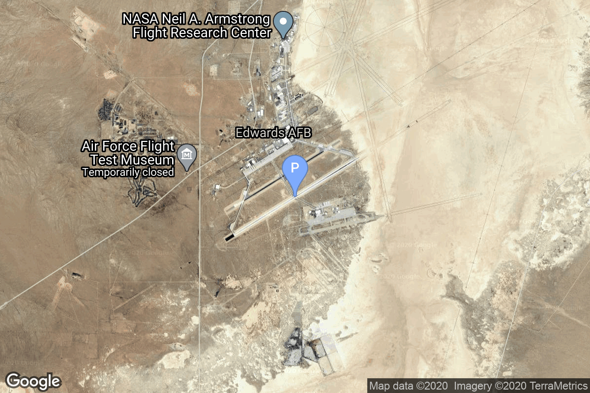
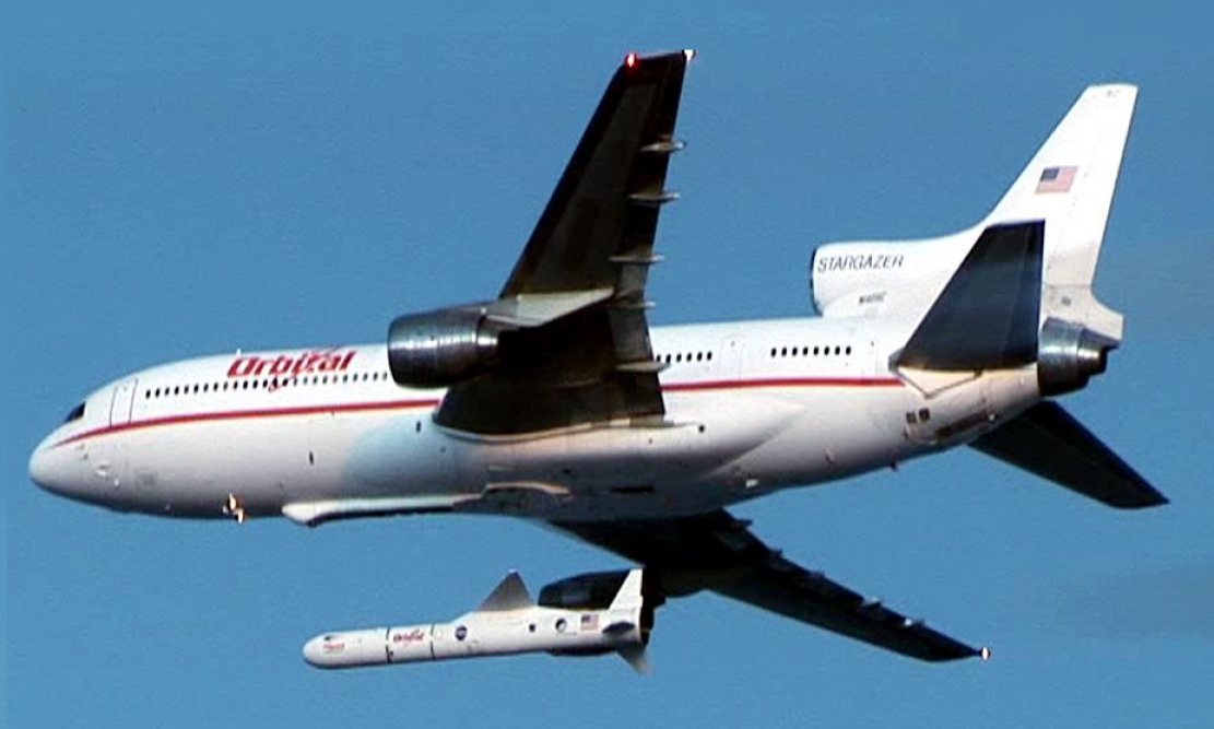
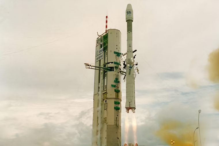
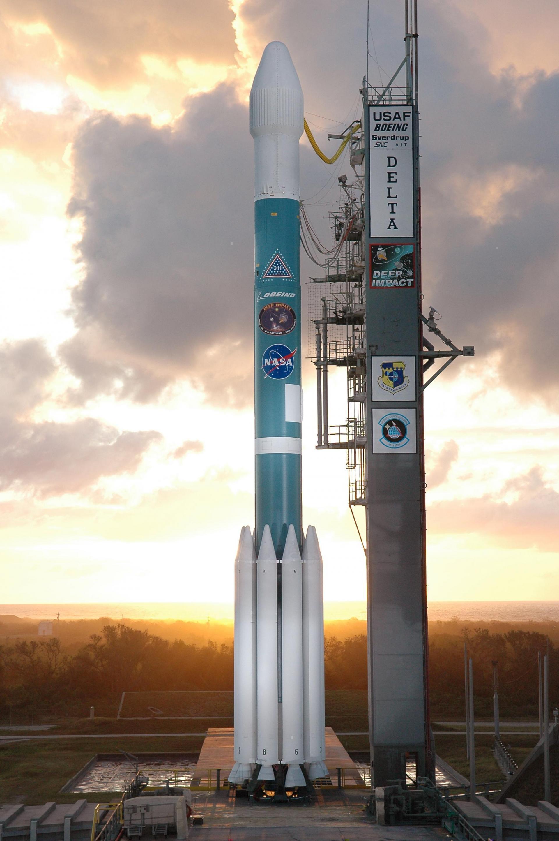
{ "count": 7496, "next": "https://ll.thespacedevs.com/2.2.0/launch/?format=api&limit=10&offset=3790&ordering=-net", "previous": "https://ll.thespacedevs.com/2.2.0/launch/?format=api&limit=10&offset=3770&ordering=-net", "results": [ { "id": "9c6e2c5f-78d6-487d-b880-c184b53e119e", "url": "https://ll.thespacedevs.com/2.2.0/launch/9c6e2c5f-78d6-487d-b880-c184b53e119e/?format=api", "slug": "pegasus-haps-7-microsats", "name": "Pegasus HAPS | 7 microsats", "status": { "id": 3, "name": "Launch Successful", "abbrev": "Success", "description": "The launch vehicle successfully inserted its payload(s) into the target orbit(s)." }, "last_updated": "2023-06-14T03:57:04Z", "net": "1991-07-17T17:33:53Z", "window_end": "1991-07-17T17:33:53Z", "window_start": "1991-07-17T17:33:53Z", "net_precision": null, "probability": -1, "weather_concerns": null, "holdreason": "", "failreason": "", "hashtag": null, "launch_service_provider": { "id": 100, "url": "https://ll.thespacedevs.com/2.2.0/agencies/100/?format=api", "name": "Orbital Sciences Corporation", "type": "Commercial" }, "rocket": { "id": 345, "configuration": { "id": 132, "url": "https://ll.thespacedevs.com/2.2.0/config/launcher/132/?format=api", "name": "Pegasus HAPS", "family": "Pegasus", "full_name": "Pegasus HAPS", "variant": "HAPS" } }, "mission": null, "pad": { "id": 70, "url": "https://ll.thespacedevs.com/2.2.0/pad/70/?format=api", "agency_id": 100, "name": "Edwards Air Force Base", "description": null, "info_url": null, "wiki_url": "https://en.wikipedia.org/wiki/Edwards_Air_Force_Base", "map_url": "https://www.google.com/maps?q=34.905556,-117.883611", "latitude": "34.905556", "longitude": "-117.883611", "location": { "id": 20, "url": "https://ll.thespacedevs.com/2.2.0/location/20/?format=api", "name": "Air launch to orbit", "country_code": "???", "description": "", "map_image": "https://thespacedevs-prod.nyc3.digitaloceanspaces.com/media/map_images/location_20_20200803142433.jpg", "timezone_name": "", "total_launch_count": 51, "total_landing_count": 0 }, "country_code": "USA", "map_image": "https://thespacedevs-prod.nyc3.digitaloceanspaces.com/media/map_images/pad_70_20200803143352.jpg", "total_launch_count": 5, "orbital_launch_attempt_count": 5 }, "webcast_live": false, "image": "https://thespacedevs-prod.nyc3.digitaloceanspaces.com/media/images/pegasus_image_20190830213841.jpg", "infographic": null, "program": [], "orbital_launch_attempt_count": 3650, "location_launch_attempt_count": 2, "pad_launch_attempt_count": 2, "agency_launch_attempt_count": 2, "orbital_launch_attempt_count_year": 3650, "location_launch_attempt_count_year": 1, "pad_launch_attempt_count_year": 1, "agency_launch_attempt_count_year": 1, "type": "normal" }, { "id": "6e25282f-2b54-4930-8d30-da00349dd949", "url": "https://ll.thespacedevs.com/2.2.0/launch/6e25282f-2b54-4930-8d30-da00349dd949/?format=api", "slug": "ariane-40-ers-1", "name": "Ariane 40 | ERS-1", "status": { "id": 3, "name": "Launch Successful", "abbrev": "Success", "description": "The launch vehicle successfully inserted its payload(s) into the target orbit(s)." }, "last_updated": "2023-06-14T04:22:21Z", "net": "1991-07-17T01:46:31Z", "window_end": "1991-07-17T01:46:31Z", "window_start": "1991-07-17T01:46:31Z", "net_precision": null, "probability": null, "weather_concerns": null, "holdreason": "", "failreason": null, "hashtag": null, "launch_service_provider": { "id": 115, "url": "https://ll.thespacedevs.com/2.2.0/agencies/115/?format=api", "name": "Arianespace", "type": "Commercial" }, "rocket": { "id": 6383, "configuration": { "id": 222, "url": "https://ll.thespacedevs.com/2.2.0/config/launcher/222/?format=api", "name": "Ariane 40", "family": "Ariane", "full_name": "Ariane 40", "variant": "40" } }, "mission": { "id": 4773, "name": "ERS-1", "description": "ERS (European Remote Sensing Satellite) are a family of multi-disciplinary Earth Observation Satellites.", "launch_designator": null, "type": "Earth Science", "orbit": { "id": 13, "name": "Polar Orbit", "abbrev": "PO" }, "agencies": [], "info_urls": [], "vid_urls": [] }, "pad": { "id": 124, "url": "https://ll.thespacedevs.com/2.2.0/pad/124/?format=api", "agency_id": 115, "name": "Ariane Launch Area 2", "description": "The ELA-2 pad, built in 1986, had been used for Ariane 4 launches from 1988 until 2003. Before 1988, although purpose-built for Ariane 4, the pad hosted an Ariane-2 and two Ariane-3 launches.", "info_url": null, "wiki_url": "https://en.wikipedia.org/wiki/ELA-2", "map_url": "https://www.google.com/maps?q=5.232,-52.778194", "latitude": "5.232", "longitude": "-52.778194", "location": { "id": 13, "url": "https://ll.thespacedevs.com/2.2.0/location/13/?format=api", "name": "Guiana Space Centre, French Guiana", "country_code": "GUF", "description": "The Guiana Space Centre is a European spaceport to the northwest of Kourou in French Guiana, a region of France in South America. Kourou is located at a latitude of 5°. In operation since 1968, it is a suitable location for a spaceport because of its equatorial location and open sea to the east.", "map_image": "https://thespacedevs-prod.nyc3.digitaloceanspaces.com/media/map_images/location_13_20200803142412.jpg", "timezone_name": "America/Cayenne", "total_launch_count": 325, "total_landing_count": 0 }, "country_code": "GUF", "map_image": "https://thespacedevs-prod.nyc3.digitaloceanspaces.com/media/map_images/pad_124_20200803143241.jpg", "total_launch_count": 119, "orbital_launch_attempt_count": 119 }, "webcast_live": false, "image": "https://thespacedevs-prod.nyc3.digitaloceanspaces.com/media/images/ariane_40_at_el_image_20240401084332.png", "infographic": null, "program": [], "orbital_launch_attempt_count": 3649, "location_launch_attempt_count": 53, "pad_launch_attempt_count": 19, "agency_launch_attempt_count": 43, "orbital_launch_attempt_count_year": 52, "location_launch_attempt_count_year": 4, "pad_launch_attempt_count_year": 4, "agency_launch_attempt_count_year": 4, "type": "normal" }, { "id": "cebe820c-87df-4cbe-ab04-34052e36401d", "url": "https://ll.thespacedevs.com/2.2.0/launch/cebe820c-87df-4cbe-ab04-34052e36401d/?format=api", "slug": "soyuz-u-yantar-4ks1m-1", "name": "Soyuz U | Yantar-4KS1M 1", "status": { "id": 3, "name": "Launch Successful", "abbrev": "Success", "description": "The launch vehicle successfully inserted its payload(s) into the target orbit(s)." }, "last_updated": "2023-06-14T03:41:32Z", "net": "1991-07-10T14:00:00Z", "window_end": "1991-07-10T14:00:00Z", "window_start": "1991-07-10T14:00:00Z", "net_precision": null, "probability": null, "weather_concerns": null, "holdreason": "", "failreason": null, "hashtag": null, "launch_service_provider": { "id": 66, "url": "https://ll.thespacedevs.com/2.2.0/agencies/66/?format=api", "name": "Soviet Space Program", "type": "Government" }, "rocket": { "id": 6382, "configuration": { "id": 37, "url": "https://ll.thespacedevs.com/2.2.0/config/launcher/37/?format=api", "name": "Soyuz U", "family": "Soyuz", "full_name": "Soyuz U", "variant": "" } }, "mission": { "id": 4772, "name": "Yantar-4KS1M 1", "description": "The Neman or Yantar-4KS1M satellites were improved versions of the Terilen elctro-optical reconnaissance satellites. They were transmitting the data via Potok (Geizer) relay satellites.", "launch_designator": null, "type": "Government/Top Secret", "orbit": { "id": 8, "name": "Low Earth Orbit", "abbrev": "LEO" }, "agencies": [], "info_urls": [], "vid_urls": [] }, "pad": { "id": 20, "url": "https://ll.thespacedevs.com/2.2.0/pad/20/?format=api", "agency_id": null, "name": "31/6", "description": "", "info_url": null, "wiki_url": "https://en.wikipedia.org/wiki/Baikonur_Cosmodrome_Site_31", "map_url": "https://www.google.com/maps?q=45.996034,63.564003", "latitude": "45.996034", "longitude": "63.564003", "location": { "id": 15, "url": "https://ll.thespacedevs.com/2.2.0/location/15/?format=api", "name": "Baikonur Cosmodrome, Republic of Kazakhstan", "country_code": "KAZ", "description": "The Baikonur Cosmodrome is a spaceport operated by Russia within Kazakhstan. Located in the Kazakh city of Baikonur, it is the largest operational space launch facility in terms of area. All Russian crewed spaceflights are launched from Baikonur.", "map_image": "https://thespacedevs-prod.nyc3.digitaloceanspaces.com/media/map_images/location_15_20200803142517.jpg", "timezone_name": "Asia/Qyzylorda", "total_launch_count": 1555, "total_landing_count": 0 }, "country_code": "KAZ", "map_image": "https://thespacedevs-prod.nyc3.digitaloceanspaces.com/media/map_images/pad_20_20200803143516.jpg", "total_launch_count": 422, "orbital_launch_attempt_count": 422 }, "webcast_live": false, "image": "https://thespacedevs-prod.nyc3.digitaloceanspaces.com/media/images/soyuz2520u_image_20190222031023.jpeg", "infographic": null, "program": [], "orbital_launch_attempt_count": 3648, "location_launch_attempt_count": 964, "pad_launch_attempt_count": 307, "agency_launch_attempt_count": 2431, "orbital_launch_attempt_count_year": 51, "location_launch_attempt_count_year": 12, "pad_launch_attempt_count_year": 1, "agency_launch_attempt_count_year": 36, "type": "normal" }, { "id": "77941eb8-02ec-4829-86d8-d896eb2319c0", "url": "https://ll.thespacedevs.com/2.2.0/launch/77941eb8-02ec-4829-86d8-d896eb2319c0/?format=api", "slug": "soyuz-u-pvb-zenit-8-99", "name": "Soyuz-U-PVB | Zenit-8 99", "status": { "id": 3, "name": "Launch Successful", "abbrev": "Success", "description": "The launch vehicle successfully inserted its payload(s) into the target orbit(s)." }, "last_updated": "2023-06-14T04:11:11Z", "net": "1991-07-09T09:40:00Z", "window_end": "1991-07-09T09:40:00Z", "window_start": "1991-07-09T09:40:00Z", "net_precision": null, "probability": null, "weather_concerns": null, "holdreason": "", "failreason": null, "hashtag": null, "launch_service_provider": { "id": 66, "url": "https://ll.thespacedevs.com/2.2.0/agencies/66/?format=api", "name": "Soviet Space Program", "type": "Government" }, "rocket": { "id": 6381, "configuration": { "id": 378, "url": "https://ll.thespacedevs.com/2.2.0/config/launcher/378/?format=api", "name": "Soyuz-U-PVB", "family": "Soyuz", "full_name": "Soyuz-U-PVB", "variant": "U-PVB" } }, "mission": { "id": 4771, "name": "Zenit-8 99", "description": "Film-return reconnaissance satellite", "launch_designator": null, "type": "Government/Top Secret", "orbit": { "id": 8, "name": "Low Earth Orbit", "abbrev": "LEO" }, "agencies": [], "info_urls": [], "vid_urls": [] }, "pad": { "id": 85, "url": "https://ll.thespacedevs.com/2.2.0/pad/85/?format=api", "agency_id": 163, "name": "43/4 (43R)", "description": "", "info_url": null, "wiki_url": null, "map_url": "https://www.google.com/maps?q=62.92883,40.457098", "latitude": "62.92883", "longitude": "40.457098", "location": { "id": 6, "url": "https://ll.thespacedevs.com/2.2.0/location/6/?format=api", "name": "Plesetsk Cosmodrome, Russian Federation", "country_code": "RUS", "description": "Plesetsk Cosmodrome is a Russian spaceport located in Mirny, Arkhangelsk Oblast, about 800 km north of Moscow and approximately 200 km south of Arkhangelsk. Originally developed as an ICBM site for the R-7 missile, it also served for numerous satellite launches using the R-7 and other rockets. Its high latitude makes it useful only for certain types of launches, especially the Molniya orbits, so for much of the site's history it functioned as a secondary location, with most orbital launches taking place from Baikonur, in the Kazakh SSR. With the end of the Soviet Union, Baikonur became a foreign territory, and Kazakhstan charged $115 million usage fees annually. Consequently, Plesetsk has seen considerably more activity since the 2000s.", "map_image": "https://thespacedevs-prod.nyc3.digitaloceanspaces.com/media/map_images/location_6_20200803142434.jpg", "timezone_name": "Europe/Moscow", "total_launch_count": 1674, "total_landing_count": 0 }, "country_code": "RUS", "map_image": "https://thespacedevs-prod.nyc3.digitaloceanspaces.com/media/map_images/pad_85_20200803143554.jpg", "total_launch_count": 323, "orbital_launch_attempt_count": 323 }, "webcast_live": false, "image": null, "infographic": null, "program": [], "orbital_launch_attempt_count": 3647, "location_launch_attempt_count": 1367, "pad_launch_attempt_count": 234, "agency_launch_attempt_count": 2430, "orbital_launch_attempt_count_year": 50, "location_launch_attempt_count_year": 24, "pad_launch_attempt_count_year": 3, "agency_launch_attempt_count_year": 35, "type": "normal" }, { "id": "f31158bc-1a89-4a72-b521-627d6e5ab5b8", "url": "https://ll.thespacedevs.com/2.2.0/launch/f31158bc-1a89-4a72-b521-627d6e5ab5b8/?format=api", "slug": "delta-ii-gps-iia-2", "name": "Delta II | GPS IIA-2", "status": { "id": 3, "name": "Launch Successful", "abbrev": "Success", "description": "The launch vehicle successfully inserted its payload(s) into the target orbit(s)." }, "last_updated": "2024-01-02T15:18:57Z", "net": "1991-07-04T02:32:00Z", "window_end": "1991-07-04T02:32:00Z", "window_start": "1991-07-04T02:32:00Z", "net_precision": null, "probability": null, "weather_concerns": null, "holdreason": "", "failreason": "", "hashtag": null, "launch_service_provider": { "id": 161, "url": "https://ll.thespacedevs.com/2.2.0/agencies/161/?format=api", "name": "United States Air Force", "type": "Government" }, "rocket": { "id": 6380, "configuration": { "id": 159, "url": "https://ll.thespacedevs.com/2.2.0/config/launcher/159/?format=api", "name": "Delta II", "family": "Delta", "full_name": "Delta II 7925", "variant": "7925" } }, "mission": { "id": 4770, "name": "GPS IIA-2", "description": "GPS-2A (Global Positioning System) or Navstar-2A (Navigation System using Timing And ranging) are improved satellites of the second generation of the GPS navigation system.", "launch_designator": null, "type": "Navigation", "orbit": { "id": 12, "name": "Medium Earth Orbit", "abbrev": "MEO" }, "agencies": [], "info_urls": [], "vid_urls": [] }, "pad": { "id": 14, "url": "https://ll.thespacedevs.com/2.2.0/pad/14/?format=api", "agency_id": null, "name": "Space Launch Complex 17A", "description": "", "info_url": null, "wiki_url": "https://en.wikipedia.org/wiki/Cape_Canaveral_Space_Launch_Complex_17", "map_url": "https://www.google.com/maps?q=28.4472,-80.565", "latitude": "28.4472", "longitude": "-80.565", "location": { "id": 12, "url": "https://ll.thespacedevs.com/2.2.0/location/12/?format=api", "name": "Cape Canaveral SFS, FL, USA", "country_code": "USA", "description": "Cape Canaveral Space Force Station (CCSFS) is an installation of the United States Space Force's Space Launch Delta 45, located on Cape Canaveral in Brevard County, Florida.", "map_image": "https://thespacedevs-prod.nyc3.digitaloceanspaces.com/media/map_images/location_12_20200803142519.jpg", "timezone_name": "America/New_York", "total_launch_count": 1022, "total_landing_count": 64 }, "country_code": "USA", "map_image": "https://thespacedevs-prod.nyc3.digitaloceanspaces.com/media/map_images/pad_14_20200803143451.jpg", "total_launch_count": 145, "orbital_launch_attempt_count": 145 }, "webcast_live": false, "image": "https://thespacedevs-prod.nyc3.digitaloceanspaces.com/media/images/delta2520ii_image_20190222030440.jpeg", "infographic": null, "program": [ { "id": 29, "url": "https://ll.thespacedevs.com/2.2.0/program/29/?format=api", "name": "Global Positioning System", "description": "The Global Positioning System (GPS), originally Navstar GPS, is a satellite-based radio navigation system owned by the United States government and operated by the United States Space Force. It is one of the global navigation satellite systems (GNSS) that provide geolocation and time information to a GPS receiver anywhere on or near the Earth where there is an unobstructed line of sight to four or more GPS satellites.", "agencies": [ { "id": 1041, "url": "https://ll.thespacedevs.com/2.2.0/agencies/1041/?format=api", "name": "United States Space Force", "type": "Government" } ], "image_url": "https://thespacedevs-prod.nyc3.digitaloceanspaces.com/media/images/global2520posi_program_20231229182501.png", "start_date": "1978-02-22T00:00:00Z", "end_date": null, "info_url": "https://www.gps.gov/", "wiki_url": "https://en.wikipedia.org/wiki/Global_Positioning_System", "mission_patches": [], "type": { "id": 4, "name": "Navigation Constellation" } } ], "orbital_launch_attempt_count": 3646, "location_launch_attempt_count": 448, "pad_launch_attempt_count": 96, "agency_launch_attempt_count": 900, "orbital_launch_attempt_count_year": 49, "location_launch_attempt_count_year": 6, "pad_launch_attempt_count_year": 1, "agency_launch_attempt_count_year": 8, "type": "normal" }, { "id": "079b811a-4c16-451e-91d6-aebcd6b72349", "url": "https://ll.thespacedevs.com/2.2.0/launch/079b811a-4c16-451e-91d6-aebcd6b72349/?format=api", "slug": "proton-gorizont-23", "name": "Proton | Gorizont 23", "status": { "id": 3, "name": "Launch Successful", "abbrev": "Success", "description": "The launch vehicle successfully inserted its payload(s) into the target orbit(s)." }, "last_updated": "2023-06-14T03:34:59Z", "net": "1991-07-01T21:53:00Z", "window_end": "1991-07-01T21:53:00Z", "window_start": "1991-07-01T21:53:00Z", "net_precision": null, "probability": null, "weather_concerns": null, "holdreason": "", "failreason": null, "hashtag": null, "launch_service_provider": { "id": 66, "url": "https://ll.thespacedevs.com/2.2.0/agencies/66/?format=api", "name": "Soviet Space Program", "type": "Government" }, "rocket": { "id": 6379, "configuration": { "id": 80, "url": "https://ll.thespacedevs.com/2.2.0/config/launcher/80/?format=api", "name": "Proton", "family": "Proton / UR-500", "full_name": "Proton K/DM-2", "variant": "K/DM-2" } }, "mission": { "id": 4769, "name": "Gorizont 23", "description": "Geostationary communications satellite", "launch_designator": null, "type": "Communications", "orbit": { "id": 1, "name": "Geostationary Orbit", "abbrev": "Direct-GEO" }, "agencies": [], "info_urls": [], "vid_urls": [] }, "pad": { "id": 15, "url": "https://ll.thespacedevs.com/2.2.0/pad/15/?format=api", "agency_id": null, "name": "200/39 (200L)", "description": null, "info_url": null, "wiki_url": "", "map_url": "https://www.google.com/maps?q=46.039984,63.032093", "latitude": "46.039984", "longitude": "63.032093", "location": { "id": 15, "url": "https://ll.thespacedevs.com/2.2.0/location/15/?format=api", "name": "Baikonur Cosmodrome, Republic of Kazakhstan", "country_code": "KAZ", "description": "The Baikonur Cosmodrome is a spaceport operated by Russia within Kazakhstan. Located in the Kazakh city of Baikonur, it is the largest operational space launch facility in terms of area. All Russian crewed spaceflights are launched from Baikonur.", "map_image": "https://thespacedevs-prod.nyc3.digitaloceanspaces.com/media/map_images/location_15_20200803142517.jpg", "timezone_name": "Asia/Qyzylorda", "total_launch_count": 1555, "total_landing_count": 0 }, "country_code": "KAZ", "map_image": "https://thespacedevs-prod.nyc3.digitaloceanspaces.com/media/map_images/pad_15_20200803143530.jpg", "total_launch_count": 167, "orbital_launch_attempt_count": 167 }, "webcast_live": false, "image": "https://thespacedevs-prod.nyc3.digitaloceanspaces.com/media/images/proton_image_20231231095535.jpg", "infographic": null, "program": [], "orbital_launch_attempt_count": 3645, "location_launch_attempt_count": 963, "pad_launch_attempt_count": 62, "agency_launch_attempt_count": 2429, "orbital_launch_attempt_count_year": 48, "location_launch_attempt_count_year": 11, "pad_launch_attempt_count_year": 3, "agency_launch_attempt_count_year": 34, "type": "normal" }, { "id": "f6087d84-0a55-4f13-b0eb-9f8de315a7bb", "url": "https://ll.thespacedevs.com/2.2.0/launch/f6087d84-0a55-4f13-b0eb-9f8de315a7bb/?format=api", "slug": "scout-g-1-rex", "name": "Scout G-1 | REX", "status": { "id": 3, "name": "Launch Successful", "abbrev": "Success", "description": "The launch vehicle successfully inserted its payload(s) into the target orbit(s)." }, "last_updated": "2023-06-14T04:25:51Z", "net": "1991-06-29T14:00:00Z", "window_end": "1991-06-29T14:00:00Z", "window_start": "1991-06-29T14:00:00Z", "net_precision": null, "probability": null, "weather_concerns": null, "holdreason": "", "failreason": null, "hashtag": null, "launch_service_provider": { "id": 161, "url": "https://ll.thespacedevs.com/2.2.0/agencies/161/?format=api", "name": "United States Air Force", "type": "Government" }, "rocket": { "id": 6378, "configuration": { "id": 363, "url": "https://ll.thespacedevs.com/2.2.0/config/launcher/363/?format=api", "name": "Scout G-1", "family": "Scout", "full_name": "Scout G-1", "variant": "G-1" } }, "mission": { "id": 4768, "name": "REX", "description": "REX (Radiation Experiment) or ISES (Integrated Space Experiment System) was an Air Force Rome Laboratory ionospheric research satellite which tested the effects of the atmosphere on radio transmissions, and employed GPS for on-board navigation and attitude control.", "launch_designator": null, "type": "Earth Science", "orbit": { "id": 13, "name": "Polar Orbit", "abbrev": "PO" }, "agencies": [], "info_urls": [], "vid_urls": [] }, "pad": { "id": 154, "url": "https://ll.thespacedevs.com/2.2.0/pad/154/?format=api", "agency_id": null, "name": "Space Launch Complex 5", "description": "Space Launch Complex 5 (SLC-5) was a launch pad at Vandenberg Space Force Base in California, United States. It was previously part of the Point Arguello Naval Air Station, during which time it was designated Launch Complex D or LC-D. Constructed in 1961, it was used by 69 Scout launch vehicles between 1962 and 1994.", "info_url": "http://www.astronautix.com/v/vandenbergslc5.html", "wiki_url": "https://en.wikipedia.org/wiki/Vandenberg_Air_Force_Base_Space_Launch_Complex_5", "map_url": "https://www.google.com/maps?q=34.6080,-120.6247", "latitude": "34.608", "longitude": "-120.6247", "location": { "id": 11, "url": "https://ll.thespacedevs.com/2.2.0/location/11/?format=api", "name": "Vandenberg SFB, CA, USA", "country_code": "USA", "description": "Vandenberg Space Force Base is a United States Space Force Base in Santa Barbara County, California. Established in 1941, Vandenberg Space Force Base is a space launch base, launching spacecraft from the Western Range, and also performs missile testing. The United States Space Force's Space Launch Delta 30 serves as the host delta for the base, equivalent to an Air Force air base wing. In addition to its military space launch mission, Vandenberg Space Force Base also hosts space launches for civil and commercial space entities, such as NASA and SpaceX.", "map_image": "https://thespacedevs-prod.nyc3.digitaloceanspaces.com/media/map_images/location_11_20200803142416.jpg", "timezone_name": "America/Los_Angeles", "total_launch_count": 806, "total_landing_count": 26 }, "country_code": "USA", "map_image": "https://thespacedevs-prod.nyc3.digitaloceanspaces.com/media/map_images/pad_154_20200803143408.jpg", "total_launch_count": 69, "orbital_launch_attempt_count": 69 }, "webcast_live": false, "image": null, "infographic": null, "program": [], "orbital_launch_attempt_count": 3644, "location_launch_attempt_count": 547, "pad_launch_attempt_count": 65, "agency_launch_attempt_count": 899, "orbital_launch_attempt_count_year": 47, "location_launch_attempt_count_year": 3, "pad_launch_attempt_count_year": 1, "agency_launch_attempt_count_year": 7, "type": "normal" }, { "id": "1879a4bb-c0f4-4da5-b267-b267405dd2d9", "url": "https://ll.thespacedevs.com/2.2.0/launch/1879a4bb-c0f4-4da5-b267-b267405dd2d9/?format=api", "slug": "soyuz-u-pvb-resurs-f-11", "name": "Soyuz-U-PVB | Resurs-F 11", "status": { "id": 3, "name": "Launch Successful", "abbrev": "Success", "description": "The launch vehicle successfully inserted its payload(s) into the target orbit(s)." }, "last_updated": "2023-06-14T03:51:30Z", "net": "1991-06-28T08:09:59Z", "window_end": "1991-06-28T08:09:59Z", "window_start": "1991-06-28T08:09:59Z", "net_precision": null, "probability": null, "weather_concerns": null, "holdreason": "", "failreason": null, "hashtag": null, "launch_service_provider": { "id": 66, "url": "https://ll.thespacedevs.com/2.2.0/agencies/66/?format=api", "name": "Soviet Space Program", "type": "Government" }, "rocket": { "id": 6377, "configuration": { "id": 378, "url": "https://ll.thespacedevs.com/2.2.0/config/launcher/378/?format=api", "name": "Soyuz-U-PVB", "family": "Soyuz", "full_name": "Soyuz-U-PVB", "variant": "U-PVB" } }, "mission": { "id": 4767, "name": "Resurs-F 11", "description": "Film-return Earth observation satellite", "launch_designator": null, "type": "Earth Science", "orbit": { "id": 8, "name": "Low Earth Orbit", "abbrev": "LEO" }, "agencies": [], "info_urls": [], "vid_urls": [] }, "pad": { "id": 36, "url": "https://ll.thespacedevs.com/2.2.0/pad/36/?format=api", "agency_id": 163, "name": "43/3 (43L)", "description": "", "info_url": null, "wiki_url": null, "map_url": "https://www.google.com/maps?q=62.9273,40.45", "latitude": "62.9273", "longitude": "40.45", "location": { "id": 6, "url": "https://ll.thespacedevs.com/2.2.0/location/6/?format=api", "name": "Plesetsk Cosmodrome, Russian Federation", "country_code": "RUS", "description": "Plesetsk Cosmodrome is a Russian spaceport located in Mirny, Arkhangelsk Oblast, about 800 km north of Moscow and approximately 200 km south of Arkhangelsk. Originally developed as an ICBM site for the R-7 missile, it also served for numerous satellite launches using the R-7 and other rockets. Its high latitude makes it useful only for certain types of launches, especially the Molniya orbits, so for much of the site's history it functioned as a secondary location, with most orbital launches taking place from Baikonur, in the Kazakh SSR. With the end of the Soviet Union, Baikonur became a foreign territory, and Kazakhstan charged $115 million usage fees annually. Consequently, Plesetsk has seen considerably more activity since the 2000s.", "map_image": "https://thespacedevs-prod.nyc3.digitaloceanspaces.com/media/map_images/location_6_20200803142434.jpg", "timezone_name": "Europe/Moscow", "total_launch_count": 1674, "total_landing_count": 0 }, "country_code": "RUS", "map_image": "https://thespacedevs-prod.nyc3.digitaloceanspaces.com/media/map_images/pad_36_20200803143534.jpg", "total_launch_count": 230, "orbital_launch_attempt_count": 230 }, "webcast_live": false, "image": null, "infographic": null, "program": [], "orbital_launch_attempt_count": 3643, "location_launch_attempt_count": 1366, "pad_launch_attempt_count": 180, "agency_launch_attempt_count": 2428, "orbital_launch_attempt_count_year": 46, "location_launch_attempt_count_year": 23, "pad_launch_attempt_count_year": 4, "agency_launch_attempt_count_year": 33, "type": "normal" }, { "id": "f7034397-80d8-416b-a3fc-c65341033524", "url": "https://ll.thespacedevs.com/2.2.0/launch/f7034397-80d8-416b-a3fc-c65341033524/?format=api", "slug": "kosmos-3m-taifun-2-26", "name": "Kosmos-3M | Taifun-2 26", "status": { "id": 4, "name": "Launch Failure", "abbrev": "Failure", "description": "Either the launch vehicle did not reach orbit, or the payload(s) failed to separate." }, "last_updated": "2023-06-14T03:43:51Z", "net": "1991-06-25T13:20:00Z", "window_end": "1991-06-25T13:20:00Z", "window_start": "1991-06-25T13:20:00Z", "net_precision": null, "probability": null, "weather_concerns": null, "holdreason": "", "failreason": null, "hashtag": null, "launch_service_provider": { "id": 66, "url": "https://ll.thespacedevs.com/2.2.0/agencies/66/?format=api", "name": "Soviet Space Program", "type": "Government" }, "rocket": { "id": 6376, "configuration": { "id": 102, "url": "https://ll.thespacedevs.com/2.2.0/config/launcher/102/?format=api", "name": "Kosmos-3M", "family": "Kosmos", "full_name": "Kosmos-3M (11K65M)", "variant": "-3M" } }, "mission": { "id": 4766, "name": "Taifun-2 26", "description": "Taifun-2 satellite used to release up to 24 subsatellites for radar and sensor calibration", "launch_designator": null, "type": "Test Target", "orbit": { "id": 8, "name": "Low Earth Orbit", "abbrev": "LEO" }, "agencies": [], "info_urls": [], "vid_urls": [] }, "pad": { "id": 28, "url": "https://ll.thespacedevs.com/2.2.0/pad/28/?format=api", "agency_id": 163, "name": "132/1 (132L)", "description": null, "info_url": null, "wiki_url": "", "map_url": "https://www.google.com/maps?q=62.883229,40.868549", "latitude": "62.883229", "longitude": "40.868549", "location": { "id": 6, "url": "https://ll.thespacedevs.com/2.2.0/location/6/?format=api", "name": "Plesetsk Cosmodrome, Russian Federation", "country_code": "RUS", "description": "Plesetsk Cosmodrome is a Russian spaceport located in Mirny, Arkhangelsk Oblast, about 800 km north of Moscow and approximately 200 km south of Arkhangelsk. Originally developed as an ICBM site for the R-7 missile, it also served for numerous satellite launches using the R-7 and other rockets. Its high latitude makes it useful only for certain types of launches, especially the Molniya orbits, so for much of the site's history it functioned as a secondary location, with most orbital launches taking place from Baikonur, in the Kazakh SSR. With the end of the Soviet Union, Baikonur became a foreign territory, and Kazakhstan charged $115 million usage fees annually. Consequently, Plesetsk has seen considerably more activity since the 2000s.", "map_image": "https://thespacedevs-prod.nyc3.digitaloceanspaces.com/media/map_images/location_6_20200803142434.jpg", "timezone_name": "Europe/Moscow", "total_launch_count": 1674, "total_landing_count": 0 }, "country_code": "RUS", "map_image": "https://thespacedevs-prod.nyc3.digitaloceanspaces.com/media/map_images/pad_28_20200803143254.jpg", "total_launch_count": 212, "orbital_launch_attempt_count": 212 }, "webcast_live": false, "image": null, "infographic": null, "program": [], "orbital_launch_attempt_count": 3642, "location_launch_attempt_count": 1365, "pad_launch_attempt_count": 163, "agency_launch_attempt_count": 2427, "orbital_launch_attempt_count_year": 45, "location_launch_attempt_count_year": 22, "pad_launch_attempt_count_year": 3, "agency_launch_attempt_count_year": 32, "type": "normal" }, { "id": "b7fce3e3-7c2b-4d93-bea8-22e6bd0c5f91", "url": "https://ll.thespacedevs.com/2.2.0/launch/b7fce3e3-7c2b-4d93-bea8-22e6bd0c5f91/?format=api", "slug": "molniya-m-molniya-1t-81", "name": "Molniya-M | Molniya-1T 81", "status": { "id": 3, "name": "Launch Successful", "abbrev": "Success", "description": "The launch vehicle successfully inserted its payload(s) into the target orbit(s)." }, "last_updated": "2023-06-14T04:10:55Z", "net": "1991-06-18T09:09:00Z", "window_end": "1991-06-18T09:09:00Z", "window_start": "1991-06-18T09:09:00Z", "net_precision": null, "probability": null, "weather_concerns": null, "holdreason": "", "failreason": null, "hashtag": null, "launch_service_provider": { "id": 66, "url": "https://ll.thespacedevs.com/2.2.0/agencies/66/?format=api", "name": "Soviet Space Program", "type": "Government" }, "rocket": { "id": 6375, "configuration": { "id": 106, "url": "https://ll.thespacedevs.com/2.2.0/config/launcher/106/?format=api", "name": "Molniya-M", "family": "R-7", "full_name": "Molniya-M 2BL", "variant": "2BL" } }, "mission": { "id": 4765, "name": "Molniya-1T 81", "description": "Military communications satellite in a highly elliptic orbit", "launch_designator": null, "type": "Communications", "orbit": { "id": 0, "name": "Elliptical Orbit", "abbrev": "Elliptical" }, "agencies": [], "info_urls": [], "vid_urls": [] }, "pad": { "id": 85, "url": "https://ll.thespacedevs.com/2.2.0/pad/85/?format=api", "agency_id": 163, "name": "43/4 (43R)", "description": "", "info_url": null, "wiki_url": null, "map_url": "https://www.google.com/maps?q=62.92883,40.457098", "latitude": "62.92883", "longitude": "40.457098", "location": { "id": 6, "url": "https://ll.thespacedevs.com/2.2.0/location/6/?format=api", "name": "Plesetsk Cosmodrome, Russian Federation", "country_code": "RUS", "description": "Plesetsk Cosmodrome is a Russian spaceport located in Mirny, Arkhangelsk Oblast, about 800 km north of Moscow and approximately 200 km south of Arkhangelsk. Originally developed as an ICBM site for the R-7 missile, it also served for numerous satellite launches using the R-7 and other rockets. Its high latitude makes it useful only for certain types of launches, especially the Molniya orbits, so for much of the site's history it functioned as a secondary location, with most orbital launches taking place from Baikonur, in the Kazakh SSR. With the end of the Soviet Union, Baikonur became a foreign territory, and Kazakhstan charged $115 million usage fees annually. Consequently, Plesetsk has seen considerably more activity since the 2000s.", "map_image": "https://thespacedevs-prod.nyc3.digitaloceanspaces.com/media/map_images/location_6_20200803142434.jpg", "timezone_name": "Europe/Moscow", "total_launch_count": 1674, "total_landing_count": 0 }, "country_code": "RUS", "map_image": "https://thespacedevs-prod.nyc3.digitaloceanspaces.com/media/map_images/pad_85_20200803143554.jpg", "total_launch_count": 323, "orbital_launch_attempt_count": 323 }, "webcast_live": false, "image": null, "infographic": null, "program": [], "orbital_launch_attempt_count": 3641, "location_launch_attempt_count": 1364, "pad_launch_attempt_count": 233, "agency_launch_attempt_count": 2426, "orbital_launch_attempt_count_year": 44, "location_launch_attempt_count_year": 21, "pad_launch_attempt_count_year": 2, "agency_launch_attempt_count_year": 31, "type": "normal" } ] }