Launch List
AN API endpoint that returns all Launch objects or a single launch.
EXAMPLE - /launch/[id]/ or /launch/?mode=list&search=SpaceX
GET Return a list of all Launch objects.
FILTERS Fields - 'name', 'id(s)', 'lsp__id', 'lsp__name', 'serial_number', 'launcher_config__id', 'rocket__spacecraftflight__spacecraft__name', 'is_crewed', 'include_suborbital', 'spacecraft_config__ids', 'related', 'location__ids', 'lsp__ids', 'pad__ids', 'status__ids'
MODE 'normal', 'list', 'detailed'
EXAMPLE ?mode=list
SEARCH Searches through the launch name, rocket name, launch agency, mission name & spacecraft name.
EXAMPLE - ?search=SpaceX
GET /2.2.0/launch/?format=api&offset=3570&ordering=-net
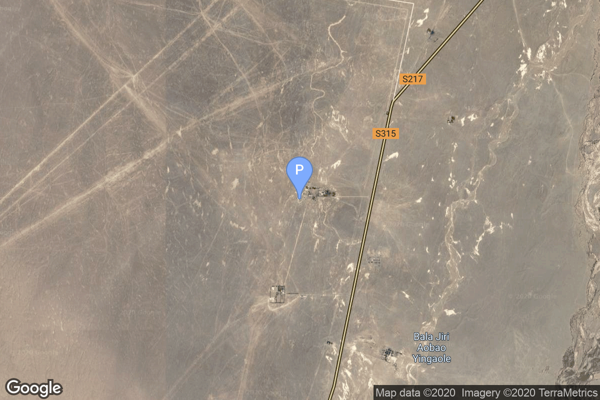
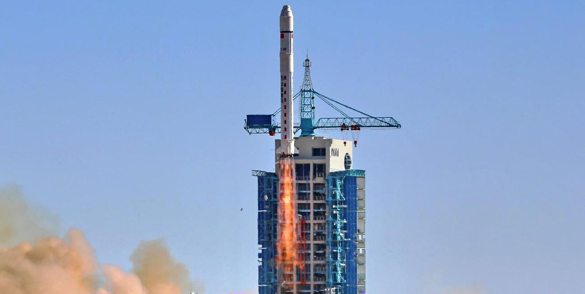
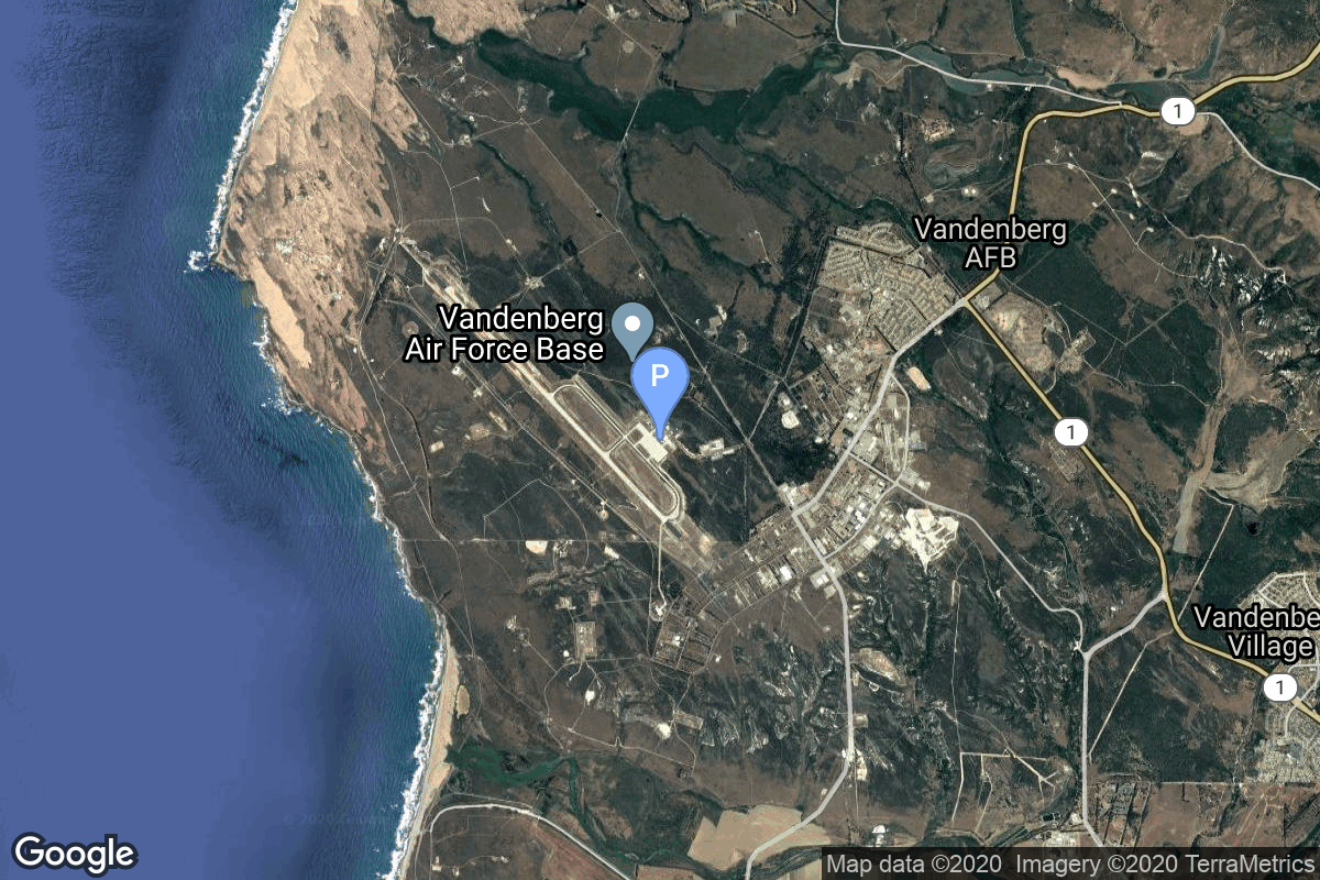
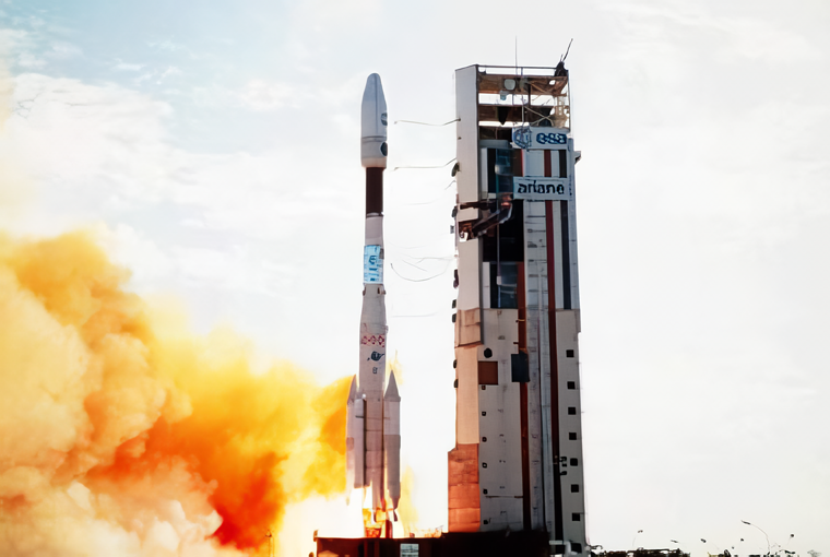
{ "count": 7544, "next": "https://ll.thespacedevs.com/2.2.0/launch/?format=api&limit=10&offset=3580&ordering=-net", "previous": "https://ll.thespacedevs.com/2.2.0/launch/?format=api&limit=10&offset=3560&ordering=-net", "results": [ { "id": "972d6117-be5b-4897-a851-bf8618d64651", "url": "https://ll.thespacedevs.com/2.2.0/launch/972d6117-be5b-4897-a851-bf8618d64651/?format=api", "slug": "long-march-2d-fanhui-shi-weixing-16", "name": "Long March 2D | Fanhui Shi Weixing (16)", "status": { "id": 3, "name": "Launch Successful", "abbrev": "Success", "description": "The launch vehicle successfully inserted its payload(s) into the target orbit(s)." }, "last_updated": "2023-06-14T15:48:03Z", "net": "1994-07-03T08:00:00Z", "window_end": "1994-07-03T08:00:00Z", "window_start": "1994-07-03T08:00:00Z", "net_precision": null, "probability": null, "weather_concerns": null, "holdreason": "", "failreason": null, "hashtag": null, "launch_service_provider": { "id": 189, "url": "https://ll.thespacedevs.com/2.2.0/agencies/189/?format=api", "name": "China Aerospace Corporation", "type": "Government" }, "rocket": { "id": 6594, "configuration": { "id": 17, "url": "https://ll.thespacedevs.com/2.2.0/config/launcher/17/?format=api", "name": "Long March 2D", "family": "Long March", "full_name": "Long March 2D", "variant": "2D" } }, "mission": { "id": 4984, "name": "Fanhui Shi Weixing (16)", "description": "The FSW-2 (Fanhui Shi Weixing) or JB-1B series was the second series of chinese recoverable satellites. These satellites feature cameras for Earth observation.", "launch_designator": null, "type": "Government/Top Secret", "orbit": { "id": 8, "name": "Low Earth Orbit", "abbrev": "LEO" }, "agencies": [], "info_urls": [], "vid_urls": [] }, "pad": { "id": 143, "url": "https://ll.thespacedevs.com/2.2.0/pad/143/?format=api", "agency_id": null, "name": "Launch Area 2B", "description": null, "info_url": null, "wiki_url": "https://en.wikipedia.org/wiki/Jiuquan_Satellite_Launch_Center", "map_url": "https://www.google.com/maps?q=41.306143,100.313229", "latitude": "41.306143", "longitude": "100.313229", "location": { "id": 17, "url": "https://ll.thespacedevs.com/2.2.0/location/17/?format=api", "name": "Jiuquan Satellite Launch Center, People's Republic of China", "country_code": "CHN", "description": "Jiuquan Satellite Launch Center is a Chinese spaceport located between the Ejin, Alxa, Inner Mongolia and Hangtian Town, Jinta County, Jiuquan, Gansu Province. It is part of the Dongfeng Aerospace City (Base 10).", "map_image": "https://thespacedevs-prod.nyc3.digitaloceanspaces.com/media/map_images/location_17_20200803142429.jpg", "timezone_name": "Asia/Shanghai", "total_launch_count": 253, "total_landing_count": 0 }, "country_code": "CHN", "map_image": "https://thespacedevs-prod.nyc3.digitaloceanspaces.com/media/map_images/pad_143_20200803143313.jpg", "total_launch_count": 26, "orbital_launch_attempt_count": 26 }, "webcast_live": false, "image": "https://thespacedevs-prod.nyc3.digitaloceanspaces.com/media/images/long2520march25202d_image_20190222031211.jpeg", "infographic": null, "program": [], "orbital_launch_attempt_count": 3908, "location_launch_attempt_count": 27, "pad_launch_attempt_count": 25, "agency_launch_attempt_count": 3, "orbital_launch_attempt_count_year": 40, "location_launch_attempt_count_year": 1, "pad_launch_attempt_count_year": 1, "agency_launch_attempt_count_year": 2, "type": "normal" }, { "id": "f2f7a10f-4c1d-4d90-9734-091399d4797a", "url": "https://ll.thespacedevs.com/2.2.0/launch/f2f7a10f-4c1d-4d90-9734-091399d4797a/?format=api", "slug": "soyuz-u2-soyuz-tm-19", "name": "Soyuz-U2 | Soyuz TM-19", "status": { "id": 3, "name": "Launch Successful", "abbrev": "Success", "description": "The launch vehicle successfully inserted its payload(s) into the target orbit(s)." }, "last_updated": "2023-06-14T08:41:44Z", "net": "1994-07-01T12:24:50Z", "window_end": "1994-07-01T12:24:50Z", "window_start": "1994-07-01T12:24:50Z", "net_precision": null, "probability": -1, "weather_concerns": null, "holdreason": "", "failreason": null, "hashtag": null, "launch_service_provider": { "id": 63, "url": "https://ll.thespacedevs.com/2.2.0/agencies/63/?format=api", "name": "Russian Federal Space Agency (ROSCOSMOS)", "type": "Government" }, "rocket": { "id": 378, "configuration": { "id": 101, "url": "https://ll.thespacedevs.com/2.2.0/config/launcher/101/?format=api", "name": "Soyuz-U", "family": "", "full_name": "Soyuz-U2", "variant": "2" } }, "mission": { "id": 361, "name": "Soyuz TM-19", "description": "Soyuz TM-19 was the 19th mission and the 16th long-duration expedition to Mir space station. The mission began on July 1, 1994, 12:24:50 UTC, launching Commander Yuri Malenchenko and Flight Engineer Talgat Musabayev into orbit. They docked with Mir two days later. During their stay there, cosmonauts performed two EVAs, carried out various scientific experiments in medicine, material sciences, astrophysics etc. Station crew was visited by several Progress resupply spacecrafts, and welcomed aboard the Soyuz TM-20 crew.\nThe mission concluded with a safe landing back on Earth on November 4, 1994, 11:18:26 UTC.", "launch_designator": null, "type": "Human Exploration", "orbit": { "id": 8, "name": "Low Earth Orbit", "abbrev": "LEO" }, "agencies": [], "info_urls": [], "vid_urls": [] }, "pad": { "id": 32, "url": "https://ll.thespacedevs.com/2.2.0/pad/32/?format=api", "agency_id": null, "name": "1/5", "description": null, "info_url": null, "wiki_url": "", "map_url": "https://www.google.com/maps?q=45.92,63.342", "latitude": "45.92", "longitude": "63.342", "location": { "id": 15, "url": "https://ll.thespacedevs.com/2.2.0/location/15/?format=api", "name": "Baikonur Cosmodrome, Republic of Kazakhstan", "country_code": "KAZ", "description": "The Baikonur Cosmodrome is a spaceport operated by Russia within Kazakhstan. Located in the Kazakh city of Baikonur, it is the largest operational space launch facility in terms of area. All Russian crewed spaceflights are launched from Baikonur.", "map_image": "https://thespacedevs-prod.nyc3.digitaloceanspaces.com/media/map_images/location_15_20200803142517.jpg", "timezone_name": "Asia/Qyzylorda", "total_launch_count": 1556, "total_landing_count": 0 }, "country_code": "KAZ", "map_image": "https://thespacedevs-prod.nyc3.digitaloceanspaces.com/media/map_images/pad_32_20200803143513.jpg", "total_launch_count": 487, "orbital_launch_attempt_count": 487 }, "webcast_live": false, "image": "https://thespacedevs-prod.nyc3.digitaloceanspaces.com/media/images/soyuz-u_image_20191229074852.jpg", "infographic": null, "program": [ { "id": 16, "url": "https://ll.thespacedevs.com/2.2.0/program/16/?format=api", "name": "Mir", "description": "Mir was a space station that operated in low Earth orbit from 1986 to 2001, operated by the Soviet Union and later by Russia. Mir was the first modular space station and was assembled in orbit from 1986 to 1996.", "agencies": [ { "id": 63, "url": "https://ll.thespacedevs.com/2.2.0/agencies/63/?format=api", "name": "Russian Federal Space Agency (ROSCOSMOS)", "type": "Government" }, { "id": 66, "url": "https://ll.thespacedevs.com/2.2.0/agencies/66/?format=api", "name": "Soviet Space Program", "type": "Government" } ], "image_url": "https://thespacedevs-prod.nyc3.digitaloceanspaces.com/media/images/mir_program_20200821092345.jpeg", "start_date": "1986-02-20T21:28:23Z", "end_date": "2001-03-23T05:59:00Z", "info_url": null, "wiki_url": "https://en.wikipedia.org/wiki/Mir", "mission_patches": [], "type": { "id": 2, "name": "Human Spaceflight" } }, { "id": 8, "url": "https://ll.thespacedevs.com/2.2.0/program/8/?format=api", "name": "Soyuz", "description": "The Soyuz programme is a human spaceflight programme initiated by the Soviet Union in the early 1960s. The Soyuz spacecraft was originally part of a Moon landing project intended to put a Soviet cosmonaut on the Moon. It was the third Soviet human spaceflight programme after the Vostok and Voskhod programmes.", "agencies": [ { "id": 63, "url": "https://ll.thespacedevs.com/2.2.0/agencies/63/?format=api", "name": "Russian Federal Space Agency (ROSCOSMOS)", "type": "Government" }, { "id": 66, "url": "https://ll.thespacedevs.com/2.2.0/agencies/66/?format=api", "name": "Soviet Space Program", "type": "Government" } ], "image_url": "https://thespacedevs-prod.nyc3.digitaloceanspaces.com/media/images/soyuz_program_20201129185543.png", "start_date": "1966-11-28T11:02:00Z", "end_date": null, "info_url": null, "wiki_url": "https://en.wikipedia.org/wiki/Soyuz_programme", "mission_patches": [], "type": { "id": 2, "name": "Human Spaceflight" } } ], "orbital_launch_attempt_count": 3907, "location_launch_attempt_count": 1031, "pad_launch_attempt_count": 325, "agency_launch_attempt_count": 37, "orbital_launch_attempt_count_year": 39, "location_launch_attempt_count_year": 12, "pad_launch_attempt_count_year": 5, "agency_launch_attempt_count_year": 7, "type": "normal" }, { "id": "fd608f82-d496-454e-957e-6350ee9e1a41", "url": "https://ll.thespacedevs.com/2.2.0/launch/fd608f82-d496-454e-957e-6350ee9e1a41/?format=api", "slug": "pegasus-xl-space-test-experiments-platform-1-step", "name": "Pegasus XL | Space Test Experiments Platform 1 (STEP-1)", "status": { "id": 4, "name": "Launch Failure", "abbrev": "Failure", "description": "Either the launch vehicle did not reach orbit, or the payload(s) failed to separate." }, "last_updated": "2023-06-14T03:55:14Z", "net": "1994-06-27T21:15:00Z", "window_end": "1994-06-27T21:15:00Z", "window_start": "1994-06-27T21:15:00Z", "net_precision": null, "probability": -1, "weather_concerns": null, "holdreason": "", "failreason": "Flight termination after loss of vehicle control 35 seconds into flight", "hashtag": null, "launch_service_provider": { "id": 100, "url": "https://ll.thespacedevs.com/2.2.0/agencies/100/?format=api", "name": "Orbital Sciences Corporation", "type": "Commercial" }, "rocket": { "id": 376, "configuration": { "id": 173, "url": "https://ll.thespacedevs.com/2.2.0/config/launcher/173/?format=api", "name": "Pegasus XL", "family": "Pegasus", "full_name": "Pegasus XL", "variant": "" } }, "mission": null, "pad": { "id": 62, "url": "https://ll.thespacedevs.com/2.2.0/pad/62/?format=api", "agency_id": null, "name": "Vandenberg Space Force Base", "description": null, "info_url": null, "wiki_url": "https://en.wikipedia.org/wiki/Vandenberg_Space_Force_Base", "map_url": "https://www.google.com/maps?q=34.732778,-120.568056", "latitude": "34.732778", "longitude": "-120.568056", "location": { "id": 20, "url": "https://ll.thespacedevs.com/2.2.0/location/20/?format=api", "name": "Air launch to orbit", "country_code": "???", "description": "", "map_image": "https://thespacedevs-prod.nyc3.digitaloceanspaces.com/media/map_images/location_20_20200803142433.jpg", "timezone_name": "", "total_launch_count": 51, "total_landing_count": 0 }, "country_code": "USA", "map_image": "https://thespacedevs-prod.nyc3.digitaloceanspaces.com/media/map_images/pad_62_20200803143441.jpg", "total_launch_count": 22, "orbital_launch_attempt_count": 22 }, "webcast_live": false, "image": "https://thespacedevs-prod.nyc3.digitaloceanspaces.com/media/images/pegasus_xl_moun_image_20240307124328.jpeg", "infographic": null, "program": [], "orbital_launch_attempt_count": 3906, "location_launch_attempt_count": 6, "pad_launch_attempt_count": 1, "agency_launch_attempt_count": 7, "orbital_launch_attempt_count_year": 3906, "location_launch_attempt_count_year": 2, "pad_launch_attempt_count_year": 1, "agency_launch_attempt_count_year": 3, "type": "normal" }, { "id": "cb664392-548f-4743-bb68-e32f420b8666", "url": "https://ll.thespacedevs.com/2.2.0/launch/cb664392-548f-4743-bb68-e32f420b8666/?format=api", "slug": "atlas-i-uhf-fo-f3", "name": "Atlas I | UHF F/O F3", "status": { "id": 3, "name": "Launch Successful", "abbrev": "Success", "description": "The launch vehicle successfully inserted its payload(s) into the target orbit(s)." }, "last_updated": "2023-06-14T17:39:57Z", "net": "1994-06-24T13:50:02Z", "window_end": "1994-06-24T13:50:02Z", "window_start": "1994-06-24T13:50:02Z", "net_precision": null, "probability": null, "weather_concerns": null, "holdreason": "", "failreason": null, "hashtag": null, "launch_service_provider": { "id": 106, "url": "https://ll.thespacedevs.com/2.2.0/agencies/106/?format=api", "name": "General Dynamics", "type": "Commercial" }, "rocket": { "id": 6593, "configuration": { "id": 252, "url": "https://ll.thespacedevs.com/2.2.0/config/launcher/252/?format=api", "name": "Atlas I", "family": "Atlas", "full_name": "Atlas I", "variant": "I" } }, "mission": { "id": 4983, "name": "UHF F/O F3", "description": "The U.S. Navy began replacing and upgrading its ultra-high frequency (UHF) satellite communications network during the 1990s with a constellation of customized satellites built by Hughes Space and Communications Company. Known as the UFO (Ultra High Frequency Follow On) series, these HS-601 model satellites support the Navy's global communications network, serving ships at sea and a variety of other U.S. military fixed and mobile terminals.", "launch_designator": null, "type": "Communications", "orbit": { "id": 1, "name": "Geostationary Orbit", "abbrev": "Direct-GEO" }, "agencies": [], "info_urls": [], "vid_urls": [] }, "pad": { "id": 122, "url": "https://ll.thespacedevs.com/2.2.0/pad/122/?format=api", "agency_id": 161, "name": "Launch Complex 36B", "description": null, "info_url": null, "wiki_url": "https://en.wikipedia.org/wiki/Cape_Canaveral_Launch_Complex_36", "map_url": "https://www.google.com/maps?q=28.4705556,-80.542194", "latitude": "28.4705556", "longitude": "-80.542194", "location": { "id": 12, "url": "https://ll.thespacedevs.com/2.2.0/location/12/?format=api", "name": "Cape Canaveral SFS, FL, USA", "country_code": "USA", "description": "Cape Canaveral Space Force Station (CCSFS) is an installation of the United States Space Force's Space Launch Delta 45, located on Cape Canaveral in Brevard County, Florida.", "map_image": "https://thespacedevs-prod.nyc3.digitaloceanspaces.com/media/map_images/location_12_20200803142519.jpg", "timezone_name": "America/New_York", "total_launch_count": 1038, "total_landing_count": 65 }, "country_code": "USA", "map_image": "https://thespacedevs-prod.nyc3.digitaloceanspaces.com/media/map_images/pad_122_20200803143232.jpg", "total_launch_count": 76, "orbital_launch_attempt_count": 76 }, "webcast_live": false, "image": null, "infographic": null, "program": [], "orbital_launch_attempt_count": 3905, "location_launch_attempt_count": 484, "pad_launch_attempt_count": 47, "agency_launch_attempt_count": 8, "orbital_launch_attempt_count_year": 37, "location_launch_attempt_count_year": 6, "pad_launch_attempt_count_year": 2, "agency_launch_attempt_count_year": 2, "type": "normal" }, { "id": "83850bc0-925d-4649-846e-d5b5fe1704de", "url": "https://ll.thespacedevs.com/2.2.0/launch/83850bc0-925d-4649-846e-d5b5fe1704de/?format=api", "slug": "ariane-44lp-intelsat-702", "name": "Ariane 44LP | INTELSAT 702", "status": { "id": 3, "name": "Launch Successful", "abbrev": "Success", "description": "The launch vehicle successfully inserted its payload(s) into the target orbit(s)." }, "last_updated": "2023-06-14T04:22:23Z", "net": "1994-06-17T07:07:19Z", "window_end": "1994-06-17T07:07:19Z", "window_start": "1994-06-17T07:07:19Z", "net_precision": null, "probability": null, "weather_concerns": null, "holdreason": "", "failreason": null, "hashtag": null, "launch_service_provider": { "id": 115, "url": "https://ll.thespacedevs.com/2.2.0/agencies/115/?format=api", "name": "Arianespace", "type": "Commercial" }, "rocket": { "id": 6592, "configuration": { "id": 226, "url": "https://ll.thespacedevs.com/2.2.0/config/launcher/226/?format=api", "name": "Ariane 44LP", "family": "Ariane", "full_name": "Ariane 44LP", "variant": "44LP" } }, "mission": { "id": 4982, "name": "INTELSAT 702", "description": "Communications satellite operating from geostationary orbit.", "launch_designator": null, "type": "Communications", "orbit": { "id": 1, "name": "Geostationary Orbit", "abbrev": "Direct-GEO" }, "agencies": [], "info_urls": [], "vid_urls": [] }, "pad": { "id": 124, "url": "https://ll.thespacedevs.com/2.2.0/pad/124/?format=api", "agency_id": 115, "name": "Ariane Launch Area 2", "description": "The ELA-2 pad, built in 1986, had been used for Ariane 4 launches from 1988 until 2003. Before 1988, although purpose-built for Ariane 4, the pad hosted an Ariane-2 and two Ariane-3 launches.", "info_url": null, "wiki_url": "https://en.wikipedia.org/wiki/ELA-2", "map_url": "https://www.google.com/maps?q=5.232,-52.778194", "latitude": "5.232", "longitude": "-52.778194", "location": { "id": 13, "url": "https://ll.thespacedevs.com/2.2.0/location/13/?format=api", "name": "Guiana Space Centre, French Guiana", "country_code": "GUF", "description": "The Guiana Space Centre is a European spaceport to the northwest of Kourou in French Guiana, a region of France in South America. Kourou is located at a latitude of 5°. In operation since 1968, it is a suitable location for a spaceport because of its equatorial location and open sea to the east.", "map_image": "https://thespacedevs-prod.nyc3.digitaloceanspaces.com/media/map_images/location_13_20200803142412.jpg", "timezone_name": "America/Cayenne", "total_launch_count": 325, "total_landing_count": 0 }, "country_code": "GUF", "map_image": "https://thespacedevs-prod.nyc3.digitaloceanspaces.com/media/map_images/pad_124_20200803143241.jpg", "total_launch_count": 119, "orbital_launch_attempt_count": 119 }, "webcast_live": false, "image": "https://thespacedevs-prod.nyc3.digitaloceanspaces.com/media/images/ariane_44lp_at__image_20240401083402.png", "infographic": null, "program": [], "orbital_launch_attempt_count": 3904, "location_launch_attempt_count": 73, "pad_launch_attempt_count": 39, "agency_launch_attempt_count": 63, "orbital_launch_attempt_count_year": 36, "location_launch_attempt_count_year": 2, "pad_launch_attempt_count_year": 2, "agency_launch_attempt_count_year": 2, "type": "normal" }, { "id": "e17f0e0e-460c-4a5d-b272-56813fcaadf0", "url": "https://ll.thespacedevs.com/2.2.0/launch/e17f0e0e-460c-4a5d-b272-56813fcaadf0/?format=api", "slug": "soyuz-u-pvb-foton-9", "name": "Soyuz-U-PVB | Foton 9", "status": { "id": 3, "name": "Launch Successful", "abbrev": "Success", "description": "The launch vehicle successfully inserted its payload(s) into the target orbit(s)." }, "last_updated": "2023-06-14T03:51:48Z", "net": "1994-06-14T16:05:00Z", "window_end": "1994-06-14T16:05:00Z", "window_start": "1994-06-14T16:05:00Z", "net_precision": null, "probability": null, "weather_concerns": null, "holdreason": "", "failreason": "", "hashtag": null, "launch_service_provider": { "id": 193, "url": "https://ll.thespacedevs.com/2.2.0/agencies/193/?format=api", "name": "Russian Space Forces", "type": "Government" }, "rocket": { "id": 6591, "configuration": { "id": 378, "url": "https://ll.thespacedevs.com/2.2.0/config/launcher/378/?format=api", "name": "Soyuz-U-PVB", "family": "Soyuz", "full_name": "Soyuz-U-PVB", "variant": "U-PVB" } }, "mission": { "id": 4981, "name": "Foton 9", "description": "Microgravity research satellite", "launch_designator": null, "type": "Materials Science", "orbit": { "id": 8, "name": "Low Earth Orbit", "abbrev": "LEO" }, "agencies": [], "info_urls": [], "vid_urls": [] }, "pad": { "id": 36, "url": "https://ll.thespacedevs.com/2.2.0/pad/36/?format=api", "agency_id": 163, "name": "43/3 (43L)", "description": "", "info_url": null, "wiki_url": null, "map_url": "https://www.google.com/maps?q=62.9273,40.45", "latitude": "62.9273", "longitude": "40.45", "location": { "id": 6, "url": "https://ll.thespacedevs.com/2.2.0/location/6/?format=api", "name": "Plesetsk Cosmodrome, Russian Federation", "country_code": "RUS", "description": "Plesetsk Cosmodrome is a Russian spaceport located in Mirny, Arkhangelsk Oblast, about 800 km north of Moscow and approximately 200 km south of Arkhangelsk. Originally developed as an ICBM site for the R-7 missile, it also served for numerous satellite launches using the R-7 and other rockets. Its high latitude makes it useful only for certain types of launches, especially the Molniya orbits, so for much of the site's history it functioned as a secondary location, with most orbital launches taking place from Baikonur, in the Kazakh SSR. With the end of the Soviet Union, Baikonur became a foreign territory, and Kazakhstan charged $115 million usage fees annually. Consequently, Plesetsk has seen considerably more activity since the 2000s.", "map_image": "https://thespacedevs-prod.nyc3.digitaloceanspaces.com/media/map_images/location_6_20200803142434.jpg", "timezone_name": "Europe/Moscow", "total_launch_count": 1676, "total_landing_count": 0 }, "country_code": "RUS", "map_image": "https://thespacedevs-prod.nyc3.digitaloceanspaces.com/media/map_images/pad_36_20200803143534.jpg", "total_launch_count": 230, "orbital_launch_attempt_count": 230 }, "webcast_live": false, "image": null, "infographic": null, "program": [], "orbital_launch_attempt_count": 3903, "location_launch_attempt_count": 1448, "pad_launch_attempt_count": 200, "agency_launch_attempt_count": 37, "orbital_launch_attempt_count_year": 35, "location_launch_attempt_count_year": 8, "pad_launch_attempt_count_year": 2, "agency_launch_attempt_count_year": 7, "type": "normal" }, { "id": "0b852c51-3537-42e5-8a9b-7fe6c059112c", "url": "https://ll.thespacedevs.com/2.2.0/launch/0b852c51-3537-42e5-8a9b-7fe6c059112c/?format=api", "slug": "soyuz-u-pvb-zenit-8-102", "name": "Soyuz-U-PVB | Zenit-8 102", "status": { "id": 3, "name": "Launch Successful", "abbrev": "Success", "description": "The launch vehicle successfully inserted its payload(s) into the target orbit(s)." }, "last_updated": "2023-06-14T03:50:25Z", "net": "1994-06-07T07:20:00Z", "window_end": "1994-06-07T07:20:00Z", "window_start": "1994-06-07T07:20:00Z", "net_precision": null, "probability": null, "weather_concerns": null, "holdreason": "", "failreason": "", "hashtag": null, "launch_service_provider": { "id": 193, "url": "https://ll.thespacedevs.com/2.2.0/agencies/193/?format=api", "name": "Russian Space Forces", "type": "Government" }, "rocket": { "id": 6590, "configuration": { "id": 378, "url": "https://ll.thespacedevs.com/2.2.0/config/launcher/378/?format=api", "name": "Soyuz-U-PVB", "family": "Soyuz", "full_name": "Soyuz-U-PVB", "variant": "U-PVB" } }, "mission": { "id": 4980, "name": "Zenit-8 102", "description": "Film-return reconnaissance satellite", "launch_designator": null, "type": "Government/Top Secret", "orbit": { "id": 8, "name": "Low Earth Orbit", "abbrev": "LEO" }, "agencies": [], "info_urls": [], "vid_urls": [] }, "pad": { "id": 35, "url": "https://ll.thespacedevs.com/2.2.0/pad/35/?format=api", "agency_id": 163, "name": "16/2", "description": null, "info_url": null, "wiki_url": "", "map_url": "https://www.google.com/maps?q=62.960091,40.682983", "latitude": "62.960091", "longitude": "40.682983", "location": { "id": 6, "url": "https://ll.thespacedevs.com/2.2.0/location/6/?format=api", "name": "Plesetsk Cosmodrome, Russian Federation", "country_code": "RUS", "description": "Plesetsk Cosmodrome is a Russian spaceport located in Mirny, Arkhangelsk Oblast, about 800 km north of Moscow and approximately 200 km south of Arkhangelsk. Originally developed as an ICBM site for the R-7 missile, it also served for numerous satellite launches using the R-7 and other rockets. Its high latitude makes it useful only for certain types of launches, especially the Molniya orbits, so for much of the site's history it functioned as a secondary location, with most orbital launches taking place from Baikonur, in the Kazakh SSR. With the end of the Soviet Union, Baikonur became a foreign territory, and Kazakhstan charged $115 million usage fees annually. Consequently, Plesetsk has seen considerably more activity since the 2000s.", "map_image": "https://thespacedevs-prod.nyc3.digitaloceanspaces.com/media/map_images/location_6_20200803142434.jpg", "timezone_name": "Europe/Moscow", "total_launch_count": 1676, "total_landing_count": 0 }, "country_code": "RUS", "map_image": "https://thespacedevs-prod.nyc3.digitaloceanspaces.com/media/map_images/pad_35_20200803143306.jpg", "total_launch_count": 136, "orbital_launch_attempt_count": 136 }, "webcast_live": false, "image": null, "infographic": null, "program": [], "orbital_launch_attempt_count": 3902, "location_launch_attempt_count": 1447, "pad_launch_attempt_count": 110, "agency_launch_attempt_count": 36, "orbital_launch_attempt_count_year": 34, "location_launch_attempt_count_year": 7, "pad_launch_attempt_count_year": 1, "agency_launch_attempt_count_year": 6, "type": "normal" }, { "id": "59a1addd-f882-4530-9612-8a0b1301422e", "url": "https://ll.thespacedevs.com/2.2.0/launch/59a1addd-f882-4530-9612-8a0b1301422e/?format=api", "slug": "tsiklon-3-tselina-d-69", "name": "Tsiklon-3 | Tselina-D 69", "status": { "id": 4, "name": "Launch Failure", "abbrev": "Failure", "description": "Either the launch vehicle did not reach orbit, or the payload(s) failed to separate." }, "last_updated": "2023-06-14T04:23:05Z", "net": "1994-05-25T10:15:00Z", "window_end": "1994-05-25T10:15:00Z", "window_start": "1994-05-25T10:15:00Z", "net_precision": null, "probability": null, "weather_concerns": null, "holdreason": "", "failreason": "", "hashtag": null, "launch_service_provider": { "id": 193, "url": "https://ll.thespacedevs.com/2.2.0/agencies/193/?format=api", "name": "Russian Space Forces", "type": "Government" }, "rocket": { "id": 6589, "configuration": { "id": 445, "url": "https://ll.thespacedevs.com/2.2.0/config/launcher/445/?format=api", "name": "Tsiklon-3", "family": "Tsiklon", "full_name": "Tsiklon-3", "variant": "3" } }, "mission": { "id": 4979, "name": "Tselina-D 69", "description": "Tselina-D satellites provided detailed observation of radio sources detected by the smaller Tselina-O satellites as part of the Tselina ELINT system.", "launch_designator": null, "type": "Government/Top Secret", "orbit": { "id": 8, "name": "Low Earth Orbit", "abbrev": "LEO" }, "agencies": [], "info_urls": [], "vid_urls": [] }, "pad": { "id": 127, "url": "https://ll.thespacedevs.com/2.2.0/pad/127/?format=api", "agency_id": 63, "name": "32/2", "description": null, "info_url": null, "wiki_url": "https://en.wikipedia.org/wiki/Plesetsk_Cosmodrome_Site_32", "map_url": "https://www.google.com/maps?q=62.9063889,40.7844727", "latitude": "62.9063889", "longitude": "40.7844727", "location": { "id": 6, "url": "https://ll.thespacedevs.com/2.2.0/location/6/?format=api", "name": "Plesetsk Cosmodrome, Russian Federation", "country_code": "RUS", "description": "Plesetsk Cosmodrome is a Russian spaceport located in Mirny, Arkhangelsk Oblast, about 800 km north of Moscow and approximately 200 km south of Arkhangelsk. Originally developed as an ICBM site for the R-7 missile, it also served for numerous satellite launches using the R-7 and other rockets. Its high latitude makes it useful only for certain types of launches, especially the Molniya orbits, so for much of the site's history it functioned as a secondary location, with most orbital launches taking place from Baikonur, in the Kazakh SSR. With the end of the Soviet Union, Baikonur became a foreign territory, and Kazakhstan charged $115 million usage fees annually. Consequently, Plesetsk has seen considerably more activity since the 2000s.", "map_image": "https://thespacedevs-prod.nyc3.digitaloceanspaces.com/media/map_images/location_6_20200803142434.jpg", "timezone_name": "Europe/Moscow", "total_launch_count": 1676, "total_landing_count": 0 }, "country_code": "RUS", "map_image": "https://thespacedevs-prod.nyc3.digitaloceanspaces.com/media/map_images/pad_127_20200803143245.jpg", "total_launch_count": 65, "orbital_launch_attempt_count": 65 }, "webcast_live": false, "image": null, "infographic": null, "program": [], "orbital_launch_attempt_count": 3901, "location_launch_attempt_count": 1446, "pad_launch_attempt_count": 58, "agency_launch_attempt_count": 35, "orbital_launch_attempt_count_year": 33, "location_launch_attempt_count_year": 6, "pad_launch_attempt_count_year": 1, "agency_launch_attempt_count_year": 5, "type": "normal" }, { "id": "3a866cba-285b-43aa-b583-a4a07ae1d501", "url": "https://ll.thespacedevs.com/2.2.0/launch/3a866cba-285b-43aa-b583-a4a07ae1d501/?format=api", "slug": "soyuz-u-progress-m-23", "name": "Soyuz U | Progress M-23", "status": { "id": 3, "name": "Launch Successful", "abbrev": "Success", "description": "The launch vehicle successfully inserted its payload(s) into the target orbit(s)." }, "last_updated": "2023-06-14T03:48:51Z", "net": "1994-05-22T04:30:04Z", "window_end": "1994-05-22T04:30:04Z", "window_start": "1994-05-22T04:30:04Z", "net_precision": null, "probability": 0, "weather_concerns": null, "holdreason": "", "failreason": "", "hashtag": "", "launch_service_provider": { "id": 63, "url": "https://ll.thespacedevs.com/2.2.0/agencies/63/?format=api", "name": "Russian Federal Space Agency (ROSCOSMOS)", "type": "Government" }, "rocket": { "id": 2296, "configuration": { "id": 37, "url": "https://ll.thespacedevs.com/2.2.0/config/launcher/37/?format=api", "name": "Soyuz U", "family": "Soyuz", "full_name": "Soyuz U", "variant": "" } }, "mission": null, "pad": { "id": 32, "url": "https://ll.thespacedevs.com/2.2.0/pad/32/?format=api", "agency_id": null, "name": "1/5", "description": null, "info_url": null, "wiki_url": "", "map_url": "https://www.google.com/maps?q=45.92,63.342", "latitude": "45.92", "longitude": "63.342", "location": { "id": 15, "url": "https://ll.thespacedevs.com/2.2.0/location/15/?format=api", "name": "Baikonur Cosmodrome, Republic of Kazakhstan", "country_code": "KAZ", "description": "The Baikonur Cosmodrome is a spaceport operated by Russia within Kazakhstan. Located in the Kazakh city of Baikonur, it is the largest operational space launch facility in terms of area. All Russian crewed spaceflights are launched from Baikonur.", "map_image": "https://thespacedevs-prod.nyc3.digitaloceanspaces.com/media/map_images/location_15_20200803142517.jpg", "timezone_name": "Asia/Qyzylorda", "total_launch_count": 1556, "total_landing_count": 0 }, "country_code": "KAZ", "map_image": "https://thespacedevs-prod.nyc3.digitaloceanspaces.com/media/map_images/pad_32_20200803143513.jpg", "total_launch_count": 487, "orbital_launch_attempt_count": 487 }, "webcast_live": false, "image": "https://thespacedevs-prod.nyc3.digitaloceanspaces.com/media/images/soyuz2520u_image_20190222031023.jpeg", "infographic": null, "program": [ { "id": 16, "url": "https://ll.thespacedevs.com/2.2.0/program/16/?format=api", "name": "Mir", "description": "Mir was a space station that operated in low Earth orbit from 1986 to 2001, operated by the Soviet Union and later by Russia. Mir was the first modular space station and was assembled in orbit from 1986 to 1996.", "agencies": [ { "id": 63, "url": "https://ll.thespacedevs.com/2.2.0/agencies/63/?format=api", "name": "Russian Federal Space Agency (ROSCOSMOS)", "type": "Government" }, { "id": 66, "url": "https://ll.thespacedevs.com/2.2.0/agencies/66/?format=api", "name": "Soviet Space Program", "type": "Government" } ], "image_url": "https://thespacedevs-prod.nyc3.digitaloceanspaces.com/media/images/mir_program_20200821092345.jpeg", "start_date": "1986-02-20T21:28:23Z", "end_date": "2001-03-23T05:59:00Z", "info_url": null, "wiki_url": "https://en.wikipedia.org/wiki/Mir", "mission_patches": [], "type": { "id": 2, "name": "Human Spaceflight" } } ], "orbital_launch_attempt_count": 3900, "location_launch_attempt_count": 1030, "pad_launch_attempt_count": 324, "agency_launch_attempt_count": 36, "orbital_launch_attempt_count_year": 3900, "location_launch_attempt_count_year": 11, "pad_launch_attempt_count_year": 4, "agency_launch_attempt_count_year": 6, "type": "normal" }, { "id": "97b09aea-b443-4a71-b36b-3bf2ef5c16a3", "url": "https://ll.thespacedevs.com/2.2.0/launch/97b09aea-b443-4a71-b36b-3bf2ef5c16a3/?format=api", "slug": "proton-rimsat-g2", "name": "Proton | Rimsat G2", "status": { "id": 3, "name": "Launch Successful", "abbrev": "Success", "description": "The launch vehicle successfully inserted its payload(s) into the target orbit(s)." }, "last_updated": "2023-06-14T03:46:18Z", "net": "1994-05-20T02:01:00Z", "window_end": "1994-05-20T02:01:00Z", "window_start": "1994-05-20T02:01:00Z", "net_precision": null, "probability": null, "weather_concerns": null, "holdreason": "", "failreason": null, "hashtag": null, "launch_service_provider": { "id": 96, "url": "https://ll.thespacedevs.com/2.2.0/agencies/96/?format=api", "name": "Khrunichev State Research and Production Space Center", "type": "Government" }, "rocket": { "id": 6588, "configuration": { "id": 80, "url": "https://ll.thespacedevs.com/2.2.0/config/launcher/80/?format=api", "name": "Proton", "family": "Proton / UR-500", "full_name": "Proton K/DM-2", "variant": "K/DM-2" } }, "mission": { "id": 4978, "name": "Rimsat G2", "description": "The geostationary Gorizont satellites are part of the Russian YeSSS Unified Satellite Communication System. These satellites provided civilian and military telephone, telegraph, and facsimile communications services, in addition to relaying TV and radio broadcasts. Gorizont also supported maritime and international communications from 1988 as an element of the Okean system operating at 1.5 to 1.6 GHz. The Gorizont system occupies 10 position on the geostationary orbit.", "launch_designator": null, "type": "Communications", "orbit": { "id": 1, "name": "Geostationary Orbit", "abbrev": "Direct-GEO" }, "agencies": [], "info_urls": [], "vid_urls": [] }, "pad": { "id": 31, "url": "https://ll.thespacedevs.com/2.2.0/pad/31/?format=api", "agency_id": null, "name": "81/23 (81L)", "description": null, "info_url": null, "wiki_url": "", "map_url": "https://www.google.com/maps?q=46.073997,62.977999", "latitude": "46.073997", "longitude": "62.977999", "location": { "id": 15, "url": "https://ll.thespacedevs.com/2.2.0/location/15/?format=api", "name": "Baikonur Cosmodrome, Republic of Kazakhstan", "country_code": "KAZ", "description": "The Baikonur Cosmodrome is a spaceport operated by Russia within Kazakhstan. Located in the Kazakh city of Baikonur, it is the largest operational space launch facility in terms of area. All Russian crewed spaceflights are launched from Baikonur.", "map_image": "https://thespacedevs-prod.nyc3.digitaloceanspaces.com/media/map_images/location_15_20200803142517.jpg", "timezone_name": "Asia/Qyzylorda", "total_launch_count": 1556, "total_landing_count": 0 }, "country_code": "KAZ", "map_image": "https://thespacedevs-prod.nyc3.digitaloceanspaces.com/media/map_images/pad_31_20200803143402.jpg", "total_launch_count": 104, "orbital_launch_attempt_count": 104 }, "webcast_live": false, "image": "https://thespacedevs-prod.nyc3.digitaloceanspaces.com/media/images/proton_image_20231231095535.jpg", "infographic": null, "program": [], "orbital_launch_attempt_count": 3899, "location_launch_attempt_count": 1029, "pad_launch_attempt_count": 61, "agency_launch_attempt_count": 19, "orbital_launch_attempt_count_year": 31, "location_launch_attempt_count_year": 10, "pad_launch_attempt_count_year": 5, "agency_launch_attempt_count_year": 5, "type": "normal" } ] }