Launch List
AN API endpoint that returns all Launch objects or a single launch.
EXAMPLE - /launch/[id]/ or /launch/?mode=list&search=SpaceX
GET Return a list of all Launch objects.
FILTERS Fields - 'name', 'id(s)', 'lsp__id', 'lsp__name', 'serial_number', 'launcher_config__id', 'rocket__spacecraftflight__spacecraft__name', 'is_crewed', 'include_suborbital', 'spacecraft_config__ids', 'related', 'location__ids', 'lsp__ids', 'pad__ids', 'status__ids'
MODE 'normal', 'list', 'detailed'
EXAMPLE ?mode=list
SEARCH Searches through the launch name, rocket name, launch agency, mission name & spacecraft name.
EXAMPLE - ?search=SpaceX
GET /2.2.0/launch/?format=api&offset=3530&ordering=id
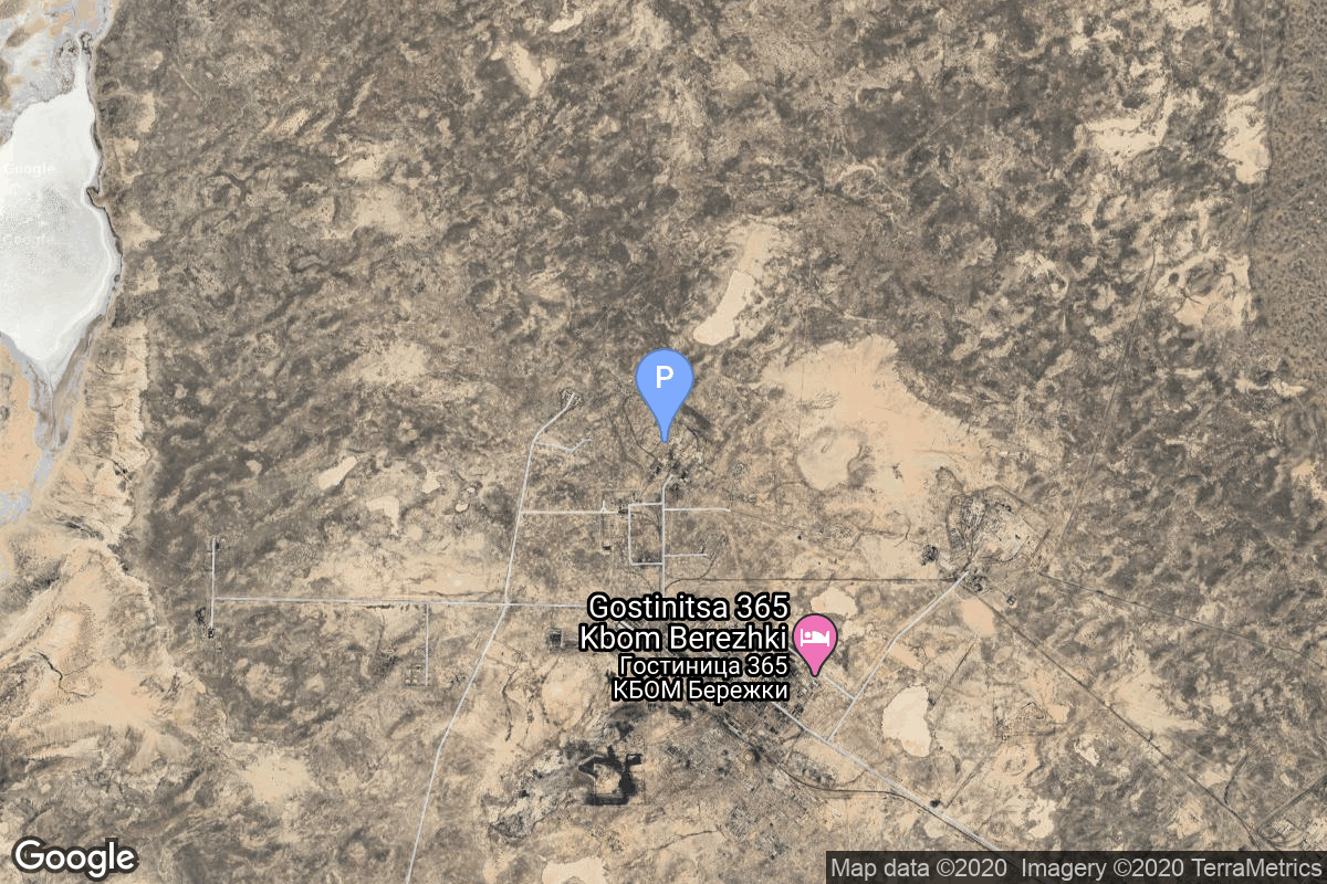
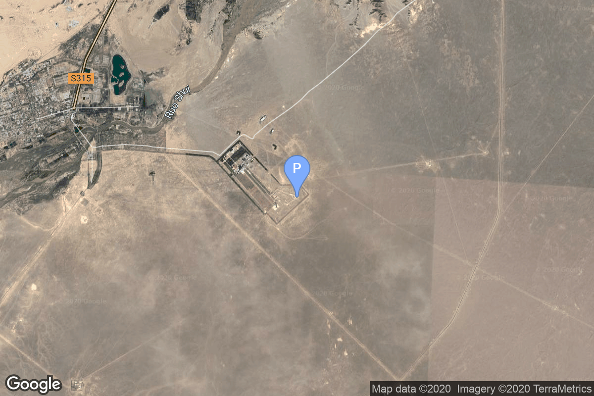
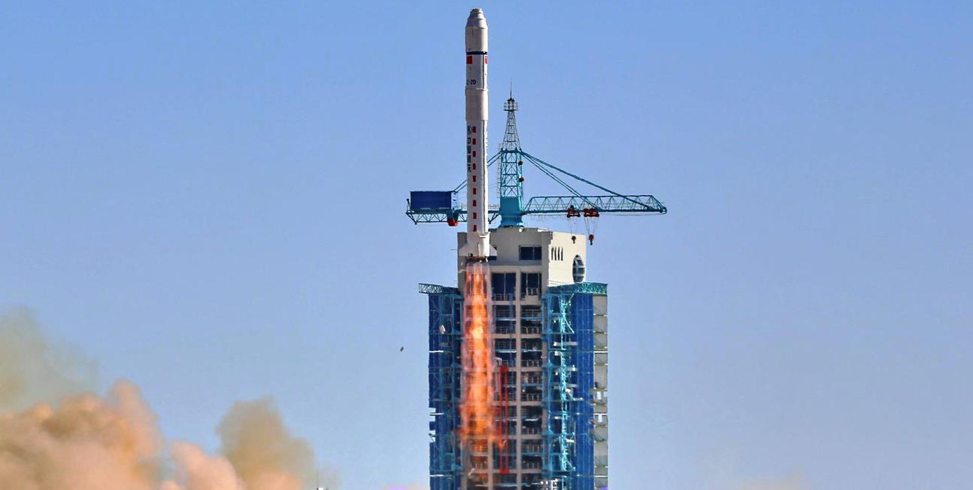
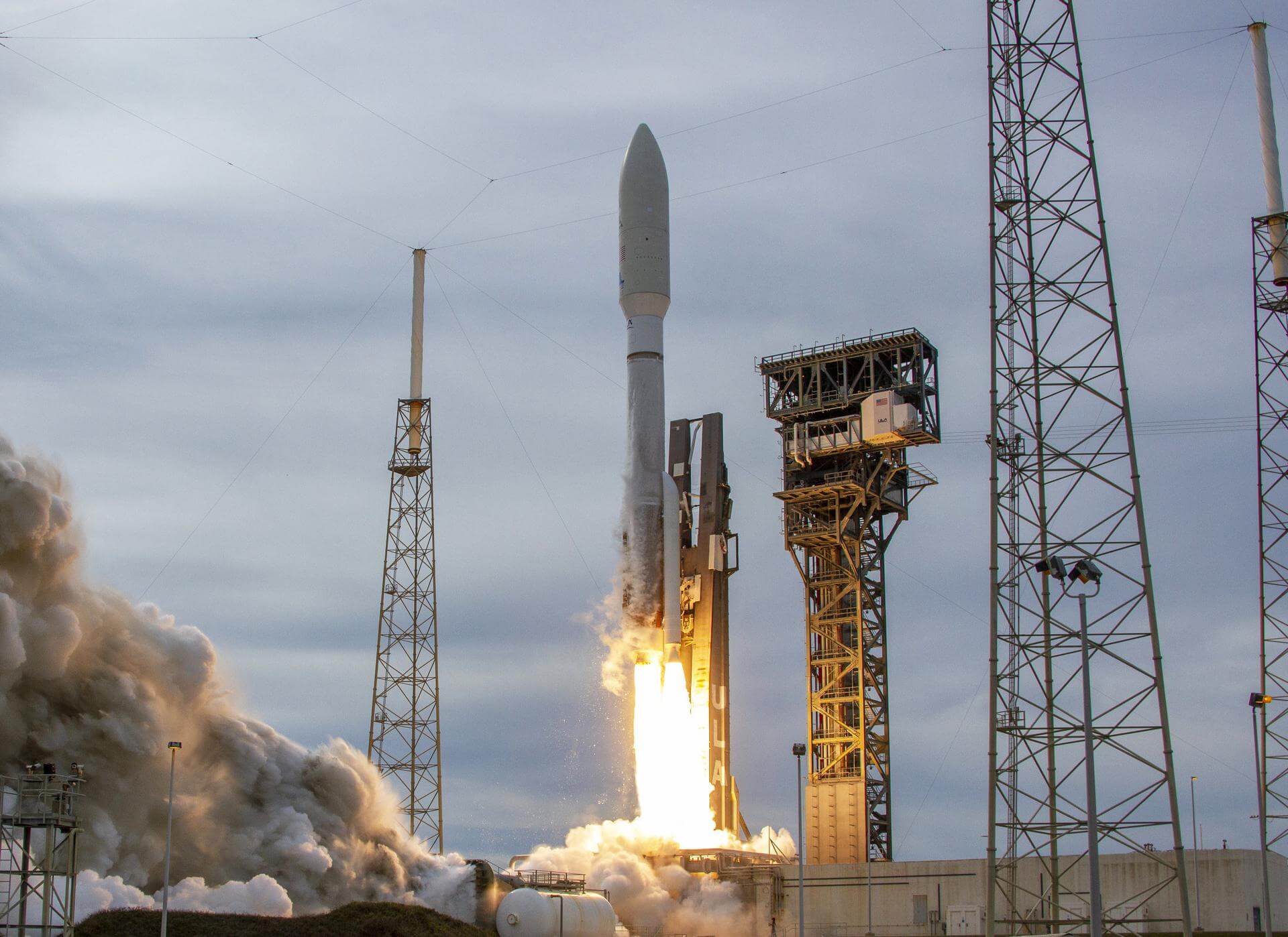
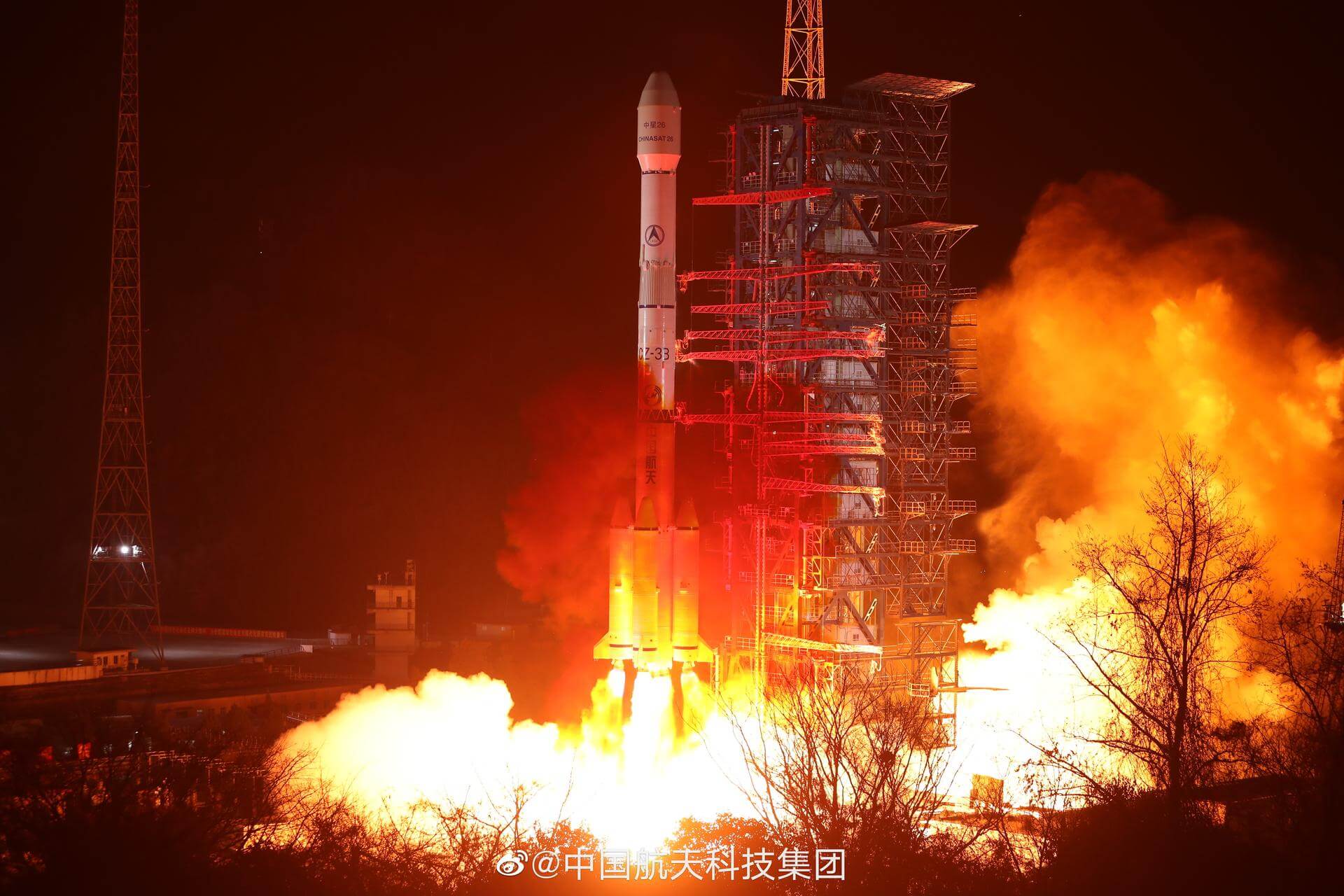
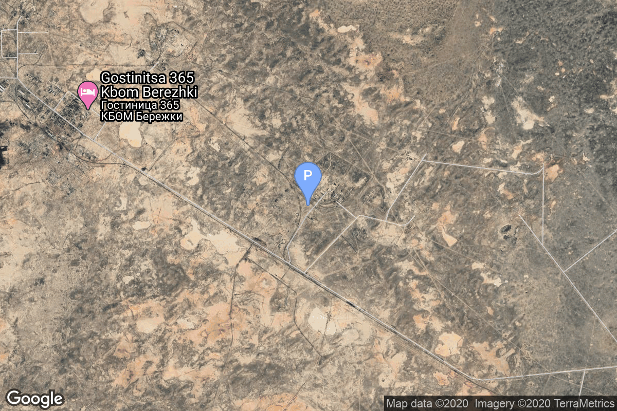
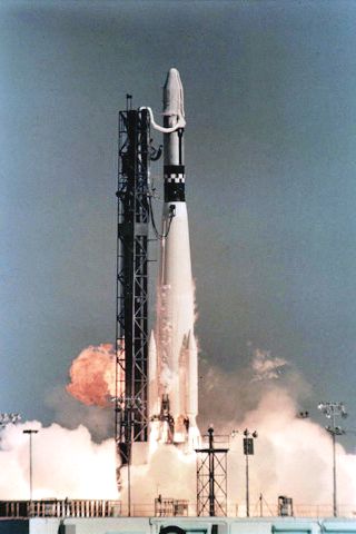
{ "count": 7924, "next": "https://ll.thespacedevs.com/2.2.0/launch/?format=api&limit=10&offset=3540&ordering=id", "previous": "https://ll.thespacedevs.com/2.2.0/launch/?format=api&limit=10&offset=3520&ordering=id", "results": [ { "id": "730fe053-3005-4a25-b2a8-aa772ca7334e", "url": "https://ll.thespacedevs.com/2.2.0/launch/730fe053-3005-4a25-b2a8-aa772ca7334e/?format=api", "slug": "tsiklon-2-us-a-4", "name": "Tsiklon-2 | US-A 4", "status": { "id": 3, "name": "Launch Successful", "abbrev": "Success", "description": "The launch vehicle successfully inserted its payload(s) into the target orbit(s)." }, "last_updated": "2023-06-14T04:24:23Z", "net": "1972-08-21T10:36:20Z", "window_end": "1972-08-21T10:36:20Z", "window_start": "1972-08-21T10:36:20Z", "net_precision": null, "probability": null, "weather_concerns": null, "holdreason": "", "failreason": null, "hashtag": null, "launch_service_provider": { "id": 66, "url": "https://ll.thespacedevs.com/2.2.0/agencies/66/?format=api", "name": "Soviet Space Program", "type": "Government" }, "rocket": { "id": 4287, "configuration": { "id": 443, "url": "https://ll.thespacedevs.com/2.2.0/config/launcher/443/?format=api", "name": "Tsiklon-2", "family": "Tsiklon", "full_name": "Tsiklon-2", "variant": "2" } }, "mission": { "id": 2705, "name": "US-A 4", "description": "Active radar satellite for ocean surveillance powered by a nuclear reactor.", "launch_designator": null, "type": "Government/Top Secret", "orbit": { "id": 8, "name": "Low Earth Orbit", "abbrev": "LEO" }, "agencies": [], "info_urls": [], "vid_urls": [] }, "pad": { "id": 133, "url": "https://ll.thespacedevs.com/2.2.0/pad/133/?format=api", "agency_id": null, "name": "90/19", "description": null, "info_url": null, "wiki_url": "https://en.wikipedia.org/wiki/Baikonur_Cosmodrome_Site_90", "map_url": "https://www.google.com/maps?q=46.081,62.929806", "latitude": "46.081", "longitude": "62.929806", "location": { "id": 15, "url": "https://ll.thespacedevs.com/2.2.0/location/15/?format=api", "name": "Baikonur Cosmodrome, Republic of Kazakhstan", "country_code": "KAZ", "description": "The Baikonur Cosmodrome is a spaceport operated by Russia within Kazakhstan. Located in the Kazakh city of Baikonur, it is the largest operational space launch facility in terms of area. All Russian crewed spaceflights are launched from Baikonur.", "map_image": "https://thespacedevs-prod.nyc3.digitaloceanspaces.com/media/map_images/location_15_20200803142517.jpg", "timezone_name": "Asia/Qyzylorda", "total_launch_count": 1563, "total_landing_count": 0 }, "country_code": "KAZ", "map_image": "https://thespacedevs-prod.nyc3.digitaloceanspaces.com/media/map_images/pad_133_20200803143315.jpg", "total_launch_count": 16, "orbital_launch_attempt_count": 16 }, "webcast_live": false, "image": "https://thespacedevs-prod.nyc3.digitaloceanspaces.com/media/images/tsyklon-2_lifto_image_20240411113159.jpg", "infographic": null, "program": [], "orbital_launch_attempt_count": 1378, "location_launch_attempt_count": 360, "pad_launch_attempt_count": 11, "agency_launch_attempt_count": 684, "orbital_launch_attempt_count_year": 72, "location_launch_attempt_count_year": 17, "pad_launch_attempt_count_year": 1, "agency_launch_attempt_count_year": 52, "type": "normal" }, { "id": "73116356-c0ae-4de2-84bf-75801b3910d2", "url": "https://ll.thespacedevs.com/2.2.0/launch/73116356-c0ae-4de2-84bf-75801b3910d2/?format=api", "slug": "long-march-2d-shiyan-weixing-5", "name": "Long March 2D | Shiyan Weixing 5", "status": { "id": 3, "name": "Launch Successful", "abbrev": "Success", "description": "The launch vehicle successfully inserted its payload(s) into the target orbit(s)." }, "last_updated": "2023-06-14T15:48:14Z", "net": "2013-11-25T02:12:04Z", "window_end": "2013-11-25T02:12:04Z", "window_start": "2013-11-25T02:12:04Z", "net_precision": null, "probability": null, "weather_concerns": null, "holdreason": "", "failreason": null, "hashtag": null, "launch_service_provider": { "id": 88, "url": "https://ll.thespacedevs.com/2.2.0/agencies/88/?format=api", "name": "China Aerospace Science and Technology Corporation", "type": "Government" }, "rocket": { "id": 1720, "configuration": { "id": 17, "url": "https://ll.thespacedevs.com/2.2.0/config/launcher/17/?format=api", "name": "Long March 2D", "family": "Long March", "full_name": "Long March 2D", "variant": "D" } }, "mission": null, "pad": { "id": 22, "url": "https://ll.thespacedevs.com/2.2.0/pad/22/?format=api", "agency_id": null, "name": "Launch Area 94 (SLS-2 / 603)", "description": "", "info_url": null, "wiki_url": "https://en.wikipedia.org/wiki/Jiuquan_Launch_Area_4", "map_url": "https://www.google.com/maps?q=40.960482,100.298059", "latitude": "40.960482", "longitude": "100.298059", "location": { "id": 17, "url": "https://ll.thespacedevs.com/2.2.0/location/17/?format=api", "name": "Jiuquan Satellite Launch Center, People's Republic of China", "country_code": "CHN", "description": "Jiuquan Satellite Launch Center is a Chinese spaceport located between the Ejin, Alxa, Inner Mongolia and Hangtian Town, Jinta County, Jiuquan, Gansu Province. It is part of the Dongfeng Aerospace City (Base 10).", "map_image": "https://thespacedevs-prod.nyc3.digitaloceanspaces.com/media/map_images/location_17_20200803142429.jpg", "timezone_name": "Asia/Shanghai", "total_launch_count": 291, "total_landing_count": 2 }, "country_code": "CHN", "map_image": "https://thespacedevs-prod.nyc3.digitaloceanspaces.com/media/map_images/pad_22_20200803143437.jpg", "total_launch_count": 137, "orbital_launch_attempt_count": 137 }, "webcast_live": false, "image": "https://thespacedevs-prod.nyc3.digitaloceanspaces.com/media/images/long2520march25202d_image_20190222031211.jpeg", "infographic": null, "program": [], "orbital_launch_attempt_count": 5338, "location_launch_attempt_count": 69, "pad_launch_attempt_count": 29, "agency_launch_attempt_count": 131, "orbital_launch_attempt_count_year": 70, "location_launch_attempt_count_year": 7, "pad_launch_attempt_count_year": 5, "agency_launch_attempt_count_year": 11, "type": "normal" }, { "id": "7323ed72-b69a-429c-8cfe-2ed454a8db28", "url": "https://ll.thespacedevs.com/2.2.0/launch/7323ed72-b69a-429c-8cfe-2ed454a8db28/?format=api", "slug": "atlas-v-511-ussf-8", "name": "Atlas V 511 | USSF-8", "status": { "id": 3, "name": "Launch Successful", "abbrev": "Success", "description": "The launch vehicle successfully inserted its payload(s) into the target orbit(s)." }, "last_updated": "2023-06-14T17:42:34Z", "net": "2022-01-21T19:00:00Z", "window_end": "2022-01-21T21:15:00Z", "window_start": "2022-01-21T18:15:00Z", "net_precision": null, "probability": 90, "weather_concerns": null, "holdreason": "", "failreason": "", "hashtag": null, "launch_service_provider": { "id": 124, "url": "https://ll.thespacedevs.com/2.2.0/agencies/124/?format=api", "name": "United Launch Alliance", "type": "Commercial" }, "rocket": { "id": 2664, "configuration": { "id": 214, "url": "https://ll.thespacedevs.com/2.2.0/config/launcher/214/?format=api", "name": "Atlas V 511", "family": "Atlas", "full_name": "Atlas V 511", "variant": "511" } }, "mission": { "id": 5928, "name": "USSF-8", "description": "USSF-8 will launch two identical Geosynchronous Space Situational Awareness Program (GSSAP) satellites GSSAP-5 and GSSAP-6 directly to a near-geosynchronous orbit approximately 36,000 km above the equator.\r\n\r\nData from the GSSAP will uniquely contribute to timely and accurate orbital predictions, further enabling space flight safety including satellite collision avoidance. \r\n\r\nUnique to this mission is the first and only planned flight of the Atlas V 511 configuration.", "launch_designator": null, "type": "Government/Top Secret", "orbit": { "id": 3, "name": "Geosynchronous Orbit", "abbrev": "GSO" }, "agencies": [], "info_urls": [], "vid_urls": [] }, "pad": { "id": 29, "url": "https://ll.thespacedevs.com/2.2.0/pad/29/?format=api", "agency_id": null, "name": "Space Launch Complex 41", "description": "", "info_url": null, "wiki_url": "https://en.wikipedia.org/wiki/Cape_Canaveral_Air_Force_Station_Space_Launch_Complex_41", "map_url": "https://www.google.com/maps?q=28.58341025,-80.58303644", "latitude": "28.58341025", "longitude": "-80.58303644", "location": { "id": 12, "url": "https://ll.thespacedevs.com/2.2.0/location/12/?format=api", "name": "Cape Canaveral SFS, FL, USA", "country_code": "USA", "description": "Cape Canaveral Space Force Station (CCSFS) is an installation of the United States Space Force's Space Launch Delta 45, located on Cape Canaveral in Brevard County, Florida.", "map_image": "https://thespacedevs-prod.nyc3.digitaloceanspaces.com/media/map_images/location_12_20200803142519.jpg", "timezone_name": "America/New_York", "total_launch_count": 1120, "total_landing_count": 75 }, "country_code": "USA", "map_image": "https://thespacedevs-prod.nyc3.digitaloceanspaces.com/media/map_images/pad_29_20200803143528.jpg", "total_launch_count": 125, "orbital_launch_attempt_count": 125 }, "webcast_live": false, "image": "https://thespacedevs-prod.nyc3.digitaloceanspaces.com/media/images/atlas_v_511_image_20220122075706.jpeg", "infographic": null, "program": [], "orbital_launch_attempt_count": 6188, "location_launch_attempt_count": 832, "pad_launch_attempt_count": 103, "agency_launch_attempt_count": 149, "orbital_launch_attempt_count_year": 6, "location_launch_attempt_count_year": 2, "pad_launch_attempt_count_year": 1, "agency_launch_attempt_count_year": 1, "type": "normal" }, { "id": "7329f132-edff-4d11-bb96-d35819f808ee", "url": "https://ll.thespacedevs.com/2.2.0/launch/7329f132-edff-4d11-bb96-d35819f808ee/?format=api", "slug": "molniya-m-molniya-1k-54", "name": "Molniya-M | Molniya-1K 54", "status": { "id": 3, "name": "Launch Successful", "abbrev": "Success", "description": "The launch vehicle successfully inserted its payload(s) into the target orbit(s)." }, "last_updated": "2023-06-14T03:51:31Z", "net": "1982-05-28T22:02:59Z", "window_end": "1982-05-28T22:02:59Z", "window_start": "1982-05-28T22:02:59Z", "net_precision": null, "probability": null, "weather_concerns": null, "holdreason": "", "failreason": null, "hashtag": null, "launch_service_provider": { "id": 66, "url": "https://ll.thespacedevs.com/2.2.0/agencies/66/?format=api", "name": "Soviet Space Program", "type": "Government" }, "rocket": { "id": 5403, "configuration": { "id": 106, "url": "https://ll.thespacedevs.com/2.2.0/config/launcher/106/?format=api", "name": "Molniya-M", "family": "R-7", "full_name": "Molniya-M 2BL", "variant": "2BL" } }, "mission": { "id": 3810, "name": "Molniya-1K 54", "description": "Military communications satellite in a highly elliptic orbit", "launch_designator": null, "type": "Government/Top Secret", "orbit": { "id": 0, "name": "Elliptical Orbit", "abbrev": "Elliptical" }, "agencies": [], "info_urls": [], "vid_urls": [] }, "pad": { "id": 36, "url": "https://ll.thespacedevs.com/2.2.0/pad/36/?format=api", "agency_id": 163, "name": "43/3 (43L)", "description": "", "info_url": null, "wiki_url": null, "map_url": "https://www.google.com/maps?q=62.9273,40.45", "latitude": "62.9273", "longitude": "40.45", "location": { "id": 6, "url": "https://ll.thespacedevs.com/2.2.0/location/6/?format=api", "name": "Plesetsk Cosmodrome, Russian Federation", "country_code": "RUS", "description": "Plesetsk Cosmodrome is a Russian spaceport located in Mirny, Arkhangelsk Oblast, about 800 km north of Moscow and approximately 200 km south of Arkhangelsk. Originally developed as an ICBM site for the R-7 missile, it also served for numerous satellite launches using the R-7 and other rockets. Its high latitude makes it useful only for certain types of launches, especially the Molniya orbits, so for much of the site's history it functioned as a secondary location, with most orbital launches taking place from Baikonur, in the Kazakh SSR. With the end of the Soviet Union, Baikonur became a foreign territory, and Kazakhstan charged $115 million usage fees annually. Consequently, Plesetsk has seen considerably more activity since the 2000s.", "map_image": "https://thespacedevs-prod.nyc3.digitaloceanspaces.com/media/map_images/location_6_20200803142434.jpg", "timezone_name": "Europe/Moscow", "total_launch_count": 1685, "total_landing_count": 0 }, "country_code": "RUS", "map_image": "https://thespacedevs-prod.nyc3.digitaloceanspaces.com/media/map_images/pad_36_20200803143534.jpg", "total_launch_count": 232, "orbital_launch_attempt_count": 232 }, "webcast_live": false, "image": "https://thespacedevs-prod.nyc3.digitaloceanspaces.com/media/images/molniya_m_image_20251102061752.jpg", "infographic": null, "program": [], "orbital_launch_attempt_count": 2569, "location_launch_attempt_count": 875, "pad_launch_attempt_count": 142, "agency_launch_attempt_count": 1595, "orbital_launch_attempt_count_year": 52, "location_launch_attempt_count_year": 28, "pad_launch_attempt_count_year": 2, "agency_launch_attempt_count_year": 44, "type": "normal" }, { "id": "7339173c-ff5d-4cd1-bd08-ed92f8362745", "url": "https://ll.thespacedevs.com/2.2.0/launch/7339173c-ff5d-4cd1-bd08-ed92f8362745/?format=api", "slug": "long-march-3be-chinasat-9c", "name": "Long March 3B/E | ChinaSat 9C", "status": { "id": 3, "name": "Launch Successful", "abbrev": "Success", "description": "The launch vehicle successfully inserted its payload(s) into the target orbit(s)." }, "last_updated": "2025-06-21T08:14:20Z", "net": "2025-06-20T12:37:00Z", "window_end": "2025-06-20T13:02:00Z", "window_start": "2025-06-20T12:27:00Z", "net_precision": { "id": 1, "name": "Minute", "abbrev": "MIN", "description": "The T-0 is accurate to the minute." }, "probability": null, "weather_concerns": null, "holdreason": "", "failreason": "", "hashtag": null, "launch_service_provider": { "id": 88, "url": "https://ll.thespacedevs.com/2.2.0/agencies/88/?format=api", "name": "China Aerospace Science and Technology Corporation", "type": "Government" }, "rocket": { "id": 8638, "configuration": { "id": 50, "url": "https://ll.thespacedevs.com/2.2.0/config/launcher/50/?format=api", "name": "Long March 3B/E", "family": "Long March", "full_name": "Long March 3B/E", "variant": "B/E" } }, "mission": { "id": 7230, "name": "ChinaSat 9C", "description": "Ku- and Ka-band geostationary communication satellite for China Satcom at 92.2° East, replacing ChinaSat 9.", "launch_designator": null, "type": "Communications", "orbit": { "id": 2, "name": "Geostationary Transfer Orbit", "abbrev": "GTO" }, "agencies": [], "info_urls": [], "vid_urls": [] }, "pad": { "id": 45, "url": "https://ll.thespacedevs.com/2.2.0/pad/45/?format=api", "agency_id": null, "name": "Launch Complex 2 (LC-2)", "description": "", "info_url": null, "wiki_url": "https://en.wikipedia.org/wiki/Xichang_Satellite_Launch_Center", "map_url": "https://www.google.com/maps?q=28.245504,102.026768", "latitude": "28.245504", "longitude": "102.026768", "location": { "id": 16, "url": "https://ll.thespacedevs.com/2.2.0/location/16/?format=api", "name": "Xichang Satellite Launch Center, People's Republic of China", "country_code": "CHN", "description": "The Xichang Satellite Launch Center is a spaceport in China. It is located in Zeyuan Town, northwest of Xichang, Liangshan Yi Autonomous Prefecture in Sichuan.", "map_image": "https://thespacedevs-prod.nyc3.digitaloceanspaces.com/media/map_images/location_16_20200803142513.jpg", "timezone_name": "Asia/Shanghai", "total_launch_count": 241, "total_landing_count": 0 }, "country_code": "CHN", "map_image": "https://thespacedevs-prod.nyc3.digitaloceanspaces.com/media/map_images/pad_45_20200803143520.jpg", "total_launch_count": 125, "orbital_launch_attempt_count": 125 }, "webcast_live": false, "image": "https://thespacedevs-prod.nyc3.digitaloceanspaces.com/media/images/long2520march_image_20230907120240.jpeg", "infographic": null, "program": [], "orbital_launch_attempt_count": 6985, "location_launch_attempt_count": 227, "pad_launch_attempt_count": 120, "agency_launch_attempt_count": 529, "orbital_launch_attempt_count_year": 136, "location_launch_attempt_count_year": 10, "pad_launch_attempt_count_year": 6, "agency_launch_attempt_count_year": 28, "type": "normal" }, { "id": "733d1edb-d15c-4fd7-bf85-061b283b1165", "url": "https://ll.thespacedevs.com/2.2.0/launch/733d1edb-d15c-4fd7-bf85-061b283b1165/?format=api", "slug": "kosmos-3m-tselina-o-16", "name": "Kosmos-3M | Tselina-O 16", "status": { "id": 3, "name": "Launch Successful", "abbrev": "Success", "description": "The launch vehicle successfully inserted its payload(s) into the target orbit(s)." }, "last_updated": "2023-06-14T03:43:50Z", "net": "1972-11-03T01:34:00Z", "window_end": "1972-11-03T01:34:00Z", "window_start": "1972-11-03T01:34:00Z", "net_precision": null, "probability": null, "weather_concerns": null, "holdreason": "", "failreason": null, "hashtag": null, "launch_service_provider": { "id": 66, "url": "https://ll.thespacedevs.com/2.2.0/agencies/66/?format=api", "name": "Soviet Space Program", "type": "Government" }, "rocket": { "id": 4311, "configuration": { "id": 102, "url": "https://ll.thespacedevs.com/2.2.0/config/launcher/102/?format=api", "name": "Kosmos-3M", "family": "Kosmos", "full_name": "Kosmos-3M (11K65M)", "variant": "-3M" } }, "mission": { "id": 2729, "name": "Tselina-O 16", "description": "The Tselina-O (11F616) was one component of two-satellite Tselina ELINT satellite system. Tselina-O provided general ELINT surveillance to be examined in detail by the larger Tselina-D satellites.", "launch_designator": null, "type": "Government/Top Secret", "orbit": { "id": 8, "name": "Low Earth Orbit", "abbrev": "LEO" }, "agencies": [], "info_urls": [], "vid_urls": [] }, "pad": { "id": 28, "url": "https://ll.thespacedevs.com/2.2.0/pad/28/?format=api", "agency_id": 163, "name": "132/1 (132L)", "description": null, "info_url": null, "wiki_url": "", "map_url": "https://www.google.com/maps?q=62.883229,40.868549", "latitude": "62.883229", "longitude": "40.868549", "location": { "id": 6, "url": "https://ll.thespacedevs.com/2.2.0/location/6/?format=api", "name": "Plesetsk Cosmodrome, Russian Federation", "country_code": "RUS", "description": "Plesetsk Cosmodrome is a Russian spaceport located in Mirny, Arkhangelsk Oblast, about 800 km north of Moscow and approximately 200 km south of Arkhangelsk. Originally developed as an ICBM site for the R-7 missile, it also served for numerous satellite launches using the R-7 and other rockets. Its high latitude makes it useful only for certain types of launches, especially the Molniya orbits, so for much of the site's history it functioned as a secondary location, with most orbital launches taking place from Baikonur, in the Kazakh SSR. With the end of the Soviet Union, Baikonur became a foreign territory, and Kazakhstan charged $115 million usage fees annually. Consequently, Plesetsk has seen considerably more activity since the 2000s.", "map_image": "https://thespacedevs-prod.nyc3.digitaloceanspaces.com/media/map_images/location_6_20200803142434.jpg", "timezone_name": "Europe/Moscow", "total_launch_count": 1685, "total_landing_count": 0 }, "country_code": "RUS", "map_image": "https://thespacedevs-prod.nyc3.digitaloceanspaces.com/media/map_images/pad_28_20200803143254.jpg", "total_launch_count": 212, "orbital_launch_attempt_count": 212 }, "webcast_live": false, "image": "https://thespacedevs-prod.nyc3.digitaloceanspaces.com/media/images/kosmos-3m_durin_image_20251101171325.jpg", "infographic": null, "program": [], "orbital_launch_attempt_count": 1402, "location_launch_attempt_count": 267, "pad_launch_attempt_count": 21, "agency_launch_attempt_count": 702, "orbital_launch_attempt_count_year": 96, "location_launch_attempt_count_year": 48, "pad_launch_attempt_count_year": 3, "agency_launch_attempt_count_year": 70, "type": "normal" }, { "id": "7343c9ac-ad77-4663-9aeb-04a770efe360", "url": "https://ll.thespacedevs.com/2.2.0/launch/7343c9ac-ad77-4663-9aeb-04a770efe360/?format=api", "slug": "soyuz-u-zenit-4mt-15", "name": "Soyuz U | Zenit-4MT 15", "status": { "id": 3, "name": "Launch Successful", "abbrev": "Success", "description": "The launch vehicle successfully inserted its payload(s) into the target orbit(s)." }, "last_updated": "2023-06-14T04:29:12Z", "net": "1978-12-28T16:30:00Z", "window_end": "1978-12-28T16:30:00Z", "window_start": "1978-12-28T16:30:00Z", "net_precision": null, "probability": null, "weather_concerns": null, "holdreason": "", "failreason": null, "hashtag": null, "launch_service_provider": { "id": 66, "url": "https://ll.thespacedevs.com/2.2.0/agencies/66/?format=api", "name": "Soviet Space Program", "type": "Government" }, "rocket": { "id": 5033, "configuration": { "id": 37, "url": "https://ll.thespacedevs.com/2.2.0/config/launcher/37/?format=api", "name": "Soyuz U", "family": "Soyuz", "full_name": "Soyuz U", "variant": "" } }, "mission": { "id": 3446, "name": "Zenit-4MT 15", "description": "Film-return reconnaissance satellite", "launch_designator": null, "type": "Government/Top Secret", "orbit": { "id": 8, "name": "Low Earth Orbit", "abbrev": "LEO" }, "agencies": [], "info_urls": [], "vid_urls": [] }, "pad": { "id": 168, "url": "https://ll.thespacedevs.com/2.2.0/pad/168/?format=api", "agency_id": null, "name": "41/1", "description": null, "info_url": null, "wiki_url": "https://en.wikipedia.org/wiki/Plesetsk_Cosmodrome", "map_url": "https://www.google.com/maps?q=62.941,40.526806", "latitude": "62.941", "longitude": "40.526806", "location": { "id": 6, "url": "https://ll.thespacedevs.com/2.2.0/location/6/?format=api", "name": "Plesetsk Cosmodrome, Russian Federation", "country_code": "RUS", "description": "Plesetsk Cosmodrome is a Russian spaceport located in Mirny, Arkhangelsk Oblast, about 800 km north of Moscow and approximately 200 km south of Arkhangelsk. Originally developed as an ICBM site for the R-7 missile, it also served for numerous satellite launches using the R-7 and other rockets. Its high latitude makes it useful only for certain types of launches, especially the Molniya orbits, so for much of the site's history it functioned as a secondary location, with most orbital launches taking place from Baikonur, in the Kazakh SSR. With the end of the Soviet Union, Baikonur became a foreign territory, and Kazakhstan charged $115 million usage fees annually. Consequently, Plesetsk has seen considerably more activity since the 2000s.", "map_image": "https://thespacedevs-prod.nyc3.digitaloceanspaces.com/media/map_images/location_6_20200803142434.jpg", "timezone_name": "Europe/Moscow", "total_launch_count": 1685, "total_landing_count": 0 }, "country_code": "RUS", "map_image": "https://thespacedevs-prod.nyc3.digitaloceanspaces.com/media/map_images/pad_168_20200803143446.jpg", "total_launch_count": 310, "orbital_launch_attempt_count": 310 }, "webcast_live": false, "image": "https://thespacedevs-prod.nyc3.digitaloceanspaces.com/media/images/soyuz2520u_image_20190222031023.jpeg", "infographic": null, "program": [], "orbital_launch_attempt_count": 2173, "location_launch_attempt_count": 655, "pad_launch_attempt_count": 154, "agency_launch_attempt_count": 1273, "orbital_launch_attempt_count_year": 128, "location_launch_attempt_count_year": 62, "pad_launch_attempt_count_year": 5, "agency_launch_attempt_count_year": 91, "type": "normal" }, { "id": "73531c9d-87a7-4129-93fc-a707b825482d", "url": "https://ll.thespacedevs.com/2.2.0/launch/73531c9d-87a7-4129-93fc-a707b825482d/?format=api", "slug": "proton-kdm-raduga-4", "name": "Proton-K/DM | Raduga 4", "status": { "id": 3, "name": "Launch Successful", "abbrev": "Success", "description": "The launch vehicle successfully inserted its payload(s) into the target orbit(s)." }, "last_updated": "2023-06-14T04:23:45Z", "net": "1978-07-18T21:59:00Z", "window_end": "1978-07-18T21:59:00Z", "window_start": "1978-07-18T21:59:00Z", "net_precision": null, "probability": null, "weather_concerns": null, "holdreason": "", "failreason": null, "hashtag": null, "launch_service_provider": { "id": 66, "url": "https://ll.thespacedevs.com/2.2.0/agencies/66/?format=api", "name": "Soviet Space Program", "type": "Government" }, "rocket": { "id": 4983, "configuration": { "id": 349, "url": "https://ll.thespacedevs.com/2.2.0/config/launcher/349/?format=api", "name": "Proton-K/DM", "family": "Proton / UR-500", "full_name": "Proton-K/DM", "variant": "DM" } }, "mission": { "id": 3398, "name": "Raduga 4", "description": "Geostationary communications satellite for military and governmental puposes", "launch_designator": null, "type": "Communications", "orbit": { "id": 1, "name": "Geostationary Orbit", "abbrev": "Direct-GEO" }, "agencies": [], "info_urls": [], "vid_urls": [] }, "pad": { "id": 130, "url": "https://ll.thespacedevs.com/2.2.0/pad/130/?format=api", "agency_id": null, "name": "200/40", "description": null, "info_url": null, "wiki_url": "https://en.wikipedia.org/wiki/Baikonur_Cosmodrome_Site_200", "map_url": "https://www.google.com/maps?q=46.0336111,63.0266949", "latitude": "46.0336111", "longitude": "63.0266949", "location": { "id": 15, "url": "https://ll.thespacedevs.com/2.2.0/location/15/?format=api", "name": "Baikonur Cosmodrome, Republic of Kazakhstan", "country_code": "KAZ", "description": "The Baikonur Cosmodrome is a spaceport operated by Russia within Kazakhstan. Located in the Kazakh city of Baikonur, it is the largest operational space launch facility in terms of area. All Russian crewed spaceflights are launched from Baikonur.", "map_image": "https://thespacedevs-prod.nyc3.digitaloceanspaces.com/media/map_images/location_15_20200803142517.jpg", "timezone_name": "Asia/Qyzylorda", "total_launch_count": 1563, "total_landing_count": 0 }, "country_code": "KAZ", "map_image": "https://thespacedevs-prod.nyc3.digitaloceanspaces.com/media/map_images/pad_130_20200803143249.jpg", "total_launch_count": 64, "orbital_launch_attempt_count": 64 }, "webcast_live": false, "image": "https://thespacedevs-prod.nyc3.digitaloceanspaces.com/media/images/proton_image_20231231095535.jpg", "infographic": null, "program": [], "orbital_launch_attempt_count": 2120, "location_launch_attempt_count": 525, "pad_launch_attempt_count": 4, "agency_launch_attempt_count": 1232, "orbital_launch_attempt_count_year": 75, "location_launch_attempt_count_year": 18, "pad_launch_attempt_count_year": 2, "agency_launch_attempt_count_year": 50, "type": "normal" }, { "id": "735ee623-0837-41ae-aa06-ad45126697a8", "url": "https://ll.thespacedevs.com/2.2.0/launch/735ee623-0837-41ae-aa06-ad45126697a8/?format=api", "slug": "kosmos-3m-strela-3m-1", "name": "Kosmos-3M | Strela-3M 1", "status": { "id": 3, "name": "Launch Successful", "abbrev": "Success", "description": "The launch vehicle successfully inserted its payload(s) into the target orbit(s)." }, "last_updated": "2023-06-14T03:43:50Z", "net": "2005-12-21T19:34:20Z", "window_end": "2005-12-21T19:34:20Z", "window_start": "2005-12-21T19:34:20Z", "net_precision": null, "probability": null, "weather_concerns": null, "holdreason": "", "failreason": null, "hashtag": null, "launch_service_provider": { "id": 154, "url": "https://ll.thespacedevs.com/2.2.0/agencies/154/?format=api", "name": "Production Corporation Polyot", "type": "Commercial" }, "rocket": { "id": 7250, "configuration": { "id": 102, "url": "https://ll.thespacedevs.com/2.2.0/config/launcher/102/?format=api", "name": "Kosmos-3M", "family": "Kosmos", "full_name": "Kosmos-3M (11K65M)", "variant": "-3M" } }, "mission": { "id": 5639, "name": "Strela-3M 1", "description": "Strela-3M (also known as Rodnik-S) is an improved version of the Strela-3 military communications satellites. The first one was launched on 21.12.2005 on a Kosmos-3M booster together with a Gonets-M satellite, which represents the civilian version. Later satellites were launched on Rokot-KM boosters.", "launch_designator": null, "type": "Communications", "orbit": { "id": 1, "name": "Geostationary Orbit", "abbrev": "Direct-GEO" }, "agencies": [], "info_urls": [], "vid_urls": [] }, "pad": { "id": 28, "url": "https://ll.thespacedevs.com/2.2.0/pad/28/?format=api", "agency_id": 163, "name": "132/1 (132L)", "description": null, "info_url": null, "wiki_url": "", "map_url": "https://www.google.com/maps?q=62.883229,40.868549", "latitude": "62.883229", "longitude": "40.868549", "location": { "id": 6, "url": "https://ll.thespacedevs.com/2.2.0/location/6/?format=api", "name": "Plesetsk Cosmodrome, Russian Federation", "country_code": "RUS", "description": "Plesetsk Cosmodrome is a Russian spaceport located in Mirny, Arkhangelsk Oblast, about 800 km north of Moscow and approximately 200 km south of Arkhangelsk. Originally developed as an ICBM site for the R-7 missile, it also served for numerous satellite launches using the R-7 and other rockets. Its high latitude makes it useful only for certain types of launches, especially the Molniya orbits, so for much of the site's history it functioned as a secondary location, with most orbital launches taking place from Baikonur, in the Kazakh SSR. With the end of the Soviet Union, Baikonur became a foreign territory, and Kazakhstan charged $115 million usage fees annually. Consequently, Plesetsk has seen considerably more activity since the 2000s.", "map_image": "https://thespacedevs-prod.nyc3.digitaloceanspaces.com/media/map_images/location_6_20200803142434.jpg", "timezone_name": "Europe/Moscow", "total_launch_count": 1685, "total_landing_count": 0 }, "country_code": "RUS", "map_image": "https://thespacedevs-prod.nyc3.digitaloceanspaces.com/media/map_images/pad_28_20200803143254.jpg", "total_launch_count": 212, "orbital_launch_attempt_count": 212 }, "webcast_live": false, "image": "https://thespacedevs-prod.nyc3.digitaloceanspaces.com/media/images/kosmos-3m_durin_image_20251101171325.jpg", "infographic": null, "program": [], "orbital_launch_attempt_count": 4746, "location_launch_attempt_count": 1546, "pad_launch_attempt_count": 204, "agency_launch_attempt_count": 49, "orbital_launch_attempt_count_year": 52, "location_launch_attempt_count_year": 6, "pad_launch_attempt_count_year": 3, "agency_launch_attempt_count_year": 3, "type": "normal" }, { "id": "736f8319-5d03-4b08-9a2e-6562d3916f4f", "url": "https://ll.thespacedevs.com/2.2.0/launch/736f8319-5d03-4b08-9a2e-6562d3916f4f/?format=api", "slug": "thor-slv-2a-agena-d-kh-4a-2", "name": "Thor SLV-2A Agena D | KH-4A 2", "status": { "id": 3, "name": "Launch Successful", "abbrev": "Success", "description": "The launch vehicle successfully inserted its payload(s) into the target orbit(s)." }, "last_updated": "2023-06-14T03:52:44Z", "net": "1963-09-23T23:00:00Z", "window_end": "1963-09-23T23:00:00Z", "window_start": "1963-09-23T23:00:00Z", "net_precision": null, "probability": null, "weather_concerns": null, "holdreason": "", "failreason": null, "hashtag": null, "launch_service_provider": { "id": 161, "url": "https://ll.thespacedevs.com/2.2.0/agencies/161/?format=api", "name": "United States Air Force", "type": "Government" }, "rocket": { "id": 3225, "configuration": { "id": 417, "url": "https://ll.thespacedevs.com/2.2.0/config/launcher/417/?format=api", "name": "Thor SLV-2A Agena D", "family": "Thor", "full_name": "Thor SLV-2A Agena D", "variant": "SLV-2A Agena D" } }, "mission": { "id": 1647, "name": "KH-4A 2", "description": "The KH-4A (Keyhole-4A) was the fifth optical reconnaissance satellite version in the Corona-program.", "launch_designator": null, "type": "Government/Top Secret", "orbit": { "id": 8, "name": "Low Earth Orbit", "abbrev": "LEO" }, "agencies": [], "info_urls": [], "vid_urls": [] }, "pad": { "id": 39, "url": "https://ll.thespacedevs.com/2.2.0/pad/39/?format=api", "agency_id": null, "name": "Space Launch Complex 2W", "description": "SLC-2W was originally used for Delta, Thor-Agena and Delta II launches. After the last Delta II flight in 2018, SLC-2W was repurposed to launch Firefly Alpha rockets.", "info_url": null, "wiki_url": "https://en.wikipedia.org/wiki/Vandenberg_Space_Launch_Complex_2", "map_url": "https://www.google.com/maps?q=34.7556,-120.6224", "latitude": "34.7556", "longitude": "-120.6224", "location": { "id": 11, "url": "https://ll.thespacedevs.com/2.2.0/location/11/?format=api", "name": "Vandenberg SFB, CA, USA", "country_code": "USA", "description": "Vandenberg Space Force Base is a United States Space Force Base in Santa Barbara County, California. Established in 1941, Vandenberg Space Force Base is a space launch base, launching spacecraft from the Western Range, and also performs missile testing. The United States Space Force's Space Launch Delta 30 serves as the host delta for the base, equivalent to an Air Force air base wing. In addition to its military space launch mission, Vandenberg Space Force Base also hosts space launches for civil and commercial space entities, such as NASA and SpaceX.", "map_image": "https://thespacedevs-prod.nyc3.digitaloceanspaces.com/media/map_images/location_11_20200803142416.jpg", "timezone_name": "America/Los_Angeles", "total_launch_count": 897, "total_landing_count": 35 }, "country_code": "USA", "map_image": "https://thespacedevs-prod.nyc3.digitaloceanspaces.com/media/map_images/pad_39_20200803143542.jpg", "total_launch_count": 99, "orbital_launch_attempt_count": 99 }, "webcast_live": false, "image": "https://thespacedevs-prod.nyc3.digitaloceanspaces.com/media/images/thor_slv-2a_age_image_20251102055131.jpg", "infographic": null, "program": [], "orbital_launch_attempt_count": 271, "location_launch_attempt_count": 107, "pad_launch_attempt_count": 7, "agency_launch_attempt_count": 162, "orbital_launch_attempt_count_year": 47, "location_launch_attempt_count_year": 25, "pad_launch_attempt_count_year": 3, "agency_launch_attempt_count_year": 36, "type": "normal" } ] }