Launch List
AN API endpoint that returns all Launch objects or a single launch.
EXAMPLE - /launch/[id]/ or /launch/?mode=list&search=SpaceX
GET Return a list of all Launch objects.
FILTERS Fields - 'name', 'id(s)', 'lsp__id', 'lsp__name', 'serial_number', 'launcher_config__id', 'rocket__spacecraftflight__spacecraft__name', 'is_crewed', 'include_suborbital', 'spacecraft_config__ids', 'related', 'location__ids', 'lsp__ids', 'pad__ids', 'status__ids'
MODE 'normal', 'list', 'detailed'
EXAMPLE ?mode=list
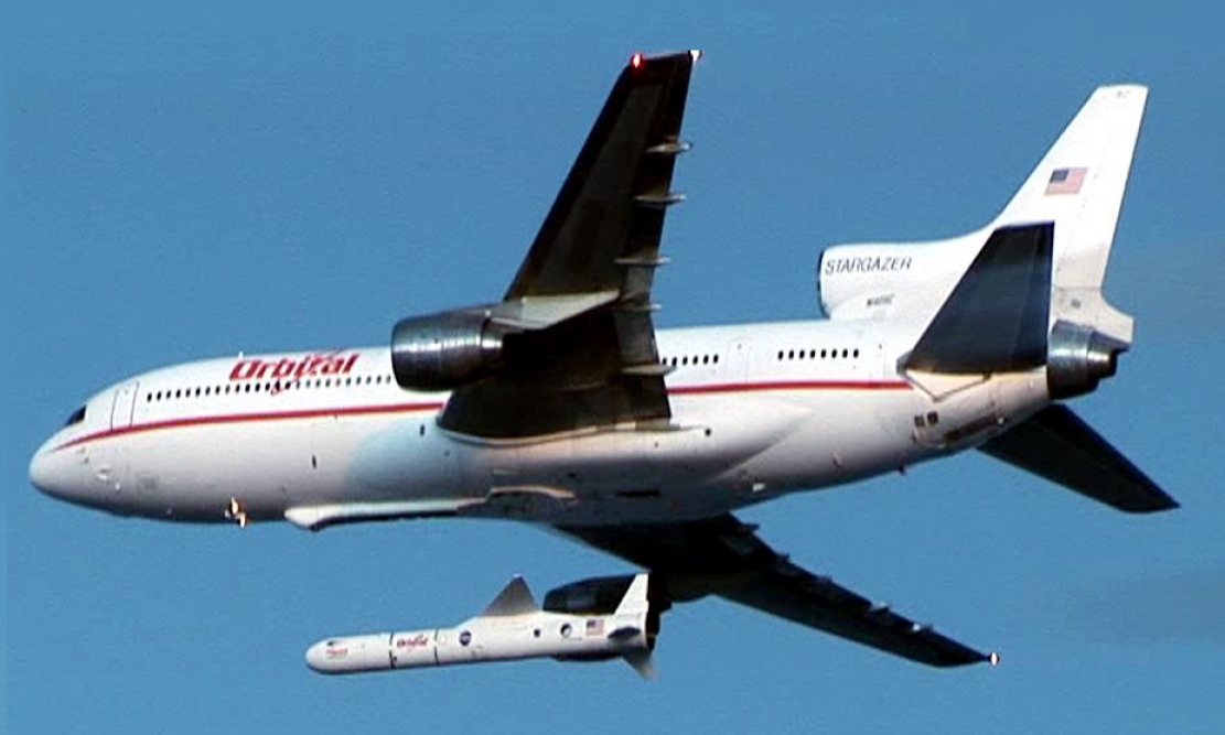
SEARCH Searches through the launch name, rocket name, launch agency, mission name & spacecraft name.
EXAMPLE - ?search=SpaceX
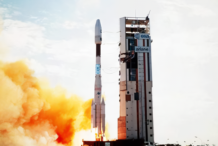
GET /2.2.0/launch/?format=api&offset=3440&ordering=-net
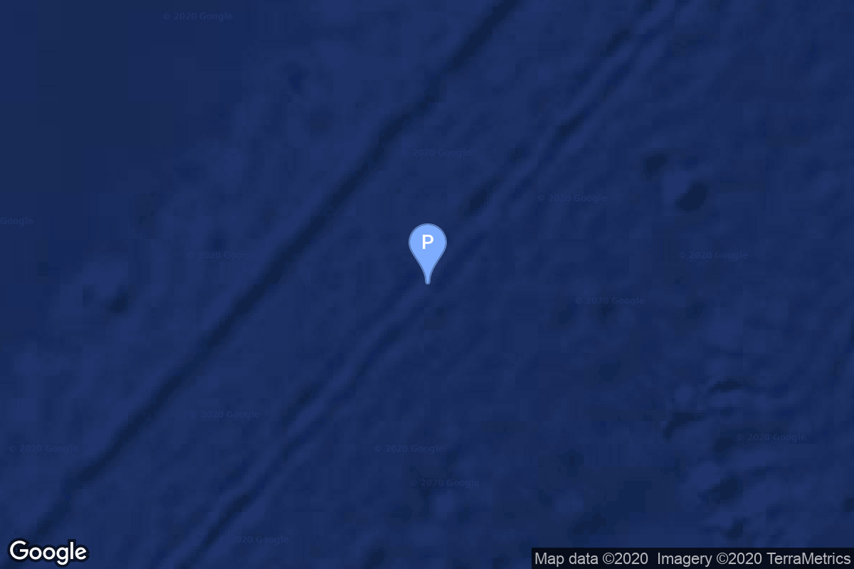
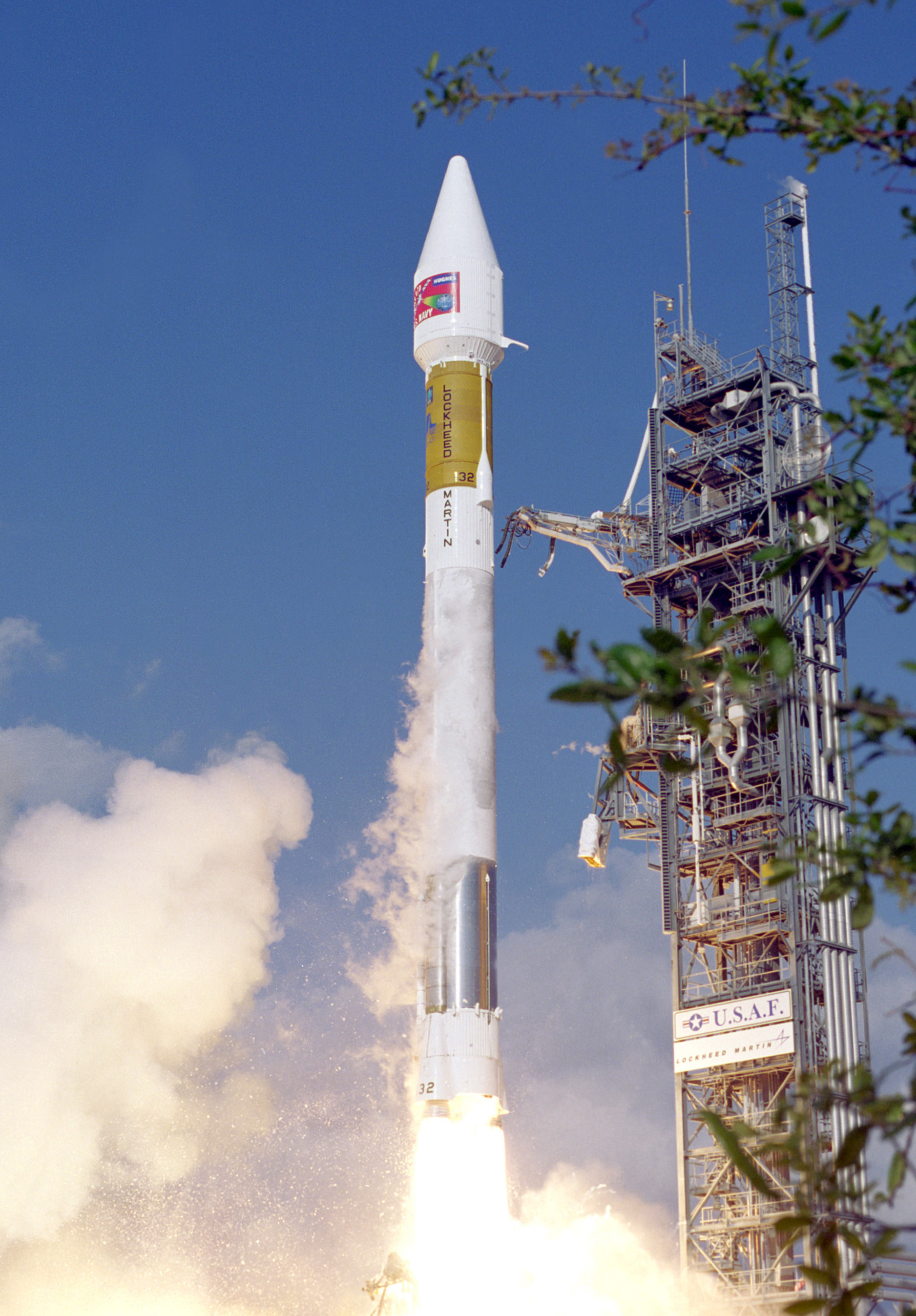
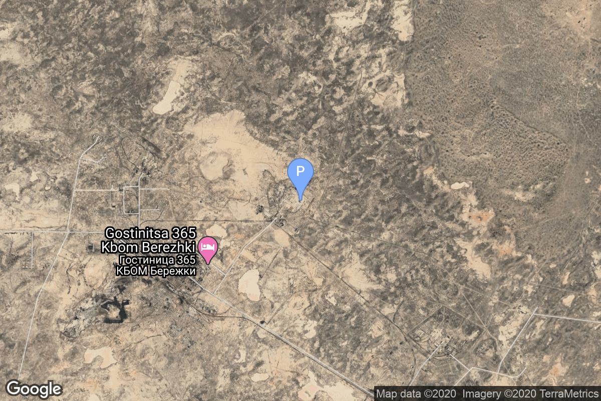
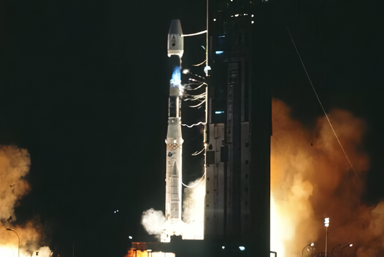
{ "count": 7943, "next": "https://ll.thespacedevs.com/2.2.0/launch/?format=api&limit=10&offset=3450&ordering=-net", "previous": "https://ll.thespacedevs.com/2.2.0/launch/?format=api&limit=10&offset=3430&ordering=-net", "results": [ { "id": "42a4f640-1603-46ea-ac2b-678432f5ed43", "url": "https://ll.thespacedevs.com/2.2.0/launch/42a4f640-1603-46ea-ac2b-678432f5ed43/?format=api", "slug": "ariane-44lp-europestar-1", "name": "Ariane 44LP | Europe*Star 1", "status": { "id": 3, "name": "Launch Successful", "abbrev": "Success", "description": "The launch vehicle successfully inserted its payload(s) into the target orbit(s)." }, "last_updated": "2023-06-14T04:22:24Z", "net": "2000-10-29T05:59:00Z", "window_end": "2000-10-29T05:59:00Z", "window_start": "2000-10-29T05:59:00Z", "net_precision": null, "probability": null, "weather_concerns": null, "holdreason": "", "failreason": null, "hashtag": null, "launch_service_provider": { "id": 115, "url": "https://ll.thespacedevs.com/2.2.0/agencies/115/?format=api", "name": "Arianespace", "type": "Commercial" }, "rocket": { "id": 7020, "configuration": { "id": 226, "url": "https://ll.thespacedevs.com/2.2.0/config/launcher/226/?format=api", "name": "Ariane 44LP", "family": "Ariane", "full_name": "Ariane 44LP", "variant": "44LP" } }, "mission": { "id": 5409, "name": "Europe*Star 1", "description": "The innovative Europe*Star 1 satellite has five high-performance beams covering Europe, Southern Africa, the Middle East, the Indian subcontinent and South East Asia.", "launch_designator": null, "type": "Communications", "orbit": { "id": 1, "name": "Geostationary Orbit", "abbrev": "Direct-GEO" }, "agencies": [], "info_urls": [], "vid_urls": [] }, "pad": { "id": 124, "url": "https://ll.thespacedevs.com/2.2.0/pad/124/?format=api", "agency_id": 115, "name": "Ariane Launch Area 2", "description": "The ELA-2 pad, built in 1986, had been used for Ariane 4 launches from 1988 until 2003. Before 1988, although purpose-built for Ariane 4, the pad hosted an Ariane-2 and two Ariane-3 launches.", "info_url": null, "wiki_url": "https://en.wikipedia.org/wiki/ELA-2", "map_url": "https://www.google.com/maps?q=5.232,-52.778194", "latitude": "5.232", "longitude": "-52.778194", "location": { "id": 13, "url": "https://ll.thespacedevs.com/2.2.0/location/13/?format=api", "name": "Guiana Space Centre, French Guiana", "country_code": "GUF", "description": "The Guiana Space Centre is a European spaceport to the northwest of Kourou in French Guiana, a region of France in South America. Kourou is located at a latitude of 5°. In operation since 1968, it is a suitable location for a spaceport because of its equatorial location and open sea to the east.", "map_image": "https://thespacedevs-prod.nyc3.digitaloceanspaces.com/media/map_images/location_13_20200803142412.jpg", "timezone_name": "America/Cayenne", "total_launch_count": 334, "total_landing_count": 0 }, "country_code": "GUF", "map_image": "https://thespacedevs-prod.nyc3.digitaloceanspaces.com/media/map_images/pad_124_20200803143241.jpg", "total_launch_count": 119, "orbital_launch_attempt_count": 119 }, "webcast_live": false, "image": "https://thespacedevs-prod.nyc3.digitaloceanspaces.com/media/images/ariane_44lp_at__image_20240401083402.png", "infographic": null, "program": [], "orbital_launch_attempt_count": 4437, "location_launch_attempt_count": 143, "pad_launch_attempt_count": 103, "agency_launch_attempt_count": 130, "orbital_launch_attempt_count_year": 70, "location_launch_attempt_count_year": 9, "pad_launch_attempt_count_year": 7, "agency_launch_attempt_count_year": 9, "type": "normal" }, { "id": "37a25942-cb76-4628-84db-13e05bfe9238", "url": "https://ll.thespacedevs.com/2.2.0/launch/37a25942-cb76-4628-84db-13e05bfe9238/?format=api", "slug": "proton-kdm-2m-ge-6", "name": "Proton-K/DM-2M | GE 6", "status": { "id": 3, "name": "Launch Successful", "abbrev": "Success", "description": "The launch vehicle successfully inserted its payload(s) into the target orbit(s)." }, "last_updated": "2023-06-14T03:46:20Z", "net": "2000-10-21T22:00:00Z", "window_end": "2000-10-21T22:00:00Z", "window_start": "2000-10-21T22:00:00Z", "net_precision": null, "probability": null, "weather_concerns": null, "holdreason": "", "failreason": null, "hashtag": null, "launch_service_provider": { "id": 96, "url": "https://ll.thespacedevs.com/2.2.0/agencies/96/?format=api", "name": "Khrunichev State Research and Production Space Center", "type": "Government" }, "rocket": { "id": 7019, "configuration": { "id": 350, "url": "https://ll.thespacedevs.com/2.2.0/config/launcher/350/?format=api", "name": "Proton-K/DM-2M", "family": "Proton / UR-500", "full_name": "Proton-K/DM-2M", "variant": "DM-2M" } }, "mission": { "id": 5408, "name": "GE 6", "description": "GE-6, a hybrid C/Ku-band satellite with 28 Ku Band and 24 C Band active transponders provides direct-to-home (DTH), media and entertainment distribution plus enterprise and internet protocol (IP)solutions in North America.", "launch_designator": null, "type": "Communications", "orbit": { "id": 1, "name": "Geostationary Orbit", "abbrev": "Direct-GEO" }, "agencies": [], "info_urls": [], "vid_urls": [] }, "pad": { "id": 31, "url": "https://ll.thespacedevs.com/2.2.0/pad/31/?format=api", "agency_id": null, "name": "81/23 (81L)", "description": null, "info_url": null, "wiki_url": "", "map_url": "https://www.google.com/maps?q=46.073997,62.977999", "latitude": "46.073997", "longitude": "62.977999", "location": { "id": 15, "url": "https://ll.thespacedevs.com/2.2.0/location/15/?format=api", "name": "Baikonur Cosmodrome, Republic of Kazakhstan", "country_code": "KAZ", "description": "The Baikonur Cosmodrome is a spaceport operated by Russia within Kazakhstan. Located in the Kazakh city of Baikonur, it is the largest operational space launch facility in terms of area. All Russian crewed spaceflights are launched from Baikonur.", "map_image": "https://thespacedevs-prod.nyc3.digitaloceanspaces.com/media/map_images/location_15_20200803142517.jpg", "timezone_name": "Asia/Qyzylorda", "total_launch_count": 1564, "total_landing_count": 0 }, "country_code": "KAZ", "map_image": "https://thespacedevs-prod.nyc3.digitaloceanspaces.com/media/map_images/pad_31_20200803143402.jpg", "total_launch_count": 104, "orbital_launch_attempt_count": 104 }, "webcast_live": false, "image": "https://thespacedevs-prod.nyc3.digitaloceanspaces.com/media/images/proton_image_20231231095535.jpg", "infographic": null, "program": [], "orbital_launch_attempt_count": 4436, "location_launch_attempt_count": 1167, "pad_launch_attempt_count": 94, "agency_launch_attempt_count": 80, "orbital_launch_attempt_count_year": 69, "location_launch_attempt_count_year": 27, "pad_launch_attempt_count_year": 5, "agency_launch_attempt_count_year": 13, "type": "normal" }, { "id": "afda37ce-de6d-4015-a5b2-dd7e11ae1882", "url": "https://ll.thespacedevs.com/2.2.0/launch/afda37ce-de6d-4015-a5b2-dd7e11ae1882/?format=api", "slug": "zenit-thuraya-1", "name": "Zenit | Thuraya 1", "status": { "id": 3, "name": "Launch Successful", "abbrev": "Success", "description": "The launch vehicle successfully inserted its payload(s) into the target orbit(s)." }, "last_updated": "2023-06-14T03:33:17Z", "net": "2000-10-21T05:52:00Z", "window_end": "2000-10-21T05:52:00Z", "window_start": "2000-10-21T05:52:00Z", "net_precision": null, "probability": null, "weather_concerns": null, "holdreason": "", "failreason": null, "hashtag": null, "launch_service_provider": { "id": 122, "url": "https://ll.thespacedevs.com/2.2.0/agencies/122/?format=api", "name": "Sea Launch", "type": "Commercial" }, "rocket": { "id": 7018, "configuration": { "id": 11, "url": "https://ll.thespacedevs.com/2.2.0/config/launcher/11/?format=api", "name": "Zenit", "family": "Zenith", "full_name": "Zenit 3SL", "variant": "3SL" } }, "mission": { "id": 5407, "name": "Thuraya 1", "description": "Thuraya-1 is the first satellite in the Boeing GEM (Geomobile) series. This product line expands Boeing's offerings beyond satellite manufacturing, to integrate a high-power geosynchronous satellite (derived from the Boeing BSS_702 body-stabilized design) with a ground segment and user handsets, to provide a range of cellular-like voice and data services over a large geographic region. The Thuraya ground segment includes terrestrial gateways plus a collocated network operations center and satellite control facility in the UAE.", "launch_designator": null, "type": "Communications", "orbit": { "id": 1, "name": "Geostationary Orbit", "abbrev": "Direct-GEO" }, "agencies": [], "info_urls": [], "vid_urls": [] }, "pad": { "id": 13, "url": "https://ll.thespacedevs.com/2.2.0/pad/13/?format=api", "agency_id": 80, "name": "Launch Platform Odyssey", "description": "", "info_url": null, "wiki_url": "https://en.wikipedia.org/wiki/Odyssey_(launch_platform)", "map_url": "https://www.google.com/maps?q=0.0,-154", "latitude": "0.0", "longitude": "-154.0", "location": { "id": 3, "url": "https://ll.thespacedevs.com/2.2.0/location/3/?format=api", "name": "Sea Launch", "country_code": "???", "description": "", "map_image": "https://thespacedevs-prod.nyc3.digitaloceanspaces.com/media/map_images/location_3_20200803142448.jpg", "timezone_name": "", "total_launch_count": 40, "total_landing_count": 0 }, "country_code": "", "map_image": "https://thespacedevs-prod.nyc3.digitaloceanspaces.com/media/map_images/pad_13_20200803143257.jpg", "total_launch_count": 36, "orbital_launch_attempt_count": 36 }, "webcast_live": false, "image": null, "infographic": null, "program": [], "orbital_launch_attempt_count": 4435, "location_launch_attempt_count": 6, "pad_launch_attempt_count": 5, "agency_launch_attempt_count": 5, "orbital_launch_attempt_count_year": 68, "location_launch_attempt_count_year": 3, "pad_launch_attempt_count_year": 3, "agency_launch_attempt_count_year": 3, "type": "normal" }, { "id": "1d0a6f7b-3ef4-4596-882c-f488bc1a62db", "url": "https://ll.thespacedevs.com/2.2.0/launch/1d0a6f7b-3ef4-4596-882c-f488bc1a62db/?format=api", "slug": "atlas-iia-dscs-3-b11", "name": "Atlas IIA | DSCS-3 B11", "status": { "id": 3, "name": "Launch Successful", "abbrev": "Success", "description": "The launch vehicle successfully inserted its payload(s) into the target orbit(s)." }, "last_updated": "2023-06-14T17:40:06Z", "net": "2000-10-20T00:40:02Z", "window_end": "2000-10-20T00:40:02Z", "window_start": "2000-10-20T00:40:02Z", "net_precision": null, "probability": null, "weather_concerns": null, "holdreason": "", "failreason": null, "hashtag": null, "launch_service_provider": { "id": 82, "url": "https://ll.thespacedevs.com/2.2.0/agencies/82/?format=api", "name": "Lockheed Martin", "type": "Commercial" }, "rocket": { "id": 7017, "configuration": { "id": 254, "url": "https://ll.thespacedevs.com/2.2.0/config/launcher/254/?format=api", "name": "Atlas IIA", "family": "Atlas", "full_name": "Atlas IIA", "variant": "IIA" } }, "mission": { "id": 5406, "name": "DSCS-3 B11", "description": "DSCS-3 (Defense Satellite Communications System 3) are geostationary communications satellites, which provide a robust anti-jam, nuclear hardened capability that supports Department of Defense (DoD) worldwide requirements, White House and Diplomatic communications. They are the follow-on generation of the DSCS-2 satellites.", "launch_designator": null, "type": "Communications", "orbit": { "id": 1, "name": "Geostationary Orbit", "abbrev": "Direct-GEO" }, "agencies": [], "info_urls": [], "vid_urls": [] }, "pad": { "id": 121, "url": "https://ll.thespacedevs.com/2.2.0/pad/121/?format=api", "agency_id": 161, "name": "Launch Complex 36A", "description": null, "info_url": null, "wiki_url": "https://en.wikipedia.org/wiki/Cape_Canaveral_Launch_Complex_36", "map_url": "https://www.google.com/maps?q=28.4705556,-80.542194", "latitude": "28.4705556", "longitude": "-80.542194", "location": { "id": 12, "url": "https://ll.thespacedevs.com/2.2.0/location/12/?format=api", "name": "Cape Canaveral SFS, FL, USA", "country_code": "USA", "description": "Cape Canaveral Space Force Station (CCSFS) is an installation of the United States Space Force's Space Launch Delta 45, located on Cape Canaveral in Brevard County, Florida.", "map_image": "https://thespacedevs-prod.nyc3.digitaloceanspaces.com/media/map_images/location_12_20200803142519.jpg", "timezone_name": "America/New_York", "total_launch_count": 1123, "total_landing_count": 76 }, "country_code": "USA", "map_image": "https://thespacedevs-prod.nyc3.digitaloceanspaces.com/media/map_images/pad_121_20200803143231.jpg", "total_launch_count": 71, "orbital_launch_attempt_count": 71 }, "webcast_live": false, "image": "https://thespacedevs-prod.nyc3.digitaloceanspaces.com/media/images/launch_of_an_at_image_20251123092831.jpg", "infographic": null, "program": [], "orbital_launch_attempt_count": 4434, "location_launch_attempt_count": 584, "pad_launch_attempt_count": 60, "agency_launch_attempt_count": 53, "orbital_launch_attempt_count_year": 67, "location_launch_attempt_count_year": 12, "pad_launch_attempt_count_year": 4, "agency_launch_attempt_count_year": 7, "type": "normal" }, { "id": "1c76d610-c557-4023-aa4e-3ee0b6aa3418", "url": "https://ll.thespacedevs.com/2.2.0/launch/1c76d610-c557-4023-aa4e-3ee0b6aa3418/?format=api", "slug": "soyuz-u-progress-m-43", "name": "Soyuz U | Progress M-43", "status": { "id": 3, "name": "Launch Successful", "abbrev": "Success", "description": "The launch vehicle successfully inserted its payload(s) into the target orbit(s)." }, "last_updated": "2023-06-14T03:48:49Z", "net": "2000-10-16T21:27:06Z", "window_end": "2000-10-16T21:27:06Z", "window_start": "2000-10-16T21:27:06Z", "net_precision": null, "probability": 0, "weather_concerns": null, "holdreason": "", "failreason": "", "hashtag": "", "launch_service_provider": { "id": 63, "url": "https://ll.thespacedevs.com/2.2.0/agencies/63/?format=api", "name": "Russian Federal Space Agency (ROSCOSMOS)", "type": "Government" }, "rocket": { "id": 2319, "configuration": { "id": 37, "url": "https://ll.thespacedevs.com/2.2.0/config/launcher/37/?format=api", "name": "Soyuz U", "family": "Soyuz", "full_name": "Soyuz U", "variant": "" } }, "mission": null, "pad": { "id": 32, "url": "https://ll.thespacedevs.com/2.2.0/pad/32/?format=api", "agency_id": null, "name": "1/5", "description": null, "info_url": null, "wiki_url": "", "map_url": "https://www.google.com/maps?q=45.92,63.342", "latitude": "45.92", "longitude": "63.342", "location": { "id": 15, "url": "https://ll.thespacedevs.com/2.2.0/location/15/?format=api", "name": "Baikonur Cosmodrome, Republic of Kazakhstan", "country_code": "KAZ", "description": "The Baikonur Cosmodrome is a spaceport operated by Russia within Kazakhstan. Located in the Kazakh city of Baikonur, it is the largest operational space launch facility in terms of area. All Russian crewed spaceflights are launched from Baikonur.", "map_image": "https://thespacedevs-prod.nyc3.digitaloceanspaces.com/media/map_images/location_15_20200803142517.jpg", "timezone_name": "Asia/Qyzylorda", "total_launch_count": 1564, "total_landing_count": 0 }, "country_code": "KAZ", "map_image": "https://thespacedevs-prod.nyc3.digitaloceanspaces.com/media/map_images/pad_32_20200803143513.jpg", "total_launch_count": 487, "orbital_launch_attempt_count": 487 }, "webcast_live": false, "image": "https://thespacedevs-prod.nyc3.digitaloceanspaces.com/media/images/soyuz2520u_image_20190222031023.jpeg", "infographic": null, "program": [ { "id": 16, "url": "https://ll.thespacedevs.com/2.2.0/program/16/?format=api", "name": "Mir", "description": "Mir was a space station that operated in low Earth orbit from 1986 to 2001, operated by the Soviet Union and later by Russia. Mir was the first modular space station and was assembled in orbit from 1986 to 1996.", "agencies": [ { "id": 63, "url": "https://ll.thespacedevs.com/2.2.0/agencies/63/?format=api", "name": "Russian Federal Space Agency (ROSCOSMOS)", "type": "Government" }, { "id": 66, "url": "https://ll.thespacedevs.com/2.2.0/agencies/66/?format=api", "name": "Soviet Space Program", "type": "Government" } ], "image_url": "https://thespacedevs-prod.nyc3.digitaloceanspaces.com/media/images/mir_program_20200821092345.jpeg", "start_date": "1986-02-20T21:28:23Z", "end_date": "2001-03-23T05:59:00Z", "info_url": null, "wiki_url": "https://en.wikipedia.org/wiki/Mir", "mission_patches": [], "type": { "id": 2, "name": "Human Spaceflight" } } ], "orbital_launch_attempt_count": 4433, "location_launch_attempt_count": 1166, "pad_launch_attempt_count": 366, "agency_launch_attempt_count": 108, "orbital_launch_attempt_count_year": 66, "location_launch_attempt_count_year": 26, "pad_launch_attempt_count_year": 6, "agency_launch_attempt_count_year": 13, "type": "normal" }, { "id": "42ef8a56-ea14-456f-973e-f432817faff2", "url": "https://ll.thespacedevs.com/2.2.0/launch/42ef8a56-ea14-456f-973e-f432817faff2/?format=api", "slug": "proton-uragan-75-to-77", "name": "Proton | Uragan 75 to 77", "status": { "id": 3, "name": "Launch Successful", "abbrev": "Success", "description": "The launch vehicle successfully inserted its payload(s) into the target orbit(s)." }, "last_updated": "2023-06-14T03:32:40Z", "net": "2000-10-13T14:12:45Z", "window_end": "2000-10-13T14:12:45Z", "window_start": "2000-10-13T14:12:45Z", "net_precision": null, "probability": null, "weather_concerns": null, "holdreason": "", "failreason": null, "hashtag": null, "launch_service_provider": { "id": 96, "url": "https://ll.thespacedevs.com/2.2.0/agencies/96/?format=api", "name": "Khrunichev State Research and Production Space Center", "type": "Government" }, "rocket": { "id": 7016, "configuration": { "id": 80, "url": "https://ll.thespacedevs.com/2.2.0/config/launcher/80/?format=api", "name": "Proton", "family": "Proton / UR-500", "full_name": "Proton K/DM-2", "variant": "K/DM-2" } }, "mission": { "id": 5405, "name": "Uragan 75 to 77", "description": "GLONASS navigation satellites", "launch_designator": null, "type": "Navigation", "orbit": { "id": 12, "name": "Medium Earth Orbit", "abbrev": "MEO" }, "agencies": [], "info_urls": [], "vid_urls": [] }, "pad": { "id": 7, "url": "https://ll.thespacedevs.com/2.2.0/pad/7/?format=api", "agency_id": null, "name": "81/24 (81P)", "description": null, "info_url": null, "wiki_url": "", "map_url": "https://www.google.com/maps?q=46.071001,62.984999", "latitude": "46.071001", "longitude": "62.984999", "location": { "id": 15, "url": "https://ll.thespacedevs.com/2.2.0/location/15/?format=api", "name": "Baikonur Cosmodrome, Republic of Kazakhstan", "country_code": "KAZ", "description": "The Baikonur Cosmodrome is a spaceport operated by Russia within Kazakhstan. Located in the Kazakh city of Baikonur, it is the largest operational space launch facility in terms of area. All Russian crewed spaceflights are launched from Baikonur.", "map_image": "https://thespacedevs-prod.nyc3.digitaloceanspaces.com/media/map_images/location_15_20200803142517.jpg", "timezone_name": "Asia/Qyzylorda", "total_launch_count": 1564, "total_landing_count": 0 }, "country_code": "KAZ", "map_image": "https://thespacedevs-prod.nyc3.digitaloceanspaces.com/media/map_images/pad_7_20200803143454.jpg", "total_launch_count": 93, "orbital_launch_attempt_count": 93 }, "webcast_live": false, "image": "https://thespacedevs-prod.nyc3.digitaloceanspaces.com/media/images/proton_image_20231231095535.jpg", "infographic": null, "program": [ { "id": 34, "url": "https://ll.thespacedevs.com/2.2.0/program/34/?format=api", "name": "GLONASS", "description": "GLONASS (ГЛОНАСС, IPA: [ɡɫɐˈnas]; Russian: Глобальная навигационная спутниковая система, tr. Global'naya Navigatsionnaya Sputnikovaya Sistema, lit. 'Global Navigation Satellite System') is a Russian satellite navigation system operating as part of a radionavigation-satellite service. It provides an alternative to Global Positioning System (GPS) and is the second navigational system in operation with global coverage and of comparable precision.", "agencies": [ { "id": 63, "url": "https://ll.thespacedevs.com/2.2.0/agencies/63/?format=api", "name": "Russian Federal Space Agency (ROSCOSMOS)", "type": "Government" } ], "image_url": "https://thespacedevs-prod.nyc3.digitaloceanspaces.com/media/images/glonass_program_20240102170258.png", "start_date": "1982-10-12T00:00:00Z", "end_date": null, "info_url": "https://www.glonass-iac.ru/en/", "wiki_url": "https://en.wikipedia.org/wiki/GLONASS", "mission_patches": [], "type": { "id": 4, "name": "Navigation Constellation" } } ], "orbital_launch_attempt_count": 4432, "location_launch_attempt_count": 1165, "pad_launch_attempt_count": 37, "agency_launch_attempt_count": 79, "orbital_launch_attempt_count_year": 65, "location_launch_attempt_count_year": 25, "pad_launch_attempt_count_year": 4, "agency_launch_attempt_count_year": 12, "type": "normal" }, { "id": "0253e89f-8d0f-4b5b-a66e-3bef8474db65", "url": "https://ll.thespacedevs.com/2.2.0/launch/0253e89f-8d0f-4b5b-a66e-3bef8474db65/?format=api", "slug": "space-shuttle-discovery-ov-103-sts-92", "name": "Space Shuttle Discovery / OV-103 | STS-92", "status": { "id": 3, "name": "Launch Successful", "abbrev": "Success", "description": "The launch vehicle successfully inserted its payload(s) into the target orbit(s)." }, "last_updated": "2023-06-14T08:50:16Z", "net": "2000-10-11T23:17:00Z", "window_end": "2000-10-11T23:17:00Z", "window_start": "2000-10-11T23:17:00Z", "net_precision": null, "probability": null, "weather_concerns": null, "holdreason": "", "failreason": null, "hashtag": null, "launch_service_provider": { "id": 192, "url": "https://ll.thespacedevs.com/2.2.0/agencies/192/?format=api", "name": "Lockheed Space Operations Company", "type": "Commercial" }, "rocket": { "id": 458, "configuration": { "id": 493, "url": "https://ll.thespacedevs.com/2.2.0/config/launcher/493/?format=api", "name": "Space Shuttle", "family": "", "full_name": "Space Shuttle", "variant": "" } }, "mission": { "id": 857, "name": "STS-92", "description": "STS-92 was a Space Shuttle mission to the International Space Station (ISS) flown by Space Shuttle Discovery. STS-92 marked the 100th mission of the Space Shuttle.", "launch_designator": null, "type": "Human Exploration", "orbit": { "id": 8, "name": "Low Earth Orbit", "abbrev": "LEO" }, "agencies": [], "info_urls": [], "vid_urls": [] }, "pad": { "id": 87, "url": "https://ll.thespacedevs.com/2.2.0/pad/87/?format=api", "agency_id": 121, "name": "Launch Complex 39A", "description": "", "info_url": null, "wiki_url": "https://en.wikipedia.org/wiki/Kennedy_Space_Center_Launch_Complex_39#Launch_Pad_39A", "map_url": "https://www.google.com/maps?q=28.60822681,-80.60428186", "latitude": "28.60822681", "longitude": "-80.60428186", "location": { "id": 27, "url": "https://ll.thespacedevs.com/2.2.0/location/27/?format=api", "name": "Kennedy Space Center, FL, USA", "country_code": "USA", "description": "The John F. Kennedy Space Center, located on Merritt Island, Florida, is one of NASA's ten field centers. Since 1968, KSC has been NASA's primary launch center of American spaceflight, research, and technology. Launch operations for the Apollo, Skylab and Space Shuttle programs were carried out from Kennedy Space Center Launch Complex 39 and managed by KSC. Located on the east coast of Florida, KSC is adjacent to Cape Canaveral Space Force Station (CCSFS).", "map_image": "https://thespacedevs-prod.nyc3.digitaloceanspaces.com/media/map_images/location_27_20200803142447.jpg", "timezone_name": "America/New_York", "total_launch_count": 281, "total_landing_count": 0 }, "country_code": "USA", "map_image": "https://thespacedevs-prod.nyc3.digitaloceanspaces.com/media/map_images/pad_87_20200803143537.jpg", "total_launch_count": 222, "orbital_launch_attempt_count": 221 }, "webcast_live": false, "image": "https://thespacedevs-prod.nyc3.digitaloceanspaces.com/media/images/space_shuttle_image_20230422074810.jpeg", "infographic": null, "program": [ { "id": 17, "url": "https://ll.thespacedevs.com/2.2.0/program/17/?format=api", "name": "International Space Station", "description": "The International Space Station programme is tied together by a complex set of legal, political and financial agreements between the sixteen nations involved in the project, governing ownership of the various components, rights to crewing and utilization, and responsibilities for crew rotation and resupply of the International Space Station. It was conceived in 1984 by President Ronald Reagan, during the Space Station Freedom project as it was originally called.", "agencies": [ { "id": 16, "url": "https://ll.thespacedevs.com/2.2.0/agencies/16/?format=api", "name": "Canadian Space Agency", "type": "Government" }, { "id": 27, "url": "https://ll.thespacedevs.com/2.2.0/agencies/27/?format=api", "name": "European Space Agency", "type": "Multinational" }, { "id": 37, "url": "https://ll.thespacedevs.com/2.2.0/agencies/37/?format=api", "name": "Japan Aerospace Exploration Agency", "type": "Government" }, { "id": 44, "url": "https://ll.thespacedevs.com/2.2.0/agencies/44/?format=api", "name": "National Aeronautics and Space Administration", "type": "Government" }, { "id": 63, "url": "https://ll.thespacedevs.com/2.2.0/agencies/63/?format=api", "name": "Russian Federal Space Agency (ROSCOSMOS)", "type": "Government" } ], "image_url": "https://thespacedevs-prod.nyc3.digitaloceanspaces.com/media/images/international2_program_20201129184745.png", "start_date": "1998-11-20T06:40:00Z", "end_date": null, "info_url": "https://www.nasa.gov/mission_pages/station/main/index.html", "wiki_url": "https://en.wikipedia.org/wiki/International_Space_Station_programme", "mission_patches": [], "type": { "id": 2, "name": "Human Spaceflight" } }, { "id": 6, "url": "https://ll.thespacedevs.com/2.2.0/program/6/?format=api", "name": "Space Shuttle", "description": "The Space Shuttle program was the fourth human spaceflight program carried out by the National Aeronautics and Space Administration (NASA), which accomplished routine transportation for Earth-to-orbit crew and cargo from 1981 to 2011.", "agencies": [ { "id": 44, "url": "https://ll.thespacedevs.com/2.2.0/agencies/44/?format=api", "name": "National Aeronautics and Space Administration", "type": "Government" } ], "image_url": "https://thespacedevs-prod.nyc3.digitaloceanspaces.com/media/images/space2520shutt_program_20200820202237.png", "start_date": "1981-04-12T12:00:03Z", "end_date": "2011-07-08T15:29:00Z", "info_url": "https://www.nasa.gov/mission_pages/shuttle/main/index.html", "wiki_url": "https://en.wikipedia.org/wiki/Space_Shuttle_program", "mission_patches": [], "type": { "id": 2, "name": "Human Spaceflight" } } ], "orbital_launch_attempt_count": 4431, "location_launch_attempt_count": 117, "pad_launch_attempt_count": 71, "agency_launch_attempt_count": 65, "orbital_launch_attempt_count_year": 64, "location_launch_attempt_count_year": 4, "pad_launch_attempt_count_year": 3, "agency_launch_attempt_count_year": 1, "type": "normal" }, { "id": "7a8b05d4-846d-4605-9fa6-ead7a70a0964", "url": "https://ll.thespacedevs.com/2.2.0/launch/7a8b05d4-846d-4605-9fa6-ead7a70a0964/?format=api", "slug": "pegasus-hybrid-high-energy-transient-explorer-2-he", "name": "Pegasus Hybrid | High Energy Transient Explorer 2 (HETE-2)", "status": { "id": 3, "name": "Launch Successful", "abbrev": "Success", "description": "The launch vehicle successfully inserted its payload(s) into the target orbit(s)." }, "last_updated": "2024-06-15T13:53:23Z", "net": "2000-10-09T05:38:18Z", "window_end": "2000-10-09T05:38:18Z", "window_start": "2000-10-09T05:38:18Z", "net_precision": { "id": 0, "name": "Second", "abbrev": "SEC", "description": "The T-0 is accurate to the second." }, "probability": null, "weather_concerns": null, "holdreason": "", "failreason": "", "hashtag": null, "launch_service_provider": { "id": 100, "url": "https://ll.thespacedevs.com/2.2.0/agencies/100/?format=api", "name": "Orbital Sciences Corporation", "type": "Commercial" }, "rocket": { "id": 457, "configuration": { "id": 129, "url": "https://ll.thespacedevs.com/2.2.0/config/launcher/129/?format=api", "name": "Pegasus Hybrid", "family": "Pegasus", "full_name": "Pegasus Hybrid", "variant": "Hybrid" } }, "mission": null, "pad": { "id": 59, "url": "https://ll.thespacedevs.com/2.2.0/pad/59/?format=api", "agency_id": null, "name": "Kwajalein Atoll", "description": null, "info_url": null, "wiki_url": "https://en.wikipedia.org/wiki/Kwajalein_Atoll", "map_url": "https://www.google.com/maps?q=8.716667,167.733333", "latitude": "8.716667", "longitude": "167.733333", "location": { "id": 20, "url": "https://ll.thespacedevs.com/2.2.0/location/20/?format=api", "name": "Air launch to orbit", "country_code": "???", "description": "", "map_image": "https://thespacedevs-prod.nyc3.digitaloceanspaces.com/media/map_images/location_20_20200803142433.jpg", "timezone_name": "", "total_launch_count": 52, "total_landing_count": 0 }, "country_code": "MHL", "map_image": "https://thespacedevs-prod.nyc3.digitaloceanspaces.com/media/map_images/pad_59_20200803143427.jpg", "total_launch_count": 5, "orbital_launch_attempt_count": 5 }, "webcast_live": false, "image": "https://thespacedevs-prod.nyc3.digitaloceanspaces.com/media/images/pegasus_image_20190830213841.jpg", "infographic": null, "program": [], "orbital_launch_attempt_count": 4430, "location_launch_attempt_count": 29, "pad_launch_attempt_count": 1, "agency_launch_attempt_count": 37, "orbital_launch_attempt_count_year": 63, "location_launch_attempt_count_year": 2, "pad_launch_attempt_count_year": 1, "agency_launch_attempt_count_year": 5, "type": "normal" }, { "id": "7c37313e-d99b-42b3-829b-eecbb570d591", "url": "https://ll.thespacedevs.com/2.2.0/launch/7c37313e-d99b-42b3-829b-eecbb570d591/?format=api", "slug": "ariane-42l-n-sat-110", "name": "Ariane 42L | N-SAT-110", "status": { "id": 3, "name": "Launch Successful", "abbrev": "Success", "description": "The launch vehicle successfully inserted its payload(s) into the target orbit(s)." }, "last_updated": "2023-06-14T04:22:21Z", "net": "2000-10-06T23:00:00Z", "window_end": "2000-10-06T23:00:00Z", "window_start": "2000-10-06T23:00:00Z", "net_precision": null, "probability": null, "weather_concerns": null, "holdreason": "", "failreason": null, "hashtag": null, "launch_service_provider": { "id": 115, "url": "https://ll.thespacedevs.com/2.2.0/agencies/115/?format=api", "name": "Arianespace", "type": "Commercial" }, "rocket": { "id": 7015, "configuration": { "id": 223, "url": "https://ll.thespacedevs.com/2.2.0/config/launcher/223/?format=api", "name": "Ariane 42L", "family": "Ariane", "full_name": "Ariane 42L", "variant": "42L" } }, "mission": { "id": 5404, "name": "N-SAT-110", "description": "The N-SAT-110 telecommunications satellite, designed and built for Space Communications Corporation (SCC) and JSAT Corporation of Tokyo, Japan by Lockheed Martin Commercial Space Systems (LMCSS), was launched successfully on 06.10.2000 from Kourou, French Guiana.", "launch_designator": null, "type": "Communications", "orbit": { "id": 1, "name": "Geostationary Orbit", "abbrev": "Direct-GEO" }, "agencies": [], "info_urls": [], "vid_urls": [] }, "pad": { "id": 124, "url": "https://ll.thespacedevs.com/2.2.0/pad/124/?format=api", "agency_id": 115, "name": "Ariane Launch Area 2", "description": "The ELA-2 pad, built in 1986, had been used for Ariane 4 launches from 1988 until 2003. Before 1988, although purpose-built for Ariane 4, the pad hosted an Ariane-2 and two Ariane-3 launches.", "info_url": null, "wiki_url": "https://en.wikipedia.org/wiki/ELA-2", "map_url": "https://www.google.com/maps?q=5.232,-52.778194", "latitude": "5.232", "longitude": "-52.778194", "location": { "id": 13, "url": "https://ll.thespacedevs.com/2.2.0/location/13/?format=api", "name": "Guiana Space Centre, French Guiana", "country_code": "GUF", "description": "The Guiana Space Centre is a European spaceport to the northwest of Kourou in French Guiana, a region of France in South America. Kourou is located at a latitude of 5°. In operation since 1968, it is a suitable location for a spaceport because of its equatorial location and open sea to the east.", "map_image": "https://thespacedevs-prod.nyc3.digitaloceanspaces.com/media/map_images/location_13_20200803142412.jpg", "timezone_name": "America/Cayenne", "total_launch_count": 334, "total_landing_count": 0 }, "country_code": "GUF", "map_image": "https://thespacedevs-prod.nyc3.digitaloceanspaces.com/media/map_images/pad_124_20200803143241.jpg", "total_launch_count": 119, "orbital_launch_attempt_count": 119 }, "webcast_live": false, "image": "https://thespacedevs-prod.nyc3.digitaloceanspaces.com/media/images/ariane_42l_at_e_image_20240401083718.png", "infographic": null, "program": [], "orbital_launch_attempt_count": 4429, "location_launch_attempt_count": 142, "pad_launch_attempt_count": 102, "agency_launch_attempt_count": 129, "orbital_launch_attempt_count_year": 62, "location_launch_attempt_count_year": 8, "pad_launch_attempt_count_year": 6, "agency_launch_attempt_count_year": 8, "type": "normal" }, { "id": "7ad9b0a2-d383-4c6c-84a1-a75d5e3662bf", "url": "https://ll.thespacedevs.com/2.2.0/launch/7ad9b0a2-d383-4c6c-84a1-a75d5e3662bf/?format=api", "slug": "proton-kdm-2m-ge-1a", "name": "Proton-K/DM-2M | GE-1A", "status": { "id": 3, "name": "Launch Successful", "abbrev": "Success", "description": "The launch vehicle successfully inserted its payload(s) into the target orbit(s)." }, "last_updated": "2023-06-14T03:46:14Z", "net": "2000-10-01T22:00:00Z", "window_end": "2000-10-01T22:00:00Z", "window_start": "2000-10-01T22:00:00Z", "net_precision": null, "probability": null, "weather_concerns": null, "holdreason": "", "failreason": null, "hashtag": null, "launch_service_provider": { "id": 96, "url": "https://ll.thespacedevs.com/2.2.0/agencies/96/?format=api", "name": "Khrunichev State Research and Production Space Center", "type": "Government" }, "rocket": { "id": 7014, "configuration": { "id": 350, "url": "https://ll.thespacedevs.com/2.2.0/config/launcher/350/?format=api", "name": "Proton-K/DM-2M", "family": "Proton / UR-500", "full_name": "Proton-K/DM-2M", "variant": "DM-2M" } }, "mission": { "id": 5403, "name": "GE-1A", "description": "The GE-1A telecommunications satellite was designed and built by Lockheed Martin Commercial Space Systems (LMCSS) for Americom Asia-Pacific (AAP), a joint venture between GE American Communications and Lockheed Martin Global Telecommunications.", "launch_designator": null, "type": "Communications", "orbit": { "id": 1, "name": "Geostationary Orbit", "abbrev": "Direct-GEO" }, "agencies": [], "info_urls": [], "vid_urls": [] }, "pad": { "id": 31, "url": "https://ll.thespacedevs.com/2.2.0/pad/31/?format=api", "agency_id": null, "name": "81/23 (81L)", "description": null, "info_url": null, "wiki_url": "", "map_url": "https://www.google.com/maps?q=46.073997,62.977999", "latitude": "46.073997", "longitude": "62.977999", "location": { "id": 15, "url": "https://ll.thespacedevs.com/2.2.0/location/15/?format=api", "name": "Baikonur Cosmodrome, Republic of Kazakhstan", "country_code": "KAZ", "description": "The Baikonur Cosmodrome is a spaceport operated by Russia within Kazakhstan. Located in the Kazakh city of Baikonur, it is the largest operational space launch facility in terms of area. All Russian crewed spaceflights are launched from Baikonur.", "map_image": "https://thespacedevs-prod.nyc3.digitaloceanspaces.com/media/map_images/location_15_20200803142517.jpg", "timezone_name": "Asia/Qyzylorda", "total_launch_count": 1564, "total_landing_count": 0 }, "country_code": "KAZ", "map_image": "https://thespacedevs-prod.nyc3.digitaloceanspaces.com/media/map_images/pad_31_20200803143402.jpg", "total_launch_count": 104, "orbital_launch_attempt_count": 104 }, "webcast_live": false, "image": "https://thespacedevs-prod.nyc3.digitaloceanspaces.com/media/images/proton_image_20231231095535.jpg", "infographic": null, "program": [], "orbital_launch_attempt_count": 4428, "location_launch_attempt_count": 1164, "pad_launch_attempt_count": 93, "agency_launch_attempt_count": 78, "orbital_launch_attempt_count_year": 61, "location_launch_attempt_count_year": 24, "pad_launch_attempt_count_year": 4, "agency_launch_attempt_count_year": 11, "type": "normal" } ] }