Launch List
AN API endpoint that returns all Launch objects or a single launch.
EXAMPLE - /launch/[id]/ or /launch/?mode=list&search=SpaceX
GET Return a list of all Launch objects.
FILTERS Fields - 'name', 'id(s)', 'lsp__id', 'lsp__name', 'serial_number', 'launcher_config__id', 'rocket__spacecraftflight__spacecraft__name', 'is_crewed', 'include_suborbital', 'spacecraft_config__ids', 'related', 'location__ids', 'lsp__ids', 'pad__ids', 'status__ids'
MODE 'normal', 'list', 'detailed'
EXAMPLE ?mode=list
SEARCH Searches through the launch name, rocket name, launch agency, mission name & spacecraft name.
EXAMPLE - ?search=SpaceX
GET /2.2.0/launch/?format=api&offset=3240&ordering=-net
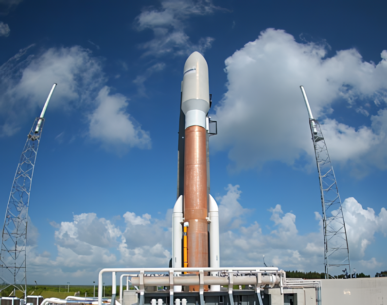
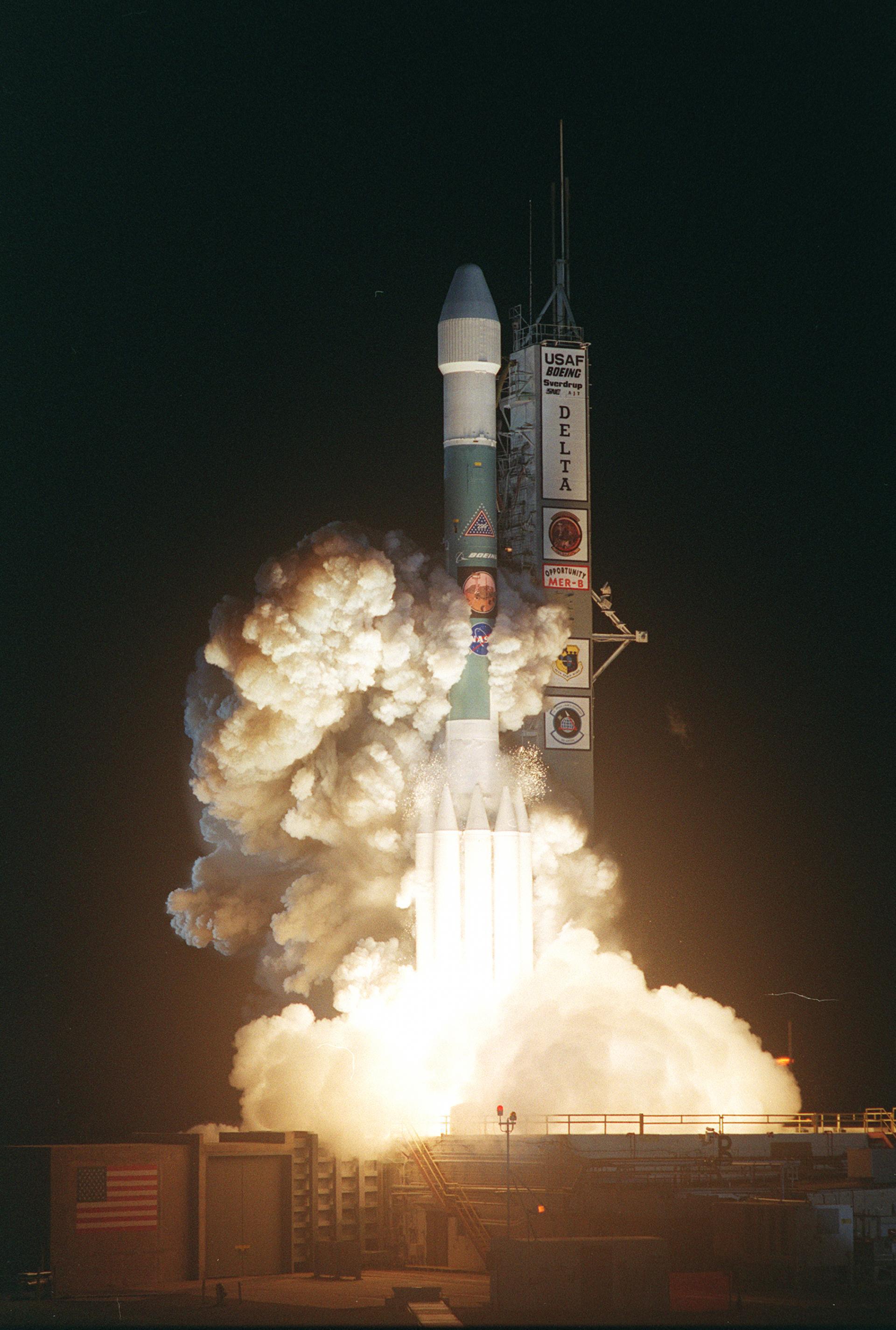
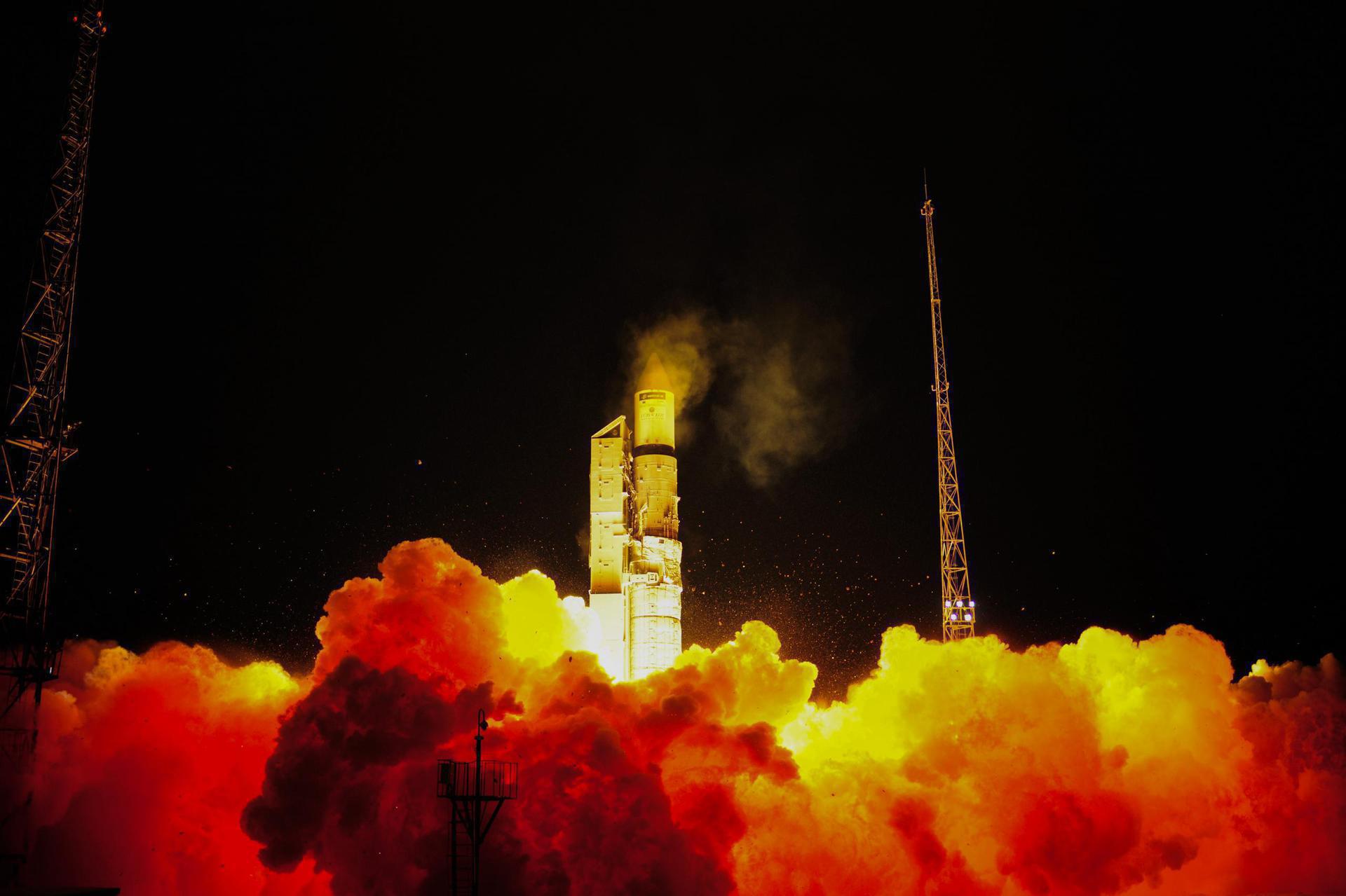
{ "count": 7916, "next": "https://ll.thespacedevs.com/2.2.0/launch/?format=api&limit=10&offset=3250&ordering=-net", "previous": "https://ll.thespacedevs.com/2.2.0/launch/?format=api&limit=10&offset=3230&ordering=-net", "results": [ { "id": "df05893f-b557-4923-b7ab-bf40dab88fea", "url": "https://ll.thespacedevs.com/2.2.0/launch/df05893f-b557-4923-b7ab-bf40dab88fea/?format=api", "slug": "zenit-echostar-ix", "name": "Zenit | Echostar IX", "status": { "id": 3, "name": "Launch Successful", "abbrev": "Success", "description": "The launch vehicle successfully inserted its payload(s) into the target orbit(s)." }, "last_updated": "2023-06-14T03:33:19Z", "net": "2003-08-08T03:30:55Z", "window_end": "2003-08-08T03:30:55Z", "window_start": "2003-08-08T03:30:55Z", "net_precision": null, "probability": null, "weather_concerns": null, "holdreason": "", "failreason": null, "hashtag": null, "launch_service_provider": { "id": 122, "url": "https://ll.thespacedevs.com/2.2.0/agencies/122/?format=api", "name": "Sea Launch", "type": "Commercial" }, "rocket": { "id": 7143, "configuration": { "id": 11, "url": "https://ll.thespacedevs.com/2.2.0/config/launcher/11/?format=api", "name": "Zenit", "family": "Zenith", "full_name": "Zenit 3SL", "variant": "3SL" } }, "mission": { "id": 5532, "name": "Echostar IX", "description": "The EchoStar IX satellite is equipped with one of the first commercial Ka-band spot-beam payloads for use over the United States", "launch_designator": null, "type": "Communications", "orbit": { "id": 3, "name": "Geosynchronous Orbit", "abbrev": "GSO" }, "agencies": [], "info_urls": [], "vid_urls": [] }, "pad": { "id": 13, "url": "https://ll.thespacedevs.com/2.2.0/pad/13/?format=api", "agency_id": 80, "name": "Launch Platform Odyssey", "description": "", "info_url": null, "wiki_url": "https://en.wikipedia.org/wiki/Odyssey_(launch_platform)", "map_url": "https://www.google.com/maps?q=0.0,-154", "latitude": "0.0", "longitude": "-154.0", "location": { "id": 3, "url": "https://ll.thespacedevs.com/2.2.0/location/3/?format=api", "name": "Sea Launch", "country_code": "???", "description": "", "map_image": "https://thespacedevs-prod.nyc3.digitaloceanspaces.com/media/map_images/location_3_20200803142448.jpg", "timezone_name": "", "total_launch_count": 40, "total_landing_count": 0 }, "country_code": "", "map_image": "https://thespacedevs-prod.nyc3.digitaloceanspaces.com/media/map_images/pad_13_20200803143257.jpg", "total_launch_count": 36, "orbital_launch_attempt_count": 36 }, "webcast_live": false, "image": null, "infographic": null, "program": [], "orbital_launch_attempt_count": 4610, "location_launch_attempt_count": 11, "pad_launch_attempt_count": 10, "agency_launch_attempt_count": 10, "orbital_launch_attempt_count_year": 34, "location_launch_attempt_count_year": 2, "pad_launch_attempt_count_year": 2, "agency_launch_attempt_count_year": 2, "type": "normal" }, { "id": "c8752d92-aecf-436b-8a19-8b5266c01e34", "url": "https://ll.thespacedevs.com/2.2.0/launch/c8752d92-aecf-436b-8a19-8b5266c01e34/?format=api", "slug": "atlas-v-521-rainbow-1", "name": "Atlas V 521 | Rainbow 1", "status": { "id": 3, "name": "Launch Successful", "abbrev": "Success", "description": "The launch vehicle successfully inserted its payload(s) into the target orbit(s)." }, "last_updated": "2023-06-14T17:42:34Z", "net": "2003-07-17T23:45:01Z", "window_end": "2003-07-17T23:45:01Z", "window_start": "2003-07-17T23:45:01Z", "net_precision": null, "probability": null, "weather_concerns": null, "holdreason": "", "failreason": null, "hashtag": null, "launch_service_provider": { "id": 82, "url": "https://ll.thespacedevs.com/2.2.0/agencies/82/?format=api", "name": "Lockheed Martin", "type": "Commercial" }, "rocket": { "id": 7142, "configuration": { "id": 262, "url": "https://ll.thespacedevs.com/2.2.0/config/launcher/262/?format=api", "name": "Atlas V 521", "family": "Atlas", "full_name": "Atlas V 521", "variant": "521" } }, "mission": { "id": 5531, "name": "Rainbow 1", "description": "Rainbow 1 is a high power Ku-band direct broadcasting satellite providing direct broadcast services across the continental United States.", "launch_designator": null, "type": "Communications", "orbit": { "id": 3, "name": "Geosynchronous Orbit", "abbrev": "GSO" }, "agencies": [], "info_urls": [], "vid_urls": [] }, "pad": { "id": 29, "url": "https://ll.thespacedevs.com/2.2.0/pad/29/?format=api", "agency_id": null, "name": "Space Launch Complex 41", "description": "", "info_url": null, "wiki_url": "https://en.wikipedia.org/wiki/Cape_Canaveral_Air_Force_Station_Space_Launch_Complex_41", "map_url": "https://www.google.com/maps?q=28.58341025,-80.58303644", "latitude": "28.58341025", "longitude": "-80.58303644", "location": { "id": 12, "url": "https://ll.thespacedevs.com/2.2.0/location/12/?format=api", "name": "Cape Canaveral SFS, FL, USA", "country_code": "USA", "description": "Cape Canaveral Space Force Station (CCSFS) is an installation of the United States Space Force's Space Launch Delta 45, located on Cape Canaveral in Brevard County, Florida.", "map_image": "https://thespacedevs-prod.nyc3.digitaloceanspaces.com/media/map_images/location_12_20200803142519.jpg", "timezone_name": "America/New_York", "total_launch_count": 1116, "total_landing_count": 75 }, "country_code": "USA", "map_image": "https://thespacedevs-prod.nyc3.digitaloceanspaces.com/media/map_images/pad_29_20200803143528.jpg", "total_launch_count": 124, "orbital_launch_attempt_count": 124 }, "webcast_live": false, "image": "https://thespacedevs-prod.nyc3.digitaloceanspaces.com/media/images/atlas_v_521_on__image_20240308092535.png", "infographic": null, "program": [], "orbital_launch_attempt_count": 4609, "location_launch_attempt_count": 613, "pad_launch_attempt_count": 30, "agency_launch_attempt_count": 68, "orbital_launch_attempt_count_year": 33, "location_launch_attempt_count_year": 9, "pad_launch_attempt_count_year": 2, "agency_launch_attempt_count_year": 3, "type": "normal" }, { "id": "4360ffb4-efae-415b-bb0b-6abfc6c4c586", "url": "https://ll.thespacedevs.com/2.2.0/launch/4360ffb4-efae-415b-bb0b-6abfc6c4c586/?format=api", "slug": "delta-ii-opportunity-rover", "name": "Delta II | Opportunity Rover", "status": { "id": 3, "name": "Launch Successful", "abbrev": "Success", "description": "The launch vehicle successfully inserted its payload(s) into the target orbit(s)." }, "last_updated": "2025-07-08T12:57:59Z", "net": "2003-07-08T03:18:15Z", "window_end": "2003-07-08T03:18:15Z", "window_start": "2003-07-08T03:18:15Z", "net_precision": null, "probability": null, "weather_concerns": null, "holdreason": "", "failreason": "", "hashtag": null, "launch_service_provider": { "id": 161, "url": "https://ll.thespacedevs.com/2.2.0/agencies/161/?format=api", "name": "United States Air Force", "type": "Government" }, "rocket": { "id": 7141, "configuration": { "id": 155, "url": "https://ll.thespacedevs.com/2.2.0/config/launcher/155/?format=api", "name": "Delta II", "family": "Delta", "full_name": "Delta II 7925H-9.5", "variant": "7925H-9.5" } }, "mission": { "id": 5530, "name": "Opportunity Rover", "description": "Opportunity, also known as MER-B or MER-1, and nicknamed \"Oppy\", is a robotic rover that was active on Mars from 2004 until the middle of 2018. Opportunity was able to stay operational for 5111 sols after landing, maintaining its power and key systems through continual recharging of its batteries using solar power, and hibernating during events such as dust storms to save power. Due to the planetary 2018 dust storm on Mars, Opportunity ceased communications on June 10 and entered hibernation on June 12, 2018. It was hoped it would reboot once the weather cleared, but it did not, suggesting either a catastrophic failure or that a layer of dust had covered its solar panels.", "launch_designator": null, "type": "Planetary Science", "orbit": { "id": 6, "name": "Heliocentric N/A", "abbrev": "Helio-N/A" }, "agencies": [], "info_urls": [], "vid_urls": [] }, "pad": { "id": 1, "url": "https://ll.thespacedevs.com/2.2.0/pad/1/?format=api", "agency_id": null, "name": "Space Launch Complex 17B", "description": "", "info_url": null, "wiki_url": "https://en.wikipedia.org/wiki/Cape_Canaveral_Space_Launch_Complex_17", "map_url": "https://www.google.com/maps?q=28.4458,-80.5657", "latitude": "28.4458", "longitude": "-80.5657", "location": { "id": 12, "url": "https://ll.thespacedevs.com/2.2.0/location/12/?format=api", "name": "Cape Canaveral SFS, FL, USA", "country_code": "USA", "description": "Cape Canaveral Space Force Station (CCSFS) is an installation of the United States Space Force's Space Launch Delta 45, located on Cape Canaveral in Brevard County, Florida.", "map_image": "https://thespacedevs-prod.nyc3.digitaloceanspaces.com/media/map_images/location_12_20200803142519.jpg", "timezone_name": "America/New_York", "total_launch_count": 1116, "total_landing_count": 75 }, "country_code": "USA", "map_image": "https://thespacedevs-prod.nyc3.digitaloceanspaces.com/media/map_images/pad_1_20200803143208.jpg", "total_launch_count": 132, "orbital_launch_attempt_count": 132 }, "webcast_live": false, "image": "https://thespacedevs-prod.nyc3.digitaloceanspaces.com/media/images/delta2520ii_image_20190222030358.jpeg", "infographic": null, "program": [], "orbital_launch_attempt_count": 4608, "location_launch_attempt_count": 612, "pad_launch_attempt_count": 119, "agency_launch_attempt_count": 1052, "orbital_launch_attempt_count_year": 32, "location_launch_attempt_count_year": 8, "pad_launch_attempt_count_year": 2, "agency_launch_attempt_count_year": 8, "type": "normal" }, { "id": "b7e1cdd5-cc08-4e0c-890c-5065e7194c5d", "url": "https://ll.thespacedevs.com/2.2.0/launch/b7e1cdd5-cc08-4e0c-890c-5065e7194c5d/?format=api", "slug": "rokot-briz-km-mimosa", "name": "Rokot / Briz-KM | Mimosa", "status": { "id": 3, "name": "Launch Successful", "abbrev": "Success", "description": "The launch vehicle successfully inserted its payload(s) into the target orbit(s)." }, "last_updated": "2023-06-14T03:31:45Z", "net": "2003-06-30T14:15:26Z", "window_end": "2003-06-30T14:15:26Z", "window_start": "2003-06-30T14:15:26Z", "net_precision": null, "probability": null, "weather_concerns": null, "holdreason": "", "failreason": "", "hashtag": null, "launch_service_provider": { "id": 117, "url": "https://ll.thespacedevs.com/2.2.0/agencies/117/?format=api", "name": "Eurockot Launch Services", "type": "Commercial" }, "rocket": { "id": 7140, "configuration": { "id": 40, "url": "https://ll.thespacedevs.com/2.2.0/config/launcher/40/?format=api", "name": "Rokot/Briz-KM", "family": "Rokot", "full_name": "Rokot/Briz-KM", "variant": "Briz-KM" } }, "mission": { "id": 5529, "name": "Mimosa", "description": "MIMOSA (Micro Measurements Of Satellite Acceleration) is a microsatellite to measure atmospheric drag.", "launch_designator": null, "type": "Astrophysics", "orbit": { "id": 8, "name": "Low Earth Orbit", "abbrev": "LEO" }, "agencies": [], "info_urls": [], "vid_urls": [] }, "pad": { "id": 3, "url": "https://ll.thespacedevs.com/2.2.0/pad/3/?format=api", "agency_id": 163, "name": "133/3 (133L)", "description": null, "info_url": null, "wiki_url": "", "map_url": "https://www.google.com/maps?q=62.886999,40.846984", "latitude": "62.886999", "longitude": "40.846984", "location": { "id": 6, "url": "https://ll.thespacedevs.com/2.2.0/location/6/?format=api", "name": "Plesetsk Cosmodrome, Russian Federation", "country_code": "RUS", "description": "Plesetsk Cosmodrome is a Russian spaceport located in Mirny, Arkhangelsk Oblast, about 800 km north of Moscow and approximately 200 km south of Arkhangelsk. Originally developed as an ICBM site for the R-7 missile, it also served for numerous satellite launches using the R-7 and other rockets. Its high latitude makes it useful only for certain types of launches, especially the Molniya orbits, so for much of the site's history it functioned as a secondary location, with most orbital launches taking place from Baikonur, in the Kazakh SSR. With the end of the Soviet Union, Baikonur became a foreign territory, and Kazakhstan charged $115 million usage fees annually. Consequently, Plesetsk has seen considerably more activity since the 2000s.", "map_image": "https://thespacedevs-prod.nyc3.digitaloceanspaces.com/media/map_images/location_6_20200803142434.jpg", "timezone_name": "Europe/Moscow", "total_launch_count": 1685, "total_landing_count": 0 }, "country_code": "RUS", "map_image": "https://thespacedevs-prod.nyc3.digitaloceanspaces.com/media/map_images/pad_3_20200803143438.jpg", "total_launch_count": 159, "orbital_launch_attempt_count": 159 }, "webcast_live": false, "image": "https://thespacedevs-prod.nyc3.digitaloceanspaces.com/media/images/rokot25202f2520briz-km_image_20190224012237.jpeg", "infographic": null, "program": [], "orbital_launch_attempt_count": 4607, "location_launch_attempt_count": 1531, "pad_launch_attempt_count": 132, "agency_launch_attempt_count": 4, "orbital_launch_attempt_count_year": 31, "location_launch_attempt_count_year": 4, "pad_launch_attempt_count_year": 1, "agency_launch_attempt_count_year": 1, "type": "normal" }, { "id": "bbc56a97-b7e1-4fd8-8f6c-dd92e020b0d6", "url": "https://ll.thespacedevs.com/2.2.0/launch/bbc56a97-b7e1-4fd8-8f6c-dd92e020b0d6/?format=api", "slug": "pegasus-xl-orbview-3", "name": "Pegasus XL | OrbView-3", "status": { "id": 3, "name": "Launch Successful", "abbrev": "Success", "description": "The launch vehicle successfully inserted its payload(s) into the target orbit(s)." }, "last_updated": "2024-06-13T18:13:44Z", "net": "2003-06-26T18:53:00Z", "window_end": "2003-06-26T18:53:00Z", "window_start": "2003-06-26T18:53:00Z", "net_precision": { "id": 1, "name": "Minute", "abbrev": "MIN", "description": "The T-0 is accurate to the minute." }, "probability": null, "weather_concerns": null, "holdreason": "", "failreason": "", "hashtag": null, "launch_service_provider": { "id": 100, "url": "https://ll.thespacedevs.com/2.2.0/agencies/100/?format=api", "name": "Orbital Sciences Corporation", "type": "Commercial" }, "rocket": { "id": 496, "configuration": { "id": 173, "url": "https://ll.thespacedevs.com/2.2.0/config/launcher/173/?format=api", "name": "Pegasus XL", "family": "Pegasus", "full_name": "Pegasus XL", "variant": "" } }, "mission": null, "pad": { "id": 62, "url": "https://ll.thespacedevs.com/2.2.0/pad/62/?format=api", "agency_id": null, "name": "Vandenberg Space Force Base", "description": null, "info_url": null, "wiki_url": "https://en.wikipedia.org/wiki/Vandenberg_Space_Force_Base", "map_url": "https://www.google.com/maps?q=34.732778,-120.568056", "latitude": "34.732778", "longitude": "-120.568056", "location": { "id": 20, "url": "https://ll.thespacedevs.com/2.2.0/location/20/?format=api", "name": "Air launch to orbit", "country_code": "???", "description": "", "map_image": "https://thespacedevs-prod.nyc3.digitaloceanspaces.com/media/map_images/location_20_20200803142433.jpg", "timezone_name": "", "total_launch_count": 51, "total_landing_count": 0 }, "country_code": "USA", "map_image": "https://thespacedevs-prod.nyc3.digitaloceanspaces.com/media/map_images/pad_62_20200803143441.jpg", "total_launch_count": 22, "orbital_launch_attempt_count": 22 }, "webcast_live": false, "image": "https://thespacedevs-prod.nyc3.digitaloceanspaces.com/media/images/pegasus_xl_moun_image_20240307124328.jpeg", "infographic": null, "program": [], "orbital_launch_attempt_count": 4606, "location_launch_attempt_count": 33, "pad_launch_attempt_count": 15, "agency_launch_attempt_count": 42, "orbital_launch_attempt_count_year": 30, "location_launch_attempt_count_year": 3, "pad_launch_attempt_count_year": 1, "agency_launch_attempt_count_year": 3, "type": "normal" }, { "id": "995a278f-f85f-412f-8771-8ef21bc99814", "url": "https://ll.thespacedevs.com/2.2.0/launch/995a278f-f85f-412f-8771-8ef21bc99814/?format=api", "slug": "molniya-m-molniya-3-65l", "name": "Molniya-M | Molniya-3 65L", "status": { "id": 3, "name": "Launch Successful", "abbrev": "Success", "description": "The launch vehicle successfully inserted its payload(s) into the target orbit(s)." }, "last_updated": "2023-06-14T03:50:25Z", "net": "2003-06-19T20:00:35Z", "window_end": "2003-06-19T20:00:35Z", "window_start": "2003-06-19T20:00:35Z", "net_precision": null, "probability": null, "weather_concerns": null, "holdreason": "", "failreason": null, "hashtag": null, "launch_service_provider": { "id": 111, "url": "https://ll.thespacedevs.com/2.2.0/agencies/111/?format=api", "name": "Progress Rocket Space Center", "type": "Commercial" }, "rocket": { "id": 7139, "configuration": { "id": 106, "url": "https://ll.thespacedevs.com/2.2.0/config/launcher/106/?format=api", "name": "Molniya-M", "family": "R-7", "full_name": "Molniya-M 2BL", "variant": "2BL" } }, "mission": { "id": 5528, "name": "Molniya-3 65L", "description": "Molniya communication satellites operating from a highly elliptical orbit", "launch_designator": null, "type": "Communications", "orbit": { "id": 0, "name": "Elliptical Orbit", "abbrev": "Elliptical" }, "agencies": [], "info_urls": [], "vid_urls": [] }, "pad": { "id": 35, "url": "https://ll.thespacedevs.com/2.2.0/pad/35/?format=api", "agency_id": 163, "name": "16/2", "description": null, "info_url": null, "wiki_url": "", "map_url": "https://www.google.com/maps?q=62.960091,40.682983", "latitude": "62.960091", "longitude": "40.682983", "location": { "id": 6, "url": "https://ll.thespacedevs.com/2.2.0/location/6/?format=api", "name": "Plesetsk Cosmodrome, Russian Federation", "country_code": "RUS", "description": "Plesetsk Cosmodrome is a Russian spaceport located in Mirny, Arkhangelsk Oblast, about 800 km north of Moscow and approximately 200 km south of Arkhangelsk. Originally developed as an ICBM site for the R-7 missile, it also served for numerous satellite launches using the R-7 and other rockets. Its high latitude makes it useful only for certain types of launches, especially the Molniya orbits, so for much of the site's history it functioned as a secondary location, with most orbital launches taking place from Baikonur, in the Kazakh SSR. With the end of the Soviet Union, Baikonur became a foreign territory, and Kazakhstan charged $115 million usage fees annually. Consequently, Plesetsk has seen considerably more activity since the 2000s.", "map_image": "https://thespacedevs-prod.nyc3.digitaloceanspaces.com/media/map_images/location_6_20200803142434.jpg", "timezone_name": "Europe/Moscow", "total_launch_count": 1685, "total_landing_count": 0 }, "country_code": "RUS", "map_image": "https://thespacedevs-prod.nyc3.digitaloceanspaces.com/media/map_images/pad_35_20200803143306.jpg", "total_launch_count": 136, "orbital_launch_attempt_count": 136 }, "webcast_live": false, "image": "https://thespacedevs-prod.nyc3.digitaloceanspaces.com/media/images/molniya_m_image_20251102061752.jpg", "infographic": null, "program": [], "orbital_launch_attempt_count": 4605, "location_launch_attempt_count": 1530, "pad_launch_attempt_count": 121, "agency_launch_attempt_count": 40, "orbital_launch_attempt_count_year": 29, "location_launch_attempt_count_year": 3, "pad_launch_attempt_count_year": 2, "agency_launch_attempt_count_year": 2, "type": "normal" }, { "id": "1e497950-b932-46b0-8b0f-028171370804", "url": "https://ll.thespacedevs.com/2.2.0/launch/1e497950-b932-46b0-8b0f-028171370804/?format=api", "slug": "ariane-5-g-optus-and-defence-c1-bsat-2c", "name": "Ariane 5 G | Optus and Defence C1 & BSAT-2c", "status": { "id": 3, "name": "Launch Successful", "abbrev": "Success", "description": "The launch vehicle successfully inserted its payload(s) into the target orbit(s)." }, "last_updated": "2024-06-15T13:55:29Z", "net": "2003-06-11T22:38:15Z", "window_end": "2003-06-11T22:38:15Z", "window_start": "2003-06-11T22:38:15Z", "net_precision": { "id": 0, "name": "Second", "abbrev": "SEC", "description": "The T-0 is accurate to the second." }, "probability": null, "weather_concerns": null, "holdreason": "", "failreason": "", "hashtag": null, "launch_service_provider": { "id": 115, "url": "https://ll.thespacedevs.com/2.2.0/agencies/115/?format=api", "name": "Arianespace", "type": "Commercial" }, "rocket": { "id": 495, "configuration": { "id": 131, "url": "https://ll.thespacedevs.com/2.2.0/config/launcher/131/?format=api", "name": "Ariane 5 G", "family": "Ariane", "full_name": "Ariane 5 G", "variant": "G" } }, "mission": { "id": 609, "name": "Optus and Defence C1 & BSAT-2c", "description": "Optus and Defence C1 is a relay platform in geostationary orbit at 156 degrees East. It is one of the most advanced communications satellites ever built. BSAT-2C is a geostationary communication satellite for B-SAT.", "launch_designator": null, "type": "Communications", "orbit": { "id": 2, "name": "Geostationary Transfer Orbit", "abbrev": "GTO" }, "agencies": [], "info_urls": [], "vid_urls": [] }, "pad": { "id": 77, "url": "https://ll.thespacedevs.com/2.2.0/pad/77/?format=api", "agency_id": 115, "name": "Ariane Launch Area 3", "description": "ELA-3, is a launch pad and associated facilities at the Centre Spatial Guyanais in French Guiana. ELA-3 was operated by Arianespace as part of the expendable launch system for Ariane 5 launch vehicles.", "info_url": null, "wiki_url": "https://en.wikipedia.org/wiki/ELA-3", "map_url": "https://www.google.com/maps?q=5.239,-52.768", "latitude": "5.239", "longitude": "-52.768", "location": { "id": 13, "url": "https://ll.thespacedevs.com/2.2.0/location/13/?format=api", "name": "Guiana Space Centre, French Guiana", "country_code": "GUF", "description": "The Guiana Space Centre is a European spaceport to the northwest of Kourou in French Guiana, a region of France in South America. Kourou is located at a latitude of 5°. In operation since 1968, it is a suitable location for a spaceport because of its equatorial location and open sea to the east.", "map_image": "https://thespacedevs-prod.nyc3.digitaloceanspaces.com/media/map_images/location_13_20200803142412.jpg", "timezone_name": "America/Cayenne", "total_launch_count": 334, "total_landing_count": 0 }, "country_code": "GUF", "map_image": "https://thespacedevs-prod.nyc3.digitaloceanspaces.com/media/map_images/pad_77_20200803143458.jpg", "total_launch_count": 118, "orbital_launch_attempt_count": 118 }, "webcast_live": false, "image": "https://thespacedevs-prod.nyc3.digitaloceanspaces.com/media/images/ariane252052520g_image_20190222030331.jpeg", "infographic": null, "program": [], "orbital_launch_attempt_count": 4604, "location_launch_attempt_count": 169, "pad_launch_attempt_count": 16, "agency_launch_attempt_count": 155, "orbital_launch_attempt_count_year": 28, "location_launch_attempt_count_year": 3, "pad_launch_attempt_count_year": 2, "agency_launch_attempt_count_year": 3, "type": "normal" }, { "id": "a9684903-9ff2-4b1f-8639-1cc6e6b77166", "url": "https://ll.thespacedevs.com/2.2.0/launch/a9684903-9ff2-4b1f-8639-1cc6e6b77166/?format=api", "slug": "delta-ii-spirit-rover", "name": "Delta II | Spirit Rover", "status": { "id": 3, "name": "Launch Successful", "abbrev": "Success", "description": "The launch vehicle successfully inserted its payload(s) into the target orbit(s)." }, "last_updated": "2023-06-14T17:40:19Z", "net": "2003-06-10T17:58:47Z", "window_end": "2003-06-10T17:58:47Z", "window_start": "2003-06-10T17:58:47Z", "net_precision": null, "probability": null, "weather_concerns": null, "holdreason": "", "failreason": null, "hashtag": null, "launch_service_provider": { "id": 161, "url": "https://ll.thespacedevs.com/2.2.0/agencies/161/?format=api", "name": "United States Air Force", "type": "Government" }, "rocket": { "id": 7138, "configuration": { "id": 140, "url": "https://ll.thespacedevs.com/2.2.0/config/launcher/140/?format=api", "name": "Delta II", "family": "Delta", "full_name": "Delta II 7925-9.5", "variant": "7925-9.5" } }, "mission": { "id": 5527, "name": "Spirit Rover", "description": "Spirit, also known as MER-A, is a robotic rover on Mars, active from 2004 to 2010. It landed successfully within the impact crater Gusev on Mars at 04:35 Ground UTC on January 4, 2004, three weeks before its twin, Opportunity (MER-B), which landed on the other side of the planet. The rover became stuck in a \"sand trap\" in late 2009 at an angle that hampered recharging of its batteries; its last communication with Earth was sent on March 22, 2010.", "launch_designator": null, "type": "Planetary Science", "orbit": { "id": 19, "name": "Mars Orbit", "abbrev": "Mars" }, "agencies": [], "info_urls": [], "vid_urls": [] }, "pad": { "id": 14, "url": "https://ll.thespacedevs.com/2.2.0/pad/14/?format=api", "agency_id": null, "name": "Space Launch Complex 17A", "description": "", "info_url": null, "wiki_url": "https://en.wikipedia.org/wiki/Cape_Canaveral_Space_Launch_Complex_17", "map_url": "https://www.google.com/maps?q=28.4472,-80.565", "latitude": "28.4472", "longitude": "-80.565", "location": { "id": 12, "url": "https://ll.thespacedevs.com/2.2.0/location/12/?format=api", "name": "Cape Canaveral SFS, FL, USA", "country_code": "USA", "description": "Cape Canaveral Space Force Station (CCSFS) is an installation of the United States Space Force's Space Launch Delta 45, located on Cape Canaveral in Brevard County, Florida.", "map_image": "https://thespacedevs-prod.nyc3.digitaloceanspaces.com/media/map_images/location_12_20200803142519.jpg", "timezone_name": "America/New_York", "total_launch_count": 1116, "total_landing_count": 75 }, "country_code": "USA", "map_image": "https://thespacedevs-prod.nyc3.digitaloceanspaces.com/media/map_images/pad_14_20200803143451.jpg", "total_launch_count": 145, "orbital_launch_attempt_count": 145 }, "webcast_live": false, "image": "https://thespacedevs-prod.nyc3.digitaloceanspaces.com/media/images/delta_ii_7925-9_image_20240312090356.jpeg", "infographic": null, "program": [], "orbital_launch_attempt_count": 4603, "location_launch_attempt_count": 611, "pad_launch_attempt_count": 133, "agency_launch_attempt_count": 1051, "orbital_launch_attempt_count_year": 27, "location_launch_attempt_count_year": 7, "pad_launch_attempt_count_year": 2, "agency_launch_attempt_count_year": 7, "type": "normal" }, { "id": "0db2781a-43cd-45a8-aa15-81e53cd6dcf7", "url": "https://ll.thespacedevs.com/2.2.0/launch/0db2781a-43cd-45a8-aa15-81e53cd6dcf7/?format=api", "slug": "zenit-thuraya-2", "name": "Zenit | Thuraya 2", "status": { "id": 3, "name": "Launch Successful", "abbrev": "Success", "description": "The launch vehicle successfully inserted its payload(s) into the target orbit(s)." }, "last_updated": "2023-06-14T03:33:16Z", "net": "2003-06-10T13:55:59Z", "window_end": "2003-06-10T13:55:59Z", "window_start": "2003-06-10T13:55:59Z", "net_precision": null, "probability": null, "weather_concerns": null, "holdreason": "", "failreason": null, "hashtag": null, "launch_service_provider": { "id": 122, "url": "https://ll.thespacedevs.com/2.2.0/agencies/122/?format=api", "name": "Sea Launch", "type": "Commercial" }, "rocket": { "id": 7137, "configuration": { "id": 11, "url": "https://ll.thespacedevs.com/2.2.0/config/launcher/11/?format=api", "name": "Zenit", "family": "Zenith", "full_name": "Zenit 3SL", "variant": "3SL" } }, "mission": { "id": 5526, "name": "Thuraya 2", "description": "Thuraya offers GSM-compatible mobile telephone services, transmitting and receiving calls through a single 12.25 meter-aperture reflector.", "launch_designator": null, "type": "Communications", "orbit": { "id": 1, "name": "Geostationary Orbit", "abbrev": "Direct-GEO" }, "agencies": [], "info_urls": [], "vid_urls": [] }, "pad": { "id": 13, "url": "https://ll.thespacedevs.com/2.2.0/pad/13/?format=api", "agency_id": 80, "name": "Launch Platform Odyssey", "description": "", "info_url": null, "wiki_url": "https://en.wikipedia.org/wiki/Odyssey_(launch_platform)", "map_url": "https://www.google.com/maps?q=0.0,-154", "latitude": "0.0", "longitude": "-154.0", "location": { "id": 3, "url": "https://ll.thespacedevs.com/2.2.0/location/3/?format=api", "name": "Sea Launch", "country_code": "???", "description": "", "map_image": "https://thespacedevs-prod.nyc3.digitaloceanspaces.com/media/map_images/location_3_20200803142448.jpg", "timezone_name": "", "total_launch_count": 40, "total_landing_count": 0 }, "country_code": "", "map_image": "https://thespacedevs-prod.nyc3.digitaloceanspaces.com/media/map_images/pad_13_20200803143257.jpg", "total_launch_count": 36, "orbital_launch_attempt_count": 36 }, "webcast_live": false, "image": null, "infographic": null, "program": [], "orbital_launch_attempt_count": 4602, "location_launch_attempt_count": 10, "pad_launch_attempt_count": 9, "agency_launch_attempt_count": 9, "orbital_launch_attempt_count_year": 26, "location_launch_attempt_count_year": 1, "pad_launch_attempt_count_year": 1, "agency_launch_attempt_count_year": 1, "type": "normal" }, { "id": "b5cfd3d6-8a4b-4cae-bac3-16e32d2090e9", "url": "https://ll.thespacedevs.com/2.2.0/launch/b5cfd3d6-8a4b-4cae-bac3-16e32d2090e9/?format=api", "slug": "soyuz-u-progress-m1-10", "name": "Soyuz U | Progress M1-10", "status": { "id": 3, "name": "Launch Successful", "abbrev": "Success", "description": "The launch vehicle successfully inserted its payload(s) into the target orbit(s)." }, "last_updated": "2023-06-14T03:48:33Z", "net": "2003-06-08T10:34:19Z", "window_end": "2003-06-08T10:34:19Z", "window_start": "2003-06-08T10:34:19Z", "net_precision": null, "probability": 0, "weather_concerns": null, "holdreason": "", "failreason": "", "hashtag": "", "launch_service_provider": { "id": 63, "url": "https://ll.thespacedevs.com/2.2.0/agencies/63/?format=api", "name": "Russian Federal Space Agency (ROSCOSMOS)", "type": "Government" }, "rocket": { "id": 2331, "configuration": { "id": 37, "url": "https://ll.thespacedevs.com/2.2.0/config/launcher/37/?format=api", "name": "Soyuz U", "family": "Soyuz", "full_name": "Soyuz U", "variant": "" } }, "mission": null, "pad": { "id": 32, "url": "https://ll.thespacedevs.com/2.2.0/pad/32/?format=api", "agency_id": null, "name": "1/5", "description": null, "info_url": null, "wiki_url": "", "map_url": "https://www.google.com/maps?q=45.92,63.342", "latitude": "45.92", "longitude": "63.342", "location": { "id": 15, "url": "https://ll.thespacedevs.com/2.2.0/location/15/?format=api", "name": "Baikonur Cosmodrome, Republic of Kazakhstan", "country_code": "KAZ", "description": "The Baikonur Cosmodrome is a spaceport operated by Russia within Kazakhstan. Located in the Kazakh city of Baikonur, it is the largest operational space launch facility in terms of area. All Russian crewed spaceflights are launched from Baikonur.", "map_image": "https://thespacedevs-prod.nyc3.digitaloceanspaces.com/media/map_images/location_15_20200803142517.jpg", "timezone_name": "Asia/Qyzylorda", "total_launch_count": 1563, "total_landing_count": 0 }, "country_code": "KAZ", "map_image": "https://thespacedevs-prod.nyc3.digitaloceanspaces.com/media/map_images/pad_32_20200803143513.jpg", "total_launch_count": 487, "orbital_launch_attempt_count": 487 }, "webcast_live": false, "image": "https://thespacedevs-prod.nyc3.digitaloceanspaces.com/media/images/soyuz2520u_image_20190222031023.jpeg", "infographic": null, "program": [ { "id": 17, "url": "https://ll.thespacedevs.com/2.2.0/program/17/?format=api", "name": "International Space Station", "description": "The International Space Station programme is tied together by a complex set of legal, political and financial agreements between the sixteen nations involved in the project, governing ownership of the various components, rights to crewing and utilization, and responsibilities for crew rotation and resupply of the International Space Station. It was conceived in 1984 by President Ronald Reagan, during the Space Station Freedom project as it was originally called.", "agencies": [ { "id": 16, "url": "https://ll.thespacedevs.com/2.2.0/agencies/16/?format=api", "name": "Canadian Space Agency", "type": "Government" }, { "id": 27, "url": "https://ll.thespacedevs.com/2.2.0/agencies/27/?format=api", "name": "European Space Agency", "type": "Multinational" }, { "id": 37, "url": "https://ll.thespacedevs.com/2.2.0/agencies/37/?format=api", "name": "Japan Aerospace Exploration Agency", "type": "Government" }, { "id": 44, "url": "https://ll.thespacedevs.com/2.2.0/agencies/44/?format=api", "name": "National Aeronautics and Space Administration", "type": "Government" }, { "id": 63, "url": "https://ll.thespacedevs.com/2.2.0/agencies/63/?format=api", "name": "Russian Federal Space Agency (ROSCOSMOS)", "type": "Government" } ], "image_url": "https://thespacedevs-prod.nyc3.digitaloceanspaces.com/media/images/international2_program_20201129184745.png", "start_date": "1998-11-20T06:40:00Z", "end_date": null, "info_url": "https://www.nasa.gov/mission_pages/station/main/index.html", "wiki_url": "https://en.wikipedia.org/wiki/International_Space_Station_programme", "mission_patches": [], "type": { "id": 2, "name": "Human Spaceflight" } } ], "orbital_launch_attempt_count": 4601, "location_launch_attempt_count": 1207, "pad_launch_attempt_count": 384, "agency_launch_attempt_count": 129, "orbital_launch_attempt_count_year": 25, "location_launch_attempt_count_year": 6, "pad_launch_attempt_count_year": 3, "agency_launch_attempt_count_year": 4, "type": "normal" } ] }