Launch List
AN API endpoint that returns all Launch objects or a single launch.
EXAMPLE - /launch/[id]/ or /launch/?mode=list&search=SpaceX
GET Return a list of all Launch objects.
FILTERS Fields - 'name', 'id(s)', 'lsp__id', 'lsp__name', 'serial_number', 'launcher_config__id', 'rocket__spacecraftflight__spacecraft__name', 'is_crewed', 'include_suborbital', 'spacecraft_config__ids', 'related', 'location__ids', 'lsp__ids', 'pad__ids', 'status__ids'
MODE 'normal', 'list', 'detailed'
EXAMPLE ?mode=list
SEARCH Searches through the launch name, rocket name, launch agency, mission name & spacecraft name.
EXAMPLE - ?search=SpaceX
GET /2.2.0/launch/?format=api&offset=3220&ordering=last_updated
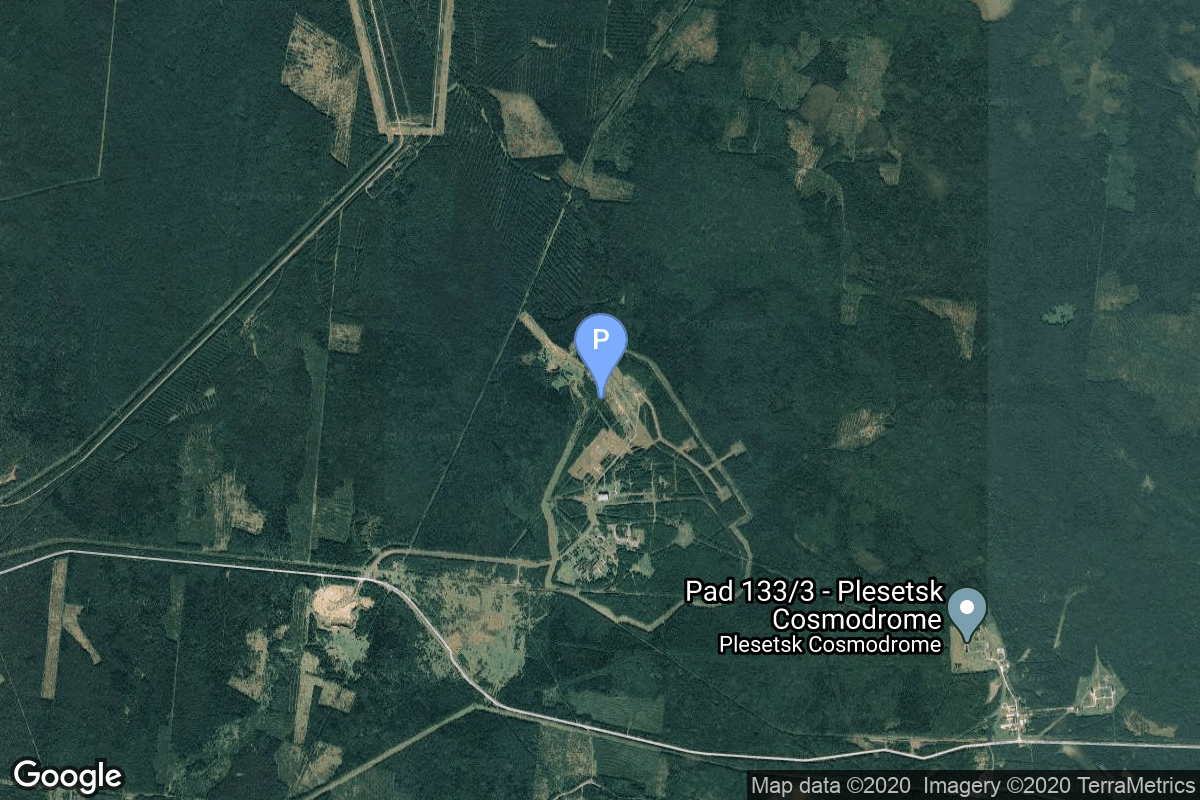
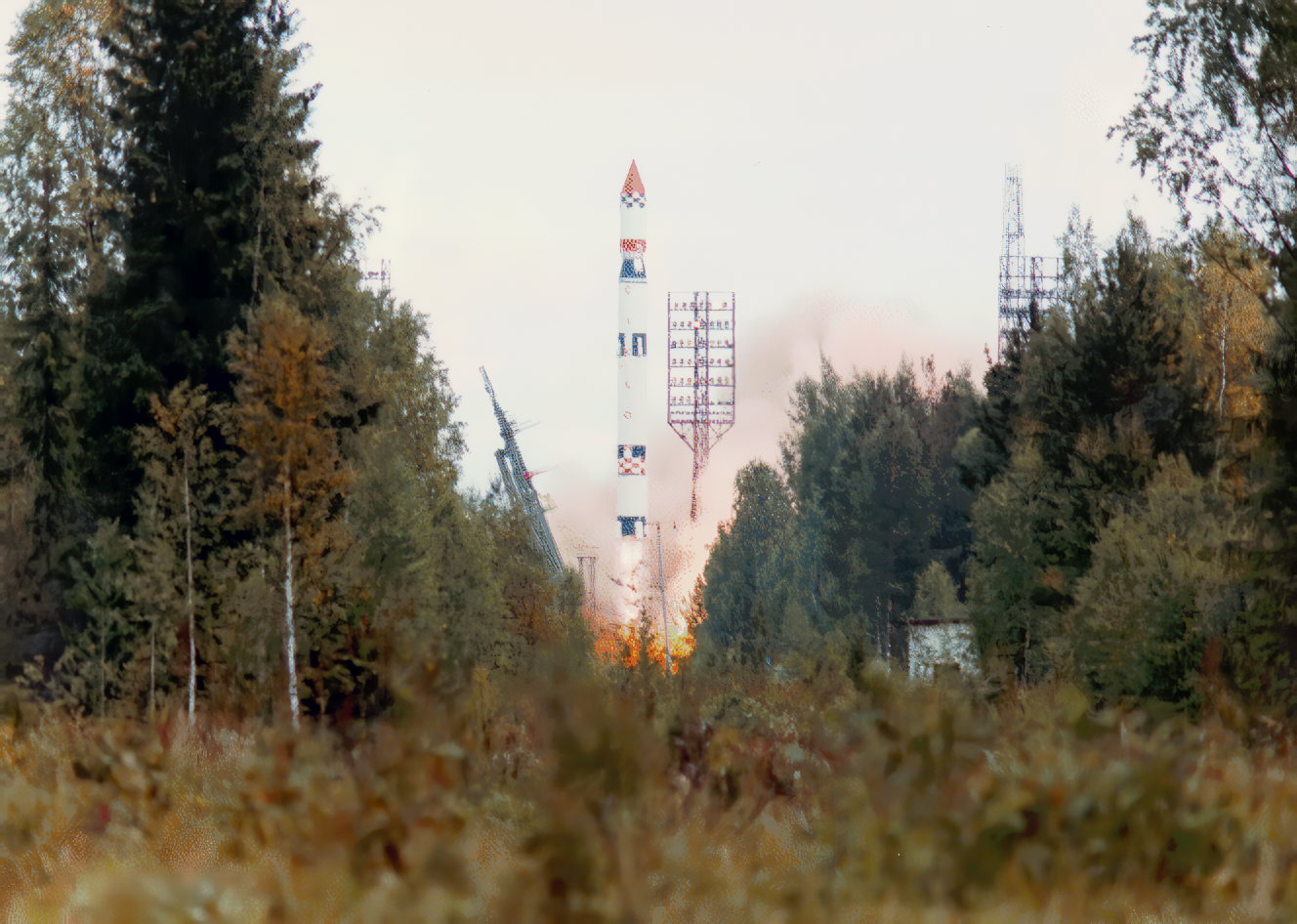
{ "count": 7813, "next": "https://ll.thespacedevs.com/2.2.0/launch/?format=api&limit=10&offset=3230&ordering=last_updated", "previous": "https://ll.thespacedevs.com/2.2.0/launch/?format=api&limit=10&offset=3210&ordering=last_updated", "results": [ { "id": "27f9cef9-59ed-4c3f-8e09-e70ee78fe8c1", "url": "https://ll.thespacedevs.com/2.2.0/launch/27f9cef9-59ed-4c3f-8e09-e70ee78fe8c1/?format=api", "slug": "tsiklon-3-strela-3-37-to-42", "name": "Tsiklon-3 | Strela-3 37 to 42", "status": { "id": 3, "name": "Launch Successful", "abbrev": "Success", "description": "The launch vehicle successfully inserted its payload(s) into the target orbit(s)." }, "last_updated": "2023-06-14T04:22:43Z", "net": "1989-02-10T15:13:56Z", "window_end": "1989-02-10T15:13:56Z", "window_start": "1989-02-10T15:13:56Z", "net_precision": null, "probability": null, "weather_concerns": null, "holdreason": "", "failreason": null, "hashtag": null, "launch_service_provider": { "id": 66, "url": "https://ll.thespacedevs.com/2.2.0/agencies/66/?format=api", "name": "Soviet Space Program", "type": "Government" }, "rocket": { "id": 6147, "configuration": { "id": 445, "url": "https://ll.thespacedevs.com/2.2.0/config/launcher/445/?format=api", "name": "Tsiklon-3", "family": "Tsiklon", "full_name": "Tsiklon-3", "variant": "3" } }, "mission": { "id": 4537, "name": "Strela-3 37 to 42", "description": "Second generation store-dump military communications satellite", "launch_designator": null, "type": "Government/Top Secret", "orbit": { "id": 8, "name": "Low Earth Orbit", "abbrev": "LEO" }, "agencies": [], "info_urls": [], "vid_urls": [] }, "pad": { "id": 126, "url": "https://ll.thespacedevs.com/2.2.0/pad/126/?format=api", "agency_id": 63, "name": "32/1", "description": null, "info_url": null, "wiki_url": "https://en.wikipedia.org/wiki/Plesetsk_Cosmodrome_Site_32", "map_url": "https://www.google.com/maps?q=62.9063889,40.7844727", "latitude": "62.9063889", "longitude": "40.7844727", "location": { "id": 6, "url": "https://ll.thespacedevs.com/2.2.0/location/6/?format=api", "name": "Plesetsk Cosmodrome, Russian Federation", "country_code": "RUS", "description": "Plesetsk Cosmodrome is a Russian spaceport located in Mirny, Arkhangelsk Oblast, about 800 km north of Moscow and approximately 200 km south of Arkhangelsk. Originally developed as an ICBM site for the R-7 missile, it also served for numerous satellite launches using the R-7 and other rockets. Its high latitude makes it useful only for certain types of launches, especially the Molniya orbits, so for much of the site's history it functioned as a secondary location, with most orbital launches taking place from Baikonur, in the Kazakh SSR. With the end of the Soviet Union, Baikonur became a foreign territory, and Kazakhstan charged $115 million usage fees annually. Consequently, Plesetsk has seen considerably more activity since the 2000s.", "map_image": "https://thespacedevs-prod.nyc3.digitaloceanspaces.com/media/map_images/location_6_20200803142434.jpg", "timezone_name": "Europe/Moscow", "total_launch_count": 1681, "total_landing_count": 0 }, "country_code": "RUS", "map_image": "https://thespacedevs-prod.nyc3.digitaloceanspaces.com/media/map_images/pad_126_20200803143238.jpg", "total_launch_count": 57, "orbital_launch_attempt_count": 57 }, "webcast_live": false, "image": "https://thespacedevs-prod.nyc3.digitaloceanspaces.com/media/images/tsyklon-3_launc_image_20251112153513.png", "infographic": null, "program": [], "orbital_launch_attempt_count": 3383, "location_launch_attempt_count": 1250, "pad_launch_attempt_count": 36, "agency_launch_attempt_count": 2249, "orbital_launch_attempt_count_year": 9, "location_launch_attempt_count_year": 3, "pad_launch_attempt_count_year": 1, "agency_launch_attempt_count_year": 8, "type": "normal" }, { "id": "25efb73f-8c57-421f-b13a-da77da1b51c8", "url": "https://ll.thespacedevs.com/2.2.0/launch/25efb73f-8c57-421f-b13a-da77da1b51c8/?format=api", "slug": "tsiklon-3-meteor-2-16", "name": "Tsiklon-3 | Meteor-2 16", "status": { "id": 3, "name": "Launch Successful", "abbrev": "Success", "description": "The launch vehicle successfully inserted its payload(s) into the target orbit(s)." }, "last_updated": "2023-06-14T04:22:43Z", "net": "1987-08-18T02:27:00Z", "window_end": "1987-08-18T02:27:00Z", "window_start": "1987-08-18T02:27:00Z", "net_precision": null, "probability": null, "weather_concerns": null, "holdreason": "", "failreason": null, "hashtag": null, "launch_service_provider": { "id": 66, "url": "https://ll.thespacedevs.com/2.2.0/agencies/66/?format=api", "name": "Soviet Space Program", "type": "Government" }, "rocket": { "id": 5990, "configuration": { "id": 445, "url": "https://ll.thespacedevs.com/2.2.0/config/launcher/445/?format=api", "name": "Tsiklon-3", "family": "Tsiklon", "full_name": "Tsiklon-3", "variant": "3" } }, "mission": { "id": 4383, "name": "Meteor-2 16", "description": "Second generation soviet meteorological satellite", "launch_designator": null, "type": "Earth Science", "orbit": { "id": 8, "name": "Low Earth Orbit", "abbrev": "LEO" }, "agencies": [], "info_urls": [], "vid_urls": [] }, "pad": { "id": 126, "url": "https://ll.thespacedevs.com/2.2.0/pad/126/?format=api", "agency_id": 63, "name": "32/1", "description": null, "info_url": null, "wiki_url": "https://en.wikipedia.org/wiki/Plesetsk_Cosmodrome_Site_32", "map_url": "https://www.google.com/maps?q=62.9063889,40.7844727", "latitude": "62.9063889", "longitude": "40.7844727", "location": { "id": 6, "url": "https://ll.thespacedevs.com/2.2.0/location/6/?format=api", "name": "Plesetsk Cosmodrome, Russian Federation", "country_code": "RUS", "description": "Plesetsk Cosmodrome is a Russian spaceport located in Mirny, Arkhangelsk Oblast, about 800 km north of Moscow and approximately 200 km south of Arkhangelsk. Originally developed as an ICBM site for the R-7 missile, it also served for numerous satellite launches using the R-7 and other rockets. Its high latitude makes it useful only for certain types of launches, especially the Molniya orbits, so for much of the site's history it functioned as a secondary location, with most orbital launches taking place from Baikonur, in the Kazakh SSR. With the end of the Soviet Union, Baikonur became a foreign territory, and Kazakhstan charged $115 million usage fees annually. Consequently, Plesetsk has seen considerably more activity since the 2000s.", "map_image": "https://thespacedevs-prod.nyc3.digitaloceanspaces.com/media/map_images/location_6_20200803142434.jpg", "timezone_name": "Europe/Moscow", "total_launch_count": 1681, "total_landing_count": 0 }, "country_code": "RUS", "map_image": "https://thespacedevs-prod.nyc3.digitaloceanspaces.com/media/map_images/pad_126_20200803143238.jpg", "total_launch_count": 57, "orbital_launch_attempt_count": 57 }, "webcast_live": false, "image": "https://thespacedevs-prod.nyc3.digitaloceanspaces.com/media/images/tsyklon-3_launc_image_20251112153513.png", "infographic": null, "program": [], "orbital_launch_attempt_count": 3211, "location_launch_attempt_count": 1184, "pad_launch_attempt_count": 27, "agency_launch_attempt_count": 2112, "orbital_launch_attempt_count_year": 72, "location_launch_attempt_count_year": 33, "pad_launch_attempt_count_year": 1, "agency_launch_attempt_count_year": 62, "type": "normal" }, { "id": "3f8f3799-7442-4eed-a7f2-d54d7bf4541b", "url": "https://ll.thespacedevs.com/2.2.0/launch/3f8f3799-7442-4eed-a7f2-d54d7bf4541b/?format=api", "slug": "tsiklon-3-koronas-i", "name": "Tsiklon-3 | Koronas-I", "status": { "id": 3, "name": "Launch Successful", "abbrev": "Success", "description": "The launch vehicle successfully inserted its payload(s) into the target orbit(s)." }, "last_updated": "2023-06-14T04:22:43Z", "net": "1994-03-02T03:25:00Z", "window_end": "1994-03-02T03:25:00Z", "window_start": "1994-03-02T03:25:00Z", "net_precision": null, "probability": null, "weather_concerns": null, "holdreason": "", "failreason": "", "hashtag": null, "launch_service_provider": { "id": 193, "url": "https://ll.thespacedevs.com/2.2.0/agencies/193/?format=api", "name": "Russian Space Forces", "type": "Government" }, "rocket": { "id": 6576, "configuration": { "id": 445, "url": "https://ll.thespacedevs.com/2.2.0/config/launcher/445/?format=api", "name": "Tsiklon-3", "family": "Tsiklon", "full_name": "Tsiklon-3", "variant": "3" } }, "mission": { "id": 4966, "name": "Koronas-I", "description": "KORONAS-I (or CORONAS-I), a Russian-Ukranian spacecraft, was launched by a Tsiklon-3 booster from the Plesetsk cosmodrome. It carried UV and x-ray instruments to map the Sun and plasma monitors to study the ionosphere and magnetosphere.", "launch_designator": null, "type": "Astrophysics", "orbit": { "id": 8, "name": "Low Earth Orbit", "abbrev": "LEO" }, "agencies": [], "info_urls": [], "vid_urls": [] }, "pad": { "id": 126, "url": "https://ll.thespacedevs.com/2.2.0/pad/126/?format=api", "agency_id": 63, "name": "32/1", "description": null, "info_url": null, "wiki_url": "https://en.wikipedia.org/wiki/Plesetsk_Cosmodrome_Site_32", "map_url": "https://www.google.com/maps?q=62.9063889,40.7844727", "latitude": "62.9063889", "longitude": "40.7844727", "location": { "id": 6, "url": "https://ll.thespacedevs.com/2.2.0/location/6/?format=api", "name": "Plesetsk Cosmodrome, Russian Federation", "country_code": "RUS", "description": "Plesetsk Cosmodrome is a Russian spaceport located in Mirny, Arkhangelsk Oblast, about 800 km north of Moscow and approximately 200 km south of Arkhangelsk. Originally developed as an ICBM site for the R-7 missile, it also served for numerous satellite launches using the R-7 and other rockets. Its high latitude makes it useful only for certain types of launches, especially the Molniya orbits, so for much of the site's history it functioned as a secondary location, with most orbital launches taking place from Baikonur, in the Kazakh SSR. With the end of the Soviet Union, Baikonur became a foreign territory, and Kazakhstan charged $115 million usage fees annually. Consequently, Plesetsk has seen considerably more activity since the 2000s.", "map_image": "https://thespacedevs-prod.nyc3.digitaloceanspaces.com/media/map_images/location_6_20200803142434.jpg", "timezone_name": "Europe/Moscow", "total_launch_count": 1681, "total_landing_count": 0 }, "country_code": "RUS", "map_image": "https://thespacedevs-prod.nyc3.digitaloceanspaces.com/media/map_images/pad_126_20200803143238.jpg", "total_launch_count": 57, "orbital_launch_attempt_count": 57 }, "webcast_live": false, "image": "https://thespacedevs-prod.nyc3.digitaloceanspaces.com/media/images/tsyklon-3_launc_image_20251112153513.png", "infographic": null, "program": [], "orbital_launch_attempt_count": 3883, "location_launch_attempt_count": 1443, "pad_launch_attempt_count": 52, "agency_launch_attempt_count": 33, "orbital_launch_attempt_count_year": 15, "location_launch_attempt_count_year": 3, "pad_launch_attempt_count_year": 3, "agency_launch_attempt_count_year": 3, "type": "normal" }, { "id": "6606b52c-f8ce-4a84-af1d-91d54bb6c6b5", "url": "https://ll.thespacedevs.com/2.2.0/launch/6606b52c-f8ce-4a84-af1d-91d54bb6c6b5/?format=api", "slug": "tsiklon-3-tselina-d-30", "name": "Tsiklon-3 | Tselina-D 30", "status": { "id": 3, "name": "Launch Successful", "abbrev": "Success", "description": "The launch vehicle successfully inserted its payload(s) into the target orbit(s)." }, "last_updated": "2023-06-14T04:22:43Z", "net": "1981-08-24T21:40:00Z", "window_end": "1981-08-24T21:40:00Z", "window_start": "1981-08-24T21:40:00Z", "net_precision": null, "probability": null, "weather_concerns": null, "holdreason": "", "failreason": null, "hashtag": null, "launch_service_provider": { "id": 66, "url": "https://ll.thespacedevs.com/2.2.0/agencies/66/?format=api", "name": "Soviet Space Program", "type": "Government" }, "rocket": { "id": 5313, "configuration": { "id": 445, "url": "https://ll.thespacedevs.com/2.2.0/config/launcher/445/?format=api", "name": "Tsiklon-3", "family": "Tsiklon", "full_name": "Tsiklon-3", "variant": "3" } }, "mission": { "id": 3721, "name": "Tselina-D 30", "description": "Tselina-D satellites provided detailed observation of radio sources detected by the smaller Tselina-O satellites as part of the Tselina ELINT system.", "launch_designator": null, "type": "Government/Top Secret", "orbit": { "id": 8, "name": "Low Earth Orbit", "abbrev": "LEO" }, "agencies": [], "info_urls": [], "vid_urls": [] }, "pad": { "id": 126, "url": "https://ll.thespacedevs.com/2.2.0/pad/126/?format=api", "agency_id": 63, "name": "32/1", "description": null, "info_url": null, "wiki_url": "https://en.wikipedia.org/wiki/Plesetsk_Cosmodrome_Site_32", "map_url": "https://www.google.com/maps?q=62.9063889,40.7844727", "latitude": "62.9063889", "longitude": "40.7844727", "location": { "id": 6, "url": "https://ll.thespacedevs.com/2.2.0/location/6/?format=api", "name": "Plesetsk Cosmodrome, Russian Federation", "country_code": "RUS", "description": "Plesetsk Cosmodrome is a Russian spaceport located in Mirny, Arkhangelsk Oblast, about 800 km north of Moscow and approximately 200 km south of Arkhangelsk. Originally developed as an ICBM site for the R-7 missile, it also served for numerous satellite launches using the R-7 and other rockets. Its high latitude makes it useful only for certain types of launches, especially the Molniya orbits, so for much of the site's history it functioned as a secondary location, with most orbital launches taking place from Baikonur, in the Kazakh SSR. With the end of the Soviet Union, Baikonur became a foreign territory, and Kazakhstan charged $115 million usage fees annually. Consequently, Plesetsk has seen considerably more activity since the 2000s.", "map_image": "https://thespacedevs-prod.nyc3.digitaloceanspaces.com/media/map_images/location_6_20200803142434.jpg", "timezone_name": "Europe/Moscow", "total_launch_count": 1681, "total_landing_count": 0 }, "country_code": "RUS", "map_image": "https://thespacedevs-prod.nyc3.digitaloceanspaces.com/media/map_images/pad_126_20200803143238.jpg", "total_launch_count": 57, "orbital_launch_attempt_count": 57 }, "webcast_live": false, "image": "https://thespacedevs-prod.nyc3.digitaloceanspaces.com/media/images/tsyklon-3_launc_image_20251112153513.png", "infographic": null, "program": [], "orbital_launch_attempt_count": 2475, "location_launch_attempt_count": 827, "pad_launch_attempt_count": 3, "agency_launch_attempt_count": 1519, "orbital_launch_attempt_count_year": 84, "location_launch_attempt_count_year": 40, "pad_launch_attempt_count_year": 2, "agency_launch_attempt_count_year": 68, "type": "normal" }, { "id": "348480a6-c84d-4c75-99eb-f0e7e92bf7d1", "url": "https://ll.thespacedevs.com/2.2.0/launch/348480a6-c84d-4c75-99eb-f0e7e92bf7d1/?format=api", "slug": "tsiklon-3-tselina-d-32", "name": "Tsiklon-3 | Tselina-D 32", "status": { "id": 3, "name": "Launch Successful", "abbrev": "Success", "description": "The launch vehicle successfully inserted its payload(s) into the target orbit(s)." }, "last_updated": "2023-06-14T04:22:43Z", "net": "1981-12-03T11:47:00Z", "window_end": "1981-12-03T11:47:00Z", "window_start": "1981-12-03T11:47:00Z", "net_precision": null, "probability": null, "weather_concerns": null, "holdreason": "", "failreason": null, "hashtag": null, "launch_service_provider": { "id": 66, "url": "https://ll.thespacedevs.com/2.2.0/agencies/66/?format=api", "name": "Soviet Space Program", "type": "Government" }, "rocket": { "id": 5347, "configuration": { "id": 445, "url": "https://ll.thespacedevs.com/2.2.0/config/launcher/445/?format=api", "name": "Tsiklon-3", "family": "Tsiklon", "full_name": "Tsiklon-3", "variant": "3" } }, "mission": { "id": 3755, "name": "Tselina-D 32", "description": "Tselina-D satellites provided detailed observation of radio sources detected by the smaller Tselina-O satellites as part of the Tselina ELINT system.", "launch_designator": null, "type": "Government/Top Secret", "orbit": { "id": 8, "name": "Low Earth Orbit", "abbrev": "LEO" }, "agencies": [], "info_urls": [], "vid_urls": [] }, "pad": { "id": 126, "url": "https://ll.thespacedevs.com/2.2.0/pad/126/?format=api", "agency_id": 63, "name": "32/1", "description": null, "info_url": null, "wiki_url": "https://en.wikipedia.org/wiki/Plesetsk_Cosmodrome_Site_32", "map_url": "https://www.google.com/maps?q=62.9063889,40.7844727", "latitude": "62.9063889", "longitude": "40.7844727", "location": { "id": 6, "url": "https://ll.thespacedevs.com/2.2.0/location/6/?format=api", "name": "Plesetsk Cosmodrome, Russian Federation", "country_code": "RUS", "description": "Plesetsk Cosmodrome is a Russian spaceport located in Mirny, Arkhangelsk Oblast, about 800 km north of Moscow and approximately 200 km south of Arkhangelsk. Originally developed as an ICBM site for the R-7 missile, it also served for numerous satellite launches using the R-7 and other rockets. Its high latitude makes it useful only for certain types of launches, especially the Molniya orbits, so for much of the site's history it functioned as a secondary location, with most orbital launches taking place from Baikonur, in the Kazakh SSR. With the end of the Soviet Union, Baikonur became a foreign territory, and Kazakhstan charged $115 million usage fees annually. Consequently, Plesetsk has seen considerably more activity since the 2000s.", "map_image": "https://thespacedevs-prod.nyc3.digitaloceanspaces.com/media/map_images/location_6_20200803142434.jpg", "timezone_name": "Europe/Moscow", "total_launch_count": 1681, "total_landing_count": 0 }, "country_code": "RUS", "map_image": "https://thespacedevs-prod.nyc3.digitaloceanspaces.com/media/map_images/pad_126_20200803143238.jpg", "total_launch_count": 57, "orbital_launch_attempt_count": 57 }, "webcast_live": false, "image": "https://thespacedevs-prod.nyc3.digitaloceanspaces.com/media/images/tsyklon-3_launc_image_20251112153513.png", "infographic": null, "program": [], "orbital_launch_attempt_count": 2510, "location_launch_attempt_count": 846, "pad_launch_attempt_count": 6, "agency_launch_attempt_count": 1547, "orbital_launch_attempt_count_year": 119, "location_launch_attempt_count_year": 59, "pad_launch_attempt_count_year": 5, "agency_launch_attempt_count_year": 96, "type": "normal" }, { "id": "271c6f28-98c7-4d27-985f-02ba79924881", "url": "https://ll.thespacedevs.com/2.2.0/launch/271c6f28-98c7-4d27-985f-02ba79924881/?format=api", "slug": "tsiklon-3-meteor-2-21", "name": "Tsiklon-3 | Meteor-2 21", "status": { "id": 3, "name": "Launch Successful", "abbrev": "Success", "description": "The launch vehicle successfully inserted its payload(s) into the target orbit(s)." }, "last_updated": "2023-06-14T04:22:43Z", "net": "1993-08-31T04:40:00Z", "window_end": "1993-08-31T04:40:00Z", "window_start": "1993-08-31T04:40:00Z", "net_precision": null, "probability": null, "weather_concerns": null, "holdreason": "", "failreason": "", "hashtag": null, "launch_service_provider": { "id": 193, "url": "https://ll.thespacedevs.com/2.2.0/agencies/193/?format=api", "name": "Russian Space Forces", "type": "Government" }, "rocket": { "id": 6542, "configuration": { "id": 445, "url": "https://ll.thespacedevs.com/2.2.0/config/launcher/445/?format=api", "name": "Tsiklon-3", "family": "Tsiklon", "full_name": "Tsiklon-3", "variant": "3" } }, "mission": { "id": 4932, "name": "Meteor-2 21", "description": "Second generation soviet meteorological satellite", "launch_designator": null, "type": "Earth Science", "orbit": { "id": 8, "name": "Low Earth Orbit", "abbrev": "LEO" }, "agencies": [], "info_urls": [], "vid_urls": [] }, "pad": { "id": 126, "url": "https://ll.thespacedevs.com/2.2.0/pad/126/?format=api", "agency_id": 63, "name": "32/1", "description": null, "info_url": null, "wiki_url": "https://en.wikipedia.org/wiki/Plesetsk_Cosmodrome_Site_32", "map_url": "https://www.google.com/maps?q=62.9063889,40.7844727", "latitude": "62.9063889", "longitude": "40.7844727", "location": { "id": 6, "url": "https://ll.thespacedevs.com/2.2.0/location/6/?format=api", "name": "Plesetsk Cosmodrome, Russian Federation", "country_code": "RUS", "description": "Plesetsk Cosmodrome is a Russian spaceport located in Mirny, Arkhangelsk Oblast, about 800 km north of Moscow and approximately 200 km south of Arkhangelsk. Originally developed as an ICBM site for the R-7 missile, it also served for numerous satellite launches using the R-7 and other rockets. Its high latitude makes it useful only for certain types of launches, especially the Molniya orbits, so for much of the site's history it functioned as a secondary location, with most orbital launches taking place from Baikonur, in the Kazakh SSR. With the end of the Soviet Union, Baikonur became a foreign territory, and Kazakhstan charged $115 million usage fees annually. Consequently, Plesetsk has seen considerably more activity since the 2000s.", "map_image": "https://thespacedevs-prod.nyc3.digitaloceanspaces.com/media/map_images/location_6_20200803142434.jpg", "timezone_name": "Europe/Moscow", "total_launch_count": 1681, "total_landing_count": 0 }, "country_code": "RUS", "map_image": "https://thespacedevs-prod.nyc3.digitaloceanspaces.com/media/map_images/pad_126_20200803143238.jpg", "total_launch_count": 57, "orbital_launch_attempt_count": 57 }, "webcast_live": false, "image": "https://thespacedevs-prod.nyc3.digitaloceanspaces.com/media/images/tsyklon-3_launc_image_20251112153513.png", "infographic": null, "program": [], "orbital_launch_attempt_count": 3842, "location_launch_attempt_count": 1437, "pad_launch_attempt_count": 49, "agency_launch_attempt_count": 30, "orbital_launch_attempt_count_year": 57, "location_launch_attempt_count_year": 23, "pad_launch_attempt_count_year": 4, "agency_launch_attempt_count_year": 12, "type": "normal" }, { "id": "5410cf74-f635-498d-93c7-a618775f607e", "url": "https://ll.thespacedevs.com/2.2.0/launch/5410cf74-f635-498d-93c7-a618775f607e/?format=api", "slug": "tsiklon-3-meteor-3-3", "name": "Tsiklon-3 | Meteor-3 3", "status": { "id": 3, "name": "Launch Successful", "abbrev": "Success", "description": "The launch vehicle successfully inserted its payload(s) into the target orbit(s)." }, "last_updated": "2023-06-14T04:22:43Z", "net": "1989-10-24T21:35:00Z", "window_end": "1989-10-24T21:35:00Z", "window_start": "1989-10-24T21:35:00Z", "net_precision": null, "probability": null, "weather_concerns": null, "holdreason": "", "failreason": null, "hashtag": null, "launch_service_provider": { "id": 66, "url": "https://ll.thespacedevs.com/2.2.0/agencies/66/?format=api", "name": "Soviet Space Program", "type": "Government" }, "rocket": { "id": 6218, "configuration": { "id": 445, "url": "https://ll.thespacedevs.com/2.2.0/config/launcher/445/?format=api", "name": "Tsiklon-3", "family": "Tsiklon", "full_name": "Tsiklon-3", "variant": "3" } }, "mission": { "id": 4608, "name": "Meteor-3 3", "description": "Third generation meteorological satellite", "launch_designator": null, "type": "Earth Science", "orbit": { "id": 17, "name": "Sun-Synchronous Orbit", "abbrev": "SSO" }, "agencies": [], "info_urls": [], "vid_urls": [] }, "pad": { "id": 126, "url": "https://ll.thespacedevs.com/2.2.0/pad/126/?format=api", "agency_id": 63, "name": "32/1", "description": null, "info_url": null, "wiki_url": "https://en.wikipedia.org/wiki/Plesetsk_Cosmodrome_Site_32", "map_url": "https://www.google.com/maps?q=62.9063889,40.7844727", "latitude": "62.9063889", "longitude": "40.7844727", "location": { "id": 6, "url": "https://ll.thespacedevs.com/2.2.0/location/6/?format=api", "name": "Plesetsk Cosmodrome, Russian Federation", "country_code": "RUS", "description": "Plesetsk Cosmodrome is a Russian spaceport located in Mirny, Arkhangelsk Oblast, about 800 km north of Moscow and approximately 200 km south of Arkhangelsk. Originally developed as an ICBM site for the R-7 missile, it also served for numerous satellite launches using the R-7 and other rockets. Its high latitude makes it useful only for certain types of launches, especially the Molniya orbits, so for much of the site's history it functioned as a secondary location, with most orbital launches taking place from Baikonur, in the Kazakh SSR. With the end of the Soviet Union, Baikonur became a foreign territory, and Kazakhstan charged $115 million usage fees annually. Consequently, Plesetsk has seen considerably more activity since the 2000s.", "map_image": "https://thespacedevs-prod.nyc3.digitaloceanspaces.com/media/map_images/location_6_20200803142434.jpg", "timezone_name": "Europe/Moscow", "total_launch_count": 1681, "total_landing_count": 0 }, "country_code": "RUS", "map_image": "https://thespacedevs-prod.nyc3.digitaloceanspaces.com/media/map_images/pad_126_20200803143238.jpg", "total_launch_count": 57, "orbital_launch_attempt_count": 57 }, "webcast_live": false, "image": "https://thespacedevs-prod.nyc3.digitaloceanspaces.com/media/images/tsyklon-3_launc_image_20251112153513.png", "infographic": null, "program": [], "orbital_launch_attempt_count": 3461, "location_launch_attempt_count": 1289, "pad_launch_attempt_count": 38, "agency_launch_attempt_count": 2305, "orbital_launch_attempt_count_year": 87, "location_launch_attempt_count_year": 42, "pad_launch_attempt_count_year": 3, "agency_launch_attempt_count_year": 64, "type": "normal" }, { "id": "7778aedf-d446-4530-90a1-0095a58ec0ec", "url": "https://ll.thespacedevs.com/2.2.0/launch/7778aedf-d446-4530-90a1-0095a58ec0ec/?format=api", "slug": "tsiklon-3-meteor-2-8", "name": "Tsiklon-3 | Meteor-2 8", "status": { "id": 3, "name": "Launch Successful", "abbrev": "Success", "description": "The launch vehicle successfully inserted its payload(s) into the target orbit(s)." }, "last_updated": "2023-06-14T04:22:43Z", "net": "1982-03-25T09:50:00Z", "window_end": "1982-03-25T09:50:00Z", "window_start": "1982-03-25T09:50:00Z", "net_precision": null, "probability": null, "weather_concerns": null, "holdreason": "", "failreason": null, "hashtag": null, "launch_service_provider": { "id": 66, "url": "https://ll.thespacedevs.com/2.2.0/agencies/66/?format=api", "name": "Soviet Space Program", "type": "Government" }, "rocket": { "id": 5379, "configuration": { "id": 445, "url": "https://ll.thespacedevs.com/2.2.0/config/launcher/445/?format=api", "name": "Tsiklon-3", "family": "Tsiklon", "full_name": "Tsiklon-3", "variant": "3" } }, "mission": { "id": 3786, "name": "Meteor-2 8", "description": "Second generation soviet meteorological satellite", "launch_designator": null, "type": "Earth Science", "orbit": { "id": 8, "name": "Low Earth Orbit", "abbrev": "LEO" }, "agencies": [], "info_urls": [], "vid_urls": [] }, "pad": { "id": 126, "url": "https://ll.thespacedevs.com/2.2.0/pad/126/?format=api", "agency_id": 63, "name": "32/1", "description": null, "info_url": null, "wiki_url": "https://en.wikipedia.org/wiki/Plesetsk_Cosmodrome_Site_32", "map_url": "https://www.google.com/maps?q=62.9063889,40.7844727", "latitude": "62.9063889", "longitude": "40.7844727", "location": { "id": 6, "url": "https://ll.thespacedevs.com/2.2.0/location/6/?format=api", "name": "Plesetsk Cosmodrome, Russian Federation", "country_code": "RUS", "description": "Plesetsk Cosmodrome is a Russian spaceport located in Mirny, Arkhangelsk Oblast, about 800 km north of Moscow and approximately 200 km south of Arkhangelsk. Originally developed as an ICBM site for the R-7 missile, it also served for numerous satellite launches using the R-7 and other rockets. Its high latitude makes it useful only for certain types of launches, especially the Molniya orbits, so for much of the site's history it functioned as a secondary location, with most orbital launches taking place from Baikonur, in the Kazakh SSR. With the end of the Soviet Union, Baikonur became a foreign territory, and Kazakhstan charged $115 million usage fees annually. Consequently, Plesetsk has seen considerably more activity since the 2000s.", "map_image": "https://thespacedevs-prod.nyc3.digitaloceanspaces.com/media/map_images/location_6_20200803142434.jpg", "timezone_name": "Europe/Moscow", "total_launch_count": 1681, "total_landing_count": 0 }, "country_code": "RUS", "map_image": "https://thespacedevs-prod.nyc3.digitaloceanspaces.com/media/map_images/pad_126_20200803143238.jpg", "total_launch_count": 57, "orbital_launch_attempt_count": 57 }, "webcast_live": false, "image": "https://thespacedevs-prod.nyc3.digitaloceanspaces.com/media/images/tsyklon-3_launc_image_20251112153513.png", "infographic": null, "program": [], "orbital_launch_attempt_count": 2543, "location_launch_attempt_count": 862, "pad_launch_attempt_count": 7, "agency_launch_attempt_count": 1571, "orbital_launch_attempt_count_year": 26, "location_launch_attempt_count_year": 15, "pad_launch_attempt_count_year": 1, "agency_launch_attempt_count_year": 20, "type": "normal" }, { "id": "52b6d7bf-c713-4fde-8ff1-2839ab9aeb27", "url": "https://ll.thespacedevs.com/2.2.0/launch/52b6d7bf-c713-4fde-8ff1-2839ab9aeb27/?format=api", "slug": "tsiklon-3-geo-ik-3", "name": "Tsiklon-3 | Geo-IK 3", "status": { "id": 3, "name": "Launch Successful", "abbrev": "Success", "description": "The launch vehicle successfully inserted its payload(s) into the target orbit(s)." }, "last_updated": "2023-06-14T04:22:43Z", "net": "1982-09-24T09:15:00Z", "window_end": "1982-09-24T09:15:00Z", "window_start": "1982-09-24T09:15:00Z", "net_precision": null, "probability": null, "weather_concerns": null, "holdreason": "", "failreason": null, "hashtag": null, "launch_service_provider": { "id": 66, "url": "https://ll.thespacedevs.com/2.2.0/agencies/66/?format=api", "name": "Soviet Space Program", "type": "Government" }, "rocket": { "id": 5448, "configuration": { "id": 445, "url": "https://ll.thespacedevs.com/2.2.0/config/launcher/445/?format=api", "name": "Tsiklon-3", "family": "Tsiklon", "full_name": "Tsiklon-3", "variant": "3" } }, "mission": { "id": 3853, "name": "Geo-IK 3", "description": "A satellite for the GEO-IK geodetic system", "launch_designator": null, "type": "Earth Science", "orbit": { "id": 8, "name": "Low Earth Orbit", "abbrev": "LEO" }, "agencies": [], "info_urls": [], "vid_urls": [] }, "pad": { "id": 126, "url": "https://ll.thespacedevs.com/2.2.0/pad/126/?format=api", "agency_id": 63, "name": "32/1", "description": null, "info_url": null, "wiki_url": "https://en.wikipedia.org/wiki/Plesetsk_Cosmodrome_Site_32", "map_url": "https://www.google.com/maps?q=62.9063889,40.7844727", "latitude": "62.9063889", "longitude": "40.7844727", "location": { "id": 6, "url": "https://ll.thespacedevs.com/2.2.0/location/6/?format=api", "name": "Plesetsk Cosmodrome, Russian Federation", "country_code": "RUS", "description": "Plesetsk Cosmodrome is a Russian spaceport located in Mirny, Arkhangelsk Oblast, about 800 km north of Moscow and approximately 200 km south of Arkhangelsk. Originally developed as an ICBM site for the R-7 missile, it also served for numerous satellite launches using the R-7 and other rockets. Its high latitude makes it useful only for certain types of launches, especially the Molniya orbits, so for much of the site's history it functioned as a secondary location, with most orbital launches taking place from Baikonur, in the Kazakh SSR. With the end of the Soviet Union, Baikonur became a foreign territory, and Kazakhstan charged $115 million usage fees annually. Consequently, Plesetsk has seen considerably more activity since the 2000s.", "map_image": "https://thespacedevs-prod.nyc3.digitaloceanspaces.com/media/map_images/location_6_20200803142434.jpg", "timezone_name": "Europe/Moscow", "total_launch_count": 1681, "total_landing_count": 0 }, "country_code": "RUS", "map_image": "https://thespacedevs-prod.nyc3.digitaloceanspaces.com/media/map_images/pad_126_20200803143238.jpg", "total_launch_count": 57, "orbital_launch_attempt_count": 57 }, "webcast_live": false, "image": "https://thespacedevs-prod.nyc3.digitaloceanspaces.com/media/images/tsyklon-3_launc_image_20251112153513.png", "infographic": null, "program": [], "orbital_launch_attempt_count": 2619, "location_launch_attempt_count": 899, "pad_launch_attempt_count": 9, "agency_launch_attempt_count": 1638, "orbital_launch_attempt_count_year": 102, "location_launch_attempt_count_year": 52, "pad_launch_attempt_count_year": 3, "agency_launch_attempt_count_year": 87, "type": "normal" }, { "id": "466caf41-03ea-4aec-ad85-cc5840581b2b", "url": "https://ll.thespacedevs.com/2.2.0/launch/466caf41-03ea-4aec-ad85-cc5840581b2b/?format=api", "slug": "tsiklon-3-strela-3-25-to-30", "name": "Tsiklon-3 | Strela-3 25 to 30", "status": { "id": 3, "name": "Launch Successful", "abbrev": "Success", "description": "The launch vehicle successfully inserted its payload(s) into the target orbit(s)." }, "last_updated": "2023-06-14T04:22:44Z", "net": "1987-09-07T23:50:09Z", "window_end": "1987-09-07T23:50:09Z", "window_start": "1987-09-07T23:50:09Z", "net_precision": null, "probability": null, "weather_concerns": null, "holdreason": "", "failreason": null, "hashtag": null, "launch_service_provider": { "id": 66, "url": "https://ll.thespacedevs.com/2.2.0/agencies/66/?format=api", "name": "Soviet Space Program", "type": "Government" }, "rocket": { "id": 5996, "configuration": { "id": 445, "url": "https://ll.thespacedevs.com/2.2.0/config/launcher/445/?format=api", "name": "Tsiklon-3", "family": "Tsiklon", "full_name": "Tsiklon-3", "variant": "3" } }, "mission": { "id": 4387, "name": "Strela-3 25 to 30", "description": "Second generation store-dump military communications satellite", "launch_designator": null, "type": "Government/Top Secret", "orbit": { "id": 8, "name": "Low Earth Orbit", "abbrev": "LEO" }, "agencies": [], "info_urls": [], "vid_urls": [] }, "pad": { "id": 126, "url": "https://ll.thespacedevs.com/2.2.0/pad/126/?format=api", "agency_id": 63, "name": "32/1", "description": null, "info_url": null, "wiki_url": "https://en.wikipedia.org/wiki/Plesetsk_Cosmodrome_Site_32", "map_url": "https://www.google.com/maps?q=62.9063889,40.7844727", "latitude": "62.9063889", "longitude": "40.7844727", "location": { "id": 6, "url": "https://ll.thespacedevs.com/2.2.0/location/6/?format=api", "name": "Plesetsk Cosmodrome, Russian Federation", "country_code": "RUS", "description": "Plesetsk Cosmodrome is a Russian spaceport located in Mirny, Arkhangelsk Oblast, about 800 km north of Moscow and approximately 200 km south of Arkhangelsk. Originally developed as an ICBM site for the R-7 missile, it also served for numerous satellite launches using the R-7 and other rockets. Its high latitude makes it useful only for certain types of launches, especially the Molniya orbits, so for much of the site's history it functioned as a secondary location, with most orbital launches taking place from Baikonur, in the Kazakh SSR. With the end of the Soviet Union, Baikonur became a foreign territory, and Kazakhstan charged $115 million usage fees annually. Consequently, Plesetsk has seen considerably more activity since the 2000s.", "map_image": "https://thespacedevs-prod.nyc3.digitaloceanspaces.com/media/map_images/location_6_20200803142434.jpg", "timezone_name": "Europe/Moscow", "total_launch_count": 1681, "total_landing_count": 0 }, "country_code": "RUS", "map_image": "https://thespacedevs-prod.nyc3.digitaloceanspaces.com/media/map_images/pad_126_20200803143238.jpg", "total_launch_count": 57, "orbital_launch_attempt_count": 57 }, "webcast_live": false, "image": "https://thespacedevs-prod.nyc3.digitaloceanspaces.com/media/images/tsyklon-3_launc_image_20251112153513.png", "infographic": null, "program": [], "orbital_launch_attempt_count": 3217, "location_launch_attempt_count": 1187, "pad_launch_attempt_count": 28, "agency_launch_attempt_count": 2117, "orbital_launch_attempt_count_year": 78, "location_launch_attempt_count_year": 36, "pad_launch_attempt_count_year": 2, "agency_launch_attempt_count_year": 67, "type": "normal" } ] }