Launch List
AN API endpoint that returns all Launch objects or a single launch.
EXAMPLE - /launch/[id]/ or /launch/?mode=list&search=SpaceX
GET Return a list of all Launch objects.
FILTERS Fields - 'name', 'id(s)', 'lsp__id', 'lsp__name', 'serial_number', 'launcher_config__id', 'rocket__spacecraftflight__spacecraft__name', 'is_crewed', 'include_suborbital', 'spacecraft_config__ids', 'related', 'location__ids', 'lsp__ids', 'pad__ids', 'status__ids'
MODE 'normal', 'list', 'detailed'
EXAMPLE ?mode=list
SEARCH Searches through the launch name, rocket name, launch agency, mission name & spacecraft name.
EXAMPLE - ?search=SpaceX
GET /2.2.0/launch/?format=api&offset=200&ordering=-id
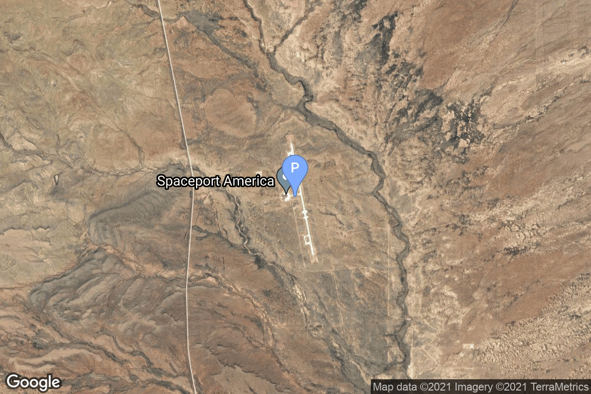
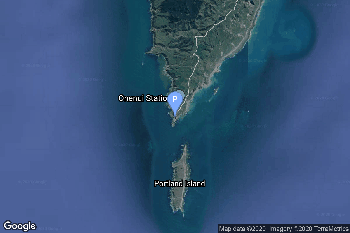
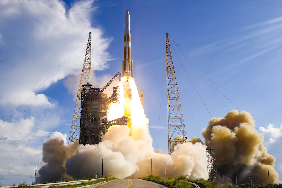
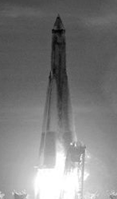
{ "count": 7851, "next": "https://ll.thespacedevs.com/2.2.0/launch/?format=api&limit=10&offset=210&ordering=-id", "previous": "https://ll.thespacedevs.com/2.2.0/launch/?format=api&limit=10&offset=190&ordering=-id", "results": [ { "id": "f8f0f404-f149-4c1a-89ba-0022d19f4b9e", "url": "https://ll.thespacedevs.com/2.2.0/launch/f8f0f404-f149-4c1a-89ba-0022d19f4b9e/?format=api", "slug": "spaceshiptwo-purdue-1", "name": "SpaceShipTwo | Purdue 1", "status": { "id": 2, "name": "To Be Determined", "abbrev": "TBD", "description": "Current date is a placeholder or rough estimation based on unreliable or interpreted sources." }, "last_updated": "2025-09-29T09:37:44Z", "net": "2027-12-31T00:00:00Z", "window_end": "2027-12-31T00:00:00Z", "window_start": "2027-12-31T00:00:00Z", "net_precision": { "id": 14, "name": "Year", "abbrev": "Y", "description": "The T-0 is expected in the given year." }, "probability": null, "weather_concerns": null, "holdreason": "", "failreason": "", "hashtag": null, "launch_service_provider": { "id": 1024, "url": "https://ll.thespacedevs.com/2.2.0/agencies/1024/?format=api", "name": "Virgin Galactic", "type": "Private" }, "rocket": { "id": 8731, "configuration": { "id": 465, "url": "https://ll.thespacedevs.com/2.2.0/config/launcher/465/?format=api", "name": "SpaceShipTwo", "family": "", "full_name": "SpaceShipTwo", "variant": "" } }, "mission": { "id": 7322, "name": "Purdue 1", "description": "Suborbital research flight for Purdue University carrying a professor, student and three alumni.", "launch_designator": null, "type": "Materials Science", "orbit": { "id": 15, "name": "Suborbital", "abbrev": "Sub" }, "agencies": [], "info_urls": [], "vid_urls": [] }, "pad": { "id": 191, "url": "https://ll.thespacedevs.com/2.2.0/pad/191/?format=api", "agency_id": 1024, "name": "Spaceport America", "description": null, "info_url": "https://www.spaceportamerica.com/", "wiki_url": "https://en.wikipedia.org/wiki/Spaceport_America", "map_url": "https://www.google.com/maps?q=32.9902778,-106.9719162", "latitude": "32.9902778", "longitude": "-106.9719162", "location": { "id": 144, "url": "https://ll.thespacedevs.com/2.2.0/location/144/?format=api", "name": "Air launch to Suborbital flight", "country_code": "???", "description": "", "map_image": "https://thespacedevs-prod.nyc3.digitaloceanspaces.com/media/map_images/location_144_20200803142439.jpg", "timezone_name": "", "total_launch_count": 86, "total_landing_count": 0 }, "country_code": "USA", "map_image": "https://thespacedevs-prod.nyc3.digitaloceanspaces.com/media/map_images/pad_spaceport_america_20210522162030.jpg", "total_launch_count": 14, "orbital_launch_attempt_count": 0 }, "webcast_live": false, "image": "https://thespacedevs-prod.nyc3.digitaloceanspaces.com/media/images/spaceshiptwo_image_20210522140909.jpeg", "infographic": null, "program": [], "orbital_launch_attempt_count": null, "location_launch_attempt_count": 87, "pad_launch_attempt_count": 15, "agency_launch_attempt_count": 68, "orbital_launch_attempt_count_year": null, "location_launch_attempt_count_year": 1, "pad_launch_attempt_count_year": 1, "agency_launch_attempt_count_year": 1, "type": "normal" }, { "id": "f8e04552-1dfa-4607-8bba-969b2988c598", "url": "https://ll.thespacedevs.com/2.2.0/launch/f8e04552-1dfa-4607-8bba-969b2988c598/?format=api", "slug": "electron-its-a-test", "name": "Electron | It's a Test", "status": { "id": 4, "name": "Launch Failure", "abbrev": "Failure", "description": "Either the launch vehicle did not reach orbit, or the payload(s) failed to separate." }, "last_updated": "2023-12-18T00:17:42Z", "net": "2017-05-25T04:20:00Z", "window_end": "2017-05-25T05:00:00Z", "window_start": "2017-05-25T01:00:00Z", "net_precision": null, "probability": null, "weather_concerns": null, "holdreason": "", "failreason": "Third-party contractor supporting the launch misconfigured ground equipment that translated radio signals from the rocket into data used by range safety officials. That caused “extensive corruption of received position data,†resulting in the data loss that led safety officials to trigger the rocket’s flight termination system.", "hashtag": "#ItsaTest", "launch_service_provider": { "id": 147, "url": "https://ll.thespacedevs.com/2.2.0/agencies/147/?format=api", "name": "Rocket Lab", "type": "Commercial" }, "rocket": { "id": 2002, "configuration": { "id": 26, "url": "https://ll.thespacedevs.com/2.2.0/config/launcher/26/?format=api", "name": "Electron", "family": "", "full_name": "Electron", "variant": "" } }, "mission": { "id": 274, "name": "It's a Test", "description": "This is the first test flight of the Electron rocket. Built and operated by Rocket Lab, Electron is meant to offer low-price launches for the small-sat market.", "launch_designator": null, "type": "Test Flight", "orbit": { "id": 8, "name": "Low Earth Orbit", "abbrev": "LEO" }, "agencies": [], "info_urls": [], "vid_urls": [] }, "pad": { "id": 65, "url": "https://ll.thespacedevs.com/2.2.0/pad/65/?format=api", "agency_id": 147, "name": "Rocket Lab Launch Complex 1A", "description": "", "info_url": null, "wiki_url": "https://en.wikipedia.org/wiki/Rocket_Lab_Launch_Complex_1", "map_url": "https://www.google.com/maps?q=-39.262833,177.864469", "latitude": "-39.262833", "longitude": "177.864469", "location": { "id": 10, "url": "https://ll.thespacedevs.com/2.2.0/location/10/?format=api", "name": "Rocket Lab Launch Complex 1, Mahia Peninsula, New Zealand", "country_code": "NZL", "description": "Rocket Lab Launch Complex 1 is a commercial spaceport located close to Ahuriri Point at the southern tip of Māhia Peninsula, on the east coast of New Zealand's North Island. It is owned and operated by private spaceflight company Rocket Lab and supports launches of the company's Electron rocket for small satellites. With the launch of Electron on 25 May 2017, it became the first private spaceport to host an orbital launch attempt, and the first site in New Zealand to host an orbital launch attempt. With the Electron launch of 21 January 2018, it became the first private spaceport to host a successful orbital launch.", "map_image": "https://thespacedevs-prod.nyc3.digitaloceanspaces.com/media/map_images/location_10_20200803142509.jpg", "timezone_name": "Pacific/Auckland", "total_launch_count": 75, "total_landing_count": 17 }, "country_code": "NZL", "map_image": "https://thespacedevs-prod.nyc3.digitaloceanspaces.com/media/map_images/pad_65_20200803143549.jpg", "total_launch_count": 40, "orbital_launch_attempt_count": 40 }, "webcast_live": false, "image": "https://thespacedevs-prod.nyc3.digitaloceanspaces.com/media/images/electron_image_20190705175640.jpeg", "infographic": null, "program": [], "orbital_launch_attempt_count": 5643, "location_launch_attempt_count": 1, "pad_launch_attempt_count": 1, "agency_launch_attempt_count": 1, "orbital_launch_attempt_count_year": 28, "location_launch_attempt_count_year": 1, "pad_launch_attempt_count_year": 1, "agency_launch_attempt_count_year": 1, "type": "normal" }, { "id": "f8d9fe33-b8ef-4881-9618-3bdf27f44707", "url": "https://ll.thespacedevs.com/2.2.0/launch/f8d9fe33-b8ef-4881-9618-3bdf27f44707/?format=api", "slug": "delta-iv-m42-gps-iif-6-usa-251", "name": "Delta IV M+(4,2) | GPS IIF-6 (USA-251)", "status": { "id": 3, "name": "Launch Successful", "abbrev": "Success", "description": "The launch vehicle successfully inserted its payload(s) into the target orbit(s)." }, "last_updated": "2024-01-02T15:26:49Z", "net": "2014-05-17T00:03:00Z", "window_end": "2014-05-17T00:03:00Z", "window_start": "2014-05-17T00:03:00Z", "net_precision": null, "probability": null, "weather_concerns": null, "holdreason": "", "failreason": "", "hashtag": null, "launch_service_provider": { "id": 124, "url": "https://ll.thespacedevs.com/2.2.0/agencies/124/?format=api", "name": "United Launch Alliance", "type": "Commercial" }, "rocket": { "id": 1756, "configuration": { "id": 33, "url": "https://ll.thespacedevs.com/2.2.0/config/launcher/33/?format=api", "name": "Delta IV M+(4,2)", "family": "Delta", "full_name": "Delta IV M+(4,2)", "variant": "M+(4,2)" } }, "mission": { "id": 71, "name": "GPS IIF-6", "description": "GPS IIF (Global Positioning System) or Navstar-2F (Navigation System using Timing And Ranging) satellites are the fourth evolution stage of the second generation of the GPS satellites. Improvements included an extended design life of 12 years, faster processors with more memory, and a new civil signal on a third frequency.", "launch_designator": null, "type": "Navigation", "orbit": { "id": 12, "name": "Medium Earth Orbit", "abbrev": "MEO" }, "agencies": [], "info_urls": [], "vid_urls": [] }, "pad": { "id": 38, "url": "https://ll.thespacedevs.com/2.2.0/pad/38/?format=api", "agency_id": null, "name": "Space Launch Complex 37B", "description": "", "info_url": null, "wiki_url": "https://en.wikipedia.org/wiki/Cape_Canaveral_Air_Force_Station_Space_Launch_Complex_37", "map_url": "https://www.google.com/maps?q=28.5317,-80.56495", "latitude": "28.5317", "longitude": "-80.56495", "location": { "id": 12, "url": "https://ll.thespacedevs.com/2.2.0/location/12/?format=api", "name": "Cape Canaveral SFS, FL, USA", "country_code": "USA", "description": "Cape Canaveral Space Force Station (CCSFS) is an installation of the United States Space Force's Space Launch Delta 45, located on Cape Canaveral in Brevard County, Florida.", "map_image": "https://thespacedevs-prod.nyc3.digitaloceanspaces.com/media/map_images/location_12_20200803142519.jpg", "timezone_name": "America/New_York", "total_launch_count": 1104, "total_landing_count": 72 }, "country_code": "USA", "map_image": "https://thespacedevs-prod.nyc3.digitaloceanspaces.com/media/map_images/pad_38_20200803143515.jpg", "total_launch_count": 40, "orbital_launch_attempt_count": 40 }, "webcast_live": false, "image": "https://thespacedevs-prod.nyc3.digitaloceanspaces.com/media/images/delta_iv_m252b_image_20220302002926.jpeg", "infographic": null, "program": [ { "id": 29, "url": "https://ll.thespacedevs.com/2.2.0/program/29/?format=api", "name": "Global Positioning System", "description": "The Global Positioning System (GPS), originally Navstar GPS, is a satellite-based radio navigation system owned by the United States government and operated by the United States Space Force. It is one of the global navigation satellite systems (GNSS) that provide geolocation and time information to a GPS receiver anywhere on or near the Earth where there is an unobstructed line of sight to four or more GPS satellites.", "agencies": [ { "id": 1041, "url": "https://ll.thespacedevs.com/2.2.0/agencies/1041/?format=api", "name": "United States Space Force", "type": "Government" } ], "image_url": "https://thespacedevs-prod.nyc3.digitaloceanspaces.com/media/images/global2520posi_program_20231229182501.png", "start_date": "1978-02-22T00:00:00Z", "end_date": null, "info_url": "https://www.gps.gov/", "wiki_url": "https://en.wikipedia.org/wiki/Global_Positioning_System", "mission_patches": [], "type": { "id": 4, "name": "Navigation Constellation" } } ], "orbital_launch_attempt_count": 5376, "location_launch_attempt_count": 709, "pad_launch_attempt_count": 28, "agency_launch_attempt_count": 83, "orbital_launch_attempt_count_year": 27, "location_launch_attempt_count_year": 6, "pad_launch_attempt_count_year": 2, "agency_launch_attempt_count_year": 5, "type": "normal" }, { "id": "f8ca5297-c476-4295-bbc4-e8423bbff73d", "url": "https://ll.thespacedevs.com/2.2.0/launch/f8ca5297-c476-4295-bbc4-e8423bbff73d/?format=api", "slug": "kosmos-3m-strela-2m-44", "name": "Kosmos-3M | Strela-2M 44", "status": { "id": 3, "name": "Launch Successful", "abbrev": "Success", "description": "The launch vehicle successfully inserted its payload(s) into the target orbit(s)." }, "last_updated": "2023-06-14T03:31:47Z", "net": "1988-04-05T14:41:00Z", "window_end": "1988-04-05T14:41:00Z", "window_start": "1988-04-05T14:41:00Z", "net_precision": null, "probability": null, "weather_concerns": null, "holdreason": "", "failreason": null, "hashtag": null, "launch_service_provider": { "id": 66, "url": "https://ll.thespacedevs.com/2.2.0/agencies/66/?format=api", "name": "Soviet Space Program", "type": "Government" }, "rocket": { "id": 6057, "configuration": { "id": 102, "url": "https://ll.thespacedevs.com/2.2.0/config/launcher/102/?format=api", "name": "Kosmos-3M", "family": "Kosmos", "full_name": "Kosmos-3M (11K65M)", "variant": "-3M" } }, "mission": { "id": 4448, "name": "Strela-2M 44", "description": "Military communications satellite", "launch_designator": null, "type": "Government/Top Secret", "orbit": { "id": 8, "name": "Low Earth Orbit", "abbrev": "LEO" }, "agencies": [], "info_urls": [], "vid_urls": [] }, "pad": { "id": 3, "url": "https://ll.thespacedevs.com/2.2.0/pad/3/?format=api", "agency_id": 163, "name": "133/3 (133L)", "description": null, "info_url": null, "wiki_url": "", "map_url": "https://www.google.com/maps?q=62.886999,40.846984", "latitude": "62.886999", "longitude": "40.846984", "location": { "id": 6, "url": "https://ll.thespacedevs.com/2.2.0/location/6/?format=api", "name": "Plesetsk Cosmodrome, Russian Federation", "country_code": "RUS", "description": "Plesetsk Cosmodrome is a Russian spaceport located in Mirny, Arkhangelsk Oblast, about 800 km north of Moscow and approximately 200 km south of Arkhangelsk. Originally developed as an ICBM site for the R-7 missile, it also served for numerous satellite launches using the R-7 and other rockets. Its high latitude makes it useful only for certain types of launches, especially the Molniya orbits, so for much of the site's history it functioned as a secondary location, with most orbital launches taking place from Baikonur, in the Kazakh SSR. With the end of the Soviet Union, Baikonur became a foreign territory, and Kazakhstan charged $115 million usage fees annually. Consequently, Plesetsk has seen considerably more activity since the 2000s.", "map_image": "https://thespacedevs-prod.nyc3.digitaloceanspaces.com/media/map_images/location_6_20200803142434.jpg", "timezone_name": "Europe/Moscow", "total_launch_count": 1685, "total_landing_count": 0 }, "country_code": "RUS", "map_image": "https://thespacedevs-prod.nyc3.digitaloceanspaces.com/media/map_images/pad_3_20200803143438.jpg", "total_launch_count": 159, "orbital_launch_attempt_count": 159 }, "webcast_live": false, "image": "https://thespacedevs-prod.nyc3.digitaloceanspaces.com/media/images/kosmos-3m_durin_image_20251101171325.jpg", "infographic": null, "program": [], "orbital_launch_attempt_count": 3283, "location_launch_attempt_count": 1212, "pad_launch_attempt_count": 100, "agency_launch_attempt_count": 2171, "orbital_launch_attempt_count_year": 30, "location_launch_attempt_count_year": 13, "pad_launch_attempt_count_year": 1, "agency_launch_attempt_count_year": 24, "type": "normal" }, { "id": "f8c9f344-a6df-4f30-873a-90fe3a7840b3", "url": "https://ll.thespacedevs.com/2.2.0/launch/f8c9f344-a6df-4f30-873a-90fe3a7840b3/?format=api", "slug": "sputnik-8k74ps-sputnik-2", "name": "Sputnik 8K74PS | Sputnik 2", "status": { "id": 3, "name": "Launch Successful", "abbrev": "Success", "description": "The launch vehicle successfully inserted its payload(s) into the target orbit(s)." }, "last_updated": "2023-06-14T03:48:36Z", "net": "1957-11-03T02:30:00Z", "window_end": "1957-11-03T02:30:00Z", "window_start": "1957-11-03T02:30:00Z", "net_precision": null, "probability": null, "weather_concerns": null, "holdreason": "", "failreason": null, "hashtag": null, "launch_service_provider": { "id": 66, "url": "https://ll.thespacedevs.com/2.2.0/agencies/66/?format=api", "name": "Soviet Space Program", "type": "Government" }, "rocket": { "id": 3004, "configuration": { "id": 468, "url": "https://ll.thespacedevs.com/2.2.0/config/launcher/468/?format=api", "name": "Sputnik 8K74PS", "family": "Sputnik", "full_name": "Sputnik 8K74PS", "variant": "8K74PS" } }, "mission": { "id": 1431, "name": "Sputnik 2", "description": "Second artificial satellite and first to carry an animal into orbit.", "launch_designator": null, "type": "Test Flight", "orbit": { "id": 8, "name": "Low Earth Orbit", "abbrev": "LEO" }, "agencies": [], "info_urls": [], "vid_urls": [] }, "pad": { "id": 32, "url": "https://ll.thespacedevs.com/2.2.0/pad/32/?format=api", "agency_id": null, "name": "1/5", "description": null, "info_url": null, "wiki_url": "", "map_url": "https://www.google.com/maps?q=45.92,63.342", "latitude": "45.92", "longitude": "63.342", "location": { "id": 15, "url": "https://ll.thespacedevs.com/2.2.0/location/15/?format=api", "name": "Baikonur Cosmodrome, Republic of Kazakhstan", "country_code": "KAZ", "description": "The Baikonur Cosmodrome is a spaceport operated by Russia within Kazakhstan. Located in the Kazakh city of Baikonur, it is the largest operational space launch facility in terms of area. All Russian crewed spaceflights are launched from Baikonur.", "map_image": "https://thespacedevs-prod.nyc3.digitaloceanspaces.com/media/map_images/location_15_20200803142517.jpg", "timezone_name": "Asia/Qyzylorda", "total_launch_count": 1562, "total_landing_count": 0 }, "country_code": "KAZ", "map_image": "https://thespacedevs-prod.nyc3.digitaloceanspaces.com/media/map_images/pad_32_20200803143513.jpg", "total_launch_count": 487, "orbital_launch_attempt_count": 487 }, "webcast_live": false, "image": "https://thespacedevs-prod.nyc3.digitaloceanspaces.com/media/images/sputnik_8k74ps_image_20210830185541.jpg", "infographic": null, "program": [], "orbital_launch_attempt_count": 2, "location_launch_attempt_count": 2, "pad_launch_attempt_count": 2, "agency_launch_attempt_count": 2, "orbital_launch_attempt_count_year": 2, "location_launch_attempt_count_year": 2, "pad_launch_attempt_count_year": 2, "agency_launch_attempt_count_year": 2, "type": "normal" }, { "id": "f8c7055d-4f4a-458e-b337-cde120965f73", "url": "https://ll.thespacedevs.com/2.2.0/launch/f8c7055d-4f4a-458e-b337-cde120965f73/?format=api", "slug": "long-march-3a-dfh-3", "name": "Long March 3A | DFH-3", "status": { "id": 3, "name": "Launch Successful", "abbrev": "Success", "description": "The launch vehicle successfully inserted its payload(s) into the target orbit(s)." }, "last_updated": "2023-06-14T03:53:45Z", "net": "1994-11-29T17:02:00Z", "window_end": "1994-11-29T17:02:00Z", "window_start": "1994-11-29T17:02:00Z", "net_precision": null, "probability": null, "weather_concerns": null, "holdreason": "", "failreason": null, "hashtag": null, "launch_service_provider": { "id": 189, "url": "https://ll.thespacedevs.com/2.2.0/agencies/189/?format=api", "name": "China Aerospace Corporation", "type": "Government" }, "rocket": { "id": 6630, "configuration": { "id": 71, "url": "https://ll.thespacedevs.com/2.2.0/config/launcher/71/?format=api", "name": "Long March 3A", "family": "Long March", "full_name": "Long March 3A", "variant": "A" } }, "mission": { "id": 5020, "name": "DFH-3", "description": "The DFH-3 satellite is a medium-capacity geostationary communications satellite based on the DFH-3 Bus (three-axis-stabilized telecommunications satellite platform). The 2200 kg satellite carries 24 C-band transponders, providing six television channels and 18 communications transmission channels. It has a power supply of 2 kW and a design life of 8 years.", "launch_designator": null, "type": "Communications", "orbit": { "id": 1, "name": "Geostationary Orbit", "abbrev": "Direct-GEO" }, "agencies": [], "info_urls": [], "vid_urls": [] }, "pad": { "id": 45, "url": "https://ll.thespacedevs.com/2.2.0/pad/45/?format=api", "agency_id": null, "name": "Launch Complex 2 (LC-2)", "description": "", "info_url": null, "wiki_url": "https://en.wikipedia.org/wiki/Xichang_Satellite_Launch_Center", "map_url": "https://www.google.com/maps?q=28.245504,102.026768", "latitude": "28.245504", "longitude": "102.026768", "location": { "id": 16, "url": "https://ll.thespacedevs.com/2.2.0/location/16/?format=api", "name": "Xichang Satellite Launch Center, People's Republic of China", "country_code": "CHN", "description": "The Xichang Satellite Launch Center is a spaceport in China. It is located in Zeyuan Town, northwest of Xichang, Liangshan Yi Autonomous Prefecture in Sichuan.", "map_image": "https://thespacedevs-prod.nyc3.digitaloceanspaces.com/media/map_images/location_16_20200803142513.jpg", "timezone_name": "Asia/Shanghai", "total_launch_count": 239, "total_landing_count": 0 }, "country_code": "CHN", "map_image": "https://thespacedevs-prod.nyc3.digitaloceanspaces.com/media/map_images/pad_45_20200803143520.jpg", "total_launch_count": 124, "orbital_launch_attempt_count": 124 }, "webcast_live": false, "image": "https://thespacedevs-prod.nyc3.digitaloceanspaces.com/media/images/long2520march25203a_image_20190222031143.png", "infographic": null, "program": [], "orbital_launch_attempt_count": 3951, "location_launch_attempt_count": 15, "pad_launch_attempt_count": 6, "agency_launch_attempt_count": 6, "orbital_launch_attempt_count_year": 83, "location_launch_attempt_count_year": 4, "pad_launch_attempt_count_year": 3, "agency_launch_attempt_count_year": 5, "type": "normal" }, { "id": "f8c2f0d1-8a40-4444-adff-f873e7fb4fd7", "url": "https://ll.thespacedevs.com/2.2.0/launch/f8c2f0d1-8a40-4444-adff-f873e7fb4fd7/?format=api", "slug": "soyuz-u-progress-m-47", "name": "Soyuz U | Progress M-47", "status": { "id": 3, "name": "Launch Successful", "abbrev": "Success", "description": "The launch vehicle successfully inserted its payload(s) into the target orbit(s)." }, "last_updated": "2023-06-14T03:48:36Z", "net": "2003-02-02T12:59:40Z", "window_end": "2003-02-02T12:59:40Z", "window_start": "2003-02-02T12:59:40Z", "net_precision": null, "probability": 0, "weather_concerns": null, "holdreason": "", "failreason": "", "hashtag": "", "launch_service_provider": { "id": 63, "url": "https://ll.thespacedevs.com/2.2.0/agencies/63/?format=api", "name": "Russian Federal Space Agency (ROSCOSMOS)", "type": "Government" }, "rocket": { "id": 2330, "configuration": { "id": 37, "url": "https://ll.thespacedevs.com/2.2.0/config/launcher/37/?format=api", "name": "Soyuz U", "family": "Soyuz", "full_name": "Soyuz U", "variant": "" } }, "mission": null, "pad": { "id": 32, "url": "https://ll.thespacedevs.com/2.2.0/pad/32/?format=api", "agency_id": null, "name": "1/5", "description": null, "info_url": null, "wiki_url": "", "map_url": "https://www.google.com/maps?q=45.92,63.342", "latitude": "45.92", "longitude": "63.342", "location": { "id": 15, "url": "https://ll.thespacedevs.com/2.2.0/location/15/?format=api", "name": "Baikonur Cosmodrome, Republic of Kazakhstan", "country_code": "KAZ", "description": "The Baikonur Cosmodrome is a spaceport operated by Russia within Kazakhstan. Located in the Kazakh city of Baikonur, it is the largest operational space launch facility in terms of area. All Russian crewed spaceflights are launched from Baikonur.", "map_image": "https://thespacedevs-prod.nyc3.digitaloceanspaces.com/media/map_images/location_15_20200803142517.jpg", "timezone_name": "Asia/Qyzylorda", "total_launch_count": 1562, "total_landing_count": 0 }, "country_code": "KAZ", "map_image": "https://thespacedevs-prod.nyc3.digitaloceanspaces.com/media/map_images/pad_32_20200803143513.jpg", "total_launch_count": 487, "orbital_launch_attempt_count": 487 }, "webcast_live": false, "image": "https://thespacedevs-prod.nyc3.digitaloceanspaces.com/media/images/soyuz2520u_image_20190222031023.jpeg", "infographic": null, "program": [ { "id": 17, "url": "https://ll.thespacedevs.com/2.2.0/program/17/?format=api", "name": "International Space Station", "description": "The International Space Station programme is tied together by a complex set of legal, political and financial agreements between the sixteen nations involved in the project, governing ownership of the various components, rights to crewing and utilization, and responsibilities for crew rotation and resupply of the International Space Station. It was conceived in 1984 by President Ronald Reagan, during the Space Station Freedom project as it was originally called.", "agencies": [ { "id": 16, "url": "https://ll.thespacedevs.com/2.2.0/agencies/16/?format=api", "name": "Canadian Space Agency", "type": "Government" }, { "id": 27, "url": "https://ll.thespacedevs.com/2.2.0/agencies/27/?format=api", "name": "European Space Agency", "type": "Multinational" }, { "id": 37, "url": "https://ll.thespacedevs.com/2.2.0/agencies/37/?format=api", "name": "Japan Aerospace Exploration Agency", "type": "Government" }, { "id": 44, "url": "https://ll.thespacedevs.com/2.2.0/agencies/44/?format=api", "name": "National Aeronautics and Space Administration", "type": "Government" }, { "id": 63, "url": "https://ll.thespacedevs.com/2.2.0/agencies/63/?format=api", "name": "Russian Federal Space Agency (ROSCOSMOS)", "type": "Government" } ], "image_url": "https://thespacedevs-prod.nyc3.digitaloceanspaces.com/media/images/international2_program_20201129184745.png", "start_date": "1998-11-20T06:40:00Z", "end_date": null, "info_url": "https://www.nasa.gov/mission_pages/station/main/index.html", "wiki_url": "https://en.wikipedia.org/wiki/International_Space_Station_programme", "mission_patches": [], "type": { "id": 2, "name": "Human Spaceflight" } } ], "orbital_launch_attempt_count": 4582, "location_launch_attempt_count": 1202, "pad_launch_attempt_count": 382, "agency_launch_attempt_count": 126, "orbital_launch_attempt_count_year": 6, "location_launch_attempt_count_year": 1, "pad_launch_attempt_count_year": 1, "agency_launch_attempt_count_year": 1, "type": "normal" }, { "id": "f8c1323d-fa4d-41f1-90d9-35616334a841", "url": "https://ll.thespacedevs.com/2.2.0/launch/f8c1323d-fa4d-41f1-90d9-35616334a841/?format=api", "slug": "delta-ii-gps-iir-10", "name": "Delta II | GPS IIR-10", "status": { "id": 3, "name": "Launch Successful", "abbrev": "Success", "description": "The launch vehicle successfully inserted its payload(s) into the target orbit(s)." }, "last_updated": "2024-01-02T14:59:48Z", "net": "2003-12-21T08:05:00Z", "window_end": "2003-12-21T08:05:00Z", "window_start": "2003-12-21T08:05:00Z", "net_precision": null, "probability": null, "weather_concerns": null, "holdreason": "", "failreason": "", "hashtag": null, "launch_service_provider": { "id": 161, "url": "https://ll.thespacedevs.com/2.2.0/agencies/161/?format=api", "name": "United States Air Force", "type": "Government" }, "rocket": { "id": 7164, "configuration": { "id": 140, "url": "https://ll.thespacedevs.com/2.2.0/config/launcher/140/?format=api", "name": "Delta II", "family": "Delta", "full_name": "Delta II 7925-9.5", "variant": "7925-9.5" } }, "mission": { "id": 5553, "name": "GPS IIR-10", "description": "The Boeing-built GPS IIF satellites provide improved signals to support both the warfighter and the growing civilian needs of the global economy", "launch_designator": null, "type": "Navigation", "orbit": { "id": 12, "name": "Medium Earth Orbit", "abbrev": "MEO" }, "agencies": [], "info_urls": [], "vid_urls": [] }, "pad": { "id": 14, "url": "https://ll.thespacedevs.com/2.2.0/pad/14/?format=api", "agency_id": null, "name": "Space Launch Complex 17A", "description": "", "info_url": null, "wiki_url": "https://en.wikipedia.org/wiki/Cape_Canaveral_Space_Launch_Complex_17", "map_url": "https://www.google.com/maps?q=28.4472,-80.565", "latitude": "28.4472", "longitude": "-80.565", "location": { "id": 12, "url": "https://ll.thespacedevs.com/2.2.0/location/12/?format=api", "name": "Cape Canaveral SFS, FL, USA", "country_code": "USA", "description": "Cape Canaveral Space Force Station (CCSFS) is an installation of the United States Space Force's Space Launch Delta 45, located on Cape Canaveral in Brevard County, Florida.", "map_image": "https://thespacedevs-prod.nyc3.digitaloceanspaces.com/media/map_images/location_12_20200803142519.jpg", "timezone_name": "America/New_York", "total_launch_count": 1104, "total_landing_count": 72 }, "country_code": "USA", "map_image": "https://thespacedevs-prod.nyc3.digitaloceanspaces.com/media/map_images/pad_14_20200803143451.jpg", "total_launch_count": 145, "orbital_launch_attempt_count": 145 }, "webcast_live": false, "image": "https://thespacedevs-prod.nyc3.digitaloceanspaces.com/media/images/delta_ii_7925-9_image_20240312090356.jpeg", "infographic": null, "program": [ { "id": 29, "url": "https://ll.thespacedevs.com/2.2.0/program/29/?format=api", "name": "Global Positioning System", "description": "The Global Positioning System (GPS), originally Navstar GPS, is a satellite-based radio navigation system owned by the United States government and operated by the United States Space Force. It is one of the global navigation satellite systems (GNSS) that provide geolocation and time information to a GPS receiver anywhere on or near the Earth where there is an unobstructed line of sight to four or more GPS satellites.", "agencies": [ { "id": 1041, "url": "https://ll.thespacedevs.com/2.2.0/agencies/1041/?format=api", "name": "United States Space Force", "type": "Government" } ], "image_url": "https://thespacedevs-prod.nyc3.digitaloceanspaces.com/media/images/global2520posi_program_20231229182501.png", "start_date": "1978-02-22T00:00:00Z", "end_date": null, "info_url": "https://www.gps.gov/", "wiki_url": "https://en.wikipedia.org/wiki/Global_Positioning_System", "mission_patches": [], "type": { "id": 4, "name": "Navigation Constellation" } } ], "orbital_launch_attempt_count": 4636, "location_launch_attempt_count": 618, "pad_launch_attempt_count": 134, "agency_launch_attempt_count": 1057, "orbital_launch_attempt_count_year": 60, "location_launch_attempt_count_year": 14, "pad_launch_attempt_count_year": 3, "agency_launch_attempt_count_year": 13, "type": "normal" }, { "id": "f8babb4c-105a-406a-881d-50c247e808ab", "url": "https://ll.thespacedevs.com/2.2.0/launch/f8babb4c-105a-406a-881d-50c247e808ab/?format=api", "slug": "soyuz-soyuz-1", "name": "Soyuz | Soyuz 1", "status": { "id": 3, "name": "Launch Successful", "abbrev": "Success", "description": "The launch vehicle successfully inserted its payload(s) into the target orbit(s)." }, "last_updated": "2023-06-14T08:40:31Z", "net": "1967-04-23T00:35:00Z", "window_end": "1967-04-23T00:35:00Z", "window_start": "1967-04-23T00:35:00Z", "net_precision": null, "probability": null, "weather_concerns": null, "holdreason": "", "failreason": null, "hashtag": null, "launch_service_provider": { "id": 66, "url": "https://ll.thespacedevs.com/2.2.0/agencies/66/?format=api", "name": "Soviet Space Program", "type": "Government" }, "rocket": { "id": 211, "configuration": { "id": 96, "url": "https://ll.thespacedevs.com/2.2.0/config/launcher/96/?format=api", "name": "Soyuz", "family": "Soyuz", "full_name": "Soyuz", "variant": "" } }, "mission": { "id": 780, "name": "Soyuz 1", "description": "Soyuz 1 was the first crewed flight of a Soyuz spacecraft, it carried the Soviet cosmonaut Vladimir Komarov to orbit. The mission goal was to rendezvous with Soyuz 2 and move crew members between the spacecrafts, the goal was not met due to Soyuz 2 launch being called off due to thunderstorms. Vladimir Komarov was killed when the parachutes of his Soyuz capsule failed during descent to earth becoming the first in-flight fatality of spaceflight.", "launch_designator": null, "type": "Human Exploration", "orbit": { "id": 8, "name": "Low Earth Orbit", "abbrev": "LEO" }, "agencies": [], "info_urls": [], "vid_urls": [] }, "pad": { "id": 32, "url": "https://ll.thespacedevs.com/2.2.0/pad/32/?format=api", "agency_id": null, "name": "1/5", "description": null, "info_url": null, "wiki_url": "", "map_url": "https://www.google.com/maps?q=45.92,63.342", "latitude": "45.92", "longitude": "63.342", "location": { "id": 15, "url": "https://ll.thespacedevs.com/2.2.0/location/15/?format=api", "name": "Baikonur Cosmodrome, Republic of Kazakhstan", "country_code": "KAZ", "description": "The Baikonur Cosmodrome is a spaceport operated by Russia within Kazakhstan. Located in the Kazakh city of Baikonur, it is the largest operational space launch facility in terms of area. All Russian crewed spaceflights are launched from Baikonur.", "map_image": "https://thespacedevs-prod.nyc3.digitaloceanspaces.com/media/map_images/location_15_20200803142517.jpg", "timezone_name": "Asia/Qyzylorda", "total_launch_count": 1562, "total_landing_count": 0 }, "country_code": "KAZ", "map_image": "https://thespacedevs-prod.nyc3.digitaloceanspaces.com/media/map_images/pad_32_20200803143513.jpg", "total_launch_count": 487, "orbital_launch_attempt_count": 487 }, "webcast_live": false, "image": null, "infographic": null, "program": [ { "id": 8, "url": "https://ll.thespacedevs.com/2.2.0/program/8/?format=api", "name": "Soyuz", "description": "The Soyuz programme is a human spaceflight programme initiated by the Soviet Union in the early 1960s. The Soyuz spacecraft was originally part of a Moon landing project intended to put a Soviet cosmonaut on the Moon. It was the third Soviet human spaceflight programme after the Vostok and Voskhod programmes.", "agencies": [ { "id": 63, "url": "https://ll.thespacedevs.com/2.2.0/agencies/63/?format=api", "name": "Russian Federal Space Agency (ROSCOSMOS)", "type": "Government" }, { "id": 66, "url": "https://ll.thespacedevs.com/2.2.0/agencies/66/?format=api", "name": "Soviet Space Program", "type": "Government" } ], "image_url": "https://thespacedevs-prod.nyc3.digitaloceanspaces.com/media/images/soyuz_program_20201129185543.png", "start_date": "1966-11-28T11:02:00Z", "end_date": null, "info_url": null, "wiki_url": "https://en.wikipedia.org/wiki/Soyuz_programme", "mission_patches": [], "type": { "id": 2, "name": "Human Spaceflight" } } ], "orbital_launch_attempt_count": 689, "location_launch_attempt_count": 175, "pad_launch_attempt_count": 88, "agency_launch_attempt_count": 235, "orbital_launch_attempt_count_year": 41, "location_launch_attempt_count_year": 9, "pad_launch_attempt_count_year": 4, "agency_launch_attempt_count_year": 20, "type": "normal" }, { "id": "f8b0a6ef-0e39-4247-bb3e-81b75718adc3", "url": "https://ll.thespacedevs.com/2.2.0/launch/f8b0a6ef-0e39-4247-bb3e-81b75718adc3/?format=api", "slug": "vostok-8a92m-meteor-priroda-3-1", "name": "Vostok 8A92M | Meteor-Priroda 3-1", "status": { "id": 3, "name": "Launch Successful", "abbrev": "Success", "description": "The launch vehicle successfully inserted its payload(s) into the target orbit(s)." }, "last_updated": "2023-06-14T03:41:07Z", "net": "1980-06-18T06:14:12Z", "window_end": "1980-06-18T06:14:12Z", "window_start": "1980-06-18T06:14:12Z", "net_precision": null, "probability": null, "weather_concerns": null, "holdreason": "", "failreason": null, "hashtag": null, "launch_service_provider": { "id": 66, "url": "https://ll.thespacedevs.com/2.2.0/agencies/66/?format=api", "name": "Soviet Space Program", "type": "Government" }, "rocket": { "id": 5183, "configuration": { "id": 452, "url": "https://ll.thespacedevs.com/2.2.0/config/launcher/452/?format=api", "name": "Vostok 8A92M", "family": "Vostok", "full_name": "Vostok 8A92M", "variant": "8A92M" } }, "mission": { "id": 3594, "name": "Meteor-Priroda 3-1", "description": "Meteor meteorological satellite", "launch_designator": null, "type": "Earth Science", "orbit": { "id": 17, "name": "Sun-Synchronous Orbit", "abbrev": "SSO" }, "agencies": [], "info_urls": [], "vid_urls": [] }, "pad": { "id": 20, "url": "https://ll.thespacedevs.com/2.2.0/pad/20/?format=api", "agency_id": null, "name": "31/6", "description": "", "info_url": null, "wiki_url": "https://en.wikipedia.org/wiki/Baikonur_Cosmodrome_Site_31", "map_url": "https://www.google.com/maps?q=45.996034,63.564003", "latitude": "45.996034", "longitude": "63.564003", "location": { "id": 15, "url": "https://ll.thespacedevs.com/2.2.0/location/15/?format=api", "name": "Baikonur Cosmodrome, Republic of Kazakhstan", "country_code": "KAZ", "description": "The Baikonur Cosmodrome is a spaceport operated by Russia within Kazakhstan. Located in the Kazakh city of Baikonur, it is the largest operational space launch facility in terms of area. All Russian crewed spaceflights are launched from Baikonur.", "map_image": "https://thespacedevs-prod.nyc3.digitaloceanspaces.com/media/map_images/location_15_20200803142517.jpg", "timezone_name": "Asia/Qyzylorda", "total_launch_count": 1562, "total_landing_count": 0 }, "country_code": "KAZ", "map_image": "https://thespacedevs-prod.nyc3.digitaloceanspaces.com/media/map_images/pad_20_20200803143516.jpg", "total_launch_count": 428, "orbital_launch_attempt_count": 428 }, "webcast_live": false, "image": "https://thespacedevs-prod.nyc3.digitaloceanspaces.com/media/images/the_full-scale__image_20251127090310.jpg", "infographic": null, "program": [], "orbital_launch_attempt_count": 2335, "location_launch_attempt_count": 567, "pad_launch_attempt_count": 220, "agency_launch_attempt_count": 1404, "orbital_launch_attempt_count_year": 52, "location_launch_attempt_count_year": 13, "pad_launch_attempt_count_year": 3, "agency_launch_attempt_count_year": 42, "type": "normal" } ] }