Launch List
AN API endpoint that returns all Launch objects or a single launch.
EXAMPLE - /launch/[id]/ or /launch/?mode=list&search=SpaceX
GET Return a list of all Launch objects.
FILTERS Fields - 'name', 'id(s)', 'lsp__id', 'lsp__name', 'serial_number', 'launcher_config__id', 'rocket__spacecraftflight__spacecraft__name', 'is_crewed', 'include_suborbital', 'spacecraft_config__ids', 'related', 'location__ids', 'lsp__ids', 'pad__ids', 'status__ids'
MODE 'normal', 'list', 'detailed'
EXAMPLE ?mode=list
SEARCH Searches through the launch name, rocket name, launch agency, mission name & spacecraft name.
EXAMPLE - ?search=SpaceX
GET /2.2.0/launch/?format=api&offset=190&ordering=id
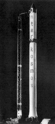
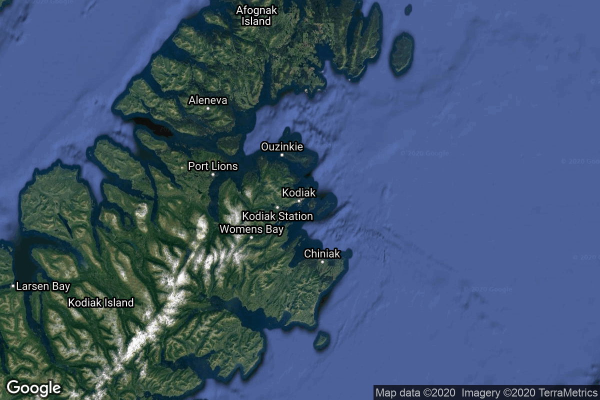
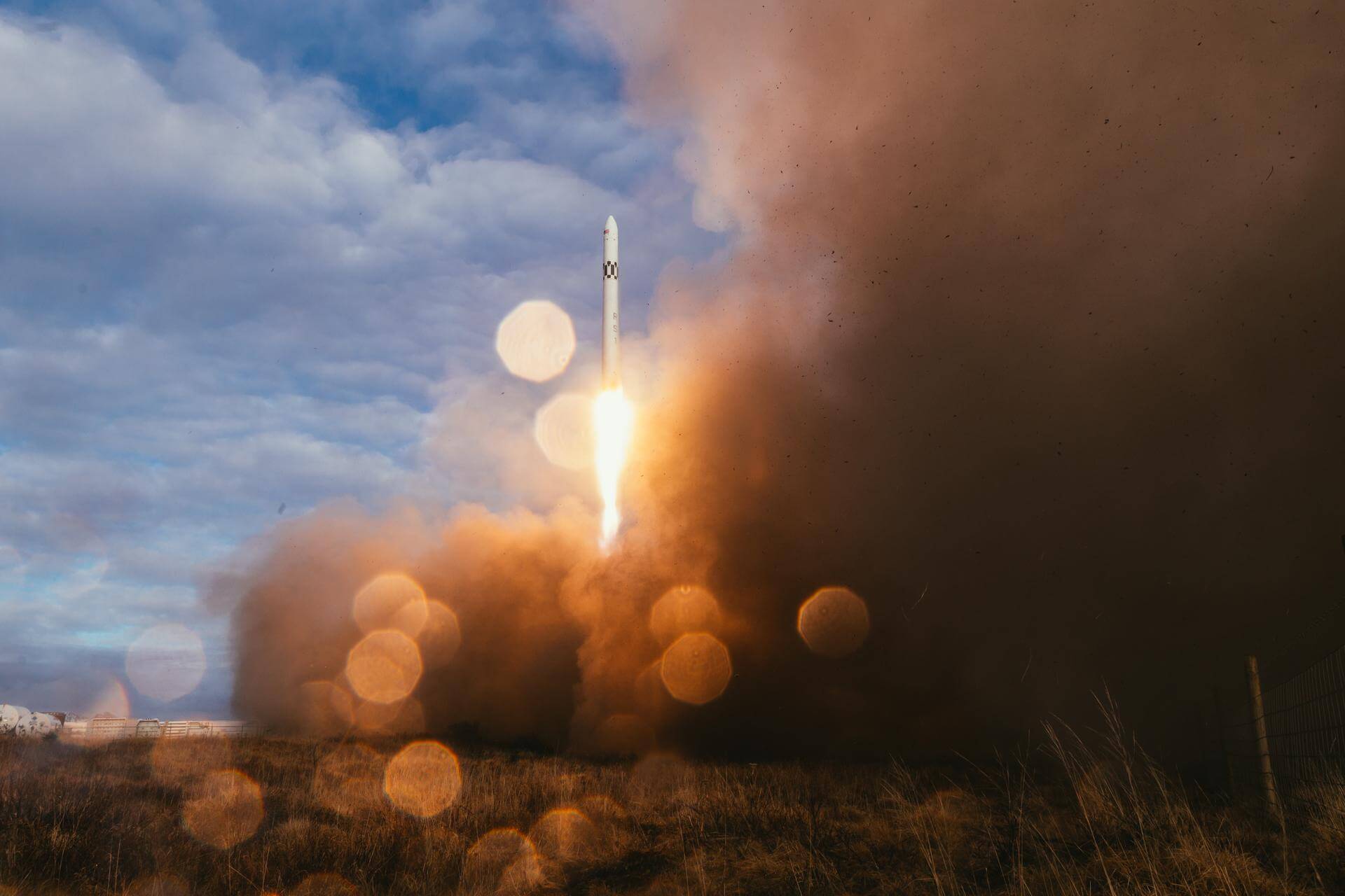
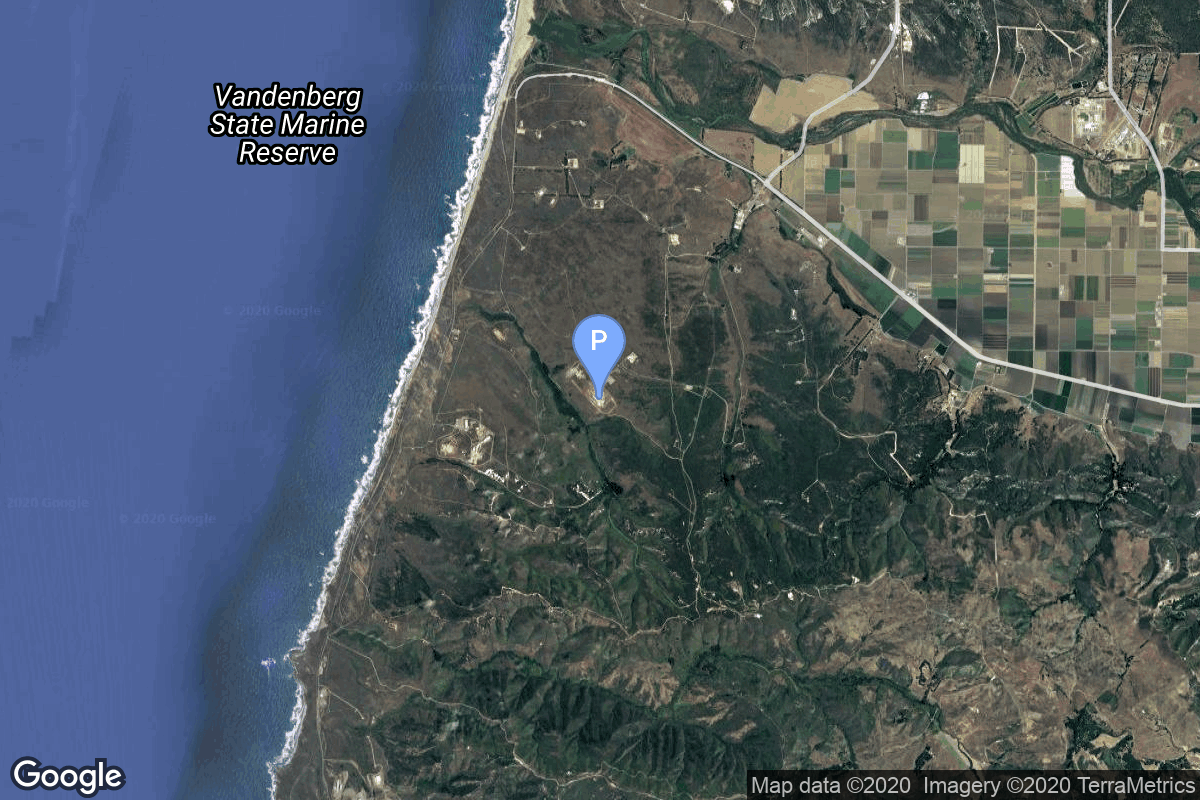
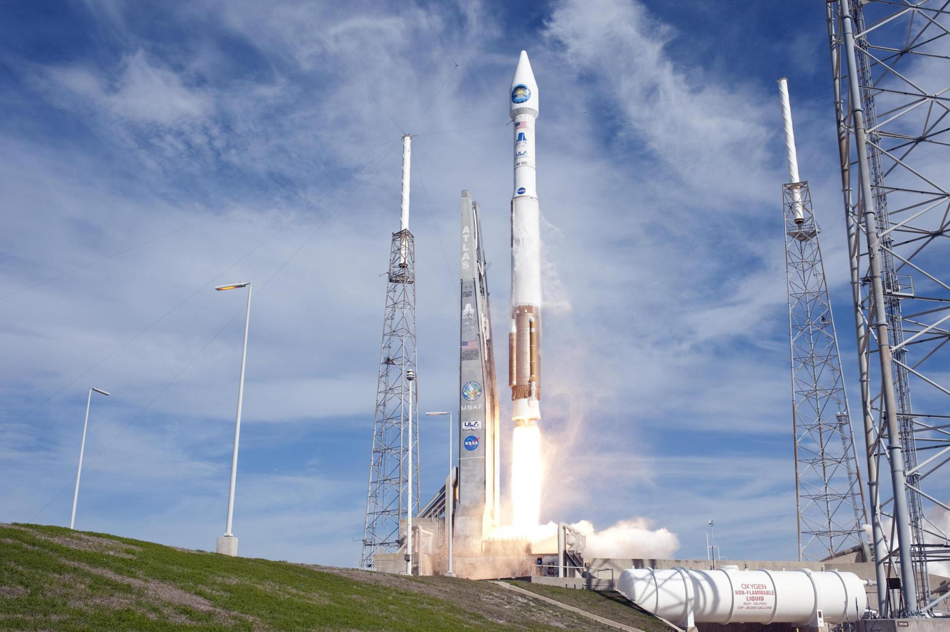
{ "count": 7851, "next": "https://ll.thespacedevs.com/2.2.0/launch/?format=api&limit=10&offset=200&ordering=id", "previous": "https://ll.thespacedevs.com/2.2.0/launch/?format=api&limit=10&offset=180&ordering=id", "results": [ { "id": "05ef78f6-bf31-415f-a10b-6bf2eb1d1ed3", "url": "https://ll.thespacedevs.com/2.2.0/launch/05ef78f6-bf31-415f-a10b-6bf2eb1d1ed3/?format=api", "slug": "kosmos-11k63-ds-u2-mg-2", "name": "Kosmos 11K63 | DS-U2-MG 2", "status": { "id": 3, "name": "Launch Successful", "abbrev": "Success", "description": "The launch vehicle successfully inserted its payload(s) into the target orbit(s)." }, "last_updated": "2023-06-14T03:31:51Z", "net": "1970-08-10T19:59:55Z", "window_end": "1970-08-10T19:59:55Z", "window_start": "1970-08-10T19:59:55Z", "net_precision": null, "probability": null, "weather_concerns": null, "holdreason": "", "failreason": null, "hashtag": null, "launch_service_provider": { "id": 66, "url": "https://ll.thespacedevs.com/2.2.0/agencies/66/?format=api", "name": "Soviet Space Program", "type": "Government" }, "rocket": { "id": 4033, "configuration": { "id": 327, "url": "https://ll.thespacedevs.com/2.2.0/config/launcher/327/?format=api", "name": "Kosmos 11K63", "family": "Kosmos", "full_name": "Kosmos 11K63", "variant": "11K63" } }, "mission": { "id": 2451, "name": "DS-U2-MG 2", "description": "Satellite designed to investigate the magnetic field of the Earth.", "launch_designator": null, "type": "Earth Science", "orbit": { "id": 8, "name": "Low Earth Orbit", "abbrev": "LEO" }, "agencies": [], "info_urls": [], "vid_urls": [] }, "pad": { "id": 3, "url": "https://ll.thespacedevs.com/2.2.0/pad/3/?format=api", "agency_id": 163, "name": "133/3 (133L)", "description": null, "info_url": null, "wiki_url": "", "map_url": "https://www.google.com/maps?q=62.886999,40.846984", "latitude": "62.886999", "longitude": "40.846984", "location": { "id": 6, "url": "https://ll.thespacedevs.com/2.2.0/location/6/?format=api", "name": "Plesetsk Cosmodrome, Russian Federation", "country_code": "RUS", "description": "Plesetsk Cosmodrome is a Russian spaceport located in Mirny, Arkhangelsk Oblast, about 800 km north of Moscow and approximately 200 km south of Arkhangelsk. Originally developed as an ICBM site for the R-7 missile, it also served for numerous satellite launches using the R-7 and other rockets. Its high latitude makes it useful only for certain types of launches, especially the Molniya orbits, so for much of the site's history it functioned as a secondary location, with most orbital launches taking place from Baikonur, in the Kazakh SSR. With the end of the Soviet Union, Baikonur became a foreign territory, and Kazakhstan charged $115 million usage fees annually. Consequently, Plesetsk has seen considerably more activity since the 2000s.", "map_image": "https://thespacedevs-prod.nyc3.digitaloceanspaces.com/media/map_images/location_6_20200803142434.jpg", "timezone_name": "Europe/Moscow", "total_launch_count": 1685, "total_landing_count": 0 }, "country_code": "RUS", "map_image": "https://thespacedevs-prod.nyc3.digitaloceanspaces.com/media/map_images/pad_3_20200803143438.jpg", "total_launch_count": 159, "orbital_launch_attempt_count": 159 }, "webcast_live": false, "image": "https://thespacedevs-prod.nyc3.digitaloceanspaces.com/media/images/kosmos_11k63_image_20251104091702.jpg", "infographic": null, "program": [], "orbital_launch_attempt_count": 1111, "location_launch_attempt_count": 139, "pad_launch_attempt_count": 35, "agency_launch_attempt_count": 497, "orbital_launch_attempt_count_year": 65, "location_launch_attempt_count_year": 31, "pad_launch_attempt_count_year": 10, "agency_launch_attempt_count_year": 44, "type": "normal" }, { "id": "05f96cb2-6f1e-47dd-8873-e31f0b1ee887", "url": "https://ll.thespacedevs.com/2.2.0/launch/05f96cb2-6f1e-47dd-8873-e31f0b1ee887/?format=api", "slug": "proton-kdm-raduga-7", "name": "Proton-K/DM | Raduga 7", "status": { "id": 3, "name": "Launch Successful", "abbrev": "Success", "description": "The launch vehicle successfully inserted its payload(s) into the target orbit(s)." }, "last_updated": "2023-06-14T03:35:18Z", "net": "1980-10-05T17:10:00Z", "window_end": "1980-10-05T17:10:00Z", "window_start": "1980-10-05T17:10:00Z", "net_precision": null, "probability": null, "weather_concerns": null, "holdreason": "", "failreason": null, "hashtag": null, "launch_service_provider": { "id": 66, "url": "https://ll.thespacedevs.com/2.2.0/agencies/66/?format=api", "name": "Soviet Space Program", "type": "Government" }, "rocket": { "id": 5210, "configuration": { "id": 349, "url": "https://ll.thespacedevs.com/2.2.0/config/launcher/349/?format=api", "name": "Proton-K/DM", "family": "Proton / UR-500", "full_name": "Proton-K/DM", "variant": "DM" } }, "mission": { "id": 3620, "name": "Raduga 7", "description": "Geostationary communications satellite for military and governmental puposes", "launch_designator": null, "type": "Communications", "orbit": { "id": 1, "name": "Geostationary Orbit", "abbrev": "Direct-GEO" }, "agencies": [], "info_urls": [], "vid_urls": [] }, "pad": { "id": 15, "url": "https://ll.thespacedevs.com/2.2.0/pad/15/?format=api", "agency_id": null, "name": "200/39 (200L)", "description": null, "info_url": null, "wiki_url": "", "map_url": "https://www.google.com/maps?q=46.039984,63.032093", "latitude": "46.039984", "longitude": "63.032093", "location": { "id": 15, "url": "https://ll.thespacedevs.com/2.2.0/location/15/?format=api", "name": "Baikonur Cosmodrome, Republic of Kazakhstan", "country_code": "KAZ", "description": "The Baikonur Cosmodrome is a spaceport operated by Russia within Kazakhstan. Located in the Kazakh city of Baikonur, it is the largest operational space launch facility in terms of area. All Russian crewed spaceflights are launched from Baikonur.", "map_image": "https://thespacedevs-prod.nyc3.digitaloceanspaces.com/media/map_images/location_15_20200803142517.jpg", "timezone_name": "Asia/Qyzylorda", "total_launch_count": 1562, "total_landing_count": 0 }, "country_code": "KAZ", "map_image": "https://thespacedevs-prod.nyc3.digitaloceanspaces.com/media/map_images/pad_15_20200803143530.jpg", "total_launch_count": 167, "orbital_launch_attempt_count": 167 }, "webcast_live": false, "image": "https://thespacedevs-prod.nyc3.digitaloceanspaces.com/media/images/proton_image_20231231095535.jpg", "infographic": null, "program": [], "orbital_launch_attempt_count": 2366, "location_launch_attempt_count": 573, "pad_launch_attempt_count": 3, "agency_launch_attempt_count": 1431, "orbital_launch_attempt_count_year": 83, "location_launch_attempt_count_year": 19, "pad_launch_attempt_count_year": 3, "agency_launch_attempt_count_year": 69, "type": "normal" }, { "id": "06066a71-c5fd-48d1-a7c9-13fe82ded736", "url": "https://ll.thespacedevs.com/2.2.0/launch/06066a71-c5fd-48d1-a7c9-13fe82ded736/?format=api", "slug": "rs1-maiden-flight", "name": "RS1 | Maiden Flight", "status": { "id": 4, "name": "Launch Failure", "abbrev": "Failure", "description": "Either the launch vehicle did not reach orbit, or the payload(s) failed to separate." }, "last_updated": "2024-03-05T18:14:27Z", "net": "2023-01-10T23:27:30Z", "window_end": "2023-01-11T01:30:00Z", "window_start": "2023-01-10T22:00:00Z", "net_precision": null, "probability": 70, "weather_concerns": null, "holdreason": "", "failreason": "RS1 successfully lifted off and flew nominally for 10.85 seconds until RS1's nine E2 engines as well as other systems on the vehicle shut down simultaneously and communications were lost. ABL believes the cause of failure was a fire in the engine bay of the first stage.", "hashtag": null, "launch_service_provider": { "id": 1030, "url": "https://ll.thespacedevs.com/2.2.0/agencies/1030/?format=api", "name": "Long Wall", "type": "Commercial" }, "rocket": { "id": 7478, "configuration": { "id": 475, "url": "https://ll.thespacedevs.com/2.2.0/config/launcher/475/?format=api", "name": "RS1", "family": "", "full_name": "RS1", "variant": "1" } }, "mission": { "id": 5878, "name": "Maiden Flight", "description": "This is the first launch of RS1 launch vehicle developed and built by ABL Space Systems. This launch carries two satellites for OmniTeq.", "launch_designator": null, "type": "Test Flight", "orbit": { "id": 8, "name": "Low Earth Orbit", "abbrev": "LEO" }, "agencies": [], "info_urls": [], "vid_urls": [] }, "pad": { "id": 199, "url": "https://ll.thespacedevs.com/2.2.0/pad/199/?format=api", "agency_id": null, "name": "Launch Pad 3C", "description": "", "info_url": null, "wiki_url": "https://en.wikipedia.org/wiki/Pacific_Spaceport_Complex_%E2%80%93_Alaska", "map_url": "https://www.google.com/maps?q=57.431239,-152.350749", "latitude": "57.431239", "longitude": "-152.350749", "location": { "id": 25, "url": "https://ll.thespacedevs.com/2.2.0/location/25/?format=api", "name": "Pacific Spaceport Complex, Alaska, USA", "country_code": "USA", "description": "The Pacific Spaceport Complex – Alaska (PSCA), formerly known as the Kodiak Launch Complex (KLC), is a dual-use commercial and military spaceport for sub-orbital and orbital launch vehicles. The facility is owned and operated by the Alaska Aerospace Corporation, a corporation owned by the Government of Alaska, and is located on Kodiak Island in Alaska.", "map_image": "https://thespacedevs-prod.nyc3.digitaloceanspaces.com/media/map_images/location_25_20200803142500.jpg", "timezone_name": "America/Anchorage", "total_launch_count": 9, "total_landing_count": 0 }, "country_code": "USA", "map_image": "https://thespacedevs-prod.nyc3.digitaloceanspaces.com/media/map_images/pad_199_20220904142623.jpg", "total_launch_count": 1, "orbital_launch_attempt_count": 1 }, "webcast_live": false, "image": "https://thespacedevs-prod.nyc3.digitaloceanspaces.com/media/images/rs12520257c2_image_20231227135638.jpeg", "infographic": null, "program": [], "orbital_launch_attempt_count": 6374, "location_launch_attempt_count": 9, "pad_launch_attempt_count": 1, "agency_launch_attempt_count": 1, "orbital_launch_attempt_count_year": 6, "location_launch_attempt_count_year": 1, "pad_launch_attempt_count_year": 1, "agency_launch_attempt_count_year": 1, "type": "normal" }, { "id": "060fc260-01bd-41ec-a0be-ce2223fbbc76", "url": "https://ll.thespacedevs.com/2.2.0/launch/060fc260-01bd-41ec-a0be-ce2223fbbc76/?format=api", "slug": "atlas-v-401-jpss-2-joint-polar-satellite-system-sp", "name": "Atlas V 401 | JPSS 2 (Joint Polar Satellite System spacecraft No. 2) & LOFTID", "status": { "id": 3, "name": "Launch Successful", "abbrev": "Success", "description": "The launch vehicle successfully inserted its payload(s) into the target orbit(s)." }, "last_updated": "2023-06-14T17:25:13Z", "net": "2022-11-10T09:49:00Z", "window_end": "2022-11-10T10:01:00Z", "window_start": "2022-11-10T09:25:00Z", "net_precision": null, "probability": 95, "weather_concerns": null, "holdreason": "", "failreason": "", "hashtag": null, "launch_service_provider": { "id": 124, "url": "https://ll.thespacedevs.com/2.2.0/agencies/124/?format=api", "name": "United Launch Alliance", "type": "Commercial" }, "rocket": { "id": 185, "configuration": { "id": 16, "url": "https://ll.thespacedevs.com/2.2.0/config/launcher/16/?format=api", "name": "Atlas V 401", "family": "Atlas", "full_name": "Atlas V 401", "variant": "401" } }, "mission": { "id": 756, "name": "JPSS 2 (Joint Polar Satellite System spacecraft No. 2) & LOFTID", "description": "JPSS is a collaborative program between NOAA and NASA. JPSS-2 is one of five satellites that will comprise the JPSS constellation. These spacecraft gather global measurements of atmospheric, terrestrial and oceanic conditions, including sea and land surface temperatures, vegetation, clouds, rainfall, snow and ice cover, fire locations and smoke plumes, atmospheric temperature, water vapor and ozone.\r\n\r\nLOFTID is a tech demo for the inflatable heatshield technology. It will attempt to survive a reentry from orbit after JPSS 2 is separated. This test will validate the technology for various applications, such as landing large payloads on Mars and engine reuse on ULA’s Vulcan rocket.", "launch_designator": null, "type": "Earth Science", "orbit": { "id": 17, "name": "Sun-Synchronous Orbit", "abbrev": "SSO" }, "agencies": [], "info_urls": [], "vid_urls": [] }, "pad": { "id": 24, "url": "https://ll.thespacedevs.com/2.2.0/pad/24/?format=api", "agency_id": 161, "name": "Space Launch Complex 3E", "description": "SLC-3E is a launch pad at Vandenberg Space Force Base. It was originally built for the MIDAS program and later used for various other missions. After a period of inactivity, it was refurbished in the early 2000s to launch Atlas V rockets. The pad is now being upgraded to accommodate the new Vulcan Centaur rocket. The last Atlas V launch from SLC-3E happened in November 2022, with the first Vulcan launch expected in 2025.", "info_url": null, "wiki_url": "https://en.wikipedia.org/wiki/Vandenberg_Space_Launch_Complex_3#SLC-3E", "map_url": "https://www.google.com/maps?q=34.64,-120.5895", "latitude": "34.64", "longitude": "-120.5895", "location": { "id": 11, "url": "https://ll.thespacedevs.com/2.2.0/location/11/?format=api", "name": "Vandenberg SFB, CA, USA", "country_code": "USA", "description": "Vandenberg Space Force Base is a United States Space Force Base in Santa Barbara County, California. Established in 1941, Vandenberg Space Force Base is a space launch base, launching spacecraft from the Western Range, and also performs missile testing. The United States Space Force's Space Launch Delta 30 serves as the host delta for the base, equivalent to an Air Force air base wing. In addition to its military space launch mission, Vandenberg Space Force Base also hosts space launches for civil and commercial space entities, such as NASA and SpaceX.", "map_image": "https://thespacedevs-prod.nyc3.digitaloceanspaces.com/media/map_images/location_11_20200803142416.jpg", "timezone_name": "America/Los_Angeles", "total_launch_count": 878, "total_landing_count": 33 }, "country_code": "USA", "map_image": "https://thespacedevs-prod.nyc3.digitaloceanspaces.com/media/map_images/pad_24_20200803143552.jpg", "total_launch_count": 48, "orbital_launch_attempt_count": 45 }, "webcast_live": false, "image": "https://thespacedevs-prod.nyc3.digitaloceanspaces.com/media/images/atlas_v_image_20201212013334.jpeg", "infographic": null, "program": [ { "id": 36, "url": "https://ll.thespacedevs.com/2.2.0/program/36/?format=api", "name": "NASA Large Strategic Science Missions", "description": "NASA's large strategic science missions or large strategic missions, formerly known as Flagship missions or Flagship-class missions, are the costliest and most capable NASA science spacecraft. Flagship missions exist within all four divisions of NASA's Science Mission Directorate (SMD): the astrophysics, Earth science, heliophysics and planetary science divisions.", "agencies": [ { "id": 44, "url": "https://ll.thespacedevs.com/2.2.0/agencies/44/?format=api", "name": "National Aeronautics and Space Administration", "type": "Government" } ], "image_url": "https://thespacedevs-prod.nyc3.digitaloceanspaces.com/media/images/nasa2520large_program_20240205122003.jpeg", "start_date": "1975-08-22T00:00:00Z", "end_date": null, "info_url": null, "wiki_url": "https://en.wikipedia.org/wiki/Large_strategic_science_missions", "mission_patches": [], "type": { "id": 5, "name": "Exploration" } } ], "orbital_launch_attempt_count": 6337, "location_launch_attempt_count": 707, "pad_launch_attempt_count": 48, "agency_launch_attempt_count": 156, "orbital_launch_attempt_count_year": 155, "location_launch_attempt_count_year": 14, "pad_launch_attempt_count_year": 1, "agency_launch_attempt_count_year": 8, "type": "normal" }, { "id": "061a962d-2cbe-46c6-8857-b76c1ef55c72", "url": "https://ll.thespacedevs.com/2.2.0/launch/061a962d-2cbe-46c6-8857-b76c1ef55c72/?format=api", "slug": "soyuz-21bfregat-glonass-m-kosmos-2478", "name": "Soyuz 2.1b/Fregat | Glonass-M (Kosmos 2478)", "status": { "id": 3, "name": "Launch Successful", "abbrev": "Success", "description": "The launch vehicle successfully inserted its payload(s) into the target orbit(s)." }, "last_updated": "2023-06-14T04:11:15Z", "net": "2011-11-28T08:25:57Z", "window_end": "2011-11-28T08:25:57Z", "window_start": "2011-11-28T08:25:57Z", "net_precision": null, "probability": null, "weather_concerns": null, "holdreason": "", "failreason": "", "hashtag": null, "launch_service_provider": { "id": 193, "url": "https://ll.thespacedevs.com/2.2.0/agencies/193/?format=api", "name": "Russian Space Forces", "type": "Government" }, "rocket": { "id": 1570, "configuration": { "id": 42, "url": "https://ll.thespacedevs.com/2.2.0/config/launcher/42/?format=api", "name": "Soyuz 2.1b/Fregat", "family": "Soyuz", "full_name": "Soyuz 2.1b Fregat", "variant": "Fregat" } }, "mission": { "id": 471, "name": "Glonass-M (Kosmos 2478)", "description": "Glonass-M, also known as Uragan-M, are the second generation of Uragan satellite design used for GLONASS satellite navigation system. GLONASS is a Russian space-based navigation system comparable to the similar GPS and Galileo systems. This generation improves on accuracy, power consumption and design life. Each satellite weighs 1415 kg, is equipped with 12 L-band antennas, and has an operational lifetime of 7 years.", "launch_designator": null, "type": "Navigation", "orbit": { "id": 12, "name": "Medium Earth Orbit", "abbrev": "MEO" }, "agencies": [], "info_urls": [], "vid_urls": [] }, "pad": { "id": 85, "url": "https://ll.thespacedevs.com/2.2.0/pad/85/?format=api", "agency_id": 163, "name": "43/4 (43R)", "description": "", "info_url": null, "wiki_url": null, "map_url": "https://www.google.com/maps?q=62.92883,40.457098", "latitude": "62.92883", "longitude": "40.457098", "location": { "id": 6, "url": "https://ll.thespacedevs.com/2.2.0/location/6/?format=api", "name": "Plesetsk Cosmodrome, Russian Federation", "country_code": "RUS", "description": "Plesetsk Cosmodrome is a Russian spaceport located in Mirny, Arkhangelsk Oblast, about 800 km north of Moscow and approximately 200 km south of Arkhangelsk. Originally developed as an ICBM site for the R-7 missile, it also served for numerous satellite launches using the R-7 and other rockets. Its high latitude makes it useful only for certain types of launches, especially the Molniya orbits, so for much of the site's history it functioned as a secondary location, with most orbital launches taking place from Baikonur, in the Kazakh SSR. With the end of the Soviet Union, Baikonur became a foreign territory, and Kazakhstan charged $115 million usage fees annually. Consequently, Plesetsk has seen considerably more activity since the 2000s.", "map_image": "https://thespacedevs-prod.nyc3.digitaloceanspaces.com/media/map_images/location_6_20200803142434.jpg", "timezone_name": "Europe/Moscow", "total_launch_count": 1685, "total_landing_count": 0 }, "country_code": "RUS", "map_image": "https://thespacedevs-prod.nyc3.digitaloceanspaces.com/media/map_images/pad_85_20200803143554.jpg", "total_launch_count": 328, "orbital_launch_attempt_count": 328 }, "webcast_live": false, "image": "https://thespacedevs-prod.nyc3.digitaloceanspaces.com/media/images/soyuz_2.1b_image_20230802085331.jpg", "infographic": null, "program": [ { "id": 34, "url": "https://ll.thespacedevs.com/2.2.0/program/34/?format=api", "name": "GLONASS", "description": "GLONASS (ГЛОНАСС, IPA: [ɡɫɐˈnas]; Russian: Глобальная навигационная спутниковая система, tr. Global'naya Navigatsionnaya Sputnikovaya Sistema, lit. 'Global Navigation Satellite System') is a Russian satellite navigation system operating as part of a radionavigation-satellite service. It provides an alternative to Global Positioning System (GPS) and is the second navigational system in operation with global coverage and of comparable precision.", "agencies": [ { "id": 63, "url": "https://ll.thespacedevs.com/2.2.0/agencies/63/?format=api", "name": "Russian Federal Space Agency (ROSCOSMOS)", "type": "Government" } ], "image_url": "https://thespacedevs-prod.nyc3.digitaloceanspaces.com/media/images/glonass_program_20240102170258.png", "start_date": "1982-10-12T00:00:00Z", "end_date": null, "info_url": "https://www.glonass-iac.ru/en/", "wiki_url": "https://en.wikipedia.org/wiki/GLONASS", "mission_patches": [], "type": { "id": 4, "name": "Navigation Constellation" } } ], "orbital_launch_attempt_count": 5180, "location_launch_attempt_count": 1582, "pad_launch_attempt_count": 268, "agency_launch_attempt_count": 85, "orbital_launch_attempt_count_year": 74, "location_launch_attempt_count_year": 6, "pad_launch_attempt_count_year": 4, "agency_launch_attempt_count_year": 6, "type": "normal" }, { "id": "061e5aea-cdfe-480a-9d6c-bbf3b97c4370", "url": "https://ll.thespacedevs.com/2.2.0/launch/061e5aea-cdfe-480a-9d6c-bbf3b97c4370/?format=api", "slug": "proton-m-briz-m-garpun-no-12l-kosmos-2513", "name": "Proton-M Briz-M | Garpun No. 12L (Kosmos-2513)", "status": { "id": 3, "name": "Launch Successful", "abbrev": "Success", "description": "The launch vehicle successfully inserted its payload(s) into the target orbit(s)." }, "last_updated": "2023-06-14T03:32:44Z", "net": "2015-12-13T00:19:00Z", "window_end": "2015-12-15T00:01:00Z", "window_start": "2015-12-13T00:10:00Z", "net_precision": null, "probability": null, "weather_concerns": null, "holdreason": "", "failreason": null, "hashtag": null, "launch_service_provider": { "id": 96, "url": "https://ll.thespacedevs.com/2.2.0/agencies/96/?format=api", "name": "Khrunichev State Research and Production Space Center", "type": "Government" }, "rocket": { "id": 1891, "configuration": { "id": 22, "url": "https://ll.thespacedevs.com/2.2.0/config/launcher/22/?format=api", "name": "Proton-M Briz-M", "family": "Proton / UR-500", "full_name": "Proton-M Briz-M", "variant": "Briz-M" } }, "mission": { "id": 95, "name": "Garpun", "description": "Garpun is a military communications satellite that will relay information between ground stations and other satellites", "launch_designator": null, "type": "Government/Top Secret", "orbit": { "id": 2, "name": "Geostationary Transfer Orbit", "abbrev": "GTO" }, "agencies": [], "info_urls": [], "vid_urls": [] }, "pad": { "id": 7, "url": "https://ll.thespacedevs.com/2.2.0/pad/7/?format=api", "agency_id": null, "name": "81/24 (81P)", "description": null, "info_url": null, "wiki_url": "", "map_url": "https://www.google.com/maps?q=46.071001,62.984999", "latitude": "46.071001", "longitude": "62.984999", "location": { "id": 15, "url": "https://ll.thespacedevs.com/2.2.0/location/15/?format=api", "name": "Baikonur Cosmodrome, Republic of Kazakhstan", "country_code": "KAZ", "description": "The Baikonur Cosmodrome is a spaceport operated by Russia within Kazakhstan. Located in the Kazakh city of Baikonur, it is the largest operational space launch facility in terms of area. All Russian crewed spaceflights are launched from Baikonur.", "map_image": "https://thespacedevs-prod.nyc3.digitaloceanspaces.com/media/map_images/location_15_20200803142517.jpg", "timezone_name": "Asia/Qyzylorda", "total_launch_count": 1562, "total_landing_count": 0 }, "country_code": "KAZ", "map_image": "https://thespacedevs-prod.nyc3.digitaloceanspaces.com/media/map_images/pad_7_20200803143454.jpg", "total_launch_count": 93, "orbital_launch_attempt_count": 93 }, "webcast_live": false, "image": "https://thespacedevs-prod.nyc3.digitaloceanspaces.com/media/images/proton-m2520briz-m_image_20190224012317.jpeg", "infographic": null, "program": [], "orbital_launch_attempt_count": 5521, "location_launch_attempt_count": 1459, "pad_launch_attempt_count": 82, "agency_launch_attempt_count": 175, "orbital_launch_attempt_count_year": 79, "location_launch_attempt_count_year": 15, "pad_launch_attempt_count_year": 2, "agency_launch_attempt_count_year": 3, "type": "normal" }, { "id": "06201706-da6b-467e-83b2-ef2ff8596e05", "url": "https://ll.thespacedevs.com/2.2.0/launch/06201706-da6b-467e-83b2-ef2ff8596e05/?format=api", "slug": "vulcan-ussf-23", "name": "Vulcan | USSF-23", "status": { "id": 2, "name": "To Be Determined", "abbrev": "TBD", "description": "Current date is a placeholder or rough estimation based on unreliable or interpreted sources." }, "last_updated": "2025-08-29T16:13:08Z", "net": "2026-12-31T00:00:00Z", "window_end": "2026-12-31T00:00:00Z", "window_start": "2026-12-31T00:00:00Z", "net_precision": { "id": 14, "name": "Year", "abbrev": "Y", "description": "The T-0 is expected in the given year." }, "probability": null, "weather_concerns": null, "holdreason": "", "failreason": "", "hashtag": null, "launch_service_provider": { "id": 124, "url": "https://ll.thespacedevs.com/2.2.0/agencies/124/?format=api", "name": "United Launch Alliance", "type": "Commercial" }, "rocket": { "id": 7591, "configuration": { "id": 200, "url": "https://ll.thespacedevs.com/2.2.0/config/launcher/200/?format=api", "name": "Vulcan", "family": "Vulcan", "full_name": "Vulcan", "variant": "Vulcan" } }, "mission": { "id": 6033, "name": "USSF-23", "description": "Classified payload for the US Space Force.", "launch_designator": null, "type": "Government/Top Secret", "orbit": { "id": 25, "name": "Unknown", "abbrev": "N/A" }, "agencies": [ { "id": 1041, "url": "https://ll.thespacedevs.com/2.2.0/agencies/1041/?format=api", "name": "United States Space Force", "featured": false, "type": "Government", "country_code": "USA", "abbrev": "USSF", "description": "The United States Space Force (USSF) is the space service branch of the U.S. Armed Forces, one of the eight U.S. uniformed services.", "administrator": null, "founding_year": "2019", "launchers": "", "spacecraft": "", "launch_library_url": null, "total_launch_count": 0, "consecutive_successful_launches": 0, "successful_launches": 0, "failed_launches": 0, "pending_launches": 0, "consecutive_successful_landings": 0, "successful_landings": 0, "failed_landings": 0, "attempted_landings": 0, "info_url": "https://www.spaceforce.mil/", "wiki_url": "https://en.wikipedia.org/wiki/United_States_Space_Force", "logo_url": "https://thespacedevs-prod.nyc3.digitaloceanspaces.com/media/images/united2520states2520space2520force_logo_20221102113048.png", "image_url": null, "nation_url": "https://thespacedevs-prod.nyc3.digitaloceanspaces.com/media/images/united_states_s_image_20250916065613.jpg" } ], "info_urls": [], "vid_urls": [] }, "pad": { "id": 29, "url": "https://ll.thespacedevs.com/2.2.0/pad/29/?format=api", "agency_id": null, "name": "Space Launch Complex 41", "description": "", "info_url": null, "wiki_url": "https://en.wikipedia.org/wiki/Cape_Canaveral_Air_Force_Station_Space_Launch_Complex_41", "map_url": "https://www.google.com/maps?q=28.58341025,-80.58303644", "latitude": "28.58341025", "longitude": "-80.58303644", "location": { "id": 12, "url": "https://ll.thespacedevs.com/2.2.0/location/12/?format=api", "name": "Cape Canaveral SFS, FL, USA", "country_code": "USA", "description": "Cape Canaveral Space Force Station (CCSFS) is an installation of the United States Space Force's Space Launch Delta 45, located on Cape Canaveral in Brevard County, Florida.", "map_image": "https://thespacedevs-prod.nyc3.digitaloceanspaces.com/media/map_images/location_12_20200803142519.jpg", "timezone_name": "America/New_York", "total_launch_count": 1104, "total_landing_count": 72 }, "country_code": "USA", "map_image": "https://thespacedevs-prod.nyc3.digitaloceanspaces.com/media/map_images/pad_29_20200803143528.jpg", "total_launch_count": 122, "orbital_launch_attempt_count": 122 }, "webcast_live": false, "image": "https://thespacedevs-prod.nyc3.digitaloceanspaces.com/media/images/vulcan_image_20240107162928.jpeg", "infographic": null, "program": [], "orbital_launch_attempt_count": 7456, "location_launch_attempt_count": 1161, "pad_launch_attempt_count": 142, "agency_launch_attempt_count": 199, "orbital_launch_attempt_count_year": 283, "location_launch_attempt_count_year": 85, "pad_launch_attempt_count_year": 22, "agency_launch_attempt_count_year": 29, "type": "normal" }, { "id": "0630efb1-516d-4d6a-af4d-d4761cb3b803", "url": "https://ll.thespacedevs.com/2.2.0/launch/0630efb1-516d-4d6a-af4d-d4761cb3b803/?format=api", "slug": "soyuz-u-zenit-4mk-78", "name": "Soyuz U | Zenit-4MK 78", "status": { "id": 3, "name": "Launch Successful", "abbrev": "Success", "description": "The launch vehicle successfully inserted its payload(s) into the target orbit(s)." }, "last_updated": "2023-06-14T03:41:33Z", "net": "1977-05-17T10:10:00Z", "window_end": "1977-05-17T10:10:00Z", "window_start": "1977-05-17T10:10:00Z", "net_precision": null, "probability": null, "weather_concerns": null, "holdreason": "", "failreason": null, "hashtag": null, "launch_service_provider": { "id": 66, "url": "https://ll.thespacedevs.com/2.2.0/agencies/66/?format=api", "name": "Soviet Space Program", "type": "Government" }, "rocket": { "id": 4825, "configuration": { "id": 37, "url": "https://ll.thespacedevs.com/2.2.0/config/launcher/37/?format=api", "name": "Soyuz U", "family": "Soyuz", "full_name": "Soyuz U", "variant": "" } }, "mission": { "id": 3242, "name": "Zenit-4MK 78", "description": "High resolution optical reconnaissance satellite of the Vostok-based Zenit family.", "launch_designator": null, "type": "Government/Top Secret", "orbit": { "id": 8, "name": "Low Earth Orbit", "abbrev": "LEO" }, "agencies": [], "info_urls": [], "vid_urls": [] }, "pad": { "id": 20, "url": "https://ll.thespacedevs.com/2.2.0/pad/20/?format=api", "agency_id": null, "name": "31/6", "description": "", "info_url": null, "wiki_url": "https://en.wikipedia.org/wiki/Baikonur_Cosmodrome_Site_31", "map_url": "https://www.google.com/maps?q=45.996034,63.564003", "latitude": "45.996034", "longitude": "63.564003", "location": { "id": 15, "url": "https://ll.thespacedevs.com/2.2.0/location/15/?format=api", "name": "Baikonur Cosmodrome, Republic of Kazakhstan", "country_code": "KAZ", "description": "The Baikonur Cosmodrome is a spaceport operated by Russia within Kazakhstan. Located in the Kazakh city of Baikonur, it is the largest operational space launch facility in terms of area. All Russian crewed spaceflights are launched from Baikonur.", "map_image": "https://thespacedevs-prod.nyc3.digitaloceanspaces.com/media/map_images/location_15_20200803142517.jpg", "timezone_name": "Asia/Qyzylorda", "total_launch_count": 1562, "total_landing_count": 0 }, "country_code": "KAZ", "map_image": "https://thespacedevs-prod.nyc3.digitaloceanspaces.com/media/map_images/pad_20_20200803143516.jpg", "total_launch_count": 428, "orbital_launch_attempt_count": 428 }, "webcast_live": false, "image": "https://thespacedevs-prod.nyc3.digitaloceanspaces.com/media/images/soyuz2520u_image_20190222031023.jpeg", "infographic": null, "program": [], "orbital_launch_attempt_count": 1951, "location_launch_attempt_count": 483, "pad_launch_attempt_count": 188, "agency_launch_attempt_count": 1108, "orbital_launch_attempt_count_year": 36, "location_launch_attempt_count_year": 6, "pad_launch_attempt_count_year": 5, "agency_launch_attempt_count_year": 28, "type": "normal" }, { "id": "0634f871-3fdd-48f2-b6c4-bdd9c578377e", "url": "https://ll.thespacedevs.com/2.2.0/launch/0634f871-3fdd-48f2-b6c4-bdd9c578377e/?format=api", "slug": "long-march-8-core-only-hainan-1-to-4-others", "name": "Long March 8 (Core Only) | Hainan-1 to 4 & others", "status": { "id": 3, "name": "Launch Successful", "abbrev": "Success", "description": "The launch vehicle successfully inserted its payload(s) into the target orbit(s)." }, "last_updated": "2024-10-22T02:00:04Z", "net": "2022-02-27T03:06:30Z", "window_end": "2022-02-27T03:19:00Z", "window_start": "2022-02-27T02:54:00Z", "net_precision": null, "probability": null, "weather_concerns": null, "holdreason": "", "failreason": "", "hashtag": null, "launch_service_provider": { "id": 88, "url": "https://ll.thespacedevs.com/2.2.0/agencies/88/?format=api", "name": "China Aerospace Science and Technology Corporation", "type": "Government" }, "rocket": { "id": 2596, "configuration": { "id": 477, "url": "https://ll.thespacedevs.com/2.2.0/config/launcher/477/?format=api", "name": "Long March 8 (Core Only)", "family": "Long March", "full_name": "Long March 8 (Core Only)", "variant": "8" } }, "mission": { "id": 6976, "name": "Hainan-1 to 4 & others", "description": "Carried 22 satellites to sun-synchronous orbit on a share-ride mission, including the Hainan-1 satellites.", "launch_designator": null, "type": "Earth Science", "orbit": { "id": 17, "name": "Sun-Synchronous Orbit", "abbrev": "SSO" }, "agencies": [], "info_urls": [], "vid_urls": [] }, "pad": { "id": 176, "url": "https://ll.thespacedevs.com/2.2.0/pad/176/?format=api", "agency_id": null, "name": "201", "description": "", "info_url": null, "wiki_url": "https://en.wikipedia.org/wiki/Wenchang_Spacecraft_Launch_Site", "map_url": "https://www.google.com/maps?q=19.618452,110.955356", "latitude": "19.618452", "longitude": "110.955356", "location": { "id": 8, "url": "https://ll.thespacedevs.com/2.2.0/location/8/?format=api", "name": "Wenchang Space Launch Site, People's Republic of China", "country_code": "CHN", "description": "The Wenchang Space Launch Site is a rocket launch site located in Wenchang on the island of Hainan, in China.\r\n\r\nFormally a suborbital test center, it currently serves as China's southernmost spaceport. The site was selected for its low latitude, 19° north of the equator, allowing for larger payloads to be launched. It is capable of launching the Long March 5, the heaviest Chinese rocket. Unlike launch facilities on the mainland, Wenchang uses its seaport for deliveries.", "map_image": "https://thespacedevs-prod.nyc3.digitaloceanspaces.com/media/map_images/location_8_20200803142445.jpg", "timezone_name": "Asia/Shanghai", "total_launch_count": 59, "total_landing_count": 0 }, "country_code": "CHN", "map_image": "https://thespacedevs-prod.nyc3.digitaloceanspaces.com/media/map_images/pad_176_20200803143412.jpg", "total_launch_count": 28, "orbital_launch_attempt_count": 28 }, "webcast_live": false, "image": "https://thespacedevs-prod.nyc3.digitaloceanspaces.com/media/images/cz-8_2528core-_image_20240315181855.png", "infographic": null, "program": [], "orbital_launch_attempt_count": 6202, "location_launch_attempt_count": 16, "pad_launch_attempt_count": 9, "agency_launch_attempt_count": 356, "orbital_launch_attempt_count_year": 20, "location_launch_attempt_count_year": 1, "pad_launch_attempt_count_year": 1, "agency_launch_attempt_count_year": 4, "type": "normal" }, { "id": "063bc833-9e00-4ae3-a2bd-3314970d6509", "url": "https://ll.thespacedevs.com/2.2.0/launch/063bc833-9e00-4ae3-a2bd-3314970d6509/?format=api", "slug": "spaceshiptwo-vss-enterprise-gf13", "name": "SpaceShipTwo | VSS Enterprise GF13", "status": { "id": 3, "name": "Launch Successful", "abbrev": "Success", "description": "The launch vehicle successfully inserted its payload(s) into the target orbit(s)." }, "last_updated": "2023-06-14T08:57:57Z", "net": "2011-06-21T12:00:00Z", "window_end": "2011-06-21T12:00:00Z", "window_start": "2011-06-21T12:00:00Z", "net_precision": null, "probability": null, "weather_concerns": null, "holdreason": "", "failreason": "", "hashtag": null, "launch_service_provider": { "id": 1024, "url": "https://ll.thespacedevs.com/2.2.0/agencies/1024/?format=api", "name": "Virgin Galactic", "type": "Private" }, "rocket": { "id": 2906, "configuration": { "id": 465, "url": "https://ll.thespacedevs.com/2.2.0/config/launcher/465/?format=api", "name": "SpaceShipTwo", "family": "", "full_name": "SpaceShipTwo", "variant": "" } }, "mission": { "id": 1323, "name": "VSS Enterprise GF13", "description": "Free glide test flight of VSS Enterprise.", "launch_designator": null, "type": "Test Flight", "orbit": { "id": 15, "name": "Suborbital", "abbrev": "Sub" }, "agencies": [], "info_urls": [], "vid_urls": [] }, "pad": { "id": 190, "url": "https://ll.thespacedevs.com/2.2.0/pad/190/?format=api", "agency_id": 1024, "name": "Mojave Air and Space Port", "description": null, "info_url": "https://www.mojaveairport.com/", "wiki_url": "https://en.wikipedia.org/wiki/Mojave_Air_and_Space_Port", "map_url": "https://www.google.com/maps?q=35.0594444,-118.1538607", "latitude": "35.0594444", "longitude": "-118.1538607", "location": { "id": 144, "url": "https://ll.thespacedevs.com/2.2.0/location/144/?format=api", "name": "Air launch to Suborbital flight", "country_code": "???", "description": "", "map_image": "https://thespacedevs-prod.nyc3.digitaloceanspaces.com/media/map_images/location_144_20200803142439.jpg", "timezone_name": "", "total_launch_count": 86, "total_landing_count": 0 }, "country_code": "USA", "map_image": "https://thespacedevs-prod.nyc3.digitaloceanspaces.com/media/map_images/pad_190_20210522160913.jpg", "total_launch_count": 53, "orbital_launch_attempt_count": 0 }, "webcast_live": false, "image": "https://thespacedevs-prod.nyc3.digitaloceanspaces.com/media/images/spaceshiptwo_image_20210522140909.jpeg", "infographic": null, "program": [], "orbital_launch_attempt_count": null, "location_launch_attempt_count": 33, "pad_launch_attempt_count": 14, "agency_launch_attempt_count": 14, "orbital_launch_attempt_count_year": null, "location_launch_attempt_count_year": 11, "pad_launch_attempt_count_year": 11, "agency_launch_attempt_count_year": 11, "type": "normal" } ] }