Upcoming Launch List
API endpoint that returns future Launch objects and launches from the last twenty four hours.
GET: Return a list of future Launches
FILTERS: Fields - 'name', 'id(s)', 'lsp_id', 'lsp_name', 'launcher_config__id',
MODE: 'normal', 'list', 'detailed' EXAMPLE: ?mode=list
SEARCH: Searches through the launch name, rocket name, launch agency and mission name. EXAMPLE - ?search=SpaceX
GET /2.0.0/launch/upcoming/?format=api&offset=184&ordering=id
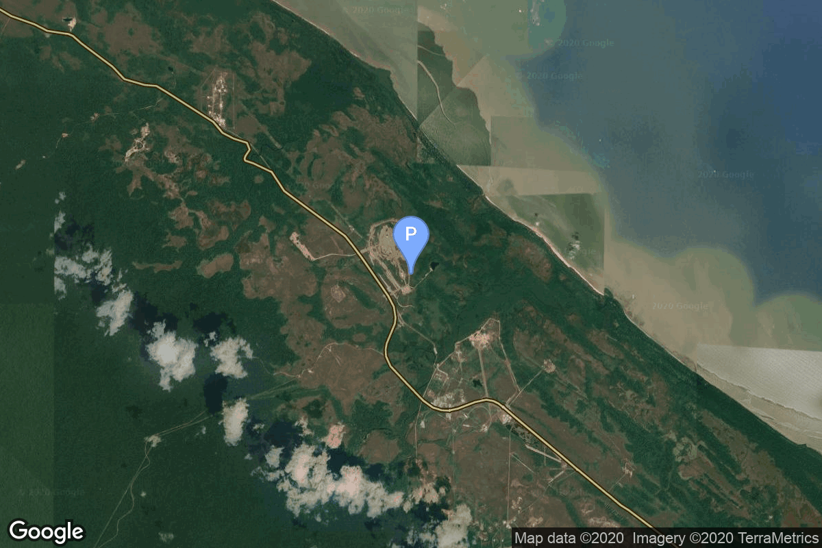
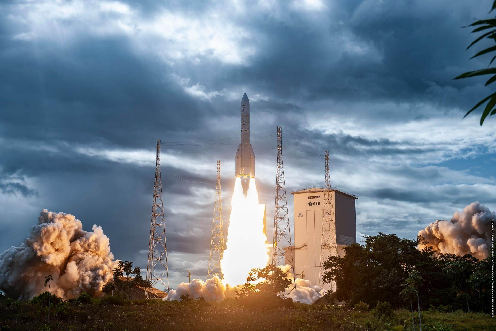
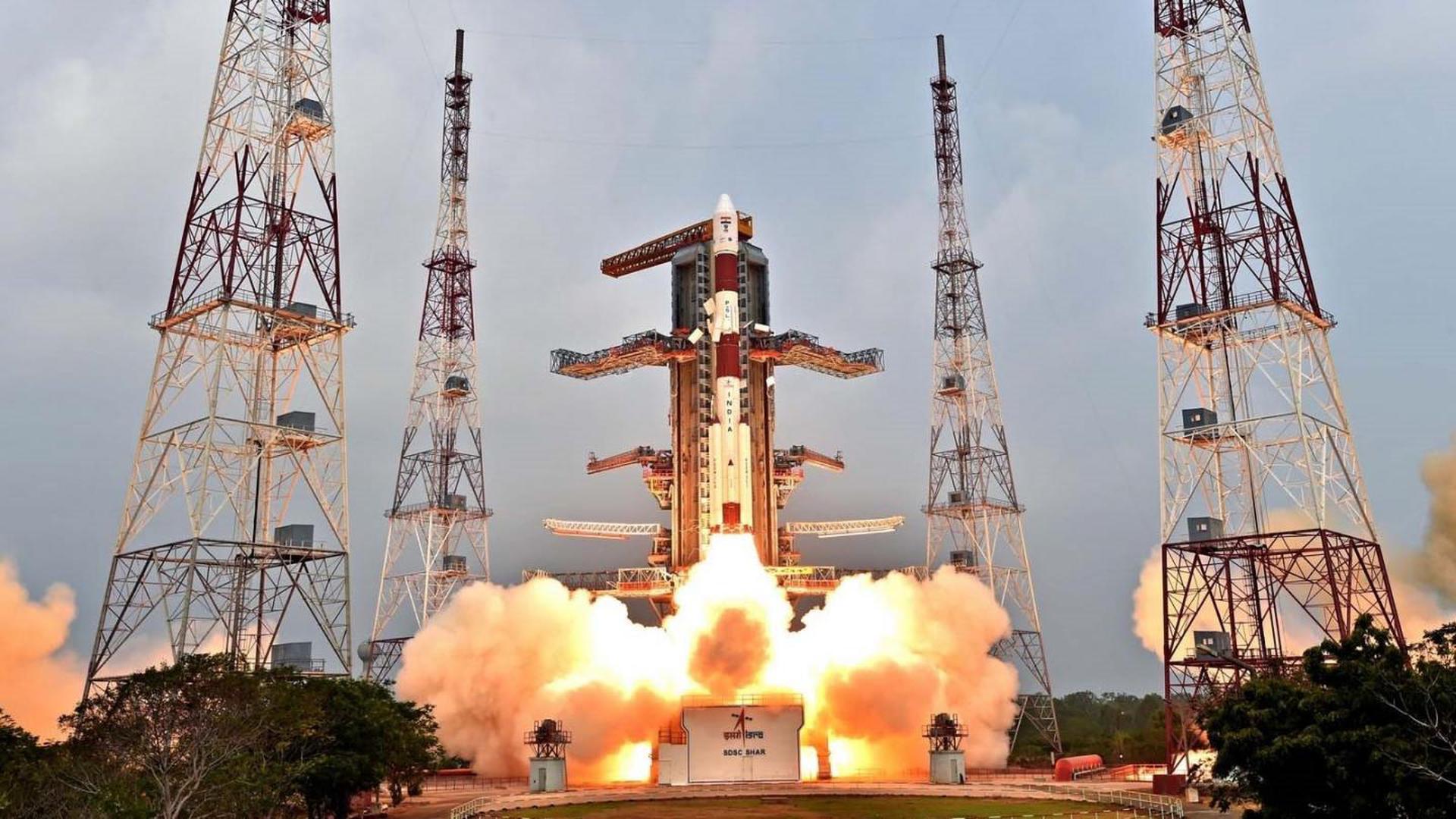
{ "count": 337, "next": "https://ll.thespacedevs.com/2.0.0/launch/upcoming/?format=api&limit=10&offset=194&ordering=id", "previous": "https://ll.thespacedevs.com/2.0.0/launch/upcoming/?format=api&limit=10&offset=174&ordering=id", "results": [ { "id": "8e7d57b1-b5c0-4d0d-a575-fe23606bdeee", "url": "https://ll.thespacedevs.com/2.0.0/launch/8e7d57b1-b5c0-4d0d-a575-fe23606bdeee/?format=api", "launch_library_id": null, "slug": "ariane-62-2-x-galileo-2", "name": "Ariane 62 | 2 x Galileo", "status": { "id": 2, "name": "TBD" }, "net": "2025-12-31T00:00:00Z", "window_end": "2025-12-31T00:00:00Z", "window_start": "2025-12-31T00:00:00Z", "inhold": false, "tbdtime": true, "tbddate": true, "probability": null, "holdreason": "", "failreason": "", "hashtag": null, "launch_service_provider": { "id": 115, "url": "https://ll.thespacedevs.com/2.0.0/agencies/115/?format=api", "name": "Arianespace", "type": "Commercial" }, "rocket": { "id": 7509, "configuration": { "id": 121, "launch_library_id": 164, "url": "https://ll.thespacedevs.com/2.0.0/config/launcher/121/?format=api", "name": "Ariane 62", "family": "Ariane", "full_name": "Ariane 62", "variant": "62" } }, "mission": { "id": 5918, "launch_library_id": null, "name": "2 x Galileo", "description": "Payload consists of two satellites for Europe's Galileo navigation system.", "launch_designator": null, "type": "Navigation", "orbit": { "id": 12, "name": "Medium Earth Orbit", "abbrev": "MEO" } }, "pad": { "id": 67, "url": "https://ll.thespacedevs.com/2.0.0/pad/67/?format=api", "agency_id": 115, "name": "Ariane Launch Area 4", "info_url": null, "wiki_url": "https://en.wikipedia.org/wiki/Guiana_Space_Centre", "map_url": "https://www.google.com/maps?q=5.256319,-52.786838", "latitude": "5.256319", "longitude": "-52.786838", "location": { "id": 13, "url": "https://ll.thespacedevs.com/2.0.0/location/13/?format=api", "name": "Guiana Space Centre, French Guiana", "country_code": "GUF", "map_image": "https://thespacedevs-prod.nyc3.digitaloceanspaces.com/media/map_images/location_13_20200803142412.jpg", "total_launch_count": 325, "total_landing_count": 0 }, "map_image": "https://thespacedevs-prod.nyc3.digitaloceanspaces.com/media/map_images/pad_67_20200803143559.jpg", "total_launch_count": 2 }, "webcast_live": false, "image": "https://thespacedevs-prod.nyc3.digitaloceanspaces.com/media/images/ariane_62_lifto_image_20240711132056.jpeg", "infographic": null, "program": [ { "id": 30, "url": "https://ll.thespacedevs.com/2.0.0/program/30/?format=api", "name": "Galileo", "description": "Galileo is a global navigation satellite system (GNSS) that went live in 2016, created by the European Union through the European Space Agency (ESA), operated by the European Union Agency for the Space Programme (EUSPA).", "agencies": [ { "id": 27, "url": "https://ll.thespacedevs.com/2.0.0/agencies/27/?format=api", "name": "European Space Agency", "type": "Multinational" } ], "image_url": "https://thespacedevs-prod.nyc3.digitaloceanspaces.com/media/images/galileo_program_20231230110547.png", "start_date": "2011-10-21T10:30:00Z", "end_date": null, "info_url": "https://www.gsc-europa.eu/", "wiki_url": "https://en.wikipedia.org/wiki/Galileo_(satellite_navigation)" } ] }, { "id": "8effc13a-c658-4d2e-9f15-8dba4d7fe2dd", "url": "https://ll.thespacedevs.com/2.0.0/launch/8effc13a-c658-4d2e-9f15-8dba4d7fe2dd/?format=api", "launch_library_id": null, "slug": "vega-c-sentinel-3c", "name": "Vega-C | Sentinel-3C", "status": { "id": 2, "name": "TBD" }, "net": "2026-12-31T00:00:00Z", "window_end": "2026-12-31T00:00:00Z", "window_start": "2026-12-31T00:00:00Z", "inhold": false, "tbdtime": true, "tbddate": true, "probability": null, "holdreason": "", "failreason": "", "hashtag": null, "launch_service_provider": { "id": 115, "url": "https://ll.thespacedevs.com/2.0.0/agencies/115/?format=api", "name": "Arianespace", "type": "Commercial" }, "rocket": { "id": 7714, "configuration": { "id": 127, "launch_library_id": 163, "url": "https://ll.thespacedevs.com/2.0.0/config/launcher/127/?format=api", "name": "Vega-C", "family": "Vega", "full_name": "Vega-C", "variant": "" } }, "mission": { "id": 6236, "launch_library_id": null, "name": "Sentinel-3C", "description": "Sentinel-3C is the third satellite in the Sentinel-3 constellation, which provides high-accuracy optical, radar and altimetry data for marine and land services.", "launch_designator": null, "type": "Earth Science", "orbit": { "id": 17, "name": "Sun-Synchronous Orbit", "abbrev": "SSO" } }, "pad": { "id": 34, "url": "https://ll.thespacedevs.com/2.0.0/pad/34/?format=api", "agency_id": 115, "name": "Ariane Launch Area 1 (ELV)", "info_url": null, "wiki_url": "https://en.wikipedia.org/wiki/ELA-1", "map_url": "https://www.google.com/maps?q=5.236,-52.775", "latitude": "5.236", "longitude": "-52.775", "location": { "id": 13, "url": "https://ll.thespacedevs.com/2.0.0/location/13/?format=api", "name": "Guiana Space Centre, French Guiana", "country_code": "GUF", "map_image": "https://thespacedevs-prod.nyc3.digitaloceanspaces.com/media/map_images/location_13_20200803142412.jpg", "total_launch_count": 325, "total_landing_count": 0 }, "map_image": "https://thespacedevs-prod.nyc3.digitaloceanspaces.com/media/map_images/pad_34_20200803143527.jpg", "total_launch_count": 52 }, "webcast_live": false, "image": "https://thespacedevs-prod.nyc3.digitaloceanspaces.com/media/images/vega-c_image_20220713154437.jpg", "infographic": null, "program": [ { "id": 22, "url": "https://ll.thespacedevs.com/2.0.0/program/22/?format=api", "name": "Copernicus", "description": "Copernicus is the European Union's Earth observation programme coordinated and managed for the European Commission by the European Union Agency for the Space Programme in partnership with the European Space Agency (ESA), the EU Member States. It aims at achieving a global, continuous, autonomous, high quality, wide range Earth observation capacity. Providing accurate, timely and easily accessible information to, among other things, improve the management of the environment, understand and mitigate the effects of climate change, and ensure civil security.", "agencies": [ { "id": 27, "url": "https://ll.thespacedevs.com/2.0.0/agencies/27/?format=api", "name": "European Space Agency", "type": "Multinational" }, { "id": 1043, "url": "https://ll.thespacedevs.com/2.0.0/agencies/1043/?format=api", "name": "European Union Agency for the Space Programme", "type": "Multinational" } ], "image_url": "https://thespacedevs-prod.nyc3.digitaloceanspaces.com/media/images/copernicus_program_20221129162831.png", "start_date": "2014-04-03T00:00:00Z", "end_date": null, "info_url": "https://www.copernicus.eu", "wiki_url": "https://en.wikipedia.org/wiki/Copernicus_Programme" } ] }, { "id": "8f8bfb94-b9b6-4bbf-a513-2d052c70908b", "url": "https://ll.thespacedevs.com/2.0.0/launch/8f8bfb94-b9b6-4bbf-a513-2d052c70908b/?format=api", "launch_library_id": null, "slug": "electron-strix-launch-15", "name": "Electron | StriX Launch 15", "status": { "id": 2, "name": "TBD" }, "net": "2027-12-31T00:00:00Z", "window_end": "2027-12-31T00:00:00Z", "window_start": "2027-12-31T00:00:00Z", "inhold": false, "tbdtime": true, "tbddate": true, "probability": null, "holdreason": "", "failreason": "", "hashtag": null, "launch_service_provider": { "id": 147, "url": "https://ll.thespacedevs.com/2.0.0/agencies/147/?format=api", "name": "Rocket Lab", "type": "Commercial" }, "rocket": { "id": 8271, "configuration": { "id": 26, "launch_library_id": 148, "url": "https://ll.thespacedevs.com/2.0.0/config/launcher/26/?format=api", "name": "Electron", "family": "", "full_name": "Electron", "variant": "" } }, "mission": { "id": 6852, "launch_library_id": null, "name": "StriX Launch 15", "description": "Synthetic aperture radar satellite for Japanese Earth imaging company Synspective.", "launch_designator": null, "type": "Earth Science", "orbit": { "id": 17, "name": "Sun-Synchronous Orbit", "abbrev": "SSO" } }, "pad": { "id": 210, "url": "https://ll.thespacedevs.com/2.0.0/pad/210/?format=api", "agency_id": null, "name": "Unknown Pad", "info_url": null, "wiki_url": null, "map_url": null, "latitude": "-39.260881", "longitude": "177.865826", "location": { "id": 10, "url": "https://ll.thespacedevs.com/2.0.0/location/10/?format=api", "name": "Rocket Lab Launch Complex 1, Mahia Peninsula, New Zealand", "country_code": "NZL", "map_image": "https://thespacedevs-prod.nyc3.digitaloceanspaces.com/media/map_images/location_10_20200803142509.jpg", "total_launch_count": 57, "total_landing_count": 17 }, "map_image": "https://thespacedevs-prod.nyc3.digitaloceanspaces.com/media/map_images/pad_210_20230819165718.jpg", "total_launch_count": 0 }, "webcast_live": false, "image": "https://thespacedevs-prod.nyc3.digitaloceanspaces.com/media/images/electron_image_20190705175640.jpeg", "infographic": null, "program": [] }, { "id": "90232cff-15ff-4755-8a56-4ed544767665", "url": "https://ll.thespacedevs.com/2.0.0/launch/90232cff-15ff-4755-8a56-4ed544767665/?format=api", "launch_library_id": null, "slug": "pslv-xl-oceansat-3a", "name": "PSLV-XL | Oceansat-3A", "status": { "id": 2, "name": "TBD" }, "net": "2025-11-30T00:00:00Z", "window_end": "2025-11-30T00:00:00Z", "window_start": "2025-11-30T00:00:00Z", "inhold": false, "tbdtime": true, "tbddate": true, "probability": null, "holdreason": "", "failreason": "", "hashtag": null, "launch_service_provider": { "id": 31, "url": "https://ll.thespacedevs.com/2.0.0/agencies/31/?format=api", "name": "Indian Space Research Organization", "type": "Government" }, "rocket": { "id": 8514, "configuration": { "id": 38, "launch_library_id": 38, "url": "https://ll.thespacedevs.com/2.0.0/config/launcher/38/?format=api", "name": "PSLV-XL", "family": "PSLV", "full_name": "PSLV XL", "variant": "XL" } }, "mission": { "id": 7104, "launch_library_id": null, "name": "Oceansat-3A", "description": "Oceansat-3A is a part of ISRO's Oceansat program. Its main purpose is ocean observation, which includes gathering ocean color data, sea surface temperature measurements and wind vector data.", "launch_designator": null, "type": "Earth Science", "orbit": { "id": 17, "name": "Sun-Synchronous Orbit", "abbrev": "SSO" } }, "pad": { "id": 50, "url": "https://ll.thespacedevs.com/2.0.0/pad/50/?format=api", "agency_id": 31, "name": "Satish Dhawan Space Centre First Launch Pad", "info_url": null, "wiki_url": "https://en.wikipedia.org/wiki/Satish_Dhawan_Space_Centre_First_Launch_Pad", "map_url": "https://www.google.com/maps?q=13.733,80.235", "latitude": "13.733", "longitude": "80.235", "location": { "id": 14, "url": "https://ll.thespacedevs.com/2.0.0/location/14/?format=api", "name": "Satish Dhawan Space Centre, India", "country_code": "IND", "map_image": "https://thespacedevs-prod.nyc3.digitaloceanspaces.com/media/map_images/location_14_20200803142403.jpg", "total_launch_count": 98, "total_landing_count": 0 }, "map_image": "https://thespacedevs-prod.nyc3.digitaloceanspaces.com/media/map_images/pad_50_20200803143457.jpg", "total_launch_count": 61 }, "webcast_live": false, "image": "https://thespacedevs-prod.nyc3.digitaloceanspaces.com/media/images/pslv_image_20190224012254.jpeg", "infographic": null, "program": [] }, { "id": "912a8aee-8fc2-47b4-81a5-040fa0e0a36f", "url": "https://ll.thespacedevs.com/2.0.0/launch/912a8aee-8fc2-47b4-81a5-040fa0e0a36f/?format=api", "launch_library_id": null, "slug": "vega-c-iride-1", "name": "Vega-C | IRIDE 1", "status": { "id": 2, "name": "TBD" }, "net": "2025-12-31T00:00:00Z", "window_end": "2025-12-31T00:00:00Z", "window_start": "2025-12-31T00:00:00Z", "inhold": false, "tbdtime": false, "tbddate": false, "probability": null, "holdreason": "", "failreason": "", "hashtag": null, "launch_service_provider": { "id": 115, "url": "https://ll.thespacedevs.com/2.0.0/agencies/115/?format=api", "name": "Arianespace", "type": "Commercial" }, "rocket": { "id": 7820, "configuration": { "id": 127, "launch_library_id": 163, "url": "https://ll.thespacedevs.com/2.0.0/config/launcher/127/?format=api", "name": "Vega-C", "family": "Vega", "full_name": "Vega-C", "variant": "" } }, "mission": { "id": 6326, "launch_library_id": null, "name": "IRIDE 1", "description": "First dedicated launch for the European Space Agency's IRIDE Earth observation constellation.", "launch_designator": null, "type": "Earth Science", "orbit": { "id": 17, "name": "Sun-Synchronous Orbit", "abbrev": "SSO" } }, "pad": { "id": 34, "url": "https://ll.thespacedevs.com/2.0.0/pad/34/?format=api", "agency_id": 115, "name": "Ariane Launch Area 1 (ELV)", "info_url": null, "wiki_url": "https://en.wikipedia.org/wiki/ELA-1", "map_url": "https://www.google.com/maps?q=5.236,-52.775", "latitude": "5.236", "longitude": "-52.775", "location": { "id": 13, "url": "https://ll.thespacedevs.com/2.0.0/location/13/?format=api", "name": "Guiana Space Centre, French Guiana", "country_code": "GUF", "map_image": "https://thespacedevs-prod.nyc3.digitaloceanspaces.com/media/map_images/location_13_20200803142412.jpg", "total_launch_count": 325, "total_landing_count": 0 }, "map_image": "https://thespacedevs-prod.nyc3.digitaloceanspaces.com/media/map_images/pad_34_20200803143527.jpg", "total_launch_count": 52 }, "webcast_live": false, "image": "https://thespacedevs-prod.nyc3.digitaloceanspaces.com/media/images/vega-c_image_20220713154437.jpg", "infographic": null, "program": [] }, { "id": "91b13c6c-4525-496d-997b-3521bb6a4cd8", "url": "https://ll.thespacedevs.com/2.0.0/launch/91b13c6c-4525-496d-997b-3521bb6a4cd8/?format=api", "launch_library_id": null, "slug": "rfa-one-maiden-flight", "name": "RFA One | Maiden Flight", "status": { "id": 2, "name": "TBD" }, "net": "2025-09-30T00:00:00Z", "window_end": "2025-09-30T00:00:00Z", "window_start": "2025-09-30T00:00:00Z", "inhold": false, "tbdtime": true, "tbddate": true, "probability": null, "holdreason": "", "failreason": "", "hashtag": null, "launch_service_provider": { "id": 1045, "url": "https://ll.thespacedevs.com/2.0.0/agencies/1045/?format=api", "name": "Rocket Factory Augsburg", "type": "Private" }, "rocket": { "id": 7762, "configuration": { "id": 488, "launch_library_id": null, "url": "https://ll.thespacedevs.com/2.0.0/config/launcher/488/?format=api", "name": "RFA One", "family": "", "full_name": "RFA One", "variant": "One" } }, "mission": { "id": 6276, "launch_library_id": null, "name": "Maiden Flight", "description": "First flight of the RFA One launch vehicle. Will carry 7 satellites for various companies and organizations coordinated by the German Aerospace Center (DLR).\r\n\r\n* AllBertEinStein\r\n* ARTICA\r\n* Curium Two\r\n* ERMINAZ\r\n* PCIOD\r\n* Separation Ring Mission\r\n* SpaceDREAM", "launch_designator": null, "type": "Test Flight", "orbit": { "id": 17, "name": "Sun-Synchronous Orbit", "abbrev": "SSO" } }, "pad": { "id": 205, "url": "https://ll.thespacedevs.com/2.0.0/pad/205/?format=api", "agency_id": 1045, "name": "Launch Pad Fredo", "info_url": "https://saxavord.com/", "wiki_url": "https://en.wikipedia.org/wiki/SaxaVord_Spaceport", "map_url": "https://www.google.com/maps?q=60.81736038715111,-0.7626391593025057", "latitude": "60.81736038715111", "longitude": "-0.7626391593025057", "location": { "id": 157, "url": "https://ll.thespacedevs.com/2.0.0/location/157/?format=api", "name": "SaxaVord Spaceport", "country_code": "GBR", "map_image": "https://thespacedevs-prod.nyc3.digitaloceanspaces.com/media/map_images/location_saxavord_spaceport_20211102161146.jpg", "total_launch_count": 0, "total_landing_count": 0 }, "map_image": "https://thespacedevs-prod.nyc3.digitaloceanspaces.com/media/map_images/pad_launch_pad_fredo_20230112225206.jpg", "total_launch_count": 0 }, "webcast_live": false, "image": "https://thespacedevs-prod.nyc3.digitaloceanspaces.com/media/images/rfa_one_image_20230117001619.png", "infographic": null, "program": [] }, { "id": "91f5f940-da5a-44de-a10a-b44c59066285", "url": "https://ll.thespacedevs.com/2.0.0/launch/91f5f940-da5a-44de-a10a-b44c59066285/?format=api", "launch_library_id": 1096, "slug": "vega-c-korean-multi-purpose-satellite-6-kompsat-6", "name": "Vega-C | Korean Multi-purpose Satellite 6 (KOMPSAT-6)", "status": { "id": 2, "name": "TBD" }, "net": "2025-12-31T00:00:00Z", "window_end": "2025-12-31T00:00:00Z", "window_start": "2025-12-31T00:00:00Z", "inhold": false, "tbdtime": true, "tbddate": true, "probability": null, "holdreason": "", "failreason": "", "hashtag": null, "launch_service_provider": { "id": 115, "url": "https://ll.thespacedevs.com/2.0.0/agencies/115/?format=api", "name": "Arianespace", "type": "Commercial" }, "rocket": { "id": 127, "configuration": { "id": 127, "launch_library_id": 163, "url": "https://ll.thespacedevs.com/2.0.0/config/launcher/127/?format=api", "name": "Vega-C", "family": "Vega", "full_name": "Vega-C", "variant": "" } }, "mission": { "id": 6163, "launch_library_id": null, "name": "Korean Multi-purpose Satellite 6 (KOMPSAT-6)", "description": "Sixth South Korean Earth observation satellite of the KOMPSAT series. It is equipped with a synthetic aperture radar with a ground resolution between 0.5 and 20 meters.", "launch_designator": null, "type": "Earth Science", "orbit": { "id": 17, "name": "Sun-Synchronous Orbit", "abbrev": "SSO" } }, "pad": { "id": 34, "url": "https://ll.thespacedevs.com/2.0.0/pad/34/?format=api", "agency_id": 115, "name": "Ariane Launch Area 1 (ELV)", "info_url": null, "wiki_url": "https://en.wikipedia.org/wiki/ELA-1", "map_url": "https://www.google.com/maps?q=5.236,-52.775", "latitude": "5.236", "longitude": "-52.775", "location": { "id": 13, "url": "https://ll.thespacedevs.com/2.0.0/location/13/?format=api", "name": "Guiana Space Centre, French Guiana", "country_code": "GUF", "map_image": "https://thespacedevs-prod.nyc3.digitaloceanspaces.com/media/map_images/location_13_20200803142412.jpg", "total_launch_count": 325, "total_landing_count": 0 }, "map_image": "https://thespacedevs-prod.nyc3.digitaloceanspaces.com/media/map_images/pad_34_20200803143527.jpg", "total_launch_count": 52 }, "webcast_live": false, "image": "https://thespacedevs-prod.nyc3.digitaloceanspaces.com/media/images/vega-c_image_20220713154437.jpg", "infographic": null, "program": [] }, { "id": "9642cfef-4687-495a-af2e-2ac81fa1e12a", "url": "https://ll.thespacedevs.com/2.0.0/launch/9642cfef-4687-495a-af2e-2ac81fa1e12a/?format=api", "launch_library_id": null, "slug": "falcon-9-block-5-kompsat-7a", "name": "Falcon 9 Block 5 | KOMPSAT-7A", "status": { "id": 2, "name": "TBD" }, "net": "2025-09-30T00:00:00Z", "window_end": "2025-09-30T00:00:00Z", "window_start": "2025-09-30T00:00:00Z", "inhold": false, "tbdtime": true, "tbddate": true, "probability": null, "holdreason": "", "failreason": "", "hashtag": null, "launch_service_provider": { "id": 121, "url": "https://ll.thespacedevs.com/2.0.0/agencies/121/?format=api", "name": "SpaceX", "type": "Commercial" }, "rocket": { "id": 8208, "configuration": { "id": 164, "launch_library_id": 188, "url": "https://ll.thespacedevs.com/2.0.0/config/launcher/164/?format=api", "name": "Falcon 9", "family": "Falcon", "full_name": "Falcon 9 Block 5", "variant": "Block 5" } }, "mission": { "id": 6780, "launch_library_id": null, "name": "KOMPSAT-7A", "description": "KOMPSAT-7 and 7A are the follow-up satellites of KOMPSAT-3A, whose mission is to provide high-resolution satellite images to satisfy South-Korea's governmental and institutional needs.", "launch_designator": null, "type": "Earth Science", "orbit": { "id": 17, "name": "Sun-Synchronous Orbit", "abbrev": "SSO" } }, "pad": { "id": 72, "url": "https://ll.thespacedevs.com/2.0.0/pad/72/?format=api", "agency_id": null, "name": "Unknown Pad", "info_url": null, "wiki_url": "", "map_url": "https://www.google.com/maps?q=28.458,-80.528", "latitude": "28.458", "longitude": "-80.528", "location": { "id": 12, "url": "https://ll.thespacedevs.com/2.0.0/location/12/?format=api", "name": "Cape Canaveral SFS, FL, USA", "country_code": "USA", "map_image": "https://thespacedevs-prod.nyc3.digitaloceanspaces.com/media/map_images/location_12_20200803142519.jpg", "total_launch_count": 1020, "total_landing_count": 64 }, "map_image": "https://thespacedevs-prod.nyc3.digitaloceanspaces.com/media/map_images/pad_72_20200803143403.jpg", "total_launch_count": 0 }, "webcast_live": false, "image": "https://thespacedevs-prod.nyc3.digitaloceanspaces.com/media/images/falcon_9_image_20230807133459.jpeg", "infographic": null, "program": [] }, { "id": "96f437cb-83c1-414b-8e32-d0e1bd6c265b", "url": "https://ll.thespacedevs.com/2.0.0/launch/96f437cb-83c1-414b-8e32-d0e1bd6c265b/?format=api", "launch_library_id": null, "slug": "electron-blacksky-gen-3-2", "name": "Electron | BlackSky Gen-3 2", "status": { "id": 2, "name": "TBD" }, "net": "2025-06-30T00:00:00Z", "window_end": "2025-06-30T00:00:00Z", "window_start": "2025-06-30T00:00:00Z", "inhold": false, "tbdtime": true, "tbddate": true, "probability": null, "holdreason": "", "failreason": "", "hashtag": null, "launch_service_provider": { "id": 147, "url": "https://ll.thespacedevs.com/2.0.0/agencies/147/?format=api", "name": "Rocket Lab", "type": "Commercial" }, "rocket": { "id": 7979, "configuration": { "id": 26, "launch_library_id": 148, "url": "https://ll.thespacedevs.com/2.0.0/config/launcher/26/?format=api", "name": "Electron", "family": "", "full_name": "Electron", "variant": "" } }, "mission": { "id": 6502, "launch_library_id": null, "name": "BlackSky Gen-3 2", "description": "BlackSky Gen-3 Earth-imaging satellites", "launch_designator": null, "type": "Earth Science", "orbit": { "id": 8, "name": "Low Earth Orbit", "abbrev": "LEO" } }, "pad": { "id": 210, "url": "https://ll.thespacedevs.com/2.0.0/pad/210/?format=api", "agency_id": null, "name": "Unknown Pad", "info_url": null, "wiki_url": null, "map_url": null, "latitude": "-39.260881", "longitude": "177.865826", "location": { "id": 10, "url": "https://ll.thespacedevs.com/2.0.0/location/10/?format=api", "name": "Rocket Lab Launch Complex 1, Mahia Peninsula, New Zealand", "country_code": "NZL", "map_image": "https://thespacedevs-prod.nyc3.digitaloceanspaces.com/media/map_images/location_10_20200803142509.jpg", "total_launch_count": 57, "total_landing_count": 17 }, "map_image": "https://thespacedevs-prod.nyc3.digitaloceanspaces.com/media/map_images/pad_210_20230819165718.jpg", "total_launch_count": 0 }, "webcast_live": false, "image": "https://thespacedevs-prod.nyc3.digitaloceanspaces.com/media/images/electron_image_20190705175640.jpeg", "infographic": null, "program": [] }, { "id": "97a7bd4f-c850-46d5-88f3-39e0834e03fd", "url": "https://ll.thespacedevs.com/2.0.0/launch/97a7bd4f-c850-46d5-88f3-39e0834e03fd/?format=api", "launch_library_id": null, "slug": "falcon-9-block-5-al-yah-4", "name": "Falcon 9 Block 5 | Al Yah 4", "status": { "id": 2, "name": "TBD" }, "net": "2027-12-31T00:00:00Z", "window_end": "2027-12-31T00:00:00Z", "window_start": "2027-12-31T00:00:00Z", "inhold": false, "tbdtime": true, "tbddate": true, "probability": null, "holdreason": "", "failreason": "", "hashtag": null, "launch_service_provider": { "id": 121, "url": "https://ll.thespacedevs.com/2.0.0/agencies/121/?format=api", "name": "SpaceX", "type": "Commercial" }, "rocket": { "id": 8279, "configuration": { "id": 164, "launch_library_id": 188, "url": "https://ll.thespacedevs.com/2.0.0/config/launcher/164/?format=api", "name": "Falcon 9", "family": "Falcon", "full_name": "Falcon 9 Block 5", "variant": "Block 5" } }, "mission": { "id": 6860, "launch_library_id": null, "name": "Al Yah 4", "description": "Geostationary communications satellite built by Airbus Defence and Space for Emirati satellite operator Yahsat.", "launch_designator": null, "type": "Communications", "orbit": { "id": 2, "name": "Geostationary Transfer Orbit", "abbrev": "GTO" } }, "pad": { "id": 72, "url": "https://ll.thespacedevs.com/2.0.0/pad/72/?format=api", "agency_id": null, "name": "Unknown Pad", "info_url": null, "wiki_url": "", "map_url": "https://www.google.com/maps?q=28.458,-80.528", "latitude": "28.458", "longitude": "-80.528", "location": { "id": 12, "url": "https://ll.thespacedevs.com/2.0.0/location/12/?format=api", "name": "Cape Canaveral SFS, FL, USA", "country_code": "USA", "map_image": "https://thespacedevs-prod.nyc3.digitaloceanspaces.com/media/map_images/location_12_20200803142519.jpg", "total_launch_count": 1020, "total_landing_count": 64 }, "map_image": "https://thespacedevs-prod.nyc3.digitaloceanspaces.com/media/map_images/pad_72_20200803143403.jpg", "total_launch_count": 0 }, "webcast_live": false, "image": "https://thespacedevs-prod.nyc3.digitaloceanspaces.com/media/images/falcon_9_image_20230807133459.jpeg", "infographic": null, "program": [] } ] }