Launch List
API endpoint that returns all Launch objects or a single launch.
EXAMPLE - /launch/
GET: Return a list of all Launch objects.
FILTERS: Fields - 'name', 'id(s)', 'lsp_id', 'lsp_name', 'serial_number', 'launcher_config__id', 'rocket__spacecraftflight__spacecraft__name'
MODE: 'normal', 'list', 'detailed' EXAMPLE: ?mode=list
SEARCH: Searches through the launch name, rocket name, launch agency, mission name & spacecraft name. EXAMPLE - ?search=SpaceX
GET /2.0.0/launch/?format=api&offset=930&ordering=net
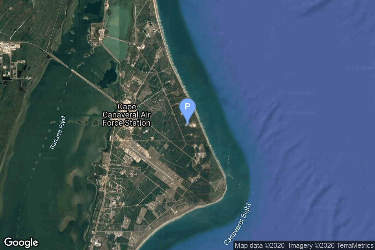
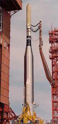
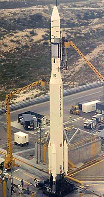
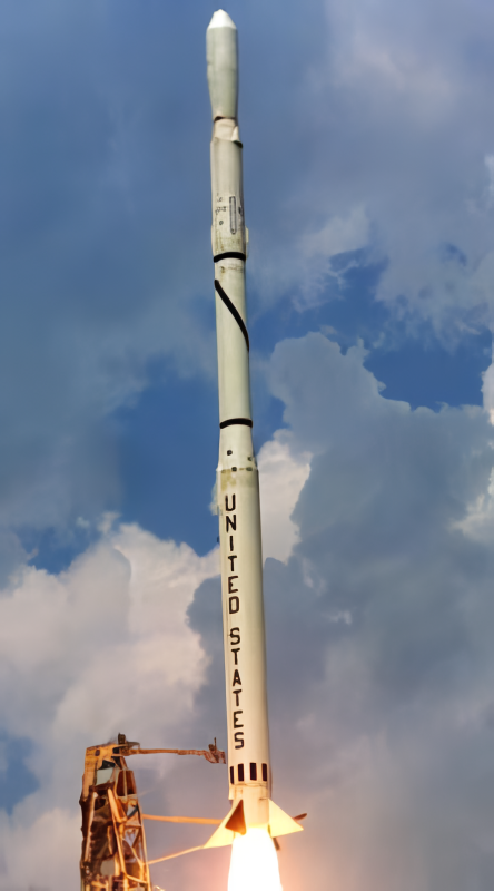
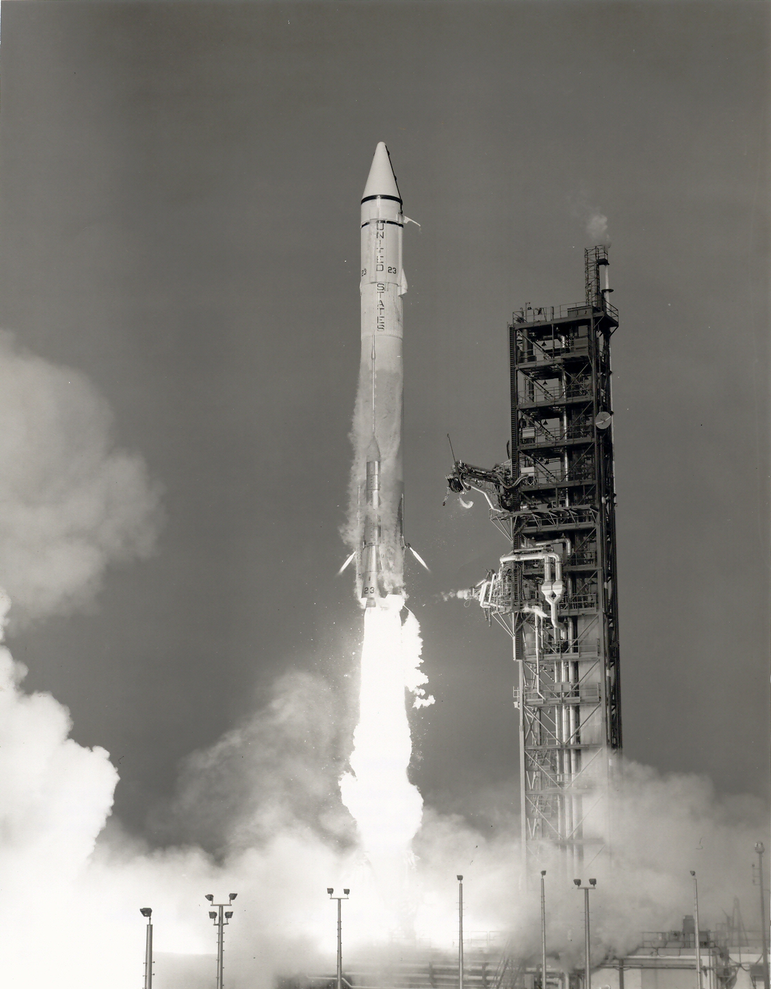
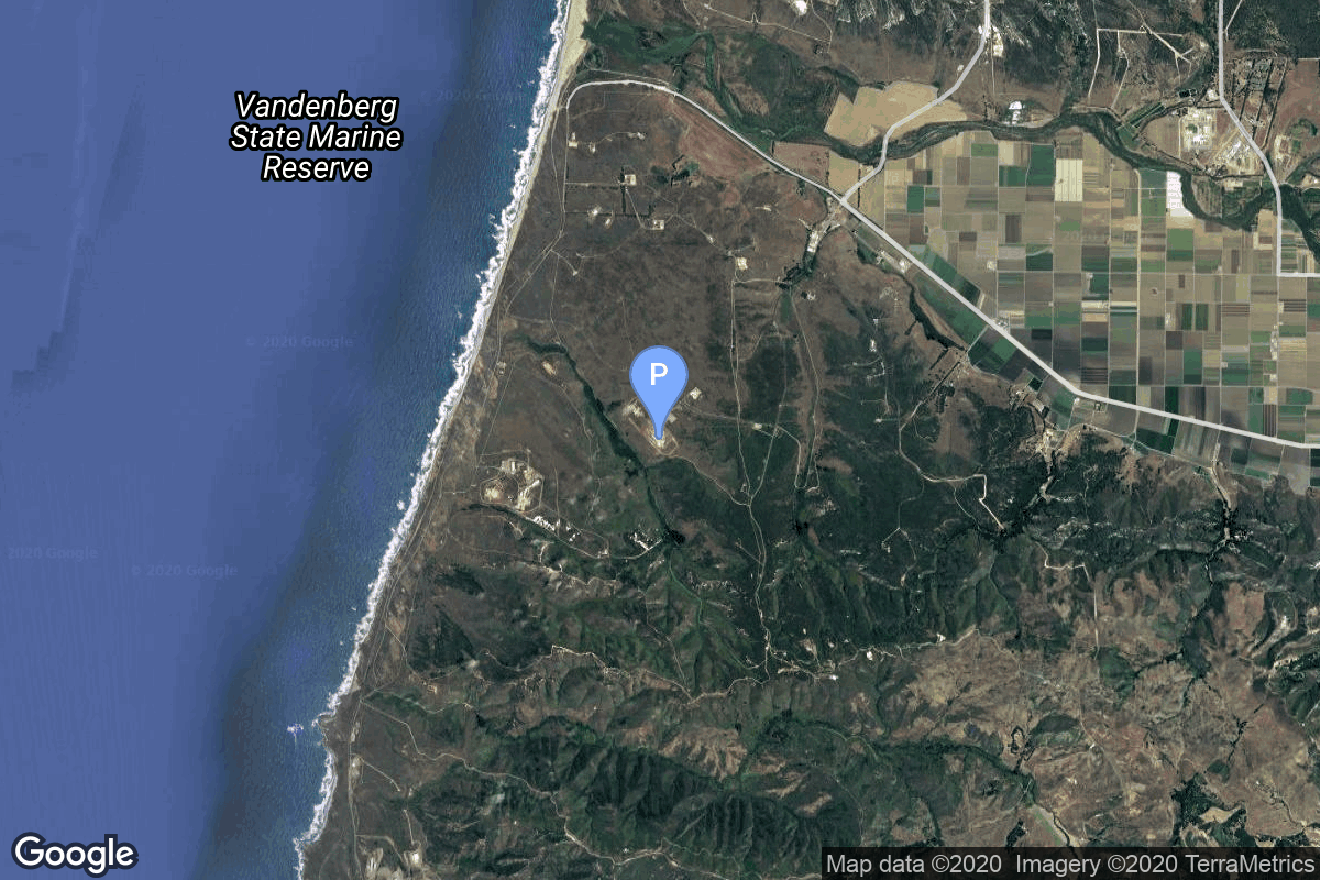
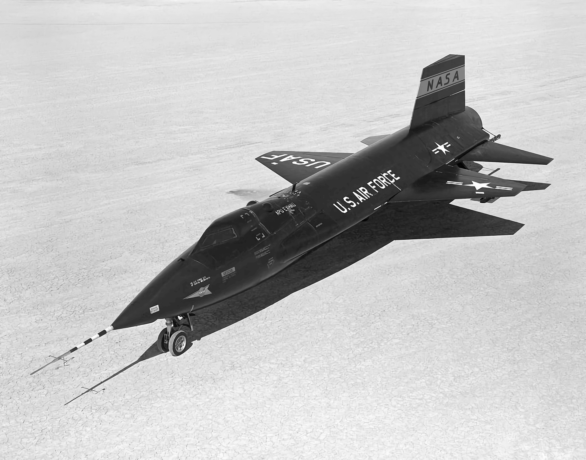
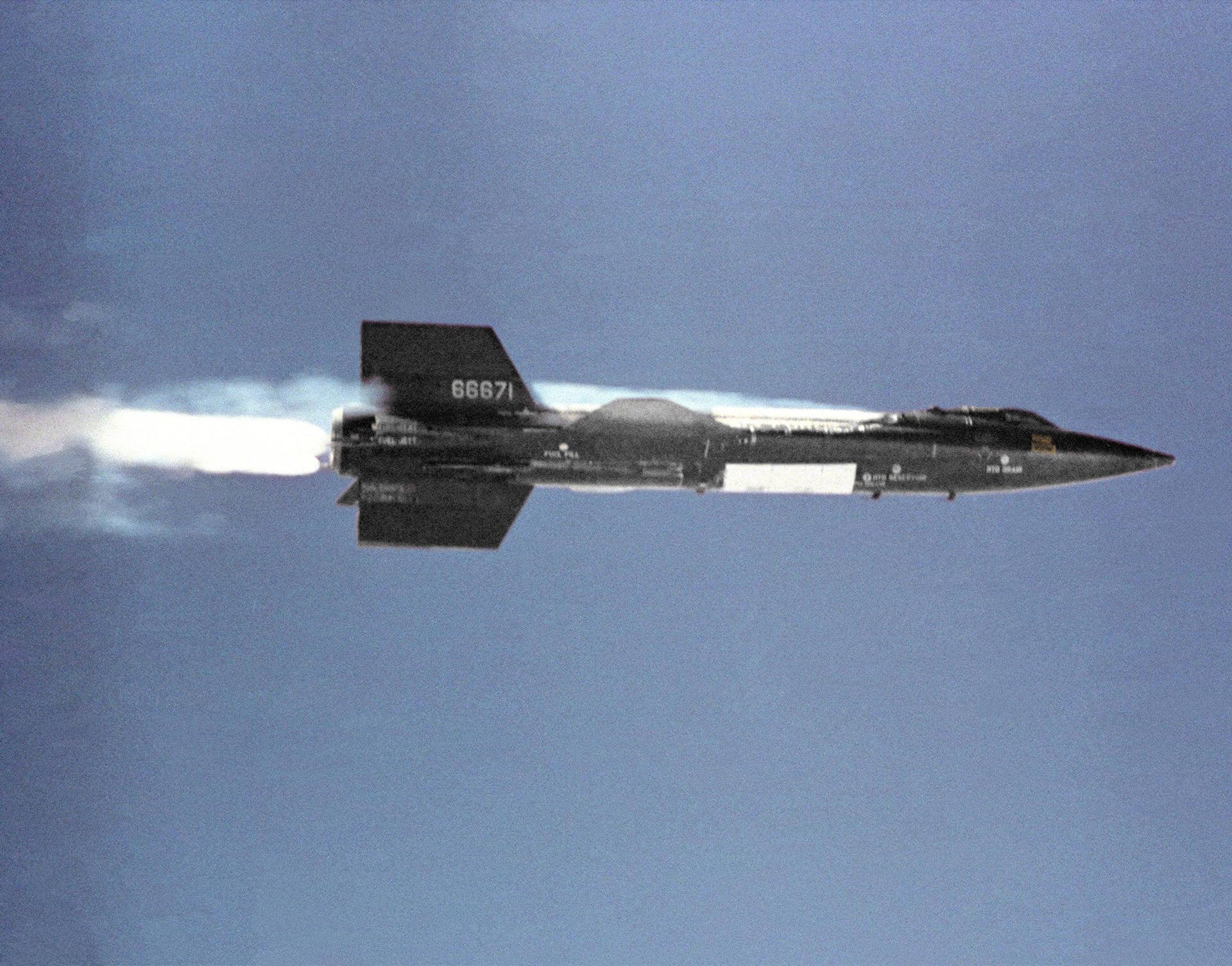
{ "count": 7916, "next": "https://ll.thespacedevs.com/2.0.0/launch/?format=api&limit=10&offset=940&ordering=net", "previous": "https://ll.thespacedevs.com/2.0.0/launch/?format=api&limit=10&offset=920&ordering=net", "results": [ { "id": "ededcfa7-40cb-4cd9-b3a9-c807ed186805", "url": "https://ll.thespacedevs.com/2.0.0/launch/ededcfa7-40cb-4cd9-b3a9-c807ed186805/?format=api", "launch_library_id": null, "slug": "atlas-slv-3a-agena-d-canyon-1", "name": "Atlas SLV-3A Agena D | Canyon 1", "status": { "id": 3, "name": "Success" }, "net": "1968-08-06T11:08:00Z", "window_end": "1968-08-06T11:08:00Z", "window_start": "1968-08-06T11:08:00Z", "inhold": false, "tbdtime": false, "tbddate": false, "probability": null, "holdreason": "", "failreason": null, "hashtag": null, "launch_service_provider": { "id": 161, "url": "https://ll.thespacedevs.com/2.0.0/agencies/161/?format=api", "name": "United States Air Force", "type": "Government" }, "rocket": { "id": 3807, "configuration": { "id": 259, "launch_library_id": null, "url": "https://ll.thespacedevs.com/2.0.0/config/launcher/259/?format=api", "name": "Atlas SLV-3A Agena D", "family": "Atlas", "full_name": "Atlas SLV-3A Agena D", "variant": "SLV-3A Agena D" } }, "mission": { "id": 2225, "launch_library_id": null, "name": "Canyon 1", "description": "Canyon was the first series of NRO's near geostationary ELINT/SIGINT satellites launched under the designation AFP-827 or Program 7500 for NRO's Program A. They were focussed on communications intelligence (COMINT).", "launch_designator": null, "type": "Government/Top Secret", "orbit": { "id": 1, "name": "Geostationary Orbit", "abbrev": "Direct-GEO" } }, "pad": { "id": 117, "url": "https://ll.thespacedevs.com/2.0.0/pad/117/?format=api", "agency_id": 161, "name": "Space Launch Complex 13", "info_url": null, "wiki_url": "https://en.wikipedia.org/wiki/Cape_Canaveral_Launch_Complex_13", "map_url": "https://www.google.com/maps?q=28.4859,-80.546594", "latitude": "28.4859", "longitude": "-80.546594", "location": { "id": 12, "url": "https://ll.thespacedevs.com/2.0.0/location/12/?format=api", "name": "Cape Canaveral SFS, FL, USA", "country_code": "USA", "map_image": "https://thespacedevs-prod.nyc3.digitaloceanspaces.com/media/map_images/location_12_20200803142519.jpg", "total_launch_count": 1116, "total_landing_count": 75 }, "map_image": "https://thespacedevs-prod.nyc3.digitaloceanspaces.com/media/map_images/pad_117_20200803143223.jpg", "total_launch_count": 21 }, "webcast_live": false, "image": "https://thespacedevs-prod.nyc3.digitaloceanspaces.com/media/images/atlas-slv3a_age_image_20251204210844.jpg", "infographic": null, "program": [] }, { "id": "24b7e803-bf4e-4e8a-978d-5c6e800024bc", "url": "https://ll.thespacedevs.com/2.0.0/launch/24b7e803-bf4e-4e8a-978d-5c6e800024bc/?format=api", "launch_library_id": null, "slug": "titan-iiib-kh-8-15", "name": "Titan IIIB | KH-8 15", "status": { "id": 3, "name": "Success" }, "net": "1968-08-06T16:30:00Z", "window_end": "1968-08-06T16:30:00Z", "window_start": "1968-08-06T16:30:00Z", "inhold": false, "tbdtime": false, "tbddate": false, "probability": null, "holdreason": "", "failreason": null, "hashtag": null, "launch_service_provider": { "id": 161, "url": "https://ll.thespacedevs.com/2.0.0/agencies/161/?format=api", "name": "United States Air Force", "type": "Government" }, "rocket": { "id": 3808, "configuration": { "id": 438, "launch_library_id": null, "url": "https://ll.thespacedevs.com/2.0.0/config/launcher/438/?format=api", "name": "Titan IIIB", "family": "Titan", "full_name": "Titan IIIB", "variant": "IIIB" } }, "mission": { "id": 2226, "launch_library_id": null, "name": "KH-8 15", "description": "KH-8 or Gambit-3 was the second generation of Gambit high resolution reconnaissance satellites.", "launch_designator": null, "type": "Government/Top Secret", "orbit": { "id": 8, "name": "Low Earth Orbit", "abbrev": "LEO" } }, "pad": { "id": 156, "url": "https://ll.thespacedevs.com/2.0.0/pad/156/?format=api", "agency_id": null, "name": "Space Launch Complex 4W", "info_url": "https://www.astronautix.com/v/vandenbergslc4w.html", "wiki_url": "https://en.wikipedia.org/wiki/Vandenberg_Air_Force_Base_Space_Launch_Complex_4#SLC-4W", "map_url": "https://www.google.com/maps?q=34.63312,-120.61584", "latitude": "34.63312", "longitude": "-120.61584", "location": { "id": 11, "url": "https://ll.thespacedevs.com/2.0.0/location/11/?format=api", "name": "Vandenberg SFB, CA, USA", "country_code": "USA", "map_image": "https://thespacedevs-prod.nyc3.digitaloceanspaces.com/media/map_images/location_11_20200803142416.jpg", "total_launch_count": 893, "total_landing_count": 35 }, "map_image": "https://thespacedevs-prod.nyc3.digitaloceanspaces.com/media/map_images/pad_156_20200803143351.jpg", "total_launch_count": 93 }, "webcast_live": false, "image": "https://thespacedevs-prod.nyc3.digitaloceanspaces.com/media/images/titan_iiib_image_20251204210122.jpg", "infographic": null, "program": [] }, { "id": "5772195d-5a0f-4409-9db5-b813583fde9d", "url": "https://ll.thespacedevs.com/2.0.0/launch/5772195d-5a0f-4409-9db5-b813583fde9d/?format=api", "launch_library_id": null, "slug": "thorad-slv-2g-agena-d-kh-4b-4", "name": "Thorad SLV-2G Agena D | KH-4B 4", "status": { "id": 3, "name": "Success" }, "net": "1968-08-07T21:36:55Z", "window_end": "1968-08-07T21:36:55Z", "window_start": "1968-08-07T21:36:55Z", "inhold": false, "tbdtime": false, "tbddate": false, "probability": null, "holdreason": "", "failreason": null, "hashtag": null, "launch_service_provider": { "id": 161, "url": "https://ll.thespacedevs.com/2.0.0/agencies/161/?format=api", "name": "United States Air Force", "type": "Government" }, "rocket": { "id": 3809, "configuration": { "id": 418, "launch_library_id": null, "url": "https://ll.thespacedevs.com/2.0.0/config/launcher/418/?format=api", "name": "Thorad SLV-2G Agena D", "family": "Thor", "full_name": "Thorad SLV-2G Agena D", "variant": "SLV-2G Agena D" } }, "mission": { "id": 2227, "launch_library_id": null, "name": "KH-4B 4", "description": "The KH-4B (Keyhole-4B) was sixth optical reconnaissance satellite version in the Corona-program.", "launch_designator": null, "type": "Government/Top Secret", "orbit": { "id": 8, "name": "Low Earth Orbit", "abbrev": "LEO" } }, "pad": { "id": 93, "url": "https://ll.thespacedevs.com/2.0.0/pad/93/?format=api", "agency_id": 161, "name": "Space Launch Complex 3W", "info_url": null, "wiki_url": "https://en.wikipedia.org/wiki/Vandenberg_Space_Launch_Complex_3#SLC-3W", "map_url": "https://www.google.com/maps?q=34.644,-120.593", "latitude": "34.644", "longitude": "-120.593", "location": { "id": 11, "url": "https://ll.thespacedevs.com/2.0.0/location/11/?format=api", "name": "Vandenberg SFB, CA, USA", "country_code": "USA", "map_image": "https://thespacedevs-prod.nyc3.digitaloceanspaces.com/media/map_images/location_11_20200803142416.jpg", "total_launch_count": 893, "total_landing_count": 35 }, "map_image": "https://thespacedevs-prod.nyc3.digitaloceanspaces.com/media/map_images/pad_93_20200803143225.jpg", "total_launch_count": 81 }, "webcast_live": false, "image": "https://thespacedevs-prod.nyc3.digitaloceanspaces.com/media/images/thorad-slv2g_ag_image_20251102061406.jpg", "infographic": null, "program": [] }, { "id": "cf451187-e695-4f41-af77-359fbae444ec", "url": "https://ll.thespacedevs.com/2.0.0/launch/cf451187-e695-4f41-af77-359fbae444ec/?format=api", "launch_library_id": null, "slug": "scout-b-explorer-39", "name": "Scout B | Explorer 39", "status": { "id": 3, "name": "Success" }, "net": "1968-08-08T20:12:00Z", "window_end": "1968-08-08T20:12:00Z", "window_start": "1968-08-08T20:12:00Z", "inhold": false, "tbdtime": false, "tbddate": false, "probability": null, "holdreason": "", "failreason": null, "hashtag": null, "launch_service_provider": { "id": 44, "url": "https://ll.thespacedevs.com/2.0.0/agencies/44/?format=api", "name": "National Aeronautics and Space Administration", "type": "Government" }, "rocket": { "id": 3810, "configuration": { "id": 358, "launch_library_id": null, "url": "https://ll.thespacedevs.com/2.0.0/config/launcher/358/?format=api", "name": "Scout B", "family": "Scout", "full_name": "Scout B", "variant": "B" } }, "mission": { "id": 2228, "launch_library_id": null, "name": "Explorer 39", "description": "Explorer 39 was an inflatable sphere, 3.6 m in diameter. It was orbited to make atmospheric density determinations.", "launch_designator": null, "type": "Earth Science", "orbit": { "id": 0, "name": "Elliptical Orbit", "abbrev": "Elliptical" } }, "pad": { "id": 154, "url": "https://ll.thespacedevs.com/2.0.0/pad/154/?format=api", "agency_id": null, "name": "Space Launch Complex 5", "info_url": "https://www.astronautix.com/v/vandenbergslc5.html", "wiki_url": "https://en.wikipedia.org/wiki/Vandenberg_Air_Force_Base_Space_Launch_Complex_5", "map_url": "https://www.google.com/maps?q=34.6080,-120.6247", "latitude": "34.608", "longitude": "-120.6247", "location": { "id": 11, "url": "https://ll.thespacedevs.com/2.0.0/location/11/?format=api", "name": "Vandenberg SFB, CA, USA", "country_code": "USA", "map_image": "https://thespacedevs-prod.nyc3.digitaloceanspaces.com/media/map_images/location_11_20200803142416.jpg", "total_launch_count": 893, "total_landing_count": 35 }, "map_image": "https://thespacedevs-prod.nyc3.digitaloceanspaces.com/media/map_images/pad_154_20200803143408.jpg", "total_launch_count": 69 }, "webcast_live": false, "image": "https://thespacedevs-prod.nyc3.digitaloceanspaces.com/media/images/scout-b_2528se_image_20251109064911.png", "infographic": null, "program": [] }, { "id": "e20d1ba5-0ba7-48d0-8948-36e28fa4fbda", "url": "https://ll.thespacedevs.com/2.0.0/launch/e20d1ba5-0ba7-48d0-8948-36e28fa4fbda/?format=api", "launch_library_id": null, "slug": "voskhod-zenit-2-64", "name": "Voskhod | Zenit-2 64", "status": { "id": 3, "name": "Success" }, "net": "1968-08-09T07:00:00Z", "window_end": "1968-08-09T07:00:00Z", "window_start": "1968-08-09T07:00:00Z", "inhold": false, "tbdtime": false, "tbddate": false, "probability": null, "holdreason": "", "failreason": null, "hashtag": null, "launch_service_provider": { "id": 66, "url": "https://ll.thespacedevs.com/2.0.0/agencies/66/?format=api", "name": "Soviet Space Program", "type": "Government" }, "rocket": { "id": 3811, "configuration": { "id": 104, "launch_library_id": 138, "url": "https://ll.thespacedevs.com/2.0.0/config/launcher/104/?format=api", "name": "Voskhod", "family": "R-7", "full_name": "Voskhod", "variant": "Voskhod" } }, "mission": { "id": 2229, "launch_library_id": null, "name": "Zenit-2 64", "description": "Zenit-2 film-return and ELINT reconnaissance satellite.", "launch_designator": null, "type": "Government/Top Secret", "orbit": { "id": 8, "name": "Low Earth Orbit", "abbrev": "LEO" } }, "pad": { "id": 20, "url": "https://ll.thespacedevs.com/2.0.0/pad/20/?format=api", "agency_id": null, "name": "31/6", "info_url": null, "wiki_url": "https://en.wikipedia.org/wiki/Baikonur_Cosmodrome_Site_31", "map_url": "https://www.google.com/maps?q=45.996034,63.564003", "latitude": "45.996034", "longitude": "63.564003", "location": { "id": 15, "url": "https://ll.thespacedevs.com/2.0.0/location/15/?format=api", "name": "Baikonur Cosmodrome, Republic of Kazakhstan", "country_code": "KAZ", "map_image": "https://thespacedevs-prod.nyc3.digitaloceanspaces.com/media/map_images/location_15_20200803142517.jpg", "total_launch_count": 1563, "total_landing_count": 0 }, "map_image": "https://thespacedevs-prod.nyc3.digitaloceanspaces.com/media/map_images/pad_20_20200803143516.jpg", "total_launch_count": 428 }, "webcast_live": false, "image": "https://thespacedevs-prod.nyc3.digitaloceanspaces.com/media/images/voskhod_during__image_20251102062248.jpg", "infographic": null, "program": [] }, { "id": "bf167e24-0904-4c91-b959-5fd10d0db4a9", "url": "https://ll.thespacedevs.com/2.0.0/launch/bf167e24-0904-4c91-b959-5fd10d0db4a9/?format=api", "launch_library_id": null, "slug": "atlas-slv-3c-centaur-ats-4", "name": "Atlas SLV-3C Centaur | ATS 4", "status": { "id": 3, "name": "Success" }, "net": "1968-08-10T22:33:02Z", "window_end": "1968-08-10T22:33:02Z", "window_start": "1968-08-10T22:33:02Z", "inhold": false, "tbdtime": false, "tbddate": false, "probability": null, "holdreason": "", "failreason": null, "hashtag": null, "launch_service_provider": { "id": 161, "url": "https://ll.thespacedevs.com/2.0.0/agencies/161/?format=api", "name": "United States Air Force", "type": "Government" }, "rocket": { "id": 3812, "configuration": { "id": 260, "launch_library_id": null, "url": "https://ll.thespacedevs.com/2.0.0/config/launcher/260/?format=api", "name": "Atlas SLV-3C Centaur", "family": "Atlas", "full_name": "Atlas SLV-3C Centaur", "variant": "SLV-3C Centaur" } }, "mission": { "id": 2230, "launch_library_id": null, "name": "ATS 4", "description": "ATS 4 was a satellite designed to test gravity gradient stabilization at synchronous altitude. It failed to reach the desired altitude, thus was not able to fulfill its mission objectives.", "launch_designator": null, "type": "Earth Science", "orbit": { "id": 3, "name": "Geosynchronous Orbit", "abbrev": "GSO" } }, "pad": { "id": 121, "url": "https://ll.thespacedevs.com/2.0.0/pad/121/?format=api", "agency_id": 161, "name": "Launch Complex 36A", "info_url": null, "wiki_url": "https://en.wikipedia.org/wiki/Cape_Canaveral_Launch_Complex_36", "map_url": "https://www.google.com/maps?q=28.4705556,-80.542194", "latitude": "28.4705556", "longitude": "-80.542194", "location": { "id": 12, "url": "https://ll.thespacedevs.com/2.0.0/location/12/?format=api", "name": "Cape Canaveral SFS, FL, USA", "country_code": "USA", "map_image": "https://thespacedevs-prod.nyc3.digitaloceanspaces.com/media/map_images/location_12_20200803142519.jpg", "total_launch_count": 1116, "total_landing_count": 75 }, "map_image": "https://thespacedevs-prod.nyc3.digitaloceanspaces.com/media/map_images/pad_121_20200803143231.jpg", "total_launch_count": 71 }, "webcast_live": false, "image": "https://thespacedevs-prod.nyc3.digitaloceanspaces.com/media/images/atlas_slv-3c_li_image_20251103141951.jpeg", "infographic": null, "program": [] }, { "id": "dd2140d8-6958-4967-8a48-60fce0fcc383", "url": "https://ll.thespacedevs.com/2.0.0/launch/dd2140d8-6958-4967-8a48-60fce0fcc383/?format=api", "launch_library_id": null, "slug": "thor-delta-n-essa-7", "name": "Thor Delta N | ESSA 7", "status": { "id": 3, "name": "Success" }, "net": "1968-08-16T11:24:33Z", "window_end": "1968-08-16T11:24:33Z", "window_start": "1968-08-16T11:24:33Z", "inhold": false, "tbdtime": false, "tbddate": false, "probability": null, "holdreason": "", "failreason": null, "hashtag": null, "launch_service_provider": { "id": 161, "url": "https://ll.thespacedevs.com/2.0.0/agencies/161/?format=api", "name": "United States Air Force", "type": "Government" }, "rocket": { "id": 3813, "configuration": { "id": 411, "launch_library_id": null, "url": "https://ll.thespacedevs.com/2.0.0/config/launcher/411/?format=api", "name": "Thor Delta N", "family": "Thor", "full_name": "Thor Delta N", "variant": "Delta N" } }, "mission": { "id": 2231, "launch_library_id": null, "name": "ESSA 7", "description": "The ESSA series was the second generation of US meterological satellites after the TIROS (Television & Infra-Red Observation Satellite) series. They were also called OT (Operational TIROS), TOS (TIROS Operational Satellite).", "launch_designator": null, "type": "Earth Science", "orbit": { "id": 17, "name": "Sun-Synchronous Orbit", "abbrev": "SSO" } }, "pad": { "id": 98, "url": "https://ll.thespacedevs.com/2.0.0/pad/98/?format=api", "agency_id": 161, "name": "Space Launch Complex 2E", "info_url": null, "wiki_url": "https://en.wikipedia.org/wiki/Vandenberg_Space_Launch_Complex_2", "map_url": "https://www.google.com/maps?q=34.7516,-120.6192", "latitude": "34.7516", "longitude": "-120.6192", "location": { "id": 11, "url": "https://ll.thespacedevs.com/2.0.0/location/11/?format=api", "name": "Vandenberg SFB, CA, USA", "country_code": "USA", "map_image": "https://thespacedevs-prod.nyc3.digitaloceanspaces.com/media/map_images/location_11_20200803142416.jpg", "total_launch_count": 893, "total_landing_count": 35 }, "map_image": "https://thespacedevs-prod.nyc3.digitaloceanspaces.com/media/map_images/pad_98_20200803143228.jpg", "total_launch_count": 47 }, "webcast_live": false, "image": null, "infographic": null, "program": [] }, { "id": "0dae8a60-e6af-4eb3-b5c7-ca45f6da5850", "url": "https://ll.thespacedevs.com/2.0.0/launch/0dae8a60-e6af-4eb3-b5c7-ca45f6da5850/?format=api", "launch_library_id": null, "slug": "atlas-burner-2-uvr", "name": "Atlas Burner 2 | UVR", "status": { "id": 4, "name": "Failure" }, "net": "1968-08-16T20:57:44Z", "window_end": "1968-08-16T20:57:44Z", "window_start": "1968-08-16T20:57:44Z", "inhold": false, "tbdtime": false, "tbddate": false, "probability": null, "holdreason": "", "failreason": null, "hashtag": null, "launch_service_provider": { "id": 161, "url": "https://ll.thespacedevs.com/2.0.0/agencies/161/?format=api", "name": "United States Air Force", "type": "Government" }, "rocket": { "id": 3814, "configuration": { "id": 234, "launch_library_id": null, "url": "https://ll.thespacedevs.com/2.0.0/config/launcher/234/?format=api", "name": "Atlas Burner 2", "family": "Atlas", "full_name": "Atlas SLV-3 Burner-2", "variant": "Burner-2" } }, "mission": { "id": 2232, "launch_library_id": null, "name": "UVR", "description": "Rideshare mission with thirteen payloads .", "launch_designator": null, "type": "Dedicated Rideshare", "orbit": { "id": 8, "name": "Low Earth Orbit", "abbrev": "LEO" } }, "pad": { "id": 24, "url": "https://ll.thespacedevs.com/2.0.0/pad/24/?format=api", "agency_id": 161, "name": "Space Launch Complex 3E", "info_url": null, "wiki_url": "https://en.wikipedia.org/wiki/Vandenberg_Space_Launch_Complex_3#SLC-3E", "map_url": "https://www.google.com/maps?q=34.64,-120.5895", "latitude": "34.64", "longitude": "-120.5895", "location": { "id": 11, "url": "https://ll.thespacedevs.com/2.0.0/location/11/?format=api", "name": "Vandenberg SFB, CA, USA", "country_code": "USA", "map_image": "https://thespacedevs-prod.nyc3.digitaloceanspaces.com/media/map_images/location_11_20200803142416.jpg", "total_launch_count": 893, "total_landing_count": 35 }, "map_image": "https://thespacedevs-prod.nyc3.digitaloceanspaces.com/media/map_images/pad_24_20200803143552.jpg", "total_launch_count": 48 }, "webcast_live": false, "image": null, "infographic": null, "program": [] }, { "id": "78af0ba6-5f5a-4649-b494-e258ef7fbd0a", "url": "https://ll.thespacedevs.com/2.0.0/launch/78af0ba6-5f5a-4649-b494-e258ef7fbd0a/?format=api", "launch_library_id": null, "slug": "x-15-flight-197", "name": "X-15 | Flight 197", "status": { "id": 3, "name": "Success" }, "net": "1968-08-21T17:05:00Z", "window_end": "1968-08-21T17:14:00Z", "window_start": "1968-08-21T17:05:00Z", "inhold": false, "tbdtime": false, "tbddate": false, "probability": null, "holdreason": "", "failreason": "", "hashtag": null, "launch_service_provider": { "id": 161, "url": "https://ll.thespacedevs.com/2.0.0/agencies/161/?format=api", "name": "United States Air Force", "type": "Government" }, "rocket": { "id": 2992, "configuration": { "id": 209, "launch_library_id": null, "url": "https://ll.thespacedevs.com/2.0.0/config/launcher/209/?format=api", "name": "North American X-15", "family": "", "full_name": "North American X-15", "variant": "" } }, "mission": { "id": 1417, "launch_library_id": null, "name": "Flight 197", "description": "Flight 197 of the North American X-15 was a test flight conducted by NASA and the US Air Force in 1968. Piloted by William H. Dana it reached an altitude of 81.4 km.", "launch_designator": null, "type": "Test Flight", "orbit": { "id": 15, "name": "Suborbital", "abbrev": "Sub" } }, "pad": { "id": 112, "url": "https://ll.thespacedevs.com/2.0.0/pad/112/?format=api", "agency_id": null, "name": "Edwards Air Force Base", "info_url": null, "wiki_url": "https://en.wikipedia.org/wiki/Edwards_Air_Force_Base", "map_url": "https://www.google.com/maps?q=34.905556,-117.883611", "latitude": "34.905556", "longitude": "-117.883611", "location": { "id": 144, "url": "https://ll.thespacedevs.com/2.0.0/location/144/?format=api", "name": "Air launch to Suborbital flight", "country_code": "???", "map_image": "https://thespacedevs-prod.nyc3.digitaloceanspaces.com/media/map_images/location_144_20200803142439.jpg", "total_launch_count": 86, "total_landing_count": 0 }, "map_image": "https://thespacedevs-prod.nyc3.digitaloceanspaces.com/media/map_images/pad_112_20200803143214.jpg", "total_launch_count": 13 }, "webcast_live": false, "image": "https://thespacedevs-prod.nyc3.digitaloceanspaces.com/media/images/north_american__image_20210813101104.png", "infographic": null, "program": [ { "id": 20, "url": "https://ll.thespacedevs.com/2.0.0/program/20/?format=api", "name": "X-15", "description": "Experimental hypersonic rocket-powered aircraft.", "agencies": [ { "id": 44, "url": "https://ll.thespacedevs.com/2.0.0/agencies/44/?format=api", "name": "National Aeronautics and Space Administration", "type": "Government" }, { "id": 161, "url": "https://ll.thespacedevs.com/2.0.0/agencies/161/?format=api", "name": "United States Air Force", "type": "Government" } ], "image_url": "https://thespacedevs-prod.nyc3.digitaloceanspaces.com/media/images/x-15_program_20210809102752.jpeg", "start_date": "1959-03-10T00:00:00Z", "end_date": "1968-12-12T00:00:00Z", "info_url": null, "wiki_url": "https://en.wikipedia.org/wiki/North_American_X-15" } ] }, { "id": "60676488-f725-461a-84fb-0a9c65fa9953", "url": "https://ll.thespacedevs.com/2.0.0/launch/60676488-f725-461a-84fb-0a9c65fa9953/?format=api", "launch_library_id": null, "slug": "scout-b-ram-c-2", "name": "Scout B | RAM C-2", "status": { "id": 3, "name": "Success" }, "net": "1968-08-22T15:16:00Z", "window_end": "1968-08-22T15:16:00Z", "window_start": "1968-08-22T15:16:00Z", "inhold": false, "tbdtime": false, "tbddate": false, "probability": null, "holdreason": "", "failreason": null, "hashtag": null, "launch_service_provider": { "id": 44, "url": "https://ll.thespacedevs.com/2.0.0/agencies/44/?format=api", "name": "National Aeronautics and Space Administration", "type": "Government" }, "rocket": { "id": 3815, "configuration": { "id": 358, "launch_library_id": null, "url": "https://ll.thespacedevs.com/2.0.0/config/launcher/358/?format=api", "name": "Scout B", "family": "Scout", "full_name": "Scout B", "variant": "B" } }, "mission": { "id": 2233, "launch_library_id": null, "name": "RAM C-2", "description": "Suborbital launch to test re-entry systems. Reached an apogee of 227 km.", "launch_designator": null, "type": "Materials Science", "orbit": { "id": 15, "name": "Suborbital", "abbrev": "Sub" } }, "pad": { "id": 178, "url": "https://ll.thespacedevs.com/2.0.0/pad/178/?format=api", "agency_id": null, "name": "Launch Area 3A", "info_url": null, "wiki_url": null, "map_url": "https://www.google.com/maps?q=37.8495,-75.4725", "latitude": "37.8495", "longitude": "-75.4725", "location": { "id": 21, "url": "https://ll.thespacedevs.com/2.0.0/location/21/?format=api", "name": "Wallops Flight Facility, Virginia, USA", "country_code": "USA", "map_image": "https://thespacedevs-prod.nyc3.digitaloceanspaces.com/media/map_images/location_21_20200803142423.jpg", "total_launch_count": 87, "total_landing_count": 0 }, "map_image": "https://thespacedevs-prod.nyc3.digitaloceanspaces.com/media/map_images/pad_178_20200803143407.jpg", "total_launch_count": 18 }, "webcast_live": false, "image": "https://thespacedevs-prod.nyc3.digitaloceanspaces.com/media/images/scout-b_2528se_image_20251109064911.png", "infographic": null, "program": [] } ] }