Launch List
API endpoint that returns all Launch objects or a single launch.
EXAMPLE - /launch/
GET: Return a list of all Launch objects.
FILTERS: Fields - 'name', 'id(s)', 'lsp_id', 'lsp_name', 'serial_number', 'launcher_config__id', 'rocket__spacecraftflight__spacecraft__name'
MODE: 'normal', 'list', 'detailed' EXAMPLE: ?mode=list
SEARCH: Searches through the launch name, rocket name, launch agency, mission name & spacecraft name. EXAMPLE - ?search=SpaceX
GET /2.0.0/launch/?format=api&offset=930&ordering=name
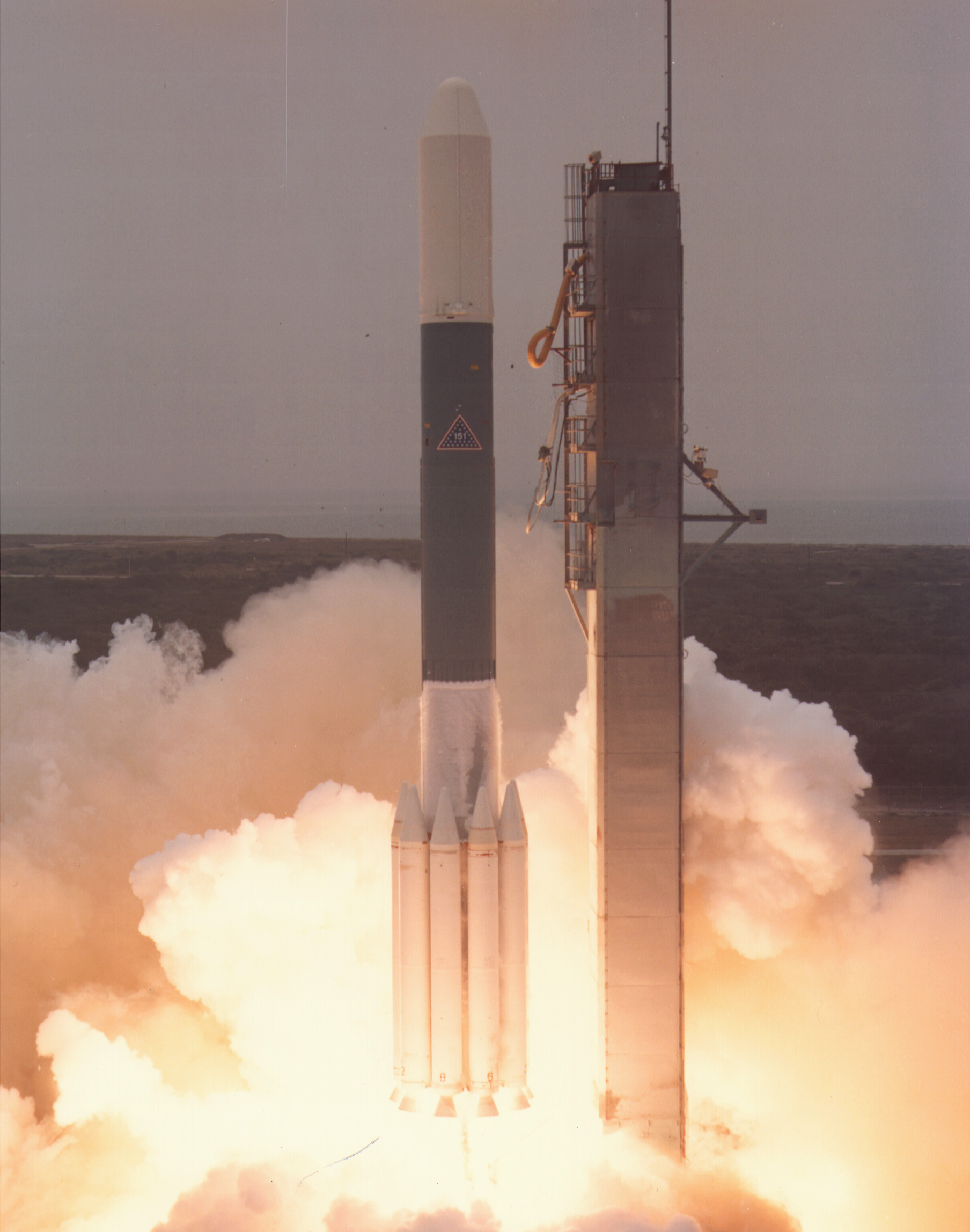
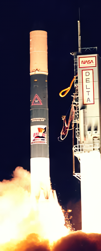
{ "count": 7737, "next": "https://ll.thespacedevs.com/2.0.0/launch/?format=api&limit=10&offset=940&ordering=name", "previous": "https://ll.thespacedevs.com/2.0.0/launch/?format=api&limit=10&offset=920&ordering=name", "results": [ { "id": "d7098c41-3853-496c-aaeb-3a3afcfa55b5", "url": "https://ll.thespacedevs.com/2.0.0/launch/d7098c41-3853-496c-aaeb-3a3afcfa55b5/?format=api", "launch_library_id": null, "slug": "delta-3920-vse-vse-target", "name": "Delta 3920 | VSE & VSE Target", "status": { "id": 3, "name": "Success" }, "net": "1986-09-05T15:08:01Z", "window_end": "1986-09-05T15:08:01Z", "window_start": "1986-09-05T15:08:01Z", "inhold": false, "tbdtime": false, "tbddate": false, "probability": null, "holdreason": "", "failreason": null, "hashtag": null, "launch_service_provider": { "id": 161, "url": "https://ll.thespacedevs.com/2.0.0/agencies/161/?format=api", "name": "United States Air Force", "type": "Government" }, "rocket": { "id": 5889, "configuration": { "id": 292, "launch_library_id": null, "url": "https://ll.thespacedevs.com/2.0.0/config/launcher/292/?format=api", "name": "Delta 3920", "family": "Delta", "full_name": "Delta 3920", "variant": "3920" } }, "mission": { "id": 4285, "launch_library_id": null, "name": "VSE & VSE Target", "description": "SDI test mission", "launch_designator": null, "type": "Government/Top Secret", "orbit": { "id": 8, "name": "Low Earth Orbit", "abbrev": "LEO" } }, "pad": { "id": 1, "url": "https://ll.thespacedevs.com/2.0.0/pad/1/?format=api", "agency_id": null, "name": "Space Launch Complex 17B", "info_url": null, "wiki_url": "https://en.wikipedia.org/wiki/Cape_Canaveral_Space_Launch_Complex_17", "map_url": "https://www.google.com/maps?q=28.4458,-80.5657", "latitude": "28.4458", "longitude": "-80.5657", "location": { "id": 12, "url": "https://ll.thespacedevs.com/2.0.0/location/12/?format=api", "name": "Cape Canaveral SFS, FL, USA", "country_code": "USA", "map_image": "https://thespacedevs-prod.nyc3.digitaloceanspaces.com/media/map_images/location_12_20200803142519.jpg", "total_launch_count": 1076, "total_landing_count": 70 }, "map_image": "https://thespacedevs-prod.nyc3.digitaloceanspaces.com/media/map_images/pad_1_20200803143208.jpg", "total_launch_count": 132 }, "webcast_live": false, "image": "https://thespacedevs-prod.nyc3.digitaloceanspaces.com/media/images/delta_3910_image_20231231105538.jpeg", "infographic": null, "program": [] }, { "id": "af9c9f95-7df5-4e55-9e96-bcd55f5d5b5a", "url": "https://ll.thespacedevs.com/2.0.0/launch/af9c9f95-7df5-4e55-9e96-bcd55f5d5b5a/?format=api", "launch_library_id": null, "slug": "delta-3924-charge-composition-explorer", "name": "Delta 3924 | Charge Composition Explorer", "status": { "id": 3, "name": "Success" }, "net": "1984-08-16T14:48:00Z", "window_end": "1984-08-16T14:48:00Z", "window_start": "1984-08-16T14:48:00Z", "inhold": false, "tbdtime": false, "tbddate": false, "probability": null, "holdreason": "", "failreason": null, "hashtag": null, "launch_service_provider": { "id": 161, "url": "https://ll.thespacedevs.com/2.0.0/agencies/161/?format=api", "name": "United States Air Force", "type": "Government" }, "rocket": { "id": 5671, "configuration": { "id": 295, "launch_library_id": null, "url": "https://ll.thespacedevs.com/2.0.0/config/launcher/295/?format=api", "name": "Delta 3924", "family": "Delta", "full_name": "Delta 3924", "variant": "3924" } }, "mission": { "id": 4073, "launch_library_id": null, "name": "Charge Composition Explorer", "description": "Joint US-German-UK astrophysics research satellite", "launch_designator": null, "type": "Astrophysics", "orbit": { "id": 0, "name": "Elliptical Orbit", "abbrev": "Elliptical" } }, "pad": { "id": 14, "url": "https://ll.thespacedevs.com/2.0.0/pad/14/?format=api", "agency_id": null, "name": "Space Launch Complex 17A", "info_url": null, "wiki_url": "https://en.wikipedia.org/wiki/Cape_Canaveral_Space_Launch_Complex_17", "map_url": "https://www.google.com/maps?q=28.4472,-80.565", "latitude": "28.4472", "longitude": "-80.565", "location": { "id": 12, "url": "https://ll.thespacedevs.com/2.0.0/location/12/?format=api", "name": "Cape Canaveral SFS, FL, USA", "country_code": "USA", "map_image": "https://thespacedevs-prod.nyc3.digitaloceanspaces.com/media/map_images/location_12_20200803142519.jpg", "total_launch_count": 1076, "total_landing_count": 70 }, "map_image": "https://thespacedevs-prod.nyc3.digitaloceanspaces.com/media/map_images/pad_14_20200803143451.jpg", "total_launch_count": 145 }, "webcast_live": false, "image": "https://thespacedevs-prod.nyc3.digitaloceanspaces.com/media/images/delta_3910_image_20231231105538.jpeg", "infographic": null, "program": [] }, { "id": "a1db5f11-4d9f-4977-9784-fbd39366747d", "url": "https://ll.thespacedevs.com/2.0.0/launch/a1db5f11-4d9f-4977-9784-fbd39366747d/?format=api", "launch_library_id": null, "slug": "delta-3924-goes-7", "name": "Delta 3924 | GOES 7", "status": { "id": 3, "name": "Success" }, "net": "1987-02-26T23:05:00Z", "window_end": "1987-02-26T23:05:00Z", "window_start": "1987-02-26T23:05:00Z", "inhold": false, "tbdtime": false, "tbddate": false, "probability": null, "holdreason": "", "failreason": null, "hashtag": null, "launch_service_provider": { "id": 161, "url": "https://ll.thespacedevs.com/2.0.0/agencies/161/?format=api", "name": "United States Air Force", "type": "Government" }, "rocket": { "id": 5945, "configuration": { "id": 295, "launch_library_id": null, "url": "https://ll.thespacedevs.com/2.0.0/config/launcher/295/?format=api", "name": "Delta 3924", "family": "Delta", "full_name": "Delta 3924", "variant": "3924" } }, "mission": { "id": 4340, "launch_library_id": null, "name": "GOES 7", "description": "Geostationary meteorological satellite", "launch_designator": null, "type": "Earth Science", "orbit": { "id": 1, "name": "Geostationary Orbit", "abbrev": "Direct-GEO" } }, "pad": { "id": 14, "url": "https://ll.thespacedevs.com/2.0.0/pad/14/?format=api", "agency_id": null, "name": "Space Launch Complex 17A", "info_url": null, "wiki_url": "https://en.wikipedia.org/wiki/Cape_Canaveral_Space_Launch_Complex_17", "map_url": "https://www.google.com/maps?q=28.4472,-80.565", "latitude": "28.4472", "longitude": "-80.565", "location": { "id": 12, "url": "https://ll.thespacedevs.com/2.0.0/location/12/?format=api", "name": "Cape Canaveral SFS, FL, USA", "country_code": "USA", "map_image": "https://thespacedevs-prod.nyc3.digitaloceanspaces.com/media/map_images/location_12_20200803142519.jpg", "total_launch_count": 1076, "total_landing_count": 70 }, "map_image": "https://thespacedevs-prod.nyc3.digitaloceanspaces.com/media/map_images/pad_14_20200803143451.jpg", "total_launch_count": 145 }, "webcast_live": false, "image": "https://thespacedevs-prod.nyc3.digitaloceanspaces.com/media/images/delta_3910_image_20231231105538.jpeg", "infographic": null, "program": [ { "id": 37, "url": "https://ll.thespacedevs.com/2.0.0/program/37/?format=api", "name": "Geostationary Operational Environmental Satellite", "description": "The Geostationary Operational Environmental Satellite (GOES), operated by the United States' National Oceanic and Atmospheric Administration (NOAA)'s National Environmental Satellite, Data, and Information Service division, supports weather forecasting, severe storm tracking, and meteorology research", "agencies": [ { "id": 44, "url": "https://ll.thespacedevs.com/2.0.0/agencies/44/?format=api", "name": "National Aeronautics and Space Administration", "type": "Government" }, { "id": 210, "url": "https://ll.thespacedevs.com/2.0.0/agencies/210/?format=api", "name": "National Oceanic and Atmospheric Administration", "type": "Government" } ], "image_url": "https://thespacedevs-prod.nyc3.digitaloceanspaces.com/media/images/goes-u_render_image_20240623151909.jpg", "start_date": "1975-10-16T22:40:00Z", "end_date": null, "info_url": null, "wiki_url": "https://en.wikipedia.org/wiki/Geostationary_Operational_Environmental_Satellite" } ] }, { "id": "6bf64269-c72f-493d-9943-9b232aec86f2", "url": "https://ll.thespacedevs.com/2.0.0/launch/6bf64269-c72f-493d-9943-9b232aec86f2/?format=api", "launch_library_id": null, "slug": "delta-3924-satcom-1r", "name": "Delta 3924 | Satcom 1R", "status": { "id": 3, "name": "Success" }, "net": "1983-04-11T22:39:00Z", "window_end": "1983-04-11T22:39:00Z", "window_start": "1983-04-11T22:39:00Z", "inhold": false, "tbdtime": false, "tbddate": false, "probability": null, "holdreason": "", "failreason": null, "hashtag": null, "launch_service_provider": { "id": 161, "url": "https://ll.thespacedevs.com/2.0.0/agencies/161/?format=api", "name": "United States Air Force", "type": "Government" }, "rocket": { "id": 5503, "configuration": { "id": 295, "launch_library_id": null, "url": "https://ll.thespacedevs.com/2.0.0/config/launcher/295/?format=api", "name": "Delta 3924", "family": "Delta", "full_name": "Delta 3924", "variant": "3924" } }, "mission": { "id": 3907, "launch_library_id": null, "name": "Satcom 1R", "description": "Geostationary communications satellite", "launch_designator": null, "type": "Communications", "orbit": { "id": 1, "name": "Geostationary Orbit", "abbrev": "Direct-GEO" } }, "pad": { "id": 1, "url": "https://ll.thespacedevs.com/2.0.0/pad/1/?format=api", "agency_id": null, "name": "Space Launch Complex 17B", "info_url": null, "wiki_url": "https://en.wikipedia.org/wiki/Cape_Canaveral_Space_Launch_Complex_17", "map_url": "https://www.google.com/maps?q=28.4458,-80.5657", "latitude": "28.4458", "longitude": "-80.5657", "location": { "id": 12, "url": "https://ll.thespacedevs.com/2.0.0/location/12/?format=api", "name": "Cape Canaveral SFS, FL, USA", "country_code": "USA", "map_image": "https://thespacedevs-prod.nyc3.digitaloceanspaces.com/media/map_images/location_12_20200803142519.jpg", "total_launch_count": 1076, "total_landing_count": 70 }, "map_image": "https://thespacedevs-prod.nyc3.digitaloceanspaces.com/media/map_images/pad_1_20200803143208.jpg", "total_launch_count": 132 }, "webcast_live": false, "image": "https://thespacedevs-prod.nyc3.digitaloceanspaces.com/media/images/delta_3910_image_20231231105538.jpeg", "infographic": null, "program": [] }, { "id": "ae5096a4-c449-43a4-92a8-68a9d80d96ba", "url": "https://ll.thespacedevs.com/2.0.0/launch/ae5096a4-c449-43a4-92a8-68a9d80d96ba/?format=api", "launch_library_id": null, "slug": "delta-3924-satcom-2r", "name": "Delta 3924 | Satcom 2R", "status": { "id": 3, "name": "Success" }, "net": "1983-09-08T22:52:00Z", "window_end": "1983-09-08T22:52:00Z", "window_start": "1983-09-08T22:52:00Z", "inhold": false, "tbdtime": false, "tbddate": false, "probability": null, "holdreason": "", "failreason": null, "hashtag": null, "launch_service_provider": { "id": 161, "url": "https://ll.thespacedevs.com/2.0.0/agencies/161/?format=api", "name": "United States Air Force", "type": "Government" }, "rocket": { "id": 5562, "configuration": { "id": 295, "launch_library_id": null, "url": "https://ll.thespacedevs.com/2.0.0/config/launcher/295/?format=api", "name": "Delta 3924", "family": "Delta", "full_name": "Delta 3924", "variant": "3924" } }, "mission": { "id": 3966, "launch_library_id": null, "name": "Satcom 2R", "description": "Geostationary communications satellite", "launch_designator": null, "type": "Communications", "orbit": { "id": 1, "name": "Geostationary Orbit", "abbrev": "Direct-GEO" } }, "pad": { "id": 1, "url": "https://ll.thespacedevs.com/2.0.0/pad/1/?format=api", "agency_id": null, "name": "Space Launch Complex 17B", "info_url": null, "wiki_url": "https://en.wikipedia.org/wiki/Cape_Canaveral_Space_Launch_Complex_17", "map_url": "https://www.google.com/maps?q=28.4458,-80.5657", "latitude": "28.4458", "longitude": "-80.5657", "location": { "id": 12, "url": "https://ll.thespacedevs.com/2.0.0/location/12/?format=api", "name": "Cape Canaveral SFS, FL, USA", "country_code": "USA", "map_image": "https://thespacedevs-prod.nyc3.digitaloceanspaces.com/media/map_images/location_12_20200803142519.jpg", "total_launch_count": 1076, "total_landing_count": 70 }, "map_image": "https://thespacedevs-prod.nyc3.digitaloceanspaces.com/media/map_images/pad_1_20200803143208.jpg", "total_launch_count": 132 }, "webcast_live": false, "image": "https://thespacedevs-prod.nyc3.digitaloceanspaces.com/media/images/delta_3910_image_20231231105538.jpeg", "infographic": null, "program": [] }, { "id": "dca21ec8-ddd3-4d56-b384-30c253c6e026", "url": "https://ll.thespacedevs.com/2.0.0/launch/dca21ec8-ddd3-4d56-b384-30c253c6e026/?format=api", "launch_library_id": null, "slug": "delta-3924-satcom-5", "name": "Delta 3924 | Satcom 5", "status": { "id": 3, "name": "Success" }, "net": "1982-10-28T01:27:49Z", "window_end": "1982-10-28T01:27:49Z", "window_start": "1982-10-28T01:27:49Z", "inhold": false, "tbdtime": false, "tbddate": false, "probability": null, "holdreason": "", "failreason": null, "hashtag": null, "launch_service_provider": { "id": 161, "url": "https://ll.thespacedevs.com/2.0.0/agencies/161/?format=api", "name": "United States Air Force", "type": "Government" }, "rocket": { "id": 5457, "configuration": { "id": 295, "launch_library_id": null, "url": "https://ll.thespacedevs.com/2.0.0/config/launcher/295/?format=api", "name": "Delta 3924", "family": "Delta", "full_name": "Delta 3924", "variant": "3924" } }, "mission": { "id": 3862, "launch_library_id": null, "name": "Satcom 5", "description": "Geostationary communications satellite", "launch_designator": null, "type": "Communications", "orbit": { "id": 1, "name": "Geostationary Orbit", "abbrev": "Direct-GEO" } }, "pad": { "id": 1, "url": "https://ll.thespacedevs.com/2.0.0/pad/1/?format=api", "agency_id": null, "name": "Space Launch Complex 17B", "info_url": null, "wiki_url": "https://en.wikipedia.org/wiki/Cape_Canaveral_Space_Launch_Complex_17", "map_url": "https://www.google.com/maps?q=28.4458,-80.5657", "latitude": "28.4458", "longitude": "-80.5657", "location": { "id": 12, "url": "https://ll.thespacedevs.com/2.0.0/location/12/?format=api", "name": "Cape Canaveral SFS, FL, USA", "country_code": "USA", "map_image": "https://thespacedevs-prod.nyc3.digitaloceanspaces.com/media/map_images/location_12_20200803142519.jpg", "total_launch_count": 1076, "total_landing_count": 70 }, "map_image": "https://thespacedevs-prod.nyc3.digitaloceanspaces.com/media/map_images/pad_1_20200803143208.jpg", "total_launch_count": 132 }, "webcast_live": false, "image": "https://thespacedevs-prod.nyc3.digitaloceanspaces.com/media/images/delta_3910_image_20231231105538.jpeg", "infographic": null, "program": [] }, { "id": "a5a408a8-36ca-4918-a347-6a4025a4be69", "url": "https://ll.thespacedevs.com/2.0.0/launch/a5a408a8-36ca-4918-a347-6a4025a4be69/?format=api", "launch_library_id": null, "slug": "delta-4925-8-insat-1d", "name": "Delta 4925-8 | Insat 1D", "status": { "id": 3, "name": "Success" }, "net": "1990-06-12T05:52:00Z", "window_end": "1990-06-12T05:52:00Z", "window_start": "1990-06-12T05:52:00Z", "inhold": false, "tbdtime": false, "tbddate": false, "probability": null, "holdreason": "", "failreason": null, "hashtag": null, "launch_service_provider": { "id": 161, "url": "https://ll.thespacedevs.com/2.0.0/agencies/161/?format=api", "name": "United States Air Force", "type": "Government" }, "rocket": { "id": 6277, "configuration": { "id": 296, "launch_library_id": null, "url": "https://ll.thespacedevs.com/2.0.0/config/launcher/296/?format=api", "name": "Delta 4925-8", "family": "Delta", "full_name": "Delta 4925-8", "variant": "4925-8" } }, "mission": { "id": 4667, "launch_library_id": null, "name": "Insat 1D", "description": "Geostationary communications satellite", "launch_designator": null, "type": "Communications", "orbit": { "id": 1, "name": "Geostationary Orbit", "abbrev": "Direct-GEO" } }, "pad": { "id": 1, "url": "https://ll.thespacedevs.com/2.0.0/pad/1/?format=api", "agency_id": null, "name": "Space Launch Complex 17B", "info_url": null, "wiki_url": "https://en.wikipedia.org/wiki/Cape_Canaveral_Space_Launch_Complex_17", "map_url": "https://www.google.com/maps?q=28.4458,-80.5657", "latitude": "28.4458", "longitude": "-80.5657", "location": { "id": 12, "url": "https://ll.thespacedevs.com/2.0.0/location/12/?format=api", "name": "Cape Canaveral SFS, FL, USA", "country_code": "USA", "map_image": "https://thespacedevs-prod.nyc3.digitaloceanspaces.com/media/map_images/location_12_20200803142519.jpg", "total_launch_count": 1076, "total_landing_count": 70 }, "map_image": "https://thespacedevs-prod.nyc3.digitaloceanspaces.com/media/map_images/pad_1_20200803143208.jpg", "total_launch_count": 132 }, "webcast_live": false, "image": null, "infographic": null, "program": [] }, { "id": "dec4bfea-4d2a-472e-b6db-9ef204e58a84", "url": "https://ll.thespacedevs.com/2.0.0/launch/dec4bfea-4d2a-472e-b6db-9ef204e58a84/?format=api", "launch_library_id": null, "slug": "delta-4925-8-marcopolo-1", "name": "Delta 4925-8 | Marcopolo 1", "status": { "id": 3, "name": "Success" }, "net": "1989-08-27T22:59:00Z", "window_end": "1989-08-27T22:59:00Z", "window_start": "1989-08-27T22:59:00Z", "inhold": false, "tbdtime": false, "tbddate": false, "probability": null, "holdreason": "", "failreason": null, "hashtag": null, "launch_service_provider": { "id": 161, "url": "https://ll.thespacedevs.com/2.0.0/agencies/161/?format=api", "name": "United States Air Force", "type": "Government" }, "rocket": { "id": 6201, "configuration": { "id": 296, "launch_library_id": null, "url": "https://ll.thespacedevs.com/2.0.0/config/launcher/296/?format=api", "name": "Delta 4925-8", "family": "Delta", "full_name": "Delta 4925-8", "variant": "4925-8" } }, "mission": { "id": 4591, "launch_library_id": null, "name": "Marcopolo 1", "description": "British geostationary communications satellite", "launch_designator": null, "type": "Communications", "orbit": { "id": 1, "name": "Geostationary Orbit", "abbrev": "Direct-GEO" } }, "pad": { "id": 1, "url": "https://ll.thespacedevs.com/2.0.0/pad/1/?format=api", "agency_id": null, "name": "Space Launch Complex 17B", "info_url": null, "wiki_url": "https://en.wikipedia.org/wiki/Cape_Canaveral_Space_Launch_Complex_17", "map_url": "https://www.google.com/maps?q=28.4458,-80.5657", "latitude": "28.4458", "longitude": "-80.5657", "location": { "id": 12, "url": "https://ll.thespacedevs.com/2.0.0/location/12/?format=api", "name": "Cape Canaveral SFS, FL, USA", "country_code": "USA", "map_image": "https://thespacedevs-prod.nyc3.digitaloceanspaces.com/media/map_images/location_12_20200803142519.jpg", "total_launch_count": 1076, "total_landing_count": 70 }, "map_image": "https://thespacedevs-prod.nyc3.digitaloceanspaces.com/media/map_images/pad_1_20200803143208.jpg", "total_launch_count": 132 }, "webcast_live": false, "image": null, "infographic": null, "program": [] }, { "id": "f882fa67-e09c-49a9-8296-99ba83d5f561", "url": "https://ll.thespacedevs.com/2.0.0/launch/f882fa67-e09c-49a9-8296-99ba83d5f561/?format=api", "launch_library_id": null, "slug": "delta-5920-8-cobe", "name": "Delta 5920-8 | COBE", "status": { "id": 3, "name": "Success" }, "net": "1989-11-18T14:34:00Z", "window_end": "1989-11-18T14:34:00Z", "window_start": "1989-11-18T14:34:00Z", "inhold": false, "tbdtime": false, "tbddate": false, "probability": null, "holdreason": "", "failreason": null, "hashtag": null, "launch_service_provider": { "id": 161, "url": "https://ll.thespacedevs.com/2.0.0/agencies/161/?format=api", "name": "United States Air Force", "type": "Government" }, "rocket": { "id": 6221, "configuration": { "id": 297, "launch_library_id": null, "url": "https://ll.thespacedevs.com/2.0.0/config/launcher/297/?format=api", "name": "Delta 5920-8", "family": "Delta", "full_name": "Delta 5920-8", "variant": "5920-8" } }, "mission": { "id": 4611, "launch_library_id": null, "name": "COBE", "description": "Cosmology research satellite", "launch_designator": null, "type": "Astrophysics", "orbit": { "id": 8, "name": "Low Earth Orbit", "abbrev": "LEO" } }, "pad": { "id": 39, "url": "https://ll.thespacedevs.com/2.0.0/pad/39/?format=api", "agency_id": null, "name": "Space Launch Complex 2W", "info_url": null, "wiki_url": "https://en.wikipedia.org/wiki/Vandenberg_Space_Launch_Complex_2", "map_url": "https://www.google.com/maps?q=34.7556,-120.6224", "latitude": "34.7556", "longitude": "-120.6224", "location": { "id": 11, "url": "https://ll.thespacedevs.com/2.0.0/location/11/?format=api", "name": "Vandenberg SFB, CA, USA", "country_code": "USA", "map_image": "https://thespacedevs-prod.nyc3.digitaloceanspaces.com/media/map_images/location_11_20200803142416.jpg", "total_launch_count": 852, "total_landing_count": 30 }, "map_image": "https://thespacedevs-prod.nyc3.digitaloceanspaces.com/media/map_images/pad_39_20200803143542.jpg", "total_launch_count": 98 }, "webcast_live": false, "image": "https://thespacedevs-prod.nyc3.digitaloceanspaces.com/media/images/delta-5920_252_image_20251118091454.png", "infographic": null, "program": [] }, { "id": "272ac40c-73b0-4468-a439-773c3bf64a5f", "url": "https://ll.thespacedevs.com/2.0.0/launch/272ac40c-73b0-4468-a439-773c3bf64a5f/?format=api", "launch_library_id": null, "slug": "delta-6920-10-euve", "name": "Delta 6920-10 | EUVE", "status": { "id": 3, "name": "Success" }, "net": "1992-06-07T16:40:00Z", "window_end": "1992-06-07T16:40:00Z", "window_start": "1992-06-07T16:40:00Z", "inhold": false, "tbdtime": false, "tbddate": false, "probability": null, "holdreason": "", "failreason": null, "hashtag": null, "launch_service_provider": { "id": 161, "url": "https://ll.thespacedevs.com/2.0.0/agencies/161/?format=api", "name": "United States Air Force", "type": "Government" }, "rocket": { "id": 6441, "configuration": { "id": 298, "launch_library_id": null, "url": "https://ll.thespacedevs.com/2.0.0/config/launcher/298/?format=api", "name": "Delta II", "family": "Delta", "full_name": "Delta II 6920-10", "variant": "6920-10" } }, "mission": { "id": 4831, "launch_library_id": null, "name": "EUVE", "description": "The Extreme-Ultraviolet Explorer (EUVE) was a spinning spacecraft designed to rotate about the earth/sun line. EUVE was a part of NASA's Explorer spacecraft series, and designed to operate in the extreme ultraviolet (EUV) range of the spectrum, from 70 - 760 Angstroms. This spacecraft's objective was to carry out a full-sky survey, and subsequently, a deep-survey and pointed observations. Science objectives included discovering and studying UV sources radiating in this spectral region, and analyzing effects of the interstellar medium on the radiation from these sources.", "launch_designator": null, "type": "Planetary Science", "orbit": { "id": 8, "name": "Low Earth Orbit", "abbrev": "LEO" } }, "pad": { "id": 14, "url": "https://ll.thespacedevs.com/2.0.0/pad/14/?format=api", "agency_id": null, "name": "Space Launch Complex 17A", "info_url": null, "wiki_url": "https://en.wikipedia.org/wiki/Cape_Canaveral_Space_Launch_Complex_17", "map_url": "https://www.google.com/maps?q=28.4472,-80.565", "latitude": "28.4472", "longitude": "-80.565", "location": { "id": 12, "url": "https://ll.thespacedevs.com/2.0.0/location/12/?format=api", "name": "Cape Canaveral SFS, FL, USA", "country_code": "USA", "map_image": "https://thespacedevs-prod.nyc3.digitaloceanspaces.com/media/map_images/location_12_20200803142519.jpg", "total_launch_count": 1076, "total_landing_count": 70 }, "map_image": "https://thespacedevs-prod.nyc3.digitaloceanspaces.com/media/map_images/pad_14_20200803143451.jpg", "total_launch_count": 145 }, "webcast_live": false, "image": null, "infographic": null, "program": [] } ] }