Launch List
API endpoint that returns all Launch objects or a single launch.
EXAMPLE - /launch/
GET: Return a list of all Launch objects.
FILTERS: Fields - 'name', 'id(s)', 'lsp_id', 'lsp_name', 'serial_number', 'launcher_config__id', 'rocket__spacecraftflight__spacecraft__name'
MODE: 'normal', 'list', 'detailed' EXAMPLE: ?mode=list
SEARCH: Searches through the launch name, rocket name, launch agency, mission name & spacecraft name. EXAMPLE - ?search=SpaceX
GET /2.0.0/launch/?format=api&offset=920&ordering=-id
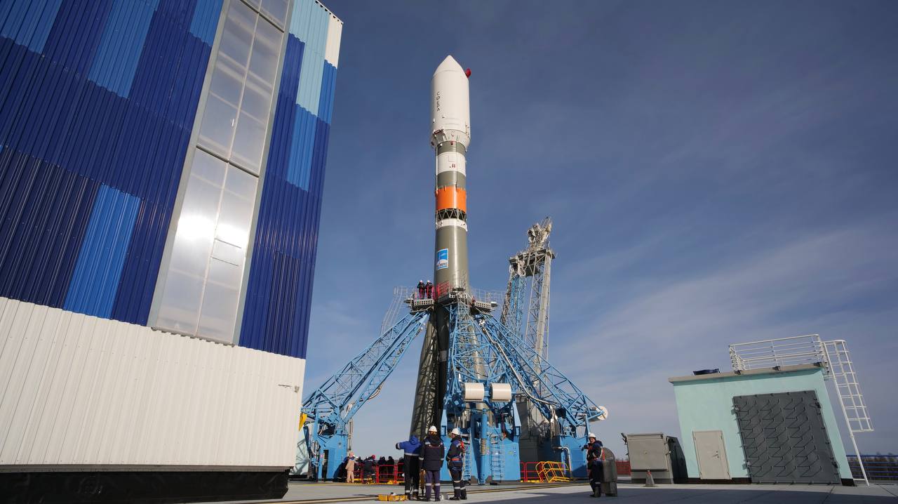
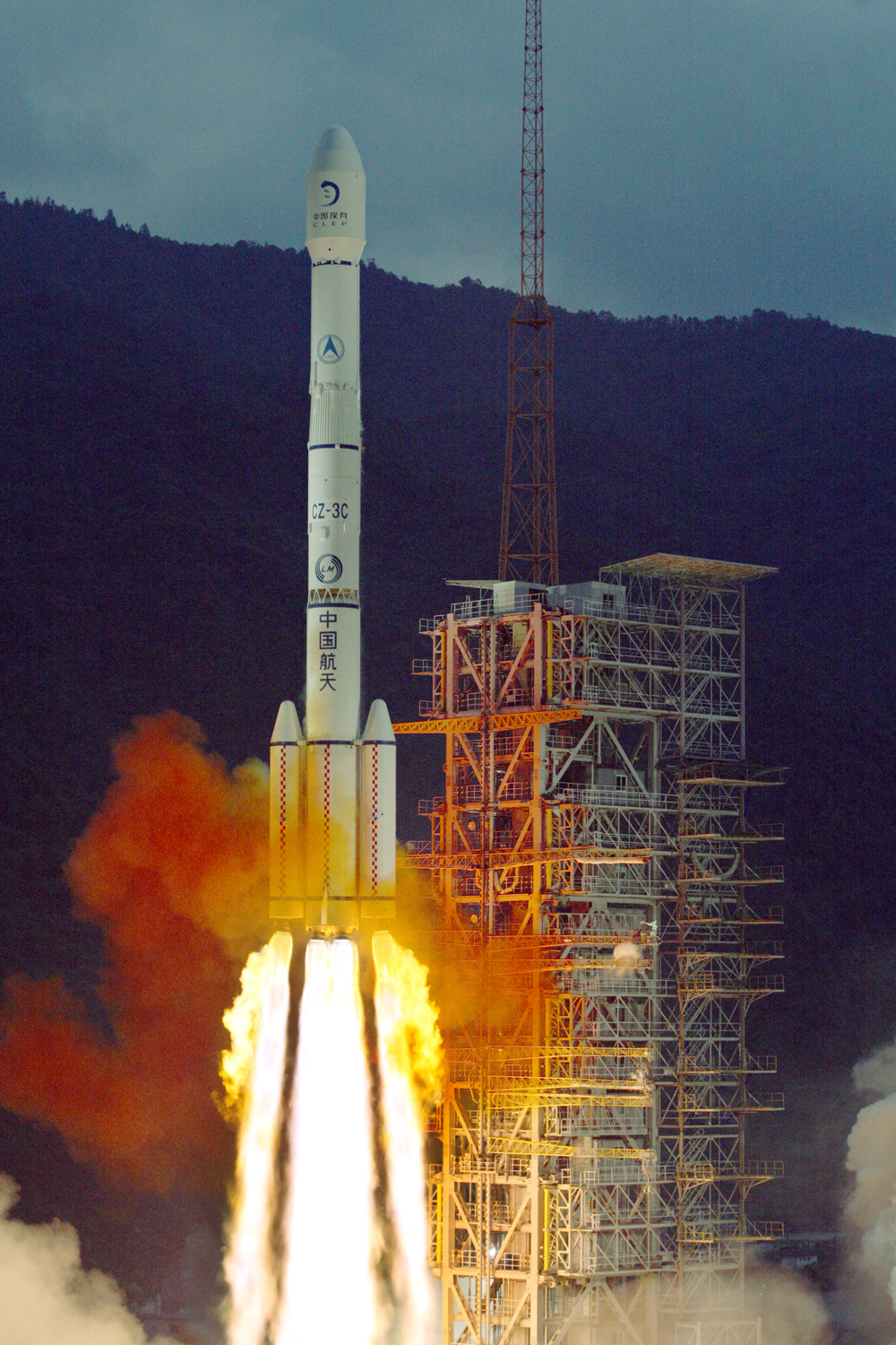
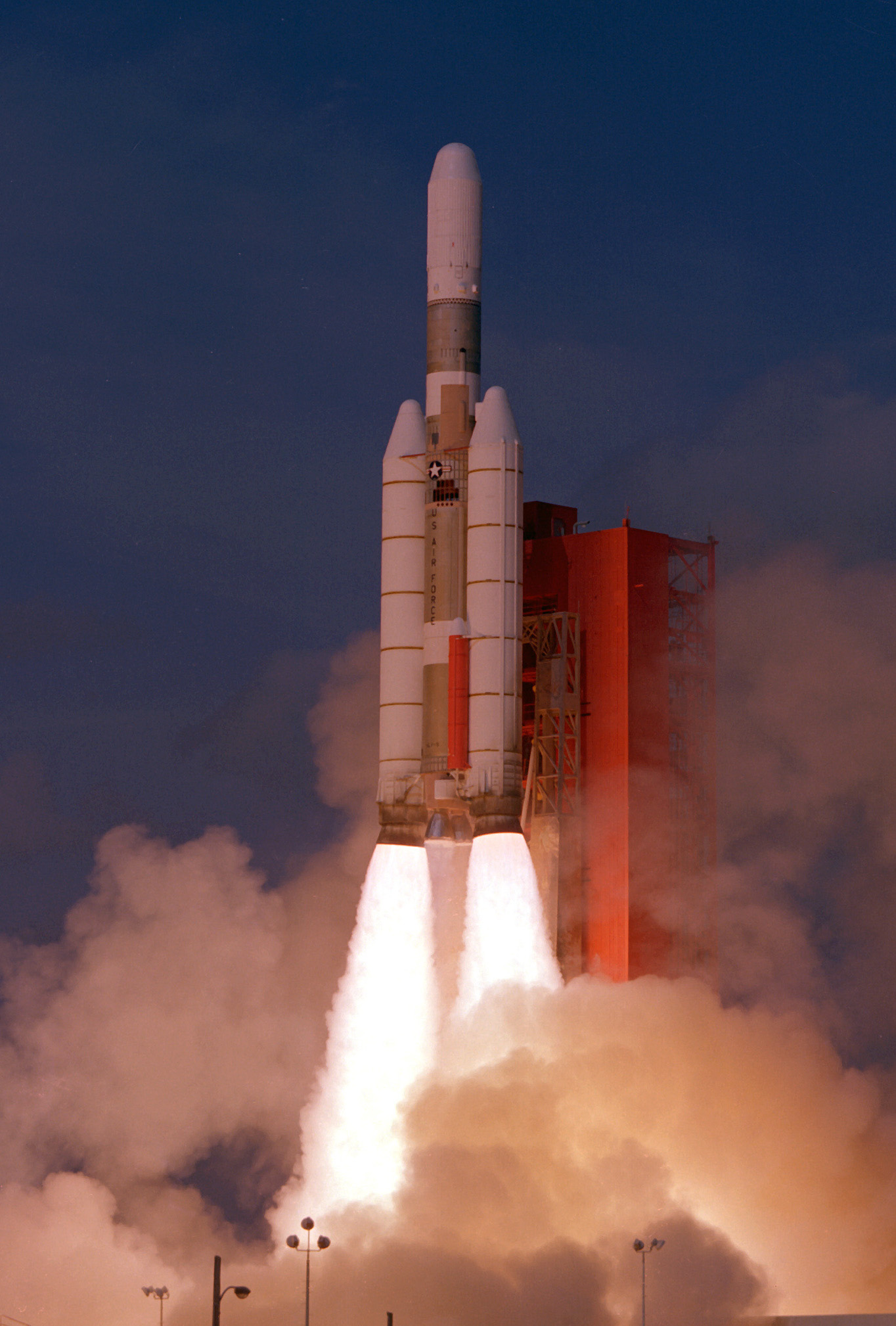
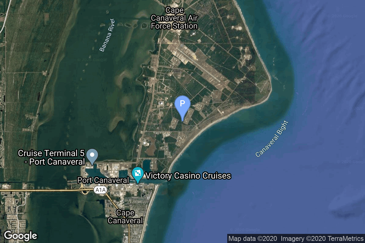
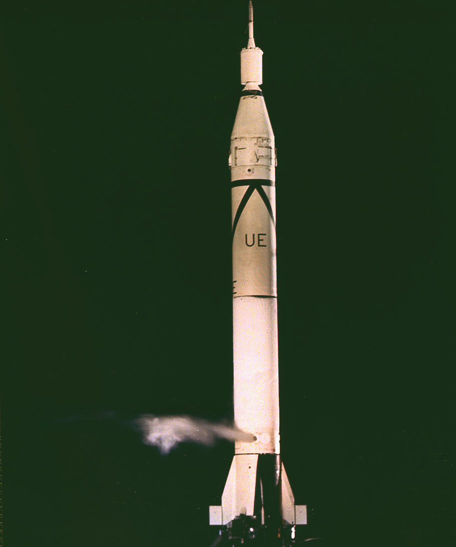
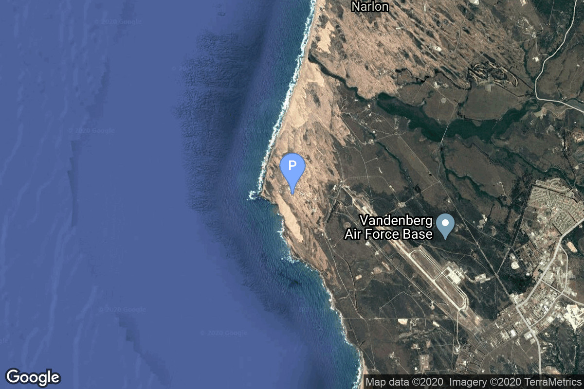
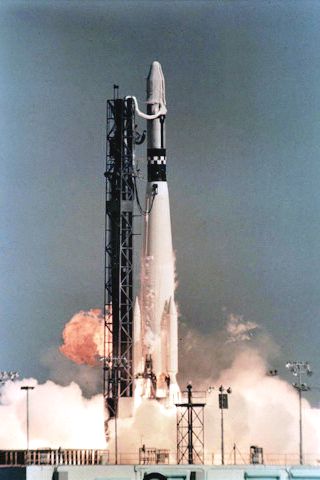
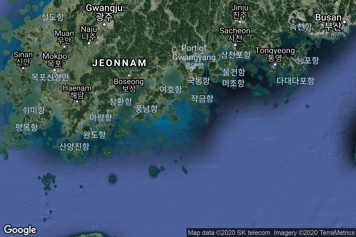
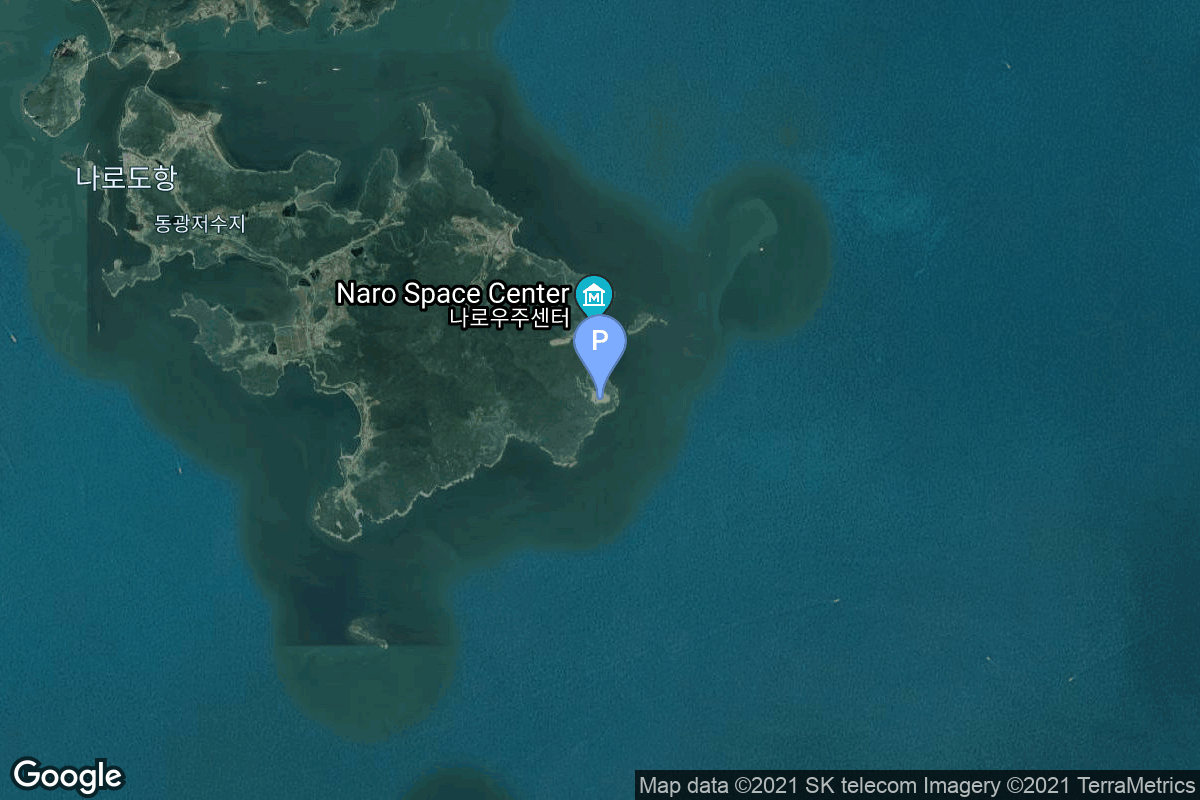
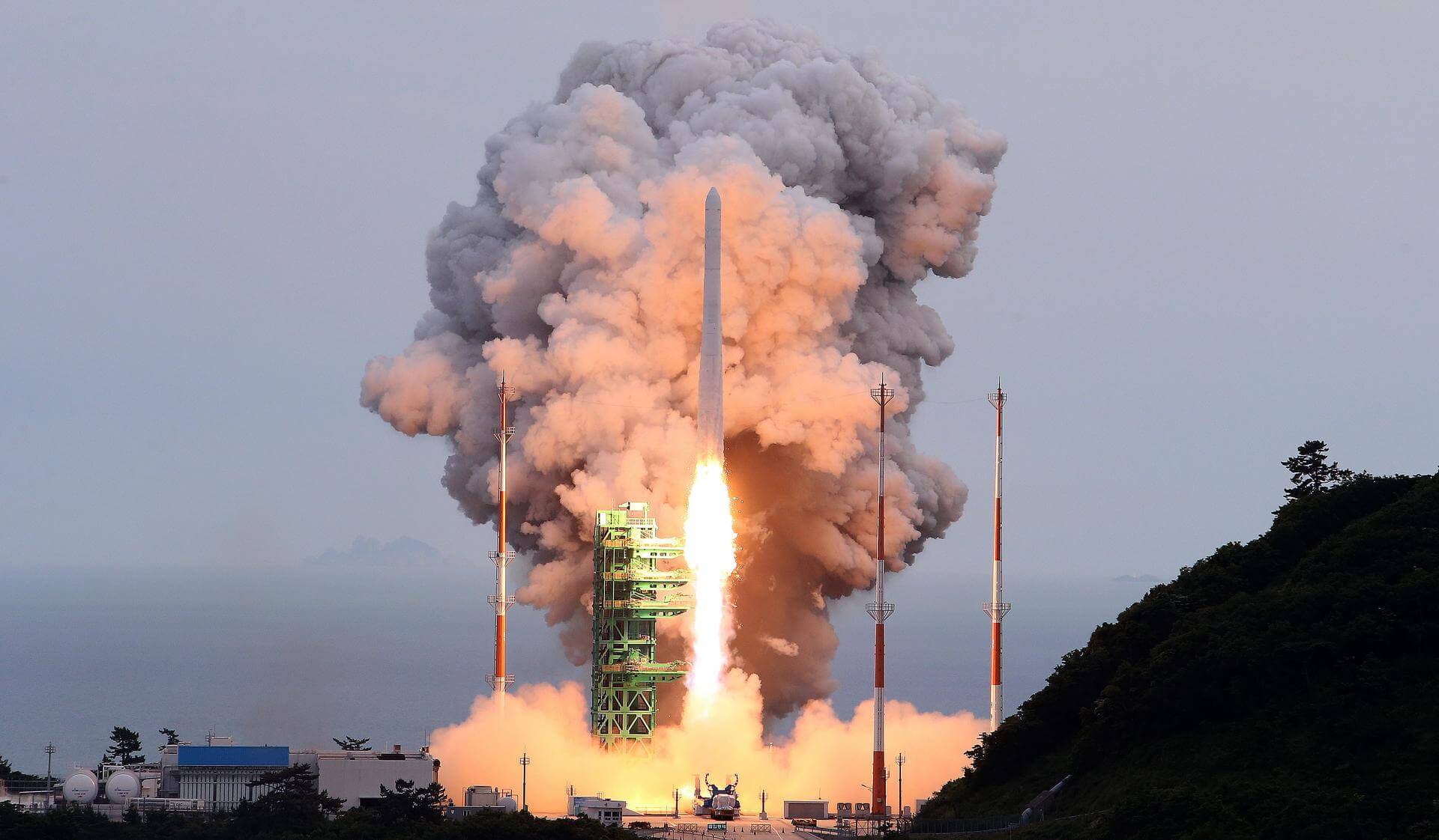
{ "count": 7793, "next": "https://ll.thespacedevs.com/2.0.0/launch/?format=api&limit=10&offset=930&ordering=-id", "previous": "https://ll.thespacedevs.com/2.0.0/launch/?format=api&limit=10&offset=910&ordering=-id", "results": [ { "id": "e0bb5afd-b70b-432e-b856-798fdefadc1a", "url": "https://ll.thespacedevs.com/2.0.0/launch/e0bb5afd-b70b-432e-b856-798fdefadc1a/?format=api", "launch_library_id": 682, "slug": "soyuz-21bfregat-glonass-k1-kosmos-2471", "name": "Soyuz-2.1b/Fregat | Glonass-K1 (Kosmos 2471)", "status": { "id": 3, "name": "Success" }, "net": "2011-02-26T03:07:15Z", "window_end": "2011-02-26T03:07:15Z", "window_start": "2011-02-26T03:07:15Z", "inhold": false, "tbdtime": false, "tbddate": false, "probability": null, "holdreason": "", "failreason": "", "hashtag": null, "launch_service_provider": { "id": 193, "url": "https://ll.thespacedevs.com/2.0.0/agencies/193/?format=api", "name": "Russian Space Forces", "type": "Government" }, "rocket": { "id": 1513, "configuration": { "id": 42, "launch_library_id": 65, "url": "https://ll.thespacedevs.com/2.0.0/config/launcher/42/?format=api", "name": "Soyuz 2.1b/Fregat", "family": "Soyuz", "full_name": "Soyuz 2.1b Fregat", "variant": "Fregat" } }, "mission": { "id": 883, "launch_library_id": 513, "name": "Glonass-K1 (Kosmos 2471)", "description": "Glonass-K are the third generation of satellite design for GLONASS satellite navigation system. GLONASS is a Russian space-based navigation system comparable to the similar GPS and Galileo systems. This generation improves on accuracy, power consumption and design life. Each satellite is unpressurized and weighs 935 kg, and has an operational lifetime of 10 years.", "launch_designator": null, "type": "Navigation", "orbit": { "id": 12, "name": "Medium Earth Orbit", "abbrev": "MEO" } }, "pad": { "id": 85, "url": "https://ll.thespacedevs.com/2.0.0/pad/85/?format=api", "agency_id": 163, "name": "43/4 (43R)", "info_url": null, "wiki_url": null, "map_url": "https://www.google.com/maps?q=62.92883,40.457098", "latitude": "62.92883", "longitude": "40.457098", "location": { "id": 6, "url": "https://ll.thespacedevs.com/2.0.0/location/6/?format=api", "name": "Plesetsk Cosmodrome, Russian Federation", "country_code": "RUS", "map_image": "https://thespacedevs-prod.nyc3.digitaloceanspaces.com/media/map_images/location_6_20200803142434.jpg", "total_launch_count": 1681, "total_landing_count": 0 }, "map_image": "https://thespacedevs-prod.nyc3.digitaloceanspaces.com/media/map_images/pad_85_20200803143554.jpg", "total_launch_count": 326 }, "webcast_live": false, "image": "https://thespacedevs-prod.nyc3.digitaloceanspaces.com/media/images/soyuz_2.1b_image_20230802085331.jpg", "infographic": null, "program": [ { "id": 34, "url": "https://ll.thespacedevs.com/2.0.0/program/34/?format=api", "name": "GLONASS", "description": "GLONASS (ГЛОНАСС, IPA: [ɡɫɐˈnas]; Russian: Глобальная навигационная спутниковая система, tr. Global'naya Navigatsionnaya Sputnikovaya Sistema, lit. 'Global Navigation Satellite System') is a Russian satellite navigation system operating as part of a radionavigation-satellite service. It provides an alternative to Global Positioning System (GPS) and is the second navigational system in operation with global coverage and of comparable precision.", "agencies": [ { "id": 63, "url": "https://ll.thespacedevs.com/2.0.0/agencies/63/?format=api", "name": "Russian Federal Space Agency (ROSCOSMOS)", "type": "Government" } ], "image_url": "https://thespacedevs-prod.nyc3.digitaloceanspaces.com/media/images/glonass_program_20240102170258.png", "start_date": "1982-10-12T00:00:00Z", "end_date": null, "info_url": "https://www.glonass-iac.ru/en/", "wiki_url": "https://en.wikipedia.org/wiki/GLONASS" } ] }, { "id": "e0ac135c-0ca2-453c-b1e8-7de0750db985", "url": "https://ll.thespacedevs.com/2.0.0/launch/e0ac135c-0ca2-453c-b1e8-7de0750db985/?format=api", "launch_library_id": 1046, "slug": "long-march-3c-beidou-2-g7", "name": "Long March 3C | Beidou-2 G7", "status": { "id": 3, "name": "Success" }, "net": "2016-06-12T15:30:00Z", "window_end": "2016-06-12T16:10:00Z", "window_start": "2016-06-12T15:30:00Z", "inhold": false, "tbdtime": false, "tbddate": false, "probability": null, "holdreason": "", "failreason": "", "hashtag": null, "launch_service_provider": { "id": 88, "url": "https://ll.thespacedevs.com/2.0.0/agencies/88/?format=api", "name": "China Aerospace Science and Technology Corporation", "type": "Government" }, "rocket": { "id": 1934, "configuration": { "id": 90, "launch_library_id": 97, "url": "https://ll.thespacedevs.com/2.0.0/config/launcher/90/?format=api", "name": "Long March 3C", "family": "Long March", "full_name": "Long March 3C", "variant": "C" } }, "mission": { "id": 209, "launch_library_id": 285, "name": "Beidou-2 G7", "description": "Navigation satellite for China's BeiDou navigation satellite constellation.", "launch_designator": null, "type": "Navigation", "orbit": { "id": 2, "name": "Geostationary Transfer Orbit", "abbrev": "GTO" } }, "pad": { "id": 66, "url": "https://ll.thespacedevs.com/2.0.0/pad/66/?format=api", "agency_id": 17, "name": "Launch Complex 3 (LC-3/LA-1)", "info_url": null, "wiki_url": "https://en.wikipedia.org/wiki/Xichang_Satellite_Launch_Center", "map_url": "https://www.google.com/maps?q=28.247209,102.02917", "latitude": "28.247209", "longitude": "102.02917", "location": { "id": 16, "url": "https://ll.thespacedevs.com/2.0.0/location/16/?format=api", "name": "Xichang Satellite Launch Center, People's Republic of China", "country_code": "CHN", "map_image": "https://thespacedevs-prod.nyc3.digitaloceanspaces.com/media/map_images/location_16_20200803142513.jpg", "total_launch_count": 237, "total_landing_count": 0 }, "map_image": "https://thespacedevs-prod.nyc3.digitaloceanspaces.com/media/map_images/pad_66_20200803143611.jpg", "total_launch_count": 105 }, "webcast_live": false, "image": "https://thespacedevs-prod.nyc3.digitaloceanspaces.com/media/images/chang2527e_2_l_image_20250906202038.bmp", "infographic": null, "program": [ { "id": 35, "url": "https://ll.thespacedevs.com/2.0.0/program/35/?format=api", "name": "BeiDou", "description": "The BeiDou Navigation Satellite System is a satellite-based radio navigation system owned and operated by the China National Space Administration.[4] It is one of the global navigation satellite systems that provide geolocation and time information to a BDS receiver anywhere on or near the Earth where there is an unobstructed line of sight to four or more BDS satellites.", "agencies": [ { "id": 17, "url": "https://ll.thespacedevs.com/2.0.0/agencies/17/?format=api", "name": "China National Space Administration", "type": "Government" } ], "image_url": "https://thespacedevs-prod.nyc3.digitaloceanspaces.com/media/images/beidou_program_20240102170615.png", "start_date": "2000-10-31T00:00:00Z", "end_date": null, "info_url": "http://en.beidou.gov.cn/", "wiki_url": "https://en.wikipedia.org/wiki/BeiDou" } ] }, { "id": "e0a10e2d-2c41-46c0-ab34-e28c081389f9", "url": "https://ll.thespacedevs.com/2.0.0/launch/e0a10e2d-2c41-46c0-ab34-e28c081389f9/?format=api", "launch_library_id": null, "slug": "ariane-1-intelsat-508", "name": "Ariane 1 | Intelsat 508", "status": { "id": 3, "name": "Success" }, "net": "1984-03-05T00:50:03Z", "window_end": "1984-03-05T00:50:03Z", "window_start": "1984-03-05T00:50:03Z", "inhold": false, "tbdtime": false, "tbddate": false, "probability": null, "holdreason": "", "failreason": null, "hashtag": null, "launch_service_provider": { "id": 115, "url": "https://ll.thespacedevs.com/2.0.0/agencies/115/?format=api", "name": "Arianespace", "type": "Commercial" }, "rocket": { "id": 5613, "configuration": { "id": 219, "launch_library_id": null, "url": "https://ll.thespacedevs.com/2.0.0/config/launcher/219/?format=api", "name": "Ariane 1", "family": "Ariane", "full_name": "Ariane 1", "variant": "1" } }, "mission": { "id": 4016, "launch_library_id": null, "name": "Intelsat 508", "description": "Geostationary communications satellite", "launch_designator": null, "type": "Communications", "orbit": { "id": 1, "name": "Geostationary Orbit", "abbrev": "Direct-GEO" } }, "pad": { "id": 34, "url": "https://ll.thespacedevs.com/2.0.0/pad/34/?format=api", "agency_id": 115, "name": "Ariane Launch Area 1 (ELV)", "info_url": null, "wiki_url": "https://en.wikipedia.org/wiki/ELA-1", "map_url": "https://www.google.com/maps?q=5.236,-52.775", "latitude": "5.236", "longitude": "-52.775", "location": { "id": 13, "url": "https://ll.thespacedevs.com/2.0.0/location/13/?format=api", "name": "Guiana Space Centre, French Guiana", "country_code": "GUF", "map_image": "https://thespacedevs-prod.nyc3.digitaloceanspaces.com/media/map_images/location_13_20200803142412.jpg", "total_launch_count": 331, "total_landing_count": 0 }, "map_image": "https://thespacedevs-prod.nyc3.digitaloceanspaces.com/media/map_images/pad_34_20200803143527.jpg", "total_launch_count": 54 }, "webcast_live": false, "image": "https://thespacedevs-prod.nyc3.digitaloceanspaces.com/media/images/ariane_1_in_fli_image_20240314094301.jpg", "infographic": null, "program": [] }, { "id": "e09bfded-1550-4892-81af-e41c3c27b1a4", "url": "https://ll.thespacedevs.com/2.0.0/launch/e09bfded-1550-4892-81af-e41c3c27b1a4/?format=api", "launch_library_id": null, "slug": "titan-iiic-dsp-4", "name": "Titan IIIC | DSP 4", "status": { "id": 3, "name": "Success" }, "net": "1973-06-12T07:14:05Z", "window_end": "1973-06-12T07:14:05Z", "window_start": "1973-06-12T07:14:05Z", "inhold": false, "tbdtime": false, "tbddate": false, "probability": null, "holdreason": "", "failreason": null, "hashtag": null, "launch_service_provider": { "id": 161, "url": "https://ll.thespacedevs.com/2.0.0/agencies/161/?format=api", "name": "United States Air Force", "type": "Government" }, "rocket": { "id": 4369, "configuration": { "id": 439, "launch_library_id": null, "url": "https://ll.thespacedevs.com/2.0.0/config/launcher/439/?format=api", "name": "Titan IIIC", "family": "Titan", "full_name": "Titan IIIC", "variant": "IIIC" } }, "mission": { "id": 2787, "launch_library_id": null, "name": "DSP 4", "description": "Satellite designed to detect any ICBM or SLBM launched against the US and its allies.", "launch_designator": null, "type": "Government/Top Secret", "orbit": { "id": 1, "name": "Geostationary Orbit", "abbrev": "Direct-GEO" } }, "pad": { "id": 80, "url": "https://ll.thespacedevs.com/2.0.0/pad/80/?format=api", "agency_id": 121, "name": "Space Launch Complex 40", "info_url": null, "wiki_url": "https://en.wikipedia.org/wiki/Cape_Canaveral_Air_Force_Station_Space_Launch_Complex_40", "map_url": "https://www.google.com/maps?q=28.56194122,-80.57735736", "latitude": "28.56194122", "longitude": "-80.57735736", "location": { "id": 12, "url": "https://ll.thespacedevs.com/2.0.0/location/12/?format=api", "name": "Cape Canaveral SFS, FL, USA", "country_code": "USA", "map_image": "https://thespacedevs-prod.nyc3.digitaloceanspaces.com/media/map_images/location_12_20200803142519.jpg", "total_launch_count": 1087, "total_landing_count": 71 }, "map_image": "https://thespacedevs-prod.nyc3.digitaloceanspaces.com/media/map_images/pad_80_20200803143323.jpg", "total_launch_count": 364 }, "webcast_live": false, "image": "https://thespacedevs-prod.nyc3.digitaloceanspaces.com/media/images/titan_iii-c_lau_image_20251103140641.jpeg", "infographic": null, "program": [] }, { "id": "e0975cef-e8c6-4f35-bbf7-1b55963e06a5", "url": "https://ll.thespacedevs.com/2.0.0/launch/e0975cef-e8c6-4f35-bbf7-1b55963e06a5/?format=api", "launch_library_id": null, "slug": "juno-i-explorer-4", "name": "Juno-I | Explorer 4", "status": { "id": 3, "name": "Success" }, "net": "1958-07-26T15:00:57Z", "window_end": "1958-07-26T15:00:57Z", "window_start": "1958-07-26T15:00:57Z", "inhold": false, "tbdtime": false, "tbddate": false, "probability": null, "holdreason": "", "failreason": null, "hashtag": null, "launch_service_provider": { "id": 271, "url": "https://ll.thespacedevs.com/2.0.0/agencies/271/?format=api", "name": "Army Ballistic Missile Agency", "type": "Government" }, "rocket": { "id": 3017, "configuration": { "id": 324, "launch_library_id": null, "url": "https://ll.thespacedevs.com/2.0.0/config/launcher/324/?format=api", "name": "Juno-I", "family": "Redstone", "full_name": "Juno-I", "variant": "Juno I" } }, "mission": { "id": 1439, "launch_library_id": null, "name": "Explorer 4", "description": "An American satellite in order to study the Van Allen radiation belts and the effects of nuclear explosions upon these belts.", "launch_designator": null, "type": "Earth Science", "orbit": { "id": 12, "name": "Medium Earth Orbit", "abbrev": "MEO" } }, "pad": { "id": 123, "url": "https://ll.thespacedevs.com/2.0.0/pad/123/?format=api", "agency_id": 161, "name": "Launch Complex 5", "info_url": null, "wiki_url": "https://en.wikipedia.org/wiki/Cape_Canaveral_Launch_Complex_5", "map_url": "https://www.google.com/maps?q=28.43942,-80.573301", "latitude": "28.43942", "longitude": "-80.573301", "location": { "id": 12, "url": "https://ll.thespacedevs.com/2.0.0/location/12/?format=api", "name": "Cape Canaveral SFS, FL, USA", "country_code": "USA", "map_image": "https://thespacedevs-prod.nyc3.digitaloceanspaces.com/media/map_images/location_12_20200803142519.jpg", "total_launch_count": 1087, "total_landing_count": 71 }, "map_image": "https://thespacedevs-prod.nyc3.digitaloceanspaces.com/media/map_images/pad_123_20200803143235.jpg", "total_launch_count": 13 }, "webcast_live": false, "image": "https://thespacedevs-prod.nyc3.digitaloceanspaces.com/media/images/juno_i_on_the_p_image_20240411120216.jpeg", "infographic": null, "program": [] }, { "id": "e08b33b0-8e29-4f03-8710-031223a550c8", "url": "https://ll.thespacedevs.com/2.0.0/launch/e08b33b0-8e29-4f03-8710-031223a550c8/?format=api", "launch_library_id": null, "slug": "trailblazer-2-trailblazer-iib", "name": "Trailblazer 2 | Trailblazer IIb", "status": { "id": 3, "name": "Success" }, "net": "1962-05-06T05:41:00Z", "window_end": "1962-05-06T05:41:00Z", "window_start": "1962-05-06T05:41:00Z", "inhold": false, "tbdtime": false, "tbddate": false, "probability": null, "holdreason": "", "failreason": null, "hashtag": null, "launch_service_provider": { "id": 44, "url": "https://ll.thespacedevs.com/2.0.0/agencies/44/?format=api", "name": "National Aeronautics and Space Administration", "type": "Government" }, "rocket": { "id": 3122, "configuration": { "id": 442, "launch_library_id": null, "url": "https://ll.thespacedevs.com/2.0.0/config/launcher/442/?format=api", "name": "Trailblazer 2", "family": "Trailblazer", "full_name": "Trailblazer 2", "variant": "2" } }, "mission": { "id": 1544, "launch_library_id": null, "name": "Trailblazer IIb", "description": "Atmospheric reentry research payloads", "launch_designator": null, "type": "Earth Science", "orbit": { "id": 15, "name": "Suborbital", "abbrev": "Sub" } }, "pad": { "id": 177, "url": "https://ll.thespacedevs.com/2.0.0/pad/177/?format=api", "agency_id": null, "name": "Unknown Pad", "info_url": null, "wiki_url": "https://en.wikipedia.org/wiki/Wallops_Flight_Facility", "map_url": "https://www.google.com/maps?q=37.9386111,-75.4594162", "latitude": "37.9386111", "longitude": "-75.4594162", "location": { "id": 21, "url": "https://ll.thespacedevs.com/2.0.0/location/21/?format=api", "name": "Wallops Flight Facility, Virginia, USA", "country_code": "USA", "map_image": "https://thespacedevs-prod.nyc3.digitaloceanspaces.com/media/map_images/location_21_20200803142423.jpg", "total_launch_count": 84, "total_landing_count": 0 }, "map_image": "https://thespacedevs-prod.nyc3.digitaloceanspaces.com/media/map_images/pad_177_20200803143406.jpg", "total_launch_count": 8 }, "webcast_live": false, "image": null, "infographic": null, "program": [] }, { "id": "e085ec96-a80e-4856-bd3f-8ab26adaf376", "url": "https://ll.thespacedevs.com/2.0.0/launch/e085ec96-a80e-4856-bd3f-8ab26adaf376/?format=api", "launch_library_id": null, "slug": "kosmos-3m-strela-1m-49-56", "name": "Kosmos-3M | Strela-1M 49-56", "status": { "id": 3, "name": "Success" }, "net": "1973-10-02T21:46:00Z", "window_end": "1973-10-02T21:46:00Z", "window_start": "1973-10-02T21:46:00Z", "inhold": false, "tbdtime": false, "tbddate": false, "probability": null, "holdreason": "", "failreason": null, "hashtag": null, "launch_service_provider": { "id": 66, "url": "https://ll.thespacedevs.com/2.0.0/agencies/66/?format=api", "name": "Soviet Space Program", "type": "Government" }, "rocket": { "id": 4399, "configuration": { "id": 102, "launch_library_id": 122, "url": "https://ll.thespacedevs.com/2.0.0/config/launcher/102/?format=api", "name": "Kosmos-3M", "family": "Kosmos", "full_name": "Kosmos-3M (11K65M)", "variant": "-3M" } }, "mission": { "id": 2817, "launch_library_id": null, "name": "Strela-1M 49-56", "description": "Military communications satellites", "launch_designator": null, "type": "Government/Top Secret", "orbit": { "id": 8, "name": "Low Earth Orbit", "abbrev": "LEO" } }, "pad": { "id": 167, "url": "https://ll.thespacedevs.com/2.0.0/pad/167/?format=api", "agency_id": null, "name": "132/2", "info_url": null, "wiki_url": "https://en.wikipedia.org/wiki/Plesetsk_Cosmodrome", "map_url": "https://www.google.com/maps?q=62.883,40.869806", "latitude": "62.883", "longitude": "40.869806", "location": { "id": 6, "url": "https://ll.thespacedevs.com/2.0.0/location/6/?format=api", "name": "Plesetsk Cosmodrome, Russian Federation", "country_code": "RUS", "map_image": "https://thespacedevs-prod.nyc3.digitaloceanspaces.com/media/map_images/location_6_20200803142434.jpg", "total_launch_count": 1681, "total_landing_count": 0 }, "map_image": "https://thespacedevs-prod.nyc3.digitaloceanspaces.com/media/map_images/pad_167_20200803143417.jpg", "total_launch_count": 172 }, "webcast_live": false, "image": "https://thespacedevs-prod.nyc3.digitaloceanspaces.com/media/images/kosmos-3m_durin_image_20251101171325.jpg", "infographic": null, "program": [] }, { "id": "e084e9ae-5d37-4c4c-b6a9-1bc6047086f3", "url": "https://ll.thespacedevs.com/2.0.0/launch/e084e9ae-5d37-4c4c-b6a9-1bc6047086f3/?format=api", "launch_library_id": null, "slug": "falcon-9-block-5-starlink-group-12-24", "name": "Falcon 9 Block 5 | Starlink Group 12-24", "status": { "id": 3, "name": "Success" }, "net": "2025-06-10T13:05:40Z", "window_end": "2025-06-10T17:02:59Z", "window_start": "2025-06-10T13:05:40Z", "inhold": false, "tbdtime": false, "tbddate": false, "probability": 95, "holdreason": "", "failreason": "", "hashtag": null, "launch_service_provider": { "id": 121, "url": "https://ll.thespacedevs.com/2.0.0/agencies/121/?format=api", "name": "SpaceX", "type": "Commercial" }, "rocket": { "id": 8628, "configuration": { "id": 164, "launch_library_id": 188, "url": "https://ll.thespacedevs.com/2.0.0/config/launcher/164/?format=api", "name": "Falcon 9", "family": "Falcon", "full_name": "Falcon 9 Block 5", "variant": "Block 5" } }, "mission": { "id": 7220, "launch_library_id": null, "name": "Starlink Group 12-24", "description": "A batch of 23 satellites for the Starlink mega-constellation - SpaceX's project for space-based Internet communication system.", "launch_designator": null, "type": "Communications", "orbit": { "id": 8, "name": "Low Earth Orbit", "abbrev": "LEO" } }, "pad": { "id": 80, "url": "https://ll.thespacedevs.com/2.0.0/pad/80/?format=api", "agency_id": 121, "name": "Space Launch Complex 40", "info_url": null, "wiki_url": "https://en.wikipedia.org/wiki/Cape_Canaveral_Air_Force_Station_Space_Launch_Complex_40", "map_url": "https://www.google.com/maps?q=28.56194122,-80.57735736", "latitude": "28.56194122", "longitude": "-80.57735736", "location": { "id": 12, "url": "https://ll.thespacedevs.com/2.0.0/location/12/?format=api", "name": "Cape Canaveral SFS, FL, USA", "country_code": "USA", "map_image": "https://thespacedevs-prod.nyc3.digitaloceanspaces.com/media/map_images/location_12_20200803142519.jpg", "total_launch_count": 1087, "total_landing_count": 71 }, "map_image": "https://thespacedevs-prod.nyc3.digitaloceanspaces.com/media/map_images/pad_80_20200803143323.jpg", "total_launch_count": 364 }, "webcast_live": false, "image": "https://thespacedevs-prod.nyc3.digitaloceanspaces.com/media/images/falcon2520925_image_20221009234147.png", "infographic": null, "program": [ { "id": 25, "url": "https://ll.thespacedevs.com/2.0.0/program/25/?format=api", "name": "Starlink", "description": "Starlink is a satellite internet constellation operated by American aerospace company SpaceX", "agencies": [ { "id": 121, "url": "https://ll.thespacedevs.com/2.0.0/agencies/121/?format=api", "name": "SpaceX", "type": "Commercial" } ], "image_url": "https://thespacedevs-prod.nyc3.digitaloceanspaces.com/media/images/starlink_program_20231228154508.jpeg", "start_date": "2018-02-22T14:17:00Z", "end_date": null, "info_url": "https://starlink.com", "wiki_url": "https://en.wikipedia.org/wiki/Starlink" } ] }, { "id": "e081ac5f-2ecb-453f-b6d5-329b63aaf681", "url": "https://ll.thespacedevs.com/2.0.0/launch/e081ac5f-2ecb-453f-b6d5-329b63aaf681/?format=api", "launch_library_id": null, "slug": "thor-slv-2a-agena-d-kh-4a-32", "name": "Thor SLV-2A Agena D | KH-4A 32", "status": { "id": 4, "name": "Failure" }, "net": "1966-05-03T19:25:25Z", "window_end": "1966-05-03T19:25:25Z", "window_start": "1966-05-03T19:25:25Z", "inhold": false, "tbdtime": false, "tbddate": false, "probability": null, "holdreason": "", "failreason": null, "hashtag": null, "launch_service_provider": { "id": 161, "url": "https://ll.thespacedevs.com/2.0.0/agencies/161/?format=api", "name": "United States Air Force", "type": "Government" }, "rocket": { "id": 3520, "configuration": { "id": 417, "launch_library_id": null, "url": "https://ll.thespacedevs.com/2.0.0/config/launcher/417/?format=api", "name": "Thor SLV-2A Agena D", "family": "Thor", "full_name": "Thor SLV-2A Agena D", "variant": "SLV-2A Agena D" } }, "mission": { "id": 1940, "launch_library_id": null, "name": "KH-4A 32", "description": "The KH-4A (Keyhole-4A) was the fifth optical reconnaissance satellite version in the Corona-program.", "launch_designator": null, "type": "Government/Top Secret", "orbit": { "id": 8, "name": "Low Earth Orbit", "abbrev": "LEO" } }, "pad": { "id": 96, "url": "https://ll.thespacedevs.com/2.0.0/pad/96/?format=api", "agency_id": 161, "name": "Space Launch Complex 1E", "info_url": null, "wiki_url": "https://en.wikipedia.org/wiki/Vandenberg_Space_Launch_Complex_1", "map_url": "https://www.google.com/maps?q=34.756,-120.6263", "latitude": "34.756", "longitude": "-120.6263", "location": { "id": 11, "url": "https://ll.thespacedevs.com/2.0.0/location/11/?format=api", "name": "Vandenberg SFB, CA, USA", "country_code": "USA", "map_image": "https://thespacedevs-prod.nyc3.digitaloceanspaces.com/media/map_images/location_11_20200803142416.jpg", "total_launch_count": 862, "total_landing_count": 33 }, "map_image": "https://thespacedevs-prod.nyc3.digitaloceanspaces.com/media/map_images/pad_96_20200803143221.jpg", "total_launch_count": 45 }, "webcast_live": false, "image": "https://thespacedevs-prod.nyc3.digitaloceanspaces.com/media/images/thor_slv-2a_age_image_20251102055131.jpg", "infographic": null, "program": [] }, { "id": "e0741415-6c63-4236-9736-24a6c04485bc", "url": "https://ll.thespacedevs.com/2.0.0/launch/e0741415-6c63-4236-9736-24a6c04485bc/?format=api", "launch_library_id": null, "slug": "nuri-neonsat-2-to-6", "name": "Nuri | NeonSat-2 to 6", "status": { "id": 2, "name": "TBD" }, "net": "2026-09-30T00:00:00Z", "window_end": "2026-09-30T00:00:00Z", "window_start": "2026-09-30T00:00:00Z", "inhold": false, "tbdtime": true, "tbddate": true, "probability": null, "holdreason": "", "failreason": "", "hashtag": null, "launch_service_provider": { "id": 41, "url": "https://ll.thespacedevs.com/2.0.0/agencies/41/?format=api", "name": "Korea Aerospace Research Institute", "type": "Government" }, "rocket": { "id": 8848, "configuration": { "id": 117, "launch_library_id": 169, "url": "https://ll.thespacedevs.com/2.0.0/config/launcher/117/?format=api", "name": "Nuri", "family": "KSLV", "full_name": "KSLV-2 Nuri", "variant": "2" } }, "mission": { "id": 7439, "launch_library_id": null, "name": "NeonSat-2 to 6", "description": "NeonSat-2 to 6 are part of the South Korean government's Earth observation micro-satellite constellation NeonSat (New-space Earth Observation Satellite). The NeonSat constellation is the first satellite system developed by the government using a mass-production approach for precise monitoring of the Korean Peninsula.", "launch_designator": null, "type": "Earth Science", "orbit": { "id": 17, "name": "Sun-Synchronous Orbit", "abbrev": "SSO" } }, "pad": { "id": 192, "url": "https://ll.thespacedevs.com/2.0.0/pad/192/?format=api", "agency_id": 41, "name": "LC-2", "info_url": null, "wiki_url": "https://en.wikipedia.org/wiki/Naro_Space_Center", "map_url": "https://www.google.com/maps?q=34.431867,127.535069", "latitude": "34.431867", "longitude": "127.535069", "location": { "id": 9, "url": "https://ll.thespacedevs.com/2.0.0/location/9/?format=api", "name": "Naro Space Center, South Korea", "country_code": "KOR", "map_image": "https://thespacedevs-prod.nyc3.digitaloceanspaces.com/media/map_images/location_9_20200803142441.jpg", "total_launch_count": 8, "total_landing_count": 0 }, "map_image": "https://thespacedevs-prod.nyc3.digitaloceanspaces.com/media/map_images/pad_lc-2_20210812070305.jpg", "total_launch_count": 5 }, "webcast_live": false, "image": "https://thespacedevs-prod.nyc3.digitaloceanspaces.com/media/images/nuri_liftoff_2_image_20240820080542.jpeg", "infographic": null, "program": [] } ] }