Launch List
API endpoint that returns all Launch objects or a single launch.
EXAMPLE - /launch/
GET: Return a list of all Launch objects.
FILTERS: Fields - 'name', 'id(s)', 'lsp_id', 'lsp_name', 'serial_number', 'launcher_config__id', 'rocket__spacecraftflight__spacecraft__name'
MODE: 'normal', 'list', 'detailed' EXAMPLE: ?mode=list
SEARCH: Searches through the launch name, rocket name, launch agency, mission name & spacecraft name. EXAMPLE - ?search=SpaceX
GET /2.0.0/launch/?format=api&offset=900&ordering=name
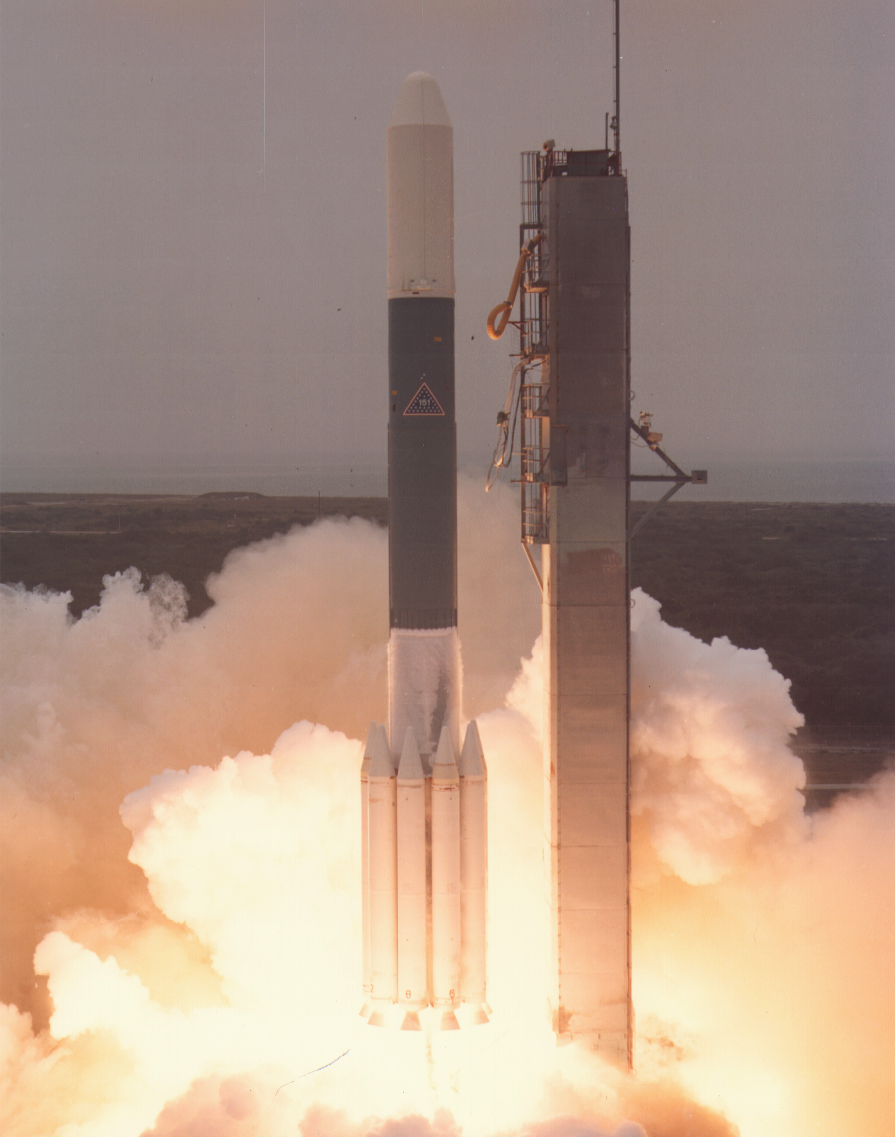
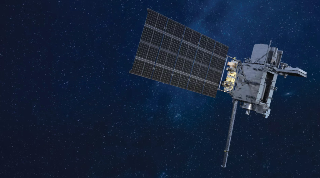
{ "count": 7505, "next": "https://ll.thespacedevs.com/2.0.0/launch/?format=api&limit=10&offset=910&ordering=name", "previous": "https://ll.thespacedevs.com/2.0.0/launch/?format=api&limit=10&offset=890&ordering=name", "results": [ { "id": "ccbc63a7-9694-4243-aabb-b7acdd0d6c9a", "url": "https://ll.thespacedevs.com/2.0.0/launch/ccbc63a7-9694-4243-aabb-b7acdd0d6c9a/?format=api", "launch_library_id": null, "slug": "delta-3914-anik-b", "name": "Delta 3914 | Anik B", "status": { "id": 3, "name": "Success" }, "net": "1978-12-16T00:21:00Z", "window_end": "1978-12-16T00:21:00Z", "window_start": "1978-12-16T00:21:00Z", "inhold": false, "tbdtime": false, "tbddate": false, "probability": null, "holdreason": "", "failreason": null, "hashtag": null, "launch_service_provider": { "id": 161, "url": "https://ll.thespacedevs.com/2.0.0/agencies/161/?format=api", "name": "United States Air Force", "type": "Government" }, "rocket": { "id": 5025, "configuration": { "id": 291, "launch_library_id": null, "url": "https://ll.thespacedevs.com/2.0.0/config/launcher/291/?format=api", "name": "Delta 3914", "family": "Delta", "full_name": "Delta 3914", "variant": "3914" } }, "mission": { "id": 3438, "launch_library_id": null, "name": "Anik B", "description": "Canadian communications satellite", "launch_designator": null, "type": "Communications", "orbit": { "id": 1, "name": "Geostationary Orbit", "abbrev": "Direct-GEO" } }, "pad": { "id": 14, "url": "https://ll.thespacedevs.com/2.0.0/pad/14/?format=api", "agency_id": null, "name": "Space Launch Complex 17A", "info_url": null, "wiki_url": "https://en.wikipedia.org/wiki/Cape_Canaveral_Space_Launch_Complex_17", "map_url": "https://www.google.com/maps?q=28.4472,-80.565", "latitude": "28.4472", "longitude": "-80.565", "location": { "id": 12, "url": "https://ll.thespacedevs.com/2.0.0/location/12/?format=api", "name": "Cape Canaveral SFS, FL, USA", "country_code": "USA", "map_image": "https://thespacedevs-prod.nyc3.digitaloceanspaces.com/media/map_images/location_12_20200803142519.jpg", "total_launch_count": 1024, "total_landing_count": 64 }, "map_image": "https://thespacedevs-prod.nyc3.digitaloceanspaces.com/media/map_images/pad_14_20200803143451.jpg", "total_launch_count": 145 }, "webcast_live": false, "image": "https://thespacedevs-prod.nyc3.digitaloceanspaces.com/media/images/delta_3910_image_20231231105538.jpeg", "infographic": null, "program": [] }, { "id": "86dd4a7a-f161-407b-b509-1c33051f70a5", "url": "https://ll.thespacedevs.com/2.0.0/launch/86dd4a7a-f161-407b-b509-1c33051f70a5/?format=api", "launch_library_id": null, "slug": "delta-3914-exosat", "name": "Delta 3914 | Exosat", "status": { "id": 3, "name": "Success" }, "net": "1983-05-26T15:18:00Z", "window_end": "1983-05-26T15:18:00Z", "window_start": "1983-05-26T15:18:00Z", "inhold": false, "tbdtime": false, "tbddate": false, "probability": null, "holdreason": "", "failreason": null, "hashtag": null, "launch_service_provider": { "id": 161, "url": "https://ll.thespacedevs.com/2.0.0/agencies/161/?format=api", "name": "United States Air Force", "type": "Government" }, "rocket": { "id": 5523, "configuration": { "id": 291, "launch_library_id": null, "url": "https://ll.thespacedevs.com/2.0.0/config/launcher/291/?format=api", "name": "Delta 3914", "family": "Delta", "full_name": "Delta 3914", "variant": "3914" } }, "mission": { "id": 3927, "launch_library_id": null, "name": "Exosat", "description": "European astronomy satellite designed dedicated to X-ray observations", "launch_designator": null, "type": "Astrophysics", "orbit": { "id": 0, "name": "Elliptical Orbit", "abbrev": "Elliptical" } }, "pad": { "id": 39, "url": "https://ll.thespacedevs.com/2.0.0/pad/39/?format=api", "agency_id": null, "name": "Space Launch Complex 2W", "info_url": null, "wiki_url": "https://en.wikipedia.org/wiki/Vandenberg_Space_Launch_Complex_2", "map_url": "https://www.google.com/maps?q=34.7556,-120.6224", "latitude": "34.7556", "longitude": "-120.6224", "location": { "id": 11, "url": "https://ll.thespacedevs.com/2.0.0/location/11/?format=api", "name": "Vandenberg SFB, CA, USA", "country_code": "USA", "map_image": "https://thespacedevs-prod.nyc3.digitaloceanspaces.com/media/map_images/location_11_20200803142416.jpg", "total_launch_count": 807, "total_landing_count": 26 }, "map_image": "https://thespacedevs-prod.nyc3.digitaloceanspaces.com/media/map_images/pad_39_20200803143542.jpg", "total_launch_count": 98 }, "webcast_live": false, "image": "https://thespacedevs-prod.nyc3.digitaloceanspaces.com/media/images/delta_3910_image_20231231105538.jpeg", "infographic": null, "program": [] }, { "id": "a95bdc3c-8565-4363-83fe-fd4d9b9b2413", "url": "https://ll.thespacedevs.com/2.0.0/launch/a95bdc3c-8565-4363-83fe-fd4d9b9b2413/?format=api", "launch_library_id": null, "slug": "delta-3914-goes-4", "name": "Delta 3914 | GOES 4", "status": { "id": 3, "name": "Success" }, "net": "1980-09-09T22:27:00Z", "window_end": "1980-09-09T22:27:00Z", "window_start": "1980-09-09T22:27:00Z", "inhold": false, "tbdtime": false, "tbddate": false, "probability": null, "holdreason": "", "failreason": null, "hashtag": null, "launch_service_provider": { "id": 161, "url": "https://ll.thespacedevs.com/2.0.0/agencies/161/?format=api", "name": "United States Air Force", "type": "Government" }, "rocket": { "id": 5205, "configuration": { "id": 291, "launch_library_id": null, "url": "https://ll.thespacedevs.com/2.0.0/config/launcher/291/?format=api", "name": "Delta 3914", "family": "Delta", "full_name": "Delta 3914", "variant": "3914" } }, "mission": { "id": 3615, "launch_library_id": null, "name": "GOES 4", "description": "Geostationary meteorological satellite", "launch_designator": null, "type": "Earth Science", "orbit": { "id": 1, "name": "Geostationary Orbit", "abbrev": "Direct-GEO" } }, "pad": { "id": 14, "url": "https://ll.thespacedevs.com/2.0.0/pad/14/?format=api", "agency_id": null, "name": "Space Launch Complex 17A", "info_url": null, "wiki_url": "https://en.wikipedia.org/wiki/Cape_Canaveral_Space_Launch_Complex_17", "map_url": "https://www.google.com/maps?q=28.4472,-80.565", "latitude": "28.4472", "longitude": "-80.565", "location": { "id": 12, "url": "https://ll.thespacedevs.com/2.0.0/location/12/?format=api", "name": "Cape Canaveral SFS, FL, USA", "country_code": "USA", "map_image": "https://thespacedevs-prod.nyc3.digitaloceanspaces.com/media/map_images/location_12_20200803142519.jpg", "total_launch_count": 1024, "total_landing_count": 64 }, "map_image": "https://thespacedevs-prod.nyc3.digitaloceanspaces.com/media/map_images/pad_14_20200803143451.jpg", "total_launch_count": 145 }, "webcast_live": false, "image": "https://thespacedevs-prod.nyc3.digitaloceanspaces.com/media/images/delta_3910_image_20231231105538.jpeg", "infographic": null, "program": [ { "id": 37, "url": "https://ll.thespacedevs.com/2.0.0/program/37/?format=api", "name": "Geostationary Operational Environmental Satellite", "description": "The Geostationary Operational Environmental Satellite (GOES), operated by the United States' National Oceanic and Atmospheric Administration (NOAA)'s National Environmental Satellite, Data, and Information Service division, supports weather forecasting, severe storm tracking, and meteorology research", "agencies": [ { "id": 44, "url": "https://ll.thespacedevs.com/2.0.0/agencies/44/?format=api", "name": "National Aeronautics and Space Administration", "type": "Government" }, { "id": 210, "url": "https://ll.thespacedevs.com/2.0.0/agencies/210/?format=api", "name": "National Oceanic and Atmospheric Administration", "type": "Government" } ], "image_url": "https://thespacedevs-prod.nyc3.digitaloceanspaces.com/media/images/goes-u_render_image_20240623151909.jpg", "start_date": "1975-10-16T22:40:00Z", "end_date": null, "info_url": null, "wiki_url": "https://en.wikipedia.org/wiki/Geostationary_Operational_Environmental_Satellite" } ] }, { "id": "4fd132cc-4eb7-42c6-9d84-c73413688ff3", "url": "https://ll.thespacedevs.com/2.0.0/launch/4fd132cc-4eb7-42c6-9d84-c73413688ff3/?format=api", "launch_library_id": null, "slug": "delta-3914-goes-5", "name": "Delta 3914 | GOES 5", "status": { "id": 3, "name": "Success" }, "net": "1981-05-22T22:29:00Z", "window_end": "1981-05-22T22:29:00Z", "window_start": "1981-05-22T22:29:00Z", "inhold": false, "tbdtime": false, "tbddate": false, "probability": null, "holdreason": "", "failreason": null, "hashtag": null, "launch_service_provider": { "id": 161, "url": "https://ll.thespacedevs.com/2.0.0/agencies/161/?format=api", "name": "United States Air Force", "type": "Government" }, "rocket": { "id": 5280, "configuration": { "id": 291, "launch_library_id": null, "url": "https://ll.thespacedevs.com/2.0.0/config/launcher/291/?format=api", "name": "Delta 3914", "family": "Delta", "full_name": "Delta 3914", "variant": "3914" } }, "mission": { "id": 3689, "launch_library_id": null, "name": "GOES 5", "description": "Geostationary meteorological satellite", "launch_designator": null, "type": "Earth Science", "orbit": { "id": 1, "name": "Geostationary Orbit", "abbrev": "Direct-GEO" } }, "pad": { "id": 14, "url": "https://ll.thespacedevs.com/2.0.0/pad/14/?format=api", "agency_id": null, "name": "Space Launch Complex 17A", "info_url": null, "wiki_url": "https://en.wikipedia.org/wiki/Cape_Canaveral_Space_Launch_Complex_17", "map_url": "https://www.google.com/maps?q=28.4472,-80.565", "latitude": "28.4472", "longitude": "-80.565", "location": { "id": 12, "url": "https://ll.thespacedevs.com/2.0.0/location/12/?format=api", "name": "Cape Canaveral SFS, FL, USA", "country_code": "USA", "map_image": "https://thespacedevs-prod.nyc3.digitaloceanspaces.com/media/map_images/location_12_20200803142519.jpg", "total_launch_count": 1024, "total_landing_count": 64 }, "map_image": "https://thespacedevs-prod.nyc3.digitaloceanspaces.com/media/map_images/pad_14_20200803143451.jpg", "total_launch_count": 145 }, "webcast_live": false, "image": "https://thespacedevs-prod.nyc3.digitaloceanspaces.com/media/images/delta_3910_image_20231231105538.jpeg", "infographic": null, "program": [ { "id": 37, "url": "https://ll.thespacedevs.com/2.0.0/program/37/?format=api", "name": "Geostationary Operational Environmental Satellite", "description": "The Geostationary Operational Environmental Satellite (GOES), operated by the United States' National Oceanic and Atmospheric Administration (NOAA)'s National Environmental Satellite, Data, and Information Service division, supports weather forecasting, severe storm tracking, and meteorology research", "agencies": [ { "id": 44, "url": "https://ll.thespacedevs.com/2.0.0/agencies/44/?format=api", "name": "National Aeronautics and Space Administration", "type": "Government" }, { "id": 210, "url": "https://ll.thespacedevs.com/2.0.0/agencies/210/?format=api", "name": "National Oceanic and Atmospheric Administration", "type": "Government" } ], "image_url": "https://thespacedevs-prod.nyc3.digitaloceanspaces.com/media/images/goes-u_render_image_20240623151909.jpg", "start_date": "1975-10-16T22:40:00Z", "end_date": null, "info_url": null, "wiki_url": "https://en.wikipedia.org/wiki/Geostationary_Operational_Environmental_Satellite" } ] }, { "id": "70651138-07c5-405c-9968-3435e5969c7a", "url": "https://ll.thespacedevs.com/2.0.0/launch/70651138-07c5-405c-9968-3435e5969c7a/?format=api", "launch_library_id": null, "slug": "delta-3914-goes-6", "name": "Delta 3914 | GOES 6", "status": { "id": 3, "name": "Success" }, "net": "1983-04-28T22:26:00Z", "window_end": "1983-04-28T22:26:00Z", "window_start": "1983-04-28T22:26:00Z", "inhold": false, "tbdtime": false, "tbddate": false, "probability": null, "holdreason": "", "failreason": null, "hashtag": null, "launch_service_provider": { "id": 161, "url": "https://ll.thespacedevs.com/2.0.0/agencies/161/?format=api", "name": "United States Air Force", "type": "Government" }, "rocket": { "id": 5513, "configuration": { "id": 291, "launch_library_id": null, "url": "https://ll.thespacedevs.com/2.0.0/config/launcher/291/?format=api", "name": "Delta 3914", "family": "Delta", "full_name": "Delta 3914", "variant": "3914" } }, "mission": { "id": 3917, "launch_library_id": null, "name": "GOES 6", "description": "Geostationary meteorological satellite", "launch_designator": null, "type": "Earth Science", "orbit": { "id": 1, "name": "Geostationary Orbit", "abbrev": "Direct-GEO" } }, "pad": { "id": 14, "url": "https://ll.thespacedevs.com/2.0.0/pad/14/?format=api", "agency_id": null, "name": "Space Launch Complex 17A", "info_url": null, "wiki_url": "https://en.wikipedia.org/wiki/Cape_Canaveral_Space_Launch_Complex_17", "map_url": "https://www.google.com/maps?q=28.4472,-80.565", "latitude": "28.4472", "longitude": "-80.565", "location": { "id": 12, "url": "https://ll.thespacedevs.com/2.0.0/location/12/?format=api", "name": "Cape Canaveral SFS, FL, USA", "country_code": "USA", "map_image": "https://thespacedevs-prod.nyc3.digitaloceanspaces.com/media/map_images/location_12_20200803142519.jpg", "total_launch_count": 1024, "total_landing_count": 64 }, "map_image": "https://thespacedevs-prod.nyc3.digitaloceanspaces.com/media/map_images/pad_14_20200803143451.jpg", "total_launch_count": 145 }, "webcast_live": false, "image": "https://thespacedevs-prod.nyc3.digitaloceanspaces.com/media/images/delta_3910_image_20231231105538.jpeg", "infographic": null, "program": [ { "id": 37, "url": "https://ll.thespacedevs.com/2.0.0/program/37/?format=api", "name": "Geostationary Operational Environmental Satellite", "description": "The Geostationary Operational Environmental Satellite (GOES), operated by the United States' National Oceanic and Atmospheric Administration (NOAA)'s National Environmental Satellite, Data, and Information Service division, supports weather forecasting, severe storm tracking, and meteorology research", "agencies": [ { "id": 44, "url": "https://ll.thespacedevs.com/2.0.0/agencies/44/?format=api", "name": "National Aeronautics and Space Administration", "type": "Government" }, { "id": 210, "url": "https://ll.thespacedevs.com/2.0.0/agencies/210/?format=api", "name": "National Oceanic and Atmospheric Administration", "type": "Government" } ], "image_url": "https://thespacedevs-prod.nyc3.digitaloceanspaces.com/media/images/goes-u_render_image_20240623151909.jpg", "start_date": "1975-10-16T22:40:00Z", "end_date": null, "info_url": null, "wiki_url": "https://en.wikipedia.org/wiki/Geostationary_Operational_Environmental_Satellite" } ] }, { "id": "1c1cca56-0b54-4612-9c84-1bfd3f2ac4d0", "url": "https://ll.thespacedevs.com/2.0.0/launch/1c1cca56-0b54-4612-9c84-1bfd3f2ac4d0/?format=api", "launch_library_id": null, "slug": "delta-3914-goes-g", "name": "Delta 3914 | GOES G", "status": { "id": 4, "name": "Failure" }, "net": "1986-05-03T22:18:00Z", "window_end": "1986-05-03T22:18:00Z", "window_start": "1986-05-03T22:18:00Z", "inhold": false, "tbdtime": false, "tbddate": false, "probability": null, "holdreason": "", "failreason": null, "hashtag": null, "launch_service_provider": { "id": 161, "url": "https://ll.thespacedevs.com/2.0.0/agencies/161/?format=api", "name": "United States Air Force", "type": "Government" }, "rocket": { "id": 5852, "configuration": { "id": 291, "launch_library_id": null, "url": "https://ll.thespacedevs.com/2.0.0/config/launcher/291/?format=api", "name": "Delta 3914", "family": "Delta", "full_name": "Delta 3914", "variant": "3914" } }, "mission": { "id": 4250, "launch_library_id": null, "name": "GOES G", "description": "Geostationary meteorological satellite", "launch_designator": null, "type": "Earth Science", "orbit": { "id": 1, "name": "Geostationary Orbit", "abbrev": "Direct-GEO" } }, "pad": { "id": 14, "url": "https://ll.thespacedevs.com/2.0.0/pad/14/?format=api", "agency_id": null, "name": "Space Launch Complex 17A", "info_url": null, "wiki_url": "https://en.wikipedia.org/wiki/Cape_Canaveral_Space_Launch_Complex_17", "map_url": "https://www.google.com/maps?q=28.4472,-80.565", "latitude": "28.4472", "longitude": "-80.565", "location": { "id": 12, "url": "https://ll.thespacedevs.com/2.0.0/location/12/?format=api", "name": "Cape Canaveral SFS, FL, USA", "country_code": "USA", "map_image": "https://thespacedevs-prod.nyc3.digitaloceanspaces.com/media/map_images/location_12_20200803142519.jpg", "total_launch_count": 1024, "total_landing_count": 64 }, "map_image": "https://thespacedevs-prod.nyc3.digitaloceanspaces.com/media/map_images/pad_14_20200803143451.jpg", "total_launch_count": 145 }, "webcast_live": false, "image": "https://thespacedevs-prod.nyc3.digitaloceanspaces.com/media/images/delta_3910_image_20231231105538.jpeg", "infographic": null, "program": [ { "id": 37, "url": "https://ll.thespacedevs.com/2.0.0/program/37/?format=api", "name": "Geostationary Operational Environmental Satellite", "description": "The Geostationary Operational Environmental Satellite (GOES), operated by the United States' National Oceanic and Atmospheric Administration (NOAA)'s National Environmental Satellite, Data, and Information Service division, supports weather forecasting, severe storm tracking, and meteorology research", "agencies": [ { "id": 44, "url": "https://ll.thespacedevs.com/2.0.0/agencies/44/?format=api", "name": "National Aeronautics and Space Administration", "type": "Government" }, { "id": 210, "url": "https://ll.thespacedevs.com/2.0.0/agencies/210/?format=api", "name": "National Oceanic and Atmospheric Administration", "type": "Government" } ], "image_url": "https://thespacedevs-prod.nyc3.digitaloceanspaces.com/media/images/goes-u_render_image_20240623151909.jpg", "start_date": "1975-10-16T22:40:00Z", "end_date": null, "info_url": null, "wiki_url": "https://en.wikipedia.org/wiki/Geostationary_Operational_Environmental_Satellite" } ] }, { "id": "beb6dd86-1b4f-4b84-ab93-b02e57ba5ad7", "url": "https://ll.thespacedevs.com/2.0.0/launch/beb6dd86-1b4f-4b84-ab93-b02e57ba5ad7/?format=api", "launch_library_id": null, "slug": "delta-3914-nato-3d", "name": "Delta 3914 | NATO 3D", "status": { "id": 3, "name": "Success" }, "net": "1984-11-14T00:34:00Z", "window_end": "1984-11-14T00:34:00Z", "window_start": "1984-11-14T00:34:00Z", "inhold": false, "tbdtime": false, "tbddate": false, "probability": null, "holdreason": "", "failreason": null, "hashtag": null, "launch_service_provider": { "id": 161, "url": "https://ll.thespacedevs.com/2.0.0/agencies/161/?format=api", "name": "United States Air Force", "type": "Government" }, "rocket": { "id": 5695, "configuration": { "id": 291, "launch_library_id": null, "url": "https://ll.thespacedevs.com/2.0.0/config/launcher/291/?format=api", "name": "Delta 3914", "family": "Delta", "full_name": "Delta 3914", "variant": "3914" } }, "mission": { "id": 4096, "launch_library_id": null, "name": "NATO 3D", "description": "Military communications satellite providing links between officials of the various NATO nations.", "launch_designator": null, "type": "Communications", "orbit": { "id": 1, "name": "Geostationary Orbit", "abbrev": "Direct-GEO" } }, "pad": { "id": 14, "url": "https://ll.thespacedevs.com/2.0.0/pad/14/?format=api", "agency_id": null, "name": "Space Launch Complex 17A", "info_url": null, "wiki_url": "https://en.wikipedia.org/wiki/Cape_Canaveral_Space_Launch_Complex_17", "map_url": "https://www.google.com/maps?q=28.4472,-80.565", "latitude": "28.4472", "longitude": "-80.565", "location": { "id": 12, "url": "https://ll.thespacedevs.com/2.0.0/location/12/?format=api", "name": "Cape Canaveral SFS, FL, USA", "country_code": "USA", "map_image": "https://thespacedevs-prod.nyc3.digitaloceanspaces.com/media/map_images/location_12_20200803142519.jpg", "total_launch_count": 1024, "total_landing_count": 64 }, "map_image": "https://thespacedevs-prod.nyc3.digitaloceanspaces.com/media/map_images/pad_14_20200803143451.jpg", "total_launch_count": 145 }, "webcast_live": false, "image": "https://thespacedevs-prod.nyc3.digitaloceanspaces.com/media/images/delta_3910_image_20231231105538.jpeg", "infographic": null, "program": [] }, { "id": "09e45d9e-e140-4831-85a2-acd41b0f9777", "url": "https://ll.thespacedevs.com/2.0.0/launch/09e45d9e-e140-4831-85a2-acd41b0f9777/?format=api", "launch_library_id": null, "slug": "delta-3914-ots-1", "name": "Delta 3914 | OTS 1", "status": { "id": 4, "name": "Failure" }, "net": "1977-09-13T23:31:00Z", "window_end": "1977-09-13T23:31:00Z", "window_start": "1977-09-13T23:31:00Z", "inhold": false, "tbdtime": false, "tbddate": false, "probability": null, "holdreason": "", "failreason": null, "hashtag": null, "launch_service_provider": { "id": 161, "url": "https://ll.thespacedevs.com/2.0.0/agencies/161/?format=api", "name": "United States Air Force", "type": "Government" }, "rocket": { "id": 4878, "configuration": { "id": 291, "launch_library_id": null, "url": "https://ll.thespacedevs.com/2.0.0/config/launcher/291/?format=api", "name": "Delta 3914", "family": "Delta", "full_name": "Delta 3914", "variant": "3914" } }, "mission": { "id": 3295, "launch_library_id": null, "name": "OTS 1", "description": "Experimental communications satellite developed by ESRO and operated by ESA", "launch_designator": null, "type": "Communications", "orbit": { "id": 1, "name": "Geostationary Orbit", "abbrev": "Direct-GEO" } }, "pad": { "id": 14, "url": "https://ll.thespacedevs.com/2.0.0/pad/14/?format=api", "agency_id": null, "name": "Space Launch Complex 17A", "info_url": null, "wiki_url": "https://en.wikipedia.org/wiki/Cape_Canaveral_Space_Launch_Complex_17", "map_url": "https://www.google.com/maps?q=28.4472,-80.565", "latitude": "28.4472", "longitude": "-80.565", "location": { "id": 12, "url": "https://ll.thespacedevs.com/2.0.0/location/12/?format=api", "name": "Cape Canaveral SFS, FL, USA", "country_code": "USA", "map_image": "https://thespacedevs-prod.nyc3.digitaloceanspaces.com/media/map_images/location_12_20200803142519.jpg", "total_launch_count": 1024, "total_landing_count": 64 }, "map_image": "https://thespacedevs-prod.nyc3.digitaloceanspaces.com/media/map_images/pad_14_20200803143451.jpg", "total_launch_count": 145 }, "webcast_live": false, "image": "https://thespacedevs-prod.nyc3.digitaloceanspaces.com/media/images/delta_3910_image_20231231105538.jpeg", "infographic": null, "program": [] }, { "id": "ef830b47-5f39-4589-a684-33b3c0d739a1", "url": "https://ll.thespacedevs.com/2.0.0/launch/ef830b47-5f39-4589-a684-33b3c0d739a1/?format=api", "launch_library_id": null, "slug": "delta-3914-ots-2", "name": "Delta 3914 | OTS 2", "status": { "id": 3, "name": "Success" }, "net": "1978-05-11T22:59:00Z", "window_end": "1978-05-11T22:59:00Z", "window_start": "1978-05-11T22:59:00Z", "inhold": false, "tbdtime": false, "tbddate": false, "probability": null, "holdreason": "", "failreason": null, "hashtag": null, "launch_service_provider": { "id": 161, "url": "https://ll.thespacedevs.com/2.0.0/agencies/161/?format=api", "name": "United States Air Force", "type": "Government" }, "rocket": { "id": 4956, "configuration": { "id": 291, "launch_library_id": null, "url": "https://ll.thespacedevs.com/2.0.0/config/launcher/291/?format=api", "name": "Delta 3914", "family": "Delta", "full_name": "Delta 3914", "variant": "3914" } }, "mission": { "id": 3372, "launch_library_id": null, "name": "OTS 2", "description": "Experimental communications satellite developed by ESRO and operated by ESA", "launch_designator": null, "type": "Communications", "orbit": { "id": 1, "name": "Geostationary Orbit", "abbrev": "Direct-GEO" } }, "pad": { "id": 14, "url": "https://ll.thespacedevs.com/2.0.0/pad/14/?format=api", "agency_id": null, "name": "Space Launch Complex 17A", "info_url": null, "wiki_url": "https://en.wikipedia.org/wiki/Cape_Canaveral_Space_Launch_Complex_17", "map_url": "https://www.google.com/maps?q=28.4472,-80.565", "latitude": "28.4472", "longitude": "-80.565", "location": { "id": 12, "url": "https://ll.thespacedevs.com/2.0.0/location/12/?format=api", "name": "Cape Canaveral SFS, FL, USA", "country_code": "USA", "map_image": "https://thespacedevs-prod.nyc3.digitaloceanspaces.com/media/map_images/location_12_20200803142519.jpg", "total_launch_count": 1024, "total_landing_count": 64 }, "map_image": "https://thespacedevs-prod.nyc3.digitaloceanspaces.com/media/map_images/pad_14_20200803143451.jpg", "total_launch_count": 145 }, "webcast_live": false, "image": "https://thespacedevs-prod.nyc3.digitaloceanspaces.com/media/images/delta_3910_image_20231231105538.jpeg", "infographic": null, "program": [] }, { "id": "4af70e55-9210-4556-815f-709a6e17d2e1", "url": "https://ll.thespacedevs.com/2.0.0/launch/4af70e55-9210-4556-815f-709a6e17d2e1/?format=api", "launch_library_id": null, "slug": "delta-3914-satcom-1", "name": "Delta 3914 | Satcom 1", "status": { "id": 3, "name": "Success" }, "net": "1975-12-13T01:56:14Z", "window_end": "1975-12-13T01:56:14Z", "window_start": "1975-12-13T01:56:14Z", "inhold": false, "tbdtime": false, "tbddate": false, "probability": null, "holdreason": "", "failreason": null, "hashtag": null, "launch_service_provider": { "id": 161, "url": "https://ll.thespacedevs.com/2.0.0/agencies/161/?format=api", "name": "United States Air Force", "type": "Government" }, "rocket": { "id": 4654, "configuration": { "id": 291, "launch_library_id": null, "url": "https://ll.thespacedevs.com/2.0.0/config/launcher/291/?format=api", "name": "Delta 3914", "family": "Delta", "full_name": "Delta 3914", "variant": "3914" } }, "mission": { "id": 3072, "launch_library_id": null, "name": "Satcom 1", "description": "First generation geostationary communication satellite built for RCA Americom", "launch_designator": null, "type": "Communications", "orbit": { "id": 1, "name": "Geostationary Orbit", "abbrev": "Direct-GEO" } }, "pad": { "id": 14, "url": "https://ll.thespacedevs.com/2.0.0/pad/14/?format=api", "agency_id": null, "name": "Space Launch Complex 17A", "info_url": null, "wiki_url": "https://en.wikipedia.org/wiki/Cape_Canaveral_Space_Launch_Complex_17", "map_url": "https://www.google.com/maps?q=28.4472,-80.565", "latitude": "28.4472", "longitude": "-80.565", "location": { "id": 12, "url": "https://ll.thespacedevs.com/2.0.0/location/12/?format=api", "name": "Cape Canaveral SFS, FL, USA", "country_code": "USA", "map_image": "https://thespacedevs-prod.nyc3.digitaloceanspaces.com/media/map_images/location_12_20200803142519.jpg", "total_launch_count": 1024, "total_landing_count": 64 }, "map_image": "https://thespacedevs-prod.nyc3.digitaloceanspaces.com/media/map_images/pad_14_20200803143451.jpg", "total_launch_count": 145 }, "webcast_live": false, "image": "https://thespacedevs-prod.nyc3.digitaloceanspaces.com/media/images/delta_3910_image_20231231105538.jpeg", "infographic": null, "program": [] } ] }