Launch List
API endpoint that returns all Launch objects or a single launch.
EXAMPLE - /launch/
GET: Return a list of all Launch objects.
FILTERS: Fields - 'name', 'id(s)', 'lsp_id', 'lsp_name', 'serial_number', 'launcher_config__id', 'rocket__spacecraftflight__spacecraft__name'
MODE: 'normal', 'list', 'detailed' EXAMPLE: ?mode=list
SEARCH: Searches through the launch name, rocket name, launch agency, mission name & spacecraft name. EXAMPLE - ?search=SpaceX
GET /2.0.0/launch/?format=api&offset=840&ordering=net
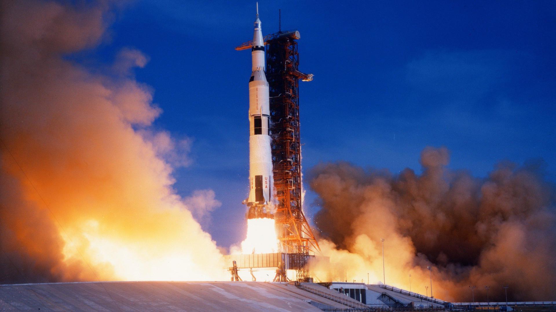
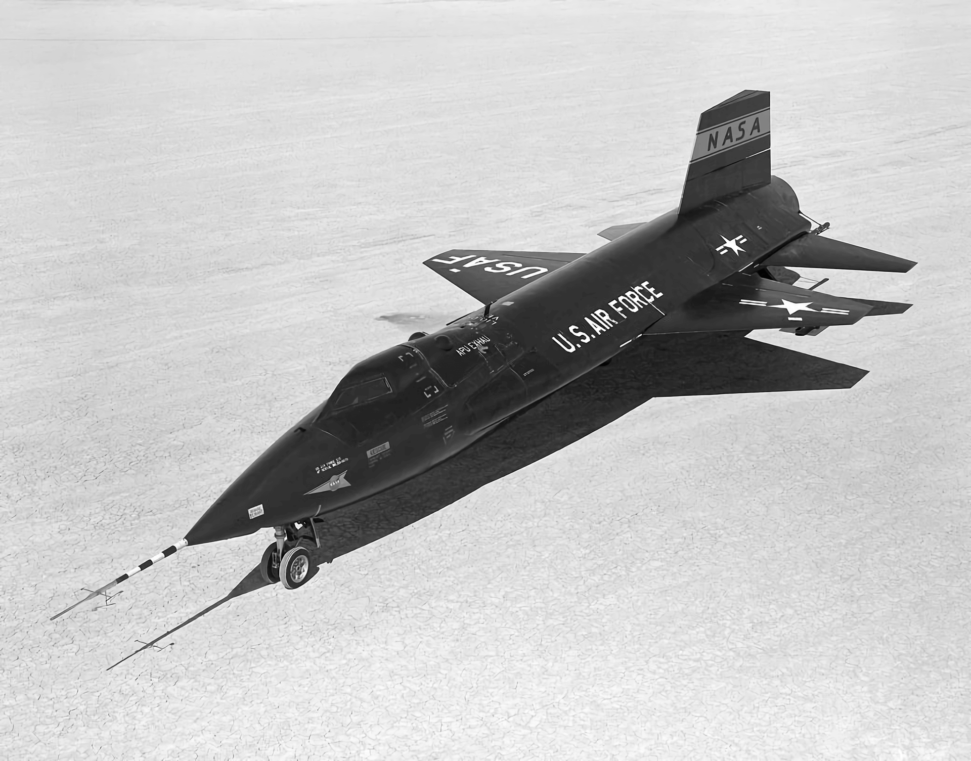
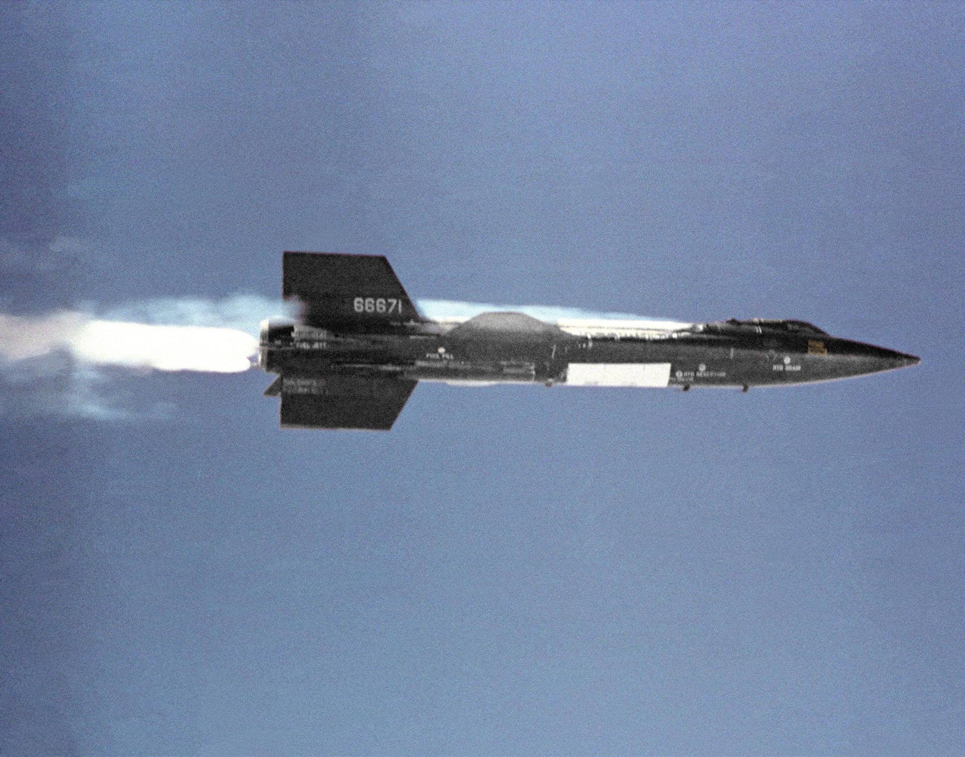
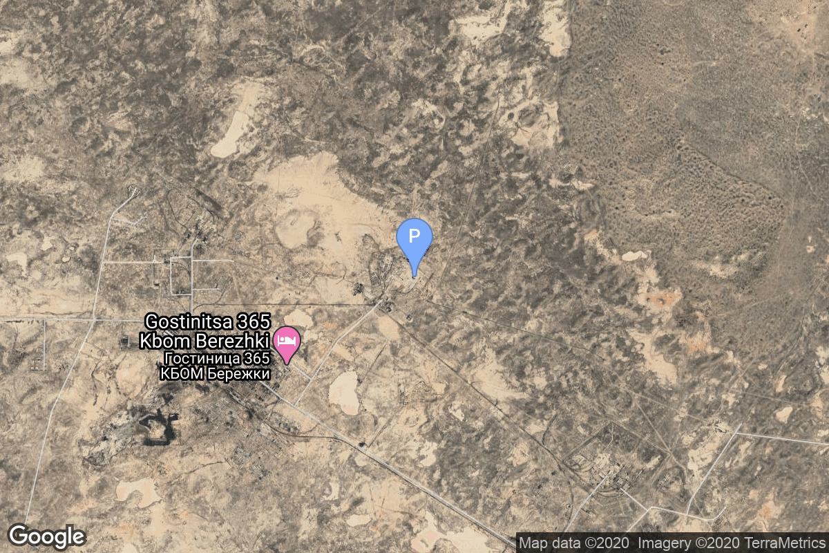
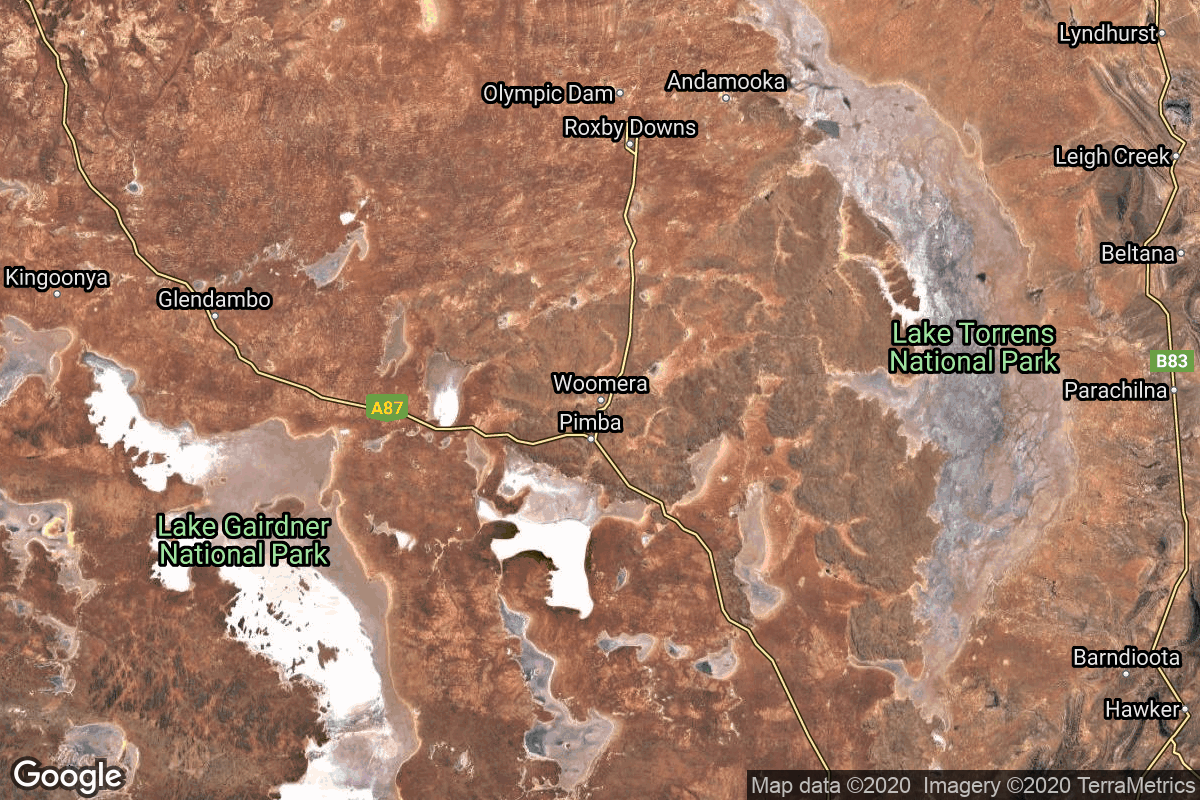
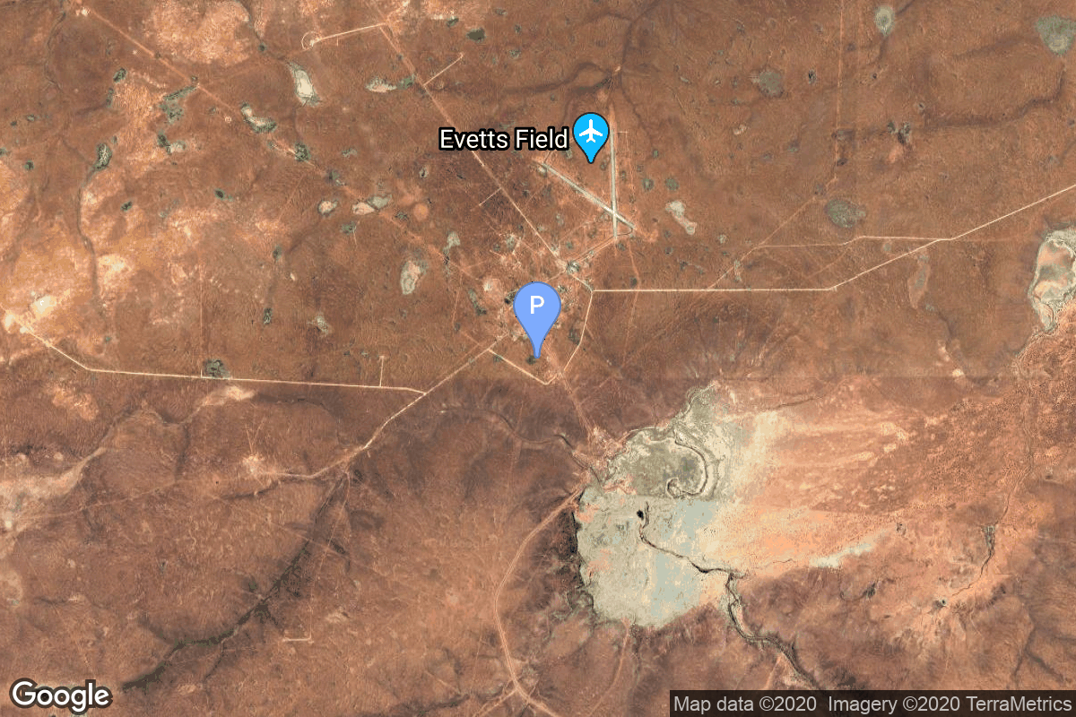
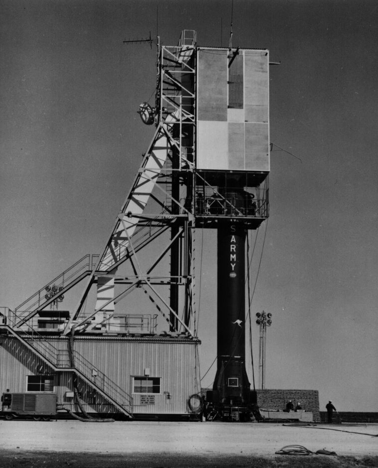
{ "count": 7505, "next": "https://ll.thespacedevs.com/2.0.0/launch/?format=api&limit=10&offset=850&ordering=net", "previous": "https://ll.thespacedevs.com/2.0.0/launch/?format=api&limit=10&offset=830&ordering=net", "results": [ { "id": "56ff394d-4170-4ad9-829e-bb8b313afd51", "url": "https://ll.thespacedevs.com/2.0.0/launch/56ff394d-4170-4ad9-829e-bb8b313afd51/?format=api", "launch_library_id": null, "slug": "atlas-slv-3-agena-d-ats-3", "name": "Atlas SLV-3 Agena D | ATS 3", "status": { "id": 3, "name": "Success" }, "net": "1967-11-05T23:37:00Z", "window_end": "1967-11-05T23:37:00Z", "window_start": "1967-11-05T23:37:00Z", "inhold": false, "tbdtime": false, "tbddate": false, "probability": null, "holdreason": "", "failreason": null, "hashtag": null, "launch_service_provider": { "id": 161, "url": "https://ll.thespacedevs.com/2.0.0/agencies/161/?format=api", "name": "United States Air Force", "type": "Government" }, "rocket": { "id": 3727, "configuration": { "id": 258, "launch_library_id": null, "url": "https://ll.thespacedevs.com/2.0.0/config/launcher/258/?format=api", "name": "Atlas SLV-3 Agena D", "family": "Atlas", "full_name": "Atlas SLV-3 Agena D", "variant": "SLV-3 Agena D" } }, "mission": { "id": 2145, "launch_library_id": null, "name": "ATS 3", "description": "ATS 3 (Applications Technology Satellite) was one of a series of spacecraft designed to demonstrate the utility and feasibility of a variety of technological and scientific activities that could be carried out by an earth-synchronous spacecraft.", "launch_designator": null, "type": "Earth Science", "orbit": { "id": 3, "name": "Geosynchronous Orbit", "abbrev": "GSO" } }, "pad": { "id": 99, "url": "https://ll.thespacedevs.com/2.0.0/pad/99/?format=api", "agency_id": 161, "name": "Launch Complex 12", "info_url": null, "wiki_url": "https://en.wikipedia.org/wiki/Cape_Canaveral_Air_Force_Station_Launch_Complex_12", "map_url": "https://www.google.com/maps?q=28.480607,-80.541938", "latitude": "28.480607", "longitude": "-80.541938", "location": { "id": 12, "url": "https://ll.thespacedevs.com/2.0.0/location/12/?format=api", "name": "Cape Canaveral SFS, FL, USA", "country_code": "USA", "map_image": "https://thespacedevs-prod.nyc3.digitaloceanspaces.com/media/map_images/location_12_20200803142519.jpg", "total_launch_count": 1024, "total_landing_count": 64 }, "map_image": "https://thespacedevs-prod.nyc3.digitaloceanspaces.com/media/map_images/pad_99_20200803143435.jpg", "total_launch_count": 23 }, "webcast_live": false, "image": null, "infographic": null, "program": [] }, { "id": "3f32490d-32cd-4bcb-9017-e5fd76cfafff", "url": "https://ll.thespacedevs.com/2.0.0/launch/3f32490d-32cd-4bcb-9017-e5fd76cfafff/?format=api", "launch_library_id": null, "slug": "atlas-slv-3c-centaur-surveyor-6", "name": "Atlas SLV-3C Centaur | Surveyor 6", "status": { "id": 3, "name": "Success" }, "net": "1967-11-07T07:39:01Z", "window_end": "1967-11-07T07:39:01Z", "window_start": "1967-11-07T07:39:01Z", "inhold": false, "tbdtime": false, "tbddate": false, "probability": null, "holdreason": "", "failreason": null, "hashtag": null, "launch_service_provider": { "id": 161, "url": "https://ll.thespacedevs.com/2.0.0/agencies/161/?format=api", "name": "United States Air Force", "type": "Government" }, "rocket": { "id": 3728, "configuration": { "id": 260, "launch_library_id": null, "url": "https://ll.thespacedevs.com/2.0.0/config/launcher/260/?format=api", "name": "Atlas SLV-3C Centaur", "family": "Atlas", "full_name": "Atlas SLV-3C Centaur", "variant": "SLV-3C Centaur" } }, "mission": { "id": 2146, "launch_library_id": null, "name": "Surveyor 6", "description": "Lunar probe which successfully landed on November 10. It transmitted 30,027 pictures.", "launch_designator": null, "type": "Lunar Exploration", "orbit": { "id": 10, "name": "Lunar Impactor", "abbrev": "Lunar Impactor" } }, "pad": { "id": 122, "url": "https://ll.thespacedevs.com/2.0.0/pad/122/?format=api", "agency_id": 161, "name": "Launch Complex 36B", "info_url": null, "wiki_url": "https://en.wikipedia.org/wiki/Cape_Canaveral_Launch_Complex_36", "map_url": "https://www.google.com/maps?q=28.4705556,-80.542194", "latitude": "28.4705556", "longitude": "-80.542194", "location": { "id": 12, "url": "https://ll.thespacedevs.com/2.0.0/location/12/?format=api", "name": "Cape Canaveral SFS, FL, USA", "country_code": "USA", "map_image": "https://thespacedevs-prod.nyc3.digitaloceanspaces.com/media/map_images/location_12_20200803142519.jpg", "total_launch_count": 1024, "total_landing_count": 64 }, "map_image": "https://thespacedevs-prod.nyc3.digitaloceanspaces.com/media/map_images/pad_122_20200803143232.jpg", "total_launch_count": 76 }, "webcast_live": false, "image": null, "infographic": null, "program": [] }, { "id": "9a2f71b1-27c8-43f9-9d7c-7d8c434371e4", "url": "https://ll.thespacedevs.com/2.0.0/launch/9a2f71b1-27c8-43f9-9d7c-7d8c434371e4/?format=api", "launch_library_id": 1376, "slug": "saturn-v-apollo-4", "name": "Saturn V | Apollo 4", "status": { "id": 3, "name": "Success" }, "net": "1967-11-09T12:00:01Z", "window_end": "1967-11-09T12:00:01Z", "window_start": "1967-11-09T12:00:01Z", "inhold": false, "tbdtime": false, "tbddate": false, "probability": -1, "holdreason": "", "failreason": "", "hashtag": null, "launch_service_provider": { "id": 44, "url": "https://ll.thespacedevs.com/2.0.0/agencies/44/?format=api", "name": "National Aeronautics and Space Administration", "type": "Government" }, "rocket": { "id": 212, "configuration": { "id": 93, "launch_library_id": 136, "url": "https://ll.thespacedevs.com/2.0.0/config/launcher/93/?format=api", "name": "Saturn V", "family": "Saturn", "full_name": "Saturn V", "variant": "V" } }, "mission": { "id": 781, "launch_library_id": 606, "name": "Apollo 4", "description": "Apollo 4 was an \"all-up\" test, meaning all rocket stages and spacecraft were fully functional on the initial flight, a first for NASA. It was the first time the S-IC first stage and S-II second stage flew. It also demonstrated the S-IVB third stage's first in-flight restart. The mission used a Block I Command Service Module (CSM) modified to test several key Block II revisions, including its heat shield at simulated lunar-return velocity and angle.", "launch_designator": null, "type": "Human Exploration", "orbit": { "id": 0, "name": "Elliptical Orbit", "abbrev": "Elliptical" } }, "pad": { "id": 87, "url": "https://ll.thespacedevs.com/2.0.0/pad/87/?format=api", "agency_id": 121, "name": "Launch Complex 39A", "info_url": null, "wiki_url": "https://en.wikipedia.org/wiki/Kennedy_Space_Center_Launch_Complex_39#Launch_Pad_39A", "map_url": "https://www.google.com/maps?q=28.60822681,-80.60428186", "latitude": "28.60822681", "longitude": "-80.60428186", "location": { "id": 27, "url": "https://ll.thespacedevs.com/2.0.0/location/27/?format=api", "name": "Kennedy Space Center, FL, USA", "country_code": "USA", "map_image": "https://thespacedevs-prod.nyc3.digitaloceanspaces.com/media/map_images/location_27_20200803142447.jpg", "total_launch_count": 265, "total_landing_count": 0 }, "map_image": "https://thespacedevs-prod.nyc3.digitaloceanspaces.com/media/map_images/pad_87_20200803143537.jpg", "total_launch_count": 207 }, "webcast_live": false, "image": "https://thespacedevs-prod.nyc3.digitaloceanspaces.com/media/images/saturn2520v_image_20190222030036.jpeg", "infographic": null, "program": [ { "id": 4, "url": "https://ll.thespacedevs.com/2.0.0/program/4/?format=api", "name": "Apollo", "description": "The Apollo program was the third United States human spaceflight program carried out by the National Aeronautics and Space Administration (NASA), which succeeded in landing the first humans on the Moon from 1969 to 1972.", "agencies": [ { "id": 44, "url": "https://ll.thespacedevs.com/2.0.0/agencies/44/?format=api", "name": "National Aeronautics and Space Administration", "type": "Government" } ], "image_url": "https://thespacedevs-prod.nyc3.digitaloceanspaces.com/media/images/apollo_program_20200820200202.png", "start_date": "1966-11-16T00:00:00Z", "end_date": "1972-12-19T19:24:59Z", "info_url": "https://www.nasa.gov/mission_pages/apollo/index.html", "wiki_url": "https://en.wikipedia.org/wiki/Apollo_program" } ] }, { "id": "433e511e-524f-4918-ac44-246fef66d845", "url": "https://ll.thespacedevs.com/2.0.0/launch/433e511e-524f-4918-ac44-246fef66d845/?format=api", "launch_library_id": null, "slug": "thor-delta-e1-essa-6", "name": "Thor Delta E1 | ESSA 6", "status": { "id": 3, "name": "Success" }, "net": "1967-11-10T17:53:08Z", "window_end": "1967-11-10T17:53:08Z", "window_start": "1967-11-10T17:53:08Z", "inhold": false, "tbdtime": false, "tbddate": false, "probability": null, "holdreason": "", "failreason": null, "hashtag": null, "launch_service_provider": { "id": 161, "url": "https://ll.thespacedevs.com/2.0.0/agencies/161/?format=api", "name": "United States Air Force", "type": "Government" }, "rocket": { "id": 3729, "configuration": { "id": 405, "launch_library_id": null, "url": "https://ll.thespacedevs.com/2.0.0/config/launcher/405/?format=api", "name": "Thor Delta E1", "family": "Thor", "full_name": "Thor Delta E1", "variant": "Delta E1" } }, "mission": { "id": 2147, "launch_library_id": null, "name": "ESSA 6", "description": "The ESSA series was the second generation of US meterological satellites after the TIROS (Television & Infra-Red Observation Satellite) series. They were also called OT (Operational TIROS), TOS (TIROS Operational Satellite).", "launch_designator": null, "type": "Earth Science", "orbit": { "id": 17, "name": "Sun-Synchronous Orbit", "abbrev": "SSO" } }, "pad": { "id": 98, "url": "https://ll.thespacedevs.com/2.0.0/pad/98/?format=api", "agency_id": 161, "name": "Space Launch Complex 2E", "info_url": null, "wiki_url": "https://en.wikipedia.org/wiki/Vandenberg_Space_Launch_Complex_2", "map_url": "https://www.google.com/maps?q=34.7516,-120.6192", "latitude": "34.7516", "longitude": "-120.6192", "location": { "id": 11, "url": "https://ll.thespacedevs.com/2.0.0/location/11/?format=api", "name": "Vandenberg SFB, CA, USA", "country_code": "USA", "map_image": "https://thespacedevs-prod.nyc3.digitaloceanspaces.com/media/map_images/location_11_20200803142416.jpg", "total_launch_count": 807, "total_landing_count": 26 }, "map_image": "https://thespacedevs-prod.nyc3.digitaloceanspaces.com/media/map_images/pad_98_20200803143228.jpg", "total_launch_count": 47 }, "webcast_live": false, "image": null, "infographic": null, "program": [] }, { "id": "4121ac6e-f2a7-4f9b-bdc0-c81c9924fd74", "url": "https://ll.thespacedevs.com/2.0.0/launch/4121ac6e-f2a7-4f9b-bdc0-c81c9924fd74/?format=api", "launch_library_id": null, "slug": "x-15-flight-191", "name": "X-15 | Flight 191", "status": { "id": 4, "name": "Failure" }, "net": "1967-11-15T18:30:00Z", "window_end": "1967-11-15T18:34:00Z", "window_start": "1967-11-15T18:30:00Z", "inhold": false, "tbdtime": false, "tbddate": false, "probability": null, "holdreason": "", "failreason": "", "hashtag": null, "launch_service_provider": { "id": 161, "url": "https://ll.thespacedevs.com/2.0.0/agencies/161/?format=api", "name": "United States Air Force", "type": "Government" }, "rocket": { "id": 2991, "configuration": { "id": 209, "launch_library_id": null, "url": "https://ll.thespacedevs.com/2.0.0/config/launcher/209/?format=api", "name": "North American X-15", "family": "", "full_name": "North American X-15", "variant": "" } }, "mission": { "id": 1416, "launch_library_id": null, "name": "Flight 191", "description": "X-15 Flight 3-65-97, also known as X-15 Flight 191 was a 1967 flight of the North American X-15. After reaching an altitude of 81.0 km, the aircraft entered a spin and broke apart mid air, killing pilot Michael J. Adams.", "launch_designator": null, "type": "Test Flight", "orbit": { "id": 15, "name": "Suborbital", "abbrev": "Sub" } }, "pad": { "id": 112, "url": "https://ll.thespacedevs.com/2.0.0/pad/112/?format=api", "agency_id": null, "name": "Edwards Air Force Base", "info_url": null, "wiki_url": "https://en.wikipedia.org/wiki/Edwards_Air_Force_Base", "map_url": "https://www.google.com/maps?q=34.905556,-117.883611", "latitude": "34.905556", "longitude": "-117.883611", "location": { "id": 144, "url": "https://ll.thespacedevs.com/2.0.0/location/144/?format=api", "name": "Air launch to Suborbital flight", "country_code": "???", "map_image": "https://thespacedevs-prod.nyc3.digitaloceanspaces.com/media/map_images/location_144_20200803142439.jpg", "total_launch_count": 86, "total_landing_count": 0 }, "map_image": "https://thespacedevs-prod.nyc3.digitaloceanspaces.com/media/map_images/pad_112_20200803143214.jpg", "total_launch_count": 13 }, "webcast_live": false, "image": "https://thespacedevs-prod.nyc3.digitaloceanspaces.com/media/images/north_american__image_20210813101104.png", "infographic": null, "program": [ { "id": 20, "url": "https://ll.thespacedevs.com/2.0.0/program/20/?format=api", "name": "X-15", "description": "Experimental hypersonic rocket-powered aircraft.", "agencies": [ { "id": 44, "url": "https://ll.thespacedevs.com/2.0.0/agencies/44/?format=api", "name": "National Aeronautics and Space Administration", "type": "Government" }, { "id": 161, "url": "https://ll.thespacedevs.com/2.0.0/agencies/161/?format=api", "name": "United States Air Force", "type": "Government" } ], "image_url": "https://thespacedevs-prod.nyc3.digitaloceanspaces.com/media/images/x-15_program_20210809102752.jpeg", "start_date": "1959-03-10T00:00:00Z", "end_date": "1968-12-12T00:00:00Z", "info_url": null, "wiki_url": "https://en.wikipedia.org/wiki/North_American_X-15" } ] }, { "id": "1f10f3dc-23e4-42cc-9a0b-2b37aac532a5", "url": "https://ll.thespacedevs.com/2.0.0/launch/1f10f3dc-23e4-42cc-9a0b-2b37aac532a5/?format=api", "launch_library_id": null, "slug": "kosmos-11k63-ds-p1-yu-11", "name": "Kosmos 11K63 | DS-P1-Yu 11", "status": { "id": 3, "name": "Success" }, "net": "1967-11-21T14:29:48Z", "window_end": "1967-11-21T14:29:48Z", "window_start": "1967-11-21T14:29:48Z", "inhold": false, "tbdtime": false, "tbddate": false, "probability": null, "holdreason": "", "failreason": null, "hashtag": null, "launch_service_provider": { "id": 66, "url": "https://ll.thespacedevs.com/2.0.0/agencies/66/?format=api", "name": "Soviet Space Program", "type": "Government" }, "rocket": { "id": 3730, "configuration": { "id": 327, "launch_library_id": null, "url": "https://ll.thespacedevs.com/2.0.0/config/launcher/327/?format=api", "name": "Kosmos 11K63", "family": "Kosmos", "full_name": "Kosmos 11K63", "variant": "11K63" } }, "mission": { "id": 2148, "launch_library_id": null, "name": "DS-P1-Yu 11", "description": "The DS-P1-Yu series of satellites was used to calibrate space surveillance and early warning radars.", "launch_designator": null, "type": "Test Target", "orbit": { "id": 8, "name": "Low Earth Orbit", "abbrev": "LEO" } }, "pad": { "id": 3, "url": "https://ll.thespacedevs.com/2.0.0/pad/3/?format=api", "agency_id": 163, "name": "133/3 (133L)", "info_url": null, "wiki_url": "", "map_url": "https://www.google.com/maps?q=62.886999,40.846984", "latitude": "62.886999", "longitude": "40.846984", "location": { "id": 6, "url": "https://ll.thespacedevs.com/2.0.0/location/6/?format=api", "name": "Plesetsk Cosmodrome, Russian Federation", "country_code": "RUS", "map_image": "https://thespacedevs-prod.nyc3.digitaloceanspaces.com/media/map_images/location_6_20200803142434.jpg", "total_launch_count": 1674, "total_landing_count": 0 }, "map_image": "https://thespacedevs-prod.nyc3.digitaloceanspaces.com/media/map_images/pad_3_20200803143438.jpg", "total_launch_count": 159 }, "webcast_live": false, "image": null, "infographic": null, "program": [] }, { "id": "7bc45146-d1f2-492e-a1b5-8e45cbb942f4", "url": "https://ll.thespacedevs.com/2.0.0/launch/7bc45146-d1f2-492e-a1b5-8e45cbb942f4/?format=api", "launch_library_id": 1895, "slug": "proton-ur-500-kd-soyuz-7k-l1-no5l", "name": "Proton / UR-500 K/D | Soyuz 7K-L1 No.5L", "status": { "id": 4, "name": "Failure" }, "net": "1967-11-22T19:07:59Z", "window_end": "1967-11-22T19:07:59Z", "window_start": "1967-11-22T19:07:59Z", "inhold": false, "tbdtime": false, "tbddate": false, "probability": 0, "holdreason": "", "failreason": "", "hashtag": "", "launch_service_provider": { "id": 66, "url": "https://ll.thespacedevs.com/2.0.0/agencies/66/?format=api", "name": "Soviet Space Program", "type": "Government" }, "rocket": { "id": 2432, "configuration": { "id": 191, "launch_library_id": 220, "url": "https://ll.thespacedevs.com/2.0.0/config/launcher/191/?format=api", "name": "Proton", "family": "Proton / UR-500", "full_name": "Proton / UR-500 K/D", "variant": "K/D" } }, "mission": null, "pad": { "id": 7, "url": "https://ll.thespacedevs.com/2.0.0/pad/7/?format=api", "agency_id": null, "name": "81/24 (81P)", "info_url": null, "wiki_url": "", "map_url": "https://www.google.com/maps?q=46.071001,62.984999", "latitude": "46.071001", "longitude": "62.984999", "location": { "id": 15, "url": "https://ll.thespacedevs.com/2.0.0/location/15/?format=api", "name": "Baikonur Cosmodrome, Republic of Kazakhstan", "country_code": "KAZ", "map_image": "https://thespacedevs-prod.nyc3.digitaloceanspaces.com/media/map_images/location_15_20200803142517.jpg", "total_launch_count": 1555, "total_landing_count": 0 }, "map_image": "https://thespacedevs-prod.nyc3.digitaloceanspaces.com/media/map_images/pad_7_20200803143454.jpg", "total_launch_count": 92 }, "webcast_live": false, "image": "https://thespacedevs-prod.nyc3.digitaloceanspaces.com/media/images/proton_image_20231231095535.jpg", "infographic": null, "program": [ { "id": 8, "url": "https://ll.thespacedevs.com/2.0.0/program/8/?format=api", "name": "Soyuz", "description": "The Soyuz programme is a human spaceflight programme initiated by the Soviet Union in the early 1960s. The Soyuz spacecraft was originally part of a Moon landing project intended to put a Soviet cosmonaut on the Moon. It was the third Soviet human spaceflight programme after the Vostok and Voskhod programmes.", "agencies": [ { "id": 63, "url": "https://ll.thespacedevs.com/2.0.0/agencies/63/?format=api", "name": "Russian Federal Space Agency (ROSCOSMOS)", "type": "Government" }, { "id": 66, "url": "https://ll.thespacedevs.com/2.0.0/agencies/66/?format=api", "name": "Soviet Space Program", "type": "Government" } ], "image_url": "https://thespacedevs-prod.nyc3.digitaloceanspaces.com/media/images/soyuz_program_20201129185543.png", "start_date": "1966-11-28T11:02:00Z", "end_date": null, "info_url": null, "wiki_url": "https://en.wikipedia.org/wiki/Soyuz_programme" } ] }, { "id": "c1f85085-ae6b-4cee-b4e2-7bf8b8e84d89", "url": "https://ll.thespacedevs.com/2.0.0/launch/c1f85085-ae6b-4cee-b4e2-7bf8b8e84d89/?format=api", "launch_library_id": null, "slug": "kosmos-3m-zaliv-1", "name": "Kosmos-3M | Zaliv 1", "status": { "id": 3, "name": "Success" }, "net": "1967-11-23T15:00:00Z", "window_end": "1967-11-23T15:00:00Z", "window_start": "1967-11-23T15:00:00Z", "inhold": false, "tbdtime": false, "tbddate": false, "probability": null, "holdreason": "", "failreason": null, "hashtag": null, "launch_service_provider": { "id": 66, "url": "https://ll.thespacedevs.com/2.0.0/agencies/66/?format=api", "name": "Soviet Space Program", "type": "Government" }, "rocket": { "id": 3731, "configuration": { "id": 102, "launch_library_id": 122, "url": "https://ll.thespacedevs.com/2.0.0/config/launcher/102/?format=api", "name": "Kosmos-3M", "family": "Kosmos", "full_name": "Kosmos-3M (11K65M)", "variant": "-3M" } }, "mission": { "id": 2149, "launch_library_id": null, "name": "Zaliv 1", "description": "The first soviet navigation system called Tsiklon consisted of Zaliv satellites in low earth orbit.", "launch_designator": null, "type": "Navigation", "orbit": { "id": 8, "name": "Low Earth Orbit", "abbrev": "LEO" } }, "pad": { "id": 167, "url": "https://ll.thespacedevs.com/2.0.0/pad/167/?format=api", "agency_id": null, "name": "132/2", "info_url": null, "wiki_url": "https://en.wikipedia.org/wiki/Plesetsk_Cosmodrome", "map_url": "https://www.google.com/maps?q=62.883,40.869806", "latitude": "62.883", "longitude": "40.869806", "location": { "id": 6, "url": "https://ll.thespacedevs.com/2.0.0/location/6/?format=api", "name": "Plesetsk Cosmodrome, Russian Federation", "country_code": "RUS", "map_image": "https://thespacedevs-prod.nyc3.digitaloceanspaces.com/media/map_images/location_6_20200803142434.jpg", "total_launch_count": 1674, "total_landing_count": 0 }, "map_image": "https://thespacedevs-prod.nyc3.digitaloceanspaces.com/media/map_images/pad_167_20200803143417.jpg", "total_launch_count": 172 }, "webcast_live": false, "image": null, "infographic": null, "program": [] }, { "id": "0504f28e-bbdb-4ae4-a85d-35f1a0074f0f", "url": "https://ll.thespacedevs.com/2.0.0/launch/0504f28e-bbdb-4ae4-a85d-35f1a0074f0f/?format=api", "launch_library_id": null, "slug": "voskhod-zenit-2-56", "name": "Voskhod | Zenit-2 56", "status": { "id": 3, "name": "Success" }, "net": "1967-11-25T11:30:00Z", "window_end": "1967-11-25T11:30:00Z", "window_start": "1967-11-25T11:30:00Z", "inhold": false, "tbdtime": false, "tbddate": false, "probability": null, "holdreason": "", "failreason": null, "hashtag": null, "launch_service_provider": { "id": 66, "url": "https://ll.thespacedevs.com/2.0.0/agencies/66/?format=api", "name": "Soviet Space Program", "type": "Government" }, "rocket": { "id": 3732, "configuration": { "id": 104, "launch_library_id": 138, "url": "https://ll.thespacedevs.com/2.0.0/config/launcher/104/?format=api", "name": "Voskhod", "family": "R-7", "full_name": "Voskhod", "variant": "Voskhod" } }, "mission": { "id": 2150, "launch_library_id": null, "name": "Zenit-2 56", "description": "Zenit-2 film-return and ELINT reconnaissance satellite.", "launch_designator": null, "type": "Government/Top Secret", "orbit": { "id": 8, "name": "Low Earth Orbit", "abbrev": "LEO" } }, "pad": { "id": 168, "url": "https://ll.thespacedevs.com/2.0.0/pad/168/?format=api", "agency_id": null, "name": "41/1", "info_url": null, "wiki_url": "https://en.wikipedia.org/wiki/Plesetsk_Cosmodrome", "map_url": "https://www.google.com/maps?q=62.941,40.526806", "latitude": "62.941", "longitude": "40.526806", "location": { "id": 6, "url": "https://ll.thespacedevs.com/2.0.0/location/6/?format=api", "name": "Plesetsk Cosmodrome, Russian Federation", "country_code": "RUS", "map_image": "https://thespacedevs-prod.nyc3.digitaloceanspaces.com/media/map_images/location_6_20200803142434.jpg", "total_launch_count": 1674, "total_landing_count": 0 }, "map_image": "https://thespacedevs-prod.nyc3.digitaloceanspaces.com/media/map_images/pad_168_20200803143446.jpg", "total_launch_count": 310 }, "webcast_live": false, "image": null, "infographic": null, "program": [] }, { "id": "5b40e5a7-bb9a-475d-a6a6-f80df686e746", "url": "https://ll.thespacedevs.com/2.0.0/launch/5b40e5a7-bb9a-475d-a6a6-f80df686e746/?format=api", "launch_library_id": null, "slug": "sparta-wresat", "name": "SPARTA | WRESAT", "status": { "id": 3, "name": "Success" }, "net": "1967-11-29T04:49:00Z", "window_end": "1967-11-29T04:49:00Z", "window_start": "1967-11-29T04:49:00Z", "inhold": false, "tbdtime": false, "tbddate": false, "probability": null, "holdreason": "", "failreason": null, "hashtag": null, "launch_service_provider": { "id": 1016, "url": "https://ll.thespacedevs.com/2.0.0/agencies/1016/?format=api", "name": "Weapons Research Establishment", "type": "Government" }, "rocket": { "id": 3733, "configuration": { "id": 354, "launch_library_id": null, "url": "https://ll.thespacedevs.com/2.0.0/config/launcher/354/?format=api", "name": "SPARTA", "family": "", "full_name": "SPARTA", "variant": "" } }, "mission": { "id": 2151, "launch_library_id": null, "name": "WRESAT", "description": "Australian satellite carrying four astrophysics experiments.", "launch_designator": null, "type": "Astrophysics", "orbit": { "id": 8, "name": "Low Earth Orbit", "abbrev": "LEO" } }, "pad": { "id": 181, "url": "https://ll.thespacedevs.com/2.0.0/pad/181/?format=api", "agency_id": null, "name": "Launch Area 8", "info_url": null, "wiki_url": "https://en.wikipedia.org/wiki/RAAF_Woomera_Range_Complex", "map_url": "https://www.google.com/maps?q=-30.9552778,136.5300282", "latitude": "-30.9552778", "longitude": "136.5300282", "location": { "id": 152, "url": "https://ll.thespacedevs.com/2.0.0/location/152/?format=api", "name": "RAAF Woomera Range Complex", "country_code": "AUS", "map_image": "https://thespacedevs-prod.nyc3.digitaloceanspaces.com/media/map_images/location_152_20200803142502.jpg", "total_launch_count": 6, "total_landing_count": 0 }, "map_image": "https://thespacedevs-prod.nyc3.digitaloceanspaces.com/media/map_images/pad_181_20200803143447.jpg", "total_launch_count": 1 }, "webcast_live": false, "image": "https://thespacedevs-prod.nyc3.digitaloceanspaces.com/media/images/sparta_rocket_o_image_20240411095008.jpeg", "infographic": null, "program": [] } ] }