Launch List
API endpoint that returns all Launch objects or a single launch.
EXAMPLE - /launch/
GET: Return a list of all Launch objects.
FILTERS: Fields - 'name', 'id(s)', 'lsp_id', 'lsp_name', 'serial_number', 'launcher_config__id', 'rocket__spacecraftflight__spacecraft__name'
MODE: 'normal', 'list', 'detailed' EXAMPLE: ?mode=list
SEARCH: Searches through the launch name, rocket name, launch agency, mission name & spacecraft name. EXAMPLE - ?search=SpaceX
GET /2.0.0/launch/?format=api&offset=830&ordering=name
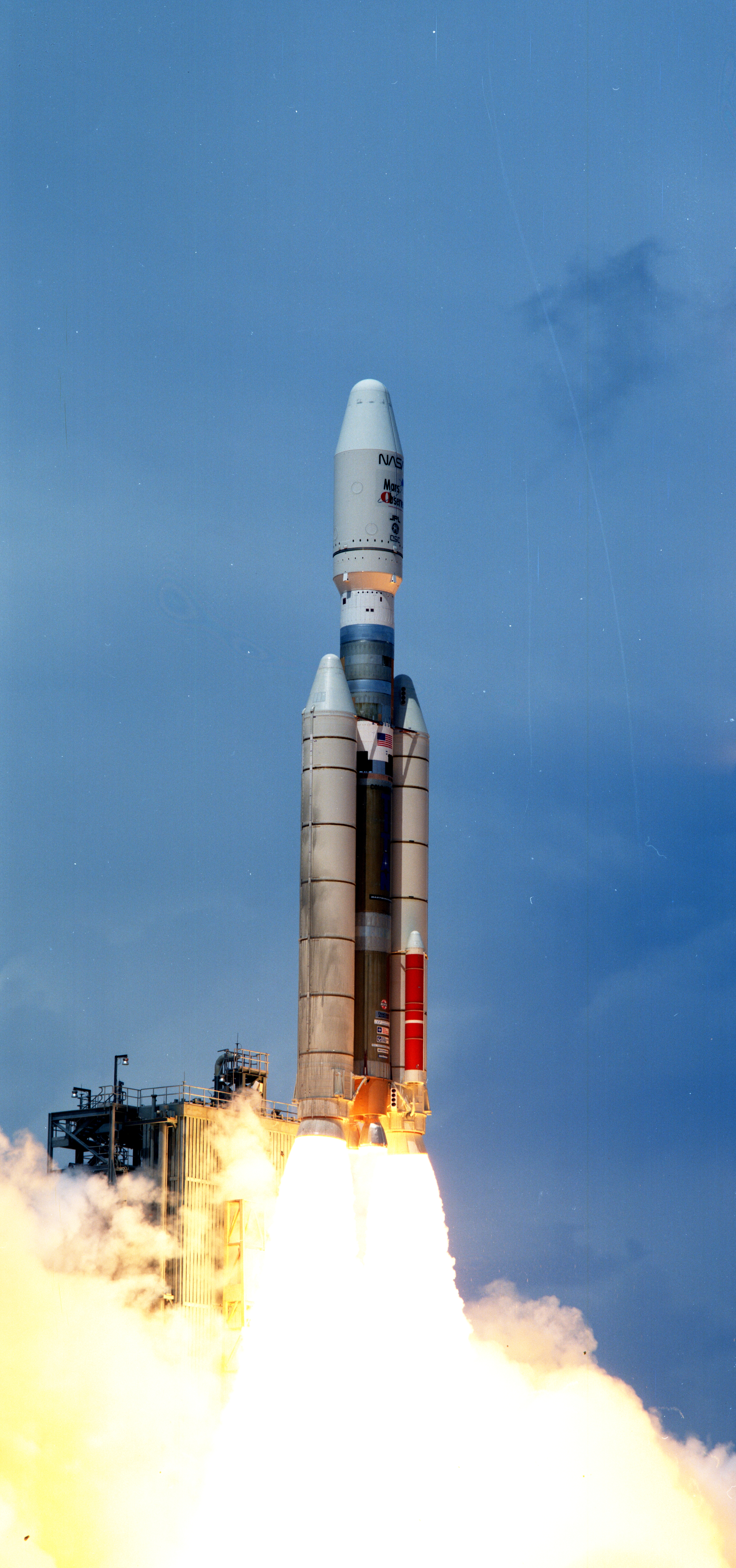
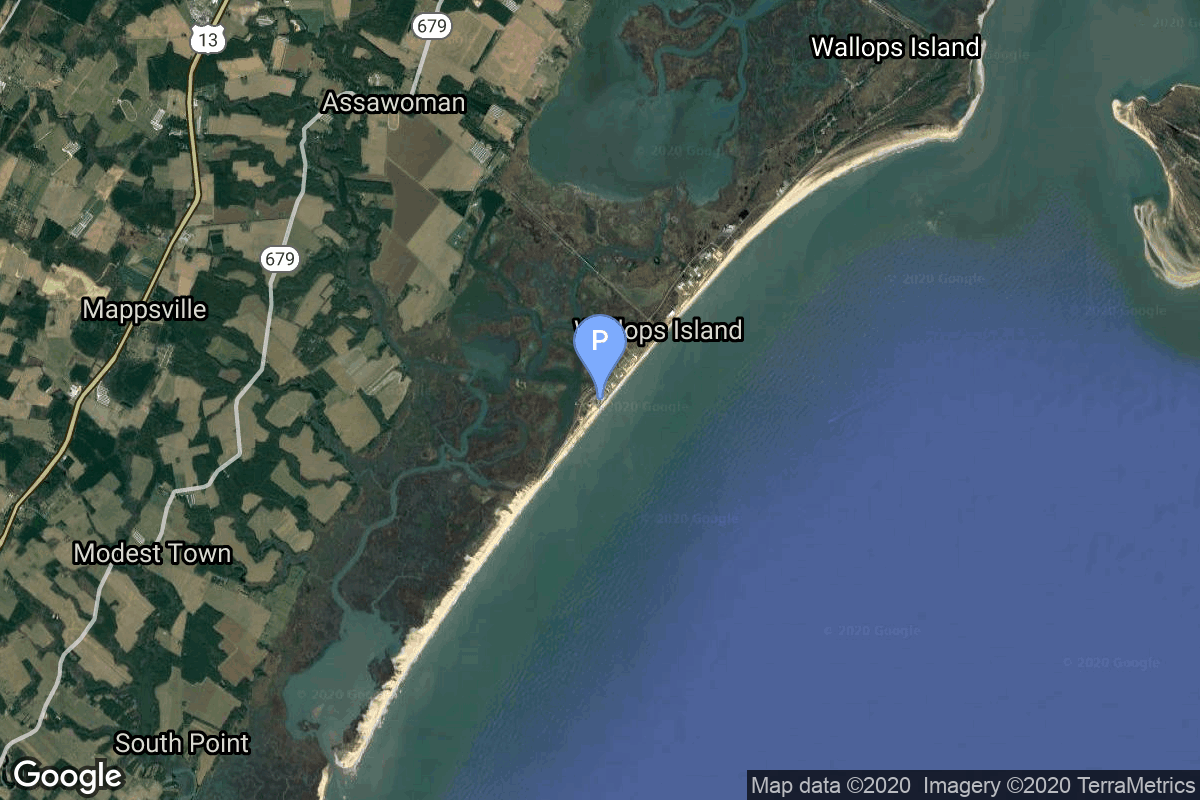
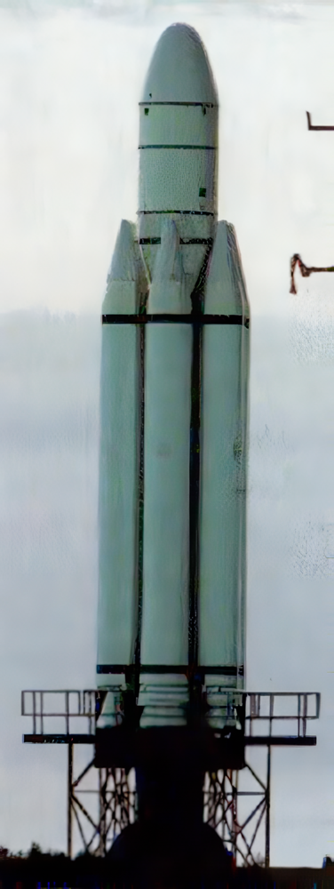
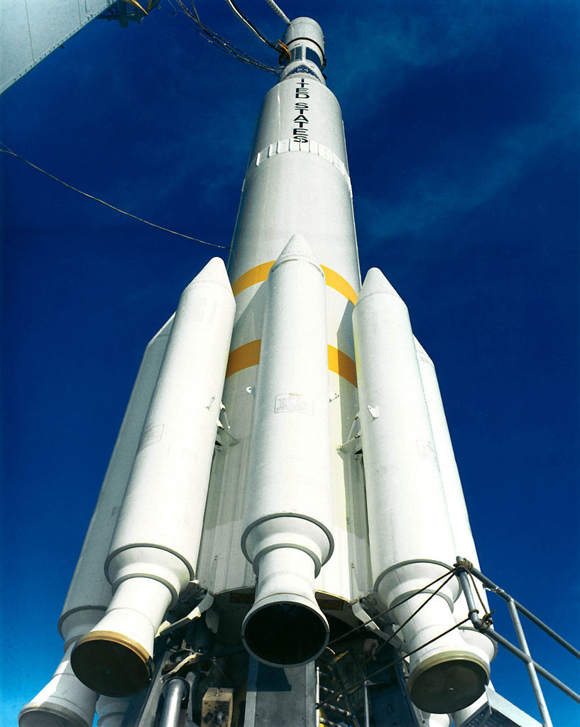
{ "count": 7505, "next": "https://ll.thespacedevs.com/2.0.0/launch/?format=api&limit=10&offset=840&ordering=name", "previous": "https://ll.thespacedevs.com/2.0.0/launch/?format=api&limit=10&offset=820&ordering=name", "results": [ { "id": "2654df79-5b87-4a04-8cb9-577b52aa89e8", "url": "https://ll.thespacedevs.com/2.0.0/launch/2654df79-5b87-4a04-8cb9-577b52aa89e8/?format=api", "launch_library_id": null, "slug": "commercial-titan-iii-skynet-4a-jcsat-2", "name": "Commercial Titan III | Skynet 4A & JCSat 2", "status": { "id": 3, "name": "Success" }, "net": "1990-01-01T00:07:00Z", "window_end": "1990-01-01T00:07:00Z", "window_start": "1990-01-01T00:07:00Z", "inhold": false, "tbdtime": false, "tbddate": false, "probability": null, "holdreason": "", "failreason": null, "hashtag": null, "launch_service_provider": { "id": 1014, "url": "https://ll.thespacedevs.com/2.0.0/agencies/1014/?format=api", "name": "Martin Marietta", "type": "Commercial" }, "rocket": { "id": 6232, "configuration": { "id": 272, "launch_library_id": null, "url": "https://ll.thespacedevs.com/2.0.0/config/launcher/272/?format=api", "name": "Commercial Titan III", "family": "Titan", "full_name": "Commercial Titan III", "variant": "III" } }, "mission": { "id": 4622, "launch_library_id": null, "name": "Skynet 4A & JCSat 2", "description": "British and Japanese geostatioary communications satellites", "launch_designator": null, "type": "Communications", "orbit": { "id": 1, "name": "Geostationary Orbit", "abbrev": "Direct-GEO" } }, "pad": { "id": 80, "url": "https://ll.thespacedevs.com/2.0.0/pad/80/?format=api", "agency_id": 121, "name": "Space Launch Complex 40", "info_url": null, "wiki_url": "https://en.wikipedia.org/wiki/Cape_Canaveral_Air_Force_Station_Space_Launch_Complex_40", "map_url": "https://www.google.com/maps?q=28.56194122,-80.57735736", "latitude": "28.56194122", "longitude": "-80.57735736", "location": { "id": 12, "url": "https://ll.thespacedevs.com/2.0.0/location/12/?format=api", "name": "Cape Canaveral SFS, FL, USA", "country_code": "USA", "map_image": "https://thespacedevs-prod.nyc3.digitaloceanspaces.com/media/map_images/location_12_20200803142519.jpg", "total_launch_count": 1024, "total_landing_count": 64 }, "map_image": "https://thespacedevs-prod.nyc3.digitaloceanspaces.com/media/map_images/pad_80_20200803143323.jpg", "total_launch_count": 308 }, "webcast_live": false, "image": "https://thespacedevs-prod.nyc3.digitaloceanspaces.com/media/images/commercial_tita_image_20240411092244.jpeg", "infographic": null, "program": [] }, { "id": "4922c17c-29f1-405d-a77b-bac8d976cfaa", "url": "https://ll.thespacedevs.com/2.0.0/launch/4922c17c-29f1-405d-a77b-bac8d976cfaa/?format=api", "launch_library_id": null, "slug": "conestoga-1620-meteor-sm", "name": "Conestoga 1620 | Meteor SM", "status": { "id": 4, "name": "Failure" }, "net": "1995-10-23T22:03:00Z", "window_end": "1995-10-23T22:03:00Z", "window_start": "1995-10-23T22:03:00Z", "inhold": false, "tbdtime": false, "tbddate": false, "probability": null, "holdreason": "", "failreason": null, "hashtag": null, "launch_service_provider": { "id": 1007, "url": "https://ll.thespacedevs.com/2.0.0/agencies/1007/?format=api", "name": "Space Services Inc.", "type": "Commercial" }, "rocket": { "id": 6689, "configuration": { "id": 273, "launch_library_id": null, "url": "https://ll.thespacedevs.com/2.0.0/config/launcher/273/?format=api", "name": "Conestoga 1620", "family": "", "full_name": "Conestoga 1620", "variant": "1620" } }, "mission": { "id": 5079, "launch_library_id": null, "name": "Meteor SM", "description": "METEOR (Multiple Experiment Transport to Earth Orbit & Return), formerly COMET (Commercial Experiment Transporter), was a NASA program to develop a commercially available experiment transporter for microgravity experiments over longer periods.", "launch_designator": null, "type": "Planetary Science", "orbit": { "id": 8, "name": "Low Earth Orbit", "abbrev": "LEO" } }, "pad": { "id": 76, "url": "https://ll.thespacedevs.com/2.0.0/pad/76/?format=api", "agency_id": 44, "name": "Launch Area 0 A", "info_url": null, "wiki_url": "https://en.wikipedia.org/wiki/Mid-Atlantic_Regional_Spaceport_Launch_Pad_0#Pad_0A", "map_url": "https://www.google.com/maps?q=37.8337,-75.4881", "latitude": "37.8337", "longitude": "-75.4881", "location": { "id": 21, "url": "https://ll.thespacedevs.com/2.0.0/location/21/?format=api", "name": "Wallops Flight Facility, Virginia, USA", "country_code": "USA", "map_image": "https://thespacedevs-prod.nyc3.digitaloceanspaces.com/media/map_images/location_21_20200803142423.jpg", "total_launch_count": 80, "total_landing_count": 0 }, "map_image": "https://thespacedevs-prod.nyc3.digitaloceanspaces.com/media/map_images/pad_76_20200803143538.jpg", "total_launch_count": 19 }, "webcast_live": false, "image": "https://thespacedevs-prod.nyc3.digitaloceanspaces.com/media/images/conestoga-1620__image_20240411094033.png", "infographic": null, "program": [] }, { "id": "fa85c4d7-d413-49d9-a32e-b5c0d56c5a7b", "url": "https://ll.thespacedevs.com/2.0.0/launch/fa85c4d7-d413-49d9-a32e-b5c0d56c5a7b/?format=api", "launch_library_id": null, "slug": "delta-0300-itos-e", "name": "Delta 0300 | ITOS E", "status": { "id": 4, "name": "Failure" }, "net": "1973-07-16T17:10:21Z", "window_end": "1973-07-16T17:10:21Z", "window_start": "1973-07-16T17:10:21Z", "inhold": false, "tbdtime": false, "tbddate": false, "probability": null, "holdreason": "", "failreason": null, "hashtag": null, "launch_service_provider": { "id": 161, "url": "https://ll.thespacedevs.com/2.0.0/agencies/161/?format=api", "name": "United States Air Force", "type": "Government" }, "rocket": { "id": 4377, "configuration": { "id": 275, "launch_library_id": null, "url": "https://ll.thespacedevs.com/2.0.0/config/launcher/275/?format=api", "name": "Delta 0300", "family": "Delta", "full_name": "Delta 0300", "variant": "0300" } }, "mission": { "id": 2795, "launch_library_id": null, "name": "ITOS E", "description": "Meteorological satellite using radiometric imaging", "launch_designator": null, "type": "Earth Science", "orbit": { "id": 17, "name": "Sun-Synchronous Orbit", "abbrev": "SSO" } }, "pad": { "id": 39, "url": "https://ll.thespacedevs.com/2.0.0/pad/39/?format=api", "agency_id": null, "name": "Space Launch Complex 2W", "info_url": null, "wiki_url": "https://en.wikipedia.org/wiki/Vandenberg_Space_Launch_Complex_2", "map_url": "https://www.google.com/maps?q=34.7556,-120.6224", "latitude": "34.7556", "longitude": "-120.6224", "location": { "id": 11, "url": "https://ll.thespacedevs.com/2.0.0/location/11/?format=api", "name": "Vandenberg SFB, CA, USA", "country_code": "USA", "map_image": "https://thespacedevs-prod.nyc3.digitaloceanspaces.com/media/map_images/location_11_20200803142416.jpg", "total_launch_count": 807, "total_landing_count": 26 }, "map_image": "https://thespacedevs-prod.nyc3.digitaloceanspaces.com/media/map_images/pad_39_20200803143542.jpg", "total_launch_count": 98 }, "webcast_live": false, "image": null, "infographic": null, "program": [] }, { "id": "ea24a82f-39e9-4ea0-b010-20215b620658", "url": "https://ll.thespacedevs.com/2.0.0/launch/ea24a82f-39e9-4ea0-b010-20215b620658/?format=api", "launch_library_id": null, "slug": "delta-0300-noaa-2", "name": "Delta 0300 | NOAA 2", "status": { "id": 3, "name": "Success" }, "net": "1972-10-15T17:19:19Z", "window_end": "1972-10-15T17:19:19Z", "window_start": "1972-10-15T17:19:19Z", "inhold": false, "tbdtime": false, "tbddate": false, "probability": null, "holdreason": "", "failreason": null, "hashtag": null, "launch_service_provider": { "id": 161, "url": "https://ll.thespacedevs.com/2.0.0/agencies/161/?format=api", "name": "United States Air Force", "type": "Government" }, "rocket": { "id": 4304, "configuration": { "id": 275, "launch_library_id": null, "url": "https://ll.thespacedevs.com/2.0.0/config/launcher/275/?format=api", "name": "Delta 0300", "family": "Delta", "full_name": "Delta 0300", "variant": "0300" } }, "mission": { "id": 2722, "launch_library_id": null, "name": "NOAA 2", "description": "Meteorological satellite using radiometric imaging", "launch_designator": null, "type": "Earth Science", "orbit": { "id": 17, "name": "Sun-Synchronous Orbit", "abbrev": "SSO" } }, "pad": { "id": 39, "url": "https://ll.thespacedevs.com/2.0.0/pad/39/?format=api", "agency_id": null, "name": "Space Launch Complex 2W", "info_url": null, "wiki_url": "https://en.wikipedia.org/wiki/Vandenberg_Space_Launch_Complex_2", "map_url": "https://www.google.com/maps?q=34.7556,-120.6224", "latitude": "34.7556", "longitude": "-120.6224", "location": { "id": 11, "url": "https://ll.thespacedevs.com/2.0.0/location/11/?format=api", "name": "Vandenberg SFB, CA, USA", "country_code": "USA", "map_image": "https://thespacedevs-prod.nyc3.digitaloceanspaces.com/media/map_images/location_11_20200803142416.jpg", "total_launch_count": 807, "total_landing_count": 26 }, "map_image": "https://thespacedevs-prod.nyc3.digitaloceanspaces.com/media/map_images/pad_39_20200803143542.jpg", "total_launch_count": 98 }, "webcast_live": false, "image": null, "infographic": null, "program": [] }, { "id": "100d627c-4835-4fe2-a3b4-8e17c0ff6765", "url": "https://ll.thespacedevs.com/2.0.0/launch/100d627c-4835-4fe2-a3b4-8e17c0ff6765/?format=api", "launch_library_id": null, "slug": "delta-0300-noaa-3", "name": "Delta 0300 | NOAA 3", "status": { "id": 3, "name": "Success" }, "net": "1973-11-06T17:02:00Z", "window_end": "1973-11-06T17:02:00Z", "window_start": "1973-11-06T17:02:00Z", "inhold": false, "tbdtime": false, "tbddate": false, "probability": null, "holdreason": "", "failreason": null, "hashtag": null, "launch_service_provider": { "id": 161, "url": "https://ll.thespacedevs.com/2.0.0/agencies/161/?format=api", "name": "United States Air Force", "type": "Government" }, "rocket": { "id": 4416, "configuration": { "id": 275, "launch_library_id": null, "url": "https://ll.thespacedevs.com/2.0.0/config/launcher/275/?format=api", "name": "Delta 0300", "family": "Delta", "full_name": "Delta 0300", "variant": "0300" } }, "mission": { "id": 2834, "launch_library_id": null, "name": "NOAA 3", "description": "Meteorological satellite using radiometric imaging", "launch_designator": null, "type": "Earth Science", "orbit": { "id": 17, "name": "Sun-Synchronous Orbit", "abbrev": "SSO" } }, "pad": { "id": 39, "url": "https://ll.thespacedevs.com/2.0.0/pad/39/?format=api", "agency_id": null, "name": "Space Launch Complex 2W", "info_url": null, "wiki_url": "https://en.wikipedia.org/wiki/Vandenberg_Space_Launch_Complex_2", "map_url": "https://www.google.com/maps?q=34.7556,-120.6224", "latitude": "34.7556", "longitude": "-120.6224", "location": { "id": 11, "url": "https://ll.thespacedevs.com/2.0.0/location/11/?format=api", "name": "Vandenberg SFB, CA, USA", "country_code": "USA", "map_image": "https://thespacedevs-prod.nyc3.digitaloceanspaces.com/media/map_images/location_11_20200803142416.jpg", "total_launch_count": 807, "total_landing_count": 26 }, "map_image": "https://thespacedevs-prod.nyc3.digitaloceanspaces.com/media/map_images/pad_39_20200803143542.jpg", "total_launch_count": 98 }, "webcast_live": false, "image": null, "infographic": null, "program": [] }, { "id": "b4749d8d-25ba-4402-9dc6-d13d4a110c78", "url": "https://ll.thespacedevs.com/2.0.0/launch/b4749d8d-25ba-4402-9dc6-d13d4a110c78/?format=api", "launch_library_id": null, "slug": "delta-0900-landsat-1", "name": "Delta 0900 | Landsat 1", "status": { "id": 3, "name": "Success" }, "net": "1972-07-23T18:06:06Z", "window_end": "1972-07-23T18:06:06Z", "window_start": "1972-07-23T18:06:06Z", "inhold": false, "tbdtime": false, "tbddate": false, "probability": null, "holdreason": "", "failreason": "", "hashtag": null, "launch_service_provider": { "id": 161, "url": "https://ll.thespacedevs.com/2.0.0/agencies/161/?format=api", "name": "United States Air Force", "type": "Government" }, "rocket": { "id": 4278, "configuration": { "id": 276, "launch_library_id": null, "url": "https://ll.thespacedevs.com/2.0.0/config/launcher/276/?format=api", "name": "Delta 0900", "family": "Delta", "full_name": "Delta 0900", "variant": "0900" } }, "mission": { "id": 2696, "launch_library_id": null, "name": "Landsat 1", "description": "Earth observation satellite", "launch_designator": null, "type": "Earth Science", "orbit": { "id": 17, "name": "Sun-Synchronous Orbit", "abbrev": "SSO" } }, "pad": { "id": 39, "url": "https://ll.thespacedevs.com/2.0.0/pad/39/?format=api", "agency_id": null, "name": "Space Launch Complex 2W", "info_url": null, "wiki_url": "https://en.wikipedia.org/wiki/Vandenberg_Space_Launch_Complex_2", "map_url": "https://www.google.com/maps?q=34.7556,-120.6224", "latitude": "34.7556", "longitude": "-120.6224", "location": { "id": 11, "url": "https://ll.thespacedevs.com/2.0.0/location/11/?format=api", "name": "Vandenberg SFB, CA, USA", "country_code": "USA", "map_image": "https://thespacedevs-prod.nyc3.digitaloceanspaces.com/media/map_images/location_11_20200803142416.jpg", "total_launch_count": 807, "total_landing_count": 26 }, "map_image": "https://thespacedevs-prod.nyc3.digitaloceanspaces.com/media/map_images/pad_39_20200803143542.jpg", "total_launch_count": 98 }, "webcast_live": false, "image": "https://thespacedevs-prod.nyc3.digitaloceanspaces.com/media/images/delta_0900_image_20231231081129.jpg", "infographic": null, "program": [ { "id": 31, "url": "https://ll.thespacedevs.com/2.0.0/program/31/?format=api", "name": "Landsat", "description": "The Landsat program is the longest-running enterprise for acquisition of satellite imagery of Earth. It is a joint NASA / USGS program.", "agencies": [ { "id": 44, "url": "https://ll.thespacedevs.com/2.0.0/agencies/44/?format=api", "name": "National Aeronautics and Space Administration", "type": "Government" } ], "image_url": "https://thespacedevs-prod.nyc3.digitaloceanspaces.com/media/images/landsat_program_20231230154736.jpeg", "start_date": "1972-07-23T00:00:00Z", "end_date": null, "info_url": null, "wiki_url": "https://en.wikipedia.org/wiki/Landsat_program" } ] }, { "id": "db98b4e7-f262-4a92-bb70-70aae3782fb2", "url": "https://ll.thespacedevs.com/2.0.0/launch/db98b4e7-f262-4a92-bb70-70aae3782fb2/?format=api", "launch_library_id": null, "slug": "delta-0900-nimbus-5", "name": "Delta 0900 | Nimbus 5", "status": { "id": 3, "name": "Success" }, "net": "1972-12-11T07:56:00Z", "window_end": "1972-12-11T07:56:00Z", "window_start": "1972-12-11T07:56:00Z", "inhold": false, "tbdtime": false, "tbddate": false, "probability": null, "holdreason": "", "failreason": null, "hashtag": null, "launch_service_provider": { "id": 161, "url": "https://ll.thespacedevs.com/2.0.0/agencies/161/?format=api", "name": "United States Air Force", "type": "Government" }, "rocket": { "id": 4319, "configuration": { "id": 276, "launch_library_id": null, "url": "https://ll.thespacedevs.com/2.0.0/config/launcher/276/?format=api", "name": "Delta 0900", "family": "Delta", "full_name": "Delta 0900", "variant": "0900" } }, "mission": { "id": 2737, "launch_library_id": null, "name": "Nimbus 5", "description": "Satellite used to test advanced meteorological sensor systems", "launch_designator": null, "type": "Earth Science", "orbit": { "id": 8, "name": "Low Earth Orbit", "abbrev": "LEO" } }, "pad": { "id": 39, "url": "https://ll.thespacedevs.com/2.0.0/pad/39/?format=api", "agency_id": null, "name": "Space Launch Complex 2W", "info_url": null, "wiki_url": "https://en.wikipedia.org/wiki/Vandenberg_Space_Launch_Complex_2", "map_url": "https://www.google.com/maps?q=34.7556,-120.6224", "latitude": "34.7556", "longitude": "-120.6224", "location": { "id": 11, "url": "https://ll.thespacedevs.com/2.0.0/location/11/?format=api", "name": "Vandenberg SFB, CA, USA", "country_code": "USA", "map_image": "https://thespacedevs-prod.nyc3.digitaloceanspaces.com/media/map_images/location_11_20200803142416.jpg", "total_launch_count": 807, "total_landing_count": 26 }, "map_image": "https://thespacedevs-prod.nyc3.digitaloceanspaces.com/media/map_images/pad_39_20200803143542.jpg", "total_launch_count": 98 }, "webcast_live": false, "image": "https://thespacedevs-prod.nyc3.digitaloceanspaces.com/media/images/delta_0900_image_20231231081129.jpg", "infographic": null, "program": [] }, { "id": "00614ede-e91a-497f-a897-841e684cdcba", "url": "https://ll.thespacedevs.com/2.0.0/launch/00614ede-e91a-497f-a897-841e684cdcba/?format=api", "launch_library_id": null, "slug": "delta-1410-geos-3", "name": "Delta 1410 | Geos 3", "status": { "id": 3, "name": "Success" }, "net": "1975-04-09T23:58:02Z", "window_end": "1975-04-09T23:58:02Z", "window_start": "1975-04-09T23:58:02Z", "inhold": false, "tbdtime": false, "tbddate": false, "probability": null, "holdreason": "", "failreason": null, "hashtag": null, "launch_service_provider": { "id": 161, "url": "https://ll.thespacedevs.com/2.0.0/agencies/161/?format=api", "name": "United States Air Force", "type": "Government" }, "rocket": { "id": 4567, "configuration": { "id": 277, "launch_library_id": null, "url": "https://ll.thespacedevs.com/2.0.0/config/launcher/277/?format=api", "name": "Delta 1410", "family": "Delta", "full_name": "Delta 1410", "variant": "1410" } }, "mission": { "id": 2985, "launch_library_id": null, "name": "Geos 3", "description": "Geodetic research satellite", "launch_designator": null, "type": "Earth Science", "orbit": { "id": 8, "name": "Low Earth Orbit", "abbrev": "LEO" } }, "pad": { "id": 39, "url": "https://ll.thespacedevs.com/2.0.0/pad/39/?format=api", "agency_id": null, "name": "Space Launch Complex 2W", "info_url": null, "wiki_url": "https://en.wikipedia.org/wiki/Vandenberg_Space_Launch_Complex_2", "map_url": "https://www.google.com/maps?q=34.7556,-120.6224", "latitude": "34.7556", "longitude": "-120.6224", "location": { "id": 11, "url": "https://ll.thespacedevs.com/2.0.0/location/11/?format=api", "name": "Vandenberg SFB, CA, USA", "country_code": "USA", "map_image": "https://thespacedevs-prod.nyc3.digitaloceanspaces.com/media/map_images/location_11_20200803142416.jpg", "total_launch_count": 807, "total_landing_count": 26 }, "map_image": "https://thespacedevs-prod.nyc3.digitaloceanspaces.com/media/map_images/pad_39_20200803143542.jpg", "total_launch_count": 98 }, "webcast_live": false, "image": null, "infographic": null, "program": [] }, { "id": "5d00af1c-5334-4b3f-aeb7-a61d42eac5f9", "url": "https://ll.thespacedevs.com/2.0.0/launch/5d00af1c-5334-4b3f-aeb7-a61d42eac5f9/?format=api", "launch_library_id": null, "slug": "delta-1604-imp-7", "name": "Delta 1604 | IMP 7", "status": { "id": 3, "name": "Success" }, "net": "1972-09-23T01:20:00Z", "window_end": "1972-09-23T01:20:00Z", "window_start": "1972-09-23T01:20:00Z", "inhold": false, "tbdtime": false, "tbddate": false, "probability": null, "holdreason": "", "failreason": null, "hashtag": null, "launch_service_provider": { "id": 161, "url": "https://ll.thespacedevs.com/2.0.0/agencies/161/?format=api", "name": "United States Air Force", "type": "Government" }, "rocket": { "id": 4295, "configuration": { "id": 278, "launch_library_id": null, "url": "https://ll.thespacedevs.com/2.0.0/config/launcher/278/?format=api", "name": "Delta 1604", "family": "Delta", "full_name": "Delta 1604", "variant": "1604" } }, "mission": { "id": 2713, "launch_library_id": null, "name": "IMP 7", "description": "Earth-orbiting satellite designed to study interplanetary and outer magnetospheric regions.", "launch_designator": null, "type": "Astrophysics", "orbit": { "id": 0, "name": "Elliptical Orbit", "abbrev": "Elliptical" } }, "pad": { "id": 1, "url": "https://ll.thespacedevs.com/2.0.0/pad/1/?format=api", "agency_id": null, "name": "Space Launch Complex 17B", "info_url": null, "wiki_url": "https://en.wikipedia.org/wiki/Cape_Canaveral_Space_Launch_Complex_17", "map_url": "https://www.google.com/maps?q=28.4458,-80.5657", "latitude": "28.4458", "longitude": "-80.5657", "location": { "id": 12, "url": "https://ll.thespacedevs.com/2.0.0/location/12/?format=api", "name": "Cape Canaveral SFS, FL, USA", "country_code": "USA", "map_image": "https://thespacedevs-prod.nyc3.digitaloceanspaces.com/media/map_images/location_12_20200803142519.jpg", "total_launch_count": 1024, "total_landing_count": 64 }, "map_image": "https://thespacedevs-prod.nyc3.digitaloceanspaces.com/media/map_images/pad_1_20200803143208.jpg", "total_launch_count": 132 }, "webcast_live": false, "image": null, "infographic": null, "program": [] }, { "id": "4b575897-55d3-46fc-b265-a8ca4c4645c2", "url": "https://ll.thespacedevs.com/2.0.0/launch/4b575897-55d3-46fc-b265-a8ca4c4645c2/?format=api", "launch_library_id": null, "slug": "delta-1604-imp-8", "name": "Delta 1604 | IMP 8", "status": { "id": 3, "name": "Success" }, "net": "1973-10-26T02:26:03Z", "window_end": "1973-10-26T02:26:03Z", "window_start": "1973-10-26T02:26:03Z", "inhold": false, "tbdtime": false, "tbddate": false, "probability": null, "holdreason": "", "failreason": null, "hashtag": null, "launch_service_provider": { "id": 161, "url": "https://ll.thespacedevs.com/2.0.0/agencies/161/?format=api", "name": "United States Air Force", "type": "Government" }, "rocket": { "id": 4408, "configuration": { "id": 278, "launch_library_id": null, "url": "https://ll.thespacedevs.com/2.0.0/config/launcher/278/?format=api", "name": "Delta 1604", "family": "Delta", "full_name": "Delta 1604", "variant": "1604" } }, "mission": { "id": 2826, "launch_library_id": null, "name": "IMP 8", "description": "Earth-orbiting satellite designed to study interplanetary and outer magnetospheric regions.", "launch_designator": null, "type": "Astrophysics", "orbit": { "id": 0, "name": "Elliptical Orbit", "abbrev": "Elliptical" } }, "pad": { "id": 1, "url": "https://ll.thespacedevs.com/2.0.0/pad/1/?format=api", "agency_id": null, "name": "Space Launch Complex 17B", "info_url": null, "wiki_url": "https://en.wikipedia.org/wiki/Cape_Canaveral_Space_Launch_Complex_17", "map_url": "https://www.google.com/maps?q=28.4458,-80.5657", "latitude": "28.4458", "longitude": "-80.5657", "location": { "id": 12, "url": "https://ll.thespacedevs.com/2.0.0/location/12/?format=api", "name": "Cape Canaveral SFS, FL, USA", "country_code": "USA", "map_image": "https://thespacedevs-prod.nyc3.digitaloceanspaces.com/media/map_images/location_12_20200803142519.jpg", "total_launch_count": 1024, "total_landing_count": 64 }, "map_image": "https://thespacedevs-prod.nyc3.digitaloceanspaces.com/media/map_images/pad_1_20200803143208.jpg", "total_launch_count": 132 }, "webcast_live": false, "image": null, "infographic": null, "program": [] } ] }