Launch List
API endpoint that returns all Launch objects or a single launch.
EXAMPLE - /launch/
GET: Return a list of all Launch objects.
FILTERS: Fields - 'name', 'id(s)', 'lsp_id', 'lsp_name', 'serial_number', 'launcher_config__id', 'rocket__spacecraftflight__spacecraft__name'
MODE: 'normal', 'list', 'detailed' EXAMPLE: ?mode=list
SEARCH: Searches through the launch name, rocket name, launch agency, mission name & spacecraft name. EXAMPLE - ?search=SpaceX
GET /2.0.0/launch/?format=api&offset=820&ordering=name
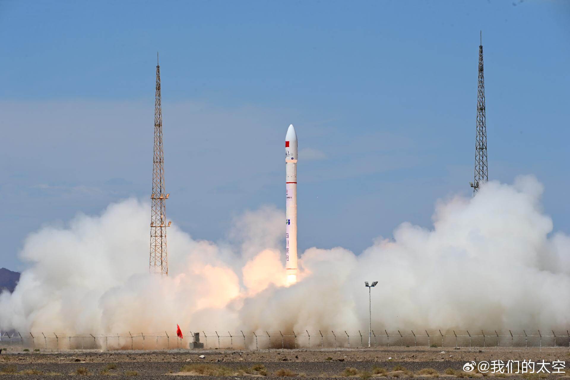
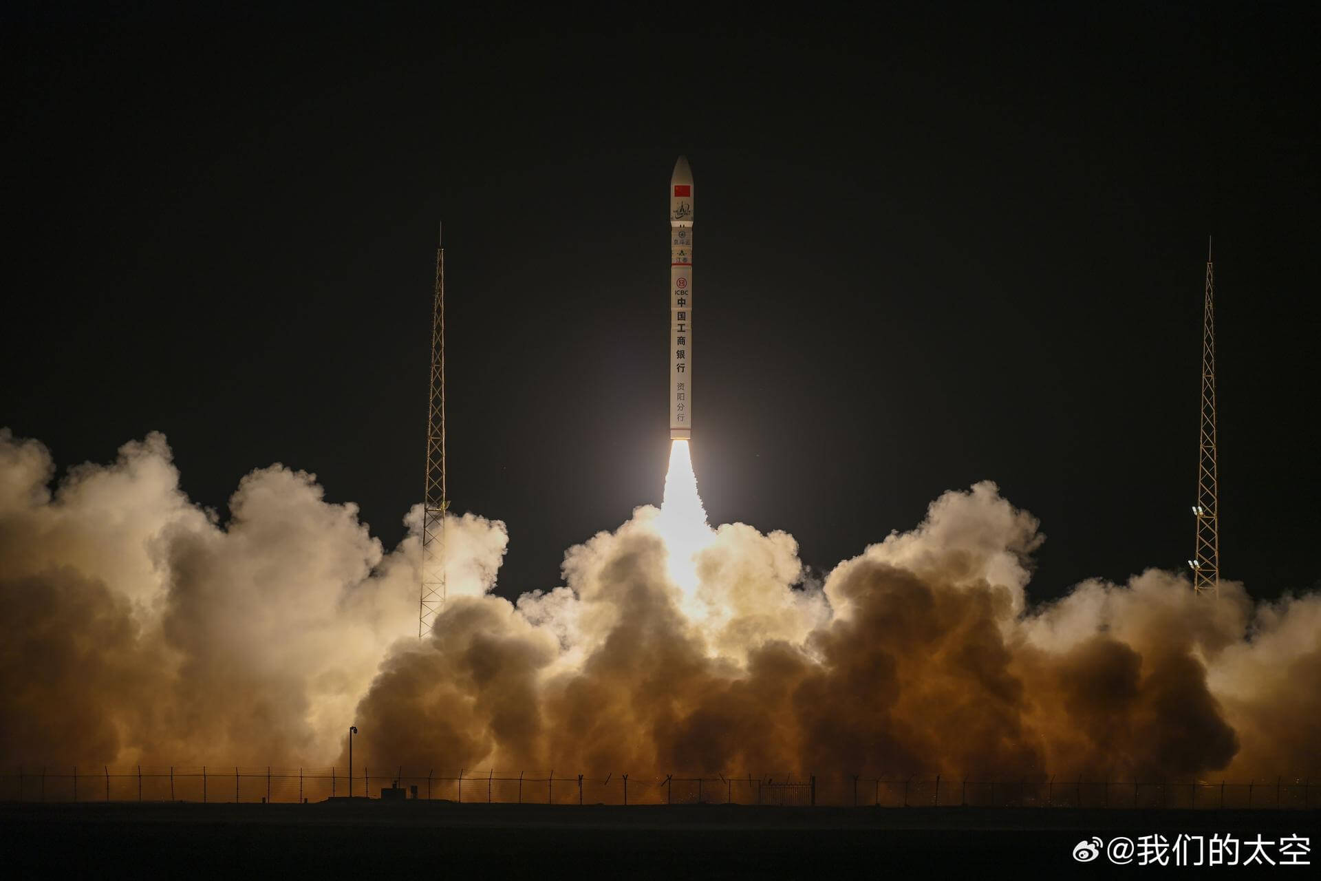
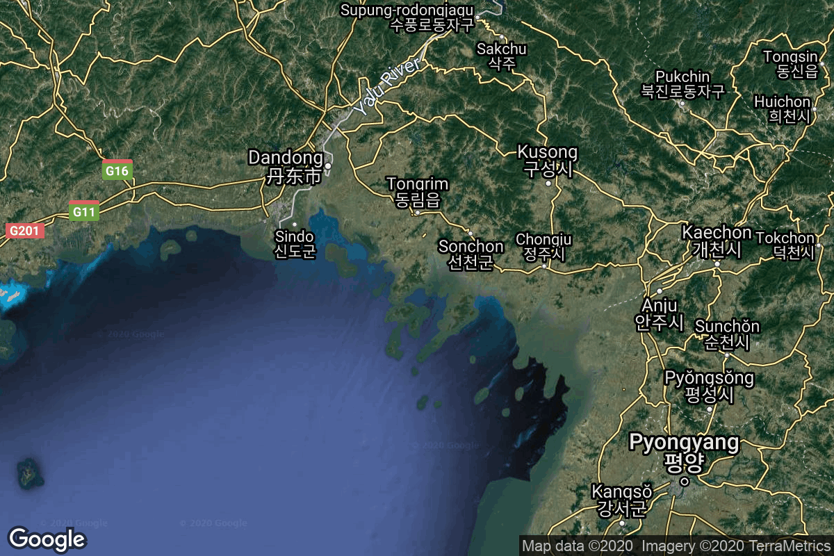
{ "count": 7505, "next": "https://ll.thespacedevs.com/2.0.0/launch/?format=api&limit=10&offset=830&ordering=name", "previous": "https://ll.thespacedevs.com/2.0.0/launch/?format=api&limit=10&offset=810&ordering=name", "results": [ { "id": "93bd93e5-4f5c-4730-b65e-11f9770168ca", "url": "https://ll.thespacedevs.com/2.0.0/launch/93bd93e5-4f5c-4730-b65e-11f9770168ca/?format=api", "launch_library_id": null, "slug": "ceres-1-tianqi-11", "name": "Ceres-1 | Tianqi-11", "status": { "id": 3, "name": "Success" }, "net": "2020-11-07T07:12:00Z", "window_end": "2020-11-07T07:42:00Z", "window_start": "2020-11-07T07:06:00Z", "inhold": false, "tbdtime": false, "tbddate": false, "probability": null, "holdreason": "", "failreason": "", "hashtag": null, "launch_service_provider": { "id": 1021, "url": "https://ll.thespacedevs.com/2.0.0/agencies/1021/?format=api", "name": "Galactic Energy", "type": "Commercial" }, "rocket": { "id": 2806, "configuration": { "id": 461, "launch_library_id": null, "url": "https://ll.thespacedevs.com/2.0.0/config/launcher/461/?format=api", "name": "Ceres-1", "family": "Ceres-1", "full_name": "Ceres-1", "variant": "Ceres-1" } }, "mission": { "id": 1206, "launch_library_id": null, "name": "Tianqi-11", "description": "Tianqi (also transcribed Tiange) is a series of small Chinese experimental LEO comsats by Guodian Gaoke for IoT (Internet of Things) communications, which are also carrying a camera for educational purposes.\r\n\r\nGuodian Gaoke plans to operate an IoT constellation. The \"Apocalypse Constellation\" provides users with much-needed data collection and transmission services for terrestrial network coverage blind areas, which are widely used in marine, environmental protection, meteorological, forestry, geological, emergency, rescue and smart city industries to enhance China's global data network coverage and application capabilities are of strategic importance.", "launch_designator": null, "type": "Communications", "orbit": { "id": 17, "name": "Sun-Synchronous Orbit", "abbrev": "SSO" } }, "pad": { "id": 21, "url": "https://ll.thespacedevs.com/2.0.0/pad/21/?format=api", "agency_id": null, "name": "Launch Area 95A", "info_url": null, "wiki_url": "https://en.wikipedia.org/wiki/Jiuquan_Satellite_Launch_Center", "map_url": "https://www.google.com/maps?q=40.969117,100.343333", "latitude": "40.969117", "longitude": "100.343333", "location": { "id": 17, "url": "https://ll.thespacedevs.com/2.0.0/location/17/?format=api", "name": "Jiuquan Satellite Launch Center, People's Republic of China", "country_code": "CHN", "map_image": "https://thespacedevs-prod.nyc3.digitaloceanspaces.com/media/map_images/location_17_20200803142429.jpg", "total_launch_count": 251, "total_landing_count": 0 }, "map_image": "https://thespacedevs-prod.nyc3.digitaloceanspaces.com/media/map_images/pad_21_20200803143253.jpg", "total_launch_count": 59 }, "webcast_live": false, "image": "https://thespacedevs-prod.nyc3.digitaloceanspaces.com/media/images/ceres-1_image_20230722081939.jpeg", "infographic": null, "program": [] }, { "id": "85a274e3-f171-4f6b-9469-3bd8ab9f2fe6", "url": "https://ll.thespacedevs.com/2.0.0/launch/85a274e3-f171-4f6b-9469-3bd8ab9f2fe6/?format=api", "launch_library_id": null, "slug": "ceres-1-tianyan-16-starpool-01a", "name": "Ceres-1 | Tianyan-16 & Starpool-01A", "status": { "id": 3, "name": "Success" }, "net": "2023-12-04T23:33:00Z", "window_end": "2023-12-05T00:21:00Z", "window_start": "2023-12-04T23:24:00Z", "inhold": false, "tbdtime": false, "tbddate": false, "probability": null, "holdreason": "", "failreason": "", "hashtag": null, "launch_service_provider": { "id": 1021, "url": "https://ll.thespacedevs.com/2.0.0/agencies/1021/?format=api", "name": "Galactic Energy", "type": "Commercial" }, "rocket": { "id": 8108, "configuration": { "id": 461, "launch_library_id": null, "url": "https://ll.thespacedevs.com/2.0.0/config/launcher/461/?format=api", "name": "Ceres-1", "family": "Ceres-1", "full_name": "Ceres-1", "variant": "Ceres-1" } }, "mission": { "id": 6666, "launch_library_id": null, "name": "Tianyan-16 & Starpool-01A", "description": "2 Earth observation and/or communication satellites for MinoSpace (Tianyan-16) & ELLISPACE (Starpool-01A).", "launch_designator": null, "type": "Earth Science", "orbit": { "id": 17, "name": "Sun-Synchronous Orbit", "abbrev": "SSO" } }, "pad": { "id": 21, "url": "https://ll.thespacedevs.com/2.0.0/pad/21/?format=api", "agency_id": null, "name": "Launch Area 95A", "info_url": null, "wiki_url": "https://en.wikipedia.org/wiki/Jiuquan_Satellite_Launch_Center", "map_url": "https://www.google.com/maps?q=40.969117,100.343333", "latitude": "40.969117", "longitude": "100.343333", "location": { "id": 17, "url": "https://ll.thespacedevs.com/2.0.0/location/17/?format=api", "name": "Jiuquan Satellite Launch Center, People's Republic of China", "country_code": "CHN", "map_image": "https://thespacedevs-prod.nyc3.digitaloceanspaces.com/media/map_images/location_17_20200803142429.jpg", "total_launch_count": 251, "total_landing_count": 0 }, "map_image": "https://thespacedevs-prod.nyc3.digitaloceanspaces.com/media/map_images/pad_21_20200803143253.jpg", "total_launch_count": 59 }, "webcast_live": false, "image": "https://thespacedevs-prod.nyc3.digitaloceanspaces.com/media/images/ceres-1252025_image_20231205052346.jpeg", "infographic": null, "program": [] }, { "id": "558c07d5-625d-4b83-b7a0-91d3de5797ae", "url": "https://ll.thespacedevs.com/2.0.0/launch/558c07d5-625d-4b83-b7a0-91d3de5797ae/?format=api", "launch_library_id": null, "slug": "ceres-1-yunyao-1-43-48", "name": "Ceres-1 | Yunyao-1 43-48", "status": { "id": 3, "name": "Success" }, "net": "2025-03-21T11:07:00Z", "window_end": "2025-03-21T11:47:00Z", "window_start": "2025-03-21T11:00:00Z", "inhold": false, "tbdtime": false, "tbddate": false, "probability": null, "holdreason": "", "failreason": "", "hashtag": null, "launch_service_provider": { "id": 1021, "url": "https://ll.thespacedevs.com/2.0.0/agencies/1021/?format=api", "name": "Galactic Energy", "type": "Commercial" }, "rocket": { "id": 8554, "configuration": { "id": 461, "launch_library_id": null, "url": "https://ll.thespacedevs.com/2.0.0/config/launcher/461/?format=api", "name": "Ceres-1", "family": "Ceres-1", "full_name": "Ceres-1", "variant": "Ceres-1" } }, "mission": { "id": 7145, "launch_library_id": null, "name": "Yunyao-1 43-48", "description": "6 weather satellites performing atmospheric measurements using GNSS Radio Occultation for a Tianjin based company. Constellation is planned to have an eventual 90 satellites.", "launch_designator": null, "type": "Earth Science", "orbit": { "id": 17, "name": "Sun-Synchronous Orbit", "abbrev": "SSO" } }, "pad": { "id": 21, "url": "https://ll.thespacedevs.com/2.0.0/pad/21/?format=api", "agency_id": null, "name": "Launch Area 95A", "info_url": null, "wiki_url": "https://en.wikipedia.org/wiki/Jiuquan_Satellite_Launch_Center", "map_url": "https://www.google.com/maps?q=40.969117,100.343333", "latitude": "40.969117", "longitude": "100.343333", "location": { "id": 17, "url": "https://ll.thespacedevs.com/2.0.0/location/17/?format=api", "name": "Jiuquan Satellite Launch Center, People's Republic of China", "country_code": "CHN", "map_image": "https://thespacedevs-prod.nyc3.digitaloceanspaces.com/media/map_images/location_17_20200803142429.jpg", "total_launch_count": 251, "total_landing_count": 0 }, "map_image": "https://thespacedevs-prod.nyc3.digitaloceanspaces.com/media/map_images/pad_21_20200803143253.jpg", "total_launch_count": 59 }, "webcast_live": false, "image": "https://thespacedevs-prod.nyc3.digitaloceanspaces.com/media/images/ceres-1_image_20230722081939.jpeg", "infographic": null, "program": [] }, { "id": "431324cc-16cb-4608-bfa2-d6fcaee73684", "url": "https://ll.thespacedevs.com/2.0.0/launch/431324cc-16cb-4608-bfa2-d6fcaee73684/?format=api", "launch_library_id": null, "slug": "chollima-1-malligyong-1-1", "name": "Chollima-1 | Malligyong-1-1", "status": { "id": 4, "name": "Failure" }, "net": "2024-05-27T13:44:00Z", "window_end": "2024-05-27T13:44:00Z", "window_start": "2024-05-27T13:44:00Z", "inhold": false, "tbdtime": false, "tbddate": false, "probability": null, "holdreason": "", "failreason": "", "hashtag": null, "launch_service_provider": { "id": 1074, "url": "https://ll.thespacedevs.com/2.0.0/agencies/1074/?format=api", "name": "National Aerospace Development Administration", "type": "Government" }, "rocket": { "id": 8254, "configuration": { "id": 495, "launch_library_id": null, "url": "https://ll.thespacedevs.com/2.0.0/config/launcher/495/?format=api", "name": "Chollima-1", "family": "Taepodong", "full_name": "Chollima-1", "variant": "Chollima-1" } }, "mission": { "id": 6835, "launch_library_id": null, "name": "Malligyong-1-1", "description": "Malligyong-1-1 (meaning \"Telescope-1\") is the fourth attempt by North Korea to launch a satellite officially declared to be for military reconnaissance purposes, and the third failure one.", "launch_designator": null, "type": "Government/Top Secret", "orbit": { "id": 17, "name": "Sun-Synchronous Orbit", "abbrev": "SSO" } }, "pad": { "id": 208, "url": "https://ll.thespacedevs.com/2.0.0/pad/208/?format=api", "agency_id": null, "name": "Malligyong-1 Pad", "info_url": null, "wiki_url": null, "map_url": "https://goo.gl/maps/DgkrTCHCsAcw1CWR7", "latitude": "39.652861", "longitude": "124.736639", "location": { "id": 7, "url": "https://ll.thespacedevs.com/2.0.0/location/7/?format=api", "name": "Sohae Satellite Launching Station, Cholsan County, North Pyongan Province, Democratic People's Republic of Korea", "country_code": "PRK", "map_image": "https://thespacedevs-prod.nyc3.digitaloceanspaces.com/media/map_images/location_7_20200803142414.jpg", "total_launch_count": 7, "total_landing_count": 0 }, "map_image": "https://thespacedevs-prod.nyc3.digitaloceanspaces.com/media/map_images/pad_unknown_pad_prk_2023_20230601125308.jpg", "total_launch_count": 4 }, "webcast_live": false, "image": "https://thespacedevs-prod.nyc3.digitaloceanspaces.com/media/images/chollima-1_lift_image_20240919165247.jpeg", "infographic": null, "program": [] }, { "id": "4aa4088f-4129-4f32-8a89-751f2a54288b", "url": "https://ll.thespacedevs.com/2.0.0/launch/4aa4088f-4129-4f32-8a89-751f2a54288b/?format=api", "launch_library_id": null, "slug": "chollima-1-malligyong-1a", "name": "Chollima-1 | Malligyong-1a", "status": { "id": 4, "name": "Failure" }, "net": "2023-05-30T21:27:00Z", "window_end": "2023-05-30T21:27:00Z", "window_start": "2023-05-30T21:27:00Z", "inhold": false, "tbdtime": false, "tbddate": false, "probability": null, "holdreason": "", "failreason": "Officially declared to be a 2nd stage engine failure after start-up.", "hashtag": null, "launch_service_provider": { "id": 1074, "url": "https://ll.thespacedevs.com/2.0.0/agencies/1074/?format=api", "name": "National Aerospace Development Administration", "type": "Government" }, "rocket": { "id": 7882, "configuration": { "id": 495, "launch_library_id": null, "url": "https://ll.thespacedevs.com/2.0.0/config/launcher/495/?format=api", "name": "Chollima-1", "family": "Taepodong", "full_name": "Chollima-1", "variant": "Chollima-1" } }, "mission": { "id": 6389, "launch_library_id": null, "name": "Malligyong-1a", "description": "Malligyong-1a (meaning \"Telescope-1\") was the first attempt by North Korea to launch a satellite officially declared to be for military reconnaissance purposes. It failed to reach orbit.", "launch_designator": null, "type": "Government/Top Secret", "orbit": { "id": 8, "name": "Low Earth Orbit", "abbrev": "LEO" } }, "pad": { "id": 208, "url": "https://ll.thespacedevs.com/2.0.0/pad/208/?format=api", "agency_id": null, "name": "Malligyong-1 Pad", "info_url": null, "wiki_url": null, "map_url": "https://goo.gl/maps/DgkrTCHCsAcw1CWR7", "latitude": "39.652861", "longitude": "124.736639", "location": { "id": 7, "url": "https://ll.thespacedevs.com/2.0.0/location/7/?format=api", "name": "Sohae Satellite Launching Station, Cholsan County, North Pyongan Province, Democratic People's Republic of Korea", "country_code": "PRK", "map_image": "https://thespacedevs-prod.nyc3.digitaloceanspaces.com/media/map_images/location_7_20200803142414.jpg", "total_launch_count": 7, "total_landing_count": 0 }, "map_image": "https://thespacedevs-prod.nyc3.digitaloceanspaces.com/media/map_images/pad_unknown_pad_prk_2023_20230601125308.jpg", "total_launch_count": 4 }, "webcast_live": false, "image": "https://thespacedevs-prod.nyc3.digitaloceanspaces.com/media/images/chollima-1_lift_image_20240919165247.jpeg", "infographic": null, "program": [] }, { "id": "b3950eeb-e69a-465a-8c73-78dd2180028c", "url": "https://ll.thespacedevs.com/2.0.0/launch/b3950eeb-e69a-465a-8c73-78dd2180028c/?format=api", "launch_library_id": null, "slug": "chollima-1-malligyong-1b", "name": "Chollima-1 | Malligyong-1b", "status": { "id": 4, "name": "Failure" }, "net": "2023-08-23T18:54:00Z", "window_end": "2023-08-23T18:54:00Z", "window_start": "2023-08-23T18:54:00Z", "inhold": false, "tbdtime": false, "tbddate": false, "probability": null, "holdreason": "", "failreason": "", "hashtag": null, "launch_service_provider": { "id": 1074, "url": "https://ll.thespacedevs.com/2.0.0/agencies/1074/?format=api", "name": "National Aerospace Development Administration", "type": "Government" }, "rocket": { "id": 7993, "configuration": { "id": 495, "launch_library_id": null, "url": "https://ll.thespacedevs.com/2.0.0/config/launcher/495/?format=api", "name": "Chollima-1", "family": "Taepodong", "full_name": "Chollima-1", "variant": "Chollima-1" } }, "mission": { "id": 6524, "launch_library_id": null, "name": "Malligyong-1b", "description": "Malligyong-1b (meaning \"Telescope-1\") was the second attempt by North Korea to launch a satellite officially declared to be for military reconnaissance purposes. It failed to reach orbit.", "launch_designator": null, "type": "Government/Top Secret", "orbit": { "id": 8, "name": "Low Earth Orbit", "abbrev": "LEO" } }, "pad": { "id": 208, "url": "https://ll.thespacedevs.com/2.0.0/pad/208/?format=api", "agency_id": null, "name": "Malligyong-1 Pad", "info_url": null, "wiki_url": null, "map_url": "https://goo.gl/maps/DgkrTCHCsAcw1CWR7", "latitude": "39.652861", "longitude": "124.736639", "location": { "id": 7, "url": "https://ll.thespacedevs.com/2.0.0/location/7/?format=api", "name": "Sohae Satellite Launching Station, Cholsan County, North Pyongan Province, Democratic People's Republic of Korea", "country_code": "PRK", "map_image": "https://thespacedevs-prod.nyc3.digitaloceanspaces.com/media/map_images/location_7_20200803142414.jpg", "total_launch_count": 7, "total_landing_count": 0 }, "map_image": "https://thespacedevs-prod.nyc3.digitaloceanspaces.com/media/map_images/pad_unknown_pad_prk_2023_20230601125308.jpg", "total_launch_count": 4 }, "webcast_live": false, "image": "https://thespacedevs-prod.nyc3.digitaloceanspaces.com/media/images/chollima-1_lift_image_20240919165247.jpeg", "infographic": null, "program": [] }, { "id": "b16513d8-1821-4418-8d06-dc821ec1808c", "url": "https://ll.thespacedevs.com/2.0.0/launch/b16513d8-1821-4418-8d06-dc821ec1808c/?format=api", "launch_library_id": null, "slug": "chollima-1-malligyong-1c", "name": "Chollima-1 | Malligyong-1c", "status": { "id": 3, "name": "Success" }, "net": "2023-11-21T13:42:58Z", "window_end": "2023-11-21T13:42:58Z", "window_start": "2023-11-21T13:42:58Z", "inhold": false, "tbdtime": false, "tbddate": false, "probability": null, "holdreason": "", "failreason": "", "hashtag": null, "launch_service_provider": { "id": 1074, "url": "https://ll.thespacedevs.com/2.0.0/agencies/1074/?format=api", "name": "National Aerospace Development Administration", "type": "Government" }, "rocket": { "id": 8018, "configuration": { "id": 495, "launch_library_id": null, "url": "https://ll.thespacedevs.com/2.0.0/config/launcher/495/?format=api", "name": "Chollima-1", "family": "Taepodong", "full_name": "Chollima-1", "variant": "Chollima-1" } }, "mission": { "id": 6554, "launch_library_id": null, "name": "Malligyong-1c", "description": "Malligyong-1c (meaning \"Telescope-1\") is the third attempt by North Korea to launch a satellite officially declared to be for military reconnaissance purposes, and the first successful one. It became the third North Korean satellite to reach orbit.", "launch_designator": null, "type": "Government/Top Secret", "orbit": { "id": 17, "name": "Sun-Synchronous Orbit", "abbrev": "SSO" } }, "pad": { "id": 208, "url": "https://ll.thespacedevs.com/2.0.0/pad/208/?format=api", "agency_id": null, "name": "Malligyong-1 Pad", "info_url": null, "wiki_url": null, "map_url": "https://goo.gl/maps/DgkrTCHCsAcw1CWR7", "latitude": "39.652861", "longitude": "124.736639", "location": { "id": 7, "url": "https://ll.thespacedevs.com/2.0.0/location/7/?format=api", "name": "Sohae Satellite Launching Station, Cholsan County, North Pyongan Province, Democratic People's Republic of Korea", "country_code": "PRK", "map_image": "https://thespacedevs-prod.nyc3.digitaloceanspaces.com/media/map_images/location_7_20200803142414.jpg", "total_launch_count": 7, "total_landing_count": 0 }, "map_image": "https://thespacedevs-prod.nyc3.digitaloceanspaces.com/media/map_images/pad_unknown_pad_prk_2023_20230601125308.jpg", "total_launch_count": 4 }, "webcast_live": false, "image": "https://thespacedevs-prod.nyc3.digitaloceanspaces.com/media/images/chollima-1_lift_image_20240919165247.jpeg", "infographic": null, "program": [] }, { "id": "83cda989-eb5d-4b19-9c2d-4a4ea3ee9ca6", "url": "https://ll.thespacedevs.com/2.0.0/launch/83cda989-eb5d-4b19-9c2d-4a4ea3ee9ca6/?format=api", "launch_library_id": null, "slug": "commercial-titan-iii-intelsat-603", "name": "Commercial Titan III | Intelsat 603", "status": { "id": 3, "name": "Success" }, "net": "1990-03-14T11:52:31Z", "window_end": "1990-03-14T11:52:31Z", "window_start": "1990-03-14T11:52:31Z", "inhold": false, "tbdtime": false, "tbddate": false, "probability": null, "holdreason": "", "failreason": null, "hashtag": null, "launch_service_provider": { "id": 1014, "url": "https://ll.thespacedevs.com/2.0.0/agencies/1014/?format=api", "name": "Martin Marietta", "type": "Commercial" }, "rocket": { "id": 6249, "configuration": { "id": 272, "launch_library_id": null, "url": "https://ll.thespacedevs.com/2.0.0/config/launcher/272/?format=api", "name": "Commercial Titan III", "family": "Titan", "full_name": "Commercial Titan III", "variant": "III" } }, "mission": { "id": 4639, "launch_library_id": null, "name": "Intelsat 603", "description": "Geostationary communications satellite", "launch_designator": null, "type": "Communications", "orbit": { "id": 1, "name": "Geostationary Orbit", "abbrev": "Direct-GEO" } }, "pad": { "id": 80, "url": "https://ll.thespacedevs.com/2.0.0/pad/80/?format=api", "agency_id": 121, "name": "Space Launch Complex 40", "info_url": null, "wiki_url": "https://en.wikipedia.org/wiki/Cape_Canaveral_Air_Force_Station_Space_Launch_Complex_40", "map_url": "https://www.google.com/maps?q=28.56194122,-80.57735736", "latitude": "28.56194122", "longitude": "-80.57735736", "location": { "id": 12, "url": "https://ll.thespacedevs.com/2.0.0/location/12/?format=api", "name": "Cape Canaveral SFS, FL, USA", "country_code": "USA", "map_image": "https://thespacedevs-prod.nyc3.digitaloceanspaces.com/media/map_images/location_12_20200803142519.jpg", "total_launch_count": 1024, "total_landing_count": 64 }, "map_image": "https://thespacedevs-prod.nyc3.digitaloceanspaces.com/media/map_images/pad_80_20200803143323.jpg", "total_launch_count": 308 }, "webcast_live": false, "image": "https://thespacedevs-prod.nyc3.digitaloceanspaces.com/media/images/commercial_tita_image_20240411092244.jpeg", "infographic": null, "program": [] }, { "id": "c48bfd47-a4c7-4fd3-9a95-c8726667f484", "url": "https://ll.thespacedevs.com/2.0.0/launch/c48bfd47-a4c7-4fd3-9a95-c8726667f484/?format=api", "launch_library_id": null, "slug": "commercial-titan-iii-intelsat-604", "name": "Commercial Titan III | Intelsat 604", "status": { "id": 3, "name": "Success" }, "net": "1990-06-23T11:19:00Z", "window_end": "1990-06-23T11:19:00Z", "window_start": "1990-06-23T11:19:00Z", "inhold": false, "tbdtime": false, "tbddate": false, "probability": null, "holdreason": "", "failreason": null, "hashtag": null, "launch_service_provider": { "id": 1014, "url": "https://ll.thespacedevs.com/2.0.0/agencies/1014/?format=api", "name": "Martin Marietta", "type": "Commercial" }, "rocket": { "id": 6282, "configuration": { "id": 272, "launch_library_id": null, "url": "https://ll.thespacedevs.com/2.0.0/config/launcher/272/?format=api", "name": "Commercial Titan III", "family": "Titan", "full_name": "Commercial Titan III", "variant": "III" } }, "mission": { "id": 4672, "launch_library_id": null, "name": "Intelsat 604", "description": "Geostationary communications satellite", "launch_designator": null, "type": "Communications", "orbit": { "id": 1, "name": "Geostationary Orbit", "abbrev": "Direct-GEO" } }, "pad": { "id": 80, "url": "https://ll.thespacedevs.com/2.0.0/pad/80/?format=api", "agency_id": 121, "name": "Space Launch Complex 40", "info_url": null, "wiki_url": "https://en.wikipedia.org/wiki/Cape_Canaveral_Air_Force_Station_Space_Launch_Complex_40", "map_url": "https://www.google.com/maps?q=28.56194122,-80.57735736", "latitude": "28.56194122", "longitude": "-80.57735736", "location": { "id": 12, "url": "https://ll.thespacedevs.com/2.0.0/location/12/?format=api", "name": "Cape Canaveral SFS, FL, USA", "country_code": "USA", "map_image": "https://thespacedevs-prod.nyc3.digitaloceanspaces.com/media/map_images/location_12_20200803142519.jpg", "total_launch_count": 1024, "total_landing_count": 64 }, "map_image": "https://thespacedevs-prod.nyc3.digitaloceanspaces.com/media/map_images/pad_80_20200803143323.jpg", "total_launch_count": 308 }, "webcast_live": false, "image": "https://thespacedevs-prod.nyc3.digitaloceanspaces.com/media/images/commercial_tita_image_20240411092244.jpeg", "infographic": null, "program": [] }, { "id": "e49a80e4-6949-47f6-922c-75414e168856", "url": "https://ll.thespacedevs.com/2.0.0/launch/e49a80e4-6949-47f6-922c-75414e168856/?format=api", "launch_library_id": null, "slug": "commercial-titan-iii-mars-observer", "name": "Commercial Titan III | Mars Observer", "status": { "id": 3, "name": "Success" }, "net": "1992-09-25T17:05:01Z", "window_end": "1992-09-25T17:05:01Z", "window_start": "1992-09-25T17:05:01Z", "inhold": false, "tbdtime": false, "tbddate": false, "probability": null, "holdreason": "", "failreason": null, "hashtag": null, "launch_service_provider": { "id": 1014, "url": "https://ll.thespacedevs.com/2.0.0/agencies/1014/?format=api", "name": "Martin Marietta", "type": "Commercial" }, "rocket": { "id": 6468, "configuration": { "id": 272, "launch_library_id": null, "url": "https://ll.thespacedevs.com/2.0.0/config/launcher/272/?format=api", "name": "Commercial Titan III", "family": "Titan", "full_name": "Commercial Titan III", "variant": "III" } }, "mission": { "id": 4858, "launch_library_id": null, "name": "Mars Observer", "description": "Mars Observer, the first of the Observer series of planetary missions, was designed to study the geoscience and climate of Mars.", "launch_designator": null, "type": "Planetary Science", "orbit": { "id": 6, "name": "Heliocentric N/A", "abbrev": "Helio-N/A" } }, "pad": { "id": 80, "url": "https://ll.thespacedevs.com/2.0.0/pad/80/?format=api", "agency_id": 121, "name": "Space Launch Complex 40", "info_url": null, "wiki_url": "https://en.wikipedia.org/wiki/Cape_Canaveral_Air_Force_Station_Space_Launch_Complex_40", "map_url": "https://www.google.com/maps?q=28.56194122,-80.57735736", "latitude": "28.56194122", "longitude": "-80.57735736", "location": { "id": 12, "url": "https://ll.thespacedevs.com/2.0.0/location/12/?format=api", "name": "Cape Canaveral SFS, FL, USA", "country_code": "USA", "map_image": "https://thespacedevs-prod.nyc3.digitaloceanspaces.com/media/map_images/location_12_20200803142519.jpg", "total_launch_count": 1024, "total_landing_count": 64 }, "map_image": "https://thespacedevs-prod.nyc3.digitaloceanspaces.com/media/map_images/pad_80_20200803143323.jpg", "total_launch_count": 308 }, "webcast_live": false, "image": "https://thespacedevs-prod.nyc3.digitaloceanspaces.com/media/images/commercial_tita_image_20240411092244.jpeg", "infographic": null, "program": [] } ] }