Launch List
API endpoint that returns all Launch objects or a single launch.
EXAMPLE - /launch/
GET: Return a list of all Launch objects.
FILTERS: Fields - 'name', 'id(s)', 'lsp_id', 'lsp_name', 'serial_number', 'launcher_config__id', 'rocket__spacecraftflight__spacecraft__name'
MODE: 'normal', 'list', 'detailed' EXAMPLE: ?mode=list
SEARCH: Searches through the launch name, rocket name, launch agency, mission name & spacecraft name. EXAMPLE - ?search=SpaceX
GET /2.0.0/launch/?format=api&offset=80&ordering=id
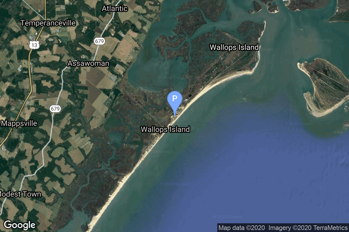
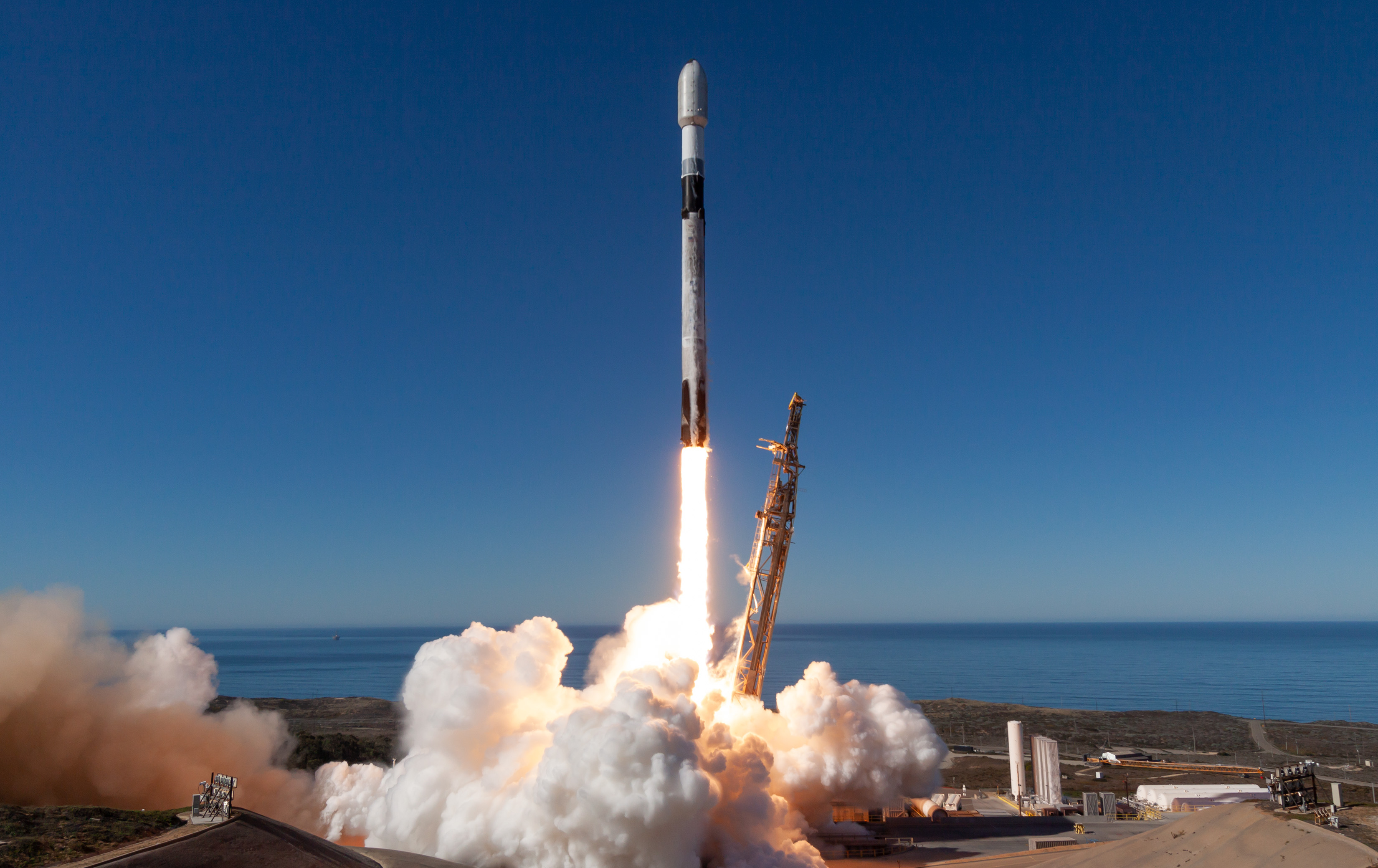
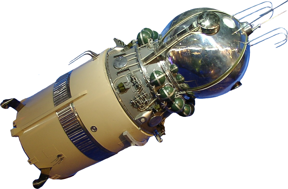
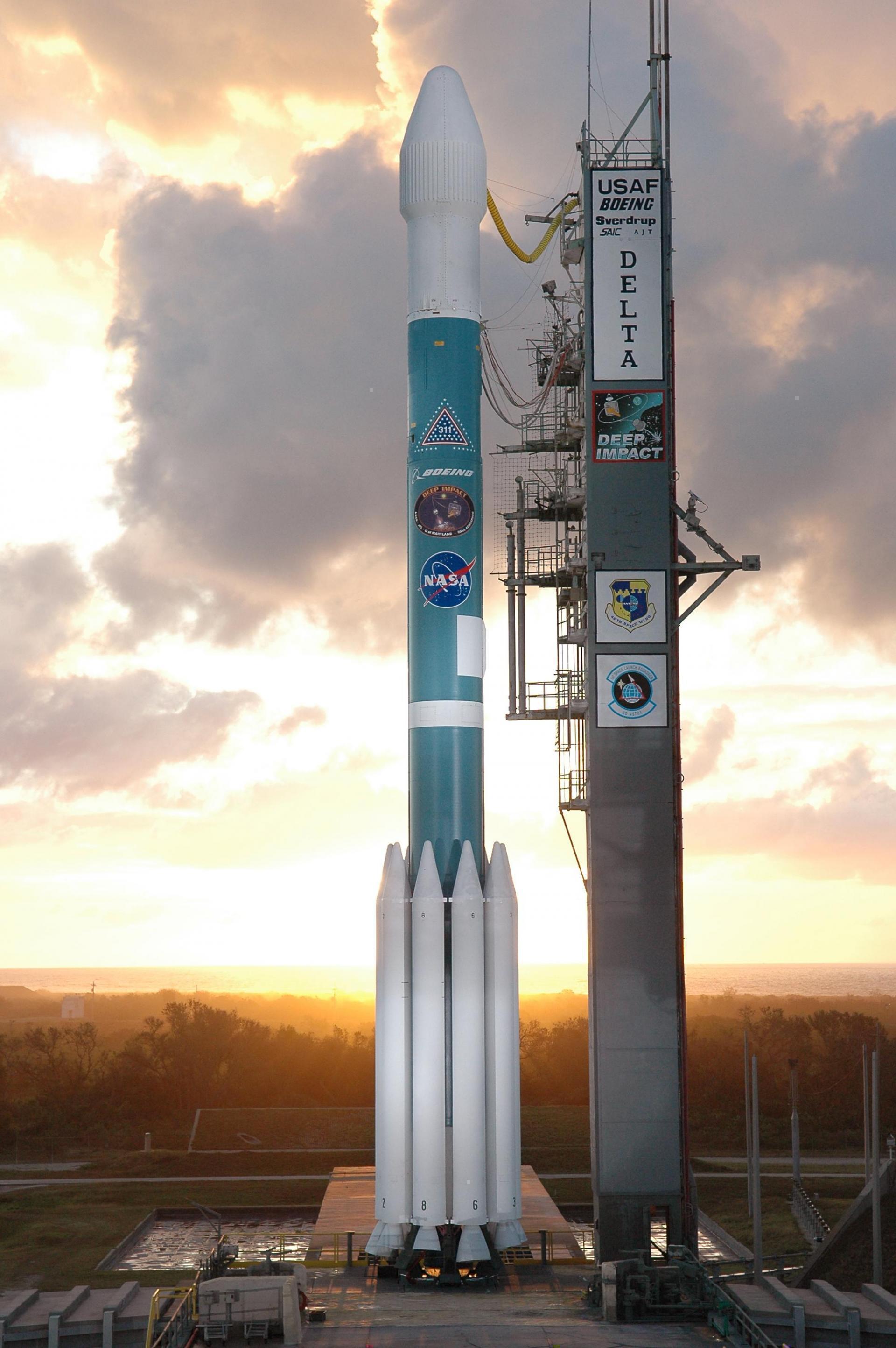
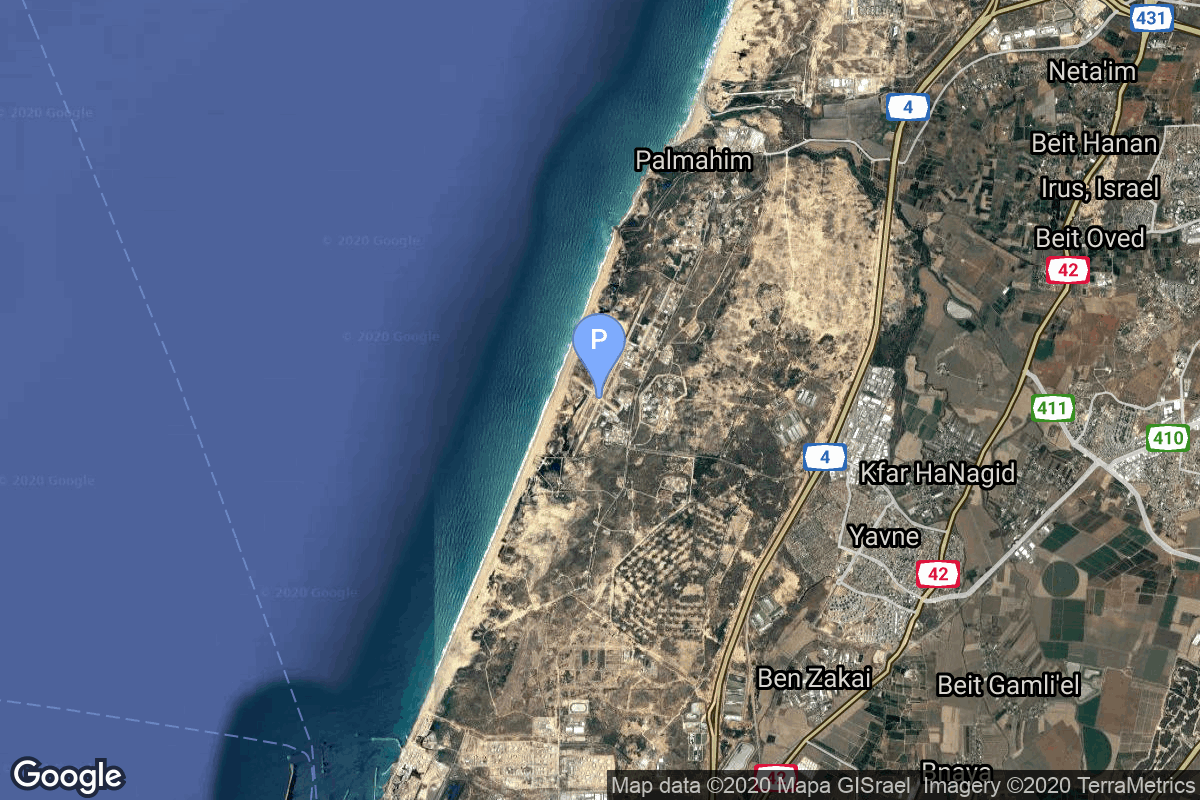
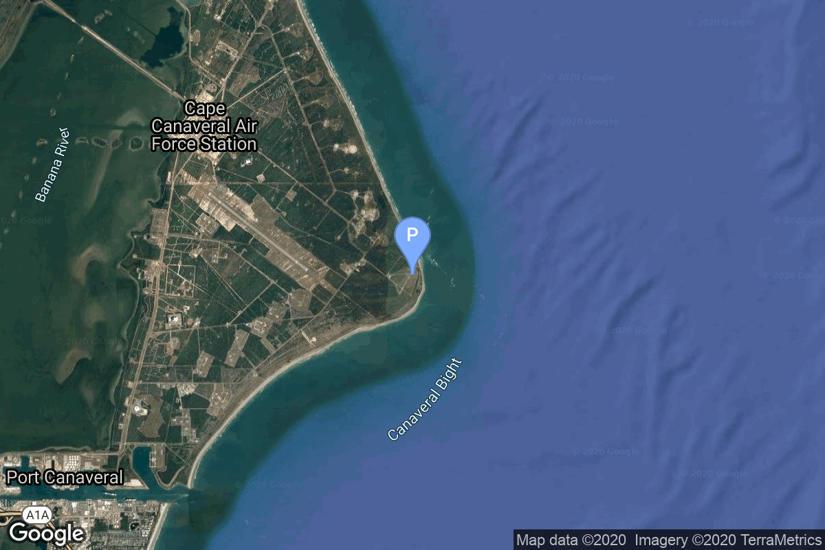
{ "count": 7802, "next": "https://ll.thespacedevs.com/2.0.0/launch/?format=api&limit=10&offset=90&ordering=id", "previous": "https://ll.thespacedevs.com/2.0.0/launch/?format=api&limit=10&offset=70&ordering=id", "results": [ { "id": "029cd324-04df-4615-bf70-c6cb693eec00", "url": "https://ll.thespacedevs.com/2.0.0/launch/029cd324-04df-4615-bf70-c6cb693eec00/?format=api", "launch_library_id": null, "slug": "scout-x-4a-reentry-4a", "name": "Scout X-4A | Reentry-4A", "status": { "id": 3, "name": "Success" }, "net": "1964-08-18T06:05:00Z", "window_end": "1964-08-18T06:05:00Z", "window_start": "1964-08-18T06:05:00Z", "inhold": false, "tbdtime": false, "tbddate": false, "probability": null, "holdreason": "", "failreason": null, "hashtag": null, "launch_service_provider": { "id": 44, "url": "https://ll.thespacedevs.com/2.0.0/agencies/44/?format=api", "name": "National Aeronautics and Space Administration", "type": "Government" }, "rocket": { "id": 3304, "configuration": { "id": 371, "launch_library_id": null, "url": "https://ll.thespacedevs.com/2.0.0/config/launcher/371/?format=api", "name": "Scout X-4A", "family": "Scout", "full_name": "Scout X-4A", "variant": "4A" } }, "mission": { "id": 1726, "launch_library_id": null, "name": "Reentry-4A", "description": "Test of Apollo-type ablator materials at lunar reentry heating levels.", "launch_designator": null, "type": "Materials Science", "orbit": { "id": 15, "name": "Suborbital", "abbrev": "Sub" } }, "pad": { "id": 94, "url": "https://ll.thespacedevs.com/2.0.0/pad/94/?format=api", "agency_id": 44, "name": "Launch Area 3", "info_url": null, "wiki_url": "", "map_url": "https://www.google.com/maps?q=37.8495,-75.4725", "latitude": "37.8495", "longitude": "-75.4725", "location": { "id": 21, "url": "https://ll.thespacedevs.com/2.0.0/location/21/?format=api", "name": "Wallops Flight Facility, Virginia, USA", "country_code": "USA", "map_image": "https://thespacedevs-prod.nyc3.digitaloceanspaces.com/media/map_images/location_21_20200803142423.jpg", "total_launch_count": 85, "total_landing_count": 0 }, "map_image": "https://thespacedevs-prod.nyc3.digitaloceanspaces.com/media/map_images/pad_94_20200803143206.jpg", "total_launch_count": 13 }, "webcast_live": false, "image": null, "infographic": null, "program": [] }, { "id": "02a67327-807e-483f-ac6c-963a3fa22a5b", "url": "https://ll.thespacedevs.com/2.0.0/launch/02a67327-807e-483f-ac6c-963a3fa22a5b/?format=api", "launch_library_id": null, "slug": "falcon-9-block-5-starlink-group-12-11", "name": "Falcon 9 Block 5 | Starlink Group 12-11", "status": { "id": 3, "name": "Success" }, "net": "2025-01-08T15:27:00Z", "window_end": "2025-01-08T19:17:59Z", "window_start": "2025-01-08T15:27:00Z", "inhold": false, "tbdtime": false, "tbddate": false, "probability": null, "holdreason": "", "failreason": "", "hashtag": null, "launch_service_provider": { "id": 121, "url": "https://ll.thespacedevs.com/2.0.0/agencies/121/?format=api", "name": "SpaceX", "type": "Commercial" }, "rocket": { "id": 8454, "configuration": { "id": 164, "launch_library_id": 188, "url": "https://ll.thespacedevs.com/2.0.0/config/launcher/164/?format=api", "name": "Falcon 9", "family": "Falcon", "full_name": "Falcon 9 Block 5", "variant": "Block 5" } }, "mission": { "id": 7043, "launch_library_id": null, "name": "Starlink Group 12-11", "description": "A batch of 21 satellites for the Starlink mega-constellation - SpaceX's project for space-based Internet communication system.", "launch_designator": null, "type": "Communications", "orbit": { "id": 8, "name": "Low Earth Orbit", "abbrev": "LEO" } }, "pad": { "id": 87, "url": "https://ll.thespacedevs.com/2.0.0/pad/87/?format=api", "agency_id": 121, "name": "Launch Complex 39A", "info_url": null, "wiki_url": "https://en.wikipedia.org/wiki/Kennedy_Space_Center_Launch_Complex_39#Launch_Pad_39A", "map_url": "https://www.google.com/maps?q=28.60822681,-80.60428186", "latitude": "28.60822681", "longitude": "-80.60428186", "location": { "id": 27, "url": "https://ll.thespacedevs.com/2.0.0/location/27/?format=api", "name": "Kennedy Space Center, FL, USA", "country_code": "USA", "map_image": "https://thespacedevs-prod.nyc3.digitaloceanspaces.com/media/map_images/location_27_20200803142447.jpg", "total_launch_count": 279, "total_landing_count": 0 }, "map_image": "https://thespacedevs-prod.nyc3.digitaloceanspaces.com/media/map_images/pad_87_20200803143537.jpg", "total_launch_count": 221 }, "webcast_live": false, "image": "https://thespacedevs-prod.nyc3.digitaloceanspaces.com/media/images/falcon2520925_image_20221009234147.png", "infographic": null, "program": [ { "id": 25, "url": "https://ll.thespacedevs.com/2.0.0/program/25/?format=api", "name": "Starlink", "description": "Starlink is a satellite internet constellation operated by American aerospace company SpaceX", "agencies": [ { "id": 121, "url": "https://ll.thespacedevs.com/2.0.0/agencies/121/?format=api", "name": "SpaceX", "type": "Commercial" } ], "image_url": "https://thespacedevs-prod.nyc3.digitaloceanspaces.com/media/images/starlink_program_20231228154508.jpeg", "start_date": "2018-02-22T14:17:00Z", "end_date": null, "info_url": "https://starlink.com", "wiki_url": "https://en.wikipedia.org/wiki/Starlink" } ] }, { "id": "02b28510-be7b-43c1-ab97-b3671ab6813d", "url": "https://ll.thespacedevs.com/2.0.0/launch/02b28510-be7b-43c1-ab97-b3671ab6813d/?format=api", "launch_library_id": null, "slug": "falcon-9-block-5-transporter-12-dedicated-sso-ride", "name": "Falcon 9 Block 5 | Transporter 12 (Dedicated SSO Rideshare)", "status": { "id": 3, "name": "Success" }, "net": "2025-01-14T19:09:00Z", "window_end": "2025-01-14T19:16:00Z", "window_start": "2025-01-14T18:49:00Z", "inhold": false, "tbdtime": false, "tbddate": false, "probability": null, "holdreason": "", "failreason": "", "hashtag": null, "launch_service_provider": { "id": 121, "url": "https://ll.thespacedevs.com/2.0.0/agencies/121/?format=api", "name": "SpaceX", "type": "Commercial" }, "rocket": { "id": 7854, "configuration": { "id": 164, "launch_library_id": 188, "url": "https://ll.thespacedevs.com/2.0.0/config/launcher/164/?format=api", "name": "Falcon 9", "family": "Falcon", "full_name": "Falcon 9 Block 5", "variant": "Block 5" } }, "mission": { "id": 6362, "launch_library_id": null, "name": "Transporter 12 (Dedicated SSO Rideshare)", "description": "Dedicated rideshare flight to a sun-synchronous orbit with dozens of small microsatellites and nanosatellites for commercial and government customers.", "launch_designator": null, "type": "Dedicated Rideshare", "orbit": { "id": 17, "name": "Sun-Synchronous Orbit", "abbrev": "SSO" } }, "pad": { "id": 16, "url": "https://ll.thespacedevs.com/2.0.0/pad/16/?format=api", "agency_id": null, "name": "Space Launch Complex 4E", "info_url": null, "wiki_url": "https://en.wikipedia.org/wiki/Vandenberg_Space_Launch_Complex_4#SLC-4E", "map_url": "https://www.google.com/maps?q=34.632,-120.611", "latitude": "34.632", "longitude": "-120.611", "location": { "id": 11, "url": "https://ll.thespacedevs.com/2.0.0/location/11/?format=api", "name": "Vandenberg SFB, CA, USA", "country_code": "USA", "map_image": "https://thespacedevs-prod.nyc3.digitaloceanspaces.com/media/map_images/location_11_20200803142416.jpg", "total_launch_count": 865, "total_landing_count": 33 }, "map_image": "https://thespacedevs-prod.nyc3.digitaloceanspaces.com/media/map_images/pad_16_20200803143532.jpg", "total_launch_count": 251 }, "webcast_live": false, "image": "https://thespacedevs-prod.nyc3.digitaloceanspaces.com/media/images/falcon_9_liftof_image_20250115064446.jpg", "infographic": null, "program": [] }, { "id": "02b8bb48-37a1-4f43-9112-33d8e8589a75", "url": "https://ll.thespacedevs.com/2.0.0/launch/02b8bb48-37a1-4f43-9112-33d8e8589a75/?format=api", "launch_library_id": null, "slug": "vostok-8k72-korabl-sputnik-1", "name": "Vostok 8K72 | Korabl'-Sputnik-1", "status": { "id": 3, "name": "Success" }, "net": "1960-05-15T00:00:05Z", "window_end": "1960-05-15T00:00:05Z", "window_start": "1960-05-15T00:00:05Z", "inhold": false, "tbdtime": false, "tbddate": false, "probability": null, "holdreason": "", "failreason": "", "hashtag": null, "launch_service_provider": { "id": 66, "url": "https://ll.thespacedevs.com/2.0.0/agencies/66/?format=api", "name": "Soviet Space Program", "type": "Government" }, "rocket": { "id": 3068, "configuration": { "id": 453, "launch_library_id": null, "url": "https://ll.thespacedevs.com/2.0.0/config/launcher/453/?format=api", "name": "Vostok 8K72", "family": "Vostok", "full_name": "Vostok 8K72", "variant": "8K72" } }, "mission": { "id": 1490, "launch_library_id": null, "name": "Korabl'-Sputnik-1", "description": "Korabl-Sputnik was the first test flight of the Vostok programme and the first Vostok spacecraft.", "launch_designator": null, "type": "Test Flight", "orbit": { "id": 8, "name": "Low Earth Orbit", "abbrev": "LEO" } }, "pad": { "id": 32, "url": "https://ll.thespacedevs.com/2.0.0/pad/32/?format=api", "agency_id": null, "name": "1/5", "info_url": null, "wiki_url": "", "map_url": "https://www.google.com/maps?q=45.92,63.342", "latitude": "45.92", "longitude": "63.342", "location": { "id": 15, "url": "https://ll.thespacedevs.com/2.0.0/location/15/?format=api", "name": "Baikonur Cosmodrome, Republic of Kazakhstan", "country_code": "KAZ", "map_image": "https://thespacedevs-prod.nyc3.digitaloceanspaces.com/media/map_images/location_15_20200803142517.jpg", "total_launch_count": 1560, "total_landing_count": 0 }, "map_image": "https://thespacedevs-prod.nyc3.digitaloceanspaces.com/media/map_images/pad_32_20200803143513.jpg", "total_launch_count": 487 }, "webcast_live": false, "image": null, "infographic": null, "program": [ { "id": 9, "url": "https://ll.thespacedevs.com/2.0.0/program/9/?format=api", "name": "Vostok", "description": "The Vostok programme was a Soviet human spaceflight project to put the first Soviet citizens into low Earth orbit and return them safely. Competing with the United States Project Mercury, it succeeded in placing the first human into space, Yuri Gagarin, in a single orbit in Vostok 1 on April 12, 1961.", "agencies": [ { "id": 66, "url": "https://ll.thespacedevs.com/2.0.0/agencies/66/?format=api", "name": "Soviet Space Program", "type": "Government" } ], "image_url": "https://thespacedevs-prod.nyc3.digitaloceanspaces.com/media/images/vostok_program_20210417063956.png", "start_date": "1961-04-12T06:07:00Z", "end_date": "1963-06-19T08:20:00Z", "info_url": null, "wiki_url": "https://en.wikipedia.org/wiki/Vostok_programme" } ] }, { "id": "02b90728-1193-4646-81c3-30ce1ebbbcff", "url": "https://ll.thespacedevs.com/2.0.0/launch/02b90728-1193-4646-81c3-30ce1ebbbcff/?format=api", "launch_library_id": null, "slug": "delta-ii-gps-iia-3", "name": "Delta II | GPS IIA-3", "status": { "id": 3, "name": "Success" }, "net": "1992-02-23T22:29:00Z", "window_end": "1992-02-23T22:29:00Z", "window_start": "1992-02-23T22:29:00Z", "inhold": false, "tbdtime": false, "tbddate": false, "probability": null, "holdreason": "", "failreason": "", "hashtag": null, "launch_service_provider": { "id": 161, "url": "https://ll.thespacedevs.com/2.0.0/agencies/161/?format=api", "name": "United States Air Force", "type": "Government" }, "rocket": { "id": 6423, "configuration": { "id": 159, "launch_library_id": 179, "url": "https://ll.thespacedevs.com/2.0.0/config/launcher/159/?format=api", "name": "Delta II", "family": "Delta", "full_name": "Delta II 7925", "variant": "7925" } }, "mission": { "id": 4813, "launch_library_id": null, "name": "GPS IIA-3", "description": "GPS-2A (Global Positioning System) or Navstar-2A (Navigation System using Timing And ranging) are improved satellites of the second generation of the GPS navigation system.", "launch_designator": null, "type": "Navigation", "orbit": { "id": 12, "name": "Medium Earth Orbit", "abbrev": "MEO" } }, "pad": { "id": 1, "url": "https://ll.thespacedevs.com/2.0.0/pad/1/?format=api", "agency_id": null, "name": "Space Launch Complex 17B", "info_url": null, "wiki_url": "https://en.wikipedia.org/wiki/Cape_Canaveral_Space_Launch_Complex_17", "map_url": "https://www.google.com/maps?q=28.4458,-80.5657", "latitude": "28.4458", "longitude": "-80.5657", "location": { "id": 12, "url": "https://ll.thespacedevs.com/2.0.0/location/12/?format=api", "name": "Cape Canaveral SFS, FL, USA", "country_code": "USA", "map_image": "https://thespacedevs-prod.nyc3.digitaloceanspaces.com/media/map_images/location_12_20200803142519.jpg", "total_launch_count": 1092, "total_landing_count": 71 }, "map_image": "https://thespacedevs-prod.nyc3.digitaloceanspaces.com/media/map_images/pad_1_20200803143208.jpg", "total_launch_count": 132 }, "webcast_live": false, "image": "https://thespacedevs-prod.nyc3.digitaloceanspaces.com/media/images/delta2520ii_image_20190222030440.jpeg", "infographic": null, "program": [ { "id": 29, "url": "https://ll.thespacedevs.com/2.0.0/program/29/?format=api", "name": "Global Positioning System", "description": "The Global Positioning System (GPS), originally Navstar GPS, is a satellite-based radio navigation system owned by the United States government and operated by the United States Space Force. It is one of the global navigation satellite systems (GNSS) that provide geolocation and time information to a GPS receiver anywhere on or near the Earth where there is an unobstructed line of sight to four or more GPS satellites.", "agencies": [ { "id": 1041, "url": "https://ll.thespacedevs.com/2.0.0/agencies/1041/?format=api", "name": "United States Space Force", "type": "Government" } ], "image_url": "https://thespacedevs-prod.nyc3.digitaloceanspaces.com/media/images/global2520posi_program_20231229182501.png", "start_date": "1978-02-22T00:00:00Z", "end_date": null, "info_url": "https://www.gps.gov/", "wiki_url": "https://en.wikipedia.org/wiki/Global_Positioning_System" } ] }, { "id": "02c07976-1444-4d53-b581-0b91c28d0330", "url": "https://ll.thespacedevs.com/2.0.0/launch/02c07976-1444-4d53-b581-0b91c28d0330/?format=api", "launch_library_id": null, "slug": "kosmos-3m-nadezhda-5", "name": "Kosmos-3M | Nadezhda 5", "status": { "id": 3, "name": "Success" }, "net": "1990-02-27T20:59:42Z", "window_end": "1990-02-27T20:59:42Z", "window_start": "1990-02-27T20:59:42Z", "inhold": false, "tbdtime": false, "tbddate": false, "probability": null, "holdreason": "", "failreason": null, "hashtag": null, "launch_service_provider": { "id": 66, "url": "https://ll.thespacedevs.com/2.0.0/agencies/66/?format=api", "name": "Soviet Space Program", "type": "Government" }, "rocket": { "id": 6247, "configuration": { "id": 102, "launch_library_id": 122, "url": "https://ll.thespacedevs.com/2.0.0/config/launcher/102/?format=api", "name": "Kosmos-3M", "family": "Kosmos", "full_name": "Kosmos-3M (11K65M)", "variant": "-3M" } }, "mission": { "id": 4637, "launch_library_id": null, "name": "Nadezhda 5", "description": "Civilian navigation satellite equivalent to the purely military Parus", "launch_designator": null, "type": "Navigation", "orbit": { "id": 8, "name": "Low Earth Orbit", "abbrev": "LEO" } }, "pad": { "id": 167, "url": "https://ll.thespacedevs.com/2.0.0/pad/167/?format=api", "agency_id": null, "name": "132/2", "info_url": null, "wiki_url": "https://en.wikipedia.org/wiki/Plesetsk_Cosmodrome", "map_url": "https://www.google.com/maps?q=62.883,40.869806", "latitude": "62.883", "longitude": "40.869806", "location": { "id": 6, "url": "https://ll.thespacedevs.com/2.0.0/location/6/?format=api", "name": "Plesetsk Cosmodrome, Russian Federation", "country_code": "RUS", "map_image": "https://thespacedevs-prod.nyc3.digitaloceanspaces.com/media/map_images/location_6_20200803142434.jpg", "total_launch_count": 1681, "total_landing_count": 0 }, "map_image": "https://thespacedevs-prod.nyc3.digitaloceanspaces.com/media/map_images/pad_167_20200803143417.jpg", "total_launch_count": 172 }, "webcast_live": false, "image": "https://thespacedevs-prod.nyc3.digitaloceanspaces.com/media/images/kosmos-3m_durin_image_20251101171325.jpg", "infographic": null, "program": [] }, { "id": "02c372d4-3bb2-4de3-a676-4cd6cfec9728", "url": "https://ll.thespacedevs.com/2.0.0/launch/02c372d4-3bb2-4de3-a676-4cd6cfec9728/?format=api", "launch_library_id": null, "slug": "shavit-2-ofeq-4", "name": "Shavit-2 | Ofeq-4", "status": { "id": 4, "name": "Failure" }, "net": "1998-01-22T12:56:00Z", "window_end": "1998-01-22T12:56:00Z", "window_start": "1998-01-22T12:56:00Z", "inhold": false, "tbdtime": false, "tbddate": false, "probability": null, "holdreason": "", "failreason": null, "hashtag": null, "launch_service_provider": { "id": 35, "url": "https://ll.thespacedevs.com/2.0.0/agencies/35/?format=api", "name": "Israeli Space Agency", "type": "Government" }, "rocket": { "id": 6834, "configuration": { "id": 110, "launch_library_id": 123, "url": "https://ll.thespacedevs.com/2.0.0/config/launcher/110/?format=api", "name": "Shavit-2", "family": "Shavit", "full_name": "Shavit-2", "variant": "2" } }, "mission": { "id": 5224, "launch_library_id": null, "name": "Ofeq-4", "description": "Intended for surveillance of Israel's neighbours, the Ofeq series is unusual in having a retrograde orbit. This is due to the geographical location of Israel, which gives only an unobstructed launch path over the mediterranean sea. It is similar to the EROS-A civilian Earth observation satellite. Ofeq 4 (which was possibly the prototype EROS-A satellite) was lost in an launch failure in early 1998.", "launch_designator": null, "type": "Government/Top Secret", "orbit": { "id": 8, "name": "Low Earth Orbit", "abbrev": "LEO" } }, "pad": { "id": 75, "url": "https://ll.thespacedevs.com/2.0.0/pad/75/?format=api", "agency_id": 95, "name": "Shavit Launch Pad", "info_url": null, "wiki_url": "https://en.wikipedia.org/wiki/Palmachim_Airbase", "map_url": "https://www.google.com/maps?q=31.884444,34.680278", "latitude": "31.884444", "longitude": "34.680278", "location": { "id": 4, "url": "https://ll.thespacedevs.com/2.0.0/location/4/?format=api", "name": "Palmachim Airbase, State of Israel", "country_code": "ISR", "map_image": "https://thespacedevs-prod.nyc3.digitaloceanspaces.com/media/map_images/location_4_20200803142418.jpg", "total_launch_count": 13, "total_landing_count": 0 }, "map_image": "https://thespacedevs-prod.nyc3.digitaloceanspaces.com/media/map_images/pad_75_20200803143316.jpg", "total_launch_count": 13 }, "webcast_live": false, "image": "https://thespacedevs-prod.nyc3.digitaloceanspaces.com/media/images/shavit-2_liftof_image_20240918164729.jpeg", "infographic": null, "program": [] }, { "id": "02c8db25-7909-4462-bab3-c785a399a013", "url": "https://ll.thespacedevs.com/2.0.0/launch/02c8db25-7909-4462-bab3-c785a399a013/?format=api", "launch_library_id": null, "slug": "soyuz-u-zenit-8-67", "name": "Soyuz U | Zenit-8 67", "status": { "id": 3, "name": "Success" }, "net": "1988-08-23T09:20:00Z", "window_end": "1988-08-23T09:20:00Z", "window_start": "1988-08-23T09:20:00Z", "inhold": false, "tbdtime": false, "tbddate": false, "probability": null, "holdreason": "", "failreason": null, "hashtag": null, "launch_service_provider": { "id": 66, "url": "https://ll.thespacedevs.com/2.0.0/agencies/66/?format=api", "name": "Soviet Space Program", "type": "Government" }, "rocket": { "id": 6100, "configuration": { "id": 37, "launch_library_id": 35, "url": "https://ll.thespacedevs.com/2.0.0/config/launcher/37/?format=api", "name": "Soyuz U", "family": "Soyuz", "full_name": "Soyuz U", "variant": "" } }, "mission": { "id": 4490, "launch_library_id": null, "name": "Zenit-8 67", "description": "Film-return reconnaissance satellite", "launch_designator": null, "type": "Government/Top Secret", "orbit": { "id": 8, "name": "Low Earth Orbit", "abbrev": "LEO" } }, "pad": { "id": 32, "url": "https://ll.thespacedevs.com/2.0.0/pad/32/?format=api", "agency_id": null, "name": "1/5", "info_url": null, "wiki_url": "", "map_url": "https://www.google.com/maps?q=45.92,63.342", "latitude": "45.92", "longitude": "63.342", "location": { "id": 15, "url": "https://ll.thespacedevs.com/2.0.0/location/15/?format=api", "name": "Baikonur Cosmodrome, Republic of Kazakhstan", "country_code": "KAZ", "map_image": "https://thespacedevs-prod.nyc3.digitaloceanspaces.com/media/map_images/location_15_20200803142517.jpg", "total_launch_count": 1560, "total_landing_count": 0 }, "map_image": "https://thespacedevs-prod.nyc3.digitaloceanspaces.com/media/map_images/pad_32_20200803143513.jpg", "total_launch_count": 487 }, "webcast_live": false, "image": "https://thespacedevs-prod.nyc3.digitaloceanspaces.com/media/images/soyuz2520u_image_20190222031023.jpeg", "infographic": null, "program": [] }, { "id": "02e34864-4363-4056-b884-9d4a7a9cd5e8", "url": "https://ll.thespacedevs.com/2.0.0/launch/02e34864-4363-4056-b884-9d4a7a9cd5e8/?format=api", "launch_library_id": null, "slug": "falcon-9-block-5-trinity", "name": "Falcon 9 Block 5 | Trinity", "status": { "id": 2, "name": "TBD" }, "net": "2027-02-28T00:00:00Z", "window_end": "2027-02-28T00:00:00Z", "window_start": "2027-02-28T00:00:00Z", "inhold": false, "tbdtime": true, "tbddate": true, "probability": null, "holdreason": "", "failreason": "", "hashtag": null, "launch_service_provider": { "id": 121, "url": "https://ll.thespacedevs.com/2.0.0/agencies/121/?format=api", "name": "SpaceX", "type": "Commercial" }, "rocket": { "id": 8768, "configuration": { "id": 164, "launch_library_id": 188, "url": "https://ll.thespacedevs.com/2.0.0/config/launcher/164/?format=api", "name": "Falcon 9", "family": "Falcon", "full_name": "Falcon 9 Block 5", "variant": "Block 5" } }, "mission": { "id": 7359, "launch_library_id": null, "name": "Trinity", "description": "Trinity is a three-spacecraft mission from US satellite manufacturer K2 Space, with each satellite deploying to a different orbital regime to prove out K2 Space’s multi-orbit satellite platform. 2 satellites will be dropped off in LEO, 1 remaining in LEO for a period before raising itself to MEO, while the other will immediately begin climbing to MEO and will aim to complete orbit raising within 90 days. The 3rd satellite will be launched directly into a geostationary transfer orbit.", "launch_designator": null, "type": "Technology", "orbit": { "id": 2, "name": "Geostationary Transfer Orbit", "abbrev": "GTO" } }, "pad": { "id": 72, "url": "https://ll.thespacedevs.com/2.0.0/pad/72/?format=api", "agency_id": null, "name": "Unknown Pad", "info_url": null, "wiki_url": "", "map_url": "https://www.google.com/maps?q=28.458,-80.528", "latitude": "28.458", "longitude": "-80.528", "location": { "id": 12, "url": "https://ll.thespacedevs.com/2.0.0/location/12/?format=api", "name": "Cape Canaveral SFS, FL, USA", "country_code": "USA", "map_image": "https://thespacedevs-prod.nyc3.digitaloceanspaces.com/media/map_images/location_12_20200803142519.jpg", "total_launch_count": 1092, "total_landing_count": 71 }, "map_image": "https://thespacedevs-prod.nyc3.digitaloceanspaces.com/media/map_images/pad_72_20200803143403.jpg", "total_launch_count": 0 }, "webcast_live": false, "image": "https://thespacedevs-prod.nyc3.digitaloceanspaces.com/media/images/falcon_9_image_20230807133459.jpeg", "infographic": null, "program": [] }, { "id": "02e56635-63a6-4abc-9f27-1e30f23bc7e1", "url": "https://ll.thespacedevs.com/2.0.0/launch/02e56635-63a6-4abc-9f27-1e30f23bc7e1/?format=api", "launch_library_id": null, "slug": "falcon-9-block-5-starlink-group-17-1", "name": "Falcon 9 Block 5 | Starlink Group 17-1", "status": { "id": 3, "name": "Success" }, "net": "2025-05-27T16:57:15Z", "window_end": "2025-05-27T20:14:00Z", "window_start": "2025-05-27T16:14:00Z", "inhold": false, "tbdtime": false, "tbddate": false, "probability": null, "holdreason": "", "failreason": "", "hashtag": null, "launch_service_provider": { "id": 121, "url": "https://ll.thespacedevs.com/2.0.0/agencies/121/?format=api", "name": "SpaceX", "type": "Commercial" }, "rocket": { "id": 8617, "configuration": { "id": 164, "launch_library_id": 188, "url": "https://ll.thespacedevs.com/2.0.0/config/launcher/164/?format=api", "name": "Falcon 9", "family": "Falcon", "full_name": "Falcon 9 Block 5", "variant": "Block 5" } }, "mission": { "id": 7209, "launch_library_id": null, "name": "Starlink Group 17-1", "description": "A batch of 24 satellites for the Starlink mega-constellation - SpaceX's project for space-based Internet communication system.", "launch_designator": null, "type": "Communications", "orbit": { "id": 8, "name": "Low Earth Orbit", "abbrev": "LEO" } }, "pad": { "id": 16, "url": "https://ll.thespacedevs.com/2.0.0/pad/16/?format=api", "agency_id": null, "name": "Space Launch Complex 4E", "info_url": null, "wiki_url": "https://en.wikipedia.org/wiki/Vandenberg_Space_Launch_Complex_4#SLC-4E", "map_url": "https://www.google.com/maps?q=34.632,-120.611", "latitude": "34.632", "longitude": "-120.611", "location": { "id": 11, "url": "https://ll.thespacedevs.com/2.0.0/location/11/?format=api", "name": "Vandenberg SFB, CA, USA", "country_code": "USA", "map_image": "https://thespacedevs-prod.nyc3.digitaloceanspaces.com/media/map_images/location_11_20200803142416.jpg", "total_launch_count": 865, "total_landing_count": 33 }, "map_image": "https://thespacedevs-prod.nyc3.digitaloceanspaces.com/media/map_images/pad_16_20200803143532.jpg", "total_launch_count": 251 }, "webcast_live": false, "image": "https://thespacedevs-prod.nyc3.digitaloceanspaces.com/media/images/falcon2520925_image_20221009234147.png", "infographic": null, "program": [ { "id": 25, "url": "https://ll.thespacedevs.com/2.0.0/program/25/?format=api", "name": "Starlink", "description": "Starlink is a satellite internet constellation operated by American aerospace company SpaceX", "agencies": [ { "id": 121, "url": "https://ll.thespacedevs.com/2.0.0/agencies/121/?format=api", "name": "SpaceX", "type": "Commercial" } ], "image_url": "https://thespacedevs-prod.nyc3.digitaloceanspaces.com/media/images/starlink_program_20231228154508.jpeg", "start_date": "2018-02-22T14:17:00Z", "end_date": null, "info_url": "https://starlink.com", "wiki_url": "https://en.wikipedia.org/wiki/Starlink" } ] } ] }