Launch List
API endpoint that returns all Launch objects or a single launch.
EXAMPLE - /launch/
GET: Return a list of all Launch objects.
FILTERS: Fields - 'name', 'id(s)', 'lsp_id', 'lsp_name', 'serial_number', 'launcher_config__id', 'rocket__spacecraftflight__spacecraft__name'
MODE: 'normal', 'list', 'detailed' EXAMPLE: ?mode=list
SEARCH: Searches through the launch name, rocket name, launch agency, mission name & spacecraft name. EXAMPLE - ?search=SpaceX
GET /2.0.0/launch/?format=api&offset=770&ordering=id
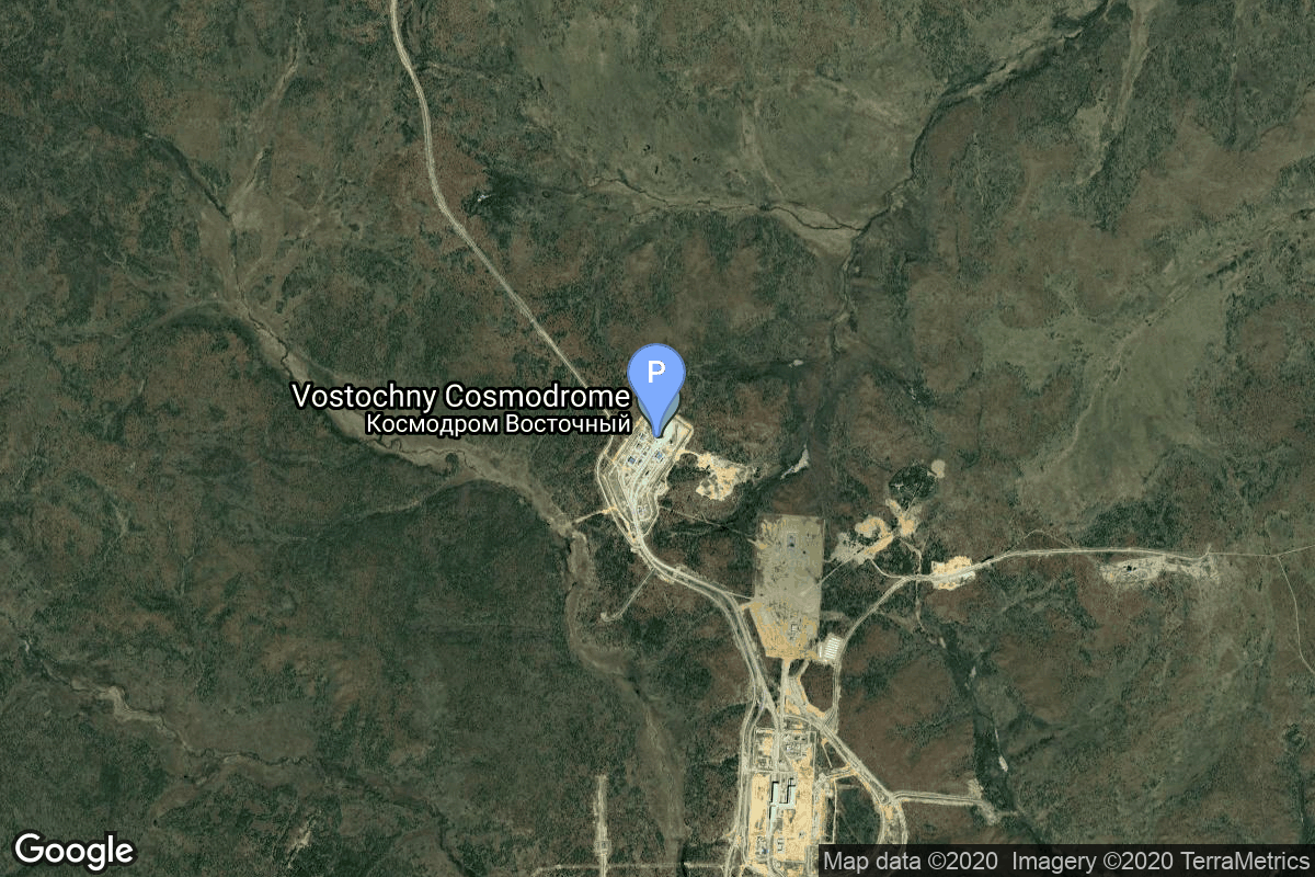
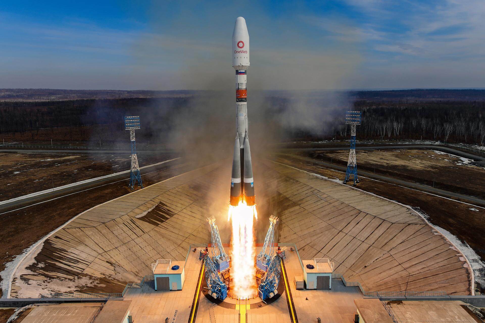
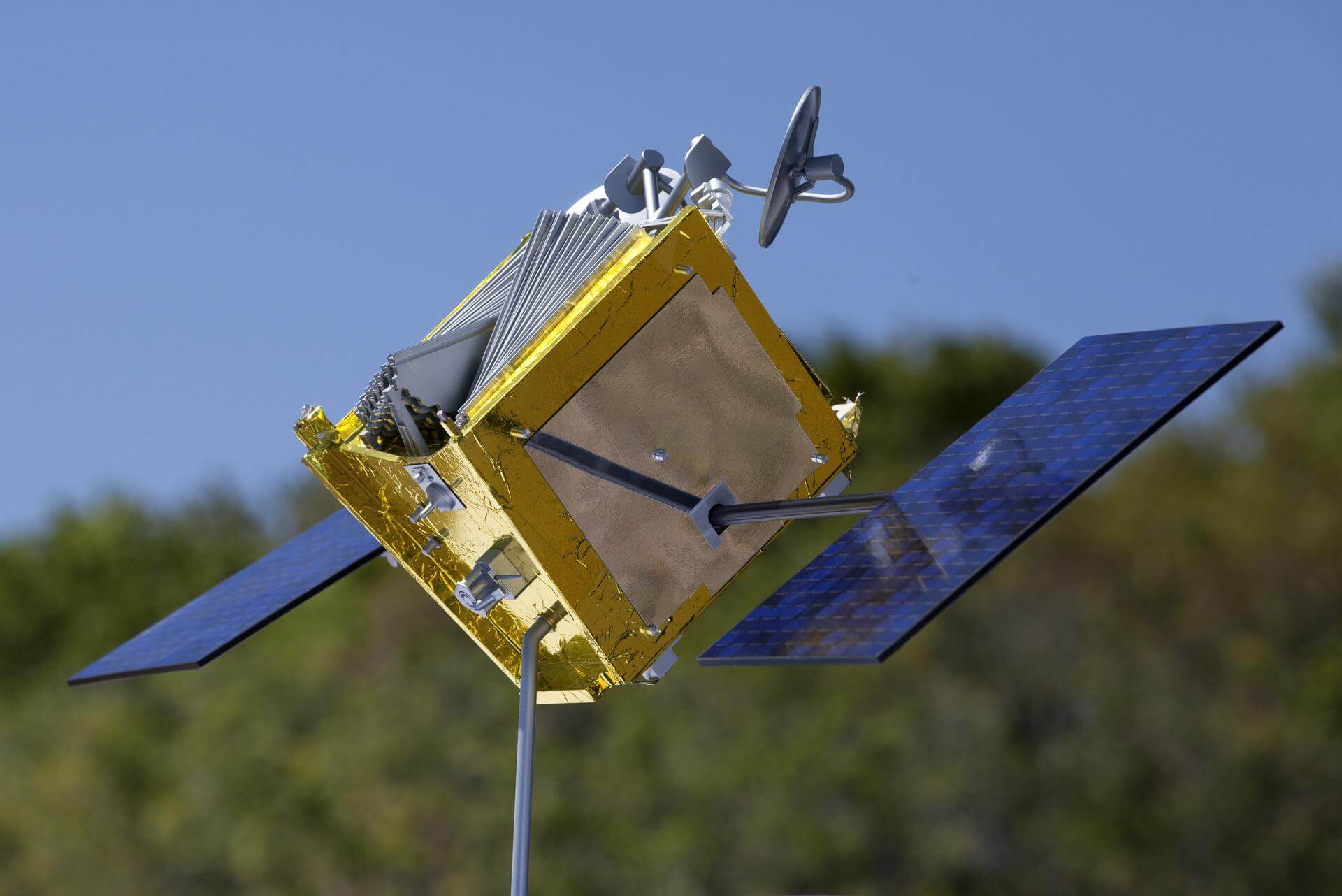
{ "count": 7925, "next": "https://ll.thespacedevs.com/2.0.0/launch/?format=api&limit=10&offset=780&ordering=id", "previous": "https://ll.thespacedevs.com/2.0.0/launch/?format=api&limit=10&offset=760&ordering=id", "results": [ { "id": "199265ca-cfd9-4474-bf54-8e5eb52bacf0", "url": "https://ll.thespacedevs.com/2.0.0/launch/199265ca-cfd9-4474-bf54-8e5eb52bacf0/?format=api", "launch_library_id": 2014, "slug": "soyuz-21bfregat-m-oneweb-6", "name": "Soyuz 2.1b/Fregat-M | OneWeb 6", "status": { "id": 3, "name": "Success" }, "net": "2021-04-25T22:14:08Z", "window_end": "2021-04-25T22:14:08Z", "window_start": "2021-04-25T22:14:08Z", "inhold": false, "tbdtime": false, "tbddate": false, "probability": null, "holdreason": "", "failreason": "", "hashtag": null, "launch_service_provider": { "id": 115, "url": "https://ll.thespacedevs.com/2.0.0/agencies/115/?format=api", "name": "Arianespace", "type": "Commercial" }, "rocket": { "id": 2603, "configuration": { "id": 134, "launch_library_id": 153, "url": "https://ll.thespacedevs.com/2.0.0/config/launcher/134/?format=api", "name": "Soyuz 2.1b/Fregat-M", "family": "Soyuz", "full_name": "Soyuz 2.1b Fregat-M", "variant": "Fregat-M" } }, "mission": { "id": 1255, "launch_library_id": null, "name": "OneWeb 6", "description": "A batch of 36 satellites for the OneWeb satellite constellation, which is intended to provide global Internet broadband service for individual consumers. The constellation is planned to have around 648 microsatellites (of which 60 are spares), around 150 kg each, operating in Ku-band from low Earth orbit.", "launch_designator": null, "type": "Communications", "orbit": { "id": 13, "name": "Polar Orbit", "abbrev": "PO" } }, "pad": { "id": 83, "url": "https://ll.thespacedevs.com/2.0.0/pad/83/?format=api", "agency_id": 63, "name": "Cosmodrome Site 1S", "info_url": null, "wiki_url": "https://en.wikipedia.org/wiki/Vostochny_Cosmodrome", "map_url": "https://www.google.com/maps?q=51.884395,128.333932", "latitude": "51.884395", "longitude": "128.333932", "location": { "id": 18, "url": "https://ll.thespacedevs.com/2.0.0/location/18/?format=api", "name": "Vostochny Cosmodrome, Siberia, Russian Federation", "country_code": "RUS", "map_image": "https://thespacedevs-prod.nyc3.digitaloceanspaces.com/media/map_images/location_18_20200803142401.jpg", "total_launch_count": 21, "total_landing_count": 0 }, "map_image": "https://thespacedevs-prod.nyc3.digitaloceanspaces.com/media/map_images/pad_83_20200803143544.jpg", "total_launch_count": 20 }, "webcast_live": false, "image": "https://thespacedevs-prod.nyc3.digitaloceanspaces.com/media/images/soyuz25202.1b_image_20210520085936.jpeg", "infographic": null, "program": [ { "id": 26, "url": "https://ll.thespacedevs.com/2.0.0/program/26/?format=api", "name": "OneWeb", "description": "Satellite constellation in low Earth orbit that can provide high-speed broadband internet to rural and isolated areas.", "agencies": [ { "id": 1081, "url": "https://ll.thespacedevs.com/2.0.0/agencies/1081/?format=api", "name": "Eutelsat OneWeb", "type": "Commercial" } ], "image_url": "https://thespacedevs-prod.nyc3.digitaloceanspaces.com/media/images/oneweb_program_20231228155842.jpeg", "start_date": "2019-02-27T21:37:00Z", "end_date": null, "info_url": "https://oneweb.net/", "wiki_url": "https://en.wikipedia.org/wiki/Eutelsat_OneWeb" } ] }, { "id": "19988a05-f39e-4f15-8899-a7dbfd863552", "url": "https://ll.thespacedevs.com/2.0.0/launch/19988a05-f39e-4f15-8899-a7dbfd863552/?format=api", "launch_library_id": null, "slug": "soyuz-u-resurs-f1-17f41-27l", "name": "Soyuz U | Resurs-F1 17F41 27L", "status": { "id": 3, "name": "Success" }, "net": "1984-02-16T08:15:00Z", "window_end": "1984-02-16T08:15:00Z", "window_start": "1984-02-16T08:15:00Z", "inhold": false, "tbdtime": false, "tbddate": false, "probability": null, "holdreason": "", "failreason": null, "hashtag": null, "launch_service_provider": { "id": 66, "url": "https://ll.thespacedevs.com/2.0.0/agencies/66/?format=api", "name": "Soviet Space Program", "type": "Government" }, "rocket": { "id": 5608, "configuration": { "id": 37, "launch_library_id": 35, "url": "https://ll.thespacedevs.com/2.0.0/config/launcher/37/?format=api", "name": "Soyuz U", "family": "Soyuz", "full_name": "Soyuz U", "variant": "" } }, "mission": { "id": 4011, "launch_library_id": null, "name": "Resurs-F1 17F41 27L", "description": "Resurs-F1 (17F41) type film-return Earth observation satellite", "launch_designator": null, "type": "Earth Science", "orbit": { "id": 17, "name": "Sun-Synchronous Orbit", "abbrev": "SSO" } }, "pad": { "id": 168, "url": "https://ll.thespacedevs.com/2.0.0/pad/168/?format=api", "agency_id": null, "name": "41/1", "info_url": null, "wiki_url": "https://en.wikipedia.org/wiki/Plesetsk_Cosmodrome", "map_url": "https://www.google.com/maps?q=62.941,40.526806", "latitude": "62.941", "longitude": "40.526806", "location": { "id": 6, "url": "https://ll.thespacedevs.com/2.0.0/location/6/?format=api", "name": "Plesetsk Cosmodrome, Russian Federation", "country_code": "RUS", "map_image": "https://thespacedevs-prod.nyc3.digitaloceanspaces.com/media/map_images/location_6_20200803142434.jpg", "total_launch_count": 1685, "total_landing_count": 0 }, "map_image": "https://thespacedevs-prod.nyc3.digitaloceanspaces.com/media/map_images/pad_168_20200803143446.jpg", "total_launch_count": 310 }, "webcast_live": false, "image": "https://thespacedevs-prod.nyc3.digitaloceanspaces.com/media/images/soyuz2520u_image_20190222031023.jpeg", "infographic": null, "program": [] }, { "id": "199c1718-5b21-4232-9d92-03d77fd62344", "url": "https://ll.thespacedevs.com/2.0.0/launch/199c1718-5b21-4232-9d92-03d77fd62344/?format=api", "launch_library_id": null, "slug": "soyuz-u-zenit-6u-69", "name": "Soyuz U | Zenit-6U 69", "status": { "id": 3, "name": "Success" }, "net": "1982-11-18T09:25:00Z", "window_end": "1982-11-18T09:25:00Z", "window_start": "1982-11-18T09:25:00Z", "inhold": false, "tbdtime": false, "tbddate": false, "probability": null, "holdreason": "", "failreason": null, "hashtag": null, "launch_service_provider": { "id": 66, "url": "https://ll.thespacedevs.com/2.0.0/agencies/66/?format=api", "name": "Soviet Space Program", "type": "Government" }, "rocket": { "id": 5462, "configuration": { "id": 37, "launch_library_id": 35, "url": "https://ll.thespacedevs.com/2.0.0/config/launcher/37/?format=api", "name": "Soyuz U", "family": "Soyuz", "full_name": "Soyuz U", "variant": "" } }, "mission": { "id": 3867, "launch_library_id": null, "name": "Zenit-6U 69", "description": "Optical film-return reconnaissance satellite", "launch_designator": null, "type": "Government/Top Secret", "orbit": { "id": 8, "name": "Low Earth Orbit", "abbrev": "LEO" } }, "pad": { "id": 20, "url": "https://ll.thespacedevs.com/2.0.0/pad/20/?format=api", "agency_id": null, "name": "31/6", "info_url": null, "wiki_url": "https://en.wikipedia.org/wiki/Baikonur_Cosmodrome_Site_31", "map_url": "https://www.google.com/maps?q=45.996034,63.564003", "latitude": "45.996034", "longitude": "63.564003", "location": { "id": 15, "url": "https://ll.thespacedevs.com/2.0.0/location/15/?format=api", "name": "Baikonur Cosmodrome, Republic of Kazakhstan", "country_code": "KAZ", "map_image": "https://thespacedevs-prod.nyc3.digitaloceanspaces.com/media/map_images/location_15_20200803142517.jpg", "total_launch_count": 1563, "total_landing_count": 0 }, "map_image": "https://thespacedevs-prod.nyc3.digitaloceanspaces.com/media/map_images/pad_20_20200803143516.jpg", "total_launch_count": 428 }, "webcast_live": false, "image": "https://thespacedevs-prod.nyc3.digitaloceanspaces.com/media/images/soyuz2520u_image_20190222031023.jpeg", "infographic": null, "program": [] }, { "id": "19a11437-bd6e-4c98-bfe7-475fd587ec70", "url": "https://ll.thespacedevs.com/2.0.0/launch/19a11437-bd6e-4c98-bfe7-475fd587ec70/?format=api", "launch_library_id": null, "slug": "titan-24b-kh-8-38", "name": "Titan 24B | KH-8 38", "status": { "id": 3, "name": "Success" }, "net": "1973-05-16T16:40:00Z", "window_end": "1973-05-16T16:40:00Z", "window_start": "1973-05-16T16:40:00Z", "inhold": false, "tbdtime": false, "tbddate": false, "probability": null, "holdreason": "", "failreason": null, "hashtag": null, "launch_service_provider": { "id": 161, "url": "https://ll.thespacedevs.com/2.0.0/agencies/161/?format=api", "name": "United States Air Force", "type": "Government" }, "rocket": { "id": 4356, "configuration": { "id": 421, "launch_library_id": null, "url": "https://ll.thespacedevs.com/2.0.0/config/launcher/421/?format=api", "name": "Titan 24B", "family": "Titan", "full_name": "Titan 24B", "variant": "24B" } }, "mission": { "id": 2774, "launch_library_id": null, "name": "KH-8 38", "description": "KH-8 Block 3 high resolution reconnaissance satellite.", "launch_designator": null, "type": "Government/Top Secret", "orbit": { "id": 8, "name": "Low Earth Orbit", "abbrev": "LEO" } }, "pad": { "id": 156, "url": "https://ll.thespacedevs.com/2.0.0/pad/156/?format=api", "agency_id": null, "name": "Space Launch Complex 4W", "info_url": "https://www.astronautix.com/v/vandenbergslc4w.html", "wiki_url": "https://en.wikipedia.org/wiki/Vandenberg_Air_Force_Base_Space_Launch_Complex_4#SLC-4W", "map_url": "https://www.google.com/maps?q=34.63312,-120.61584", "latitude": "34.63312", "longitude": "-120.61584", "location": { "id": 11, "url": "https://ll.thespacedevs.com/2.0.0/location/11/?format=api", "name": "Vandenberg SFB, CA, USA", "country_code": "USA", "map_image": "https://thespacedevs-prod.nyc3.digitaloceanspaces.com/media/map_images/location_11_20200803142416.jpg", "total_launch_count": 897, "total_landing_count": 35 }, "map_image": "https://thespacedevs-prod.nyc3.digitaloceanspaces.com/media/map_images/pad_156_20200803143351.jpg", "total_launch_count": 93 }, "webcast_live": false, "image": null, "infographic": null, "program": [] }, { "id": "19aa7901-e16b-4732-b4d8-5b89c9096b5a", "url": "https://ll.thespacedevs.com/2.0.0/launch/19aa7901-e16b-4732-b4d8-5b89c9096b5a/?format=api", "launch_library_id": null, "slug": "atlas-slv-3-agena-d-kh-7-32", "name": "Atlas SLV-3 Agena D | KH-7 32", "status": { "id": 3, "name": "Success" }, "net": "1966-09-16T17:59:00Z", "window_end": "1966-09-16T17:59:00Z", "window_start": "1966-09-16T17:59:00Z", "inhold": false, "tbdtime": false, "tbddate": false, "probability": null, "holdreason": "", "failreason": null, "hashtag": null, "launch_service_provider": { "id": 161, "url": "https://ll.thespacedevs.com/2.0.0/agencies/161/?format=api", "name": "United States Air Force", "type": "Government" }, "rocket": { "id": 3570, "configuration": { "id": 258, "launch_library_id": null, "url": "https://ll.thespacedevs.com/2.0.0/config/launcher/258/?format=api", "name": "Atlas SLV-3 Agena D", "family": "Atlas", "full_name": "Atlas SLV-3 Agena D", "variant": "SLV-3 Agena D" } }, "mission": { "id": 1990, "launch_library_id": null, "name": "KH-7 32", "description": "The Program 206 satellite, carrying the KH-7 (Keyhole 7) camera system (codenamed Gambit-1), was the first successful high resolution space reconnaissance program. It was managed by NRO's Program A, the USAF-led segment of the National Reconnaissance Program managed from Los Angeles AFB in El Segundo, California.", "launch_designator": null, "type": "Government/Top Secret", "orbit": { "id": 17, "name": "Sun-Synchronous Orbit", "abbrev": "SSO" } }, "pad": { "id": 16, "url": "https://ll.thespacedevs.com/2.0.0/pad/16/?format=api", "agency_id": null, "name": "Space Launch Complex 4E", "info_url": null, "wiki_url": "https://en.wikipedia.org/wiki/Vandenberg_Space_Launch_Complex_4#SLC-4E", "map_url": "https://www.google.com/maps?q=34.632,-120.611", "latitude": "34.632", "longitude": "-120.611", "location": { "id": 11, "url": "https://ll.thespacedevs.com/2.0.0/location/11/?format=api", "name": "Vandenberg SFB, CA, USA", "country_code": "USA", "map_image": "https://thespacedevs-prod.nyc3.digitaloceanspaces.com/media/map_images/location_11_20200803142416.jpg", "total_launch_count": 897, "total_landing_count": 35 }, "map_image": "https://thespacedevs-prod.nyc3.digitaloceanspaces.com/media/map_images/pad_16_20200803143532.jpg", "total_launch_count": 281 }, "webcast_live": false, "image": "https://thespacedevs-prod.nyc3.digitaloceanspaces.com/media/images/atlas-slv3_agen_image_20251102060811.jpg", "infographic": null, "program": [] }, { "id": "19ac5258-0251-4954-90b3-f2790e2abd0d", "url": "https://ll.thespacedevs.com/2.0.0/launch/19ac5258-0251-4954-90b3-f2790e2abd0d/?format=api", "launch_library_id": 1343, "slug": "ariane-5-eca-eutelsat-7c-att-t-16", "name": "Ariane 5 ECA | Eutelsat 7C & AT&T T-16", "status": { "id": 3, "name": "Success" }, "net": "2019-06-20T21:43:00Z", "window_end": "2019-06-20T23:30:00Z", "window_start": "2019-06-20T21:43:00Z", "inhold": false, "tbdtime": false, "tbddate": false, "probability": null, "holdreason": "", "failreason": null, "hashtag": "#VA248", "launch_service_provider": { "id": 115, "url": "https://ll.thespacedevs.com/2.0.0/agencies/115/?format=api", "name": "Arianespace", "type": "Commercial" }, "rocket": { "id": 66, "configuration": { "id": 20, "launch_library_id": 27, "url": "https://ll.thespacedevs.com/2.0.0/config/launcher/20/?format=api", "name": "Ariane 5 ECA", "family": "Ariane", "full_name": "Ariane 5 ECA", "variant": "ECA" } }, "mission": { "id": 1005, "launch_library_id": 1215, "name": "Eutelsat 7C & AT&T T-16", "description": "Eutelsat 7C is based on an all-electric propulsion version of the SSL-1300 satellite platform. Equipped with 44 operational Ku-band transponders, the new satellite will be copositioned with Eutelsat 7B, releasing Eutelsat 7A to another orbital location. This improved two-satellite constellation will enable Eutelsat to optimise resources across both satellites, with enhanced coverage flexibility and connectivity set to take the 7° East neighbourhood to a new level. By almost doubling capacity over Sub-Saharan Africa, from 22 to 42 transponders, it will also make room for several hundred additional digital channels to support the region’s fast expanding TV market. Eutelsat 7C will also be equipped with a beam providing enhanced capacity for government services over Europe, the Middle East and Central Asia, and a beam that can be steered to cover any region visible from 7° East.\n\nAT&T T-16 is based on Astrium’s Eurostar-3000 platform. The satellite has a payload comprising of high power transponders in Ku-band and transponders in Ka-band. It will operate from 100.85° West.", "launch_designator": null, "type": "Communications", "orbit": { "id": 2, "name": "Geostationary Transfer Orbit", "abbrev": "GTO" } }, "pad": { "id": 77, "url": "https://ll.thespacedevs.com/2.0.0/pad/77/?format=api", "agency_id": 115, "name": "Ariane Launch Area 3", "info_url": null, "wiki_url": "https://en.wikipedia.org/wiki/ELA-3", "map_url": "https://www.google.com/maps?q=5.239,-52.768", "latitude": "5.239", "longitude": "-52.768", "location": { "id": 13, "url": "https://ll.thespacedevs.com/2.0.0/location/13/?format=api", "name": "Guiana Space Centre, French Guiana", "country_code": "GUF", "map_image": "https://thespacedevs-prod.nyc3.digitaloceanspaces.com/media/map_images/location_13_20200803142412.jpg", "total_launch_count": 334, "total_landing_count": 0 }, "map_image": "https://thespacedevs-prod.nyc3.digitaloceanspaces.com/media/map_images/pad_77_20200803143458.jpg", "total_launch_count": 118 }, "webcast_live": false, "image": "https://thespacedevs-prod.nyc3.digitaloceanspaces.com/media/images/ariane252052520eca_image_20190224012333.jpeg", "infographic": null, "program": [] }, { "id": "19af765a-17b1-427c-ab12-c418311fea5b", "url": "https://ll.thespacedevs.com/2.0.0/launch/19af765a-17b1-427c-ab12-c418311fea5b/?format=api", "launch_library_id": null, "slug": "soyuz-u-zenit-4mkm-25", "name": "Soyuz U | Zenit-4MKM 25", "status": { "id": 3, "name": "Success" }, "net": "1978-12-26T15:30:00Z", "window_end": "1978-12-26T15:30:00Z", "window_start": "1978-12-26T15:30:00Z", "inhold": false, "tbdtime": false, "tbddate": false, "probability": null, "holdreason": "", "failreason": null, "hashtag": null, "launch_service_provider": { "id": 66, "url": "https://ll.thespacedevs.com/2.0.0/agencies/66/?format=api", "name": "Soviet Space Program", "type": "Government" }, "rocket": { "id": 5032, "configuration": { "id": 37, "launch_library_id": 35, "url": "https://ll.thespacedevs.com/2.0.0/config/launcher/37/?format=api", "name": "Soyuz U", "family": "Soyuz", "full_name": "Soyuz U", "variant": "" } }, "mission": { "id": 3445, "launch_library_id": null, "name": "Zenit-4MKM 25", "description": "High-resolution film-return Zenit reconnaissance satellite", "launch_designator": null, "type": "Government/Top Secret", "orbit": { "id": 8, "name": "Low Earth Orbit", "abbrev": "LEO" } }, "pad": { "id": 85, "url": "https://ll.thespacedevs.com/2.0.0/pad/85/?format=api", "agency_id": 163, "name": "43/4 (43R)", "info_url": null, "wiki_url": null, "map_url": "https://www.google.com/maps?q=62.92883,40.457098", "latitude": "62.92883", "longitude": "40.457098", "location": { "id": 6, "url": "https://ll.thespacedevs.com/2.0.0/location/6/?format=api", "name": "Plesetsk Cosmodrome, Russian Federation", "country_code": "RUS", "map_image": "https://thespacedevs-prod.nyc3.digitaloceanspaces.com/media/map_images/location_6_20200803142434.jpg", "total_launch_count": 1685, "total_landing_count": 0 }, "map_image": "https://thespacedevs-prod.nyc3.digitaloceanspaces.com/media/map_images/pad_85_20200803143554.jpg", "total_launch_count": 328 }, "webcast_live": false, "image": "https://thespacedevs-prod.nyc3.digitaloceanspaces.com/media/images/soyuz2520u_image_20190222031023.jpeg", "infographic": null, "program": [] }, { "id": "19b4b97c-5eaa-48fc-a4a9-37c9daa7a26a", "url": "https://ll.thespacedevs.com/2.0.0/launch/19b4b97c-5eaa-48fc-a4a9-37c9daa7a26a/?format=api", "launch_library_id": null, "slug": "zenit-spaceway-1", "name": "Zenit | Spaceway 1", "status": { "id": 3, "name": "Success" }, "net": "2005-04-26T07:31:29Z", "window_end": "2005-04-26T07:31:29Z", "window_start": "2005-04-26T07:31:29Z", "inhold": false, "tbdtime": false, "tbddate": false, "probability": null, "holdreason": "", "failreason": null, "hashtag": null, "launch_service_provider": { "id": 122, "url": "https://ll.thespacedevs.com/2.0.0/agencies/122/?format=api", "name": "Sea Launch", "type": "Commercial" }, "rocket": { "id": 7222, "configuration": { "id": 11, "launch_library_id": 12, "url": "https://ll.thespacedevs.com/2.0.0/config/launcher/11/?format=api", "name": "Zenit", "family": "Zenith", "full_name": "Zenit 3SL", "variant": "3SL" } }, "mission": { "id": 5611, "launch_library_id": null, "name": "Spaceway 1", "description": "Hughes Network Systems is developing a global satellite network named Spaceway, which will provide high-bandwidth and high-speed communications for broadband and multimedia applications.", "launch_designator": null, "type": "Communications", "orbit": { "id": 1, "name": "Geostationary Orbit", "abbrev": "Direct-GEO" } }, "pad": { "id": 13, "url": "https://ll.thespacedevs.com/2.0.0/pad/13/?format=api", "agency_id": 80, "name": "Launch Platform Odyssey", "info_url": null, "wiki_url": "https://en.wikipedia.org/wiki/Odyssey_(launch_platform)", "map_url": "https://www.google.com/maps?q=0.0,-154", "latitude": "0.0", "longitude": "-154.0", "location": { "id": 3, "url": "https://ll.thespacedevs.com/2.0.0/location/3/?format=api", "name": "Sea Launch", "country_code": "???", "map_image": "https://thespacedevs-prod.nyc3.digitaloceanspaces.com/media/map_images/location_3_20200803142448.jpg", "total_launch_count": 40, "total_landing_count": 0 }, "map_image": "https://thespacedevs-prod.nyc3.digitaloceanspaces.com/media/map_images/pad_13_20200803143257.jpg", "total_launch_count": 36 }, "webcast_live": false, "image": null, "infographic": null, "program": [] }, { "id": "19cf0ff6-70ff-4c32-8f3a-094fe688b5b7", "url": "https://ll.thespacedevs.com/2.0.0/launch/19cf0ff6-70ff-4c32-8f3a-094fe688b5b7/?format=api", "launch_library_id": 126, "slug": "delta-ii-7320-10c-smap-firebird-ii-a-firebird-ii-b", "name": "Delta II 7320-10C | SMAP, FIREBIRD II A, FIREBIRD II B, GRIFEX, ExoCube", "status": { "id": 3, "name": "Success" }, "net": "2015-01-31T14:22:00Z", "window_end": "2015-01-31T14:22:00Z", "window_start": "2015-01-31T14:22:00Z", "inhold": false, "tbdtime": false, "tbddate": false, "probability": null, "holdreason": "", "failreason": null, "hashtag": null, "launch_service_provider": { "id": 124, "url": "https://ll.thespacedevs.com/2.0.0/agencies/124/?format=api", "name": "United Launch Alliance", "type": "Commercial" }, "rocket": { "id": 1822, "configuration": { "id": 56, "launch_library_id": 78, "url": "https://ll.thespacedevs.com/2.0.0/config/launcher/56/?format=api", "name": "Delta II", "family": "Delta", "full_name": "Delta II 7320-10C", "variant": "7320-10C" } }, "mission": { "id": 66, "launch_library_id": 113, "name": "SMAP, FIREBIRD II A, FIREBIRD II B, GRIFEX, ExoCube", "description": "SMAP is an Earth satellite mission designed to measure and map Earth’s soil moisture and freeze/thaw state to better understand terrestrial water, carbon and energy cycles. ", "launch_designator": null, "type": "Earth Science", "orbit": { "id": 17, "name": "Sun-Synchronous Orbit", "abbrev": "SSO" } }, "pad": { "id": 39, "url": "https://ll.thespacedevs.com/2.0.0/pad/39/?format=api", "agency_id": null, "name": "Space Launch Complex 2W", "info_url": null, "wiki_url": "https://en.wikipedia.org/wiki/Vandenberg_Space_Launch_Complex_2", "map_url": "https://www.google.com/maps?q=34.7556,-120.6224", "latitude": "34.7556", "longitude": "-120.6224", "location": { "id": 11, "url": "https://ll.thespacedevs.com/2.0.0/location/11/?format=api", "name": "Vandenberg SFB, CA, USA", "country_code": "USA", "map_image": "https://thespacedevs-prod.nyc3.digitaloceanspaces.com/media/map_images/location_11_20200803142416.jpg", "total_launch_count": 897, "total_landing_count": 35 }, "map_image": "https://thespacedevs-prod.nyc3.digitaloceanspaces.com/media/map_images/pad_39_20200803143542.jpg", "total_launch_count": 99 }, "webcast_live": false, "image": "https://thespacedevs-prod.nyc3.digitaloceanspaces.com/media/images/delta2520ii_image_20190222030834.jpeg", "infographic": null, "program": [] }, { "id": "19cf1139-733e-486c-affe-909ac19114a6", "url": "https://ll.thespacedevs.com/2.0.0/launch/19cf1139-733e-486c-affe-909ac19114a6/?format=api", "launch_library_id": null, "slug": "strela-gruzomaket", "name": "Strela | Gruzomaket", "status": { "id": 3, "name": "Success" }, "net": "2003-12-05T06:00:00Z", "window_end": "2003-12-05T06:00:00Z", "window_start": "2003-12-05T06:00:00Z", "inhold": false, "tbdtime": false, "tbddate": false, "probability": null, "holdreason": "", "failreason": null, "hashtag": null, "launch_service_provider": { "id": 96, "url": "https://ll.thespacedevs.com/2.0.0/agencies/96/?format=api", "name": "Khrunichev State Research and Production Space Center", "type": "Government" }, "rocket": { "id": 7161, "configuration": { "id": 76, "launch_library_id": 86, "url": "https://ll.thespacedevs.com/2.0.0/config/launcher/76/?format=api", "name": "Strela", "family": "", "full_name": "Strela", "variant": "Strela" } }, "mission": { "id": 5550, "launch_library_id": null, "name": "Gruzomaket", "description": "The Gruzomaket (or Kondor-E-GVM) ws a vehicle evaluation payload representing a dynamic model of the Kondor / Kondor-E Earth observation satellite.", "launch_designator": null, "type": "Test Flight", "orbit": { "id": 8, "name": "Low Earth Orbit", "abbrev": "LEO" } }, "pad": { "id": 5, "url": "https://ll.thespacedevs.com/2.0.0/pad/5/?format=api", "agency_id": null, "name": "175/59", "info_url": null, "wiki_url": "", "map_url": "https://www.google.com/maps?q=46.052,62.986", "latitude": "46.052", "longitude": "62.986", "location": { "id": 15, "url": "https://ll.thespacedevs.com/2.0.0/location/15/?format=api", "name": "Baikonur Cosmodrome, Republic of Kazakhstan", "country_code": "KAZ", "map_image": "https://thespacedevs-prod.nyc3.digitaloceanspaces.com/media/map_images/location_15_20200803142517.jpg", "total_launch_count": 1563, "total_landing_count": 0 }, "map_image": "https://thespacedevs-prod.nyc3.digitaloceanspaces.com/media/map_images/pad_5_20200803143217.jpg", "total_launch_count": 3 }, "webcast_live": false, "image": "https://thespacedevs-prod.nyc3.digitaloceanspaces.com/media/images/a_strela_rocket_image_20251205042752.jpg", "infographic": null, "program": [] } ] }