Launch List
API endpoint that returns all Launch objects or a single launch.
EXAMPLE - /launch/
GET: Return a list of all Launch objects.
FILTERS: Fields - 'name', 'id(s)', 'lsp_id', 'lsp_name', 'serial_number', 'launcher_config__id', 'rocket__spacecraftflight__spacecraft__name'
MODE: 'normal', 'list', 'detailed' EXAMPLE: ?mode=list
SEARCH: Searches through the launch name, rocket name, launch agency, mission name & spacecraft name. EXAMPLE - ?search=SpaceX
GET /2.0.0/launch/?format=api&offset=7660
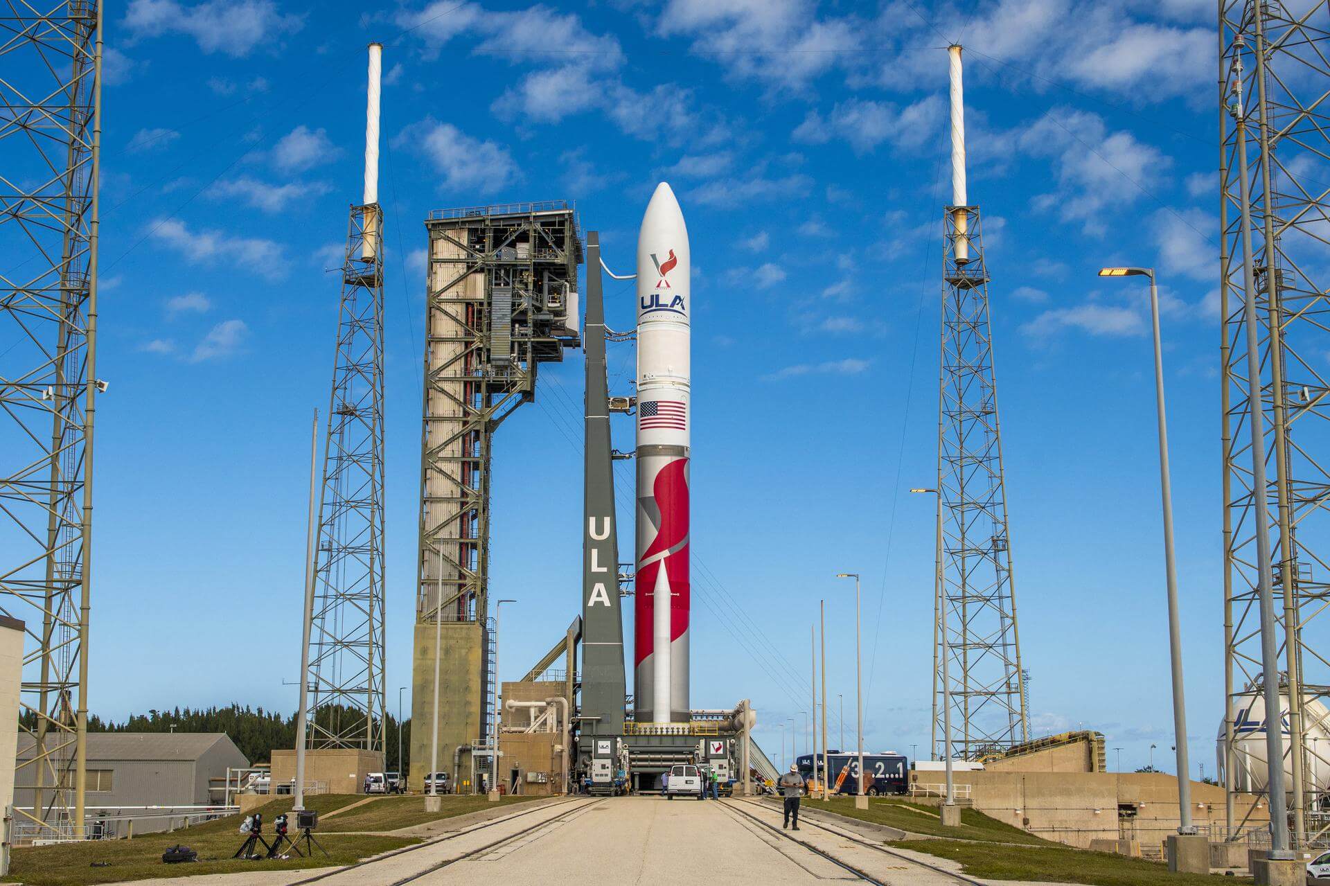
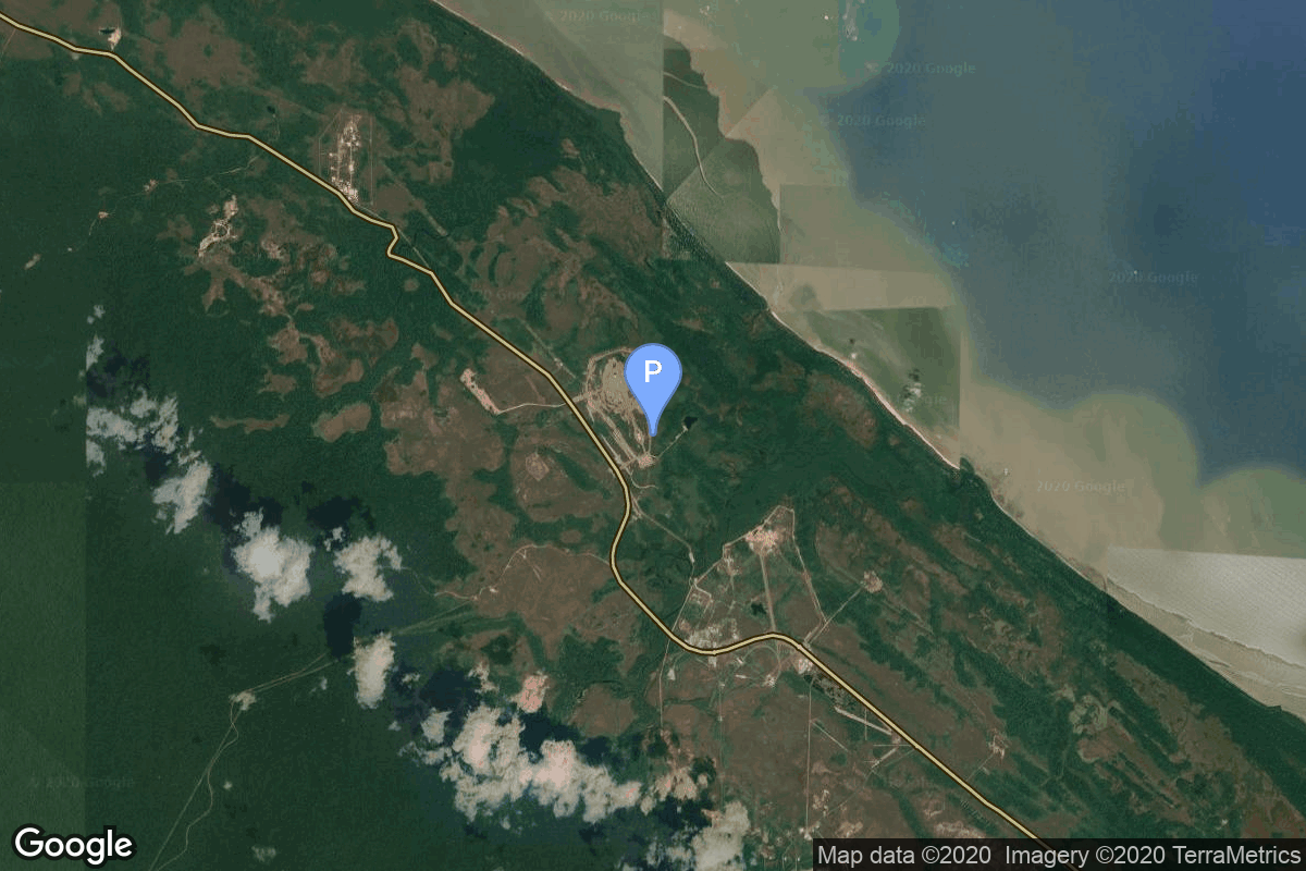
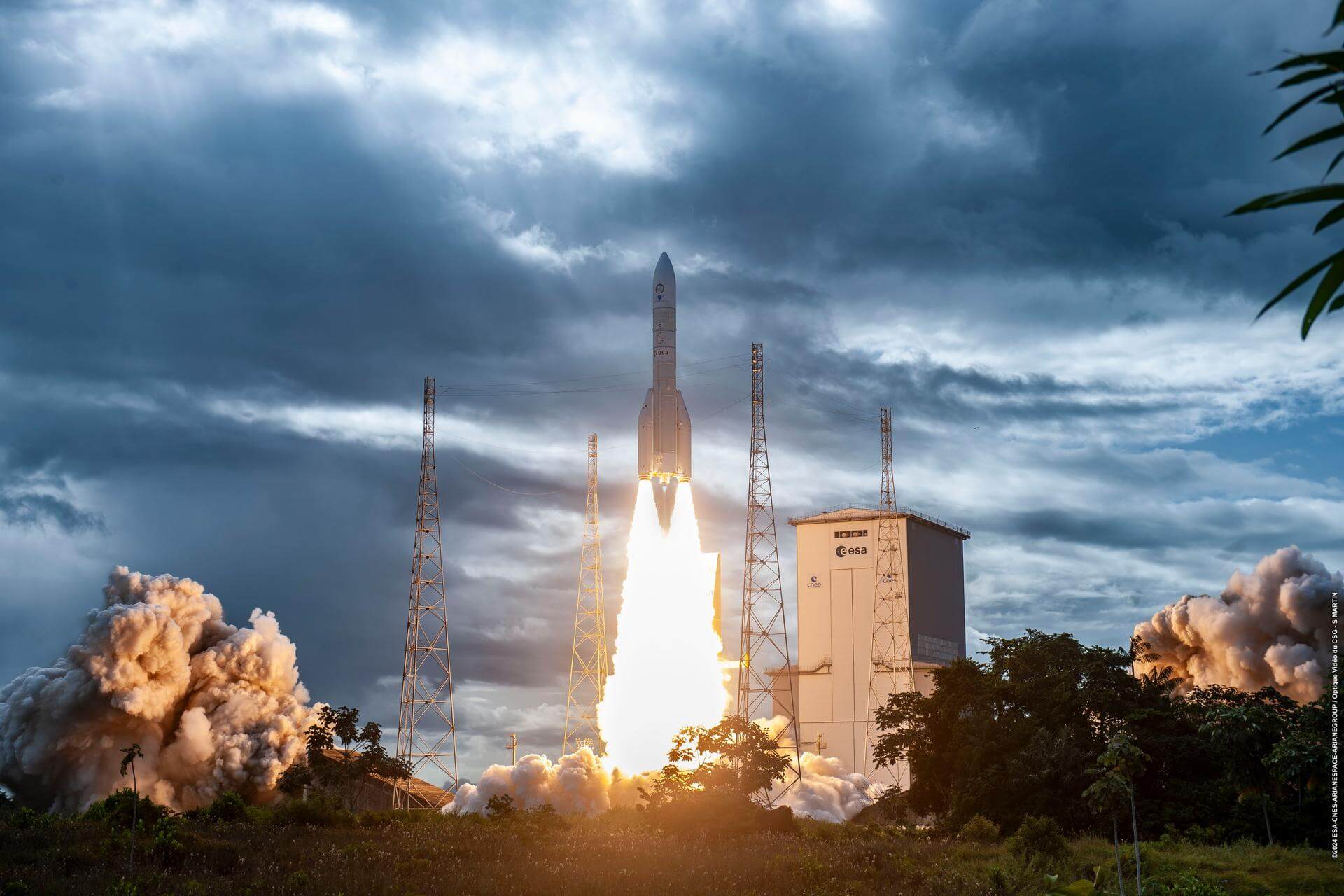
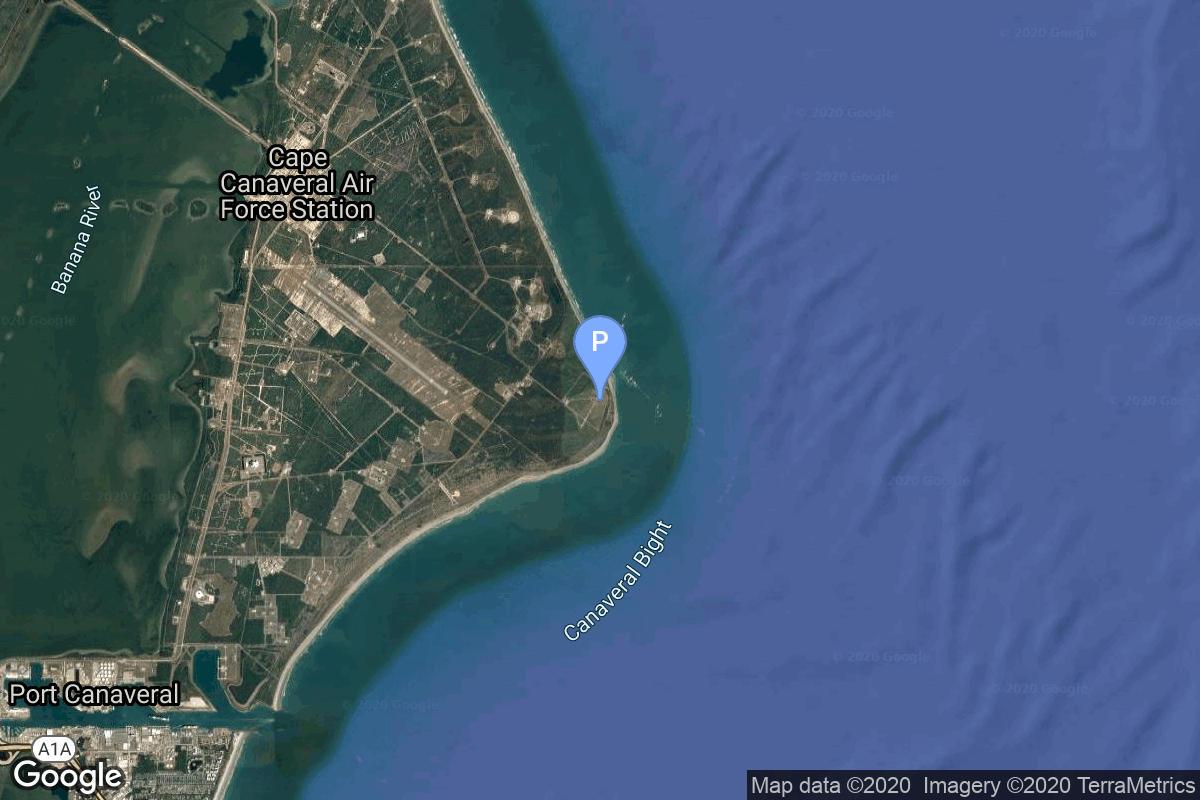
{ "count": 7692, "next": "https://ll.thespacedevs.com/2.0.0/launch/?format=api&limit=10&offset=7670", "previous": "https://ll.thespacedevs.com/2.0.0/launch/?format=api&limit=10&offset=7650", "results": [ { "id": "47cc8616-8c23-4e64-8a73-6e4d4434f3d2", "url": "https://ll.thespacedevs.com/2.0.0/launch/47cc8616-8c23-4e64-8a73-6e4d4434f3d2/?format=api", "launch_library_id": null, "slug": "electron-strix-launch-20", "name": "Electron | StriX Launch 20", "status": { "id": 2, "name": "TBD" }, "net": "2029-12-31T00:00:00Z", "window_end": "2029-12-31T00:00:00Z", "window_start": "2029-12-31T00:00:00Z", "inhold": false, "tbdtime": true, "tbddate": true, "probability": null, "holdreason": "", "failreason": "", "hashtag": null, "launch_service_provider": { "id": 147, "url": "https://ll.thespacedevs.com/2.0.0/agencies/147/?format=api", "name": "Rocket Lab", "type": "Commercial" }, "rocket": { "id": 8738, "configuration": { "id": 26, "launch_library_id": 148, "url": "https://ll.thespacedevs.com/2.0.0/config/launcher/26/?format=api", "name": "Electron", "family": "", "full_name": "Electron", "variant": "" } }, "mission": { "id": 7329, "launch_library_id": null, "name": "StriX Launch 20", "description": "Synthetic aperture radar satellite for Japanese Earth imaging company Synspective.", "launch_designator": null, "type": "Earth Science", "orbit": { "id": 17, "name": "Sun-Synchronous Orbit", "abbrev": "SSO" } }, "pad": { "id": 210, "url": "https://ll.thespacedevs.com/2.0.0/pad/210/?format=api", "agency_id": null, "name": "Unknown Pad", "info_url": null, "wiki_url": null, "map_url": null, "latitude": "-39.260881", "longitude": "177.865826", "location": { "id": 10, "url": "https://ll.thespacedevs.com/2.0.0/location/10/?format=api", "name": "Rocket Lab Launch Complex 1, Mahia Peninsula, New Zealand", "country_code": "NZL", "map_image": "https://thespacedevs-prod.nyc3.digitaloceanspaces.com/media/map_images/location_10_20200803142509.jpg", "total_launch_count": 67, "total_landing_count": 17 }, "map_image": "https://thespacedevs-prod.nyc3.digitaloceanspaces.com/media/map_images/pad_210_20230819165718.jpg", "total_launch_count": 0 }, "webcast_live": false, "image": "https://thespacedevs-prod.nyc3.digitaloceanspaces.com/media/images/electron_image_20190705175640.jpeg", "infographic": null, "program": [] }, { "id": "4c696af0-887c-4ff0-9f16-fed6bebd00bf", "url": "https://ll.thespacedevs.com/2.0.0/launch/4c696af0-887c-4ff0-9f16-fed6bebd00bf/?format=api", "launch_library_id": null, "slug": "vulcan-gps-iiif-sv02-ussf-49", "name": "Vulcan | GPS IIIF SV02 (USSF-49)", "status": { "id": 2, "name": "TBD" }, "net": "2029-12-31T00:00:00Z", "window_end": "2029-12-31T00:00:00Z", "window_start": "2029-12-31T00:00:00Z", "inhold": false, "tbdtime": true, "tbddate": true, "probability": null, "holdreason": "", "failreason": "", "hashtag": null, "launch_service_provider": { "id": 124, "url": "https://ll.thespacedevs.com/2.0.0/agencies/124/?format=api", "name": "United Launch Alliance", "type": "Commercial" }, "rocket": { "id": 8581, "configuration": { "id": 200, "launch_library_id": 226, "url": "https://ll.thespacedevs.com/2.0.0/config/launcher/200/?format=api", "name": "Vulcan", "family": "Vulcan", "full_name": "Vulcan", "variant": "Vulcan" } }, "mission": { "id": 7172, "launch_library_id": null, "name": "GPS IIIF SV02 (USSF-49)", "description": "Second Block IIIF GPS satellite", "launch_designator": null, "type": "Navigation", "orbit": { "id": 12, "name": "Medium Earth Orbit", "abbrev": "MEO" } }, "pad": { "id": 29, "url": "https://ll.thespacedevs.com/2.0.0/pad/29/?format=api", "agency_id": null, "name": "Space Launch Complex 41", "info_url": null, "wiki_url": "https://en.wikipedia.org/wiki/Cape_Canaveral_Air_Force_Station_Space_Launch_Complex_41", "map_url": "https://www.google.com/maps?q=28.58341025,-80.58303644", "latitude": "28.58341025", "longitude": "-80.58303644", "location": { "id": 12, "url": "https://ll.thespacedevs.com/2.0.0/location/12/?format=api", "name": "Cape Canaveral SFS, FL, USA", "country_code": "USA", "map_image": "https://thespacedevs-prod.nyc3.digitaloceanspaces.com/media/map_images/location_12_20200803142519.jpg", "total_launch_count": 1071, "total_landing_count": 69 }, "map_image": "https://thespacedevs-prod.nyc3.digitaloceanspaces.com/media/map_images/pad_29_20200803143528.jpg", "total_launch_count": 119 }, "webcast_live": false, "image": "https://thespacedevs-prod.nyc3.digitaloceanspaces.com/media/images/vulcan_image_20240107162928.jpeg", "infographic": null, "program": [ { "id": 29, "url": "https://ll.thespacedevs.com/2.0.0/program/29/?format=api", "name": "Global Positioning System", "description": "The Global Positioning System (GPS), originally Navstar GPS, is a satellite-based radio navigation system owned by the United States government and operated by the United States Space Force. It is one of the global navigation satellite systems (GNSS) that provide geolocation and time information to a GPS receiver anywhere on or near the Earth where there is an unobstructed line of sight to four or more GPS satellites.", "agencies": [ { "id": 1041, "url": "https://ll.thespacedevs.com/2.0.0/agencies/1041/?format=api", "name": "United States Space Force", "type": "Government" } ], "image_url": "https://thespacedevs-prod.nyc3.digitaloceanspaces.com/media/images/global2520posi_program_20231229182501.png", "start_date": "1978-02-22T00:00:00Z", "end_date": null, "info_url": "https://www.gps.gov/", "wiki_url": "https://en.wikipedia.org/wiki/Global_Positioning_System" } ] }, { "id": "582515be-18d9-4038-9bf0-8e08f40579ca", "url": "https://ll.thespacedevs.com/2.0.0/launch/582515be-18d9-4038-9bf0-8e08f40579ca/?format=api", "launch_library_id": null, "slug": "electron-strix-launch-19", "name": "Electron | StriX Launch 19", "status": { "id": 2, "name": "TBD" }, "net": "2029-12-31T00:00:00Z", "window_end": "2029-12-31T00:00:00Z", "window_start": "2029-12-31T00:00:00Z", "inhold": false, "tbdtime": true, "tbddate": true, "probability": null, "holdreason": "", "failreason": "", "hashtag": null, "launch_service_provider": { "id": 147, "url": "https://ll.thespacedevs.com/2.0.0/agencies/147/?format=api", "name": "Rocket Lab", "type": "Commercial" }, "rocket": { "id": 8737, "configuration": { "id": 26, "launch_library_id": 148, "url": "https://ll.thespacedevs.com/2.0.0/config/launcher/26/?format=api", "name": "Electron", "family": "", "full_name": "Electron", "variant": "" } }, "mission": { "id": 7328, "launch_library_id": null, "name": "StriX Launch 19", "description": "Synthetic aperture radar satellite for Japanese Earth imaging company Synspective.", "launch_designator": null, "type": "Earth Science", "orbit": { "id": 17, "name": "Sun-Synchronous Orbit", "abbrev": "SSO" } }, "pad": { "id": 210, "url": "https://ll.thespacedevs.com/2.0.0/pad/210/?format=api", "agency_id": null, "name": "Unknown Pad", "info_url": null, "wiki_url": null, "map_url": null, "latitude": "-39.260881", "longitude": "177.865826", "location": { "id": 10, "url": "https://ll.thespacedevs.com/2.0.0/location/10/?format=api", "name": "Rocket Lab Launch Complex 1, Mahia Peninsula, New Zealand", "country_code": "NZL", "map_image": "https://thespacedevs-prod.nyc3.digitaloceanspaces.com/media/map_images/location_10_20200803142509.jpg", "total_launch_count": 67, "total_landing_count": 17 }, "map_image": "https://thespacedevs-prod.nyc3.digitaloceanspaces.com/media/map_images/pad_210_20230819165718.jpg", "total_launch_count": 0 }, "webcast_live": false, "image": "https://thespacedevs-prod.nyc3.digitaloceanspaces.com/media/images/electron_image_20190705175640.jpeg", "infographic": null, "program": [] }, { "id": "6826ad67-c5a8-4293-868d-ab3d51b2bd6f", "url": "https://ll.thespacedevs.com/2.0.0/launch/6826ad67-c5a8-4293-868d-ab3d51b2bd6f/?format=api", "launch_library_id": null, "slug": "vulcan-ngg-2-ussf-50", "name": "Vulcan | NGG-2 (USSF-50)", "status": { "id": 2, "name": "TBD" }, "net": "2029-12-31T00:00:00Z", "window_end": "2029-12-31T00:00:00Z", "window_start": "2029-12-31T00:00:00Z", "inhold": false, "tbdtime": true, "tbddate": true, "probability": null, "holdreason": "", "failreason": "", "hashtag": null, "launch_service_provider": { "id": 124, "url": "https://ll.thespacedevs.com/2.0.0/agencies/124/?format=api", "name": "United Launch Alliance", "type": "Commercial" }, "rocket": { "id": 8580, "configuration": { "id": 200, "launch_library_id": 226, "url": "https://ll.thespacedevs.com/2.0.0/config/launcher/200/?format=api", "name": "Vulcan", "family": "Vulcan", "full_name": "Vulcan", "variant": "Vulcan" } }, "mission": { "id": 7171, "launch_library_id": null, "name": "NGG-2 (USSF-50)", "description": "Second Next-Generation Overhead Persistent Infrared GEO (NGG) satellite for the US Space Force. It is designed to deliver survivable, resilient missile warning, tracking, and defense.", "launch_designator": null, "type": "Government/Top Secret", "orbit": { "id": 25, "name": "Unknown", "abbrev": "N/A" } }, "pad": { "id": 29, "url": "https://ll.thespacedevs.com/2.0.0/pad/29/?format=api", "agency_id": null, "name": "Space Launch Complex 41", "info_url": null, "wiki_url": "https://en.wikipedia.org/wiki/Cape_Canaveral_Air_Force_Station_Space_Launch_Complex_41", "map_url": "https://www.google.com/maps?q=28.58341025,-80.58303644", "latitude": "28.58341025", "longitude": "-80.58303644", "location": { "id": 12, "url": "https://ll.thespacedevs.com/2.0.0/location/12/?format=api", "name": "Cape Canaveral SFS, FL, USA", "country_code": "USA", "map_image": "https://thespacedevs-prod.nyc3.digitaloceanspaces.com/media/map_images/location_12_20200803142519.jpg", "total_launch_count": 1071, "total_landing_count": 69 }, "map_image": "https://thespacedevs-prod.nyc3.digitaloceanspaces.com/media/map_images/pad_29_20200803143528.jpg", "total_launch_count": 119 }, "webcast_live": false, "image": "https://thespacedevs-prod.nyc3.digitaloceanspaces.com/media/images/vulcan_image_20240107162928.jpeg", "infographic": null, "program": [] }, { "id": "739d1744-7924-4988-b9e4-8759308d243c", "url": "https://ll.thespacedevs.com/2.0.0/launch/739d1744-7924-4988-b9e4-8759308d243c/?format=api", "launch_library_id": null, "slug": "electron-strix-launch-21", "name": "Electron | StriX Launch 21", "status": { "id": 2, "name": "TBD" }, "net": "2029-12-31T00:00:00Z", "window_end": "2029-12-31T00:00:00Z", "window_start": "2029-12-31T00:00:00Z", "inhold": false, "tbdtime": true, "tbddate": true, "probability": null, "holdreason": "", "failreason": "", "hashtag": null, "launch_service_provider": { "id": 147, "url": "https://ll.thespacedevs.com/2.0.0/agencies/147/?format=api", "name": "Rocket Lab", "type": "Commercial" }, "rocket": { "id": 8739, "configuration": { "id": 26, "launch_library_id": 148, "url": "https://ll.thespacedevs.com/2.0.0/config/launcher/26/?format=api", "name": "Electron", "family": "", "full_name": "Electron", "variant": "" } }, "mission": { "id": 7330, "launch_library_id": null, "name": "StriX Launch 21", "description": "Synthetic aperture radar satellite for Japanese Earth imaging company Synspective.", "launch_designator": null, "type": "Earth Science", "orbit": { "id": 17, "name": "Sun-Synchronous Orbit", "abbrev": "SSO" } }, "pad": { "id": 210, "url": "https://ll.thespacedevs.com/2.0.0/pad/210/?format=api", "agency_id": null, "name": "Unknown Pad", "info_url": null, "wiki_url": null, "map_url": null, "latitude": "-39.260881", "longitude": "177.865826", "location": { "id": 10, "url": "https://ll.thespacedevs.com/2.0.0/location/10/?format=api", "name": "Rocket Lab Launch Complex 1, Mahia Peninsula, New Zealand", "country_code": "NZL", "map_image": "https://thespacedevs-prod.nyc3.digitaloceanspaces.com/media/map_images/location_10_20200803142509.jpg", "total_launch_count": 67, "total_landing_count": 17 }, "map_image": "https://thespacedevs-prod.nyc3.digitaloceanspaces.com/media/map_images/pad_210_20230819165718.jpg", "total_launch_count": 0 }, "webcast_live": false, "image": "https://thespacedevs-prod.nyc3.digitaloceanspaces.com/media/images/electron_image_20190705175640.jpeg", "infographic": null, "program": [] }, { "id": "793c9a86-b242-417c-893a-790222a28fc7", "url": "https://ll.thespacedevs.com/2.0.0/launch/793c9a86-b242-417c-893a-790222a28fc7/?format=api", "launch_library_id": null, "slug": "vega-c-sbg-tir", "name": "Vega-C | SBG-TIR", "status": { "id": 2, "name": "TBD" }, "net": "2029-12-31T00:00:00Z", "window_end": "2029-12-31T00:00:00Z", "window_start": "2029-12-31T00:00:00Z", "inhold": false, "tbdtime": true, "tbddate": true, "probability": null, "holdreason": "", "failreason": "", "hashtag": null, "launch_service_provider": { "id": 159, "url": "https://ll.thespacedevs.com/2.0.0/agencies/159/?format=api", "name": "Avio S.p.A", "type": "Commercial" }, "rocket": { "id": 8525, "configuration": { "id": 127, "launch_library_id": 163, "url": "https://ll.thespacedevs.com/2.0.0/config/launcher/127/?format=api", "name": "Vega-C", "family": "Vega", "full_name": "Vega-C", "variant": "" } }, "mission": { "id": 7115, "launch_library_id": null, "name": "SBG-TIR", "description": "The Surface Biology and Geology - Thermal Infrared (SBG-TIR) Earth Observation mission aims to provide radiometric and multispectral measurements of terrestrial and aquatic emissions for climate, ecological, and geological analyses, and to support practical applications such as food security and water management. The thermal infrared (TIR) radiometer is provided by NASA, while the VIS-NIR camera is provided by ASI. Their combination ensures high-quality observations, enabling the investigation of terrestrial and marine ecosystems, monitoring of water resources, and phenomena related to high temperatures such as wildfires and volcanic eruptions.", "launch_designator": null, "type": "Earth Science", "orbit": { "id": 17, "name": "Sun-Synchronous Orbit", "abbrev": "SSO" } }, "pad": { "id": 34, "url": "https://ll.thespacedevs.com/2.0.0/pad/34/?format=api", "agency_id": 115, "name": "Ariane Launch Area 1 (ELV)", "info_url": null, "wiki_url": "https://en.wikipedia.org/wiki/ELA-1", "map_url": "https://www.google.com/maps?q=5.236,-52.775", "latitude": "5.236", "longitude": "-52.775", "location": { "id": 13, "url": "https://ll.thespacedevs.com/2.0.0/location/13/?format=api", "name": "Guiana Space Centre, French Guiana", "country_code": "GUF", "map_image": "https://thespacedevs-prod.nyc3.digitaloceanspaces.com/media/map_images/location_13_20200803142412.jpg", "total_launch_count": 328, "total_landing_count": 0 }, "map_image": "https://thespacedevs-prod.nyc3.digitaloceanspaces.com/media/map_images/pad_34_20200803143527.jpg", "total_launch_count": 53 }, "webcast_live": false, "image": "https://thespacedevs-prod.nyc3.digitaloceanspaces.com/media/images/vega-c_image_20220713154437.jpg", "infographic": null, "program": [] }, { "id": "8a75d257-7b26-48a2-bf8b-6c68dce6f38b", "url": "https://ll.thespacedevs.com/2.0.0/launch/8a75d257-7b26-48a2-bf8b-6c68dce6f38b/?format=api", "launch_library_id": null, "slug": "electron-strix-launch-23", "name": "Electron | StriX Launch 23", "status": { "id": 2, "name": "TBD" }, "net": "2029-12-31T00:00:00Z", "window_end": "2029-12-31T00:00:00Z", "window_start": "2029-12-31T00:00:00Z", "inhold": false, "tbdtime": true, "tbddate": true, "probability": null, "holdreason": "", "failreason": "", "hashtag": null, "launch_service_provider": { "id": 147, "url": "https://ll.thespacedevs.com/2.0.0/agencies/147/?format=api", "name": "Rocket Lab", "type": "Commercial" }, "rocket": { "id": 8741, "configuration": { "id": 26, "launch_library_id": 148, "url": "https://ll.thespacedevs.com/2.0.0/config/launcher/26/?format=api", "name": "Electron", "family": "", "full_name": "Electron", "variant": "" } }, "mission": { "id": 7332, "launch_library_id": null, "name": "StriX Launch 23", "description": "Synthetic aperture radar satellite for Japanese Earth imaging company Synspective.", "launch_designator": null, "type": "Earth Science", "orbit": { "id": 17, "name": "Sun-Synchronous Orbit", "abbrev": "SSO" } }, "pad": { "id": 210, "url": "https://ll.thespacedevs.com/2.0.0/pad/210/?format=api", "agency_id": null, "name": "Unknown Pad", "info_url": null, "wiki_url": null, "map_url": null, "latitude": "-39.260881", "longitude": "177.865826", "location": { "id": 10, "url": "https://ll.thespacedevs.com/2.0.0/location/10/?format=api", "name": "Rocket Lab Launch Complex 1, Mahia Peninsula, New Zealand", "country_code": "NZL", "map_image": "https://thespacedevs-prod.nyc3.digitaloceanspaces.com/media/map_images/location_10_20200803142509.jpg", "total_launch_count": 67, "total_landing_count": 17 }, "map_image": "https://thespacedevs-prod.nyc3.digitaloceanspaces.com/media/map_images/pad_210_20230819165718.jpg", "total_launch_count": 0 }, "webcast_live": false, "image": "https://thespacedevs-prod.nyc3.digitaloceanspaces.com/media/images/electron_image_20190705175640.jpeg", "infographic": null, "program": [] }, { "id": "a5e056e5-1e07-4479-9352-bd18cd7eecf7", "url": "https://ll.thespacedevs.com/2.0.0/launch/a5e056e5-1e07-4479-9352-bd18cd7eecf7/?format=api", "launch_library_id": null, "slug": "ariane-6-2-x-galileo-second-generation-g2", "name": "Ariane 6 | 2 x Galileo Second Generation (G2)", "status": { "id": 2, "name": "TBD" }, "net": "2029-12-31T00:00:00Z", "window_end": "2029-12-31T00:00:00Z", "window_start": "2029-12-31T00:00:00Z", "inhold": false, "tbdtime": true, "tbddate": true, "probability": null, "holdreason": "", "failreason": "", "hashtag": null, "launch_service_provider": { "id": 115, "url": "https://ll.thespacedevs.com/2.0.0/agencies/115/?format=api", "name": "Arianespace", "type": "Commercial" }, "rocket": { "id": 8509, "configuration": { "id": 506, "launch_library_id": null, "url": "https://ll.thespacedevs.com/2.0.0/config/launcher/506/?format=api", "name": "Ariane 6", "family": "Ariane", "full_name": "Ariane 6", "variant": "N/A" } }, "mission": { "id": 7099, "launch_library_id": null, "name": "2 x Galileo Second Generation (G2)", "description": "Payload consists of two satellites for Europe's second generation Galileo navigation system.", "launch_designator": null, "type": "Navigation", "orbit": { "id": 12, "name": "Medium Earth Orbit", "abbrev": "MEO" } }, "pad": { "id": 67, "url": "https://ll.thespacedevs.com/2.0.0/pad/67/?format=api", "agency_id": 115, "name": "Ariane Launch Area 4", "info_url": null, "wiki_url": "https://en.wikipedia.org/wiki/Guiana_Space_Centre", "map_url": "https://www.google.com/maps?q=5.256319,-52.786838", "latitude": "5.256319", "longitude": "-52.786838", "location": { "id": 13, "url": "https://ll.thespacedevs.com/2.0.0/location/13/?format=api", "name": "Guiana Space Centre, French Guiana", "country_code": "GUF", "map_image": "https://thespacedevs-prod.nyc3.digitaloceanspaces.com/media/map_images/location_13_20200803142412.jpg", "total_launch_count": 328, "total_landing_count": 0 }, "map_image": "https://thespacedevs-prod.nyc3.digitaloceanspaces.com/media/map_images/pad_67_20200803143559.jpg", "total_launch_count": 4 }, "webcast_live": false, "image": "https://thespacedevs-prod.nyc3.digitaloceanspaces.com/media/images/ariane_62_lifto_image_20240711132056.jpeg", "infographic": null, "program": [ { "id": 30, "url": "https://ll.thespacedevs.com/2.0.0/program/30/?format=api", "name": "Galileo", "description": "Galileo is a global navigation satellite system (GNSS) that went live in 2016, created by the European Union through the European Space Agency (ESA), operated by the European Union Agency for the Space Programme (EUSPA).", "agencies": [ { "id": 27, "url": "https://ll.thespacedevs.com/2.0.0/agencies/27/?format=api", "name": "European Space Agency", "type": "Multinational" } ], "image_url": "https://thespacedevs-prod.nyc3.digitaloceanspaces.com/media/images/galileo_program_20231230110547.png", "start_date": "2011-10-21T10:30:00Z", "end_date": null, "info_url": "https://www.gsc-europa.eu/", "wiki_url": "https://en.wikipedia.org/wiki/Galileo_(satellite_navigation)" } ] }, { "id": "ae0eb5dc-cd7e-4d1d-9f57-4d28a2ba3611", "url": "https://ll.thespacedevs.com/2.0.0/launch/ae0eb5dc-cd7e-4d1d-9f57-4d28a2ba3611/?format=api", "launch_library_id": null, "slug": "falcon-9-block-5-ussf-234", "name": "Falcon 9 Block 5 | USSF-234", "status": { "id": 2, "name": "TBD" }, "net": "2029-12-31T00:00:00Z", "window_end": "2029-12-31T00:00:00Z", "window_start": "2029-12-31T00:00:00Z", "inhold": false, "tbdtime": true, "tbddate": true, "probability": null, "holdreason": "", "failreason": "", "hashtag": null, "launch_service_provider": { "id": 121, "url": "https://ll.thespacedevs.com/2.0.0/agencies/121/?format=api", "name": "SpaceX", "type": "Commercial" }, "rocket": { "id": 8577, "configuration": { "id": 164, "launch_library_id": 188, "url": "https://ll.thespacedevs.com/2.0.0/config/launcher/164/?format=api", "name": "Falcon 9", "family": "Falcon", "full_name": "Falcon 9 Block 5", "variant": "Block 5" } }, "mission": { "id": 7168, "launch_library_id": null, "name": "USSF-234", "description": "Classified US Space Force mission", "launch_designator": null, "type": "Government/Top Secret", "orbit": { "id": 25, "name": "Unknown", "abbrev": "N/A" } }, "pad": { "id": 72, "url": "https://ll.thespacedevs.com/2.0.0/pad/72/?format=api", "agency_id": null, "name": "Unknown Pad", "info_url": null, "wiki_url": "", "map_url": "https://www.google.com/maps?q=28.458,-80.528", "latitude": "28.458", "longitude": "-80.528", "location": { "id": 12, "url": "https://ll.thespacedevs.com/2.0.0/location/12/?format=api", "name": "Cape Canaveral SFS, FL, USA", "country_code": "USA", "map_image": "https://thespacedevs-prod.nyc3.digitaloceanspaces.com/media/map_images/location_12_20200803142519.jpg", "total_launch_count": 1071, "total_landing_count": 69 }, "map_image": "https://thespacedevs-prod.nyc3.digitaloceanspaces.com/media/map_images/pad_72_20200803143403.jpg", "total_launch_count": 0 }, "webcast_live": false, "image": "https://thespacedevs-prod.nyc3.digitaloceanspaces.com/media/images/falcon_9_image_20230807133459.jpeg", "infographic": null, "program": [] }, { "id": "b0634bea-4769-4846-8546-b7574d571bbc", "url": "https://ll.thespacedevs.com/2.0.0/launch/b0634bea-4769-4846-8546-b7574d571bbc/?format=api", "launch_library_id": null, "slug": "vega-c-clearspace-1", "name": "Vega-C | ClearSpace-1", "status": { "id": 2, "name": "TBD" }, "net": "2029-12-31T00:00:00Z", "window_end": "2029-12-31T00:00:00Z", "window_start": "2029-12-31T00:00:00Z", "inhold": false, "tbdtime": true, "tbddate": true, "probability": null, "holdreason": "", "failreason": "", "hashtag": null, "launch_service_provider": { "id": 159, "url": "https://ll.thespacedevs.com/2.0.0/agencies/159/?format=api", "name": "Avio S.p.A", "type": "Commercial" }, "rocket": { "id": 7765, "configuration": { "id": 127, "launch_library_id": 163, "url": "https://ll.thespacedevs.com/2.0.0/config/launcher/127/?format=api", "name": "Vega-C", "family": "Vega", "full_name": "Vega-C", "variant": "" } }, "mission": { "id": 6283, "launch_library_id": null, "name": "ClearSpace-1", "description": "First debris removal mission by the Swiss startup ClearSpace. Contracted by the European Space Agency, it is designed to catch and de-orbit part of a Vega rocket from Low Earth Orbit using four articulated arms.", "launch_designator": null, "type": "Technology", "orbit": { "id": 8, "name": "Low Earth Orbit", "abbrev": "LEO" } }, "pad": { "id": 34, "url": "https://ll.thespacedevs.com/2.0.0/pad/34/?format=api", "agency_id": 115, "name": "Ariane Launch Area 1 (ELV)", "info_url": null, "wiki_url": "https://en.wikipedia.org/wiki/ELA-1", "map_url": "https://www.google.com/maps?q=5.236,-52.775", "latitude": "5.236", "longitude": "-52.775", "location": { "id": 13, "url": "https://ll.thespacedevs.com/2.0.0/location/13/?format=api", "name": "Guiana Space Centre, French Guiana", "country_code": "GUF", "map_image": "https://thespacedevs-prod.nyc3.digitaloceanspaces.com/media/map_images/location_13_20200803142412.jpg", "total_launch_count": 328, "total_landing_count": 0 }, "map_image": "https://thespacedevs-prod.nyc3.digitaloceanspaces.com/media/map_images/pad_34_20200803143527.jpg", "total_launch_count": 53 }, "webcast_live": false, "image": "https://thespacedevs-prod.nyc3.digitaloceanspaces.com/media/images/vega-c_image_20220713154437.jpg", "infographic": null, "program": [] } ] }