Launch List
API endpoint that returns all Launch objects or a single launch.
EXAMPLE - /launch/
GET: Return a list of all Launch objects.
FILTERS: Fields - 'name', 'id(s)', 'lsp_id', 'lsp_name', 'serial_number', 'launcher_config__id', 'rocket__spacecraftflight__spacecraft__name'
MODE: 'normal', 'list', 'detailed' EXAMPLE: ?mode=list
SEARCH: Searches through the launch name, rocket name, launch agency, mission name & spacecraft name. EXAMPLE - ?search=SpaceX
GET /2.0.0/launch/?format=api&offset=7480&ordering=-id
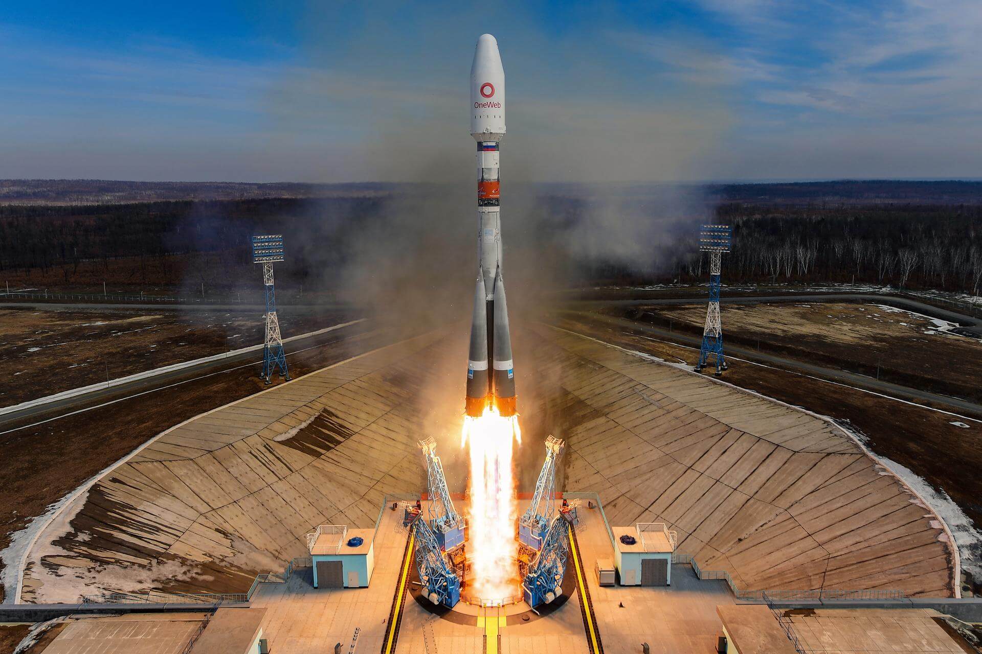
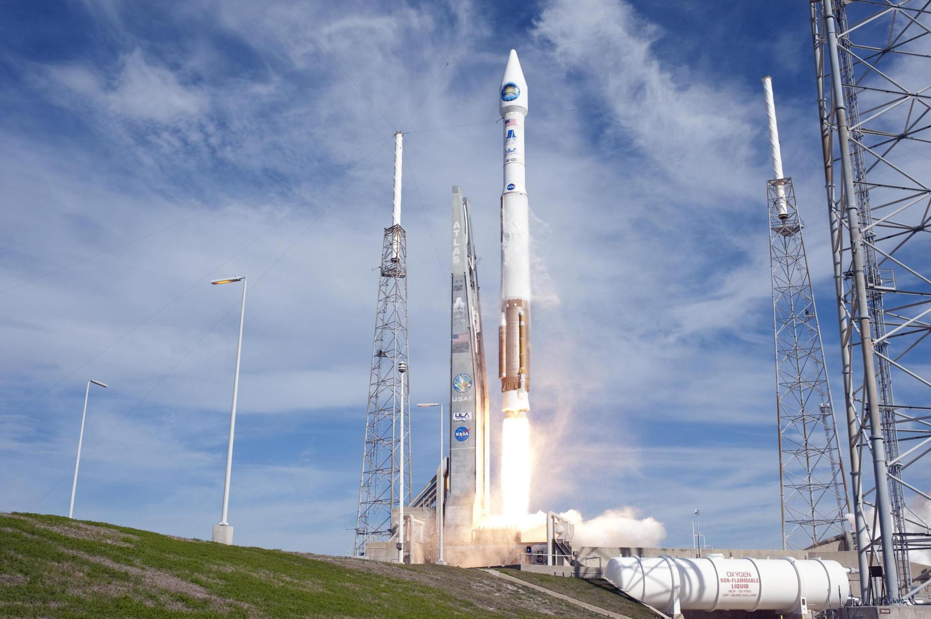
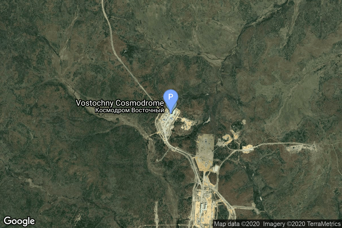
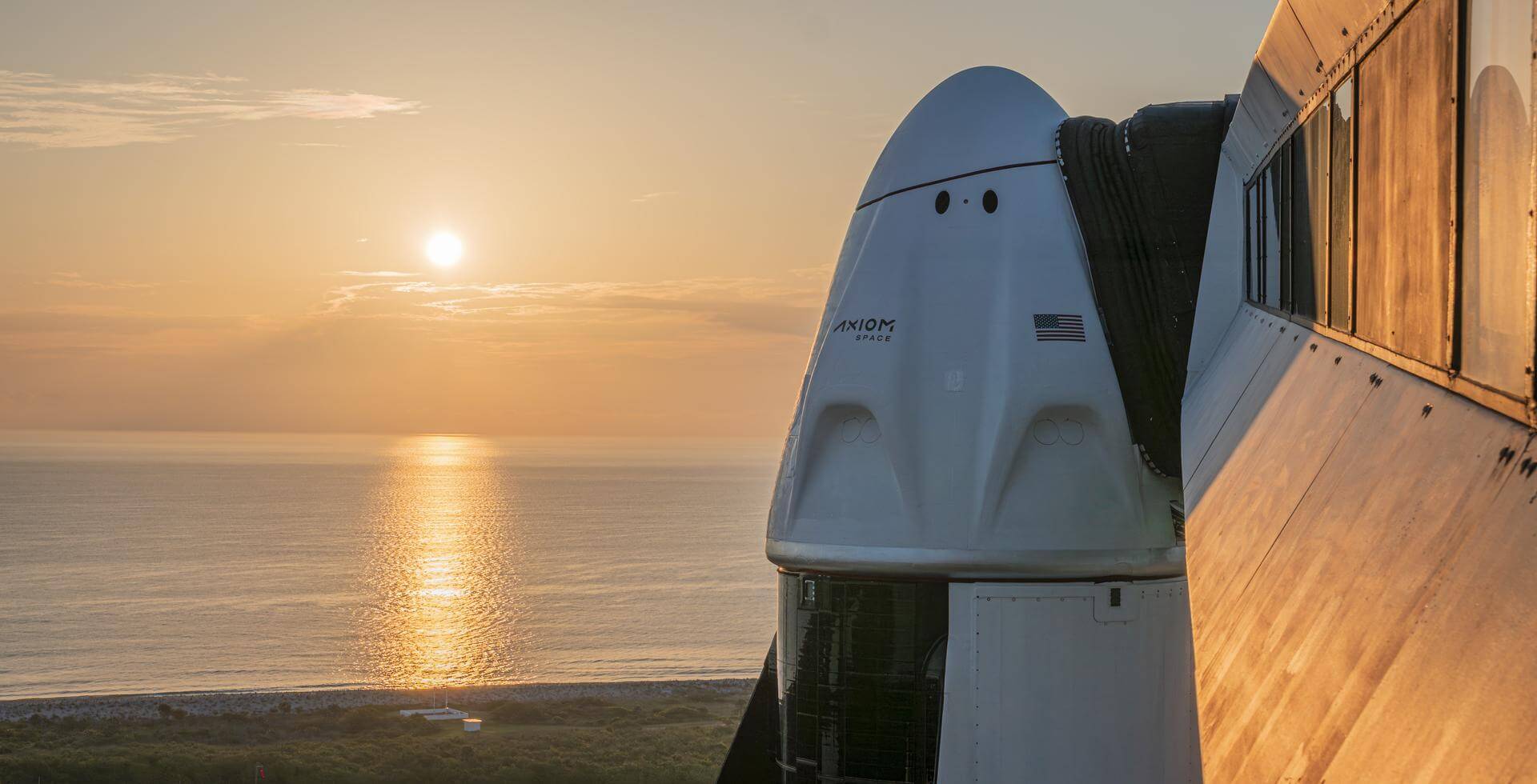
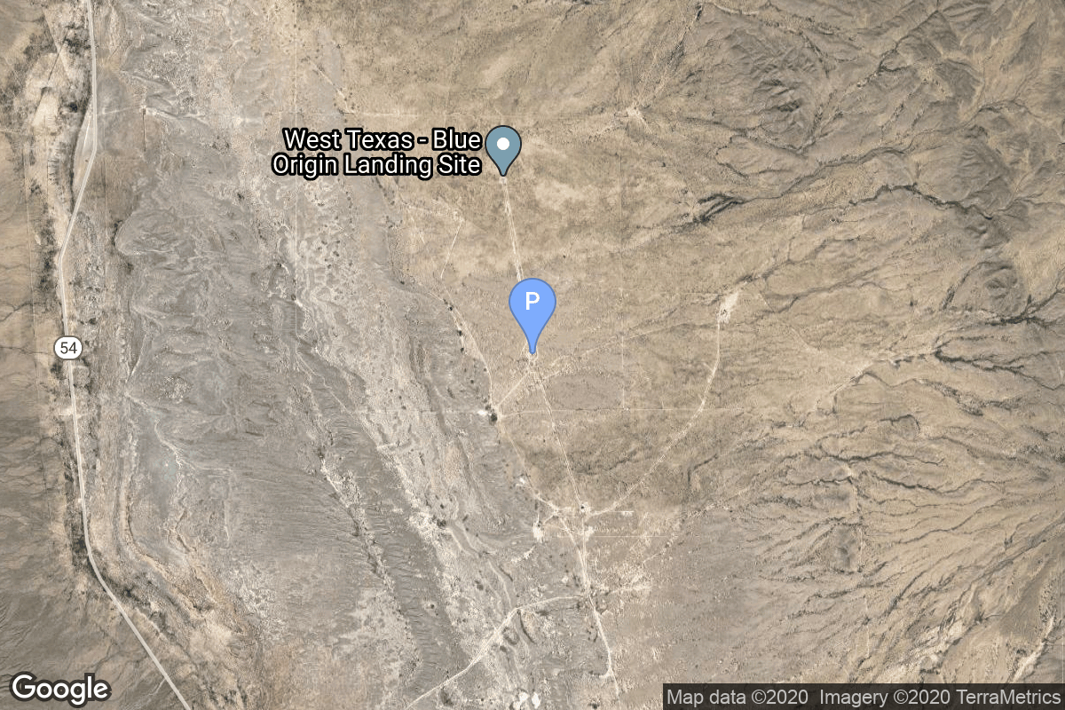
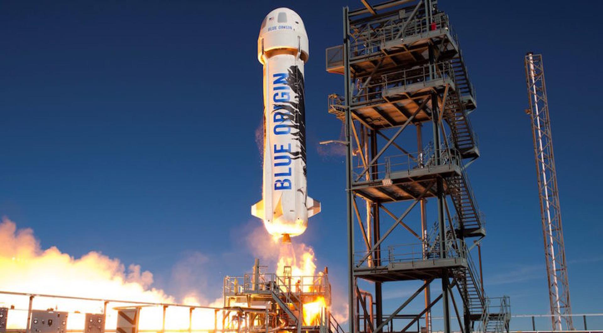
{ "count": 7730, "next": "https://ll.thespacedevs.com/2.0.0/launch/?format=api&limit=10&offset=7490&ordering=-id", "previous": "https://ll.thespacedevs.com/2.0.0/launch/?format=api&limit=10&offset=7470&ordering=-id", "results": [ { "id": "0834f42e-8b04-4026-a3e1-df7a0d570bba", "url": "https://ll.thespacedevs.com/2.0.0/launch/0834f42e-8b04-4026-a3e1-df7a0d570bba/?format=api", "launch_library_id": null, "slug": "soyuz-21bfregat-m-oneweb-10", "name": "Soyuz 2.1b/Fregat-M | OneWeb 10", "status": { "id": 3, "name": "Success" }, "net": "2021-09-14T18:07:19Z", "window_end": "2021-09-14T18:07:19Z", "window_start": "2021-09-14T18:07:19Z", "inhold": false, "tbdtime": false, "tbddate": false, "probability": null, "holdreason": "", "failreason": "", "hashtag": null, "launch_service_provider": { "id": 115, "url": "https://ll.thespacedevs.com/2.0.0/agencies/115/?format=api", "name": "Arianespace", "type": "Commercial" }, "rocket": { "id": 2856, "configuration": { "id": 134, "launch_library_id": 153, "url": "https://ll.thespacedevs.com/2.0.0/config/launcher/134/?format=api", "name": "Soyuz 2.1b/Fregat-M", "family": "Soyuz", "full_name": "Soyuz 2.1b Fregat-M", "variant": "Fregat-M" } }, "mission": { "id": 1270, "launch_library_id": null, "name": "OneWeb 10", "description": "A batch of 34 satellites for the OneWeb satellite constellation, which is intended to provide global Internet broadband service for individual consumers. The constellation is planned to have around 648 microsatellites (of which 60 are spares), around 150 kg each, operating in Ku-band from low Earth orbit.", "launch_designator": null, "type": "Communications", "orbit": { "id": 13, "name": "Polar Orbit", "abbrev": "PO" } }, "pad": { "id": 20, "url": "https://ll.thespacedevs.com/2.0.0/pad/20/?format=api", "agency_id": null, "name": "31/6", "info_url": null, "wiki_url": "https://en.wikipedia.org/wiki/Baikonur_Cosmodrome_Site_31", "map_url": "https://www.google.com/maps?q=45.996034,63.564003", "latitude": "45.996034", "longitude": "63.564003", "location": { "id": 15, "url": "https://ll.thespacedevs.com/2.0.0/location/15/?format=api", "name": "Baikonur Cosmodrome, Republic of Kazakhstan", "country_code": "KAZ", "map_image": "https://thespacedevs-prod.nyc3.digitaloceanspaces.com/media/map_images/location_15_20200803142517.jpg", "total_launch_count": 1559, "total_landing_count": 0 }, "map_image": "https://thespacedevs-prod.nyc3.digitaloceanspaces.com/media/map_images/pad_20_20200803143516.jpg", "total_launch_count": 426 }, "webcast_live": false, "image": "https://thespacedevs-prod.nyc3.digitaloceanspaces.com/media/images/soyuz25202.1b_image_20210520085936.jpeg", "infographic": null, "program": [ { "id": 26, "url": "https://ll.thespacedevs.com/2.0.0/program/26/?format=api", "name": "OneWeb", "description": "Satellite constellation in low Earth orbit that can provide high-speed broadband internet to rural and isolated areas.", "agencies": [ { "id": 1081, "url": "https://ll.thespacedevs.com/2.0.0/agencies/1081/?format=api", "name": "Eutelsat OneWeb", "type": "Commercial" } ], "image_url": "https://thespacedevs-prod.nyc3.digitaloceanspaces.com/media/images/oneweb_program_20231228155842.jpeg", "start_date": "2019-02-27T21:37:00Z", "end_date": null, "info_url": "https://oneweb.net/", "wiki_url": "https://en.wikipedia.org/wiki/Eutelsat_OneWeb" } ] }, { "id": "083153f8-436d-4689-8ba5-84bd32bfe57b", "url": "https://ll.thespacedevs.com/2.0.0/launch/083153f8-436d-4689-8ba5-84bd32bfe57b/?format=api", "launch_library_id": 307, "slug": "atlas-v-401-gps-iif-7-usa-256", "name": "Atlas V 401 | GPS IIF-7 (USA-256)", "status": { "id": 3, "name": "Success" }, "net": "2014-08-02T03:23:00Z", "window_end": "2014-08-02T03:23:00Z", "window_start": "2014-08-02T03:23:00Z", "inhold": false, "tbdtime": false, "tbddate": false, "probability": null, "holdreason": "", "failreason": "", "hashtag": null, "launch_service_provider": { "id": 124, "url": "https://ll.thespacedevs.com/2.0.0/agencies/124/?format=api", "name": "United Launch Alliance", "type": "Commercial" }, "rocket": { "id": 1775, "configuration": { "id": 16, "launch_library_id": 26, "url": "https://ll.thespacedevs.com/2.0.0/config/launcher/16/?format=api", "name": "Atlas V 401", "family": "Atlas", "full_name": "Atlas V 401", "variant": "401" } }, "mission": { "id": 6729, "launch_library_id": null, "name": "GPS IIF-7 (USA-256)", "description": "GPS IIF-7 is a next-generation GPS satellite which provides navigational assistance for U.S. military operations on land, at sea, and in the air.", "launch_designator": null, "type": "Navigation", "orbit": { "id": 12, "name": "Medium Earth Orbit", "abbrev": "MEO" } }, "pad": { "id": 29, "url": "https://ll.thespacedevs.com/2.0.0/pad/29/?format=api", "agency_id": null, "name": "Space Launch Complex 41", "info_url": null, "wiki_url": "https://en.wikipedia.org/wiki/Cape_Canaveral_Air_Force_Station_Space_Launch_Complex_41", "map_url": "https://www.google.com/maps?q=28.58341025,-80.58303644", "latitude": "28.58341025", "longitude": "-80.58303644", "location": { "id": 12, "url": "https://ll.thespacedevs.com/2.0.0/location/12/?format=api", "name": "Cape Canaveral SFS, FL, USA", "country_code": "USA", "map_image": "https://thespacedevs-prod.nyc3.digitaloceanspaces.com/media/map_images/location_12_20200803142519.jpg", "total_launch_count": 1074, "total_landing_count": 70 }, "map_image": "https://thespacedevs-prod.nyc3.digitaloceanspaces.com/media/map_images/pad_29_20200803143528.jpg", "total_launch_count": 119 }, "webcast_live": false, "image": "https://thespacedevs-prod.nyc3.digitaloceanspaces.com/media/images/atlas_v_image_20201212013334.jpeg", "infographic": null, "program": [ { "id": 29, "url": "https://ll.thespacedevs.com/2.0.0/program/29/?format=api", "name": "Global Positioning System", "description": "The Global Positioning System (GPS), originally Navstar GPS, is a satellite-based radio navigation system owned by the United States government and operated by the United States Space Force. It is one of the global navigation satellite systems (GNSS) that provide geolocation and time information to a GPS receiver anywhere on or near the Earth where there is an unobstructed line of sight to four or more GPS satellites.", "agencies": [ { "id": 1041, "url": "https://ll.thespacedevs.com/2.0.0/agencies/1041/?format=api", "name": "United States Space Force", "type": "Government" } ], "image_url": "https://thespacedevs-prod.nyc3.digitaloceanspaces.com/media/images/global2520posi_program_20231229182501.png", "start_date": "1978-02-22T00:00:00Z", "end_date": null, "info_url": "https://www.gps.gov/", "wiki_url": "https://en.wikipedia.org/wiki/Global_Positioning_System" } ] }, { "id": "082ee822-2ec2-4329-a6dc-8d319e0c6dd5", "url": "https://ll.thespacedevs.com/2.0.0/launch/082ee822-2ec2-4329-a6dc-8d319e0c6dd5/?format=api", "launch_library_id": null, "slug": "soyuz-21bfregat-m-gonets-m33-gonets-m34-gonets-m35", "name": "Soyuz 2.1b/Fregat-M | Gonets-M33, Gonets-M34, Gonets-M35 & Skif-D", "status": { "id": 3, "name": "Success" }, "net": "2022-10-22T19:57:09Z", "window_end": "2022-10-22T19:57:09Z", "window_start": "2022-10-22T19:57:09Z", "inhold": false, "tbdtime": false, "tbddate": false, "probability": null, "holdreason": "", "failreason": "", "hashtag": null, "launch_service_provider": { "id": 63, "url": "https://ll.thespacedevs.com/2.0.0/agencies/63/?format=api", "name": "Russian Federal Space Agency (ROSCOSMOS)", "type": "Government" }, "rocket": { "id": 7633, "configuration": { "id": 134, "launch_library_id": 153, "url": "https://ll.thespacedevs.com/2.0.0/config/launcher/134/?format=api", "name": "Soyuz 2.1b/Fregat-M", "family": "Soyuz", "full_name": "Soyuz 2.1b Fregat-M", "variant": "Fregat-M" } }, "mission": { "id": 6134, "launch_library_id": null, "name": "Gonets-M33, Gonets-M34, Gonets-M35 & Skif-D", "description": "Gonets-M are an upgraded version of Gonets satellites, derived from military communications system Strela-3. Gonets-M constellation is tasked with monitoring ecological and industrial objects, providing communication and data transmission services, covering also the remote areas like the Far North region.\r\n\r\nAlso onboard is the Skif-D demonstration satellite for the planned Russian Sfera LEO communication satellite constellation.", "launch_designator": null, "type": "Communications", "orbit": { "id": 8, "name": "Low Earth Orbit", "abbrev": "LEO" } }, "pad": { "id": 83, "url": "https://ll.thespacedevs.com/2.0.0/pad/83/?format=api", "agency_id": 63, "name": "Cosmodrome Site 1S", "info_url": null, "wiki_url": "https://en.wikipedia.org/wiki/Vostochny_Cosmodrome", "map_url": "https://www.google.com/maps?q=51.884395,128.333932", "latitude": "51.884395", "longitude": "128.333932", "location": { "id": 18, "url": "https://ll.thespacedevs.com/2.0.0/location/18/?format=api", "name": "Vostochny Cosmodrome, Siberia, Russian Federation", "country_code": "RUS", "map_image": "https://thespacedevs-prod.nyc3.digitaloceanspaces.com/media/map_images/location_18_20200803142401.jpg", "total_launch_count": 20, "total_landing_count": 0 }, "map_image": "https://thespacedevs-prod.nyc3.digitaloceanspaces.com/media/map_images/pad_83_20200803143544.jpg", "total_launch_count": 19 }, "webcast_live": false, "image": "https://thespacedevs-prod.nyc3.digitaloceanspaces.com/media/images/soyuz_2.1b_image_20230802085331.jpg", "infographic": null, "program": [] }, { "id": "082bdcab-7a90-4a32-ad7e-4a201ea926a3", "url": "https://ll.thespacedevs.com/2.0.0/launch/082bdcab-7a90-4a32-ad7e-4a201ea926a3/?format=api", "launch_library_id": null, "slug": "thor-delta-c-essa-1", "name": "Thor Delta C | ESSA 1", "status": { "id": 3, "name": "Success" }, "net": "1966-02-03T07:41:23Z", "window_end": "1966-02-03T07:41:23Z", "window_start": "1966-02-03T07:41:23Z", "inhold": false, "tbdtime": false, "tbddate": false, "probability": null, "holdreason": "", "failreason": null, "hashtag": null, "launch_service_provider": { "id": 161, "url": "https://ll.thespacedevs.com/2.0.0/agencies/161/?format=api", "name": "United States Air Force", "type": "Government" }, "rocket": { "id": 3485, "configuration": { "id": 401, "launch_library_id": null, "url": "https://ll.thespacedevs.com/2.0.0/config/launcher/401/?format=api", "name": "Thor Delta C", "family": "Thor", "full_name": "Thor Delta C", "variant": "Delta C" } }, "mission": { "id": 1905, "launch_library_id": null, "name": "ESSA 1", "description": "The ESSA series was the second generation of US meterological satellites after the TIROS (Television & Infra-Red Observation Satellite) series. They were also called OT (Operational TIROS), TOS (TIROS Operational Satellite).", "launch_designator": null, "type": "Earth Science", "orbit": { "id": 17, "name": "Sun-Synchronous Orbit", "abbrev": "SSO" } }, "pad": { "id": 14, "url": "https://ll.thespacedevs.com/2.0.0/pad/14/?format=api", "agency_id": null, "name": "Space Launch Complex 17A", "info_url": null, "wiki_url": "https://en.wikipedia.org/wiki/Cape_Canaveral_Space_Launch_Complex_17", "map_url": "https://www.google.com/maps?q=28.4472,-80.565", "latitude": "28.4472", "longitude": "-80.565", "location": { "id": 12, "url": "https://ll.thespacedevs.com/2.0.0/location/12/?format=api", "name": "Cape Canaveral SFS, FL, USA", "country_code": "USA", "map_image": "https://thespacedevs-prod.nyc3.digitaloceanspaces.com/media/map_images/location_12_20200803142519.jpg", "total_launch_count": 1074, "total_landing_count": 70 }, "map_image": "https://thespacedevs-prod.nyc3.digitaloceanspaces.com/media/map_images/pad_14_20200803143451.jpg", "total_launch_count": 145 }, "webcast_live": false, "image": "https://thespacedevs-prod.nyc3.digitaloceanspaces.com/media/images/launch_of_thor__image_20251127091608.png", "infographic": null, "program": [] }, { "id": "08253959-9e10-41cf-9ce3-2235c60a954c", "url": "https://ll.thespacedevs.com/2.0.0/launch/08253959-9e10-41cf-9ce3-2235c60a954c/?format=api", "launch_library_id": null, "slug": "ariane-3-ecs-3-spacenet-3", "name": "Ariane 3 | ECS 3 & Spacenet 3", "status": { "id": 4, "name": "Failure" }, "net": "1985-09-12T23:26:00Z", "window_end": "1985-09-12T23:26:00Z", "window_start": "1985-09-12T23:26:00Z", "inhold": false, "tbdtime": false, "tbddate": false, "probability": null, "holdreason": "", "failreason": null, "hashtag": null, "launch_service_provider": { "id": 115, "url": "https://ll.thespacedevs.com/2.0.0/agencies/115/?format=api", "name": "Arianespace", "type": "Commercial" }, "rocket": { "id": 5783, "configuration": { "id": 221, "launch_library_id": null, "url": "https://ll.thespacedevs.com/2.0.0/config/launcher/221/?format=api", "name": "Ariane 3", "family": "Ariane", "full_name": "Ariane 3", "variant": "3" } }, "mission": { "id": 4182, "launch_library_id": null, "name": "ECS 3 & Spacenet 3", "description": "Geostationary communications satellites", "launch_designator": null, "type": "Communications", "orbit": { "id": 1, "name": "Geostationary Orbit", "abbrev": "Direct-GEO" } }, "pad": { "id": 34, "url": "https://ll.thespacedevs.com/2.0.0/pad/34/?format=api", "agency_id": 115, "name": "Ariane Launch Area 1 (ELV)", "info_url": null, "wiki_url": "https://en.wikipedia.org/wiki/ELA-1", "map_url": "https://www.google.com/maps?q=5.236,-52.775", "latitude": "5.236", "longitude": "-52.775", "location": { "id": 13, "url": "https://ll.thespacedevs.com/2.0.0/location/13/?format=api", "name": "Guiana Space Centre, French Guiana", "country_code": "GUF", "map_image": "https://thespacedevs-prod.nyc3.digitaloceanspaces.com/media/map_images/location_13_20200803142412.jpg", "total_launch_count": 329, "total_landing_count": 0 }, "map_image": "https://thespacedevs-prod.nyc3.digitaloceanspaces.com/media/map_images/pad_34_20200803143527.jpg", "total_launch_count": 54 }, "webcast_live": false, "image": "https://thespacedevs-prod.nyc3.digitaloceanspaces.com/media/images/ariane_3_liftof_image_20240314095002.jpg", "infographic": null, "program": [] }, { "id": "08101385-d735-42a7-bb4b-ab3e79b60720", "url": "https://ll.thespacedevs.com/2.0.0/launch/08101385-d735-42a7-bb4b-ab3e79b60720/?format=api", "launch_library_id": null, "slug": "ariane-6-comsatbw-2b-satcombw-stufe-3-2", "name": "Ariane 6 | COMSATBw 2B (SATCOMBw Stufe 3-2)", "status": { "id": 2, "name": "TBD" }, "net": "2029-12-31T00:00:00Z", "window_end": "2029-12-31T00:00:00Z", "window_start": "2029-12-31T00:00:00Z", "inhold": false, "tbdtime": true, "tbddate": true, "probability": null, "holdreason": "", "failreason": "", "hashtag": null, "launch_service_provider": { "id": 115, "url": "https://ll.thespacedevs.com/2.0.0/agencies/115/?format=api", "name": "Arianespace", "type": "Commercial" }, "rocket": { "id": 8728, "configuration": { "id": 506, "launch_library_id": null, "url": "https://ll.thespacedevs.com/2.0.0/config/launcher/506/?format=api", "name": "Ariane 6", "family": "Ariane", "full_name": "Ariane 6", "variant": "N/A" } }, "mission": { "id": 7319, "launch_library_id": null, "name": "COMSATBw 2B (SATCOMBw Stufe 3-2)", "description": "Second of two satellites of Germany's next generation of secure military satellite system. For the Bundeswehr, Airbus is the prime contractor for the design, integration, test and in orbit delivery of two new military GEO telecommunications satellites which are the successor communications satellites to COMSATBw 1 and 2.", "launch_designator": null, "type": "Government/Top Secret", "orbit": { "id": 2, "name": "Geostationary Transfer Orbit", "abbrev": "GTO" } }, "pad": { "id": 67, "url": "https://ll.thespacedevs.com/2.0.0/pad/67/?format=api", "agency_id": 115, "name": "Ariane Launch Area 4", "info_url": null, "wiki_url": "https://en.wikipedia.org/wiki/Guiana_Space_Centre", "map_url": "https://www.google.com/maps?q=5.256319,-52.786838", "latitude": "5.256319", "longitude": "-52.786838", "location": { "id": 13, "url": "https://ll.thespacedevs.com/2.0.0/location/13/?format=api", "name": "Guiana Space Centre, French Guiana", "country_code": "GUF", "map_image": "https://thespacedevs-prod.nyc3.digitaloceanspaces.com/media/map_images/location_13_20200803142412.jpg", "total_launch_count": 329, "total_landing_count": 0 }, "map_image": "https://thespacedevs-prod.nyc3.digitaloceanspaces.com/media/map_images/pad_67_20200803143559.jpg", "total_launch_count": 4 }, "webcast_live": false, "image": "https://thespacedevs-prod.nyc3.digitaloceanspaces.com/media/images/ariane_62_lifto_image_20240711132056.jpeg", "infographic": null, "program": [] }, { "id": "0805af04-c2ea-4750-9eb4-f24f89eeb5d6", "url": "https://ll.thespacedevs.com/2.0.0/launch/0805af04-c2ea-4750-9eb4-f24f89eeb5d6/?format=api", "launch_library_id": null, "slug": "falcon-9-block-5-axiom-space-mission-4", "name": "Falcon 9 Block 5 | Axiom Space Mission 4", "status": { "id": 3, "name": "Success" }, "net": "2025-06-25T06:31:52Z", "window_end": "2025-06-25T06:31:52Z", "window_start": "2025-06-25T06:31:52Z", "inhold": false, "tbdtime": false, "tbddate": false, "probability": 90, "holdreason": "", "failreason": "", "hashtag": null, "launch_service_provider": { "id": 121, "url": "https://ll.thespacedevs.com/2.0.0/agencies/121/?format=api", "name": "SpaceX", "type": "Commercial" }, "rocket": { "id": 2952, "configuration": { "id": 164, "launch_library_id": 188, "url": "https://ll.thespacedevs.com/2.0.0/config/launcher/164/?format=api", "name": "Falcon 9", "family": "Falcon", "full_name": "Falcon 9 Block 5", "variant": "Block 5" } }, "mission": { "id": 1369, "launch_library_id": null, "name": "Axiom Space Mission 4", "description": "This is a Crew Dragon flight for a private company Axiom Space. The mission will carry a professionally trained commander alongside three private astronauts to and from the International Space Station. This crew will stay aboard space station for at least eight days.", "launch_designator": null, "type": "Tourism", "orbit": { "id": 8, "name": "Low Earth Orbit", "abbrev": "LEO" } }, "pad": { "id": 87, "url": "https://ll.thespacedevs.com/2.0.0/pad/87/?format=api", "agency_id": 121, "name": "Launch Complex 39A", "info_url": null, "wiki_url": "https://en.wikipedia.org/wiki/Kennedy_Space_Center_Launch_Complex_39#Launch_Pad_39A", "map_url": "https://www.google.com/maps?q=28.60822681,-80.60428186", "latitude": "28.60822681", "longitude": "-80.60428186", "location": { "id": 27, "url": "https://ll.thespacedevs.com/2.0.0/location/27/?format=api", "name": "Kennedy Space Center, FL, USA", "country_code": "USA", "map_image": "https://thespacedevs-prod.nyc3.digitaloceanspaces.com/media/map_images/location_27_20200803142447.jpg", "total_launch_count": 278, "total_landing_count": 0 }, "map_image": "https://thespacedevs-prod.nyc3.digitaloceanspaces.com/media/map_images/pad_87_20200803143537.jpg", "total_launch_count": 220 }, "webcast_live": false, "image": "https://thespacedevs-prod.nyc3.digitaloceanspaces.com/media/images/crew_dragon_at__image_20250611155004.jpg", "infographic": null, "program": [ { "id": 32, "url": "https://ll.thespacedevs.com/2.0.0/program/32/?format=api", "name": "Axiom Private Spaceflight", "description": "Axiom Space provides human spaceflight missions to the International Space Station. \r\nThe company sent its first commercial astronauts into orbit in 2022. It also plans human spaceflight for government-funded and commercial astronauts engaging in in-space research, in-space manufacturing, and space exploration.", "agencies": [ { "id": 1022, "url": "https://ll.thespacedevs.com/2.0.0/agencies/1022/?format=api", "name": "Axiom Space", "type": "Private" } ], "image_url": "https://thespacedevs-prod.nyc3.digitaloceanspaces.com/media/images/axiom2520priva_program_20231231100427.jpeg", "start_date": "2022-04-08T00:00:00Z", "end_date": null, "info_url": "https://www.axiomspace.com/missions/", "wiki_url": "https://en.wikipedia.org/wiki/Axiom_Space#Missions" } ] }, { "id": "08040943-ec97-413d-b134-22e516e50528", "url": "https://ll.thespacedevs.com/2.0.0/launch/08040943-ec97-413d-b134-22e516e50528/?format=api", "launch_library_id": null, "slug": "new-shepard-ns-20", "name": "New Shepard | NS-20", "status": { "id": 3, "name": "Success" }, "net": "2022-03-31T13:57:55Z", "window_end": "2022-03-31T16:30:00Z", "window_start": "2022-03-31T13:10:00Z", "inhold": false, "tbdtime": false, "tbddate": false, "probability": null, "holdreason": "", "failreason": "", "hashtag": null, "launch_service_provider": { "id": 141, "url": "https://ll.thespacedevs.com/2.0.0/agencies/141/?format=api", "name": "Blue Origin", "type": "Commercial" }, "rocket": { "id": 7540, "configuration": { "id": 137, "launch_library_id": 9999, "url": "https://ll.thespacedevs.com/2.0.0/config/launcher/137/?format=api", "name": "New Shepard", "family": "", "full_name": "New Shepard", "variant": "" } }, "mission": { "id": 5965, "launch_library_id": null, "name": "NS-20", "description": "NS-20 is the fourth crewed New Shepard flight, carrying six passengers.", "launch_designator": null, "type": "Tourism", "orbit": { "id": 15, "name": "Suborbital", "abbrev": "Sub" } }, "pad": { "id": 90, "url": "https://ll.thespacedevs.com/2.0.0/pad/90/?format=api", "agency_id": 141, "name": "West Texas Suborbital Launch Site/ Corn Ranch", "info_url": "https://www.blueorigin.com", "wiki_url": "https://en.wikipedia.org/wiki/Corn_Ranch", "map_url": "https://www.google.com/maps?q=31.422878000000000,-104.757121000000000", "latitude": "31.422878", "longitude": "-104.757121", "location": { "id": 29, "url": "https://ll.thespacedevs.com/2.0.0/location/29/?format=api", "name": "Corn Ranch, Van Horn, TX, USA", "country_code": "USA", "map_image": "https://thespacedevs-prod.nyc3.digitaloceanspaces.com/media/map_images/location_29_20200803142436.jpg", "total_launch_count": 36, "total_landing_count": 36 }, "map_image": "https://thespacedevs-prod.nyc3.digitaloceanspaces.com/media/map_images/pad_90_20200803143233.jpg", "total_launch_count": 36 }, "webcast_live": false, "image": "https://thespacedevs-prod.nyc3.digitaloceanspaces.com/media/images/new2520shepard_image_20190207032624.jpeg", "infographic": null, "program": [] }, { "id": "0800a022-2ac7-4e59-8b37-81d3fb132632", "url": "https://ll.thespacedevs.com/2.0.0/launch/0800a022-2ac7-4e59-8b37-81d3fb132632/?format=api", "launch_library_id": 234, "slug": "ariane-5-eca-arabsat-6b-gsat-15", "name": "Ariane 5 ECA | Arabsat 6B & GSAT-15", "status": { "id": 3, "name": "Success" }, "net": "2015-11-10T21:34:07Z", "window_end": "2015-11-10T21:34:07Z", "window_start": "2015-11-10T21:34:07Z", "inhold": false, "tbdtime": false, "tbddate": false, "probability": null, "holdreason": "", "failreason": null, "hashtag": null, "launch_service_provider": { "id": 115, "url": "https://ll.thespacedevs.com/2.0.0/agencies/115/?format=api", "name": "Arianespace", "type": "Commercial" }, "rocket": { "id": 1100, "configuration": { "id": 20, "launch_library_id": 27, "url": "https://ll.thespacedevs.com/2.0.0/config/launcher/20/?format=api", "name": "Ariane 5 ECA", "family": "Ariane", "full_name": "Ariane 5 ECA", "variant": "ECA" } }, "mission": { "id": 76, "launch_library_id": 139, "name": "Arabsat 6B & GSAT-15", "description": "Arabsat-6B will provide telecommunications and TV broadcast services to the Middle East and Africa. GSAT-15 will provide C and Ku-band telecommunication services.", "launch_designator": null, "type": "Communications", "orbit": { "id": 2, "name": "Geostationary Transfer Orbit", "abbrev": "GTO" } }, "pad": { "id": 77, "url": "https://ll.thespacedevs.com/2.0.0/pad/77/?format=api", "agency_id": 115, "name": "Ariane Launch Area 3", "info_url": null, "wiki_url": "https://en.wikipedia.org/wiki/ELA-3", "map_url": "https://www.google.com/maps?q=5.239,-52.768", "latitude": "5.239", "longitude": "-52.768", "location": { "id": 13, "url": "https://ll.thespacedevs.com/2.0.0/location/13/?format=api", "name": "Guiana Space Centre, French Guiana", "country_code": "GUF", "map_image": "https://thespacedevs-prod.nyc3.digitaloceanspaces.com/media/map_images/location_13_20200803142412.jpg", "total_launch_count": 329, "total_landing_count": 0 }, "map_image": "https://thespacedevs-prod.nyc3.digitaloceanspaces.com/media/map_images/pad_77_20200803143458.jpg", "total_launch_count": 118 }, "webcast_live": false, "image": "https://thespacedevs-prod.nyc3.digitaloceanspaces.com/media/images/ariane252052520eca_image_20190224012333.jpeg", "infographic": null, "program": [] }, { "id": "07f5788c-a1f9-4167-b0d3-1c5a7446c969", "url": "https://ll.thespacedevs.com/2.0.0/launch/07f5788c-a1f9-4167-b0d3-1c5a7446c969/?format=api", "launch_library_id": null, "slug": "molniya-m-molniya-3-16l", "name": "Molniya-M | Molniya-3 16L", "status": { "id": 3, "name": "Success" }, "net": "1976-05-12T17:57:00Z", "window_end": "1976-05-12T17:57:00Z", "window_start": "1976-05-12T17:57:00Z", "inhold": false, "tbdtime": false, "tbddate": false, "probability": null, "holdreason": "", "failreason": null, "hashtag": null, "launch_service_provider": { "id": 66, "url": "https://ll.thespacedevs.com/2.0.0/agencies/66/?format=api", "name": "Soviet Space Program", "type": "Government" }, "rocket": { "id": 4704, "configuration": { "id": 106, "launch_library_id": 126, "url": "https://ll.thespacedevs.com/2.0.0/config/launcher/106/?format=api", "name": "Molniya-M", "family": "R-7", "full_name": "Molniya-M 2BL", "variant": "2BL" } }, "mission": { "id": 3122, "launch_library_id": null, "name": "Molniya-3 16L", "description": "Molniya communication satellites operating from a highly elliptical orbit", "launch_designator": null, "type": "Communications", "orbit": { "id": 0, "name": "Elliptical Orbit", "abbrev": "Elliptical" } }, "pad": { "id": 168, "url": "https://ll.thespacedevs.com/2.0.0/pad/168/?format=api", "agency_id": null, "name": "41/1", "info_url": null, "wiki_url": "https://en.wikipedia.org/wiki/Plesetsk_Cosmodrome", "map_url": "https://www.google.com/maps?q=62.941,40.526806", "latitude": "62.941", "longitude": "40.526806", "location": { "id": 6, "url": "https://ll.thespacedevs.com/2.0.0/location/6/?format=api", "name": "Plesetsk Cosmodrome, Russian Federation", "country_code": "RUS", "map_image": "https://thespacedevs-prod.nyc3.digitaloceanspaces.com/media/map_images/location_6_20200803142434.jpg", "total_launch_count": 1679, "total_landing_count": 0 }, "map_image": "https://thespacedevs-prod.nyc3.digitaloceanspaces.com/media/map_images/pad_168_20200803143446.jpg", "total_launch_count": 310 }, "webcast_live": false, "image": "https://thespacedevs-prod.nyc3.digitaloceanspaces.com/media/images/molniya_m_image_20251102061752.jpg", "infographic": null, "program": [] } ] }