Launch List
API endpoint that returns all Launch objects or a single launch.
EXAMPLE - /launch/
GET: Return a list of all Launch objects.
FILTERS: Fields - 'name', 'id(s)', 'lsp_id', 'lsp_name', 'serial_number', 'launcher_config__id', 'rocket__spacecraftflight__spacecraft__name'
MODE: 'normal', 'list', 'detailed' EXAMPLE: ?mode=list
SEARCH: Searches through the launch name, rocket name, launch agency, mission name & spacecraft name. EXAMPLE - ?search=SpaceX
GET /2.0.0/launch/?format=api&offset=7470&ordering=-id
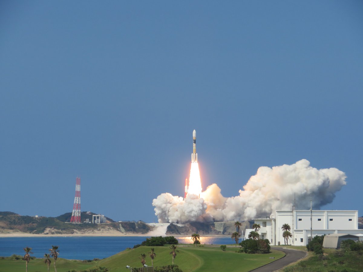
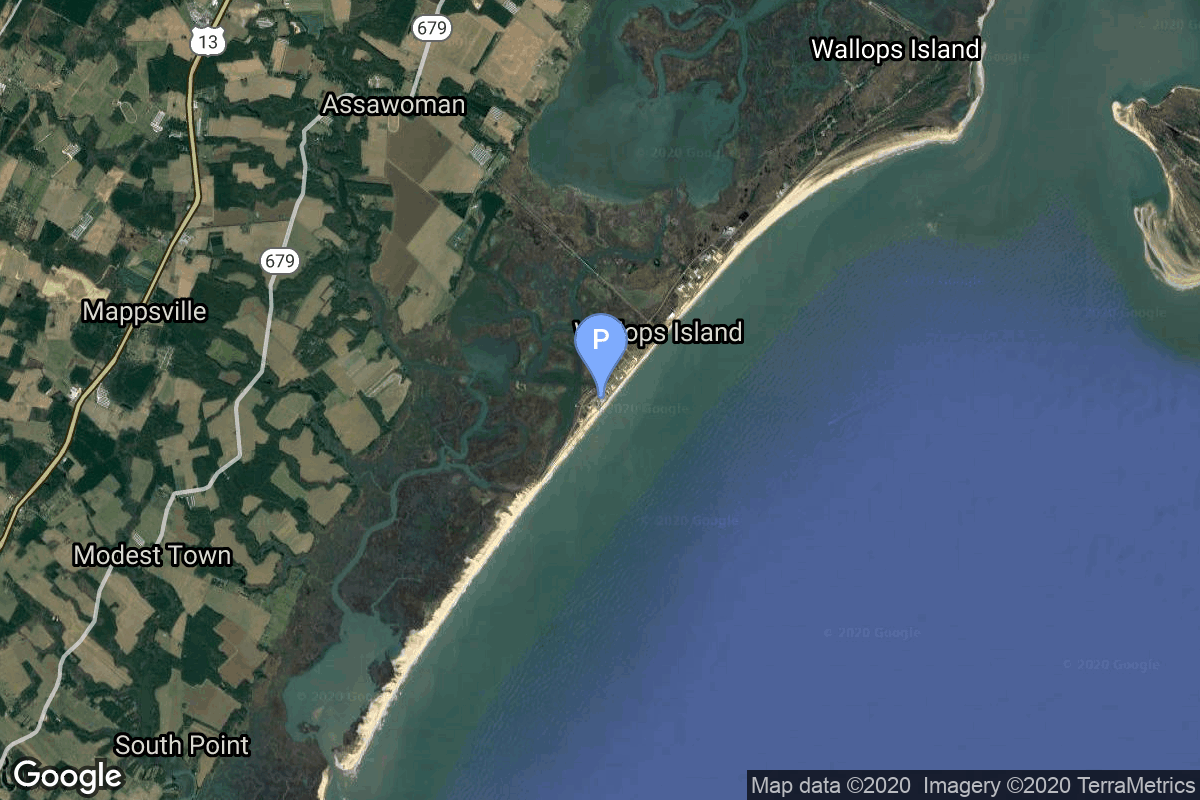
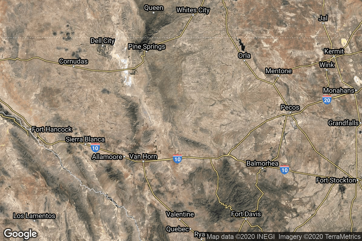
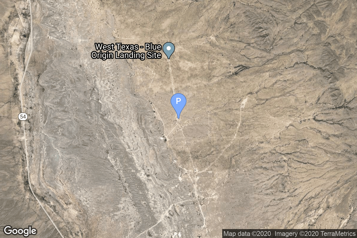
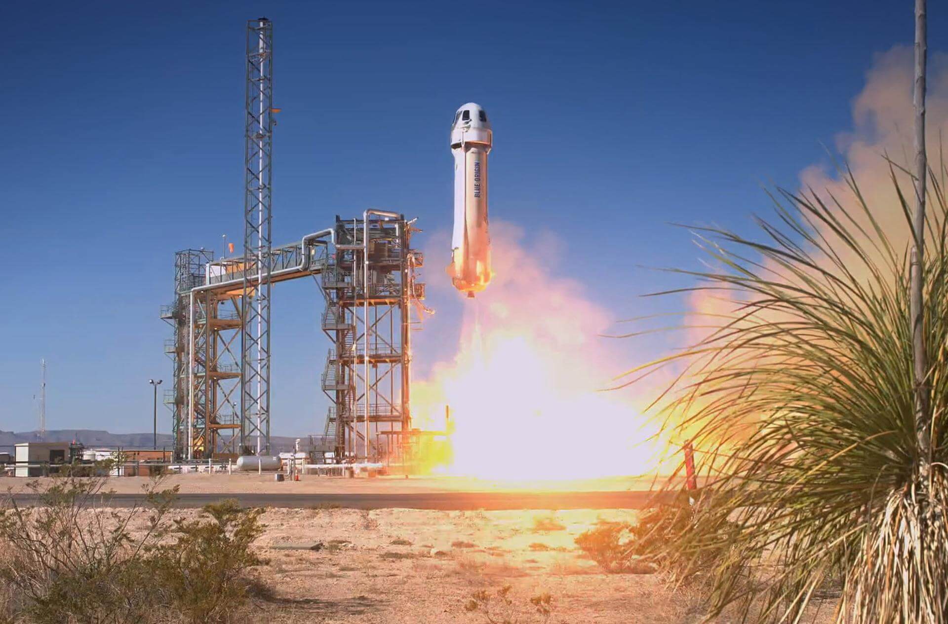
{ "count": 7730, "next": "https://ll.thespacedevs.com/2.0.0/launch/?format=api&limit=10&offset=7480&ordering=-id", "previous": "https://ll.thespacedevs.com/2.0.0/launch/?format=api&limit=10&offset=7460&ordering=-id", "results": [ { "id": "08ccc857-69bc-4e74-9ed5-218a1ac47884", "url": "https://ll.thespacedevs.com/2.0.0/launch/08ccc857-69bc-4e74-9ed5-218a1ac47884/?format=api", "launch_library_id": 90, "slug": "delta-iv-m42-gps-iif-5-usa-248", "name": "Delta IV M+(4,2) | GPS IIF-5 (USA-248)", "status": { "id": 3, "name": "Success" }, "net": "2014-02-21T01:59:00Z", "window_end": "2014-02-21T01:59:00Z", "window_start": "2014-02-21T01:59:00Z", "inhold": false, "tbdtime": false, "tbddate": false, "probability": null, "holdreason": "", "failreason": "", "hashtag": null, "launch_service_provider": { "id": 124, "url": "https://ll.thespacedevs.com/2.0.0/agencies/124/?format=api", "name": "United Launch Alliance", "type": "Commercial" }, "rocket": { "id": 1739, "configuration": { "id": 33, "launch_library_id": 40, "url": "https://ll.thespacedevs.com/2.0.0/config/launcher/33/?format=api", "name": "Delta IV M+(4,2)", "family": "Delta", "full_name": "Delta IV M+(4,2)", "variant": "M+(4,2)" } }, "mission": { "id": 28, "launch_library_id": 73, "name": "GPS IIF-5", "description": "GPS Block IIF, or GPS IIF is an interim class of GPS satellite, which will be used to keep the Navstar Global Positioning System operational until the GPS Block IIIA satellites become operational. They are being built by Boeing, and will be operated by the United States Air Force following their launch by United Launch Alliance, using Evolved Expendable Launch Vehicles.", "launch_designator": null, "type": "Navigation", "orbit": { "id": 12, "name": "Medium Earth Orbit", "abbrev": "MEO" } }, "pad": { "id": 38, "url": "https://ll.thespacedevs.com/2.0.0/pad/38/?format=api", "agency_id": null, "name": "Space Launch Complex 37B", "info_url": null, "wiki_url": "https://en.wikipedia.org/wiki/Cape_Canaveral_Air_Force_Station_Space_Launch_Complex_37", "map_url": "https://www.google.com/maps?q=28.5317,-80.56495", "latitude": "28.5317", "longitude": "-80.56495", "location": { "id": 12, "url": "https://ll.thespacedevs.com/2.0.0/location/12/?format=api", "name": "Cape Canaveral SFS, FL, USA", "country_code": "USA", "map_image": "https://thespacedevs-prod.nyc3.digitaloceanspaces.com/media/map_images/location_12_20200803142519.jpg", "total_launch_count": 1074, "total_landing_count": 70 }, "map_image": "https://thespacedevs-prod.nyc3.digitaloceanspaces.com/media/map_images/pad_38_20200803143515.jpg", "total_launch_count": 40 }, "webcast_live": false, "image": "https://thespacedevs-prod.nyc3.digitaloceanspaces.com/media/images/delta_iv_m252b_image_20220302002926.jpeg", "infographic": null, "program": [ { "id": 29, "url": "https://ll.thespacedevs.com/2.0.0/program/29/?format=api", "name": "Global Positioning System", "description": "The Global Positioning System (GPS), originally Navstar GPS, is a satellite-based radio navigation system owned by the United States government and operated by the United States Space Force. It is one of the global navigation satellite systems (GNSS) that provide geolocation and time information to a GPS receiver anywhere on or near the Earth where there is an unobstructed line of sight to four or more GPS satellites.", "agencies": [ { "id": 1041, "url": "https://ll.thespacedevs.com/2.0.0/agencies/1041/?format=api", "name": "United States Space Force", "type": "Government" } ], "image_url": "https://thespacedevs-prod.nyc3.digitaloceanspaces.com/media/images/global2520posi_program_20231229182501.png", "start_date": "1978-02-22T00:00:00Z", "end_date": null, "info_url": "https://www.gps.gov/", "wiki_url": "https://en.wikipedia.org/wiki/Global_Positioning_System" } ] }, { "id": "08c50e22-a55f-4f8f-bdd7-35720e78c0d2", "url": "https://ll.thespacedevs.com/2.0.0/launch/08c50e22-a55f-4f8f-bdd7-35720e78c0d2/?format=api", "launch_library_id": null, "slug": "thor-delta-e1-heos-1", "name": "Thor Delta E1 | HEOS 1", "status": { "id": 3, "name": "Success" }, "net": "1968-12-05T18:55:00Z", "window_end": "1968-12-05T18:55:00Z", "window_start": "1968-12-05T18:55:00Z", "inhold": false, "tbdtime": false, "tbddate": false, "probability": null, "holdreason": "", "failreason": null, "hashtag": null, "launch_service_provider": { "id": 161, "url": "https://ll.thespacedevs.com/2.0.0/agencies/161/?format=api", "name": "United States Air Force", "type": "Government" }, "rocket": { "id": 3851, "configuration": { "id": 405, "launch_library_id": null, "url": "https://ll.thespacedevs.com/2.0.0/config/launcher/405/?format=api", "name": "Thor Delta E1", "family": "Thor", "full_name": "Thor Delta E1", "variant": "Delta E1" } }, "mission": { "id": 2269, "launch_library_id": null, "name": "HEOS 1", "description": "HEOS 1 (Highly Eccentric Orbit Satellite) was an earth-orbiting, spin-stabilized satellite that was launched by ESA. The spacecraft objectives were to study interplanetary magnetic fields, cosmic rays, the solar wind, and the magnetosheath.", "launch_designator": null, "type": "Astrophysics", "orbit": { "id": 0, "name": "Elliptical Orbit", "abbrev": "Elliptical" } }, "pad": { "id": 1, "url": "https://ll.thespacedevs.com/2.0.0/pad/1/?format=api", "agency_id": null, "name": "Space Launch Complex 17B", "info_url": null, "wiki_url": "https://en.wikipedia.org/wiki/Cape_Canaveral_Space_Launch_Complex_17", "map_url": "https://www.google.com/maps?q=28.4458,-80.5657", "latitude": "28.4458", "longitude": "-80.5657", "location": { "id": 12, "url": "https://ll.thespacedevs.com/2.0.0/location/12/?format=api", "name": "Cape Canaveral SFS, FL, USA", "country_code": "USA", "map_image": "https://thespacedevs-prod.nyc3.digitaloceanspaces.com/media/map_images/location_12_20200803142519.jpg", "total_launch_count": 1074, "total_landing_count": 70 }, "map_image": "https://thespacedevs-prod.nyc3.digitaloceanspaces.com/media/map_images/pad_1_20200803143208.jpg", "total_launch_count": 132 }, "webcast_live": false, "image": "https://thespacedevs-prod.nyc3.digitaloceanspaces.com/media/images/delta-e1_2528i_image_20251205042339.png", "infographic": null, "program": [] }, { "id": "08a86fb8-dde3-49cf-8914-2878a45a6232", "url": "https://ll.thespacedevs.com/2.0.0/launch/08a86fb8-dde3-49cf-8914-2878a45a6232/?format=api", "launch_library_id": null, "slug": "tsiklon-2-us-p-10", "name": "Tsiklon-2 | US-P 10", "status": { "id": 3, "name": "Success" }, "net": "1981-03-20T23:45:00Z", "window_end": "1981-03-20T23:45:00Z", "window_start": "1981-03-20T23:45:00Z", "inhold": false, "tbdtime": false, "tbddate": false, "probability": null, "holdreason": "", "failreason": null, "hashtag": null, "launch_service_provider": { "id": 66, "url": "https://ll.thespacedevs.com/2.0.0/agencies/66/?format=api", "name": "Soviet Space Program", "type": "Government" }, "rocket": { "id": 5261, "configuration": { "id": 443, "launch_library_id": null, "url": "https://ll.thespacedevs.com/2.0.0/config/launcher/443/?format=api", "name": "Tsiklon-2", "family": "Tsiklon", "full_name": "Tsiklon-2", "variant": "2" } }, "mission": { "id": 3670, "launch_library_id": null, "name": "US-P 10", "description": "Ocean surveillance satellite using passive ELINT devices", "launch_designator": null, "type": "Government/Top Secret", "orbit": { "id": 8, "name": "Low Earth Orbit", "abbrev": "LEO" } }, "pad": { "id": 132, "url": "https://ll.thespacedevs.com/2.0.0/pad/132/?format=api", "agency_id": null, "name": "90", "info_url": null, "wiki_url": "https://en.wikipedia.org/wiki/Baikonur_Cosmodrome_Site_90", "map_url": "https://www.google.com/maps?q=46.081,62.929806", "latitude": "46.081", "longitude": "62.929806", "location": { "id": 15, "url": "https://ll.thespacedevs.com/2.0.0/location/15/?format=api", "name": "Baikonur Cosmodrome, Republic of Kazakhstan", "country_code": "KAZ", "map_image": "https://thespacedevs-prod.nyc3.digitaloceanspaces.com/media/map_images/location_15_20200803142517.jpg", "total_launch_count": 1559, "total_landing_count": 0 }, "map_image": "https://thespacedevs-prod.nyc3.digitaloceanspaces.com/media/map_images/pad_132_20200803143344.jpg", "total_launch_count": 74 }, "webcast_live": false, "image": "https://thespacedevs-prod.nyc3.digitaloceanspaces.com/media/images/tsyklon-2_lifto_image_20240411113159.jpg", "infographic": null, "program": [] }, { "id": "08a30217-344b-4d5e-85ff-c62b1b25643c", "url": "https://ll.thespacedevs.com/2.0.0/launch/08a30217-344b-4d5e-85ff-c62b1b25643c/?format=api", "launch_library_id": 1204, "slug": "h-iia-204-dsn-2-kirameki-2", "name": "H-IIA 204 | DSN 2 (Kirameki 2)", "status": { "id": 3, "name": "Success" }, "net": "2017-01-24T07:44:00Z", "window_end": "2017-01-24T08:58:00Z", "window_start": "2017-01-24T07:44:00Z", "inhold": false, "tbdtime": false, "tbddate": false, "probability": null, "holdreason": "", "failreason": null, "hashtag": null, "launch_service_provider": { "id": 98, "url": "https://ll.thespacedevs.com/2.0.0/agencies/98/?format=api", "name": "Mitsubishi Heavy Industries", "type": "Commercial" }, "rocket": { "id": 1983, "configuration": { "id": 48, "launch_library_id": 67, "url": "https://ll.thespacedevs.com/2.0.0/config/launcher/48/?format=api", "name": "H-IIA", "family": "H-II", "full_name": "H-IIA 204", "variant": "204" } }, "mission": { "id": 387, "launch_library_id": 495, "name": "DSN 2 (Kirameki 2)", "description": "DSN 2, also known as Kirameki 2, is a geostationary communications satellite to be used for military communications by the Japanese military.", "launch_designator": null, "type": "Communications", "orbit": { "id": 2, "name": "Geostationary Transfer Orbit", "abbrev": "GTO" } }, "pad": { "id": 41, "url": "https://ll.thespacedevs.com/2.0.0/pad/41/?format=api", "agency_id": 37, "name": "Yoshinobu Launch Complex LP-1", "info_url": null, "wiki_url": "https://en.wikipedia.org/wiki/Yoshinobu_Launch_Complex", "map_url": "https://www.google.com/maps?q=30.400813,130.977748", "latitude": "30.400813", "longitude": "130.977748", "location": { "id": 26, "url": "https://ll.thespacedevs.com/2.0.0/location/26/?format=api", "name": "Tanegashima Space Center, Japan", "country_code": "JPN", "map_image": "https://thespacedevs-prod.nyc3.digitaloceanspaces.com/media/map_images/location_26_20200803142507.jpg", "total_launch_count": 96, "total_landing_count": 0 }, "map_image": "https://thespacedevs-prod.nyc3.digitaloceanspaces.com/media/map_images/pad_41_20200803143551.jpg", "total_launch_count": 57 }, "webcast_live": false, "image": "https://thespacedevs-prod.nyc3.digitaloceanspaces.com/media/images/h-iia_204_lifto_image_20240325124231.jpg", "infographic": null, "program": [] }, { "id": "089a182d-7e8a-48d8-815c-eefbade8110c", "url": "https://ll.thespacedevs.com/2.0.0/launch/089a182d-7e8a-48d8-815c-eefbade8110c/?format=api", "launch_library_id": null, "slug": "haste-prometheus-run-van", "name": "HASTE | Prometheus Run (VAN)", "status": { "id": 3, "name": "Success" }, "net": "2025-11-18T13:00:00Z", "window_end": "2025-11-18T18:00:00Z", "window_start": "2025-11-18T12:45:00Z", "inhold": false, "tbdtime": false, "tbddate": false, "probability": null, "holdreason": "", "failreason": "", "hashtag": null, "launch_service_provider": { "id": 147, "url": "https://ll.thespacedevs.com/2.0.0/agencies/147/?format=api", "name": "Rocket Lab", "type": "Commercial" }, "rocket": { "id": 8791, "configuration": { "id": 26, "launch_library_id": 148, "url": "https://ll.thespacedevs.com/2.0.0/config/launcher/26/?format=api", "name": "Electron", "family": "", "full_name": "Electron", "variant": "" } }, "mission": { "id": 7382, "launch_library_id": null, "name": "Prometheus Run (VAN)", "description": "Sub-orbital launch under Rocket Lab’s Hypersonic Accelerator Suborbital Test Electron (HASTE) program.\r\n\r\nThis mission was lead by MDA and deployed a government-provided primary payload developed by the John Hopkins University Applied Physics Laboratory (JHUAPL), and multiple secondary payloads by federal and industry partners, which tested key technologies for missile defense applications.\r\n\r\nThe mission was contracted to Rocket Lab through the DIU’s Hypersonic and High-Cadence Airborne Testing Capabilities (HyCAT) program, an initiative supporting test and evaluation of new and emerging hypersonic technologies through low cost, responsive and long endurance flight testing.", "launch_designator": null, "type": "Government/Top Secret", "orbit": { "id": 15, "name": "Suborbital", "abbrev": "Sub" } }, "pad": { "id": 79, "url": "https://ll.thespacedevs.com/2.0.0/pad/79/?format=api", "agency_id": 147, "name": "Rocket Lab Launch Complex 2 (Launch Area 0 C)", "info_url": null, "wiki_url": null, "map_url": "https://www.google.com/maps?q=37.833262,-75.488235", "latitude": "37.833262", "longitude": "-75.488235", "location": { "id": 21, "url": "https://ll.thespacedevs.com/2.0.0/location/21/?format=api", "name": "Wallops Flight Facility, Virginia, USA", "country_code": "USA", "map_image": "https://thespacedevs-prod.nyc3.digitaloceanspaces.com/media/map_images/location_21_20200803142423.jpg", "total_launch_count": 83, "total_landing_count": 0 }, "map_image": "https://thespacedevs-prod.nyc3.digitaloceanspaces.com/media/map_images/pad_79_20200803143607.jpg", "total_launch_count": 9 }, "webcast_live": false, "image": "https://thespacedevs-prod.nyc3.digitaloceanspaces.com/media/images/electron_image_20190705175640.jpeg", "infographic": null, "program": [] }, { "id": "087fedcb-57ff-45c8-a68c-66976ff429eb", "url": "https://ll.thespacedevs.com/2.0.0/launch/087fedcb-57ff-45c8-a68c-66976ff429eb/?format=api", "launch_library_id": null, "slug": "kosmos-11k63-ds-p1-i-8", "name": "Kosmos 11K63 | DS-P1-I 8", "status": { "id": 3, "name": "Success" }, "net": "1970-03-18T14:39:56Z", "window_end": "1970-03-18T14:39:56Z", "window_start": "1970-03-18T14:39:56Z", "inhold": false, "tbdtime": false, "tbddate": false, "probability": null, "holdreason": "", "failreason": null, "hashtag": null, "launch_service_provider": { "id": 66, "url": "https://ll.thespacedevs.com/2.0.0/agencies/66/?format=api", "name": "Soviet Space Program", "type": "Government" }, "rocket": { "id": 3993, "configuration": { "id": 327, "launch_library_id": null, "url": "https://ll.thespacedevs.com/2.0.0/config/launcher/327/?format=api", "name": "Kosmos 11K63", "family": "Kosmos", "full_name": "Kosmos 11K63", "variant": "11K63" } }, "mission": { "id": 2411, "launch_library_id": null, "name": "DS-P1-I 8", "description": "The DS-P1-I series of satellites was used to calibrate space surveillance and early warning radars.", "launch_designator": null, "type": "Test Target", "orbit": { "id": 8, "name": "Low Earth Orbit", "abbrev": "LEO" } }, "pad": { "id": 3, "url": "https://ll.thespacedevs.com/2.0.0/pad/3/?format=api", "agency_id": 163, "name": "133/3 (133L)", "info_url": null, "wiki_url": "", "map_url": "https://www.google.com/maps?q=62.886999,40.846984", "latitude": "62.886999", "longitude": "40.846984", "location": { "id": 6, "url": "https://ll.thespacedevs.com/2.0.0/location/6/?format=api", "name": "Plesetsk Cosmodrome, Russian Federation", "country_code": "RUS", "map_image": "https://thespacedevs-prod.nyc3.digitaloceanspaces.com/media/map_images/location_6_20200803142434.jpg", "total_launch_count": 1679, "total_landing_count": 0 }, "map_image": "https://thespacedevs-prod.nyc3.digitaloceanspaces.com/media/map_images/pad_3_20200803143438.jpg", "total_launch_count": 159 }, "webcast_live": false, "image": "https://thespacedevs-prod.nyc3.digitaloceanspaces.com/media/images/kosmos_11k63_image_20251104091702.jpg", "infographic": null, "program": [] }, { "id": "085be7a8-8aa7-46ff-b60f-512eb71c3e7f", "url": "https://ll.thespacedevs.com/2.0.0/launch/085be7a8-8aa7-46ff-b60f-512eb71c3e7f/?format=api", "launch_library_id": null, "slug": "scout-x-2m-dsap-1-f2", "name": "Scout X-2M | DSAP-1 F2", "status": { "id": 3, "name": "Success" }, "net": "1962-08-23T11:33:00Z", "window_end": "1962-08-23T11:33:00Z", "window_start": "1962-08-23T11:33:00Z", "inhold": false, "tbdtime": false, "tbddate": false, "probability": null, "holdreason": "", "failreason": null, "hashtag": null, "launch_service_provider": { "id": 161, "url": "https://ll.thespacedevs.com/2.0.0/agencies/161/?format=api", "name": "United States Air Force", "type": "Government" }, "rocket": { "id": 3145, "configuration": { "id": 366, "launch_library_id": null, "url": "https://ll.thespacedevs.com/2.0.0/config/launcher/366/?format=api", "name": "Scout X-2M", "family": "Scout", "full_name": "Scout X-2M", "variant": "X-2M" } }, "mission": { "id": 1567, "launch_library_id": null, "name": "DSAP-1 F2", "description": "The DSAP-1 (Defense Satellite Application Program Block 1) satellites series, also known as P-35, was the first series of military meteorologal satellites of the USA.", "launch_designator": null, "type": "Government/Top Secret", "orbit": { "id": 17, "name": "Sun-Synchronous Orbit", "abbrev": "SSO" } }, "pad": { "id": 154, "url": "https://ll.thespacedevs.com/2.0.0/pad/154/?format=api", "agency_id": null, "name": "Space Launch Complex 5", "info_url": "https://www.astronautix.com/v/vandenbergslc5.html", "wiki_url": "https://en.wikipedia.org/wiki/Vandenberg_Air_Force_Base_Space_Launch_Complex_5", "map_url": "https://www.google.com/maps?q=34.6080,-120.6247", "latitude": "34.608", "longitude": "-120.6247", "location": { "id": 11, "url": "https://ll.thespacedevs.com/2.0.0/location/11/?format=api", "name": "Vandenberg SFB, CA, USA", "country_code": "USA", "map_image": "https://thespacedevs-prod.nyc3.digitaloceanspaces.com/media/map_images/location_11_20200803142416.jpg", "total_launch_count": 850, "total_landing_count": 30 }, "map_image": "https://thespacedevs-prod.nyc3.digitaloceanspaces.com/media/map_images/pad_154_20200803143408.jpg", "total_launch_count": 69 }, "webcast_live": false, "image": null, "infographic": null, "program": [] }, { "id": "08508c47-42ea-44c8-9da6-9e2e21742994", "url": "https://ll.thespacedevs.com/2.0.0/launch/08508c47-42ea-44c8-9da6-9e2e21742994/?format=api", "launch_library_id": null, "slug": "falcon-9-block-5-starlink-group-6-49", "name": "Falcon 9 Block 5 | Starlink Group 6-49", "status": { "id": 3, "name": "Success" }, "net": "2024-04-13T01:40:00Z", "window_end": "2024-04-13T04:48:00Z", "window_start": "2024-04-13T01:22:00Z", "inhold": false, "tbdtime": false, "tbddate": false, "probability": 98, "holdreason": "", "failreason": "", "hashtag": null, "launch_service_provider": { "id": 121, "url": "https://ll.thespacedevs.com/2.0.0/agencies/121/?format=api", "name": "SpaceX", "type": "Commercial" }, "rocket": { "id": 8217, "configuration": { "id": 164, "launch_library_id": 188, "url": "https://ll.thespacedevs.com/2.0.0/config/launcher/164/?format=api", "name": "Falcon 9", "family": "Falcon", "full_name": "Falcon 9 Block 5", "variant": "Block 5" } }, "mission": { "id": 6789, "launch_library_id": null, "name": "Starlink Group 6-49", "description": "A batch of 23 satellites for the Starlink mega-constellation - SpaceX's project for space-based Internet communication system.", "launch_designator": null, "type": "Communications", "orbit": { "id": 8, "name": "Low Earth Orbit", "abbrev": "LEO" } }, "pad": { "id": 80, "url": "https://ll.thespacedevs.com/2.0.0/pad/80/?format=api", "agency_id": 121, "name": "Space Launch Complex 40", "info_url": null, "wiki_url": "https://en.wikipedia.org/wiki/Cape_Canaveral_Air_Force_Station_Space_Launch_Complex_40", "map_url": "https://www.google.com/maps?q=28.56194122,-80.57735736", "latitude": "28.56194122", "longitude": "-80.57735736", "location": { "id": 12, "url": "https://ll.thespacedevs.com/2.0.0/location/12/?format=api", "name": "Cape Canaveral SFS, FL, USA", "country_code": "USA", "map_image": "https://thespacedevs-prod.nyc3.digitaloceanspaces.com/media/map_images/location_12_20200803142519.jpg", "total_launch_count": 1074, "total_landing_count": 70 }, "map_image": "https://thespacedevs-prod.nyc3.digitaloceanspaces.com/media/map_images/pad_80_20200803143323.jpg", "total_launch_count": 353 }, "webcast_live": false, "image": "https://thespacedevs-prod.nyc3.digitaloceanspaces.com/media/images/falcon2520925_image_20221009234147.png", "infographic": null, "program": [ { "id": 25, "url": "https://ll.thespacedevs.com/2.0.0/program/25/?format=api", "name": "Starlink", "description": "Starlink is a satellite internet constellation operated by American aerospace company SpaceX", "agencies": [ { "id": 121, "url": "https://ll.thespacedevs.com/2.0.0/agencies/121/?format=api", "name": "SpaceX", "type": "Commercial" } ], "image_url": "https://thespacedevs-prod.nyc3.digitaloceanspaces.com/media/images/starlink_program_20231228154508.jpeg", "start_date": "2018-02-22T14:17:00Z", "end_date": null, "info_url": "https://starlink.com", "wiki_url": "https://en.wikipedia.org/wiki/Starlink" } ] }, { "id": "08433f85-5ba3-470d-95ed-167e615e9e9a", "url": "https://ll.thespacedevs.com/2.0.0/launch/08433f85-5ba3-470d-95ed-167e615e9e9a/?format=api", "launch_library_id": null, "slug": "new-shepard-ns-31", "name": "New Shepard | NS-31", "status": { "id": 3, "name": "Success" }, "net": "2025-04-14T13:30:00Z", "window_end": "2025-04-14T13:30:00Z", "window_start": "2025-04-14T13:30:00Z", "inhold": false, "tbdtime": false, "tbddate": false, "probability": null, "holdreason": "", "failreason": "", "hashtag": null, "launch_service_provider": { "id": 141, "url": "https://ll.thespacedevs.com/2.0.0/agencies/141/?format=api", "name": "Blue Origin", "type": "Commercial" }, "rocket": { "id": 8543, "configuration": { "id": 137, "launch_library_id": 9999, "url": "https://ll.thespacedevs.com/2.0.0/config/launcher/137/?format=api", "name": "New Shepard", "family": "", "full_name": "New Shepard", "variant": "" } }, "mission": { "id": 7134, "launch_library_id": null, "name": "NS-31", "description": "NS-31 is the 11th crewed flight for the New Shepard program and the 31st in its history.", "launch_designator": null, "type": "Tourism", "orbit": { "id": 15, "name": "Suborbital", "abbrev": "Sub" } }, "pad": { "id": 90, "url": "https://ll.thespacedevs.com/2.0.0/pad/90/?format=api", "agency_id": 141, "name": "West Texas Suborbital Launch Site/ Corn Ranch", "info_url": "https://www.blueorigin.com", "wiki_url": "https://en.wikipedia.org/wiki/Corn_Ranch", "map_url": "https://www.google.com/maps?q=31.422878000000000,-104.757121000000000", "latitude": "31.422878", "longitude": "-104.757121", "location": { "id": 29, "url": "https://ll.thespacedevs.com/2.0.0/location/29/?format=api", "name": "Corn Ranch, Van Horn, TX, USA", "country_code": "USA", "map_image": "https://thespacedevs-prod.nyc3.digitaloceanspaces.com/media/map_images/location_29_20200803142436.jpg", "total_launch_count": 36, "total_landing_count": 36 }, "map_image": "https://thespacedevs-prod.nyc3.digitaloceanspaces.com/media/map_images/pad_90_20200803143233.jpg", "total_launch_count": 36 }, "webcast_live": false, "image": "https://thespacedevs-prod.nyc3.digitaloceanspaces.com/media/images/new_shepard_lif_image_20240621062033.jpeg", "infographic": null, "program": [] }, { "id": "0835b613-246b-4679-a7db-56462e4e7580", "url": "https://ll.thespacedevs.com/2.0.0/launch/0835b613-246b-4679-a7db-56462e4e7580/?format=api", "launch_library_id": null, "slug": "molniya-m-us-k-6", "name": "Molniya-M | US-K 6", "status": { "id": 3, "name": "Success" }, "net": "1977-04-11T01:38:00Z", "window_end": "1977-04-11T01:38:00Z", "window_start": "1977-04-11T01:38:00Z", "inhold": false, "tbdtime": false, "tbddate": false, "probability": null, "holdreason": "", "failreason": null, "hashtag": null, "launch_service_provider": { "id": 66, "url": "https://ll.thespacedevs.com/2.0.0/agencies/66/?format=api", "name": "Soviet Space Program", "type": "Government" }, "rocket": { "id": 4817, "configuration": { "id": 106, "launch_library_id": 126, "url": "https://ll.thespacedevs.com/2.0.0/config/launcher/106/?format=api", "name": "Molniya-M", "family": "R-7", "full_name": "Molniya-M 2BL", "variant": "2BL" } }, "mission": { "id": 3234, "launch_library_id": null, "name": "US-K 6", "description": "Early warning satellite", "launch_designator": null, "type": "Government/Top Secret", "orbit": { "id": 0, "name": "Elliptical Orbit", "abbrev": "Elliptical" } }, "pad": { "id": 36, "url": "https://ll.thespacedevs.com/2.0.0/pad/36/?format=api", "agency_id": 163, "name": "43/3 (43L)", "info_url": null, "wiki_url": null, "map_url": "https://www.google.com/maps?q=62.9273,40.45", "latitude": "62.9273", "longitude": "40.45", "location": { "id": 6, "url": "https://ll.thespacedevs.com/2.0.0/location/6/?format=api", "name": "Plesetsk Cosmodrome, Russian Federation", "country_code": "RUS", "map_image": "https://thespacedevs-prod.nyc3.digitaloceanspaces.com/media/map_images/location_6_20200803142434.jpg", "total_launch_count": 1679, "total_landing_count": 0 }, "map_image": "https://thespacedevs-prod.nyc3.digitaloceanspaces.com/media/map_images/pad_36_20200803143534.jpg", "total_launch_count": 231 }, "webcast_live": false, "image": "https://thespacedevs-prod.nyc3.digitaloceanspaces.com/media/images/molniya_m_image_20251102061752.jpg", "infographic": null, "program": [] } ] }