Launch List
API endpoint that returns all Launch objects or a single launch.
EXAMPLE - /launch/
GET: Return a list of all Launch objects.
FILTERS: Fields - 'name', 'id(s)', 'lsp_id', 'lsp_name', 'serial_number', 'launcher_config__id', 'rocket__spacecraftflight__spacecraft__name'
MODE: 'normal', 'list', 'detailed' EXAMPLE: ?mode=list
SEARCH: Searches through the launch name, rocket name, launch agency, mission name & spacecraft name. EXAMPLE - ?search=SpaceX
GET /2.0.0/launch/?format=api&offset=7420&ordering=id
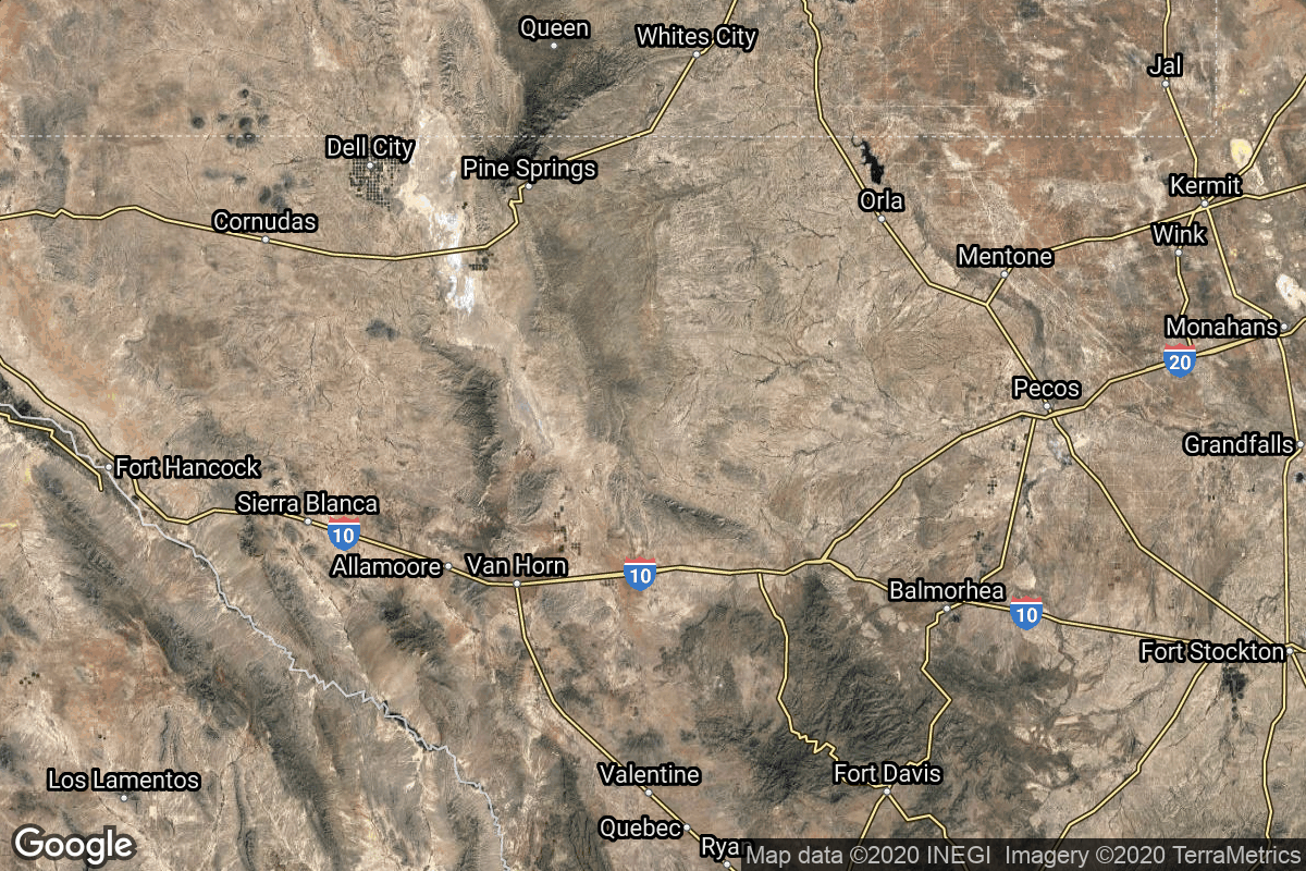
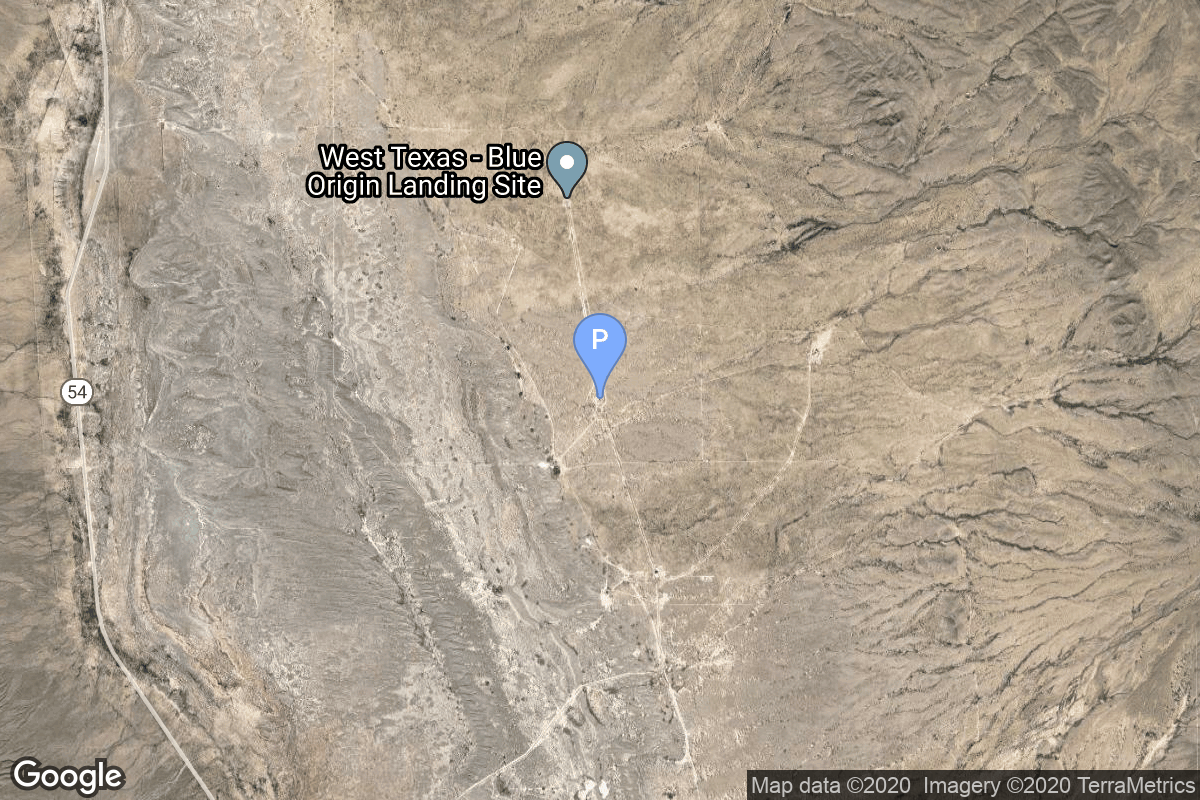
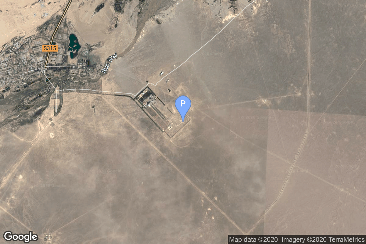
{ "count": 7875, "next": "https://ll.thespacedevs.com/2.0.0/launch/?format=api&limit=10&offset=7430&ordering=id", "previous": "https://ll.thespacedevs.com/2.0.0/launch/?format=api&limit=10&offset=7410&ordering=id", "results": [ { "id": "f0554c45-3e52-43bb-95e5-73aa8fab53dd", "url": "https://ll.thespacedevs.com/2.0.0/launch/f0554c45-3e52-43bb-95e5-73aa8fab53dd/?format=api", "launch_library_id": null, "slug": "falcon-9-block-5-starlink-group-6-78", "name": "Falcon 9 Block 5 | Starlink Group 6-78", "status": { "id": 3, "name": "Success" }, "net": "2025-11-21T03:39:30Z", "window_end": "2025-11-21T07:01:00Z", "window_start": "2025-11-21T03:01:00Z", "inhold": false, "tbdtime": false, "tbddate": false, "probability": 99, "holdreason": "", "failreason": "", "hashtag": null, "launch_service_provider": { "id": 121, "url": "https://ll.thespacedevs.com/2.0.0/agencies/121/?format=api", "name": "SpaceX", "type": "Commercial" }, "rocket": { "id": 8796, "configuration": { "id": 164, "launch_library_id": 188, "url": "https://ll.thespacedevs.com/2.0.0/config/launcher/164/?format=api", "name": "Falcon 9", "family": "Falcon", "full_name": "Falcon 9 Block 5", "variant": "Block 5" } }, "mission": { "id": 7387, "launch_library_id": null, "name": "Starlink Group 6-78", "description": "A batch of 29 satellites for the Starlink mega-constellation - SpaceX's project for space-based Internet communication system.", "launch_designator": null, "type": "Communications", "orbit": { "id": 8, "name": "Low Earth Orbit", "abbrev": "LEO" } }, "pad": { "id": 87, "url": "https://ll.thespacedevs.com/2.0.0/pad/87/?format=api", "agency_id": 121, "name": "Launch Complex 39A", "info_url": null, "wiki_url": "https://en.wikipedia.org/wiki/Kennedy_Space_Center_Launch_Complex_39#Launch_Pad_39A", "map_url": "https://www.google.com/maps?q=28.60822681,-80.60428186", "latitude": "28.60822681", "longitude": "-80.60428186", "location": { "id": 27, "url": "https://ll.thespacedevs.com/2.0.0/location/27/?format=api", "name": "Kennedy Space Center, FL, USA", "country_code": "USA", "map_image": "https://thespacedevs-prod.nyc3.digitaloceanspaces.com/media/map_images/location_27_20200803142447.jpg", "total_launch_count": 281, "total_landing_count": 0 }, "map_image": "https://thespacedevs-prod.nyc3.digitaloceanspaces.com/media/map_images/pad_87_20200803143537.jpg", "total_launch_count": 222 }, "webcast_live": false, "image": "https://thespacedevs-prod.nyc3.digitaloceanspaces.com/media/images/falcon2520925_image_20221009234147.png", "infographic": null, "program": [ { "id": 25, "url": "https://ll.thespacedevs.com/2.0.0/program/25/?format=api", "name": "Starlink", "description": "Starlink is a satellite internet constellation operated by American aerospace company SpaceX", "agencies": [ { "id": 121, "url": "https://ll.thespacedevs.com/2.0.0/agencies/121/?format=api", "name": "SpaceX", "type": "Commercial" } ], "image_url": "https://thespacedevs-prod.nyc3.digitaloceanspaces.com/media/images/starlink_program_20231228154508.jpeg", "start_date": "2018-02-22T14:17:00Z", "end_date": null, "info_url": "https://starlink.com", "wiki_url": "https://en.wikipedia.org/wiki/Starlink" } ] }, { "id": "f058ecca-bda7-4797-ae47-b5c450b1bd78", "url": "https://ll.thespacedevs.com/2.0.0/launch/f058ecca-bda7-4797-ae47-b5c450b1bd78/?format=api", "launch_library_id": null, "slug": "new-shepard-ns-21", "name": "New Shepard | NS-21", "status": { "id": 3, "name": "Success" }, "net": "2022-06-04T13:25:02Z", "window_end": "2022-06-04T16:00:00Z", "window_start": "2022-06-04T13:00:00Z", "inhold": false, "tbdtime": false, "tbddate": false, "probability": null, "holdreason": "", "failreason": "", "hashtag": null, "launch_service_provider": { "id": 141, "url": "https://ll.thespacedevs.com/2.0.0/agencies/141/?format=api", "name": "Blue Origin", "type": "Commercial" }, "rocket": { "id": 7573, "configuration": { "id": 137, "launch_library_id": 9999, "url": "https://ll.thespacedevs.com/2.0.0/config/launcher/137/?format=api", "name": "New Shepard", "family": "", "full_name": "New Shepard", "variant": "" } }, "mission": { "id": 6016, "launch_library_id": null, "name": "NS-21", "description": "NS-21 is the fifth crewed New Shepard flight, carrying six passengers.", "launch_designator": null, "type": "Tourism", "orbit": { "id": 15, "name": "Suborbital", "abbrev": "Sub" } }, "pad": { "id": 90, "url": "https://ll.thespacedevs.com/2.0.0/pad/90/?format=api", "agency_id": 141, "name": "West Texas Suborbital Launch Site/ Corn Ranch", "info_url": "https://www.blueorigin.com", "wiki_url": "https://en.wikipedia.org/wiki/Corn_Ranch", "map_url": "https://www.google.com/maps?q=31.422878000000000,-104.757121000000000", "latitude": "31.422878", "longitude": "-104.757121", "location": { "id": 29, "url": "https://ll.thespacedevs.com/2.0.0/location/29/?format=api", "name": "Corn Ranch, Van Horn, TX, USA", "country_code": "USA", "map_image": "https://thespacedevs-prod.nyc3.digitaloceanspaces.com/media/map_images/location_29_20200803142436.jpg", "total_launch_count": 38, "total_landing_count": 38 }, "map_image": "https://thespacedevs-prod.nyc3.digitaloceanspaces.com/media/map_images/pad_90_20200803143233.jpg", "total_launch_count": 38 }, "webcast_live": false, "image": "https://thespacedevs-prod.nyc3.digitaloceanspaces.com/media/images/new2520shepard_image_20190207032624.jpeg", "infographic": null, "program": [] }, { "id": "f05cf79e-faf8-477e-9929-a94945e90b37", "url": "https://ll.thespacedevs.com/2.0.0/launch/f05cf79e-faf8-477e-9929-a94945e90b37/?format=api", "launch_library_id": null, "slug": "molniya-8k78m-pvb-molniya-3-56l", "name": "Molniya 8K78M-PVB | Molniya-3 56L", "status": { "id": 3, "name": "Success" }, "net": "1992-12-02T01:57:00Z", "window_end": "1992-12-02T01:57:00Z", "window_start": "1992-12-02T01:57:00Z", "inhold": false, "tbdtime": false, "tbddate": false, "probability": null, "holdreason": "", "failreason": null, "hashtag": null, "launch_service_provider": { "id": 111, "url": "https://ll.thespacedevs.com/2.0.0/agencies/111/?format=api", "name": "Progress Rocket Space Center", "type": "Commercial" }, "rocket": { "id": 6488, "configuration": { "id": 335, "launch_library_id": null, "url": "https://ll.thespacedevs.com/2.0.0/config/launcher/335/?format=api", "name": "Molniya 8K78M-PVB", "family": "R-7", "full_name": "Molniya 8K78M-PVB", "variant": "8K78M-PVB" } }, "mission": { "id": 4878, "launch_library_id": null, "name": "Molniya-3 56L", "description": "Molniya communication satellites operating from a highly elliptical orbit", "launch_designator": null, "type": "Communications", "orbit": { "id": 0, "name": "Elliptical Orbit", "abbrev": "Elliptical" } }, "pad": { "id": 36, "url": "https://ll.thespacedevs.com/2.0.0/pad/36/?format=api", "agency_id": 163, "name": "43/3 (43L)", "info_url": null, "wiki_url": null, "map_url": "https://www.google.com/maps?q=62.9273,40.45", "latitude": "62.9273", "longitude": "40.45", "location": { "id": 6, "url": "https://ll.thespacedevs.com/2.0.0/location/6/?format=api", "name": "Plesetsk Cosmodrome, Russian Federation", "country_code": "RUS", "map_image": "https://thespacedevs-prod.nyc3.digitaloceanspaces.com/media/map_images/location_6_20200803142434.jpg", "total_launch_count": 1685, "total_landing_count": 0 }, "map_image": "https://thespacedevs-prod.nyc3.digitaloceanspaces.com/media/map_images/pad_36_20200803143534.jpg", "total_launch_count": 232 }, "webcast_live": false, "image": null, "infographic": null, "program": [] }, { "id": "f06ec811-be10-4fa2-a539-b7f7ac50adb8", "url": "https://ll.thespacedevs.com/2.0.0/launch/f06ec811-be10-4fa2-a539-b7f7ac50adb8/?format=api", "launch_library_id": 1439, "slug": "long-march-2d-lkw-3-land-survey-satellite-3", "name": "Long March 2D | LKW-3 (Land Survey Satellite-3)", "status": { "id": 3, "name": "Success" }, "net": "2018-01-13T07:10:00Z", "window_end": "2018-01-13T07:21:00Z", "window_start": "2018-01-13T07:03:00Z", "inhold": false, "tbdtime": false, "tbddate": false, "probability": null, "holdreason": "", "failreason": null, "hashtag": null, "launch_service_provider": { "id": 88, "url": "https://ll.thespacedevs.com/2.0.0/agencies/88/?format=api", "name": "China Aerospace Science and Technology Corporation", "type": "Government" }, "rocket": { "id": 2066, "configuration": { "id": 17, "launch_library_id": 73, "url": "https://ll.thespacedevs.com/2.0.0/config/launcher/17/?format=api", "name": "Long March 2D", "family": "Long March", "full_name": "Long March 2D", "variant": "D" } }, "mission": null, "pad": { "id": 22, "url": "https://ll.thespacedevs.com/2.0.0/pad/22/?format=api", "agency_id": null, "name": "Launch Area 94 (SLS-2 / 603)", "info_url": null, "wiki_url": "https://en.wikipedia.org/wiki/Jiuquan_Launch_Area_4", "map_url": "https://www.google.com/maps?q=40.960482,100.298059", "latitude": "40.960482", "longitude": "100.298059", "location": { "id": 17, "url": "https://ll.thespacedevs.com/2.0.0/location/17/?format=api", "name": "Jiuquan Satellite Launch Center, People's Republic of China", "country_code": "CHN", "map_image": "https://thespacedevs-prod.nyc3.digitaloceanspaces.com/media/map_images/location_17_20200803142429.jpg", "total_launch_count": 286, "total_landing_count": 2 }, "map_image": "https://thespacedevs-prod.nyc3.digitaloceanspaces.com/media/map_images/pad_22_20200803143437.jpg", "total_launch_count": 136 }, "webcast_live": false, "image": "https://thespacedevs-prod.nyc3.digitaloceanspaces.com/media/images/long2520march25202d_image_20190222031211.jpeg", "infographic": null, "program": [] }, { "id": "f07f6b32-5547-4c92-9ca7-4b4cb14f3cd0", "url": "https://ll.thespacedevs.com/2.0.0/launch/f07f6b32-5547-4c92-9ca7-4b4cb14f3cd0/?format=api", "launch_library_id": null, "slug": "dnepr-terrasar-x", "name": "Dnepr | TerraSAR-X", "status": { "id": 3, "name": "Success" }, "net": "2007-06-15T02:14:00Z", "window_end": "2007-06-15T02:14:00Z", "window_start": "2007-06-15T02:14:00Z", "inhold": false, "tbdtime": false, "tbddate": false, "probability": null, "holdreason": "", "failreason": null, "hashtag": null, "launch_service_provider": { "id": 119, "url": "https://ll.thespacedevs.com/2.0.0/agencies/119/?format=api", "name": "ISC Kosmotras", "type": "Commercial" }, "rocket": { "id": 7319, "configuration": { "id": 31, "launch_library_id": 54, "url": "https://ll.thespacedevs.com/2.0.0/config/launcher/31/?format=api", "name": "Dnepr", "family": "", "full_name": "Dnepr 1", "variant": "1" } }, "mission": { "id": 5708, "launch_library_id": null, "name": "TerraSAR-X", "description": "German Earth observation satellite", "launch_designator": null, "type": "Earth Science", "orbit": { "id": 17, "name": "Sun-Synchronous Orbit", "abbrev": "SSO" } }, "pad": { "id": 12, "url": "https://ll.thespacedevs.com/2.0.0/pad/12/?format=api", "agency_id": null, "name": "109/95", "info_url": null, "wiki_url": "", "map_url": "https://www.google.com/maps?q=45.95112,63.497095", "latitude": "45.95112", "longitude": "63.497095", "location": { "id": 15, "url": "https://ll.thespacedevs.com/2.0.0/location/15/?format=api", "name": "Baikonur Cosmodrome, Republic of Kazakhstan", "country_code": "KAZ", "map_image": "https://thespacedevs-prod.nyc3.digitaloceanspaces.com/media/map_images/location_15_20200803142517.jpg", "total_launch_count": 1563, "total_landing_count": 0 }, "map_image": "https://thespacedevs-prod.nyc3.digitaloceanspaces.com/media/map_images/pad_12_20200803143322.jpg", "total_launch_count": 12 }, "webcast_live": false, "image": "https://thespacedevs-prod.nyc3.digitaloceanspaces.com/media/images/dnepr-1_liftoff_image_20240411092543.jpeg", "infographic": null, "program": [] }, { "id": "f08172e1-e53e-4c5c-9f97-df620f934ed9", "url": "https://ll.thespacedevs.com/2.0.0/launch/f08172e1-e53e-4c5c-9f97-df620f934ed9/?format=api", "launch_library_id": null, "slug": "long-march-2d-piesat-1-x-4", "name": "Long March 2D | PIESAT-1 x 4", "status": { "id": 3, "name": "Success" }, "net": "2023-03-30T10:50:00Z", "window_end": "2023-03-30T11:26:00Z", "window_start": "2023-03-30T10:43:00Z", "inhold": false, "tbdtime": false, "tbddate": false, "probability": null, "holdreason": "", "failreason": "", "hashtag": null, "launch_service_provider": { "id": 88, "url": "https://ll.thespacedevs.com/2.0.0/agencies/88/?format=api", "name": "China Aerospace Science and Technology Corporation", "type": "Government" }, "rocket": { "id": 7835, "configuration": { "id": 17, "launch_library_id": 73, "url": "https://ll.thespacedevs.com/2.0.0/config/launcher/17/?format=api", "name": "Long March 2D", "family": "Long March", "full_name": "Long March 2D", "variant": "D" } }, "mission": { "id": 6340, "launch_library_id": null, "name": "PIESAT-1 x 4", "description": "4 X-band synthetic-aperture radar Earth observation satellites for PIESAT (1 main, 3 sub-satellites), operating in tandem using very long baseline interferometry, with resolution at 0.5 - 5 m.", "launch_designator": null, "type": "Earth Science", "orbit": { "id": 17, "name": "Sun-Synchronous Orbit", "abbrev": "SSO" } }, "pad": { "id": 25, "url": "https://ll.thespacedevs.com/2.0.0/pad/25/?format=api", "agency_id": null, "name": "Launch Complex 9", "info_url": null, "wiki_url": null, "map_url": "https://www.google.com/maps?q=38.863128,111.589567", "latitude": "38.863128", "longitude": "111.589567", "location": { "id": 19, "url": "https://ll.thespacedevs.com/2.0.0/location/19/?format=api", "name": "Taiyuan Satellite Launch Center, People's Republic of China", "country_code": "CHN", "map_image": "https://thespacedevs-prod.nyc3.digitaloceanspaces.com/media/map_images/location_19_20200803142421.jpg", "total_launch_count": 155, "total_landing_count": 0 }, "map_image": "https://thespacedevs-prod.nyc3.digitaloceanspaces.com/media/map_images/pad_25_20200803143501.jpg", "total_launch_count": 78 }, "webcast_live": false, "image": "https://thespacedevs-prod.nyc3.digitaloceanspaces.com/media/images/long2520march_image_20230907065813.jpeg", "infographic": null, "program": [] }, { "id": "f0821ec7-31bf-4383-b1af-576aadfb7e92", "url": "https://ll.thespacedevs.com/2.0.0/launch/f0821ec7-31bf-4383-b1af-576aadfb7e92/?format=api", "launch_library_id": null, "slug": "proton-raduga-33", "name": "Proton | Raduga 33", "status": { "id": 3, "name": "Success" }, "net": "1996-02-19T08:19:00Z", "window_end": "1996-02-19T08:19:00Z", "window_start": "1996-02-19T08:19:00Z", "inhold": false, "tbdtime": false, "tbddate": false, "probability": null, "holdreason": "", "failreason": null, "hashtag": null, "launch_service_provider": { "id": 96, "url": "https://ll.thespacedevs.com/2.0.0/agencies/96/?format=api", "name": "Khrunichev State Research and Production Space Center", "type": "Government" }, "rocket": { "id": 6714, "configuration": { "id": 80, "launch_library_id": 99, "url": "https://ll.thespacedevs.com/2.0.0/config/launcher/80/?format=api", "name": "Proton", "family": "Proton / UR-500", "full_name": "Proton K/DM-2", "variant": "K/DM-2" } }, "mission": { "id": 5104, "launch_library_id": null, "name": "Raduga 33", "description": "Geostationary communications satellite for military and governmental puposes", "launch_designator": null, "type": "Communications", "orbit": { "id": 1, "name": "Geostationary Orbit", "abbrev": "Direct-GEO" } }, "pad": { "id": 15, "url": "https://ll.thespacedevs.com/2.0.0/pad/15/?format=api", "agency_id": null, "name": "200/39 (200L)", "info_url": null, "wiki_url": "", "map_url": "https://www.google.com/maps?q=46.039984,63.032093", "latitude": "46.039984", "longitude": "63.032093", "location": { "id": 15, "url": "https://ll.thespacedevs.com/2.0.0/location/15/?format=api", "name": "Baikonur Cosmodrome, Republic of Kazakhstan", "country_code": "KAZ", "map_image": "https://thespacedevs-prod.nyc3.digitaloceanspaces.com/media/map_images/location_15_20200803142517.jpg", "total_launch_count": 1563, "total_landing_count": 0 }, "map_image": "https://thespacedevs-prod.nyc3.digitaloceanspaces.com/media/map_images/pad_15_20200803143530.jpg", "total_launch_count": 167 }, "webcast_live": false, "image": "https://thespacedevs-prod.nyc3.digitaloceanspaces.com/media/images/proton_image_20231231095535.jpg", "infographic": null, "program": [] }, { "id": "f097fbf2-a1c3-4a1f-ab5a-e3af0e90f102", "url": "https://ll.thespacedevs.com/2.0.0/launch/f097fbf2-a1c3-4a1f-ab5a-e3af0e90f102/?format=api", "launch_library_id": null, "slug": "atlas-fois-solwind", "name": "Atlas F/OIS | Solwind", "status": { "id": 3, "name": "Success" }, "net": "1979-02-24T08:20:00Z", "window_end": "1979-02-24T08:20:00Z", "window_start": "1979-02-24T08:20:00Z", "inhold": false, "tbdtime": false, "tbddate": false, "probability": null, "holdreason": "", "failreason": null, "hashtag": null, "launch_service_provider": { "id": 161, "url": "https://ll.thespacedevs.com/2.0.0/agencies/161/?format=api", "name": "United States Air Force", "type": "Government" }, "rocket": { "id": 5050, "configuration": { "id": 247, "launch_library_id": null, "url": "https://ll.thespacedevs.com/2.0.0/config/launcher/247/?format=api", "name": "Atlas F/OIS", "family": "Atlas", "full_name": "Atlas F/OIS", "variant": "F/OIS" } }, "mission": { "id": 3462, "launch_library_id": null, "name": "Solwind", "description": "Experimental scientific satellite dedicated to solar wind", "launch_designator": null, "type": "Heliophysics", "orbit": { "id": 8, "name": "Low Earth Orbit", "abbrev": "LEO" } }, "pad": { "id": 93, "url": "https://ll.thespacedevs.com/2.0.0/pad/93/?format=api", "agency_id": 161, "name": "Space Launch Complex 3W", "info_url": null, "wiki_url": "https://en.wikipedia.org/wiki/Vandenberg_Space_Launch_Complex_3#SLC-3W", "map_url": "https://www.google.com/maps?q=34.644,-120.593", "latitude": "34.644", "longitude": "-120.593", "location": { "id": 11, "url": "https://ll.thespacedevs.com/2.0.0/location/11/?format=api", "name": "Vandenberg SFB, CA, USA", "country_code": "USA", "map_image": "https://thespacedevs-prod.nyc3.digitaloceanspaces.com/media/map_images/location_11_20200803142416.jpg", "total_launch_count": 886, "total_landing_count": 34 }, "map_image": "https://thespacedevs-prod.nyc3.digitaloceanspaces.com/media/map_images/pad_93_20200803143225.jpg", "total_launch_count": 81 }, "webcast_live": false, "image": null, "infographic": null, "program": [] }, { "id": "f09ec581-32b0-4d7f-82fa-8187f26c7f28", "url": "https://ll.thespacedevs.com/2.0.0/launch/f09ec581-32b0-4d7f-82fa-8187f26c7f28/?format=api", "launch_library_id": null, "slug": "tsiklon-3-sich-1m", "name": "Tsiklon-3 | Sich-1M", "status": { "id": 4, "name": "Failure" }, "net": "2004-12-24T11:20:00Z", "window_end": "2004-12-24T11:20:00Z", "window_start": "2004-12-24T11:20:00Z", "inhold": false, "tbdtime": false, "tbddate": false, "probability": null, "holdreason": "", "failreason": "", "hashtag": null, "launch_service_provider": { "id": 193, "url": "https://ll.thespacedevs.com/2.0.0/agencies/193/?format=api", "name": "Russian Space Forces", "type": "Government" }, "rocket": { "id": 7210, "configuration": { "id": 445, "launch_library_id": null, "url": "https://ll.thespacedevs.com/2.0.0/config/launcher/445/?format=api", "name": "Tsiklon-3", "family": "Tsiklon", "full_name": "Tsiklon-3", "variant": "3" } }, "mission": { "id": 5599, "launch_library_id": null, "name": "Sich-1M", "description": "Ukranian-built remote sensing satellite. Third stage apogee kick burn was too short, raising the perigee of the orbit from 78 km to 280 km, rather than the 650 km planned..", "launch_designator": null, "type": "Earth Science", "orbit": { "id": 8, "name": "Low Earth Orbit", "abbrev": "LEO" } }, "pad": { "id": 127, "url": "https://ll.thespacedevs.com/2.0.0/pad/127/?format=api", "agency_id": 63, "name": "32/2", "info_url": null, "wiki_url": "https://en.wikipedia.org/wiki/Plesetsk_Cosmodrome_Site_32", "map_url": "https://www.google.com/maps?q=62.9063889,40.7844727", "latitude": "62.9063889", "longitude": "40.7844727", "location": { "id": 6, "url": "https://ll.thespacedevs.com/2.0.0/location/6/?format=api", "name": "Plesetsk Cosmodrome, Russian Federation", "country_code": "RUS", "map_image": "https://thespacedevs-prod.nyc3.digitaloceanspaces.com/media/map_images/location_6_20200803142434.jpg", "total_launch_count": 1685, "total_landing_count": 0 }, "map_image": "https://thespacedevs-prod.nyc3.digitaloceanspaces.com/media/map_images/pad_127_20200803143245.jpg", "total_launch_count": 65 }, "webcast_live": false, "image": "https://thespacedevs-prod.nyc3.digitaloceanspaces.com/media/images/tsyklon-3_launc_image_20251112153513.png", "infographic": null, "program": [] }, { "id": "f0af308a-f4bf-46ae-94cd-93da7d3fc589", "url": "https://ll.thespacedevs.com/2.0.0/launch/f0af308a-f4bf-46ae-94cd-93da7d3fc589/?format=api", "launch_library_id": null, "slug": "tsiklon-2-us-p-3", "name": "Tsiklon-2 | US-P 3", "status": { "id": 3, "name": "Success" }, "net": "1976-07-02T10:30:00Z", "window_end": "1976-07-02T10:30:00Z", "window_start": "1976-07-02T10:30:00Z", "inhold": false, "tbdtime": false, "tbddate": false, "probability": null, "holdreason": "", "failreason": null, "hashtag": null, "launch_service_provider": { "id": 66, "url": "https://ll.thespacedevs.com/2.0.0/agencies/66/?format=api", "name": "Soviet Space Program", "type": "Government" }, "rocket": { "id": 4727, "configuration": { "id": 443, "launch_library_id": null, "url": "https://ll.thespacedevs.com/2.0.0/config/launcher/443/?format=api", "name": "Tsiklon-2", "family": "Tsiklon", "full_name": "Tsiklon-2", "variant": "2" } }, "mission": { "id": 3145, "launch_library_id": null, "name": "US-P 3", "description": "Ocean surveillance satellite using passive ELINT devices", "launch_designator": null, "type": "Government/Top Secret", "orbit": { "id": 8, "name": "Low Earth Orbit", "abbrev": "LEO" } }, "pad": { "id": 132, "url": "https://ll.thespacedevs.com/2.0.0/pad/132/?format=api", "agency_id": null, "name": "90", "info_url": null, "wiki_url": "https://en.wikipedia.org/wiki/Baikonur_Cosmodrome_Site_90", "map_url": "https://www.google.com/maps?q=46.081,62.929806", "latitude": "46.081", "longitude": "62.929806", "location": { "id": 15, "url": "https://ll.thespacedevs.com/2.0.0/location/15/?format=api", "name": "Baikonur Cosmodrome, Republic of Kazakhstan", "country_code": "KAZ", "map_image": "https://thespacedevs-prod.nyc3.digitaloceanspaces.com/media/map_images/location_15_20200803142517.jpg", "total_launch_count": 1563, "total_landing_count": 0 }, "map_image": "https://thespacedevs-prod.nyc3.digitaloceanspaces.com/media/map_images/pad_132_20200803143344.jpg", "total_launch_count": 74 }, "webcast_live": false, "image": "https://thespacedevs-prod.nyc3.digitaloceanspaces.com/media/images/tsyklon-2_lifto_image_20240411113159.jpg", "infographic": null, "program": [] } ] }