Launch List
API endpoint that returns all Launch objects or a single launch.
EXAMPLE - /launch/
GET: Return a list of all Launch objects.
FILTERS: Fields - 'name', 'id(s)', 'lsp_id', 'lsp_name', 'serial_number', 'launcher_config__id', 'rocket__spacecraftflight__spacecraft__name'
MODE: 'normal', 'list', 'detailed' EXAMPLE: ?mode=list
SEARCH: Searches through the launch name, rocket name, launch agency, mission name & spacecraft name. EXAMPLE - ?search=SpaceX
GET /2.0.0/launch/?format=api&offset=7300&ordering=-net
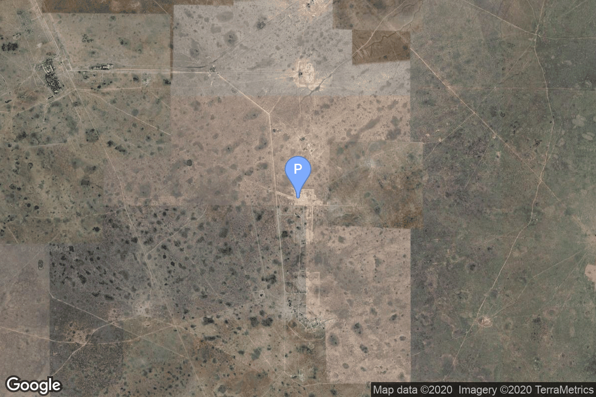
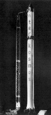
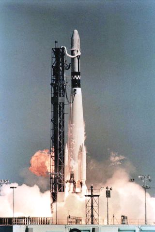
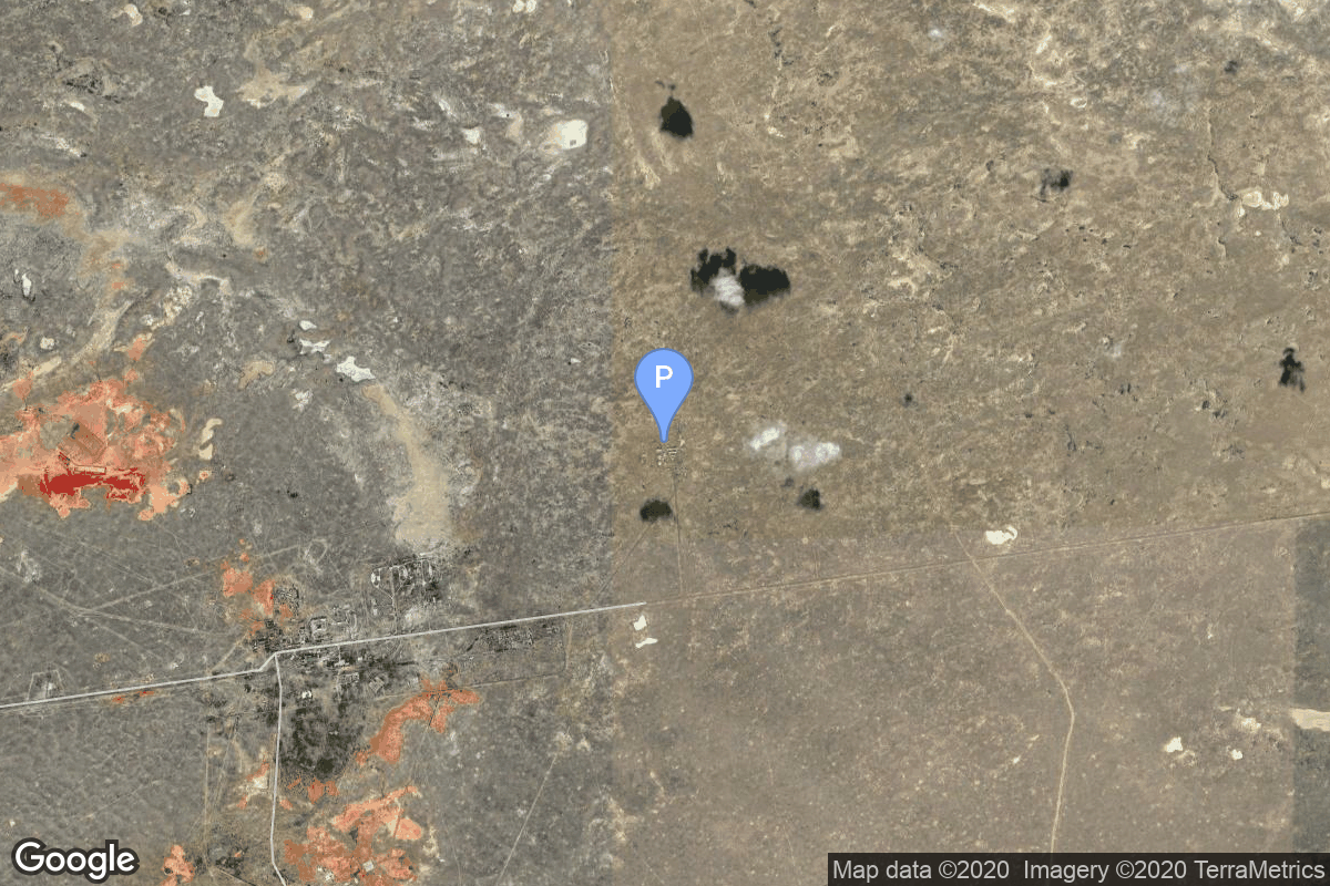
{ "count": 7930, "next": "https://ll.thespacedevs.com/2.0.0/launch/?format=api&limit=10&offset=7310&ordering=-net", "previous": "https://ll.thespacedevs.com/2.0.0/launch/?format=api&limit=10&offset=7290&ordering=-net", "results": [ { "id": "ed6639ac-efc2-4772-9986-63865d1af940", "url": "https://ll.thespacedevs.com/2.0.0/launch/ed6639ac-efc2-4772-9986-63865d1af940/?format=api", "launch_library_id": null, "slug": "atlas-centaur-d-surveyor-1", "name": "Atlas Centaur D | Surveyor 1", "status": { "id": 3, "name": "Success" }, "net": "1966-05-30T14:41:01Z", "window_end": "1966-05-30T14:41:01Z", "window_start": "1966-05-30T14:41:01Z", "inhold": false, "tbdtime": false, "tbddate": false, "probability": null, "holdreason": "", "failreason": null, "hashtag": null, "launch_service_provider": { "id": 161, "url": "https://ll.thespacedevs.com/2.0.0/agencies/161/?format=api", "name": "United States Air Force", "type": "Government" }, "rocket": { "id": 3532, "configuration": { "id": 236, "launch_library_id": null, "url": "https://ll.thespacedevs.com/2.0.0/config/launcher/236/?format=api", "name": "Atlas Centaur D", "family": "Atlas", "full_name": "Atlas LV-3C Centaur D", "variant": "Centaur D" } }, "mission": { "id": 1952, "launch_library_id": null, "name": "Surveyor 1", "description": "Lunar probe which successfully landed on the surface on June 2 from where it transmitted 11,237 photos.", "launch_designator": null, "type": "Lunar Exploration", "orbit": { "id": 10, "name": "Lunar Impactor", "abbrev": "Lunar Impactor" } }, "pad": { "id": 121, "url": "https://ll.thespacedevs.com/2.0.0/pad/121/?format=api", "agency_id": 161, "name": "Launch Complex 36A", "info_url": null, "wiki_url": "https://en.wikipedia.org/wiki/Cape_Canaveral_Launch_Complex_36", "map_url": "https://www.google.com/maps?q=28.4705556,-80.542194", "latitude": "28.4705556", "longitude": "-80.542194", "location": { "id": 12, "url": "https://ll.thespacedevs.com/2.0.0/location/12/?format=api", "name": "Cape Canaveral SFS, FL, USA", "country_code": "USA", "map_image": "https://thespacedevs-prod.nyc3.digitaloceanspaces.com/media/map_images/location_12_20200803142519.jpg", "total_launch_count": 1122, "total_landing_count": 75 }, "map_image": "https://thespacedevs-prod.nyc3.digitaloceanspaces.com/media/map_images/pad_121_20200803143231.jpg", "total_launch_count": 71 }, "webcast_live": false, "image": null, "infographic": null, "program": [] }, { "id": "85d2374d-cca2-4605-a96b-8674f90865e5", "url": "https://ll.thespacedevs.com/2.0.0/launch/85d2374d-cca2-4605-a96b-8674f90865e5/?format=api", "launch_library_id": null, "slug": "thor-delta-c1-explorer-32", "name": "Thor Delta C1 | Explorer 32", "status": { "id": 3, "name": "Success" }, "net": "1966-05-25T14:00:00Z", "window_end": "1966-05-25T14:00:00Z", "window_start": "1966-05-25T14:00:00Z", "inhold": false, "tbdtime": false, "tbddate": false, "probability": null, "holdreason": "", "failreason": null, "hashtag": null, "launch_service_provider": { "id": 161, "url": "https://ll.thespacedevs.com/2.0.0/agencies/161/?format=api", "name": "United States Air Force", "type": "Government" }, "rocket": { "id": 3531, "configuration": { "id": 402, "launch_library_id": null, "url": "https://ll.thespacedevs.com/2.0.0/config/launcher/402/?format=api", "name": "Thor Delta C1", "family": "Thor", "full_name": "Thor Delta C1", "variant": "Delta C1" } }, "mission": { "id": 1951, "launch_library_id": null, "name": "Explorer 32", "description": "AE B (Aeronomy Explorer B) was an aeronomy satellite which was designed to directly measure temperatures, composition, densities, and pressures in the upper atmosphere on a global basis.", "launch_designator": null, "type": "Earth Science", "orbit": { "id": 8, "name": "Low Earth Orbit", "abbrev": "LEO" } }, "pad": { "id": 1, "url": "https://ll.thespacedevs.com/2.0.0/pad/1/?format=api", "agency_id": null, "name": "Space Launch Complex 17B", "info_url": null, "wiki_url": "https://en.wikipedia.org/wiki/Cape_Canaveral_Space_Launch_Complex_17", "map_url": "https://www.google.com/maps?q=28.4458,-80.5657", "latitude": "28.4458", "longitude": "-80.5657", "location": { "id": 12, "url": "https://ll.thespacedevs.com/2.0.0/location/12/?format=api", "name": "Cape Canaveral SFS, FL, USA", "country_code": "USA", "map_image": "https://thespacedevs-prod.nyc3.digitaloceanspaces.com/media/map_images/location_12_20200803142519.jpg", "total_launch_count": 1122, "total_landing_count": 75 }, "map_image": "https://thespacedevs-prod.nyc3.digitaloceanspaces.com/media/map_images/pad_1_20200803143208.jpg", "total_launch_count": 132 }, "webcast_live": false, "image": null, "infographic": null, "program": [] }, { "id": "5b99e94f-0d28-410d-93b7-c2c98a255b96", "url": "https://ll.thespacedevs.com/2.0.0/launch/5b99e94f-0d28-410d-93b7-c2c98a255b96/?format=api", "launch_library_id": null, "slug": "kosmos-11k63-ds-u2-i-1", "name": "Kosmos 11K63 | DS-U2-I 1", "status": { "id": 3, "name": "Success" }, "net": "1966-05-24T05:31:00Z", "window_end": "1966-05-24T05:31:00Z", "window_start": "1966-05-24T05:31:00Z", "inhold": false, "tbdtime": false, "tbddate": false, "probability": null, "holdreason": "", "failreason": null, "hashtag": null, "launch_service_provider": { "id": 66, "url": "https://ll.thespacedevs.com/2.0.0/agencies/66/?format=api", "name": "Soviet Space Program", "type": "Government" }, "rocket": { "id": 3530, "configuration": { "id": 327, "launch_library_id": null, "url": "https://ll.thespacedevs.com/2.0.0/config/launcher/327/?format=api", "name": "Kosmos 11K63", "family": "Kosmos", "full_name": "Kosmos 11K63", "variant": "11K63" } }, "mission": { "id": 1950, "launch_library_id": null, "name": "DS-U2-I 1", "description": "The DS-U2-I satellites were Soviet ionospheric research satellites launched as part of the Dnepropetrovsk Sputnik program.", "launch_designator": null, "type": "Earth Science", "orbit": { "id": 8, "name": "Low Earth Orbit", "abbrev": "LEO" } }, "pad": { "id": 139, "url": "https://ll.thespacedevs.com/2.0.0/pad/139/?format=api", "agency_id": null, "name": "86/1", "info_url": null, "wiki_url": "https://en.wikipedia.org/wiki/Kapustin_Yar", "map_url": "https://www.google.com/maps?q=48.56935,46.293219", "latitude": "48.56935", "longitude": "46.293219", "location": { "id": 30, "url": "https://ll.thespacedevs.com/2.0.0/location/30/?format=api", "name": "Kapustin Yar, Russian Federation", "country_code": "RUS", "map_image": "https://thespacedevs-prod.nyc3.digitaloceanspaces.com/media/map_images/location_30_20200803142515.jpg", "total_launch_count": 101, "total_landing_count": 0 }, "map_image": "https://thespacedevs-prod.nyc3.digitaloceanspaces.com/media/map_images/pad_139_20200803143345.jpg", "total_launch_count": 26 }, "webcast_live": false, "image": "https://thespacedevs-prod.nyc3.digitaloceanspaces.com/media/images/kosmos_11k63_image_20251104091702.jpg", "infographic": null, "program": [] }, { "id": "d46f52d0-c50e-4bdb-9b6b-75a676fb2f13", "url": "https://ll.thespacedevs.com/2.0.0/launch/d46f52d0-c50e-4bdb-9b6b-75a676fb2f13/?format=api", "launch_library_id": null, "slug": "thor-slv-2a-agena-d-kh-4a-33", "name": "Thor SLV-2A Agena D | KH-4A 33", "status": { "id": 3, "name": "Success" }, "net": "1966-05-24T02:00:33Z", "window_end": "1966-05-24T02:00:33Z", "window_start": "1966-05-24T02:00:33Z", "inhold": false, "tbdtime": false, "tbddate": false, "probability": null, "holdreason": "", "failreason": null, "hashtag": null, "launch_service_provider": { "id": 161, "url": "https://ll.thespacedevs.com/2.0.0/agencies/161/?format=api", "name": "United States Air Force", "type": "Government" }, "rocket": { "id": 3529, "configuration": { "id": 417, "launch_library_id": null, "url": "https://ll.thespacedevs.com/2.0.0/config/launcher/417/?format=api", "name": "Thor SLV-2A Agena D", "family": "Thor", "full_name": "Thor SLV-2A Agena D", "variant": "SLV-2A Agena D" } }, "mission": { "id": 1949, "launch_library_id": null, "name": "KH-4A 33", "description": "The KH-4A (Keyhole-4A) was the fifth optical reconnaissance satellite version in the Corona-program.", "launch_designator": null, "type": "Government/Top Secret", "orbit": { "id": 8, "name": "Low Earth Orbit", "abbrev": "LEO" } }, "pad": { "id": 93, "url": "https://ll.thespacedevs.com/2.0.0/pad/93/?format=api", "agency_id": 161, "name": "Space Launch Complex 3W", "info_url": null, "wiki_url": "https://en.wikipedia.org/wiki/Vandenberg_Space_Launch_Complex_3#SLC-3W", "map_url": "https://www.google.com/maps?q=34.644,-120.593", "latitude": "34.644", "longitude": "-120.593", "location": { "id": 11, "url": "https://ll.thespacedevs.com/2.0.0/location/11/?format=api", "name": "Vandenberg SFB, CA, USA", "country_code": "USA", "map_image": "https://thespacedevs-prod.nyc3.digitaloceanspaces.com/media/map_images/location_11_20200803142416.jpg", "total_launch_count": 900, "total_landing_count": 35 }, "map_image": "https://thespacedevs-prod.nyc3.digitaloceanspaces.com/media/map_images/pad_93_20200803143225.jpg", "total_launch_count": 81 }, "webcast_live": false, "image": "https://thespacedevs-prod.nyc3.digitaloceanspaces.com/media/images/thor_slv-2a_age_image_20251102055131.jpg", "infographic": null, "program": [] }, { "id": "665ad764-947b-469e-8f37-8a9d5596419e", "url": "https://ll.thespacedevs.com/2.0.0/launch/665ad764-947b-469e-8f37-8a9d5596419e/?format=api", "launch_library_id": null, "slug": "r-36o-8k69-ogch-4", "name": "R-36O 8K69 | OGCh 4", "status": { "id": 3, "name": "Success" }, "net": "1966-05-19T19:30:00Z", "window_end": "1966-05-19T19:30:00Z", "window_start": "1966-05-19T19:30:00Z", "inhold": false, "tbdtime": false, "tbddate": false, "probability": null, "holdreason": "", "failreason": null, "hashtag": null, "launch_service_provider": { "id": 66, "url": "https://ll.thespacedevs.com/2.0.0/agencies/66/?format=api", "name": "Soviet Space Program", "type": "Government" }, "rocket": { "id": 3528, "configuration": { "id": 351, "launch_library_id": null, "url": "https://ll.thespacedevs.com/2.0.0/config/launcher/351/?format=api", "name": "R-36O 8K69", "family": "R-36O", "full_name": "R-36O 8K69", "variant": "8K69" } }, "mission": { "id": 1948, "launch_library_id": null, "name": "OGCh 4", "description": "Missile equipped with the 8F021 warhead", "launch_designator": null, "type": "Government/Top Secret", "orbit": { "id": 15, "name": "Suborbital", "abbrev": "Sub" } }, "pad": { "id": 166, "url": "https://ll.thespacedevs.com/2.0.0/pad/166/?format=api", "agency_id": null, "name": "67/22", "info_url": null, "wiki_url": "https://en.wikipedia.org/wiki/Baikonur_Cosmodrome", "map_url": "https://www.google.com/maps?q=45.99,63.704806", "latitude": "45.99", "longitude": "63.704806", "location": { "id": 15, "url": "https://ll.thespacedevs.com/2.0.0/location/15/?format=api", "name": "Baikonur Cosmodrome, Republic of Kazakhstan", "country_code": "KAZ", "map_image": "https://thespacedevs-prod.nyc3.digitaloceanspaces.com/media/map_images/location_15_20200803142517.jpg", "total_launch_count": 1564, "total_landing_count": 0 }, "map_image": "https://thespacedevs-prod.nyc3.digitaloceanspaces.com/media/map_images/pad_166_20200803143503.jpg", "total_launch_count": 1 }, "webcast_live": false, "image": "https://thespacedevs-prod.nyc3.digitaloceanspaces.com/media/images/r-360_during_fl_image_20251102175933.jpg", "infographic": null, "program": [] }, { "id": "7e24d9c3-21e4-414f-b731-7464c32ecd1e", "url": "https://ll.thespacedevs.com/2.0.0/launch/7e24d9c3-21e4-414f-b731-7464c32ecd1e/?format=api", "launch_library_id": null, "slug": "scout-a-transit-o-9", "name": "Scout A | Transit-O 9", "status": { "id": 3, "name": "Success" }, "net": "1966-05-19T02:27:00Z", "window_end": "1966-05-19T02:27:00Z", "window_start": "1966-05-19T02:27:00Z", "inhold": false, "tbdtime": false, "tbddate": false, "probability": null, "holdreason": "", "failreason": null, "hashtag": null, "launch_service_provider": { "id": 161, "url": "https://ll.thespacedevs.com/2.0.0/agencies/161/?format=api", "name": "United States Air Force", "type": "Government" }, "rocket": { "id": 3527, "configuration": { "id": 356, "launch_library_id": null, "url": "https://ll.thespacedevs.com/2.0.0/config/launcher/356/?format=api", "name": "Scout A", "family": "Scout", "full_name": "Scout A", "variant": "A" } }, "mission": { "id": 1947, "launch_library_id": null, "name": "Transit-O 9", "description": "The Transit-O series of satellites that closely followed the design of Transit 5C-1 were also called “Oscars” (Oscar is the phonetic alphabet for “O”, i. e., operational). They were also called NNS (Navy Navigation Satellite) or shortened NavSat.", "launch_designator": null, "type": "Navigation", "orbit": { "id": 13, "name": "Polar Orbit", "abbrev": "PO" } }, "pad": { "id": 154, "url": "https://ll.thespacedevs.com/2.0.0/pad/154/?format=api", "agency_id": null, "name": "Space Launch Complex 5", "info_url": "https://www.astronautix.com/v/vandenbergslc5.html", "wiki_url": "https://en.wikipedia.org/wiki/Vandenberg_Air_Force_Base_Space_Launch_Complex_5", "map_url": "https://www.google.com/maps?q=34.6080,-120.6247", "latitude": "34.608", "longitude": "-120.6247", "location": { "id": 11, "url": "https://ll.thespacedevs.com/2.0.0/location/11/?format=api", "name": "Vandenberg SFB, CA, USA", "country_code": "USA", "map_image": "https://thespacedevs-prod.nyc3.digitaloceanspaces.com/media/map_images/location_11_20200803142416.jpg", "total_launch_count": 900, "total_landing_count": 35 }, "map_image": "https://thespacedevs-prod.nyc3.digitaloceanspaces.com/media/map_images/pad_154_20200803143408.jpg", "total_launch_count": 69 }, "webcast_live": false, "image": null, "infographic": null, "program": [] }, { "id": "2eeecb38-f001-48c1-b112-40ed057f57ad", "url": "https://ll.thespacedevs.com/2.0.0/launch/2eeecb38-f001-48c1-b112-40ed057f57ad/?format=api", "launch_library_id": null, "slug": "atlas-slv-3-agena-d-gatv-9", "name": "Atlas SLV-3 Agena D | GATV 9", "status": { "id": 4, "name": "Failure" }, "net": "1966-05-17T15:15:03Z", "window_end": "1966-05-17T15:15:03Z", "window_start": "1966-05-17T15:15:03Z", "inhold": false, "tbdtime": false, "tbddate": false, "probability": null, "holdreason": "", "failreason": "", "hashtag": null, "launch_service_provider": { "id": 161, "url": "https://ll.thespacedevs.com/2.0.0/agencies/161/?format=api", "name": "United States Air Force", "type": "Government" }, "rocket": { "id": 3526, "configuration": { "id": 258, "launch_library_id": null, "url": "https://ll.thespacedevs.com/2.0.0/config/launcher/258/?format=api", "name": "Atlas SLV-3 Agena D", "family": "Atlas", "full_name": "Atlas SLV-3 Agena D", "variant": "SLV-3 Agena D" } }, "mission": { "id": 1946, "launch_library_id": null, "name": "GATV 9", "description": "The GATV (Gemini Agena Target Vehicle) was designed to be launched into Earth orbit prior to a Gemini mission and used for rendezvous and docking practice.", "launch_designator": null, "type": "Test Target", "orbit": { "id": 8, "name": "Low Earth Orbit", "abbrev": "LEO" } }, "pad": { "id": 17, "url": "https://ll.thespacedevs.com/2.0.0/pad/17/?format=api", "agency_id": 1048, "name": "Space Launch Complex 14", "info_url": null, "wiki_url": "https://en.wikipedia.org/wiki/Cape_Canaveral_Air_Force_Station_Launch_Complex_14", "map_url": "https://www.google.com/maps?q=28.49103,-80.54687", "latitude": "28.49103", "longitude": "-80.54687", "location": { "id": 12, "url": "https://ll.thespacedevs.com/2.0.0/location/12/?format=api", "name": "Cape Canaveral SFS, FL, USA", "country_code": "USA", "map_image": "https://thespacedevs-prod.nyc3.digitaloceanspaces.com/media/map_images/location_12_20200803142519.jpg", "total_launch_count": 1122, "total_landing_count": 75 }, "map_image": "https://thespacedevs-prod.nyc3.digitaloceanspaces.com/media/map_images/pad_17_20200803143405.jpg", "total_launch_count": 20 }, "webcast_live": false, "image": "https://thespacedevs-prod.nyc3.digitaloceanspaces.com/media/images/atlas-slv3_agen_image_20251102060811.jpg", "infographic": null, "program": [ { "id": 3, "url": "https://ll.thespacedevs.com/2.0.0/program/3/?format=api", "name": "Gemini", "description": "Project Gemini was NASA's second human spaceflight program. Conducted between projects Mercury and Apollo, Gemini started in 1961 and concluded in 1966.", "agencies": [ { "id": 44, "url": "https://ll.thespacedevs.com/2.0.0/agencies/44/?format=api", "name": "National Aeronautics and Space Administration", "type": "Government" } ], "image_url": "https://thespacedevs-prod.nyc3.digitaloceanspaces.com/media/images/project2520gem_program_20200820195350.png", "start_date": "1961-12-07T00:00:00Z", "end_date": "1966-11-15T19:21:04Z", "info_url": "https://www.nasa.gov/mission_pages/gemini/index.html", "wiki_url": "https://en.wikipedia.org/wiki/Project_Gemini" } ] }, { "id": "755498a3-909b-46e7-ae55-9ea303ab3f7b", "url": "https://ll.thespacedevs.com/2.0.0/launch/755498a3-909b-46e7-ae55-9ea303ab3f7b/?format=api", "launch_library_id": null, "slug": "voskhod-zenit-4-18", "name": "Voskhod | Zenit-4 18", "status": { "id": 4, "name": "Failure" }, "net": "1966-05-17T11:00:00Z", "window_end": "1966-05-17T11:00:00Z", "window_start": "1966-05-17T11:00:00Z", "inhold": false, "tbdtime": false, "tbddate": false, "probability": null, "holdreason": "", "failreason": null, "hashtag": null, "launch_service_provider": { "id": 66, "url": "https://ll.thespacedevs.com/2.0.0/agencies/66/?format=api", "name": "Soviet Space Program", "type": "Government" }, "rocket": { "id": 3525, "configuration": { "id": 104, "launch_library_id": 138, "url": "https://ll.thespacedevs.com/2.0.0/config/launcher/104/?format=api", "name": "Voskhod", "family": "R-7", "full_name": "Voskhod", "variant": "Voskhod" } }, "mission": { "id": 1945, "launch_library_id": null, "name": "Zenit-4 18", "description": "Zenit-4 film-return reconnaissance satellite.", "launch_designator": null, "type": "Government/Top Secret", "orbit": { "id": 8, "name": "Low Earth Orbit", "abbrev": "LEO" } }, "pad": { "id": 168, "url": "https://ll.thespacedevs.com/2.0.0/pad/168/?format=api", "agency_id": null, "name": "41/1", "info_url": null, "wiki_url": "https://en.wikipedia.org/wiki/Plesetsk_Cosmodrome", "map_url": "https://www.google.com/maps?q=62.941,40.526806", "latitude": "62.941", "longitude": "40.526806", "location": { "id": 6, "url": "https://ll.thespacedevs.com/2.0.0/location/6/?format=api", "name": "Plesetsk Cosmodrome, Russian Federation", "country_code": "RUS", "map_image": "https://thespacedevs-prod.nyc3.digitaloceanspaces.com/media/map_images/location_6_20200803142434.jpg", "total_launch_count": 1686, "total_landing_count": 0 }, "map_image": "https://thespacedevs-prod.nyc3.digitaloceanspaces.com/media/map_images/pad_168_20200803143446.jpg", "total_launch_count": 310 }, "webcast_live": false, "image": "https://thespacedevs-prod.nyc3.digitaloceanspaces.com/media/images/voskhod_during__image_20251102062248.jpg", "infographic": null, "program": [] }, { "id": "81a295d5-4780-4104-bcb8-2ee1caa9f6c1", "url": "https://ll.thespacedevs.com/2.0.0/launch/81a295d5-4780-4104-bcb8-2ee1caa9f6c1/?format=api", "launch_library_id": null, "slug": "thor-slv-2a-agena-b-nimbus-2", "name": "Thor SLV-2A Agena B | Nimbus 2", "status": { "id": 3, "name": "Success" }, "net": "1966-05-15T07:55:34Z", "window_end": "1966-05-15T07:55:34Z", "window_start": "1966-05-15T07:55:34Z", "inhold": false, "tbdtime": false, "tbddate": false, "probability": null, "holdreason": "", "failreason": null, "hashtag": null, "launch_service_provider": { "id": 161, "url": "https://ll.thespacedevs.com/2.0.0/agencies/161/?format=api", "name": "United States Air Force", "type": "Government" }, "rocket": { "id": 3524, "configuration": { "id": 416, "launch_library_id": null, "url": "https://ll.thespacedevs.com/2.0.0/config/launcher/416/?format=api", "name": "Thor SLV-2A Agena B", "family": "Thor", "full_name": "Thor SLV-2A Agena B", "variant": "SLV-2A Agena B" } }, "mission": { "id": 1944, "launch_library_id": null, "name": "Nimbus 2", "description": "Nimbus 2, the second in a series of second-generation meteorological research-and-development satellites, added an additional medium-resolution infrared radiometer (MRIR) compared to Nimbus 1.", "launch_designator": null, "type": "Earth Science", "orbit": { "id": 13, "name": "Polar Orbit", "abbrev": "PO" } }, "pad": { "id": 98, "url": "https://ll.thespacedevs.com/2.0.0/pad/98/?format=api", "agency_id": 161, "name": "Space Launch Complex 2E", "info_url": null, "wiki_url": "https://en.wikipedia.org/wiki/Vandenberg_Space_Launch_Complex_2", "map_url": "https://www.google.com/maps?q=34.7516,-120.6192", "latitude": "34.7516", "longitude": "-120.6192", "location": { "id": 11, "url": "https://ll.thespacedevs.com/2.0.0/location/11/?format=api", "name": "Vandenberg SFB, CA, USA", "country_code": "USA", "map_image": "https://thespacedevs-prod.nyc3.digitaloceanspaces.com/media/map_images/location_11_20200803142416.jpg", "total_launch_count": 900, "total_landing_count": 35 }, "map_image": "https://thespacedevs-prod.nyc3.digitaloceanspaces.com/media/map_images/pad_98_20200803143228.jpg", "total_launch_count": 47 }, "webcast_live": false, "image": "https://thespacedevs-prod.nyc3.digitaloceanspaces.com/media/images/thor_slv-2a_age_image_20251102055131.jpg", "infographic": null, "program": [] }, { "id": "7bfa0670-2c02-49cf-94bb-baf5a71b4f1a", "url": "https://ll.thespacedevs.com/2.0.0/launch/7bfa0670-2c02-49cf-94bb-baf5a71b4f1a/?format=api", "launch_library_id": null, "slug": "atlas-slv-3-agena-d-kh-7-28", "name": "Atlas SLV-3 Agena D | KH-7 28", "status": { "id": 3, "name": "Success" }, "net": "1966-05-14T19:02:00Z", "window_end": "1966-05-14T19:02:00Z", "window_start": "1966-05-14T19:02:00Z", "inhold": false, "tbdtime": false, "tbddate": false, "probability": null, "holdreason": "", "failreason": null, "hashtag": null, "launch_service_provider": { "id": 161, "url": "https://ll.thespacedevs.com/2.0.0/agencies/161/?format=api", "name": "United States Air Force", "type": "Government" }, "rocket": { "id": 3523, "configuration": { "id": 258, "launch_library_id": null, "url": "https://ll.thespacedevs.com/2.0.0/config/launcher/258/?format=api", "name": "Atlas SLV-3 Agena D", "family": "Atlas", "full_name": "Atlas SLV-3 Agena D", "variant": "SLV-3 Agena D" } }, "mission": { "id": 1943, "launch_library_id": null, "name": "KH-7 28", "description": "The Program 206 satellite, carrying the KH-7 (Keyhole 7) camera system (codenamed Gambit-1), was the first successful high resolution space reconnaissance program. It was managed by NRO's Program A, the USAF-led segment of the National Reconnaissance Program managed from Los Angeles AFB in El Segundo, California.", "launch_designator": null, "type": "Government/Top Secret", "orbit": { "id": 17, "name": "Sun-Synchronous Orbit", "abbrev": "SSO" } }, "pad": { "id": 16, "url": "https://ll.thespacedevs.com/2.0.0/pad/16/?format=api", "agency_id": null, "name": "Space Launch Complex 4E", "info_url": null, "wiki_url": "https://en.wikipedia.org/wiki/Vandenberg_Space_Launch_Complex_4#SLC-4E", "map_url": "https://www.google.com/maps?q=34.632,-120.611", "latitude": "34.632", "longitude": "-120.611", "location": { "id": 11, "url": "https://ll.thespacedevs.com/2.0.0/location/11/?format=api", "name": "Vandenberg SFB, CA, USA", "country_code": "USA", "map_image": "https://thespacedevs-prod.nyc3.digitaloceanspaces.com/media/map_images/location_11_20200803142416.jpg", "total_launch_count": 900, "total_landing_count": 35 }, "map_image": "https://thespacedevs-prod.nyc3.digitaloceanspaces.com/media/map_images/pad_16_20200803143532.jpg", "total_launch_count": 284 }, "webcast_live": false, "image": "https://thespacedevs-prod.nyc3.digitaloceanspaces.com/media/images/atlas-slv3_agen_image_20251102060811.jpg", "infographic": null, "program": [] } ] }