Launch List
API endpoint that returns all Launch objects or a single launch.
EXAMPLE - /launch/
GET: Return a list of all Launch objects.
FILTERS: Fields - 'name', 'id(s)', 'lsp_id', 'lsp_name', 'serial_number', 'launcher_config__id', 'rocket__spacecraftflight__spacecraft__name'
MODE: 'normal', 'list', 'detailed' EXAMPLE: ?mode=list
SEARCH: Searches through the launch name, rocket name, launch agency, mission name & spacecraft name. EXAMPLE - ?search=SpaceX
GET /2.0.0/launch/?format=api&offset=7250&ordering=-net
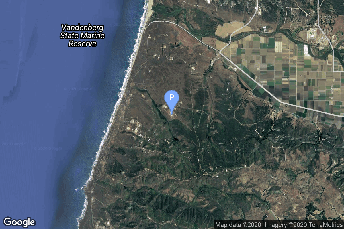
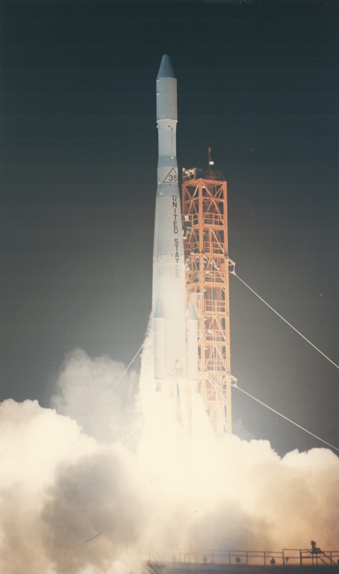
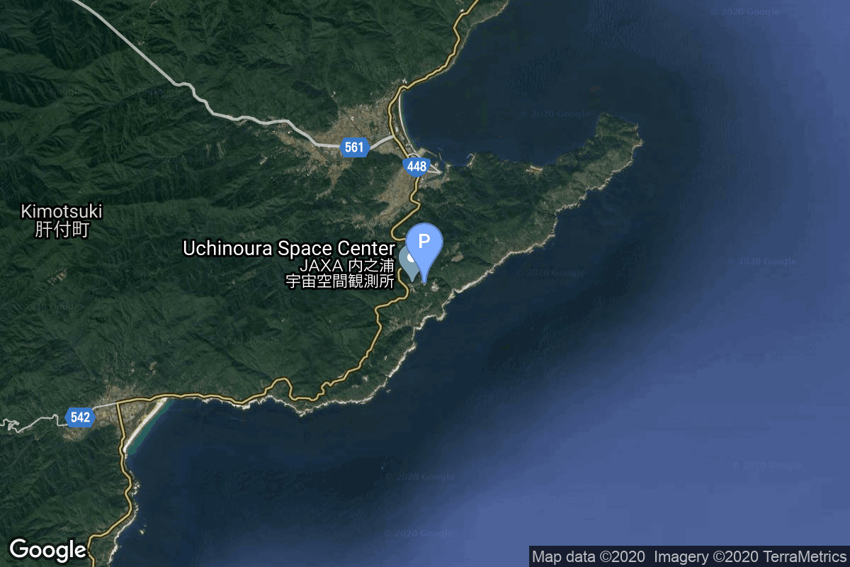
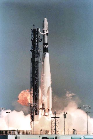
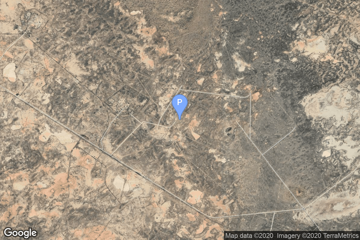
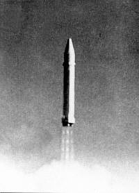
{ "count": 7930, "next": "https://ll.thespacedevs.com/2.0.0/launch/?format=api&limit=10&offset=7260&ordering=-net", "previous": "https://ll.thespacedevs.com/2.0.0/launch/?format=api&limit=10&offset=7240&ordering=-net", "results": [ { "id": "f7fc8b7b-21d8-4c9d-bb2e-d6cde9264310", "url": "https://ll.thespacedevs.com/2.0.0/launch/f7fc8b7b-21d8-4c9d-bb2e-d6cde9264310/?format=api", "launch_library_id": null, "slug": "atlas-slv-3-agena-d-kh-7-33", "name": "Atlas SLV-3 Agena D | KH-7 33", "status": { "id": 3, "name": "Success" }, "net": "1966-10-12T19:15:00Z", "window_end": "1966-10-12T19:15:00Z", "window_start": "1966-10-12T19:15:00Z", "inhold": false, "tbdtime": false, "tbddate": false, "probability": null, "holdreason": "", "failreason": null, "hashtag": null, "launch_service_provider": { "id": 161, "url": "https://ll.thespacedevs.com/2.0.0/agencies/161/?format=api", "name": "United States Air Force", "type": "Government" }, "rocket": { "id": 3579, "configuration": { "id": 258, "launch_library_id": null, "url": "https://ll.thespacedevs.com/2.0.0/config/launcher/258/?format=api", "name": "Atlas SLV-3 Agena D", "family": "Atlas", "full_name": "Atlas SLV-3 Agena D", "variant": "SLV-3 Agena D" } }, "mission": { "id": 1998, "launch_library_id": null, "name": "KH-7 33", "description": "The Program 206 satellite, carrying the KH-7 (Keyhole 7) camera system (codenamed Gambit-1), was the first successful high resolution space reconnaissance program. It was managed by NRO's Program A, the USAF-led segment of the National Reconnaissance Program managed from Los Angeles AFB in El Segundo, California.", "launch_designator": null, "type": "Government/Top Secret", "orbit": { "id": 17, "name": "Sun-Synchronous Orbit", "abbrev": "SSO" } }, "pad": { "id": 16, "url": "https://ll.thespacedevs.com/2.0.0/pad/16/?format=api", "agency_id": null, "name": "Space Launch Complex 4E", "info_url": null, "wiki_url": "https://en.wikipedia.org/wiki/Vandenberg_Space_Launch_Complex_4#SLC-4E", "map_url": "https://www.google.com/maps?q=34.632,-120.611", "latitude": "34.632", "longitude": "-120.611", "location": { "id": 11, "url": "https://ll.thespacedevs.com/2.0.0/location/11/?format=api", "name": "Vandenberg SFB, CA, USA", "country_code": "USA", "map_image": "https://thespacedevs-prod.nyc3.digitaloceanspaces.com/media/map_images/location_11_20200803142416.jpg", "total_launch_count": 900, "total_landing_count": 35 }, "map_image": "https://thespacedevs-prod.nyc3.digitaloceanspaces.com/media/map_images/pad_16_20200803143532.jpg", "total_launch_count": 284 }, "webcast_live": false, "image": "https://thespacedevs-prod.nyc3.digitaloceanspaces.com/media/images/atlas-slv3_agen_image_20251102060811.jpg", "infographic": null, "program": [] }, { "id": "ecd6491e-d5fa-409a-a027-c80b6058f56e", "url": "https://ll.thespacedevs.com/2.0.0/launch/ecd6491e-d5fa-409a-a027-c80b6058f56e/?format=api", "launch_library_id": null, "slug": "atlas-slv-3-agena-d-rts-1-3", "name": "Atlas SLV-3 Agena D | RTS-1 3", "status": { "id": 3, "name": "Success" }, "net": "1966-10-05T22:00:00Z", "window_end": "1966-10-05T22:00:00Z", "window_start": "1966-10-05T22:00:00Z", "inhold": false, "tbdtime": false, "tbddate": false, "probability": null, "holdreason": "", "failreason": null, "hashtag": null, "launch_service_provider": { "id": 161, "url": "https://ll.thespacedevs.com/2.0.0/agencies/161/?format=api", "name": "United States Air Force", "type": "Government" }, "rocket": { "id": 3578, "configuration": { "id": 258, "launch_library_id": null, "url": "https://ll.thespacedevs.com/2.0.0/config/launcher/258/?format=api", "name": "Atlas SLV-3 Agena D", "family": "Atlas", "full_name": "Atlas SLV-3 Agena D", "variant": "SLV-3 Agena D" } }, "mission": { "id": 1997, "launch_library_id": null, "name": "RTS-1 3", "description": "The RTS-1 (Research Test Series 1), also known as MIDAS-RTS-1 or AFP-461, was an extension to the MIDAS program of early warning satellites.", "launch_designator": null, "type": "Government/Top Secret", "orbit": { "id": 13, "name": "Polar Orbit", "abbrev": "PO" } }, "pad": { "id": 24, "url": "https://ll.thespacedevs.com/2.0.0/pad/24/?format=api", "agency_id": 161, "name": "Space Launch Complex 3E", "info_url": null, "wiki_url": "https://en.wikipedia.org/wiki/Vandenberg_Space_Launch_Complex_3#SLC-3E", "map_url": "https://www.google.com/maps?q=34.64,-120.5895", "latitude": "34.64", "longitude": "-120.5895", "location": { "id": 11, "url": "https://ll.thespacedevs.com/2.0.0/location/11/?format=api", "name": "Vandenberg SFB, CA, USA", "country_code": "USA", "map_image": "https://thespacedevs-prod.nyc3.digitaloceanspaces.com/media/map_images/location_11_20200803142416.jpg", "total_launch_count": 900, "total_landing_count": 35 }, "map_image": "https://thespacedevs-prod.nyc3.digitaloceanspaces.com/media/map_images/pad_24_20200803143552.jpg", "total_launch_count": 48 }, "webcast_live": false, "image": "https://thespacedevs-prod.nyc3.digitaloceanspaces.com/media/images/atlas-slv3_agen_image_20251102060811.jpg", "infographic": null, "program": [] }, { "id": "06e691d9-5ef6-4e1c-a0eb-ae7534410b41", "url": "https://ll.thespacedevs.com/2.0.0/launch/06e691d9-5ef6-4e1c-a0eb-ae7534410b41/?format=api", "launch_library_id": null, "slug": "thor-delta-e-essa-3", "name": "Thor Delta E | ESSA 3", "status": { "id": 3, "name": "Success" }, "net": "1966-10-02T10:39:03Z", "window_end": "1966-10-02T10:39:03Z", "window_start": "1966-10-02T10:39:03Z", "inhold": false, "tbdtime": false, "tbddate": false, "probability": null, "holdreason": "", "failreason": null, "hashtag": null, "launch_service_provider": { "id": 161, "url": "https://ll.thespacedevs.com/2.0.0/agencies/161/?format=api", "name": "United States Air Force", "type": "Government" }, "rocket": { "id": 3577, "configuration": { "id": 404, "launch_library_id": null, "url": "https://ll.thespacedevs.com/2.0.0/config/launcher/404/?format=api", "name": "Thor Delta E", "family": "Thor", "full_name": "Thor Delta E", "variant": "Delta E" } }, "mission": { "id": 1996, "launch_library_id": null, "name": "ESSA 3", "description": "The ESSA series was the second generation of US meterological satellites after the TIROS (Television & Infra-Red Observation Satellite) series. They were also called OT (Operational TIROS), TOS (TIROS Operational Satellite).", "launch_designator": null, "type": "Earth Science", "orbit": { "id": 17, "name": "Sun-Synchronous Orbit", "abbrev": "SSO" } }, "pad": { "id": 98, "url": "https://ll.thespacedevs.com/2.0.0/pad/98/?format=api", "agency_id": 161, "name": "Space Launch Complex 2E", "info_url": null, "wiki_url": "https://en.wikipedia.org/wiki/Vandenberg_Space_Launch_Complex_2", "map_url": "https://www.google.com/maps?q=34.7516,-120.6192", "latitude": "34.7516", "longitude": "-120.6192", "location": { "id": 11, "url": "https://ll.thespacedevs.com/2.0.0/location/11/?format=api", "name": "Vandenberg SFB, CA, USA", "country_code": "USA", "map_image": "https://thespacedevs-prod.nyc3.digitaloceanspaces.com/media/map_images/location_11_20200803142416.jpg", "total_launch_count": 900, "total_landing_count": 35 }, "map_image": "https://thespacedevs-prod.nyc3.digitaloceanspaces.com/media/map_images/pad_98_20200803143228.jpg", "total_launch_count": 47 }, "webcast_live": false, "image": "https://thespacedevs-prod.nyc3.digitaloceanspaces.com/media/images/thor_delta_e1_image_20251205041725.jpg", "infographic": null, "program": [] }, { "id": "863a4518-b385-40cb-8388-7446fb6410d8", "url": "https://ll.thespacedevs.com/2.0.0/launch/863a4518-b385-40cb-8388-7446fb6410d8/?format=api", "launch_library_id": null, "slug": "titan-iiib-kh-8-2", "name": "Titan IIIB | KH-8 2", "status": { "id": 3, "name": "Success" }, "net": "1966-09-28T19:07:00Z", "window_end": "1966-09-28T19:07:00Z", "window_start": "1966-09-28T19:07:00Z", "inhold": false, "tbdtime": false, "tbddate": false, "probability": null, "holdreason": "", "failreason": null, "hashtag": null, "launch_service_provider": { "id": 161, "url": "https://ll.thespacedevs.com/2.0.0/agencies/161/?format=api", "name": "United States Air Force", "type": "Government" }, "rocket": { "id": 3576, "configuration": { "id": 438, "launch_library_id": null, "url": "https://ll.thespacedevs.com/2.0.0/config/launcher/438/?format=api", "name": "Titan IIIB", "family": "Titan", "full_name": "Titan IIIB", "variant": "IIIB" } }, "mission": { "id": 1995, "launch_library_id": null, "name": "KH-8 2", "description": "KH-8 or Gambit-3 was the second generation of Gambit high resolution reconnaissance satellites.", "launch_designator": null, "type": "Government/Top Secret", "orbit": { "id": 8, "name": "Low Earth Orbit", "abbrev": "LEO" } }, "pad": { "id": 156, "url": "https://ll.thespacedevs.com/2.0.0/pad/156/?format=api", "agency_id": null, "name": "Space Launch Complex 4W", "info_url": "https://www.astronautix.com/v/vandenbergslc4w.html", "wiki_url": "https://en.wikipedia.org/wiki/Vandenberg_Air_Force_Base_Space_Launch_Complex_4#SLC-4W", "map_url": "https://www.google.com/maps?q=34.63312,-120.61584", "latitude": "34.63312", "longitude": "-120.61584", "location": { "id": 11, "url": "https://ll.thespacedevs.com/2.0.0/location/11/?format=api", "name": "Vandenberg SFB, CA, USA", "country_code": "USA", "map_image": "https://thespacedevs-prod.nyc3.digitaloceanspaces.com/media/map_images/location_11_20200803142416.jpg", "total_launch_count": 900, "total_landing_count": 35 }, "map_image": "https://thespacedevs-prod.nyc3.digitaloceanspaces.com/media/map_images/pad_156_20200803143351.jpg", "total_launch_count": 93 }, "webcast_live": false, "image": "https://thespacedevs-prod.nyc3.digitaloceanspaces.com/media/images/titan_iiib_image_20251204210122.jpg", "infographic": null, "program": [] }, { "id": "82f5c49a-7cc6-46ee-a965-a604cc2659b3", "url": "https://ll.thespacedevs.com/2.0.0/launch/82f5c49a-7cc6-46ee-a965-a604cc2659b3/?format=api", "launch_library_id": null, "slug": "lambda-4s-ohsumi-1", "name": "Lambda 4S | Ohsumi 1", "status": { "id": 4, "name": "Failure" }, "net": "1966-09-26T02:58:00Z", "window_end": "1966-09-26T02:58:00Z", "window_start": "1966-09-26T02:58:00Z", "inhold": false, "tbdtime": false, "tbddate": false, "probability": null, "holdreason": "", "failreason": "", "hashtag": null, "launch_service_provider": { "id": 1009, "url": "https://ll.thespacedevs.com/2.0.0/agencies/1009/?format=api", "name": "Institute of Space and Astronautical Science", "type": "Government" }, "rocket": { "id": 3575, "configuration": { "id": 333, "launch_library_id": null, "url": "https://ll.thespacedevs.com/2.0.0/config/launcher/333/?format=api", "name": "Lambda 4S", "family": "", "full_name": "Lambda 4S", "variant": "4S" } }, "mission": { "id": 1994, "launch_library_id": null, "name": "Ohsumi 1", "description": "Ohsumi was a series of five small satellites built to become the first Japanese satellite on orbit.", "launch_designator": null, "type": "Test Flight", "orbit": { "id": 8, "name": "Low Earth Orbit", "abbrev": "LEO" } }, "pad": { "id": 43, "url": "https://ll.thespacedevs.com/2.0.0/pad/43/?format=api", "agency_id": null, "name": "KS Center", "info_url": null, "wiki_url": "https://en.wikipedia.org/wiki/Uchinoura_Space_Center", "map_url": "https://www.google.com/maps?q=31.2519752,131.0791609", "latitude": "31.2519752", "longitude": "131.0791609", "location": { "id": 24, "url": "https://ll.thespacedevs.com/2.0.0/location/24/?format=api", "name": "Uchinoura Space Center, Japan", "country_code": "JPN", "map_image": "https://thespacedevs-prod.nyc3.digitaloceanspaces.com/media/map_images/location_24_20200803142411.jpg", "total_launch_count": 43, "total_landing_count": 0 }, "map_image": "https://thespacedevs-prod.nyc3.digitaloceanspaces.com/media/map_images/pad_43_20200803143309.jpg", "total_launch_count": 7 }, "webcast_live": false, "image": null, "infographic": null, "program": [] }, { "id": "61ff8ec8-e58e-42bb-a1be-db05a713627f", "url": "https://ll.thespacedevs.com/2.0.0/launch/61ff8ec8-e58e-42bb-a1be-db05a713627f/?format=api", "launch_library_id": null, "slug": "thor-slv-2a-agena-d-kh-4a-36", "name": "Thor SLV-2A Agena D | KH-4A 36", "status": { "id": 3, "name": "Success" }, "net": "1966-09-20T21:14:05Z", "window_end": "1966-09-20T21:14:05Z", "window_start": "1966-09-20T21:14:05Z", "inhold": false, "tbdtime": false, "tbddate": false, "probability": null, "holdreason": "", "failreason": null, "hashtag": null, "launch_service_provider": { "id": 161, "url": "https://ll.thespacedevs.com/2.0.0/agencies/161/?format=api", "name": "United States Air Force", "type": "Government" }, "rocket": { "id": 3574, "configuration": { "id": 417, "launch_library_id": null, "url": "https://ll.thespacedevs.com/2.0.0/config/launcher/417/?format=api", "name": "Thor SLV-2A Agena D", "family": "Thor", "full_name": "Thor SLV-2A Agena D", "variant": "SLV-2A Agena D" } }, "mission": { "id": 1993, "launch_library_id": null, "name": "KH-4A 36", "description": "The KH-4A (Keyhole-4A) was the fifth optical reconnaissance satellite version in the Corona-program.", "launch_designator": null, "type": "Government/Top Secret", "orbit": { "id": 8, "name": "Low Earth Orbit", "abbrev": "LEO" } }, "pad": { "id": 93, "url": "https://ll.thespacedevs.com/2.0.0/pad/93/?format=api", "agency_id": 161, "name": "Space Launch Complex 3W", "info_url": null, "wiki_url": "https://en.wikipedia.org/wiki/Vandenberg_Space_Launch_Complex_3#SLC-3W", "map_url": "https://www.google.com/maps?q=34.644,-120.593", "latitude": "34.644", "longitude": "-120.593", "location": { "id": 11, "url": "https://ll.thespacedevs.com/2.0.0/location/11/?format=api", "name": "Vandenberg SFB, CA, USA", "country_code": "USA", "map_image": "https://thespacedevs-prod.nyc3.digitaloceanspaces.com/media/map_images/location_11_20200803142416.jpg", "total_launch_count": 900, "total_landing_count": 35 }, "map_image": "https://thespacedevs-prod.nyc3.digitaloceanspaces.com/media/map_images/pad_93_20200803143225.jpg", "total_launch_count": 81 }, "webcast_live": false, "image": "https://thespacedevs-prod.nyc3.digitaloceanspaces.com/media/images/thor_slv-2a_age_image_20251102055131.jpg", "infographic": null, "program": [] }, { "id": "91ee7159-1558-42af-8b63-3736705e0b6f", "url": "https://ll.thespacedevs.com/2.0.0/launch/91ee7159-1558-42af-8b63-3736705e0b6f/?format=api", "launch_library_id": null, "slug": "atlas-centaur-d-surveyor-2", "name": "Atlas Centaur D | Surveyor 2", "status": { "id": 3, "name": "Success" }, "net": "1966-09-20T12:32:00Z", "window_end": "1966-09-20T12:32:00Z", "window_start": "1966-09-20T12:32:00Z", "inhold": false, "tbdtime": false, "tbddate": false, "probability": null, "holdreason": "", "failreason": null, "hashtag": null, "launch_service_provider": { "id": 161, "url": "https://ll.thespacedevs.com/2.0.0/agencies/161/?format=api", "name": "United States Air Force", "type": "Government" }, "rocket": { "id": 3573, "configuration": { "id": 236, "launch_library_id": null, "url": "https://ll.thespacedevs.com/2.0.0/config/launcher/236/?format=api", "name": "Atlas Centaur D", "family": "Atlas", "full_name": "Atlas LV-3C Centaur D", "variant": "Centaur D" } }, "mission": { "id": 1992, "launch_library_id": null, "name": "Surveyor 2", "description": "Lunar probe lost due to the failure of a vernier engine during a midcourse correction maneuver which sent the spacecraft in an unrecoverable tumble.", "launch_designator": null, "type": "Lunar Exploration", "orbit": { "id": 10, "name": "Lunar Impactor", "abbrev": "Lunar Impactor" } }, "pad": { "id": 121, "url": "https://ll.thespacedevs.com/2.0.0/pad/121/?format=api", "agency_id": 161, "name": "Launch Complex 36A", "info_url": null, "wiki_url": "https://en.wikipedia.org/wiki/Cape_Canaveral_Launch_Complex_36", "map_url": "https://www.google.com/maps?q=28.4705556,-80.542194", "latitude": "28.4705556", "longitude": "-80.542194", "location": { "id": 12, "url": "https://ll.thespacedevs.com/2.0.0/location/12/?format=api", "name": "Cape Canaveral SFS, FL, USA", "country_code": "USA", "map_image": "https://thespacedevs-prod.nyc3.digitaloceanspaces.com/media/map_images/location_12_20200803142519.jpg", "total_launch_count": 1122, "total_landing_count": 75 }, "map_image": "https://thespacedevs-prod.nyc3.digitaloceanspaces.com/media/map_images/pad_121_20200803143231.jpg", "total_launch_count": 71 }, "webcast_live": false, "image": null, "infographic": null, "program": [] }, { "id": "33da85f3-08a8-4c5f-892d-8b4be3b4fae6", "url": "https://ll.thespacedevs.com/2.0.0/launch/33da85f3-08a8-4c5f-892d-8b4be3b4fae6/?format=api", "launch_library_id": null, "slug": "r-36o-8k69-ogch-5", "name": "R-36O 8K69 | OGCh 5", "status": { "id": 3, "name": "Success" }, "net": "1966-09-17T22:35:00Z", "window_end": "1966-09-17T22:35:00Z", "window_start": "1966-09-17T22:35:00Z", "inhold": false, "tbdtime": false, "tbddate": false, "probability": null, "holdreason": "", "failreason": null, "hashtag": null, "launch_service_provider": { "id": 66, "url": "https://ll.thespacedevs.com/2.0.0/agencies/66/?format=api", "name": "Soviet Space Program", "type": "Government" }, "rocket": { "id": 3572, "configuration": { "id": 351, "launch_library_id": null, "url": "https://ll.thespacedevs.com/2.0.0/config/launcher/351/?format=api", "name": "R-36O 8K69", "family": "R-36O", "full_name": "R-36O 8K69", "variant": "8K69" } }, "mission": { "id": 1991, "launch_library_id": null, "name": "OGCh 5", "description": "Missile equipped with the 8F021 warhead", "launch_designator": null, "type": "Government/Top Secret", "orbit": { "id": 8, "name": "Low Earth Orbit", "abbrev": "LEO" } }, "pad": { "id": 161, "url": "https://ll.thespacedevs.com/2.0.0/pad/161/?format=api", "agency_id": null, "name": "162/36", "info_url": null, "wiki_url": "https://en.wikipedia.org/wiki/Baikonur_Cosmodrome", "map_url": "https://www.google.com/maps?q=46.032,63.064806", "latitude": "46.032", "longitude": "63.064806", "location": { "id": 15, "url": "https://ll.thespacedevs.com/2.0.0/location/15/?format=api", "name": "Baikonur Cosmodrome, Republic of Kazakhstan", "country_code": "KAZ", "map_image": "https://thespacedevs-prod.nyc3.digitaloceanspaces.com/media/map_images/location_15_20200803142517.jpg", "total_launch_count": 1564, "total_landing_count": 0 }, "map_image": "https://thespacedevs-prod.nyc3.digitaloceanspaces.com/media/map_images/pad_161_20200803143442.jpg", "total_launch_count": 9 }, "webcast_live": false, "image": "https://thespacedevs-prod.nyc3.digitaloceanspaces.com/media/images/r-360_during_fl_image_20251102175933.jpg", "infographic": null, "program": [] }, { "id": "a02691d9-6770-4afe-b10b-941a18802dce", "url": "https://ll.thespacedevs.com/2.0.0/launch/a02691d9-6770-4afe-b10b-941a18802dce/?format=api", "launch_library_id": null, "slug": "nike-cajun-trailblazer-pellet-4", "name": "Nike Cajun | Trailblazer Pellet", "status": { "id": 3, "name": "Success" }, "net": "1966-09-17T01:57:00Z", "window_end": "1966-09-17T01:57:00Z", "window_start": "1966-09-17T01:57:00Z", "inhold": false, "tbdtime": false, "tbddate": false, "probability": null, "holdreason": "", "failreason": null, "hashtag": null, "launch_service_provider": { "id": 44, "url": "https://ll.thespacedevs.com/2.0.0/agencies/44/?format=api", "name": "National Aeronautics and Space Administration", "type": "Government" }, "rocket": { "id": 3571, "configuration": { "id": 342, "launch_library_id": null, "url": "https://ll.thespacedevs.com/2.0.0/config/launcher/342/?format=api", "name": "Nike Cajun", "family": "", "full_name": "Nike Cajun", "variant": "" } }, "mission": { "id": 1922, "launch_library_id": null, "name": "Trailblazer Pellet", "description": "Suborbital launch to test re-entry systems. Reached an apogee of 280 km.", "launch_designator": null, "type": "Materials Science", "orbit": { "id": 15, "name": "Suborbital", "abbrev": "Sub" } }, "pad": { "id": 177, "url": "https://ll.thespacedevs.com/2.0.0/pad/177/?format=api", "agency_id": null, "name": "Unknown Pad", "info_url": null, "wiki_url": "https://en.wikipedia.org/wiki/Wallops_Flight_Facility", "map_url": "https://www.google.com/maps?q=37.9386111,-75.4594162", "latitude": "37.9386111", "longitude": "-75.4594162", "location": { "id": 21, "url": "https://ll.thespacedevs.com/2.0.0/location/21/?format=api", "name": "Wallops Flight Facility, Virginia, USA", "country_code": "USA", "map_image": "https://thespacedevs-prod.nyc3.digitaloceanspaces.com/media/map_images/location_21_20200803142423.jpg", "total_launch_count": 87, "total_landing_count": 0 }, "map_image": "https://thespacedevs-prod.nyc3.digitaloceanspaces.com/media/map_images/pad_177_20200803143406.jpg", "total_launch_count": 8 }, "webcast_live": false, "image": null, "infographic": null, "program": [] }, { "id": "19aa7901-e16b-4732-b4d8-5b89c9096b5a", "url": "https://ll.thespacedevs.com/2.0.0/launch/19aa7901-e16b-4732-b4d8-5b89c9096b5a/?format=api", "launch_library_id": null, "slug": "atlas-slv-3-agena-d-kh-7-32", "name": "Atlas SLV-3 Agena D | KH-7 32", "status": { "id": 3, "name": "Success" }, "net": "1966-09-16T17:59:00Z", "window_end": "1966-09-16T17:59:00Z", "window_start": "1966-09-16T17:59:00Z", "inhold": false, "tbdtime": false, "tbddate": false, "probability": null, "holdreason": "", "failreason": null, "hashtag": null, "launch_service_provider": { "id": 161, "url": "https://ll.thespacedevs.com/2.0.0/agencies/161/?format=api", "name": "United States Air Force", "type": "Government" }, "rocket": { "id": 3570, "configuration": { "id": 258, "launch_library_id": null, "url": "https://ll.thespacedevs.com/2.0.0/config/launcher/258/?format=api", "name": "Atlas SLV-3 Agena D", "family": "Atlas", "full_name": "Atlas SLV-3 Agena D", "variant": "SLV-3 Agena D" } }, "mission": { "id": 1990, "launch_library_id": null, "name": "KH-7 32", "description": "The Program 206 satellite, carrying the KH-7 (Keyhole 7) camera system (codenamed Gambit-1), was the first successful high resolution space reconnaissance program. It was managed by NRO's Program A, the USAF-led segment of the National Reconnaissance Program managed from Los Angeles AFB in El Segundo, California.", "launch_designator": null, "type": "Government/Top Secret", "orbit": { "id": 17, "name": "Sun-Synchronous Orbit", "abbrev": "SSO" } }, "pad": { "id": 16, "url": "https://ll.thespacedevs.com/2.0.0/pad/16/?format=api", "agency_id": null, "name": "Space Launch Complex 4E", "info_url": null, "wiki_url": "https://en.wikipedia.org/wiki/Vandenberg_Space_Launch_Complex_4#SLC-4E", "map_url": "https://www.google.com/maps?q=34.632,-120.611", "latitude": "34.632", "longitude": "-120.611", "location": { "id": 11, "url": "https://ll.thespacedevs.com/2.0.0/location/11/?format=api", "name": "Vandenberg SFB, CA, USA", "country_code": "USA", "map_image": "https://thespacedevs-prod.nyc3.digitaloceanspaces.com/media/map_images/location_11_20200803142416.jpg", "total_launch_count": 900, "total_landing_count": 35 }, "map_image": "https://thespacedevs-prod.nyc3.digitaloceanspaces.com/media/map_images/pad_16_20200803143532.jpg", "total_launch_count": 284 }, "webcast_live": false, "image": "https://thespacedevs-prod.nyc3.digitaloceanspaces.com/media/images/atlas-slv3_agen_image_20251102060811.jpg", "infographic": null, "program": [] } ] }