Launch List
API endpoint that returns all Launch objects or a single launch.
EXAMPLE - /launch/
GET: Return a list of all Launch objects.
FILTERS: Fields - 'name', 'id(s)', 'lsp_id', 'lsp_name', 'serial_number', 'launcher_config__id', 'rocket__spacecraftflight__spacecraft__name'
MODE: 'normal', 'list', 'detailed' EXAMPLE: ?mode=list
SEARCH: Searches through the launch name, rocket name, launch agency, mission name & spacecraft name. EXAMPLE - ?search=SpaceX
GET /2.0.0/launch/?format=api&offset=7230&ordering=-id
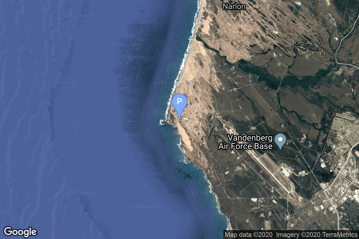
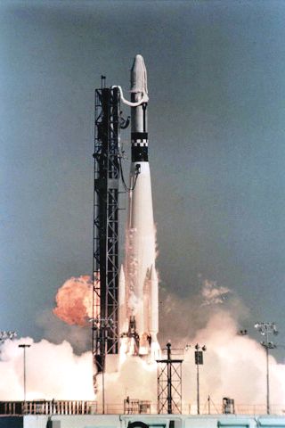
{ "count": 7930, "next": "https://ll.thespacedevs.com/2.0.0/launch/?format=api&limit=10&offset=7240&ordering=-id", "previous": "https://ll.thespacedevs.com/2.0.0/launch/?format=api&limit=10&offset=7220&ordering=-id", "results": [ { "id": "172fc62c-c7d1-4ad8-abd9-e2544f9d6230", "url": "https://ll.thespacedevs.com/2.0.0/launch/172fc62c-c7d1-4ad8-abd9-e2544f9d6230/?format=api", "launch_library_id": null, "slug": "soyuz-u-resurs-f2-2", "name": "Soyuz U | Resurs-F2 2", "status": { "id": 3, "name": "Success" }, "net": "1988-08-23T11:15:00Z", "window_end": "1988-08-23T11:15:00Z", "window_start": "1988-08-23T11:15:00Z", "inhold": false, "tbdtime": false, "tbddate": false, "probability": null, "holdreason": "", "failreason": null, "hashtag": null, "launch_service_provider": { "id": 66, "url": "https://ll.thespacedevs.com/2.0.0/agencies/66/?format=api", "name": "Soviet Space Program", "type": "Government" }, "rocket": { "id": 6101, "configuration": { "id": 37, "launch_library_id": 35, "url": "https://ll.thespacedevs.com/2.0.0/config/launcher/37/?format=api", "name": "Soyuz U", "family": "Soyuz", "full_name": "Soyuz U", "variant": "" } }, "mission": { "id": 4491, "launch_library_id": null, "name": "Resurs-F2 2", "description": "Film-return reconnaissance satellite", "launch_designator": null, "type": "Government/Top Secret", "orbit": { "id": 8, "name": "Low Earth Orbit", "abbrev": "LEO" } }, "pad": { "id": 168, "url": "https://ll.thespacedevs.com/2.0.0/pad/168/?format=api", "agency_id": null, "name": "41/1", "info_url": null, "wiki_url": "https://en.wikipedia.org/wiki/Plesetsk_Cosmodrome", "map_url": "https://www.google.com/maps?q=62.941,40.526806", "latitude": "62.941", "longitude": "40.526806", "location": { "id": 6, "url": "https://ll.thespacedevs.com/2.0.0/location/6/?format=api", "name": "Plesetsk Cosmodrome, Russian Federation", "country_code": "RUS", "map_image": "https://thespacedevs-prod.nyc3.digitaloceanspaces.com/media/map_images/location_6_20200803142434.jpg", "total_launch_count": 1686, "total_landing_count": 0 }, "map_image": "https://thespacedevs-prod.nyc3.digitaloceanspaces.com/media/map_images/pad_168_20200803143446.jpg", "total_launch_count": 310 }, "webcast_live": false, "image": "https://thespacedevs-prod.nyc3.digitaloceanspaces.com/media/images/soyuz2520u_image_20190222031023.jpeg", "infographic": null, "program": [] }, { "id": "172111f8-35c3-413e-9f6e-06676a462895", "url": "https://ll.thespacedevs.com/2.0.0/launch/172111f8-35c3-413e-9f6e-06676a462895/?format=api", "launch_library_id": null, "slug": "falcon-9-block-5-starlink-group-10-6", "name": "Falcon 9 Block 5 | Starlink Group 10-6", "status": { "id": 3, "name": "Success" }, "net": "2024-08-02T05:01:00Z", "window_end": "2024-08-02T08:19:00Z", "window_start": "2024-08-02T04:19:00Z", "inhold": false, "tbdtime": false, "tbddate": false, "probability": 95, "holdreason": "", "failreason": "", "hashtag": null, "launch_service_provider": { "id": 121, "url": "https://ll.thespacedevs.com/2.0.0/agencies/121/?format=api", "name": "SpaceX", "type": "Commercial" }, "rocket": { "id": 8220, "configuration": { "id": 164, "launch_library_id": 188, "url": "https://ll.thespacedevs.com/2.0.0/config/launcher/164/?format=api", "name": "Falcon 9", "family": "Falcon", "full_name": "Falcon 9 Block 5", "variant": "Block 5" } }, "mission": { "id": 6794, "launch_library_id": null, "name": "Starlink Group 10-6", "description": "A batch of 23 satellites for the Starlink mega-constellation - SpaceX's project for space-based Internet communication system.", "launch_designator": null, "type": "Communications", "orbit": { "id": 8, "name": "Low Earth Orbit", "abbrev": "LEO" } }, "pad": { "id": 87, "url": "https://ll.thespacedevs.com/2.0.0/pad/87/?format=api", "agency_id": 121, "name": "Launch Complex 39A", "info_url": null, "wiki_url": "https://en.wikipedia.org/wiki/Kennedy_Space_Center_Launch_Complex_39#Launch_Pad_39A", "map_url": "https://www.google.com/maps?q=28.60822681,-80.60428186", "latitude": "28.60822681", "longitude": "-80.60428186", "location": { "id": 27, "url": "https://ll.thespacedevs.com/2.0.0/location/27/?format=api", "name": "Kennedy Space Center, FL, USA", "country_code": "USA", "map_image": "https://thespacedevs-prod.nyc3.digitaloceanspaces.com/media/map_images/location_27_20200803142447.jpg", "total_launch_count": 281, "total_landing_count": 0 }, "map_image": "https://thespacedevs-prod.nyc3.digitaloceanspaces.com/media/map_images/pad_87_20200803143537.jpg", "total_launch_count": 222 }, "webcast_live": false, "image": "https://thespacedevs-prod.nyc3.digitaloceanspaces.com/media/images/falcon2520925_image_20221009234147.png", "infographic": null, "program": [ { "id": 25, "url": "https://ll.thespacedevs.com/2.0.0/program/25/?format=api", "name": "Starlink", "description": "Starlink is a satellite internet constellation operated by American aerospace company SpaceX", "agencies": [ { "id": 121, "url": "https://ll.thespacedevs.com/2.0.0/agencies/121/?format=api", "name": "SpaceX", "type": "Commercial" } ], "image_url": "https://thespacedevs-prod.nyc3.digitaloceanspaces.com/media/images/starlink_program_20231228154508.jpeg", "start_date": "2018-02-22T14:17:00Z", "end_date": null, "info_url": "https://starlink.com", "wiki_url": "https://en.wikipedia.org/wiki/Starlink" } ] }, { "id": "171bf3b5-9b1c-4bd8-b64c-111257d06131", "url": "https://ll.thespacedevs.com/2.0.0/launch/171bf3b5-9b1c-4bd8-b64c-111257d06131/?format=api", "launch_library_id": null, "slug": "falcon-9-block-5-nrol-57", "name": "Falcon 9 Block 5 | NROL-57", "status": { "id": 3, "name": "Success" }, "net": "2025-03-21T06:49:00Z", "window_end": "2025-03-21T08:17:00Z", "window_start": "2025-03-21T05:48:00Z", "inhold": false, "tbdtime": false, "tbddate": false, "probability": null, "holdreason": "", "failreason": "", "hashtag": null, "launch_service_provider": { "id": 121, "url": "https://ll.thespacedevs.com/2.0.0/agencies/121/?format=api", "name": "SpaceX", "type": "Commercial" }, "rocket": { "id": 8522, "configuration": { "id": 164, "launch_library_id": 188, "url": "https://ll.thespacedevs.com/2.0.0/config/launcher/164/?format=api", "name": "Falcon 9", "family": "Falcon", "full_name": "Falcon 9 Block 5", "variant": "Block 5" } }, "mission": { "id": 7112, "launch_library_id": null, "name": "NROL-57", "description": "Eighth batch of satellites for a reconnaissance satellite constellation built by SpaceX and Northrop Grumman for the National Reconnaissance Office to provide imaging and other reconnaissance capabilities.", "launch_designator": null, "type": "Government/Top Secret", "orbit": { "id": 25, "name": "Unknown", "abbrev": "N/A" } }, "pad": { "id": 16, "url": "https://ll.thespacedevs.com/2.0.0/pad/16/?format=api", "agency_id": null, "name": "Space Launch Complex 4E", "info_url": null, "wiki_url": "https://en.wikipedia.org/wiki/Vandenberg_Space_Launch_Complex_4#SLC-4E", "map_url": "https://www.google.com/maps?q=34.632,-120.611", "latitude": "34.632", "longitude": "-120.611", "location": { "id": 11, "url": "https://ll.thespacedevs.com/2.0.0/location/11/?format=api", "name": "Vandenberg SFB, CA, USA", "country_code": "USA", "map_image": "https://thespacedevs-prod.nyc3.digitaloceanspaces.com/media/map_images/location_11_20200803142416.jpg", "total_launch_count": 900, "total_landing_count": 35 }, "map_image": "https://thespacedevs-prod.nyc3.digitaloceanspaces.com/media/map_images/pad_16_20200803143532.jpg", "total_launch_count": 284 }, "webcast_live": false, "image": "https://thespacedevs-prod.nyc3.digitaloceanspaces.com/media/images/falcon_9_on_slc_image_20241024165956.jpg", "infographic": null, "program": [] }, { "id": "17197134-7b78-47c5-90ac-9dca52e8f7f7", "url": "https://ll.thespacedevs.com/2.0.0/launch/17197134-7b78-47c5-90ac-9dca52e8f7f7/?format=api", "launch_library_id": null, "slug": "soyuz-u-zenit-6u-59", "name": "Soyuz U | Zenit-6U 59", "status": { "id": 3, "name": "Success" }, "net": "1982-06-02T12:50:00Z", "window_end": "1982-06-02T12:50:00Z", "window_start": "1982-06-02T12:50:00Z", "inhold": false, "tbdtime": false, "tbddate": false, "probability": null, "holdreason": "", "failreason": null, "hashtag": null, "launch_service_provider": { "id": 66, "url": "https://ll.thespacedevs.com/2.0.0/agencies/66/?format=api", "name": "Soviet Space Program", "type": "Government" }, "rocket": { "id": 5406, "configuration": { "id": 37, "launch_library_id": 35, "url": "https://ll.thespacedevs.com/2.0.0/config/launcher/37/?format=api", "name": "Soyuz U", "family": "Soyuz", "full_name": "Soyuz U", "variant": "" } }, "mission": { "id": 3813, "launch_library_id": null, "name": "Zenit-6U 59", "description": "Optical film-return reconnaissance satellite", "launch_designator": null, "type": "Government/Top Secret", "orbit": { "id": 8, "name": "Low Earth Orbit", "abbrev": "LEO" } }, "pad": { "id": 20, "url": "https://ll.thespacedevs.com/2.0.0/pad/20/?format=api", "agency_id": null, "name": "31/6", "info_url": null, "wiki_url": "https://en.wikipedia.org/wiki/Baikonur_Cosmodrome_Site_31", "map_url": "https://www.google.com/maps?q=45.996034,63.564003", "latitude": "45.996034", "longitude": "63.564003", "location": { "id": 15, "url": "https://ll.thespacedevs.com/2.0.0/location/15/?format=api", "name": "Baikonur Cosmodrome, Republic of Kazakhstan", "country_code": "KAZ", "map_image": "https://thespacedevs-prod.nyc3.digitaloceanspaces.com/media/map_images/location_15_20200803142517.jpg", "total_launch_count": 1564, "total_landing_count": 0 }, "map_image": "https://thespacedevs-prod.nyc3.digitaloceanspaces.com/media/map_images/pad_20_20200803143516.jpg", "total_launch_count": 429 }, "webcast_live": false, "image": "https://thespacedevs-prod.nyc3.digitaloceanspaces.com/media/images/soyuz2520u_image_20190222031023.jpeg", "infographic": null, "program": [] }, { "id": "17134ffb-3345-4219-ae2a-8eaefc1d8b18", "url": "https://ll.thespacedevs.com/2.0.0/launch/17134ffb-3345-4219-ae2a-8eaefc1d8b18/?format=api", "launch_library_id": null, "slug": "vostok-8a92-zenit-2-41", "name": "Vostok 8A92 | Zenit-2 41", "status": { "id": 4, "name": "Failure" }, "net": "1966-09-16T09:30:00Z", "window_end": "1966-09-16T09:30:00Z", "window_start": "1966-09-16T09:30:00Z", "inhold": false, "tbdtime": false, "tbddate": false, "probability": null, "holdreason": "", "failreason": null, "hashtag": null, "launch_service_provider": { "id": 66, "url": "https://ll.thespacedevs.com/2.0.0/agencies/66/?format=api", "name": "Soviet Space Program", "type": "Government" }, "rocket": { "id": 3569, "configuration": { "id": 451, "launch_library_id": null, "url": "https://ll.thespacedevs.com/2.0.0/config/launcher/451/?format=api", "name": "Vostok 8A92", "family": "Vostok", "full_name": "Vostok 8A92", "variant": "8A92" } }, "mission": { "id": 1989, "launch_library_id": null, "name": "Zenit-2 41", "description": "Zenit-2 film-return and ELINT reconnaissance satellite.", "launch_designator": null, "type": "Government/Top Secret", "orbit": { "id": 8, "name": "Low Earth Orbit", "abbrev": "LEO" } }, "pad": { "id": 20, "url": "https://ll.thespacedevs.com/2.0.0/pad/20/?format=api", "agency_id": null, "name": "31/6", "info_url": null, "wiki_url": "https://en.wikipedia.org/wiki/Baikonur_Cosmodrome_Site_31", "map_url": "https://www.google.com/maps?q=45.996034,63.564003", "latitude": "45.996034", "longitude": "63.564003", "location": { "id": 15, "url": "https://ll.thespacedevs.com/2.0.0/location/15/?format=api", "name": "Baikonur Cosmodrome, Republic of Kazakhstan", "country_code": "KAZ", "map_image": "https://thespacedevs-prod.nyc3.digitaloceanspaces.com/media/map_images/location_15_20200803142517.jpg", "total_launch_count": 1564, "total_landing_count": 0 }, "map_image": "https://thespacedevs-prod.nyc3.digitaloceanspaces.com/media/map_images/pad_20_20200803143516.jpg", "total_launch_count": 429 }, "webcast_live": false, "image": "https://thespacedevs-prod.nyc3.digitaloceanspaces.com/media/images/vostok_launch_v_image_20251119053730.jpg", "infographic": null, "program": [] }, { "id": "1712f9f2-54a5-421e-899a-f699dfbd3ad8", "url": "https://ll.thespacedevs.com/2.0.0/launch/1712f9f2-54a5-421e-899a-f699dfbd3ad8/?format=api", "launch_library_id": null, "slug": "electron-strix-launch-26", "name": "Electron | StriX Launch 26", "status": { "id": 2, "name": "TBD" }, "net": "2029-12-31T00:00:00Z", "window_end": "2029-12-31T00:00:00Z", "window_start": "2029-12-31T00:00:00Z", "inhold": false, "tbdtime": true, "tbddate": true, "probability": null, "holdreason": "", "failreason": "", "hashtag": null, "launch_service_provider": { "id": 147, "url": "https://ll.thespacedevs.com/2.0.0/agencies/147/?format=api", "name": "Rocket Lab", "type": "Commercial" }, "rocket": { "id": 8744, "configuration": { "id": 26, "launch_library_id": 148, "url": "https://ll.thespacedevs.com/2.0.0/config/launcher/26/?format=api", "name": "Electron", "family": "", "full_name": "Electron", "variant": "" } }, "mission": { "id": 7335, "launch_library_id": null, "name": "StriX Launch 26", "description": "Synthetic aperture radar satellite for Japanese Earth imaging company Synspective.", "launch_designator": null, "type": "Earth Science", "orbit": { "id": 17, "name": "Sun-Synchronous Orbit", "abbrev": "SSO" } }, "pad": { "id": 210, "url": "https://ll.thespacedevs.com/2.0.0/pad/210/?format=api", "agency_id": null, "name": "Unknown Pad", "info_url": null, "wiki_url": null, "map_url": null, "latitude": "-39.260881", "longitude": "177.865826", "location": { "id": 10, "url": "https://ll.thespacedevs.com/2.0.0/location/10/?format=api", "name": "Rocket Lab Launch Complex 1, Mahia Peninsula, New Zealand", "country_code": "NZL", "map_image": "https://thespacedevs-prod.nyc3.digitaloceanspaces.com/media/map_images/location_10_20200803142509.jpg", "total_launch_count": 78, "total_landing_count": 17 }, "map_image": "https://thespacedevs-prod.nyc3.digitaloceanspaces.com/media/map_images/pad_210_20230819165718.jpg", "total_launch_count": 0 }, "webcast_live": false, "image": "https://thespacedevs-prod.nyc3.digitaloceanspaces.com/media/images/electron_image_20190705175640.jpeg", "infographic": null, "program": [] }, { "id": "16f50e71-336a-44d5-b78a-56e57b8dc318", "url": "https://ll.thespacedevs.com/2.0.0/launch/16f50e71-336a-44d5-b78a-56e57b8dc318/?format=api", "launch_library_id": null, "slug": "scout-g-1-nova-2", "name": "Scout G-1 | Nova 2", "status": { "id": 3, "name": "Success" }, "net": "1988-06-16T06:54:00Z", "window_end": "1988-06-16T06:54:00Z", "window_start": "1988-06-16T06:54:00Z", "inhold": false, "tbdtime": false, "tbddate": false, "probability": null, "holdreason": "", "failreason": null, "hashtag": null, "launch_service_provider": { "id": 161, "url": "https://ll.thespacedevs.com/2.0.0/agencies/161/?format=api", "name": "United States Air Force", "type": "Government" }, "rocket": { "id": 6078, "configuration": { "id": 363, "launch_library_id": null, "url": "https://ll.thespacedevs.com/2.0.0/config/launcher/363/?format=api", "name": "Scout G-1", "family": "Scout", "full_name": "Scout G-1", "variant": "G-1" } }, "mission": { "id": 4468, "launch_library_id": null, "name": "Nova 2", "description": "Improved Transit navigation satellite", "launch_designator": null, "type": "Navigation", "orbit": { "id": 13, "name": "Polar Orbit", "abbrev": "PO" } }, "pad": { "id": 154, "url": "https://ll.thespacedevs.com/2.0.0/pad/154/?format=api", "agency_id": null, "name": "Space Launch Complex 5", "info_url": "https://www.astronautix.com/v/vandenbergslc5.html", "wiki_url": "https://en.wikipedia.org/wiki/Vandenberg_Air_Force_Base_Space_Launch_Complex_5", "map_url": "https://www.google.com/maps?q=34.6080,-120.6247", "latitude": "34.608", "longitude": "-120.6247", "location": { "id": 11, "url": "https://ll.thespacedevs.com/2.0.0/location/11/?format=api", "name": "Vandenberg SFB, CA, USA", "country_code": "USA", "map_image": "https://thespacedevs-prod.nyc3.digitaloceanspaces.com/media/map_images/location_11_20200803142416.jpg", "total_launch_count": 900, "total_landing_count": 35 }, "map_image": "https://thespacedevs-prod.nyc3.digitaloceanspaces.com/media/map_images/pad_154_20200803143408.jpg", "total_launch_count": 69 }, "webcast_live": false, "image": null, "infographic": null, "program": [] }, { "id": "16e4908a-564a-4019-89a9-0d64ee4caaaa", "url": "https://ll.thespacedevs.com/2.0.0/launch/16e4908a-564a-4019-89a9-0d64ee4caaaa/?format=api", "launch_library_id": 1314, "slug": "titan-ivbcentaur-cassini-huygens", "name": "Titan IVB/Centaur | Cassini-Huygens", "status": { "id": 3, "name": "Success" }, "net": "1997-10-15T08:43:01Z", "window_end": "1997-10-15T08:43:01Z", "window_start": "1997-10-15T08:43:01Z", "inhold": false, "tbdtime": false, "tbddate": false, "probability": null, "holdreason": "", "failreason": "", "hashtag": null, "launch_service_provider": { "id": 82, "url": "https://ll.thespacedevs.com/2.0.0/agencies/82/?format=api", "name": "Lockheed Martin", "type": "Commercial" }, "rocket": { "id": 421, "configuration": { "id": 130, "launch_library_id": 162, "url": "https://ll.thespacedevs.com/2.0.0/config/launcher/130/?format=api", "name": "Titan IVB", "family": "Titan", "full_name": "Titan IVB/Centaur", "variant": "Centaur" } }, "mission": null, "pad": { "id": 80, "url": "https://ll.thespacedevs.com/2.0.0/pad/80/?format=api", "agency_id": 121, "name": "Space Launch Complex 40", "info_url": null, "wiki_url": "https://en.wikipedia.org/wiki/Cape_Canaveral_Air_Force_Station_Space_Launch_Complex_40", "map_url": "https://www.google.com/maps?q=28.56194122,-80.57735736", "latitude": "28.56194122", "longitude": "-80.57735736", "location": { "id": 12, "url": "https://ll.thespacedevs.com/2.0.0/location/12/?format=api", "name": "Cape Canaveral SFS, FL, USA", "country_code": "USA", "map_image": "https://thespacedevs-prod.nyc3.digitaloceanspaces.com/media/map_images/location_12_20200803142519.jpg", "total_launch_count": 1122, "total_landing_count": 75 }, "map_image": "https://thespacedevs-prod.nyc3.digitaloceanspaces.com/media/map_images/pad_80_20200803143323.jpg", "total_launch_count": 394 }, "webcast_live": false, "image": "https://thespacedevs-prod.nyc3.digitaloceanspaces.com/media/images/titan2520ivb_image_20190222030244.jpeg", "infographic": null, "program": [ { "id": 36, "url": "https://ll.thespacedevs.com/2.0.0/program/36/?format=api", "name": "NASA Large Strategic Science Missions", "description": "NASA's large strategic science missions or large strategic missions, formerly known as Flagship missions or Flagship-class missions, are the costliest and most capable NASA science spacecraft. Flagship missions exist within all four divisions of NASA's Science Mission Directorate (SMD): the astrophysics, Earth science, heliophysics and planetary science divisions.", "agencies": [ { "id": 44, "url": "https://ll.thespacedevs.com/2.0.0/agencies/44/?format=api", "name": "National Aeronautics and Space Administration", "type": "Government" } ], "image_url": "https://thespacedevs-prod.nyc3.digitaloceanspaces.com/media/images/nasa2520large_program_20240205122003.jpeg", "start_date": "1975-08-22T00:00:00Z", "end_date": null, "info_url": null, "wiki_url": "https://en.wikipedia.org/wiki/Large_strategic_science_missions" } ] }, { "id": "16e0f780-7d6d-46bc-a0d4-cb23368e3501", "url": "https://ll.thespacedevs.com/2.0.0/launch/16e0f780-7d6d-46bc-a0d4-cb23368e3501/?format=api", "launch_library_id": null, "slug": "falcon-9-block-5-starlink-group-5-6", "name": "Falcon 9 Block 5 | Starlink Group 5-6", "status": { "id": 3, "name": "Success" }, "net": "2023-05-04T07:31:00Z", "window_end": "2023-05-04T07:31:00Z", "window_start": "2023-05-04T07:31:00Z", "inhold": false, "tbdtime": false, "tbddate": false, "probability": 95, "holdreason": "", "failreason": "", "hashtag": null, "launch_service_provider": { "id": 121, "url": "https://ll.thespacedevs.com/2.0.0/agencies/121/?format=api", "name": "SpaceX", "type": "Commercial" }, "rocket": { "id": 7695, "configuration": { "id": 164, "launch_library_id": 188, "url": "https://ll.thespacedevs.com/2.0.0/config/launcher/164/?format=api", "name": "Falcon 9", "family": "Falcon", "full_name": "Falcon 9 Block 5", "variant": "Block 5" } }, "mission": { "id": 6211, "launch_library_id": null, "name": "Starlink Group 5-6", "description": "A batch of 56 satellites for Starlink mega-constellation - SpaceX's project for space-based Internet communication system.", "launch_designator": null, "type": "Communications", "orbit": { "id": 8, "name": "Low Earth Orbit", "abbrev": "LEO" } }, "pad": { "id": 80, "url": "https://ll.thespacedevs.com/2.0.0/pad/80/?format=api", "agency_id": 121, "name": "Space Launch Complex 40", "info_url": null, "wiki_url": "https://en.wikipedia.org/wiki/Cape_Canaveral_Air_Force_Station_Space_Launch_Complex_40", "map_url": "https://www.google.com/maps?q=28.56194122,-80.57735736", "latitude": "28.56194122", "longitude": "-80.57735736", "location": { "id": 12, "url": "https://ll.thespacedevs.com/2.0.0/location/12/?format=api", "name": "Cape Canaveral SFS, FL, USA", "country_code": "USA", "map_image": "https://thespacedevs-prod.nyc3.digitaloceanspaces.com/media/map_images/location_12_20200803142519.jpg", "total_launch_count": 1122, "total_landing_count": 75 }, "map_image": "https://thespacedevs-prod.nyc3.digitaloceanspaces.com/media/map_images/pad_80_20200803143323.jpg", "total_launch_count": 394 }, "webcast_live": false, "image": "https://thespacedevs-prod.nyc3.digitaloceanspaces.com/media/images/falcon2520925_image_20221009234147.png", "infographic": null, "program": [ { "id": 25, "url": "https://ll.thespacedevs.com/2.0.0/program/25/?format=api", "name": "Starlink", "description": "Starlink is a satellite internet constellation operated by American aerospace company SpaceX", "agencies": [ { "id": 121, "url": "https://ll.thespacedevs.com/2.0.0/agencies/121/?format=api", "name": "SpaceX", "type": "Commercial" } ], "image_url": "https://thespacedevs-prod.nyc3.digitaloceanspaces.com/media/images/starlink_program_20231228154508.jpeg", "start_date": "2018-02-22T14:17:00Z", "end_date": null, "info_url": "https://starlink.com", "wiki_url": "https://en.wikipedia.org/wiki/Starlink" } ] }, { "id": "16d64832-9a15-4085-95af-f55360b1776f", "url": "https://ll.thespacedevs.com/2.0.0/launch/16d64832-9a15-4085-95af-f55360b1776f/?format=api", "launch_library_id": null, "slug": "thor-slv-2a-agena-d-kh-4a-18", "name": "Thor SLV-2A Agena D | KH-4A 18", "status": { "id": 3, "name": "Success" }, "net": "1965-03-25T21:11:17Z", "window_end": "1965-03-25T21:11:17Z", "window_start": "1965-03-25T21:11:17Z", "inhold": false, "tbdtime": false, "tbddate": false, "probability": null, "holdreason": "", "failreason": null, "hashtag": null, "launch_service_provider": { "id": 161, "url": "https://ll.thespacedevs.com/2.0.0/agencies/161/?format=api", "name": "United States Air Force", "type": "Government" }, "rocket": { "id": 3379, "configuration": { "id": 417, "launch_library_id": null, "url": "https://ll.thespacedevs.com/2.0.0/config/launcher/417/?format=api", "name": "Thor SLV-2A Agena D", "family": "Thor", "full_name": "Thor SLV-2A Agena D", "variant": "SLV-2A Agena D" } }, "mission": { "id": 1800, "launch_library_id": null, "name": "KH-4A 18", "description": "The KH-4A (Keyhole-4A) was the fifth optical reconnaissance satellite version in the Corona-program.", "launch_designator": null, "type": "Government/Top Secret", "orbit": { "id": 8, "name": "Low Earth Orbit", "abbrev": "LEO" } }, "pad": { "id": 95, "url": "https://ll.thespacedevs.com/2.0.0/pad/95/?format=api", "agency_id": 161, "name": "Space Launch Complex 1W", "info_url": null, "wiki_url": "https://en.wikipedia.org/wiki/Vandenberg_Space_Launch_Complex_1", "map_url": "https://www.google.com/maps?q=34.7572,-120.6303", "latitude": "34.7572", "longitude": "-120.6303", "location": { "id": 11, "url": "https://ll.thespacedevs.com/2.0.0/location/11/?format=api", "name": "Vandenberg SFB, CA, USA", "country_code": "USA", "map_image": "https://thespacedevs-prod.nyc3.digitaloceanspaces.com/media/map_images/location_11_20200803142416.jpg", "total_launch_count": 900, "total_landing_count": 35 }, "map_image": "https://thespacedevs-prod.nyc3.digitaloceanspaces.com/media/map_images/pad_95_20200803143209.jpg", "total_launch_count": 56 }, "webcast_live": false, "image": "https://thespacedevs-prod.nyc3.digitaloceanspaces.com/media/images/thor_slv-2a_age_image_20251102055131.jpg", "infographic": null, "program": [] } ] }