Launch List
API endpoint that returns all Launch objects or a single launch.
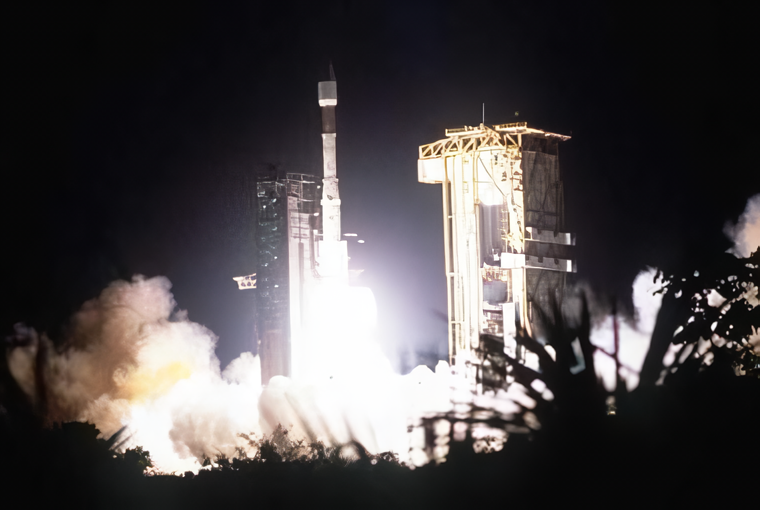
EXAMPLE - /launch/
GET: Return a list of all Launch objects.
FILTERS: Fields - 'name', 'id(s)', 'lsp_id', 'lsp_name', 'serial_number', 'launcher_config__id', 'rocket__spacecraftflight__spacecraft__name'
MODE: 'normal', 'list', 'detailed' EXAMPLE: ?mode=list
SEARCH: Searches through the launch name, rocket name, launch agency, mission name & spacecraft name. EXAMPLE - ?search=SpaceX
GET /2.0.0/launch/?format=api&offset=7190&ordering=id
{ "count": 7513, "next": "https://ll.thespacedevs.com/2.0.0/launch/?format=api&limit=10&offset=7200&ordering=id", "previous": "https://ll.thespacedevs.com/2.0.0/launch/?format=api&limit=10&offset=7180&ordering=id", "results": [ { "id": "f4561a34-aaef-42a8-ba5b-6d7fee4bee6b", "url": "https://ll.thespacedevs.com/2.0.0/launch/f4561a34-aaef-42a8-ba5b-6d7fee4bee6b/?format=api", "launch_library_id": null, "slug": "atlas-iia-hot-bird-2", "name": "Atlas IIA | Hot Bird 2", "status": { "id": 3, "name": "Success" }, "net": "1996-11-21T20:47:01Z", "window_end": "1996-11-21T20:47:01Z", "window_start": "1996-11-21T20:47:01Z", "inhold": false, "tbdtime": false, "tbddate": false, "probability": null, "holdreason": "", "failreason": null, "hashtag": null, "launch_service_provider": { "id": 82, "url": "https://ll.thespacedevs.com/2.0.0/agencies/82/?format=api", "name": "Lockheed Martin", "type": "Commercial" }, "rocket": { "id": 6757, "configuration": { "id": 254, "launch_library_id": null, "url": "https://ll.thespacedevs.com/2.0.0/config/launcher/254/?format=api", "name": "Atlas IIA", "family": "Atlas", "full_name": "Atlas IIA", "variant": "IIA" } }, "mission": { "id": 5147, "launch_library_id": null, "name": "Hot Bird 2", "description": "Geostationary communications satellite", "launch_designator": null, "type": "Communications", "orbit": { "id": 1, "name": "Geostationary Orbit", "abbrev": "Direct-GEO" } }, "pad": { "id": 122, "url": "https://ll.thespacedevs.com/2.0.0/pad/122/?format=api", "agency_id": 161, "name": "Launch Complex 36B", "info_url": null, "wiki_url": "https://en.wikipedia.org/wiki/Cape_Canaveral_Launch_Complex_36", "map_url": "https://www.google.com/maps?q=28.4705556,-80.542194", "latitude": "28.4705556", "longitude": "-80.542194", "location": { "id": 12, "url": "https://ll.thespacedevs.com/2.0.0/location/12/?format=api", "name": "Cape Canaveral SFS, FL, USA", "country_code": "USA", "map_image": "https://thespacedevs-prod.nyc3.digitaloceanspaces.com/media/map_images/location_12_20200803142519.jpg", "total_launch_count": 1027, "total_landing_count": 64 }, "map_image": "https://thespacedevs-prod.nyc3.digitaloceanspaces.com/media/map_images/pad_122_20200803143232.jpg", "total_launch_count": 76 }, "webcast_live": false, "image": null, "infographic": null, "program": [] }, { "id": "f45bcfb2-fb58-416d-a793-363419d305d2", "url": "https://ll.thespacedevs.com/2.0.0/launch/f45bcfb2-fb58-416d-a793-363419d305d2/?format=api", "launch_library_id": null, "slug": "kosmos-11k63-ds-p1-i-15", "name": "Kosmos 11K63 | DS-P1-I 15", "status": { "id": 3, "name": "Success" }, "net": "1974-06-26T12:29:57Z", "window_end": "1974-06-26T12:29:57Z", "window_start": "1974-06-26T12:29:57Z", "inhold": false, "tbdtime": false, "tbddate": false, "probability": null, "holdreason": "", "failreason": null, "hashtag": null, "launch_service_provider": { "id": 66, "url": "https://ll.thespacedevs.com/2.0.0/agencies/66/?format=api", "name": "Soviet Space Program", "type": "Government" }, "rocket": { "id": 4483, "configuration": { "id": 327, "launch_library_id": null, "url": "https://ll.thespacedevs.com/2.0.0/config/launcher/327/?format=api", "name": "Kosmos 11K63", "family": "Kosmos", "full_name": "Kosmos 11K63", "variant": "11K63" } }, "mission": { "id": 2901, "launch_library_id": null, "name": "DS-P1-I 15", "description": "The DS-P1-I series of satellites was used to calibrate space surveillance and early warning radars.", "launch_designator": null, "type": "Test Target", "orbit": { "id": 8, "name": "Low Earth Orbit", "abbrev": "LEO" } }, "pad": { "id": 3, "url": "https://ll.thespacedevs.com/2.0.0/pad/3/?format=api", "agency_id": 163, "name": "133/3 (133L)", "info_url": null, "wiki_url": "", "map_url": "https://www.google.com/maps?q=62.886999,40.846984", "latitude": "62.886999", "longitude": "40.846984", "location": { "id": 6, "url": "https://ll.thespacedevs.com/2.0.0/location/6/?format=api", "name": "Plesetsk Cosmodrome, Russian Federation", "country_code": "RUS", "map_image": "https://thespacedevs-prod.nyc3.digitaloceanspaces.com/media/map_images/location_6_20200803142434.jpg", "total_launch_count": 1675, "total_landing_count": 0 }, "map_image": "https://thespacedevs-prod.nyc3.digitaloceanspaces.com/media/map_images/pad_3_20200803143438.jpg", "total_launch_count": 159 }, "webcast_live": false, "image": null, "infographic": null, "program": [] }, { "id": "f463bbce-fd0e-44aa-9a0c-0de62e4492f6", "url": "https://ll.thespacedevs.com/2.0.0/launch/f463bbce-fd0e-44aa-9a0c-0de62e4492f6/?format=api", "launch_library_id": null, "slug": "thor-delta-d-syncom-3", "name": "Thor Delta D | Syncom 3", "status": { "id": 3, "name": "Success" }, "net": "1964-08-19T12:15:02Z", "window_end": "1964-08-19T12:15:02Z", "window_start": "1964-08-19T12:15:02Z", "inhold": false, "tbdtime": false, "tbddate": false, "probability": null, "holdreason": "", "failreason": null, "hashtag": null, "launch_service_provider": { "id": 161, "url": "https://ll.thespacedevs.com/2.0.0/agencies/161/?format=api", "name": "United States Air Force", "type": "Government" }, "rocket": { "id": 3306, "configuration": { "id": 403, "launch_library_id": null, "url": "https://ll.thespacedevs.com/2.0.0/config/launcher/403/?format=api", "name": "Thor Delta D", "family": "Thor", "full_name": "Thor Delta D", "variant": "Delta D" } }, "mission": { "id": 1728, "launch_library_id": null, "name": "Syncom 3", "description": "Syncom 3 was the first geostationary satellite.", "launch_designator": null, "type": "Communications", "orbit": { "id": 3, "name": "Geosynchronous Orbit", "abbrev": "GSO" } }, "pad": { "id": 14, "url": "https://ll.thespacedevs.com/2.0.0/pad/14/?format=api", "agency_id": null, "name": "Space Launch Complex 17A", "info_url": null, "wiki_url": "https://en.wikipedia.org/wiki/Cape_Canaveral_Space_Launch_Complex_17", "map_url": "https://www.google.com/maps?q=28.4472,-80.565", "latitude": "28.4472", "longitude": "-80.565", "location": { "id": 12, "url": "https://ll.thespacedevs.com/2.0.0/location/12/?format=api", "name": "Cape Canaveral SFS, FL, USA", "country_code": "USA", "map_image": "https://thespacedevs-prod.nyc3.digitaloceanspaces.com/media/map_images/location_12_20200803142519.jpg", "total_launch_count": 1027, "total_landing_count": 64 }, "map_image": "https://thespacedevs-prod.nyc3.digitaloceanspaces.com/media/map_images/pad_14_20200803143451.jpg", "total_launch_count": 145 }, "webcast_live": false, "image": null, "infographic": null, "program": [] }, { "id": "f466b70a-f55e-4f66-a178-e58cd040e5ff", "url": "https://ll.thespacedevs.com/2.0.0/launch/f466b70a-f55e-4f66-a178-e58cd040e5ff/?format=api", "launch_library_id": null, "slug": "thor-delta-m-nato-iia", "name": "Thor Delta M | NATO IIA", "status": { "id": 3, "name": "Success" }, "net": "1970-03-20T23:52:00Z", "window_end": "1970-03-20T23:52:00Z", "window_start": "1970-03-20T23:52:00Z", "inhold": false, "tbdtime": false, "tbddate": false, "probability": null, "holdreason": "", "failreason": null, "hashtag": null, "launch_service_provider": { "id": 161, "url": "https://ll.thespacedevs.com/2.0.0/agencies/161/?format=api", "name": "United States Air Force", "type": "Government" }, "rocket": { "id": 3994, "configuration": { "id": 409, "launch_library_id": null, "url": "https://ll.thespacedevs.com/2.0.0/config/launcher/409/?format=api", "name": "Thor Delta M", "family": "Thor", "full_name": "Thor Delta M", "variant": "Delta M" } }, "mission": { "id": 2412, "launch_library_id": null, "name": "NATO IIA", "description": "First generation satellite providing communications bezween officials of NATO nations.", "launch_designator": null, "type": "Government/Top Secret", "orbit": { "id": 1, "name": "Geostationary Orbit", "abbrev": "Direct-GEO" } }, "pad": { "id": 14, "url": "https://ll.thespacedevs.com/2.0.0/pad/14/?format=api", "agency_id": null, "name": "Space Launch Complex 17A", "info_url": null, "wiki_url": "https://en.wikipedia.org/wiki/Cape_Canaveral_Space_Launch_Complex_17", "map_url": "https://www.google.com/maps?q=28.4472,-80.565", "latitude": "28.4472", "longitude": "-80.565", "location": { "id": 12, "url": "https://ll.thespacedevs.com/2.0.0/location/12/?format=api", "name": "Cape Canaveral SFS, FL, USA", "country_code": "USA", "map_image": "https://thespacedevs-prod.nyc3.digitaloceanspaces.com/media/map_images/location_12_20200803142519.jpg", "total_launch_count": 1027, "total_landing_count": 64 }, "map_image": "https://thespacedevs-prod.nyc3.digitaloceanspaces.com/media/map_images/pad_14_20200803143451.jpg", "total_launch_count": 145 }, "webcast_live": false, "image": null, "infographic": null, "program": [] }, { "id": "f467f95f-de15-46fc-9609-88717195a4cf", "url": "https://ll.thespacedevs.com/2.0.0/launch/f467f95f-de15-46fc-9609-88717195a4cf/?format=api", "launch_library_id": null, "slug": "ariane-44p-turksat-2a", "name": "Ariane 44P | Turksat 2A", "status": { "id": 3, "name": "Success" }, "net": "2001-01-10T22:09:00Z", "window_end": "2001-01-10T22:09:00Z", "window_start": "2001-01-10T22:09:00Z", "inhold": false, "tbdtime": false, "tbddate": false, "probability": null, "holdreason": "", "failreason": null, "hashtag": null, "launch_service_provider": { "id": 115, "url": "https://ll.thespacedevs.com/2.0.0/agencies/115/?format=api", "name": "Arianespace", "type": "Commercial" }, "rocket": { "id": 7031, "configuration": { "id": 227, "launch_library_id": null, "url": "https://ll.thespacedevs.com/2.0.0/config/launcher/227/?format=api", "name": "Ariane 44P", "family": "Ariane", "full_name": "Ariane 44P", "variant": "44P" } }, "mission": { "id": 5420, "launch_library_id": null, "name": "Turksat 2A", "description": "Türksat 2A, a.k.a. Eurasiasat 1, was a Turkish communications satellite as part of a project to form an instant network with two geosynchronous satellites that is supervised by the companies Türksat A.Ş. in Turkey and Eurasiasat SAM in Monaco.", "launch_designator": null, "type": "Communications", "orbit": { "id": 3, "name": "Geosynchronous Orbit", "abbrev": "GSO" } }, "pad": { "id": 124, "url": "https://ll.thespacedevs.com/2.0.0/pad/124/?format=api", "agency_id": 115, "name": "Ariane Launch Area 2", "info_url": null, "wiki_url": "https://en.wikipedia.org/wiki/ELA-2", "map_url": "https://www.google.com/maps?q=5.232,-52.778194", "latitude": "5.232", "longitude": "-52.778194", "location": { "id": 13, "url": "https://ll.thespacedevs.com/2.0.0/location/13/?format=api", "name": "Guiana Space Centre, French Guiana", "country_code": "GUF", "map_image": "https://thespacedevs-prod.nyc3.digitaloceanspaces.com/media/map_images/location_13_20200803142412.jpg", "total_launch_count": 325, "total_landing_count": 0 }, "map_image": "https://thespacedevs-prod.nyc3.digitaloceanspaces.com/media/map_images/pad_124_20200803143241.jpg", "total_launch_count": 119 }, "webcast_live": false, "image": "https://thespacedevs-prod.nyc3.digitaloceanspaces.com/media/images/ariane_44p_at_e_image_20240401083030.png", "infographic": null, "program": [] }, { "id": "f47213ef-1bdb-491a-beee-1ec01f4c3053", "url": "https://ll.thespacedevs.com/2.0.0/launch/f47213ef-1bdb-491a-beee-1ec01f4c3053/?format=api", "launch_library_id": null, "slug": "thor-slv-2a-agena-d-p-770-group-3-a-1", "name": "Thor SLV-2A Agena D | P-770 Group 3-A 1", "status": { "id": 3, "name": "Success" }, "net": "1965-07-17T05:55:01Z", "window_end": "1965-07-17T05:55:01Z", "window_start": "1965-07-17T05:55:01Z", "inhold": false, "tbdtime": false, "tbddate": false, "probability": null, "holdreason": "", "failreason": null, "hashtag": null, "launch_service_provider": { "id": 161, "url": "https://ll.thespacedevs.com/2.0.0/agencies/161/?format=api", "name": "United States Air Force", "type": "Government" }, "rocket": { "id": 3417, "configuration": { "id": 417, "launch_library_id": null, "url": "https://ll.thespacedevs.com/2.0.0/config/launcher/417/?format=api", "name": "Thor SLV-2A Agena D", "family": "Thor", "full_name": "Thor SLV-2A Agena D", "variant": "SLV-2A Agena D" } }, "mission": { "id": 1837, "launch_library_id": null, "name": "P-770 Group 3-A 1", "description": "ELINT/SIGINT satellite", "launch_designator": null, "type": "Government/Top Secret", "orbit": { "id": 8, "name": "Low Earth Orbit", "abbrev": "LEO" } }, "pad": { "id": 39, "url": "https://ll.thespacedevs.com/2.0.0/pad/39/?format=api", "agency_id": null, "name": "Space Launch Complex 2W", "info_url": null, "wiki_url": "https://en.wikipedia.org/wiki/Vandenberg_Space_Launch_Complex_2", "map_url": "https://www.google.com/maps?q=34.7556,-120.6224", "latitude": "34.7556", "longitude": "-120.6224", "location": { "id": 11, "url": "https://ll.thespacedevs.com/2.0.0/location/11/?format=api", "name": "Vandenberg SFB, CA, USA", "country_code": "USA", "map_image": "https://thespacedevs-prod.nyc3.digitaloceanspaces.com/media/map_images/location_11_20200803142416.jpg", "total_launch_count": 810, "total_landing_count": 26 }, "map_image": "https://thespacedevs-prod.nyc3.digitaloceanspaces.com/media/map_images/pad_39_20200803143542.jpg", "total_launch_count": 98 }, "webcast_live": false, "image": null, "infographic": null, "program": [] }, { "id": "f47c768e-1db4-4227-86cd-7b2f188284cc", "url": "https://ll.thespacedevs.com/2.0.0/launch/f47c768e-1db4-4227-86cd-7b2f188284cc/?format=api", "launch_library_id": null, "slug": "molniya-m-molniya-3-38l", "name": "Molniya-M | Molniya-3 38L", "status": { "id": 3, "name": "Success" }, "net": "1985-10-03T07:33:00Z", "window_end": "1985-10-03T07:33:00Z", "window_start": "1985-10-03T07:33:00Z", "inhold": false, "tbdtime": false, "tbddate": false, "probability": null, "holdreason": "", "failreason": null, "hashtag": null, "launch_service_provider": { "id": 66, "url": "https://ll.thespacedevs.com/2.0.0/agencies/66/?format=api", "name": "Soviet Space Program", "type": "Government" }, "rocket": { "id": 5793, "configuration": { "id": 106, "launch_library_id": 126, "url": "https://ll.thespacedevs.com/2.0.0/config/launcher/106/?format=api", "name": "Molniya-M", "family": "R-7", "full_name": "Molniya-M 2BL", "variant": "2BL" } }, "mission": { "id": 4192, "launch_library_id": null, "name": "Molniya-3 38L", "description": "Molniya communication satellites operating from a highly elliptical orbit", "launch_designator": null, "type": "Communications", "orbit": { "id": 0, "name": "Elliptical Orbit", "abbrev": "Elliptical" } }, "pad": { "id": 85, "url": "https://ll.thespacedevs.com/2.0.0/pad/85/?format=api", "agency_id": 163, "name": "43/4 (43R)", "info_url": null, "wiki_url": null, "map_url": "https://www.google.com/maps?q=62.92883,40.457098", "latitude": "62.92883", "longitude": "40.457098", "location": { "id": 6, "url": "https://ll.thespacedevs.com/2.0.0/location/6/?format=api", "name": "Plesetsk Cosmodrome, Russian Federation", "country_code": "RUS", "map_image": "https://thespacedevs-prod.nyc3.digitaloceanspaces.com/media/map_images/location_6_20200803142434.jpg", "total_launch_count": 1675, "total_landing_count": 0 }, "map_image": "https://thespacedevs-prod.nyc3.digitaloceanspaces.com/media/map_images/pad_85_20200803143554.jpg", "total_launch_count": 324 }, "webcast_live": false, "image": null, "infographic": null, "program": [] }, { "id": "f47cff80-f8e5-4c6d-b0e2-3027fab627b5", "url": "https://ll.thespacedevs.com/2.0.0/launch/f47cff80-f8e5-4c6d-b0e2-3027fab627b5/?format=api", "launch_library_id": 405, "slug": "space-shuttle-discovery-ov-103-sts-60", "name": "Space Shuttle Discovery / OV-103 | STS-60", "status": { "id": 3, "name": "Success" }, "net": "1994-02-03T12:10:00Z", "window_end": "1994-02-03T12:10:00Z", "window_start": "1994-02-03T12:10:00Z", "inhold": false, "tbdtime": false, "tbddate": false, "probability": -1, "holdreason": "", "failreason": null, "hashtag": null, "launch_service_provider": { "id": 192, "url": "https://ll.thespacedevs.com/2.0.0/agencies/192/?format=api", "name": "Lockheed Space Operations Company", "type": "Commercial" }, "rocket": { "id": 372, "configuration": { "id": 493, "launch_library_id": null, "url": "https://ll.thespacedevs.com/2.0.0/config/launcher/493/?format=api", "name": "Space Shuttle", "family": "", "full_name": "Space Shuttle", "variant": "" } }, "mission": { "id": 760, "launch_library_id": 956, "name": "STS-60", "description": "STS-60 was the first mission of the US/Russian Shuttle-Mir Program, which carried Sergei K. Krikalev, the first Russian cosmonaut to fly aboard a Space Shuttle. The mission used Space Shuttle Discovery, which lifted off from Launch Pad 39A on 3 February 1994 from Kennedy Space Center, Florida. The mission carried the Wake Shield Facility experiment and a SPACEHAB module into orbit, and carried out a live bi-directional audio and downlink link-up with the cosmonauts aboard the Russian space station Mir.", "launch_designator": null, "type": "", "orbit": { "id": 8, "name": "Low Earth Orbit", "abbrev": "LEO" } }, "pad": { "id": 87, "url": "https://ll.thespacedevs.com/2.0.0/pad/87/?format=api", "agency_id": 121, "name": "Launch Complex 39A", "info_url": null, "wiki_url": "https://en.wikipedia.org/wiki/Kennedy_Space_Center_Launch_Complex_39#Launch_Pad_39A", "map_url": "https://www.google.com/maps?q=28.60822681,-80.60428186", "latitude": "28.60822681", "longitude": "-80.60428186", "location": { "id": 27, "url": "https://ll.thespacedevs.com/2.0.0/location/27/?format=api", "name": "Kennedy Space Center, FL, USA", "country_code": "USA", "map_image": "https://thespacedevs-prod.nyc3.digitaloceanspaces.com/media/map_images/location_27_20200803142447.jpg", "total_launch_count": 266, "total_landing_count": 0 }, "map_image": "https://thespacedevs-prod.nyc3.digitaloceanspaces.com/media/map_images/pad_87_20200803143537.jpg", "total_launch_count": 208 }, "webcast_live": false, "image": "https://thespacedevs-prod.nyc3.digitaloceanspaces.com/media/images/space_shuttle_image_20230422074810.jpeg", "infographic": null, "program": [ { "id": 6, "url": "https://ll.thespacedevs.com/2.0.0/program/6/?format=api", "name": "Space Shuttle", "description": "The Space Shuttle program was the fourth human spaceflight program carried out by the National Aeronautics and Space Administration (NASA), which accomplished routine transportation for Earth-to-orbit crew and cargo from 1981 to 2011.", "agencies": [ { "id": 44, "url": "https://ll.thespacedevs.com/2.0.0/agencies/44/?format=api", "name": "National Aeronautics and Space Administration", "type": "Government" } ], "image_url": "https://thespacedevs-prod.nyc3.digitaloceanspaces.com/media/images/space2520shutt_program_20200820202237.png", "start_date": "1981-04-12T12:00:03Z", "end_date": "2011-07-08T15:29:00Z", "info_url": "https://www.nasa.gov/mission_pages/shuttle/main/index.html", "wiki_url": "https://en.wikipedia.org/wiki/Space_Shuttle_program" }, { "id": 12, "url": "https://ll.thespacedevs.com/2.0.0/program/12/?format=api", "name": "Shuttle–Mir", "description": "The Shuttle–Mir program was a collaborative 11-mission space program between Russia and the United States that involved American Space Shuttles visiting the Russian space station Mir, Russian cosmonauts flying on the Shuttle, and an American astronaut flying aboard a Soyuz spacecraft to engage in long-duration expeditions aboard Mir.", "agencies": [ { "id": 44, "url": "https://ll.thespacedevs.com/2.0.0/agencies/44/?format=api", "name": "National Aeronautics and Space Administration", "type": "Government" }, { "id": 63, "url": "https://ll.thespacedevs.com/2.0.0/agencies/63/?format=api", "name": "Russian Federal Space Agency (ROSCOSMOS)", "type": "Government" } ], "image_url": "https://thespacedevs-prod.nyc3.digitaloceanspaces.com/media/images/shuttle25e225_program_20200821090507.png", "start_date": "1993-09-01T00:00:00Z", "end_date": "1998-06-12T18:00:18Z", "info_url": "https://www.nasa.gov/audience/formedia/factsheet/shuttle_mir_factsheet.html", "wiki_url": "https://en.wikipedia.org/wiki/Shuttle–Mir_program" } ] }, { "id": "f47daa0f-677c-4041-8be7-1ff47c3a0509", "url": "https://ll.thespacedevs.com/2.0.0/launch/f47daa0f-677c-4041-8be7-1ff47c3a0509/?format=api", "launch_library_id": null, "slug": "proton-altair-13l-luch-1", "name": "Proton | Altair 13L (Luch 1)", "status": { "id": 3, "name": "Success" }, "net": "1994-12-16T12:00:00Z", "window_end": "1994-12-16T12:00:00Z", "window_start": "1994-12-16T12:00:00Z", "inhold": false, "tbdtime": false, "tbddate": false, "probability": null, "holdreason": "", "failreason": "", "hashtag": null, "launch_service_provider": { "id": 96, "url": "https://ll.thespacedevs.com/2.0.0/agencies/96/?format=api", "name": "Khrunichev State Research and Production Space Center", "type": "Government" }, "rocket": { "id": 6633, "configuration": { "id": 80, "launch_library_id": 99, "url": "https://ll.thespacedevs.com/2.0.0/config/launcher/80/?format=api", "name": "Proton", "family": "Proton / UR-500", "full_name": "Proton K/DM-2", "variant": "K/DM-2" } }, "mission": { "id": 5023, "launch_library_id": null, "name": "Altair 13L (Luch 1)", "description": "The Luch or Altair satellites were the first generation of Soviet and later Russian data relay satellites. These satellites provided communications service to the Mir space station, Buran space shuttle, Soyuz-TM spacecraft, military satellites and the TsUPK ground control center.", "launch_designator": null, "type": "Communications", "orbit": { "id": 1, "name": "Geostationary Orbit", "abbrev": "Direct-GEO" } }, "pad": { "id": 31, "url": "https://ll.thespacedevs.com/2.0.0/pad/31/?format=api", "agency_id": null, "name": "81/23 (81L)", "info_url": null, "wiki_url": "", "map_url": "https://www.google.com/maps?q=46.073997,62.977999", "latitude": "46.073997", "longitude": "62.977999", "location": { "id": 15, "url": "https://ll.thespacedevs.com/2.0.0/location/15/?format=api", "name": "Baikonur Cosmodrome, Republic of Kazakhstan", "country_code": "KAZ", "map_image": "https://thespacedevs-prod.nyc3.digitaloceanspaces.com/media/map_images/location_15_20200803142517.jpg", "total_launch_count": 1555, "total_landing_count": 0 }, "map_image": "https://thespacedevs-prod.nyc3.digitaloceanspaces.com/media/map_images/pad_31_20200803143402.jpg", "total_launch_count": 104 }, "webcast_live": false, "image": "https://thespacedevs-prod.nyc3.digitaloceanspaces.com/media/images/proton_image_20231231095535.jpg", "infographic": null, "program": [] }, { "id": "f4852483-4a22-4fec-84ee-ca959df7d047", "url": "https://ll.thespacedevs.com/2.0.0/launch/f4852483-4a22-4fec-84ee-ca959df7d047/?format=api", "launch_library_id": null, "slug": "thor-dm-21-agena-b-kh-4-12", "name": "Thor DM-21 Agena-B | KH-4 12", "status": { "id": 3, "name": "Success" }, "net": "1962-09-17T23:46:18Z", "window_end": "1962-09-17T23:46:18Z", "window_start": "1962-09-17T23:46:18Z", "inhold": false, "tbdtime": false, "tbddate": false, "probability": null, "holdreason": "", "failreason": null, "hashtag": null, "launch_service_provider": { "id": 161, "url": "https://ll.thespacedevs.com/2.0.0/agencies/161/?format=api", "name": "United States Air Force", "type": "Government" }, "rocket": { "id": 3153, "configuration": { "id": 186, "launch_library_id": 201, "url": "https://ll.thespacedevs.com/2.0.0/config/launcher/186/?format=api", "name": "Thor DM-21 Agena-B", "family": "Thor", "full_name": "Thor DM-21 Agena-B", "variant": "" } }, "mission": { "id": 1575, "launch_library_id": null, "name": "KH-4 12", "description": "The KH-4 (Keyhole-4) was fourth version in the Corona-program to build an optical reconnaissance satellite.", "launch_designator": null, "type": "Government/Top Secret", "orbit": { "id": 8, "name": "Low Earth Orbit", "abbrev": "LEO" } }, "pad": { "id": 95, "url": "https://ll.thespacedevs.com/2.0.0/pad/95/?format=api", "agency_id": 161, "name": "Space Launch Complex 1W", "info_url": null, "wiki_url": "https://en.wikipedia.org/wiki/Vandenberg_Space_Launch_Complex_1", "map_url": "https://www.google.com/maps?q=34.7572,-120.6303", "latitude": "34.7572", "longitude": "-120.6303", "location": { "id": 11, "url": "https://ll.thespacedevs.com/2.0.0/location/11/?format=api", "name": "Vandenberg SFB, CA, USA", "country_code": "USA", "map_image": "https://thespacedevs-prod.nyc3.digitaloceanspaces.com/media/map_images/location_11_20200803142416.jpg", "total_launch_count": 810, "total_landing_count": 26 }, "map_image": "https://thespacedevs-prod.nyc3.digitaloceanspaces.com/media/map_images/pad_95_20200803143209.jpg", "total_launch_count": 56 }, "webcast_live": false, "image": "https://thespacedevs-prod.nyc3.digitaloceanspaces.com/media/images/thor2520dm-212520agena-b_image_20190414123658.jpg", "infographic": null, "program": [] } ] }