Launch List
API endpoint that returns all Launch objects or a single launch.
EXAMPLE - /launch/
GET: Return a list of all Launch objects.
FILTERS: Fields - 'name', 'id(s)', 'lsp_id', 'lsp_name', 'serial_number', 'launcher_config__id', 'rocket__spacecraftflight__spacecraft__name'
MODE: 'normal', 'list', 'detailed' EXAMPLE: ?mode=list
SEARCH: Searches through the launch name, rocket name, launch agency, mission name & spacecraft name. EXAMPLE - ?search=SpaceX
GET /2.0.0/launch/?format=api&offset=7190&ordering=-net
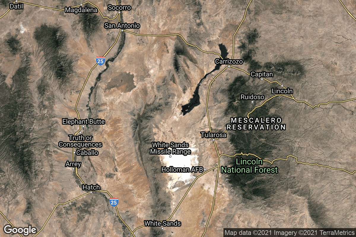
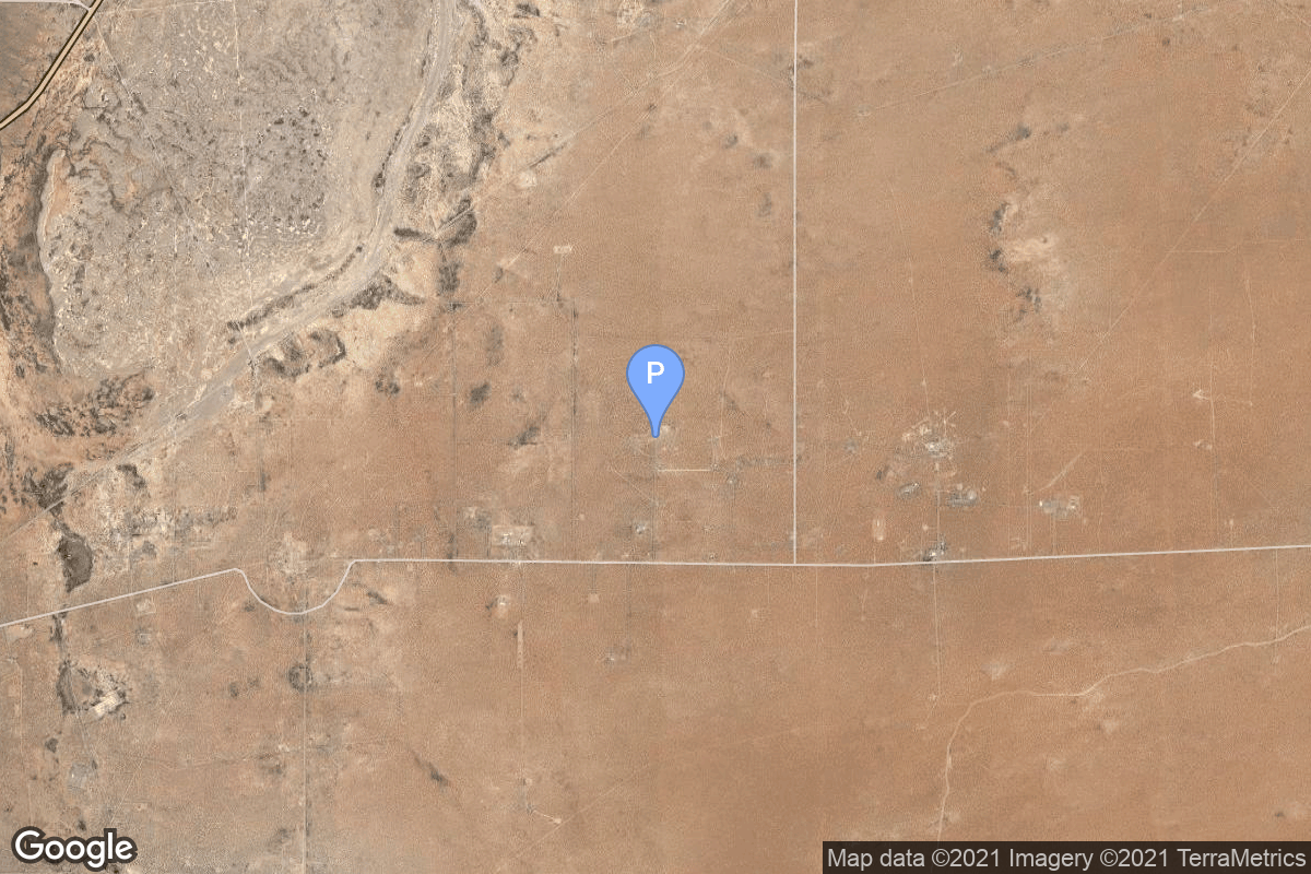
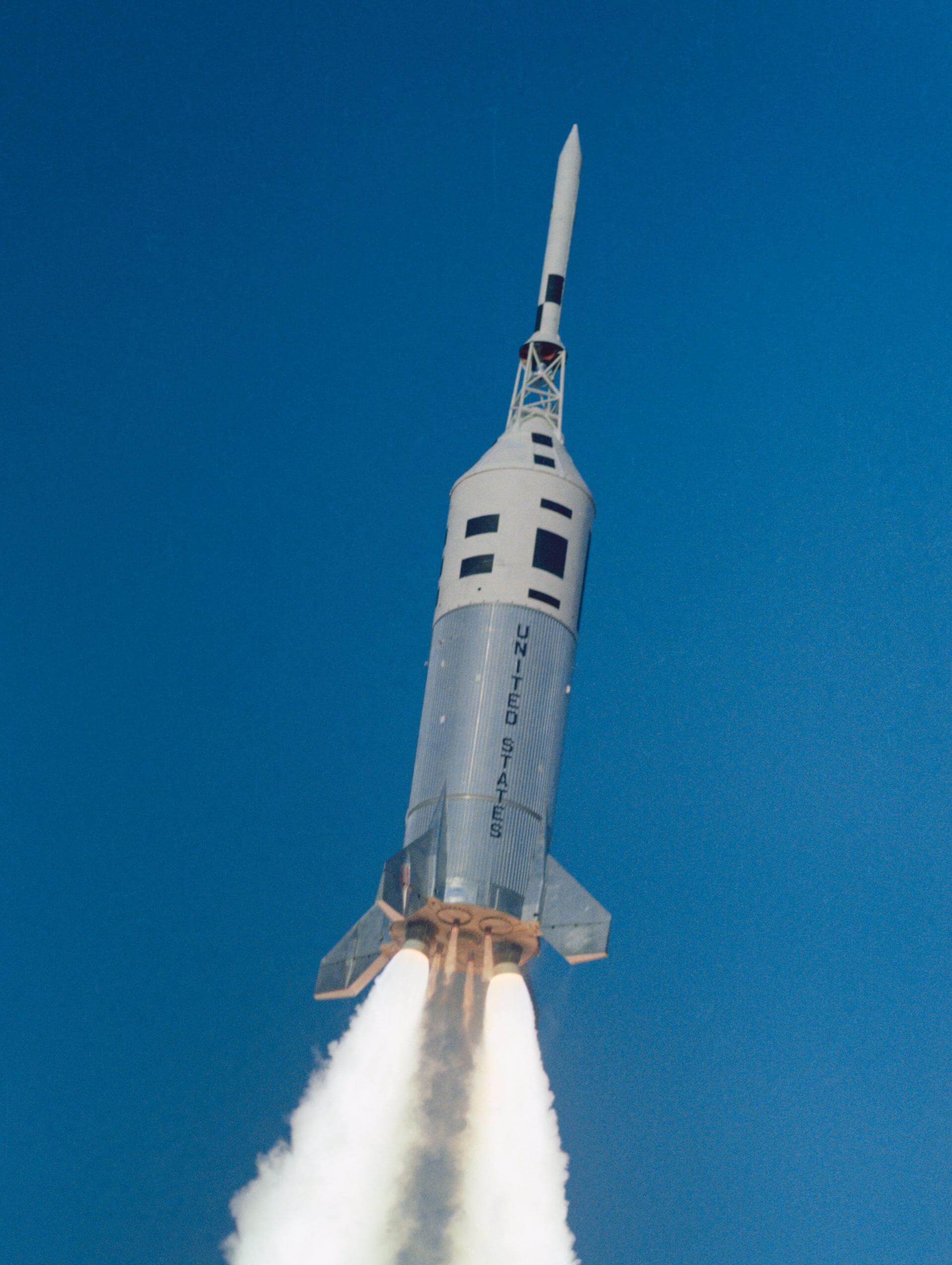
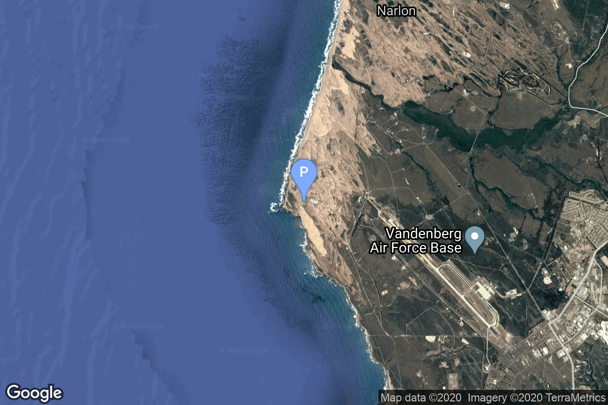
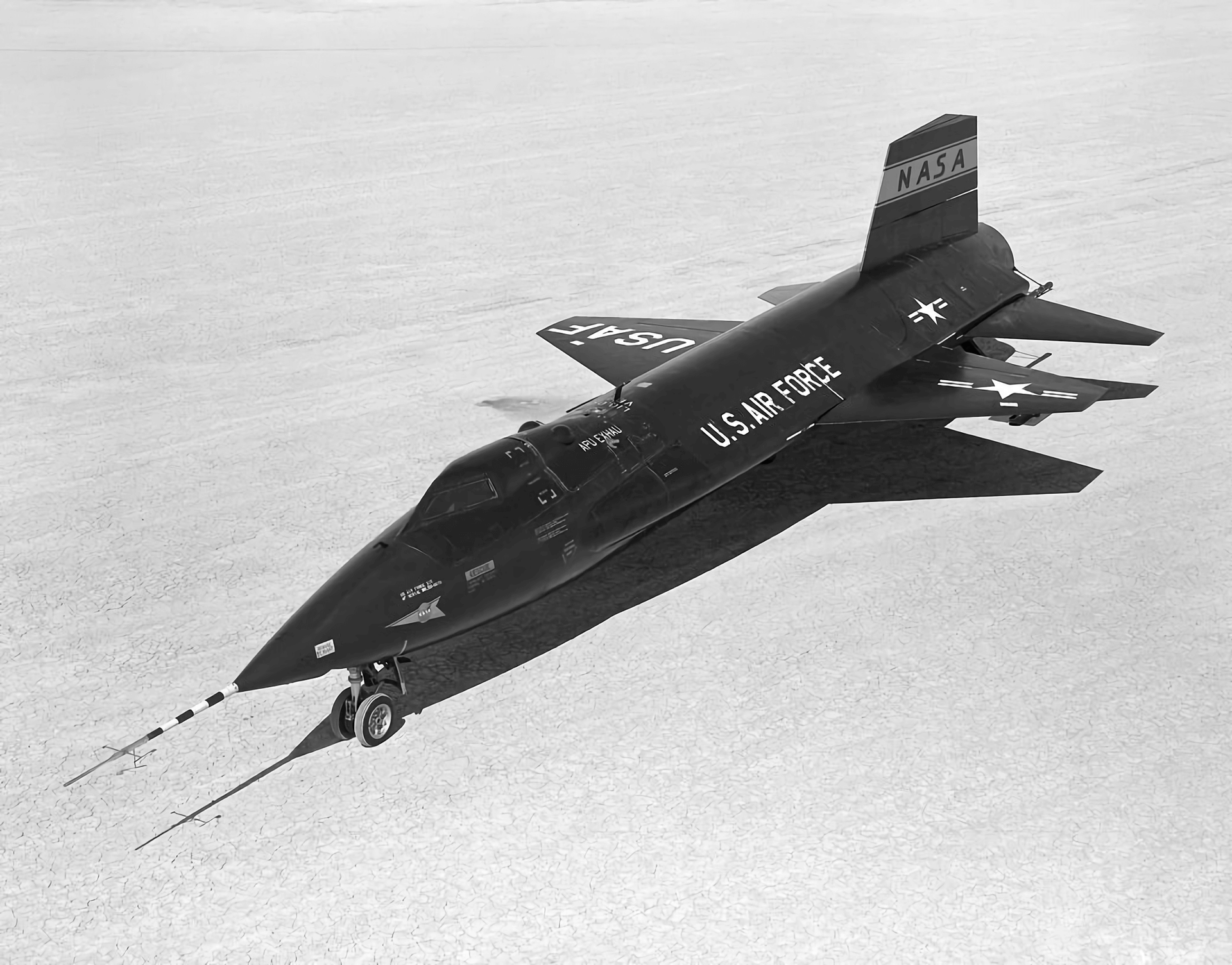
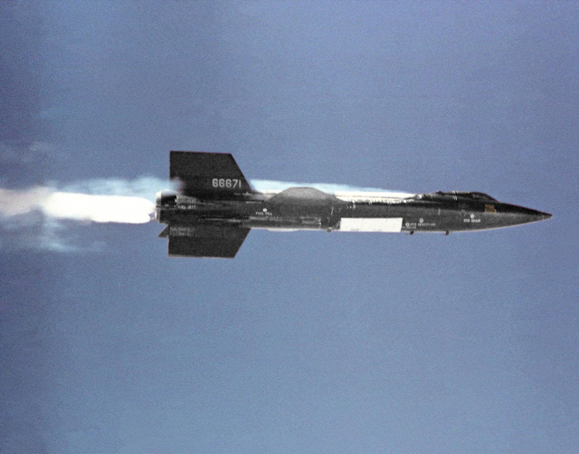
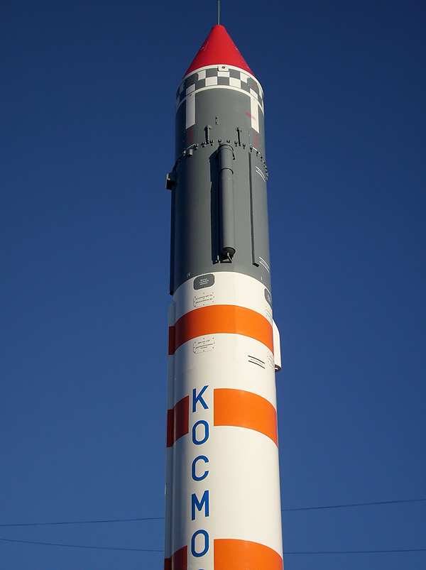
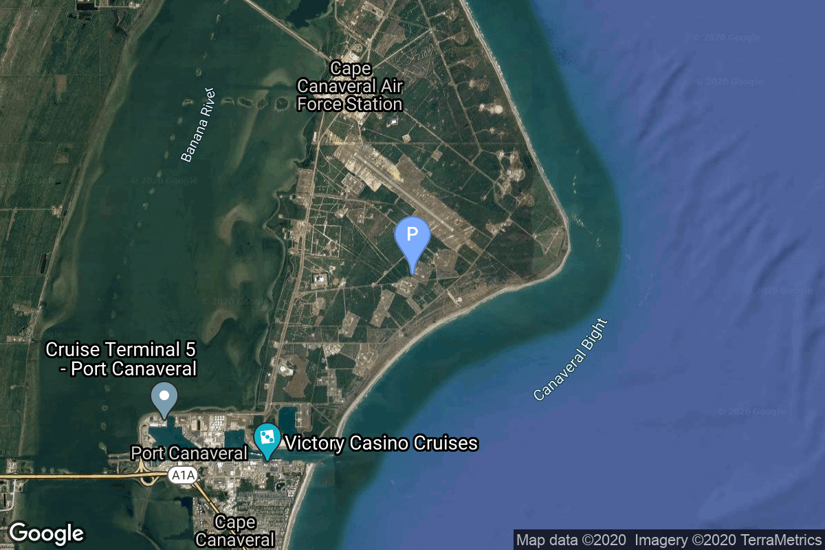
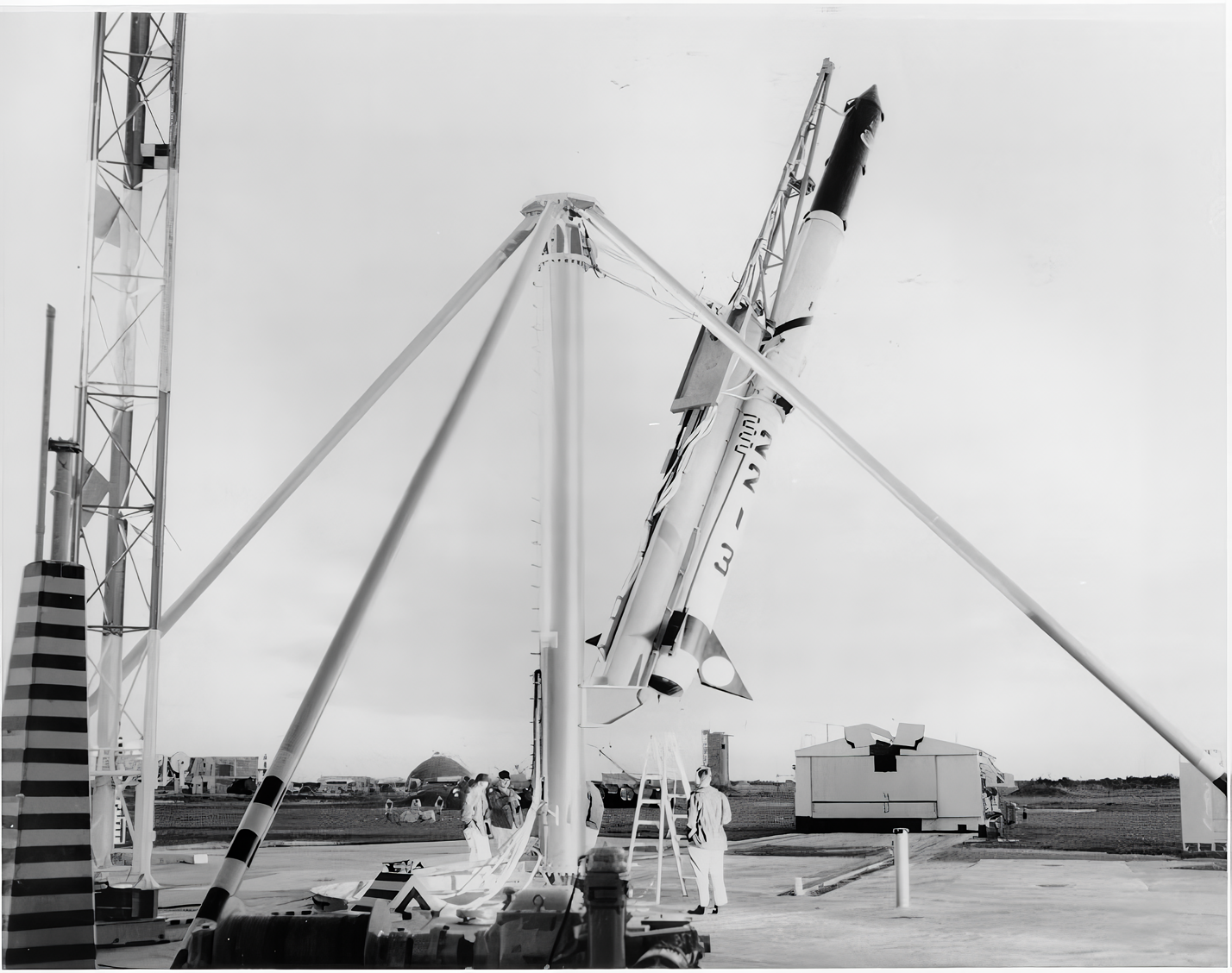
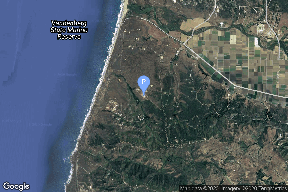
{ "count": 7494, "next": "https://ll.thespacedevs.com/2.0.0/launch/?format=api&limit=10&offset=7200&ordering=-net", "previous": "https://ll.thespacedevs.com/2.0.0/launch/?format=api&limit=10&offset=7180&ordering=-net", "results": [ { "id": "5fa1ab53-6a11-494e-8fdd-aef7e527c3f8", "url": "https://ll.thespacedevs.com/2.0.0/launch/5fa1ab53-6a11-494e-8fdd-aef7e527c3f8/?format=api", "launch_library_id": null, "slug": "little-joe-ii-qtv", "name": "Little Joe II | QTV", "status": { "id": 3, "name": "Success" }, "net": "1963-08-28T16:00:02Z", "window_end": "1963-08-28T16:00:02Z", "window_start": "1963-08-28T16:00:02Z", "inhold": false, "tbdtime": false, "tbddate": false, "probability": null, "holdreason": "", "failreason": "", "hashtag": null, "launch_service_provider": { "id": 44, "url": "https://ll.thespacedevs.com/2.0.0/agencies/44/?format=api", "name": "National Aeronautics and Space Administration", "type": "Government" }, "rocket": { "id": 7423, "configuration": { "id": 470, "launch_library_id": null, "url": "https://ll.thespacedevs.com/2.0.0/config/launcher/470/?format=api", "name": "Little Joe II", "family": "Little Joe", "full_name": "Little Joe II", "variant": "II" } }, "mission": { "id": 5812, "launch_library_id": null, "name": "Qualification Test Vehicle", "description": "First test flight of the Little Joe II rocket.", "launch_designator": null, "type": "Test Flight", "orbit": { "id": 15, "name": "Suborbital", "abbrev": "Sub" } }, "pad": { "id": 194, "url": "https://ll.thespacedevs.com/2.0.0/pad/194/?format=api", "agency_id": 165, "name": "Launch Complex 36", "info_url": null, "wiki_url": "https://en.wikipedia.org/wiki/White_Sands_Launch_Complex_36", "map_url": "https://www.google.com/maps?q=32.416944,-106.321944", "latitude": "32.416944", "longitude": "-106.321944", "location": { "id": 155, "url": "https://ll.thespacedevs.com/2.0.0/location/155/?format=api", "name": "White Sands Missile Range", "country_code": "USA", "map_image": "https://thespacedevs-prod.nyc3.digitaloceanspaces.com/media/map_images/location_white_sands_missile_range_20210901072636.jpg", "total_launch_count": 5, "total_landing_count": 0 }, "map_image": "https://thespacedevs-prod.nyc3.digitaloceanspaces.com/media/map_images/pad_launch_complex_36_20210901072730.jpg", "total_launch_count": 5 }, "webcast_live": false, "image": "https://thespacedevs-prod.nyc3.digitaloceanspaces.com/media/images/little_joe_ii_image_20210901072351.jpeg", "infographic": null, "program": [ { "id": 4, "url": "https://ll.thespacedevs.com/2.0.0/program/4/?format=api", "name": "Apollo", "description": "The Apollo program was the third United States human spaceflight program carried out by the National Aeronautics and Space Administration (NASA), which succeeded in landing the first humans on the Moon from 1969 to 1972.", "agencies": [ { "id": 44, "url": "https://ll.thespacedevs.com/2.0.0/agencies/44/?format=api", "name": "National Aeronautics and Space Administration", "type": "Government" } ], "image_url": "https://thespacedevs-prod.nyc3.digitaloceanspaces.com/media/images/apollo_program_20200820200202.png", "start_date": "1966-11-16T00:00:00Z", "end_date": "1972-12-19T19:24:59Z", "info_url": "https://www.nasa.gov/mission_pages/apollo/index.html", "wiki_url": "https://en.wikipedia.org/wiki/Apollo_program" } ] }, { "id": "4a849f7b-4491-45a1-821f-05ad607c364f", "url": "https://ll.thespacedevs.com/2.0.0/launch/4a849f7b-4491-45a1-821f-05ad607c364f/?format=api", "launch_library_id": null, "slug": "thor-slv-2a-agena-d-kh-4a-1", "name": "Thor SLV-2A Agena D | KH-4A 1", "status": { "id": 3, "name": "Success" }, "net": "1963-08-25T00:29:58Z", "window_end": "1963-08-25T00:29:58Z", "window_start": "1963-08-25T00:29:58Z", "inhold": false, "tbdtime": false, "tbddate": false, "probability": null, "holdreason": "", "failreason": null, "hashtag": null, "launch_service_provider": { "id": 161, "url": "https://ll.thespacedevs.com/2.0.0/agencies/161/?format=api", "name": "United States Air Force", "type": "Government" }, "rocket": { "id": 3222, "configuration": { "id": 417, "launch_library_id": null, "url": "https://ll.thespacedevs.com/2.0.0/config/launcher/417/?format=api", "name": "Thor SLV-2A Agena D", "family": "Thor", "full_name": "Thor SLV-2A Agena D", "variant": "SLV-2A Agena D" } }, "mission": { "id": 1644, "launch_library_id": null, "name": "KH-4A 1", "description": "The KH-4A (Keyhole-4A) was the fifth optical reconnaissance satellite version in the Corona-program.", "launch_designator": null, "type": "Government/Top Secret", "orbit": { "id": 8, "name": "Low Earth Orbit", "abbrev": "LEO" } }, "pad": { "id": 95, "url": "https://ll.thespacedevs.com/2.0.0/pad/95/?format=api", "agency_id": 161, "name": "Space Launch Complex 1W", "info_url": null, "wiki_url": "https://en.wikipedia.org/wiki/Vandenberg_Space_Launch_Complex_1", "map_url": "https://www.google.com/maps?q=34.7572,-120.6303", "latitude": "34.7572", "longitude": "-120.6303", "location": { "id": 11, "url": "https://ll.thespacedevs.com/2.0.0/location/11/?format=api", "name": "Vandenberg SFB, CA, USA", "country_code": "USA", "map_image": "https://thespacedevs-prod.nyc3.digitaloceanspaces.com/media/map_images/location_11_20200803142416.jpg", "total_launch_count": 806, "total_landing_count": 26 }, "map_image": "https://thespacedevs-prod.nyc3.digitaloceanspaces.com/media/map_images/pad_95_20200803143209.jpg", "total_launch_count": 56 }, "webcast_live": false, "image": null, "infographic": null, "program": [] }, { "id": "6da57141-ac4f-4932-8136-1ed6d507b618", "url": "https://ll.thespacedevs.com/2.0.0/launch/6da57141-ac4f-4932-8136-1ed6d507b618/?format=api", "launch_library_id": null, "slug": "x-15-flight-91", "name": "X-15 | Flight 91", "status": { "id": 3, "name": "Success" }, "net": "1963-08-22T18:05:57Z", "window_end": "1963-08-22T18:05:57Z", "window_start": "1963-08-22T18:05:57Z", "inhold": false, "tbdtime": false, "tbddate": false, "probability": null, "holdreason": "", "failreason": "", "hashtag": null, "launch_service_provider": { "id": 161, "url": "https://ll.thespacedevs.com/2.0.0/agencies/161/?format=api", "name": "United States Air Force", "type": "Government" }, "rocket": { "id": 2570, "configuration": { "id": 209, "launch_library_id": null, "url": "https://ll.thespacedevs.com/2.0.0/config/launcher/209/?format=api", "name": "North American X-15", "family": "", "full_name": "North American X-15", "variant": "" } }, "mission": { "id": 1130, "launch_library_id": null, "name": "Flight 91", "description": "X-15 Flight 91 was a 1963 American crewed mission, and the second and final flight in the program to achieve sub-orbital spaceflight—a flight over 100 km in altitude. It was the highest flight of the X-15 program.", "launch_designator": null, "type": "Test Flight", "orbit": { "id": 15, "name": "Suborbital", "abbrev": "Sub" } }, "pad": { "id": 112, "url": "https://ll.thespacedevs.com/2.0.0/pad/112/?format=api", "agency_id": null, "name": "Edwards Air Force Base", "info_url": null, "wiki_url": "https://en.wikipedia.org/wiki/Edwards_Air_Force_Base", "map_url": "https://www.google.com/maps?q=34.905556,-117.883611", "latitude": "34.905556", "longitude": "-117.883611", "location": { "id": 144, "url": "https://ll.thespacedevs.com/2.0.0/location/144/?format=api", "name": "Air launch to Suborbital flight", "country_code": "???", "map_image": "https://thespacedevs-prod.nyc3.digitaloceanspaces.com/media/map_images/location_144_20200803142439.jpg", "total_launch_count": 86, "total_landing_count": 0 }, "map_image": "https://thespacedevs-prod.nyc3.digitaloceanspaces.com/media/map_images/pad_112_20200803143214.jpg", "total_launch_count": 13 }, "webcast_live": false, "image": "https://thespacedevs-prod.nyc3.digitaloceanspaces.com/media/images/north_american__image_20210813101104.png", "infographic": null, "program": [ { "id": 20, "url": "https://ll.thespacedevs.com/2.0.0/program/20/?format=api", "name": "X-15", "description": "Experimental hypersonic rocket-powered aircraft.", "agencies": [ { "id": 44, "url": "https://ll.thespacedevs.com/2.0.0/agencies/44/?format=api", "name": "National Aeronautics and Space Administration", "type": "Government" }, { "id": 161, "url": "https://ll.thespacedevs.com/2.0.0/agencies/161/?format=api", "name": "United States Air Force", "type": "Government" } ], "image_url": "https://thespacedevs-prod.nyc3.digitaloceanspaces.com/media/images/x-15_program_20210809102752.jpeg", "start_date": "1959-03-10T00:00:00Z", "end_date": "1968-12-12T00:00:00Z", "info_url": null, "wiki_url": "https://en.wikipedia.org/wiki/North_American_X-15" } ] }, { "id": "3aad6df9-6c3d-4adc-a5a4-009d34edad00", "url": "https://ll.thespacedevs.com/2.0.0/launch/3aad6df9-6c3d-4adc-a5a4-009d34edad00/?format=api", "launch_library_id": null, "slug": "kosmos-2i-63s1-ds-a1-3", "name": "Kosmos-2I 63S1 | DS-A1 3", "status": { "id": 4, "name": "Failure" }, "net": "1963-08-22T06:00:00Z", "window_end": "1963-08-22T06:00:00Z", "window_start": "1963-08-22T06:00:00Z", "inhold": false, "tbdtime": false, "tbddate": false, "probability": null, "holdreason": "", "failreason": null, "hashtag": null, "launch_service_provider": { "id": 66, "url": "https://ll.thespacedevs.com/2.0.0/agencies/66/?format=api", "name": "Soviet Space Program", "type": "Government" }, "rocket": { "id": 3221, "configuration": { "id": 190, "launch_library_id": 211, "url": "https://ll.thespacedevs.com/2.0.0/config/launcher/190/?format=api", "name": "Kosmos-2I 63S1", "family": "Kosmos", "full_name": "Kosmos-2I", "variant": "" } }, "mission": { "id": 1643, "launch_library_id": null, "name": "DS-A1 3", "description": "DS-A1 satellite designed to test techniques and equipment for communication and navigation systems.", "launch_designator": null, "type": "Communications", "orbit": { "id": 8, "name": "Low Earth Orbit", "abbrev": "LEO" } }, "pad": { "id": 100, "url": "https://ll.thespacedevs.com/2.0.0/pad/100/?format=api", "agency_id": null, "name": "Mayak-2", "info_url": null, "wiki_url": null, "map_url": "https://www.google.com/maps?q=48.569551,46.295814", "latitude": "48.569551", "longitude": "46.295814", "location": { "id": 30, "url": "https://ll.thespacedevs.com/2.0.0/location/30/?format=api", "name": "Kapustin Yar, Russian Federation", "country_code": "RUS", "map_image": "https://thespacedevs-prod.nyc3.digitaloceanspaces.com/media/map_images/location_30_20200803142515.jpg", "total_launch_count": 101, "total_landing_count": 0 }, "map_image": "https://thespacedevs-prod.nyc3.digitaloceanspaces.com/media/map_images/pad_100_20200803143212.jpg", "total_launch_count": 24 }, "webcast_live": false, "image": "https://thespacedevs-prod.nyc3.digitaloceanspaces.com/media/images/kosmos-2i252063s1_image_20191201205435.jpg", "infographic": null, "program": [] }, { "id": "fc7af641-ed15-46fe-b521-8d3a8a71fd61", "url": "https://ll.thespacedevs.com/2.0.0/launch/fc7af641-ed15-46fe-b521-8d3a8a71fd61/?format=api", "launch_library_id": null, "slug": "kosmos-2i-63s1-ds-p1-3", "name": "Kosmos-2I 63S1 | DS-P1 3", "status": { "id": 3, "name": "Success" }, "net": "1963-08-06T06:07:00Z", "window_end": "1963-08-06T06:07:00Z", "window_start": "1963-08-06T06:07:00Z", "inhold": false, "tbdtime": false, "tbddate": false, "probability": null, "holdreason": "", "failreason": null, "hashtag": null, "launch_service_provider": { "id": 66, "url": "https://ll.thespacedevs.com/2.0.0/agencies/66/?format=api", "name": "Soviet Space Program", "type": "Government" }, "rocket": { "id": 3220, "configuration": { "id": 190, "launch_library_id": 211, "url": "https://ll.thespacedevs.com/2.0.0/config/launcher/190/?format=api", "name": "Kosmos-2I 63S1", "family": "Kosmos", "full_name": "Kosmos-2I", "variant": "" } }, "mission": { "id": 1642, "launch_library_id": null, "name": "DS-P1 3", "description": "The DS-P1 series of satellites was used to calibrate space surveillance and early warning radars.", "launch_designator": null, "type": "Test Target", "orbit": { "id": 8, "name": "Low Earth Orbit", "abbrev": "LEO" } }, "pad": { "id": 100, "url": "https://ll.thespacedevs.com/2.0.0/pad/100/?format=api", "agency_id": null, "name": "Mayak-2", "info_url": null, "wiki_url": null, "map_url": "https://www.google.com/maps?q=48.569551,46.295814", "latitude": "48.569551", "longitude": "46.295814", "location": { "id": 30, "url": "https://ll.thespacedevs.com/2.0.0/location/30/?format=api", "name": "Kapustin Yar, Russian Federation", "country_code": "RUS", "map_image": "https://thespacedevs-prod.nyc3.digitaloceanspaces.com/media/map_images/location_30_20200803142515.jpg", "total_launch_count": 101, "total_landing_count": 0 }, "map_image": "https://thespacedevs-prod.nyc3.digitaloceanspaces.com/media/map_images/pad_100_20200803143212.jpg", "total_launch_count": 24 }, "webcast_live": false, "image": "https://thespacedevs-prod.nyc3.digitaloceanspaces.com/media/images/kosmos-2i252063s1_image_20191201205435.jpg", "infographic": null, "program": [] }, { "id": "76a2695b-cbfd-445c-8a3d-14dd19b63aa2", "url": "https://ll.thespacedevs.com/2.0.0/launch/76a2695b-cbfd-445c-8a3d-14dd19b63aa2/?format=api", "launch_library_id": null, "slug": "thor-slv-2a-agena-d-kh-6-3", "name": "Thor SLV-2A Agena D | KH-6 3", "status": { "id": 3, "name": "Success" }, "net": "1963-07-31T00:00:26Z", "window_end": "1963-07-31T00:00:26Z", "window_start": "1963-07-31T00:00:26Z", "inhold": false, "tbdtime": false, "tbddate": false, "probability": null, "holdreason": "", "failreason": null, "hashtag": null, "launch_service_provider": { "id": 161, "url": "https://ll.thespacedevs.com/2.0.0/agencies/161/?format=api", "name": "United States Air Force", "type": "Government" }, "rocket": { "id": 3219, "configuration": { "id": 417, "launch_library_id": null, "url": "https://ll.thespacedevs.com/2.0.0/config/launcher/417/?format=api", "name": "Thor SLV-2A Agena D", "family": "Thor", "full_name": "Thor SLV-2A Agena D", "variant": "SLV-2A Agena D" } }, "mission": { "id": 1641, "launch_library_id": null, "name": "KH-6 3", "description": "KH-6 (Keyhole 6, codenamed Lanyard) was an early attempt to gain higher resolution imagery, which flew only one successful mission in 1963. It was part of the Corona program.", "launch_designator": null, "type": "Government/Top Secret", "orbit": { "id": 8, "name": "Low Earth Orbit", "abbrev": "LEO" } }, "pad": { "id": 39, "url": "https://ll.thespacedevs.com/2.0.0/pad/39/?format=api", "agency_id": null, "name": "Space Launch Complex 2W", "info_url": null, "wiki_url": "https://en.wikipedia.org/wiki/Vandenberg_Space_Launch_Complex_2", "map_url": "https://www.google.com/maps?q=34.7556,-120.6224", "latitude": "34.7556", "longitude": "-120.6224", "location": { "id": 11, "url": "https://ll.thespacedevs.com/2.0.0/location/11/?format=api", "name": "Vandenberg SFB, CA, USA", "country_code": "USA", "map_image": "https://thespacedevs-prod.nyc3.digitaloceanspaces.com/media/map_images/location_11_20200803142416.jpg", "total_launch_count": 806, "total_landing_count": 26 }, "map_image": "https://thespacedevs-prod.nyc3.digitaloceanspaces.com/media/map_images/pad_39_20200803143542.jpg", "total_launch_count": 98 }, "webcast_live": false, "image": null, "infographic": null, "program": [] }, { "id": "4897547b-a437-4b43-abad-a714872896fb", "url": "https://ll.thespacedevs.com/2.0.0/launch/4897547b-a437-4b43-abad-a714872896fb/?format=api", "launch_library_id": null, "slug": "blue-scout-jr-oar-22-1", "name": "Blue Scout Jr | OAR 22-1", "status": { "id": 3, "name": "Success" }, "net": "1963-07-30T16:16:08Z", "window_end": "1963-07-30T16:16:08Z", "window_start": "1963-07-30T16:16:08Z", "inhold": false, "tbdtime": false, "tbddate": false, "probability": null, "holdreason": "", "failreason": null, "hashtag": null, "launch_service_provider": { "id": 161, "url": "https://ll.thespacedevs.com/2.0.0/agencies/161/?format=api", "name": "United States Air Force", "type": "Government" }, "rocket": { "id": 3218, "configuration": { "id": 265, "launch_library_id": null, "url": "https://ll.thespacedevs.com/2.0.0/config/launcher/265/?format=api", "name": "Blue Scout Jr", "family": "Blue Scout", "full_name": "Blue Scout Jr", "variant": "Jr" } }, "mission": { "id": 1640, "launch_library_id": null, "name": "OAR 22-1", "description": "Radio astronomy mission", "launch_designator": null, "type": "Astrophysics", "orbit": { "id": 15, "name": "Suborbital", "abbrev": "Sub" } }, "pad": { "id": 118, "url": "https://ll.thespacedevs.com/2.0.0/pad/118/?format=api", "agency_id": 166, "name": "Launch Complex 18A", "info_url": null, "wiki_url": "https://en.wikipedia.org/wiki/Cape_Canaveral_Launch_Complex_18", "map_url": "https://www.google.com/maps?q=28.4493,-80.564494", "latitude": "28.4493", "longitude": "-80.564494", "location": { "id": 12, "url": "https://ll.thespacedevs.com/2.0.0/location/12/?format=api", "name": "Cape Canaveral SFS, FL, USA", "country_code": "USA", "map_image": "https://thespacedevs-prod.nyc3.digitaloceanspaces.com/media/map_images/location_12_20200803142519.jpg", "total_launch_count": 1022, "total_landing_count": 64 }, "map_image": "https://thespacedevs-prod.nyc3.digitaloceanspaces.com/media/map_images/pad_118_20200803143338.jpg", "total_launch_count": 18 }, "webcast_live": false, "image": "https://thespacedevs-prod.nyc3.digitaloceanspaces.com/media/images/blue_scout_juni_image_20240411084702.png", "infographic": null, "program": [] }, { "id": "80d602cd-12c6-4921-bba8-73f329cdeaa8", "url": "https://ll.thespacedevs.com/2.0.0/launch/80d602cd-12c6-4921-bba8-73f329cdeaa8/?format=api", "launch_library_id": null, "slug": "thor-delta-b-syncom-2", "name": "Thor Delta B | Syncom 2", "status": { "id": 3, "name": "Success" }, "net": "1963-07-26T14:33:00Z", "window_end": "1963-07-26T14:33:00Z", "window_start": "1963-07-26T14:33:00Z", "inhold": false, "tbdtime": false, "tbddate": false, "probability": null, "holdreason": "", "failreason": null, "hashtag": null, "launch_service_provider": { "id": 161, "url": "https://ll.thespacedevs.com/2.0.0/agencies/161/?format=api", "name": "United States Air Force", "type": "Government" }, "rocket": { "id": 3217, "configuration": { "id": 400, "launch_library_id": null, "url": "https://ll.thespacedevs.com/2.0.0/config/launcher/400/?format=api", "name": "Thor Delta B", "family": "Thor", "full_name": "Thor Delta B", "variant": "Delta B" } }, "mission": { "id": 1639, "launch_library_id": null, "name": "Syncom 2", "description": "Syncom 2 was the first geosynchronous satellite. Although the period was 24 hours and the spacecraft remained at a nearly constant longitude, the orbit was inclined at 33 degrees so it was not truly geostationary but moved in an elongated figure eight pattern 33 degrees north and south of the equator.", "launch_designator": null, "type": "Communications", "orbit": { "id": 3, "name": "Geosynchronous Orbit", "abbrev": "GSO" } }, "pad": { "id": 14, "url": "https://ll.thespacedevs.com/2.0.0/pad/14/?format=api", "agency_id": null, "name": "Space Launch Complex 17A", "info_url": null, "wiki_url": "https://en.wikipedia.org/wiki/Cape_Canaveral_Space_Launch_Complex_17", "map_url": "https://www.google.com/maps?q=28.4472,-80.565", "latitude": "28.4472", "longitude": "-80.565", "location": { "id": 12, "url": "https://ll.thespacedevs.com/2.0.0/location/12/?format=api", "name": "Cape Canaveral SFS, FL, USA", "country_code": "USA", "map_image": "https://thespacedevs-prod.nyc3.digitaloceanspaces.com/media/map_images/location_12_20200803142519.jpg", "total_launch_count": 1022, "total_landing_count": 64 }, "map_image": "https://thespacedevs-prod.nyc3.digitaloceanspaces.com/media/map_images/pad_14_20200803143451.jpg", "total_launch_count": 145 }, "webcast_live": false, "image": null, "infographic": null, "program": [] }, { "id": "b2c5017d-edc7-44bf-9655-ef05e168b4cf", "url": "https://ll.thespacedevs.com/2.0.0/launch/b2c5017d-edc7-44bf-9655-ef05e168b4cf/?format=api", "launch_library_id": null, "slug": "x-15-flight-90", "name": "X-15 | Flight 90", "status": { "id": 3, "name": "Success" }, "net": "1963-07-19T18:20:05Z", "window_end": "1963-07-19T18:20:05Z", "window_start": "1963-07-19T18:20:05Z", "inhold": false, "tbdtime": false, "tbddate": false, "probability": null, "holdreason": "", "failreason": "", "hashtag": null, "launch_service_provider": { "id": 161, "url": "https://ll.thespacedevs.com/2.0.0/agencies/161/?format=api", "name": "United States Air Force", "type": "Government" }, "rocket": { "id": 2729, "configuration": { "id": 209, "launch_library_id": null, "url": "https://ll.thespacedevs.com/2.0.0/config/launcher/209/?format=api", "name": "North American X-15", "family": "", "full_name": "North American X-15", "variant": "" } }, "mission": { "id": 1131, "launch_library_id": null, "name": "Flight 90", "description": "Flight 90 of the North American X-15 was a test flight conducted by NASA and the US Air Force in 1963. It was the first of two X-15 missions that passed the 100-km high Kármán line.", "launch_designator": null, "type": "Test Flight", "orbit": { "id": 15, "name": "Suborbital", "abbrev": "Sub" } }, "pad": { "id": 112, "url": "https://ll.thespacedevs.com/2.0.0/pad/112/?format=api", "agency_id": null, "name": "Edwards Air Force Base", "info_url": null, "wiki_url": "https://en.wikipedia.org/wiki/Edwards_Air_Force_Base", "map_url": "https://www.google.com/maps?q=34.905556,-117.883611", "latitude": "34.905556", "longitude": "-117.883611", "location": { "id": 144, "url": "https://ll.thespacedevs.com/2.0.0/location/144/?format=api", "name": "Air launch to Suborbital flight", "country_code": "???", "map_image": "https://thespacedevs-prod.nyc3.digitaloceanspaces.com/media/map_images/location_144_20200803142439.jpg", "total_launch_count": 86, "total_landing_count": 0 }, "map_image": "https://thespacedevs-prod.nyc3.digitaloceanspaces.com/media/map_images/pad_112_20200803143214.jpg", "total_launch_count": 13 }, "webcast_live": false, "image": "https://thespacedevs-prod.nyc3.digitaloceanspaces.com/media/images/north_american__image_20210813101104.png", "infographic": null, "program": [ { "id": 20, "url": "https://ll.thespacedevs.com/2.0.0/program/20/?format=api", "name": "X-15", "description": "Experimental hypersonic rocket-powered aircraft.", "agencies": [ { "id": 44, "url": "https://ll.thespacedevs.com/2.0.0/agencies/44/?format=api", "name": "National Aeronautics and Space Administration", "type": "Government" }, { "id": 161, "url": "https://ll.thespacedevs.com/2.0.0/agencies/161/?format=api", "name": "United States Air Force", "type": "Government" } ], "image_url": "https://thespacedevs-prod.nyc3.digitaloceanspaces.com/media/images/x-15_program_20210809102752.jpeg", "start_date": "1959-03-10T00:00:00Z", "end_date": "1968-12-12T00:00:00Z", "info_url": null, "wiki_url": "https://en.wikipedia.org/wiki/North_American_X-15" } ] }, { "id": "7c50a87c-ea82-434e-b1fc-3b19e8001441", "url": "https://ll.thespacedevs.com/2.0.0/launch/7c50a87c-ea82-434e-b1fc-3b19e8001441/?format=api", "launch_library_id": null, "slug": "atlas-agena-b-midas-9", "name": "Atlas Agena B | Midas 9", "status": { "id": 3, "name": "Success" }, "net": "1963-07-19T03:51:18Z", "window_end": "1963-07-19T03:51:18Z", "window_start": "1963-07-19T03:51:18Z", "inhold": false, "tbdtime": false, "tbddate": false, "probability": null, "holdreason": "", "failreason": null, "hashtag": null, "launch_service_provider": { "id": 161, "url": "https://ll.thespacedevs.com/2.0.0/agencies/161/?format=api", "name": "United States Air Force", "type": "Government" }, "rocket": { "id": 3216, "configuration": { "id": 183, "launch_library_id": 193, "url": "https://ll.thespacedevs.com/2.0.0/config/launcher/183/?format=api", "name": "Atlas Agena B", "family": "Atlas", "full_name": "Atlas LV-3 Agena B", "variant": "LV-3 Agena B" } }, "mission": { "id": 1638, "launch_library_id": null, "name": "Midas 9", "description": "MIDAS Series 3 (Military Defense Alarm System) early warning satellite.", "launch_designator": null, "type": "Government/Top Secret", "orbit": { "id": 12, "name": "Medium Earth Orbit", "abbrev": "MEO" } }, "pad": { "id": 24, "url": "https://ll.thespacedevs.com/2.0.0/pad/24/?format=api", "agency_id": 161, "name": "Space Launch Complex 3E", "info_url": null, "wiki_url": "https://en.wikipedia.org/wiki/Vandenberg_Space_Launch_Complex_3#SLC-3E", "map_url": "https://www.google.com/maps?q=34.64,-120.5895", "latitude": "34.64", "longitude": "-120.5895", "location": { "id": 11, "url": "https://ll.thespacedevs.com/2.0.0/location/11/?format=api", "name": "Vandenberg SFB, CA, USA", "country_code": "USA", "map_image": "https://thespacedevs-prod.nyc3.digitaloceanspaces.com/media/map_images/location_11_20200803142416.jpg", "total_launch_count": 806, "total_landing_count": 26 }, "map_image": "https://thespacedevs-prod.nyc3.digitaloceanspaces.com/media/map_images/pad_24_20200803143552.jpg", "total_launch_count": 48 }, "webcast_live": false, "image": null, "infographic": null, "program": [] } ] }