Launch List
API endpoint that returns all Launch objects or a single launch.
EXAMPLE - /launch/
GET: Return a list of all Launch objects.
FILTERS: Fields - 'name', 'id(s)', 'lsp_id', 'lsp_name', 'serial_number', 'launcher_config__id', 'rocket__spacecraftflight__spacecraft__name'
MODE: 'normal', 'list', 'detailed' EXAMPLE: ?mode=list
SEARCH: Searches through the launch name, rocket name, launch agency, mission name & spacecraft name. EXAMPLE - ?search=SpaceX
GET /2.0.0/launch/?format=api&offset=7150&ordering=id
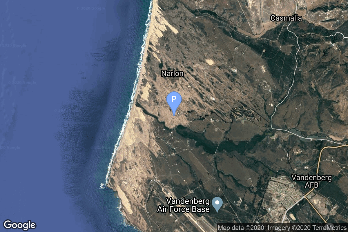
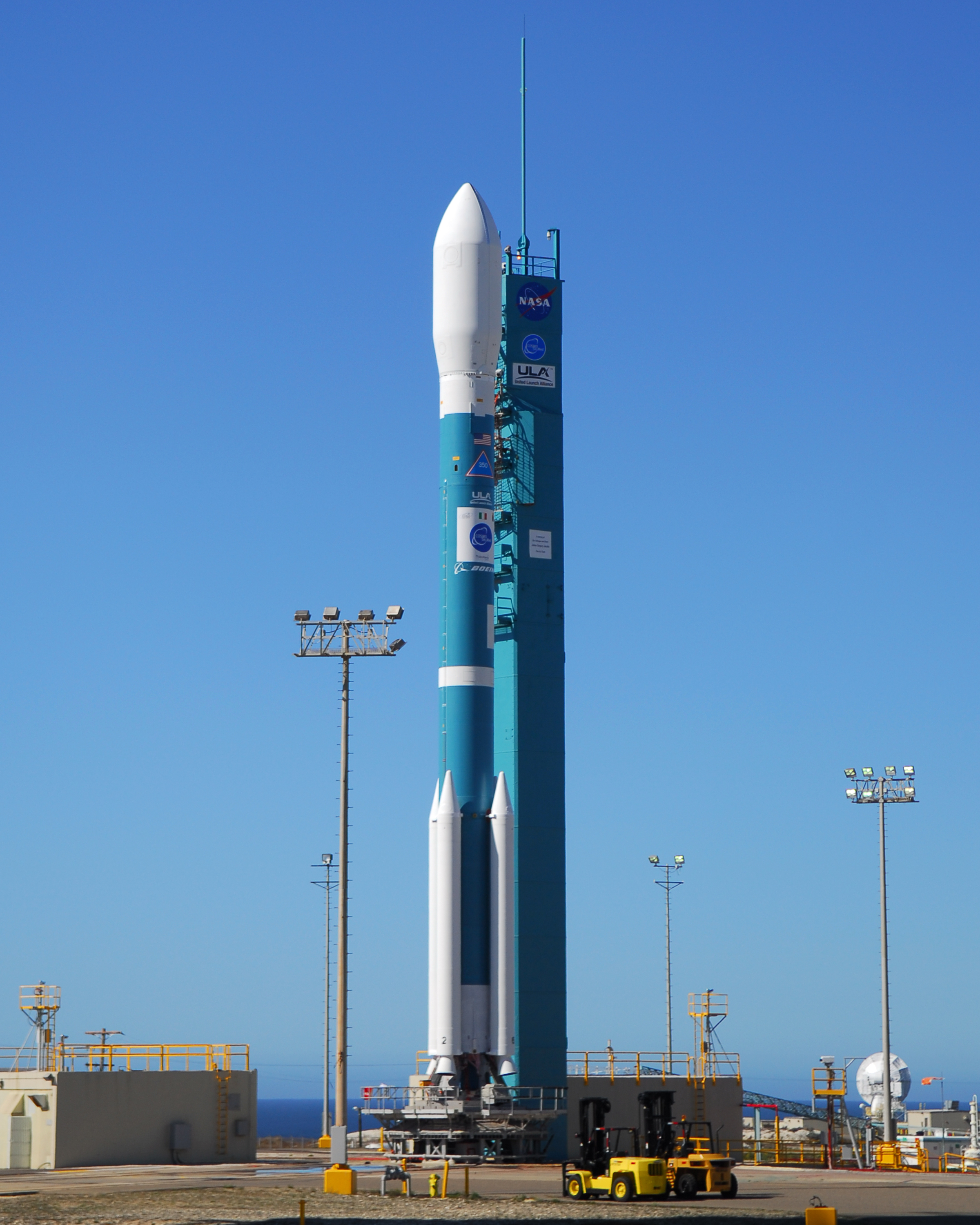
{ "count": 7494, "next": "https://ll.thespacedevs.com/2.0.0/launch/?format=api&limit=10&offset=7160&ordering=id", "previous": "https://ll.thespacedevs.com/2.0.0/launch/?format=api&limit=10&offset=7140&ordering=id", "results": [ { "id": "f38a3f48-173e-4305-9583-ac51ba6cb882", "url": "https://ll.thespacedevs.com/2.0.0/launch/f38a3f48-173e-4305-9583-ac51ba6cb882/?format=api", "launch_library_id": 1776, "slug": "soyuz-u-progress-m-35", "name": "Soyuz U | Progress M-35", "status": { "id": 3, "name": "Success" }, "net": "1997-07-05T04:11:54Z", "window_end": "1997-07-05T04:11:54Z", "window_start": "1997-07-05T04:11:54Z", "inhold": false, "tbdtime": false, "tbddate": false, "probability": 0, "holdreason": "", "failreason": "", "hashtag": "", "launch_service_provider": { "id": 63, "url": "https://ll.thespacedevs.com/2.0.0/agencies/63/?format=api", "name": "Russian Federal Space Agency (ROSCOSMOS)", "type": "Government" }, "rocket": { "id": 2308, "configuration": { "id": 37, "launch_library_id": 35, "url": "https://ll.thespacedevs.com/2.0.0/config/launcher/37/?format=api", "name": "Soyuz U", "family": "Soyuz", "full_name": "Soyuz U", "variant": "" } }, "mission": null, "pad": { "id": 32, "url": "https://ll.thespacedevs.com/2.0.0/pad/32/?format=api", "agency_id": null, "name": "1/5", "info_url": null, "wiki_url": "", "map_url": "https://www.google.com/maps?q=45.92,63.342", "latitude": "45.92", "longitude": "63.342", "location": { "id": 15, "url": "https://ll.thespacedevs.com/2.0.0/location/15/?format=api", "name": "Baikonur Cosmodrome, Republic of Kazakhstan", "country_code": "KAZ", "map_image": "https://thespacedevs-prod.nyc3.digitaloceanspaces.com/media/map_images/location_15_20200803142517.jpg", "total_launch_count": 1555, "total_landing_count": 0 }, "map_image": "https://thespacedevs-prod.nyc3.digitaloceanspaces.com/media/map_images/pad_32_20200803143513.jpg", "total_launch_count": 487 }, "webcast_live": false, "image": "https://thespacedevs-prod.nyc3.digitaloceanspaces.com/media/images/soyuz2520u_image_20190222031023.jpeg", "infographic": null, "program": [ { "id": 16, "url": "https://ll.thespacedevs.com/2.0.0/program/16/?format=api", "name": "Mir", "description": "Mir was a space station that operated in low Earth orbit from 1986 to 2001, operated by the Soviet Union and later by Russia. Mir was the first modular space station and was assembled in orbit from 1986 to 1996.", "agencies": [ { "id": 63, "url": "https://ll.thespacedevs.com/2.0.0/agencies/63/?format=api", "name": "Russian Federal Space Agency (ROSCOSMOS)", "type": "Government" }, { "id": 66, "url": "https://ll.thespacedevs.com/2.0.0/agencies/66/?format=api", "name": "Soviet Space Program", "type": "Government" } ], "image_url": "https://thespacedevs-prod.nyc3.digitaloceanspaces.com/media/images/mir_program_20200821092345.jpeg", "start_date": "1986-02-20T21:28:23Z", "end_date": "2001-03-23T05:59:00Z", "info_url": null, "wiki_url": "https://en.wikipedia.org/wiki/Mir" } ] }, { "id": "f38f0321-080b-4313-843b-2b8c140b0669", "url": "https://ll.thespacedevs.com/2.0.0/launch/f38f0321-080b-4313-843b-2b8c140b0669/?format=api", "launch_library_id": null, "slug": "smart-dragon-3-10-x-centispace-1", "name": "Smart Dragon 3 | 10 x CentiSpace-1", "status": { "id": 3, "name": "Success" }, "net": "2025-01-13T03:00:00Z", "window_end": "2025-01-13T03:17:00Z", "window_start": "2025-01-13T02:51:00Z", "inhold": false, "tbdtime": false, "tbddate": false, "probability": null, "holdreason": "", "failreason": "", "hashtag": null, "launch_service_provider": { "id": 272, "url": "https://ll.thespacedevs.com/2.0.0/agencies/272/?format=api", "name": "China Rocket Co. Ltd.", "type": "Commercial" }, "rocket": { "id": 8459, "configuration": { "id": 484, "launch_library_id": null, "url": "https://ll.thespacedevs.com/2.0.0/config/launcher/484/?format=api", "name": "Smart Dragon 3", "family": "Smart Dragon", "full_name": "Smart Dragon 3", "variant": "" } }, "mission": { "id": 7048, "launch_library_id": null, "name": "10 x CentiSpace-1", "description": "Chinese commercial small satellites by Beijing-based company Future Navigation for providing GNSS augmentation signals services from LEO. They are part of a planned 160 satellites constellation.", "launch_designator": null, "type": "Navigation", "orbit": { "id": 8, "name": "Low Earth Orbit", "abbrev": "LEO" } }, "pad": { "id": 212, "url": "https://ll.thespacedevs.com/2.0.0/pad/212/?format=api", "agency_id": 88, "name": "Haiyang Spaceport", "info_url": null, "wiki_url": null, "map_url": null, "latitude": "36.676794", "longitude": "121.235103", "location": { "id": 3, "url": "https://ll.thespacedevs.com/2.0.0/location/3/?format=api", "name": "Sea Launch", "country_code": "???", "map_image": "https://thespacedevs-prod.nyc3.digitaloceanspaces.com/media/map_images/location_3_20200803142448.jpg", "total_launch_count": 55, "total_landing_count": 0 }, "map_image": "https://thespacedevs-prod.nyc3.digitaloceanspaces.com/media/map_images/pad_haiyang_spaceport_20230827174240.jpg", "total_launch_count": 4 }, "webcast_live": false, "image": "https://thespacedevs-prod.nyc3.digitaloceanspaces.com/media/images/smart_dragon_3__image_20240925074606.jpg", "infographic": null, "program": [] }, { "id": "f3a51bce-e58a-4033-b6ea-7f4615c7a66c", "url": "https://ll.thespacedevs.com/2.0.0/launch/f3a51bce-e58a-4033-b6ea-7f4615c7a66c/?format=api", "launch_library_id": null, "slug": "titan-34b-jumpseat-6", "name": "Titan 34B | Jumpseat 6", "status": { "id": 3, "name": "Success" }, "net": "1981-04-24T21:32:00Z", "window_end": "1981-04-24T21:32:00Z", "window_start": "1981-04-24T21:32:00Z", "inhold": false, "tbdtime": false, "tbddate": false, "probability": null, "holdreason": "", "failreason": null, "hashtag": null, "launch_service_provider": { "id": 161, "url": "https://ll.thespacedevs.com/2.0.0/agencies/161/?format=api", "name": "United States Air Force", "type": "Government" }, "rocket": { "id": 5270, "configuration": { "id": 423, "launch_library_id": null, "url": "https://ll.thespacedevs.com/2.0.0/config/launcher/423/?format=api", "name": "Titan 34B", "family": "Titan", "full_name": "Titan 34B", "variant": "34B" } }, "mission": { "id": 3679, "launch_library_id": null, "name": "Jumpseat 6", "description": "Signal intelligence satellite operating from highly elliptic Molniya-type orbits.", "launch_designator": null, "type": "Government/Top Secret", "orbit": { "id": 0, "name": "Elliptical Orbit", "abbrev": "Elliptical" } }, "pad": { "id": 156, "url": "https://ll.thespacedevs.com/2.0.0/pad/156/?format=api", "agency_id": null, "name": "Space Launch Complex 4W", "info_url": "http://www.astronautix.com/v/vandenbergslc4w.html", "wiki_url": "https://en.wikipedia.org/wiki/Vandenberg_Air_Force_Base_Space_Launch_Complex_4#SLC-4W", "map_url": "https://www.google.com/maps?q=34.63312,-120.61584", "latitude": "34.63312", "longitude": "-120.61584", "location": { "id": 11, "url": "https://ll.thespacedevs.com/2.0.0/location/11/?format=api", "name": "Vandenberg SFB, CA, USA", "country_code": "USA", "map_image": "https://thespacedevs-prod.nyc3.digitaloceanspaces.com/media/map_images/location_11_20200803142416.jpg", "total_launch_count": 806, "total_landing_count": 26 }, "map_image": "https://thespacedevs-prod.nyc3.digitaloceanspaces.com/media/map_images/pad_156_20200803143351.jpg", "total_launch_count": 93 }, "webcast_live": false, "image": null, "infographic": null, "program": [] }, { "id": "f3a8b0e3-6cbc-4aed-900e-790cb6a5a11d", "url": "https://ll.thespacedevs.com/2.0.0/launch/f3a8b0e3-6cbc-4aed-900e-790cb6a5a11d/?format=api", "launch_library_id": null, "slug": "long-march-4b-zi-yuan-2-3", "name": "Long March 4B | Zi Yuan 2-3", "status": { "id": 3, "name": "Success" }, "net": "2004-11-06T03:10:00Z", "window_end": "2004-11-06T03:10:00Z", "window_start": "2004-11-06T03:10:00Z", "inhold": false, "tbdtime": false, "tbddate": false, "probability": null, "holdreason": "", "failreason": null, "hashtag": null, "launch_service_provider": { "id": 88, "url": "https://ll.thespacedevs.com/2.0.0/agencies/88/?format=api", "name": "China Aerospace Science and Technology Corporation", "type": "Government" }, "rocket": { "id": 7204, "configuration": { "id": 10, "launch_library_id": 16, "url": "https://ll.thespacedevs.com/2.0.0/config/launcher/10/?format=api", "name": "Long March 4B", "family": "Long March", "full_name": "Long March 4B", "variant": "B" } }, "mission": { "id": 5593, "launch_library_id": null, "name": "Zi Yuan 2-3", "description": "Zi Yuan 2-3 was a low earth orbit digital imaging spacecraft used by the Chinese government, probably for both civilian and military reconnaissance purposes..", "launch_designator": null, "type": "Earth Science", "orbit": { "id": 8, "name": "Low Earth Orbit", "abbrev": "LEO" } }, "pad": { "id": 33, "url": "https://ll.thespacedevs.com/2.0.0/pad/33/?format=api", "agency_id": null, "name": "Launch Complex 7", "info_url": null, "wiki_url": null, "map_url": "https://www.google.com/maps?q=38.8489311,111.6079339", "latitude": "38.8489311", "longitude": "111.6079339", "location": { "id": 19, "url": "https://ll.thespacedevs.com/2.0.0/location/19/?format=api", "name": "Taiyuan Satellite Launch Center, People's Republic of China", "country_code": "CHN", "map_image": "https://thespacedevs-prod.nyc3.digitaloceanspaces.com/media/map_images/location_19_20200803142421.jpg", "total_launch_count": 141, "total_landing_count": 0 }, "map_image": "https://thespacedevs-prod.nyc3.digitaloceanspaces.com/media/map_images/pad_33_20200803143335.jpg", "total_launch_count": 32 }, "webcast_live": false, "image": "https://thespacedevs-prod.nyc3.digitaloceanspaces.com/media/images/long2520march25204_image_20190430065008.jpg", "infographic": null, "program": [] }, { "id": "f3abb008-5c85-4671-8c52-47b1d2b458fa", "url": "https://ll.thespacedevs.com/2.0.0/launch/f3abb008-5c85-4671-8c52-47b1d2b458fa/?format=api", "launch_library_id": null, "slug": "kosmos-3m-strela-2m-26", "name": "Kosmos-3M | Strela-2M 26", "status": { "id": 3, "name": "Success" }, "net": "1982-01-07T15:38:00Z", "window_end": "1982-01-07T15:38:00Z", "window_start": "1982-01-07T15:38:00Z", "inhold": false, "tbdtime": false, "tbddate": false, "probability": null, "holdreason": "", "failreason": null, "hashtag": null, "launch_service_provider": { "id": 66, "url": "https://ll.thespacedevs.com/2.0.0/agencies/66/?format=api", "name": "Soviet Space Program", "type": "Government" }, "rocket": { "id": 5355, "configuration": { "id": 102, "launch_library_id": 122, "url": "https://ll.thespacedevs.com/2.0.0/config/launcher/102/?format=api", "name": "Kosmos-3M", "family": "Kosmos", "full_name": "Kosmos-3M (11K65M)", "variant": "-3M" } }, "mission": { "id": 3763, "launch_library_id": null, "name": "Strela-2M 26", "description": "Military communications satellite", "launch_designator": null, "type": "Government/Top Secret", "orbit": { "id": 8, "name": "Low Earth Orbit", "abbrev": "LEO" } }, "pad": { "id": 167, "url": "https://ll.thespacedevs.com/2.0.0/pad/167/?format=api", "agency_id": null, "name": "132/2", "info_url": null, "wiki_url": "https://en.wikipedia.org/wiki/Plesetsk_Cosmodrome", "map_url": "https://www.google.com/maps?q=62.883,40.869806", "latitude": "62.883", "longitude": "40.869806", "location": { "id": 6, "url": "https://ll.thespacedevs.com/2.0.0/location/6/?format=api", "name": "Plesetsk Cosmodrome, Russian Federation", "country_code": "RUS", "map_image": "https://thespacedevs-prod.nyc3.digitaloceanspaces.com/media/map_images/location_6_20200803142434.jpg", "total_launch_count": 1674, "total_landing_count": 0 }, "map_image": "https://thespacedevs-prod.nyc3.digitaloceanspaces.com/media/map_images/pad_167_20200803143417.jpg", "total_launch_count": 172 }, "webcast_live": false, "image": null, "infographic": null, "program": [] }, { "id": "f3b5b2d3-d1ba-495a-9160-10ce884beaeb", "url": "https://ll.thespacedevs.com/2.0.0/launch/f3b5b2d3-d1ba-495a-9160-10ce884beaeb/?format=api", "launch_library_id": null, "slug": "molniya-m-us-k-72", "name": "Molniya-M | US-K 72", "status": { "id": 3, "name": "Success" }, "net": "1993-01-26T15:55:26Z", "window_end": "1993-01-26T15:55:26Z", "window_start": "1993-01-26T15:55:26Z", "inhold": false, "tbdtime": false, "tbddate": false, "probability": null, "holdreason": "", "failreason": null, "hashtag": null, "launch_service_provider": { "id": 111, "url": "https://ll.thespacedevs.com/2.0.0/agencies/111/?format=api", "name": "Progress Rocket Space Center", "type": "Commercial" }, "rocket": { "id": 6501, "configuration": { "id": 106, "launch_library_id": 126, "url": "https://ll.thespacedevs.com/2.0.0/config/launcher/106/?format=api", "name": "Molniya-M", "family": "R-7", "full_name": "Molniya-M 2BL", "variant": "2BL" } }, "mission": { "id": 4891, "launch_library_id": null, "name": "US-K 72", "description": "Early warning satellite", "launch_designator": null, "type": "Government/Top Secret", "orbit": { "id": 0, "name": "Elliptical Orbit", "abbrev": "Elliptical" } }, "pad": { "id": 35, "url": "https://ll.thespacedevs.com/2.0.0/pad/35/?format=api", "agency_id": 163, "name": "16/2", "info_url": null, "wiki_url": "", "map_url": "https://www.google.com/maps?q=62.960091,40.682983", "latitude": "62.960091", "longitude": "40.682983", "location": { "id": 6, "url": "https://ll.thespacedevs.com/2.0.0/location/6/?format=api", "name": "Plesetsk Cosmodrome, Russian Federation", "country_code": "RUS", "map_image": "https://thespacedevs-prod.nyc3.digitaloceanspaces.com/media/map_images/location_6_20200803142434.jpg", "total_launch_count": 1674, "total_landing_count": 0 }, "map_image": "https://thespacedevs-prod.nyc3.digitaloceanspaces.com/media/map_images/pad_35_20200803143306.jpg", "total_launch_count": 136 }, "webcast_live": false, "image": null, "infographic": null, "program": [] }, { "id": "f3b7c2e0-d3db-4a75-91b3-13af5ad7df5d", "url": "https://ll.thespacedevs.com/2.0.0/launch/f3b7c2e0-d3db-4a75-91b3-13af5ad7df5d/?format=api", "launch_library_id": null, "slug": "voskhod-zenit-2m-66", "name": "Voskhod | Zenit-2M 66", "status": { "id": 3, "name": "Success" }, "net": "1976-04-09T08:30:00Z", "window_end": "1976-04-09T08:30:00Z", "window_start": "1976-04-09T08:30:00Z", "inhold": false, "tbdtime": false, "tbddate": false, "probability": null, "holdreason": "", "failreason": null, "hashtag": null, "launch_service_provider": { "id": 66, "url": "https://ll.thespacedevs.com/2.0.0/agencies/66/?format=api", "name": "Soviet Space Program", "type": "Government" }, "rocket": { "id": 4696, "configuration": { "id": 104, "launch_library_id": 138, "url": "https://ll.thespacedevs.com/2.0.0/config/launcher/104/?format=api", "name": "Voskhod", "family": "R-7", "full_name": "Voskhod", "variant": "Voskhod" } }, "mission": { "id": 3114, "launch_library_id": null, "name": "Zenit-2M 66", "description": "The soviet Zenit-2M (Gektor, 11F690) was an improved version of the Zenit-2 area surveillance reconnaissance satellite. It was part of the Vostok-based Zenit-family.", "launch_designator": null, "type": "Government/Top Secret", "orbit": { "id": 8, "name": "Low Earth Orbit", "abbrev": "LEO" } }, "pad": { "id": 36, "url": "https://ll.thespacedevs.com/2.0.0/pad/36/?format=api", "agency_id": 163, "name": "43/3 (43L)", "info_url": null, "wiki_url": null, "map_url": "https://www.google.com/maps?q=62.9273,40.45", "latitude": "62.9273", "longitude": "40.45", "location": { "id": 6, "url": "https://ll.thespacedevs.com/2.0.0/location/6/?format=api", "name": "Plesetsk Cosmodrome, Russian Federation", "country_code": "RUS", "map_image": "https://thespacedevs-prod.nyc3.digitaloceanspaces.com/media/map_images/location_6_20200803142434.jpg", "total_launch_count": 1674, "total_landing_count": 0 }, "map_image": "https://thespacedevs-prod.nyc3.digitaloceanspaces.com/media/map_images/pad_36_20200803143534.jpg", "total_launch_count": 230 }, "webcast_live": false, "image": null, "infographic": null, "program": [] }, { "id": "f3c8614d-3c7d-4e9c-8529-bcb6fa0f5a82", "url": "https://ll.thespacedevs.com/2.0.0/launch/f3c8614d-3c7d-4e9c-8529-bcb6fa0f5a82/?format=api", "launch_library_id": null, "slug": "tsiklon-3-koltso-3", "name": "Tsiklon-3 | Koltso 3", "status": { "id": 3, "name": "Success" }, "net": "1990-11-28T16:33:58Z", "window_end": "1990-11-28T16:33:58Z", "window_start": "1990-11-28T16:33:58Z", "inhold": false, "tbdtime": false, "tbddate": false, "probability": null, "holdreason": "", "failreason": null, "hashtag": null, "launch_service_provider": { "id": 66, "url": "https://ll.thespacedevs.com/2.0.0/agencies/66/?format=api", "name": "Soviet Space Program", "type": "Government" }, "rocket": { "id": 6328, "configuration": { "id": 445, "launch_library_id": null, "url": "https://ll.thespacedevs.com/2.0.0/config/launcher/445/?format=api", "name": "Tsiklon-3", "family": "Tsiklon", "full_name": "Tsiklon-3", "variant": "3" } }, "mission": { "id": 4718, "launch_library_id": null, "name": "Koltso 3", "description": "Radar calibration satellite", "launch_designator": null, "type": "Test Target", "orbit": { "id": 8, "name": "Low Earth Orbit", "abbrev": "LEO" } }, "pad": { "id": 127, "url": "https://ll.thespacedevs.com/2.0.0/pad/127/?format=api", "agency_id": 63, "name": "32/2", "info_url": null, "wiki_url": "https://en.wikipedia.org/wiki/Plesetsk_Cosmodrome_Site_32", "map_url": "https://www.google.com/maps?q=62.9063889,40.7844727", "latitude": "62.9063889", "longitude": "40.7844727", "location": { "id": 6, "url": "https://ll.thespacedevs.com/2.0.0/location/6/?format=api", "name": "Plesetsk Cosmodrome, Russian Federation", "country_code": "RUS", "map_image": "https://thespacedevs-prod.nyc3.digitaloceanspaces.com/media/map_images/location_6_20200803142434.jpg", "total_launch_count": 1674, "total_landing_count": 0 }, "map_image": "https://thespacedevs-prod.nyc3.digitaloceanspaces.com/media/map_images/pad_127_20200803143245.jpg", "total_launch_count": 65 }, "webcast_live": false, "image": null, "infographic": null, "program": [] }, { "id": "f3dd4581-661c-40cd-aed6-63a4287abcee", "url": "https://ll.thespacedevs.com/2.0.0/launch/f3dd4581-661c-40cd-aed6-63a4287abcee/?format=api", "launch_library_id": null, "slug": "atlas-d-ov1-4-5", "name": "Atlas D | OV1-4 & 5", "status": { "id": 3, "name": "Success" }, "net": "1966-03-30T09:20:12Z", "window_end": "1966-03-30T09:20:12Z", "window_start": "1966-03-30T09:20:12Z", "inhold": false, "tbdtime": false, "tbddate": false, "probability": null, "holdreason": "", "failreason": null, "hashtag": null, "launch_service_provider": { "id": 161, "url": "https://ll.thespacedevs.com/2.0.0/agencies/161/?format=api", "name": "United States Air Force", "type": "Government" }, "rocket": { "id": 3508, "configuration": { "id": 237, "launch_library_id": null, "url": "https://ll.thespacedevs.com/2.0.0/config/launcher/237/?format=api", "name": "Atlas D", "family": "Atlas", "full_name": "SM-65D Atlas", "variant": "D" } }, "mission": { "id": 1928, "launch_library_id": null, "name": "OV1-4 & 5", "description": "The OV1 (Orbiting Vehicle 1) were small research satellite to be launched piggy back on Atlas ICBM test flights. They consisted in general of the OV1 satellite and the OV1-PM propulsion module (or upper stage) to reach orbit.", "launch_designator": null, "type": "Test Flight", "orbit": { "id": 8, "name": "Low Earth Orbit", "abbrev": "LEO" } }, "pad": { "id": 170, "url": "https://ll.thespacedevs.com/2.0.0/pad/170/?format=api", "agency_id": null, "name": "576B3", "info_url": null, "wiki_url": "https://en.wikipedia.org/wiki/List_of_Vandenberg_Air_Force_Base_launch_facilities", "map_url": "https://www.google.com/maps?q=34.7897222,-120.5980273", "latitude": "34.7897222", "longitude": "-120.5980273", "location": { "id": 11, "url": "https://ll.thespacedevs.com/2.0.0/location/11/?format=api", "name": "Vandenberg SFB, CA, USA", "country_code": "USA", "map_image": "https://thespacedevs-prod.nyc3.digitaloceanspaces.com/media/map_images/location_11_20200803142416.jpg", "total_launch_count": 806, "total_landing_count": 26 }, "map_image": "https://thespacedevs-prod.nyc3.digitaloceanspaces.com/media/map_images/pad_170_20200803143421.jpg", "total_launch_count": 7 }, "webcast_live": false, "image": null, "infographic": null, "program": [] }, { "id": "f3f8a352-be03-469f-a467-de8fd5835bb6", "url": "https://ll.thespacedevs.com/2.0.0/launch/f3f8a352-be03-469f-a467-de8fd5835bb6/?format=api", "launch_library_id": 1546, "slug": "delta-ii-7420-10-cosmo-skymed-3", "name": "Delta II 7420-10 | COSMO-Skymed 3", "status": { "id": 3, "name": "Success" }, "net": "2008-10-25T02:28:25Z", "window_end": "2008-10-25T02:28:25Z", "window_start": "2008-10-25T02:28:25Z", "inhold": false, "tbdtime": false, "tbddate": false, "probability": null, "holdreason": "", "failreason": "", "hashtag": null, "launch_service_provider": { "id": 124, "url": "https://ll.thespacedevs.com/2.0.0/agencies/124/?format=api", "name": "United Launch Alliance", "type": "Commercial" }, "rocket": { "id": 2720, "configuration": { "id": 105, "launch_library_id": 127, "url": "https://ll.thespacedevs.com/2.0.0/config/launcher/105/?format=api", "name": "Delta II", "family": "Delta", "full_name": "Delta II 7420-10C", "variant": "7420-10C" } }, "mission": { "id": 306, "launch_library_id": 703, "name": "COSMO-Skymed 3", "description": "A reconnaissance satellite for the Italy, for both military and civilian use.", "launch_designator": null, "type": "Government/Top Secret", "orbit": { "id": 17, "name": "Sun-Synchronous Orbit", "abbrev": "SSO" } }, "pad": { "id": 39, "url": "https://ll.thespacedevs.com/2.0.0/pad/39/?format=api", "agency_id": null, "name": "Space Launch Complex 2W", "info_url": null, "wiki_url": "https://en.wikipedia.org/wiki/Vandenberg_Space_Launch_Complex_2", "map_url": "https://www.google.com/maps?q=34.7556,-120.6224", "latitude": "34.7556", "longitude": "-120.6224", "location": { "id": 11, "url": "https://ll.thespacedevs.com/2.0.0/location/11/?format=api", "name": "Vandenberg SFB, CA, USA", "country_code": "USA", "map_image": "https://thespacedevs-prod.nyc3.digitaloceanspaces.com/media/map_images/location_11_20200803142416.jpg", "total_launch_count": 806, "total_landing_count": 26 }, "map_image": "https://thespacedevs-prod.nyc3.digitaloceanspaces.com/media/map_images/pad_39_20200803143542.jpg", "total_launch_count": 98 }, "webcast_live": false, "image": "https://thespacedevs-prod.nyc3.digitaloceanspaces.com/media/images/delta_ii_7420-1_image_20240312090635.jpg", "infographic": null, "program": [] } ] }