Launch List
API endpoint that returns all Launch objects or a single launch.
EXAMPLE - /launch/
GET: Return a list of all Launch objects.
FILTERS: Fields - 'name', 'id(s)', 'lsp_id', 'lsp_name', 'serial_number', 'launcher_config__id', 'rocket__spacecraftflight__spacecraft__name'
MODE: 'normal', 'list', 'detailed' EXAMPLE: ?mode=list
SEARCH: Searches through the launch name, rocket name, launch agency, mission name & spacecraft name. EXAMPLE - ?search=SpaceX
GET /2.0.0/launch/?format=api&offset=7010&ordering=-net
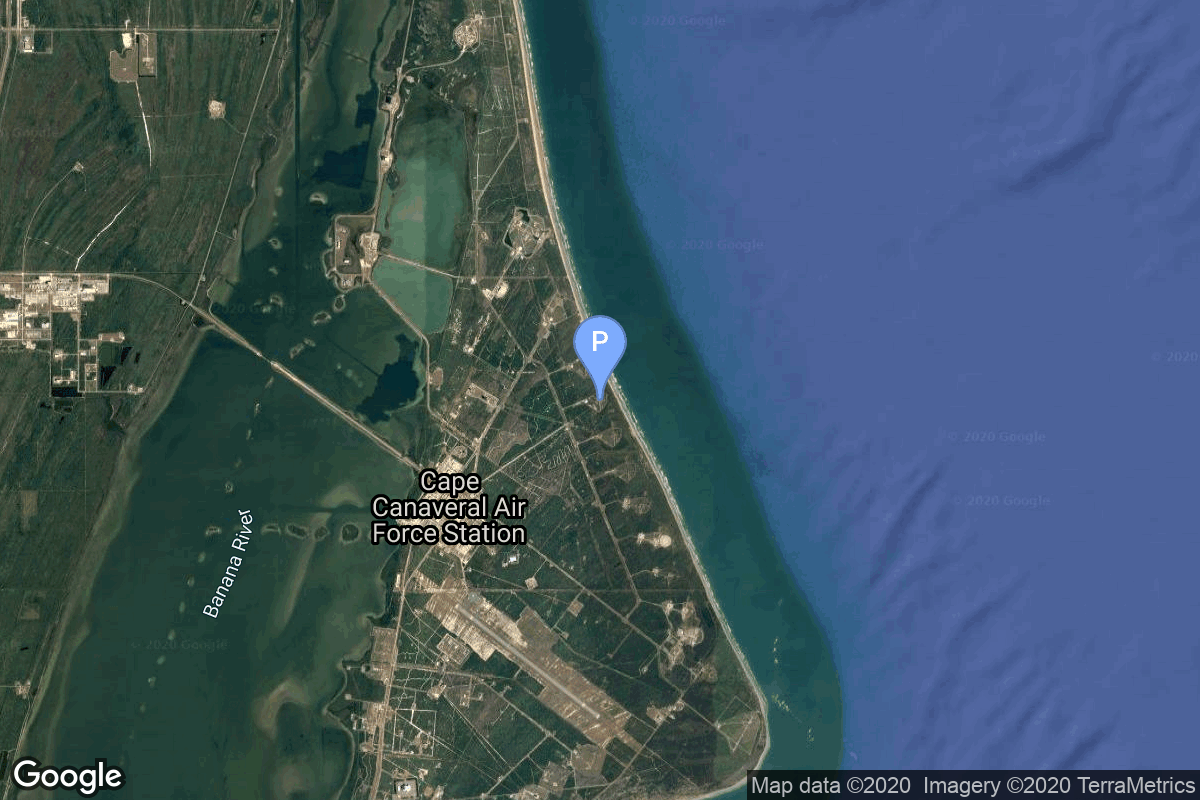
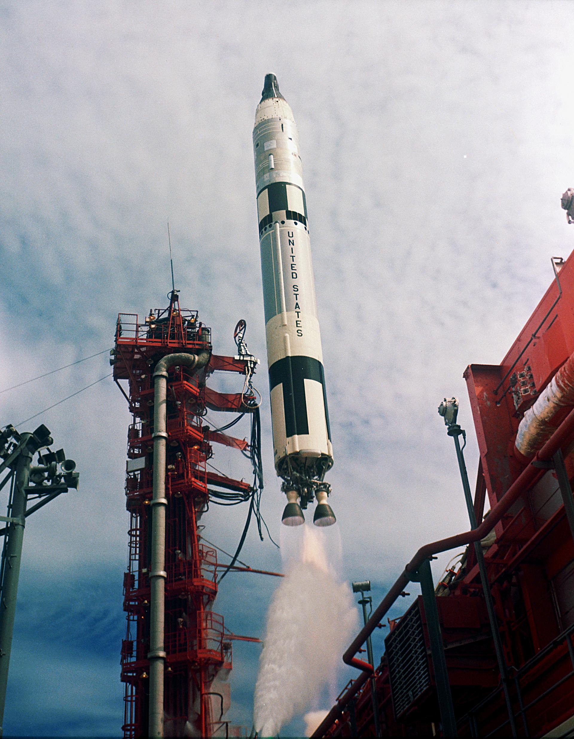
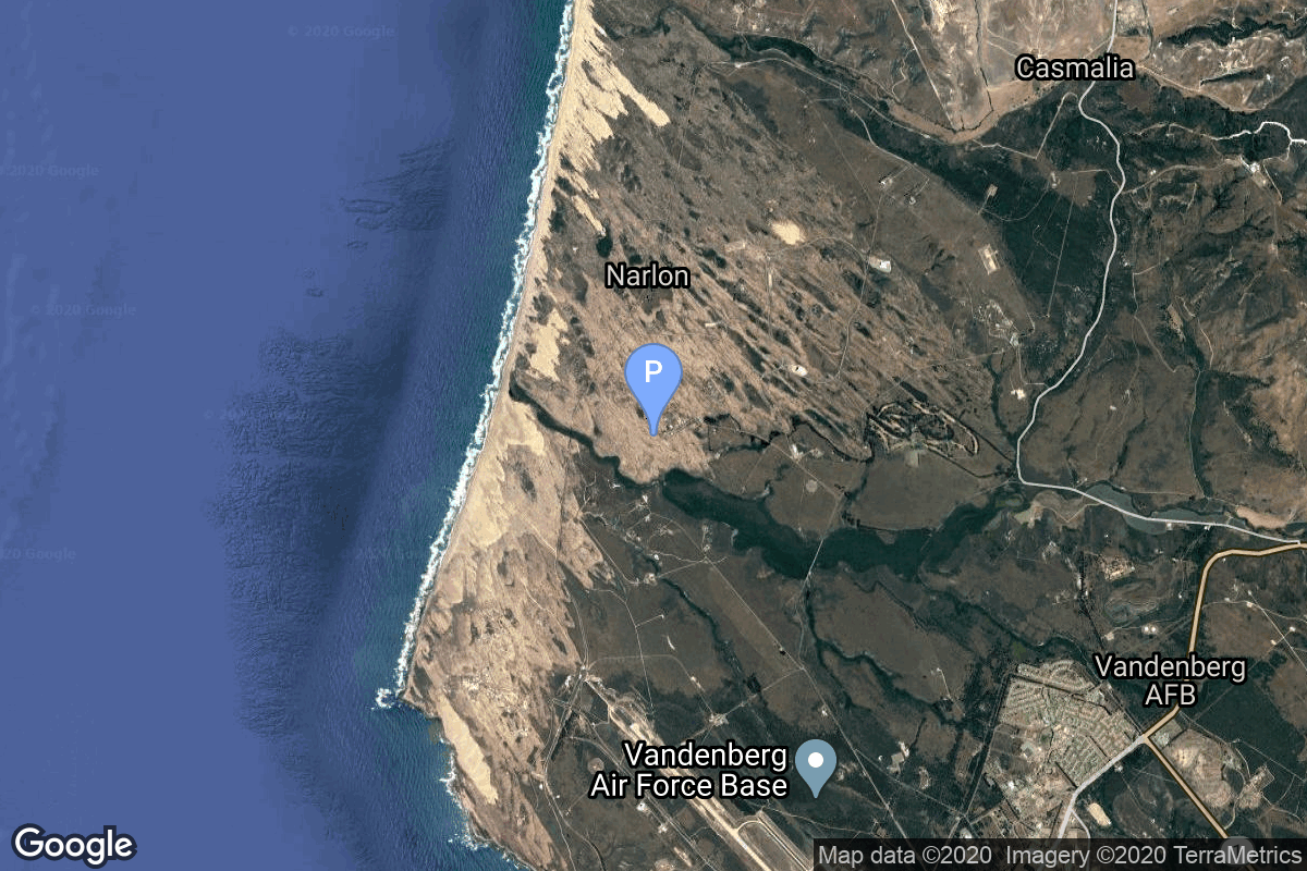
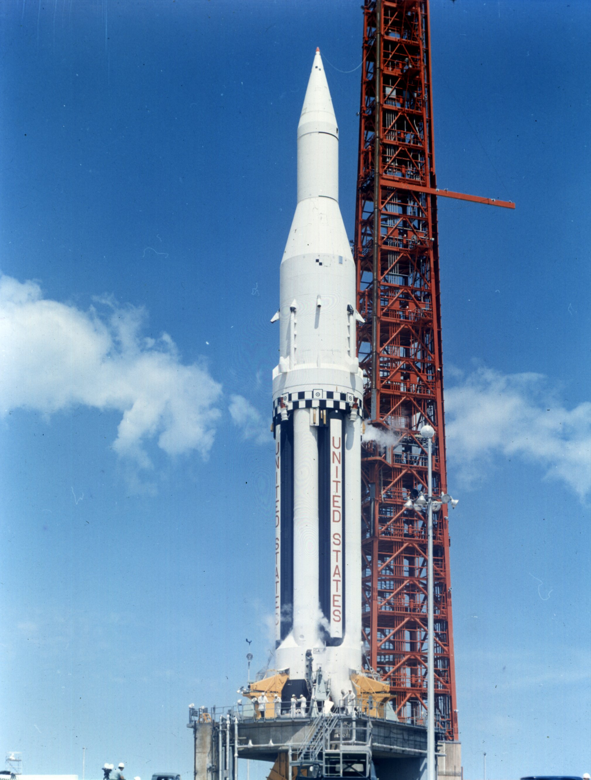
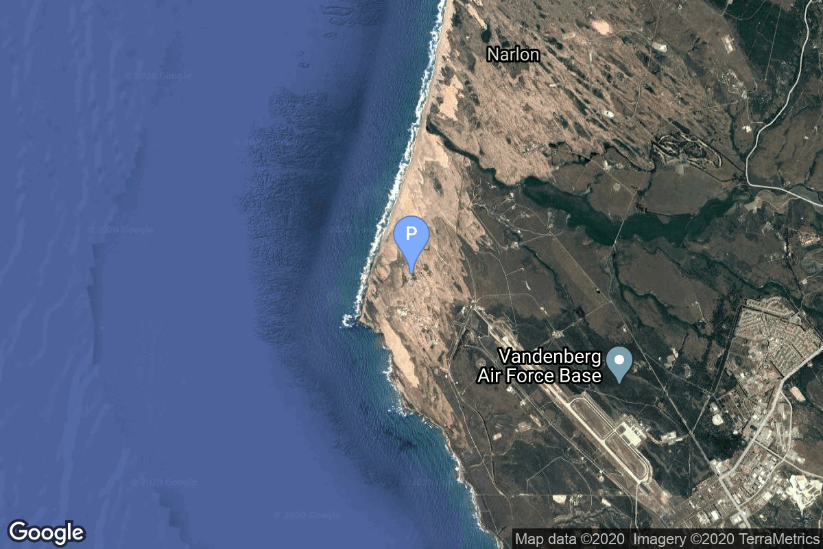
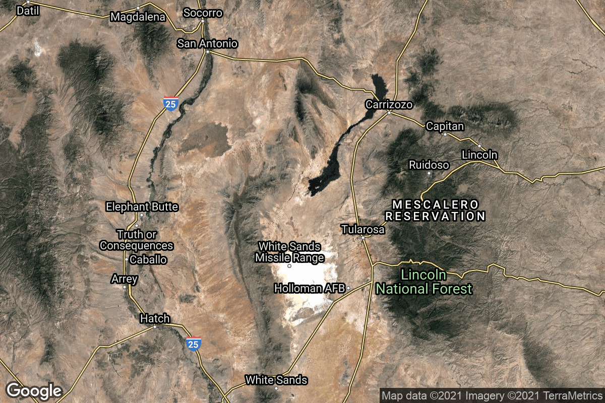
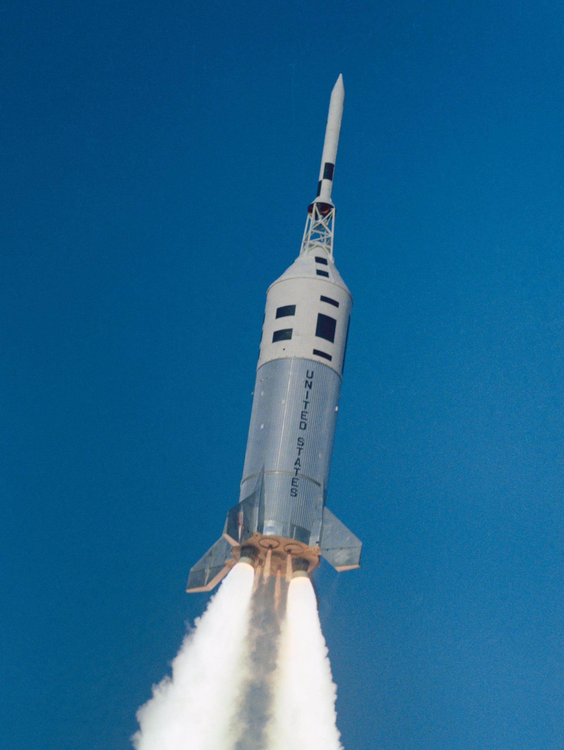
{ "count": 7501, "next": "https://ll.thespacedevs.com/2.0.0/launch/?format=api&limit=10&offset=7020&ordering=-net", "previous": "https://ll.thespacedevs.com/2.0.0/launch/?format=api&limit=10&offset=7000&ordering=-net", "results": [ { "id": "6202a9c0-c5be-4be3-bd55-bb924bf92b84", "url": "https://ll.thespacedevs.com/2.0.0/launch/6202a9c0-c5be-4be3-bd55-bb924bf92b84/?format=api", "launch_library_id": 1015, "slug": "titan-ii-glv-gemini-iv", "name": "Titan II GLV | Gemini IV", "status": { "id": 3, "name": "Success" }, "net": "1965-06-03T15:16:00Z", "window_end": "1965-06-03T15:16:00Z", "window_start": "1965-06-03T15:16:00Z", "inhold": false, "tbdtime": false, "tbddate": false, "probability": null, "holdreason": "", "failreason": "", "hashtag": null, "launch_service_provider": { "id": 44, "url": "https://ll.thespacedevs.com/2.0.0/agencies/44/?format=api", "name": "National Aeronautics and Space Administration", "type": "Government" }, "rocket": { "id": 202, "configuration": { "id": 98, "launch_library_id": 137, "url": "https://ll.thespacedevs.com/2.0.0/config/launcher/98/?format=api", "name": "Titan II", "family": "Titan", "full_name": "Titan II GLV", "variant": "GLV" } }, "mission": { "id": 180, "launch_library_id": 256, "name": "Gemini IV (Gemini 4)", "description": "Gemini 4 was the second crewed mission of the NASA's Project Gemini. The mission was commanded by Command Pilot James A. McDivitt and Pilot Edward H. White II. On the mission, White became the first American to perform a spacewalk. The mission began on June 3, 1965, 15:15:59 UTC and ended on June 7, 1965, 17:12:11 UTC.", "launch_designator": null, "type": "Human Exploration", "orbit": { "id": 8, "name": "Low Earth Orbit", "abbrev": "LEO" } }, "pad": { "id": 18, "url": "https://ll.thespacedevs.com/2.0.0/pad/18/?format=api", "agency_id": null, "name": "Launch Complex 19", "info_url": null, "wiki_url": "https://en.wikipedia.org/wiki/Cape_Canaveral_Air_Force_Station_Launch_Complex_19", "map_url": "https://www.google.com/maps?q=28.506898,-80.554169", "latitude": "28.506898", "longitude": "-80.554169", "location": { "id": 12, "url": "https://ll.thespacedevs.com/2.0.0/location/12/?format=api", "name": "Cape Canaveral SFS, FL, USA", "country_code": "USA", "map_image": "https://thespacedevs-prod.nyc3.digitaloceanspaces.com/media/map_images/location_12_20200803142519.jpg", "total_launch_count": 1023, "total_landing_count": 64 }, "map_image": "https://thespacedevs-prod.nyc3.digitaloceanspaces.com/media/map_images/pad_18_20200803143356.jpg", "total_launch_count": 12 }, "webcast_live": false, "image": "https://thespacedevs-prod.nyc3.digitaloceanspaces.com/media/images/titan2520ii_image_20190222030027.jpeg", "infographic": null, "program": [ { "id": 3, "url": "https://ll.thespacedevs.com/2.0.0/program/3/?format=api", "name": "Gemini", "description": "Project Gemini was NASA's second human spaceflight program. Conducted between projects Mercury and Apollo, Gemini started in 1961 and concluded in 1966.", "agencies": [ { "id": 44, "url": "https://ll.thespacedevs.com/2.0.0/agencies/44/?format=api", "name": "National Aeronautics and Space Administration", "type": "Government" } ], "image_url": "https://thespacedevs-prod.nyc3.digitaloceanspaces.com/media/images/project2520gem_program_20200820195350.png", "start_date": "1961-12-07T00:00:00Z", "end_date": "1966-11-15T19:21:04Z", "info_url": "https://www.nasa.gov/mission_pages/gemini/index.html", "wiki_url": "https://en.wikipedia.org/wiki/Project_Gemini" } ] }, { "id": "d0a77912-bcaf-4aaa-af7c-4f8e0843bf52", "url": "https://ll.thespacedevs.com/2.0.0/launch/d0a77912-bcaf-4aaa-af7c-4f8e0843bf52/?format=api", "launch_library_id": null, "slug": "thor-delta-c-explorer-28", "name": "Thor Delta C | Explorer 28", "status": { "id": 3, "name": "Success" }, "net": "1965-05-29T12:00:00Z", "window_end": "1965-05-29T12:00:00Z", "window_start": "1965-05-29T12:00:00Z", "inhold": false, "tbdtime": false, "tbddate": false, "probability": null, "holdreason": "", "failreason": null, "hashtag": null, "launch_service_provider": { "id": 161, "url": "https://ll.thespacedevs.com/2.0.0/agencies/161/?format=api", "name": "United States Air Force", "type": "Government" }, "rocket": { "id": 3402, "configuration": { "id": 401, "launch_library_id": null, "url": "https://ll.thespacedevs.com/2.0.0/config/launcher/401/?format=api", "name": "Thor Delta C", "family": "Thor", "full_name": "Thor Delta C", "variant": "Delta C" } }, "mission": { "id": 1822, "launch_library_id": null, "name": "Explorer 28", "description": "Explorer 28 (IMP 3) was a solar-cell and chemical-battery powered spacecraft instrumented for interplanetary and distant magnetospheric studies of energetic particles, cosmic rays, magnetic fields, and plasmas.", "launch_designator": null, "type": "Astrophysics", "orbit": { "id": 0, "name": "Elliptical Orbit", "abbrev": "Elliptical" } }, "pad": { "id": 1, "url": "https://ll.thespacedevs.com/2.0.0/pad/1/?format=api", "agency_id": null, "name": "Space Launch Complex 17B", "info_url": null, "wiki_url": "https://en.wikipedia.org/wiki/Cape_Canaveral_Space_Launch_Complex_17", "map_url": "https://www.google.com/maps?q=28.4458,-80.5657", "latitude": "28.4458", "longitude": "-80.5657", "location": { "id": 12, "url": "https://ll.thespacedevs.com/2.0.0/location/12/?format=api", "name": "Cape Canaveral SFS, FL, USA", "country_code": "USA", "map_image": "https://thespacedevs-prod.nyc3.digitaloceanspaces.com/media/map_images/location_12_20200803142519.jpg", "total_launch_count": 1023, "total_landing_count": 64 }, "map_image": "https://thespacedevs-prod.nyc3.digitaloceanspaces.com/media/map_images/pad_1_20200803143208.jpg", "total_launch_count": 132 }, "webcast_live": false, "image": null, "infographic": null, "program": [] }, { "id": "dd9d41dc-675d-4dec-9f3a-1dcef46f45b4", "url": "https://ll.thespacedevs.com/2.0.0/launch/dd9d41dc-675d-4dec-9f3a-1dcef46f45b4/?format=api", "launch_library_id": null, "slug": "atlas-d-ov1-3", "name": "Atlas D | OV1-3", "status": { "id": 4, "name": "Failure" }, "net": "1965-05-28T02:54:56Z", "window_end": "1965-05-28T02:54:56Z", "window_start": "1965-05-28T02:54:56Z", "inhold": false, "tbdtime": false, "tbddate": false, "probability": null, "holdreason": "", "failreason": null, "hashtag": null, "launch_service_provider": { "id": 161, "url": "https://ll.thespacedevs.com/2.0.0/agencies/161/?format=api", "name": "United States Air Force", "type": "Government" }, "rocket": { "id": 3401, "configuration": { "id": 237, "launch_library_id": null, "url": "https://ll.thespacedevs.com/2.0.0/config/launcher/237/?format=api", "name": "Atlas D", "family": "Atlas", "full_name": "SM-65D Atlas", "variant": "D" } }, "mission": { "id": 1821, "launch_library_id": null, "name": "OV1-3", "description": "The OV1 (Orbiting Vehicle 1) were small research satellite to be launched piggy back on Atlas ICBM test flights. They consisted in general of the OV1 satellite and the OV1-PM propulsion module (or upper stage) to reach orbit.", "launch_designator": null, "type": "Test Flight", "orbit": { "id": 8, "name": "Low Earth Orbit", "abbrev": "LEO" } }, "pad": { "id": 170, "url": "https://ll.thespacedevs.com/2.0.0/pad/170/?format=api", "agency_id": null, "name": "576B3", "info_url": null, "wiki_url": "https://en.wikipedia.org/wiki/List_of_Vandenberg_Air_Force_Base_launch_facilities", "map_url": "https://www.google.com/maps?q=34.7897222,-120.5980273", "latitude": "34.7897222", "longitude": "-120.5980273", "location": { "id": 11, "url": "https://ll.thespacedevs.com/2.0.0/location/11/?format=api", "name": "Vandenberg SFB, CA, USA", "country_code": "USA", "map_image": "https://thespacedevs-prod.nyc3.digitaloceanspaces.com/media/map_images/location_11_20200803142416.jpg", "total_launch_count": 806, "total_landing_count": 26 }, "map_image": "https://thespacedevs-prod.nyc3.digitaloceanspaces.com/media/map_images/pad_170_20200803143421.jpg", "total_launch_count": 7 }, "webcast_live": false, "image": null, "infographic": null, "program": [] }, { "id": "6c924ebf-9d27-4c23-9993-98d9f30ae551", "url": "https://ll.thespacedevs.com/2.0.0/launch/6c924ebf-9d27-4c23-9993-98d9f30ae551/?format=api", "launch_library_id": null, "slug": "atlas-slv-3-agena-d-kh-7-18", "name": "Atlas SLV-3 Agena D | KH-7 18", "status": { "id": 3, "name": "Success" }, "net": "1965-05-27T20:48:00Z", "window_end": "1965-05-27T20:48:00Z", "window_start": "1965-05-27T20:48:00Z", "inhold": false, "tbdtime": false, "tbddate": false, "probability": null, "holdreason": "", "failreason": null, "hashtag": null, "launch_service_provider": { "id": 161, "url": "https://ll.thespacedevs.com/2.0.0/agencies/161/?format=api", "name": "United States Air Force", "type": "Government" }, "rocket": { "id": 3400, "configuration": { "id": 258, "launch_library_id": null, "url": "https://ll.thespacedevs.com/2.0.0/config/launcher/258/?format=api", "name": "Atlas SLV-3 Agena D", "family": "Atlas", "full_name": "Atlas SLV-3 Agena D", "variant": "SLV-3 Agena D" } }, "mission": { "id": 1820, "launch_library_id": null, "name": "KH-7 18", "description": "The Program 206 satellite, carrying the KH-7 (Keyhole 7) camera system (codenamed Gambit-1), was the first successful high resolution space reconnaissance program. It was managed by NRO's Program A, the USAF-led segment of the National Reconnaissance Program managed from Los Angeles AFB in El Segundo, California.", "launch_designator": null, "type": "Government/Top Secret", "orbit": { "id": 17, "name": "Sun-Synchronous Orbit", "abbrev": "SSO" } }, "pad": { "id": 16, "url": "https://ll.thespacedevs.com/2.0.0/pad/16/?format=api", "agency_id": null, "name": "Space Launch Complex 4E", "info_url": null, "wiki_url": "https://en.wikipedia.org/wiki/Vandenberg_Space_Launch_Complex_4#SLC-4E", "map_url": "https://www.google.com/maps?q=34.632,-120.611", "latitude": "34.632", "longitude": "-120.611", "location": { "id": 11, "url": "https://ll.thespacedevs.com/2.0.0/location/11/?format=api", "name": "Vandenberg SFB, CA, USA", "country_code": "USA", "map_image": "https://thespacedevs-prod.nyc3.digitaloceanspaces.com/media/map_images/location_11_20200803142416.jpg", "total_launch_count": 806, "total_landing_count": 26 }, "map_image": "https://thespacedevs-prod.nyc3.digitaloceanspaces.com/media/map_images/pad_16_20200803143532.jpg", "total_launch_count": 192 }, "webcast_live": false, "image": null, "infographic": null, "program": [] }, { "id": "1e6d7cd2-dd6f-41bb-ace9-95ea96dadd10", "url": "https://ll.thespacedevs.com/2.0.0/launch/1e6d7cd2-dd6f-41bb-ace9-95ea96dadd10/?format=api", "launch_library_id": null, "slug": "voskhod-zenit-4-7", "name": "Voskhod | Zenit-4 7", "status": { "id": 3, "name": "Success" }, "net": "1965-05-25T10:50:00Z", "window_end": "1965-05-25T10:50:00Z", "window_start": "1965-05-25T10:50:00Z", "inhold": false, "tbdtime": false, "tbddate": false, "probability": null, "holdreason": "", "failreason": null, "hashtag": null, "launch_service_provider": { "id": 66, "url": "https://ll.thespacedevs.com/2.0.0/agencies/66/?format=api", "name": "Soviet Space Program", "type": "Government" }, "rocket": { "id": 3399, "configuration": { "id": 104, "launch_library_id": 138, "url": "https://ll.thespacedevs.com/2.0.0/config/launcher/104/?format=api", "name": "Voskhod", "family": "R-7", "full_name": "Voskhod", "variant": "Voskhod" } }, "mission": { "id": 1819, "launch_library_id": null, "name": "Zenit-4 7", "description": "Zenit-4 film-return reconnaissance satellite.", "launch_designator": null, "type": "Government/Top Secret", "orbit": { "id": 8, "name": "Low Earth Orbit", "abbrev": "LEO" } }, "pad": { "id": 20, "url": "https://ll.thespacedevs.com/2.0.0/pad/20/?format=api", "agency_id": null, "name": "31/6", "info_url": null, "wiki_url": "https://en.wikipedia.org/wiki/Baikonur_Cosmodrome_Site_31", "map_url": "https://www.google.com/maps?q=45.996034,63.564003", "latitude": "45.996034", "longitude": "63.564003", "location": { "id": 15, "url": "https://ll.thespacedevs.com/2.0.0/location/15/?format=api", "name": "Baikonur Cosmodrome, Republic of Kazakhstan", "country_code": "KAZ", "map_image": "https://thespacedevs-prod.nyc3.digitaloceanspaces.com/media/map_images/location_15_20200803142517.jpg", "total_launch_count": 1555, "total_landing_count": 0 }, "map_image": "https://thespacedevs-prod.nyc3.digitaloceanspaces.com/media/map_images/pad_20_20200803143516.jpg", "total_launch_count": 422 }, "webcast_live": false, "image": null, "infographic": null, "program": [] }, { "id": "a773fc75-9626-4df0-99c1-abfc5c0a21a0", "url": "https://ll.thespacedevs.com/2.0.0/launch/a773fc75-9626-4df0-99c1-abfc5c0a21a0/?format=api", "launch_library_id": null, "slug": "saturn-i-pegasus-2", "name": "Saturn I | Pegasus 2", "status": { "id": 3, "name": "Success" }, "net": "1965-05-25T07:35:01Z", "window_end": "1965-05-25T07:35:01Z", "window_start": "1965-05-25T07:35:01Z", "inhold": false, "tbdtime": false, "tbddate": false, "probability": null, "holdreason": "", "failreason": "", "hashtag": null, "launch_service_provider": { "id": 44, "url": "https://ll.thespacedevs.com/2.0.0/agencies/44/?format=api", "name": "National Aeronautics and Space Administration", "type": "Government" }, "rocket": { "id": 3398, "configuration": { "id": 355, "launch_library_id": null, "url": "https://ll.thespacedevs.com/2.0.0/config/launcher/355/?format=api", "name": "Saturn I", "family": "Saturn", "full_name": "Saturn I", "variant": "I" } }, "mission": { "id": 1818, "launch_library_id": null, "name": "Pegasus 2", "description": "The mission of the Pegasus spacecraft was to measure meteoroid abundances in the region near the earth.", "launch_designator": null, "type": "Earth Science", "orbit": { "id": 8, "name": "Low Earth Orbit", "abbrev": "LEO" } }, "pad": { "id": 38, "url": "https://ll.thespacedevs.com/2.0.0/pad/38/?format=api", "agency_id": null, "name": "Space Launch Complex 37B", "info_url": null, "wiki_url": "https://en.wikipedia.org/wiki/Cape_Canaveral_Air_Force_Station_Space_Launch_Complex_37", "map_url": "https://www.google.com/maps?q=28.5317,-80.56495", "latitude": "28.5317", "longitude": "-80.56495", "location": { "id": 12, "url": "https://ll.thespacedevs.com/2.0.0/location/12/?format=api", "name": "Cape Canaveral SFS, FL, USA", "country_code": "USA", "map_image": "https://thespacedevs-prod.nyc3.digitaloceanspaces.com/media/map_images/location_12_20200803142519.jpg", "total_launch_count": 1023, "total_landing_count": 64 }, "map_image": "https://thespacedevs-prod.nyc3.digitaloceanspaces.com/media/map_images/pad_38_20200803143515.jpg", "total_launch_count": 40 }, "webcast_live": false, "image": "https://thespacedevs-prod.nyc3.digitaloceanspaces.com/media/images/saturn_1_on_lc-_image_20240411095856.jpeg", "infographic": null, "program": [ { "id": 4, "url": "https://ll.thespacedevs.com/2.0.0/program/4/?format=api", "name": "Apollo", "description": "The Apollo program was the third United States human spaceflight program carried out by the National Aeronautics and Space Administration (NASA), which succeeded in landing the first humans on the Moon from 1969 to 1972.", "agencies": [ { "id": 44, "url": "https://ll.thespacedevs.com/2.0.0/agencies/44/?format=api", "name": "National Aeronautics and Space Administration", "type": "Government" } ], "image_url": "https://thespacedevs-prod.nyc3.digitaloceanspaces.com/media/images/apollo_program_20200820200202.png", "start_date": "1966-11-16T00:00:00Z", "end_date": "1972-12-19T19:24:59Z", "info_url": "https://www.nasa.gov/mission_pages/apollo/index.html", "wiki_url": "https://en.wikipedia.org/wiki/Apollo_program" } ] }, { "id": "db894d0a-573f-42d5-a7ba-62ce243ec2dc", "url": "https://ll.thespacedevs.com/2.0.0/launch/db894d0a-573f-42d5-a7ba-62ce243ec2dc/?format=api", "launch_library_id": null, "slug": "atlas-d-fire-2", "name": "Atlas D | FIRE 2", "status": { "id": 3, "name": "Success" }, "net": "1965-05-22T21:55:00Z", "window_end": "1965-05-22T21:55:00Z", "window_start": "1965-05-22T21:55:00Z", "inhold": false, "tbdtime": false, "tbddate": false, "probability": null, "holdreason": "", "failreason": null, "hashtag": null, "launch_service_provider": { "id": 161, "url": "https://ll.thespacedevs.com/2.0.0/agencies/161/?format=api", "name": "United States Air Force", "type": "Government" }, "rocket": { "id": 3397, "configuration": { "id": 237, "launch_library_id": null, "url": "https://ll.thespacedevs.com/2.0.0/config/launcher/237/?format=api", "name": "Atlas D", "family": "Atlas", "full_name": "SM-65D Atlas", "variant": "D" } }, "mission": { "id": 1817, "launch_library_id": null, "name": "FIRE 2", "description": "FIRE (Flight Investigation of Re-Entry) was a high-speed reentry heat research program to obtain data on materials, heating rates, and radio signal attenuation on spacecraft reentering the atmosphere at speeds of about 24,500 miles per hour.", "launch_designator": null, "type": "Materials Science", "orbit": { "id": 15, "name": "Suborbital", "abbrev": "Sub" } }, "pad": { "id": 99, "url": "https://ll.thespacedevs.com/2.0.0/pad/99/?format=api", "agency_id": 161, "name": "Launch Complex 12", "info_url": null, "wiki_url": "https://en.wikipedia.org/wiki/Cape_Canaveral_Air_Force_Station_Launch_Complex_12", "map_url": "https://www.google.com/maps?q=28.480607,-80.541938", "latitude": "28.480607", "longitude": "-80.541938", "location": { "id": 12, "url": "https://ll.thespacedevs.com/2.0.0/location/12/?format=api", "name": "Cape Canaveral SFS, FL, USA", "country_code": "USA", "map_image": "https://thespacedevs-prod.nyc3.digitaloceanspaces.com/media/map_images/location_12_20200803142519.jpg", "total_launch_count": 1023, "total_landing_count": 64 }, "map_image": "https://thespacedevs-prod.nyc3.digitaloceanspaces.com/media/map_images/pad_99_20200803143435.jpg", "total_launch_count": 23 }, "webcast_live": false, "image": null, "infographic": null, "program": [] }, { "id": "e8d38045-a048-426d-b47b-fb7d09ce4dfe", "url": "https://ll.thespacedevs.com/2.0.0/launch/e8d38045-a048-426d-b47b-fb7d09ce4dfe/?format=api", "launch_library_id": null, "slug": "thor-burner-1-ops-8386", "name": "Thor Burner 1 | OPS 8386", "status": { "id": 3, "name": "Success" }, "net": "1965-05-20T16:30:53Z", "window_end": "1965-05-20T16:30:53Z", "window_start": "1965-05-20T16:30:53Z", "inhold": false, "tbdtime": false, "tbddate": false, "probability": null, "holdreason": "", "failreason": null, "hashtag": null, "launch_service_provider": { "id": 161, "url": "https://ll.thespacedevs.com/2.0.0/agencies/161/?format=api", "name": "United States Air Force", "type": "Government" }, "rocket": { "id": 3396, "configuration": { "id": 394, "launch_library_id": null, "url": "https://ll.thespacedevs.com/2.0.0/config/launcher/394/?format=api", "name": "Thor Burner 1", "family": "Thor", "full_name": "Thor Burner 1", "variant": "Burner 1" } }, "mission": { "id": 1816, "launch_library_id": null, "name": "OPS 8386", "description": "The single DSAP-3 (Defense Satellite Application Program Block 3) was a modified DSAP-2 satellite to provide experimental tactical access to weather data.", "launch_designator": null, "type": "Government/Top Secret", "orbit": { "id": 17, "name": "Sun-Synchronous Orbit", "abbrev": "SSO" } }, "pad": { "id": 171, "url": "https://ll.thespacedevs.com/2.0.0/pad/171/?format=api", "agency_id": null, "name": "Space Launch Complex 10W", "info_url": null, "wiki_url": "https://en.wikipedia.org/wiki/Vandenberg_Air_Force_Base_Space_Launch_Complex_10", "map_url": "https://www.google.com/maps?q=34.7652778,-120.6244162", "latitude": "34.7652778", "longitude": "-120.6244162", "location": { "id": 11, "url": "https://ll.thespacedevs.com/2.0.0/location/11/?format=api", "name": "Vandenberg SFB, CA, USA", "country_code": "USA", "map_image": "https://thespacedevs-prod.nyc3.digitaloceanspaces.com/media/map_images/location_11_20200803142416.jpg", "total_launch_count": 806, "total_landing_count": 26 }, "map_image": "https://thespacedevs-prod.nyc3.digitaloceanspaces.com/media/map_images/pad_171_20200803143449.jpg", "total_launch_count": 31 }, "webcast_live": false, "image": null, "infographic": null, "program": [] }, { "id": "80ae0917-1291-4128-9ed8-c5d4c24a0392", "url": "https://ll.thespacedevs.com/2.0.0/launch/80ae0917-1291-4128-9ed8-c5d4c24a0392/?format=api", "launch_library_id": null, "slug": "little-joe-ii-a-003", "name": "Little Joe II | A-003", "status": { "id": 4, "name": "Failure" }, "net": "1965-05-19T13:01:04Z", "window_end": "1965-05-19T13:01:04Z", "window_start": "1965-05-19T13:01:04Z", "inhold": false, "tbdtime": false, "tbddate": false, "probability": null, "holdreason": "", "failreason": "", "hashtag": null, "launch_service_provider": { "id": 44, "url": "https://ll.thespacedevs.com/2.0.0/agencies/44/?format=api", "name": "National Aeronautics and Space Administration", "type": "Government" }, "rocket": { "id": 7426, "configuration": { "id": 470, "launch_library_id": null, "url": "https://ll.thespacedevs.com/2.0.0/config/launcher/470/?format=api", "name": "Little Joe II", "family": "Little Joe", "full_name": "Little Joe II", "variant": "II" } }, "mission": { "id": 5815, "launch_library_id": null, "name": "A-003", "description": "A-003 was the fourth abort test of the Apollo spacecraft. This particular flight is notable because during the abort test flight, an actual abort situation occurred, and further proved the Apollo launch escape system (LES). The CM was successfully pulled away from the malfunctioning Little Joe booster and it landed safely under parachutes.", "launch_designator": null, "type": "Test Flight", "orbit": { "id": 15, "name": "Suborbital", "abbrev": "Sub" } }, "pad": { "id": 194, "url": "https://ll.thespacedevs.com/2.0.0/pad/194/?format=api", "agency_id": 165, "name": "Launch Complex 36", "info_url": null, "wiki_url": "https://en.wikipedia.org/wiki/White_Sands_Launch_Complex_36", "map_url": "https://www.google.com/maps?q=32.416944,-106.321944", "latitude": "32.416944", "longitude": "-106.321944", "location": { "id": 155, "url": "https://ll.thespacedevs.com/2.0.0/location/155/?format=api", "name": "White Sands Missile Range", "country_code": "USA", "map_image": "https://thespacedevs-prod.nyc3.digitaloceanspaces.com/media/map_images/location_white_sands_missile_range_20210901072636.jpg", "total_launch_count": 5, "total_landing_count": 0 }, "map_image": "https://thespacedevs-prod.nyc3.digitaloceanspaces.com/media/map_images/pad_launch_complex_36_20210901072730.jpg", "total_launch_count": 5 }, "webcast_live": false, "image": "https://thespacedevs-prod.nyc3.digitaloceanspaces.com/media/images/little_joe_ii_image_20210901072351.jpeg", "infographic": null, "program": [ { "id": 4, "url": "https://ll.thespacedevs.com/2.0.0/program/4/?format=api", "name": "Apollo", "description": "The Apollo program was the third United States human spaceflight program carried out by the National Aeronautics and Space Administration (NASA), which succeeded in landing the first humans on the Moon from 1969 to 1972.", "agencies": [ { "id": 44, "url": "https://ll.thespacedevs.com/2.0.0/agencies/44/?format=api", "name": "National Aeronautics and Space Administration", "type": "Government" } ], "image_url": "https://thespacedevs-prod.nyc3.digitaloceanspaces.com/media/images/apollo_program_20200820200202.png", "start_date": "1966-11-16T00:00:00Z", "end_date": "1972-12-19T19:24:59Z", "info_url": "https://www.nasa.gov/mission_pages/apollo/index.html", "wiki_url": "https://en.wikipedia.org/wiki/Apollo_program" } ] }, { "id": "a292a76a-0221-496d-a385-91b08d9b9530", "url": "https://ll.thespacedevs.com/2.0.0/launch/a292a76a-0221-496d-a385-91b08d9b9530/?format=api", "launch_library_id": null, "slug": "thor-slv-2a-agena-d-kh-4a-20", "name": "Thor SLV-2A Agena D | KH-4A 20", "status": { "id": 3, "name": "Success" }, "net": "1965-05-18T18:02:18Z", "window_end": "1965-05-18T18:02:18Z", "window_start": "1965-05-18T18:02:18Z", "inhold": false, "tbdtime": false, "tbddate": false, "probability": null, "holdreason": "", "failreason": null, "hashtag": null, "launch_service_provider": { "id": 161, "url": "https://ll.thespacedevs.com/2.0.0/agencies/161/?format=api", "name": "United States Air Force", "type": "Government" }, "rocket": { "id": 3395, "configuration": { "id": 417, "launch_library_id": null, "url": "https://ll.thespacedevs.com/2.0.0/config/launcher/417/?format=api", "name": "Thor SLV-2A Agena D", "family": "Thor", "full_name": "Thor SLV-2A Agena D", "variant": "SLV-2A Agena D" } }, "mission": { "id": 1815, "launch_library_id": null, "name": "KH-4A 20", "description": "The KH-4A (Keyhole-4A) was the fifth optical reconnaissance satellite version in the Corona-program.", "launch_designator": null, "type": "Government/Top Secret", "orbit": { "id": 8, "name": "Low Earth Orbit", "abbrev": "LEO" } }, "pad": { "id": 95, "url": "https://ll.thespacedevs.com/2.0.0/pad/95/?format=api", "agency_id": 161, "name": "Space Launch Complex 1W", "info_url": null, "wiki_url": "https://en.wikipedia.org/wiki/Vandenberg_Space_Launch_Complex_1", "map_url": "https://www.google.com/maps?q=34.7572,-120.6303", "latitude": "34.7572", "longitude": "-120.6303", "location": { "id": 11, "url": "https://ll.thespacedevs.com/2.0.0/location/11/?format=api", "name": "Vandenberg SFB, CA, USA", "country_code": "USA", "map_image": "https://thespacedevs-prod.nyc3.digitaloceanspaces.com/media/map_images/location_11_20200803142416.jpg", "total_launch_count": 806, "total_landing_count": 26 }, "map_image": "https://thespacedevs-prod.nyc3.digitaloceanspaces.com/media/map_images/pad_95_20200803143209.jpg", "total_launch_count": 56 }, "webcast_live": false, "image": null, "infographic": null, "program": [] } ] }