Launch List
API endpoint that returns all Launch objects or a single launch.
EXAMPLE - /launch/
GET: Return a list of all Launch objects.
FILTERS: Fields - 'name', 'id(s)', 'lsp_id', 'lsp_name', 'serial_number', 'launcher_config__id', 'rocket__spacecraftflight__spacecraft__name'
MODE: 'normal', 'list', 'detailed' EXAMPLE: ?mode=list
SEARCH: Searches through the launch name, rocket name, launch agency, mission name & spacecraft name. EXAMPLE - ?search=SpaceX
GET /2.0.0/launch/?format=api&offset=6990&ordering=name
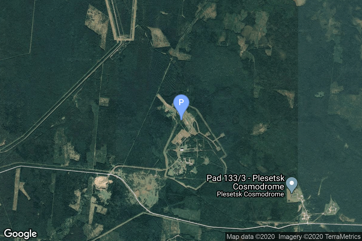
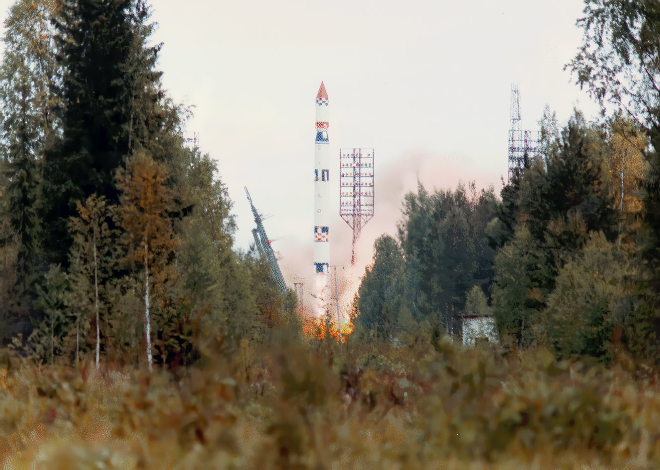
{ "count": 7794, "next": "https://ll.thespacedevs.com/2.0.0/launch/?format=api&limit=10&offset=7000&ordering=name", "previous": "https://ll.thespacedevs.com/2.0.0/launch/?format=api&limit=10&offset=6980&ordering=name", "results": [ { "id": "d2af3b05-7db9-41d2-b9d2-1f5f24cd9068", "url": "https://ll.thespacedevs.com/2.0.0/launch/d2af3b05-7db9-41d2-b9d2-1f5f24cd9068/?format=api", "launch_library_id": null, "slug": "tsiklon-3-auos-z-ap-ik-1", "name": "Tsiklon-3 | AUOS-Z-AP-IK 1", "status": { "id": 3, "name": "Success" }, "net": "1991-12-18T03:54:00Z", "window_end": "1991-12-18T03:54:00Z", "window_start": "1991-12-18T03:54:00Z", "inhold": false, "tbdtime": false, "tbddate": false, "probability": null, "holdreason": "", "failreason": null, "hashtag": null, "launch_service_provider": { "id": 66, "url": "https://ll.thespacedevs.com/2.0.0/agencies/66/?format=api", "name": "Soviet Space Program", "type": "Government" }, "rocket": { "id": 6413, "configuration": { "id": 445, "launch_library_id": null, "url": "https://ll.thespacedevs.com/2.0.0/config/launcher/445/?format=api", "name": "Tsiklon-3", "family": "Tsiklon", "full_name": "Tsiklon-3", "variant": "3" } }, "mission": { "id": 4803, "launch_library_id": null, "name": "AUOS-Z-AP-IK 1", "description": "Scientific satellite dedicated to the ionosphere and magnetosphere", "launch_designator": null, "type": "Earth Science", "orbit": { "id": 0, "name": "Elliptical Orbit", "abbrev": "Elliptical" } }, "pad": { "id": 127, "url": "https://ll.thespacedevs.com/2.0.0/pad/127/?format=api", "agency_id": 63, "name": "32/2", "info_url": null, "wiki_url": "https://en.wikipedia.org/wiki/Plesetsk_Cosmodrome_Site_32", "map_url": "https://www.google.com/maps?q=62.9063889,40.7844727", "latitude": "62.9063889", "longitude": "40.7844727", "location": { "id": 6, "url": "https://ll.thespacedevs.com/2.0.0/location/6/?format=api", "name": "Plesetsk Cosmodrome, Russian Federation", "country_code": "RUS", "map_image": "https://thespacedevs-prod.nyc3.digitaloceanspaces.com/media/map_images/location_6_20200803142434.jpg", "total_launch_count": 1681, "total_landing_count": 0 }, "map_image": "https://thespacedevs-prod.nyc3.digitaloceanspaces.com/media/map_images/pad_127_20200803143245.jpg", "total_launch_count": 65 }, "webcast_live": false, "image": "https://thespacedevs-prod.nyc3.digitaloceanspaces.com/media/images/tsyklon-3_launc_image_20251112153513.png", "infographic": null, "program": [] }, { "id": "0d0b188d-5a8a-48e8-9cef-469ef7e42b68", "url": "https://ll.thespacedevs.com/2.0.0/launch/0d0b188d-5a8a-48e8-9cef-469ef7e42b68/?format=api", "launch_library_id": null, "slug": "tsiklon-3-auos-z-av-ik-1", "name": "Tsiklon-3 | AUOS-Z-AV-IK 1", "status": { "id": 3, "name": "Success" }, "net": "1989-09-28T00:04:59Z", "window_end": "1989-09-28T00:04:59Z", "window_start": "1989-09-28T00:04:59Z", "inhold": false, "tbdtime": false, "tbddate": false, "probability": null, "holdreason": "", "failreason": null, "hashtag": null, "launch_service_provider": { "id": 66, "url": "https://ll.thespacedevs.com/2.0.0/agencies/66/?format=api", "name": "Soviet Space Program", "type": "Government" }, "rocket": { "id": 6213, "configuration": { "id": 445, "launch_library_id": null, "url": "https://ll.thespacedevs.com/2.0.0/config/launcher/445/?format=api", "name": "Tsiklon-3", "family": "Tsiklon", "full_name": "Tsiklon-3", "variant": "3" } }, "mission": { "id": 4603, "launch_library_id": null, "name": "AUOS-Z-AV-IK 1", "description": "Scientific satellite studying the radiation properties of loop antennas in a plasma environment", "launch_designator": null, "type": "Materials Science", "orbit": { "id": 0, "name": "Elliptical Orbit", "abbrev": "Elliptical" } }, "pad": { "id": 127, "url": "https://ll.thespacedevs.com/2.0.0/pad/127/?format=api", "agency_id": 63, "name": "32/2", "info_url": null, "wiki_url": "https://en.wikipedia.org/wiki/Plesetsk_Cosmodrome_Site_32", "map_url": "https://www.google.com/maps?q=62.9063889,40.7844727", "latitude": "62.9063889", "longitude": "40.7844727", "location": { "id": 6, "url": "https://ll.thespacedevs.com/2.0.0/location/6/?format=api", "name": "Plesetsk Cosmodrome, Russian Federation", "country_code": "RUS", "map_image": "https://thespacedevs-prod.nyc3.digitaloceanspaces.com/media/map_images/location_6_20200803142434.jpg", "total_launch_count": 1681, "total_landing_count": 0 }, "map_image": "https://thespacedevs-prod.nyc3.digitaloceanspaces.com/media/map_images/pad_127_20200803143245.jpg", "total_launch_count": 65 }, "webcast_live": false, "image": "https://thespacedevs-prod.nyc3.digitaloceanspaces.com/media/images/tsyklon-3_launc_image_20251112153513.png", "infographic": null, "program": [] }, { "id": "2bfa019d-3ad8-4ab3-9167-2c3a4b97d2fe", "url": "https://ll.thespacedevs.com/2.0.0/launch/2bfa019d-3ad8-4ab3-9167-2c3a4b97d2fe/?format=api", "launch_library_id": null, "slug": "tsiklon-3-aureole-3", "name": "Tsiklon-3 | Aureole 3", "status": { "id": 3, "name": "Success" }, "net": "1981-09-21T13:10:00Z", "window_end": "1981-09-21T13:10:00Z", "window_start": "1981-09-21T13:10:00Z", "inhold": false, "tbdtime": false, "tbddate": false, "probability": null, "holdreason": "", "failreason": null, "hashtag": null, "launch_service_provider": { "id": 66, "url": "https://ll.thespacedevs.com/2.0.0/agencies/66/?format=api", "name": "Soviet Space Program", "type": "Government" }, "rocket": { "id": 5325, "configuration": { "id": 445, "launch_library_id": null, "url": "https://ll.thespacedevs.com/2.0.0/config/launcher/445/?format=api", "name": "Tsiklon-3", "family": "Tsiklon", "full_name": "Tsiklon-3", "variant": "3" } }, "mission": { "id": 3733, "launch_library_id": null, "name": "Aureole 3", "description": "Joint Soviet-French satellite dedicated to magnetospheric research", "launch_designator": null, "type": "Earth Science", "orbit": { "id": 0, "name": "Elliptical Orbit", "abbrev": "Elliptical" } }, "pad": { "id": 126, "url": "https://ll.thespacedevs.com/2.0.0/pad/126/?format=api", "agency_id": 63, "name": "32/1", "info_url": null, "wiki_url": "https://en.wikipedia.org/wiki/Plesetsk_Cosmodrome_Site_32", "map_url": "https://www.google.com/maps?q=62.9063889,40.7844727", "latitude": "62.9063889", "longitude": "40.7844727", "location": { "id": 6, "url": "https://ll.thespacedevs.com/2.0.0/location/6/?format=api", "name": "Plesetsk Cosmodrome, Russian Federation", "country_code": "RUS", "map_image": "https://thespacedevs-prod.nyc3.digitaloceanspaces.com/media/map_images/location_6_20200803142434.jpg", "total_launch_count": 1681, "total_landing_count": 0 }, "map_image": "https://thespacedevs-prod.nyc3.digitaloceanspaces.com/media/map_images/pad_126_20200803143238.jpg", "total_launch_count": 57 }, "webcast_live": false, "image": "https://thespacedevs-prod.nyc3.digitaloceanspaces.com/media/images/tsyklon-3_launc_image_20251112153513.png", "infographic": null, "program": [] }, { "id": "db557093-33d0-4808-b7a9-5efbbe1b5cdf", "url": "https://ll.thespacedevs.com/2.0.0/launch/db557093-33d0-4808-b7a9-5efbbe1b5cdf/?format=api", "launch_library_id": null, "slug": "tsiklon-3-epn-030380-1", "name": "Tsiklon-3 | EPN 03.0380 1", "status": { "id": 3, "name": "Success" }, "net": "1977-06-24T10:30:00Z", "window_end": "1977-06-24T10:30:00Z", "window_start": "1977-06-24T10:30:00Z", "inhold": false, "tbdtime": false, "tbddate": false, "probability": null, "holdreason": "", "failreason": null, "hashtag": null, "launch_service_provider": { "id": 66, "url": "https://ll.thespacedevs.com/2.0.0/agencies/66/?format=api", "name": "Soviet Space Program", "type": "Government" }, "rocket": { "id": 4845, "configuration": { "id": 445, "launch_library_id": null, "url": "https://ll.thespacedevs.com/2.0.0/config/launcher/445/?format=api", "name": "Tsiklon-3", "family": "Tsiklon", "full_name": "Tsiklon-3", "variant": "3" } }, "mission": { "id": 3262, "launch_library_id": null, "name": "EPN 03.0380 1", "description": "Dynamic simulator of the Tselina-D ELINT satellite", "launch_designator": null, "type": "Test Flight", "orbit": { "id": 8, "name": "Low Earth Orbit", "abbrev": "LEO" } }, "pad": { "id": 127, "url": "https://ll.thespacedevs.com/2.0.0/pad/127/?format=api", "agency_id": 63, "name": "32/2", "info_url": null, "wiki_url": "https://en.wikipedia.org/wiki/Plesetsk_Cosmodrome_Site_32", "map_url": "https://www.google.com/maps?q=62.9063889,40.7844727", "latitude": "62.9063889", "longitude": "40.7844727", "location": { "id": 6, "url": "https://ll.thespacedevs.com/2.0.0/location/6/?format=api", "name": "Plesetsk Cosmodrome, Russian Federation", "country_code": "RUS", "map_image": "https://thespacedevs-prod.nyc3.digitaloceanspaces.com/media/map_images/location_6_20200803142434.jpg", "total_launch_count": 1681, "total_landing_count": 0 }, "map_image": "https://thespacedevs-prod.nyc3.digitaloceanspaces.com/media/map_images/pad_127_20200803143245.jpg", "total_launch_count": 65 }, "webcast_live": false, "image": "https://thespacedevs-prod.nyc3.digitaloceanspaces.com/media/images/tsyklon-3_launc_image_20251112153513.png", "infographic": null, "program": [] }, { "id": "06b9f723-6418-406f-a14b-ab05c3059acd", "url": "https://ll.thespacedevs.com/2.0.0/launch/06b9f723-6418-406f-a14b-ab05c3059acd/?format=api", "launch_library_id": null, "slug": "tsiklon-3-epn-030380-2", "name": "Tsiklon-3 | EPN 03.0380 2", "status": { "id": 3, "name": "Success" }, "net": "1977-09-24T10:15:00Z", "window_end": "1977-09-24T10:15:00Z", "window_start": "1977-09-24T10:15:00Z", "inhold": false, "tbdtime": false, "tbddate": false, "probability": null, "holdreason": "", "failreason": null, "hashtag": null, "launch_service_provider": { "id": 66, "url": "https://ll.thespacedevs.com/2.0.0/agencies/66/?format=api", "name": "Soviet Space Program", "type": "Government" }, "rocket": { "id": 4886, "configuration": { "id": 445, "launch_library_id": null, "url": "https://ll.thespacedevs.com/2.0.0/config/launcher/445/?format=api", "name": "Tsiklon-3", "family": "Tsiklon", "full_name": "Tsiklon-3", "variant": "3" } }, "mission": { "id": 3302, "launch_library_id": null, "name": "EPN 03.0380 2", "description": "Dynamic simulator of the Tselina-D ELINT satellite", "launch_designator": null, "type": "Test Flight", "orbit": { "id": 8, "name": "Low Earth Orbit", "abbrev": "LEO" } }, "pad": { "id": 127, "url": "https://ll.thespacedevs.com/2.0.0/pad/127/?format=api", "agency_id": 63, "name": "32/2", "info_url": null, "wiki_url": "https://en.wikipedia.org/wiki/Plesetsk_Cosmodrome_Site_32", "map_url": "https://www.google.com/maps?q=62.9063889,40.7844727", "latitude": "62.9063889", "longitude": "40.7844727", "location": { "id": 6, "url": "https://ll.thespacedevs.com/2.0.0/location/6/?format=api", "name": "Plesetsk Cosmodrome, Russian Federation", "country_code": "RUS", "map_image": "https://thespacedevs-prod.nyc3.digitaloceanspaces.com/media/map_images/location_6_20200803142434.jpg", "total_launch_count": 1681, "total_landing_count": 0 }, "map_image": "https://thespacedevs-prod.nyc3.digitaloceanspaces.com/media/map_images/pad_127_20200803143245.jpg", "total_launch_count": 65 }, "webcast_live": false, "image": "https://thespacedevs-prod.nyc3.digitaloceanspaces.com/media/images/tsyklon-3_launc_image_20251112153513.png", "infographic": null, "program": [] }, { "id": "94e848b4-deaa-4f67-bb60-fa3e3fb396fb", "url": "https://ll.thespacedevs.com/2.0.0/launch/94e848b4-deaa-4f67-bb60-fa3e3fb396fb/?format=api", "launch_library_id": null, "slug": "tsiklon-3-epn-030380-3", "name": "Tsiklon-3 | EPN 03.0380 3", "status": { "id": 3, "name": "Success" }, "net": "1977-12-27T08:00:00Z", "window_end": "1977-12-27T08:00:00Z", "window_start": "1977-12-27T08:00:00Z", "inhold": false, "tbdtime": false, "tbddate": false, "probability": null, "holdreason": "", "failreason": null, "hashtag": null, "launch_service_provider": { "id": 66, "url": "https://ll.thespacedevs.com/2.0.0/agencies/66/?format=api", "name": "Soviet Space Program", "type": "Government" }, "rocket": { "id": 4914, "configuration": { "id": 445, "launch_library_id": null, "url": "https://ll.thespacedevs.com/2.0.0/config/launcher/445/?format=api", "name": "Tsiklon-3", "family": "Tsiklon", "full_name": "Tsiklon-3", "variant": "3" } }, "mission": { "id": 3330, "launch_library_id": null, "name": "EPN 03.0380 3", "description": "Dynamic simulator of the Tselina-D ELINT satellite", "launch_designator": null, "type": "Test Flight", "orbit": { "id": 8, "name": "Low Earth Orbit", "abbrev": "LEO" } }, "pad": { "id": 127, "url": "https://ll.thespacedevs.com/2.0.0/pad/127/?format=api", "agency_id": 63, "name": "32/2", "info_url": null, "wiki_url": "https://en.wikipedia.org/wiki/Plesetsk_Cosmodrome_Site_32", "map_url": "https://www.google.com/maps?q=62.9063889,40.7844727", "latitude": "62.9063889", "longitude": "40.7844727", "location": { "id": 6, "url": "https://ll.thespacedevs.com/2.0.0/location/6/?format=api", "name": "Plesetsk Cosmodrome, Russian Federation", "country_code": "RUS", "map_image": "https://thespacedevs-prod.nyc3.digitaloceanspaces.com/media/map_images/location_6_20200803142434.jpg", "total_launch_count": 1681, "total_landing_count": 0 }, "map_image": "https://thespacedevs-prod.nyc3.digitaloceanspaces.com/media/map_images/pad_127_20200803143245.jpg", "total_launch_count": 65 }, "webcast_live": false, "image": "https://thespacedevs-prod.nyc3.digitaloceanspaces.com/media/images/tsyklon-3_launc_image_20251112153513.png", "infographic": null, "program": [] }, { "id": "46108706-9fb8-495a-87a0-77257f0f990e", "url": "https://ll.thespacedevs.com/2.0.0/launch/46108706-9fb8-495a-87a0-77257f0f990e/?format=api", "launch_library_id": null, "slug": "tsiklon-3-epn-030380-4", "name": "Tsiklon-3 | EPN 03.0380 4", "status": { "id": 3, "name": "Success" }, "net": "1978-06-28T17:35:00Z", "window_end": "1978-06-28T17:35:00Z", "window_start": "1978-06-28T17:35:00Z", "inhold": false, "tbdtime": false, "tbddate": false, "probability": null, "holdreason": "", "failreason": null, "hashtag": null, "launch_service_provider": { "id": 66, "url": "https://ll.thespacedevs.com/2.0.0/agencies/66/?format=api", "name": "Soviet Space Program", "type": "Government" }, "rocket": { "id": 4978, "configuration": { "id": 445, "launch_library_id": null, "url": "https://ll.thespacedevs.com/2.0.0/config/launcher/445/?format=api", "name": "Tsiklon-3", "family": "Tsiklon", "full_name": "Tsiklon-3", "variant": "3" } }, "mission": { "id": 3393, "launch_library_id": null, "name": "EPN 03.0380 4", "description": "Dynamic simulator of the Tselina-D ELINT satellite", "launch_designator": null, "type": "Test Flight", "orbit": { "id": 8, "name": "Low Earth Orbit", "abbrev": "LEO" } }, "pad": { "id": 127, "url": "https://ll.thespacedevs.com/2.0.0/pad/127/?format=api", "agency_id": 63, "name": "32/2", "info_url": null, "wiki_url": "https://en.wikipedia.org/wiki/Plesetsk_Cosmodrome_Site_32", "map_url": "https://www.google.com/maps?q=62.9063889,40.7844727", "latitude": "62.9063889", "longitude": "40.7844727", "location": { "id": 6, "url": "https://ll.thespacedevs.com/2.0.0/location/6/?format=api", "name": "Plesetsk Cosmodrome, Russian Federation", "country_code": "RUS", "map_image": "https://thespacedevs-prod.nyc3.digitaloceanspaces.com/media/map_images/location_6_20200803142434.jpg", "total_launch_count": 1681, "total_landing_count": 0 }, "map_image": "https://thespacedevs-prod.nyc3.digitaloceanspaces.com/media/map_images/pad_127_20200803143245.jpg", "total_launch_count": 65 }, "webcast_live": false, "image": "https://thespacedevs-prod.nyc3.digitaloceanspaces.com/media/images/tsyklon-3_launc_image_20251112153513.png", "infographic": null, "program": [] }, { "id": "1e94c896-b0ac-4a5f-85a7-f34aa3cab735", "url": "https://ll.thespacedevs.com/2.0.0/launch/1e94c896-b0ac-4a5f-85a7-f34aa3cab735/?format=api", "launch_library_id": null, "slug": "tsiklon-3-geo-ik-1", "name": "Tsiklon-3 | Geo-IK 1", "status": { "id": 4, "name": "Failure" }, "net": "1981-01-23T11:20:00Z", "window_end": "1981-01-23T11:20:00Z", "window_start": "1981-01-23T11:20:00Z", "inhold": false, "tbdtime": false, "tbddate": false, "probability": null, "holdreason": "", "failreason": null, "hashtag": null, "launch_service_provider": { "id": 66, "url": "https://ll.thespacedevs.com/2.0.0/agencies/66/?format=api", "name": "Soviet Space Program", "type": "Government" }, "rocket": { "id": 5241, "configuration": { "id": 445, "launch_library_id": null, "url": "https://ll.thespacedevs.com/2.0.0/config/launcher/445/?format=api", "name": "Tsiklon-3", "family": "Tsiklon", "full_name": "Tsiklon-3", "variant": "3" } }, "mission": { "id": 3650, "launch_library_id": null, "name": "Geo-IK 1", "description": "A satellite for the GEO-IK geodetic system", "launch_designator": null, "type": "Earth Science", "orbit": { "id": 8, "name": "Low Earth Orbit", "abbrev": "LEO" } }, "pad": { "id": 126, "url": "https://ll.thespacedevs.com/2.0.0/pad/126/?format=api", "agency_id": 63, "name": "32/1", "info_url": null, "wiki_url": "https://en.wikipedia.org/wiki/Plesetsk_Cosmodrome_Site_32", "map_url": "https://www.google.com/maps?q=62.9063889,40.7844727", "latitude": "62.9063889", "longitude": "40.7844727", "location": { "id": 6, "url": "https://ll.thespacedevs.com/2.0.0/location/6/?format=api", "name": "Plesetsk Cosmodrome, Russian Federation", "country_code": "RUS", "map_image": "https://thespacedevs-prod.nyc3.digitaloceanspaces.com/media/map_images/location_6_20200803142434.jpg", "total_launch_count": 1681, "total_landing_count": 0 }, "map_image": "https://thespacedevs-prod.nyc3.digitaloceanspaces.com/media/map_images/pad_126_20200803143238.jpg", "total_launch_count": 57 }, "webcast_live": false, "image": "https://thespacedevs-prod.nyc3.digitaloceanspaces.com/media/images/tsyklon-3_launc_image_20251112153513.png", "infographic": null, "program": [] }, { "id": "32f719d8-1b59-4d7c-94a2-2079999550ac", "url": "https://ll.thespacedevs.com/2.0.0/launch/32f719d8-1b59-4d7c-94a2-2079999550ac/?format=api", "launch_library_id": null, "slug": "tsiklon-3-geo-ik-10", "name": "Tsiklon-3 | Geo-IK 10", "status": { "id": 3, "name": "Success" }, "net": "1988-05-30T08:00:00Z", "window_end": "1988-05-30T08:00:00Z", "window_start": "1988-05-30T08:00:00Z", "inhold": false, "tbdtime": false, "tbddate": false, "probability": null, "holdreason": "", "failreason": null, "hashtag": null, "launch_service_provider": { "id": 66, "url": "https://ll.thespacedevs.com/2.0.0/agencies/66/?format=api", "name": "Soviet Space Program", "type": "Government" }, "rocket": { "id": 6073, "configuration": { "id": 445, "launch_library_id": null, "url": "https://ll.thespacedevs.com/2.0.0/config/launcher/445/?format=api", "name": "Tsiklon-3", "family": "Tsiklon", "full_name": "Tsiklon-3", "variant": "3" } }, "mission": { "id": 4463, "launch_library_id": null, "name": "Geo-IK 10", "description": "A satellite for the GEO-IK geodetic system", "launch_designator": null, "type": "Earth Science", "orbit": { "id": 8, "name": "Low Earth Orbit", "abbrev": "LEO" } }, "pad": { "id": 126, "url": "https://ll.thespacedevs.com/2.0.0/pad/126/?format=api", "agency_id": 63, "name": "32/1", "info_url": null, "wiki_url": "https://en.wikipedia.org/wiki/Plesetsk_Cosmodrome_Site_32", "map_url": "https://www.google.com/maps?q=62.9063889,40.7844727", "latitude": "62.9063889", "longitude": "40.7844727", "location": { "id": 6, "url": "https://ll.thespacedevs.com/2.0.0/location/6/?format=api", "name": "Plesetsk Cosmodrome, Russian Federation", "country_code": "RUS", "map_image": "https://thespacedevs-prod.nyc3.digitaloceanspaces.com/media/map_images/location_6_20200803142434.jpg", "total_launch_count": 1681, "total_landing_count": 0 }, "map_image": "https://thespacedevs-prod.nyc3.digitaloceanspaces.com/media/map_images/pad_126_20200803143238.jpg", "total_launch_count": 57 }, "webcast_live": false, "image": "https://thespacedevs-prod.nyc3.digitaloceanspaces.com/media/images/tsyklon-3_launc_image_20251112153513.png", "infographic": null, "program": [] }, { "id": "3bea2178-2d16-420f-b6d9-e6a7aea2d625", "url": "https://ll.thespacedevs.com/2.0.0/launch/3bea2178-2d16-420f-b6d9-e6a7aea2d625/?format=api", "launch_library_id": null, "slug": "tsiklon-3-geo-ik-11", "name": "Tsiklon-3 | Geo-IK 11", "status": { "id": 3, "name": "Success" }, "net": "1989-08-28T00:14:00Z", "window_end": "1989-08-28T00:14:00Z", "window_start": "1989-08-28T00:14:00Z", "inhold": false, "tbdtime": false, "tbddate": false, "probability": null, "holdreason": "", "failreason": null, "hashtag": null, "launch_service_provider": { "id": 66, "url": "https://ll.thespacedevs.com/2.0.0/agencies/66/?format=api", "name": "Soviet Space Program", "type": "Government" }, "rocket": { "id": 6202, "configuration": { "id": 445, "launch_library_id": null, "url": "https://ll.thespacedevs.com/2.0.0/config/launcher/445/?format=api", "name": "Tsiklon-3", "family": "Tsiklon", "full_name": "Tsiklon-3", "variant": "3" } }, "mission": { "id": 4592, "launch_library_id": null, "name": "Geo-IK 11", "description": "A satellite for the GEO-IK geodetic system", "launch_designator": null, "type": "Earth Science", "orbit": { "id": 8, "name": "Low Earth Orbit", "abbrev": "LEO" } }, "pad": { "id": 127, "url": "https://ll.thespacedevs.com/2.0.0/pad/127/?format=api", "agency_id": 63, "name": "32/2", "info_url": null, "wiki_url": "https://en.wikipedia.org/wiki/Plesetsk_Cosmodrome_Site_32", "map_url": "https://www.google.com/maps?q=62.9063889,40.7844727", "latitude": "62.9063889", "longitude": "40.7844727", "location": { "id": 6, "url": "https://ll.thespacedevs.com/2.0.0/location/6/?format=api", "name": "Plesetsk Cosmodrome, Russian Federation", "country_code": "RUS", "map_image": "https://thespacedevs-prod.nyc3.digitaloceanspaces.com/media/map_images/location_6_20200803142434.jpg", "total_launch_count": 1681, "total_landing_count": 0 }, "map_image": "https://thespacedevs-prod.nyc3.digitaloceanspaces.com/media/map_images/pad_127_20200803143245.jpg", "total_launch_count": 65 }, "webcast_live": false, "image": "https://thespacedevs-prod.nyc3.digitaloceanspaces.com/media/images/tsyklon-3_launc_image_20251112153513.png", "infographic": null, "program": [] } ] }