Launch List
API endpoint that returns all Launch objects or a single launch.
EXAMPLE - /launch/
GET: Return a list of all Launch objects.
FILTERS: Fields - 'name', 'id(s)', 'lsp_id', 'lsp_name', 'serial_number', 'launcher_config__id', 'rocket__spacecraftflight__spacecraft__name'
MODE: 'normal', 'list', 'detailed' EXAMPLE: ?mode=list
SEARCH: Searches through the launch name, rocket name, launch agency, mission name & spacecraft name. EXAMPLE - ?search=SpaceX
GET /2.0.0/launch/?format=api&offset=6990&ordering=-name
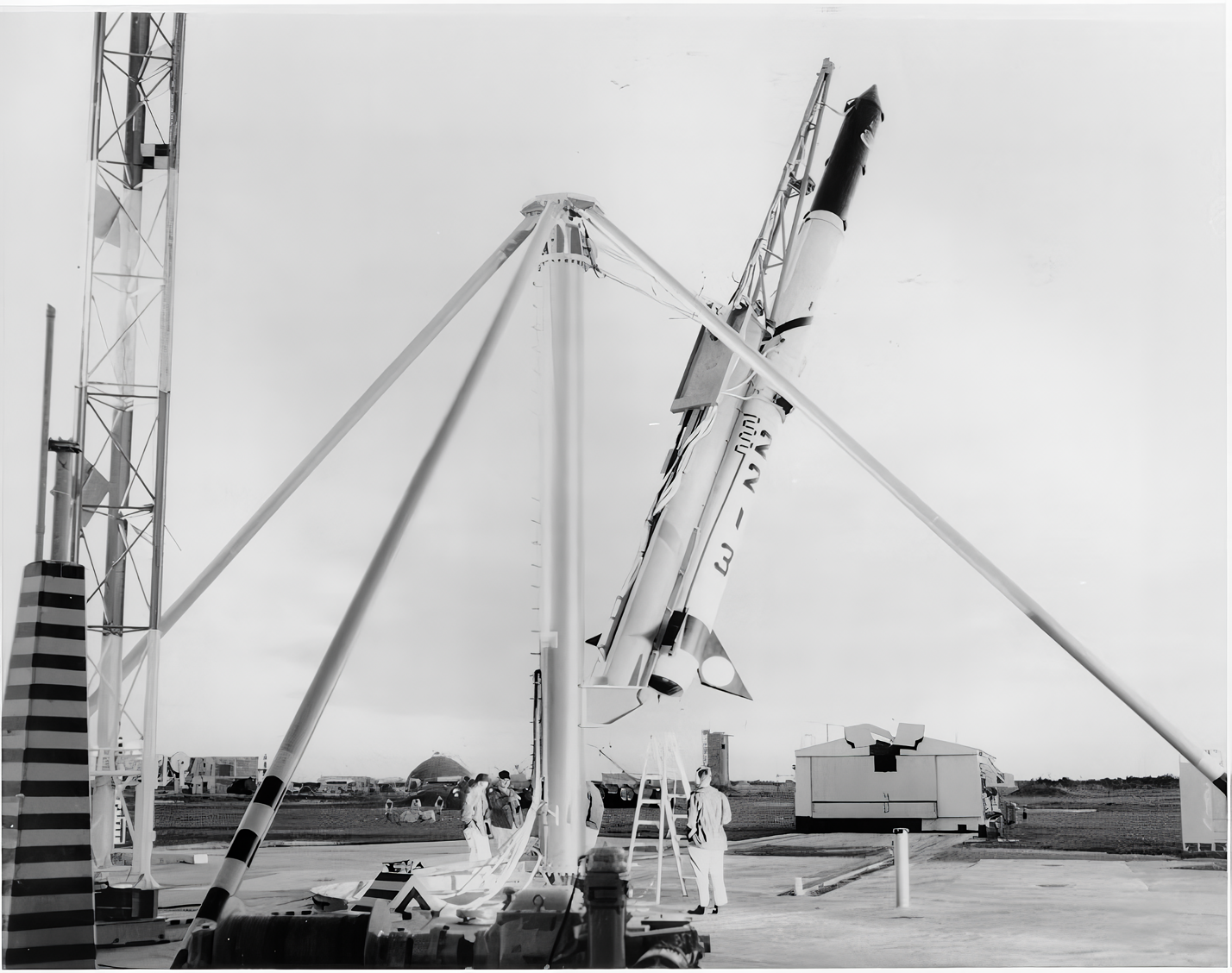
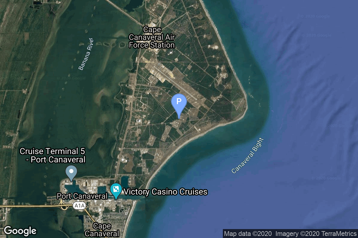
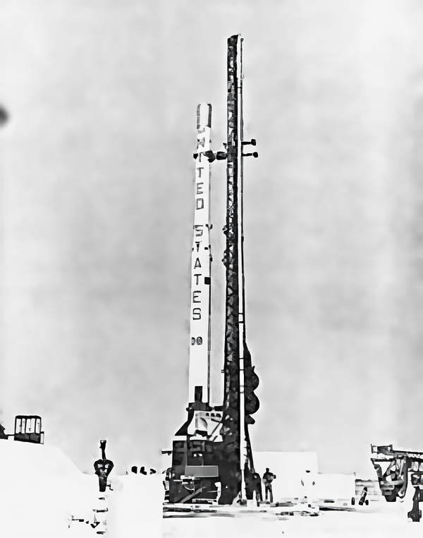
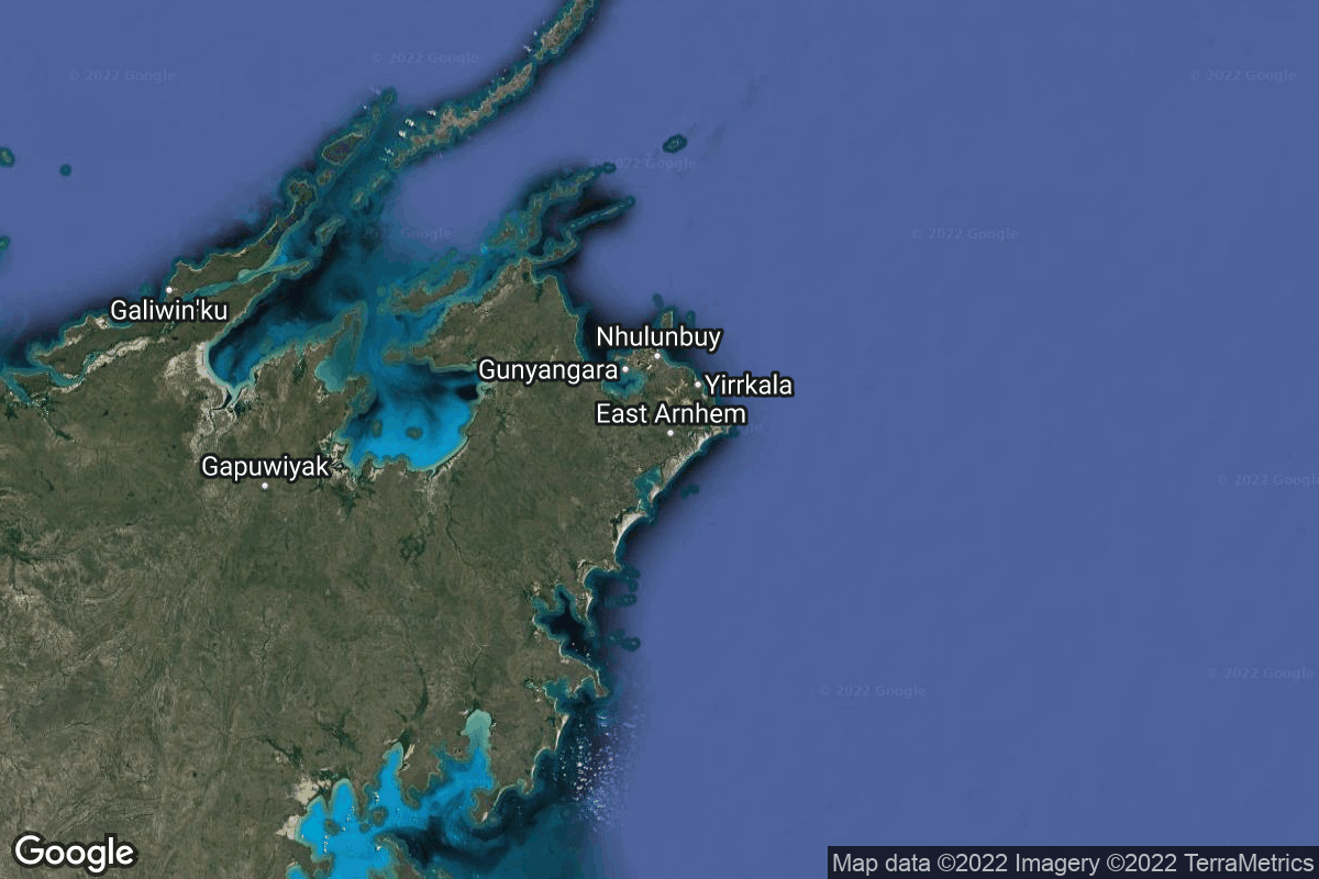
{ "count": 7794, "next": "https://ll.thespacedevs.com/2.0.0/launch/?format=api&limit=10&offset=7000&ordering=-name", "previous": "https://ll.thespacedevs.com/2.0.0/launch/?format=api&limit=10&offset=6980&ordering=-name", "results": [ { "id": "ada5068a-c2e0-4c0e-9167-402536f4af37", "url": "https://ll.thespacedevs.com/2.0.0/launch/ada5068a-c2e0-4c0e-9167-402536f4af37/?format=api", "launch_library_id": null, "slug": "blue-scout-jr-blue-scout-d-1", "name": "Blue Scout Jr | Blue Scout D-1", "status": { "id": 3, "name": "Success" }, "net": "1960-09-21T13:01:53Z", "window_end": "1960-09-21T13:01:53Z", "window_start": "1960-09-21T13:01:53Z", "inhold": false, "tbdtime": false, "tbddate": false, "probability": null, "holdreason": "", "failreason": null, "hashtag": null, "launch_service_provider": { "id": 161, "url": "https://ll.thespacedevs.com/2.0.0/agencies/161/?format=api", "name": "United States Air Force", "type": "Government" }, "rocket": { "id": 3079, "configuration": { "id": 265, "launch_library_id": null, "url": "https://ll.thespacedevs.com/2.0.0/config/launcher/265/?format=api", "name": "Blue Scout Jr", "family": "Blue Scout", "full_name": "Blue Scout Jr", "variant": "Jr" } }, "mission": { "id": 1501, "launch_library_id": null, "name": "Blue Scout D-1", "description": "The flight planned to make radiation and magnetic field measurements at 26700km from Earth. While the rocket achieved this altitude the telemetry system failed so no data was received.", "launch_designator": null, "type": "Earth Science", "orbit": { "id": 15, "name": "Suborbital", "abbrev": "Sub" } }, "pad": { "id": 118, "url": "https://ll.thespacedevs.com/2.0.0/pad/118/?format=api", "agency_id": 166, "name": "Launch Complex 18A", "info_url": null, "wiki_url": "https://en.wikipedia.org/wiki/Cape_Canaveral_Launch_Complex_18", "map_url": "https://www.google.com/maps?q=28.4493,-80.564494", "latitude": "28.4493", "longitude": "-80.564494", "location": { "id": 12, "url": "https://ll.thespacedevs.com/2.0.0/location/12/?format=api", "name": "Cape Canaveral SFS, FL, USA", "country_code": "USA", "map_image": "https://thespacedevs-prod.nyc3.digitaloceanspaces.com/media/map_images/location_12_20200803142519.jpg", "total_launch_count": 1089, "total_landing_count": 71 }, "map_image": "https://thespacedevs-prod.nyc3.digitaloceanspaces.com/media/map_images/pad_118_20200803143338.jpg", "total_launch_count": 18 }, "webcast_live": false, "image": "https://thespacedevs-prod.nyc3.digitaloceanspaces.com/media/images/blue_scout_juni_image_20240411084702.png", "infographic": null, "program": [] }, { "id": "5b288b8a-3861-4114-828f-8b1a363c6b73", "url": "https://ll.thespacedevs.com/2.0.0/launch/5b288b8a-3861-4114-828f-8b1a363c6b73/?format=api", "launch_library_id": null, "slug": "blue-scout-ii-mercury-scout-1", "name": "Blue Scout II | Mercury-Scout 1", "status": { "id": 4, "name": "Failure" }, "net": "1961-11-01T15:32:00Z", "window_end": "1961-11-01T15:32:00Z", "window_start": "1961-11-01T15:32:00Z", "inhold": false, "tbdtime": false, "tbddate": false, "probability": null, "holdreason": "", "failreason": "", "hashtag": null, "launch_service_provider": { "id": 44, "url": "https://ll.thespacedevs.com/2.0.0/agencies/44/?format=api", "name": "National Aeronautics and Space Administration", "type": "Government" }, "rocket": { "id": 7443, "configuration": { "id": 264, "launch_library_id": null, "url": "https://ll.thespacedevs.com/2.0.0/config/launcher/264/?format=api", "name": "Blue Scout II", "family": "Blue Scout", "full_name": "Blue Scout II", "variant": "II" } }, "mission": { "id": 5834, "launch_library_id": null, "name": "Mercury-Scout 1", "description": "Mercury-Scout 1, or MS-1, was a United States spacecraft intended to test tracking stations for Project Mercury flights. The launch of Mercury-Scout 1 on November 1, 1961 was unsuccessful, and the satellite failed to achieve orbit.", "launch_designator": null, "type": "Communications", "orbit": { "id": 8, "name": "Low Earth Orbit", "abbrev": "LEO" } }, "pad": { "id": 119, "url": "https://ll.thespacedevs.com/2.0.0/pad/119/?format=api", "agency_id": 161, "name": "Launch Complex 18B", "info_url": null, "wiki_url": "https://en.wikipedia.org/wiki/Cape_Canaveral_Launch_Complex_18", "map_url": "https://www.google.com/maps?q=28.4493,-80.564494", "latitude": "28.4493", "longitude": "-80.564494", "location": { "id": 12, "url": "https://ll.thespacedevs.com/2.0.0/location/12/?format=api", "name": "Cape Canaveral SFS, FL, USA", "country_code": "USA", "map_image": "https://thespacedevs-prod.nyc3.digitaloceanspaces.com/media/map_images/location_12_20200803142519.jpg", "total_launch_count": 1089, "total_landing_count": 71 }, "map_image": "https://thespacedevs-prod.nyc3.digitaloceanspaces.com/media/map_images/pad_119_20200803143226.jpg", "total_launch_count": 1 }, "webcast_live": false, "image": "https://thespacedevs-prod.nyc3.digitaloceanspaces.com/media/images/blue_scout_ii_image_20240411085341.png", "infographic": null, "program": [ { "id": 2, "url": "https://ll.thespacedevs.com/2.0.0/program/2/?format=api", "name": "Mercury", "description": "Project Mercury was the first human spaceflight program of the United States, running from 1958 through 1963.", "agencies": [ { "id": 44, "url": "https://ll.thespacedevs.com/2.0.0/agencies/44/?format=api", "name": "National Aeronautics and Space Administration", "type": "Government" } ], "image_url": "https://thespacedevs-prod.nyc3.digitaloceanspaces.com/media/images/project2520mer_program_20200820194755.png", "start_date": "1958-10-07T00:00:00Z", "end_date": "1963-05-16T23:24:02Z", "info_url": "https://www.nasa.gov/mission_pages/mercury/missions/program-toc.html", "wiki_url": "https://en.wikipedia.org/wiki/Project_Mercury" } ] }, { "id": "7533059e-732d-4ee5-9f5d-2974f85b9e88", "url": "https://ll.thespacedevs.com/2.0.0/launch/7533059e-732d-4ee5-9f5d-2974f85b9e88/?format=api", "launch_library_id": null, "slug": "black-brant-ix-xqc", "name": "Black Brant IX | XQC", "status": { "id": 3, "name": "Success" }, "net": "2022-06-26T14:30:00Z", "window_end": "2022-06-26T16:14:00Z", "window_start": "2022-06-26T13:14:00Z", "inhold": false, "tbdtime": false, "tbddate": false, "probability": null, "holdreason": "", "failreason": "", "hashtag": null, "launch_service_provider": { "id": 1038, "url": "https://ll.thespacedevs.com/2.0.0/agencies/1038/?format=api", "name": "Equatorial Launch Australia", "type": "Commercial" }, "rocket": { "id": 7610, "configuration": { "id": 481, "launch_library_id": null, "url": "https://ll.thespacedevs.com/2.0.0/config/launcher/481/?format=api", "name": "Black Brant IX", "family": "", "full_name": "Black Brant IX", "variant": "IX" } }, "mission": { "id": 6096, "launch_library_id": null, "name": "XQC", "description": "The X-ray Quantum Calorimeter Experiment (XQC) is a payload from the University of Wisconsin. Its objective is to measure X-rays with unprecedented precision to better understand the interstellar medium and its influence on the structure and evolution of galaxies and stars.", "launch_designator": null, "type": "Astrophysics", "orbit": { "id": 15, "name": "Suborbital", "abbrev": "Sub" } }, "pad": { "id": 202, "url": "https://ll.thespacedevs.com/2.0.0/pad/202/?format=api", "agency_id": 1038, "name": "Suborbital Launch Ramp", "info_url": "https://ela.space/arnhem-space-centre/", "wiki_url": "https://en.wikipedia.org/wiki/Arnhem_Land#Economy", "map_url": "https://www.google.com/maps?q=-12.3892948,136.7903215", "latitude": "-12.3892948", "longitude": "136.7903215", "location": { "id": 160, "url": "https://ll.thespacedevs.com/2.0.0/location/160/?format=api", "name": "Arnhem Space Centre", "country_code": "AUS", "map_image": "https://thespacedevs-prod.nyc3.digitaloceanspaces.com/media/map_images/location_arnhem_space_centre_20220622160552.jpg", "total_launch_count": 3, "total_landing_count": 0 }, "map_image": "https://thespacedevs-prod.nyc3.digitaloceanspaces.com/media/map_images/pad_suborbital_launch_ramp_20220625184504.jpg", "total_launch_count": 3 }, "webcast_live": false, "image": "https://thespacedevs-prod.nyc3.digitaloceanspaces.com/media/images/black_brant_ix_image_20220625190201.jpg", "infographic": null, "program": [] }, { "id": "055fa36b-74c4-4fc5-809e-d123f7781df8", "url": "https://ll.thespacedevs.com/2.0.0/launch/055fa36b-74c4-4fc5-809e-d123f7781df8/?format=api", "launch_library_id": null, "slug": "black-brant-ix-sistine", "name": "Black Brant IX | SISTINE", "status": { "id": 3, "name": "Success" }, "net": "2022-07-06T13:54:00Z", "window_end": "2022-07-06T13:54:00Z", "window_start": "2022-07-06T13:54:00Z", "inhold": false, "tbdtime": false, "tbddate": false, "probability": null, "holdreason": "", "failreason": "", "hashtag": null, "launch_service_provider": { "id": 1038, "url": "https://ll.thespacedevs.com/2.0.0/agencies/1038/?format=api", "name": "Equatorial Launch Australia", "type": "Commercial" }, "rocket": { "id": 7611, "configuration": { "id": 481, "launch_library_id": null, "url": "https://ll.thespacedevs.com/2.0.0/config/launcher/481/?format=api", "name": "Black Brant IX", "family": "", "full_name": "Black Brant IX", "variant": "IX" } }, "mission": { "id": 6097, "launch_library_id": null, "name": "SISTINE", "description": "The Suborbital Imaging Spectrograph for Transition region Irradiance from Nearby Exoplanet host stars (SISTINE) is a payload from the University of Colorado. Its objective is to study how light from stars affects the atmospheres of the planets around them, including the gases thought to be signs of life. For this flight, it will measure the ultraviolet light output from α Centauri A and B, two stars of the three-star α Centauri system that are the closest stars to our Sun.", "launch_designator": null, "type": "Astrophysics", "orbit": { "id": 15, "name": "Suborbital", "abbrev": "Sub" } }, "pad": { "id": 202, "url": "https://ll.thespacedevs.com/2.0.0/pad/202/?format=api", "agency_id": 1038, "name": "Suborbital Launch Ramp", "info_url": "https://ela.space/arnhem-space-centre/", "wiki_url": "https://en.wikipedia.org/wiki/Arnhem_Land#Economy", "map_url": "https://www.google.com/maps?q=-12.3892948,136.7903215", "latitude": "-12.3892948", "longitude": "136.7903215", "location": { "id": 160, "url": "https://ll.thespacedevs.com/2.0.0/location/160/?format=api", "name": "Arnhem Space Centre", "country_code": "AUS", "map_image": "https://thespacedevs-prod.nyc3.digitaloceanspaces.com/media/map_images/location_arnhem_space_centre_20220622160552.jpg", "total_launch_count": 3, "total_landing_count": 0 }, "map_image": "https://thespacedevs-prod.nyc3.digitaloceanspaces.com/media/map_images/pad_suborbital_launch_ramp_20220625184504.jpg", "total_launch_count": 3 }, "webcast_live": false, "image": "https://thespacedevs-prod.nyc3.digitaloceanspaces.com/media/images/black_brant_ix_image_20220625190201.jpg", "infographic": null, "program": [] }, { "id": "82e754cc-c893-4992-a992-c1b3db972c80", "url": "https://ll.thespacedevs.com/2.0.0/launch/82e754cc-c893-4992-a992-c1b3db972c80/?format=api", "launch_library_id": null, "slug": "black-brant-ix-deuce", "name": "Black Brant IX | DEUCE", "status": { "id": 3, "name": "Success" }, "net": "2022-07-11T11:01:00Z", "window_end": "2022-07-11T14:45:00Z", "window_start": "2022-07-11T10:57:00Z", "inhold": false, "tbdtime": false, "tbddate": false, "probability": null, "holdreason": "", "failreason": "", "hashtag": null, "launch_service_provider": { "id": 1038, "url": "https://ll.thespacedevs.com/2.0.0/agencies/1038/?format=api", "name": "Equatorial Launch Australia", "type": "Commercial" }, "rocket": { "id": 7612, "configuration": { "id": 481, "launch_library_id": null, "url": "https://ll.thespacedevs.com/2.0.0/config/launcher/481/?format=api", "name": "Black Brant IX", "family": "", "full_name": "Black Brant IX", "variant": "IX" } }, "mission": { "id": 6098, "launch_library_id": null, "name": "DEUCE", "description": "The Dual-channel Extreme Ultraviolet Continuum Experiment (DEUCE) is a payload from the University of Colorado. its objective is to observe α Centauri A & B and measure a so-far unstudied part of their extreme ultraviolet light spectrum. These measurements are needed to model stars similar to and smaller than our Sun, as well as understand their effects on planetary atmospheres.", "launch_designator": null, "type": "Astrophysics", "orbit": { "id": 15, "name": "Suborbital", "abbrev": "Sub" } }, "pad": { "id": 202, "url": "https://ll.thespacedevs.com/2.0.0/pad/202/?format=api", "agency_id": 1038, "name": "Suborbital Launch Ramp", "info_url": "https://ela.space/arnhem-space-centre/", "wiki_url": "https://en.wikipedia.org/wiki/Arnhem_Land#Economy", "map_url": "https://www.google.com/maps?q=-12.3892948,136.7903215", "latitude": "-12.3892948", "longitude": "136.7903215", "location": { "id": 160, "url": "https://ll.thespacedevs.com/2.0.0/location/160/?format=api", "name": "Arnhem Space Centre", "country_code": "AUS", "map_image": "https://thespacedevs-prod.nyc3.digitaloceanspaces.com/media/map_images/location_arnhem_space_centre_20220622160552.jpg", "total_launch_count": 3, "total_landing_count": 0 }, "map_image": "https://thespacedevs-prod.nyc3.digitaloceanspaces.com/media/map_images/pad_suborbital_launch_ramp_20220625184504.jpg", "total_launch_count": 3 }, "webcast_live": false, "image": "https://thespacedevs-prod.nyc3.digitaloceanspaces.com/media/images/black_brant_ix_image_20220625190201.jpg", "infographic": null, "program": [] }, { "id": "2d1a819f-e800-4db2-b4a8-23b77d5f63f7", "url": "https://ll.thespacedevs.com/2.0.0/launch/2d1a819f-e800-4db2-b4a8-23b77d5f63f7/?format=api", "launch_library_id": null, "slug": "black-arrow-x-2", "name": "Black Arrow | X-2", "status": { "id": 4, "name": "Failure" }, "net": "1970-09-02T00:34:05Z", "window_end": "1970-09-02T00:34:05Z", "window_start": "1970-09-02T00:34:05Z", "inhold": false, "tbdtime": false, "tbddate": false, "probability": null, "holdreason": "", "failreason": null, "hashtag": null, "launch_service_provider": { "id": 1005, "url": "https://ll.thespacedevs.com/2.0.0/agencies/1005/?format=api", "name": "Royal Aircraft Establishment", "type": "Government" }, "rocket": { "id": 4044, "configuration": { "id": 263, "launch_library_id": null, "url": "https://ll.thespacedevs.com/2.0.0/config/launcher/263/?format=api", "name": "Black Arrow", "family": "", "full_name": "Black Arrow", "variant": "" } }, "mission": { "id": 2462, "launch_library_id": null, "name": "X-2", "description": "Uninstrumented spherical satellite meant to enable atmospheric density measurements by observing its orbital decay. It was destroyed in the failure of the first Black Arrow orbital launch failure.", "launch_designator": null, "type": "Test Flight", "orbit": { "id": 8, "name": "Low Earth Orbit", "abbrev": "LEO" } }, "pad": { "id": 179, "url": "https://ll.thespacedevs.com/2.0.0/pad/179/?format=api", "agency_id": null, "name": "Launch Area 5B", "info_url": null, "wiki_url": "https://en.wikipedia.org/wiki/RAAF_Woomera_Range_Complex", "map_url": "https://www.google.com/maps?q=-30.9552778,136.5300282", "latitude": "-30.9552778", "longitude": "136.5300282", "location": { "id": 152, "url": "https://ll.thespacedevs.com/2.0.0/location/152/?format=api", "name": "RAAF Woomera Range Complex", "country_code": "AUS", "map_image": "https://thespacedevs-prod.nyc3.digitaloceanspaces.com/media/map_images/location_152_20200803142502.jpg", "total_launch_count": 6, "total_landing_count": 0 }, "map_image": "https://thespacedevs-prod.nyc3.digitaloceanspaces.com/media/map_images/pad_179_20200803143455.jpg", "total_launch_count": 2 }, "webcast_live": false, "image": "https://thespacedevs-prod.nyc3.digitaloceanspaces.com/media/images/black_arrow_in__image_20240314095415.jpg", "infographic": null, "program": [] }, { "id": "454b8835-f615-41c5-8078-380fffb265fc", "url": "https://ll.thespacedevs.com/2.0.0/launch/454b8835-f615-41c5-8078-380fffb265fc/?format=api", "launch_library_id": null, "slug": "black-arrow-prospero", "name": "Black Arrow | Prospero", "status": { "id": 3, "name": "Success" }, "net": "1971-10-28T04:09:29Z", "window_end": "1971-10-28T04:09:29Z", "window_start": "1971-10-28T04:09:29Z", "inhold": false, "tbdtime": false, "tbddate": false, "probability": null, "holdreason": "", "failreason": null, "hashtag": null, "launch_service_provider": { "id": 1005, "url": "https://ll.thespacedevs.com/2.0.0/agencies/1005/?format=api", "name": "Royal Aircraft Establishment", "type": "Government" }, "rocket": { "id": 4188, "configuration": { "id": 263, "launch_library_id": null, "url": "https://ll.thespacedevs.com/2.0.0/config/launcher/263/?format=api", "name": "Black Arrow", "family": "", "full_name": "Black Arrow", "variant": "" } }, "mission": { "id": 2606, "launch_library_id": null, "name": "Prospero", "description": "British scientific satellite used to demonstrate technologies needed for communication satellites.", "launch_designator": null, "type": "Test Flight", "orbit": { "id": 8, "name": "Low Earth Orbit", "abbrev": "LEO" } }, "pad": { "id": 179, "url": "https://ll.thespacedevs.com/2.0.0/pad/179/?format=api", "agency_id": null, "name": "Launch Area 5B", "info_url": null, "wiki_url": "https://en.wikipedia.org/wiki/RAAF_Woomera_Range_Complex", "map_url": "https://www.google.com/maps?q=-30.9552778,136.5300282", "latitude": "-30.9552778", "longitude": "136.5300282", "location": { "id": 152, "url": "https://ll.thespacedevs.com/2.0.0/location/152/?format=api", "name": "RAAF Woomera Range Complex", "country_code": "AUS", "map_image": "https://thespacedevs-prod.nyc3.digitaloceanspaces.com/media/map_images/location_152_20200803142502.jpg", "total_launch_count": 6, "total_landing_count": 0 }, "map_image": "https://thespacedevs-prod.nyc3.digitaloceanspaces.com/media/map_images/pad_179_20200803143455.jpg", "total_launch_count": 2 }, "webcast_live": false, "image": "https://thespacedevs-prod.nyc3.digitaloceanspaces.com/media/images/black_arrow_in__image_20240314095415.jpg", "infographic": null, "program": [] }, { "id": "366dce38-e39c-4358-8b11-40c97b6e282b", "url": "https://ll.thespacedevs.com/2.0.0/launch/366dce38-e39c-4358-8b11-40c97b6e282b/?format=api", "launch_library_id": null, "slug": "atlas-v-n22-starliner-6", "name": "Atlas V N22 | Starliner-6", "status": { "id": 2, "name": "TBD" }, "net": "2028-09-30T00:00:00Z", "window_end": "2028-09-30T00:00:00Z", "window_start": "2028-09-30T00:00:00Z", "inhold": false, "tbdtime": false, "tbddate": false, "probability": null, "holdreason": "", "failreason": "", "hashtag": null, "launch_service_provider": { "id": 124, "url": "https://ll.thespacedevs.com/2.0.0/agencies/124/?format=api", "name": "United Launch Alliance", "type": "Commercial" }, "rocket": { "id": 120, "configuration": { "id": 166, "launch_library_id": 118, "url": "https://ll.thespacedevs.com/2.0.0/config/launcher/166/?format=api", "name": "Atlas V N22", "family": "Atlas", "full_name": "Atlas V N22", "variant": "V N22" } }, "mission": { "id": 5991, "launch_library_id": null, "name": "Starliner-6", "description": "Starliner-6 is the sixth crewed operational flight of a Starliner spacecraft to the International Space Station as part of NASA's Commercial Crew Program.", "launch_designator": null, "type": "Human Exploration", "orbit": { "id": 8, "name": "Low Earth Orbit", "abbrev": "LEO" } }, "pad": { "id": 29, "url": "https://ll.thespacedevs.com/2.0.0/pad/29/?format=api", "agency_id": null, "name": "Space Launch Complex 41", "info_url": null, "wiki_url": "https://en.wikipedia.org/wiki/Cape_Canaveral_Air_Force_Station_Space_Launch_Complex_41", "map_url": "https://www.google.com/maps?q=28.58341025,-80.58303644", "latitude": "28.58341025", "longitude": "-80.58303644", "location": { "id": 12, "url": "https://ll.thespacedevs.com/2.0.0/location/12/?format=api", "name": "Cape Canaveral SFS, FL, USA", "country_code": "USA", "map_image": "https://thespacedevs-prod.nyc3.digitaloceanspaces.com/media/map_images/location_12_20200803142519.jpg", "total_launch_count": 1089, "total_landing_count": 71 }, "map_image": "https://thespacedevs-prod.nyc3.digitaloceanspaces.com/media/map_images/pad_29_20200803143528.jpg", "total_launch_count": 121 }, "webcast_live": false, "image": "https://thespacedevs-prod.nyc3.digitaloceanspaces.com/media/images/atlas_v_n22_image_20210813082339.jpeg", "infographic": null, "program": [ { "id": 5, "url": "https://ll.thespacedevs.com/2.0.0/program/5/?format=api", "name": "Commercial Crew Program", "description": "The Commercial Crew Program (CCP) is a human spaceflight program operated by NASA, in association with American aerospace manufacturers Boeing and SpaceX. The program conducts rotations between the expeditions of the International Space Station program, transporting crews to and from the International Space Station (ISS) aboard Boeing Starliner and SpaceX Crew Dragon capsules, in the first crewed orbital spaceflights operated by private companies.", "agencies": [ { "id": 80, "url": "https://ll.thespacedevs.com/2.0.0/agencies/80/?format=api", "name": "Boeing", "type": "Commercial" }, { "id": 44, "url": "https://ll.thespacedevs.com/2.0.0/agencies/44/?format=api", "name": "National Aeronautics and Space Administration", "type": "Government" }, { "id": 121, "url": "https://ll.thespacedevs.com/2.0.0/agencies/121/?format=api", "name": "SpaceX", "type": "Commercial" } ], "image_url": "https://thespacedevs-prod.nyc3.digitaloceanspaces.com/media/images/commercial2520_program_20200820201209.png", "start_date": "2011-04-18T00:00:00Z", "end_date": null, "info_url": "https://www.nasa.gov/exploration/commercial/crew/index.html", "wiki_url": "https://en.wikipedia.org/wiki/Commercial_Crew_Program" }, { "id": 17, "url": "https://ll.thespacedevs.com/2.0.0/program/17/?format=api", "name": "International Space Station", "description": "The International Space Station programme is tied together by a complex set of legal, political and financial agreements between the sixteen nations involved in the project, governing ownership of the various components, rights to crewing and utilization, and responsibilities for crew rotation and resupply of the International Space Station. It was conceived in 1984 by President Ronald Reagan, during the Space Station Freedom project as it was originally called.", "agencies": [ { "id": 16, "url": "https://ll.thespacedevs.com/2.0.0/agencies/16/?format=api", "name": "Canadian Space Agency", "type": "Government" }, { "id": 27, "url": "https://ll.thespacedevs.com/2.0.0/agencies/27/?format=api", "name": "European Space Agency", "type": "Multinational" }, { "id": 37, "url": "https://ll.thespacedevs.com/2.0.0/agencies/37/?format=api", "name": "Japan Aerospace Exploration Agency", "type": "Government" }, { "id": 44, "url": "https://ll.thespacedevs.com/2.0.0/agencies/44/?format=api", "name": "National Aeronautics and Space Administration", "type": "Government" }, { "id": 63, "url": "https://ll.thespacedevs.com/2.0.0/agencies/63/?format=api", "name": "Russian Federal Space Agency (ROSCOSMOS)", "type": "Government" } ], "image_url": "https://thespacedevs-prod.nyc3.digitaloceanspaces.com/media/images/international2_program_20201129184745.png", "start_date": "1998-11-20T06:40:00Z", "end_date": null, "info_url": "https://www.nasa.gov/mission_pages/station/main/index.html", "wiki_url": "https://en.wikipedia.org/wiki/International_Space_Station_programme" } ] }, { "id": "f1fef4f8-e7e2-47e8-b75a-0b2e25b75817", "url": "https://ll.thespacedevs.com/2.0.0/launch/f1fef4f8-e7e2-47e8-b75a-0b2e25b75817/?format=api", "launch_library_id": null, "slug": "atlas-v-n22-starliner-5", "name": "Atlas V N22 | Starliner-5", "status": { "id": 2, "name": "TBD" }, "net": "2027-09-30T00:00:00Z", "window_end": "2027-09-30T00:00:00Z", "window_start": "2027-09-30T00:00:00Z", "inhold": false, "tbdtime": false, "tbddate": false, "probability": null, "holdreason": "", "failreason": "", "hashtag": null, "launch_service_provider": { "id": 124, "url": "https://ll.thespacedevs.com/2.0.0/agencies/124/?format=api", "name": "United Launch Alliance", "type": "Commercial" }, "rocket": { "id": 67, "configuration": { "id": 166, "launch_library_id": 118, "url": "https://ll.thespacedevs.com/2.0.0/config/launcher/166/?format=api", "name": "Atlas V N22", "family": "Atlas", "full_name": "Atlas V N22", "variant": "V N22" } }, "mission": { "id": 5990, "launch_library_id": null, "name": "Starliner-5", "description": "Starliner-5 is the fifth crewed operational flight of a Starliner spacecraft to the International Space Station as part of NASA's Commercial Crew Program.", "launch_designator": null, "type": "Human Exploration", "orbit": { "id": 8, "name": "Low Earth Orbit", "abbrev": "LEO" } }, "pad": { "id": 29, "url": "https://ll.thespacedevs.com/2.0.0/pad/29/?format=api", "agency_id": null, "name": "Space Launch Complex 41", "info_url": null, "wiki_url": "https://en.wikipedia.org/wiki/Cape_Canaveral_Air_Force_Station_Space_Launch_Complex_41", "map_url": "https://www.google.com/maps?q=28.58341025,-80.58303644", "latitude": "28.58341025", "longitude": "-80.58303644", "location": { "id": 12, "url": "https://ll.thespacedevs.com/2.0.0/location/12/?format=api", "name": "Cape Canaveral SFS, FL, USA", "country_code": "USA", "map_image": "https://thespacedevs-prod.nyc3.digitaloceanspaces.com/media/map_images/location_12_20200803142519.jpg", "total_launch_count": 1089, "total_landing_count": 71 }, "map_image": "https://thespacedevs-prod.nyc3.digitaloceanspaces.com/media/map_images/pad_29_20200803143528.jpg", "total_launch_count": 121 }, "webcast_live": false, "image": "https://thespacedevs-prod.nyc3.digitaloceanspaces.com/media/images/atlas_v_n22_image_20210813082339.jpeg", "infographic": null, "program": [ { "id": 5, "url": "https://ll.thespacedevs.com/2.0.0/program/5/?format=api", "name": "Commercial Crew Program", "description": "The Commercial Crew Program (CCP) is a human spaceflight program operated by NASA, in association with American aerospace manufacturers Boeing and SpaceX. The program conducts rotations between the expeditions of the International Space Station program, transporting crews to and from the International Space Station (ISS) aboard Boeing Starliner and SpaceX Crew Dragon capsules, in the first crewed orbital spaceflights operated by private companies.", "agencies": [ { "id": 80, "url": "https://ll.thespacedevs.com/2.0.0/agencies/80/?format=api", "name": "Boeing", "type": "Commercial" }, { "id": 44, "url": "https://ll.thespacedevs.com/2.0.0/agencies/44/?format=api", "name": "National Aeronautics and Space Administration", "type": "Government" }, { "id": 121, "url": "https://ll.thespacedevs.com/2.0.0/agencies/121/?format=api", "name": "SpaceX", "type": "Commercial" } ], "image_url": "https://thespacedevs-prod.nyc3.digitaloceanspaces.com/media/images/commercial2520_program_20200820201209.png", "start_date": "2011-04-18T00:00:00Z", "end_date": null, "info_url": "https://www.nasa.gov/exploration/commercial/crew/index.html", "wiki_url": "https://en.wikipedia.org/wiki/Commercial_Crew_Program" }, { "id": 17, "url": "https://ll.thespacedevs.com/2.0.0/program/17/?format=api", "name": "International Space Station", "description": "The International Space Station programme is tied together by a complex set of legal, political and financial agreements between the sixteen nations involved in the project, governing ownership of the various components, rights to crewing and utilization, and responsibilities for crew rotation and resupply of the International Space Station. It was conceived in 1984 by President Ronald Reagan, during the Space Station Freedom project as it was originally called.", "agencies": [ { "id": 16, "url": "https://ll.thespacedevs.com/2.0.0/agencies/16/?format=api", "name": "Canadian Space Agency", "type": "Government" }, { "id": 27, "url": "https://ll.thespacedevs.com/2.0.0/agencies/27/?format=api", "name": "European Space Agency", "type": "Multinational" }, { "id": 37, "url": "https://ll.thespacedevs.com/2.0.0/agencies/37/?format=api", "name": "Japan Aerospace Exploration Agency", "type": "Government" }, { "id": 44, "url": "https://ll.thespacedevs.com/2.0.0/agencies/44/?format=api", "name": "National Aeronautics and Space Administration", "type": "Government" }, { "id": 63, "url": "https://ll.thespacedevs.com/2.0.0/agencies/63/?format=api", "name": "Russian Federal Space Agency (ROSCOSMOS)", "type": "Government" } ], "image_url": "https://thespacedevs-prod.nyc3.digitaloceanspaces.com/media/images/international2_program_20201129184745.png", "start_date": "1998-11-20T06:40:00Z", "end_date": null, "info_url": "https://www.nasa.gov/mission_pages/station/main/index.html", "wiki_url": "https://en.wikipedia.org/wiki/International_Space_Station_programme" } ] }, { "id": "24c5a3ac-94e6-4a78-bbc2-43388a2dc5db", "url": "https://ll.thespacedevs.com/2.0.0/launch/24c5a3ac-94e6-4a78-bbc2-43388a2dc5db/?format=api", "launch_library_id": null, "slug": "atlas-v-n22-starliner-4", "name": "Atlas V N22 | Starliner-4", "status": { "id": 2, "name": "TBD" }, "net": "2027-06-30T00:00:00Z", "window_end": "2027-06-30T00:00:00Z", "window_start": "2027-06-30T00:00:00Z", "inhold": false, "tbdtime": false, "tbddate": false, "probability": null, "holdreason": "", "failreason": "", "hashtag": null, "launch_service_provider": { "id": 124, "url": "https://ll.thespacedevs.com/2.0.0/agencies/124/?format=api", "name": "United Launch Alliance", "type": "Commercial" }, "rocket": { "id": 62, "configuration": { "id": 166, "launch_library_id": 118, "url": "https://ll.thespacedevs.com/2.0.0/config/launcher/166/?format=api", "name": "Atlas V N22", "family": "Atlas", "full_name": "Atlas V N22", "variant": "V N22" } }, "mission": { "id": 5989, "launch_library_id": null, "name": "Starliner-4", "description": "Starliner-4 is the fourth crewed operational flight of a Starliner spacecraft to the International Space Station as part of NASA's Commercial Crew Program.", "launch_designator": null, "type": "Human Exploration", "orbit": { "id": 8, "name": "Low Earth Orbit", "abbrev": "LEO" } }, "pad": { "id": 29, "url": "https://ll.thespacedevs.com/2.0.0/pad/29/?format=api", "agency_id": null, "name": "Space Launch Complex 41", "info_url": null, "wiki_url": "https://en.wikipedia.org/wiki/Cape_Canaveral_Air_Force_Station_Space_Launch_Complex_41", "map_url": "https://www.google.com/maps?q=28.58341025,-80.58303644", "latitude": "28.58341025", "longitude": "-80.58303644", "location": { "id": 12, "url": "https://ll.thespacedevs.com/2.0.0/location/12/?format=api", "name": "Cape Canaveral SFS, FL, USA", "country_code": "USA", "map_image": "https://thespacedevs-prod.nyc3.digitaloceanspaces.com/media/map_images/location_12_20200803142519.jpg", "total_launch_count": 1089, "total_landing_count": 71 }, "map_image": "https://thespacedevs-prod.nyc3.digitaloceanspaces.com/media/map_images/pad_29_20200803143528.jpg", "total_launch_count": 121 }, "webcast_live": false, "image": "https://thespacedevs-prod.nyc3.digitaloceanspaces.com/media/images/atlas_v_n22_image_20210813082339.jpeg", "infographic": null, "program": [ { "id": 5, "url": "https://ll.thespacedevs.com/2.0.0/program/5/?format=api", "name": "Commercial Crew Program", "description": "The Commercial Crew Program (CCP) is a human spaceflight program operated by NASA, in association with American aerospace manufacturers Boeing and SpaceX. The program conducts rotations between the expeditions of the International Space Station program, transporting crews to and from the International Space Station (ISS) aboard Boeing Starliner and SpaceX Crew Dragon capsules, in the first crewed orbital spaceflights operated by private companies.", "agencies": [ { "id": 80, "url": "https://ll.thespacedevs.com/2.0.0/agencies/80/?format=api", "name": "Boeing", "type": "Commercial" }, { "id": 44, "url": "https://ll.thespacedevs.com/2.0.0/agencies/44/?format=api", "name": "National Aeronautics and Space Administration", "type": "Government" }, { "id": 121, "url": "https://ll.thespacedevs.com/2.0.0/agencies/121/?format=api", "name": "SpaceX", "type": "Commercial" } ], "image_url": "https://thespacedevs-prod.nyc3.digitaloceanspaces.com/media/images/commercial2520_program_20200820201209.png", "start_date": "2011-04-18T00:00:00Z", "end_date": null, "info_url": "https://www.nasa.gov/exploration/commercial/crew/index.html", "wiki_url": "https://en.wikipedia.org/wiki/Commercial_Crew_Program" }, { "id": 17, "url": "https://ll.thespacedevs.com/2.0.0/program/17/?format=api", "name": "International Space Station", "description": "The International Space Station programme is tied together by a complex set of legal, political and financial agreements between the sixteen nations involved in the project, governing ownership of the various components, rights to crewing and utilization, and responsibilities for crew rotation and resupply of the International Space Station. It was conceived in 1984 by President Ronald Reagan, during the Space Station Freedom project as it was originally called.", "agencies": [ { "id": 16, "url": "https://ll.thespacedevs.com/2.0.0/agencies/16/?format=api", "name": "Canadian Space Agency", "type": "Government" }, { "id": 27, "url": "https://ll.thespacedevs.com/2.0.0/agencies/27/?format=api", "name": "European Space Agency", "type": "Multinational" }, { "id": 37, "url": "https://ll.thespacedevs.com/2.0.0/agencies/37/?format=api", "name": "Japan Aerospace Exploration Agency", "type": "Government" }, { "id": 44, "url": "https://ll.thespacedevs.com/2.0.0/agencies/44/?format=api", "name": "National Aeronautics and Space Administration", "type": "Government" }, { "id": 63, "url": "https://ll.thespacedevs.com/2.0.0/agencies/63/?format=api", "name": "Russian Federal Space Agency (ROSCOSMOS)", "type": "Government" } ], "image_url": "https://thespacedevs-prod.nyc3.digitaloceanspaces.com/media/images/international2_program_20201129184745.png", "start_date": "1998-11-20T06:40:00Z", "end_date": null, "info_url": "https://www.nasa.gov/mission_pages/station/main/index.html", "wiki_url": "https://en.wikipedia.org/wiki/International_Space_Station_programme" } ] } ] }