Launch List
API endpoint that returns all Launch objects or a single launch.
EXAMPLE - /launch/
GET: Return a list of all Launch objects.
FILTERS: Fields - 'name', 'id(s)', 'lsp_id', 'lsp_name', 'serial_number', 'launcher_config__id', 'rocket__spacecraftflight__spacecraft__name'
MODE: 'normal', 'list', 'detailed' EXAMPLE: ?mode=list
SEARCH: Searches through the launch name, rocket name, launch agency, mission name & spacecraft name. EXAMPLE - ?search=SpaceX
GET /2.0.0/launch/?format=api&offset=6980&ordering=-net
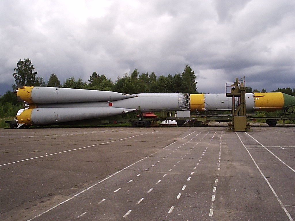
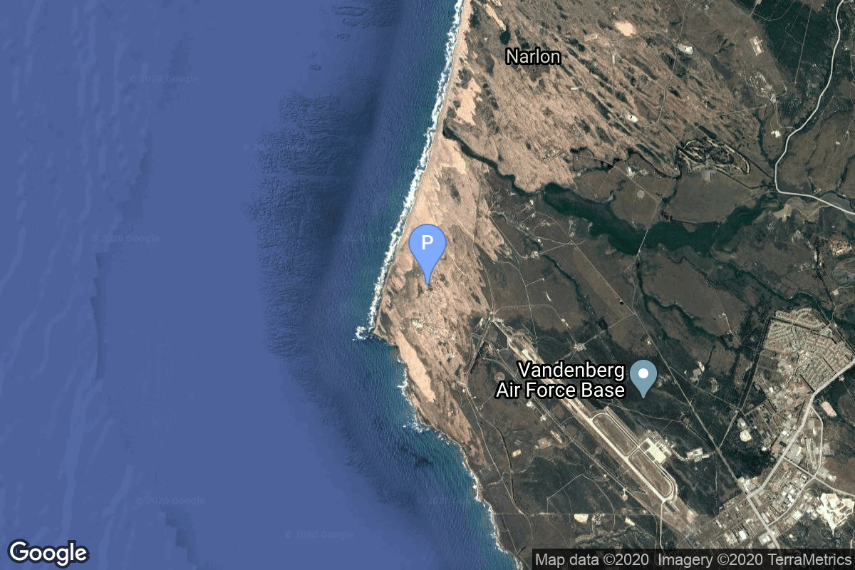
{ "count": 7794, "next": "https://ll.thespacedevs.com/2.0.0/launch/?format=api&limit=10&offset=6990&ordering=-net", "previous": "https://ll.thespacedevs.com/2.0.0/launch/?format=api&limit=10&offset=6970&ordering=-net", "results": [ { "id": "31e20b2a-bdc5-421f-8607-81d884d61862", "url": "https://ll.thespacedevs.com/2.0.0/launch/31e20b2a-bdc5-421f-8607-81d884d61862/?format=api", "launch_library_id": null, "slug": "voskhod-zenit-2-53", "name": "Voskhod | Zenit-2 53", "status": { "id": 3, "name": "Success" }, "net": "1967-09-16T06:06:00Z", "window_end": "1967-09-16T06:06:00Z", "window_start": "1967-09-16T06:06:00Z", "inhold": false, "tbdtime": false, "tbddate": false, "probability": null, "holdreason": "", "failreason": null, "hashtag": null, "launch_service_provider": { "id": 66, "url": "https://ll.thespacedevs.com/2.0.0/agencies/66/?format=api", "name": "Soviet Space Program", "type": "Government" }, "rocket": { "id": 3704, "configuration": { "id": 104, "launch_library_id": 138, "url": "https://ll.thespacedevs.com/2.0.0/config/launcher/104/?format=api", "name": "Voskhod", "family": "R-7", "full_name": "Voskhod", "variant": "Voskhod" } }, "mission": { "id": 2122, "launch_library_id": null, "name": "Zenit-2 53", "description": "Zenit-2 film-return and ELINT reconnaissance satellite.", "launch_designator": null, "type": "Government/Top Secret", "orbit": { "id": 8, "name": "Low Earth Orbit", "abbrev": "LEO" } }, "pad": { "id": 32, "url": "https://ll.thespacedevs.com/2.0.0/pad/32/?format=api", "agency_id": null, "name": "1/5", "info_url": null, "wiki_url": "", "map_url": "https://www.google.com/maps?q=45.92,63.342", "latitude": "45.92", "longitude": "63.342", "location": { "id": 15, "url": "https://ll.thespacedevs.com/2.0.0/location/15/?format=api", "name": "Baikonur Cosmodrome, Republic of Kazakhstan", "country_code": "KAZ", "map_image": "https://thespacedevs-prod.nyc3.digitaloceanspaces.com/media/map_images/location_15_20200803142517.jpg", "total_launch_count": 1560, "total_landing_count": 0 }, "map_image": "https://thespacedevs-prod.nyc3.digitaloceanspaces.com/media/map_images/pad_32_20200803143513.jpg", "total_launch_count": 487 }, "webcast_live": false, "image": "https://thespacedevs-prod.nyc3.digitaloceanspaces.com/media/images/voskhod_during__image_20251102062248.jpg", "infographic": null, "program": [] }, { "id": "4f27c20e-8a4e-4845-8de9-482417a39626", "url": "https://ll.thespacedevs.com/2.0.0/launch/4f27c20e-8a4e-4845-8de9-482417a39626/?format=api", "launch_library_id": null, "slug": "thorad-slv-2g-agena-d-kh-4b-1", "name": "Thorad SLV-2G Agena D | KH-4B 1", "status": { "id": 3, "name": "Success" }, "net": "1967-09-15T19:41:15Z", "window_end": "1967-09-15T19:41:15Z", "window_start": "1967-09-15T19:41:15Z", "inhold": false, "tbdtime": false, "tbddate": false, "probability": null, "holdreason": "", "failreason": null, "hashtag": null, "launch_service_provider": { "id": 161, "url": "https://ll.thespacedevs.com/2.0.0/agencies/161/?format=api", "name": "United States Air Force", "type": "Government" }, "rocket": { "id": 3703, "configuration": { "id": 418, "launch_library_id": null, "url": "https://ll.thespacedevs.com/2.0.0/config/launcher/418/?format=api", "name": "Thorad SLV-2G Agena D", "family": "Thor", "full_name": "Thorad SLV-2G Agena D", "variant": "SLV-2G Agena D" } }, "mission": { "id": 2121, "launch_library_id": null, "name": "KH-4B 1", "description": "The KH-4B (Keyhole-4B) was sixth optical reconnaissance satellite version in the Corona-program.", "launch_designator": null, "type": "Government/Top Secret", "orbit": { "id": 8, "name": "Low Earth Orbit", "abbrev": "LEO" } }, "pad": { "id": 95, "url": "https://ll.thespacedevs.com/2.0.0/pad/95/?format=api", "agency_id": 161, "name": "Space Launch Complex 1W", "info_url": null, "wiki_url": "https://en.wikipedia.org/wiki/Vandenberg_Space_Launch_Complex_1", "map_url": "https://www.google.com/maps?q=34.7572,-120.6303", "latitude": "34.7572", "longitude": "-120.6303", "location": { "id": 11, "url": "https://ll.thespacedevs.com/2.0.0/location/11/?format=api", "name": "Vandenberg SFB, CA, USA", "country_code": "USA", "map_image": "https://thespacedevs-prod.nyc3.digitaloceanspaces.com/media/map_images/location_11_20200803142416.jpg", "total_launch_count": 863, "total_landing_count": 33 }, "map_image": "https://thespacedevs-prod.nyc3.digitaloceanspaces.com/media/map_images/pad_95_20200803143209.jpg", "total_launch_count": 56 }, "webcast_live": false, "image": "https://thespacedevs-prod.nyc3.digitaloceanspaces.com/media/images/thorad-slv2g_ag_image_20251102061406.jpg", "infographic": null, "program": [] }, { "id": "fb6e81f6-cc91-47da-ace7-5788a63304fa", "url": "https://ll.thespacedevs.com/2.0.0/launch/fb6e81f6-cc91-47da-ace7-5788a63304fa/?format=api", "launch_library_id": null, "slug": "kosmos-11k63-ds-p1-yu-10", "name": "Kosmos 11K63 | DS-P1-Yu 10", "status": { "id": 3, "name": "Success" }, "net": "1967-09-12T17:00:00Z", "window_end": "1967-09-12T17:00:00Z", "window_start": "1967-09-12T17:00:00Z", "inhold": false, "tbdtime": false, "tbddate": false, "probability": null, "holdreason": "", "failreason": null, "hashtag": null, "launch_service_provider": { "id": 66, "url": "https://ll.thespacedevs.com/2.0.0/agencies/66/?format=api", "name": "Soviet Space Program", "type": "Government" }, "rocket": { "id": 3702, "configuration": { "id": 327, "launch_library_id": null, "url": "https://ll.thespacedevs.com/2.0.0/config/launcher/327/?format=api", "name": "Kosmos 11K63", "family": "Kosmos", "full_name": "Kosmos 11K63", "variant": "11K63" } }, "mission": { "id": 2120, "launch_library_id": null, "name": "DS-P1-Yu 10", "description": "The DS-P1-Yu series of satellites was used to calibrate space surveillance and early warning radars.", "launch_designator": null, "type": "Test Target", "orbit": { "id": 8, "name": "Low Earth Orbit", "abbrev": "LEO" } }, "pad": { "id": 3, "url": "https://ll.thespacedevs.com/2.0.0/pad/3/?format=api", "agency_id": 163, "name": "133/3 (133L)", "info_url": null, "wiki_url": "", "map_url": "https://www.google.com/maps?q=62.886999,40.846984", "latitude": "62.886999", "longitude": "40.846984", "location": { "id": 6, "url": "https://ll.thespacedevs.com/2.0.0/location/6/?format=api", "name": "Plesetsk Cosmodrome, Russian Federation", "country_code": "RUS", "map_image": "https://thespacedevs-prod.nyc3.digitaloceanspaces.com/media/map_images/location_6_20200803142434.jpg", "total_launch_count": 1681, "total_landing_count": 0 }, "map_image": "https://thespacedevs-prod.nyc3.digitaloceanspaces.com/media/map_images/pad_3_20200803143438.jpg", "total_launch_count": 159 }, "webcast_live": false, "image": "https://thespacedevs-prod.nyc3.digitaloceanspaces.com/media/images/kosmos_11k63_image_20251104091702.jpg", "infographic": null, "program": [] }, { "id": "aa3fa12b-d28d-43a5-aacd-70b64ee8d26b", "url": "https://ll.thespacedevs.com/2.0.0/launch/aa3fa12b-d28d-43a5-aacd-70b64ee8d26b/?format=api", "launch_library_id": null, "slug": "voskhod-zenit-4-34", "name": "Voskhod | Zenit-4 34", "status": { "id": 3, "name": "Success" }, "net": "1967-09-11T10:30:00Z", "window_end": "1967-09-11T10:30:00Z", "window_start": "1967-09-11T10:30:00Z", "inhold": false, "tbdtime": false, "tbddate": false, "probability": null, "holdreason": "", "failreason": null, "hashtag": null, "launch_service_provider": { "id": 66, "url": "https://ll.thespacedevs.com/2.0.0/agencies/66/?format=api", "name": "Soviet Space Program", "type": "Government" }, "rocket": { "id": 3701, "configuration": { "id": 104, "launch_library_id": 138, "url": "https://ll.thespacedevs.com/2.0.0/config/launcher/104/?format=api", "name": "Voskhod", "family": "R-7", "full_name": "Voskhod", "variant": "Voskhod" } }, "mission": { "id": 2119, "launch_library_id": null, "name": "Zenit-4 34", "description": "Zenit-4 film-return reconnaissance satellite.", "launch_designator": null, "type": "Government/Top Secret", "orbit": { "id": 8, "name": "Low Earth Orbit", "abbrev": "LEO" } }, "pad": { "id": 168, "url": "https://ll.thespacedevs.com/2.0.0/pad/168/?format=api", "agency_id": null, "name": "41/1", "info_url": null, "wiki_url": "https://en.wikipedia.org/wiki/Plesetsk_Cosmodrome", "map_url": "https://www.google.com/maps?q=62.941,40.526806", "latitude": "62.941", "longitude": "40.526806", "location": { "id": 6, "url": "https://ll.thespacedevs.com/2.0.0/location/6/?format=api", "name": "Plesetsk Cosmodrome, Russian Federation", "country_code": "RUS", "map_image": "https://thespacedevs-prod.nyc3.digitaloceanspaces.com/media/map_images/location_6_20200803142434.jpg", "total_launch_count": 1681, "total_landing_count": 0 }, "map_image": "https://thespacedevs-prod.nyc3.digitaloceanspaces.com/media/map_images/pad_168_20200803143446.jpg", "total_launch_count": 310 }, "webcast_live": false, "image": "https://thespacedevs-prod.nyc3.digitaloceanspaces.com/media/images/voskhod_during__image_20251102062248.jpg", "infographic": null, "program": [] }, { "id": "d06aa62f-4f36-45f7-b7b8-77720fb8efc9", "url": "https://ll.thespacedevs.com/2.0.0/launch/d06aa62f-4f36-45f7-b7b8-77720fb8efc9/?format=api", "launch_library_id": null, "slug": "atlas-slv-3c-centaur-surveyor-5", "name": "Atlas SLV-3C Centaur | Surveyor 5", "status": { "id": 3, "name": "Success" }, "net": "1967-09-08T07:57:01Z", "window_end": "1967-09-08T07:57:01Z", "window_start": "1967-09-08T07:57:01Z", "inhold": false, "tbdtime": false, "tbddate": false, "probability": null, "holdreason": "", "failreason": null, "hashtag": null, "launch_service_provider": { "id": 161, "url": "https://ll.thespacedevs.com/2.0.0/agencies/161/?format=api", "name": "United States Air Force", "type": "Government" }, "rocket": { "id": 3700, "configuration": { "id": 260, "launch_library_id": null, "url": "https://ll.thespacedevs.com/2.0.0/config/launcher/260/?format=api", "name": "Atlas SLV-3C Centaur", "family": "Atlas", "full_name": "Atlas SLV-3C Centaur", "variant": "SLV-3C Centaur" } }, "mission": { "id": 2118, "launch_library_id": null, "name": "Surveyor 5", "description": "Lunar probe which successfully landed on September 11. It transmitted 19,000 pictures.", "launch_designator": null, "type": "Lunar Exploration", "orbit": { "id": 10, "name": "Lunar Impactor", "abbrev": "Lunar Impactor" } }, "pad": { "id": 122, "url": "https://ll.thespacedevs.com/2.0.0/pad/122/?format=api", "agency_id": 161, "name": "Launch Complex 36B", "info_url": null, "wiki_url": "https://en.wikipedia.org/wiki/Cape_Canaveral_Launch_Complex_36", "map_url": "https://www.google.com/maps?q=28.4705556,-80.542194", "latitude": "28.4705556", "longitude": "-80.542194", "location": { "id": 12, "url": "https://ll.thespacedevs.com/2.0.0/location/12/?format=api", "name": "Cape Canaveral SFS, FL, USA", "country_code": "USA", "map_image": "https://thespacedevs-prod.nyc3.digitaloceanspaces.com/media/map_images/location_12_20200803142519.jpg", "total_launch_count": 1089, "total_landing_count": 71 }, "map_image": "https://thespacedevs-prod.nyc3.digitaloceanspaces.com/media/map_images/pad_122_20200803143232.jpg", "total_launch_count": 76 }, "webcast_live": false, "image": "https://thespacedevs-prod.nyc3.digitaloceanspaces.com/media/images/atlas_slv-3c_li_image_20251103141951.jpeg", "infographic": null, "program": [] }, { "id": "4520fe79-09e1-48a0-b7c7-0f44ba1ddfd8", "url": "https://ll.thespacedevs.com/2.0.0/launch/4520fe79-09e1-48a0-b7c7-0f44ba1ddfd8/?format=api", "launch_library_id": null, "slug": "thor-delta-g-biosat-2", "name": "Thor Delta G | Biosat 2", "status": { "id": 3, "name": "Success" }, "net": "1967-09-07T22:04:26Z", "window_end": "1967-09-07T22:04:26Z", "window_start": "1967-09-07T22:04:26Z", "inhold": false, "tbdtime": false, "tbddate": false, "probability": null, "holdreason": "", "failreason": null, "hashtag": null, "launch_service_provider": { "id": 161, "url": "https://ll.thespacedevs.com/2.0.0/agencies/161/?format=api", "name": "United States Air Force", "type": "Government" }, "rocket": { "id": 3699, "configuration": { "id": 406, "launch_library_id": null, "url": "https://ll.thespacedevs.com/2.0.0/config/launcher/406/?format=api", "name": "Thor Delta G", "family": "Thor", "full_name": "Thor Delta G", "variant": "Delta G" } }, "mission": { "id": 2117, "launch_library_id": null, "name": "Biosat 2", "description": "The objectives of the Biosatellite, a.k.a. Biosat, Bios (Biological Satellite), were to determine the biological effects of the space environment upon daily rhythms of living organisms and to obtain and analyze available data on the performance in orbit of life support, altitude control, and other spacecraft systems, including instrumentation for recording biological data.", "launch_designator": null, "type": "Biology", "orbit": { "id": 8, "name": "Low Earth Orbit", "abbrev": "LEO" } }, "pad": { "id": 1, "url": "https://ll.thespacedevs.com/2.0.0/pad/1/?format=api", "agency_id": null, "name": "Space Launch Complex 17B", "info_url": null, "wiki_url": "https://en.wikipedia.org/wiki/Cape_Canaveral_Space_Launch_Complex_17", "map_url": "https://www.google.com/maps?q=28.4458,-80.5657", "latitude": "28.4458", "longitude": "-80.5657", "location": { "id": 12, "url": "https://ll.thespacedevs.com/2.0.0/location/12/?format=api", "name": "Cape Canaveral SFS, FL, USA", "country_code": "USA", "map_image": "https://thespacedevs-prod.nyc3.digitaloceanspaces.com/media/map_images/location_12_20200803142519.jpg", "total_launch_count": 1089, "total_landing_count": 71 }, "map_image": "https://thespacedevs-prod.nyc3.digitaloceanspaces.com/media/map_images/pad_1_20200803143208.jpg", "total_launch_count": 132 }, "webcast_live": false, "image": "https://thespacedevs-prod.nyc3.digitaloceanspaces.com/media/images/launch_of_a_del_image_20251214194405.png", "infographic": null, "program": [] }, { "id": "91b76ad4-45a7-483a-b722-1197c7a1ba47", "url": "https://ll.thespacedevs.com/2.0.0/launch/91b76ad4-45a7-483a-b722-1197c7a1ba47/?format=api", "launch_library_id": null, "slug": "voskhod-zenit-2-52", "name": "Voskhod | Zenit-2 52", "status": { "id": 4, "name": "Failure" }, "net": "1967-09-01T10:30:00Z", "window_end": "1967-09-01T10:30:00Z", "window_start": "1967-09-01T10:30:00Z", "inhold": false, "tbdtime": false, "tbddate": false, "probability": null, "holdreason": "", "failreason": null, "hashtag": null, "launch_service_provider": { "id": 66, "url": "https://ll.thespacedevs.com/2.0.0/agencies/66/?format=api", "name": "Soviet Space Program", "type": "Government" }, "rocket": { "id": 3698, "configuration": { "id": 104, "launch_library_id": 138, "url": "https://ll.thespacedevs.com/2.0.0/config/launcher/104/?format=api", "name": "Voskhod", "family": "R-7", "full_name": "Voskhod", "variant": "Voskhod" } }, "mission": { "id": 2116, "launch_library_id": null, "name": "Zenit-2 52", "description": "Zenit-2 film-return and ELINT reconnaissance satellite.", "launch_designator": null, "type": "Government/Top Secret", "orbit": { "id": 8, "name": "Low Earth Orbit", "abbrev": "LEO" } }, "pad": { "id": 168, "url": "https://ll.thespacedevs.com/2.0.0/pad/168/?format=api", "agency_id": null, "name": "41/1", "info_url": null, "wiki_url": "https://en.wikipedia.org/wiki/Plesetsk_Cosmodrome", "map_url": "https://www.google.com/maps?q=62.941,40.526806", "latitude": "62.941", "longitude": "40.526806", "location": { "id": 6, "url": "https://ll.thespacedevs.com/2.0.0/location/6/?format=api", "name": "Plesetsk Cosmodrome, Russian Federation", "country_code": "RUS", "map_image": "https://thespacedevs-prod.nyc3.digitaloceanspaces.com/media/map_images/location_6_20200803142434.jpg", "total_launch_count": 1681, "total_landing_count": 0 }, "map_image": "https://thespacedevs-prod.nyc3.digitaloceanspaces.com/media/map_images/pad_168_20200803143446.jpg", "total_launch_count": 310 }, "webcast_live": false, "image": "https://thespacedevs-prod.nyc3.digitaloceanspaces.com/media/images/voskhod_during__image_20251102062248.jpg", "infographic": null, "program": [] }, { "id": "b1bbc149-3d5e-4129-b167-efb068483ad4", "url": "https://ll.thespacedevs.com/2.0.0/launch/b1bbc149-3d5e-4129-b167-efb068483ad4/?format=api", "launch_library_id": null, "slug": "molniya-8k78-molniya-1yu-11l", "name": "Molniya 8K78 | Molniya-1Yu 11L", "status": { "id": 3, "name": "Success" }, "net": "1967-08-31T08:00:03Z", "window_end": "1967-08-31T08:00:03Z", "window_start": "1967-08-31T08:00:03Z", "inhold": false, "tbdtime": false, "tbddate": false, "probability": null, "holdreason": "", "failreason": null, "hashtag": null, "launch_service_provider": { "id": 66, "url": "https://ll.thespacedevs.com/2.0.0/agencies/66/?format=api", "name": "Soviet Space Program", "type": "Government" }, "rocket": { "id": 3697, "configuration": { "id": 184, "launch_library_id": 207, "url": "https://ll.thespacedevs.com/2.0.0/config/launcher/184/?format=api", "name": "Molniya 8K78", "family": "R-7", "full_name": "Molniya 8K78", "variant": "8K78" } }, "mission": { "id": 2115, "launch_library_id": null, "name": "Molniya-1Yu 11L", "description": "The Molniya-1Yu satellites were modified Molniya-1 satellites to test and calibrate the deep space tracking systems of the Soviet lunar program.", "launch_designator": null, "type": "Test Target", "orbit": { "id": 0, "name": "Elliptical Orbit", "abbrev": "Elliptical" } }, "pad": { "id": 32, "url": "https://ll.thespacedevs.com/2.0.0/pad/32/?format=api", "agency_id": null, "name": "1/5", "info_url": null, "wiki_url": "", "map_url": "https://www.google.com/maps?q=45.92,63.342", "latitude": "45.92", "longitude": "63.342", "location": { "id": 15, "url": "https://ll.thespacedevs.com/2.0.0/location/15/?format=api", "name": "Baikonur Cosmodrome, Republic of Kazakhstan", "country_code": "KAZ", "map_image": "https://thespacedevs-prod.nyc3.digitaloceanspaces.com/media/map_images/location_15_20200803142517.jpg", "total_launch_count": 1560, "total_landing_count": 0 }, "map_image": "https://thespacedevs-prod.nyc3.digitaloceanspaces.com/media/map_images/pad_32_20200803143513.jpg", "total_launch_count": 487 }, "webcast_live": false, "image": "https://thespacedevs-prod.nyc3.digitaloceanspaces.com/media/images/molniya25208k78_image_20191201210000.jpg", "infographic": null, "program": [] }, { "id": "62c7e187-4e0c-4266-ac83-2fa50205ccad", "url": "https://ll.thespacedevs.com/2.0.0/launch/62c7e187-4e0c-4266-ac83-2fa50205ccad/?format=api", "launch_library_id": null, "slug": "kosmos-11k63-ds-p1-yu-9", "name": "Kosmos 11K63 | DS-P1-Yu 9", "status": { "id": 3, "name": "Success" }, "net": "1967-08-24T04:59:49Z", "window_end": "1967-08-24T04:59:49Z", "window_start": "1967-08-24T04:59:49Z", "inhold": false, "tbdtime": false, "tbddate": false, "probability": null, "holdreason": "", "failreason": null, "hashtag": null, "launch_service_provider": { "id": 66, "url": "https://ll.thespacedevs.com/2.0.0/agencies/66/?format=api", "name": "Soviet Space Program", "type": "Government" }, "rocket": { "id": 3696, "configuration": { "id": 327, "launch_library_id": null, "url": "https://ll.thespacedevs.com/2.0.0/config/launcher/327/?format=api", "name": "Kosmos 11K63", "family": "Kosmos", "full_name": "Kosmos 11K63", "variant": "11K63" } }, "mission": { "id": 2114, "launch_library_id": null, "name": "DS-P1-Yu 9", "description": "The DS-P1-Yu series of satellites was used to calibrate space surveillance and early warning radars.", "launch_designator": null, "type": "Test Target", "orbit": { "id": 8, "name": "Low Earth Orbit", "abbrev": "LEO" } }, "pad": { "id": 3, "url": "https://ll.thespacedevs.com/2.0.0/pad/3/?format=api", "agency_id": 163, "name": "133/3 (133L)", "info_url": null, "wiki_url": "", "map_url": "https://www.google.com/maps?q=62.886999,40.846984", "latitude": "62.886999", "longitude": "40.846984", "location": { "id": 6, "url": "https://ll.thespacedevs.com/2.0.0/location/6/?format=api", "name": "Plesetsk Cosmodrome, Russian Federation", "country_code": "RUS", "map_image": "https://thespacedevs-prod.nyc3.digitaloceanspaces.com/media/map_images/location_6_20200803142434.jpg", "total_launch_count": 1681, "total_landing_count": 0 }, "map_image": "https://thespacedevs-prod.nyc3.digitaloceanspaces.com/media/map_images/pad_3_20200803143438.jpg", "total_launch_count": 159 }, "webcast_live": false, "image": "https://thespacedevs-prod.nyc3.digitaloceanspaces.com/media/images/kosmos_11k63_image_20251104091702.jpg", "infographic": null, "program": [] }, { "id": "0fe06ff6-dc3b-4ec4-8cd0-44631fdc6b0d", "url": "https://ll.thespacedevs.com/2.0.0/launch/0fe06ff6-dc3b-4ec4-8cd0-44631fdc6b0d/?format=api", "launch_library_id": null, "slug": "thor-burner-2-dsap-4a-f3", "name": "Thor Burner 2 | DSAP-4A F3", "status": { "id": 3, "name": "Success" }, "net": "1967-08-23T04:41:04Z", "window_end": "1967-08-23T04:41:04Z", "window_start": "1967-08-23T04:41:04Z", "inhold": false, "tbdtime": false, "tbddate": false, "probability": null, "holdreason": "", "failreason": "", "hashtag": null, "launch_service_provider": { "id": 161, "url": "https://ll.thespacedevs.com/2.0.0/agencies/161/?format=api", "name": "United States Air Force", "type": "Government" }, "rocket": { "id": 3695, "configuration": { "id": 395, "launch_library_id": null, "url": "https://ll.thespacedevs.com/2.0.0/config/launcher/395/?format=api", "name": "Thor Burner 2", "family": "Thor", "full_name": "Thor Burner 2", "variant": "Burner 2" } }, "mission": { "id": 2113, "launch_library_id": null, "name": "DSAP-4A F3", "description": "DSAP-4A (Defense Satellite Application Program Block 4A) was the fourth version of the military meteorological satellites of the Defense Meteorological Satellite Program.", "launch_designator": null, "type": "Earth Science", "orbit": { "id": 17, "name": "Sun-Synchronous Orbit", "abbrev": "SSO" } }, "pad": { "id": 171, "url": "https://ll.thespacedevs.com/2.0.0/pad/171/?format=api", "agency_id": null, "name": "Space Launch Complex 10W", "info_url": null, "wiki_url": "https://en.wikipedia.org/wiki/Vandenberg_Air_Force_Base_Space_Launch_Complex_10", "map_url": "https://www.google.com/maps?q=34.7652778,-120.6244162", "latitude": "34.7652778", "longitude": "-120.6244162", "location": { "id": 11, "url": "https://ll.thespacedevs.com/2.0.0/location/11/?format=api", "name": "Vandenberg SFB, CA, USA", "country_code": "USA", "map_image": "https://thespacedevs-prod.nyc3.digitaloceanspaces.com/media/map_images/location_11_20200803142416.jpg", "total_launch_count": 863, "total_landing_count": 33 }, "map_image": "https://thespacedevs-prod.nyc3.digitaloceanspaces.com/media/map_images/pad_171_20200803143449.jpg", "total_launch_count": 31 }, "webcast_live": false, "image": null, "infographic": null, "program": [] } ] }