Launch List
API endpoint that returns all Launch objects or a single launch.
EXAMPLE - /launch/
GET: Return a list of all Launch objects.
FILTERS: Fields - 'name', 'id(s)', 'lsp_id', 'lsp_name', 'serial_number', 'launcher_config__id', 'rocket__spacecraftflight__spacecraft__name'
MODE: 'normal', 'list', 'detailed' EXAMPLE: ?mode=list
SEARCH: Searches through the launch name, rocket name, launch agency, mission name & spacecraft name. EXAMPLE - ?search=SpaceX
GET /2.0.0/launch/?format=api&offset=6980&ordering=-name
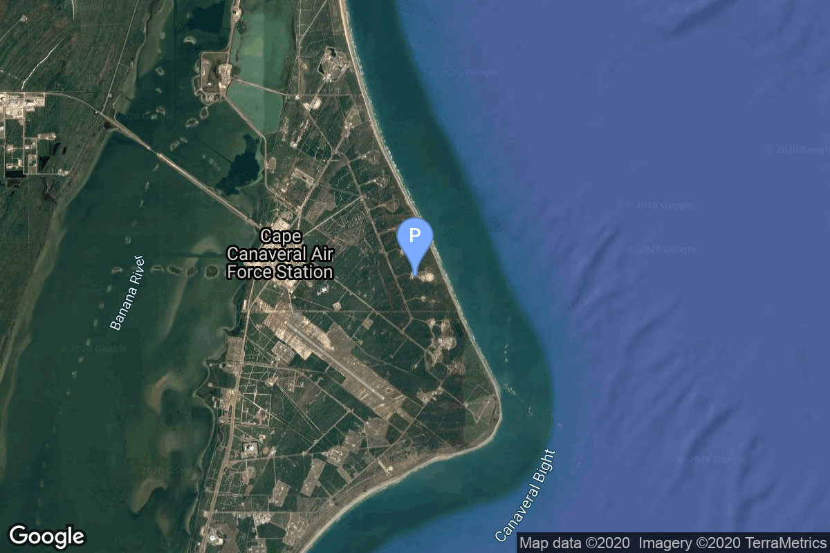
{ "count": 7596, "next": "https://ll.thespacedevs.com/2.0.0/launch/?format=api&limit=10&offset=6990&ordering=-name", "previous": "https://ll.thespacedevs.com/2.0.0/launch/?format=api&limit=10&offset=6970&ordering=-name", "results": [ { "id": "d8c1ac26-f2c7-4ba2-89ec-0d949769adf3", "url": "https://ll.thespacedevs.com/2.0.0/launch/d8c1ac26-f2c7-4ba2-89ec-0d949769adf3/?format=api", "launch_library_id": null, "slug": "atlas-slv-3-agena-d-oao-1", "name": "Atlas SLV-3 Agena D | OAO 1", "status": { "id": 3, "name": "Success" }, "net": "1966-04-08T19:35:00Z", "window_end": "1966-04-08T19:35:00Z", "window_start": "1966-04-08T19:35:00Z", "inhold": false, "tbdtime": false, "tbddate": false, "probability": null, "holdreason": "", "failreason": null, "hashtag": null, "launch_service_provider": { "id": 161, "url": "https://ll.thespacedevs.com/2.0.0/agencies/161/?format=api", "name": "United States Air Force", "type": "Government" }, "rocket": { "id": 3514, "configuration": { "id": 258, "launch_library_id": null, "url": "https://ll.thespacedevs.com/2.0.0/config/launcher/258/?format=api", "name": "Atlas SLV-3 Agena D", "family": "Atlas", "full_name": "Atlas SLV-3 Agena D", "variant": "SLV-3 Agena D" } }, "mission": { "id": 1934, "launch_library_id": null, "name": "OAO 1", "description": "OAO 1 (Orbiting Astronomical Observatory 1) was a solar-cell-powered satellite instrumented to make precision astronomical observations and to measure the absorption and emission characteristics of the stars, planets, nebulae, and the interplanetary and interstellar media from visible to gamma-ray regions.", "launch_designator": null, "type": "Planetary Science", "orbit": { "id": 8, "name": "Low Earth Orbit", "abbrev": "LEO" } }, "pad": { "id": 99, "url": "https://ll.thespacedevs.com/2.0.0/pad/99/?format=api", "agency_id": 161, "name": "Launch Complex 12", "info_url": null, "wiki_url": "https://en.wikipedia.org/wiki/Cape_Canaveral_Air_Force_Station_Launch_Complex_12", "map_url": "https://www.google.com/maps?q=28.480607,-80.541938", "latitude": "28.480607", "longitude": "-80.541938", "location": { "id": 12, "url": "https://ll.thespacedevs.com/2.0.0/location/12/?format=api", "name": "Cape Canaveral SFS, FL, USA", "country_code": "USA", "map_image": "https://thespacedevs-prod.nyc3.digitaloceanspaces.com/media/map_images/location_12_20200803142519.jpg", "total_launch_count": 1052, "total_landing_count": 68 }, "map_image": "https://thespacedevs-prod.nyc3.digitaloceanspaces.com/media/map_images/pad_99_20200803143435.jpg", "total_launch_count": 23 }, "webcast_live": false, "image": null, "infographic": null, "program": [] }, { "id": "9c853a07-e45e-446e-a945-a4fc5bc515a2", "url": "https://ll.thespacedevs.com/2.0.0/launch/9c853a07-e45e-446e-a945-a4fc5bc515a2/?format=api", "launch_library_id": null, "slug": "atlas-slv-3-agena-d-mariner-5", "name": "Atlas SLV-3 Agena D | Mariner 5", "status": { "id": 3, "name": "Success" }, "net": "1967-06-14T06:01:00Z", "window_end": "1967-06-14T06:01:00Z", "window_start": "1967-06-14T06:01:00Z", "inhold": false, "tbdtime": false, "tbddate": false, "probability": null, "holdreason": "", "failreason": null, "hashtag": null, "launch_service_provider": { "id": 161, "url": "https://ll.thespacedevs.com/2.0.0/agencies/161/?format=api", "name": "United States Air Force", "type": "Government" }, "rocket": { "id": 3672, "configuration": { "id": 258, "launch_library_id": null, "url": "https://ll.thespacedevs.com/2.0.0/config/launcher/258/?format=api", "name": "Atlas SLV-3 Agena D", "family": "Atlas", "full_name": "Atlas SLV-3 Agena D", "variant": "SLV-3 Agena D" } }, "mission": { "id": 2090, "launch_library_id": null, "name": "Mariner 5", "description": "The Mariner 5 spacecraft was the fifth in a series of spacecraft used for planetary exploration in the flyby mode. Mariner 5 was a refurbished backup spacecraft for the Mariner 4 mission and was converted from a Mars mission to a Venus mission.", "launch_designator": null, "type": "Robotic Exploration", "orbit": { "id": 22, "name": "Venus flyby", "abbrev": "Venus flyby" } }, "pad": { "id": 99, "url": "https://ll.thespacedevs.com/2.0.0/pad/99/?format=api", "agency_id": 161, "name": "Launch Complex 12", "info_url": null, "wiki_url": "https://en.wikipedia.org/wiki/Cape_Canaveral_Air_Force_Station_Launch_Complex_12", "map_url": "https://www.google.com/maps?q=28.480607,-80.541938", "latitude": "28.480607", "longitude": "-80.541938", "location": { "id": 12, "url": "https://ll.thespacedevs.com/2.0.0/location/12/?format=api", "name": "Cape Canaveral SFS, FL, USA", "country_code": "USA", "map_image": "https://thespacedevs-prod.nyc3.digitaloceanspaces.com/media/map_images/location_12_20200803142519.jpg", "total_launch_count": 1052, "total_landing_count": 68 }, "map_image": "https://thespacedevs-prod.nyc3.digitaloceanspaces.com/media/map_images/pad_99_20200803143435.jpg", "total_launch_count": 23 }, "webcast_live": false, "image": null, "infographic": null, "program": [] }, { "id": "7cca0343-0985-467c-a145-658bfbbceb4d", "url": "https://ll.thespacedevs.com/2.0.0/launch/7cca0343-0985-467c-a145-658bfbbceb4d/?format=api", "launch_library_id": null, "slug": "atlas-slv-3-agena-d-lunar-orbiter-i", "name": "Atlas SLV-3 Agena D | Lunar Orbiter I", "status": { "id": 3, "name": "Success" }, "net": "1966-08-10T19:26:00Z", "window_end": "1966-08-10T19:26:00Z", "window_start": "1966-08-10T19:26:00Z", "inhold": false, "tbdtime": false, "tbddate": false, "probability": null, "holdreason": "", "failreason": null, "hashtag": null, "launch_service_provider": { "id": 161, "url": "https://ll.thespacedevs.com/2.0.0/agencies/161/?format=api", "name": "United States Air Force", "type": "Government" }, "rocket": { "id": 3558, "configuration": { "id": 258, "launch_library_id": null, "url": "https://ll.thespacedevs.com/2.0.0/config/launcher/258/?format=api", "name": "Atlas SLV-3 Agena D", "family": "Atlas", "full_name": "Atlas SLV-3 Agena D", "variant": "SLV-3 Agena D" } }, "mission": { "id": 1978, "launch_library_id": null, "name": "Lunar Orbiter I", "description": "Lunar probe designed to photograph the surface of the Moon with a resolution down to 1 meter.", "launch_designator": null, "type": "Lunar Exploration", "orbit": { "id": 11, "name": "Lunar Orbit", "abbrev": "LO" } }, "pad": { "id": 117, "url": "https://ll.thespacedevs.com/2.0.0/pad/117/?format=api", "agency_id": 161, "name": "Space Launch Complex 13", "info_url": null, "wiki_url": "https://en.wikipedia.org/wiki/Cape_Canaveral_Launch_Complex_13", "map_url": "https://www.google.com/maps?q=28.4859,-80.546594", "latitude": "28.4859", "longitude": "-80.546594", "location": { "id": 12, "url": "https://ll.thespacedevs.com/2.0.0/location/12/?format=api", "name": "Cape Canaveral SFS, FL, USA", "country_code": "USA", "map_image": "https://thespacedevs-prod.nyc3.digitaloceanspaces.com/media/map_images/location_12_20200803142519.jpg", "total_launch_count": 1052, "total_landing_count": 68 }, "map_image": "https://thespacedevs-prod.nyc3.digitaloceanspaces.com/media/map_images/pad_117_20200803143223.jpg", "total_launch_count": 21 }, "webcast_live": false, "image": null, "infographic": null, "program": [] }, { "id": "98d8be4b-6fcd-4330-bbf5-89ee99ce0d09", "url": "https://ll.thespacedevs.com/2.0.0/launch/98d8be4b-6fcd-4330-bbf5-89ee99ce0d09/?format=api", "launch_library_id": null, "slug": "atlas-slv-3-agena-d-lunar-orbiter-5", "name": "Atlas SLV-3 Agena D | Lunar Orbiter 5", "status": { "id": 3, "name": "Success" }, "net": "1967-08-01T22:33:00Z", "window_end": "1967-08-01T22:33:00Z", "window_start": "1967-08-01T22:33:00Z", "inhold": false, "tbdtime": false, "tbddate": false, "probability": null, "holdreason": "", "failreason": null, "hashtag": null, "launch_service_provider": { "id": 161, "url": "https://ll.thespacedevs.com/2.0.0/agencies/161/?format=api", "name": "United States Air Force", "type": "Government" }, "rocket": { "id": 3690, "configuration": { "id": 258, "launch_library_id": null, "url": "https://ll.thespacedevs.com/2.0.0/config/launcher/258/?format=api", "name": "Atlas SLV-3 Agena D", "family": "Atlas", "full_name": "Atlas SLV-3 Agena D", "variant": "SLV-3 Agena D" } }, "mission": { "id": 2108, "launch_library_id": null, "name": "Lunar Orbiter 5", "description": "Lunar probe designed to photograph the surface of the Moon with a resolution down to 1 meter.", "launch_designator": null, "type": "Lunar Exploration", "orbit": { "id": 11, "name": "Lunar Orbit", "abbrev": "LO" } }, "pad": { "id": 117, "url": "https://ll.thespacedevs.com/2.0.0/pad/117/?format=api", "agency_id": 161, "name": "Space Launch Complex 13", "info_url": null, "wiki_url": "https://en.wikipedia.org/wiki/Cape_Canaveral_Launch_Complex_13", "map_url": "https://www.google.com/maps?q=28.4859,-80.546594", "latitude": "28.4859", "longitude": "-80.546594", "location": { "id": 12, "url": "https://ll.thespacedevs.com/2.0.0/location/12/?format=api", "name": "Cape Canaveral SFS, FL, USA", "country_code": "USA", "map_image": "https://thespacedevs-prod.nyc3.digitaloceanspaces.com/media/map_images/location_12_20200803142519.jpg", "total_launch_count": 1052, "total_landing_count": 68 }, "map_image": "https://thespacedevs-prod.nyc3.digitaloceanspaces.com/media/map_images/pad_117_20200803143223.jpg", "total_launch_count": 21 }, "webcast_live": false, "image": null, "infographic": null, "program": [] }, { "id": "d5f31d7d-571c-41a3-8872-639b2bac2824", "url": "https://ll.thespacedevs.com/2.0.0/launch/d5f31d7d-571c-41a3-8872-639b2bac2824/?format=api", "launch_library_id": null, "slug": "atlas-slv-3-agena-d-lunar-orbiter-4", "name": "Atlas SLV-3 Agena D | Lunar Orbiter 4", "status": { "id": 3, "name": "Success" }, "net": "1967-05-04T22:25:00Z", "window_end": "1967-05-04T22:25:00Z", "window_start": "1967-05-04T22:25:00Z", "inhold": false, "tbdtime": false, "tbddate": false, "probability": null, "holdreason": "", "failreason": null, "hashtag": null, "launch_service_provider": { "id": 161, "url": "https://ll.thespacedevs.com/2.0.0/agencies/161/?format=api", "name": "United States Air Force", "type": "Government" }, "rocket": { "id": 3652, "configuration": { "id": 258, "launch_library_id": null, "url": "https://ll.thespacedevs.com/2.0.0/config/launcher/258/?format=api", "name": "Atlas SLV-3 Agena D", "family": "Atlas", "full_name": "Atlas SLV-3 Agena D", "variant": "SLV-3 Agena D" } }, "mission": { "id": 2070, "launch_library_id": null, "name": "Lunar Orbiter 4", "description": "Lunar probe designed to photograph the surface of the Moon with a resolution down to 1 meter.", "launch_designator": null, "type": "Lunar Exploration", "orbit": { "id": 11, "name": "Lunar Orbit", "abbrev": "LO" } }, "pad": { "id": 117, "url": "https://ll.thespacedevs.com/2.0.0/pad/117/?format=api", "agency_id": 161, "name": "Space Launch Complex 13", "info_url": null, "wiki_url": "https://en.wikipedia.org/wiki/Cape_Canaveral_Launch_Complex_13", "map_url": "https://www.google.com/maps?q=28.4859,-80.546594", "latitude": "28.4859", "longitude": "-80.546594", "location": { "id": 12, "url": "https://ll.thespacedevs.com/2.0.0/location/12/?format=api", "name": "Cape Canaveral SFS, FL, USA", "country_code": "USA", "map_image": "https://thespacedevs-prod.nyc3.digitaloceanspaces.com/media/map_images/location_12_20200803142519.jpg", "total_launch_count": 1052, "total_landing_count": 68 }, "map_image": "https://thespacedevs-prod.nyc3.digitaloceanspaces.com/media/map_images/pad_117_20200803143223.jpg", "total_launch_count": 21 }, "webcast_live": false, "image": null, "infographic": null, "program": [] }, { "id": "96fd4a72-a16a-4f32-8a04-4dc5b41917ab", "url": "https://ll.thespacedevs.com/2.0.0/launch/96fd4a72-a16a-4f32-8a04-4dc5b41917ab/?format=api", "launch_library_id": null, "slug": "atlas-slv-3-agena-d-lunar-orbiter-3", "name": "Atlas SLV-3 Agena D | Lunar Orbiter 3", "status": { "id": 3, "name": "Success" }, "net": "1967-02-05T01:17:01Z", "window_end": "1967-02-05T01:17:01Z", "window_start": "1967-02-05T01:17:01Z", "inhold": false, "tbdtime": false, "tbddate": false, "probability": null, "holdreason": "", "failreason": null, "hashtag": null, "launch_service_provider": { "id": 161, "url": "https://ll.thespacedevs.com/2.0.0/agencies/161/?format=api", "name": "United States Air Force", "type": "Government" }, "rocket": { "id": 3617, "configuration": { "id": 258, "launch_library_id": null, "url": "https://ll.thespacedevs.com/2.0.0/config/launcher/258/?format=api", "name": "Atlas SLV-3 Agena D", "family": "Atlas", "full_name": "Atlas SLV-3 Agena D", "variant": "SLV-3 Agena D" } }, "mission": { "id": 2036, "launch_library_id": null, "name": "Lunar Orbiter 3", "description": "Lunar probe designed to photograph the surface of the Moon with a resolution down to 1 meter.", "launch_designator": null, "type": "Lunar Exploration", "orbit": { "id": 11, "name": "Lunar Orbit", "abbrev": "LO" } }, "pad": { "id": 117, "url": "https://ll.thespacedevs.com/2.0.0/pad/117/?format=api", "agency_id": 161, "name": "Space Launch Complex 13", "info_url": null, "wiki_url": "https://en.wikipedia.org/wiki/Cape_Canaveral_Launch_Complex_13", "map_url": "https://www.google.com/maps?q=28.4859,-80.546594", "latitude": "28.4859", "longitude": "-80.546594", "location": { "id": 12, "url": "https://ll.thespacedevs.com/2.0.0/location/12/?format=api", "name": "Cape Canaveral SFS, FL, USA", "country_code": "USA", "map_image": "https://thespacedevs-prod.nyc3.digitaloceanspaces.com/media/map_images/location_12_20200803142519.jpg", "total_launch_count": 1052, "total_landing_count": 68 }, "map_image": "https://thespacedevs-prod.nyc3.digitaloceanspaces.com/media/map_images/pad_117_20200803143223.jpg", "total_launch_count": 21 }, "webcast_live": false, "image": null, "infographic": null, "program": [] }, { "id": "e9db9d80-6ae5-49f1-bbb1-baf8d6f02604", "url": "https://ll.thespacedevs.com/2.0.0/launch/e9db9d80-6ae5-49f1-bbb1-baf8d6f02604/?format=api", "launch_library_id": null, "slug": "atlas-slv-3-agena-d-lunar-orbiter-2", "name": "Atlas SLV-3 Agena D | Lunar Orbiter 2", "status": { "id": 3, "name": "Success" }, "net": "1966-11-06T23:21:00Z", "window_end": "1966-11-06T23:21:00Z", "window_start": "1966-11-06T23:21:00Z", "inhold": false, "tbdtime": false, "tbddate": false, "probability": null, "holdreason": "", "failreason": null, "hashtag": null, "launch_service_provider": { "id": 161, "url": "https://ll.thespacedevs.com/2.0.0/agencies/161/?format=api", "name": "United States Air Force", "type": "Government" }, "rocket": { "id": 3590, "configuration": { "id": 258, "launch_library_id": null, "url": "https://ll.thespacedevs.com/2.0.0/config/launcher/258/?format=api", "name": "Atlas SLV-3 Agena D", "family": "Atlas", "full_name": "Atlas SLV-3 Agena D", "variant": "SLV-3 Agena D" } }, "mission": { "id": 2009, "launch_library_id": null, "name": "Lunar Orbiter 2", "description": "Lunar probe designed to photograph the surface of the Moon with a resolution down to 1 meter.", "launch_designator": null, "type": "Lunar Exploration", "orbit": { "id": 11, "name": "Lunar Orbit", "abbrev": "LO" } }, "pad": { "id": 117, "url": "https://ll.thespacedevs.com/2.0.0/pad/117/?format=api", "agency_id": 161, "name": "Space Launch Complex 13", "info_url": null, "wiki_url": "https://en.wikipedia.org/wiki/Cape_Canaveral_Launch_Complex_13", "map_url": "https://www.google.com/maps?q=28.4859,-80.546594", "latitude": "28.4859", "longitude": "-80.546594", "location": { "id": 12, "url": "https://ll.thespacedevs.com/2.0.0/location/12/?format=api", "name": "Cape Canaveral SFS, FL, USA", "country_code": "USA", "map_image": "https://thespacedevs-prod.nyc3.digitaloceanspaces.com/media/map_images/location_12_20200803142519.jpg", "total_launch_count": 1052, "total_landing_count": 68 }, "map_image": "https://thespacedevs-prod.nyc3.digitaloceanspaces.com/media/map_images/pad_117_20200803143223.jpg", "total_launch_count": 21 }, "webcast_live": false, "image": null, "infographic": null, "program": [] }, { "id": "816ea9c9-90b3-4142-8f59-71f8cb2b7027", "url": "https://ll.thespacedevs.com/2.0.0/launch/816ea9c9-90b3-4142-8f59-71f8cb2b7027/?format=api", "launch_library_id": null, "slug": "atlas-slv-3-agena-d-kh-7-38", "name": "Atlas SLV-3 Agena D | KH-7 38", "status": { "id": 3, "name": "Success" }, "net": "1967-06-04T18:07:01Z", "window_end": "1967-06-04T18:07:01Z", "window_start": "1967-06-04T18:07:01Z", "inhold": false, "tbdtime": false, "tbddate": false, "probability": null, "holdreason": "", "failreason": null, "hashtag": null, "launch_service_provider": { "id": 161, "url": "https://ll.thespacedevs.com/2.0.0/agencies/161/?format=api", "name": "United States Air Force", "type": "Government" }, "rocket": { "id": 3667, "configuration": { "id": 258, "launch_library_id": null, "url": "https://ll.thespacedevs.com/2.0.0/config/launcher/258/?format=api", "name": "Atlas SLV-3 Agena D", "family": "Atlas", "full_name": "Atlas SLV-3 Agena D", "variant": "SLV-3 Agena D" } }, "mission": { "id": 2085, "launch_library_id": null, "name": "KH-7 38", "description": "The Program 206 satellite, carrying the KH-7 (Keyhole 7) camera system (codenamed Gambit-1), was the first successful high resolution space reconnaissance program. It was managed by NRO's Program A, the USAF-led segment of the National Reconnaissance Program managed from Los Angeles AFB in El Segundo, California.", "launch_designator": null, "type": "Government/Top Secret", "orbit": { "id": 17, "name": "Sun-Synchronous Orbit", "abbrev": "SSO" } }, "pad": { "id": 16, "url": "https://ll.thespacedevs.com/2.0.0/pad/16/?format=api", "agency_id": null, "name": "Space Launch Complex 4E", "info_url": null, "wiki_url": "https://en.wikipedia.org/wiki/Vandenberg_Space_Launch_Complex_4#SLC-4E", "map_url": "https://www.google.com/maps?q=34.632,-120.611", "latitude": "34.632", "longitude": "-120.611", "location": { "id": 11, "url": "https://ll.thespacedevs.com/2.0.0/location/11/?format=api", "name": "Vandenberg SFB, CA, USA", "country_code": "USA", "map_image": "https://thespacedevs-prod.nyc3.digitaloceanspaces.com/media/map_images/location_11_20200803142416.jpg", "total_launch_count": 830, "total_landing_count": 28 }, "map_image": "https://thespacedevs-prod.nyc3.digitaloceanspaces.com/media/map_images/pad_16_20200803143532.jpg", "total_launch_count": 216 }, "webcast_live": false, "image": null, "infographic": null, "program": [] }, { "id": "bc7f4aea-34be-4d20-8717-41acd67a6295", "url": "https://ll.thespacedevs.com/2.0.0/launch/bc7f4aea-34be-4d20-8717-41acd67a6295/?format=api", "launch_library_id": null, "slug": "atlas-slv-3-agena-d-kh-7-37", "name": "Atlas SLV-3 Agena D | KH-7 37", "status": { "id": 3, "name": "Success" }, "net": "1967-05-22T18:30:00Z", "window_end": "1967-05-22T18:30:00Z", "window_start": "1967-05-22T18:30:00Z", "inhold": false, "tbdtime": false, "tbddate": false, "probability": null, "holdreason": "", "failreason": null, "hashtag": null, "launch_service_provider": { "id": 161, "url": "https://ll.thespacedevs.com/2.0.0/agencies/161/?format=api", "name": "United States Air Force", "type": "Government" }, "rocket": { "id": 3661, "configuration": { "id": 258, "launch_library_id": null, "url": "https://ll.thespacedevs.com/2.0.0/config/launcher/258/?format=api", "name": "Atlas SLV-3 Agena D", "family": "Atlas", "full_name": "Atlas SLV-3 Agena D", "variant": "SLV-3 Agena D" } }, "mission": { "id": 2079, "launch_library_id": null, "name": "KH-7 37", "description": "The Program 206 satellite, carrying the KH-7 (Keyhole 7) camera system (codenamed Gambit-1), was the first successful high resolution space reconnaissance program. It was managed by NRO's Program A, the USAF-led segment of the National Reconnaissance Program managed from Los Angeles AFB in El Segundo, California.", "launch_designator": null, "type": "Government/Top Secret", "orbit": { "id": 17, "name": "Sun-Synchronous Orbit", "abbrev": "SSO" } }, "pad": { "id": 16, "url": "https://ll.thespacedevs.com/2.0.0/pad/16/?format=api", "agency_id": null, "name": "Space Launch Complex 4E", "info_url": null, "wiki_url": "https://en.wikipedia.org/wiki/Vandenberg_Space_Launch_Complex_4#SLC-4E", "map_url": "https://www.google.com/maps?q=34.632,-120.611", "latitude": "34.632", "longitude": "-120.611", "location": { "id": 11, "url": "https://ll.thespacedevs.com/2.0.0/location/11/?format=api", "name": "Vandenberg SFB, CA, USA", "country_code": "USA", "map_image": "https://thespacedevs-prod.nyc3.digitaloceanspaces.com/media/map_images/location_11_20200803142416.jpg", "total_launch_count": 830, "total_landing_count": 28 }, "map_image": "https://thespacedevs-prod.nyc3.digitaloceanspaces.com/media/map_images/pad_16_20200803143532.jpg", "total_launch_count": 216 }, "webcast_live": false, "image": null, "infographic": null, "program": [] }, { "id": "a468a13f-1221-4438-92b4-7a87d18fb23a", "url": "https://ll.thespacedevs.com/2.0.0/launch/a468a13f-1221-4438-92b4-7a87d18fb23a/?format=api", "launch_library_id": null, "slug": "atlas-slv-3-agena-d-kh-7-36", "name": "Atlas SLV-3 Agena D | KH-7 36", "status": { "id": 3, "name": "Success" }, "net": "1967-02-02T20:00:00Z", "window_end": "1967-02-02T20:00:00Z", "window_start": "1967-02-02T20:00:00Z", "inhold": false, "tbdtime": false, "tbddate": false, "probability": null, "holdreason": "", "failreason": null, "hashtag": null, "launch_service_provider": { "id": 161, "url": "https://ll.thespacedevs.com/2.0.0/agencies/161/?format=api", "name": "United States Air Force", "type": "Government" }, "rocket": { "id": 3616, "configuration": { "id": 258, "launch_library_id": null, "url": "https://ll.thespacedevs.com/2.0.0/config/launcher/258/?format=api", "name": "Atlas SLV-3 Agena D", "family": "Atlas", "full_name": "Atlas SLV-3 Agena D", "variant": "SLV-3 Agena D" } }, "mission": { "id": 2035, "launch_library_id": null, "name": "KH-7 36", "description": "The Program 206 satellite, carrying the KH-7 (Keyhole 7) camera system (codenamed Gambit-1), was the first successful high resolution space reconnaissance program. It was managed by NRO's Program A, the USAF-led segment of the National Reconnaissance Program managed from Los Angeles AFB in El Segundo, California.", "launch_designator": null, "type": "Government/Top Secret", "orbit": { "id": 17, "name": "Sun-Synchronous Orbit", "abbrev": "SSO" } }, "pad": { "id": 16, "url": "https://ll.thespacedevs.com/2.0.0/pad/16/?format=api", "agency_id": null, "name": "Space Launch Complex 4E", "info_url": null, "wiki_url": "https://en.wikipedia.org/wiki/Vandenberg_Space_Launch_Complex_4#SLC-4E", "map_url": "https://www.google.com/maps?q=34.632,-120.611", "latitude": "34.632", "longitude": "-120.611", "location": { "id": 11, "url": "https://ll.thespacedevs.com/2.0.0/location/11/?format=api", "name": "Vandenberg SFB, CA, USA", "country_code": "USA", "map_image": "https://thespacedevs-prod.nyc3.digitaloceanspaces.com/media/map_images/location_11_20200803142416.jpg", "total_launch_count": 830, "total_landing_count": 28 }, "map_image": "https://thespacedevs-prod.nyc3.digitaloceanspaces.com/media/map_images/pad_16_20200803143532.jpg", "total_launch_count": 216 }, "webcast_live": false, "image": null, "infographic": null, "program": [] } ] }